| Pages:
1
2
3
4 |
fishbuck
Banned
Posts: 5318
Registered: 8-31-2006
Member Is Offline
|
|
I saw at least 1 secret surf spot.
"A ship in harbor is safe, but that is not what ships are built for." J. A. Shedd.
A clever person solves a problem. A wise person avoids it. – Albert Einstein
"Life's a Beach... and then you Fly!" Fishbuck
|
|
|
BornFisher
Super Nomad

Posts: 2103
Registered: 1-11-2005
Location: K-38 Santa Martha/Encinitas
Member Is Offline
|
|
This is so much fun!! THANKS!!!!
"When you catch a fish, you open the door of happiness."
|
|
|
David K
Honored Nomad
Posts: 64479
Registered: 8-30-2002
Location: San Diego County
Member Is Offline
Mood: Have Baja Fever
|
|
This trip report is about backcountry travel on dirt roads and land based activities, like photography, rock hounding, local food. There is nor will
be any connection with watersports of any kind beyond the one and only tourist I saw all the days I was on dirt roads. Thank you for your
understanding.
|
|
|
David K
Honored Nomad
Posts: 64479
Registered: 8-30-2002
Location: San Diego County
Member Is Offline
Mood: Have Baja Fever
|
|
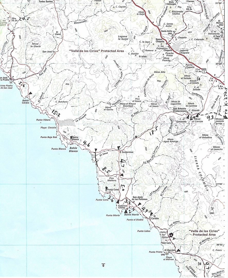
SAT (DAY 4, 4-22-17) cont'd...
Panorama at Playa El Marrón (south of Punta Prieta/ Punta Negra)
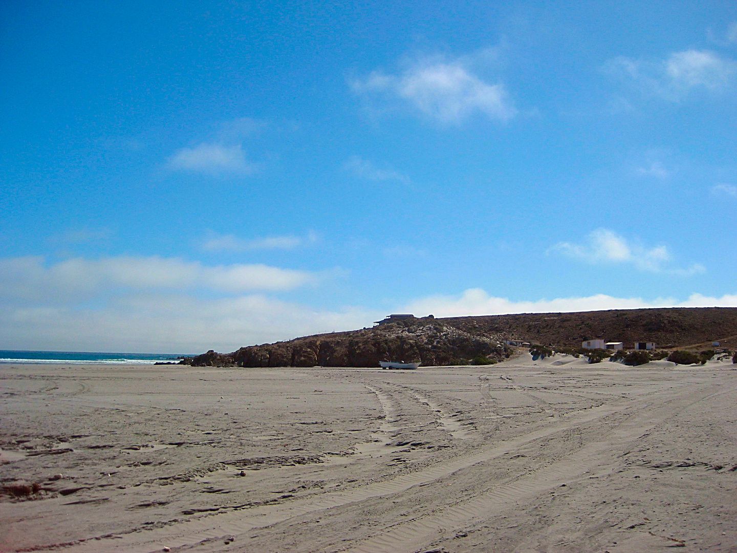
Puerto San Andrés
---------------------------------------------------------------------------------------------------------------------------
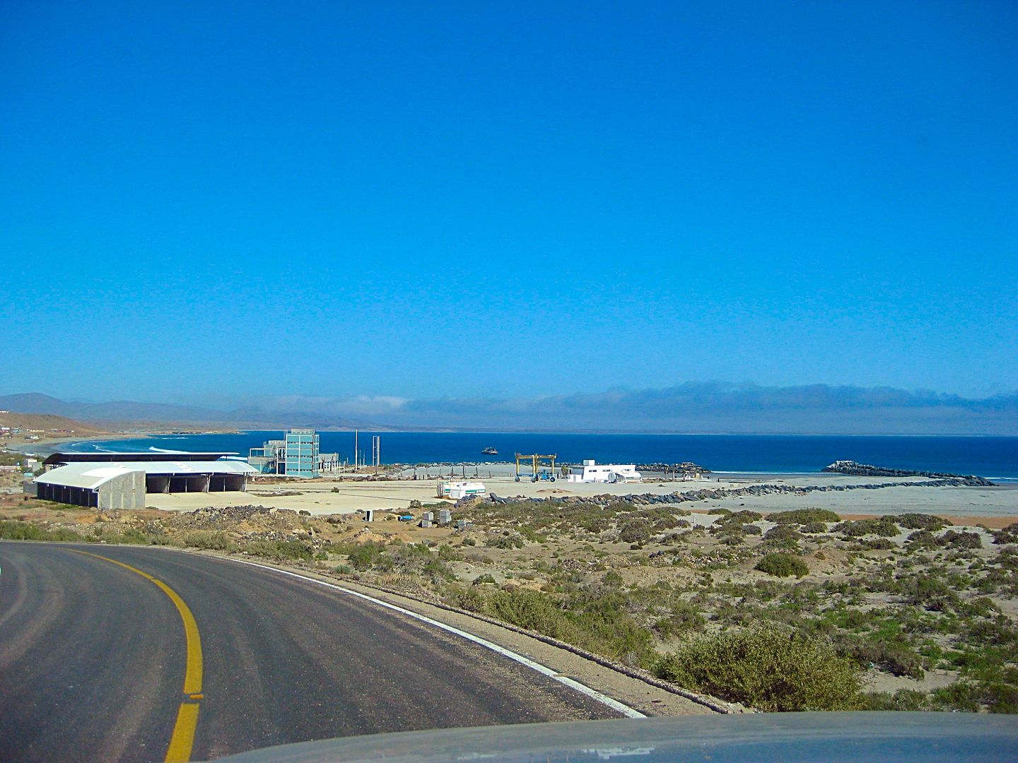
Abandoned Escalera Nautica harbor, full of sand (and no rising sea levels) at Santa Rosalillita.
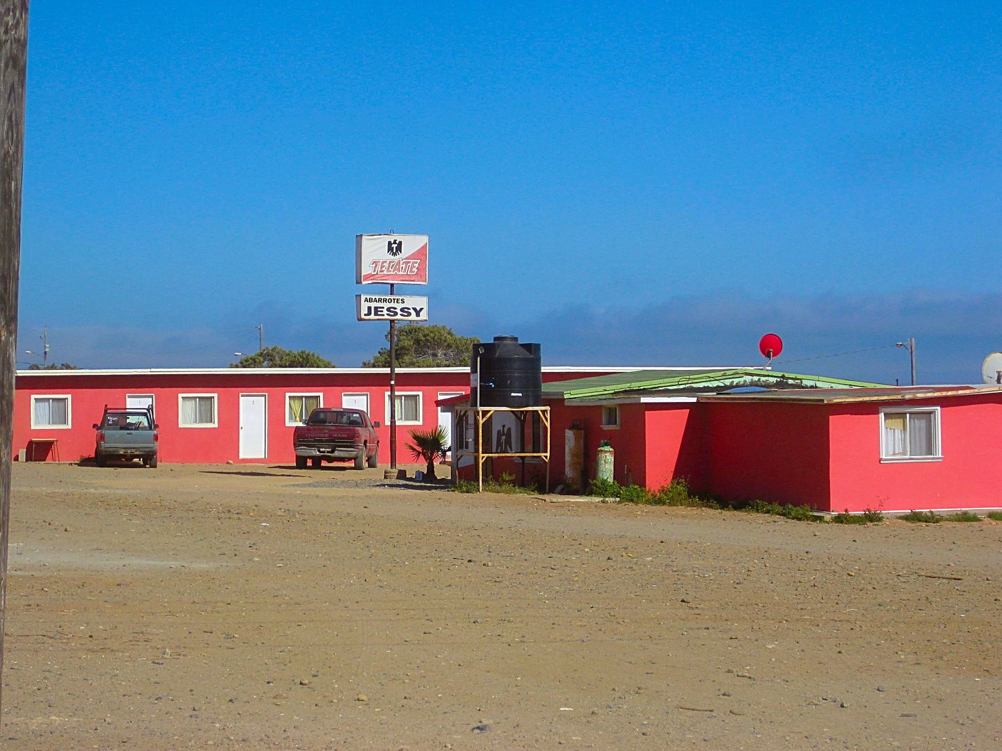
The motel, market and gasoline distributor 'Jessy', in Santa Rosalillita.
The restaurant (no signs) owned by Ramona. There is a pagoda of white painted tires in front and this faces the basketball court in the middle of
town.
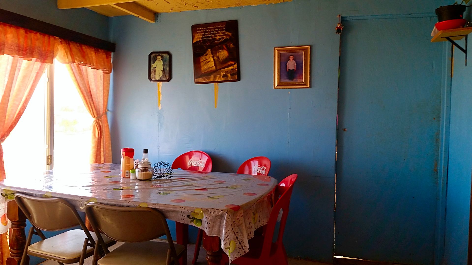
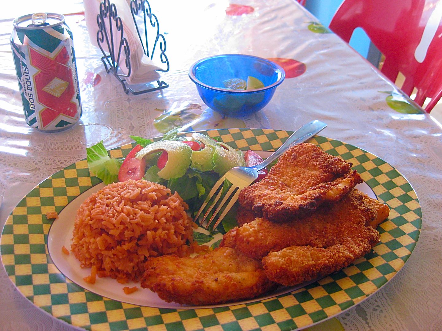
My dinner (halibut) had four filets, salad, rice, tortillas... more than I could eat! No drinks available so the beer was from my cooler. Cost 100
pesos (US$5.65) which demanded a 50% tip in my opinion! Everything in Baja was a great value (except perhaps the price of gasoline). All in all, I
choose Baja!
After dinner, I want to find a wind free (and fog free) spot in the desert to camp so I do a run out the paved road to where the graded dirt highway
meets it. Just under a mile from town is the dirt highway north, with this sign:
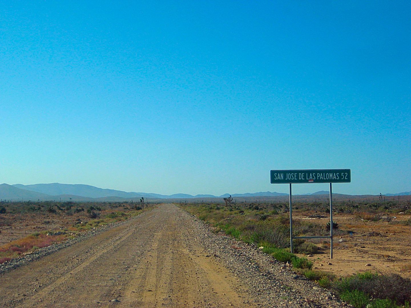
Now, in 52 kms. (32 miles) there is no such place, that is about where the fast dirt highway ends (I got it at 31 miles) which is at the Punta Cono
junction. That is still 38 miles south of San José fish camp (Faro San José or San José de la Piedra).
I drive it the 3.8 miles north to the San Andrés road (where I drove into the coast, yesterday). This time, I take the dirt track the opposite
direction and go about a mile to set up camp. Just a few cows... all was good. No wind, no bugs, and clear sky!
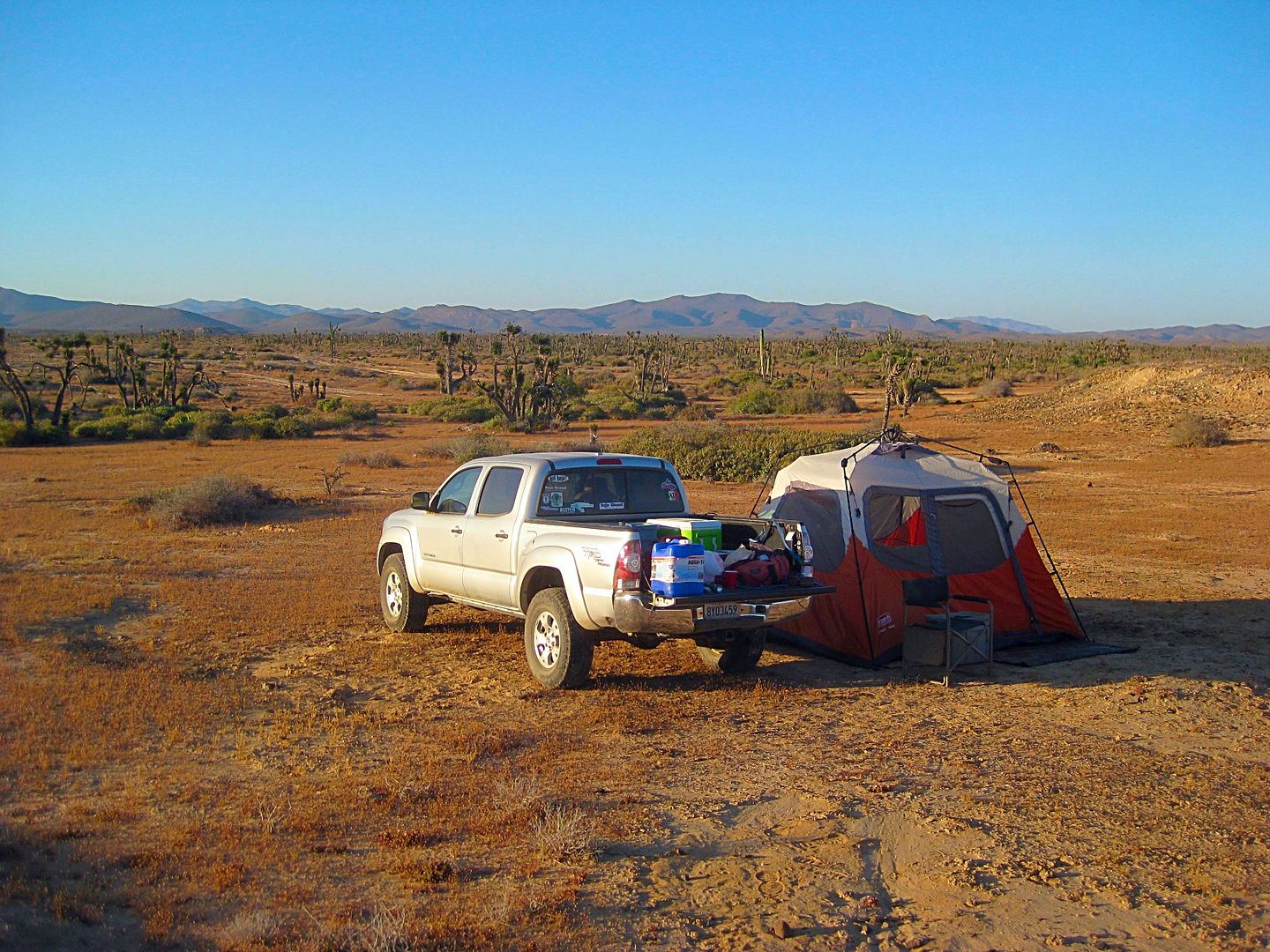
Well, sometime after midnight, the sound of water dropping onto the floor of my tent alerted me. I looked out, and no more stars. The fog had made it
back inland during the night... I was not far enough inland!
[Edited on 4-29-2017 by David K]
|
|
|
JZ
Elite Nomad
Posts: 9230
Registered: 10-3-2003
Member Is Offline
|
|
The area from San Jose down looks a lot more interesting. We are going to do this next month. Coming in from Hwy1 to SJ hopefully.
|
|
|
David K
Honored Nomad
Posts: 64479
Registered: 8-30-2002
Location: San Diego County
Member Is Offline
Mood: Have Baja Fever
|
|
Quote: Originally posted by JZ  | The area from San Jose down looks a lot more interesting. We are going to do this next month. Coming in from Hwy1 to SJ hopefully.
|
That is why I like to photo the route and I am photographing the things that I think are interesting, but certainly not everything or what others may
find interesting. But, I am glad this helps you plan. The road north of San José is pretty bad on the two places where it goes up and down the hill
that are 4x4 climbs now, with the erosion from last winter. That cliff 'Candlestick' just south of Canoas was the most dramatic site of that drive,
but that is about all you'll miss... and you don't see it unless you take the side road to the beach there.
|
|
|
woody with a view
PITA Nomad
Posts: 15937
Registered: 11-8-2004
Location: Looking at the Coronado Islands
Member Is Offline
Mood: Everchangin'
|
|
whatever they wanna call it, San Jose de las Palomas is Faro SJ (in general) so there's that!
if you scour all of your maps you'll find it.
|
|
|
David K
Honored Nomad
Posts: 64479
Registered: 8-30-2002
Location: San Diego County
Member Is Offline
Mood: Have Baja Fever
|
|
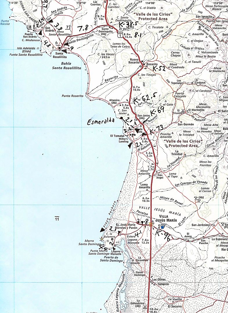
DAY 5 (SUN 4-23-17)
The sun fights with the fog, my tent dries, and I am on the road at 8:40 am.
Today's goal is to continue south and explore El Tomatal and Laguna Manuela as well as gas up at the Pemex at Villa Jesus María.
I drive back south on the graded dirt highway to the paved Santa Rosalillita road, turn left, reach Hwy. 1 (at Km. 38.5) and turn south.
The ranching community of Rosarito seems to have been renamed 'Nuevo Rosarito' (so there is no confusion with the resort city Rosarito Beach, I
guess?). It has two famous restaurants, on the north side of town (Km. 51.5+) is Mauricio's Restaurant (on the left).
Next is the dip (vado) over Arroyo Rosarito (Km. 52) and then the first road to Mission San Borja goes south where the highway bends to the west, on
the other side of the dip. Going to San Borja? The route is 0.2 mi ahead on the dirt street to a cross road in the village, where you turn left for
the mission. After the curve, 2/10 a mile, the other signed road for San Borja goes to the left.
The highway soon widens for the next 27 kms. as in other places with an actually paved shoulder that could double as a bike lane. Km. 53-80.
Unfortunately with the exception of the 5 km. markers (which are bigger with the Highway 1 logo), all but one I saw of the kilometer markers are
missing from this widened section near Nuevo Rosarito for at least 15 kms. Use your odometer, as every .6 mile is a kilometer (it's .62 actually).
Km. 54.5: La Cienega Restaurant, the other popular eatery.
Km. 57: Dirt road right toward Punta Rosarito (joins the more used road, ahead).
Km. 62.5+ Punta Rosarito road (continues along the coast to Santa Rosalillita, rough).
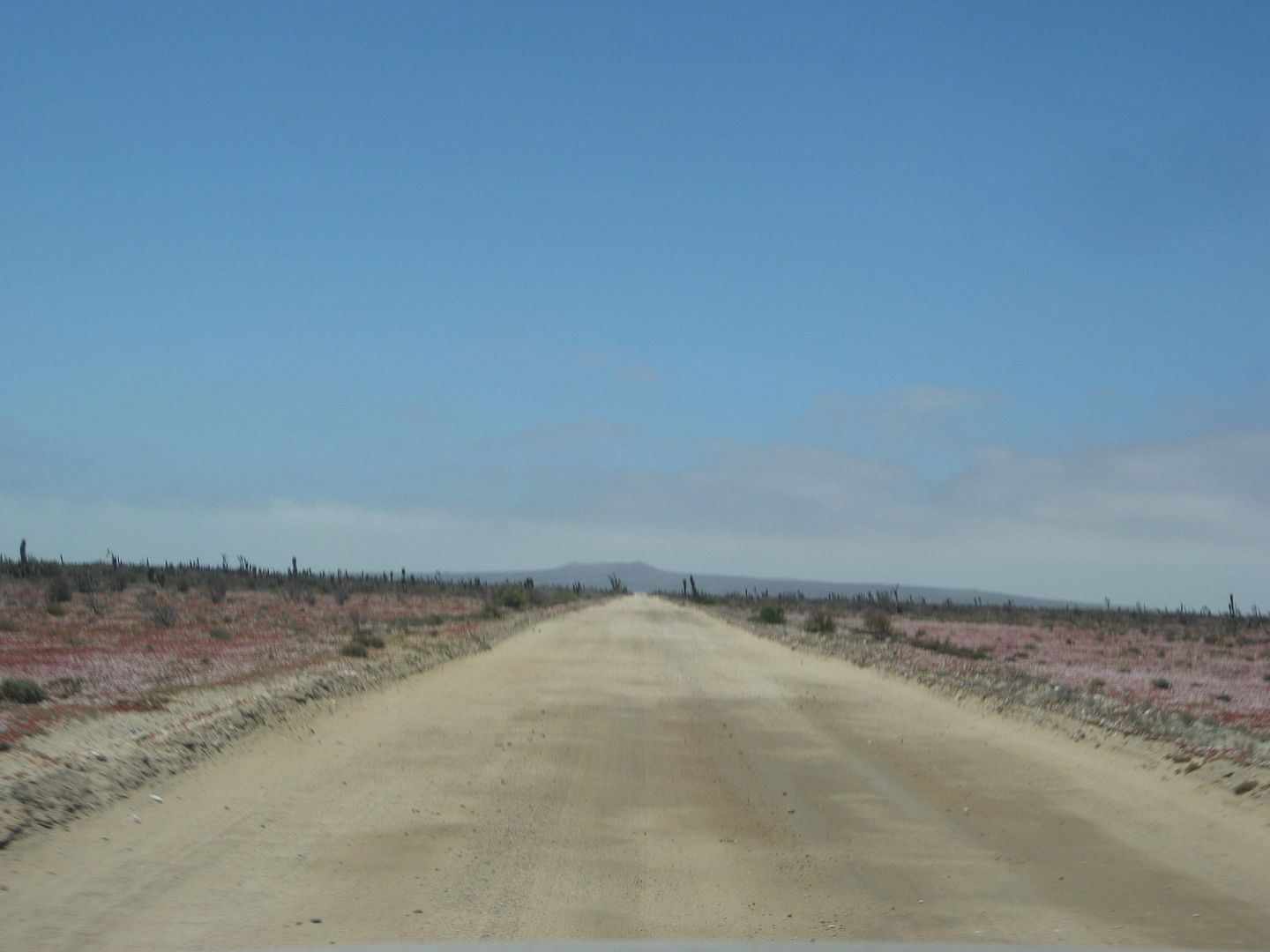
Km. 69 El Tomatal junction and Military Checkpoint. Get the inspection done first, then go in reverse to head to El Tomatal, as the intersection is
just north of the checkpoint. This was the instructed process.
TO the coast:
Mile 0.0 Hwy. 1/ Checkpoint/ Km. 69
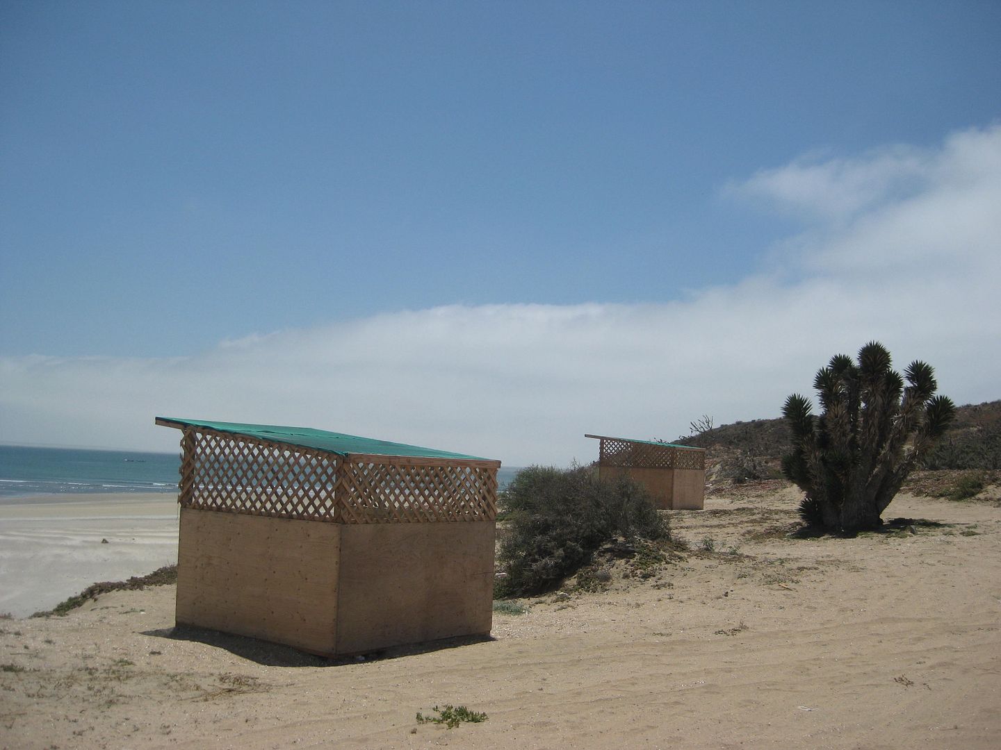
1.0 Fork. Campo Esmeralda right, El Tomatal left. Esmeralda has some camping 'cabins' and a bathroom building, it is 2.1 miles on the right branch. I
go there and back out. Continuing toward El TomataL...
2.4 Crossroad. Sign fo Esmeralda (right). Continue west.
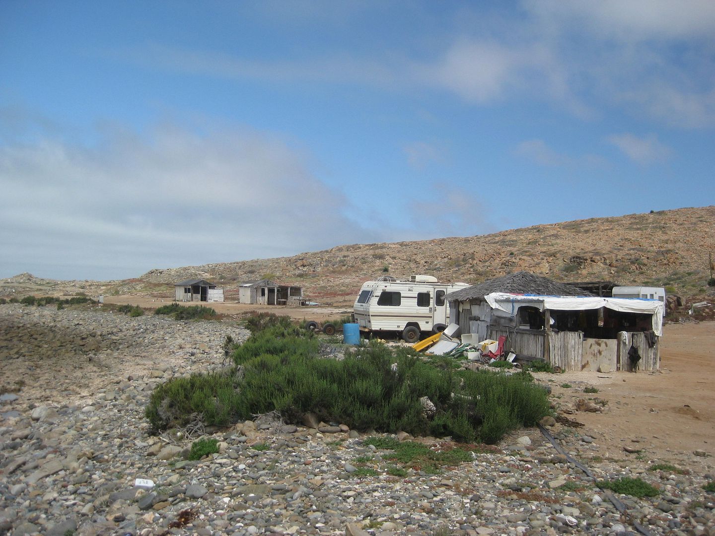
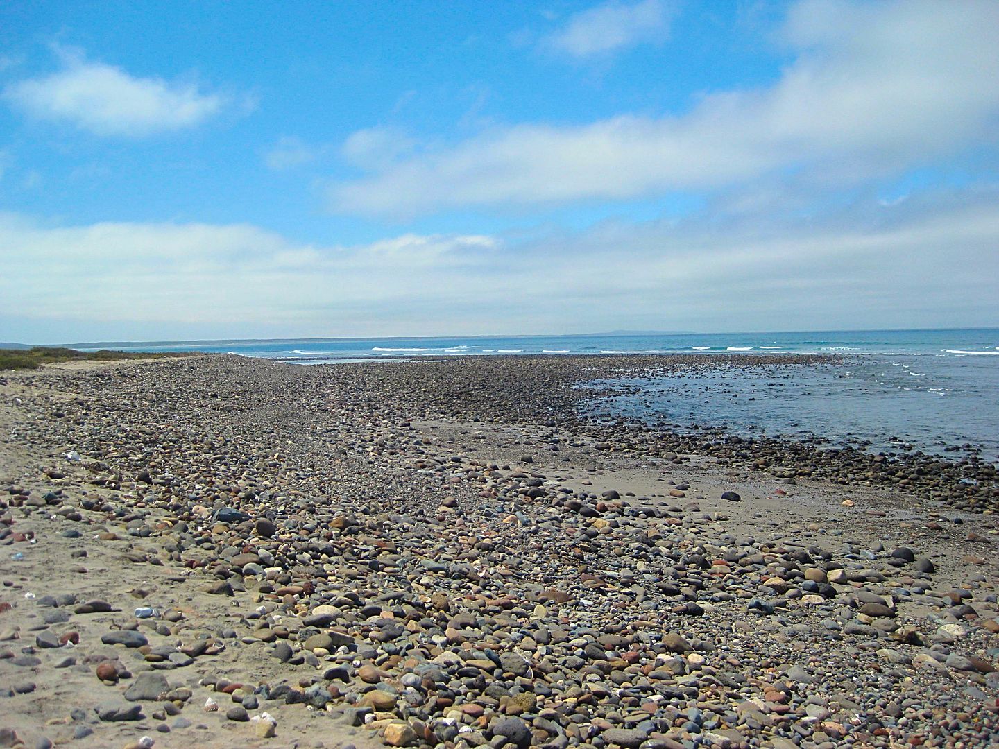
2.9 After passing a small oasis of date palms come to a rocky beach. Tracks turn south.
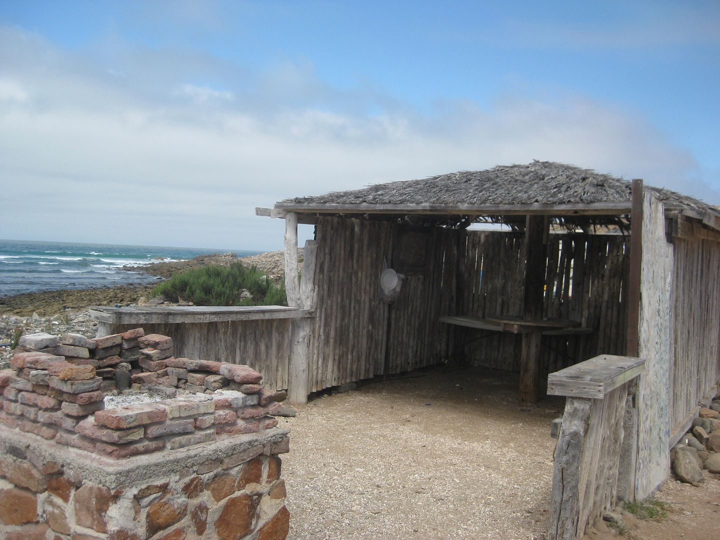
3.2 Fish camp, abandoned homes. Was this where Graham Mackintosh writes about 'Blondie' (the late Ginger McMahan Potter) and her beach home where he
made some money cleaning the mess made by the local fishermen during his 1980s walk around Baja? See pages 204-207 of Graham's book, 'Into a Desert
Place'.
I go back out past the oasis to the cross road and turn south. In a couple miles, I take a road heading back to Highway 1 (after a look at the rocky
beach). In just over 2 miles is Hwy. 1 at Km. 73+.
Next, I zip south to the Pemex station at Villa Jesus María (Km. 95). Note the highway department placed a sign calling the town 'Valle Jesus
María". I was assured by the woman attendant at the Pemex, that their town was Villa NOT Valle!
Gas is 16.10 pesos/liter (US$3.44/ gal), I top off with 63 liters. Adding in the 20 liters I got at Santa Rosalillita and 390 miles since the El
Rosario Pemex has me averaging over 17 mpg, off road mostly. Also, in that my tank holds 80 liters, I would have run out if I didn't get the 20 liters
at Santa Rosalillita. I only use 4WD when I needed to avoid tire spin (climbing or sand).
It was 11:39 am, and there is great food all around the Pemex station.
A seafood restaurant (Mariscos Paulina) is across the highway. On either side of the Pemex are taco places, Kassandra's and the late Carmelita's
(famous tamales) but they both were closed. Open was Carmelita's sister Lupita's restaurant, Torta's La Casita... Big menu, indoor seating, and ice
for sale! I had two quesatacos (they were good sized), a coke, and a bag of ice (frozen solid) for my chest... the total was just 100 pesos! This
place is a winner!
Photos:
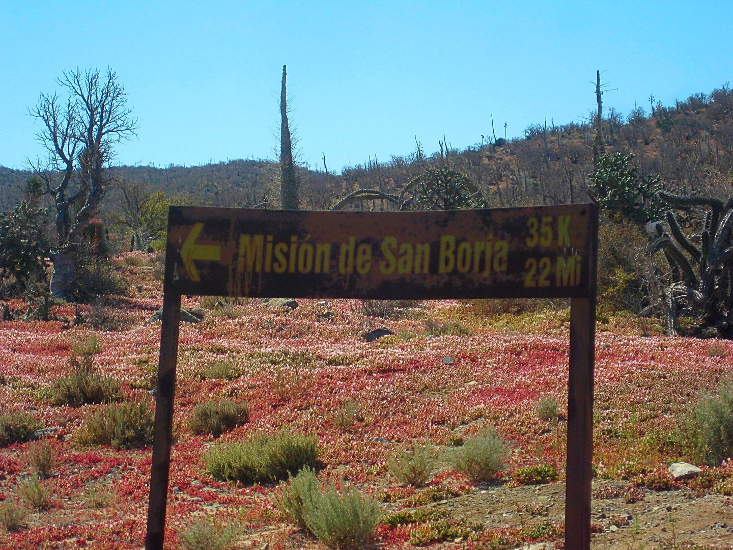
One of the signs in Nuevo Rosarito to San Borja.
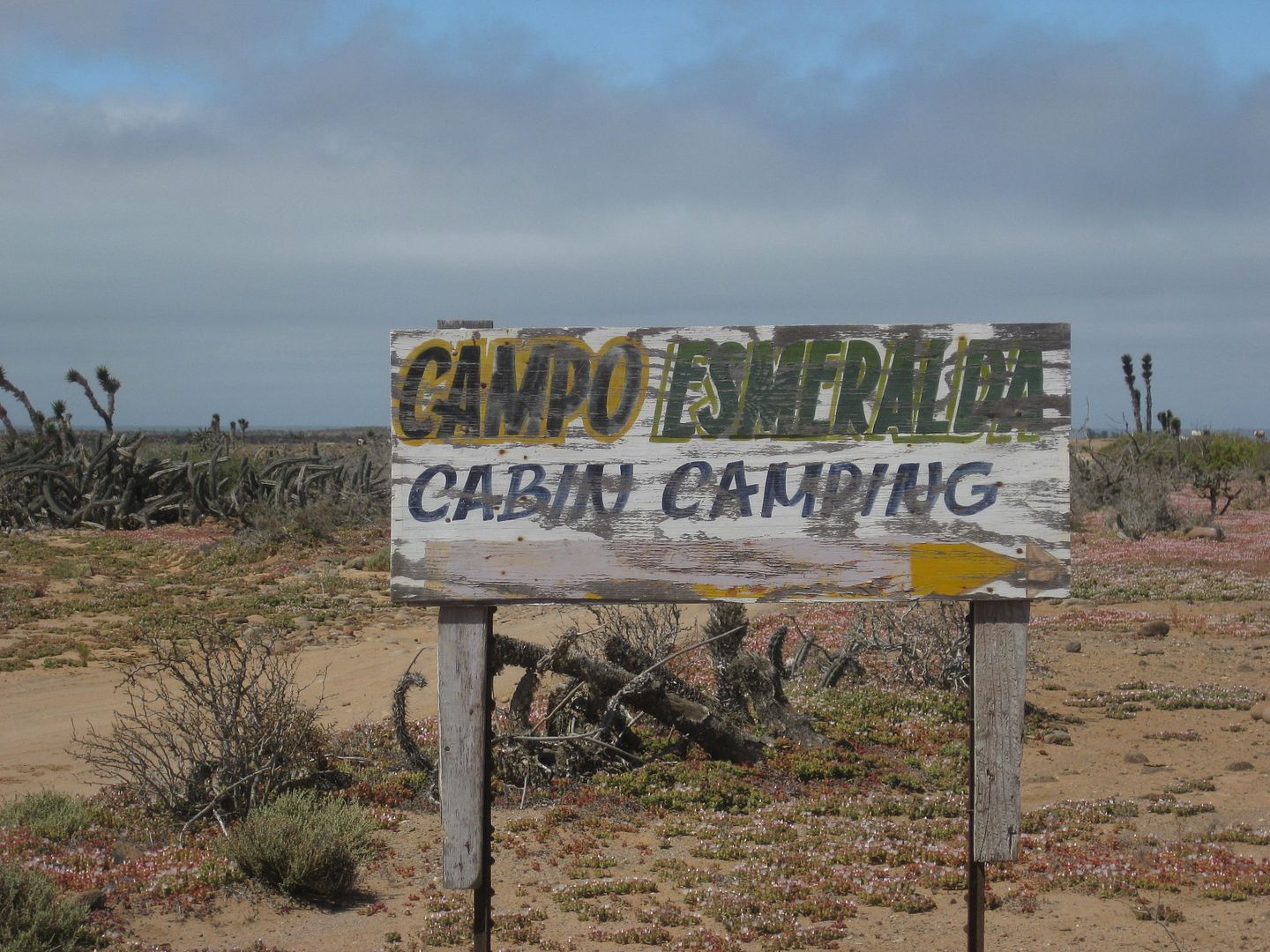
The next three photos are at Esmeralda...
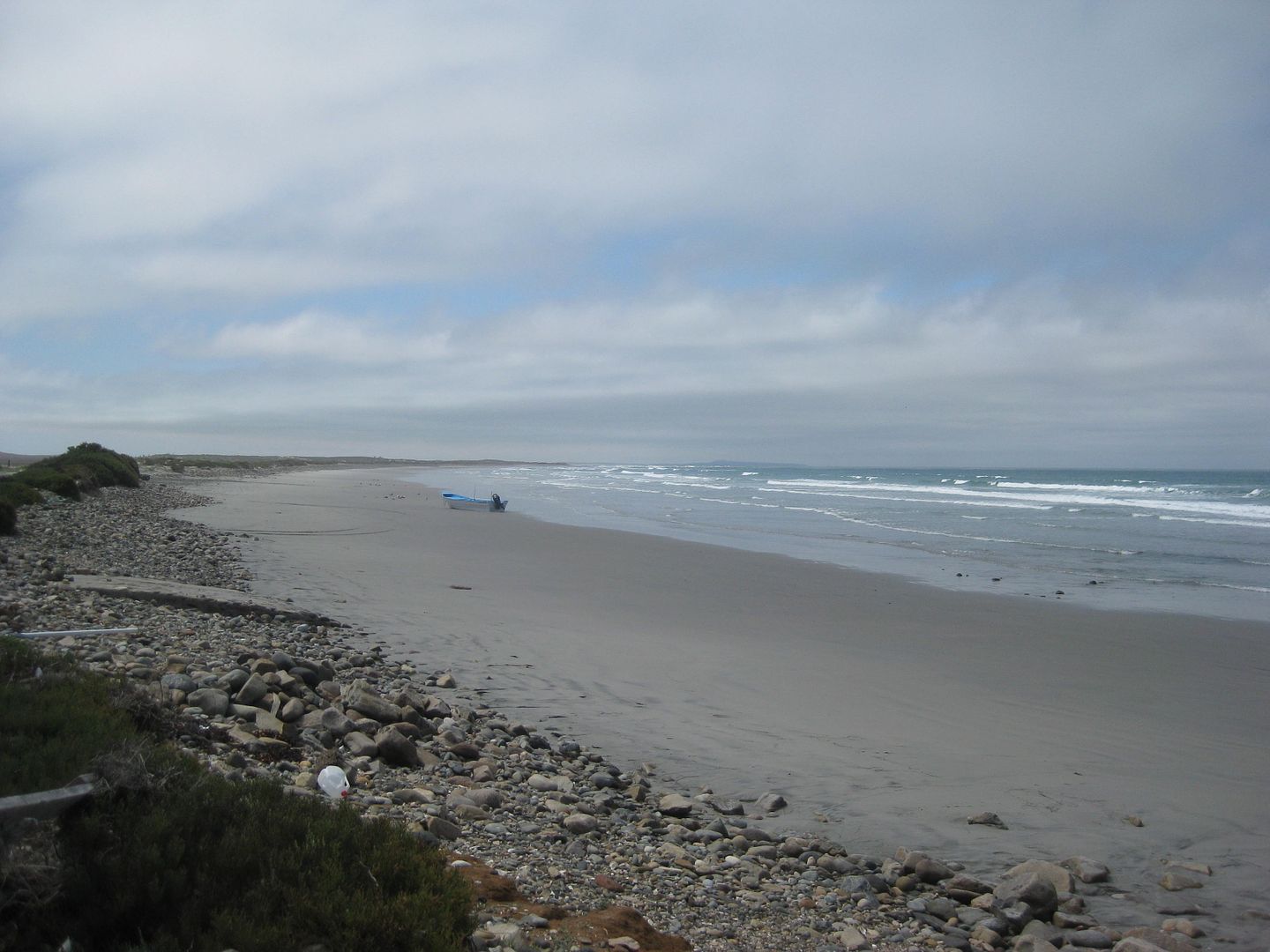
The beach at the end of the road west of the military checkpoint.
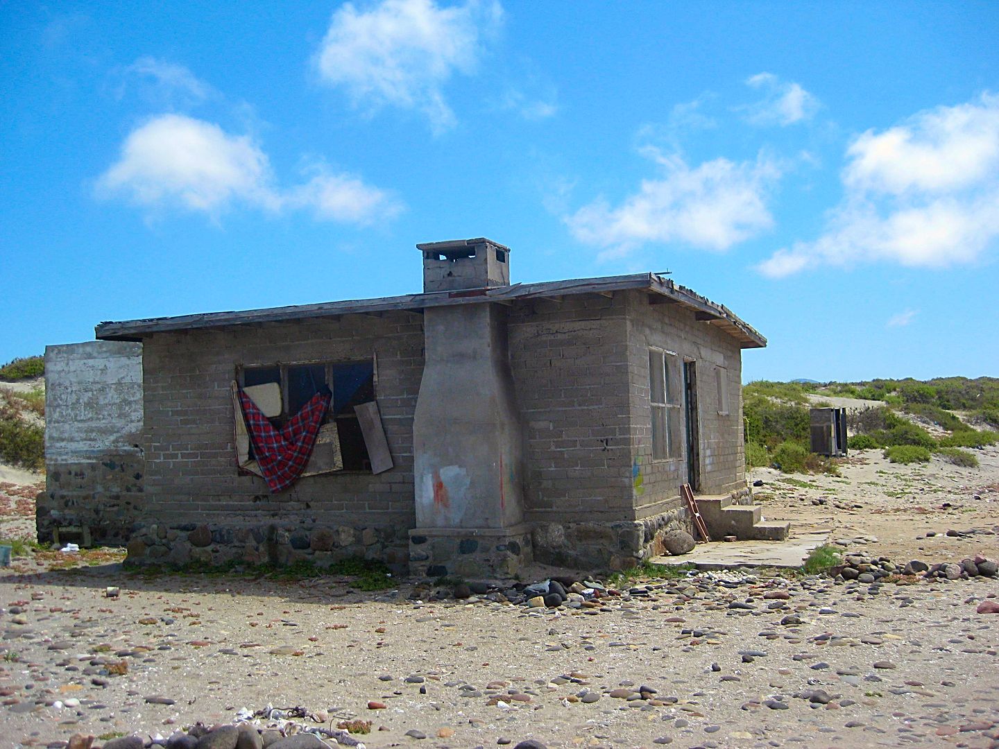
One of the abandoned homes at El Tomatal, just south of the previous photo location. Did Blondie build this to replace her trailer here?
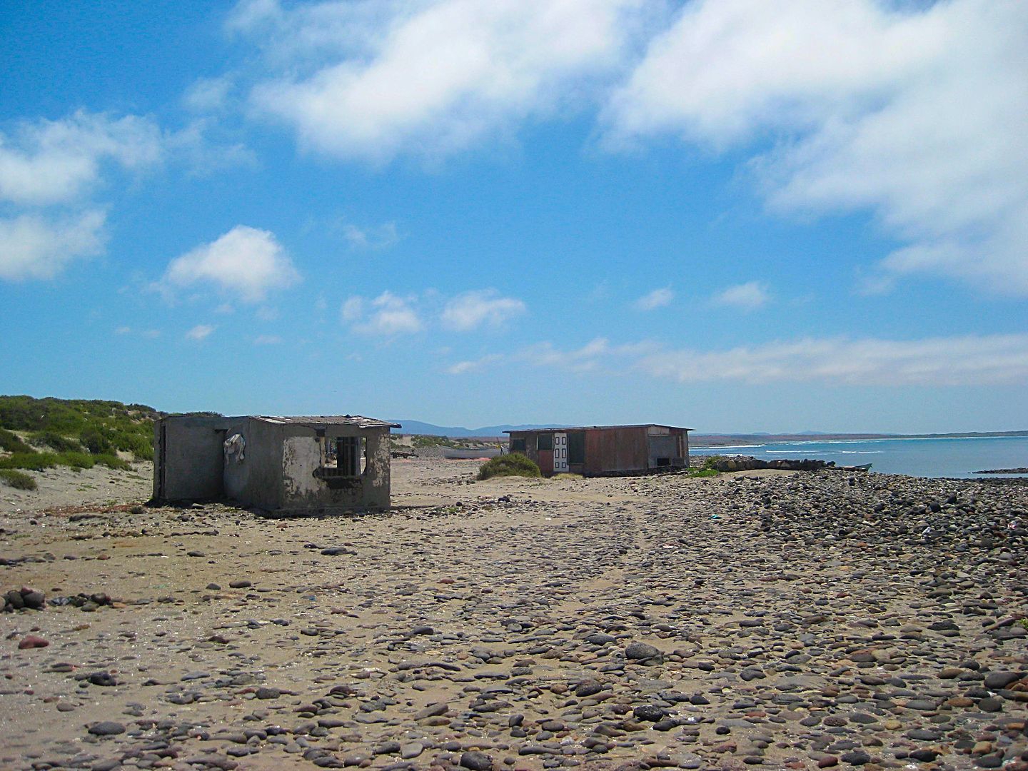
Other empty homes and beyond is the fishing camp at El Tomatal.
I did not see any sign of Miller's Landing with onyx blocks from the El Marmolito onyx mine inland from here or the mystery of El Tomatal described so
well by Michelle 'M' here on the Internet around 2001 (on Amigos de Baja, then). Here is a web page I made to tell her story of the mystery sound
amplifying stones and battery draining powers, with her photos: http://www.vivabaja.com/et/
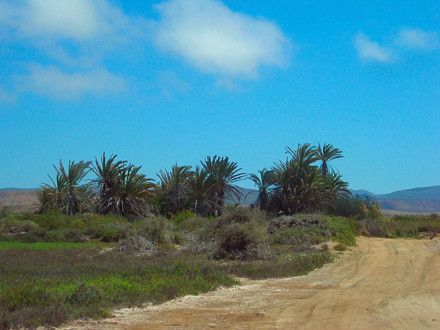
Driving away from the beach, here is the little oasis.
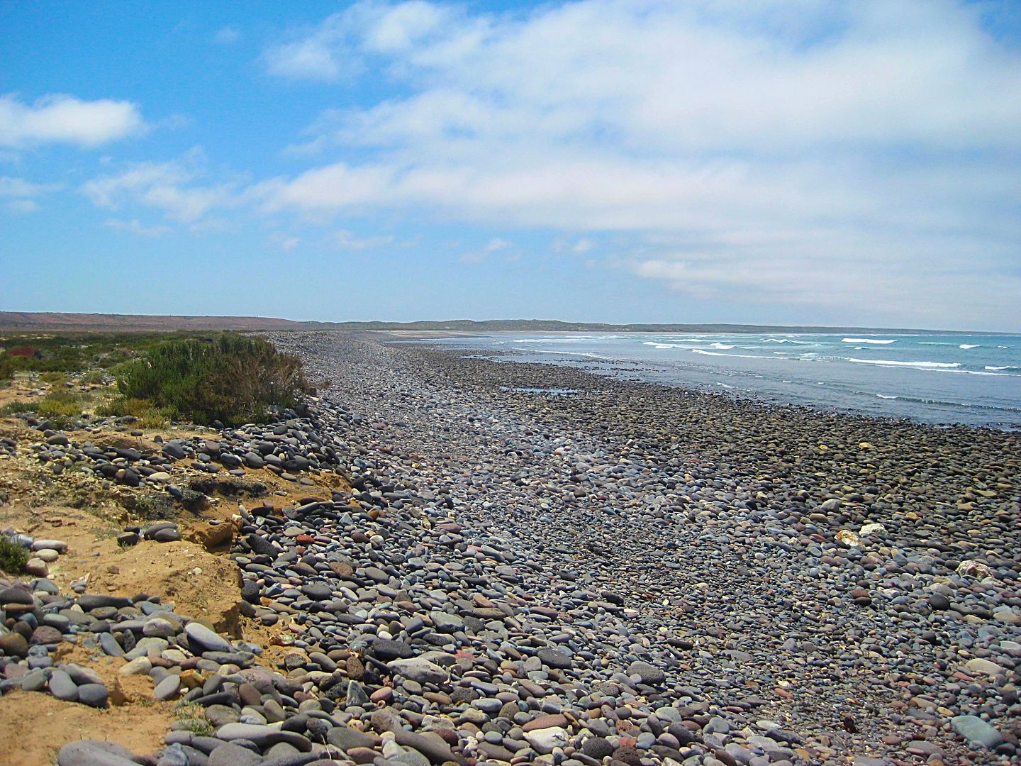
Searching for Miller's Landing, this is about 2 miles south of El Tomatal.
Looking north towards El Tomatal from 2 miles south.
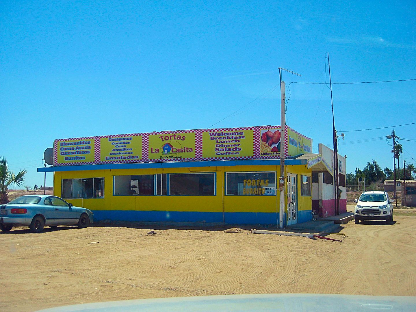
A good place for food and ice at the Pemex station Villa Jesus María. Owned by Lupita, the sister of the late famous Carmelita.
In the next installment, we go to Laguna Manuela! Stay tuned...
|
|
|
David K
Honored Nomad
Posts: 64479
Registered: 8-30-2002
Location: San Diego County
Member Is Offline
Mood: Have Baja Fever
|
|
The name was not the point of contention, the distance was. I said no such place exists at 52 kms. (32 miles), per the sign.
Maybe I should have inserted a LOL?  It is more than double that distance to the
San José fish camp. It is more than double that distance to the
San José fish camp.
[Edited on 5-1-2017 by David K]
|
|
|
BooJumMan
Senior Nomad
Posts: 875
Registered: 8-11-2007
Location: San Diego
Member Is Offline
|
|
Just my opinion but making a guidebook of this area will only destroy its natural beauty and solitude. The only good thing it will do is make you a
few extra bucks. There are a few people who have spent their lives enjoying this area without mentioning it in hopes of it not getting ruined. Please
just keep that in mind.
In that pre-Google Earth and social media epoch, The Code was adhered to. It was based on a simple verity: if a locale had been transformational for
you, and you had put the hard yards in to get there and to learn it, to know it, why in god�s name would you broadcast the news, thus ruining the
future experience not only for yourself, but for future adventurers?
|
|
|
Boulder bob222
Junior Nomad
Posts: 68
Registered: 3-23-2017
Member Is Offline
|
|
| Quote: Originally posted by BooJumMan | | Just my opinion but making a guidebook of this area will only destroy its natural beauty and solitude. The only good thing it will do is make you a
few extra bucks. There are a few people who have spent their lives enjoying this area without mentioning it in hopes of it not getting ruined. Please
just keep that in mind. |
Been over for years, forget it dude. You can't save a failed state.
|
|
|
shari
Select Nomad
Posts: 13033
Registered: 3-10-2006
Location: bahia asuncion, baja sur
Member Is Offline
Mood: there is no reality except the one contained within us "Herman Hesse"
|
|
thanks for the tip David about the little restaurant casa in Rosalillita...never knew about it and been there in the hotelito many times....looking
forward to halibut on our next visit then.
....some real beauty breaks out there
|
|
|
David K
Honored Nomad
Posts: 64479
Registered: 8-30-2002
Location: San Diego County
Member Is Offline
Mood: Have Baja Fever
|
|
| Quote: Originally posted by BooJumMan | | Just my opinion but making a guidebook of this area will only destroy its natural beauty and solitude. The only good thing it will do is make you a
few extra bucks. There are a few people who have spent their lives enjoying this area without mentioning it in hopes of it not getting ruined. Please
just keep that in mind. |
Thank you for your opinion. If any of this gets into a book, it won't change a thing in this area. Only better roads may do that if they bring
inconsiderate people. The roads have been either greatly detailed or at least mentioned in several books, yet you came to the area, you didn't destroy
it, and neither have others since these books were made.
Why didn't all the other guidebooks "destroy" the area?
These dirt roads along the Pacific coast have been detailed back to the 1950s.
Those other guidebooks made Baja more enjoyable and interesting for myself and others. If my work gets published in paper it will make me no more
bucks than me doing these reports do, for free. Publishing a book costs money, ask me how I know. My motivation is sharing the enjoyment that some
adventure is out there. It would be great if all Nomads could see this area in person. In reality, maybe 1% actually will.
Guidebooks (or these posts on the Internet don't bring in people, good roads will be the enemy... The Baja 1000 uses some of these roads on occasion
and that hasn't ruined the area. Bad weather is what tears up the roads. But, you should want the roads to remain bad if you think people driving them
is somehow destroying an area?
That dirt highway north from Santa Rosalillita (I traveled first on in 2007) is just as good today and if anything, the area is just as unpopulated.
The area just doesn't appeal to a lot of people to risk a breakdown or bad weather, or ??
Don't worry, Baja is pretty resilient. It will be here long after we are all gone. Can't we just enjoy it a little while we are still on this earth?
[Edited on 4-29-2017 by David K]
|
|
|
David K
Honored Nomad
Posts: 64479
Registered: 8-30-2002
Location: San Diego County
Member Is Offline
Mood: Have Baja Fever
|
|
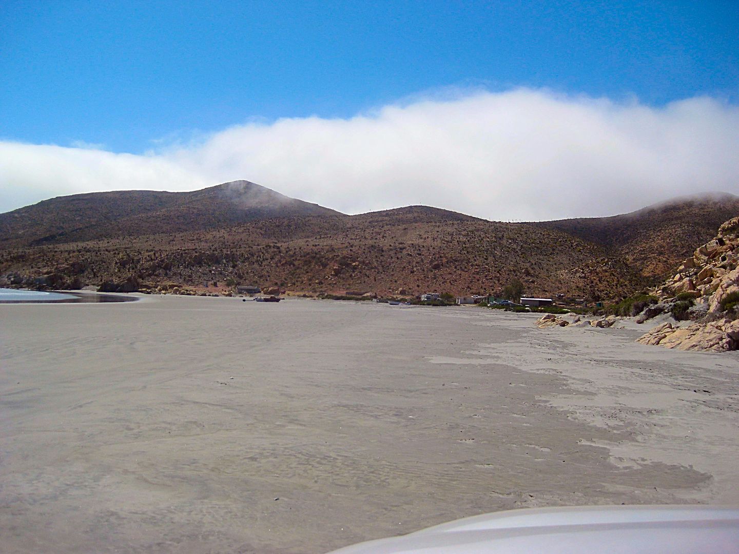
DAY 5, cont'd: To Laguna Manuela
After having lunch at Villa Jesus María, I drove south to the paved road west at Km. 96. The road goes to a farm town, but in less than a mile you
turn off of it, to the left, for Laguna Manuela.
0.0 Hwy. 1 Km. 96 (Villa Jesus María), take paved road west.
0.8 Turn left off pavement onto wide graded road.
4.9 Road to right is a deep sand route to the long north beach. Excellent fishing in past years. Known as 'Variety Beach' for the wide selection of
surf fish caught (croaker, calico bass, halibut, etc.). The road ahead can be driven over Morro Santo Domingo past the beach and back to this point
(4WD).
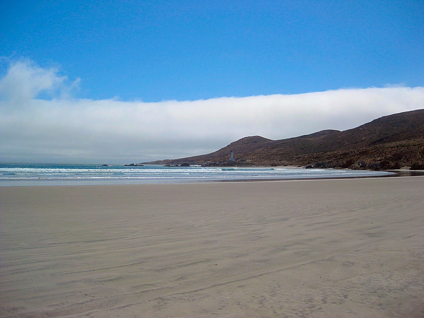
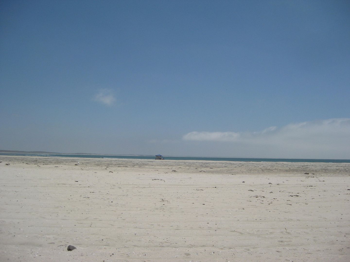
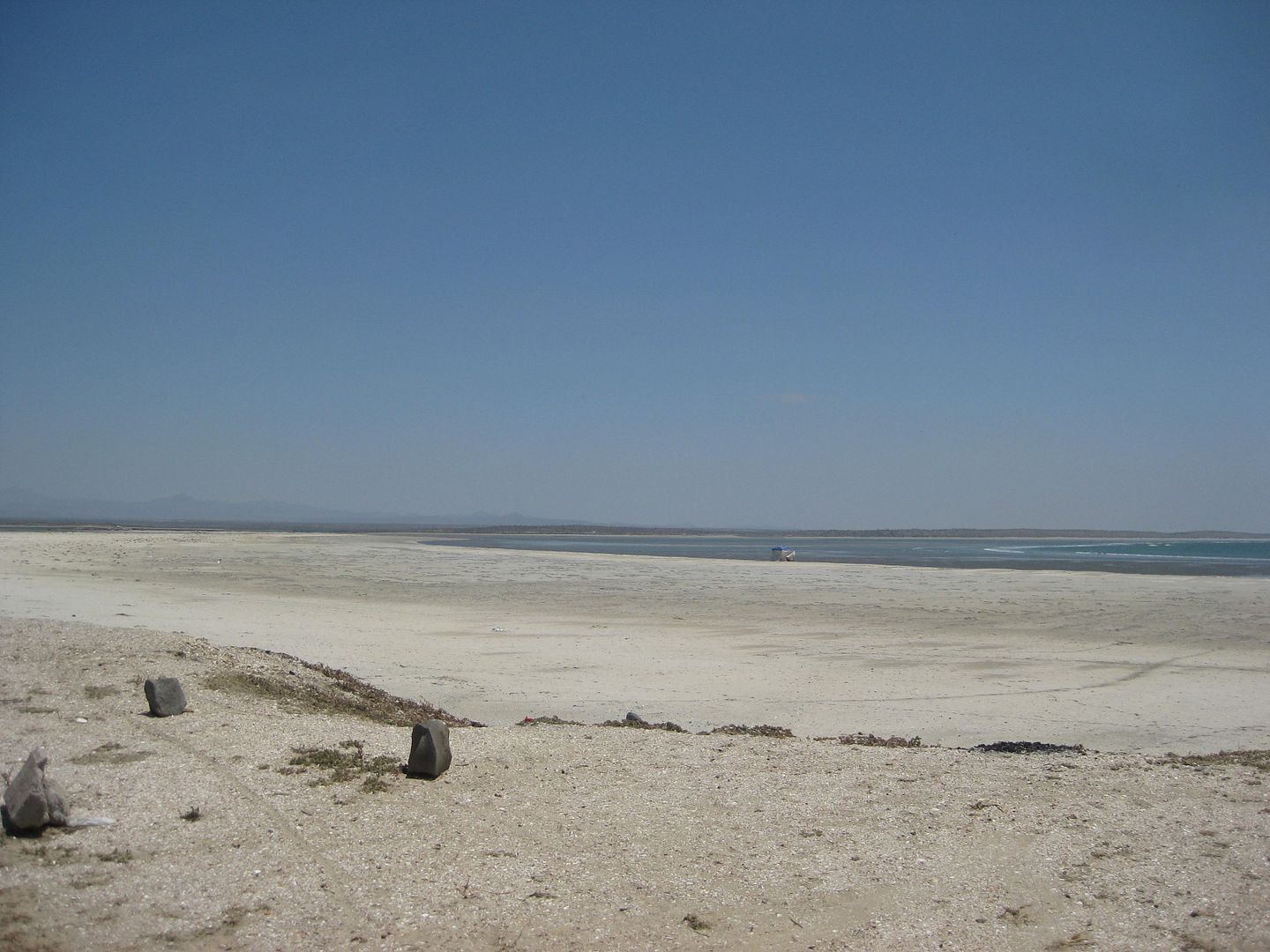
6.7 Edge of big beach at Laguna Manuela. This log continues up the hill.
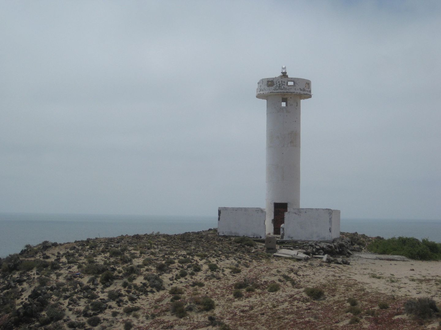
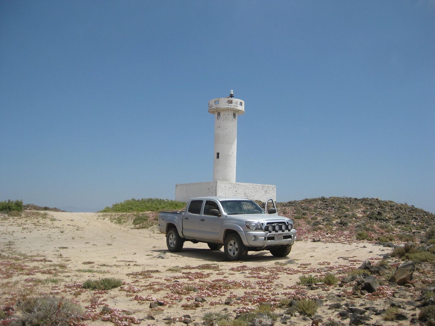
7.8 Lighthouse.
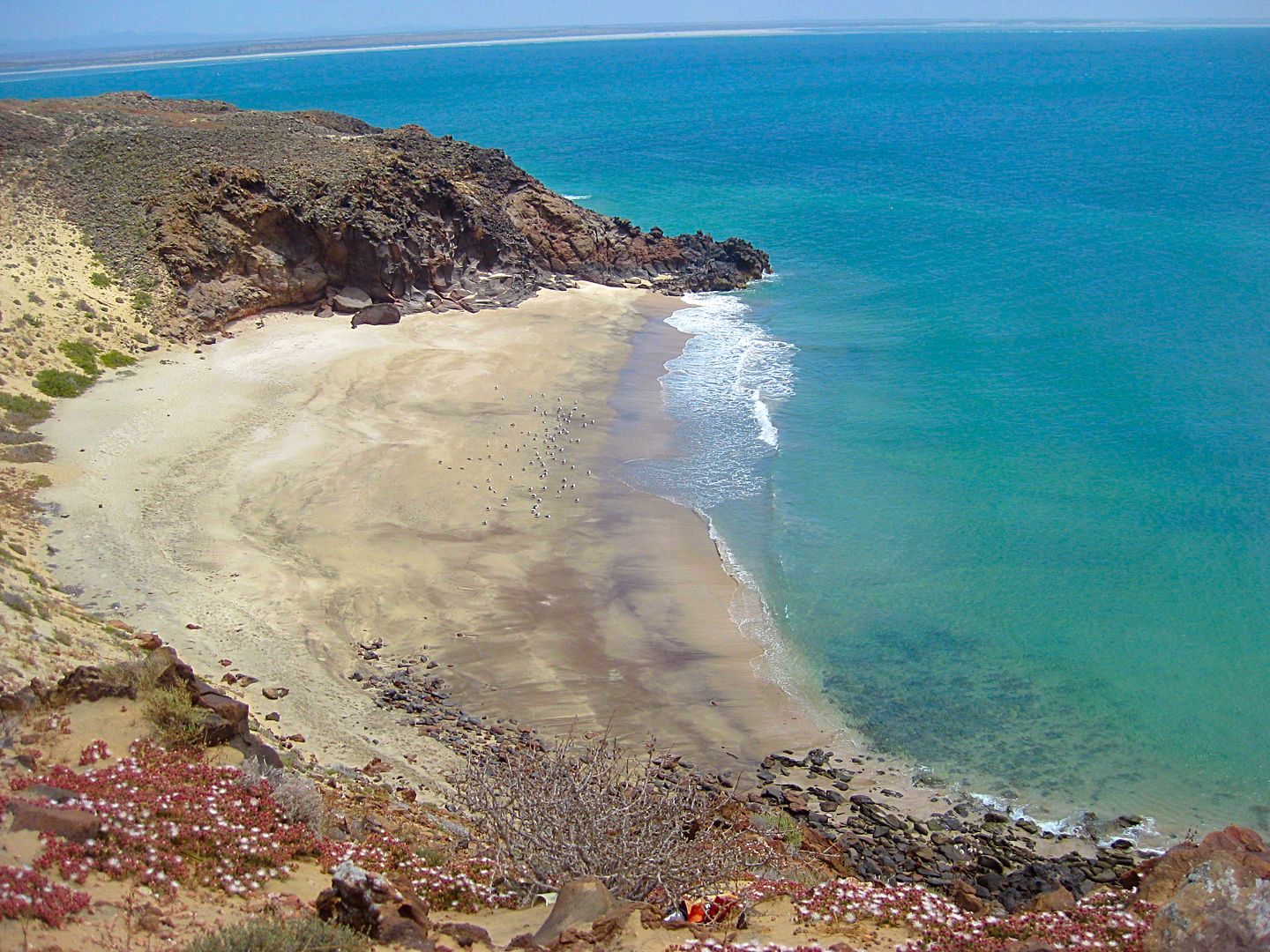
8.2 Fork. Left goes 0.3 to a spectacular sea arch beach.
10.8 Drop down the hill and meet with road parallel to Variety Beach. Camp spot at end of road to left, 1/4 mile. Turn right.
11.2 Turn right and soon go over deep sand to return to Villa Jesus María.
13.1 Back at Laguna Manuela road, 4.1 mi from paved road, 4.9 from Hwy. 1.
Laguna Manuela road.
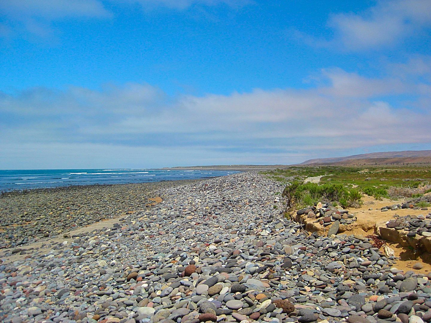
Beach at Laguna Manuela.
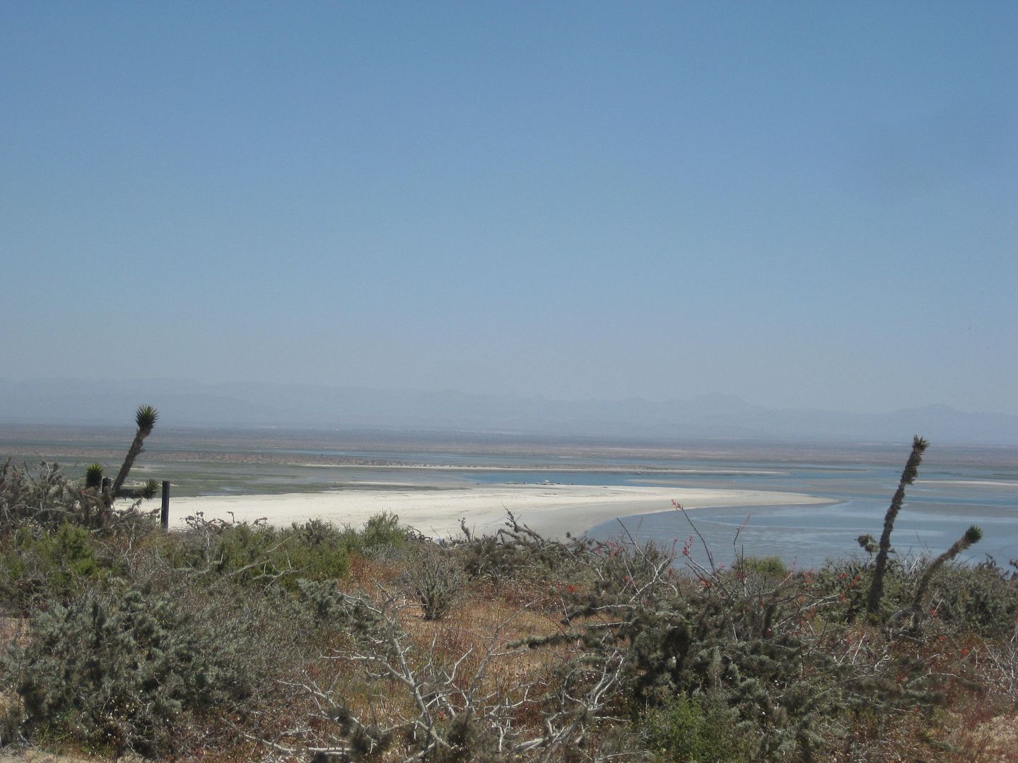
Driving up towards lighthouse.
Clear water!
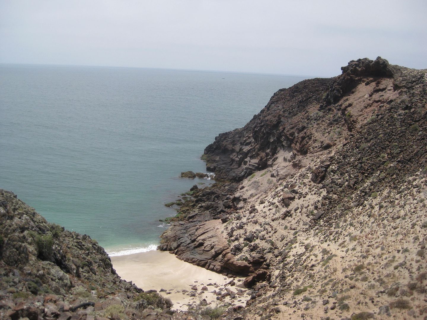

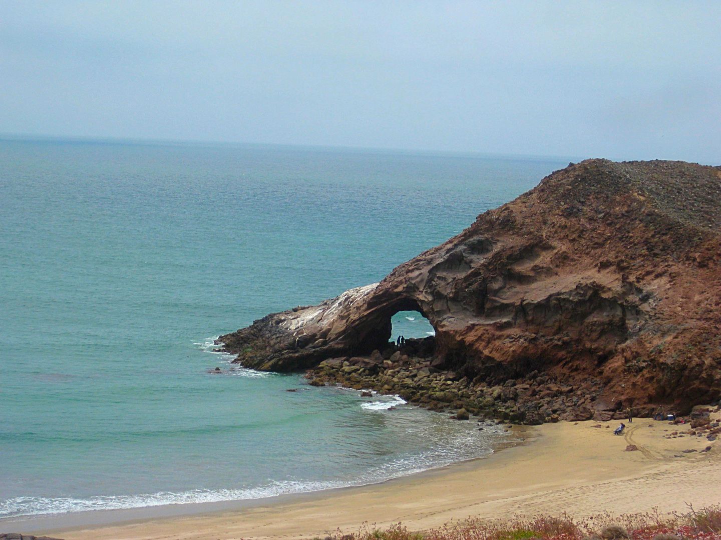
People in the arch help show the scale!
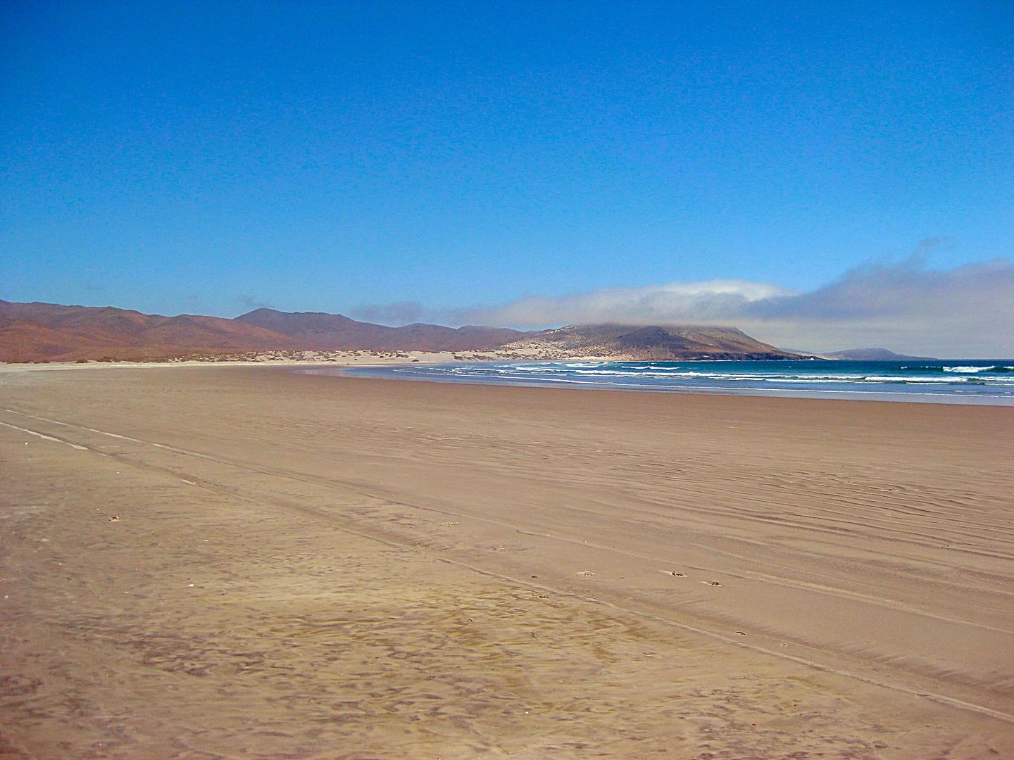
Continuing north from Morro Santo Domingo...
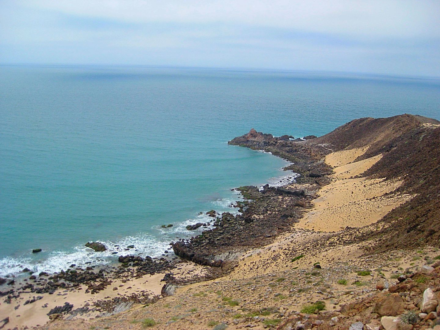
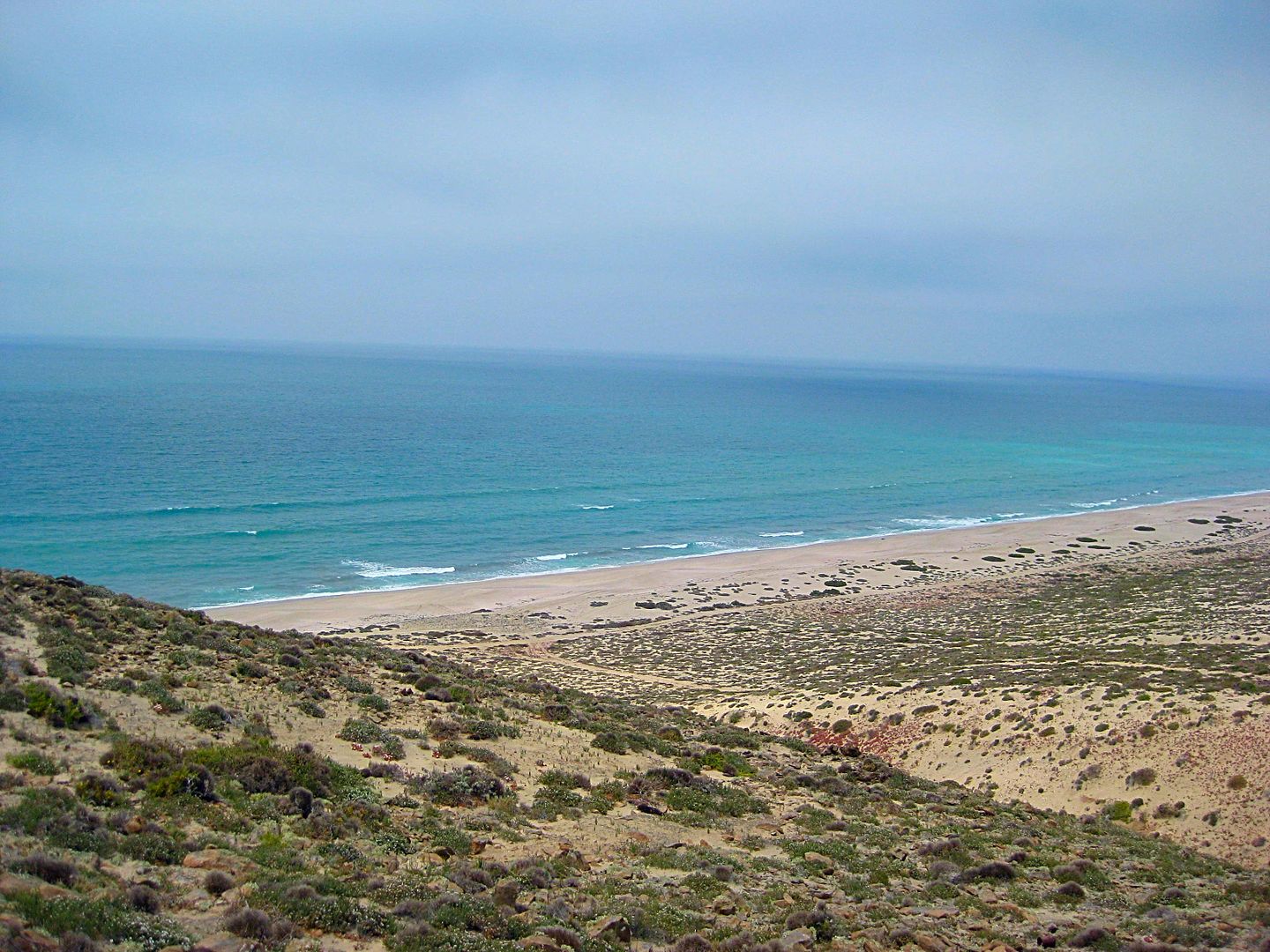
Variety Beach* comes into view.
*The name was provided by Whistler (Glenn). When my folks and I camped and fished here (1980s), we just knew it the Laguna Manuela fishing beach.
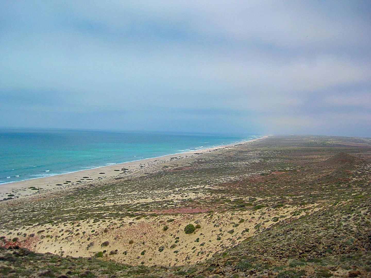
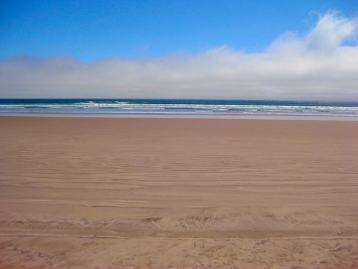
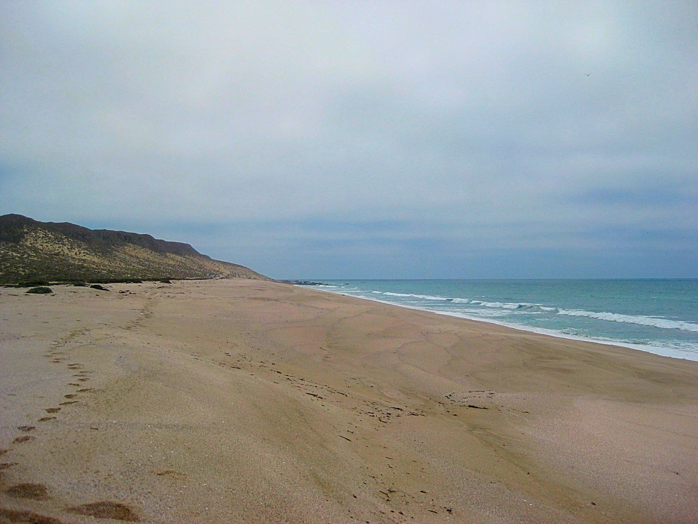
Looking north this is one long beach... all the way to El Tomatal!
Looking south. We used to camp and fish down where the beach meets the cliff. Croaker off the sand and calico bass off then rocks.
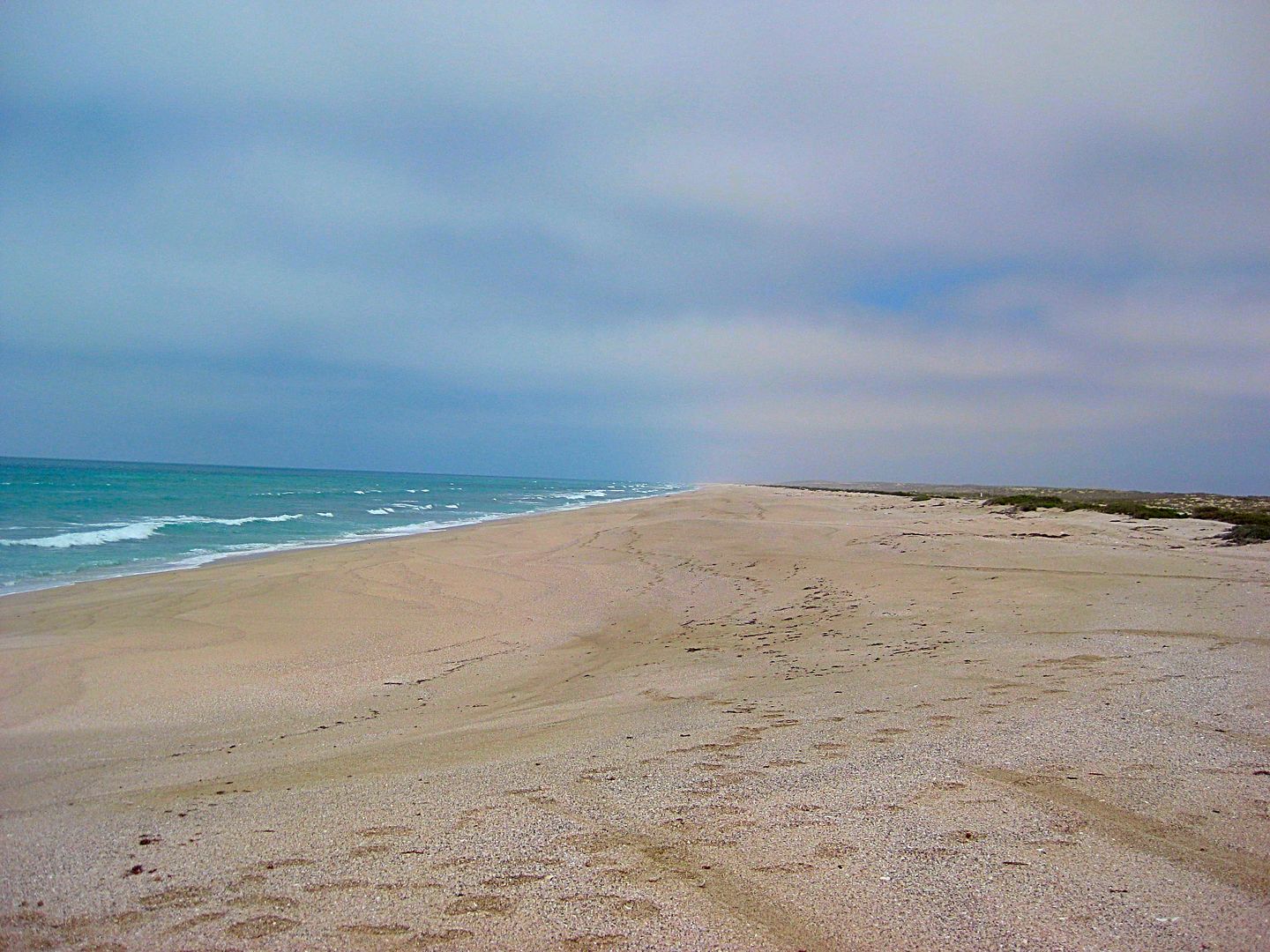
Looking north
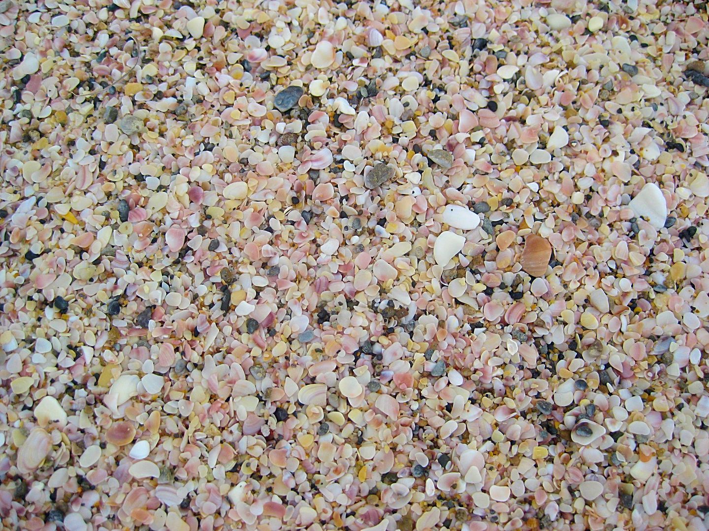
Close up of the sand... tiny shells!
More photos still to come!
[Edited on 4-27-2021 by David K]
|
|
|
fishbuck
Banned
Posts: 5318
Registered: 8-31-2006
Member Is Offline
|
|
| Quote: Originally posted by David K |
This trip report is about backcountry travel on dirt roads and land based activities, like photography, rock hounding, local food. There is nor will
be any connection with watersports of any kind beyond the one and only tourist I saw all the days I was on dirt roads. Thank you for your
understanding. |
Everyone please ignore the photograph of the secret surf spot. It's just a land based photograph. No secret surf spots were harmed in the making of
David's new book about land based activities.
I personally will avert my eyes from any colateral photos of secret surf spots that are inadventantly included in land based activity photography.
"A ship in harbor is safe, but that is not what ships are built for." J. A. Shedd.
A clever person solves a problem. A wise person avoids it. – Albert Einstein
"Life's a Beach... and then you Fly!" Fishbuck
|
|
|
chippy
Super Nomad
Posts: 1697
Registered: 2-2-2010
Member Is Offline
|
|
Secret surf spots in Baja ? I want what yous is smokin. ? I want what yous is smokin.
|
|
|
mtgoat666
Select Nomad
Posts: 17295
Registered: 9-16-2006
Location: San Diego
Member Is Offline
Mood: Hot n spicy
|
|
The guidebook for central baja / 7 sisters area would sell better if it included maps of fishing spots and surf spots,... just saying!
Why write a guidebook that doesn't include a a broad spectrum of activities and locations?
The surf spots are not secret, just put a map in the guidebook and ignore the old surfer sour pusses!

|
|
|
David K
Honored Nomad
Posts: 64479
Registered: 8-30-2002
Location: San Diego County
Member Is Offline
Mood: Have Baja Fever
|
|
This guide (not a book) is just to the roads and what one may find along them. What you like to do from those roads is open and no book needs to tell
anyone where to fish or surf. The spectrum is very broad, almost unlimited.
|
|
|
David K
Honored Nomad
Posts: 64479
Registered: 8-30-2002
Location: San Diego County
Member Is Offline
Mood: Have Baja Fever
|
|
I added more photos from the Laguna Manuela side trip, above.
My truck had milestone moment as I was nearing Hwy. 1 coming out of Laguna Manuela!
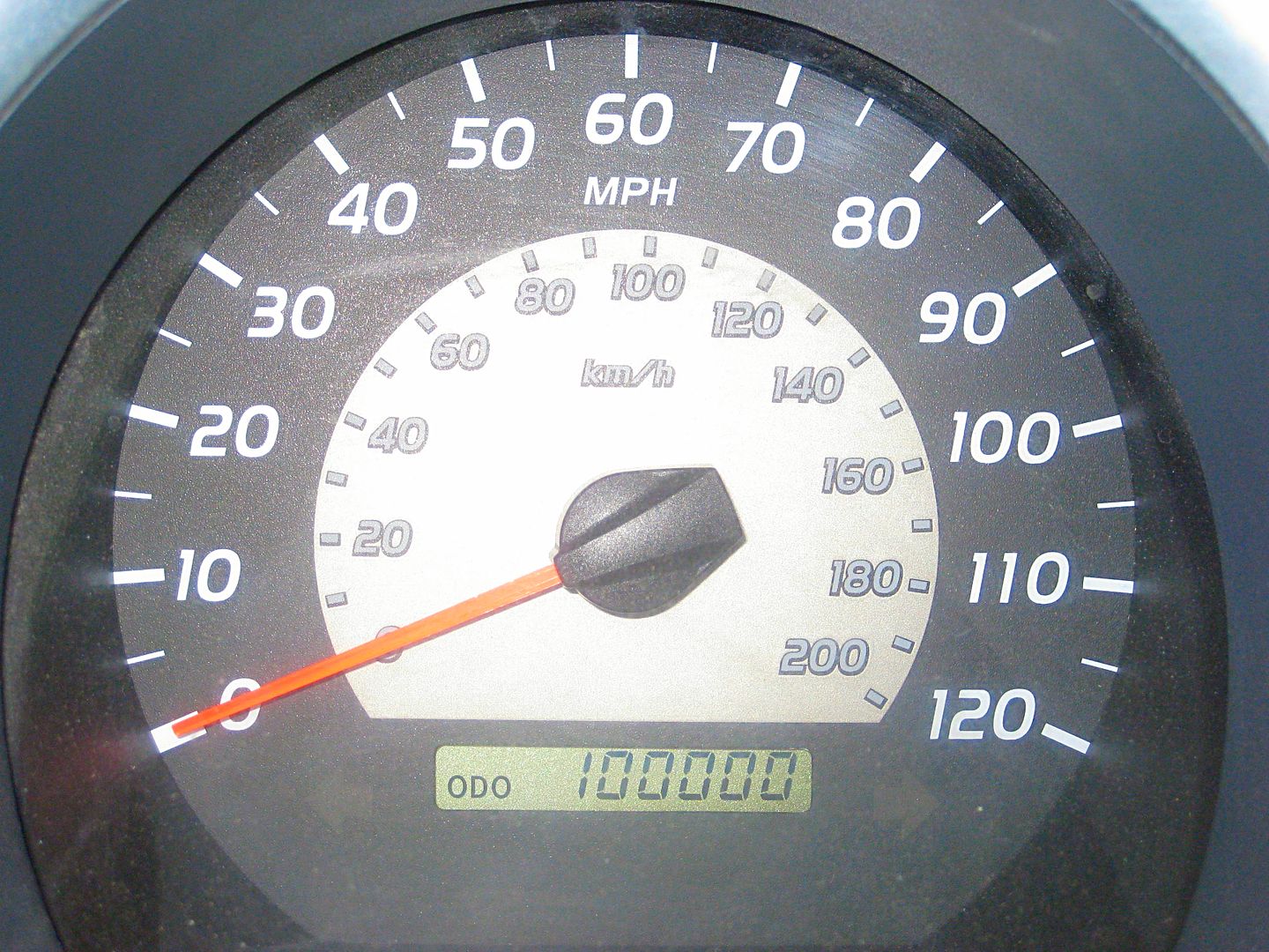
The truck is 7 years and 4 months old. It is the fewest miles I have driven of any of my vehicles, which have had over 100,000 miles in under 4 years.
[Edited on 4-27-2021 by David K]
|
|
|
fishbuck
Banned
Posts: 5318
Registered: 8-31-2006
Member Is Offline
|
|
| Quote: Originally posted by David K | | This guide (not a book) is just to the roads and what one may find along them. What you like to do from those roads is open and no book needs to tell
anyone where to fish or surf. The spectrum is very broad, almost unlimited. |
Aw shucks! I was waiting for your new book to be published so I could buy it and support one of my baja amigos who does really cool baja stuff.
"A ship in harbor is safe, but that is not what ships are built for." J. A. Shedd.
A clever person solves a problem. A wise person avoids it. – Albert Einstein
"Life's a Beach... and then you Fly!" Fishbuck
|
|
|
| Pages:
1
2
3
4 |


