| Pages:
1
2
3
4 |
David K
Honored Nomad

Posts: 64479
Registered: 8-30-2002
Location: San Diego County
Member Is Online
Mood: Have Baja Fever
|
|
TRIP #5 (June 2017): Central Baja: El Arco to El Barril, San Francisco de la Sierra, Bahía Tortugas, Agua Dulce, more!
EDIT: Report & Photos sized for message boards and no watermarks are here: https://www.tacomaworld.com/threads/2017-baja-expedition-5-c...
I will post notes and photos until all 7 days are here, until then, please return to see additions.
DAY 1:
My fifth research trip for the Baja Bound Map/Guide ran from June 2-June 8. I crossed south at Tijuana and drove to Mission San Fernando where I
camped near the petroglyphs, on the cliff, west of the mission.
At San Ysidro, I converted dollars to pesos and the rate was 17.80 pesos: dollar. The border was a bit of a mess as the left lane had to merge into
others at the final curve near the crossing.
The three tolls to Ensenada were (in dollars) 1.80, 1.80, 1.95.
On the way south, at Km. 88.5 south of Ensenada, I popped over to see if the gate for Mission San Vicente (1780) was open (it had been closed on
previous trips since my last time on the site in 2000 or flying over by helicopter in 2014). It was open, and the caretaker (Samuel) was there at the
museum, 1 km. from the highway.
At El Rosario, I filled up the tank (16.02/liter) and my Tacoma was getting 17.8 mpg for the 280 miles since my fill up near home. Antonio
('BajaCactus') was getting a newly acquired (for the Desert Hawks Rescue Service) 4x4 Isuzu Trooper repaired and I did not see him this day. Isela
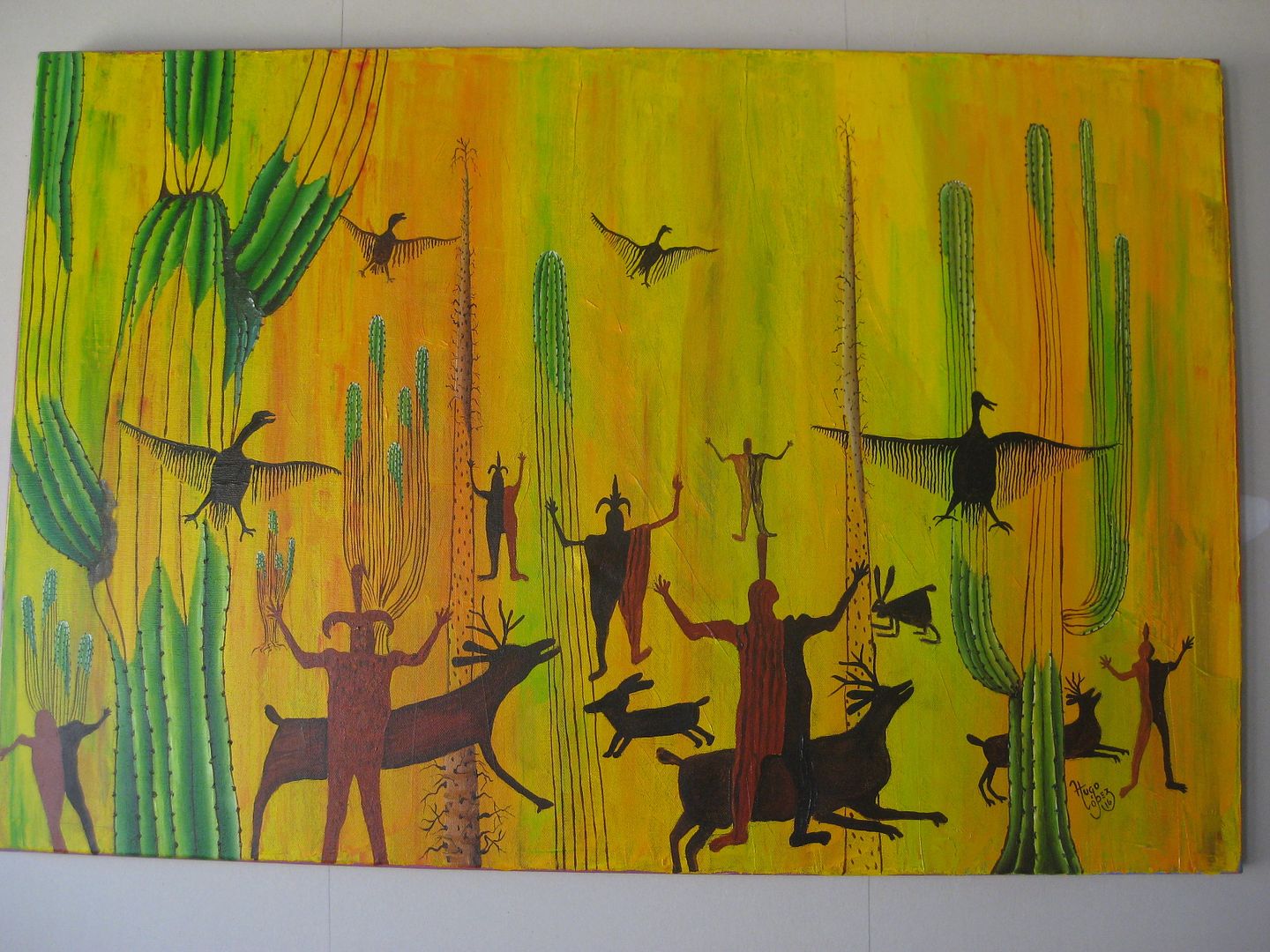
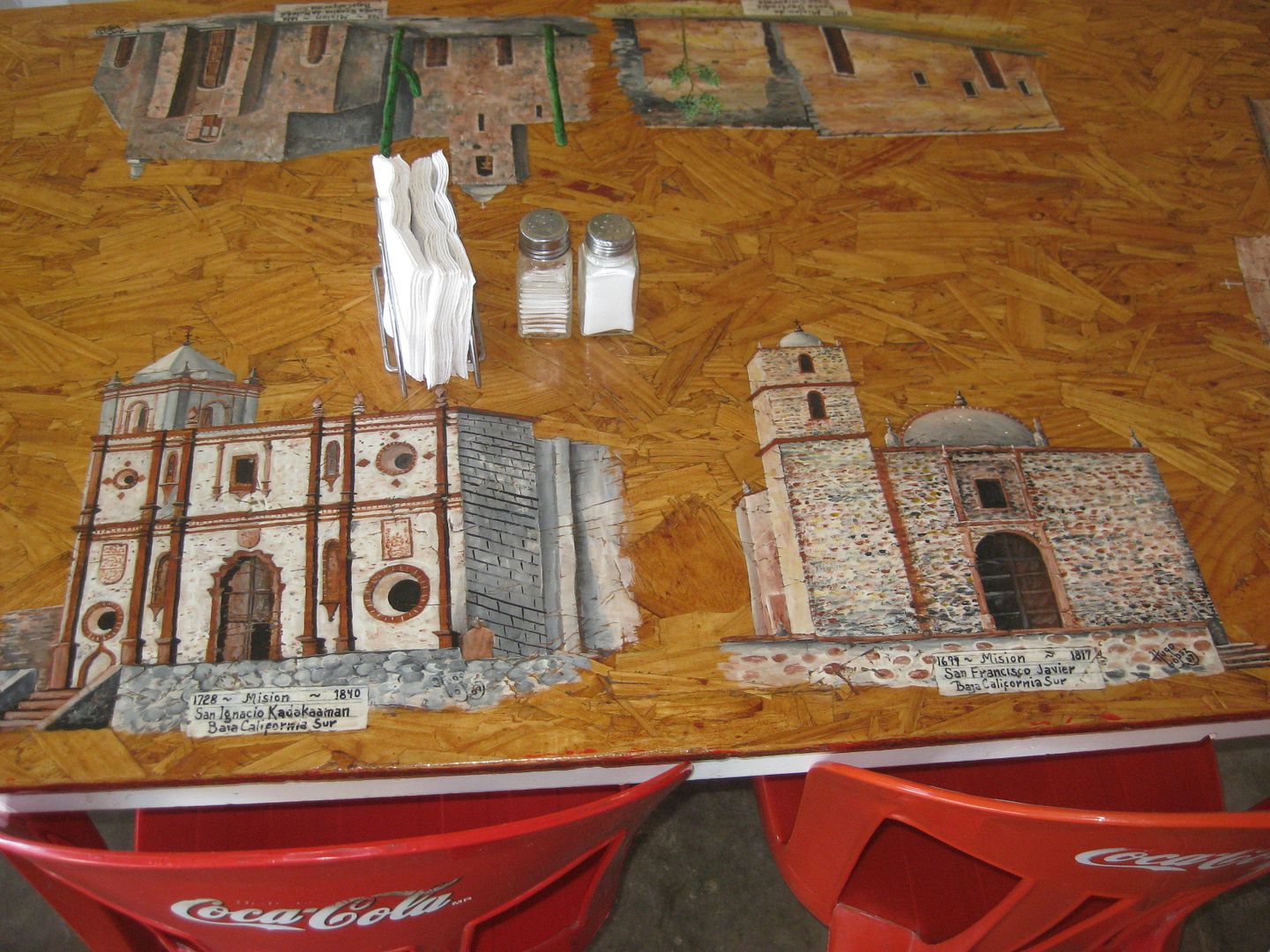
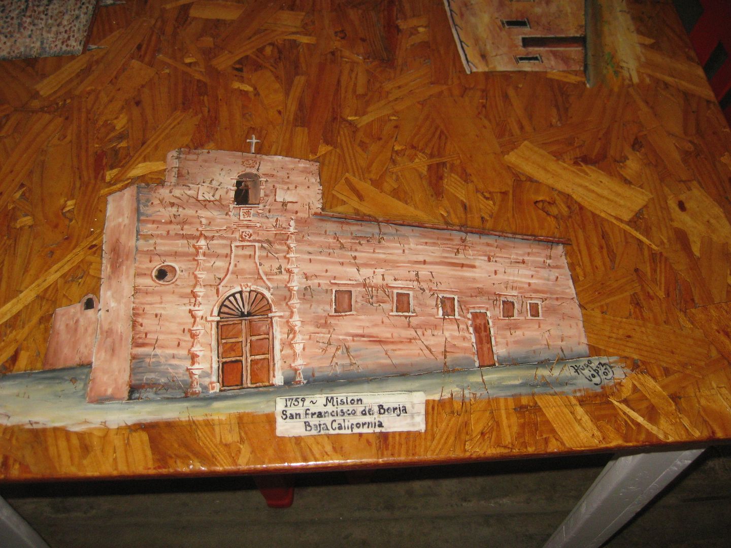
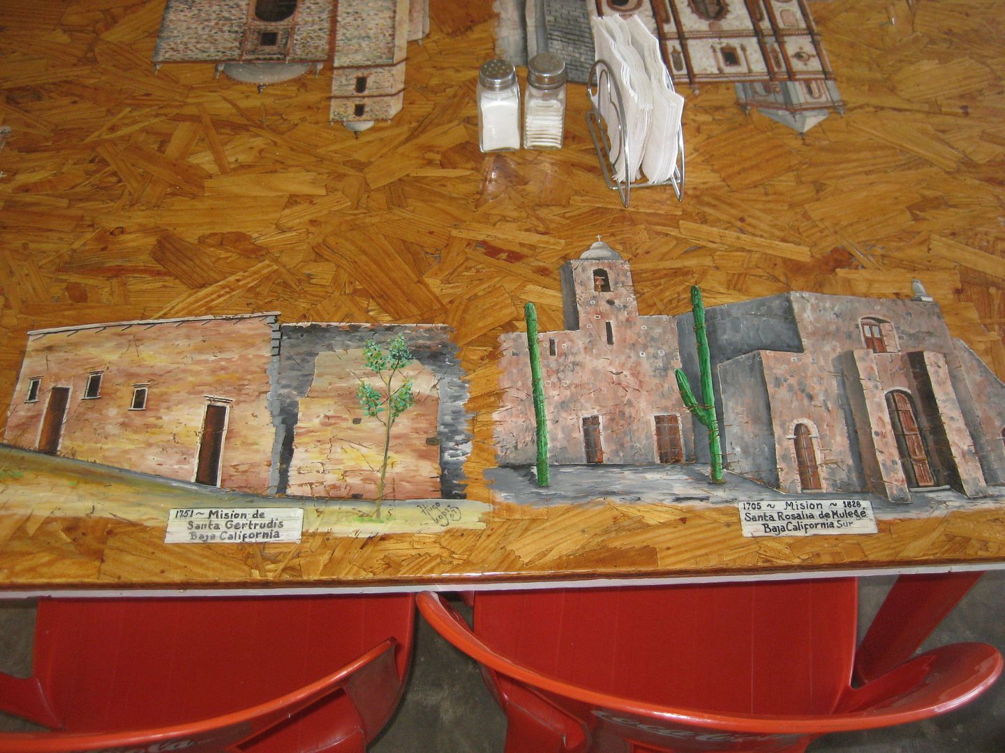
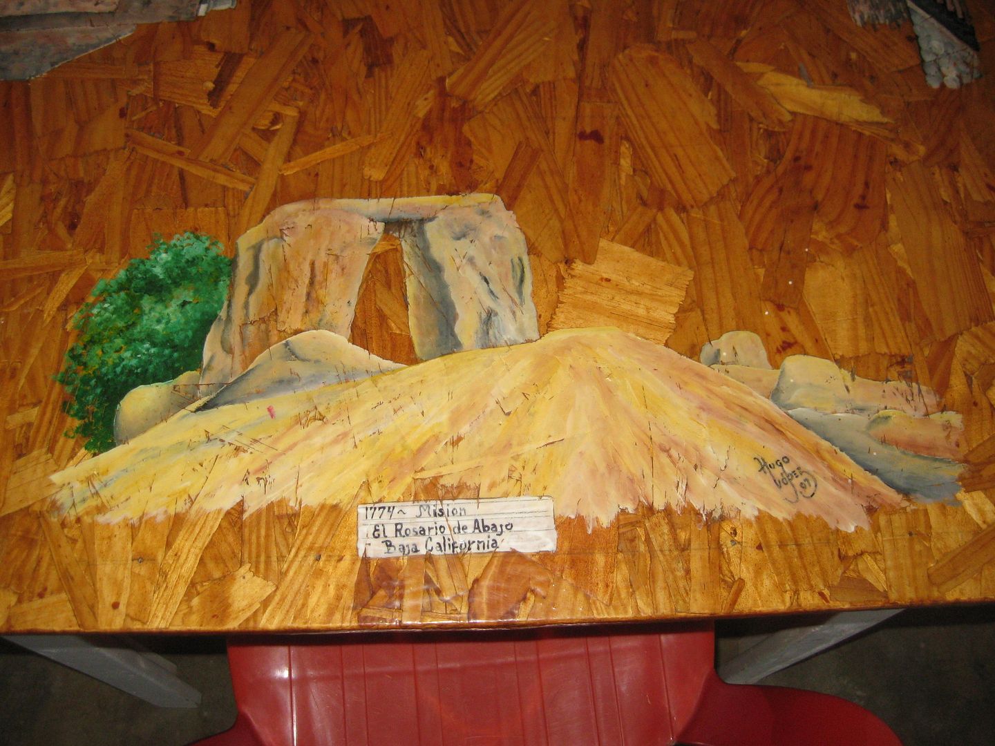
told me where to look for him but I missed making contact. I did see the Hugo Lopez' rebuilt 'Tacos Misión' restaurant (about Km. 59.5) was open and
had lunch there. Hugo has begun painting again! The first El Rosario mission (1774) is nearby, uphill from the highway on a concrete street, about Km.
58.5.
On south, the drive was easy, only a few holes in the highway (it gets worse further south). I take the old main Baja road shortcut to reach Mission
San Fernando de Velicatá (1769). The old road is at Km. 118.5. It is easier to just go on to Km. 121+ at the abandoned El Progreso restaurant and go
the 2.3 miles to the mission.
A cattle control gate now must be opened (and closed) 1.1 miles before the mission. No humans were beyond, but a family of cattle greeted me at my
camp later!
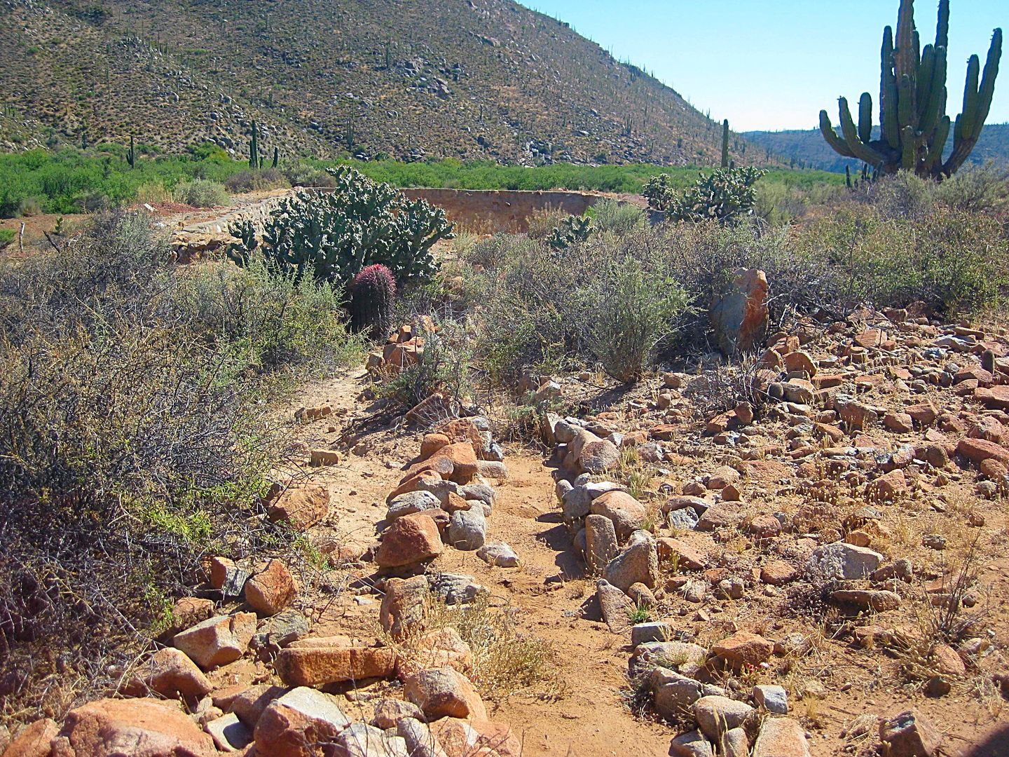
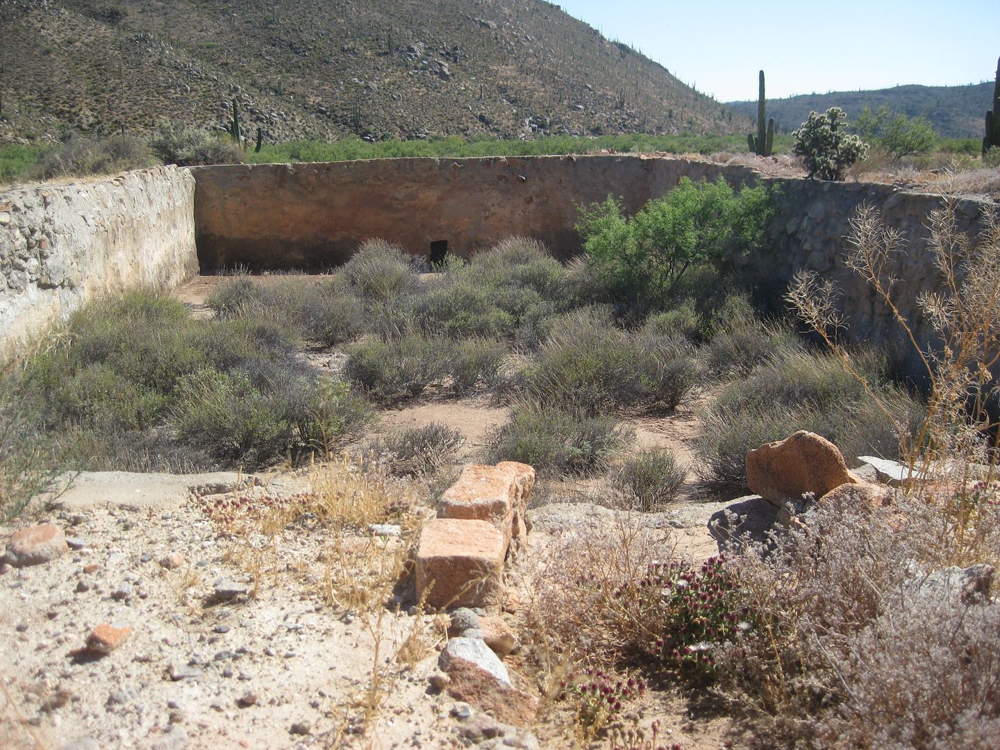
I also went past the cliff to see the pila (reservoir, made for the mission) and an abandoned ranch, just past. Of all the times I have visited the
petroglyphs here (1974, 1975, 2000, 2003, 2005), I have never gone beyond to see the reservoir.
OK today's photos:
Mission San Vicente Ferrer, 1780
The above two from inside the museum.
Hugo's latest, at Tacos Misión Restaurant, El Rosario:
Looking down on Hugo's mission table:
Mission San Fernando de Velicatá, 1769:
Aqueduct and Reservoir, 0.9 mile west of mission:
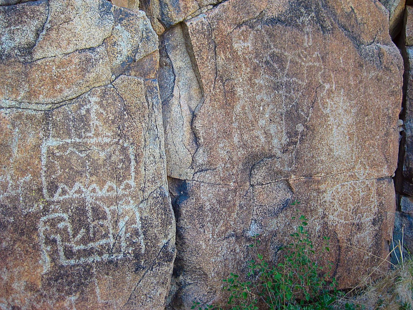
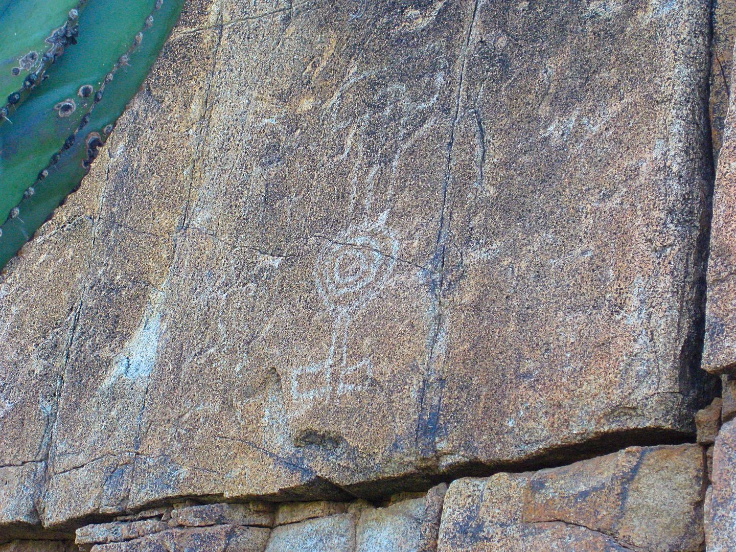
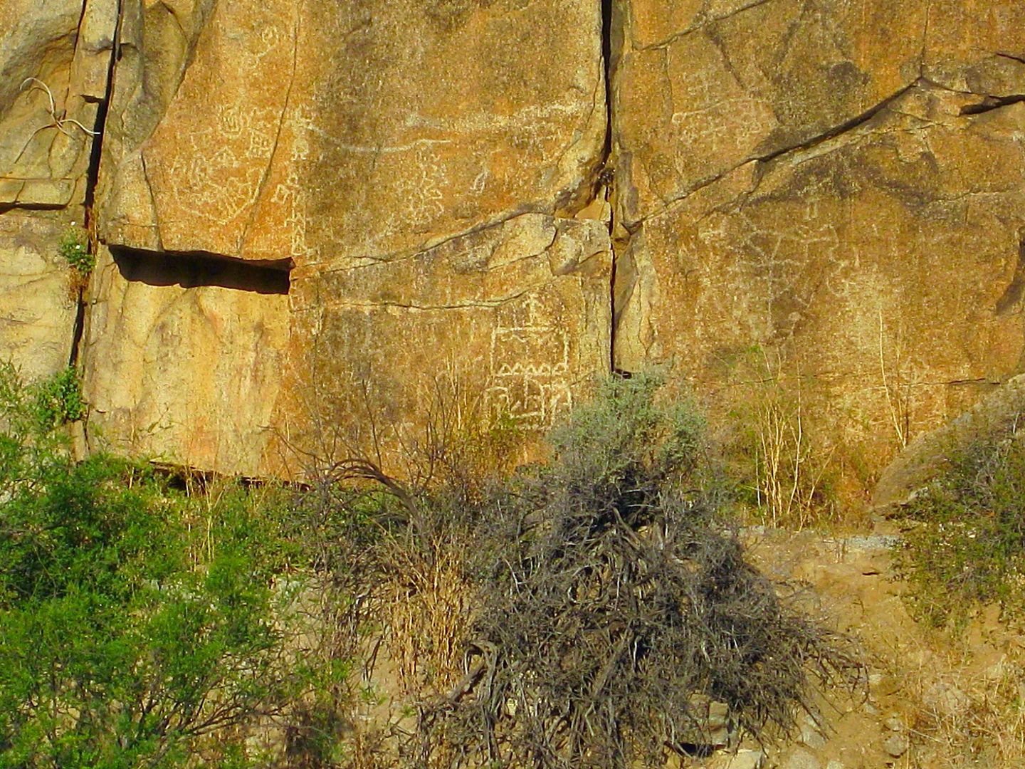
Petroglyphs, including the 'galleon', 0.7 mi west of the mission:
In the morning I take more photos with the sun on the cliff, see tomorrow's post. I set up camp nearby...
Stay Tuned for Day 2 (Saturday, June 3)...
[Edited on 6-5-2021 by David K]
|
|
|
Udo
Elite Nomad
Posts: 6321
Registered: 4-26-2008
Location: Black Hills, SD/Ensenada/San Felipe
Member Is Offline
Mood: TEQUILA!
|
|
Can't wait!
Udo
Youth is wasted on the young!
|
|
|
DawnPatrol
Nomad
Posts: 357
Registered: 11-19-2013
Member Is Offline
|
|
excellent!
|
|
|
David K
Honored Nomad
Posts: 64479
Registered: 8-30-2002
Location: San Diego County
Member Is Online
Mood: Have Baja Fever
|
|
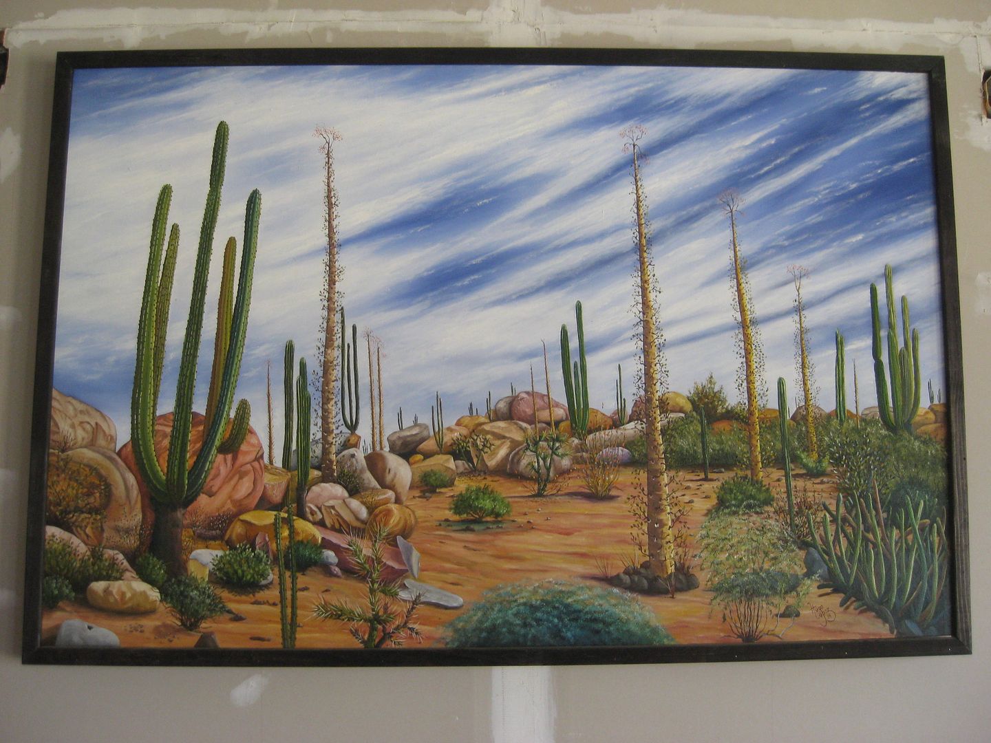
Here's another Hugo Lopez painting, that didn't get into the first post:
|
|
|
David K
Honored Nomad
Posts: 64479
Registered: 8-30-2002
Location: San Diego County
Member Is Online
Mood: Have Baja Fever
|
|
DAY 2 (Saturday, June 3, 2017)
I had a very nice, quiet sleep... once the cattle moved on. Just as it was getting dark, a bull with his cows and several young calves came to munch
on the shrubs by my tent.
I had an easy drive south to Guerrero Negro. The highway has a few holes south of El Progreso becoming more numerous nearing Cataviña, but not as
terrible as in the past. You can see a lot of patch work. Where it got really annoying was south of Laguna Chapala and very bad the final few miles
before the L.A. Bay Junction. South of there, it was pretty good sailing with a few holes until south of Villa Jesus María where more pot holes
awaited. Once across the state border, no more holes in the highway that I noticed... until taking the road to Punta Abreojos (more on that later).
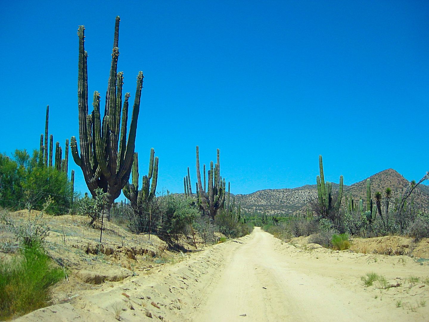
I took a side trip west of the highway to the Sarafan Sand Dunes (this was the name that Jim Hunter gave them in his 1977 book, Offbeat Baja). The
edge of the dunes is just 1/2 mile from the highway at Km. 121.5. A road just north, I took first, crosses the dunes and heads across the flatlands to
the south shore of Laguna Manuela.
With all the chatter about the 'other way' into Guerrero Negro, I had to see it for the first time. The road just goes around the west end of the
Guerrero Negro airport runway, beginning at Km. 124.5 as the paved airport road. Beyond the airport entrance (all military looking) the road becomes a
wide, graded road. When my GPS indicated I was at 28° latitude (the border), I took a photo. I also took photos at the other two, dirt road border
crossings, to the east.
I saw a car with the hood open out on a dirt road just east and a man was walking towards me from it... A young guy whose battery was dead. Why he was
there, north of town, with a bad battery is anyone's guess. I jumped the battery and waited until he was on the wide road and heading south to town.
Good karma for my taking the backroad into Guerrero Negro this day! He would be the first of three hombres I would assist on this trip.
The airport back road comes into town near the bank and almost to the old harbor road. I drove through town and topped my gas tank there.
Magna gas in Baja Sur was 16.40 pesos per liter, which made the cost close to $3.50/gallon at the 17.80/dollar exchange (which is what I got at the
border). Stations are giving 16.50-17.00 pesos per dollar south of Ensenada if you are using dollars... and that makes the cost as much as
$3.76/gallon.
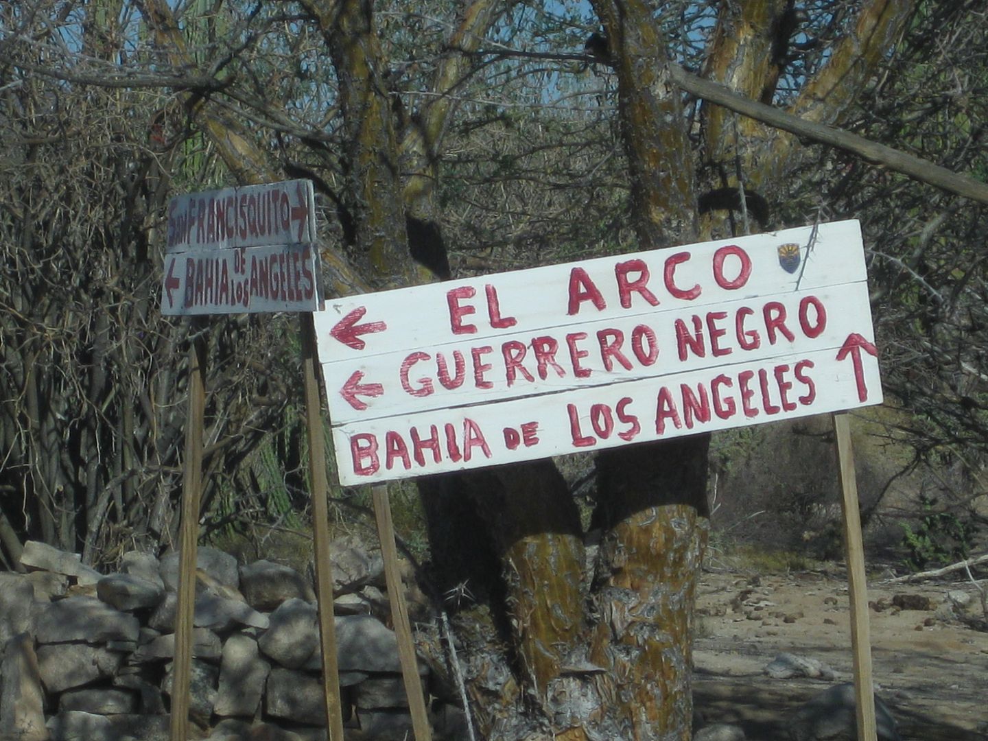
I headed for El Arco, back across the border, and back into Pacific Time Zone. The El Arco "highway" (Mexico #18) is at Km. 189 for southbound traffic
and 188.5 if northbound. There is a big Y, like the way the L.A. Bay highway meets Hwy. 1.
Once paved (in the mid-late 1970s), the asphalt is now gone, but the roadbed was quite good. This was not the case when I last drove this very road in
1983. The pavement was all broken up and full of holes (even worse that the northern half of the Punta Abreojos highway now).
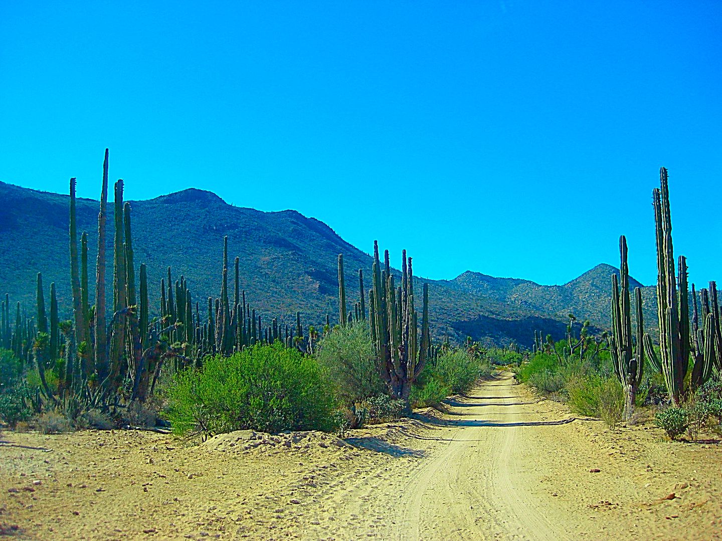
El Arco was once a major gold mine center from the 1930s. It was also on the old main road to La Paz. Copper was discovered and the town hoped for new
prosperity in the early 1970s. That copper mine plan was never developed. There are some modular 'homes' up on the hill to the southeast of town.
Perhaps they belonged to the new mine engineers?
Guerrero Negro didn't exist before the late 1950s. When the Transpeninsular Highway was surveyed and built in central Baja, in 1973, poor El Arco was
bypassed in favor of Guerrero Negro. Not to totally dismiss the town, it got a paved highway off the new road. A major military base was located
there, too.
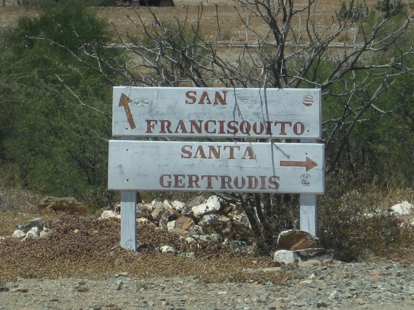
The road is 25 miles from Highway 1 to El Arco at a fork by the abandoned military base. The right fork is signed for Santa Gertrudis and again for
Vizcaino (the old main road). It passes a church, and the entire town except for a ranch now is abandoned. The left fork passes the ranch and leaves
town for Pozo Aleman, Piedra Blanca, El Barril and Punta San Francisquito.
I will take a break and post photos to this point...
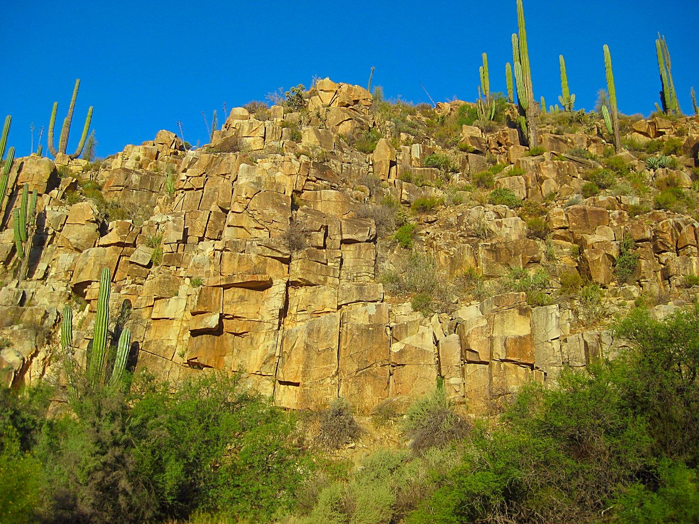
Petroglyph cliff, near Mission San Fernando
Pertos as seen from the road.
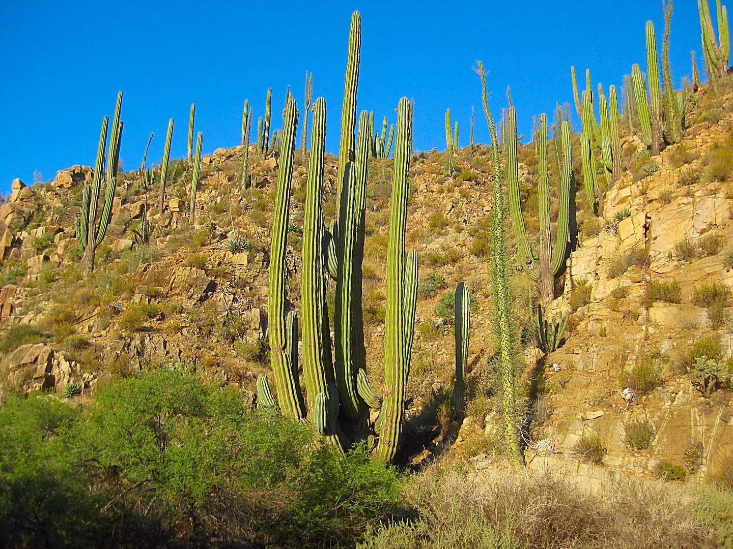
Big cardón by the cliff.
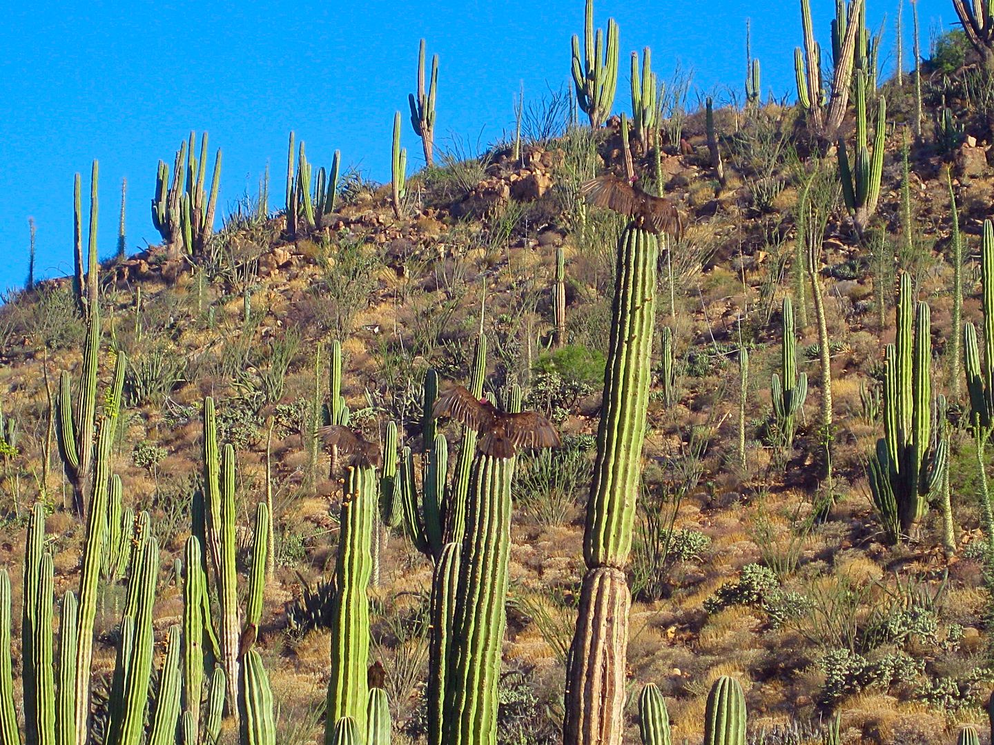
See the three vultures having a sunbath?
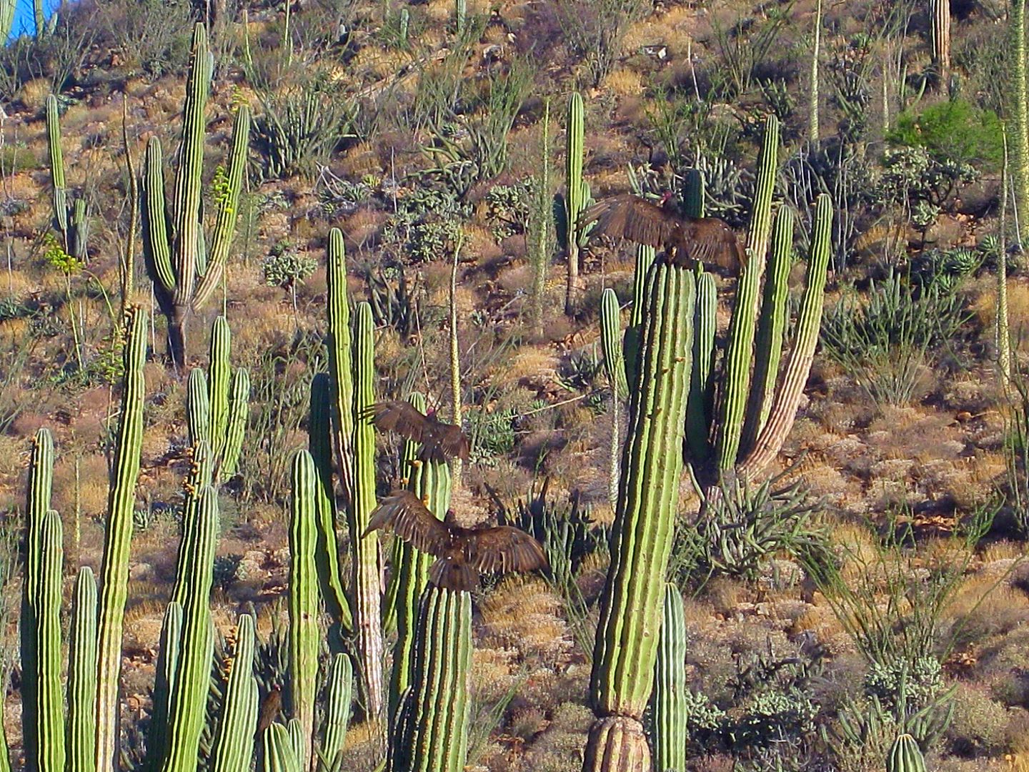
Mission San Fernando, in the morning. The petroglyph cliff is the light-color rockface, to the right of the palms, in the distant background.
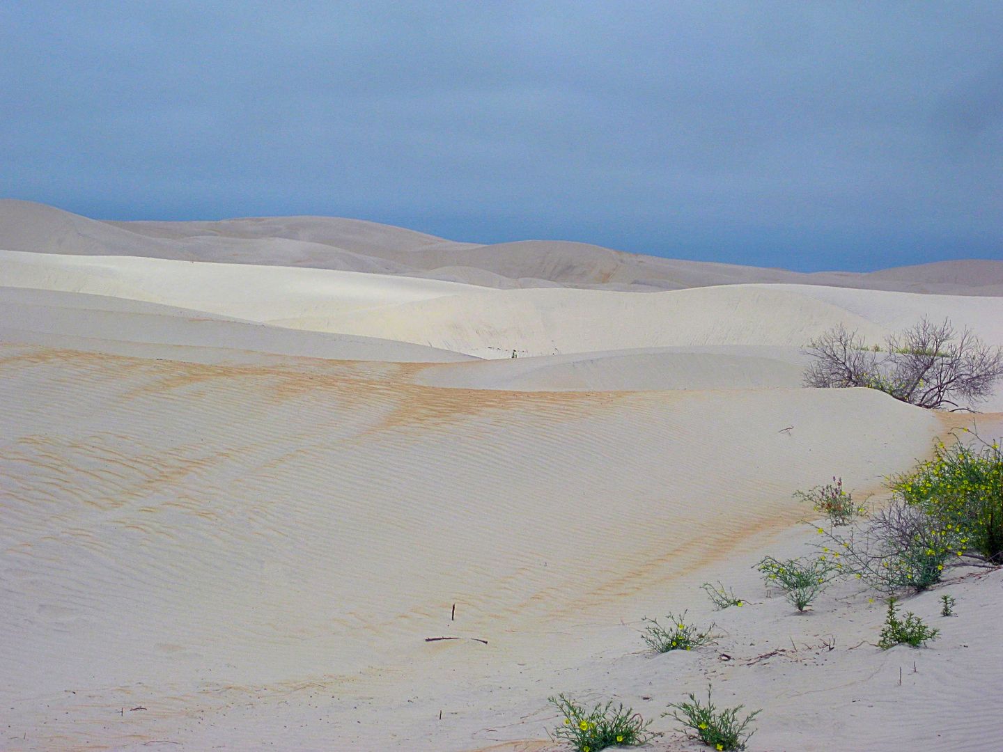
Edge of the dune field. The sun was just poking through the June Gloom and lit a part of the dunes.
State border on the Guerrero Negro airport road. Looking south.
State border on the El Arco road. Looking south.
In El Arco:
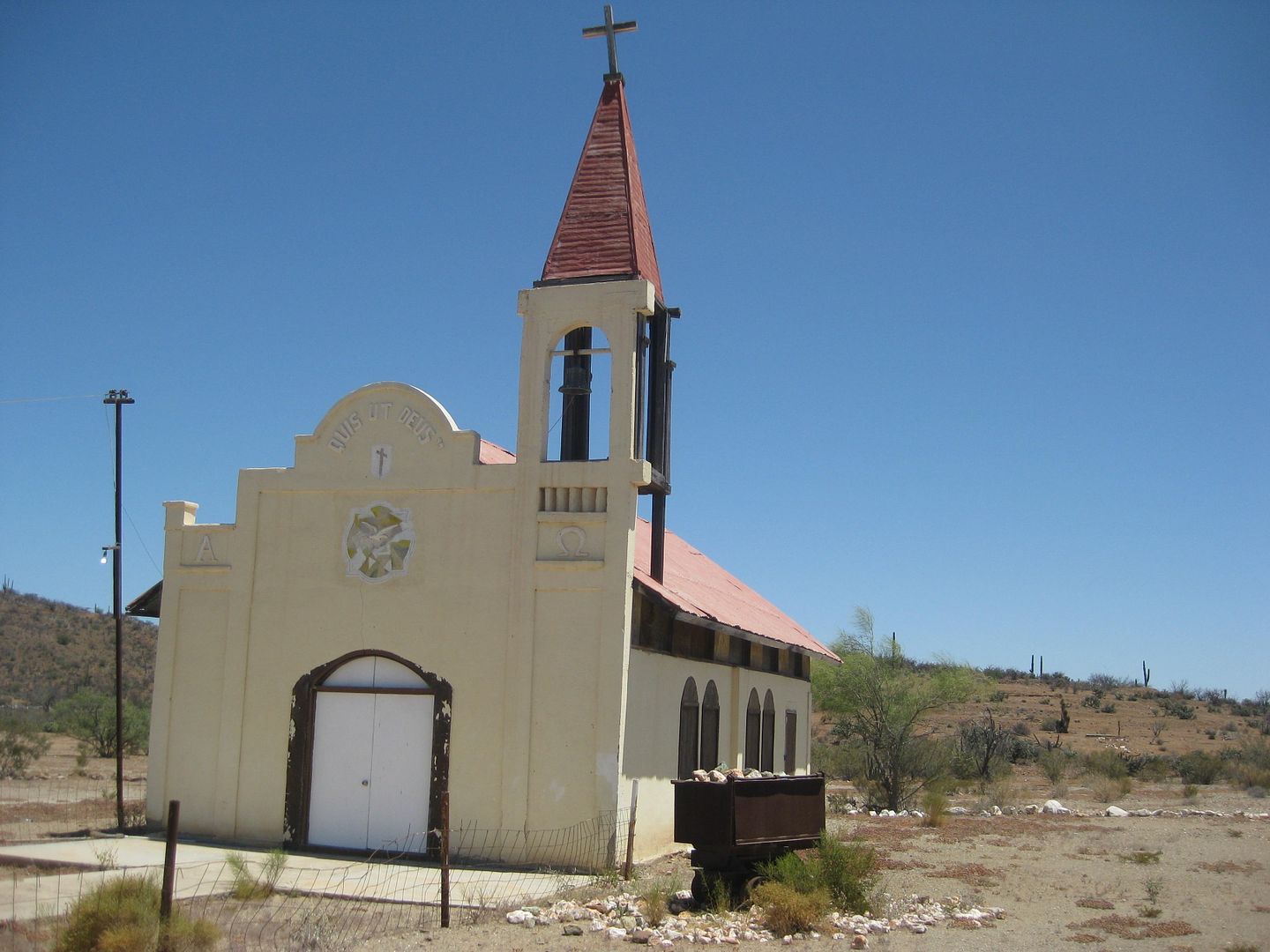
El Arco church.
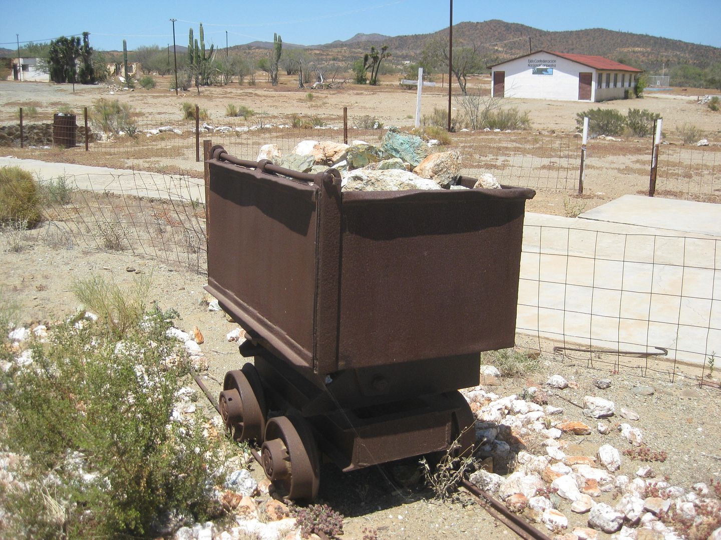
Display ore cart by church.
See the 'mine hole' in the bottom of that cliff? That was a storage area for dynamite and doubled as a jail... no smoking!  
To be continued...
[Edited on 6-19-2017 by David K]
|
|
|
StuckSucks
Super Nomad
Posts: 2306
Registered: 10-17-2013
Member Is Offline
|
|
Nice clump of photos!
Been many years since I was thru El Arco - pretty much what I remembered.
|
|
|
David K
Honored Nomad
Posts: 64479
Registered: 8-30-2002
Location: San Diego County
Member Is Online
Mood: Have Baja Fever
|
|
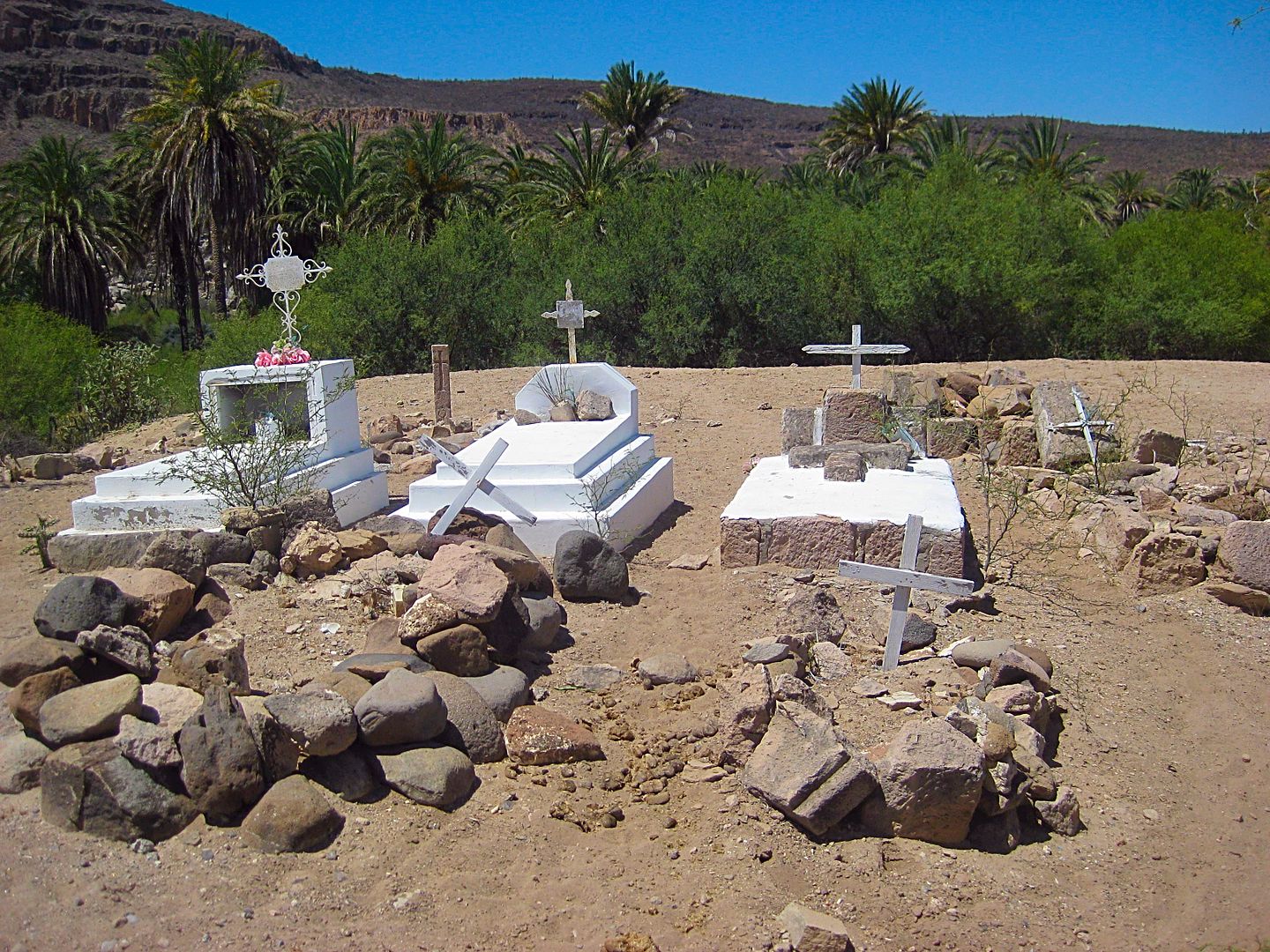
From El Arco, it is just 2.3 miles to the Pozo Aleman road (to the left 1/4 mi, passing a graveyard).
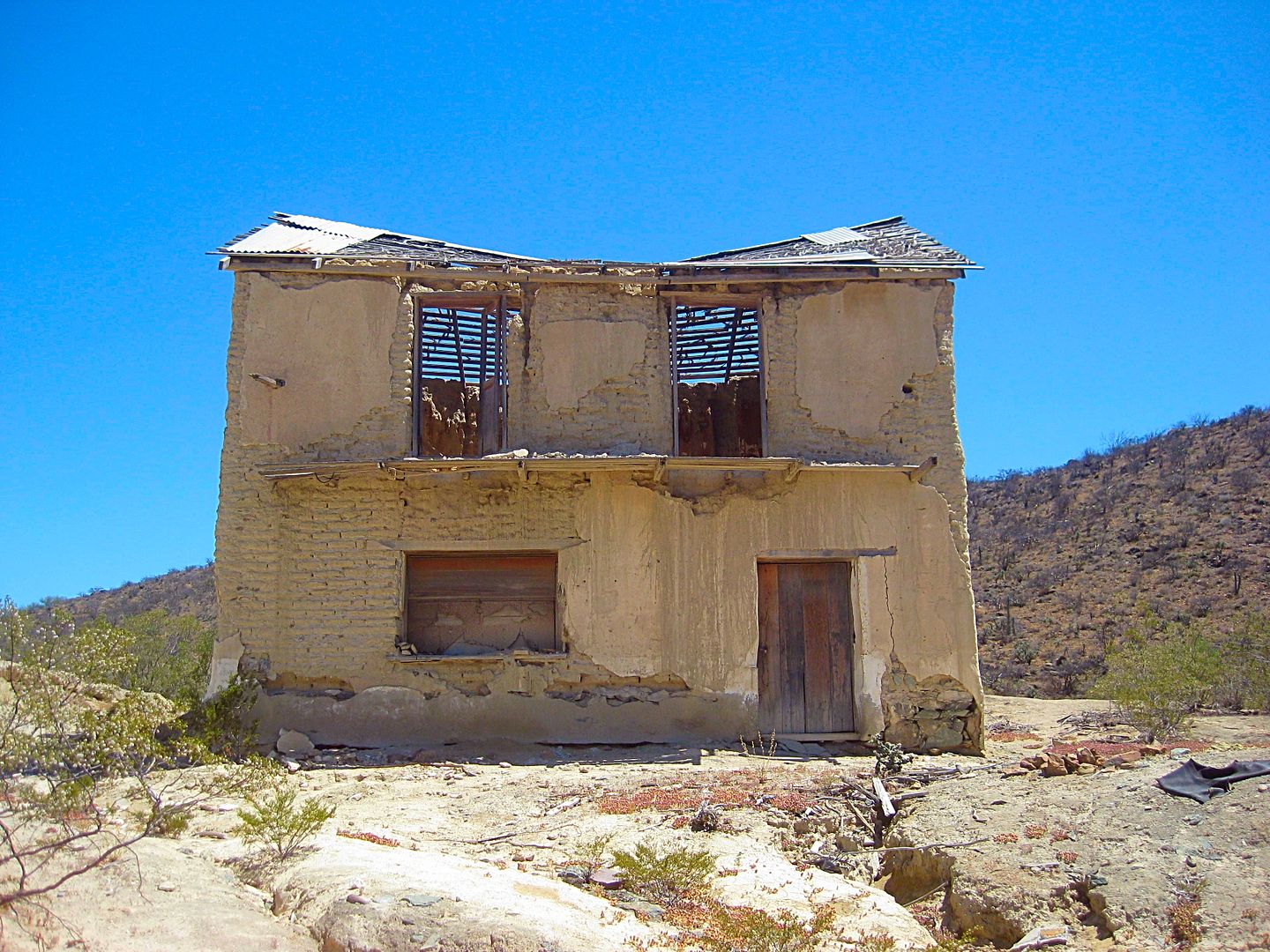
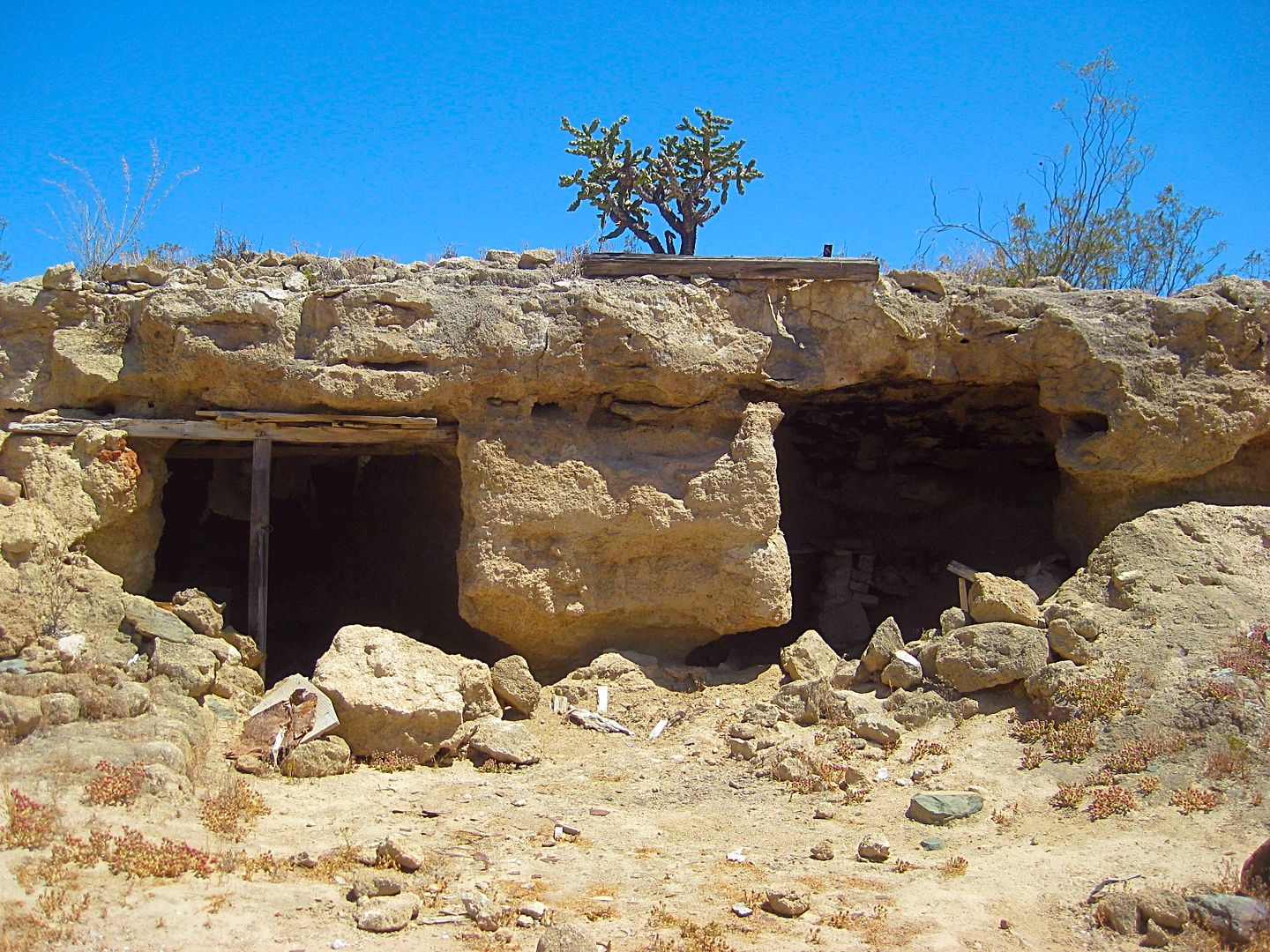
Pozo Aleman was a gold mine that operated around 110 years ago. The miners lived underground to escape the heat.
I headed on eastward for El Barril, a fishing town on the Gulf of California coast, made famous in the 1960s when it was just a ranch, in the
adventure books by famous author and Perry Mason creator, Erle Stanley Gardner.
Boojum tree with Ball Moss
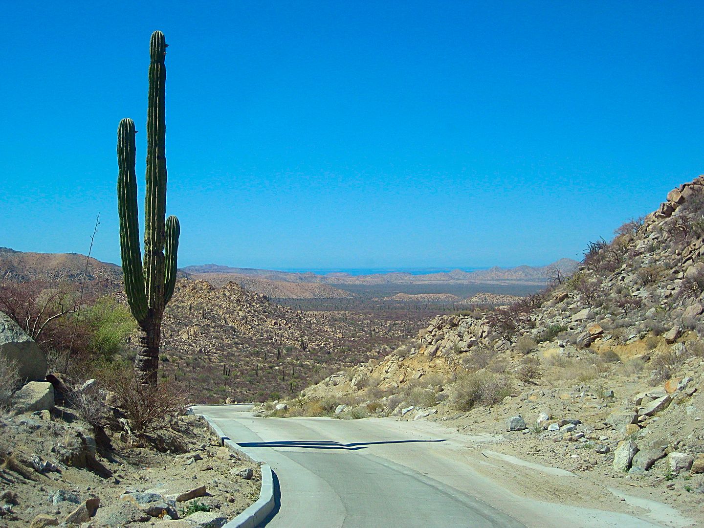
Top of the now concrete paved grade, Cuesta de la Ley. The Gulf of California is in the distance. This is 27.4 miles from El Arco.
More to come!
|
|
|
mtgoat666
Select Nomad
Posts: 17295
Registered: 9-16-2006
Location: San Diego
Member Is Offline
Mood: Hot n spicy
|
|
That toy pickup needs a canopy!
|
|
|
David K
Honored Nomad
Posts: 64479
Registered: 8-30-2002
Location: San Diego County
Member Is Online
Mood: Have Baja Fever
|
|
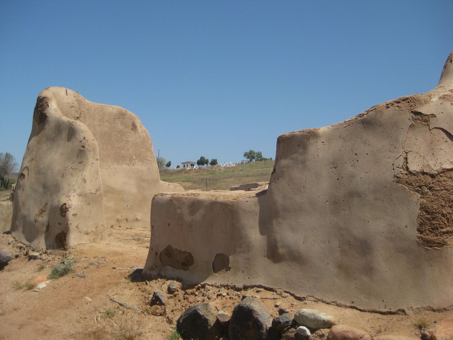
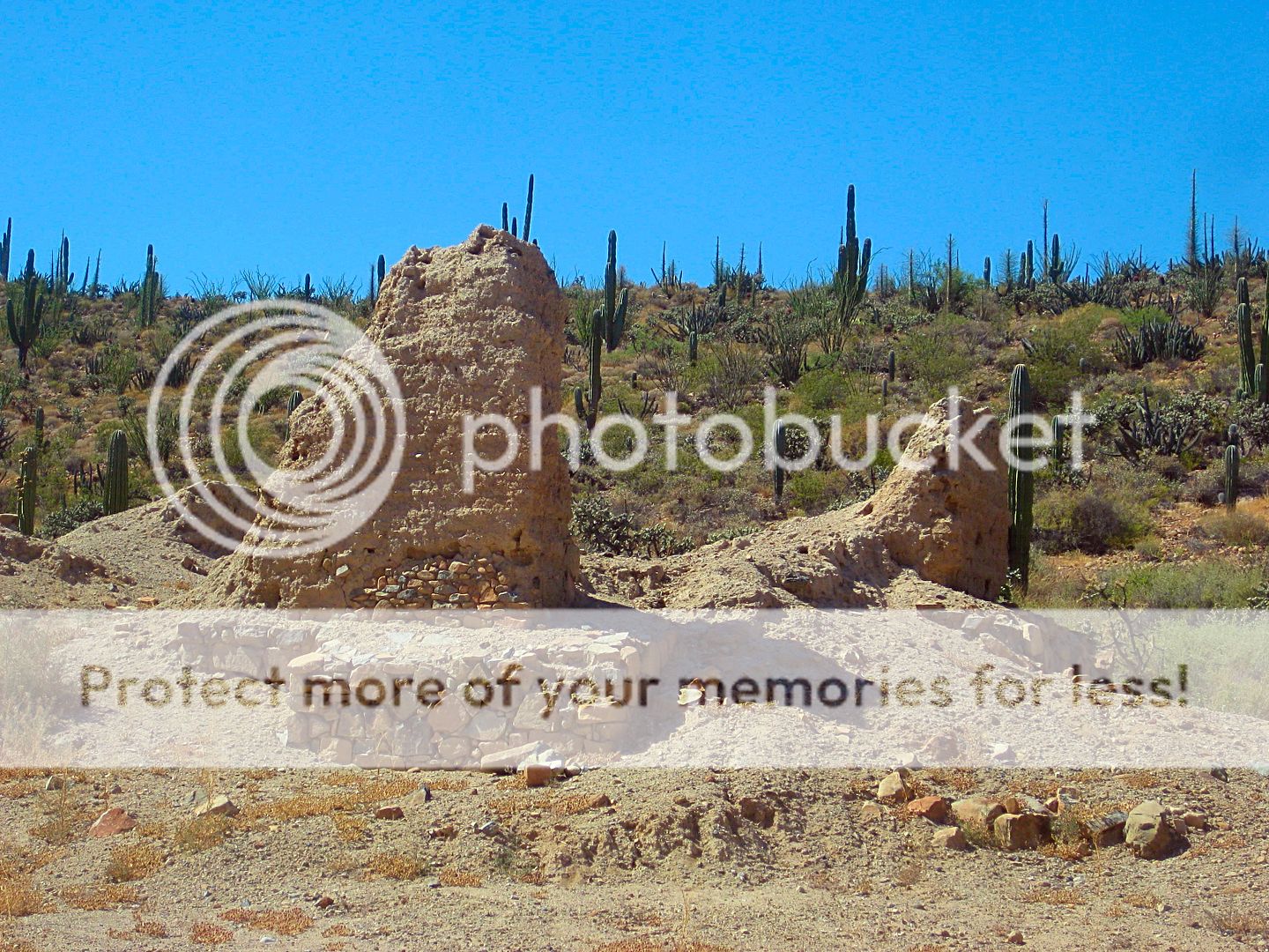
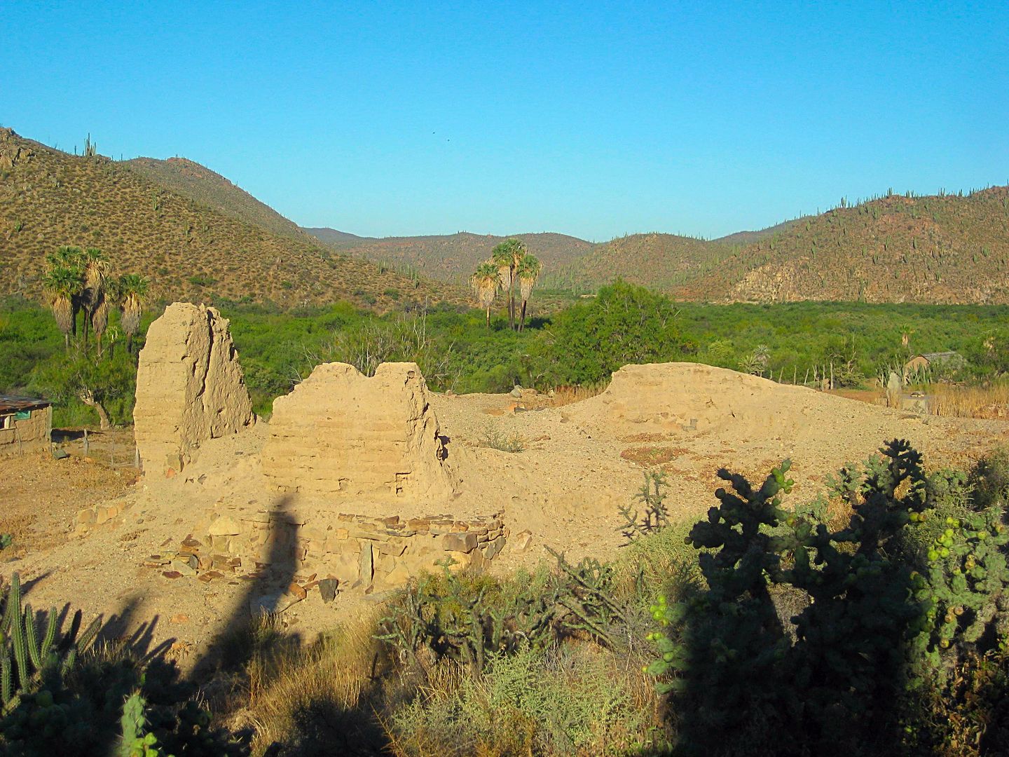
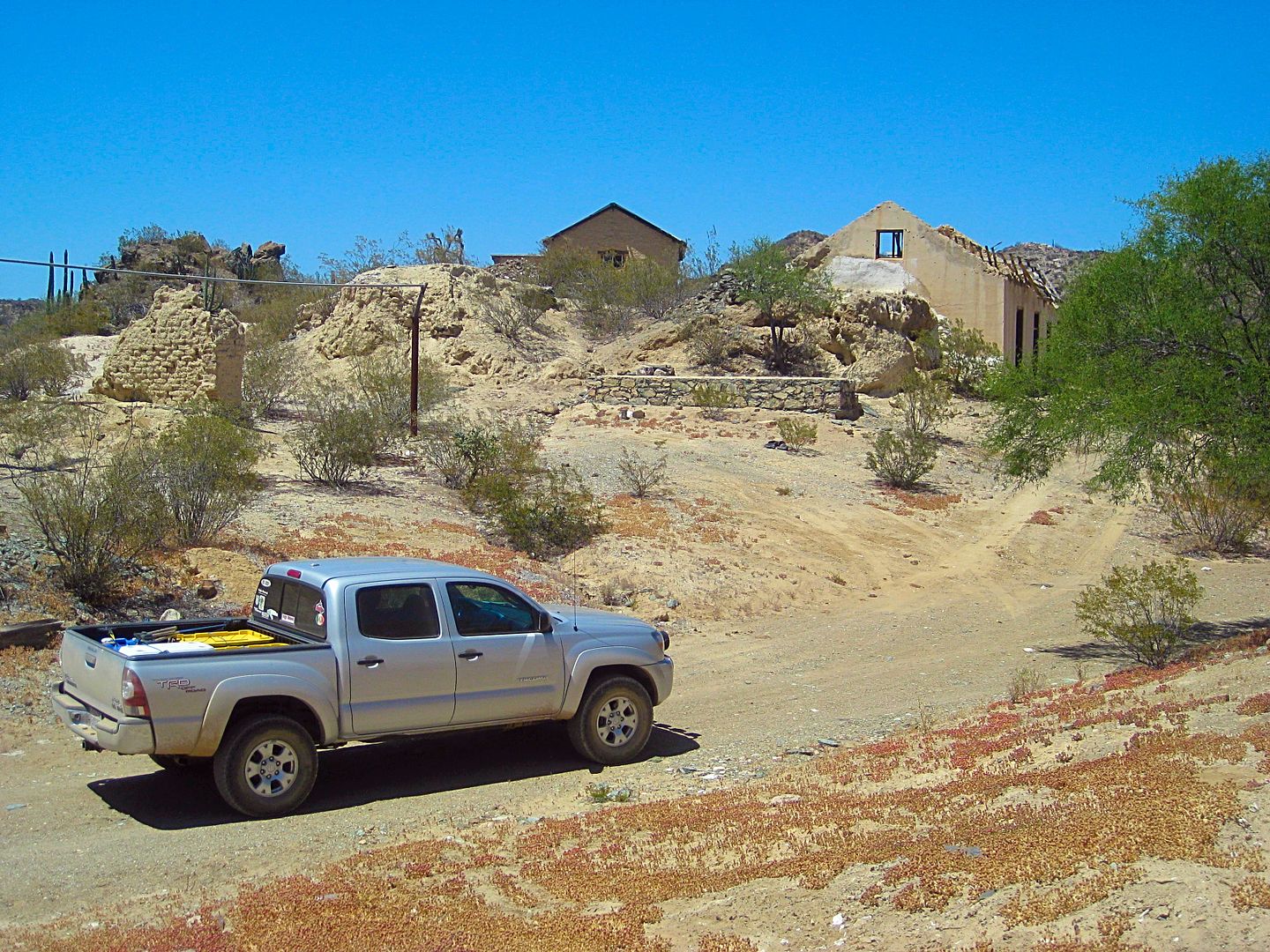
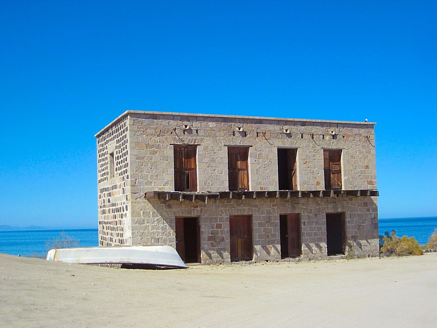
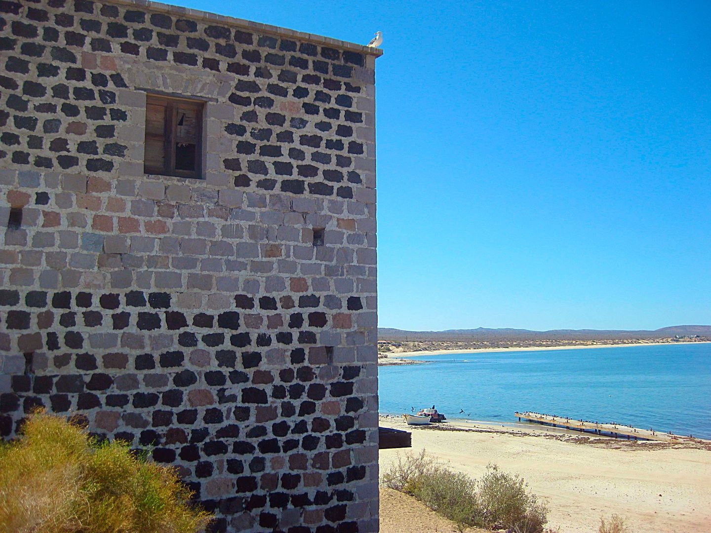
The Ybarra House in El Barril... The seaside port for supplies to the gold mines. There may be a pearling connection and I know that Choral Pepper
thought there may be a Mormon connection (from when the Mormons were moving to Utah and had to get around government blockades). I will research that
story again, it has been some years.
[Edited on 6-10-2017 by David K]
|
|
|
BornFisher
Super Nomad
Posts: 2103
Registered: 1-11-2005
Location: K-38 Santa Martha/Encinitas
Member Is Offline
|
|
Digging it, thanks!!
"When you catch a fish, you open the door of happiness."
|
|
|
gueribo
Nomad
Posts: 458
Registered: 10-16-2014
Member Is Offline
|
|
Thanks--great report. Keep the photos coming.
|
|
|
TMW
Select Nomad
Posts: 10659
Registered: 9-1-2003
Location: Bakersfield, CA
Member Is Offline
|
|
Excellent David, keep it coming.
|
|
|
David K
Honored Nomad
Posts: 64479
Registered: 8-30-2002
Location: San Diego County
Member Is Online
Mood: Have Baja Fever
|
|
Okay amigos... more...
I get into posting photos and captions for the photos and forget the notes I write down, so let me catch up here...
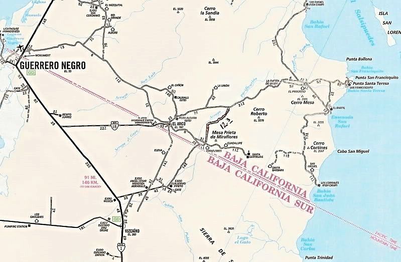
Highway 1 to Punta San Francisquito/ El Barril Mileage Log:
Hwy. 1 to El Arco (fork in road near military base) is 24.8 mi.
El Arco to Pozo Aleman road is 2.3 mi
Pozo Aleman road to the El Camino Real crossing is 9.6 mi
E.C.R. to Guillermo Prieto shortcut road is 3.6 mi
Guillermo P. (& Mission Sta Gertrudis) shortcut to Piedra Blanca is 1.7 mi
Rancho Piedra Blanca to top of Cuesta de la Ley concrete grade is 10.3 mi
Top of grade to L.A. Bay road left is 8.1 mi
L.A. Bay road to El Barril road right is 0.3 mi (faded sign for Rancho Escondido here)
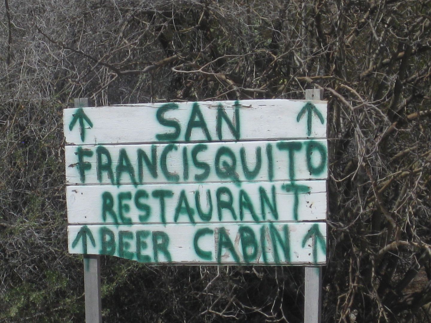
El Barril is 8.8 mi south and Punta San Francisquito is 12 miles east.
Total Hwy. 1 to El Barril is 69.5 mi
... or to PSFO is 72.7 mi
The road is almost all very good, graded road with many sections safely allowing 45-50 mph (Toyota Tacoma, Bilstein 5100 shocks)
[Edited on 6-11-2017 by David K]
|
|
|
chuckie
Elite Nomad
Posts: 6082
Registered: 2-20-2012
Location: Kansas Prairies
Member Is Offline
Mood: Weary
|
|
Looks like you having fun as well as getting work done! I (foggily) remember a mine of sorts up in the El Arco area, where we used to buy
showers....Shower head affixed to a pila and a rope actuator...about a dollar I think...Ever hear of that place? We always looked forward to it....
|
|
|
David K
Honored Nomad
Posts: 64479
Registered: 8-30-2002
Location: San Diego County
Member Is Online
Mood: Have Baja Fever
|
|
Quote: Originally posted by chuckie  | | Looks like you having fun as well as getting work done! I (foggily) remember a mine of sorts up in the El Arco area, where we used to buy
showers....Shower head affixed to a pila and a rope actuator...about a dollar I think...Ever hear of that place? We always looked forward to it....
|
That sounds cool... like what was once offered at Las Arrastras (south of Gonzaga). Calmalli and Pozo Aleman are the two better-known mine ghost
towns. Nobody around anymore. I did not go into Calmalli, however.
[Edited on 6-10-2017 by David K]
|
|
|
David K
Honored Nomad
Posts: 64479
Registered: 8-30-2002
Location: San Diego County
Member Is Online
Mood: Have Baja Fever
|
|
DAY 2 (Saturday, June 3, 2017) continued
After looking around mostly deserted El Arco, my next stop was Pozo Aleman, a most interesting ghost town where some miners lived underground. I wrote
about its history for Baja Bound a while ago... https://www.bajabound.com/bajaadventures/bajatravel/pozo_ale...
There is a modern ranch house there, but nobody has been home my last couple of visits.
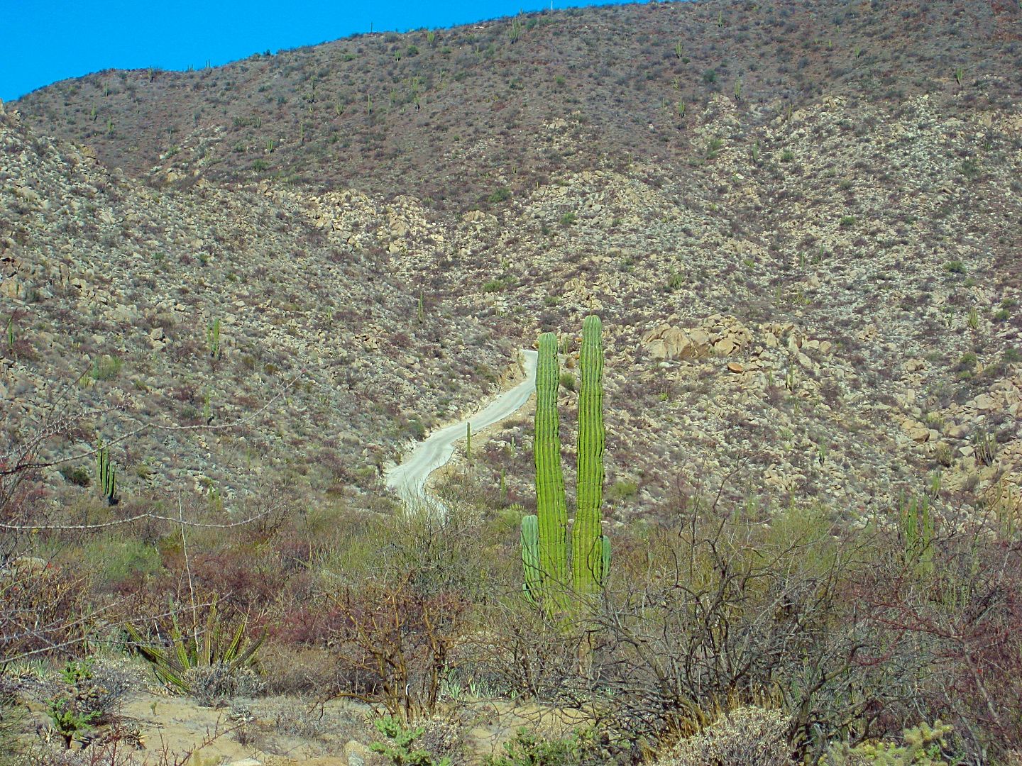
On to the east on a very good dirt road, perhaps one of the best long stretches of graded road in Baja?
I passed by the road to the giant painted cave trailhead (see https://www.bajabound.com/bajaadventures/bajatravel/painted_... ) and note where El Camino Real crosses (the north direction has become an auto
road to Rancho La Unión).
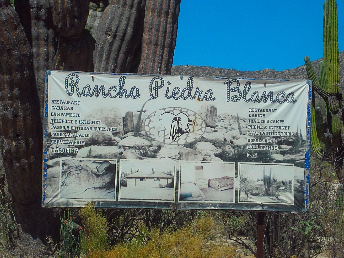
The shortcut road to Hwy 1 if southbound (via Guillermo Prieto) is noted (I will be using this road tomorrow) and I stop at Rancho Piedra Blanca where
a motorcycle group is, getting gasoline. Piedra Blanca is both a cattle ranch and a guest ranch with cabins and meals available. See their Facebook
page: https://www.facebook.com/Rancho-Piedra-Blanca-11752899493822...
As I saw last September on my Baja Extreme 2016 tour, the Cuesta de la Ley (The Grade that Rules) is now concrete. Once at the bottom the speed was
back up. Rancho El Progreso is passed (no activity was seen) and the T-junction where the road to Bahía de los Angeles goes left and the road east
turns right. Just 1/4 mile to the right is the Road south passing Rancho Escondido (closed) and going to El Barril. The road straight continues east
to Punta San Francisquito. See my TRIP #1 for details.
El Barril is a small town with power poles and wires all over! I soon learn from a local that they had a generator for the town. When it broke down,
nobody could fix it. Instead, they all have solar panels on their homes, now!!!
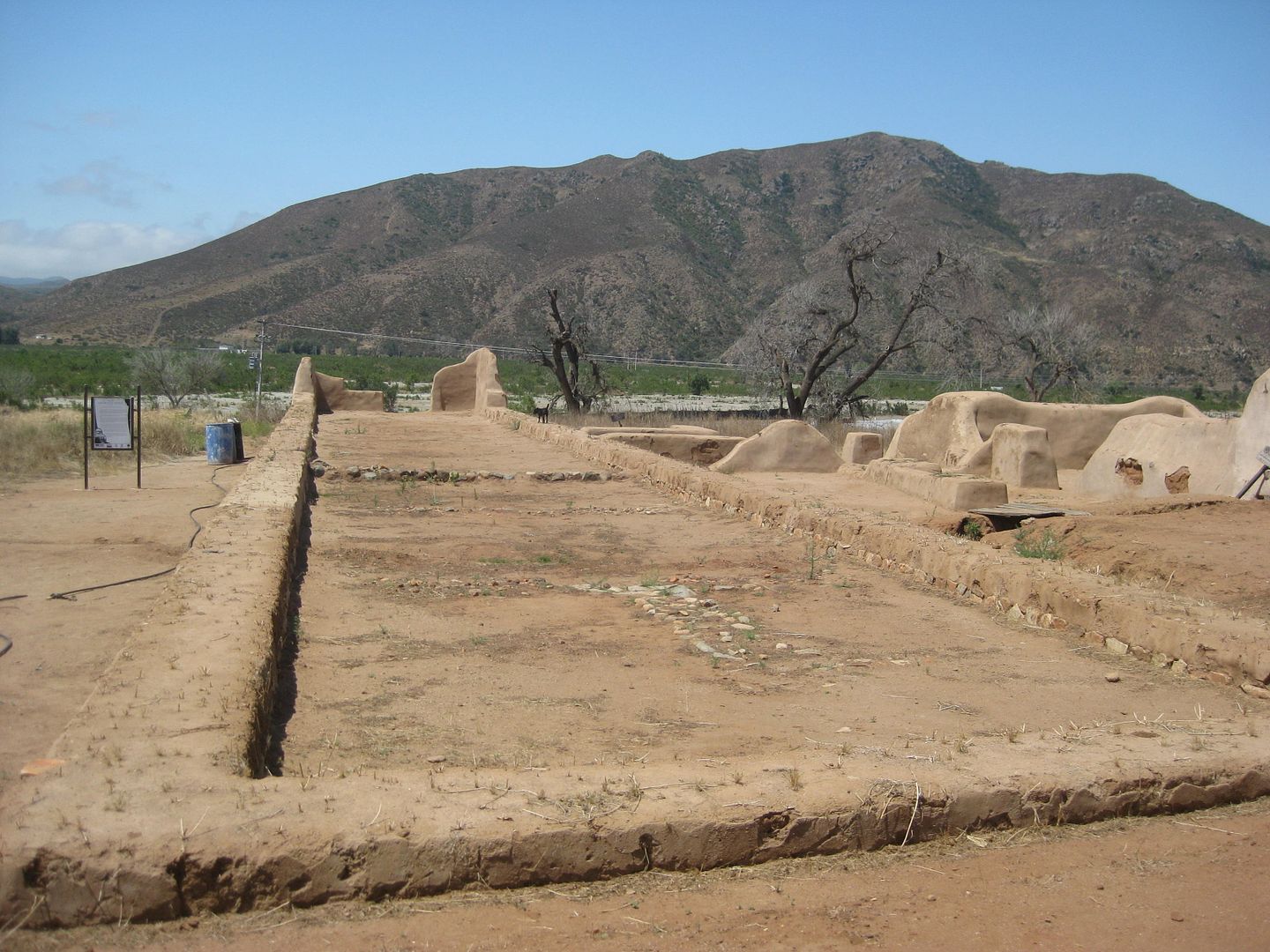
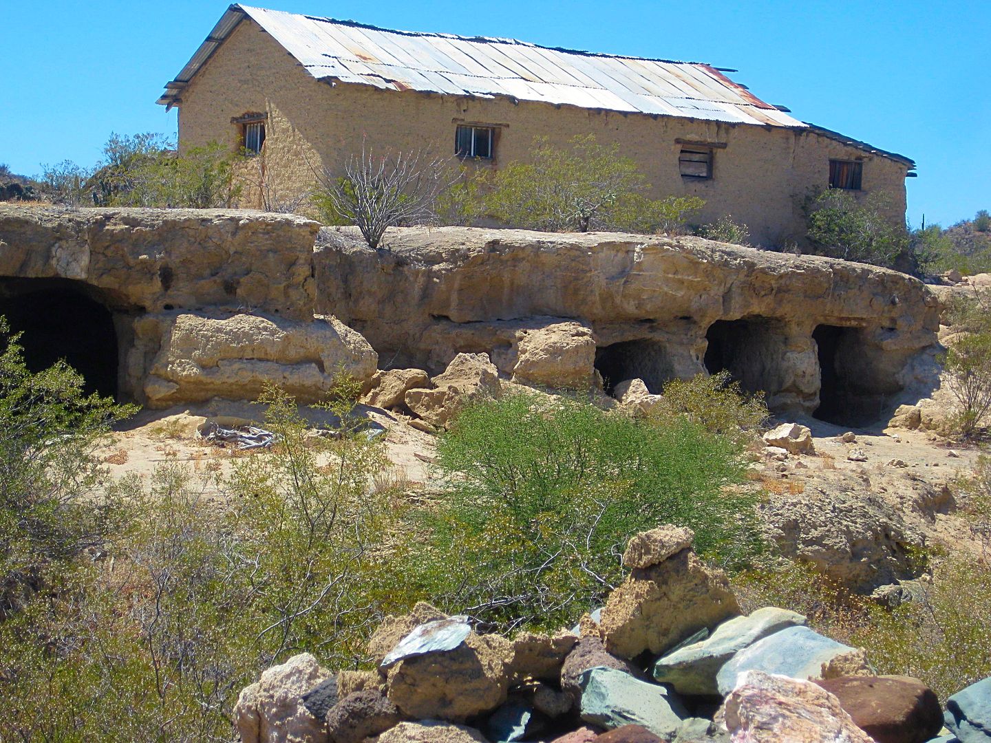
There is a brick, two + story building on the cliff, with some interesting stories behind it. It is sometimes known as the Ybarra House, named after
the mining company that brought supplies in from Sonora to El Barril for the Calmalli (and Pozo Aleman) area mines.
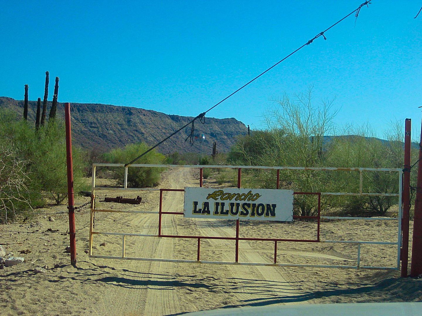
My friends asked me to go to Rancho Ilusión, being so near El Barril and ask the owner about future gates on the No Whimps Trail (the track that goes
south along the coast via Los Corrales to Rancho La Trinidad and meets the road from San Ignacio via Santa Marta).
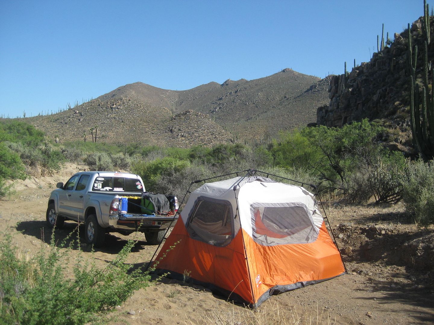
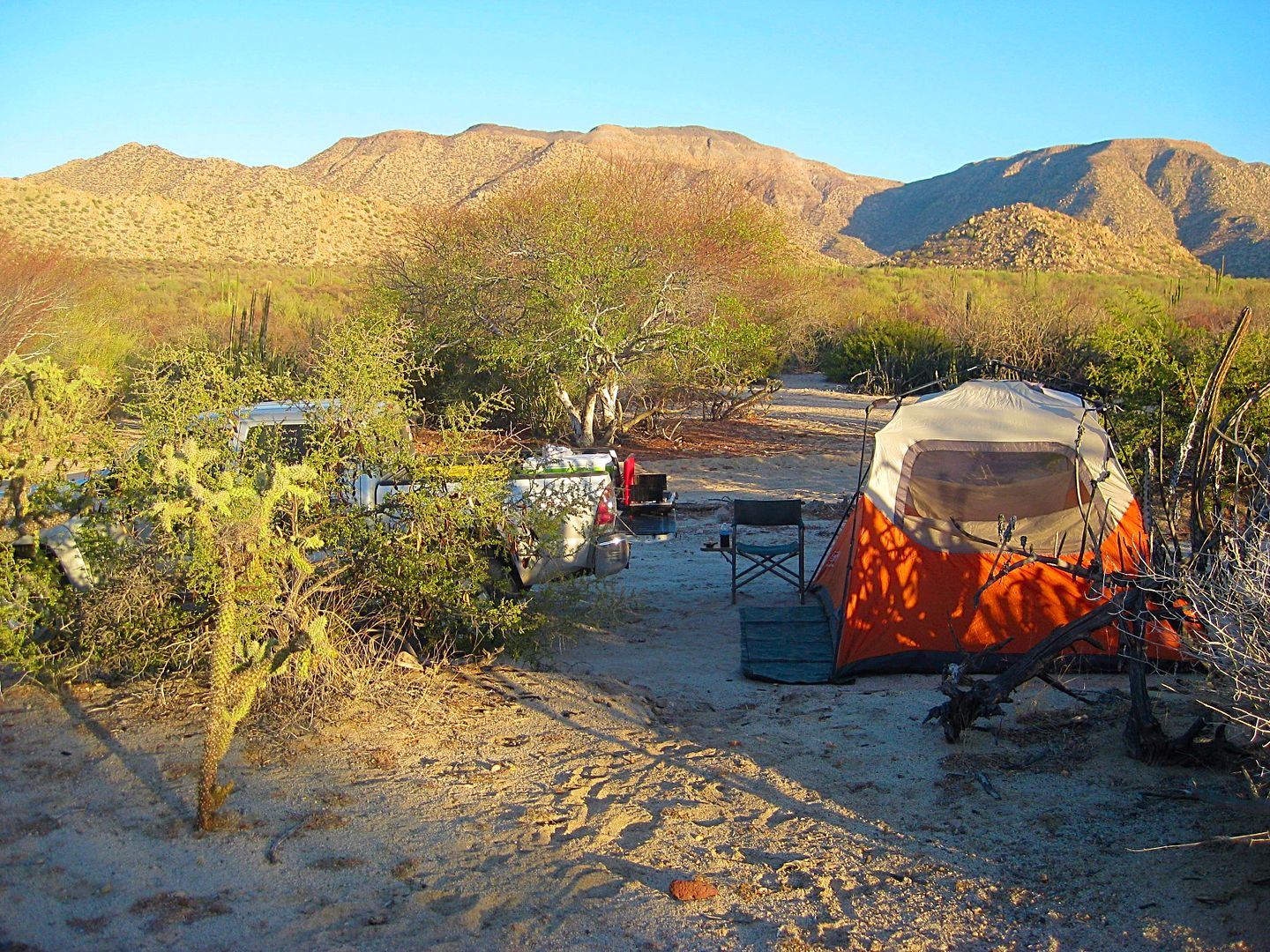
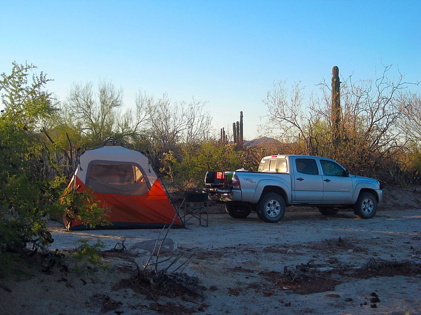
I end up camping in a sandy arroyo about a mile from La Ilusión. It was a perfect spot, no bugs, no cows, perfect!
End of DAY 2.
More Day 2 Photos:

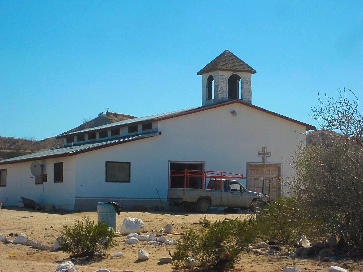
Church at El Barril
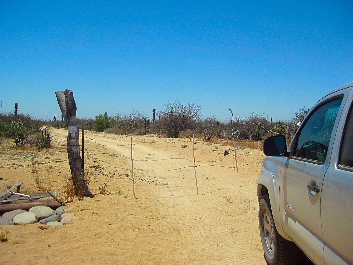
One of the fancier cattle control gates. If they are not signed to keep out or locked, then proceed through and close behind you.
|
|
|
David K
Honored Nomad
Posts: 64479
Registered: 8-30-2002
Location: San Diego County
Member Is Online
Mood: Have Baja Fever
|
|
DAY 3 (Sun. June 4, 2017)
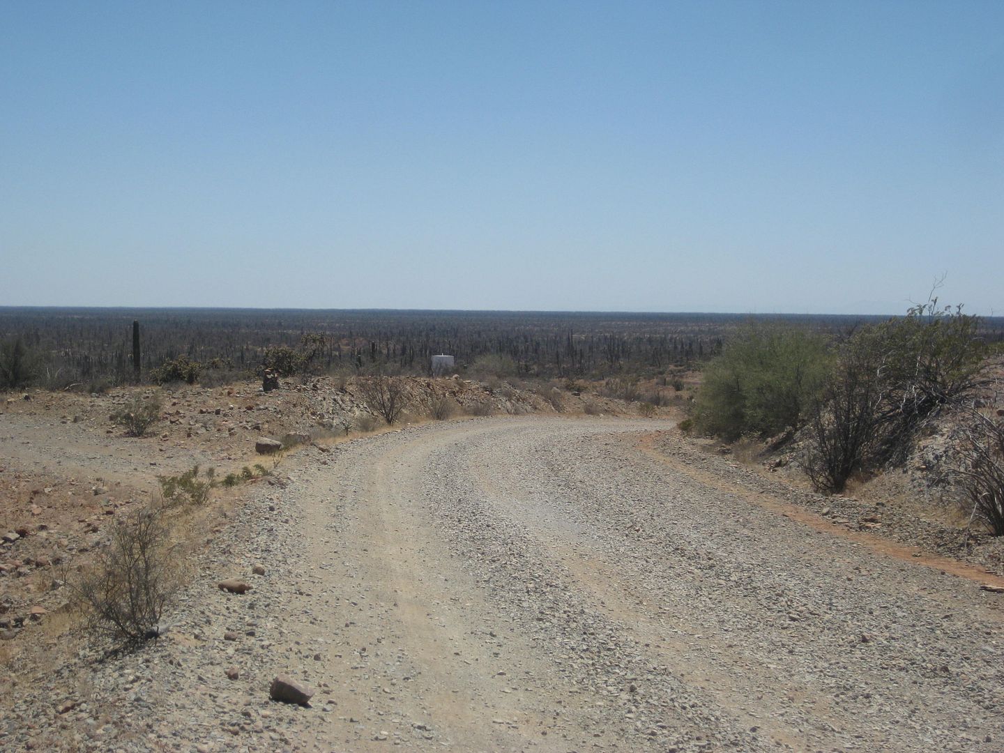
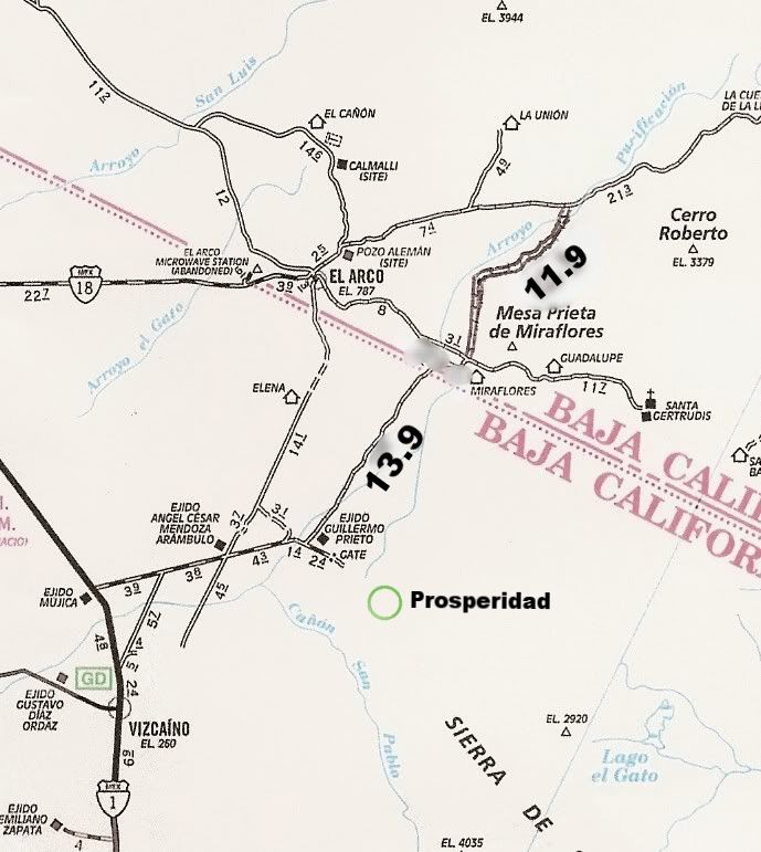
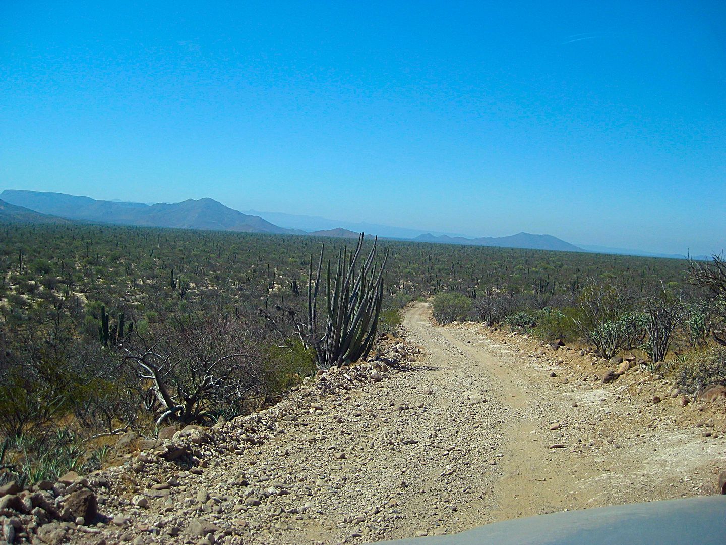
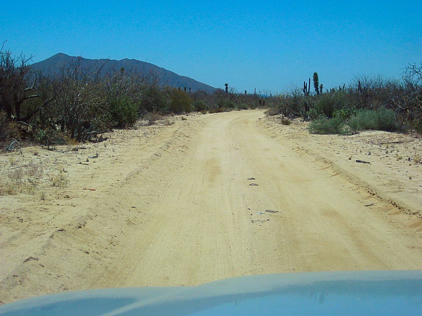
Easy camp take-down on a beautiful morning. I head on east on the road, in the arroyo. The graded road between El Barril and Ilusión is reached 3.4
miles from Ilusión and the El Barril road junction is in just 0.4 mi.
At Mile 8.5 from the above junction is the San Francisquito-El Arco road and the time is 8:02 am Pacific Time. I make notes on the various road points
driving back west. Rancho Piedra Blanca is reached at 8:42 am.The Guillermo Prieto road fork (unmarked) is in the arroyo plain where the El Arco road
climbs up, on the west side. It is 1.7 mi from Piedra Blanca (8:46 am).
The road crosses the wide Arroyo Purificación and with all the rain this past winter, the road is very sandy at the crossing. If you don't have 4WD,
then get your speed up, momentum is your friend in 2WD. On the south side of the crossing is a big hill the road climbs over, and once again the
recent wet weather has made an easy hill a bit slower and there is a detour route around a real rocky section of the old graded road where the fill
dirt has washed out leaving big rocks exposed. The detour road is short but slow.
Other than the wash and hill (both together at the very north end of the Guillermo Prieto cut across route) this is a fast and easy road between
Vizcaino and Punta San Francisquito or to reach Mission Santa Gertrudis.
If you are in a heavy rig, camper, or towing, perhaps better to not use the northern section until the grader goes over it again?
Where the road crosses El Camino Real is easy to spot on Google Earth, but I spent a half hour walking the desert on both sides of the road looking
for some sign of the ancient highway that here dates back to 1759 when San Borja da Adac was made a visita of Mission Santa Gertrudis.
11.9 miles from the San Francisquito road, I reach the intersection with the road between El Arco and Santa Gertrudis. Straight across is the road to
Guillermo Prieto and Vizcaino. I turn left (east) to visit the mission. It is 9:43 am (includes the 30-minute walkabout looking for El Camino Real.
Rancho Miraflores (made famous in Graham Mackintosh's second book, Journey with a Baja Burro) is just a kilometer away and the road circles around it
to the north side. Another ranch (Guadalupe) is 4.6 miles past Miraflores. The road to the mission is 10.9 miles long and fast for 7 of those miles
with the last 4 very rocky (again from the floods of this past winter).
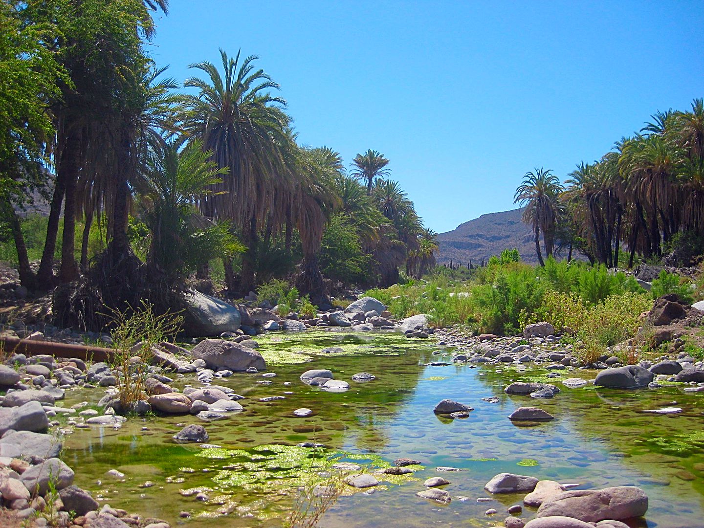
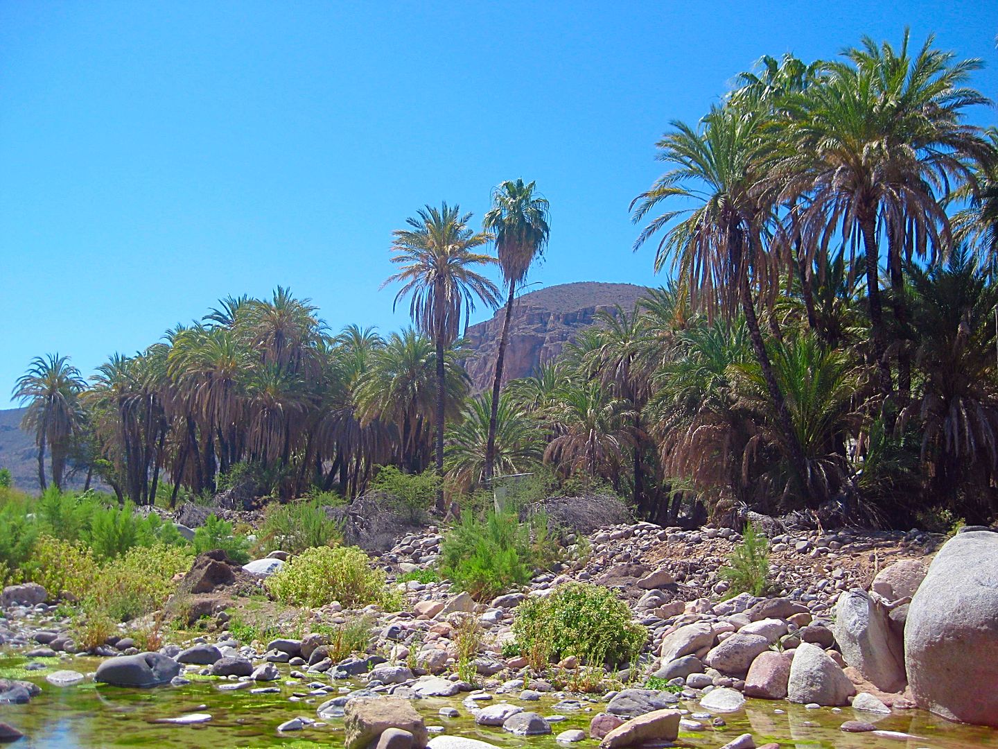
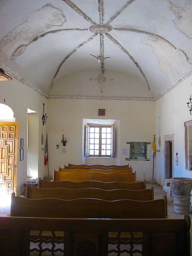
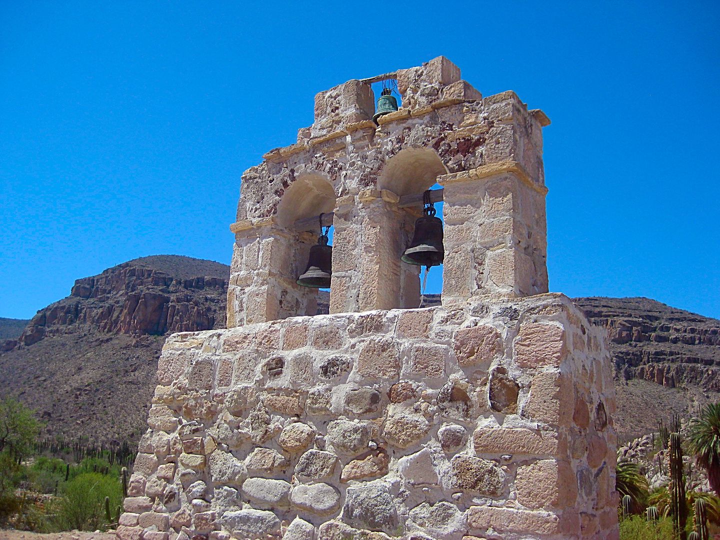
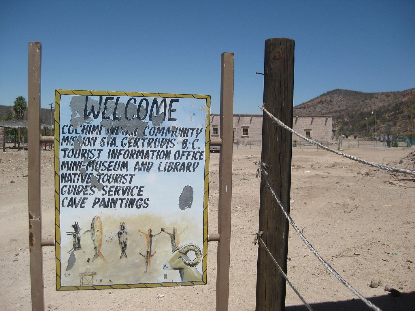
The oasis at the mission is a beautiful site. A village was once here, but now, just two people inhabit the mission area other than the ranches. One
is named Francisco and he is in charge of the mission grounds and museum there. My past visit here found the mission locked, so it was with great
pleasure to see the door open. After photos inside and out of the mission and its remote bell tower, Francisco opened the museum for me. It is small
but has a library (mostly with books for children and National Geographic magazines). I thanked Francisco and left a donation. This corner of historic
Baja California receives little attention from either tourists or government.
I was at Santa Gertrudis from 10:15-11:00 am.
Back at the Guillermo Prieto intersection at 11:32 am and turned south. The state border between Baja California and Baja California Sur is 2.5 miles
away. A cattle control gate is just a few feet north of the invisible border line. The clock goes from 11:44 am to 12:44 pm as I enter Mountain Time
Zone.
To Be Continued...
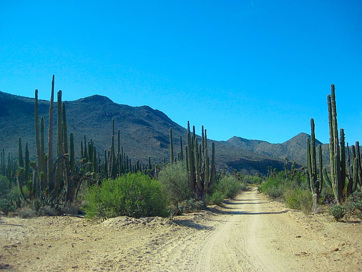
Photos along the road from El Barril back west and then south to Mission Santa Gertrudis and to the state border...
Cuesta de la Ley concrete grade as seen from the east.
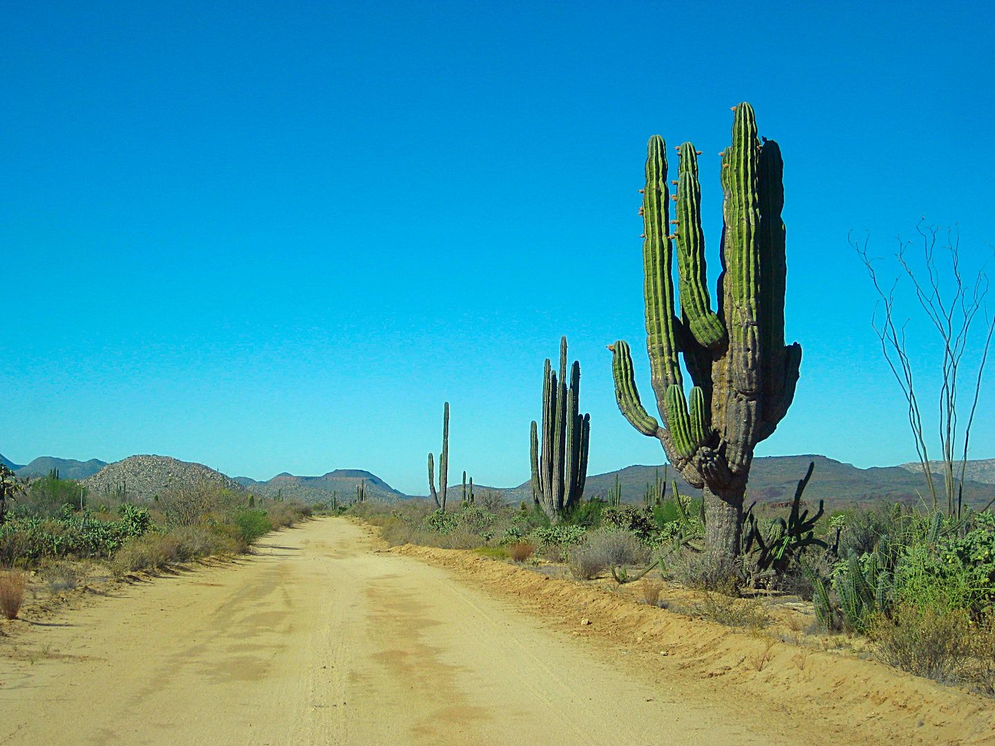
Fast road
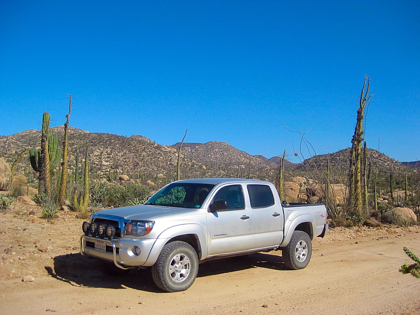
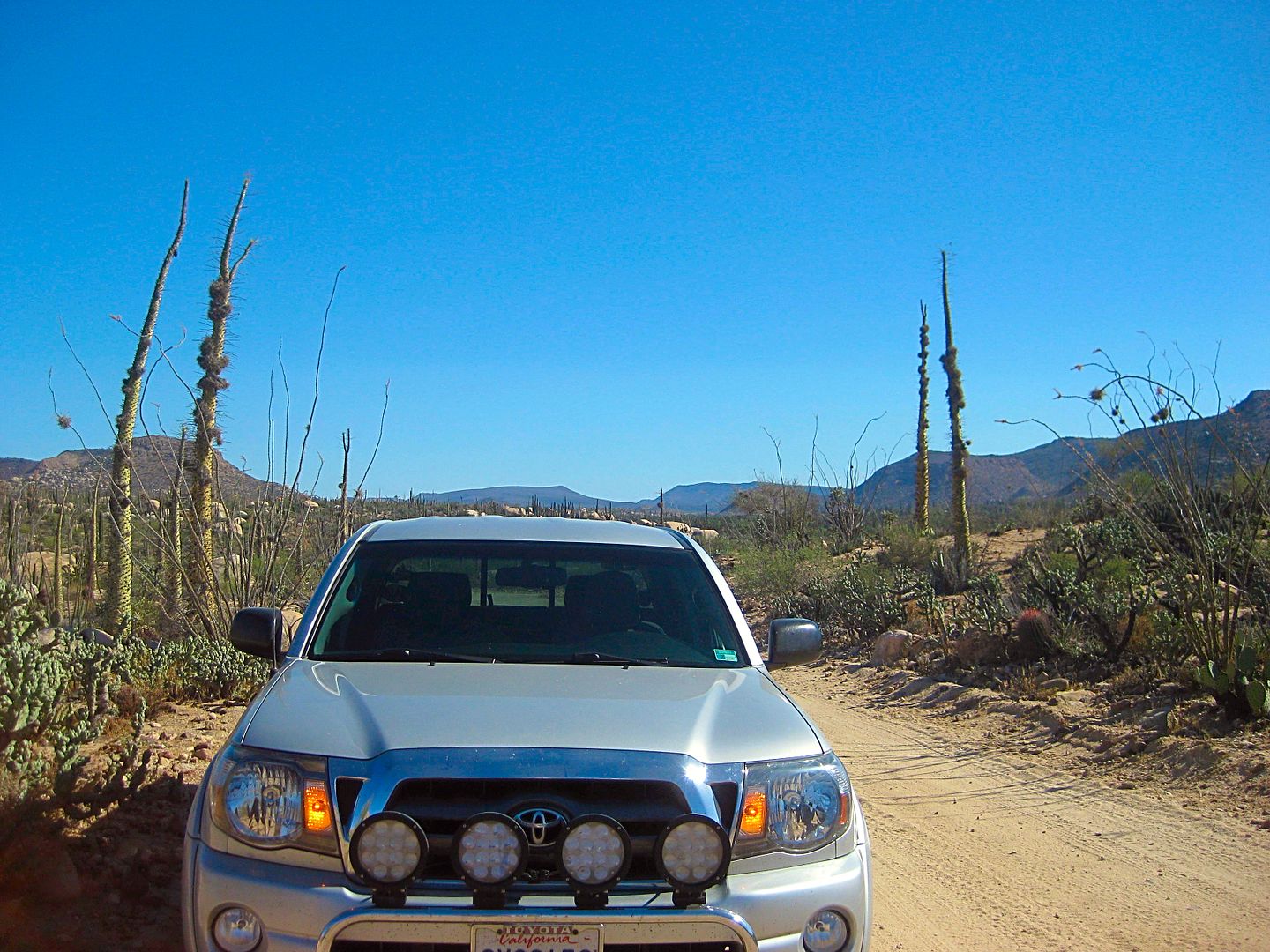
Great truck
Beautiful country
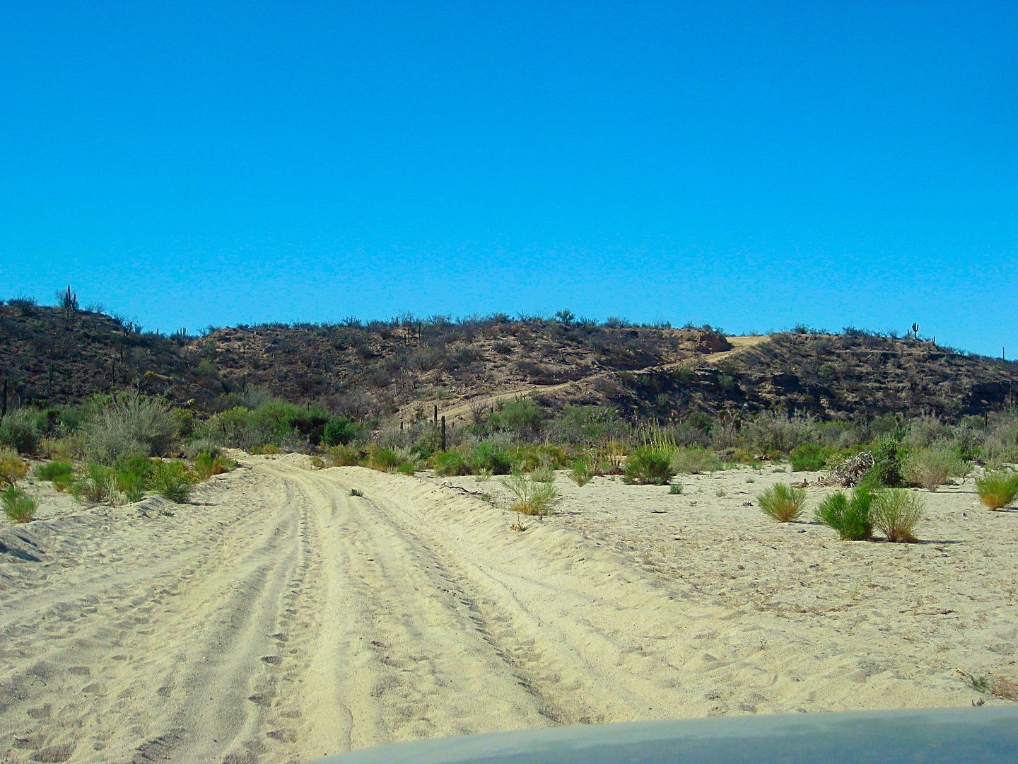
Shortcut road crosses Arroyo Purificació. The only deep sand of the entire shortcut road.
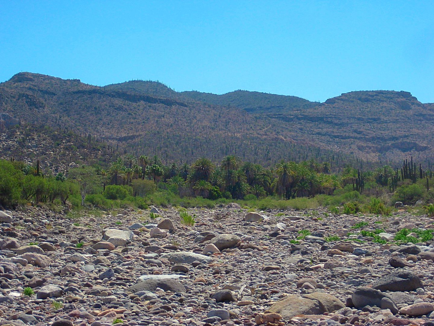
Santa Gertrudis oasis comes into view.
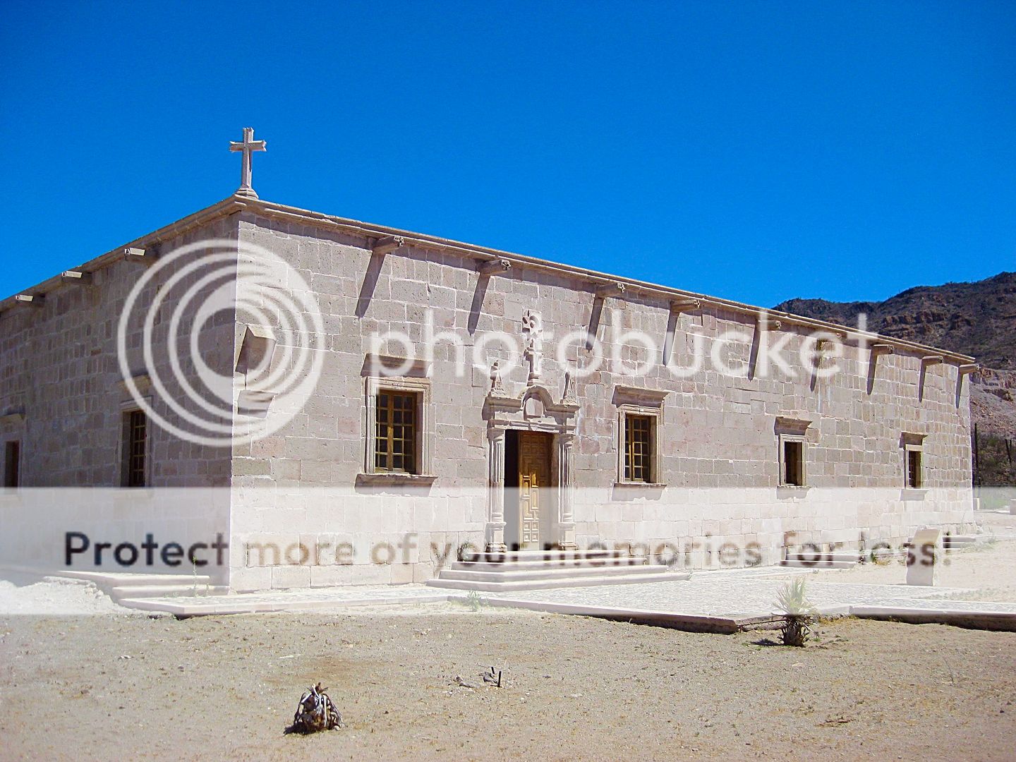
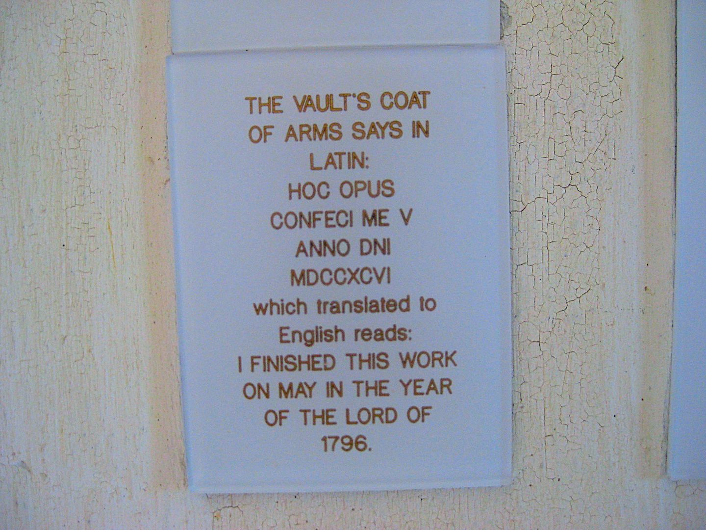
Mission Santa Gertrudis, 1752-1822
|
|
|
David K
Honored Nomad
Posts: 64479
Registered: 8-30-2002
Location: San Diego County
Member Is Online
Mood: Have Baja Fever
|
|
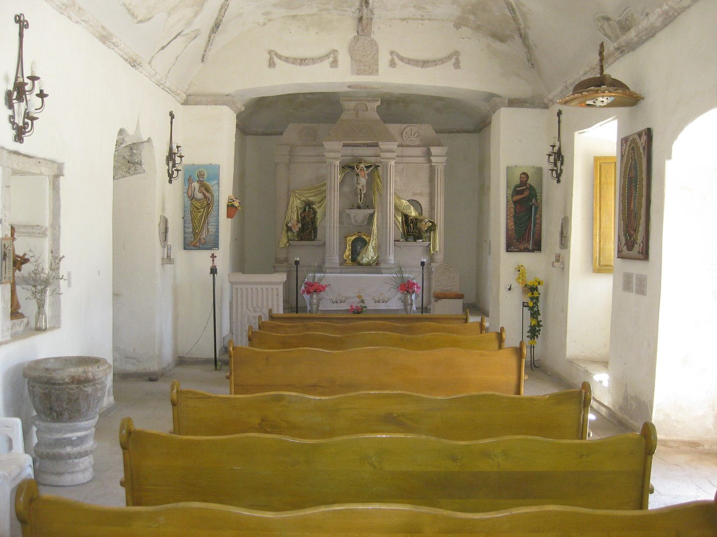
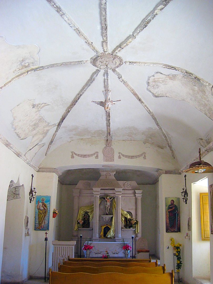
Looking straight up.
Founded by the Jesuits in 1752, the mission consisted of adobe rooms until the Dominicans were given charge of the Baja California missions and
constructed the stone churches here, at San Borja and completed the San Ignacio stone mission church.
Correct if we deduct the hour added for Daylight Savings, it was about 9:45 Standard time/ 10:45 Daylight time.
|
|
|
David K
Honored Nomad
Posts: 64479
Registered: 8-30-2002
Location: San Diego County
Member Is Online
Mood: Have Baja Fever
|
|
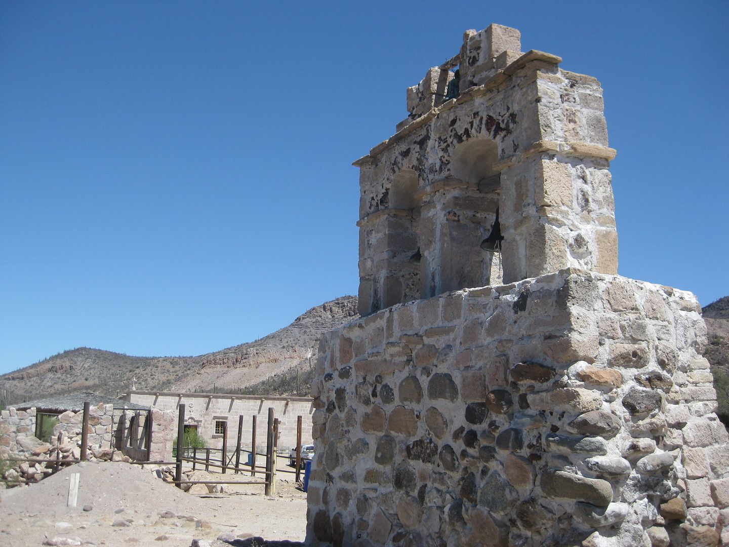
Santa Gertrudis is the only mission in Baja with a remote bell tower... note the mission in the distance.
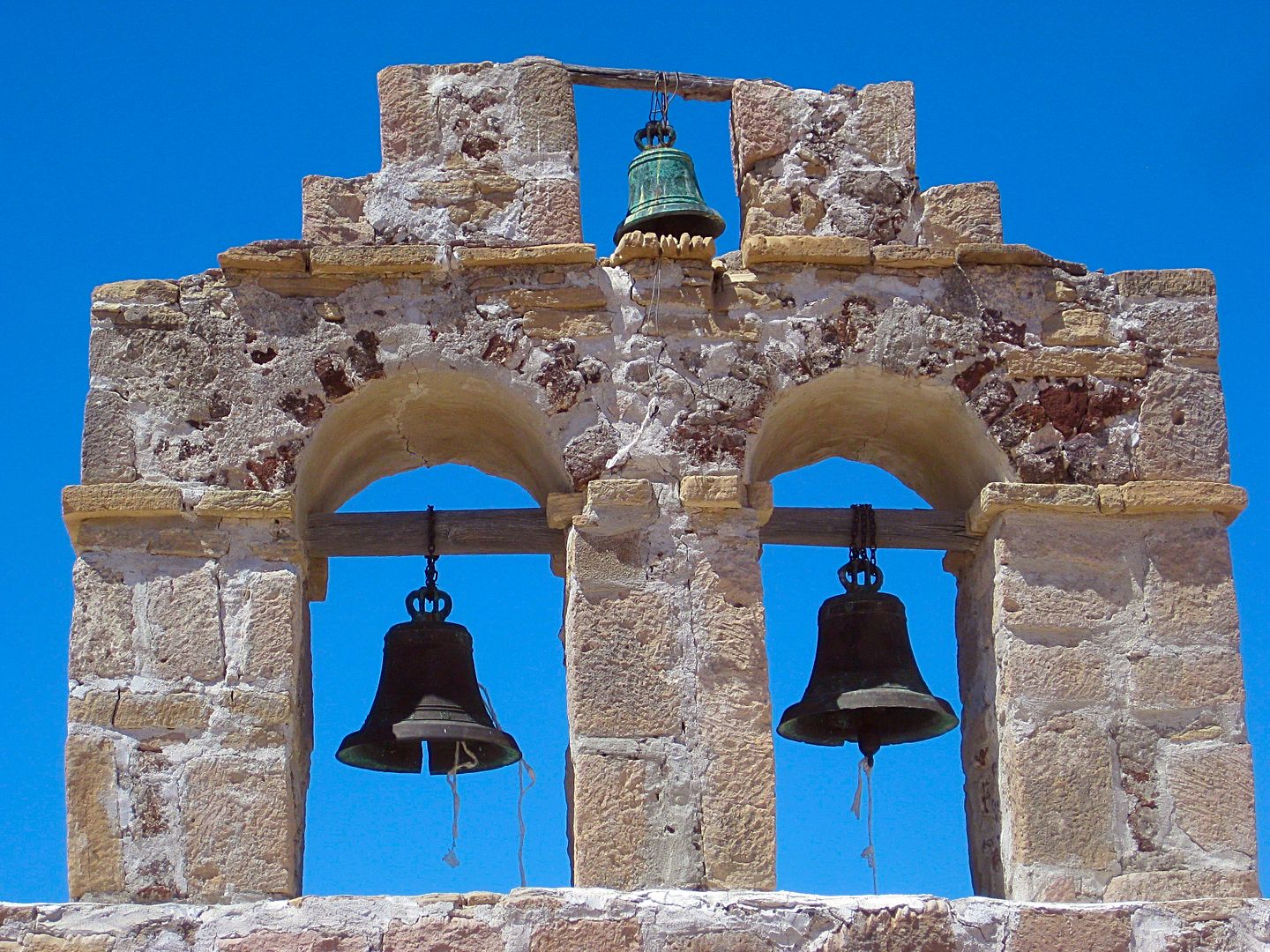
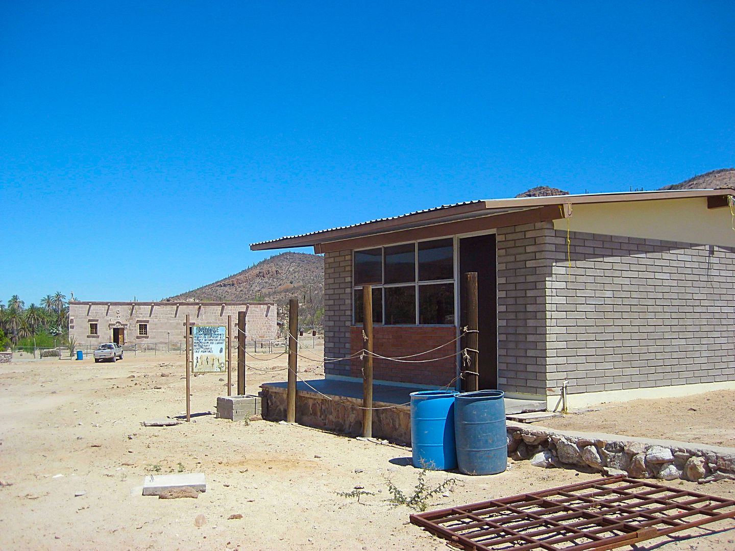
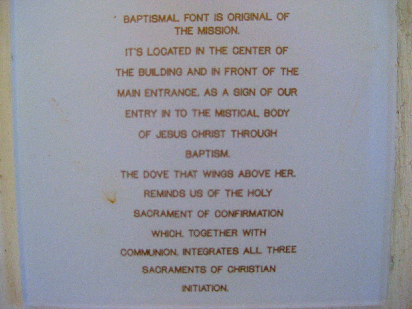
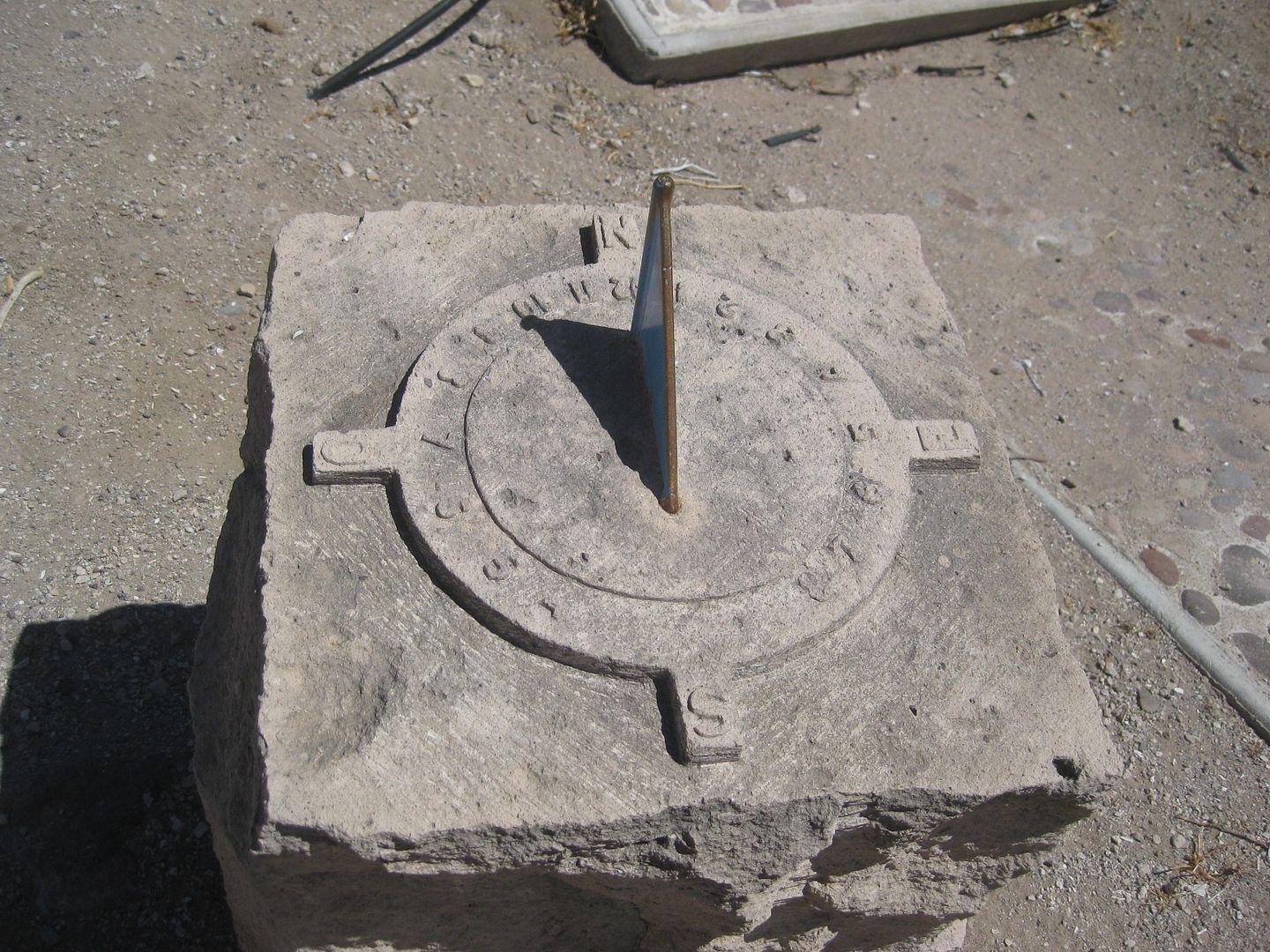
The museum at Santa Gertrudis.
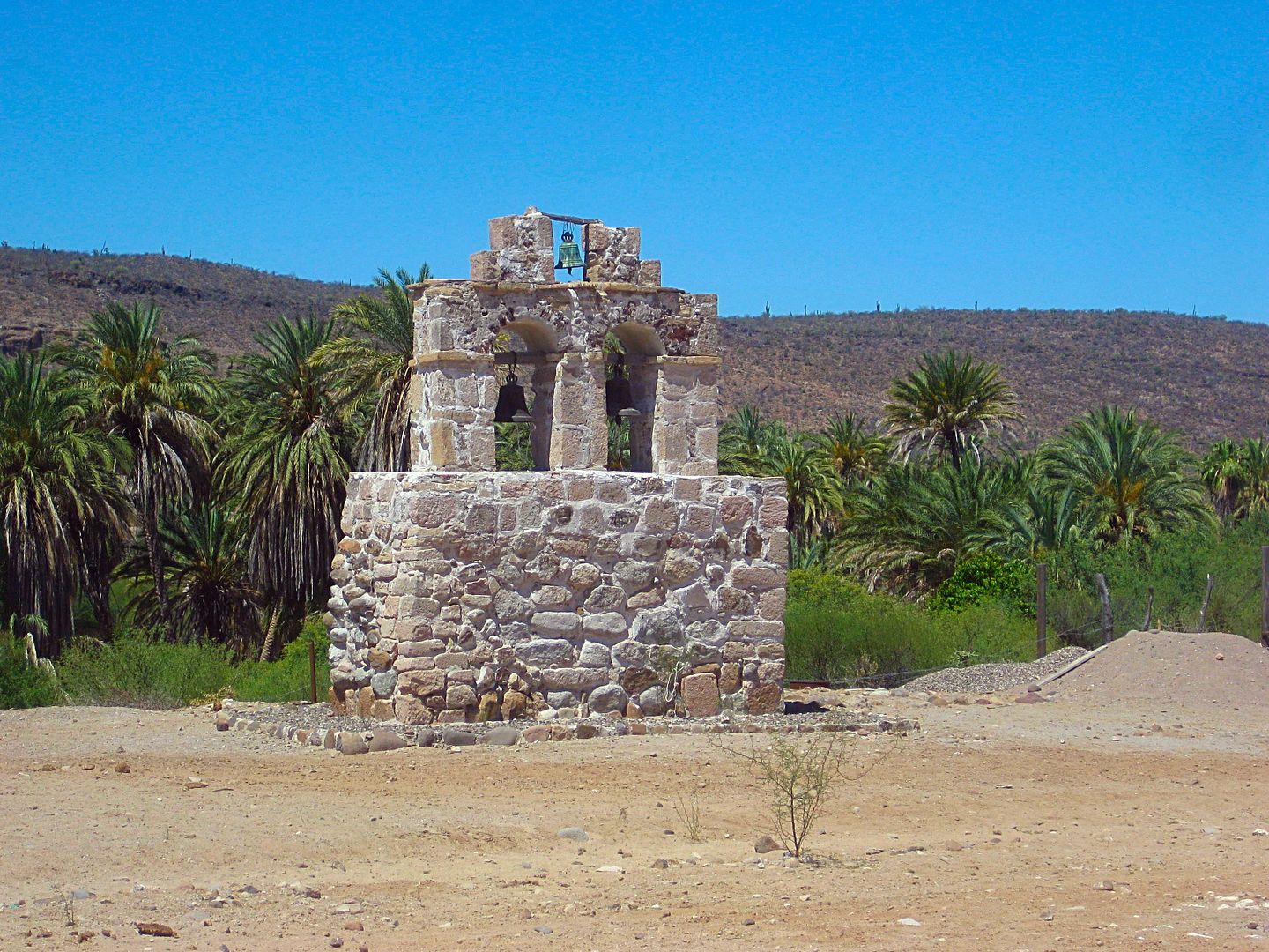
I leave Santa Gertrudis at 11 am and returned back to the Guillermo Prieto intersection (10.9 mi west). A couple miles from the mission, El Camino
Real can be seen going up the hillside, heading for San Borja, three days ride to the north...
Cattle fence, just a hundred feet or so north of the border with Baja California Sur, 28° North Latitude.
Per my GPS, the state border, and change to Mountain Time Zone. 11:44 am to 12:44 pm.
To be continued...
|
|
|
gueribo
Nomad
Posts: 458
Registered: 10-16-2014
Member Is Offline
|
|
Great photos. Were they taken on your phone? Keep 'em coming.
|
|
|
| Pages:
1
2
3
4 |
|


