| Pages:
1
2
3
4 |
David K
Honored Nomad

Posts: 64479
Registered: 8-30-2002
Location: San Diego County
Member Is Offline
Mood: Have Baja Fever
|
|
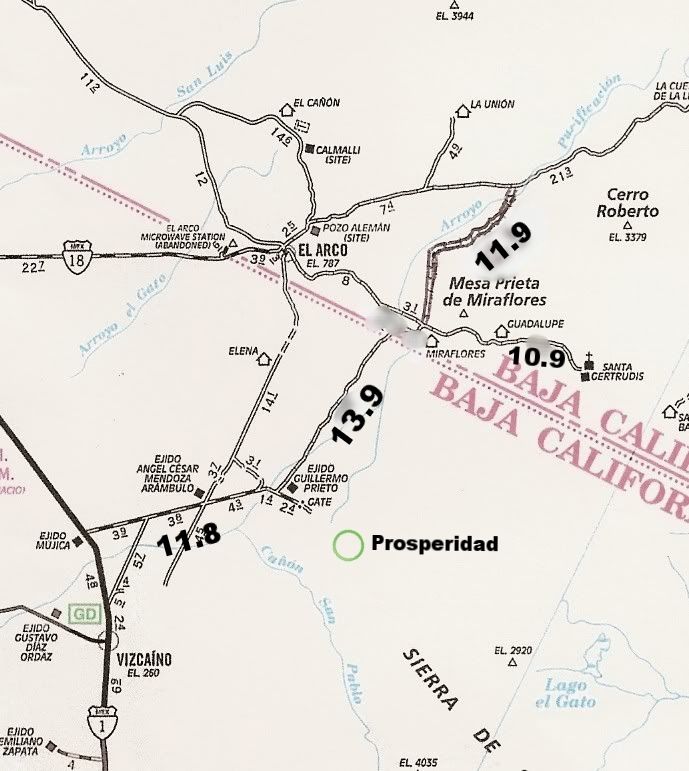
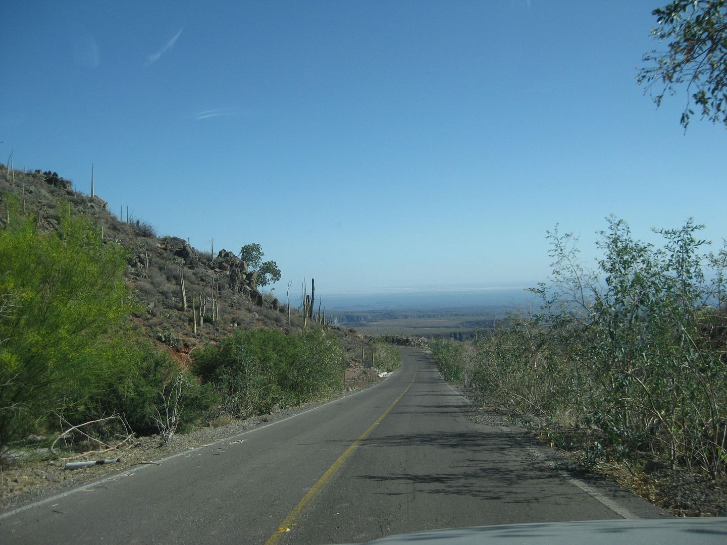
Afternoon of Day 3...
Now inside the state of Baja California Sur heading south on a great road.
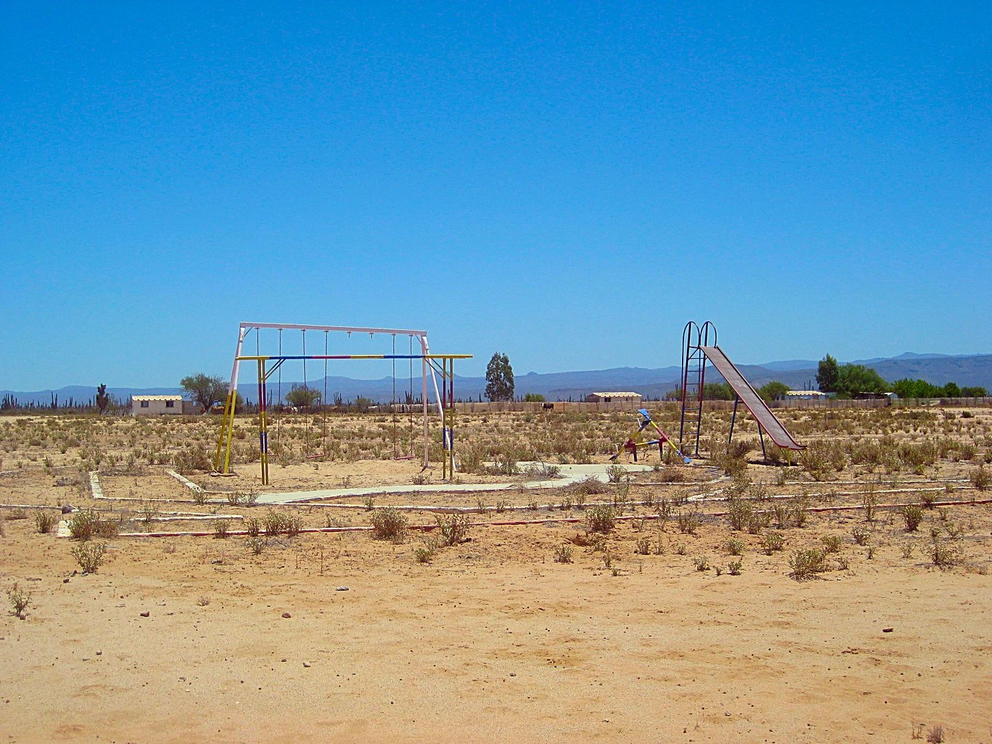
I arrive in the center of Guillermo Prieto, 13.3 miles south of the Santa Gertrudis/ El Arco intersection, at 1:06 and take 10 minutes to make a
PB&J sandwich. The town was abandoned long ago but the playground equipment at the school remains. One home has become a ranch.
Curve to the right to pass clean through Guillermo Prieto (Dark William).
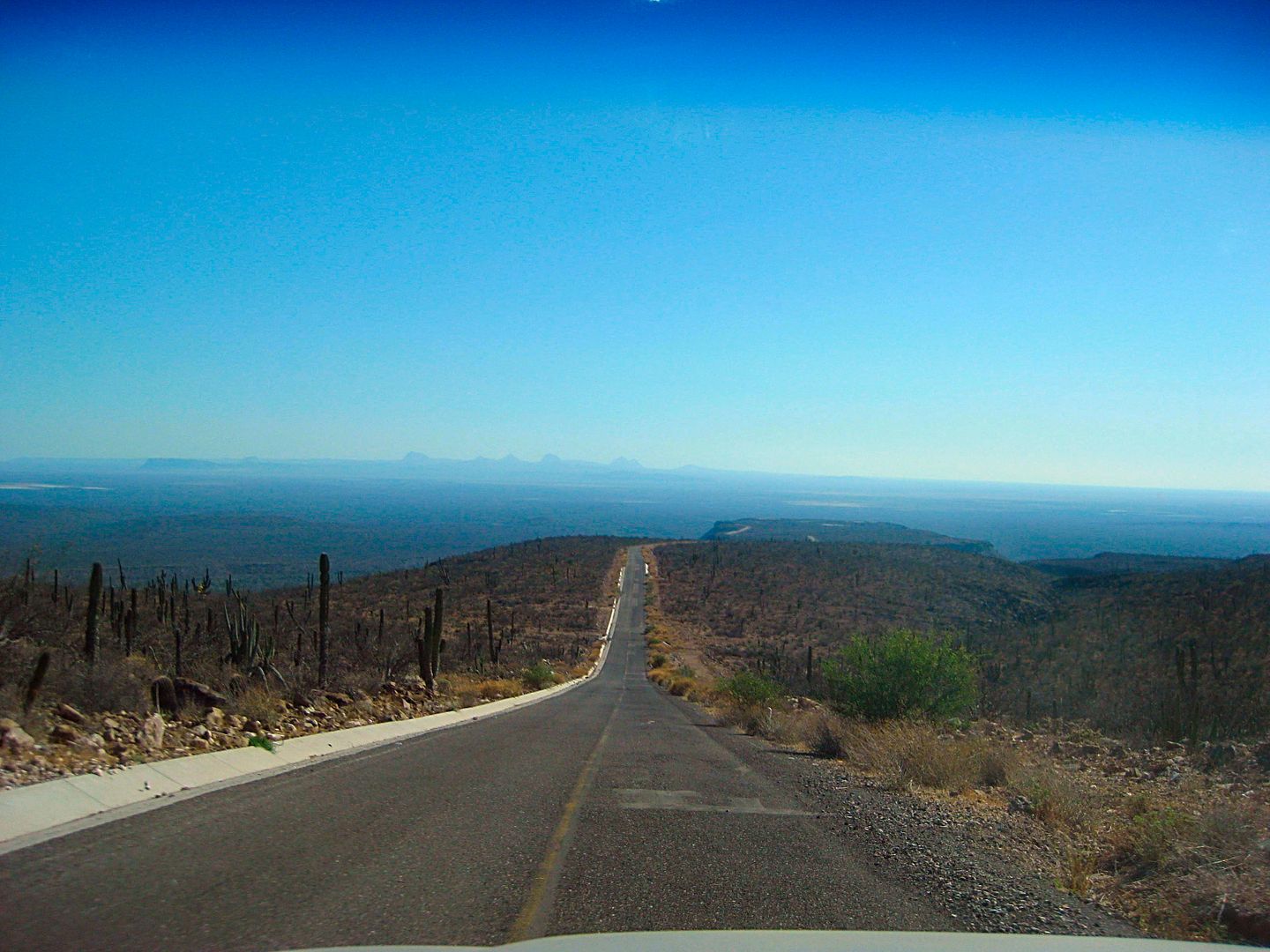
One kilometer (0.6 mi) south of 'downtown' Guillermo Prieto the southbound road comes to a T junction. To the right (west) is the road to Hwy. 1 and
Vizcaino, San Ignacio, etc. To the left, is a huge farm and on the other side, and old ranch called Prosperidad and an old road south to San Pablo
Canyon. In the canyon is a major mission visita ruin, one that had many in the past believe it was a "lost mission" of Dolores del Norte! Baja Nomads
(XR Phil, Kevin in Oklahoma and others) have been down this road so I went to see how far I could get...
Stay tuned!!!
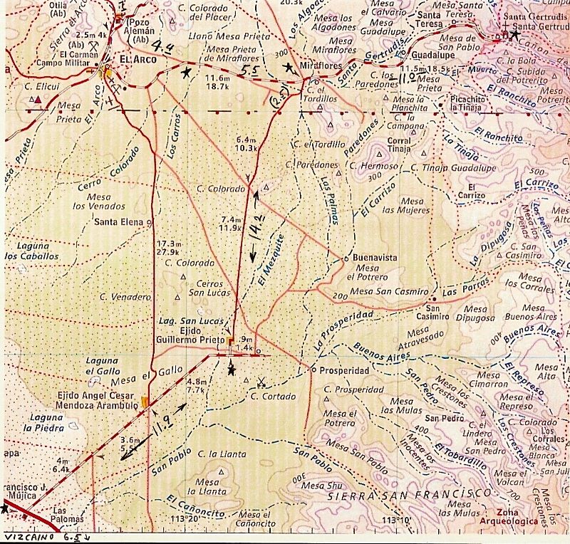
The mileages I penciled in are from my 2012 trip. My new figures are just a bit under these (13.9 vs 14.2 and 11.8 vs. 11.9) for the two section north
of and southbound from Guillermo Prieto.
|
|
|
David K
Honored Nomad
Posts: 64479
Registered: 8-30-2002
Location: San Diego County
Member Is Offline
Mood: Have Baja Fever
|
|
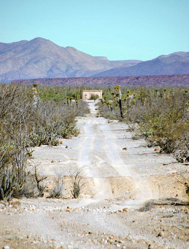
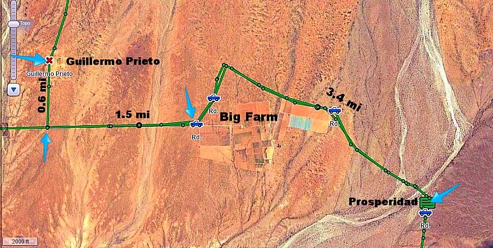
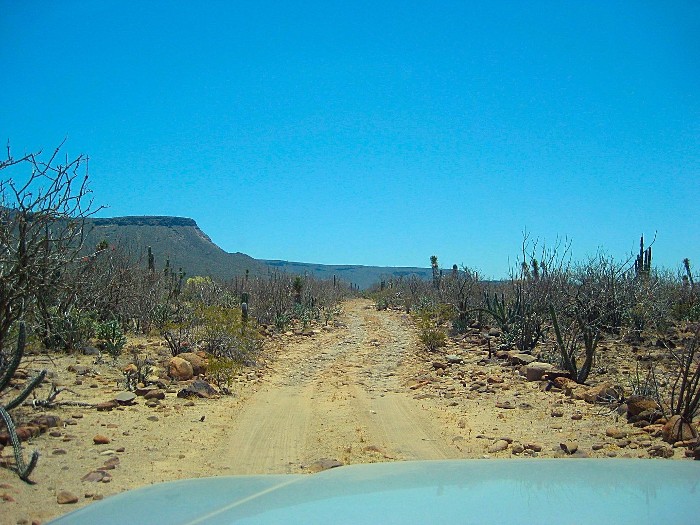
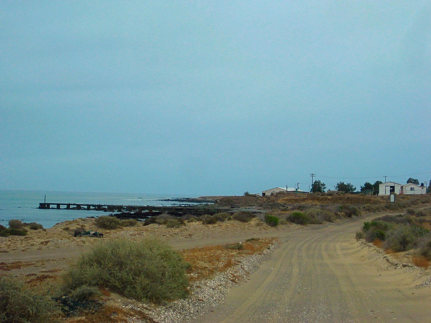
Prosperidad and San Pablo Canyon, almost!
Just 0.6 mile south of 'downtown' Guillermo Prieto is the T junction. We always go west here for Hwy. 1, Vizcaino, etc. This time, I turned east to
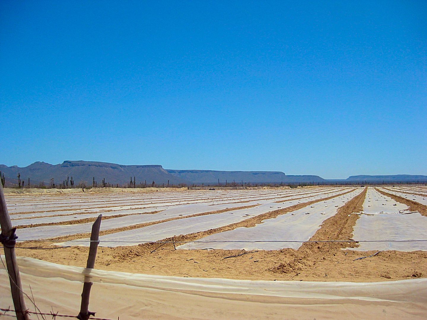
see how far into San Pablo Canyon the road went. There is a big farm just east and there is a road around the north side of it.
0.0 T junction (0.6 mi south of Guillermo Prieto and 11.8 mi northeast of Km. 154.5 on Hwy. 1)
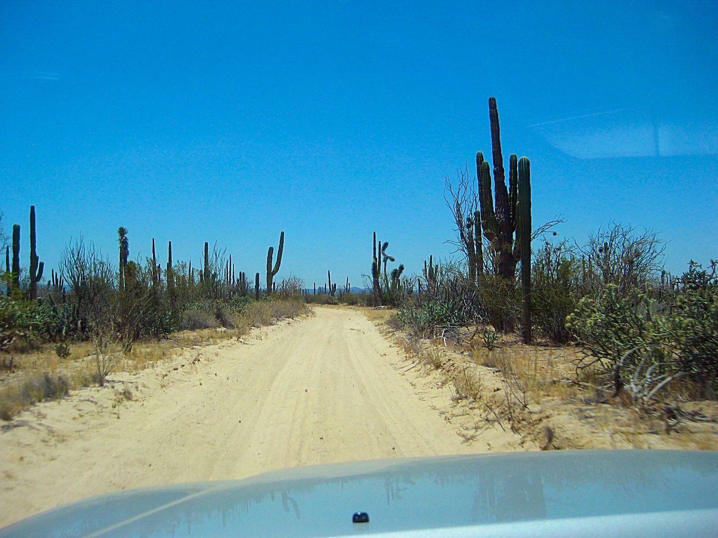
1.5 Big Farm Entrance, cattle guard, turn left outside entrance.
1.8 Fork, go left. Road soon bends east and follows farm fence line.
3.5 Northeast corner of farm, the road bends to the southeast and leaves the edge of the farm.
4.6 Cattle gate, pass through closing behind you.
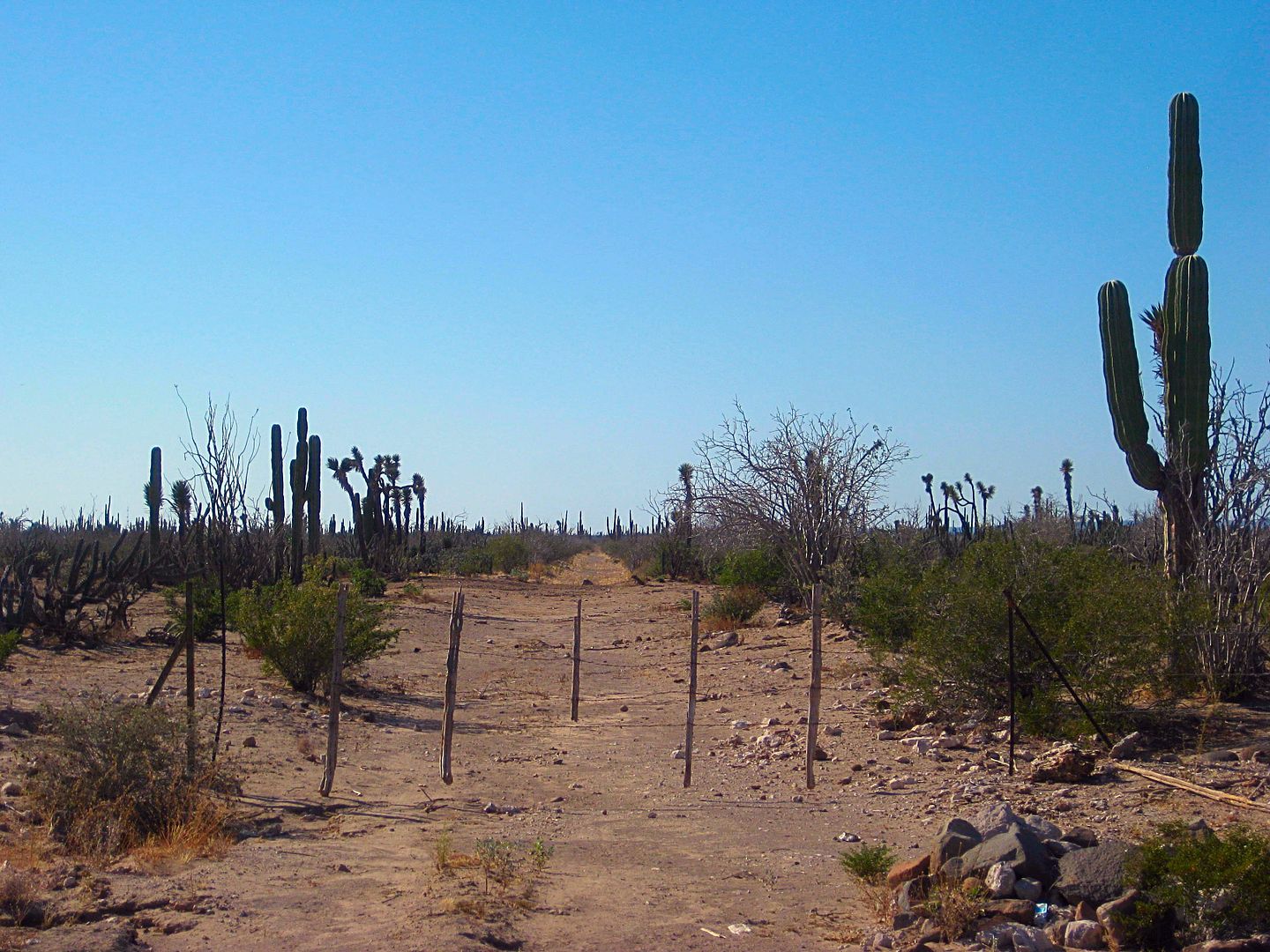
4.9 Prosperidad brick building on a knoll to right and active ranch off to left. The road turns south from the brick building.
5.6 Cattle gate.
5.8 Cattle gate.
The road is an old-old roadbed perhaps made by the French Boleo Copper Mine company.
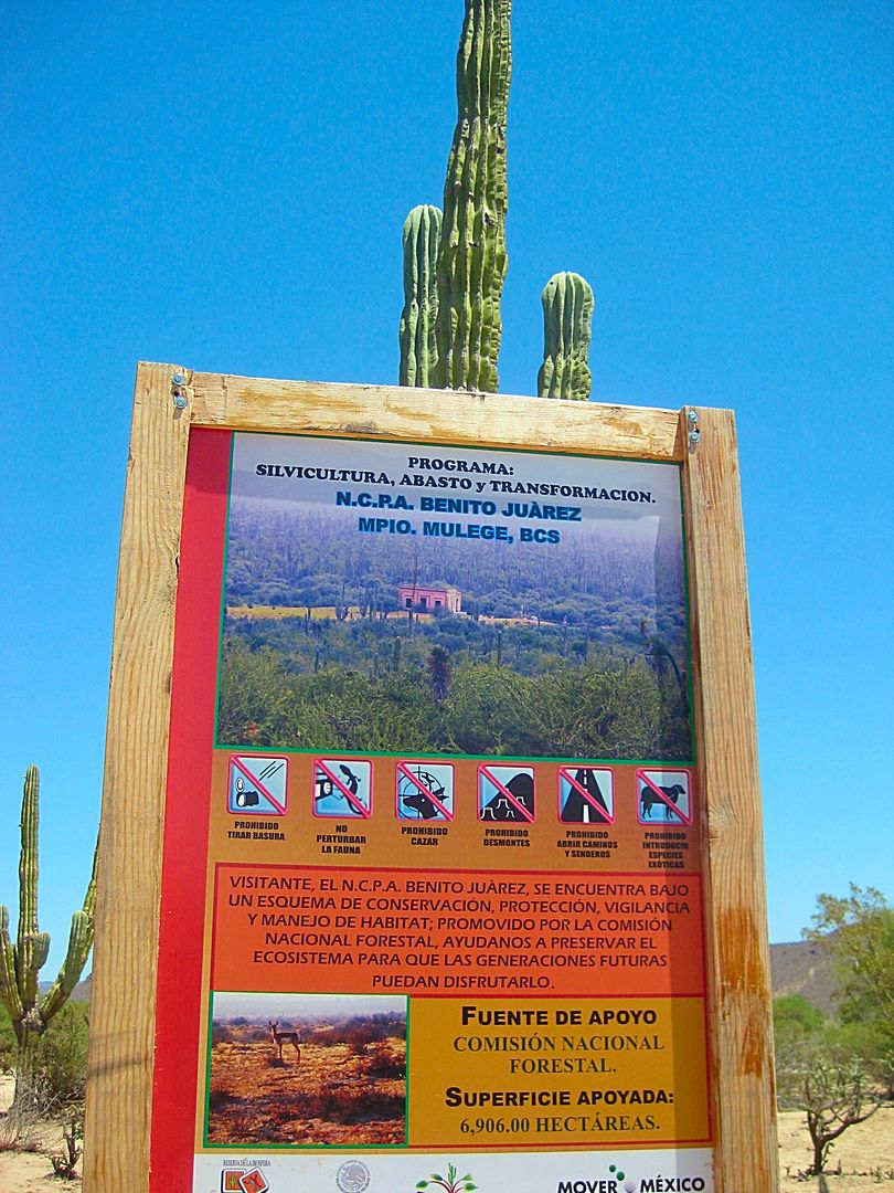
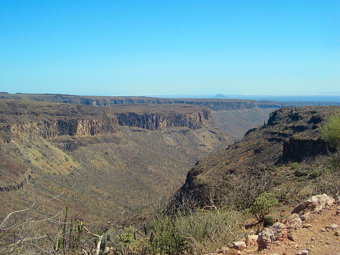
8.4 Locked gate at the entrance to San Pablo Canyon.
Near the northeast corner of the big farm.
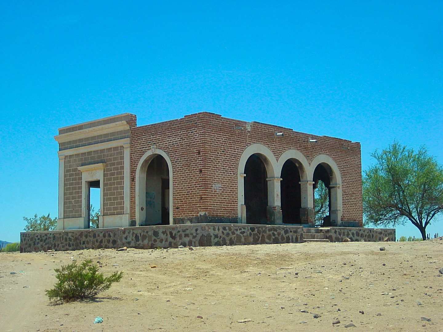
Prosperidad, north-east side.
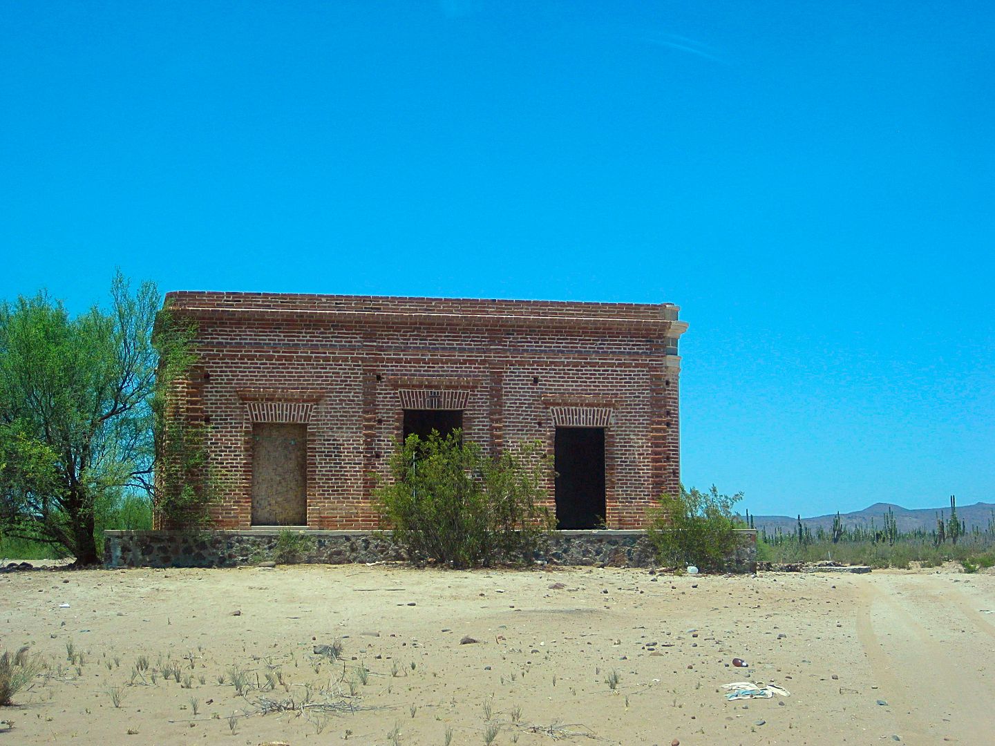
Prosperidad, south side.
Sign just west of Prosperidad.
Old-old road southbound from Prosperidad.
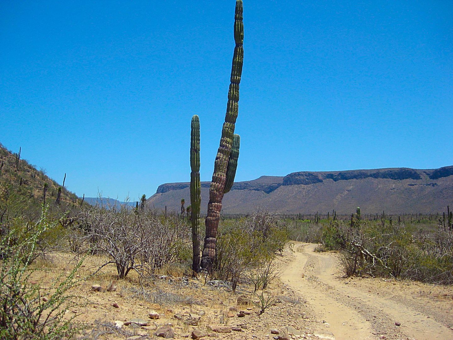
Entrance of San Pablo Canyon. The locked gate was just ahead.
The dramatic mountainside, northwest corner of San Pablo Canyon entrance.
Coming up next: San Francisco de la Sierra!
[Edited on 6-27-2017 by David K]
|
|
|
David K
Honored Nomad
Posts: 64479
Registered: 8-30-2002
Location: San Diego County
Member Is Offline
Mood: Have Baja Fever
|
|
Nomad 'Geoffff' was here in 2014 and took close up photos of the brick building. There is a date above the doorway, too.
http://octopup.org/baja2014/gertrudis
The year was 1916 and he uses the name "La Casona" for the building.
'La Casona' translates to 'Big House' or 'Villa'.
|
|
|
David K
Honored Nomad
Posts: 64479
Registered: 8-30-2002
Location: San Diego County
Member Is Offline
Mood: Have Baja Fever
|
|
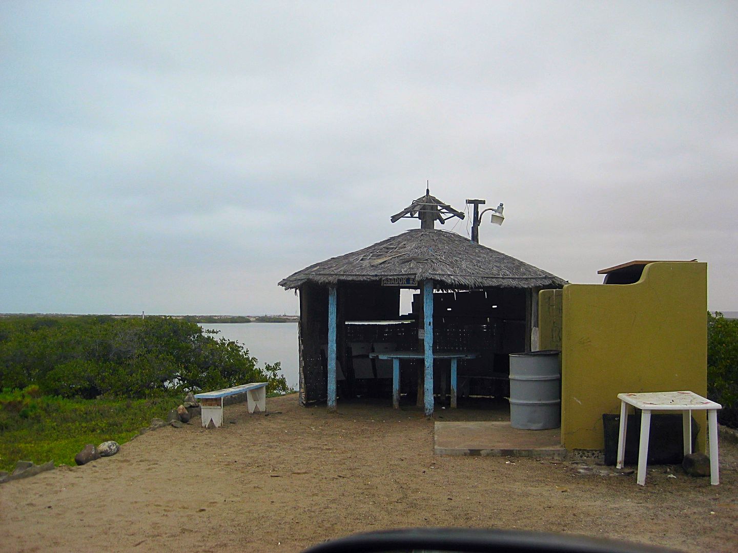
Day 3, late afternoon, San Francisco de la Sierra
Baja California is sometimes called 'a thousand miles of fun'.
In fact, it is not only a thousand miles from north to south on the highway, but when you add all the criss-cross and other roads I hope to travel in
2017, it seems like a million miles!
I have already logged over 7,000 Baja miles on the five mapping trips this year!
With a goal of getting as many roads and interesting sites as you Baja Nomads and Tacoma World guys like to read about documented, I made the run up
to San Francisco de la Sierra before resting for the day.
The paved road up the mountain is at Km. 117+, about 17 miles south of Vizcaíno, on Hwy. 1. It was about 3:30 when I headed up. In just 0.5 mi the
old main road between Ensenada and La Paz is crossed. A farm (El Porvenir) is on the south side but you can look north over its route...
This was the road my folks and I drove over in 1966. A year later, it would become the Mexican (and Baja) 1000 race course for several years!
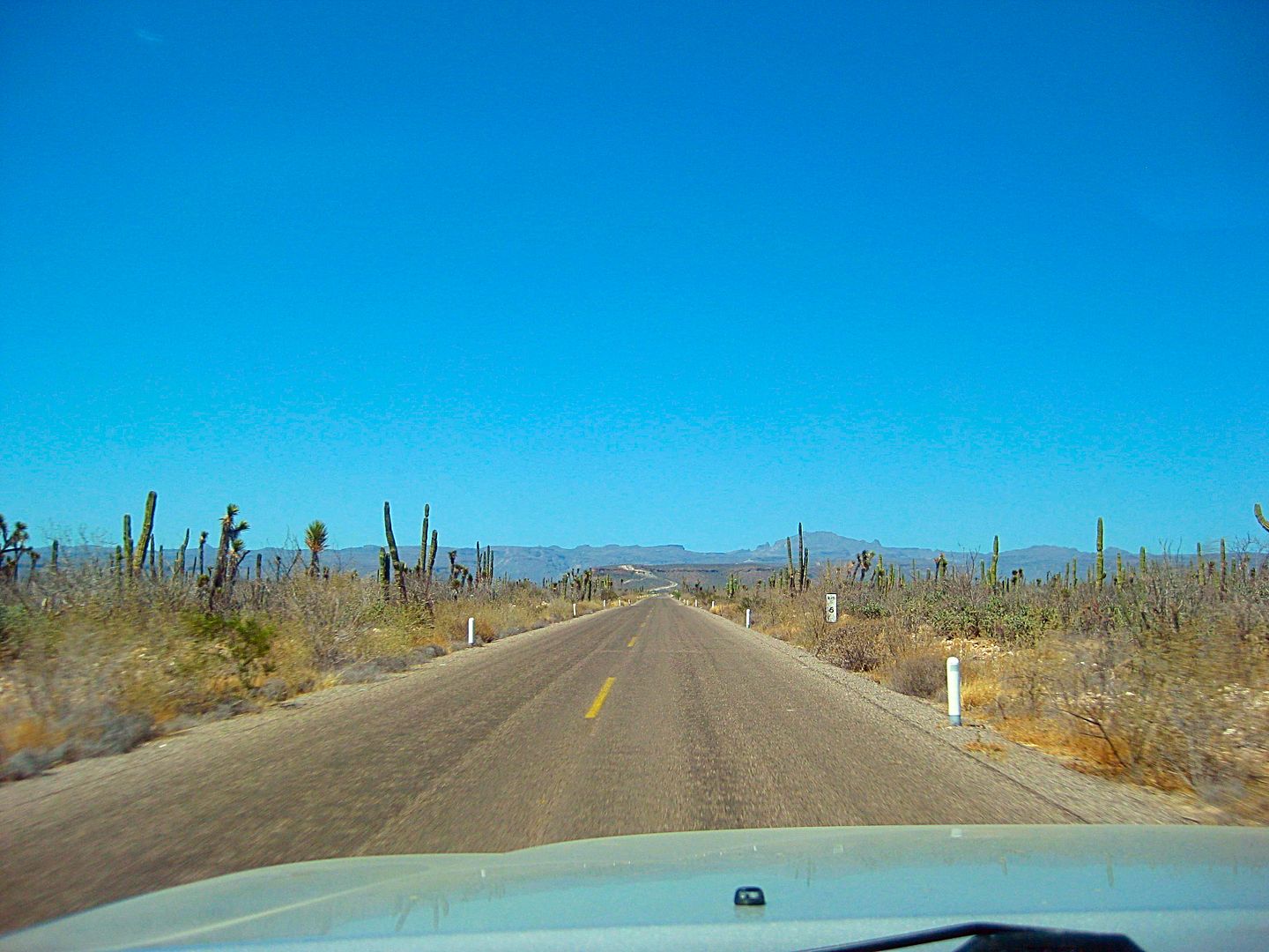
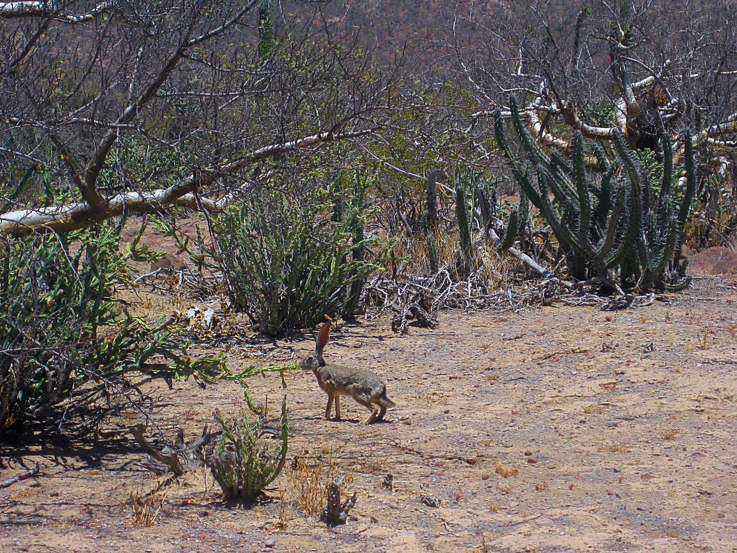
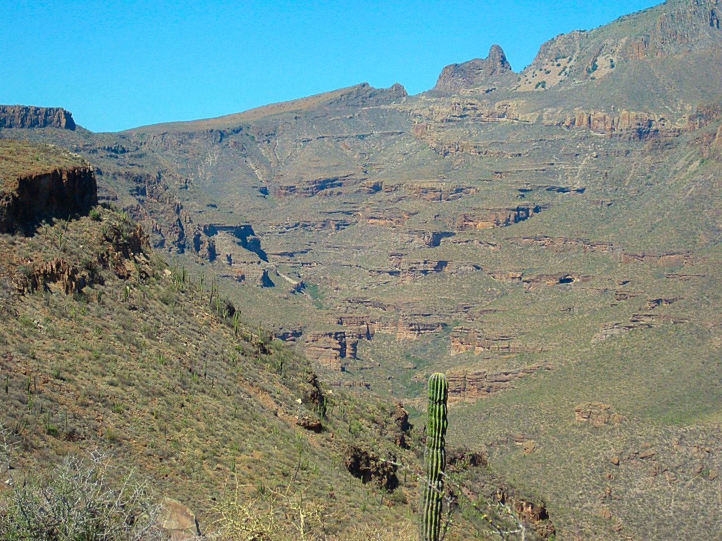
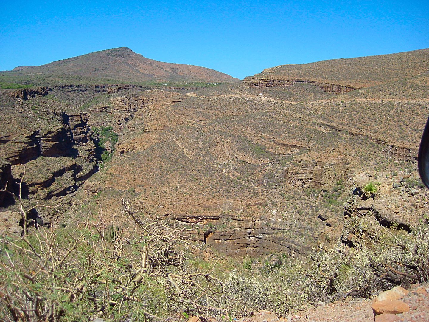
The road soon begins a steep climb up the sierra. Free range goats begin to appear and beautiful vistas of the big canyons on each side of this
ridgeline road are hard to not stop and take in.
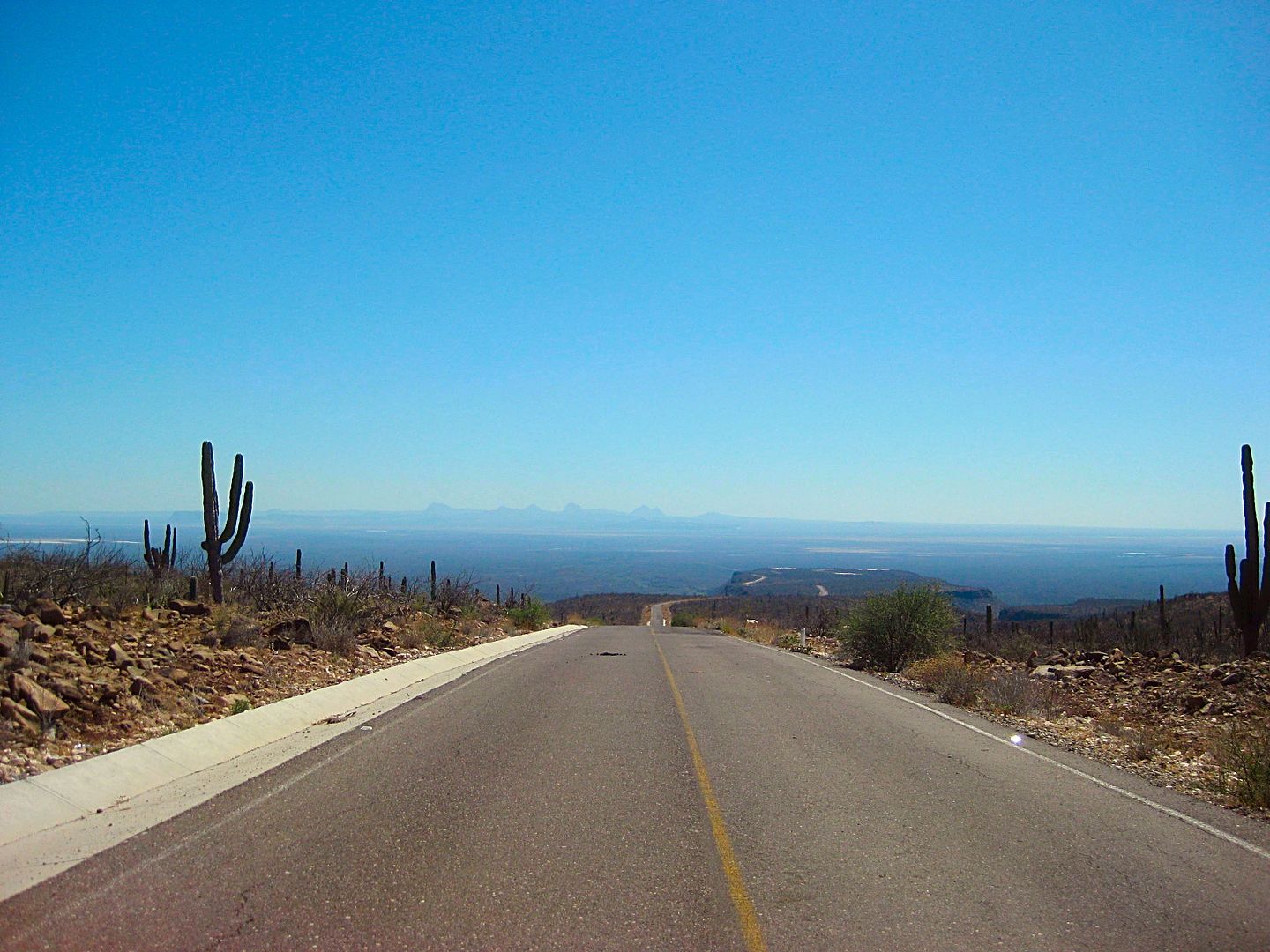
Looking back down. That's the Sierra Santa Clara, in the distance.
Old and new... the highway circles around near the top edge of the canyon while ancient trails, such as El Camino Real, are carved into the canyon
sides.
The pavement comes to an end after Km. 29, 18.3 miles from Hwy. 1. There are still 4.3 miles to the village.. and they are slow, scary for some,
miles.
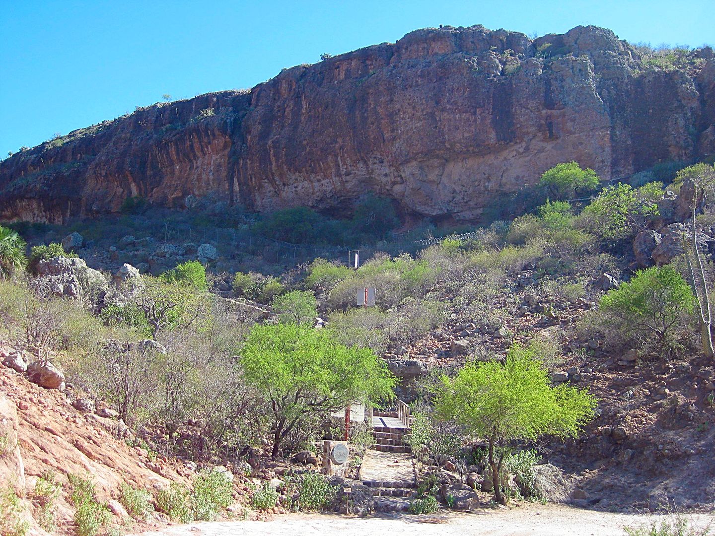
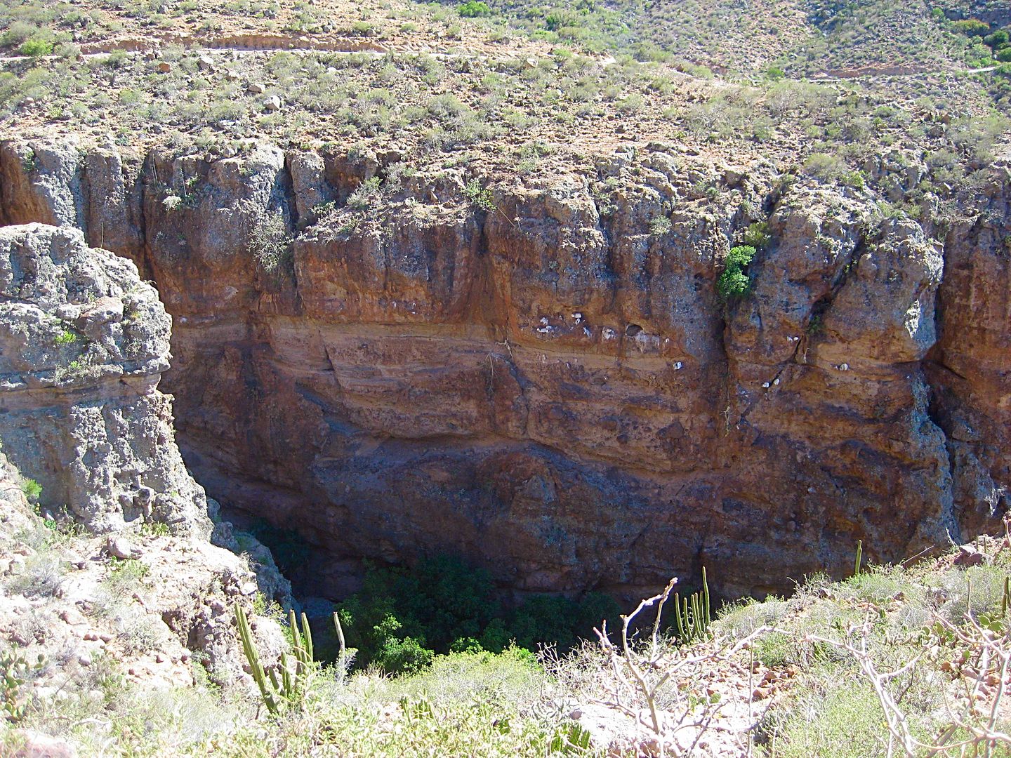
Three miles from the end of pavement is the entrance to Cueva El Ratón. Locked entrance. A minor cave when compared to the others in the canyon
below. Because it is easily reached, without a mule ride, it sees many tourists.
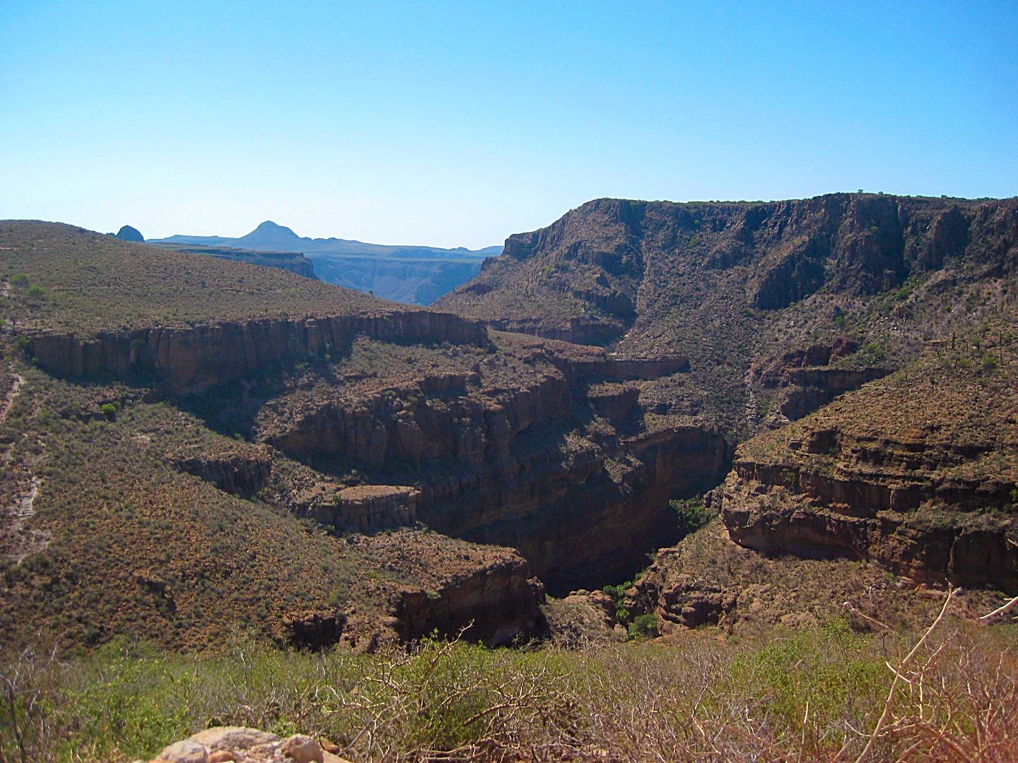
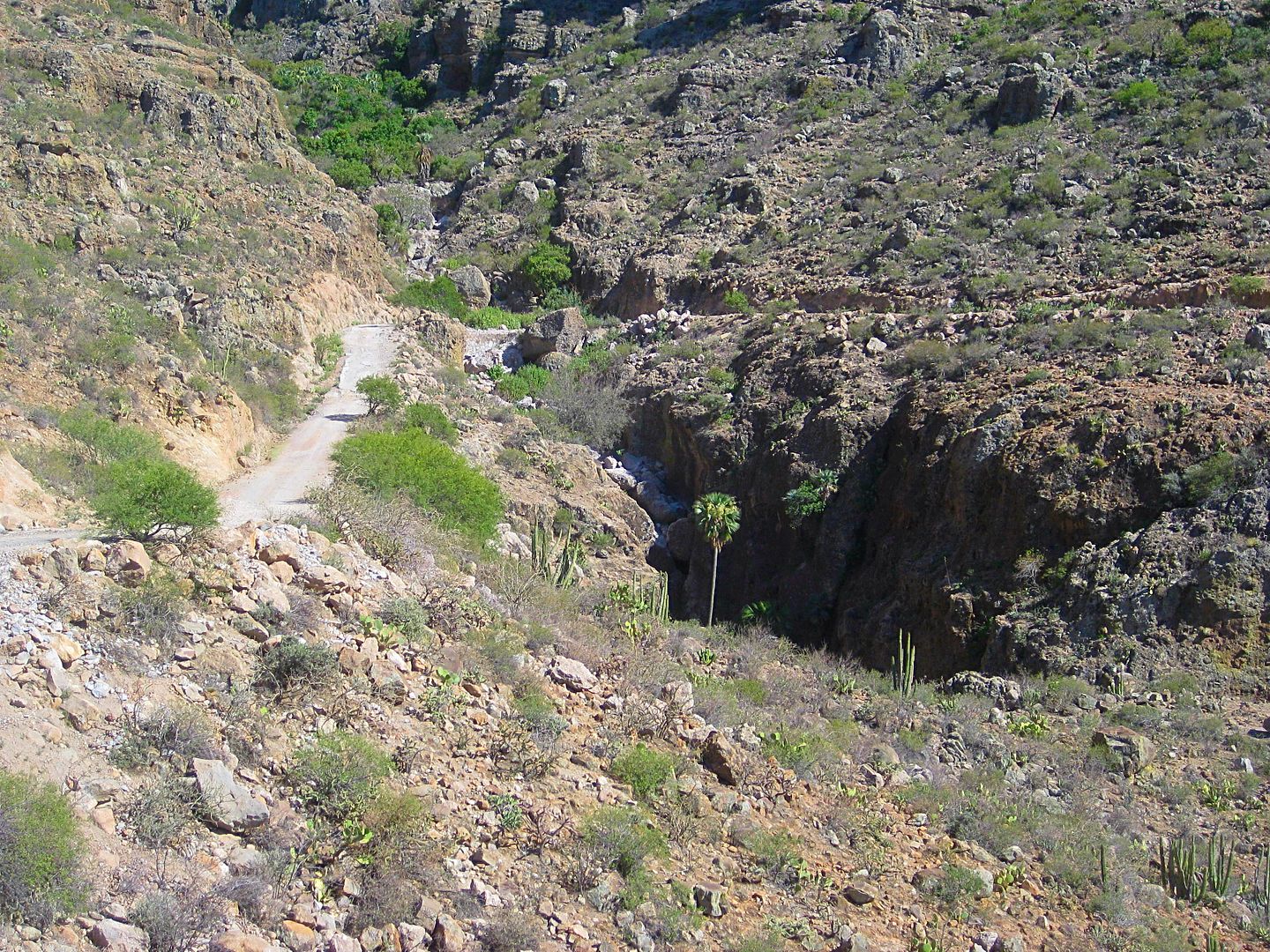
San Pablo Canyon (the upper end of where I was at earlier today).
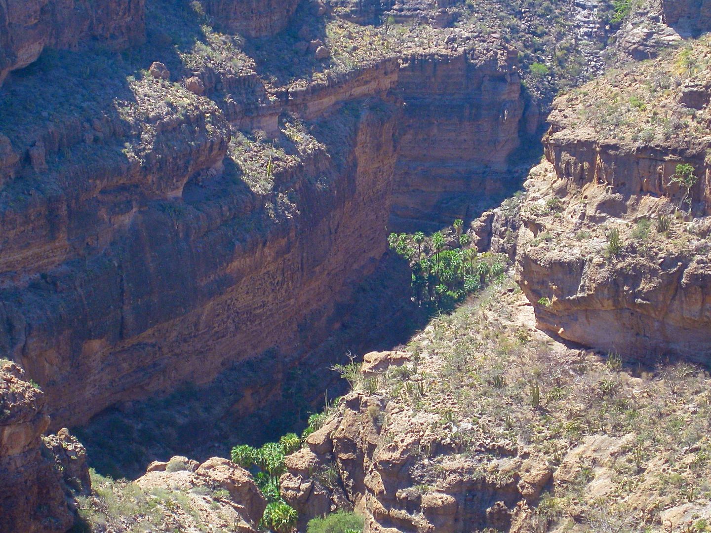
Looking down, from the road!
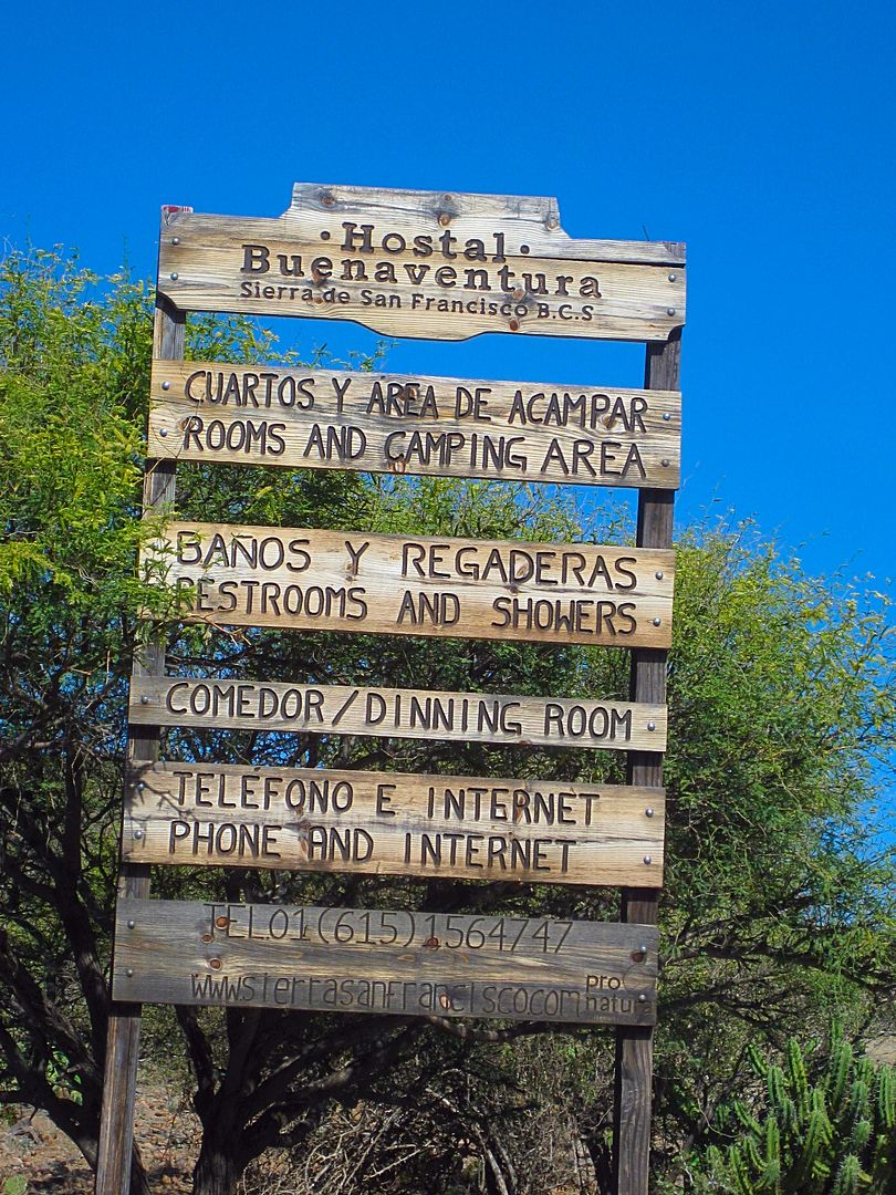
3.7 miles from the pavement and 0.6 before the village is this hostel, named after the first Arce in Baja California, Buenaventura.
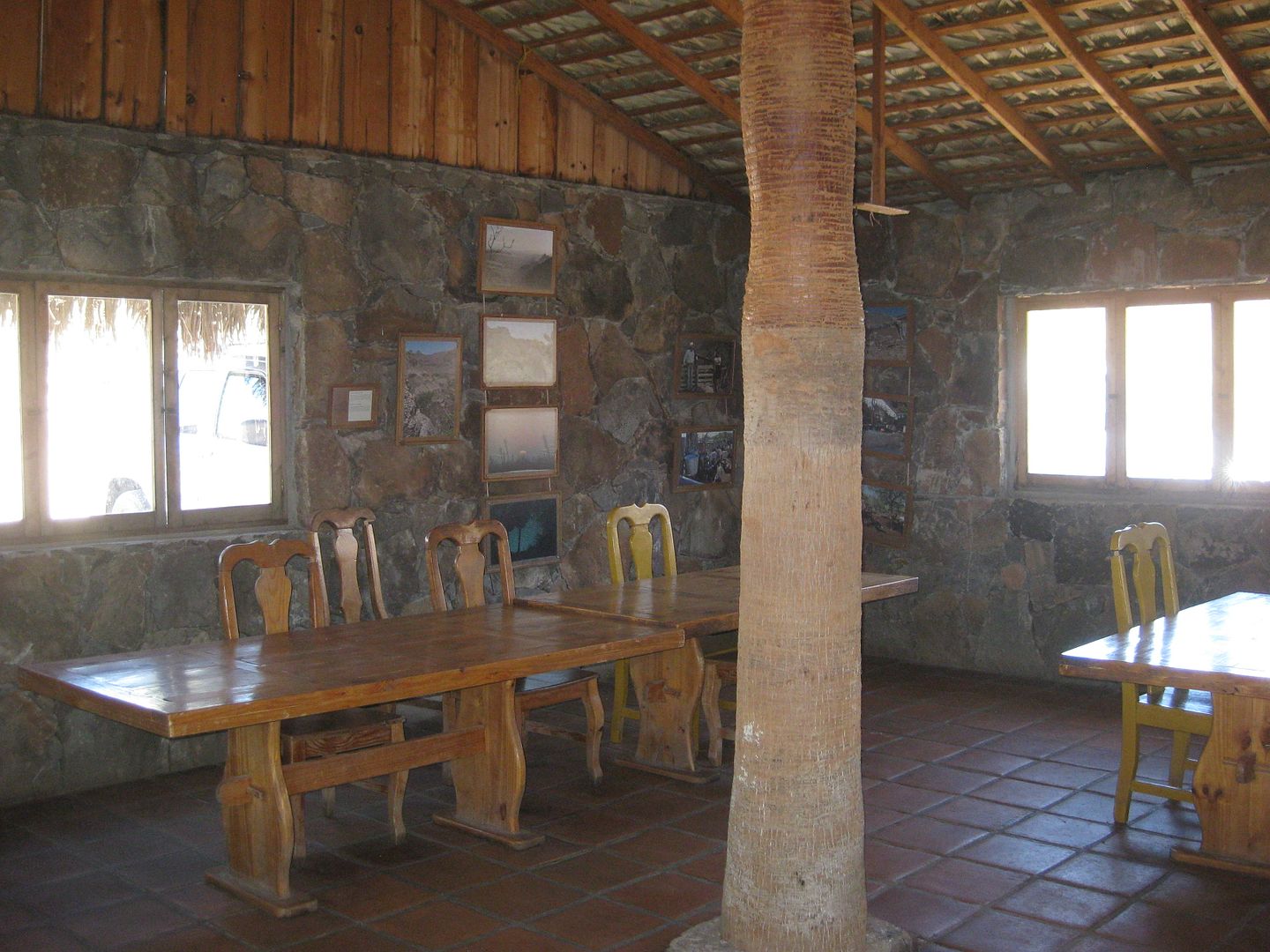
Dining area. Machaca is the main dish.
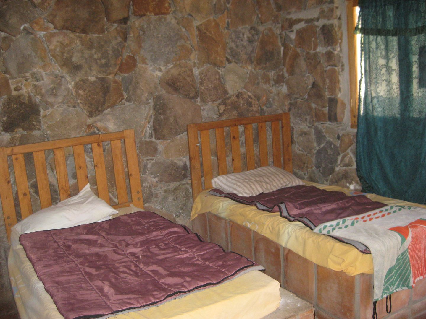
Each cabin has two singles and a bunkbed, plus bathroom.
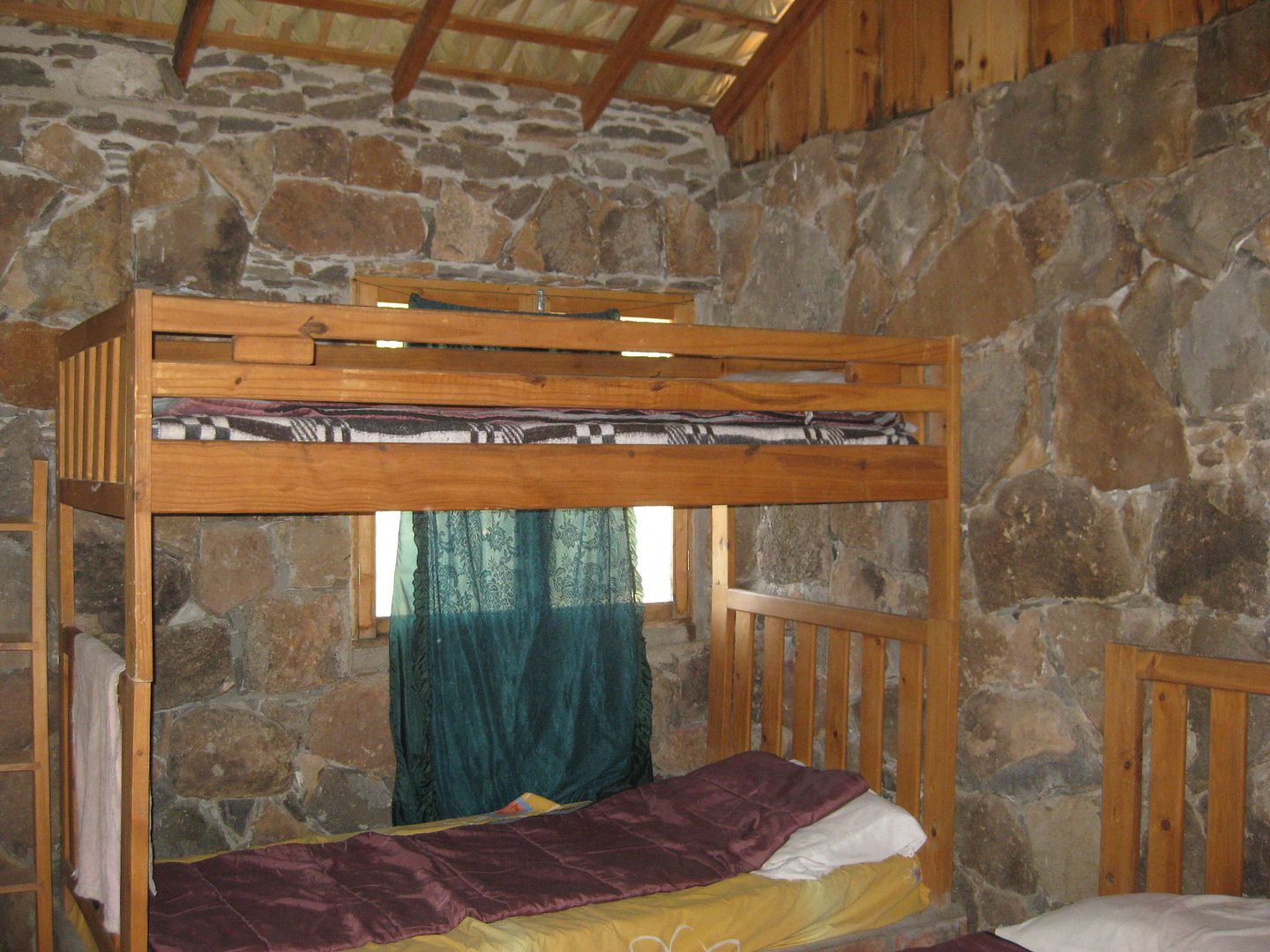
Cost is 200 pesos per person (=$11.24 at this time). Ramón is the manager.
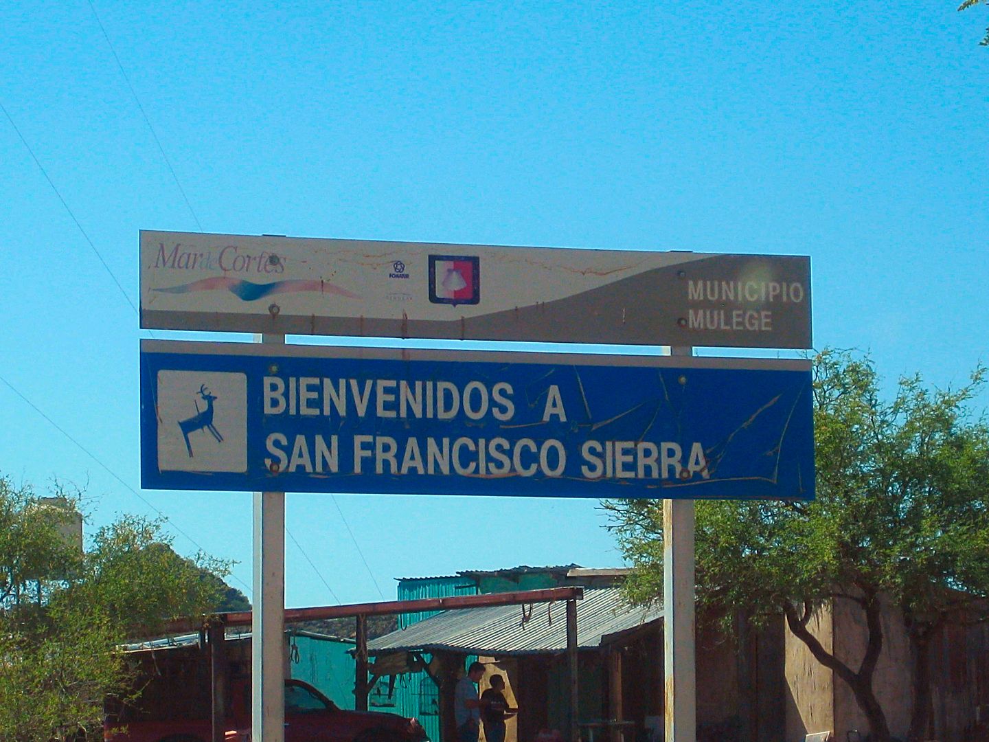
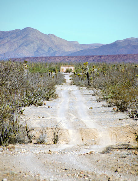
The end of the road at Rancho San Francisco. It is 4:30 and the elevation is over 3,640 feet.
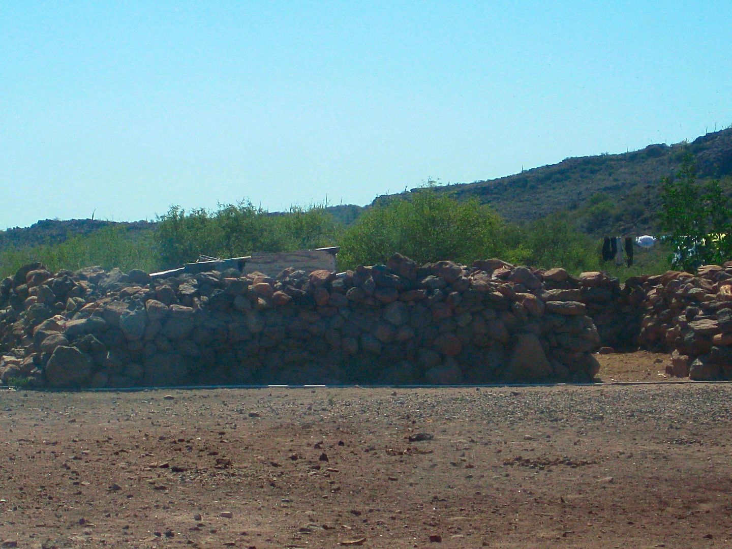
Ancient walls that the villagers told Choral Pepper in the 1960s were the remains of 'Mission Dolores', as that was what they believed.
Actually, San Francisco was a mission ranch station attached to San Ignacio. Dolores del Norte was the proposed name for the next mission north of San
Ignacio and was used in Jesuit documents and maps. However, when the mission was established, it was named Santa Gertrudis in honor of the wife of the
benefactor. The adobe ruins far below San Francisco, in the canyon of San Pablo, were also mistaken for Dolores del Norte by early writers.
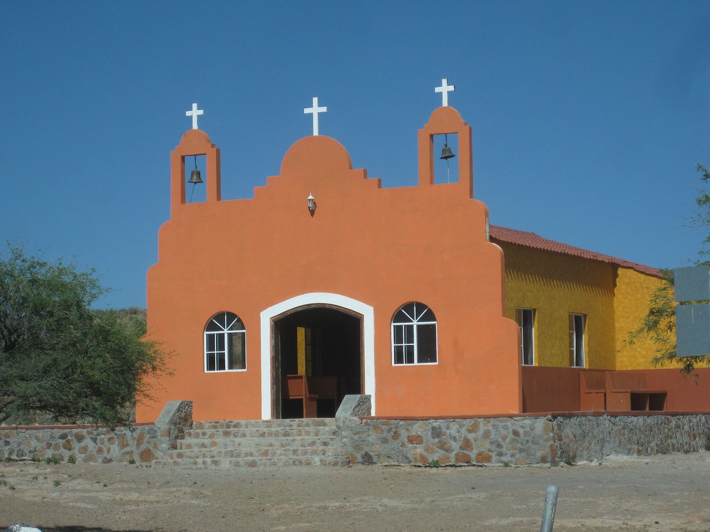
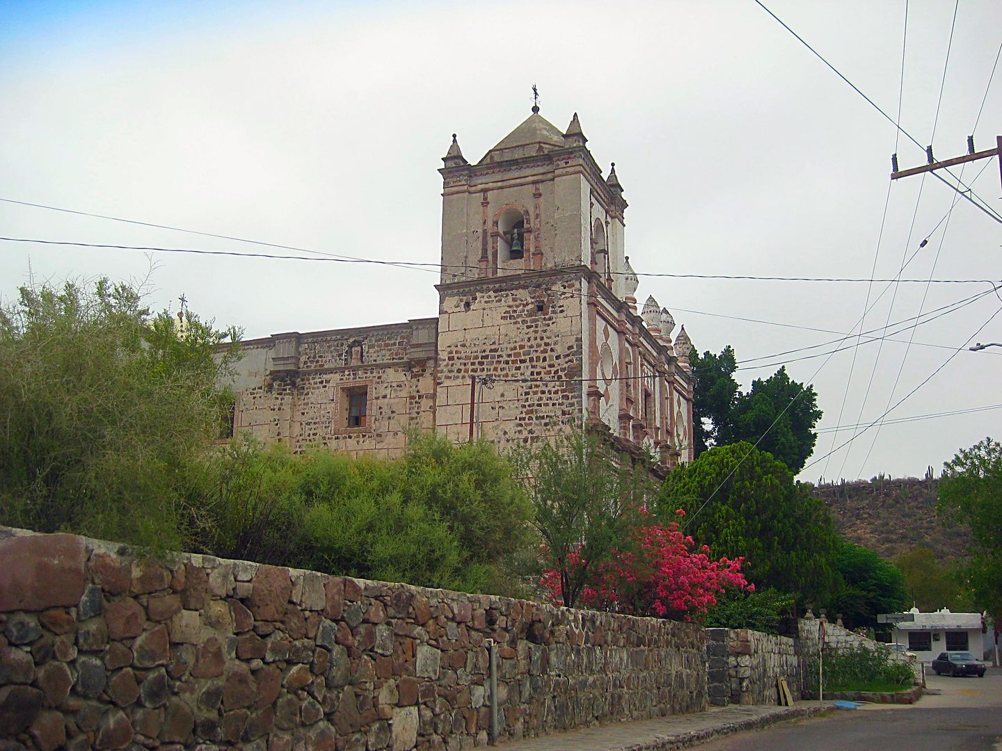
Church in San Francisco.
Heading back down the mountain.
Note the road on the opposite side of the deep gorge.
Crossing El Camino Real, one of three primary routes north from San Ignacio (Golfo, Sierra, Pacifico).
I choose to take a break from camping and go to maybe the next best comfort and value motel, after Baja Cactus, the La Huerta in San Ignacio.
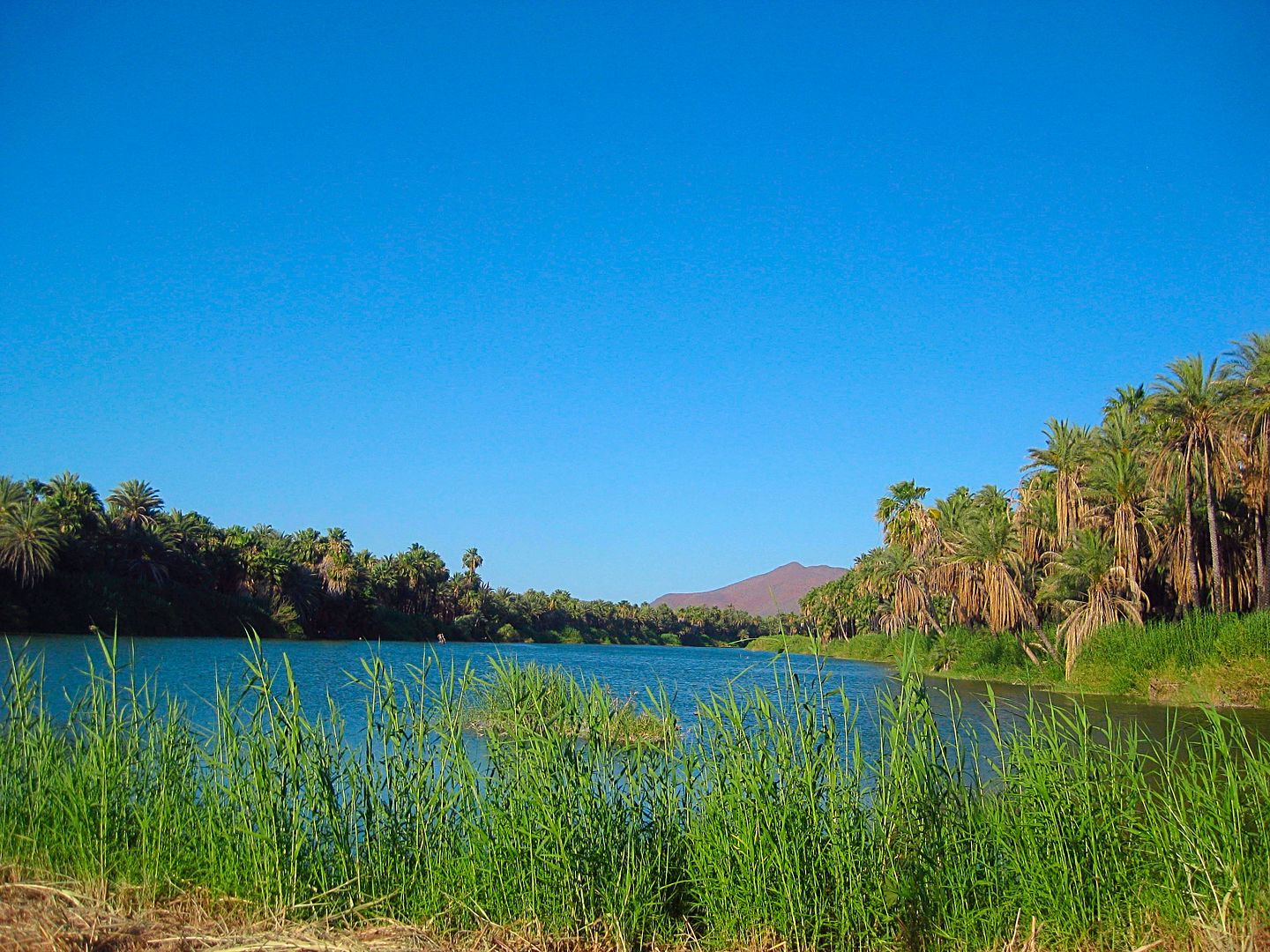
The river crossing between Highway 1 and San Ignacio's plaza is one that always makes one feel calm and relaxed. The motel had just one single room
left, it was next to the office, but I did not hear any noise at all. The cost was US$39.
While there is a nice restaurant on the hotel grounds, as well as a market, I opted to walk the block to the town plaza facing the mission. Victor's
was closed (I learned he had passed away) but I spotted a taco stand at the opposite corner of the plaza, operated for 30 years by Agustín. Only
carne asada... I ordered two... and two more... they were incredible! The meat was tender, tasty, and a real winner. 4 tacos, with a coke, 107 pesos
(=$6.01).
Good wifi and the Internet so I could check in with you guys and check emails. I had a great night's sleep.
END of DAY 3. with 4 to go!
[Edited on 6-14-2017 by David K]
|
|
|
gueribo
Nomad
Posts: 458
Registered: 10-16-2014
Member Is Offline
|
|
One of my favorite places in the world...Sierra San Francisco. Thanks for the beautiful photos.
|
|
|
BajaGeoff
Super Nomad
Posts: 1727
Registered: 1-11-2006
Location: San Diego and Campo Lopez
Member Is Offline
Mood: Heading To Baja!!!
|
|
Great stuff DK! Any idea when Cuesta de la Ley was paved? I hauled a trailer through there for the NORRA in 2012 and it was pretty brutal terrain.
|
|
|
David K
Honored Nomad
Posts: 64479
Registered: 8-30-2002
Location: San Diego County
Member Is Offline
Mood: Have Baja Fever
|
|
Quote: Originally posted by BajaGeoff  | | Great stuff DK! Any idea when Cuesta de la Ley was paved? I hauled a trailer through there for the NORRA in 2012 and it was pretty brutal terrain.
|
Hi amigo, I first saw it paved in Sept. 2016. My previous trip over it was July 2012 and it was dirt. Nomads Pacifico, Honda Tom, TW, amd others use
it far more an probably can nail down the year, but I bet 2015 or 2016?
|
|
|
bkbend
Senior Nomad
Posts: 693
Registered: 11-27-2003
Location: central OR or central baja
Member Is Offline
|
|
| Quote: Originally posted by BajaGeoff | | Great stuff DK! Any idea when Cuesta de la Ley was paved? I hauled a trailer through there for the NORRA in 2012 and it was pretty brutal terrain.
|
It was about 80% complete in early April 2016. Two guys were camped at the top building forms and the cement trucks were staged and loading at Piedra
Blanca.
|
|
|
chuckie
Elite Nomad
Posts: 6082
Registered: 2-20-2012
Location: Kansas Prairies
Member Is Offline
Mood: Weary
|
|
Good stuff! Keep it up! Tho I have to admit the first pic kinda scared me.. me..
|
|
|
geoffff
Senior Nomad
Posts: 643
Registered: 1-15-2009
Member Is Offline
|
|
I referred to it as "La Casona" because I found this Panoramio photo which called it "La Casona de Pedro Altamirano": http://www.panoramio.com/photo/42375959
-- Geoff
|
|
|
David K
Honored Nomad
Posts: 64479
Registered: 8-30-2002
Location: San Diego County
Member Is Offline
Mood: Have Baja Fever
|
|
Great investigating! Did you drive south towards Arroyo San Pablo? Wasn't that wide roadbed interesting? That was when I concluded it was possibly an
El Boleo ranch. They built roads all around central Baja in support of the copper mine needs (for food). The date on the ranch building, elaborate
style of construction, and the roadbed south all were out of the ordinary for this remote spot in Baja.
|
|
|
geoffff
Senior Nomad
Posts: 643
Registered: 1-15-2009
Member Is Offline
|
|
I only made it about a mile south before getting tired, only half-heartedly looking for a way into the canyon. Yes, an odd very straight road right to
the Casona, now apparently much less used.
It's a pity about the locked gate.
[Edited on 6-15-2017 by geoffff]
|
|
|
David K
Honored Nomad
Posts: 64479
Registered: 8-30-2002
Location: San Diego County
Member Is Offline
Mood: Have Baja Fever
|
|
It had recent ranch traffic on it and if you look on GE, there doesn't appear to be any other road or shortcut in from Vizcaino? There are three
manual gates before the locked gate. The ranchers must have a passenger because to hop out 6 times to open and close the unlocked gates would sure get
old fast!
|
|
|
David K
Honored Nomad
Posts: 64479
Registered: 8-30-2002
Location: San Diego County
Member Is Offline
Mood: Have Baja Fever
|
|
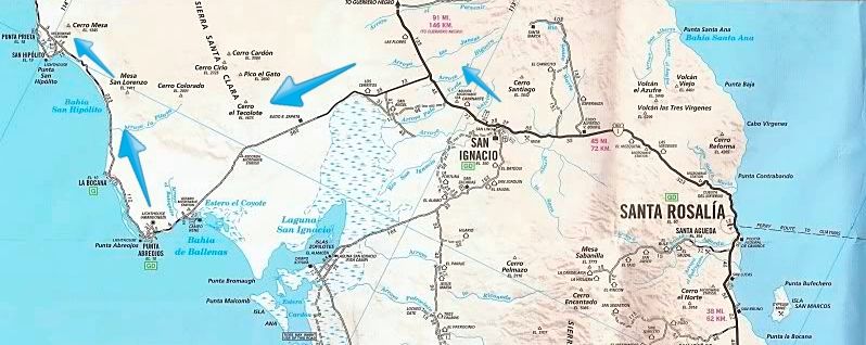
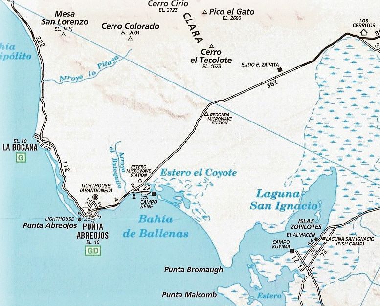
DAY 4 (Mon. June 5, 2017) San Ignacio to Bahía Asunción
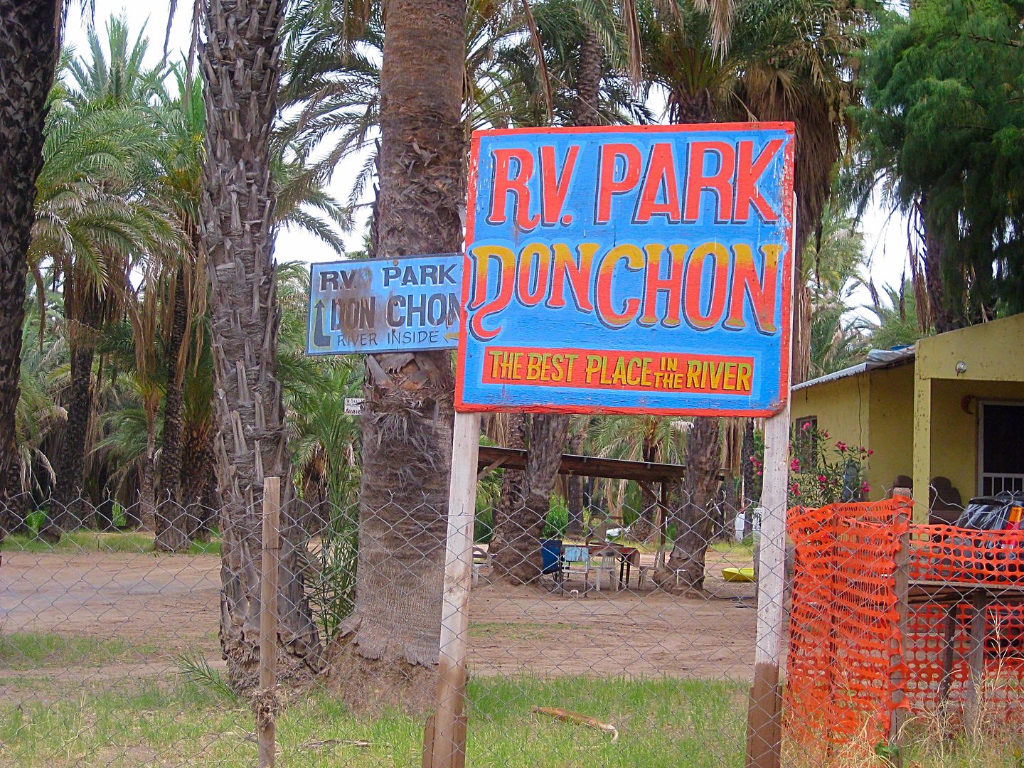
Had a very good night's sleep at the La Huerta hotel (motel), and the Mountain Time Zone change didn't bother me too badly. I was on the road before 8
am. Leaving, I noticed a new RV Park next to Ignacio Springs Bed & Breakfast. If it isn't new, I did not see any signage when I was here a few
months ago. Called 'Don Chon' and it's right on the river.
I topped my gas tank at the San Ignacio Pemex: 350 pesos for 21.35 liters (@16.40/liter) for the 96 miles since Vizcaino fill up. The tank was just
under 3/4 full but I was heading out the Vizcaino peninsula next and you never know if a key supply point will be closed.
Some kilometer notes (the numbers are from Santa Rosalia and increase northbound, 1 km. = 0.62 mile)
San Ignacio entrance is at Km. 73 (just east of the Pemex station)
Rice & Beans (restaurant & motel) is at Km. 74
Military Checkpoint is at Km. 77
Airport road is at Km. 78
Punta Abreojos Highway is at Km. 97+
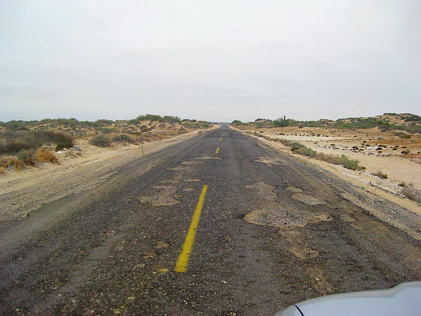
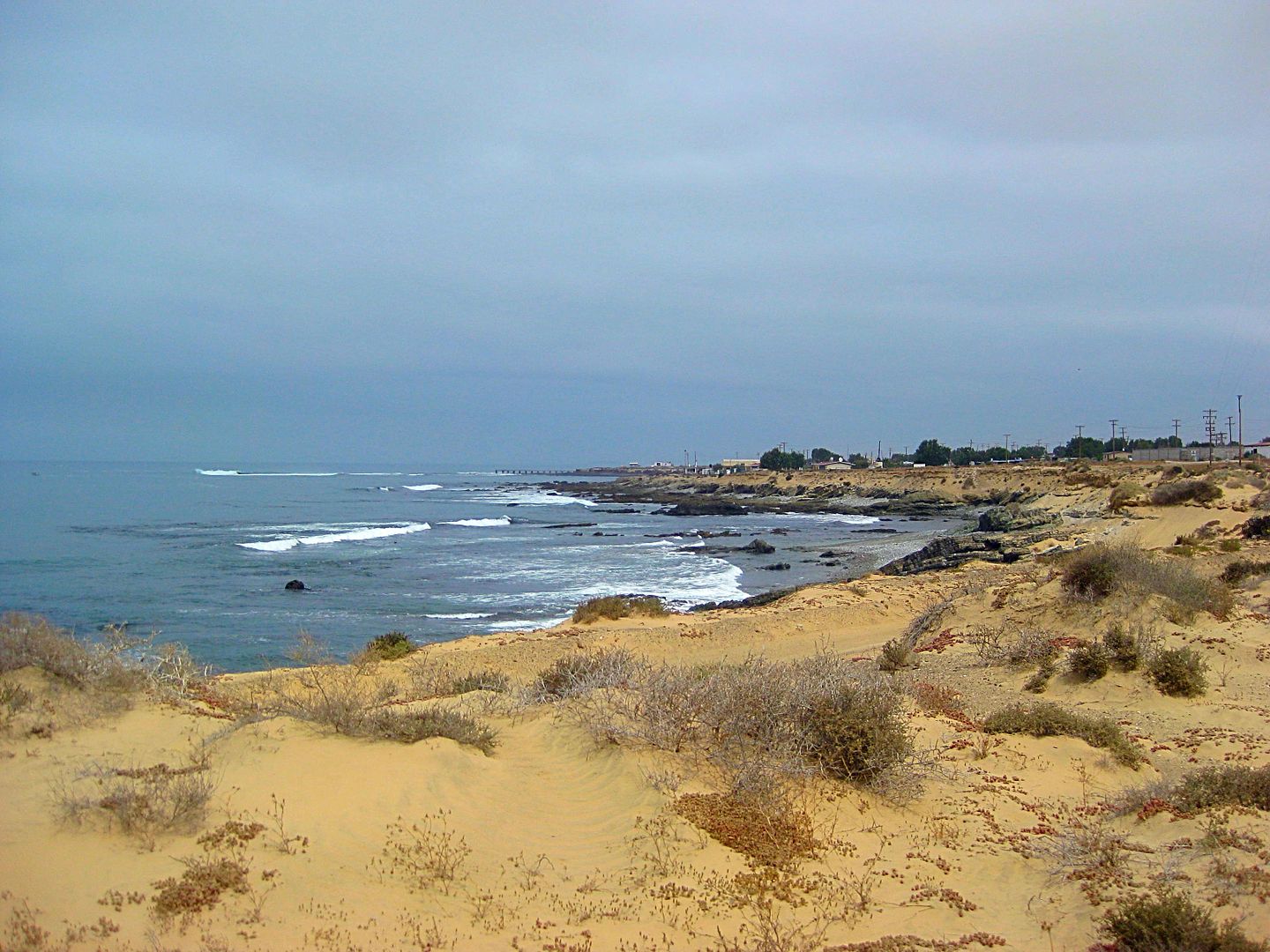
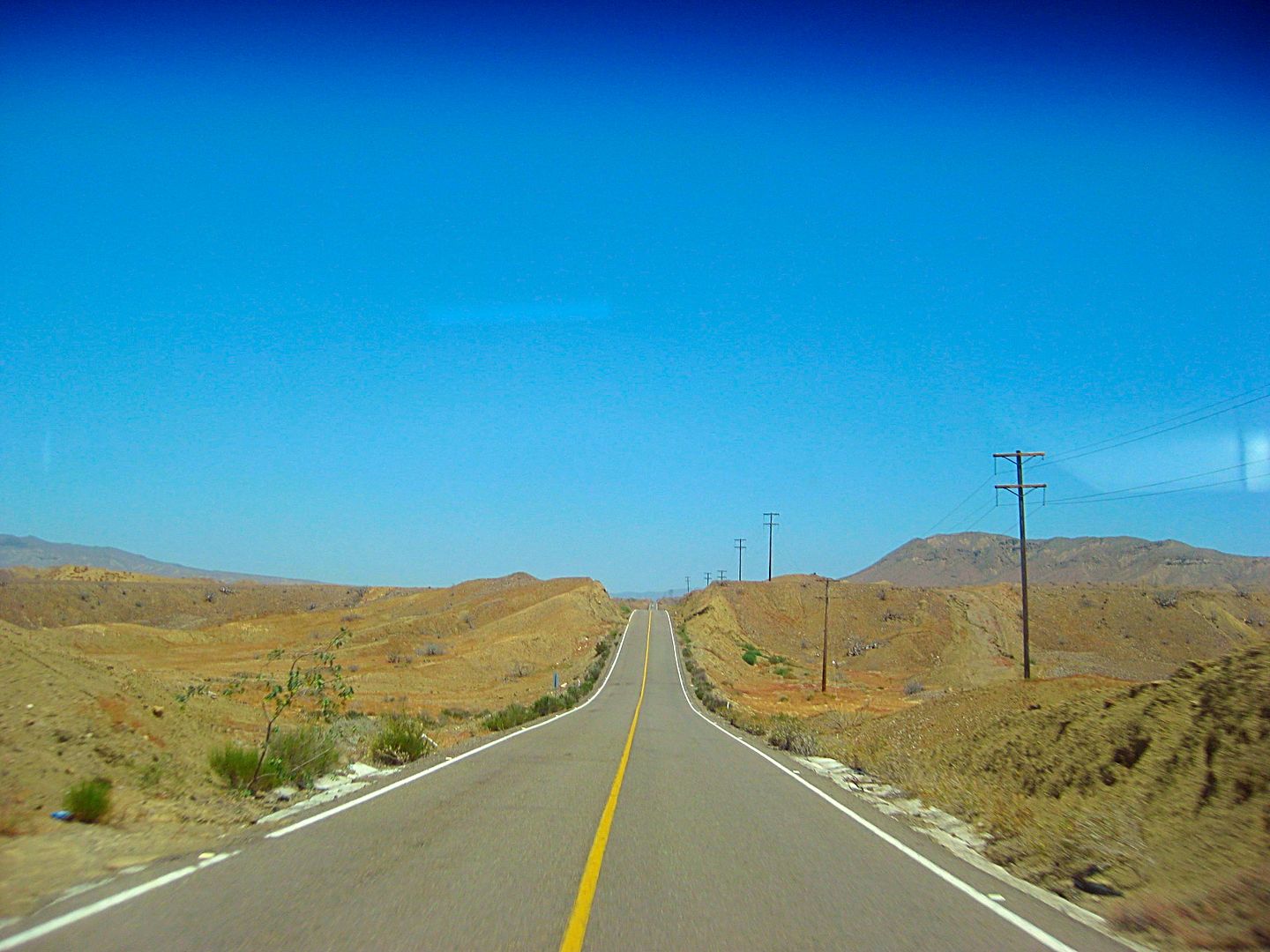
The fastest way to Bahía Asunción is to go to Vizcaino and take the all paved route west from there (Km. 143.5). The Abreojos route is an alternate
for those who want to see the remote coast region and other fishing towns. I was just on the road last September (2016).
The highway between Mexico #1 and Punta Abreojos is 84 kilometers (52 miles). The first half (~25 miles) is in bad condition with many deep holes and
sections of missing blacktop. It was this way 9 months ago when I was last over it, so nothing much done in all that time. Signs from the government
announced it is being fixed and I actually saw about a half mile of new road work started but no equipment in sight. The second half is fine.
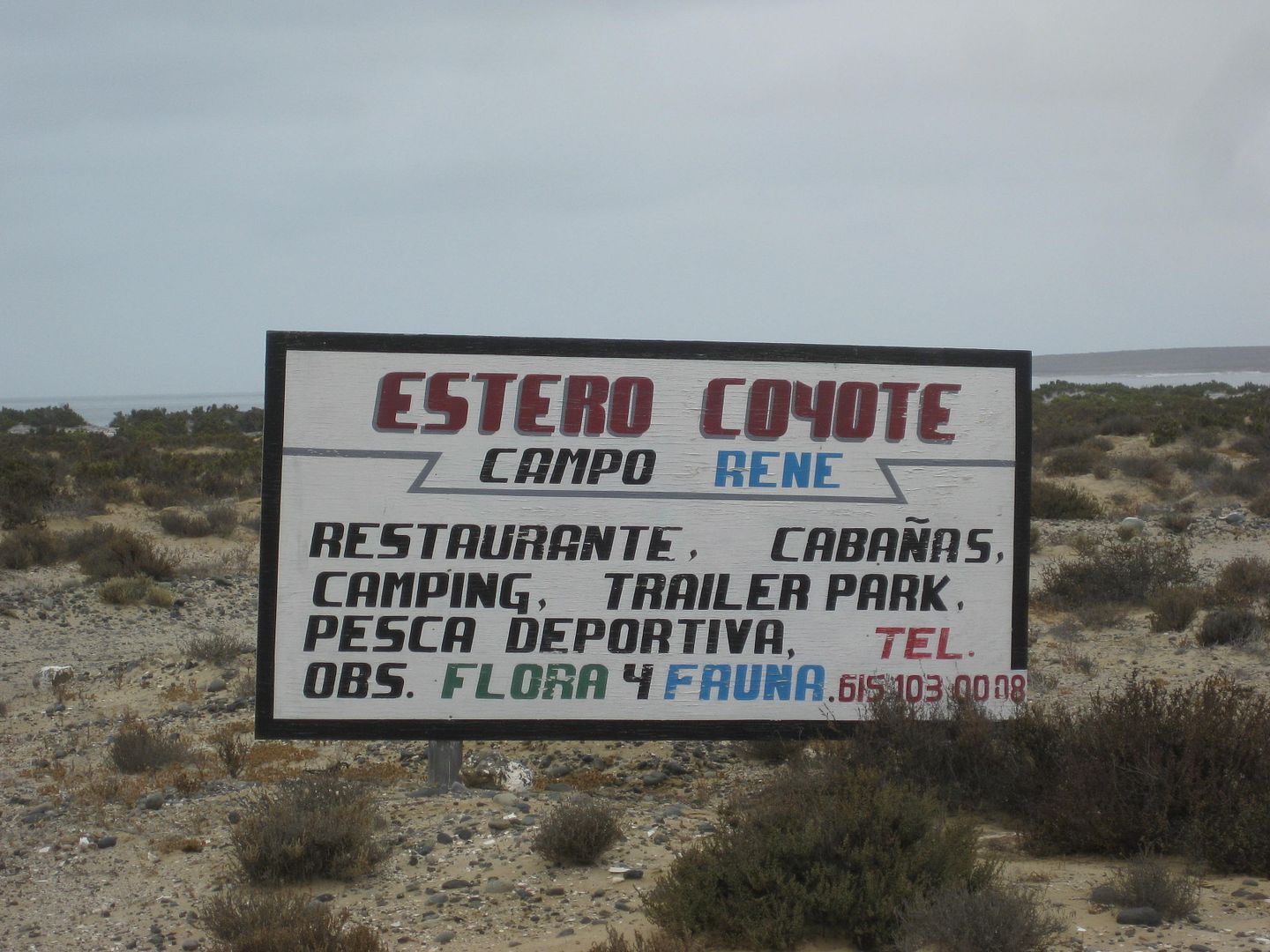
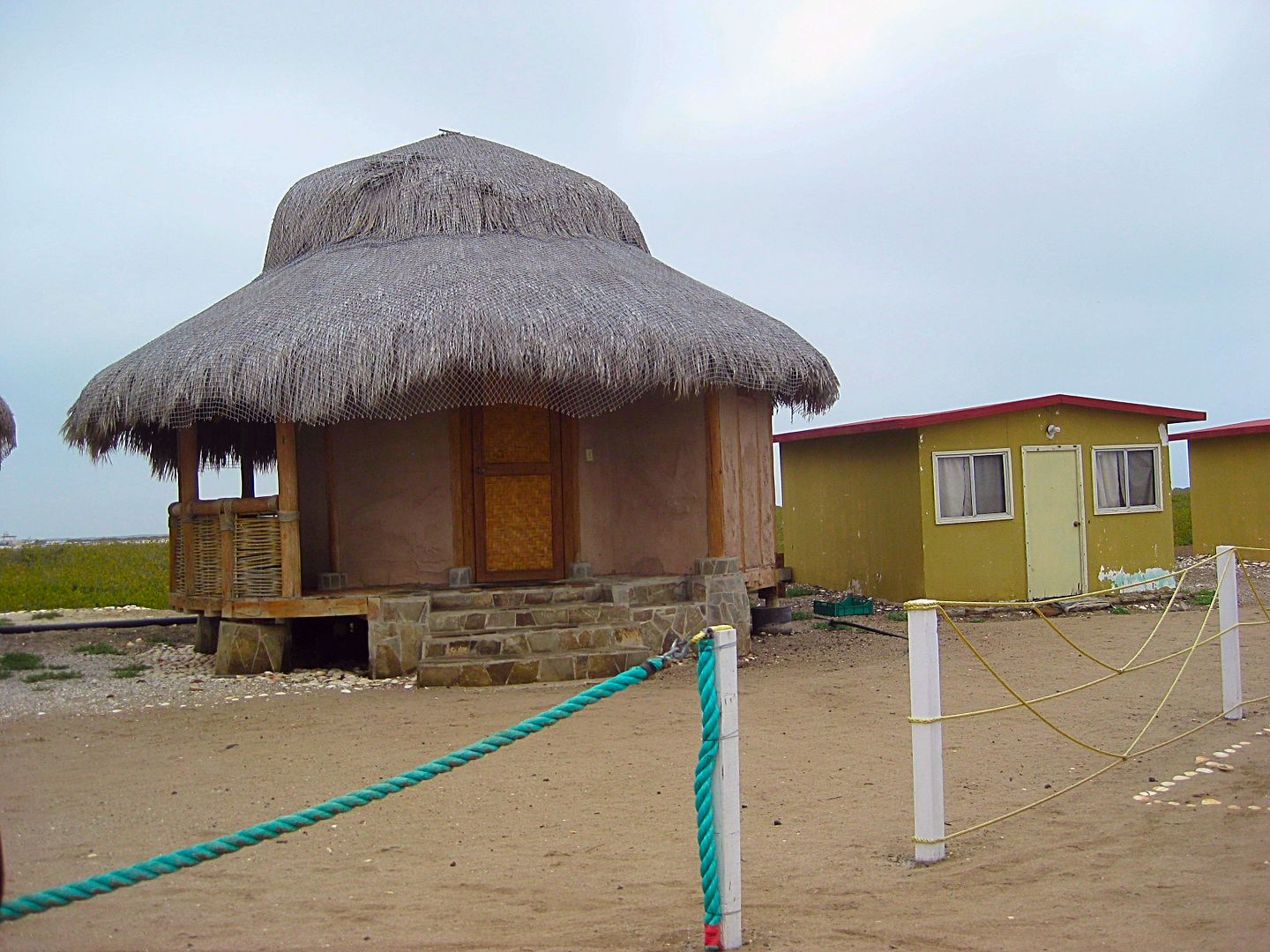
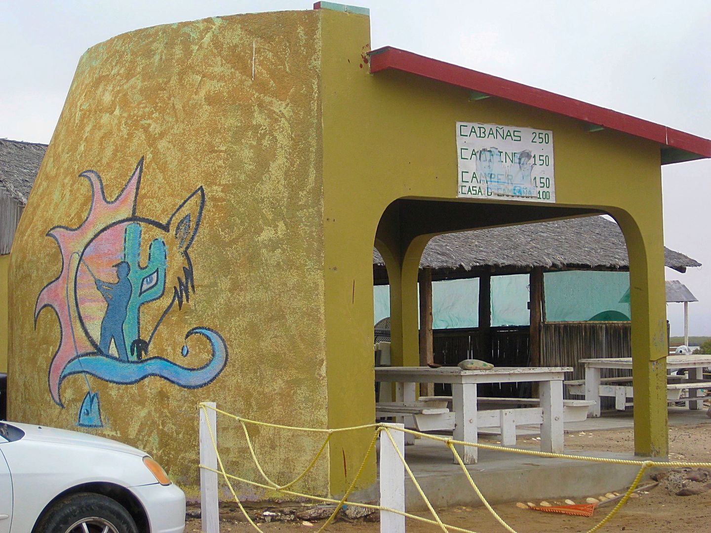
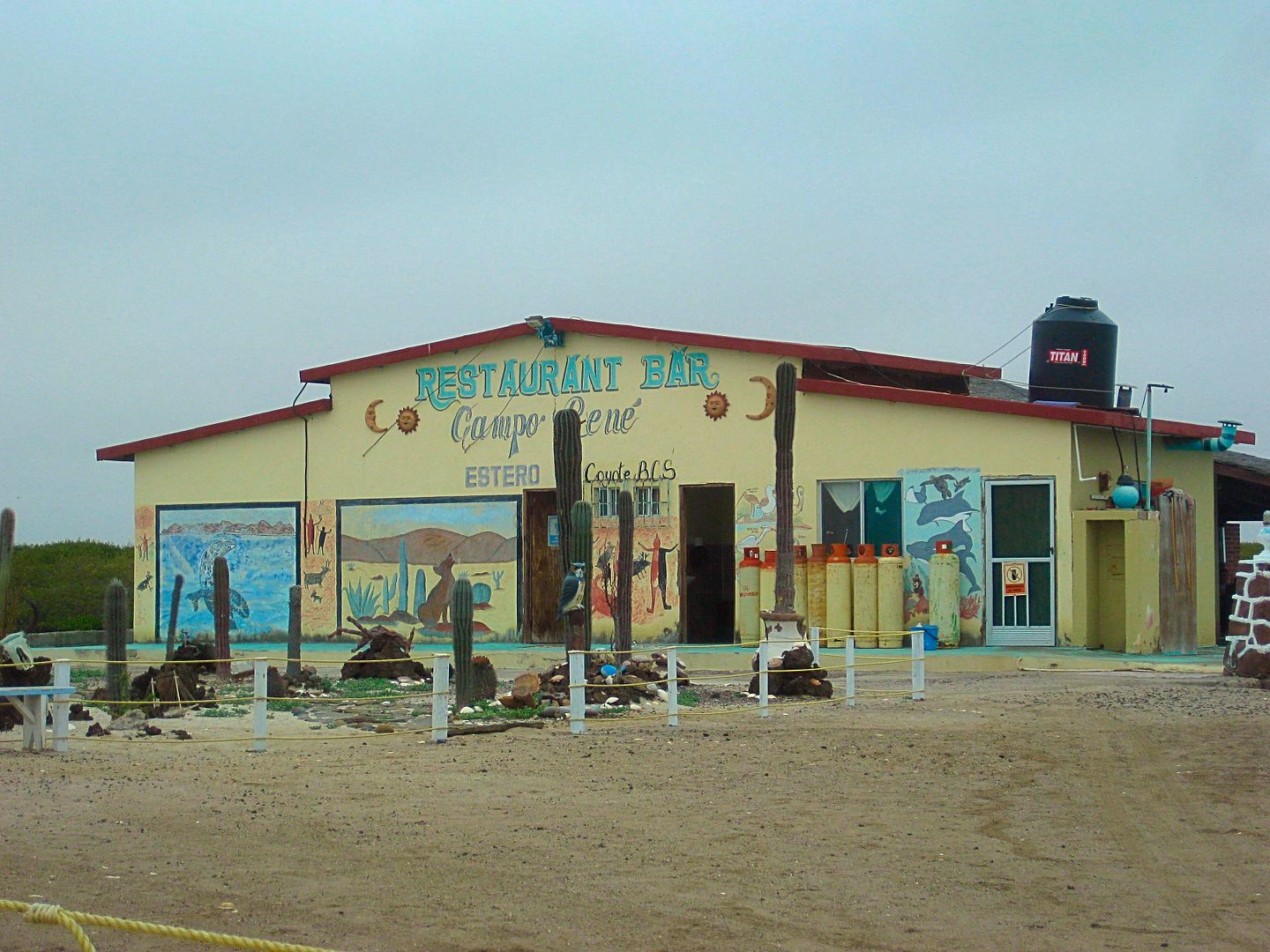
I drove over for a look at Campo Rene and there was no activity or campers at the palapas. The restaurant parking was roped off but a vehicle was
parked inside.
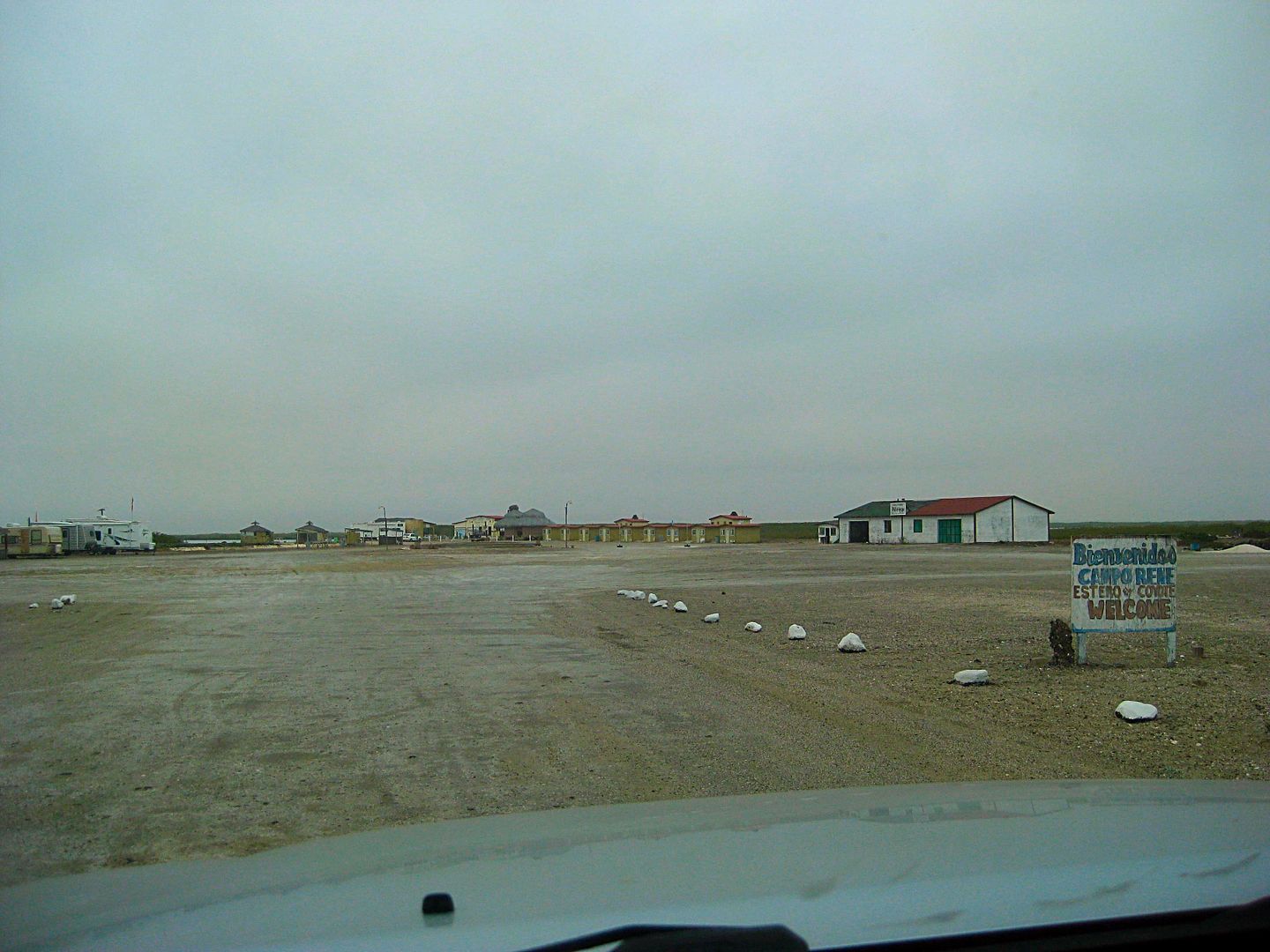
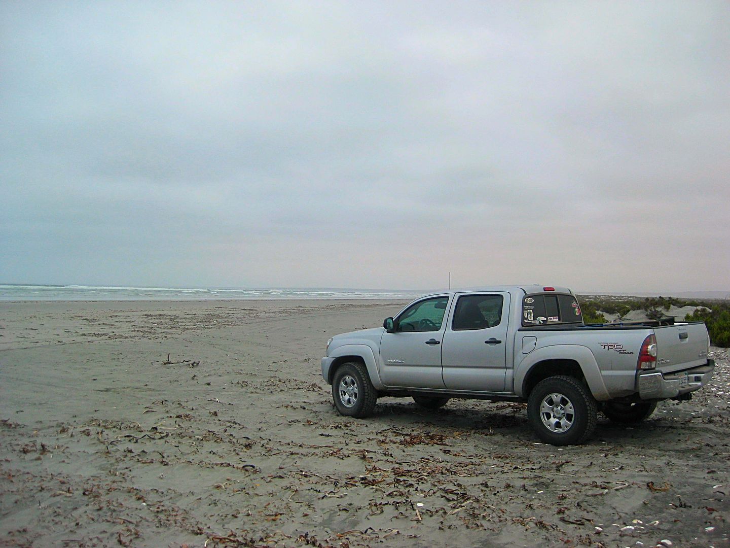
Big beach just south of Campo Rene.
Km. 0 Hwy. 1 (Km. 97+) Restaurant Crucero del Pacifico at the junction.
Km. 1 (0.6 mi) Old main road to La Paz (original Baja 1000 road) is crossed.
Km. 43+ Rancho Santa Clara road west.
Km. 73.5 Campo Rene signed road (2.5 mi in).
Km. 75 Another road to Campo Rene joins the previous.
Km. 84+ End of pavement, Punta Abreojos entrance.
Pemex station, car wash, and tire dealer are 1/4 mi ahead, on the right.
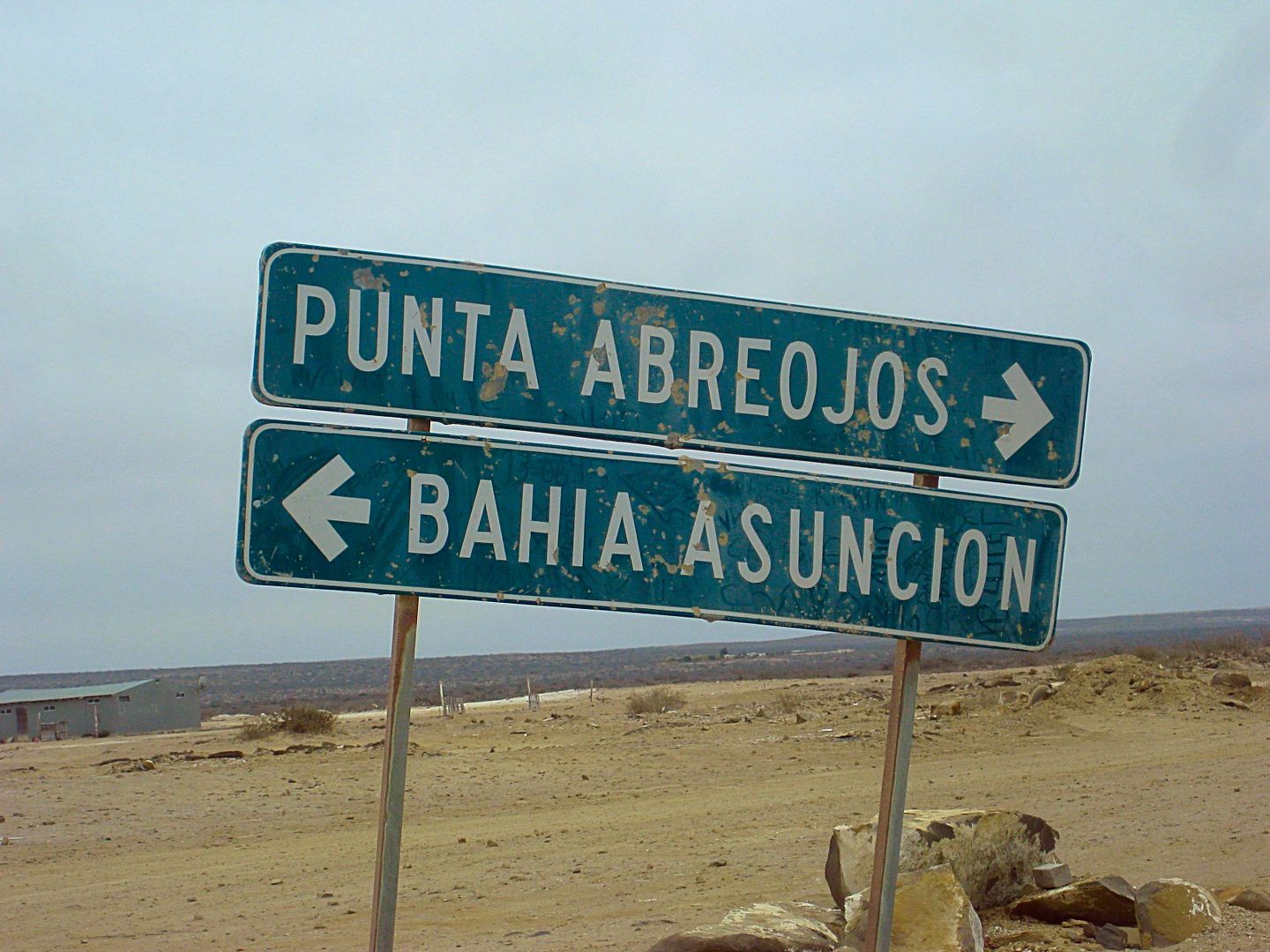
The end of the road straight across town ends a mile further near the lighthouse. The popular salt flat road to La Bocana and Bahía Asunción is
reached by turning right just past the school on Juan de Barrera street or the next street to the right.
Punta Abreojos
Set odometer to 0.0 here.
Easy driving (today) on the salt flat, parallel to the big lagoon of La Bocana.
7.5 a beach on the lagoon
8.2 The salt flat road merges with the graded dirt road (which follows the power poles between towns).
10.5 La Bocana town entrance. Motel Las Cabañas (closed) and signs for Blanca and Les' hotel on the opposite side of town.
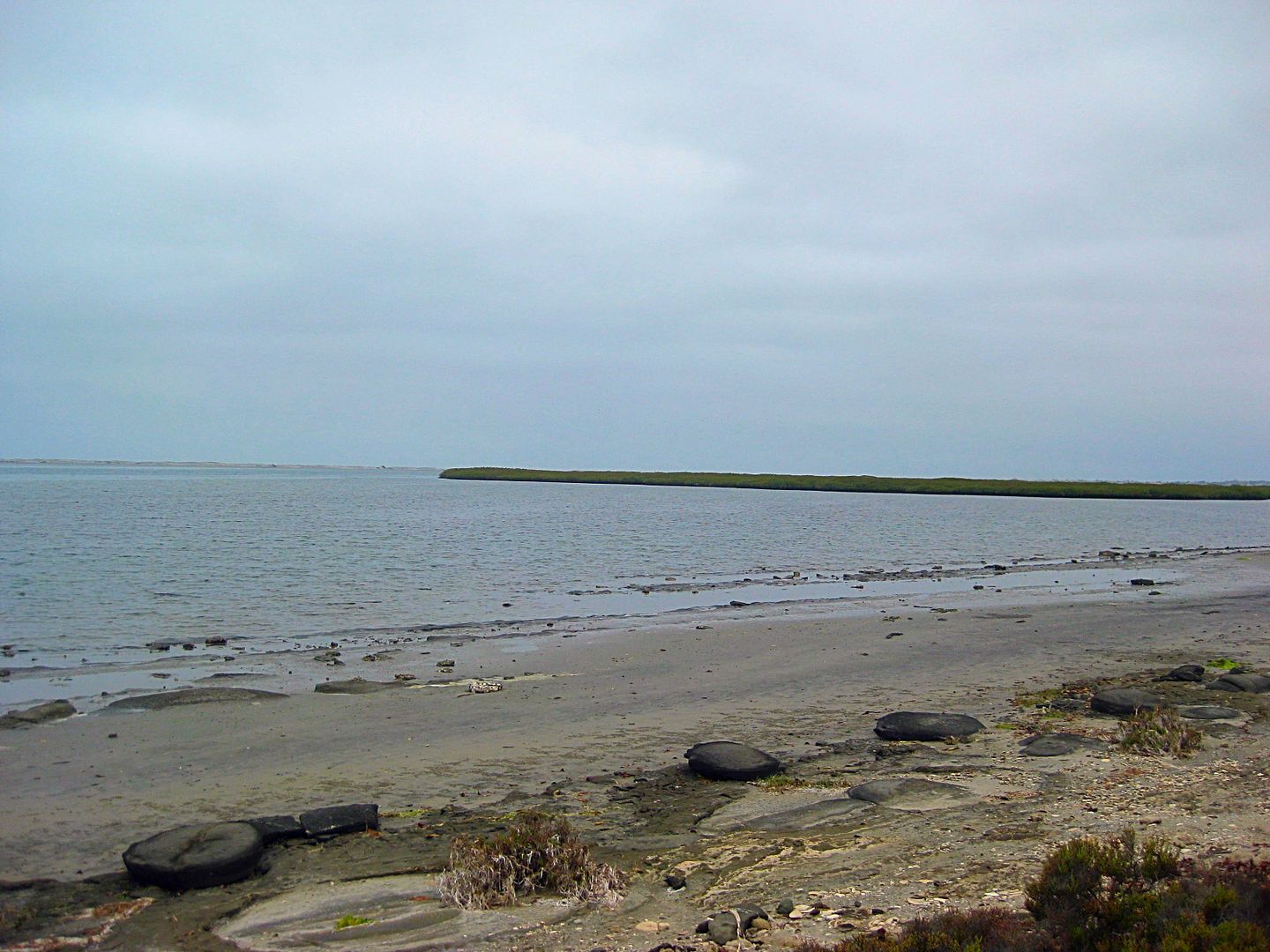
Lagoon beach near La Bocana.
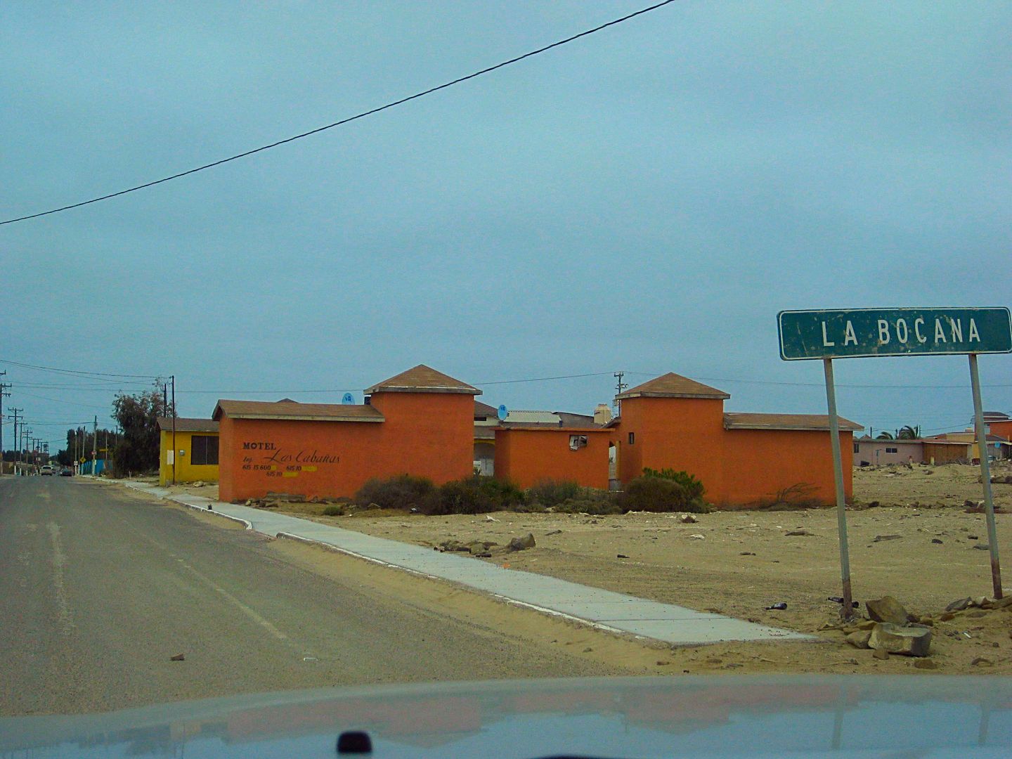
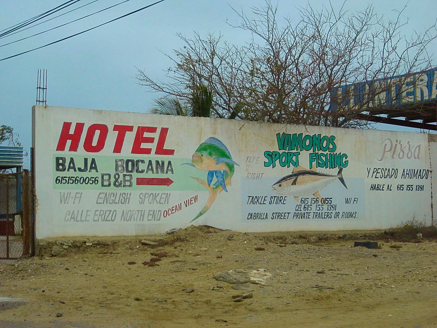
Las Cabañas motel (closed) by the entrance sign to La Bocana. Signs point the way to Blanca and Les' B & B and the road to Bahía Asunción, just
beyond.
Reset odometer to 0.0.
22.0 Fork (left to stay near the coast)
24.4 San Hipolito, small fishing town.
29.4 Punta Prieta, another small town.
San Hipolito
Punta Prieta, B.C.S. (not to be confused with Punta Prieta, B.C. on Hwy. 1)
An old man was standing by the road with two net bags seeking a ride to Asuncion. As it may be hours or days before another comes along, I made room
for him in the truck (he began to head for the back/bed). His name was Eligio and he was from Sinaloa selling 'natural' vitamins from town to town. He
had an honest and innocent face so I was not worried.
47.3 (17.9 from Punta Prieta) is the paved Bahía Asunción highway, 5 kms. east of town.
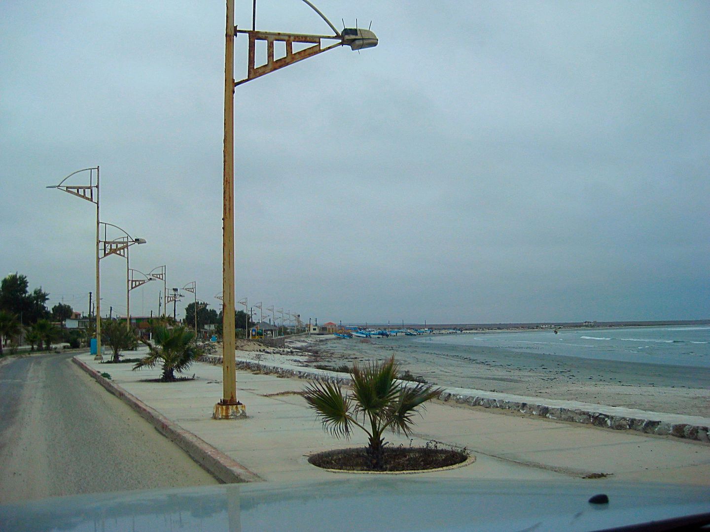
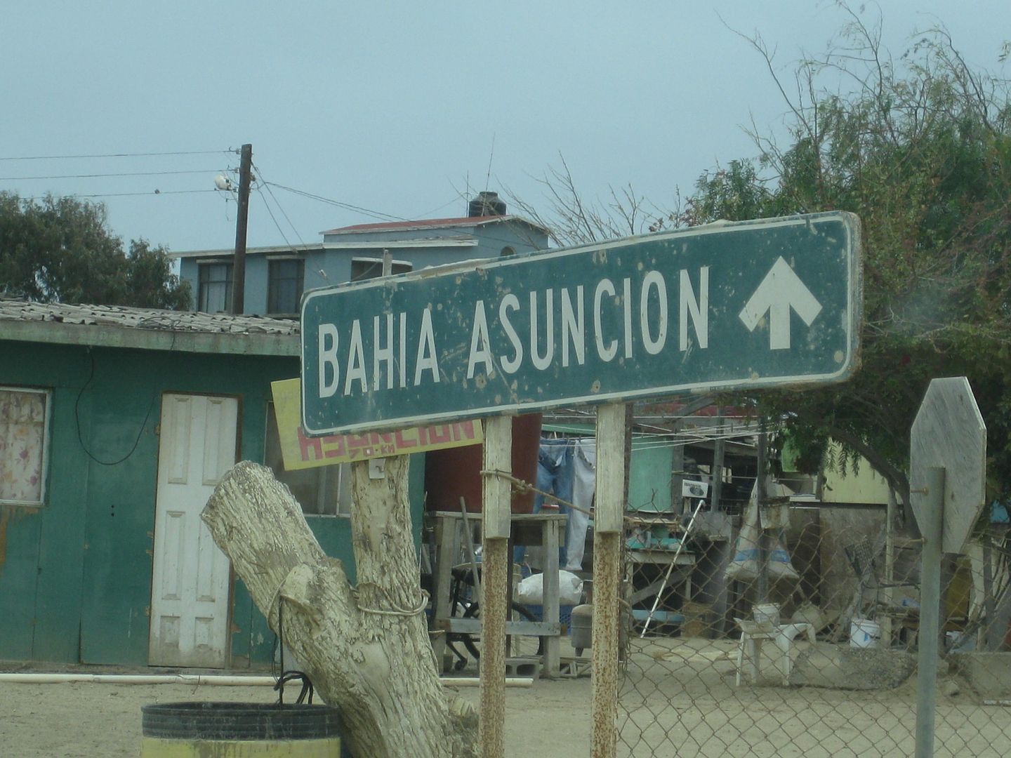
50.4 Entrance of Bahía Asunción. Pemex just ahead, on the left.
500 pesos for 30.49 liters for the ~135 miles driving from San Ignacio.
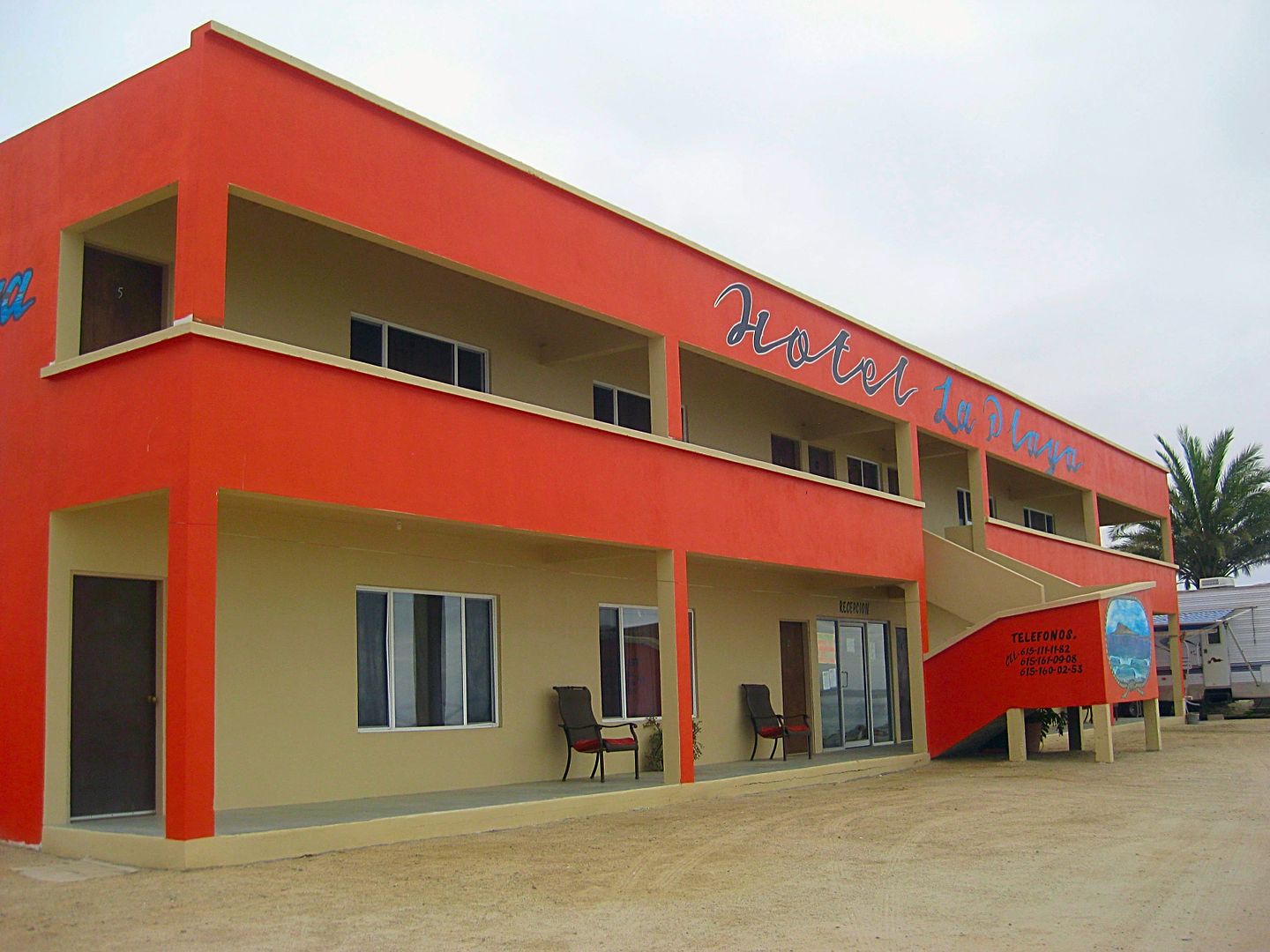
I head across town to Shari's La Bufadora Inn.
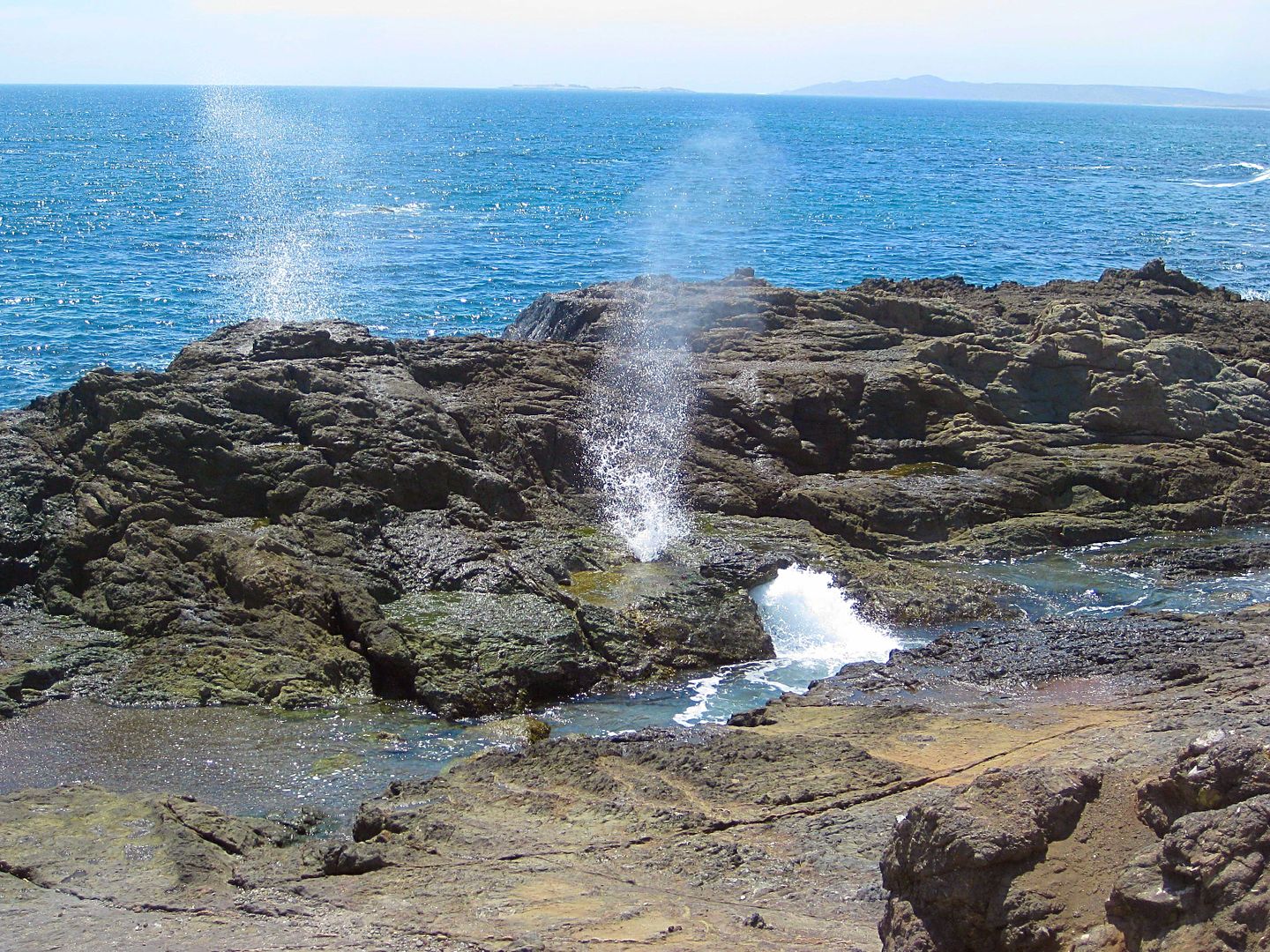
La Bufadora at Bahía Asunción.
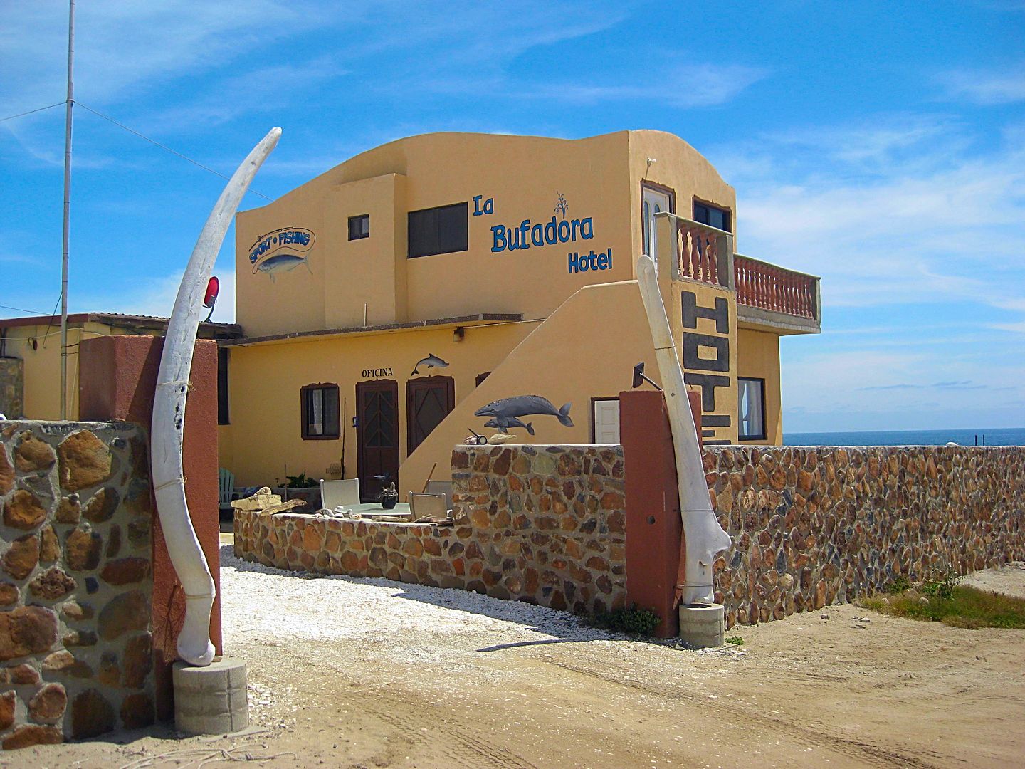
Just amazing how the June Gloom vanishes most of the day at Asunción.
I get a room with a view!
More Asunción photos taken the next couple of days.
Tomorrow I drive to Bahía Tortugas and out to the very tip of Baja's hook, Punta Eugenia.
Stay Tuned!
[Edited on 6-17-2017 by David K]
|
|
|
BajaBlanca
Select Nomad
Posts: 13165
Registered: 10-28-2008
Location: La Bocana, BCS
Member Is Offline
|
|
Great trip so far!
|
|
|
kevin_in_idaho
Nomad
Posts: 143
Registered: 12-13-2016
Member Is Offline
|
|
Awesome. Makes me wish that I could easily get there from Idaho and do some more travelling (ok, maybe not in the summer :-) ).
|
|
|
David K
Honored Nomad
Posts: 64479
Registered: 8-30-2002
Location: San Diego County
Member Is Offline
Mood: Have Baja Fever
|
|
Maps are from 2010 printing (but field research in 2004 and 2007). Paved road to Punta Abreojos was completed near the end of 2007. The northern half
(~25 miles) has deteriorated with many holes now slowing the drive.
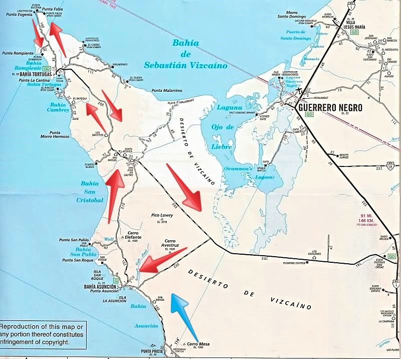
DAY 4 Blue Arrows, DAY 5 Red Arrows.
The road all the way into Asuncion from the north (Tortugas highway) is totally paved and the road west from that junction to Bahia Tortugas is all
paved EXCEPT for 9 miles (15 kms) eastbound beginning just east of San Jose de Castro/Malarrimo Beach junction.
[Edited on 6-16-2017 by David K]
|
|
|
David K
Honored Nomad
Posts: 64479
Registered: 8-30-2002
Location: San Diego County
Member Is Offline
Mood: Have Baja Fever
|
|
DAY 5 (Tue. June 6, 2017) To Bahía Tortugas and beyond!
Today's goal was to check out the two main routes to Bahía Tortugas and as much exploring as time allowed.
The June Gloom was so thick, normally clear Asunción even was gray in the morning (sunny later). La Bufadora Inn is on the point, west of town. To
get to Tortugas, one drives back through town going east. Here is the town just over the rise that blocks it from Shari's inn.
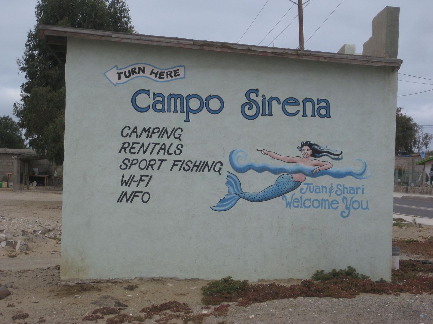
This is the sign pointing to Juan and Shari's campground just as you enter town.
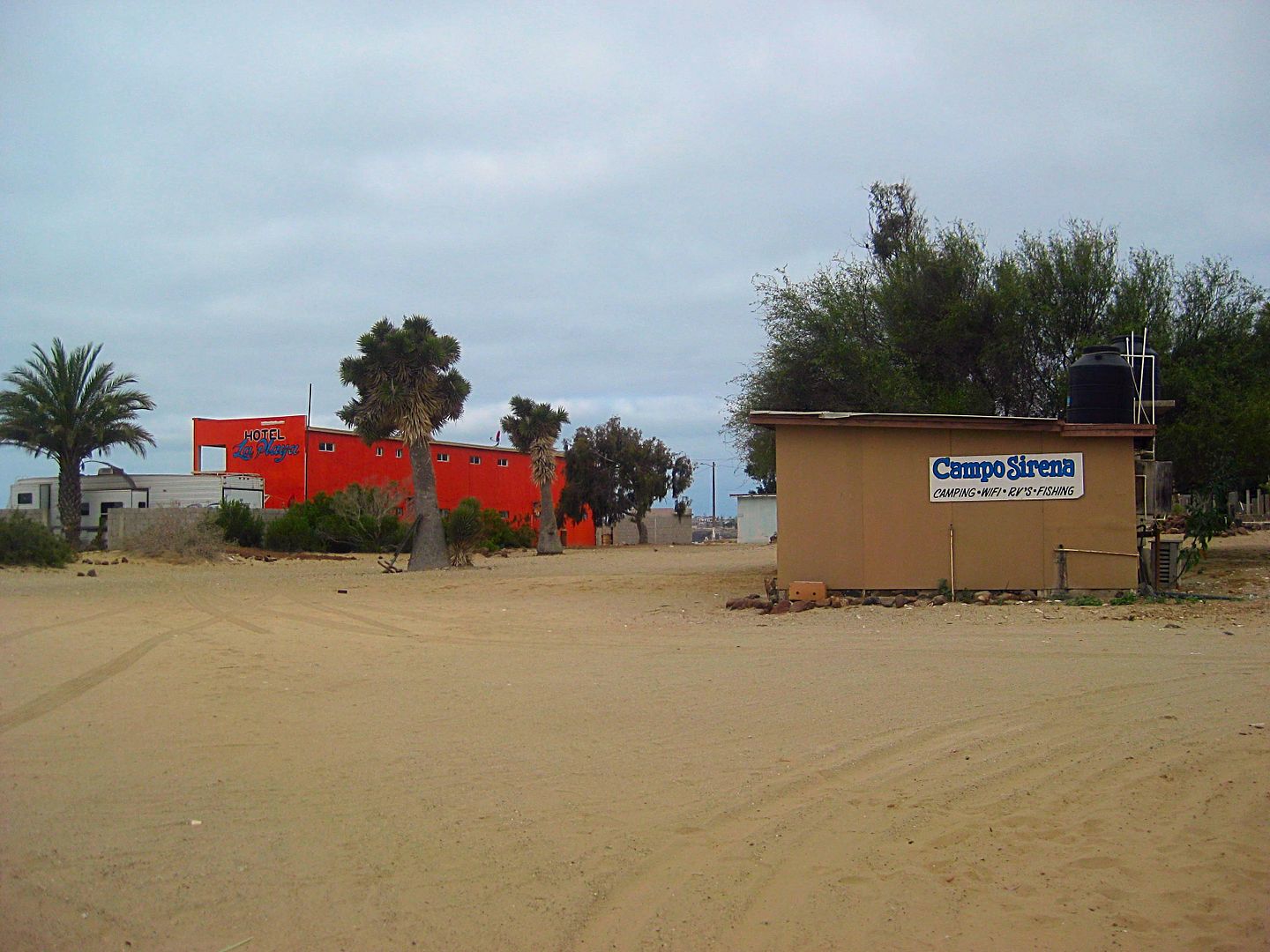
Mostly just a place to park near the beach with a bathroom/ shower and electricity. A new hotel is just beyond, the La Playa.
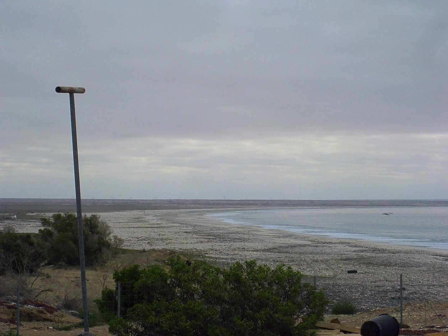
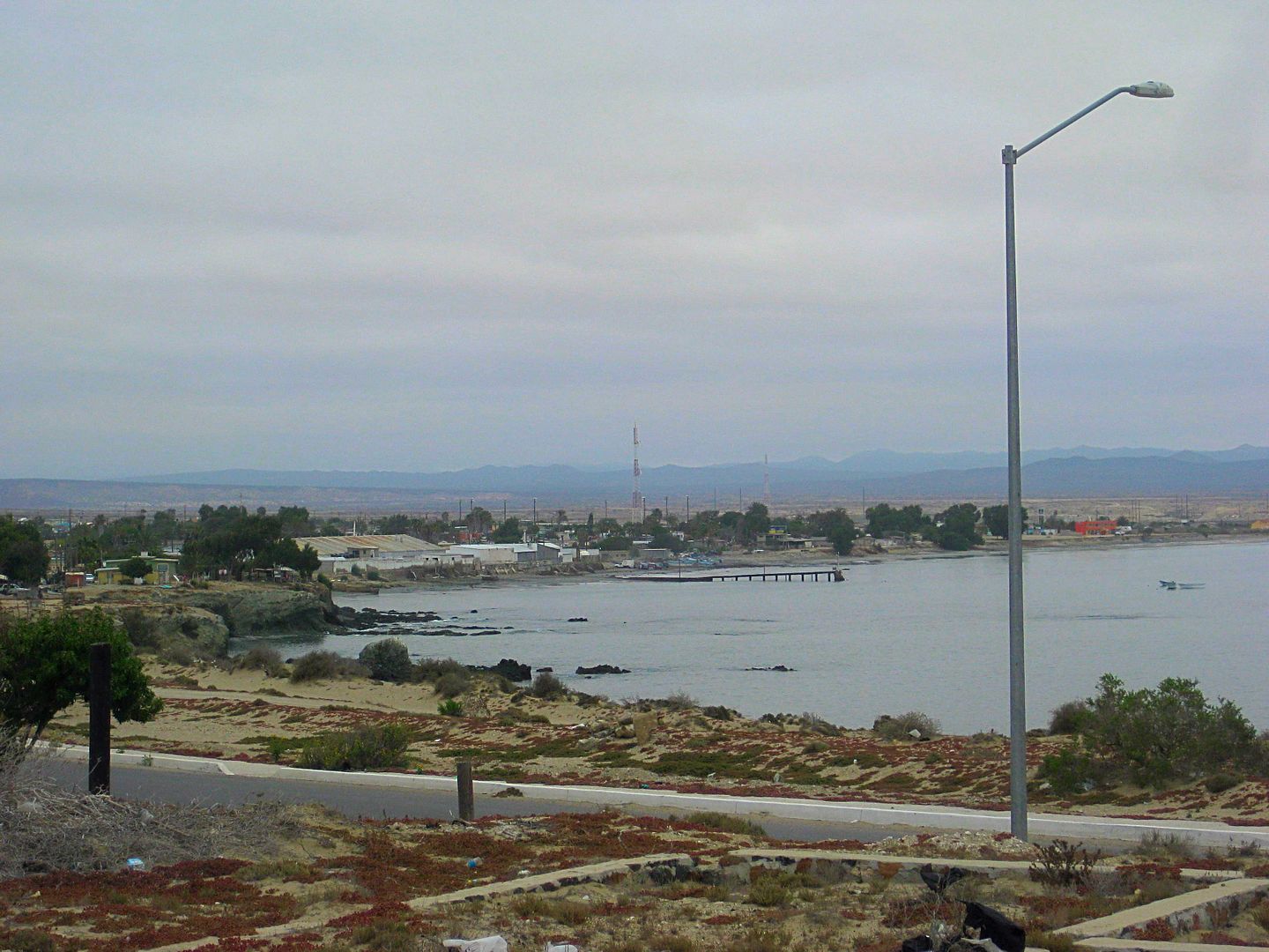
The beach at Campo Sirena and Bahía Asunción is endless!
Hotel La Playa (nobody was there).
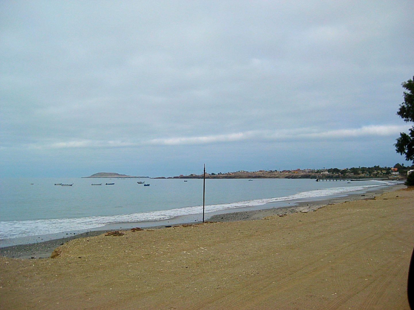
Looking back to Bahía Asunción and Asunción Island just off the point. Shari's place is on the other side of the point.
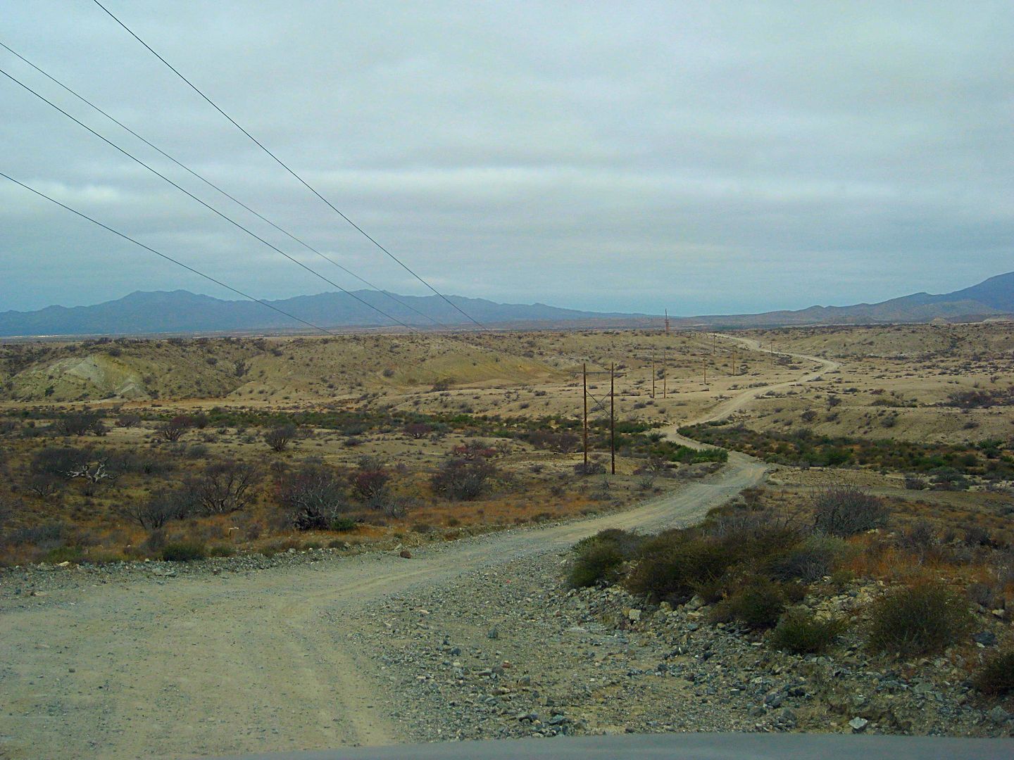
The direct (dirt) road to Tortugas from Asunción is mostly good and typically follows the power lines.
To find the unmarked road for Tortugas, head east on the paved road from the Asunción Pemex Gas Station for 0.3 mi (1/2 kilometer) to a curve in the
highway where the propane filling tank is located. The Tortugas road forks off to the left (northeast) at the curve. This would be Km. 38.5 if there
were half-kilometer signs.
Set odometer to 0.0 at the paved road/ Tortugas dirt road junction.
0.8 Fork to right for the airport. A newer airport road goes directly to the highway at Km. 37.
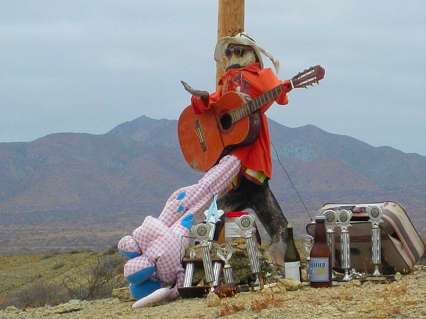
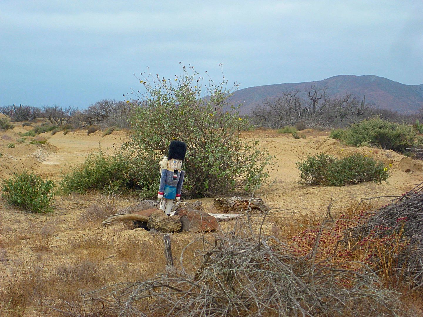
12.3 Road to the south (toy soldier photo).
21.6 Road south to Bahía San Cristóbal.
32.8 Abandoned buildings off to the right.
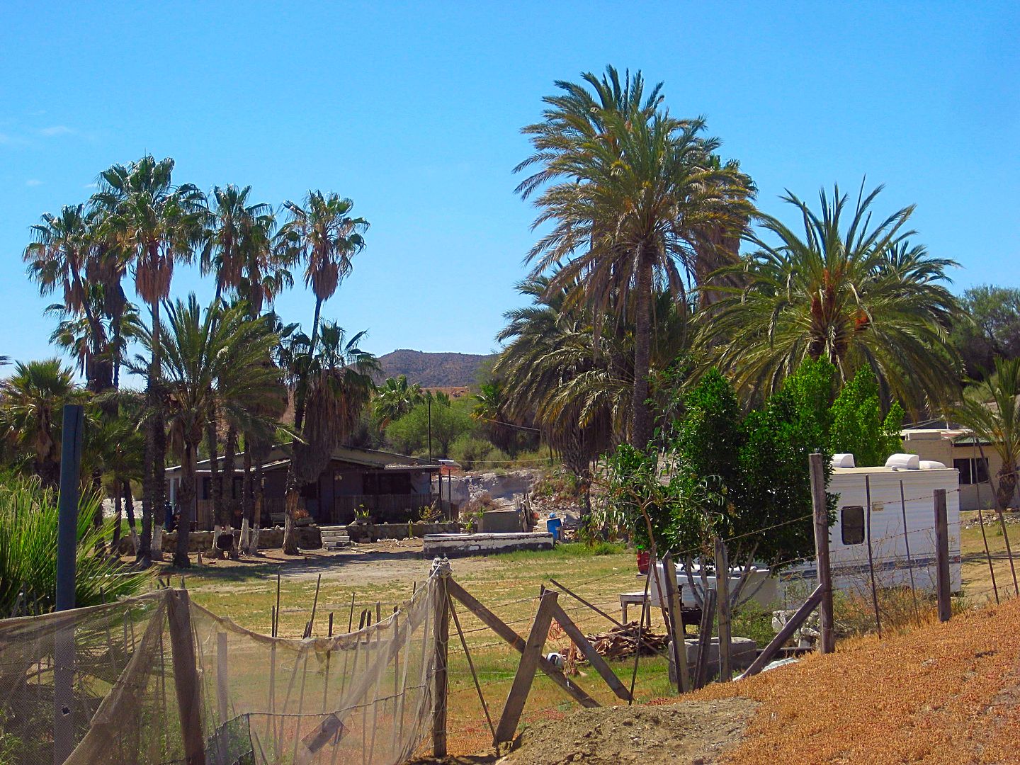
33.0 Rancho San José de Castro.
34.0 Tortugas/ Vizcaino Highway, Km. 117.5, Sign "Rancho San José"
Mexico is the amigo country!
Intersting 'monuments' along the way.
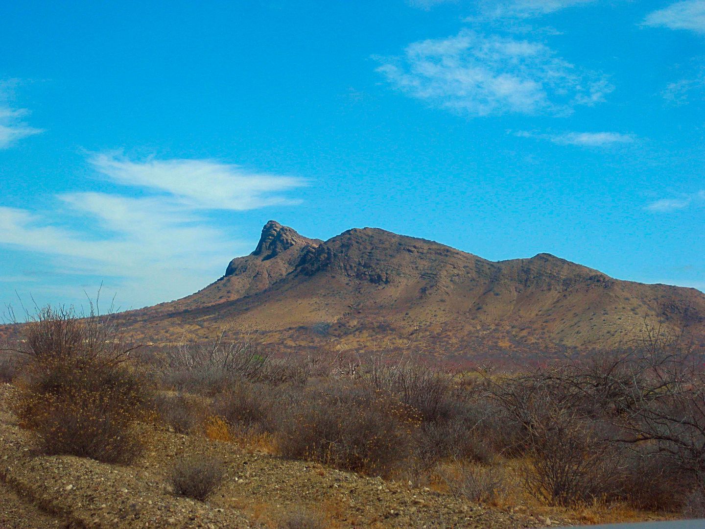
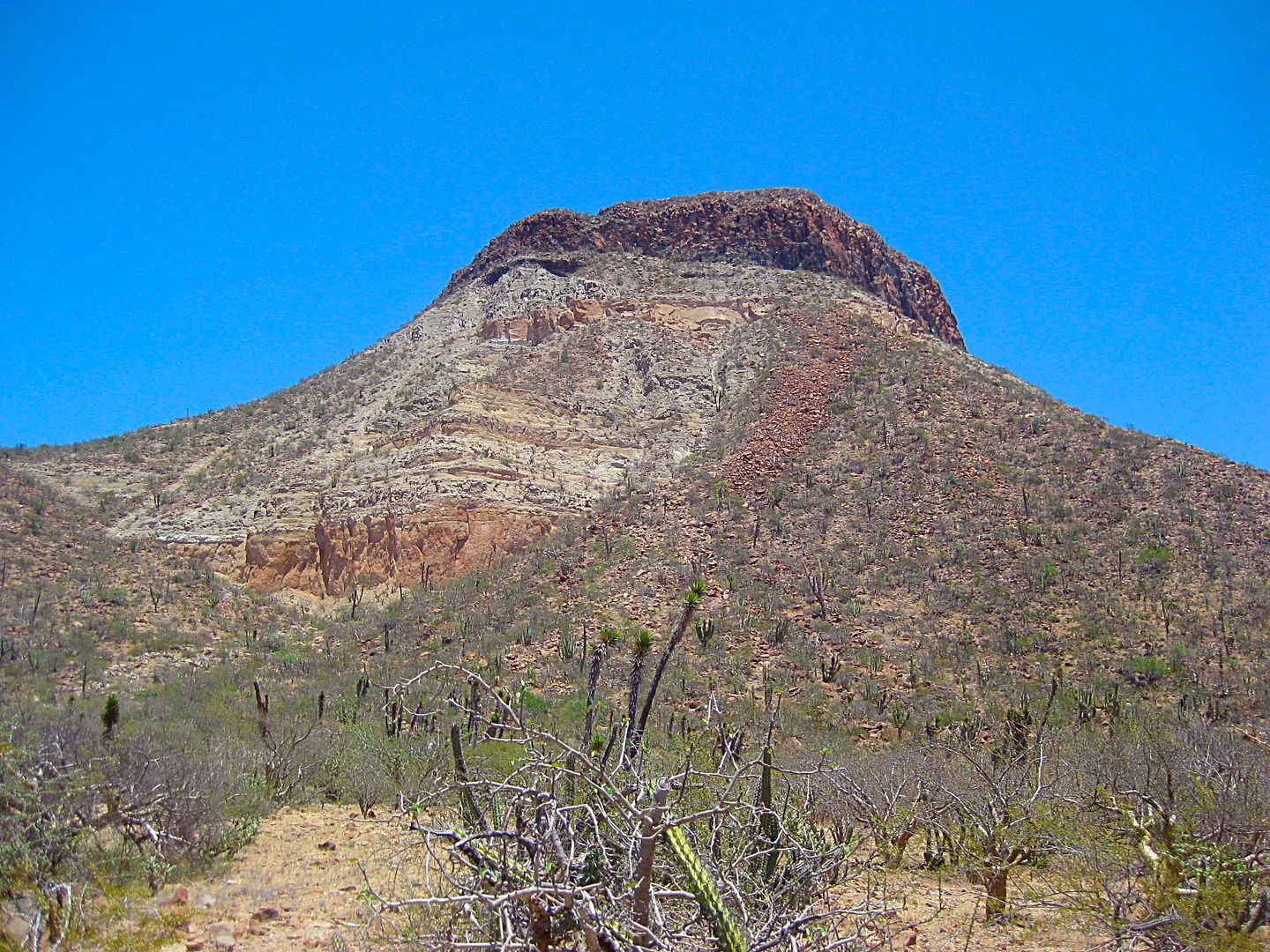
Near the end of the dirt section was this dramatic peak.
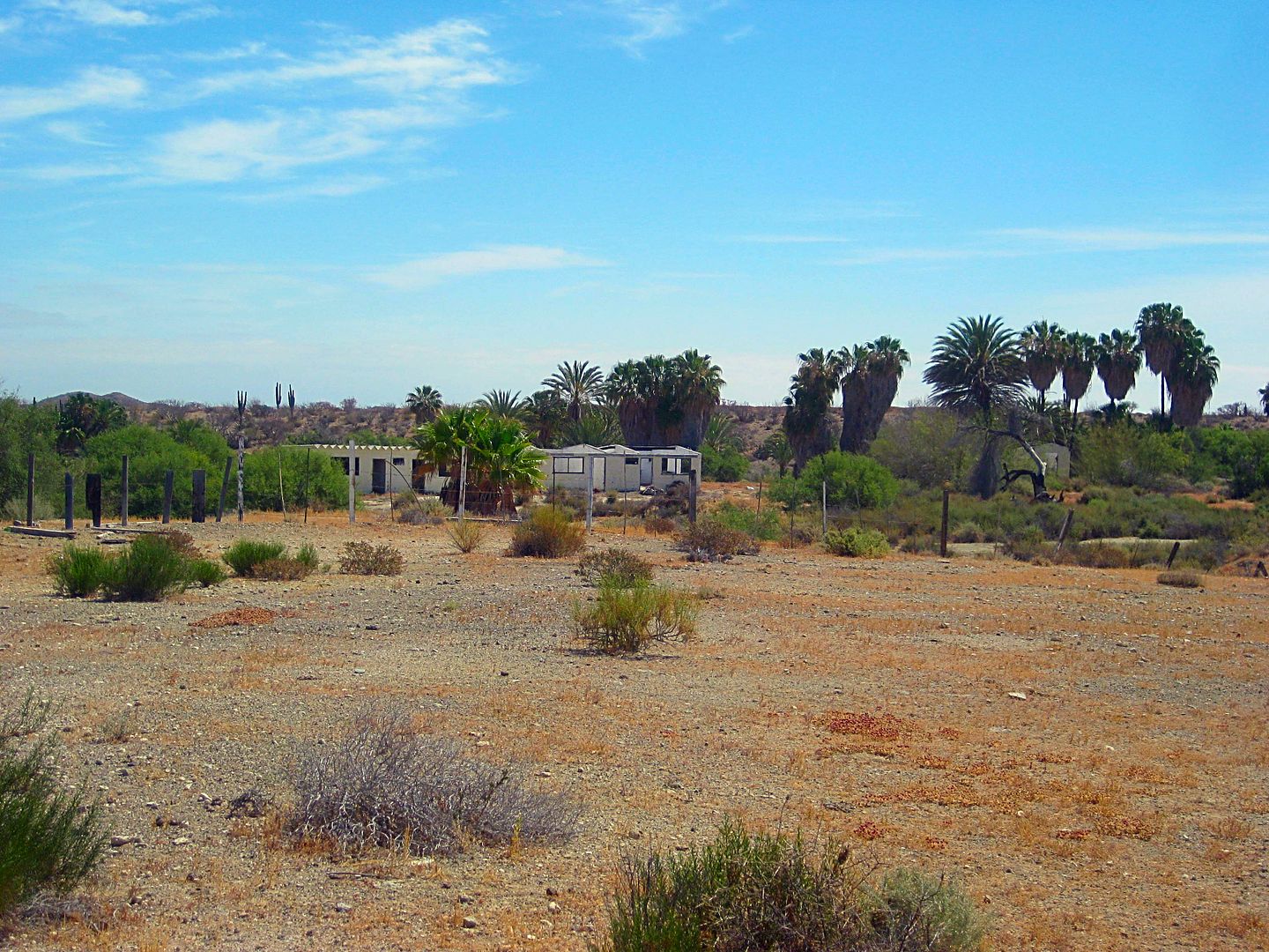
Some abandoned buildings are next to the working ranch of San José de Castro. The map shows a fork here with one branch going north to meet the
highway and the other continuing west to meet the highway in a couple miles. This day, the only traveled road curved north here, past the ranch
entrance, and met the highway in a mile.
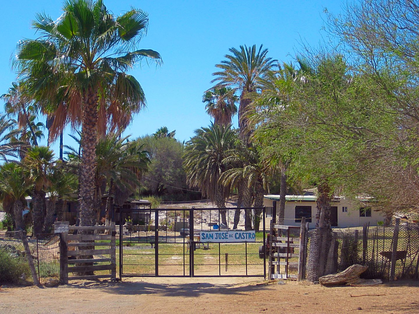
The highway between San José de Castro junction and Bahía Tortugas is all good and fast.
More to come!
|
|
|
norte
Super Nomad
Posts: 1163
Registered: 10-8-2008
Member Is Offline
|
|
Why don't you use GPS waypoints with the mile markers. seems to me this would keep people from getting lost a lot easier.
|
|
|
David K
Honored Nomad
Posts: 64479
Registered: 8-30-2002
Location: San Diego County
Member Is Offline
Mood: Have Baja Fever
|
|
The KILOMETER posts are physically there (most of the time) and no electronics needed to use them... that was my thinking.
To use GPS, one must go through the tedious work of downloading waypoints into the GPS (if you even have one).
As for the dirt road miles, most vehicles now have a trip odometer on their speedometer or can do an easy calculation with the odometer.
If there is any question or when the choice is not obvious I have included GPS in my trip reports. I thank you for your input and can add GPS to the
report. In the future Baja Bound online map, I am working on, every point of interest or important road junction has a GPS waypoint... so that is in
the works!
I can't get to everyplace this year, so contributions to the map and guide are welcomed!
|
|
|
| Pages:
1
2
3
4 |
|