| Pages:
1
2
3
4 |
PaulW
Ultra Nomad

Posts: 3004
Registered: 5-21-2013
Member Is Offline
|
|
Quote: Originally posted by David K  | The KILOMETER posts are physically there (most of the time) and no electronics needed to use them... that was my thinking.
To use GPS, one must go through the tedious work of downloading waypoints into the GPS (if you even have one).
= =
Murdock nav Gps maps for Garmin and Lowrnace have WPs for all federal highways KM markers.
= =
As for the dirt road miles, most vehicles now have a trip odometer on their speedometer or can do an easy calculation with the odometer.
= =
Yes your posted maps with miles are very helpful. I never do that due to to much down time to create the log. Keep up the good work.
= =
If there is any question or when the choice is not obvious I have included GPS in my trip reports. I thank you for your input and can add GPS to the
report. In the future Baja Bound online map, I am working on, every point of interest or important road junction has a GPS waypoint... so that is in
the works!
I can't get to everyplace this year, so contributions to the map and guide are welcomed! |
= =
I seldom use my many maps thees days since my GPS has so much more info and so many more roads. Every place I am at I have a coord readout and to
make a new WP it is just a button click. Takes a lot more time if the road I am on is not on the GPS map because the new WP needs a label.
PW
|
|
|
David K
Honored Nomad
Posts: 64476
Registered: 8-30-2002
Location: San Diego County
Member Is Offline
Mood: Have Baja Fever
|
|
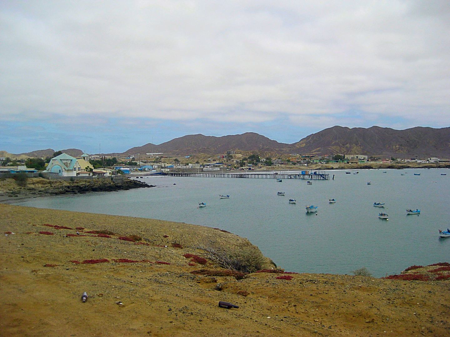
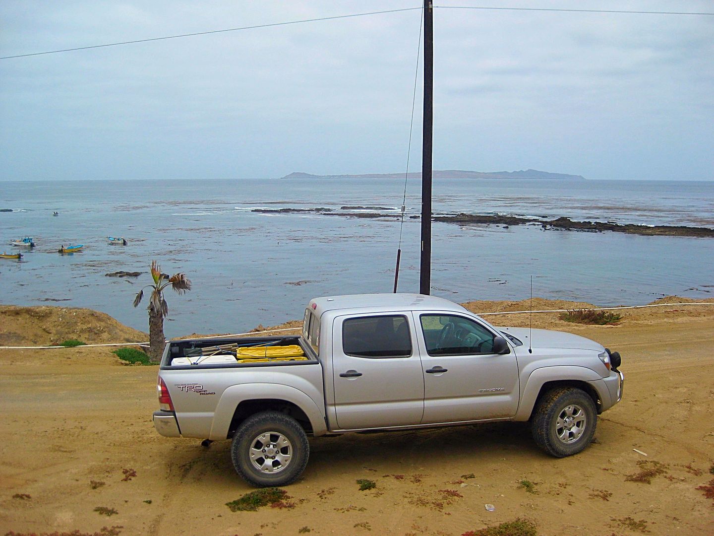
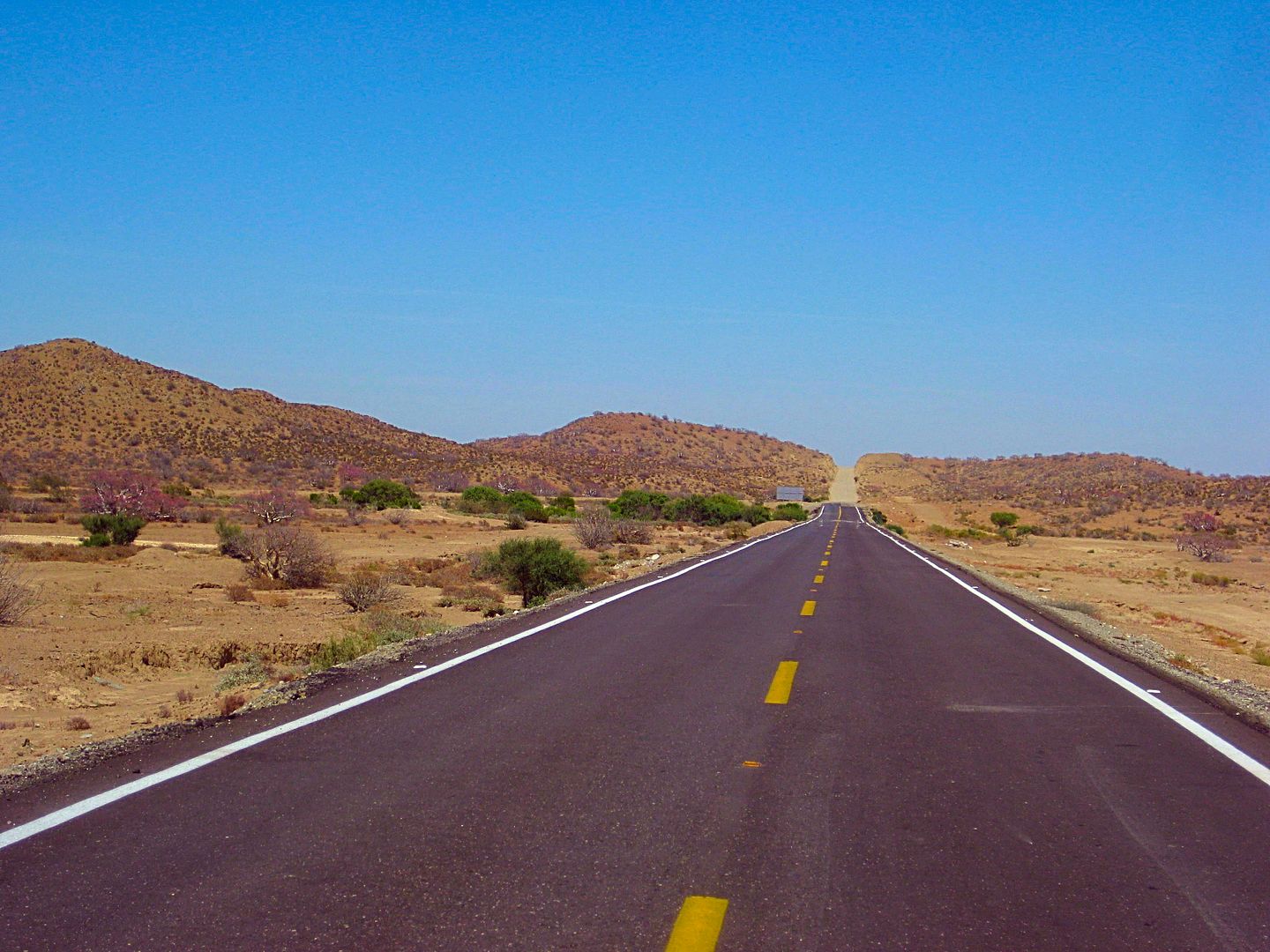
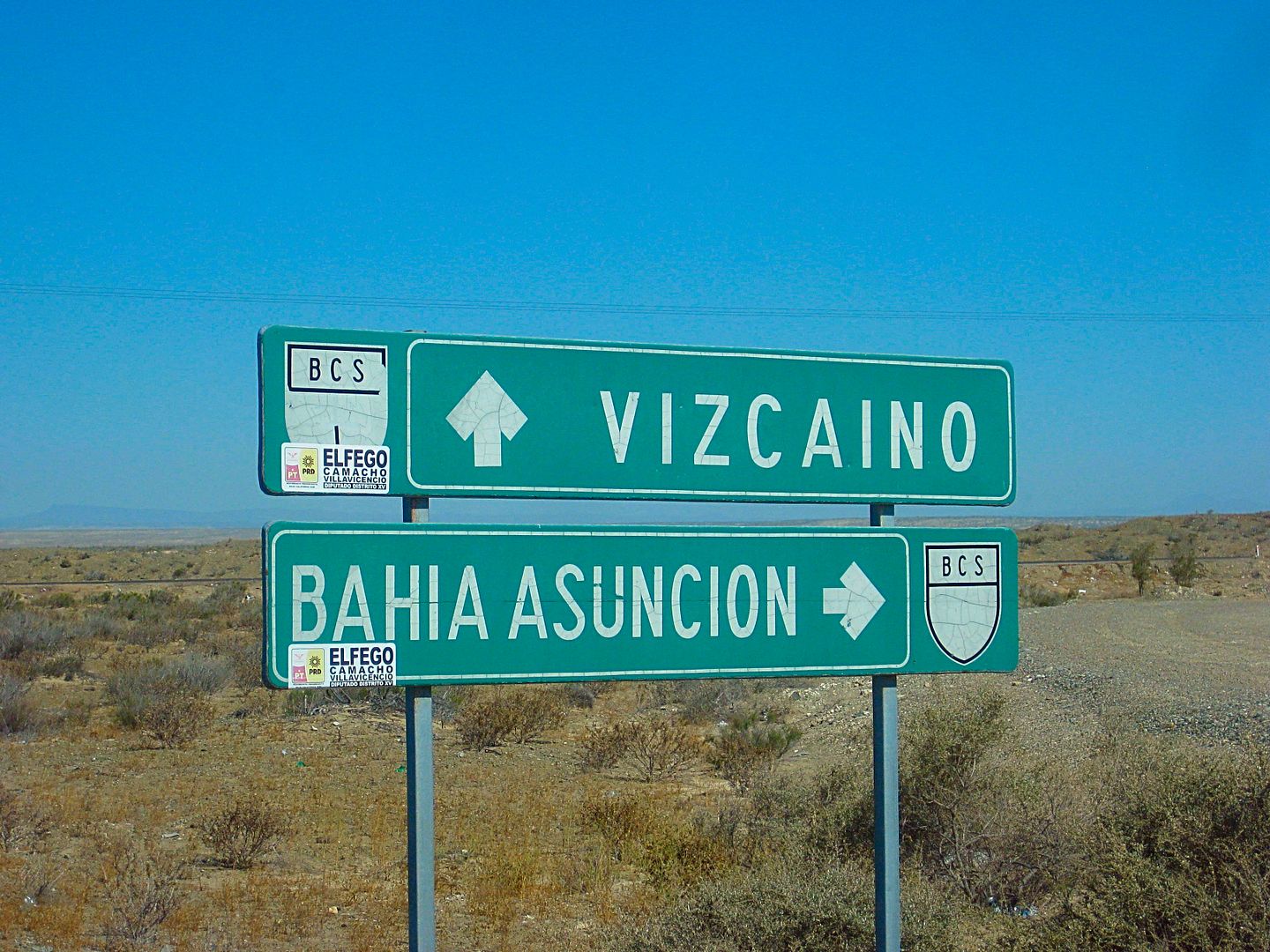
Bahía Tortugas June 6, 2017
It is almost 33 miles from the Rancho San José/ Bahía Asunción dirt road junction to the entrance to Bahía Tortugas. It is all well paved.
Km. 128 and 128.5 are turnoffs left to the coast at Puerto Nuevo. This sign was at the turnoff:
Approx Km. 168 or 24.5 miles after the above road junction is the road that heads northwest to fish camps, shown on maps as Malarrimo and El Queen.
The kilometer signs near the end of the highway are missing, but it would be Km. 172 at the entrance to Bahía Tortugas.
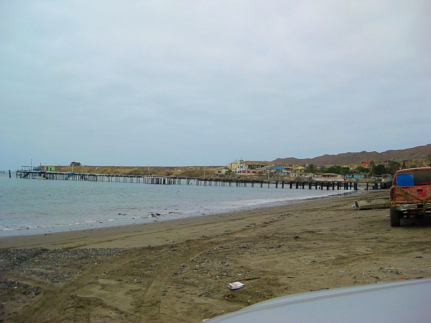
There is a Pemex station on the left but a busier and bigger one is a bit further in town and on another street paralleling just west (to the right).
Just 1/10 mile past the Pemex is the signed road right to Punta Eugenia.
It is a mile from the town entrance to the bay shore. I drove around a bit, spotted one hotel (Motel Rendon) and it was across from the Restaurant El
Moroco.
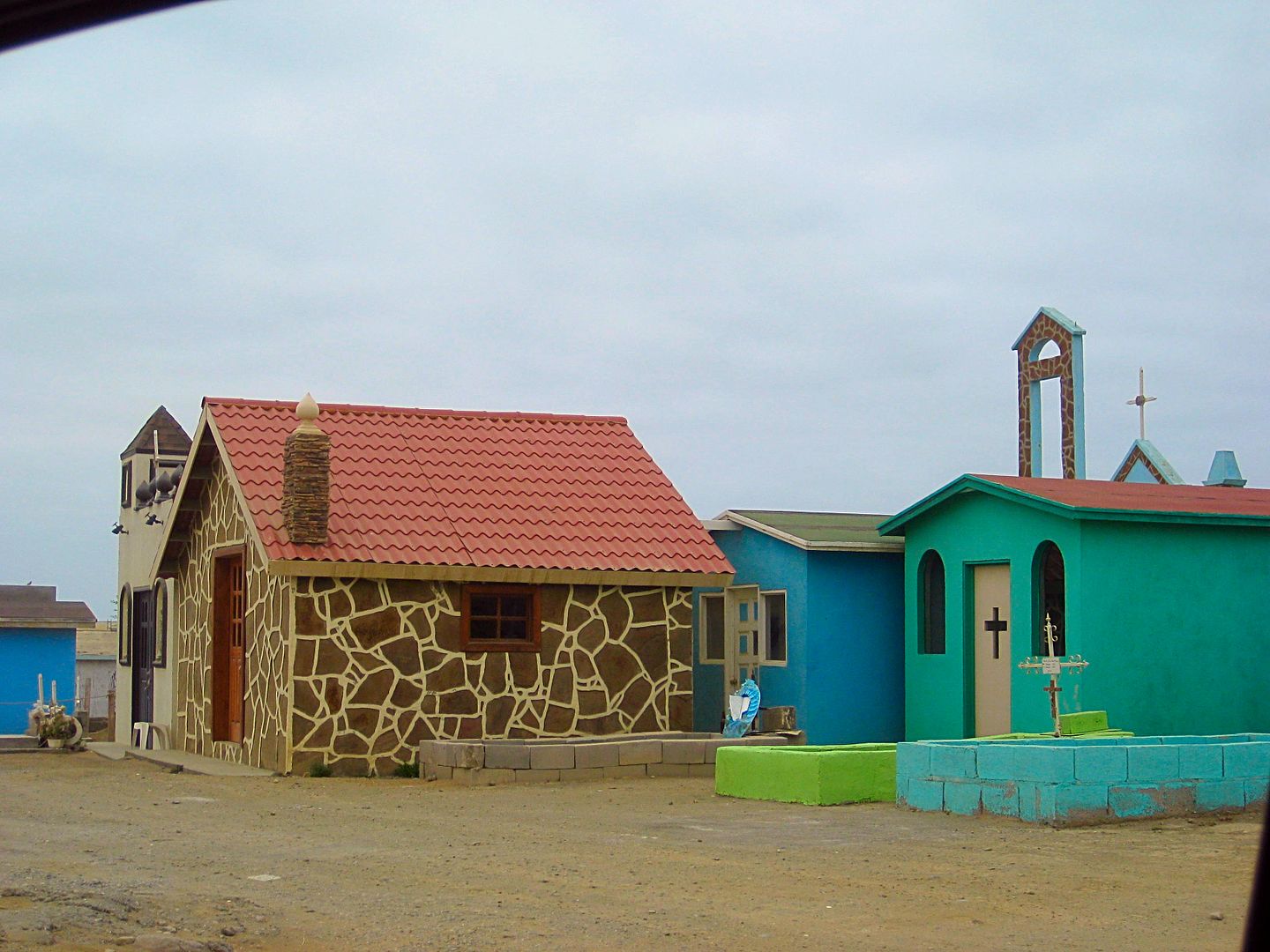
I drove over to a view spot just west and saw a 'City of the Dead', which is what a scaled down or mini town, over a cemetery, might be called.
Perhaps the most interesting thing I saw in this compact and busy little city (or big town) of Bahía Tortugas.
Some photos...
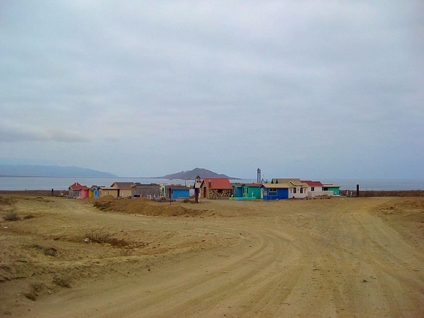
'City of the Dead'
View back east to the town from just beyond the cemetery.
Now, it was on to Punta Eugenia, the tip of Baja's big hook into the Pacific.
|
|
|
norte
Super Nomad
Posts: 1163
Registered: 10-8-2008
Member Is Offline
|
|
City of the dead??? Mexicans (and people in other countries) have been enclosing their gravesites for years...it does not resemble a little city.
|
|
|
Barry A.
Select Nomad
Posts: 10007
Registered: 11-30-2003
Location: Redding, Northern CA
Member Is Offline
Mood: optimistic
|
|
"City of the dead". I know exactly what you mean, David as I have spent time there also. Great reports!!!
|
|
|
norte
Super Nomad
Posts: 1163
Registered: 10-8-2008
Member Is Offline
|
|
| Quote: Originally posted by David K |
There is a Pemex station on the left but a busier and bigger one is a bit further in town and on another street paralleling just west (to the right).
Just 1/10 mile past the Pemex is the signed road right to Punta Eugenia.
It is a mile from the town entrance to the bay shore. I drove around a bit, spotted one hotel (Motel Rendon) and it was across from the Restaurant El
Moroco.
|
If this is going to be a travel guide wouldn't it have been worth someones while to get out and ask questions. I am sure there are more hotels and
restaurants there? Just a suggestion.
|
|
|
Bajaboy
Ultra Nomad
Posts: 4375
Registered: 10-9-2003
Location: Bahia Asuncion, BCS, Mexico
Member Is Offline
|
|
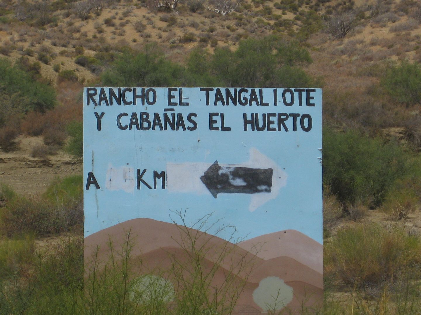
Tangaliote is a secret gem. Great place and wonderful people!
| Quote: Originally posted by David K | It is almost 33 miles from the Rancho San José/ Bahía Asunción dirt road junction to the entrance to Bahía Tortugas. It is all well paved.
Km. 128 and 128.5 are turnoffs left to the coast at Puerto Nuevo. This sign was at the turnoff:
Approx Km. 168 or 24.5 miles after the above road junction is the road that heads northwest to fish camps, shown on maps as Malarrimo and El Queen.
The kilometer signs near the end of the highway are missing, but it would be Km. 172 at the entrance to Bahía Tortugas.
There is a Pemex station on the left but a busier and bigger one is a bit further in town and on another street paralleling just west (to the right).
Just 1/10 mile past the Pemex is the signed road right to Punta Eugenia.
It is a mile from the town entrance to the bay shore. I drove around a bit, spotted one hotel (Motel Rendon) and it was across from the Restaurant El
Moroco.
I drove over to a view spot just west and saw a 'City of the Dead', which is what a scaled down or mini town, over a cemetery, might be called.
Perhaps the most interesting thing I saw in this compact and busy little city (or big town) of Bahía Tortugas.
Some photos...
'City of the Dead'
View back east to the town from just beyond the cemetery.
Now, it was on to Punta Eugenia, the tip of Baja's big hook into the Pacific. |
|
|
|
David K
Honored Nomad
Posts: 64476
Registered: 8-30-2002
Location: San Diego County
Member Is Offline
Mood: Have Baja Fever
|
|
| Quote: Originally posted by norte | | Quote: Originally posted by David K |
There is a Pemex station on the left but a busier and bigger one is a bit further in town and on another street paralleling just west (to the right).
Just 1/10 mile past the Pemex is the signed road right to Punta Eugenia.
It is a mile from the town entrance to the bay shore. I drove around a bit, spotted one hotel (Motel Rendon) and it was across from the Restaurant El
Moroco.
|
If this is going to be a travel guide wouldn't it have been worth someones while to get out and ask questions. I am sure there are more hotels and
restaurants there? Just a suggestion. |
Sorry, no, this is a TRIP REPORT.
The data gathered may become part of a travel guide, one that will be 'living' and easily edited for new or changing information. Despite a few here
who claim otherwise, my goal is only to give glimpses or hints as to what's down a road and not expose everything there. In addition to my notes on
what I saw, GPS points are being recorded noting things like gas stations, banks, hotels, campgrounds, historic sites, points of interest, road
junctions, etc.
There is only so much I can do each day with the budgeted amount of time available to cover the peninsula this year. Future trips by myself or
others can fill in the gaps or modify the data. I am just getting this project off the ground and Baja Bound Insurance will have a great
resource for their traveling clients to take advantage of.
|
|
|
David K
Honored Nomad
Posts: 64476
Registered: 8-30-2002
Location: San Diego County
Member Is Offline
Mood: Have Baja Fever
|
|
Thanks for that! Is the name Puerto Nuevo used in there at all (as shown on maps) or is Tangaliote a campground in Puerto Nuevo?
|
|
|
David K
Honored Nomad
Posts: 64476
Registered: 8-30-2002
Location: San Diego County
Member Is Offline
Mood: Have Baja Fever
|
|
To Punta Eugenia
Set odometer to 0.0 at the signed junction to Punta Eugenia on the Tortugas entrance road, 0.1 mi south of Pemex.
0.1 Cross Street The road to Punta Eugenia angles to the right, heading northwest. Left on this cross street goes to the larger Pemex gas station and
eventually out to the cemetery in 1 mile.
7.2 Road south to coast.
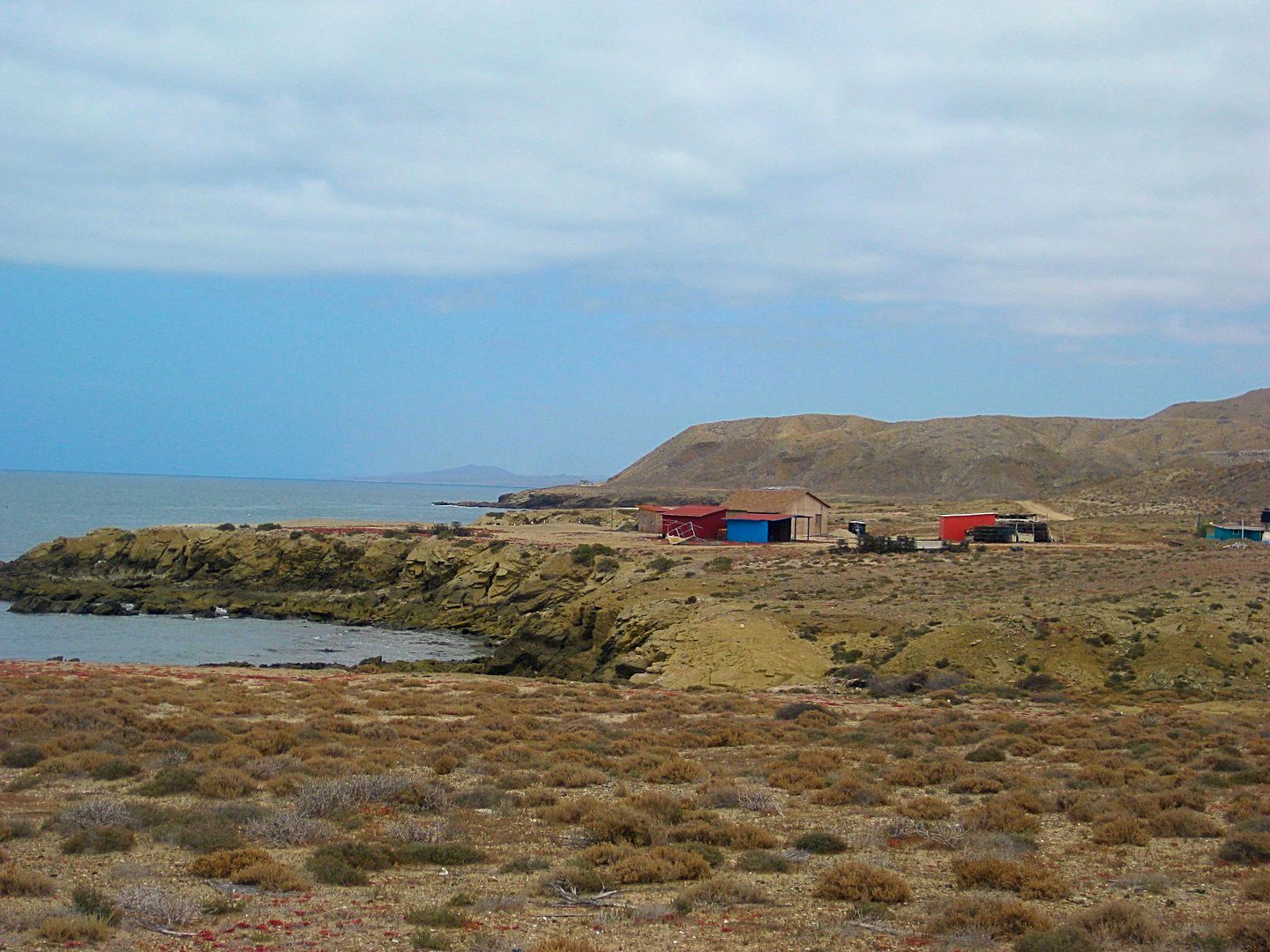
16.0 Punta Eugenia, town, boat launch, transport across to Isla Navidad, a popular surfing location.
17.8 Punta Falsa. Several ruined palapas once served campers here. A fishing camp is just east. View north of Isla Cedros and the salt hill where salt
from the Guerrero Negro facility is barged out to Cedros Island. There it is then transported onto large ocean ships.
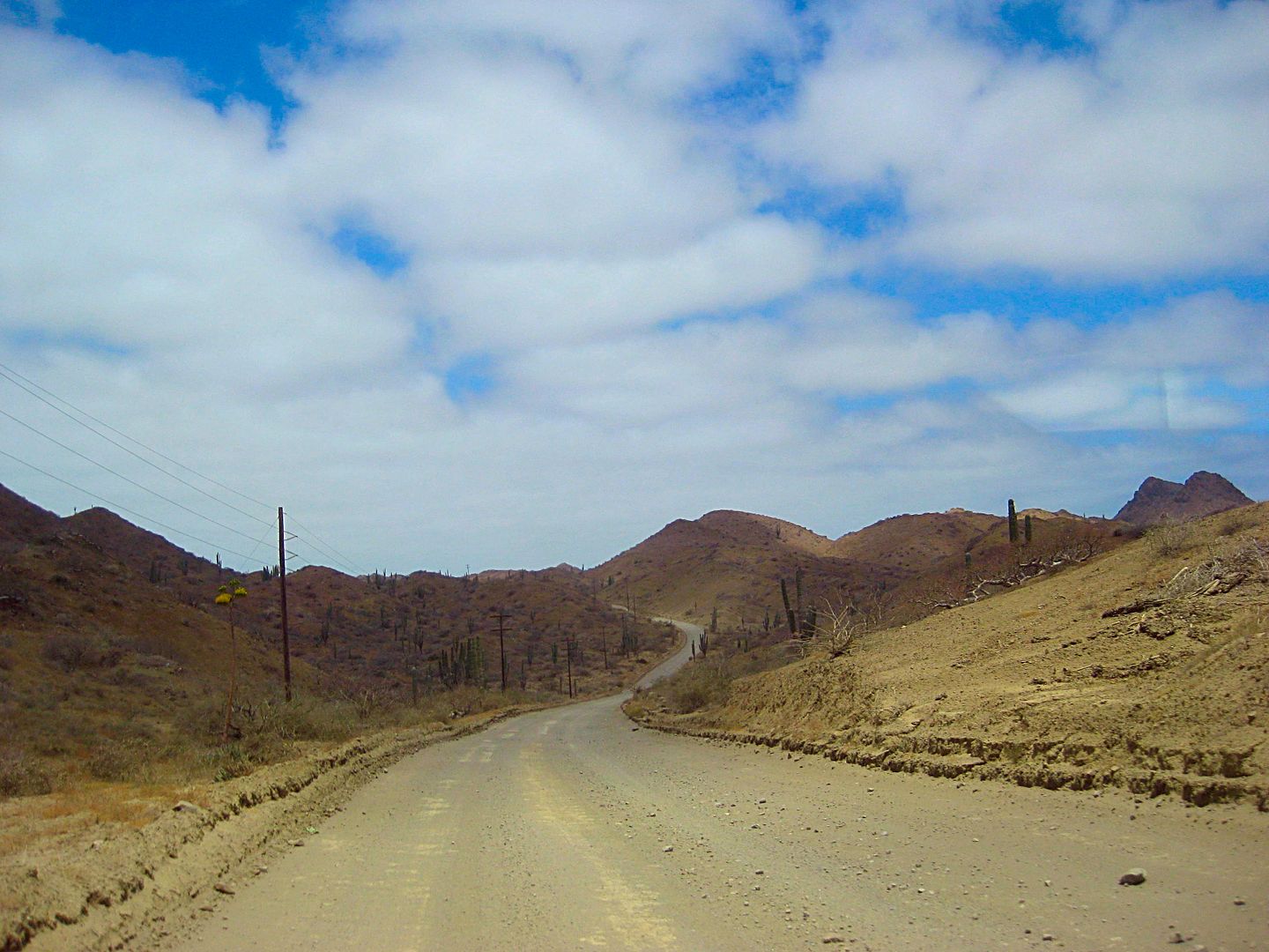
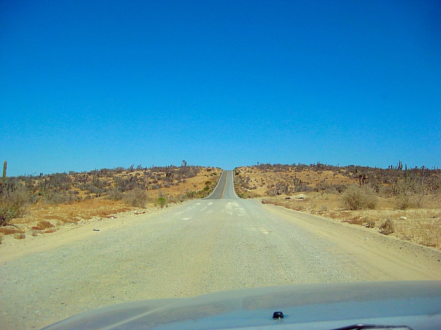
Except for the part close to Bahía Tortugas, the road out to Punta Eugenia is excellent.
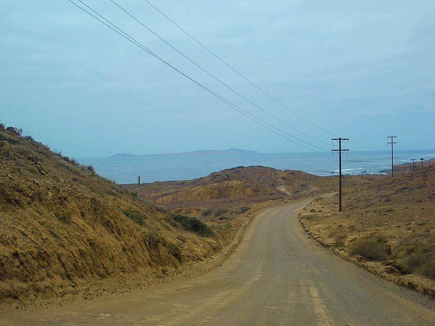
Isla Natividad is only 5 miles offshore from the point, ahead.
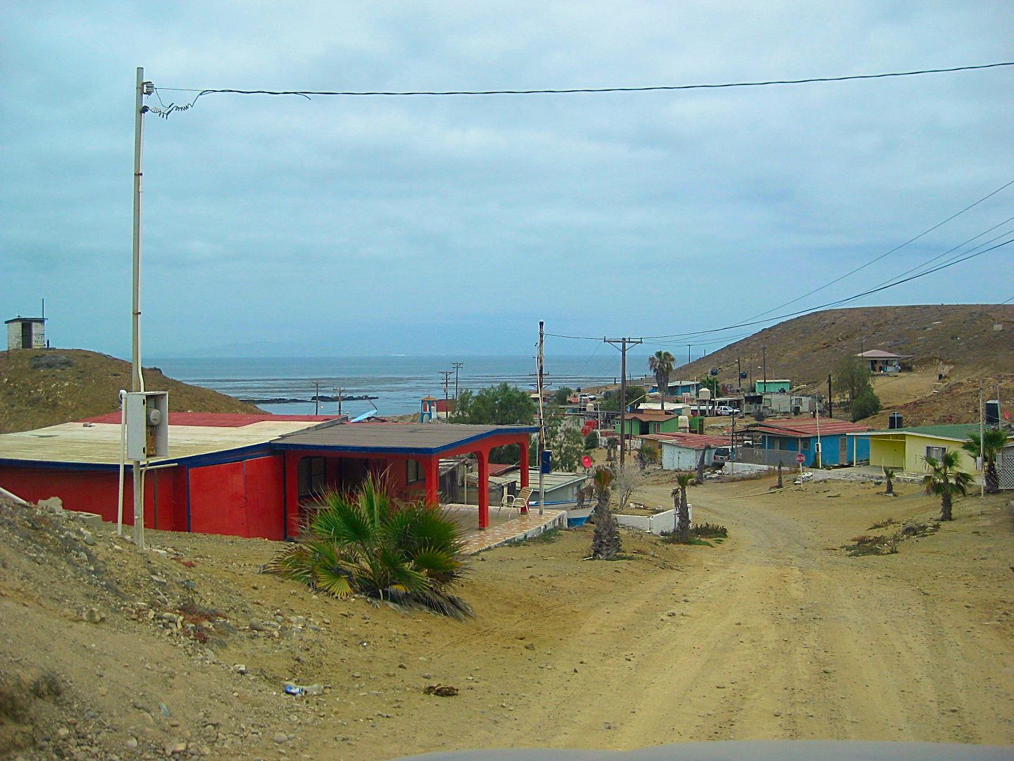
The town of Punta Eugenia
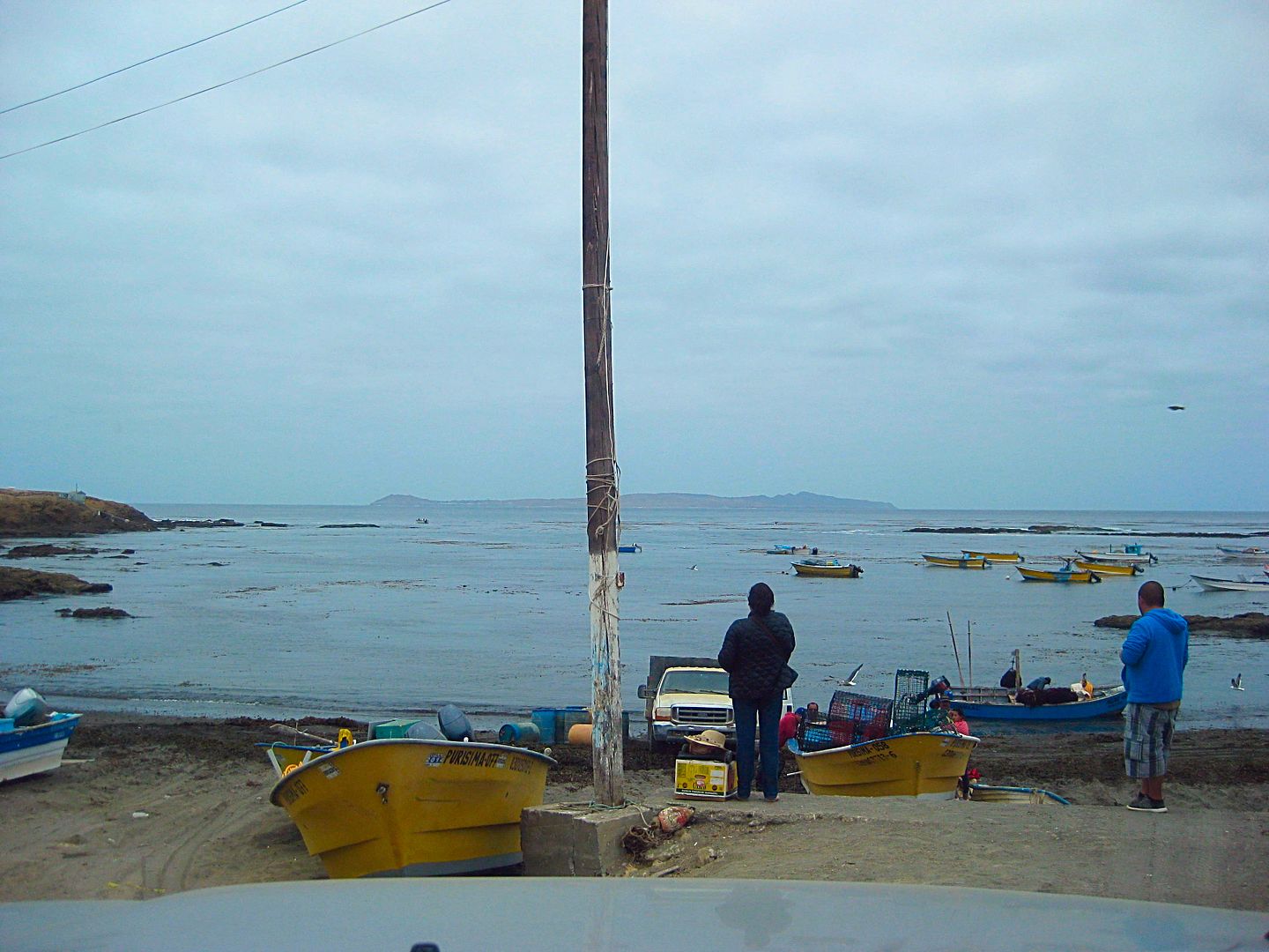
Boat launch at Eugenia. Isla Natividad just 5 miles away.
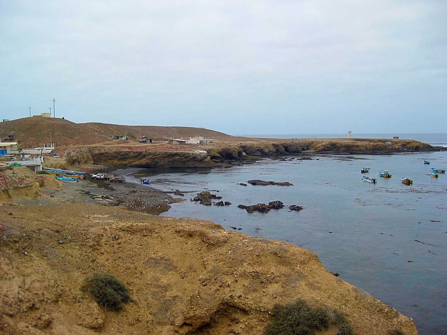
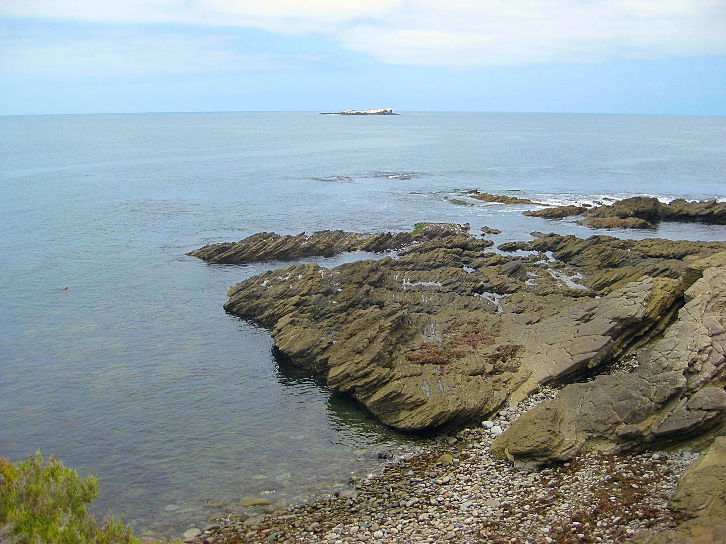
Looking back at the harbor of Punta Eugenia from the road to Punta Falsa.
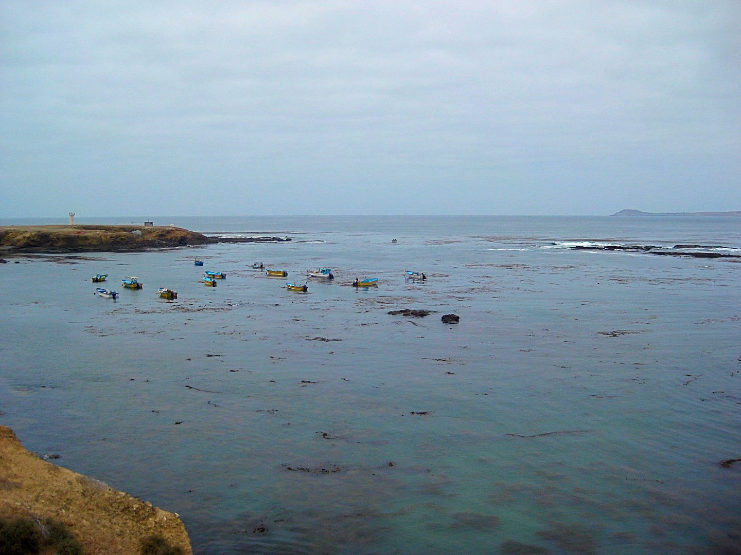
A reef creates a natural breakwater.
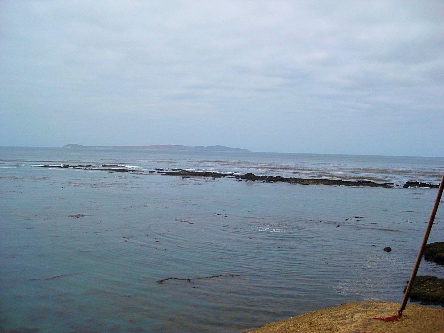
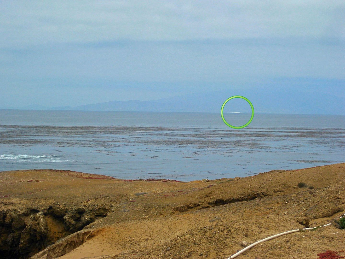
Isla Cedros, to the north of Punta Falsa. I added the circle around the salt hill.
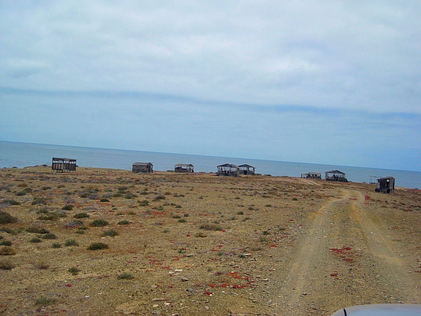
Abandoned palapa campground in ruins.
Shore below the palapas at Punta Falsa.
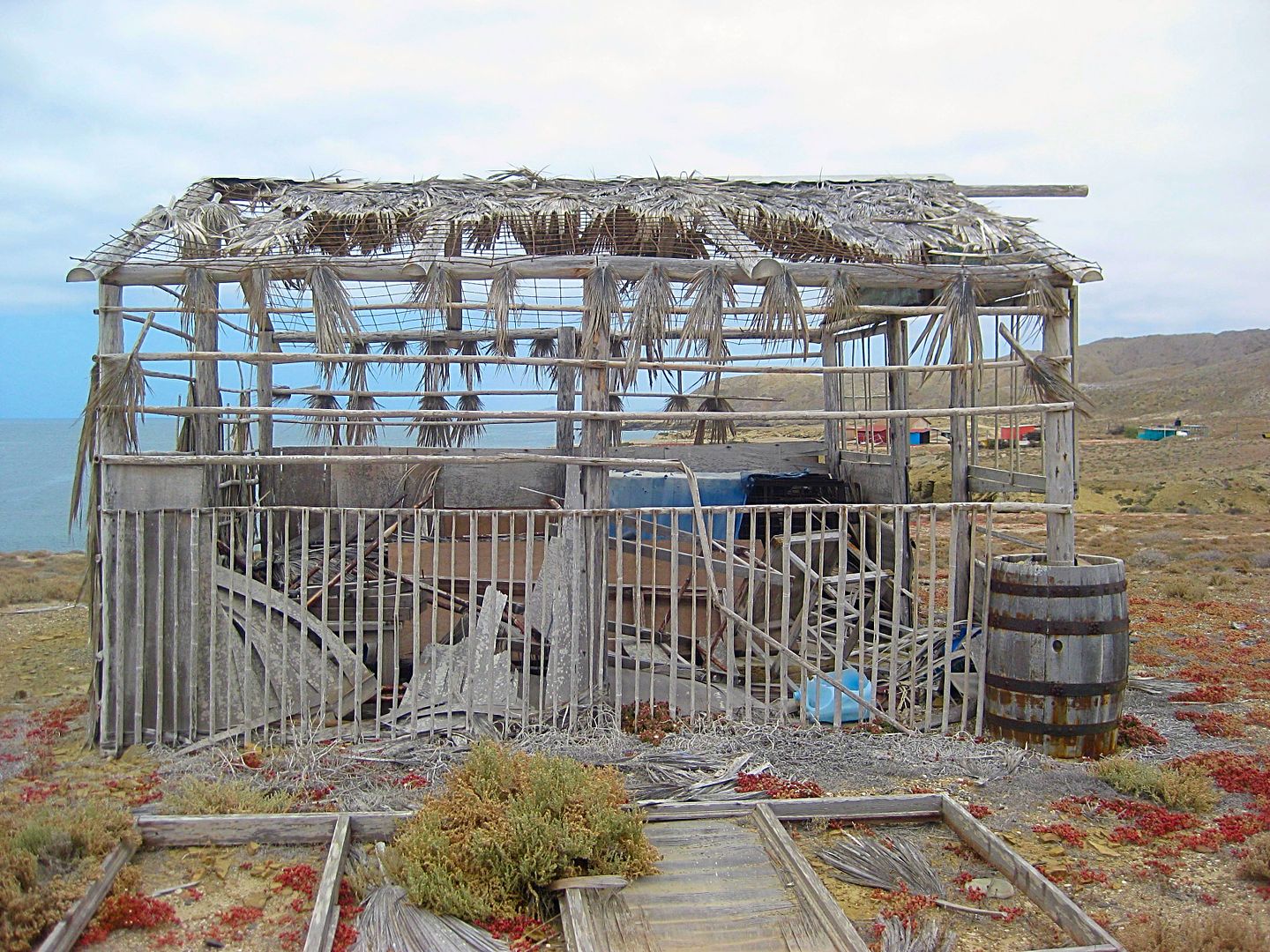
Punta Falsa fish camp.
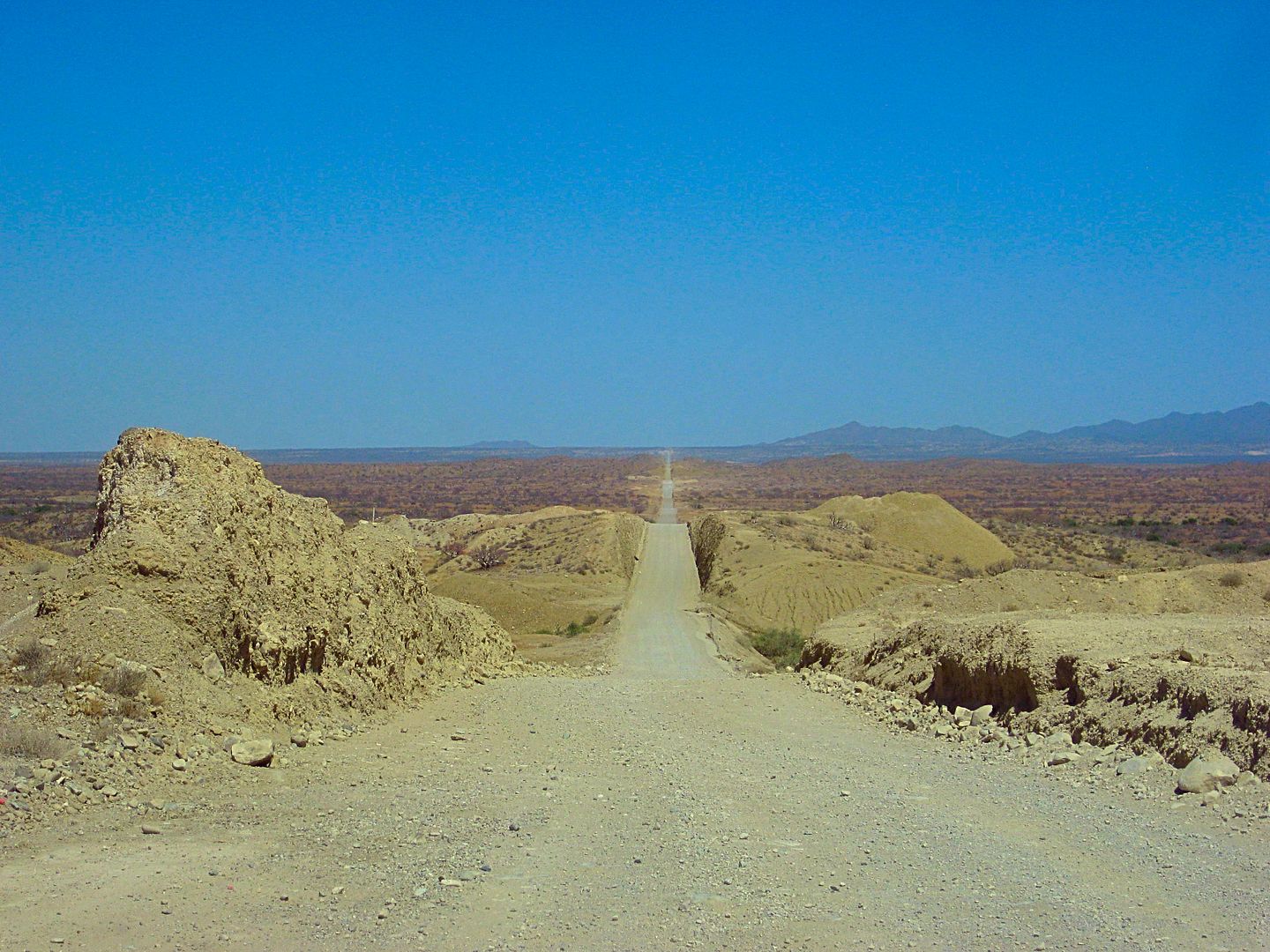
Heading back to Bahía Tortugas...
Excellent dirt road.
Coming up next... Can I get to Malarrimo Beach today?
|
|
|
barcodemarco
Junior Nomad
Posts: 58
Registered: 6-14-2015
Location: Oceanside
Member Is Offline
|
|
REALLY enjoy your trip reports and photos David. Thanks for taking us along for the ride! Looking forward to seeing Mallarimo. Been intrigued since
reading about Grahams visit way back when. There used to be a restaurant in Guerrero named after that beach. Great Chocolate clams. Maybe its
still there?
|
|
|
David K
Honored Nomad
Posts: 64476
Registered: 8-30-2002
Location: San Diego County
Member Is Offline
Mood: Have Baja Fever
|
|
Thank you for the reply... sadly, I didn't make it to Malarrimo Beach. A lack of time and a slow, overgrown road within a mile of the highway had me
postpone the attempt to a future date.
The Malarrimo Hotel and Restaurant are still in business.
We moved from Oceanside to San Marcos, four years ago. I lived in Oceanside for 14 years, out past the mission.
[Edited on 10-17-2017 by David K]
|
|
|
acadist
Super Nomad
Posts: 1125
Registered: 3-31-2007
Location: Spanaway,WA
Member Is Offline
Mood: Waiting for the Sun
|
|
Great trip report ( as always! ) David, just one question for now. What does gas cost in SD? I get about 500 miles to a tank and wondering if it is
worth the time to make sure to top off before crossing.
Dave
I moved to CO and they made me buy a little rod to make it feel like a real fish
|
|
|
David K
Honored Nomad
Posts: 64476
Registered: 8-30-2002
Location: San Diego County
Member Is Offline
Mood: Have Baja Fever
|
|
Costco is about $2.60/gal last week and ARCO about $2.80 and the other brand stations (Shell, Chevron, etc) are from $2.99 and up. Some are well over
$3.30 to $3.50.
|
|
|
kevin_in_idaho
Nomad
Posts: 143
Registered: 12-13-2016
Member Is Offline
|
|
Punta Eugenia looks like a great place; the kind of place we like to go to but not sure what all there is do there, if there's any services,
restaurants, etc. Too bad the camping palapas are in ruins.
Mallarrimo Beach sounds good too and will await some future trip report.
Impossible to answer (I know) but do you have a top-10 places in Baja you like?
|
|
|
David K
Honored Nomad
Posts: 64476
Registered: 8-30-2002
Location: San Diego County
Member Is Offline
Mood: Have Baja Fever
|
|
| Quote: Originally posted by kevin_in_idaho | Punta Eugenia looks like a great place; the kind of place we like to go to but not sure what all there is do there, if there's any services,
restaurants, etc. Too bad the camping palapas are in ruins.
Mallarrimo Beach sounds good too and will await some future trip report.
Impossible to answer (I know) but do you have a top-10 places in Baja you like?
|
Baja has so many different places for different purposes. Here are 10 places I could easily go back to multiple times, and have:
*As you may know, for all out relaxing on the beach and doing nothing, without any need for any services or facilities, and within an easy day drive
from home, it is Shell Island for us.
*For its tropical appeal, Mulegé, and Bahía Concepción.
*Loreto and
*La Paz, for nice tropical cities.
*For a nice Pacific side retreat and nice people, it's Juan & Shari at Bahía Asunción.
*For a beautiful location on the sea with history all around, it's Bahía de los Angeles.
*A very special place for me, beautiful beach and interesting desert around, it is Gonzaga Bay.
*A town most people blow through but has interesting sites all around and a great friend who owns the Pemex and Baja Cactus Motel is El Rosario.
*Exotic and very hard to get to, Mission Santa María de los Angeles.
*Fascinating, great people (José), and easy to get to Mission San Borja.
|
|
|
barcodemarco
Junior Nomad
Posts: 58
Registered: 6-14-2015
Location: Oceanside
Member Is Offline
|
|
It sounds like a very difficult place to get to. San Marcos is a good spot. We are practically neighbors!
|
|
|
barcodemarco
Junior Nomad
Posts: 58
Registered: 6-14-2015
Location: Oceanside
Member Is Offline
|
|
Did you check out the lagoon north of Abreojos? Wondering if it would be a good spot to camp and launch a small boat. I understand there is a little
fish camp near the mouth on the north side.
|
|
|
David K
Honored Nomad
Posts: 64476
Registered: 8-30-2002
Location: San Diego County
Member Is Offline
Mood: Have Baja Fever
|
|
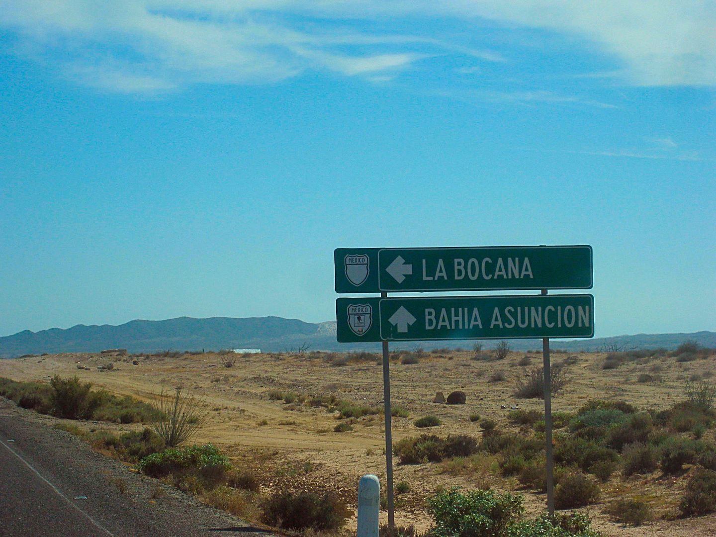
The town of La Bocana and the 10 mile long lagoon is northwest and Campo Rene and Estero El Coyote is northeast. I went to both in my trip report plus
I have other trip photos at both places.
|
|
|
kevin_in_idaho
Nomad
Posts: 143
Registered: 12-13-2016
Member Is Offline
|
|
| Quote: Originally posted by David K | | Quote: Originally posted by kevin_in_idaho | Punta Eugenia looks like a great place; the kind of place we like to go to but not sure what all there is do there, if there's any services,
restaurants, etc. Too bad the camping palapas are in ruins.
Mallarrimo Beach sounds good too and will await some future trip report.
Impossible to answer (I know) but do you have a top-10 places in Baja you like?
|
Baja has so many different places for different purposes. Here are 10 places I could easily go back to multiple times, and have:
*As you may know, for all out relaxing on the beach and doing nothing, without any need for any services or facilities, and within an easy day drive
from home, it is Shell Island for us.
*For its tropical appeal, Mulegé, and Bahía Concepción.
*Loreto and
*La Paz, for nice tropical cities.
*For a nice Pacific side retreat and nice people, it's Juan & Shari at Bahía Asunción.
*For a beautiful location on the sea with history all around, it's Bahía de los Angeles.
*A very special place for me, beautiful beach and interesting desert around, it is Gonzaga Bay.
*A town most people blow through but has interesting sites all around and a great friend who owns the Pemex and Baja Cactus Motel is El Rosario.
*Exotic and very hard to get to, Mission Santa María de los Angeles.
*Fascinating, great people (José), and easy to get to Mission San Borja.
|
We made it a lot of those places on our last trip Jan/Feb and they were great! Thanks!
|
|
|
David K
Honored Nomad
Posts: 64476
Registered: 8-30-2002
Location: San Diego County
Member Is Offline
Mood: Have Baja Fever
|
|
Malarrimo = 'Bad to be near'
Back on the pavement on the north edge of Bahía Tortugas heading east, I double check my odometer mileage and kilometer post notes.
[The K figures in these brackets are what the Km. position should be IF there were kilometer markers nearby]
0.0 Punta Eugenia signed road at the pavement, Bahía Tortugas. [K172.5]
0.1 Pemex station[K172+]
1.7 Road off to the northeast for fish camps 'Malarrimo' and 'El Queen' (not signed). [K169.5]
2.0 Road south to El Rincon and Bahía Cambrey (not signed). [K169+]
2.7 Km. 168 marker.
22.4 Km. 135 (my odometer figure is about a 0.7 mi too fast over the 20 miles if the kilometer location is correct).
33.0 Rancho San José (de Castro) and road I came in on earlier. [K117]
33.3 Old road north to Malarrimo Beach, also called the 'Arroyo Road' [K116.5]
It is already after 3 in the afternoon but I give it a shot... The road first passes the foundations of an abandoned ranch, just north of the highway.
The road is not used by any recent traffic beyond. It goes through a pass in the hills and brush is overgrown onto the road.
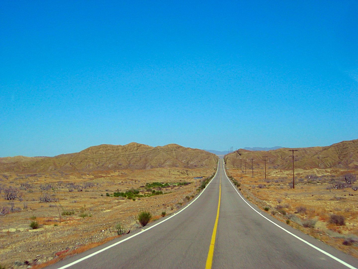
Eastbound from Tortugas towards Vizcaino.

Malarrimo road where it leaves the highway. Abandoned ranch site is the cleared area.

The Malarrimo road, just north of the abandoned ranch and highway junction.

Vegetation is soon overgrowing onto the road.
It is clear this side trip requires a full day devotion and time to explore the beach, 26 miles away. I turn around a mile from the highway and
continue on to Bahía Asunción.
The end of the pavement going west is clearly visible from the Malarrimo road junction.
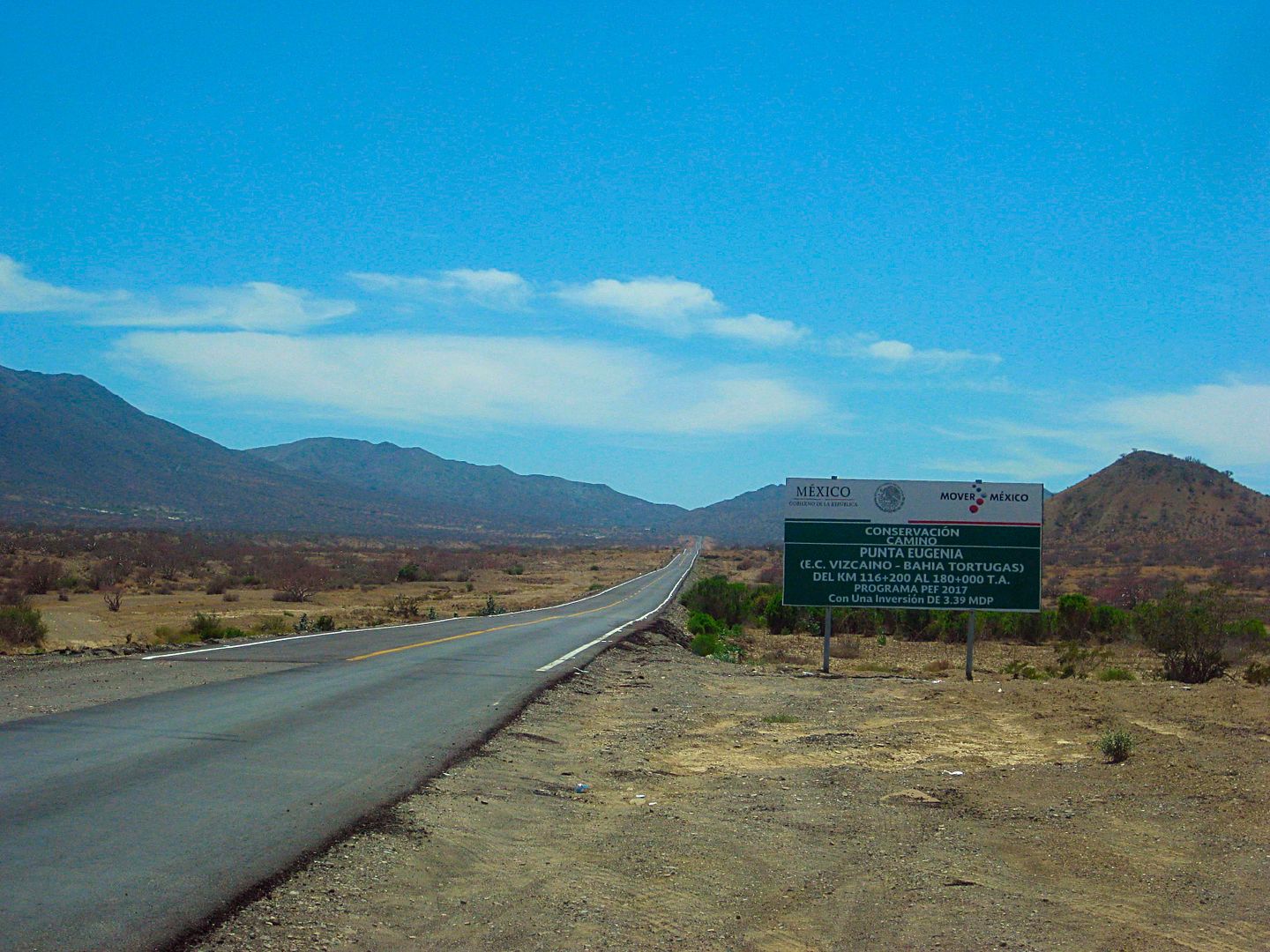
Looking back east. The sign facing westbound traffic where the pavement begins (Km. 116 + 200 meters) driving to Tortugas... just east of the
Malarrimo old road, and 1 km. east of the Rancho San José (de Castro) road.
There is a pipeline road that crosses the Malarrimo arroyo (old) road coming from the highway closer to the Asunción highway junction. Some have
reported that being the preferred route over the arroyo road?
The unpaved section of the Tortugas highway is 9.2 miles long (per my odometer). [It begins near Km. 100, making the dirt section 16 kms or 10 miles
long]
Pavement begins. Approx. Km. 100.

The Pipeline road to access Malarrimo is at Km. 83, 10.9 miles from the pavement start (eastbound).

The little curb along the highway has been busted up to allow access onto or off of the pipeline road. A second access is just west.
The Bahía Asuncióon highway junction is at Km. 75 or 15.7 miles from the start of pavement westbound and 8.0 miles from the pipeline road junction.
Km. 0 on the Asunción Highway begins here. It is 39 kilometers to the town entrance of Bahía Asunción. (24 miles). They are fast and easy driving
miles.
The road south along the coast to Punta Prieta, San Hipolito, La Bocana, and Punta Abreojos is at Km. 34.
The direct dirt road to San José de Castro by the Tortugas highway is at Km. 38.5 (just past the propane tank).
The Bahía Asunción Pemex station would be Km. 39, if there was a sign.
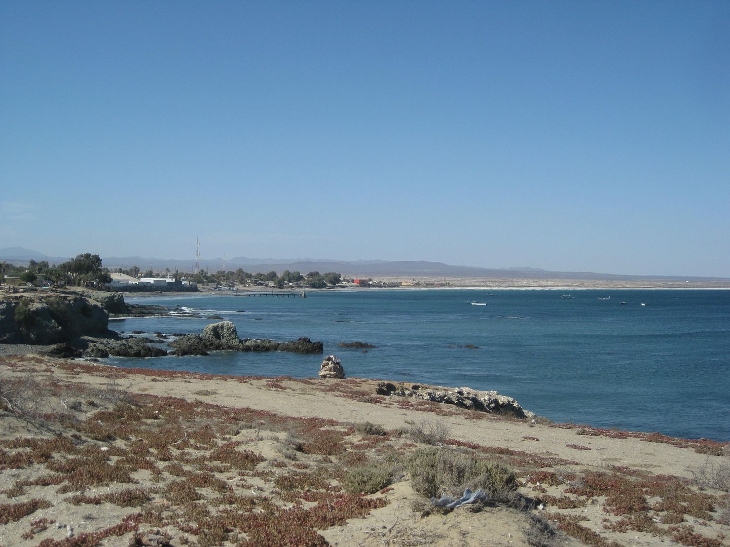
View back east to town from the road to La Bufadora Inn and point.
I get back to Shari and Juan's La Bufadora Inn at 5:05 pm. It is 1.5 miles from the Pemex station, across town. Take paved street through town, fork
left at the fisherman statue, turn right after the pavement ends and just head west the final 1/4 mile to the Inn on the bluff above the sea, over to
the left.
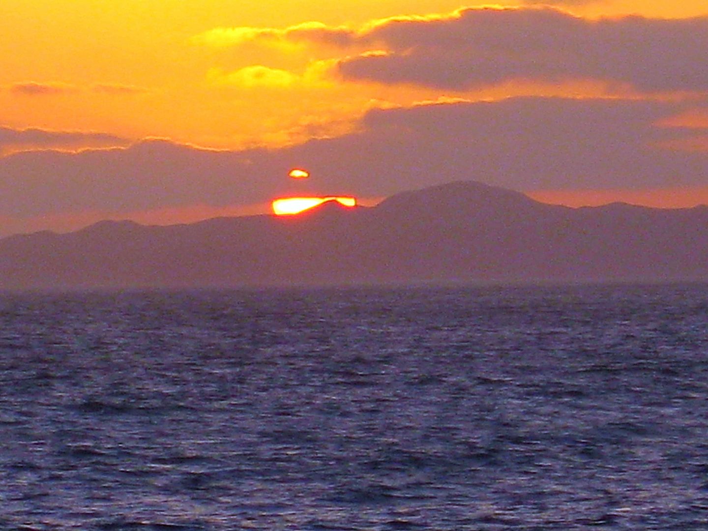
Sundown from La Bufadora Inn.
Shari invites me to dinner she has been cooking all day and it was great: Rabbit with mole sauce (say "mo-lay", not the underground animal).
It was great and was my first rabbit, too!
The ocean sounds just outside my room (The Dolphin Room) at La Bufadora Inn are wonderful for sleep.
END of DAY 5.
Tomorrow, I make a run for El Rosario and take the time to visit the pronghorn research center and Agua Dulce historic spring on El Camino Real, the
mission road in Old California (Loreto to San Diego).
|
|
|
| Pages:
1
2
3
4 |


