| Pages:
1
2
3
4 |
TMW
Select Nomad

Posts: 10659
Registered: 9-1-2003
Location: Bakersfield, CA
Member Is Offline
|
|
David K wrote:
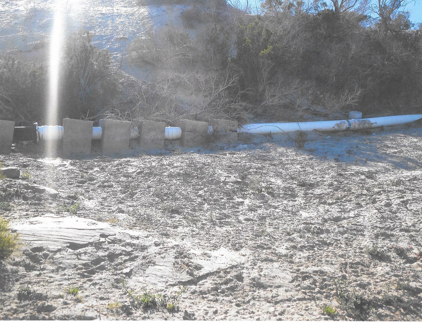
["The Pipeline road to access Malarrimo is at Km. 83, 10.9 miles from the pavement start (eastbound)."]
Where does the pipeline start and finish at?
This is it crossing the arroyo going to Malarrimo Beach.
|
|
|
David K
Honored Nomad
Posts: 64479
Registered: 8-30-2002
Location: San Diego County
Member Is Offline
Mood: Have Baja Fever
|
|
It would logically go to Tortugas, the large population center, from Vizcaino, connecting to the Vizcaino-Asuncion-Abreojos water pipe.
|
|
|
BornFisher
Super Nomad
Posts: 2103
Registered: 1-11-2005
Location: K-38 Santa Martha/Encinitas
Member Is Offline
|
|
Lots of info here, looking forward to more!
By coincidence, i was recently out to road`s end at Punta Eugenia. It was a beautiful day but the wind must howl there as the elephant trees looked
like ground cover!!!
"When you catch a fish, you open the door of happiness."
|
|
|
David K
Honored Nomad
Posts: 64479
Registered: 8-30-2002
Location: San Diego County
Member Is Offline
Mood: Have Baja Fever
|
|
Quote: Originally posted by BornFisher  | Lots of info here, looking forward to more!
By coincidence, i was recently out to road`s end at Punta Eugenia. It was a beautiful day but the wind must howl there as the elephant trees looked
like ground cover!!! |
It was a great 'day trip' from Shari's. Going to Malarrimo Beach would need to be a separate day trip, and I was out of days this time. I very much
enjoyed seeing the tip of the hook of Baja!

The entire road is now paved from the Playa Malarrimo junction to Bahía Tortugas. 9 miles of unpaved begin just past the Malarrimo road heading east,
then all paved to Vizcaino.
|
|
|
salttram
Junior Nomad
Posts: 50
Registered: 9-17-2003
Member Is Offline
|
|
Concrete on the Cuesta? Is NOTHING sacred?
|
|
|
David K
Honored Nomad
Posts: 64479
Registered: 8-30-2002
Location: San Diego County
Member Is Offline
Mood: Have Baja Fever
|
|
Nope, and there's a paved highway to Gonzaga Bay, too!
Where can all the "Good People" go when there are no more "Bad Roads" to bring them???
|
|
|
David K
Honored Nomad
Posts: 64479
Registered: 8-30-2002
Location: San Diego County
Member Is Offline
Mood: Have Baja Fever
|
|
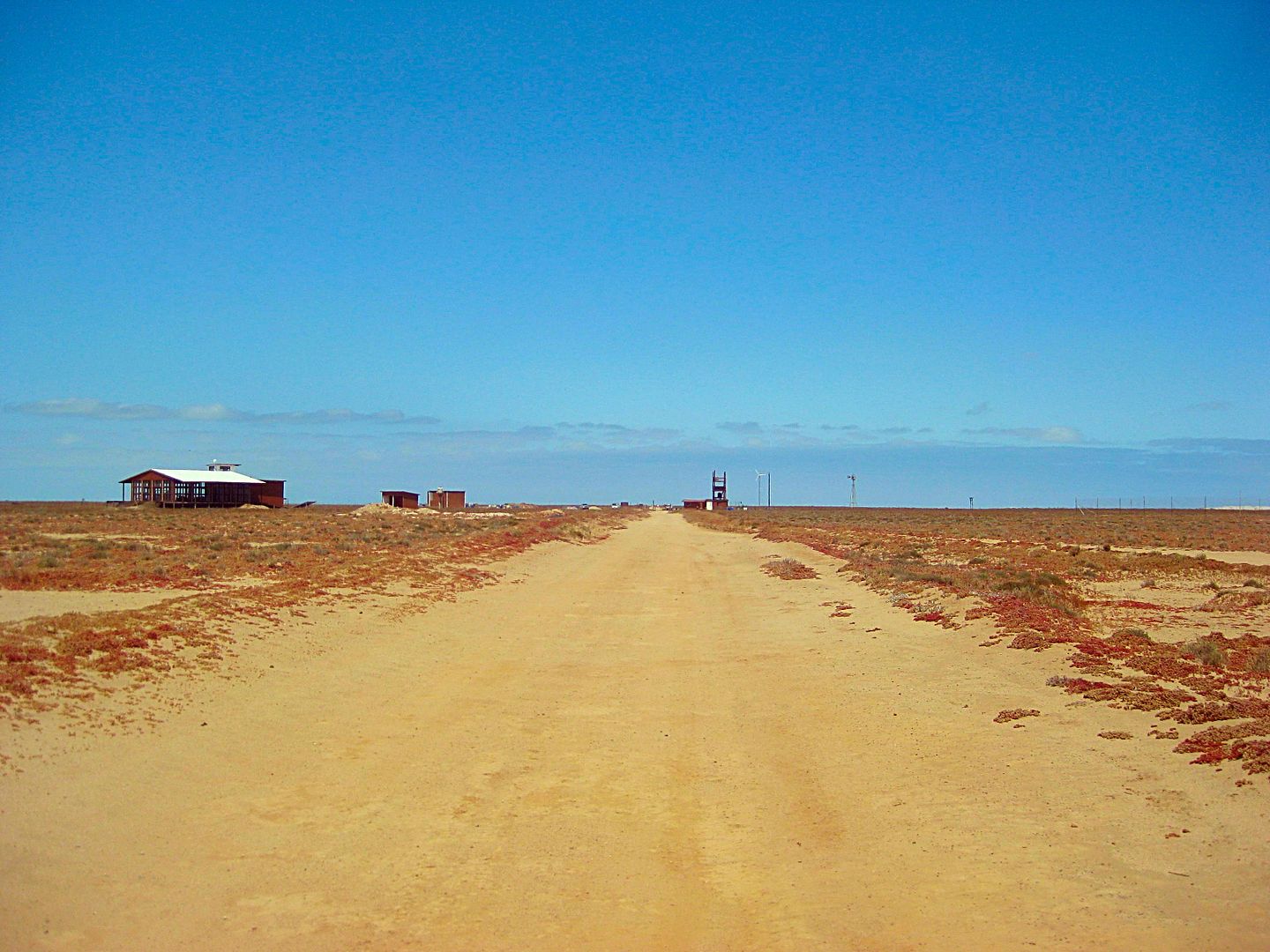
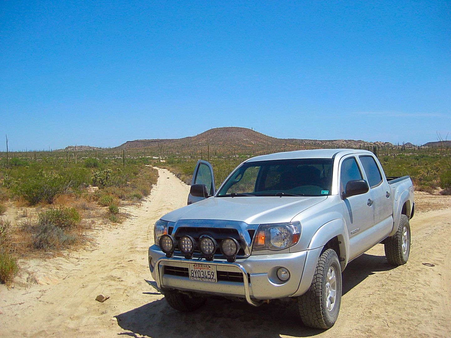
DAY 6 (Wed. June 7, 2017) Pronghorn Reserve, Agua Dulce, El Rosario
A second great night at La Bufadora Inn, with the sounds of the ocean splashing below, had passed. Today, I must migrate north to make the final drive
home easily doable in a day's drive.
Shari made me breakfast and coffee so I had a good start. The truck was loaded and I was about to leave when a young man walked up looking for Shari.
His name is Martín and he had been invited to Bahía Asunción as a diver to harvest sargasso (kelp). When he arrived, the co-op or whoever changed
their needs, and he had no job after all. Shari asked if I could take him to El Rosario and he could then catch a bus to Ensenada where he could find
work.
No problema, I made room easily for his suitcase and a tank and off we went. He spoke no English, but my Spanish was enough for us to communicate. He
understood that I was on a mapping and research trip with some side trips along the way to El Rosario.
We left Shari's La Bufadora Inn at 9:05 am. Martín needed to stop at someone's house to get something and again at the market in town to sell
something. Both stops required about 10-15 minutes of waiting for the person he needed to show up. Obviously, I was not sure what was happening and I
did not want to become a drug transporter (worse case scenario). I bought a bag of ice at the store ($1.50) while waiting for Martín to conclude his
business. Finally leaving town and it was a fast drive on the good highway (no potholes). Arrived at the Tortugas highway at 10 am and at Vizcaino at
10:40 am.
Crossing the state line at the Eagle Monument, there was no immigration stop. 11:30 am became 10:30 am with the crossing back into Pacific Time.
The Km. marker on the north side of the Eagle traffic circle is Km. 127.
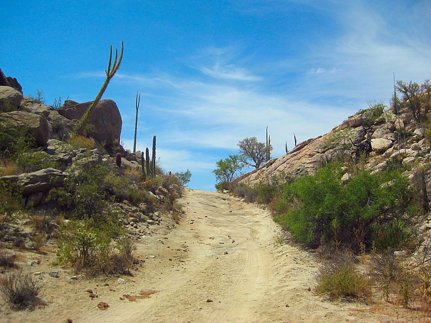
At Km. 123 (2.4 miles north) is the signed road east to the Pronghorn Research and Breeding Facility. It is an easy 1.6-mile dirt road in, a fence
needs to be opened just before the buildings, where you park.
Two young ladies and a young man were there and welcomed us. Nobody spoke English but I was able to understand the majority of her explaining the
program.
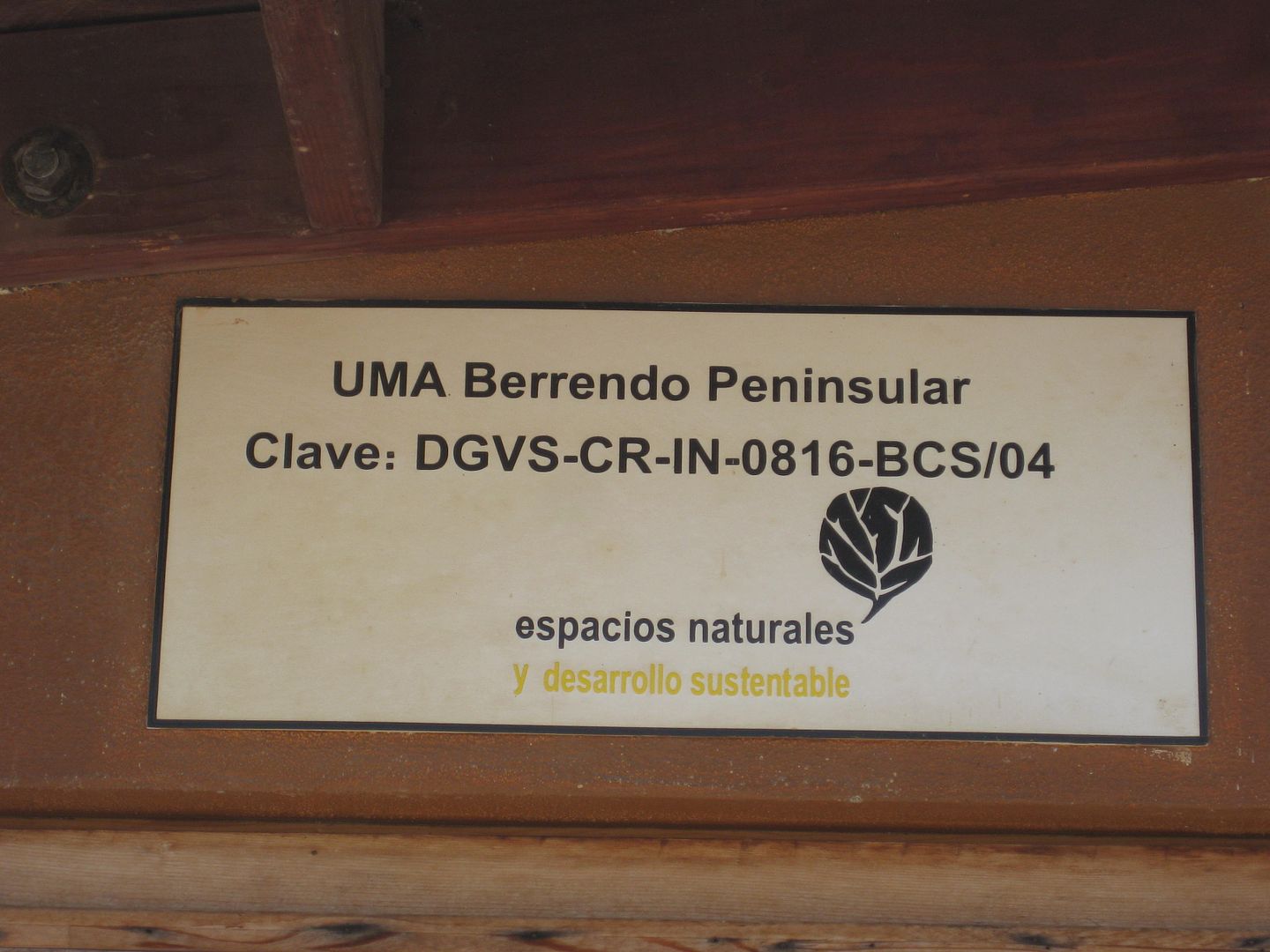
The director's name is Ana Isabel Razo Zaragoza and the website is http://berrendo.endesu.org.mx/acerca.html
and http://berrendo.endesu.org.mx/
On Facebook: https://www.facebook.com/Berrendo-Peninsular-PRBP-1750464048...
Email: endesugn@gmail.com to perhaps arrange a group tour?
BERRENDO = PENINSULAR PRONGHORN
PHOTOS:
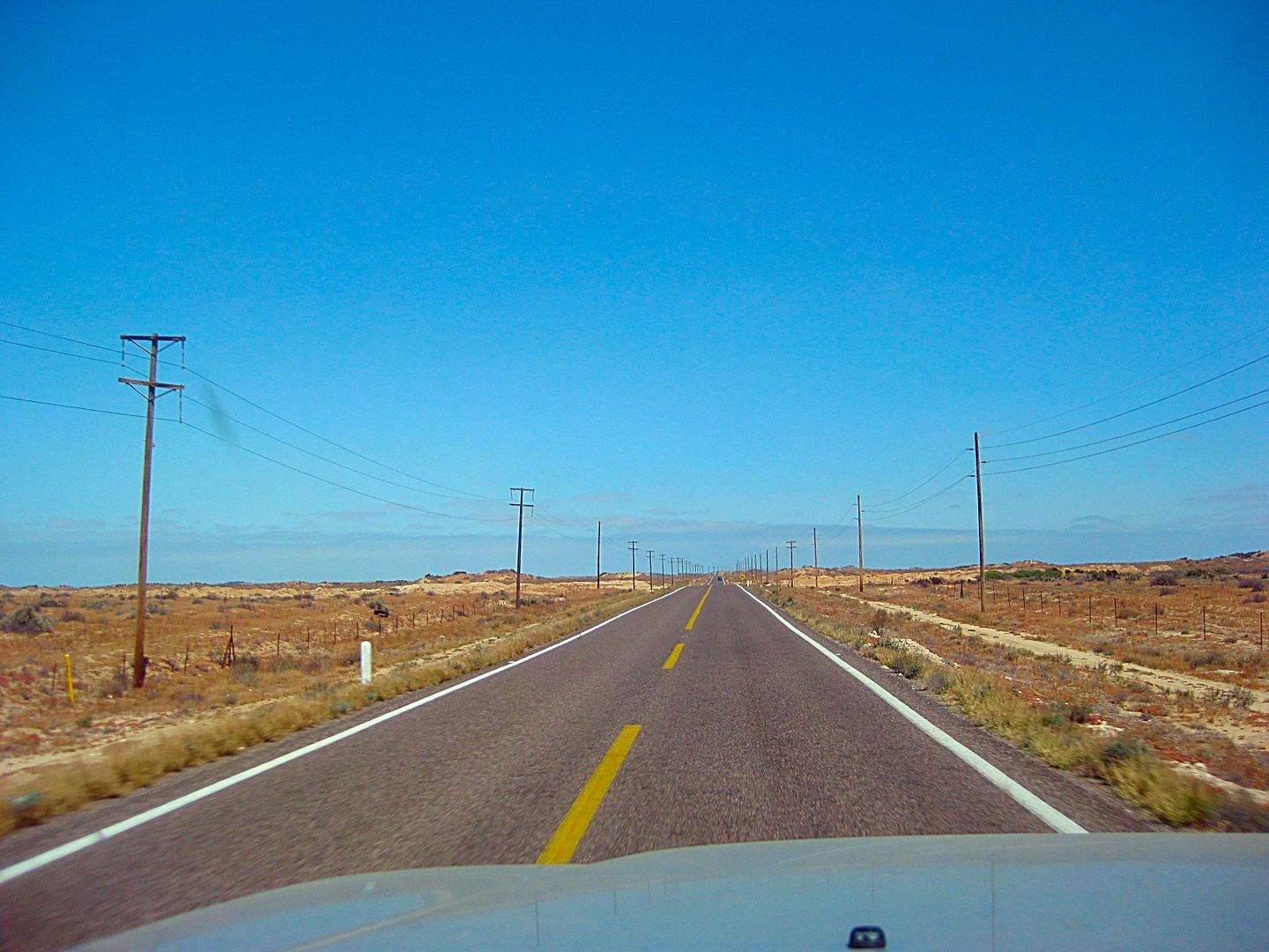
Highway One across the Vizcaino Desert.
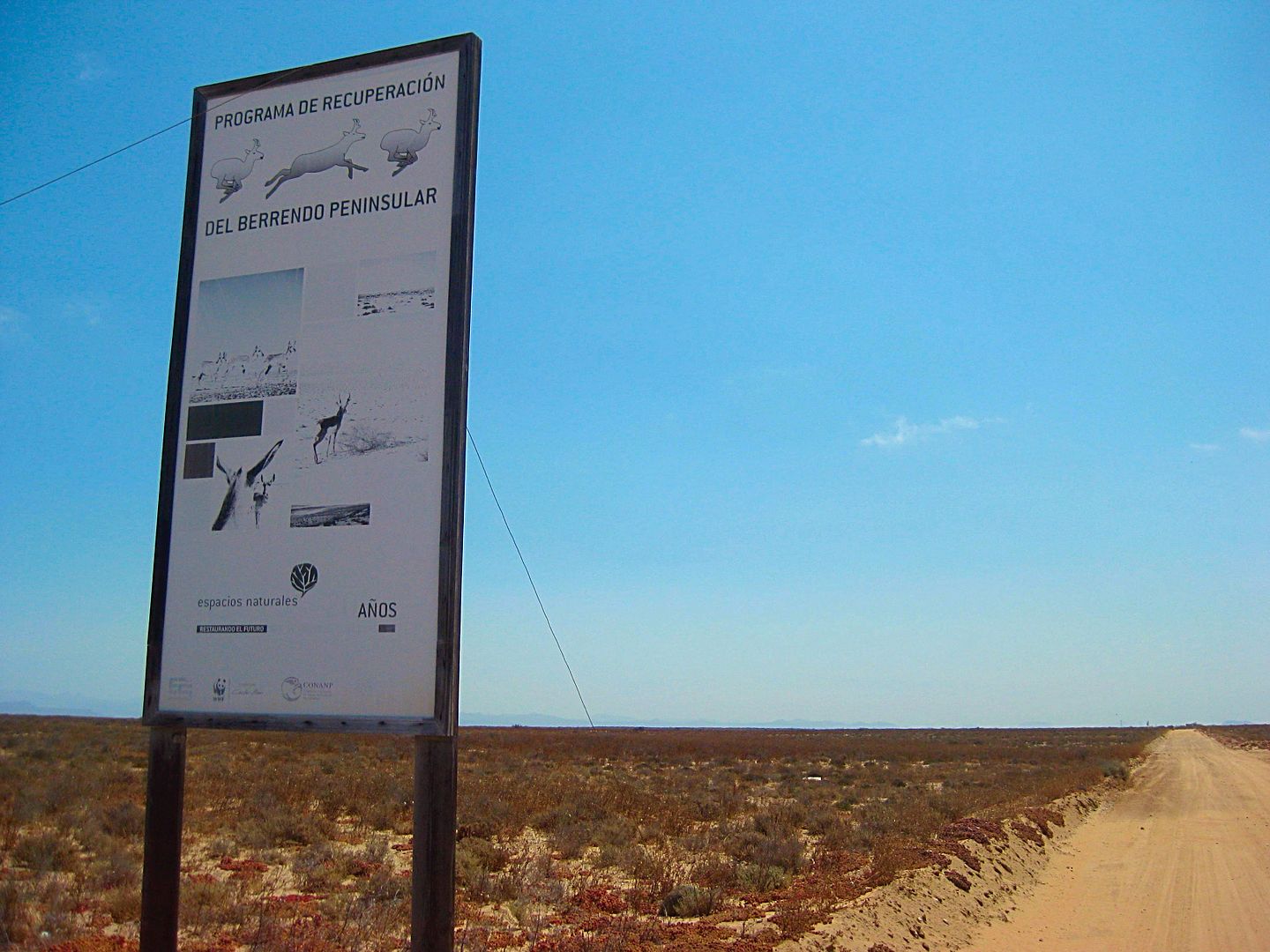
Pronghorn Reserve sign.
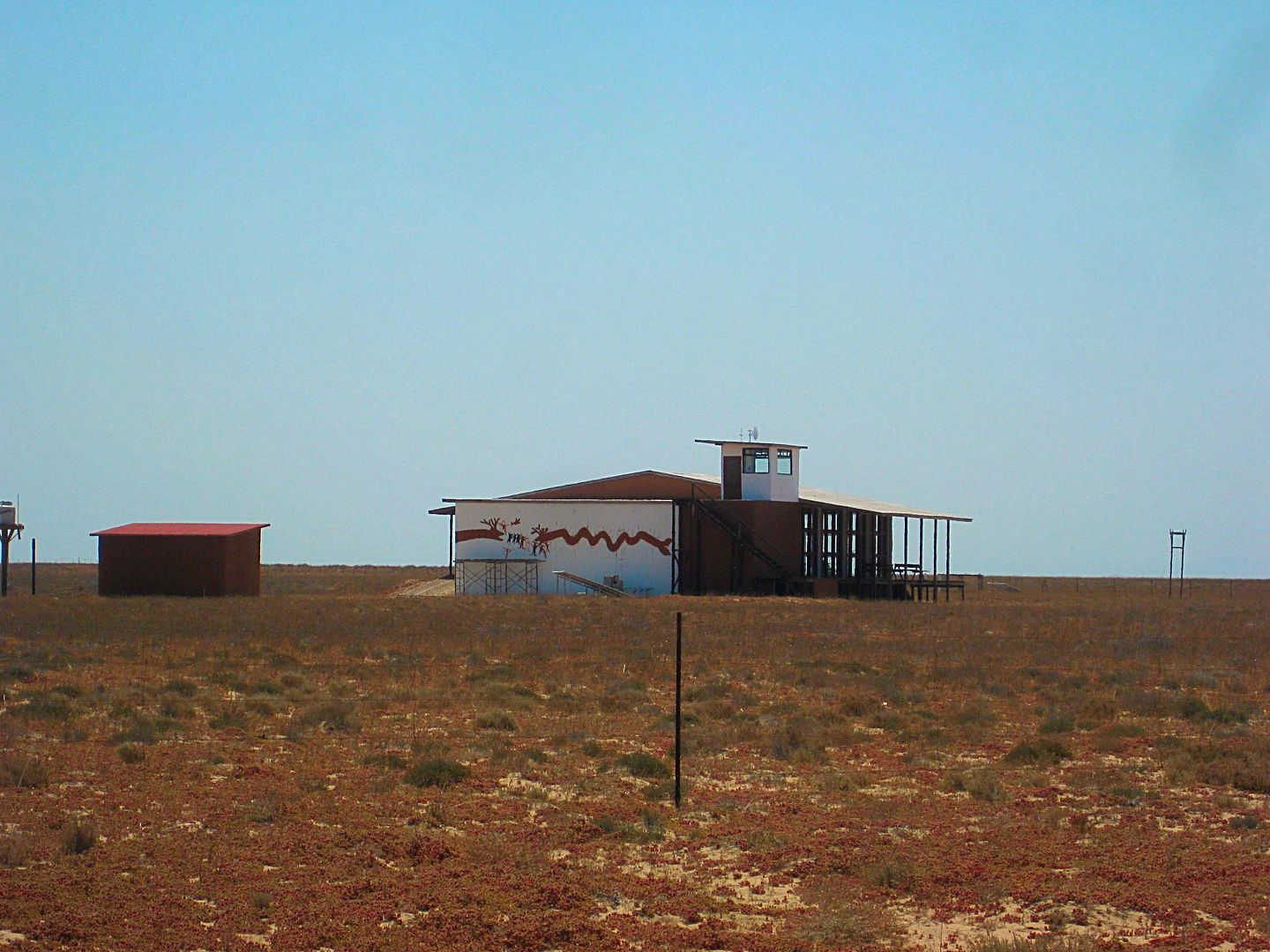
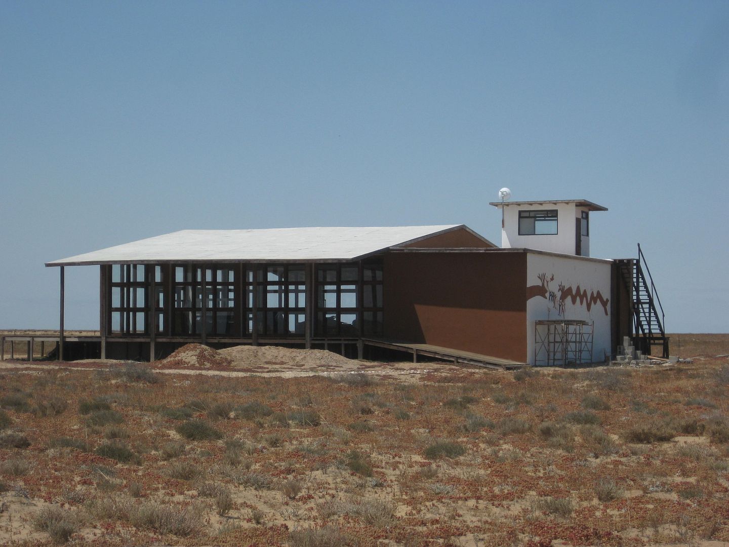
The future museum and observation room.
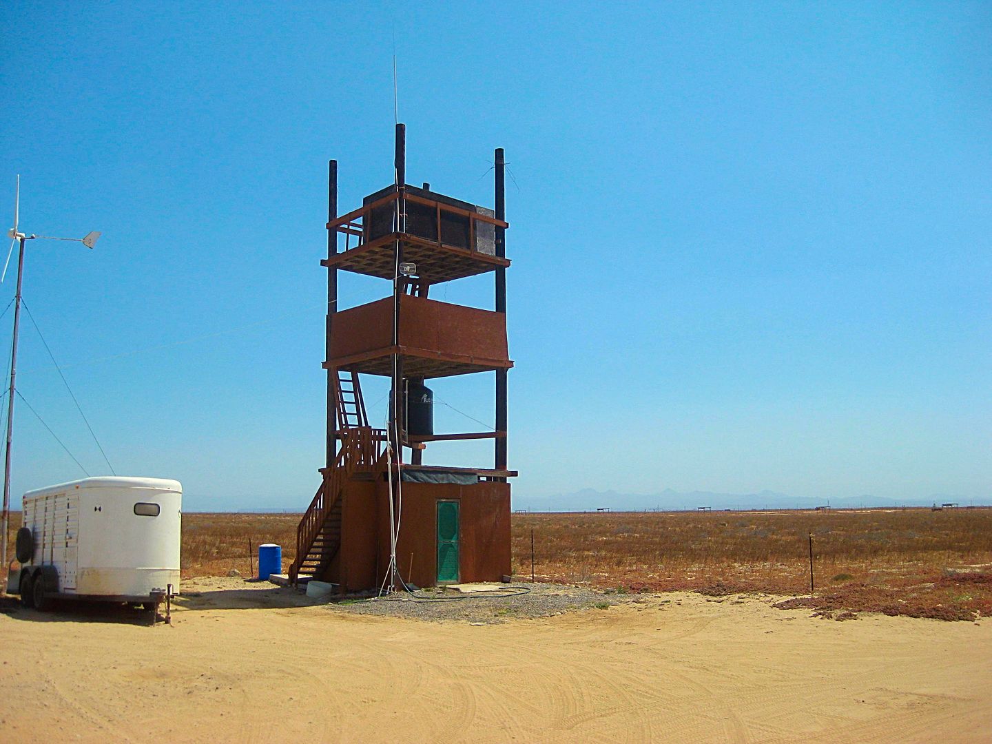
Observation tower.
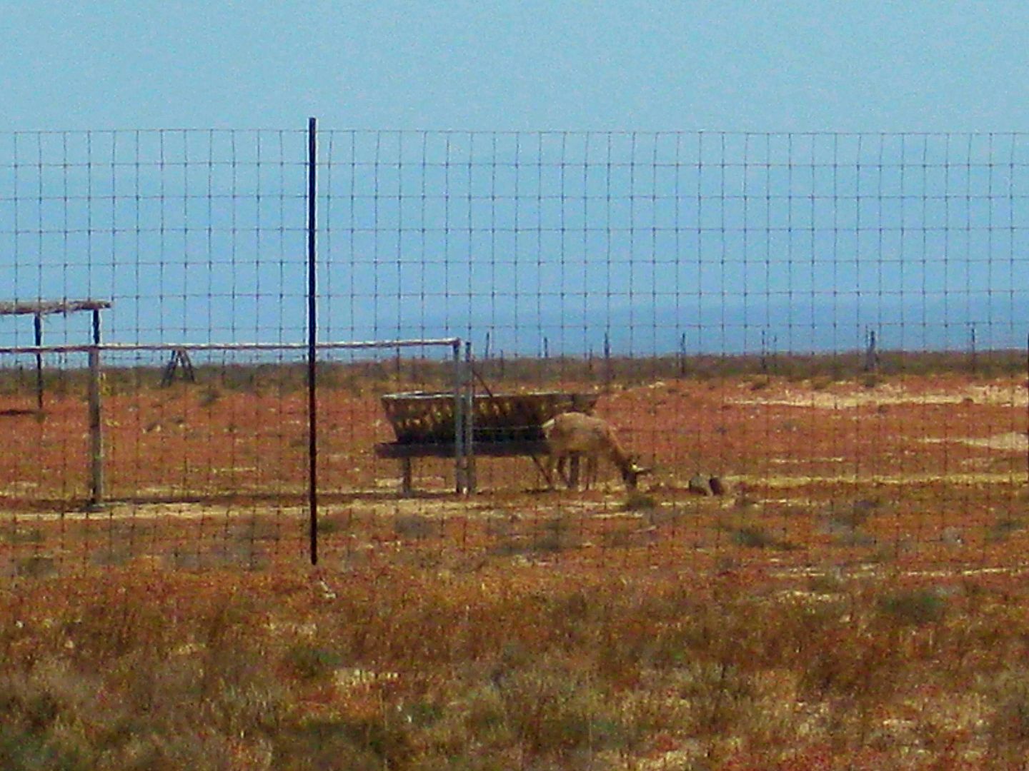
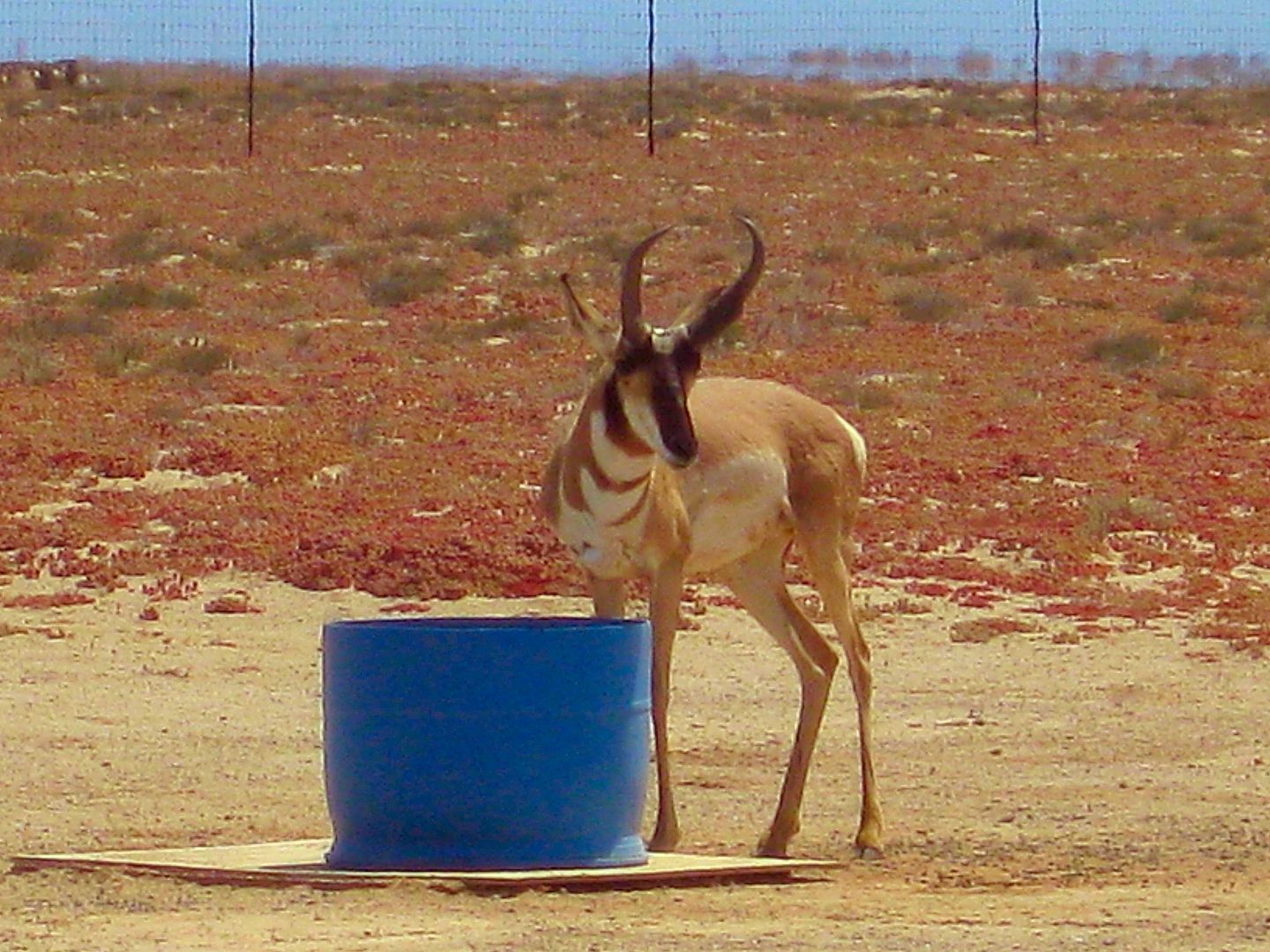
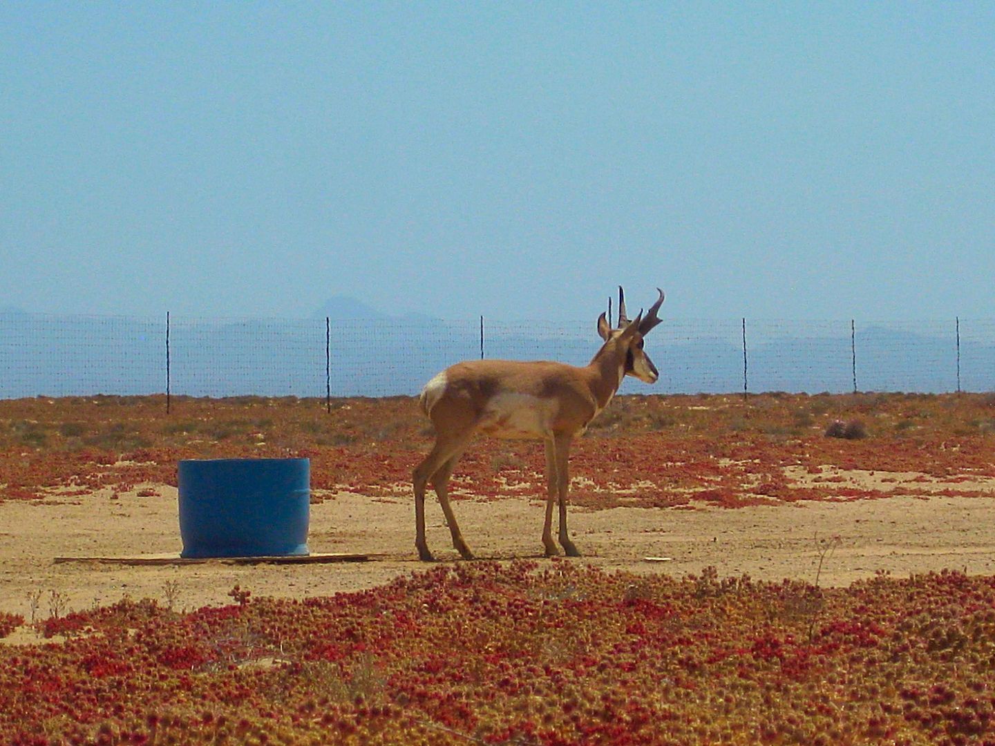
Ana and the rest of us walked down the dirt road, passing the large pens where the females and young are (on the left) and approached 'loose' roaming
machos (breeding males).
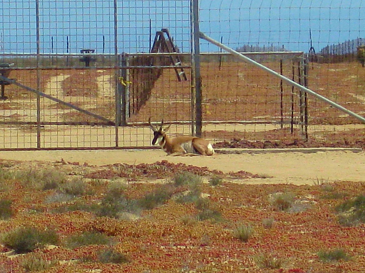
This macho berrendo just wants to be close to the ladies.
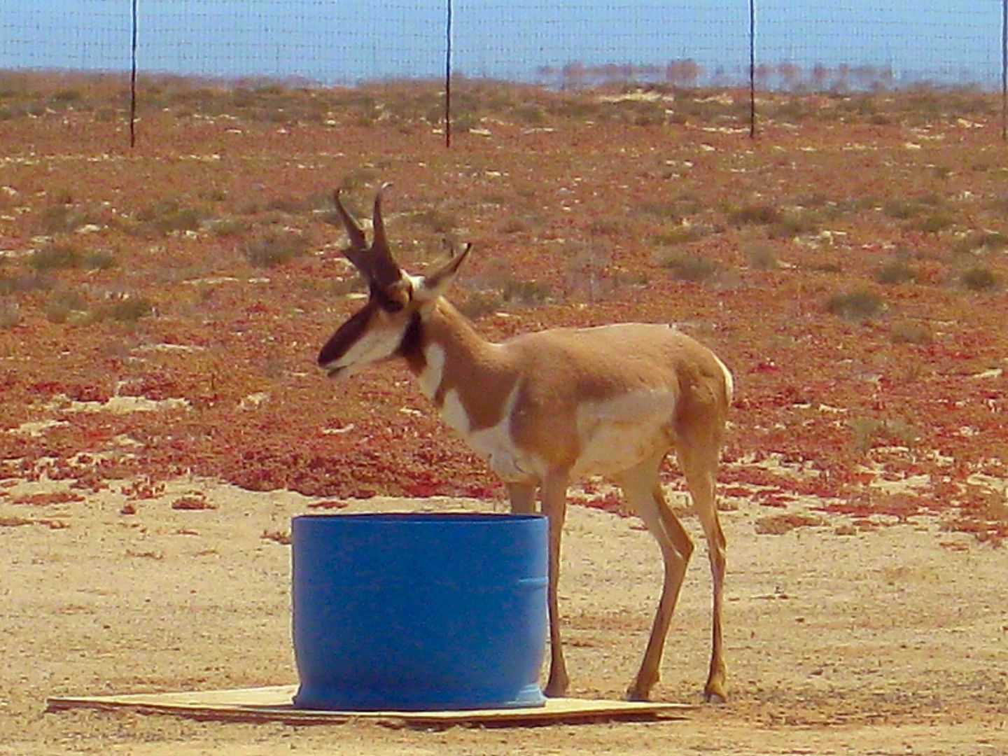
Very relaxed, we slowly got to about 50 feet of him.
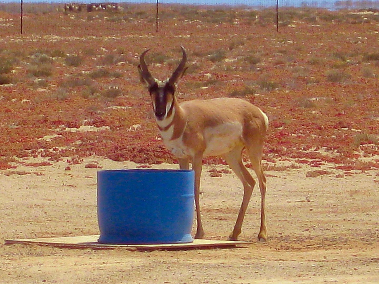
The blue tub is filled with water.
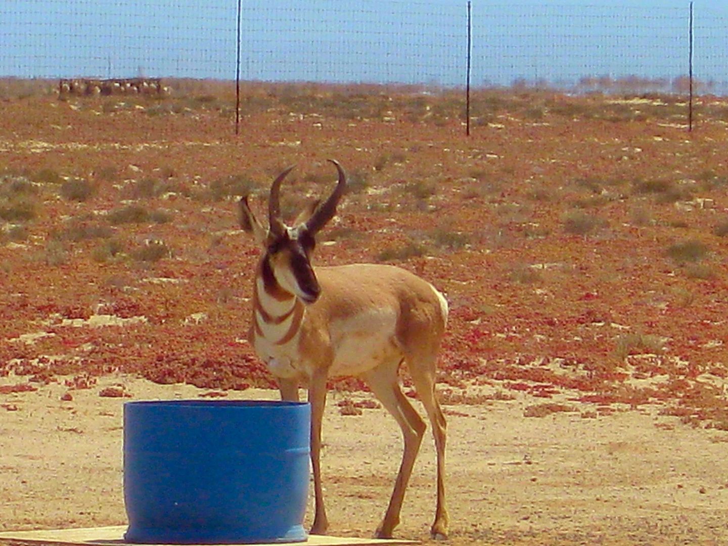
This was a great experience. I have seen them at the San Diego Zoo, but seeing these much larger machos 'in person' was much better!
From where we walked looking back west towards the museum, tower, and parking area.
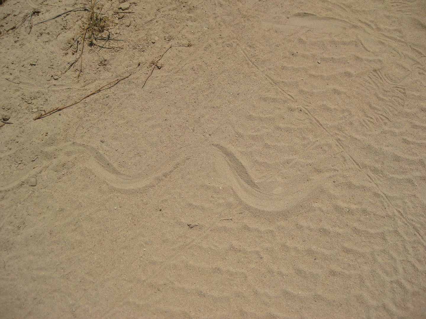
Snake track.
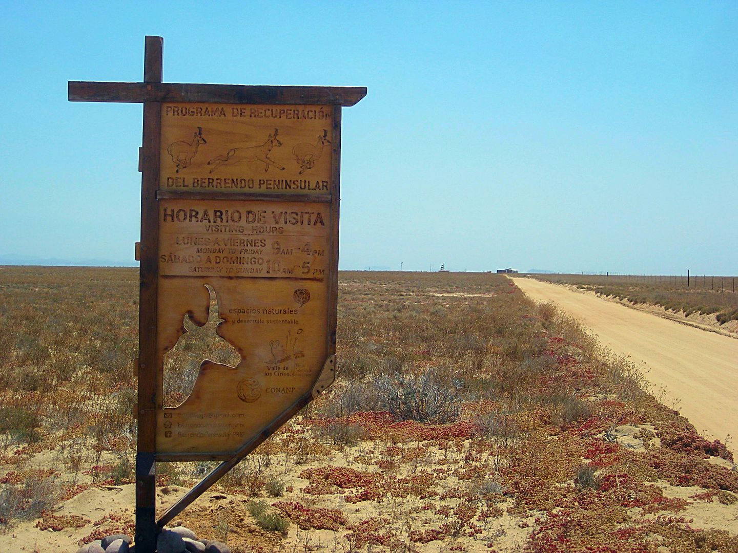
Well worth the time to visit!
Coming up next, a re-visit to the historic spring on El Camino Real, Agua Dulce... STAY TUNED!
|
|
|
Udo
Elite Nomad
Posts: 6321
Registered: 4-26-2008
Location: Black Hills, SD/Ensenada/San Felipe
Member Is Offline
Mood: TEQUILA!
|
|
WOW!
Thanks for the superb photos and detailed travel directions. Gives many of us something to add to our Baja bucket list.
Udo
Youth is wasted on the young!
|
|
|
David K
Honored Nomad
Posts: 64479
Registered: 8-30-2002
Location: San Diego County
Member Is Offline
Mood: Have Baja Fever
|
|
Day 6 cont'd... Agua Dulce
One of the most important sources of water in central Baja, before the modern times, was Agua Dulce (sweet water). Located in a very dry desert plain,
between Mission Santa María and Mission San Fernando, on the Camino Real. This large spring made the trek possible for man and beast on the mission
road.
Likely, this was the spring discovered by the Wenceslaus Linck-Jesuit expedition seeking future mission sites on March 3, 1766, and named Keita by the
native Californians.
When the Franciscan leader, Junípero Serra, traveled from Loreto to San Diego, the future saint rested here and named the spring "Sweet Water" (Agua
Dulce). That was in May of 1769.
In the old dirt road days of Baja travel, Agua Dulce was just 1/4 mile off the main road to La Paz. My parents and I camped there on our Jeep trip to
Cabo, in 1966.
In the summer of 1973, the new Transpeninsular Highway was built about a mile west of, and parallel to, the old main road (in this area). When we
passed by this site, the detour off the new roadbed took us back to Agua Dulce. The highway crews bulldozed a ramp down to the pond and used the water
for highway construction and looked to have really destroyed the historic site.
I returned in 2002 and found that Nature had done well at healing the 1973 damage and spent some time there thinking of my parents, who had both left
this world years before. In 2005, I once again returned to Agua Dulce with my future wife ('Baja Angel') to show here the famous spring. It was
looking better than ever, with much water (but the presence of cattle and their droppings made it not so 'sweet'). A new, better access road to the
spring was made and reported by Neal Johns.
I recent years, friends on Baja Nomad forums reported a ranch was established by the spring and a gate blocked access to it. I HAD to see if that was
still the case.
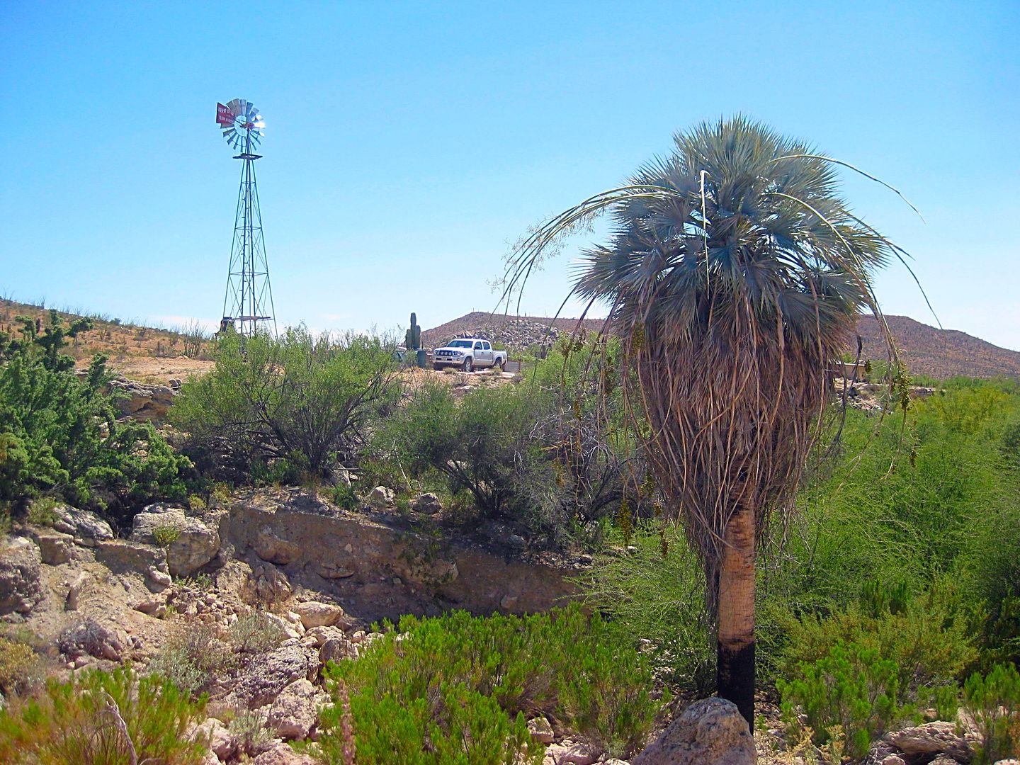
Km. 160.5 and hard to spot, but the only auto track around going to the east of Hwy. 1... I hit the brakes and got right on it. Martín probably
thought I was nuts.
It is 1.2 miles over to the old main Baja road (the original 1967-1972 Mexican 1000 road). Turn left (north), over a crest of granite to a fork at
Mile 1.6, and to the right through an open gate and right past the front of the ranch house to park above the spring, in a gully below, Mile 1.8 from
Km. 160.5.
I drove very slow, parked and got out... a few ranchers came out of the house to see who just came into their back yard. I waved and asked if it would
be okay to take some photos of the spring. They enthusiastically welcomed me to go right ahead.
PHOTOS:
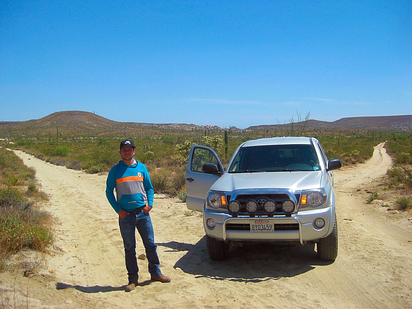
Martín standing on the old main Baja road where the Km. 160.5 access road joins in, 1.2 miles from the highway.
Before late 1973, this was the "highway" to La Paz and Cabo!
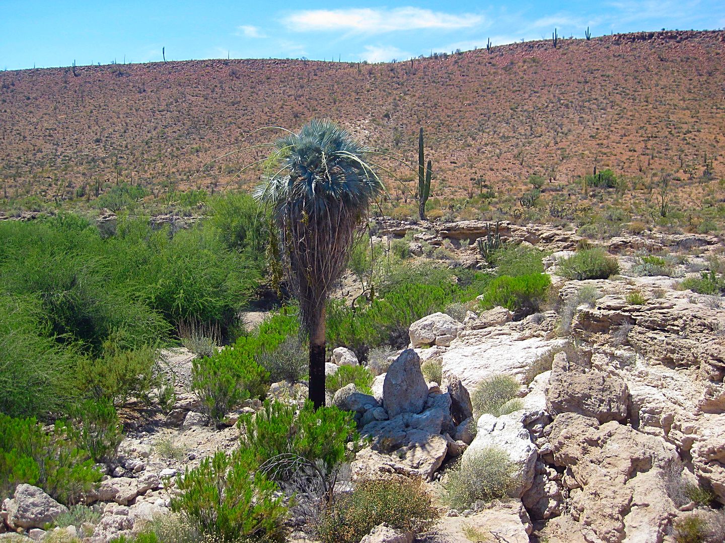
Looking north on the old main road, Agua Dulce is on the other side of this rise, 1/2 mile away.
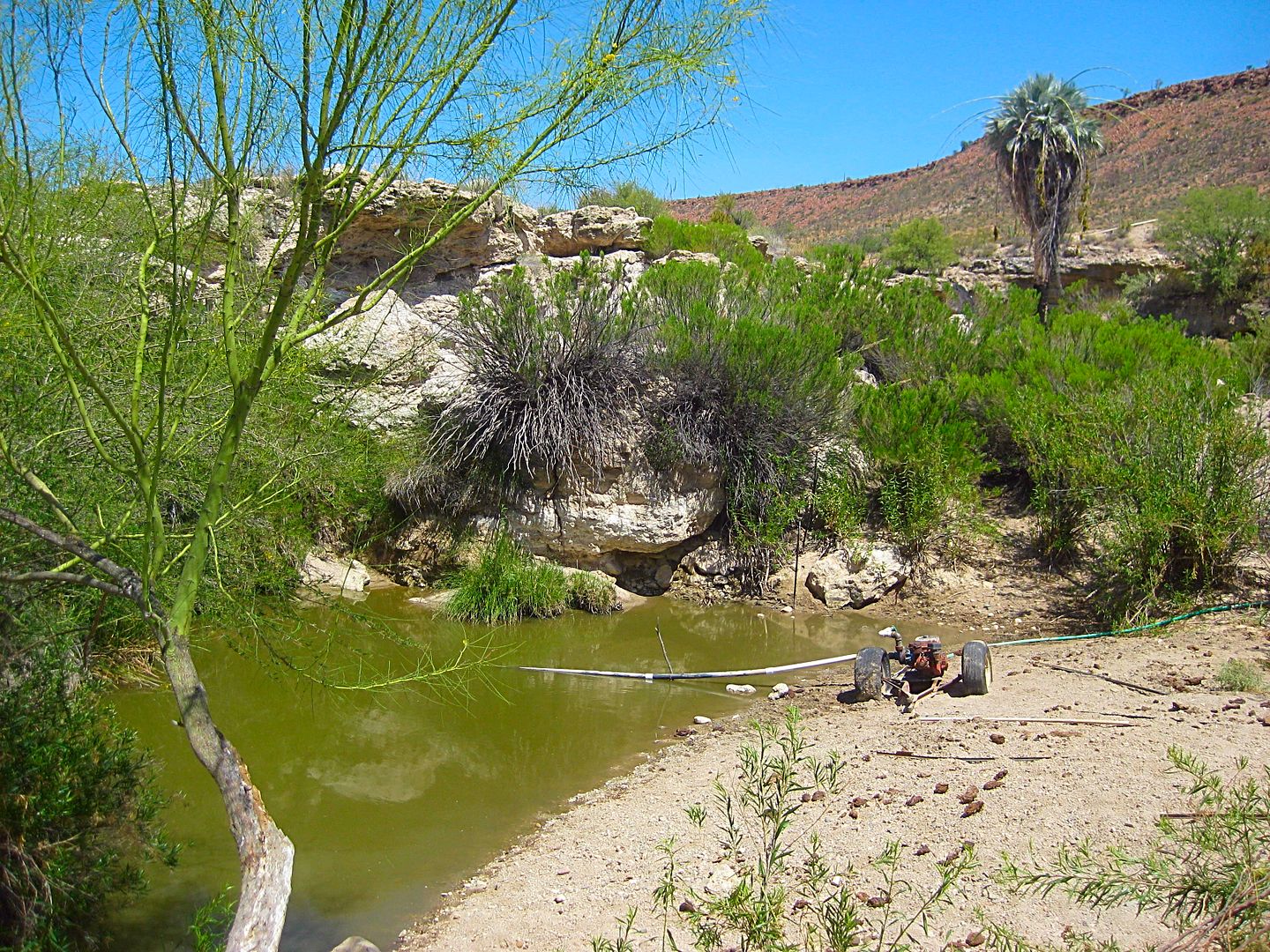
Agua Dulce with a pump to take water to the ranch, nearby. A lone blue palm is just beyond.
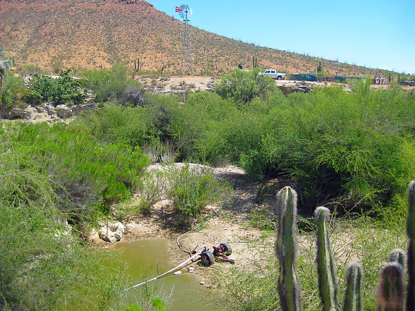
I climb up from the gully. My truck on the opposite side by a windmill that was not over a well, but used also or instead of the gasoline pump, to
bring water up.
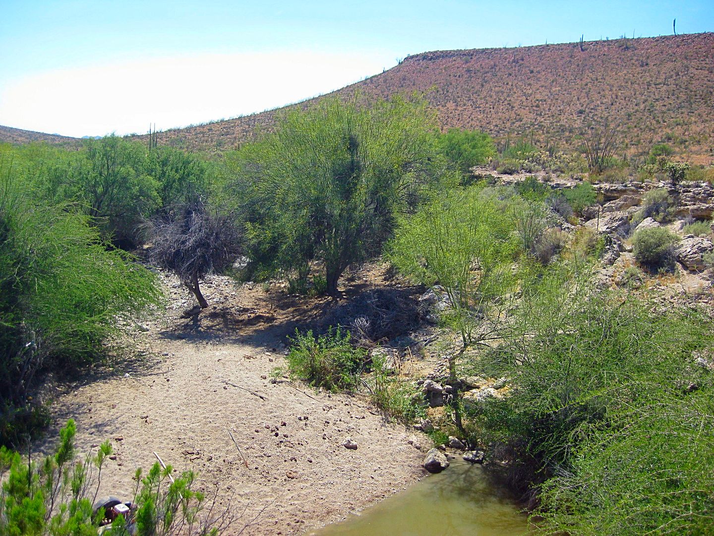
Looking down at the beach next to the spring's pond.
I walk around back to the truck, above the spring. I am (in my best Spanish) telling Martín the history of this place.
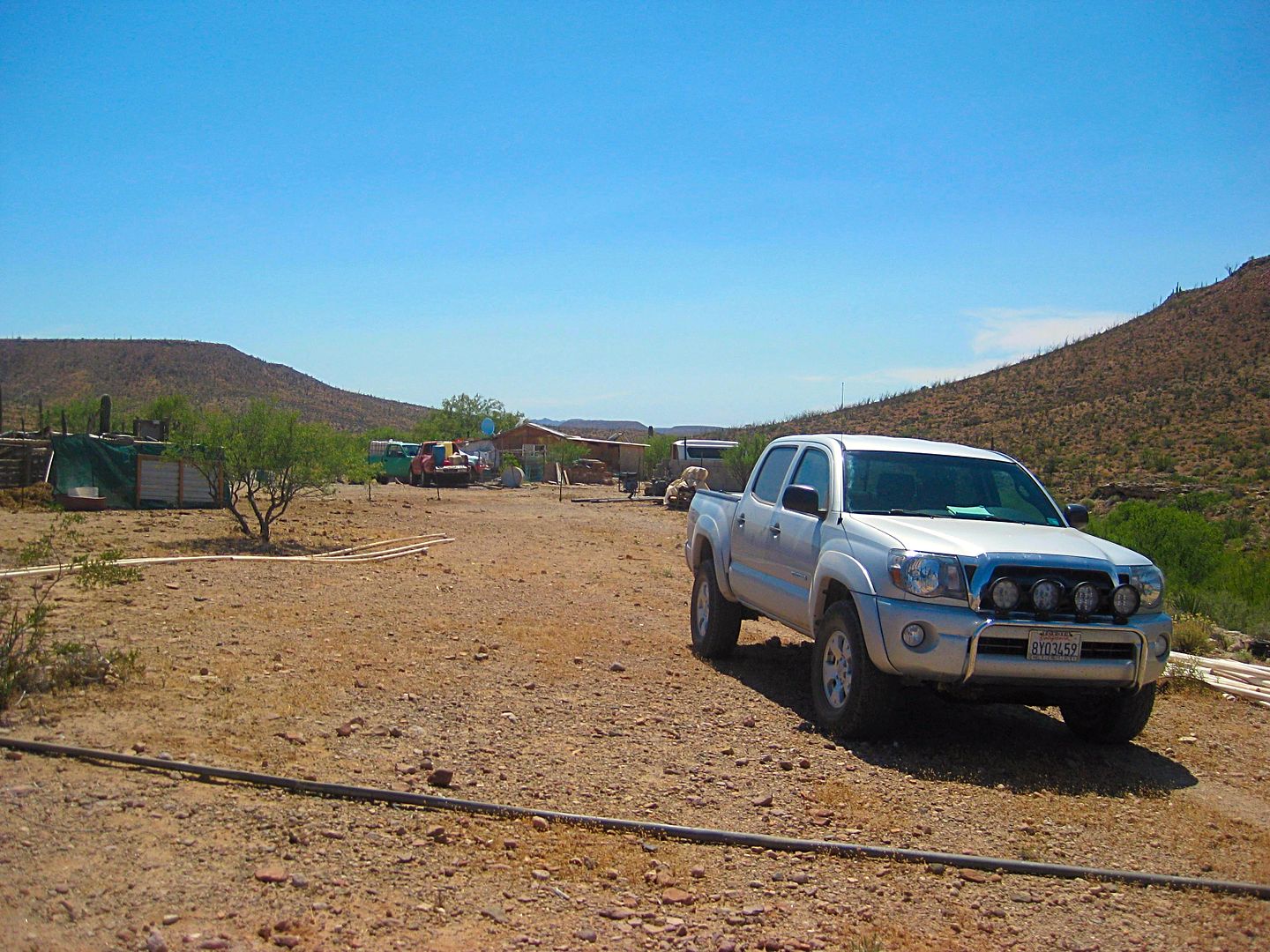
Rancho Agua Dulce
Back out to Hwy. 1 and an easy drive to El Rosario, getting there about 4:30. I drop Martín off at the bus station but wait to hear if he makes the
connection okay. He comes back out to tell me the bus to Ensenada will be there in a few hours, but he is 100 pesos short on the ticket cost. No
problem, I took care of that. The poor guy had to hear my history lesson in bad Spanish, after all!
Around the corner to Baja Cactus Motel and a little bit of heaven on the highway! Antonio is there and inside my room, a new surprise (inside all the
new rooms, in fact)...
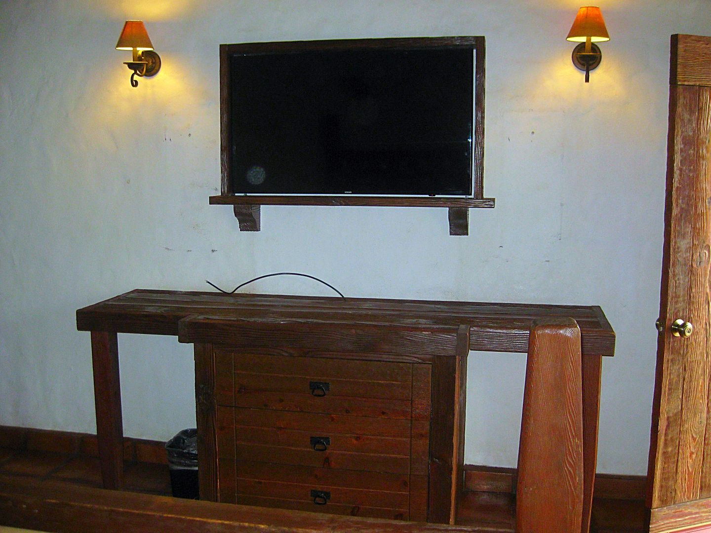
Large, flat screen TVs! It was just installed and not even connected yet... but it was soon after I took the photo. More TV news, instead of the so-so
some snowy, local satellite TV (12 channels, half in English), there will be Dish Network TV with 60+ channels in high definition and music channels,
too.
An interesting historical note, my first time staying at Baja Cactus was Thanksgiving weekend, 2004, when Antonio brought the new rooms their TVs,
purchased in San Diego. So nearly 13 years later, new TVs again... Good job Antonio. Sure, I know we don't go to Baja for TVs, but he wants you all to
have a top rate room experience on par or better than any other similar place in either country. The in-room coffee makers are a hit.
In my final day's report, I will show you photos of the room at Baja Cactus and give you the last day's road notes.
Stay tuned for DAY 7.
|
|
|
David K
Honored Nomad
Posts: 64479
Registered: 8-30-2002
Location: San Diego County
Member Is Offline
Mood: Have Baja Fever
|
|
DAY 7 (THU JUN 8, 2016) El Rosario to San Diego County
[I apologize for not completing the trip report sooner. Typically I get these done in about a week. This one has taken over 2 weeks. I was working
still on the TRIP 4 chapter of the road guide I am writing and after a technical issue which caused me to re-make several pages. I finally got that
completed and can now complete this TRIP 5 report for you all!]
Just a comment to add to yesterday's report post:
Martín and I left Agua Dulce and as we passed the ranch house, I confirmed with the ranchers standing about that their ranch was named the same as
the spring, ie. Rancho Agua Dulce.
My impression should any of you come by and the gate is closed (but not locked or signed no entry) to let yourself in, ask if you can take photos, and
enjoy the time travel experience here. Gates that are not locked are to control livestock not keep out visitors. I have never met an unfriendly in the
backcountry of Baja and that includes the time (17 years ago) I unknowingly hiked into a marijuana growing project in a canyon near San Felipe! All
smiles!!
OK... DAY 7. Today I was heading home, I had a great night at Baja Cactus (Room 202). Antonio, Isela, and I went to the Restaurant 'Loncheria El
Faro'. It is a newer place, owned by a man from Faro San José and his wife who cooks with the flavor of her native Oaxaca. This was my third meal at
Loncheria El Faro (previously had a shrimp dinner and a breakfast here, both were great). (at the moment I can't find his card with his name)
We all had the fish dinner, choices were halibut and corbina. It was excellent! The lemonade made with mineral water (we got a pitcher) was great. The
cost for dinner was US$20 (that was all three dinners, drink and tip). Unbelievable! My treat!! El Faro is at Km. 59, next to the San Borjas Tire
Shop, left side of the highway if southbound.
Antonio ('BajaCactus') and Isela were busy with prepping for the Baja 500 support when I was coming through El Rosario earlier this week. The Red
Cross in Camalu asked for the services of Antonio's rescue service: Halcones del Desierto (Desert Hawks) https://www.facebook.com/HalconesdelDesierto/
The energy this man has and his quest for quality and fairness is so admirable. For those of you unfamiliar with Antonio Muñoz: He assumed operations
of his family's business nearly 20 years ago. At the time, a small motel and the Pemex gas station (next door). He built a new, modern motel on the
site with amazing rooms and services generally unknown in central Baja or on many highways in either Mexico or the United States. His rates are
crazy-cheap for such luxury and he even maintains a few of the original motel rooms (but they were recently refurbished) at even lower prices.
The El Rosario Pemex gas station is famous for having 100% honest pumps, not all that common in Mexico where an 80-liter tank can magically hold 90
liters out of a tampered pump!
A few years ago, seeing the need, Antonio and volunteers from El Rosario received EMT training and he has a fire/rescue service that has rendered help
all along Highway One between San Quintin and Punta Prieta... 200 miles of (mostly) dangerous highway! See the Facebook link above.
The government provides almost no help, so donations are all that keep Antonio going with this (and any profits from staying at his motel or buying
his gasoline).
Antonio sells my Baja mission history books (I donate them so all sales income goes to the Desert Hawks) as well as other items, in the motel lobby.
Here's a photo of Antonio and I taken last year by my wife when I presented him with my books donation...
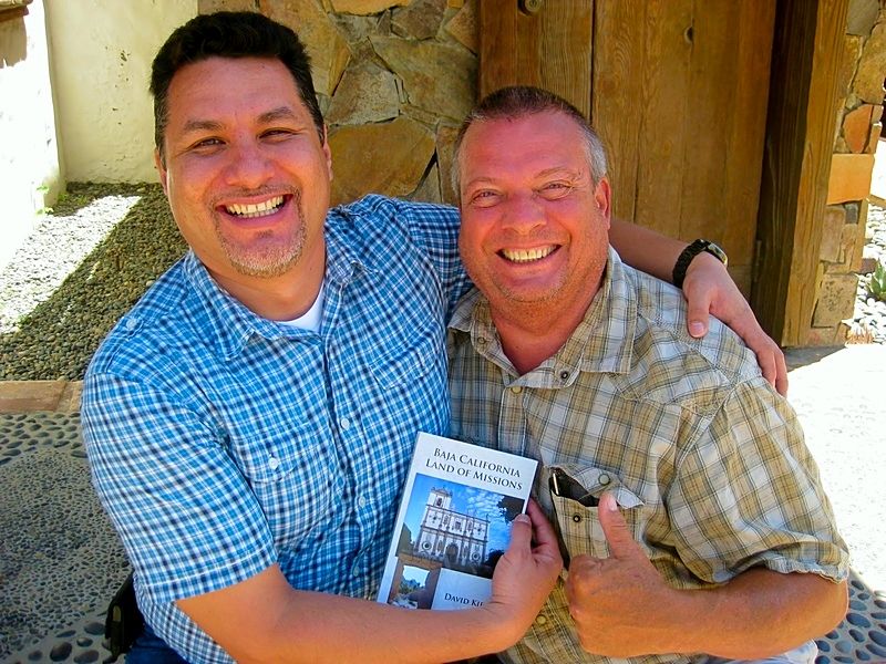
The book regular price is $29.95, but at Baja Cactus, they are discounted and the sale helps to fund the Desert Hawks. He also has a few copies of the
(out-of-print) The Old Missions of Baja & Alta California book, as well.
Oh, Isela's daughter (Itzel) who many of you know from her open heart surgery performed in the United States, is doing great and growing up fast!
A single Baja Cactus Motel Room is under $40, features a king bed and now all LED lights, flat screen satellite TV, coffee maker, pressure boosted
shower, bottled water, phone, wifi, secure parking...


Antonio ready to roll with the newest addition to the Desert Hawks fleet, an Isuzu Trooper 4x4.
I say goodbye, top the gas tank at his Pemex station (15.99 pesos/liter) and 50 liters is about 800 pesos. You can use a debit card here with only the
3% bank fee added. Dollars this day were valued at 17.00 pesos each, at El Rosario, if you don't have pesos.
I was on the highway at 9:45 am.
I made many notes for kilometer markers of various spots to add to the list I had already started, plus GPS marking certain points for the future Baja
Guide and Map for Baja Bound.
Ensenada traffic was not fun, and I reached the north end of town, by the harbor, at 1:45 pm (150 miles from El Rosario).
Taking Hwy. 3 to Tecate, I stopped at the Guadalupe mission and museum to see the latest additions. A very clean bathroom building (with toilet paper
even) was a nice touch (note to new Baja travelers, especially the ladies, toilet paper is typically not supplied in public bathrooms).
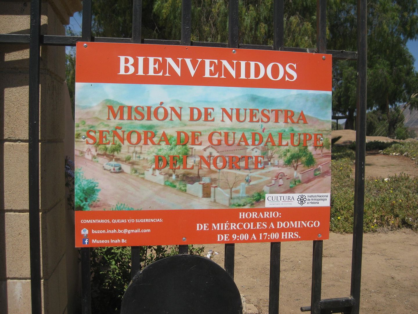
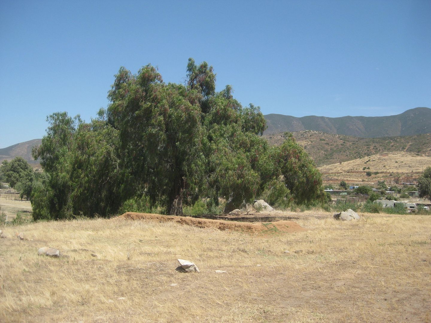
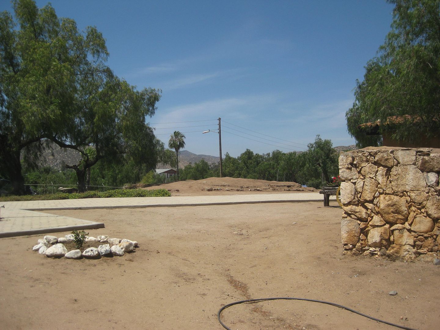
Guadalupe mission site foundations. The Guadalupe mission was the last California mission to be founded. The year was 1834 and in 5 years, Indian
raids destroyed the church and mission here.
Inside the museum:
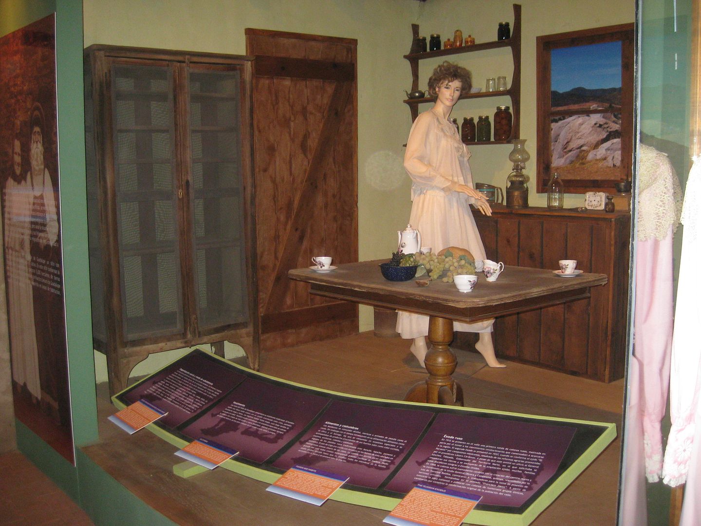
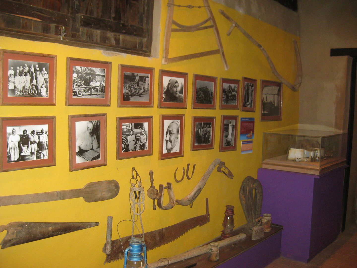
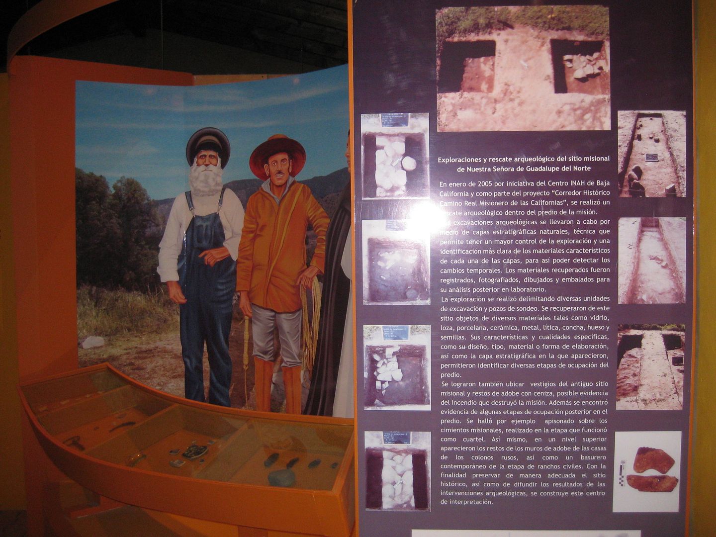
Outside...
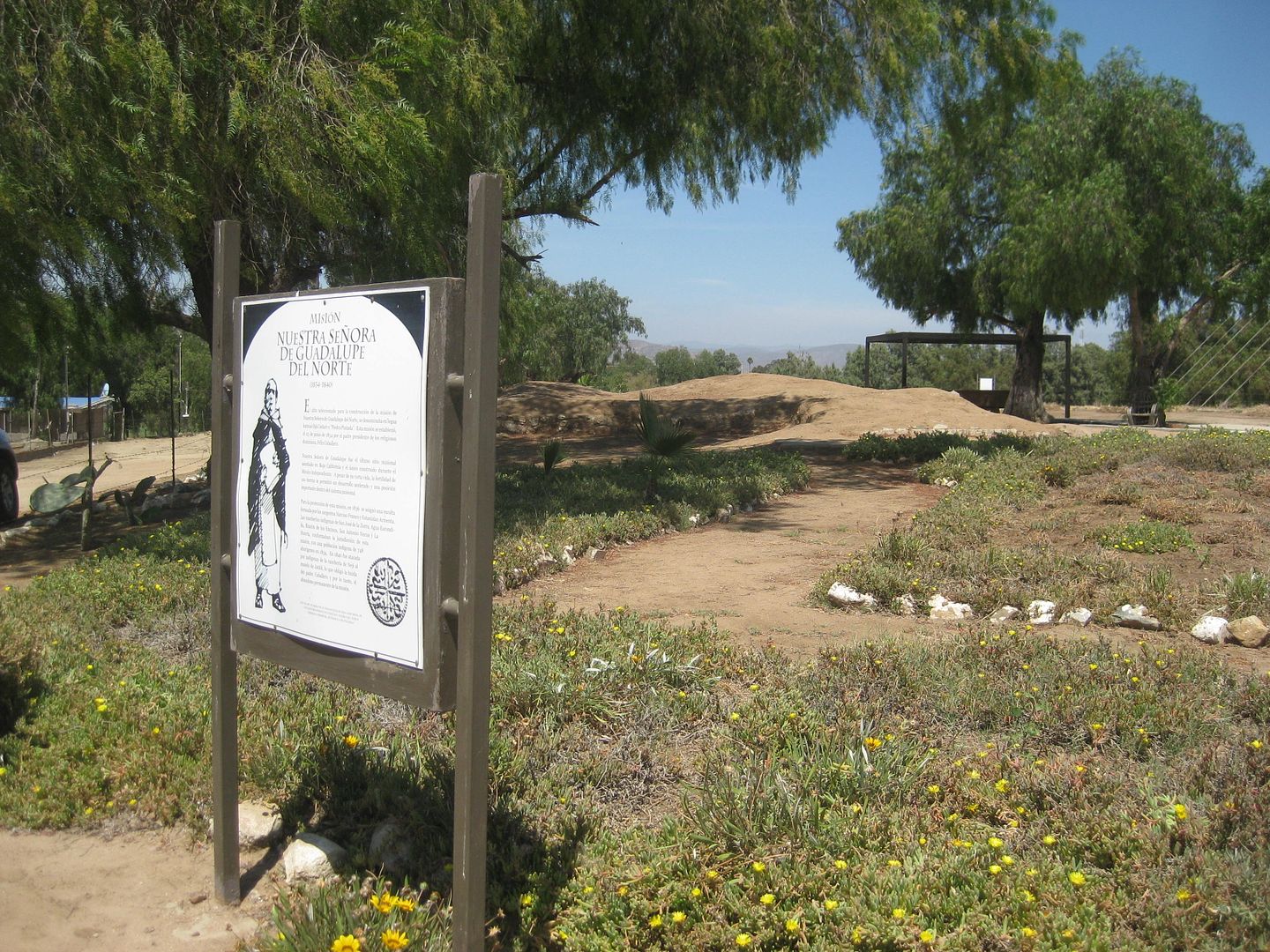
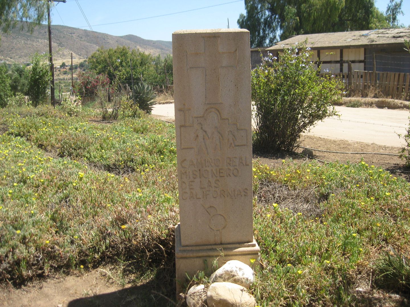
To find the mission, take the paved road going into town, at the Pemex station for Guadalupe (Francisco Zarco). Go 1 mile to a cross street. Ahead the
road is divided, turn left to the museum, passing a school.
I reach the Tecate border line at 3:27 and I am cleared into te United States at 3:31. With afternoon traffic, I get home at 5:30. 1,743 miles
traveled.
VIVA BAJA!
|
|
|
TacoFeliz
Nomad
Posts: 265
Registered: 7-22-2005
Location: Here
Member Is Offline
Mood: Exploratory
|
|
Another great trip report David. Keep 'em coming please...
|
|
|
TacoFeliz
Nomad
Posts: 265
Registered: 7-22-2005
Location: Here
Member Is Offline
Mood: Exploratory
|
|
Another great trip report David. Keep 'em coming please...
|
|
|
David K
Honored Nomad
Posts: 64479
Registered: 8-30-2002
Location: San Diego County
Member Is Offline
Mood: Have Baja Fever
|
|
I will, I will! 
|
|
|
hdn2mx
Junior Nomad
Posts: 75
Registered: 12-8-2002
Location: HB and Todos Santos/Pescadero
Member Is Offline
|
|
Unbelieveable documentation! Love it. Great work, feels like I just drove it myself.
Thanks, RT
|
|
|
David K
Honored Nomad
Posts: 64479
Registered: 8-30-2002
Location: San Diego County
Member Is Offline
Mood: Have Baja Fever
|
|
Thank you very much. This was one of 6 research trips in 2017 (so far). The others are also posted here. Again, thank you!
2017-2018 Baja Bound Road Guide & Map Research Trips at original size photos and no watermarks: http://www.vivabaja.com/Tacoma_Travels/
TRIP #1 (San Felipe to Punta San Francisquito via L.A. Bay): http://forums.bajanomad.com/viewthread.php?tid=85374
TRIP #2 (San Ignacio to Loreto, Ligüí, San Javier, Comondú, La Purísima): http://forums.bajanomad.com/viewthread.php?tid=85756
TRIP #3 (Mexicali to San Felipe, Valle Chico, Matomí, Parral, + El Rosario area): http://forums.bajanomad.com/viewthread.php?tid=85989
TRIP #4 (Valle de Trinidad crossover, San Quintin to Laguna Manuela and 7 Sisters coast road): http://forums.bajanomad.com/viewthread.php?tid=86376
TRIP #5 (Central Baja: El Arco, El Barril, San Francisco de la Sierra, Abreojos, Asuncion, Tortugas, Eugenia, Pronghorn Reserve): http://forums.bajanomad.com/viewthread.php?tid=86781
TRIP #6 (Southernmost Baja: San Ignacio to San Juanico, Loreto to Cabo San Lucas, San Evaristo, and more): http://forums.bajanomad.com/viewthread.php?tid=87323
TRIP #7 (Pacific North, San Pedro Mártir Mountains):
http://forums.bajanomad.com/viewthread.php?tid=87976
In 2018:
TRIP #8 (Tecate to Ensenada; Ensenada to San Felipe and south to Hwy. 1; Sierra Juárez Laguna Hanson road from Hwy. 3 to Hwy. 2): http://forums.bajanomad.com/viewthread.php?tid=91029
[Edited on 6-5-2021 by David K]
|
|
|
David K
Honored Nomad
Posts: 64479
Registered: 8-30-2002
Location: San Diego County
Member Is Offline
Mood: Have Baja Fever
|
|

|
|
|
David K
Honored Nomad
Posts: 64479
Registered: 8-30-2002
Location: San Diego County
Member Is Offline
Mood: Have Baja Fever
|
|
Here on Nomad, the Photobucket images are no longer sized to fit the page and have watermarks, but not where I also shared the trip report on Tacoma
World... odd?? I have been paying to prevent that.
Here is the trip report, as it should appear: https://www.tacomaworld.com/threads/2017-baja-expedition-5-c...
|
|
|
| Pages:
1
2
3
4 |
|