TMW
Select Nomad

Posts: 10659
Registered: 9-1-2003
Location: Bakersfield, CA
Member Is Offline
|
|
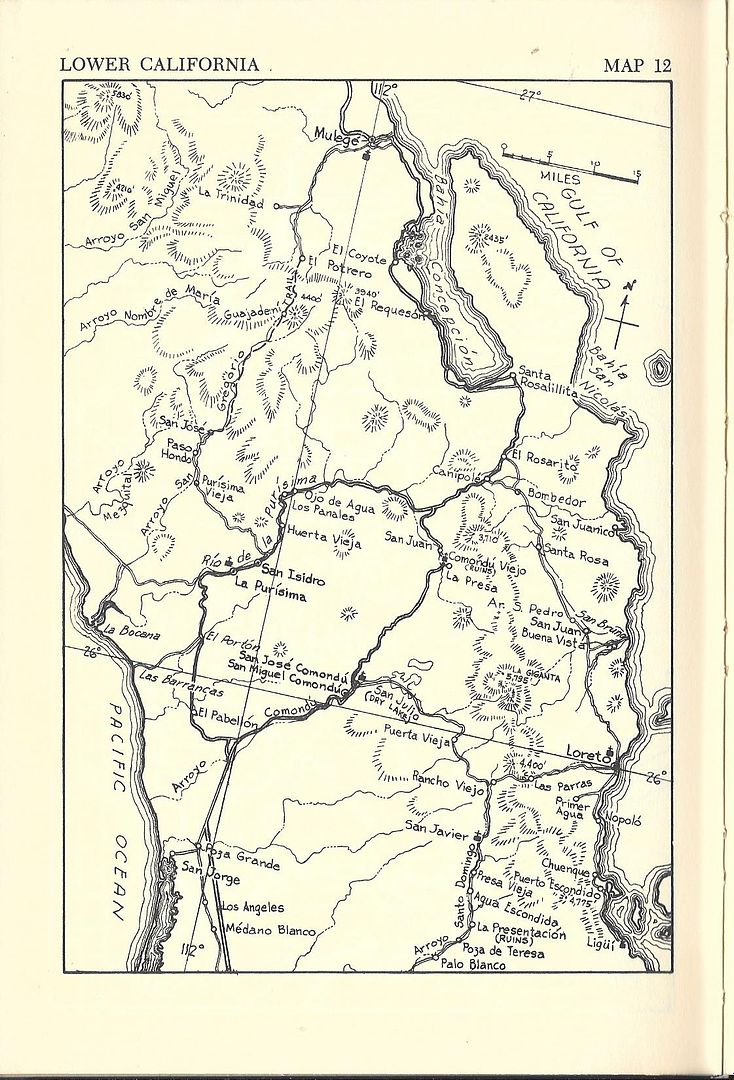
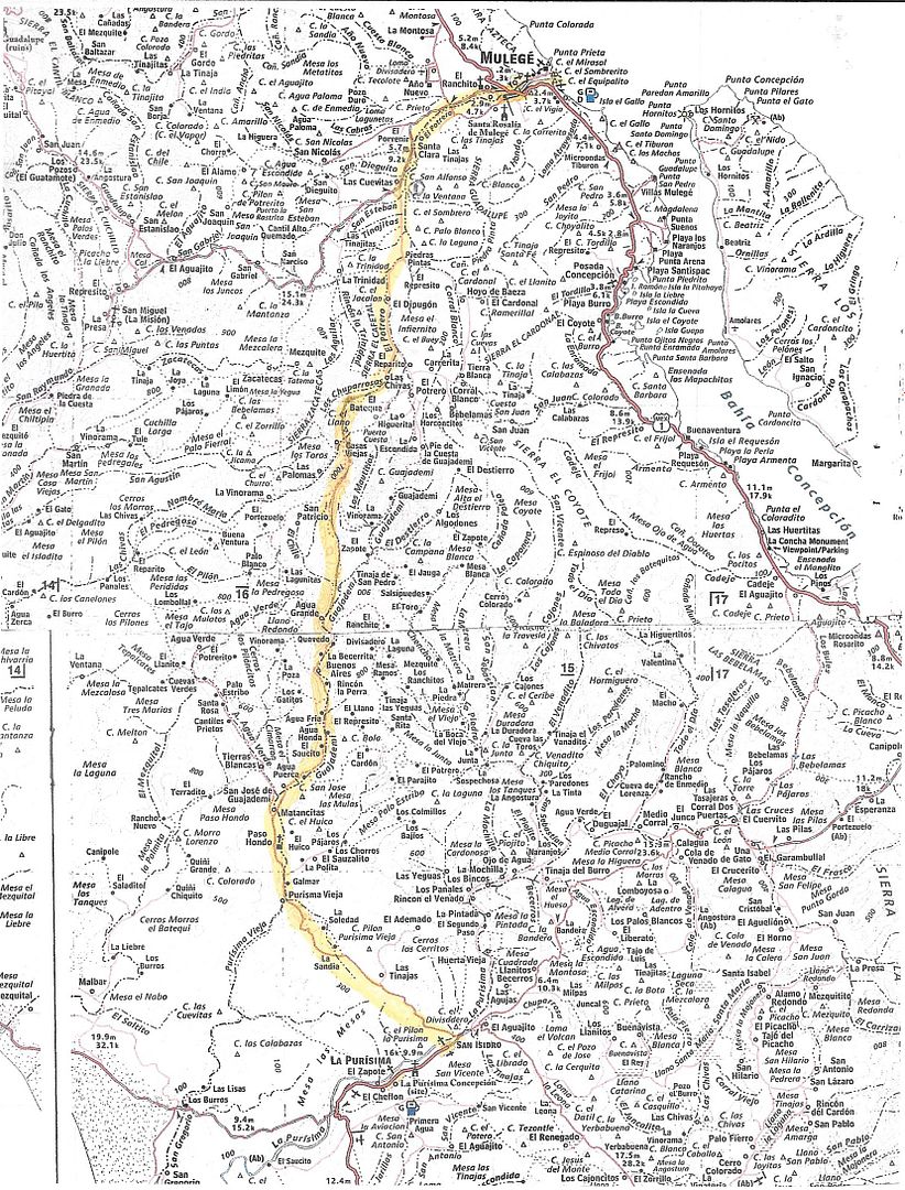
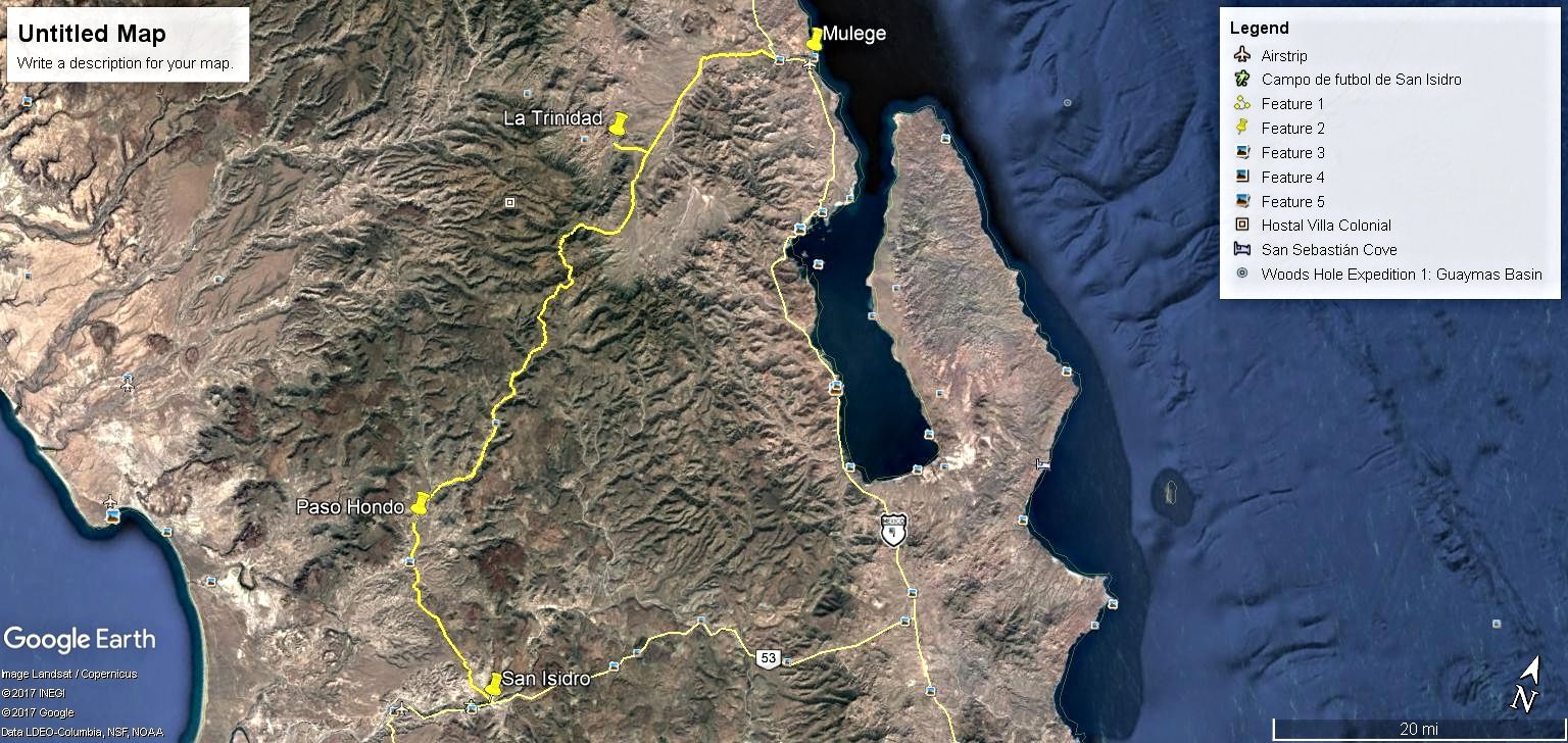
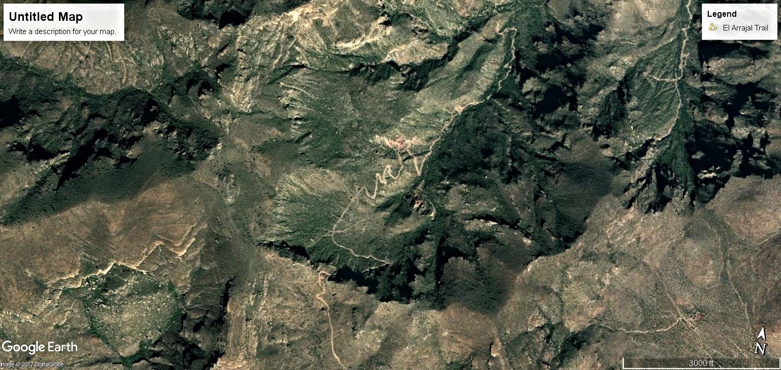
Mulege to San Isidro or San Isidro to Mulege
I just now noticed the route from Mulege to San Isidro in the Lower CA Guidebook by Gerhard and Gulick. It is very similar to the actual route now in
use. They called it the Gregorio Trail where as we or I have been calling it the Guajademi Trail.
Guidebook Map
Almanac Map
Google Earth Image
[Edited on 7-28-2017 by TMW]
|
|
|
David K
Honored Nomad
Posts: 64478
Registered: 8-30-2002
Location: San Diego County
Member Is Offline
Mood: Have Baja Fever
|
|
Great post Tom. Howard Gulick's book and maps are just so great.
It is a route of El Camino Real from La Purísima to Mulegé. The arroyo is San Gregorio... the word TRAIL is all CAPS so as to prevent the confusion
of that being the trail named.
|
|
|
TMW
Select Nomad
Posts: 10659
Registered: 9-1-2003
Location: Bakersfield, CA
Member Is Offline
|
|
A several months back someone reported that there was a rock slide on one of the switchbacks closing the road. I wonder if it is now open. It's a
great trail run.
|
|
|
David K
Honored Nomad
Posts: 64478
Registered: 8-30-2002
Location: San Diego County
Member Is Offline
Mood: Have Baja Fever
|
|
Do you have, or have you seen the maps we made of the newer auto road that is west of the trail? KurtG has driven it in his Explorer.
The Jesuit trail was never passable in a 4x4. Maybe Baja Bucko has ridden it on a mule?
Edit: I see you have a track and highlight of the auto road and not the trail of Gulick's map... Hard to see on my phone while Elizabeth is driving!
[Edited on 7-28-2017 by David K]
|
|
|
TMW
Select Nomad
Posts: 10659
Registered: 9-1-2003
Location: Bakersfield, CA
Member Is Offline
|
|
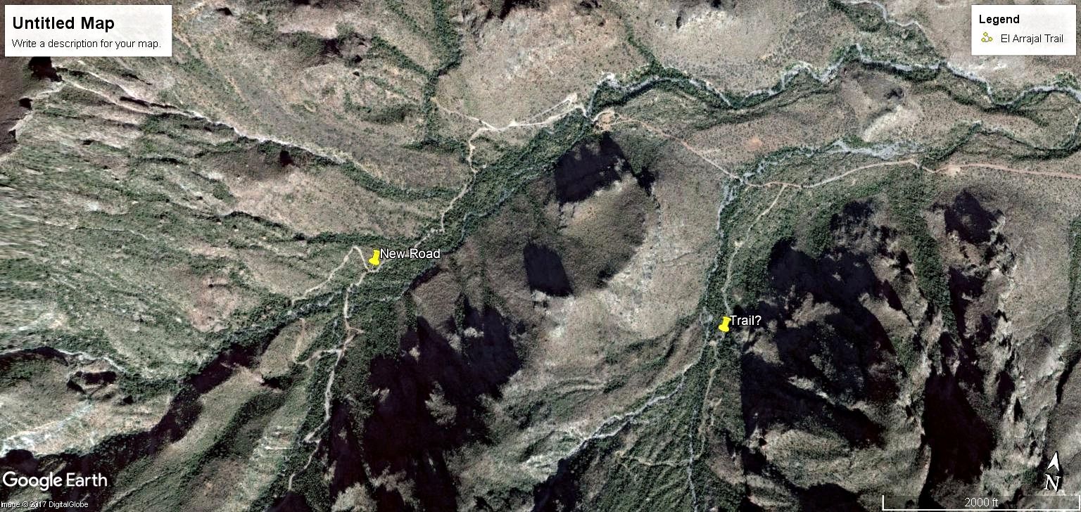
Where Gulick show the Trail I think is where the switchbacks are and that section was only opened around 2010. Google Earth does not show the
switchbacks in 2009 but do in 2010.
GE Image 2009
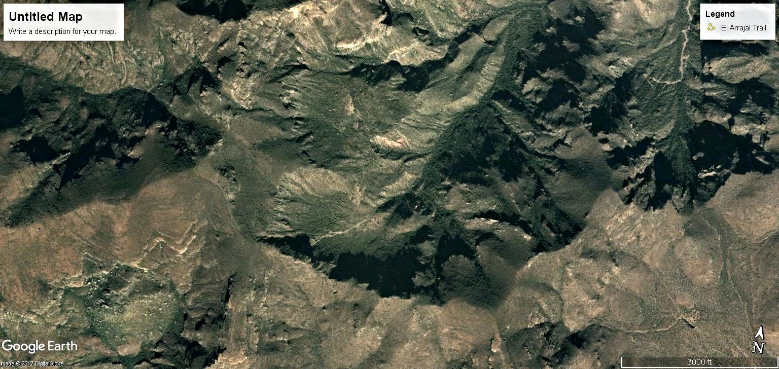
GE Image 2010
[Edited on 7-29-2017 by TMW]
|
|
|
TMW
Select Nomad
Posts: 10659
Registered: 9-1-2003
Location: Bakersfield, CA
Member Is Offline
|
|
It also could be that the original trail was to the right of the new road.
|
|
|
Jinete Viejo
Junior Nomad
Posts: 88
Registered: 1-23-2017
Member Is Offline
|
|
Has someone ridden / driven this route recently? I rode it in March of 2013 and it was no problem. I inquired this past February on this forum
regarding this route and the consensus was the route was not passable.
|
|
|
MulegeAL
Nomad
Posts: 298
Registered: 8-25-2009
Location: PDX/Mulege
Member Is Offline
|
|
Jinete,
I scouted the route N to S last Feb. The steep climb up into the Chuparossa canyon was totally destroyed starting 1/4 mile south of the rancho palapa
at the bottom of the canyon. I scrambled up another 200 yards, is a dry waterfall now, 3 foot overfalls and boulders as far as I could see up slope.
The rancheros park at the bottom and go in by mule.
Didn't try S to N last season as I spent March recovering from crash into a goat/broken rib. Would love to try S to N again from San Isidro, is a
very scenic ride.
|
|
|


