| Pages:
1
2
3
..
5 |
David K
Honored Nomad

Posts: 64476
Registered: 8-30-2002
Location: San Diego County
Member Is Offline
Mood: Have Baja Fever
|
|
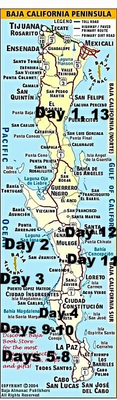
TRIP #6 (AUG 2017) Southernmost Baja Research Trip! North road to San Juanico and on to Cabo.
EDIT: Report & Photos sized for message boards and no watermarks are here: https://www.tacomaworld.com/threads/2017-baja-expedition-6-s...
2,946 Miles (Home to Home)
DAYS:
1) San Diego North County to Shell Island (south of San Felipe), 298 miles (via Mexicali).
2) Shell Island to El Datil south, 396 miles.
3) El Datil south to Lopez Mateos, 229 miles (via La Purisima & Comondu).
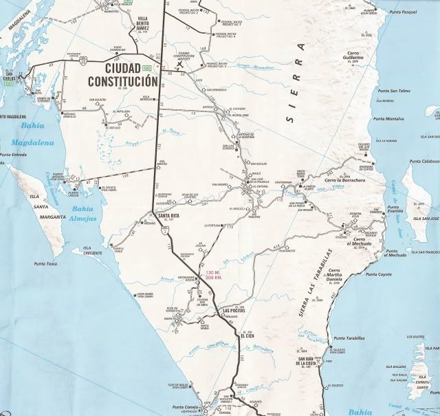
4) Lopez Mateos to Dolores Overview, 201 miles (via Pto. San Carlos, Mission San Luis Gonzaga, La Pasion).
5) Dolores Overview to La Paz, 181 miles (via La Soledad, San Evaristo, tire slow leak).
6) La Paz (Tire repair, a rest day otherwise)
7) La Paz to Todos Santos, Los Cabos, La Ribera, and back, 272 miles.
8) La Paz to Tecolote, La Ventana/El Sargento, Punta Arena, San Antonio, and back, 177 miles.
9) La Paz to Punta Conejo and La Aguja, 88 miles (Days 9 & 10).
10) La Aguja to Punta Marquez, Conquista, and back.
11) La Aguja to Constitucion (dead battery), Agua Verde Overview, Bahia Concepcion, 285 miles.
12) Bahia Concepcion to Mission Guadalupe to Punta Chivato, 135 miles.
13) Punta Chivato to Shell Island, 392 miles.
14) Shell Island (south of San Felipe) to North San Diego County, via Tecate, 292 miles.
DAY 1 (Tue Aug 1, 2017)
On the road at 8:05 am, heading east for Calexico/Mexicali via I-8.
Exchanged dollars for pesos at 17.35 pesos: 1 dollar. Making 100 pesos = US$5.76
The border crossing was simple, I got the green light [red light means you get inspected, it's either random or someone decides?]. As I already had a
validated FMM (Tourist Card), no need to stop at the INM (immigration) office, once inside Mexico.
At 12:20, I stopped to have lunch just south of Mexicali, at the restaurant 'Yocojihua' (Km. 12) having been reading good reviews for it on Baja
Nomad. I had 4 tacos dorados (2 beef & 2 chicken) with rice & beans and a Jamaica drink for 115 pesos + tip (25 pesos). It was a very
good lunch and start for Baja food!
Gasoline at Km. 184 'ejido' Pemex, near San Felipe, was 15.86 pesos per liter (=US$3.46/ gallon) for Magna (87 octane). The Oxxo market had a deal for
Tecate Light beer, 9 cans for 101 pesos (65 cents each). That deal improved the further south I got (10 cans for 95 pesos or 55 cents each). The time
was 2:17 pm.
Cans to avoid broken glass in the ice chest. However, later on... all the rough dirt roads did a number on 2 cans, causing them to leak! If I am not
on the road for a day, then an ice cold bottle or two of Pacifico is perhaps my favorite drink in Baja?
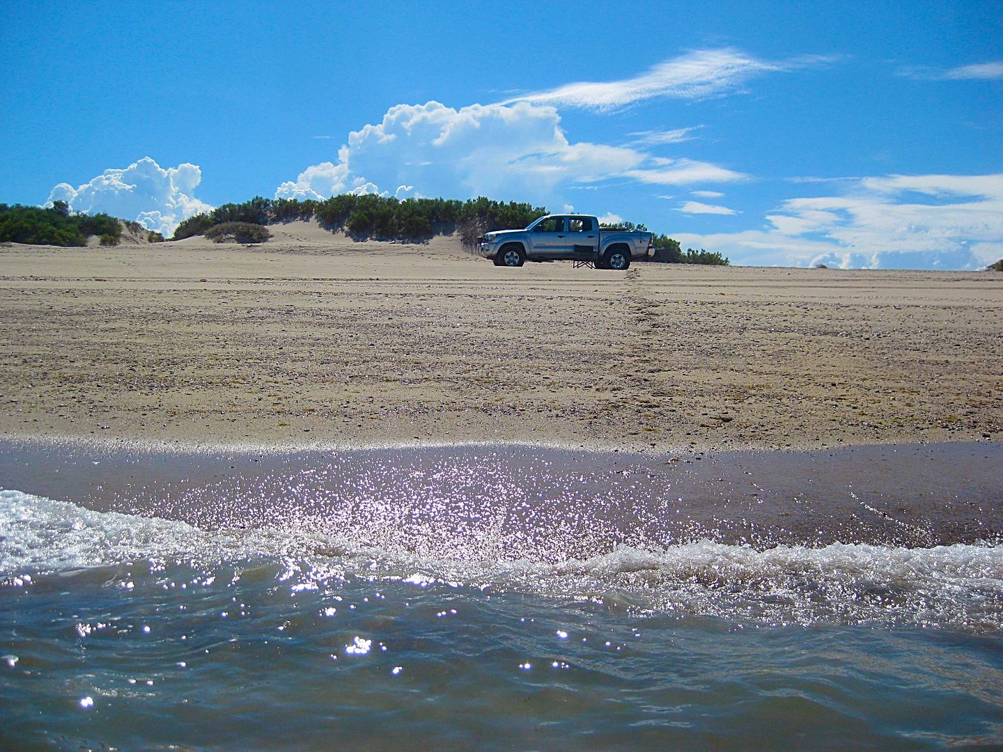
I arrive on Shell Island (access is 22 miles south of San Felipe) and go about a mile up the beach to camp. The truck not being as heavily loaded as
other times was able to do the drive on the deep sand without deflating (thus saving me the work of putting air back in, in the morning).
It is 4:30 pm and my simple camp is set up... a folding chair, a cot, and the stars above. Only a sheet is needed as the summer nights are warm.
DAY 1 PHOTOS:
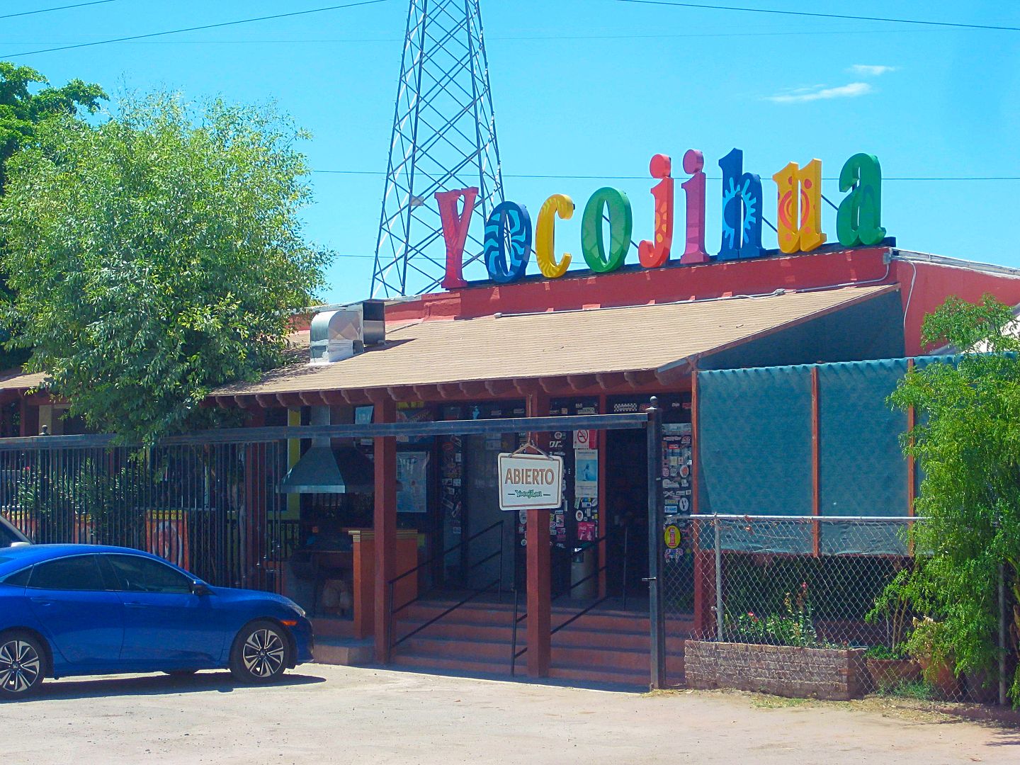
Km. 12, south of Mexicali
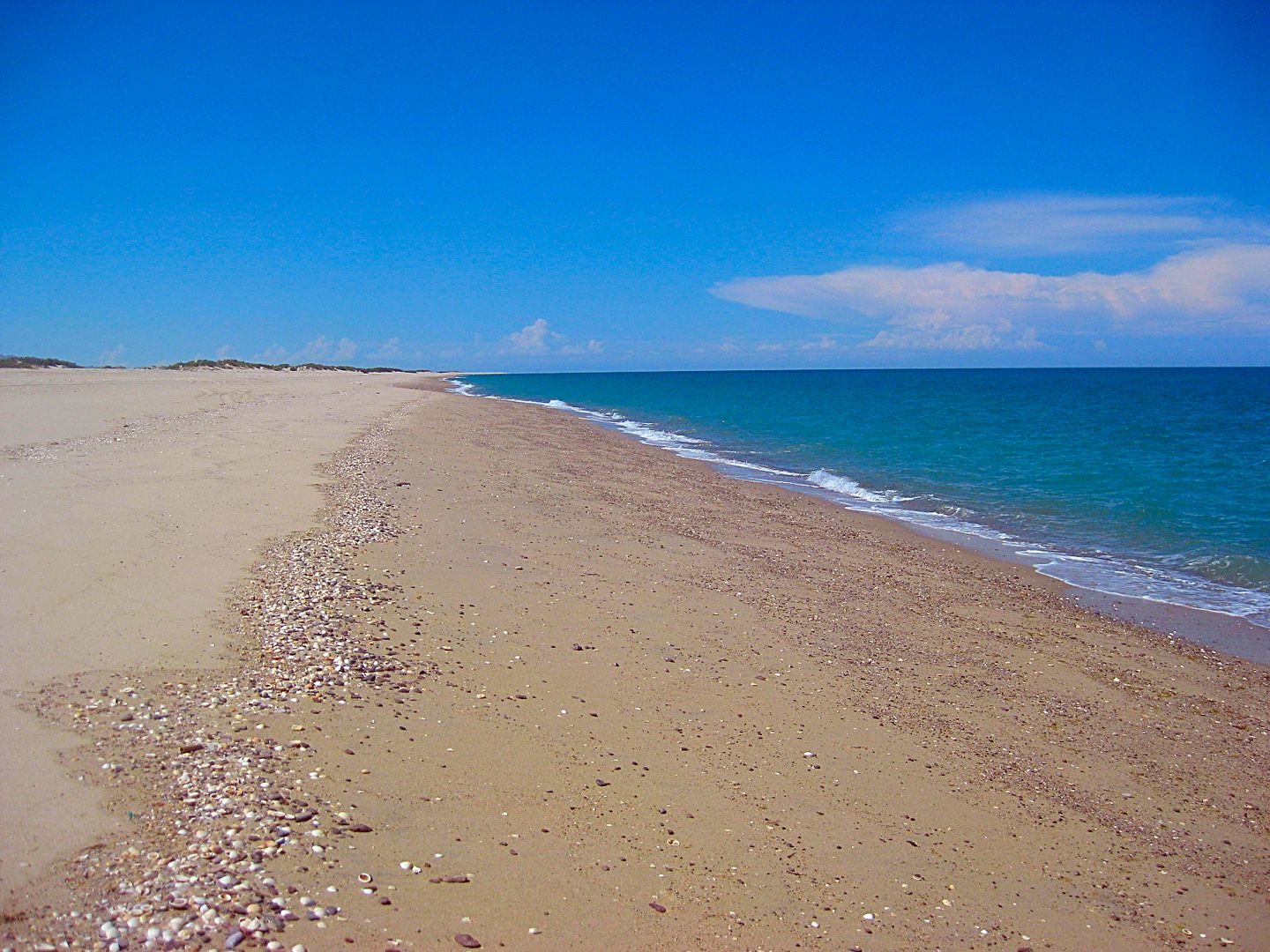
On Shell Island, Km. 26, south of San Felipe, looking north...
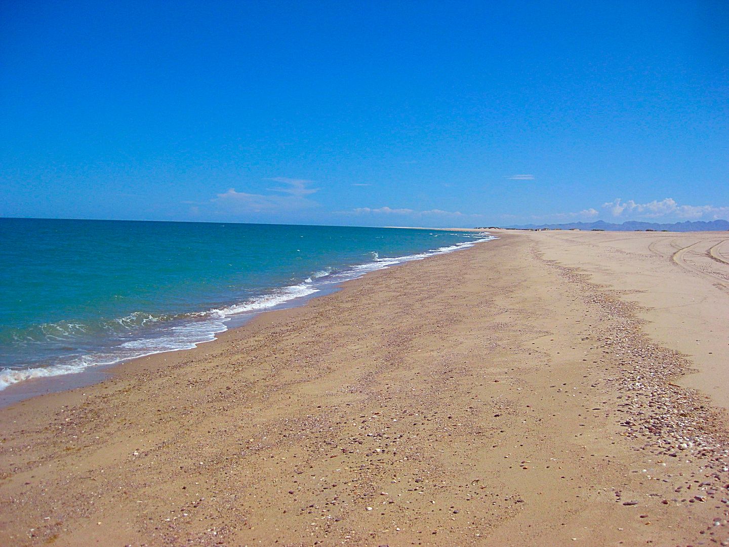
Looking south...
Shell Island as seen from the Sea of Cortez!
I enjoy a couple swims before the sun sets behind the Sierra San Pedro Mártir, just south of Diablo Mountain.
Total miles today: 298
[Edited on 6-5-2021 by David K]
|
|
|
David K
Honored Nomad
Posts: 64476
Registered: 8-30-2002
Location: San Diego County
Member Is Offline
Mood: Have Baja Fever
|
|
DAY 2 (Wed. AUG 2)
Being in a place where the sun rises over the sea instead of a mountain range means it gets light sooner. I was actually packed and left camp at 6:12
am!
I arrived at Bahía San Luis Gonzaga Pemex Station (Km. 147+) at 8:00 am. I topped the tank (108 miles from the last topping) so I could drive worry
free to San Ignacio. Magna here was 16.36/liter ($3.57/gallon) and pumped in 25 liters (6.6 gallons). For those who are wondering, dollars are
accepted everywhere in Baja. It is often easier to have pesos for trip expenses and takes away any confusion on money. Mostly that you will get pesos
in change if you don't have the exact amount in U.S. money. This remote Pemex was offering a good rate of 17.00 pesos per dollar. Further south, that
rate dropped to as low as 16.00 per dollar.
The end of pavement was unchanged from 2014, 12.5 miles south of the Gonzaga Pemex, just beyond the Km. 167 post.
A side note: There was a Km. 170 sign here for a couple years, even though it was 1 km. south of the Km. 166 post. THAT has been fixed!
I pass Coco's Corner, Mile 22.6 from Gonzaga/ 10.1 from the end of pavement, at 8:50 am. I reach Highway 1 (Laguna Chapala) at 9:28 am. Mile 35.7 from
Gonzaga, (23.2 unpaved miles).
At the Eagle Monument, near Guerrero Negro, is the state border between Baja California and Baja California Sur. The only 'big' deal here is being
charged 20 pesos to drive over an insect spray strip and losing an hour on the clock going into Mountain Time Zone. 11:30 am becomes 12:30 pm!
I arrive in San Ignacio at 2:09 pm Mountain Time. Pemex station to fill the gas tank for the long drive ahead...
16.27 pesos/liter here. My highway mileage is about 17 mpg... providing the gasoline pump amounts are correct... and sadly, many stations are known to
not be. That is just the nature of things... Baja is still so worth it.
Across from the Pemex station are some small eating places. The burrito/taco one is really good. I tried the sea food one today, Mariscos San Ignacio.
I had some great shrimp tacos and ceviche of mixed seafood. Totally great.
It is 1.6 paved miles from the highway into the town plaza at the giant, stone mission (founded in 1728). This mission of San Ignacio appears on the
cover of my book...
I will continue this day's report soon...
DAY 2 PHOTOS Part 1:
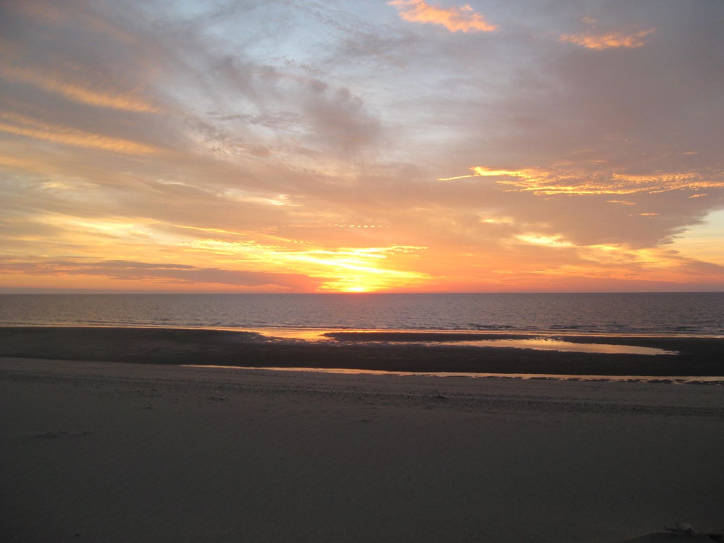
Sunrise from Shell Island
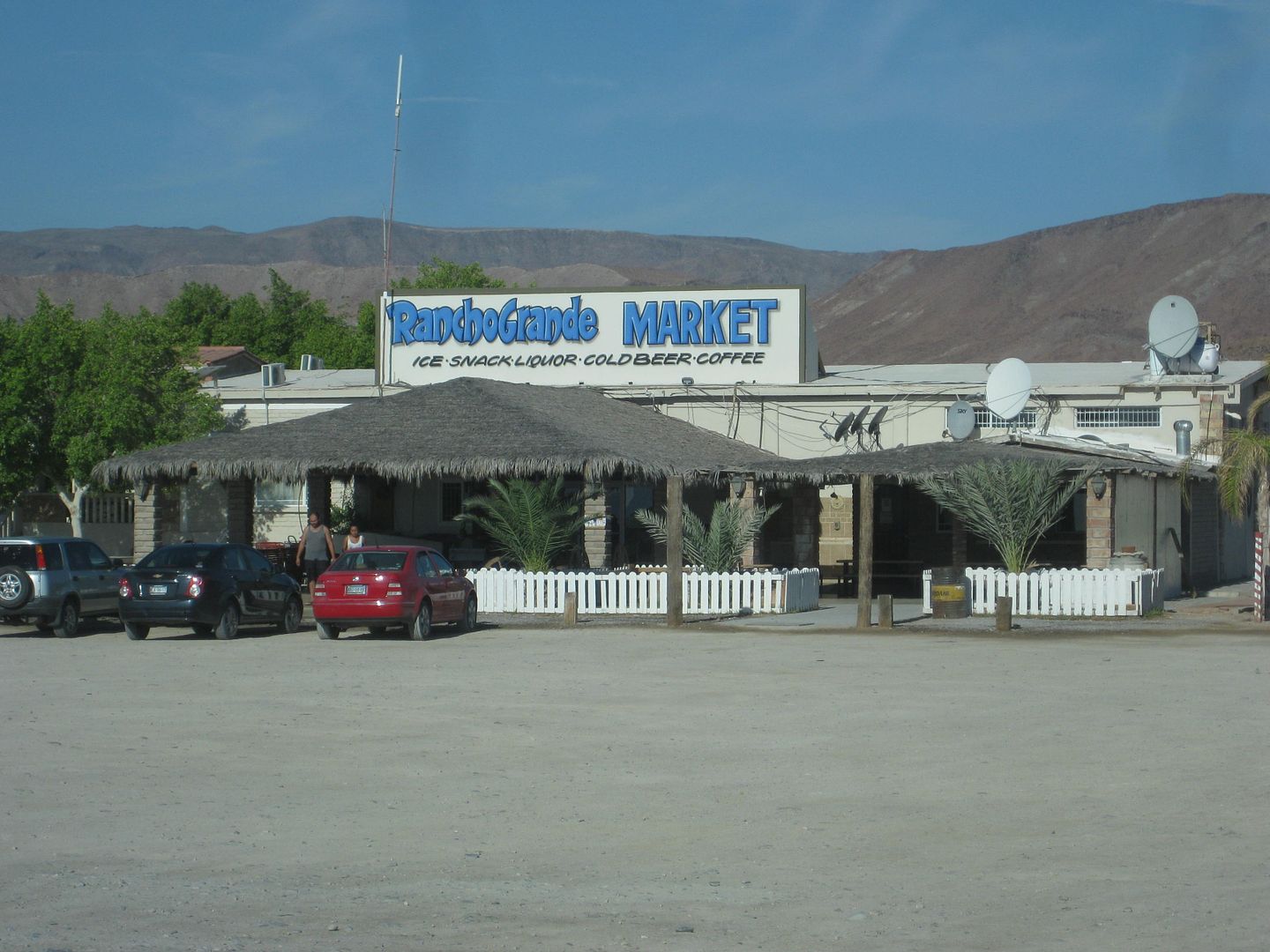
Rancho Grande Market (across from the Gonzaga Pemex) has a new sign.
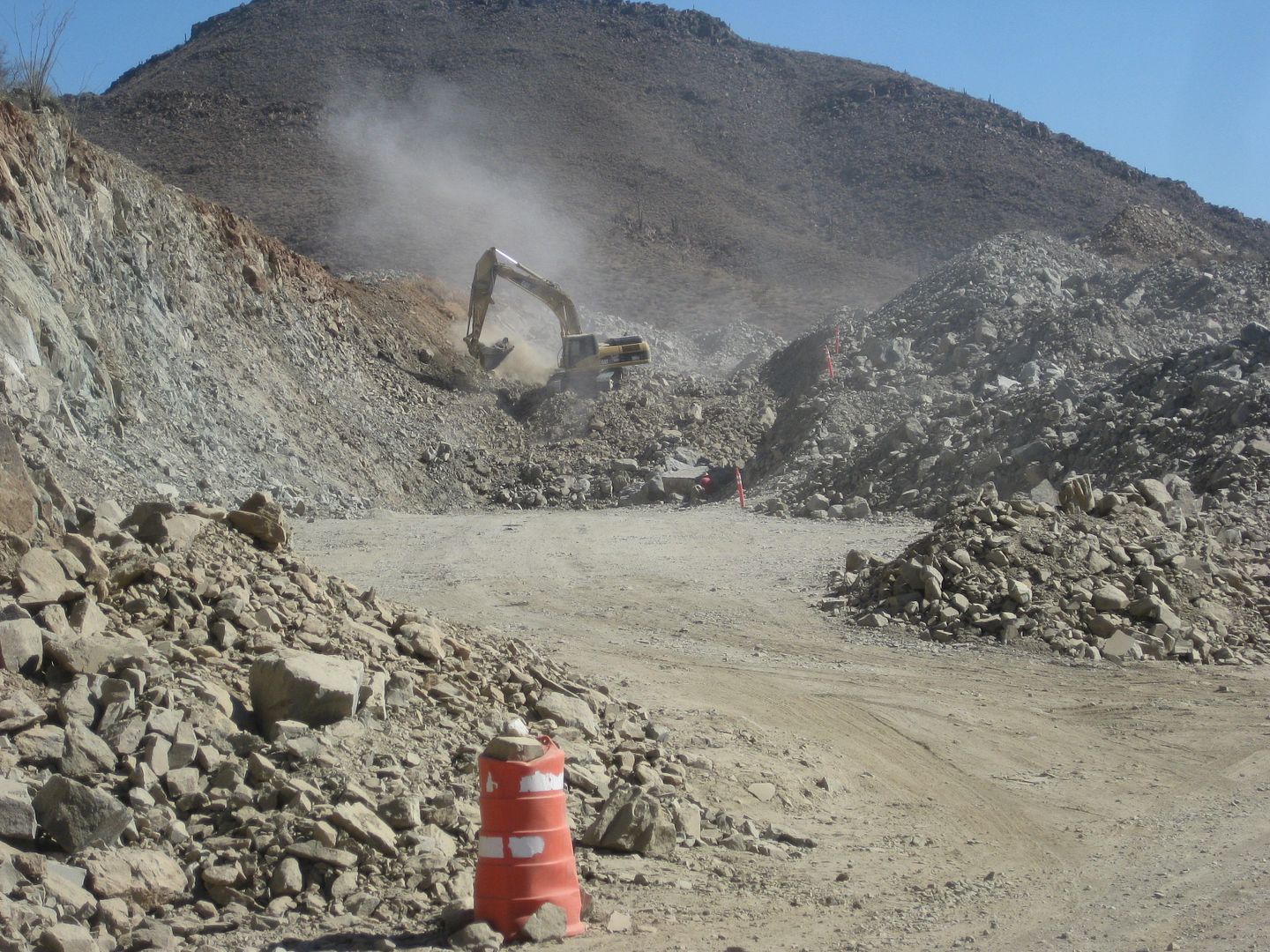
New highway construction south of Gonzaga Bay.
Hotel sign at Eagle Monument.
Eagle Monument on the state border, erected in 1973, 140 feet high, harder to see with trees military base buildings, and giant flag distraction.
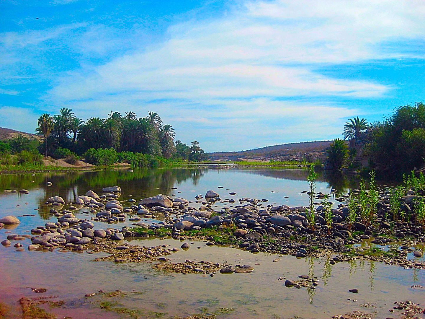
Oasis of San Ignacio, in the center of Baja.
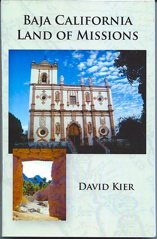
San Ignacio stone mission on my book's cover.
Much more of Day 2 to come!
[Edited on 8-16-2017 by David K]
|
|
|
David K
Honored Nomad
Posts: 64476
Registered: 8-30-2002
Location: San Diego County
Member Is Offline
Mood: Have Baja Fever
|
|
DAY 2, Part 2: San Ignacio South
Gas tank full, my stomach full, on south I go!
Setting the odometer to zero in front of the mission, I head for Laguna San Ignacio, a popular whale watching location, in season. Closed-up to
tourism off season.
The road has been paved to about 5 miles from the lagoon shoreline.
Here is a road log (with times), there may be slight differences in map and log mileages, maybe not [see revised log in bold text, below]:
0.0 Mission San Ignacio/Plaza (1.6 mi from Hwy. 1) 3:00 pm
0.6 Km. 0 Post
0.7 New pavement begins
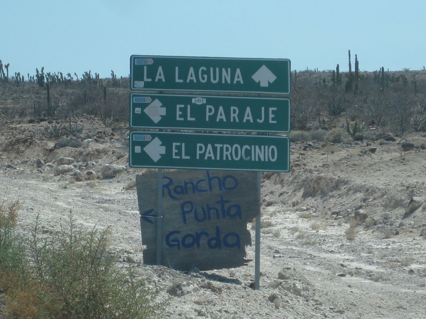
18.8 Road left to El Patrocinio (Km. 29.5)
30.1 End Pavement (Km. 47.5+) 4:00 pm
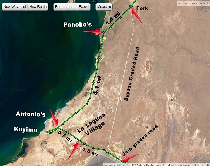
34.7 Fork, to bypass lagoon left (signed San José de Garcia). Go right.
36.1 Pancho's whale camp road
36.2 Along lagoon shore
38.8 Fork, go right "Kuyima" sign (left to Camp Cortez 11 km)
40.2 Cross road. Right to Antonio's, ahead to Kuyima, go left.
40.9 La Laguna, village, cross through.
42.8 Join back with the graded road that branched at Mile 34.7
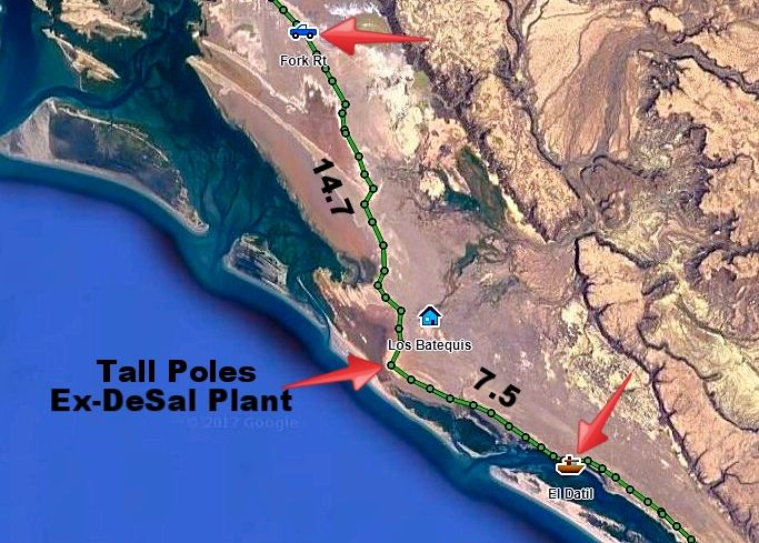
46.7 Fork, signed "Salina" (Salt Flat) to right. Bad washboard for a short distance. 5:02 pm
61.9 White empty building and tall poles with osprey nests on top. AAA map calls it a desalinization plant.
69.6 El Datil fishing village 6:15 pm
REVISED ROAD LOG
The mission and town plaza is 1.6 miles from Highway 1. Continue straight, passing in front of the mission church, passing the market and
hotel La Huerta, the paved street curves left, passing the Hotel Posada. Pavement ends briefly.
Km. 0 This marker sign is 0.6 mi (1 km.) from the mission/plaza. Pavement begins in 500 feet.
Km. 9 Rancho El Batequi
Km. 12.5+ Rancho San Juaquín Km.
Km. 16.5 Road left, signed to San Vicente.
Km. 19.5 San Zacarias
Km. 29.5 Road left to El Patrocinio (35 kms.)
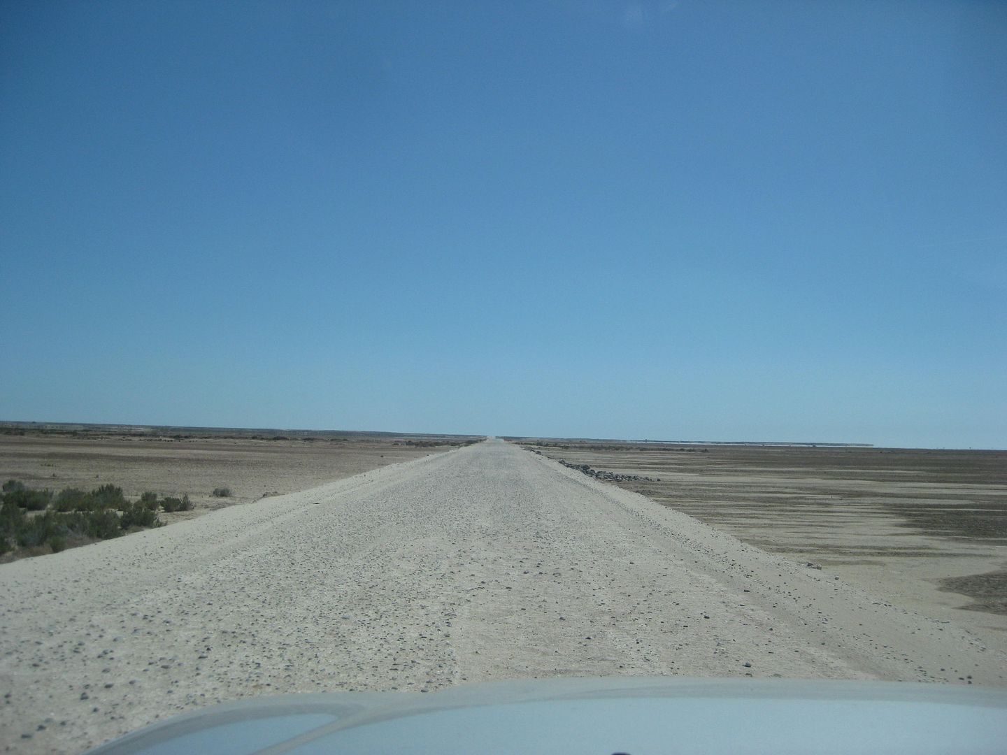
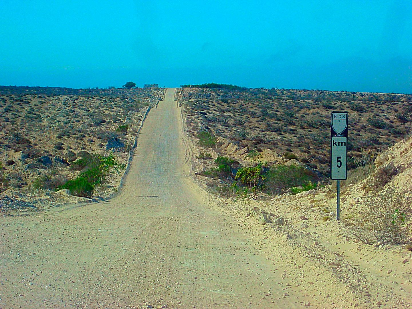
Km. 47.5+ End of Pavement (30.1 miles from the mission/plaza). The road ahead is an elevated roadbed, over the salt pan.
The following are mileages from the mission/plaza in San Ignacio:
34.7 Bypass road south, avoids whale camps and village. Signed San José de Garcia. Log goes on right branch, to the lagoon.
36.1 Pancho’s whale camp entrance, on right.
36.2 Lagoon shore.
38.8 Fork, keep right. Left goes into village.
40.2 Crossroad. Antonio’s Camp is to the right, Kuyima Camp is 0.4 mi ahead. Turn left (east) to continue south. Operations open during whale
watching season. Typically, that is December-April.
40.9 La Laguna village, pass through to far side. Several optional roads come back together.
42.8 Join graded bypass road from Mile 34.7, above.
46.7/ 0.0 Major Fork. Small sign “Salina” here. The left branch is the high road via Rancho Cuarenta and the access to San José de Garcia. The
low road returns to the high road after 39 miles. This road log uses the more popular low road, longer but smoother driving, if dry. Reset odometer to
zero.
The washboard surface begins very bad, but soon improves. Deflating tires by ~30% improves the ride and traction off the pavement.
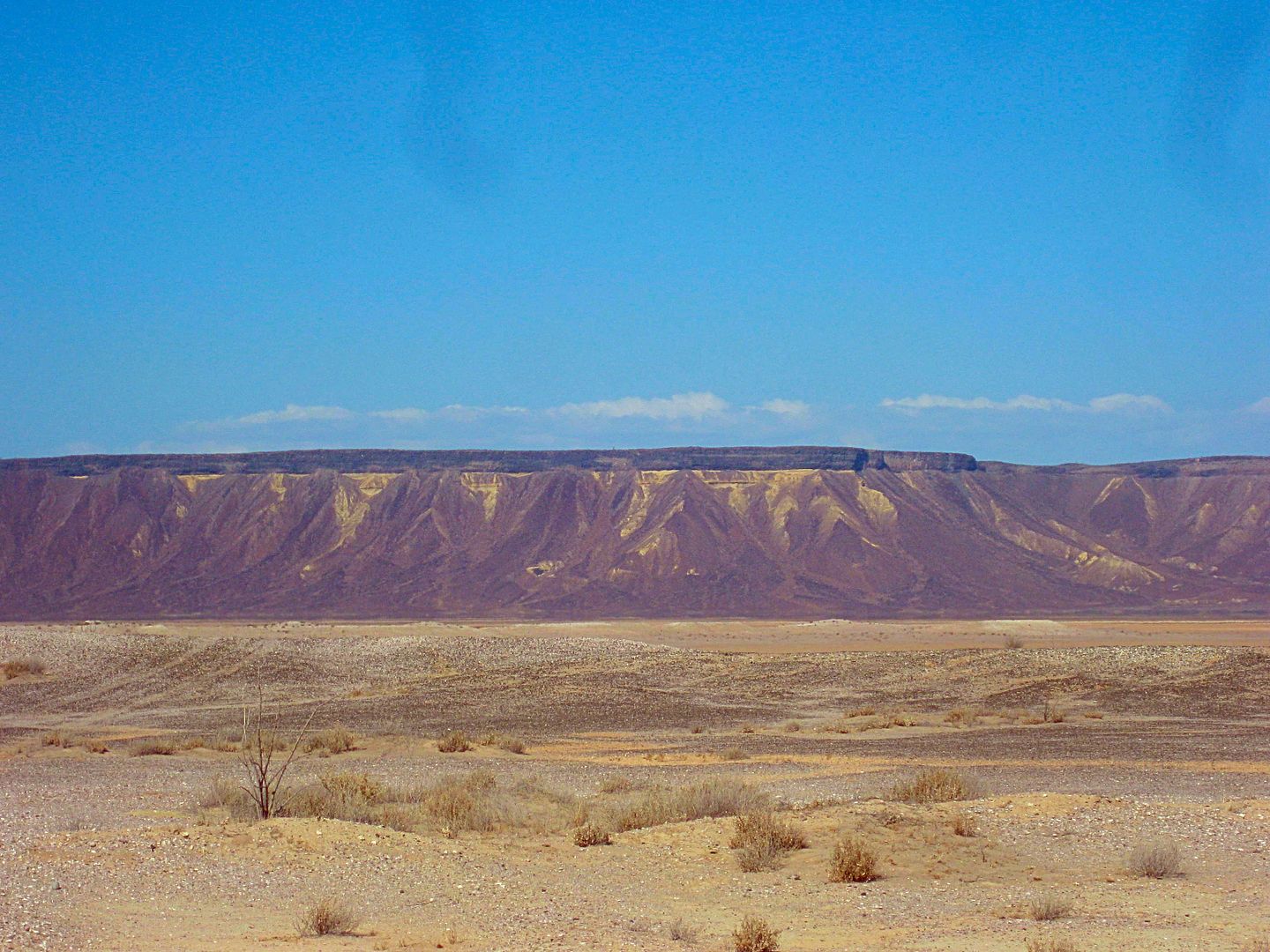
14.7 Abandoned building and many high poles now serving as osprey nests mark a former desalinization project. The road soon reaches the salt flats. It
is advised to avoid any shortcuts across the flats and stay on the route that follows the desert’s edge.
22.2 El Dátil fishing village. Limited supplies.
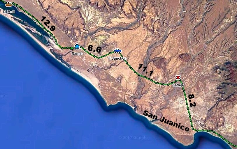
32.0 Sand dunes near the south end of salt flats. The road begins to turn inland.
35.1 Rancho El Datilón. The road soon turns south and crosses an arroyo.
41.7 Junction with high road coming approx. 39 miles from the fork at Mile 0.0, above. Turn south for San Juanico and on to La Paz.
46.7 Rancho La Ballena at Arroyo San Raymundo. The mountain road from Mulegé came in here, but recent storms may have altered the route.
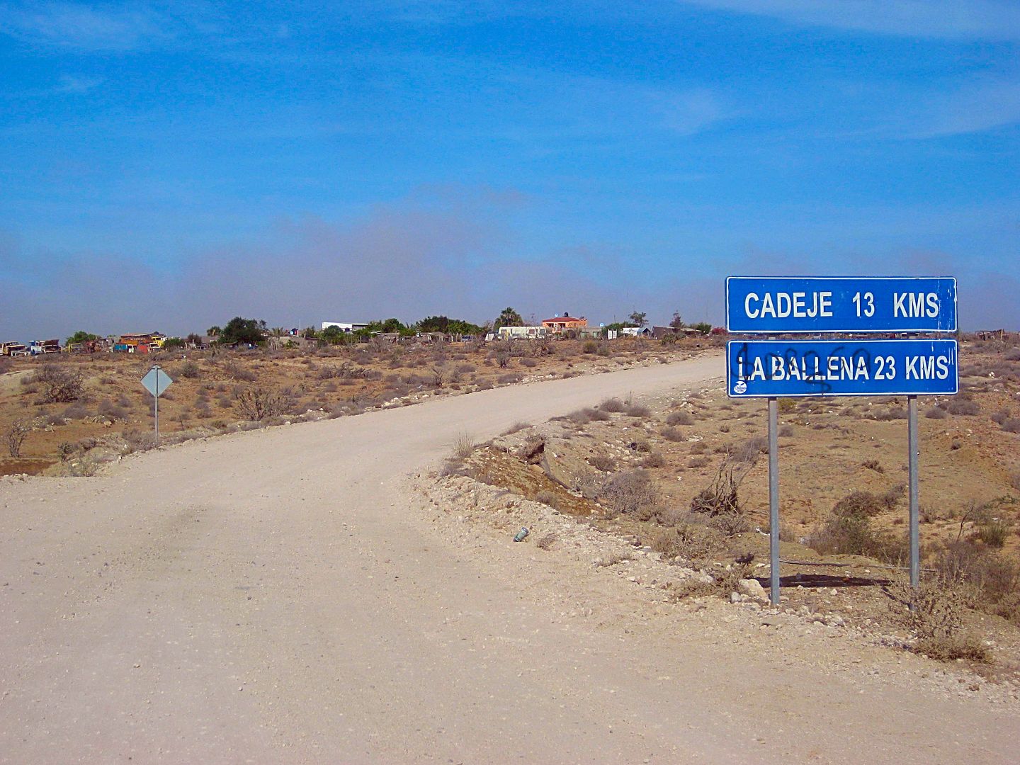
52.8 Cadeje an oasis village with an airstrip.
61.0 San Juanico town entrance. Motels, restaurants, supplies. Popularly known as Scorpion Bay by surfers. Paved road south to Las Barrancas and on to
Ciudad Insurgentes and Highway 1 to La Paz or Loreto.
10 miles south of El Datil, are sand dunes to the west and the end of the salt flat driving. I make camp in the sand dunes at 6:48 pm.
REVISED MAPS:
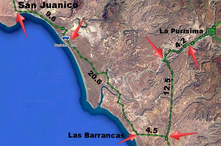
The more direct, original dirt road between San Juanico and La Purísima is between the red pointers, along the paved roads. The north end has the
blue truck symbol. The dirt road is approx. 20 miles long between the arrows. Another access is when the new highway reaches the edge of Estero San
Gregorio, reducing the dirt drive to La Purísima to about 12 miles.
PHOTOS:
El Patrocino road jcn. Km. 29.5
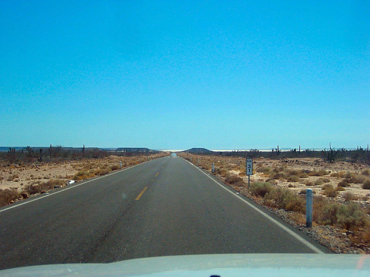
Km. 31
Unpaved road, easy.
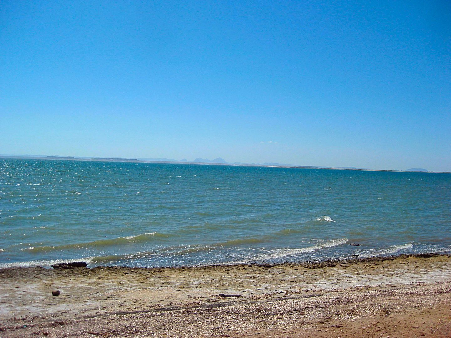
Lagoon shore
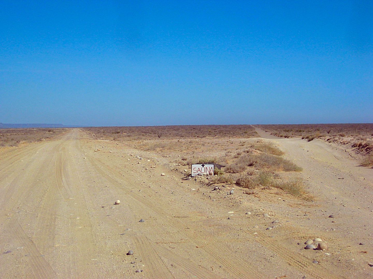
Salina Road Fork
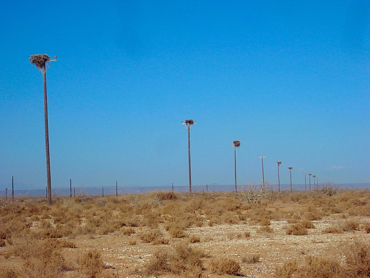
Tall power poles converted to osprey nests at ex-daslinization plant.
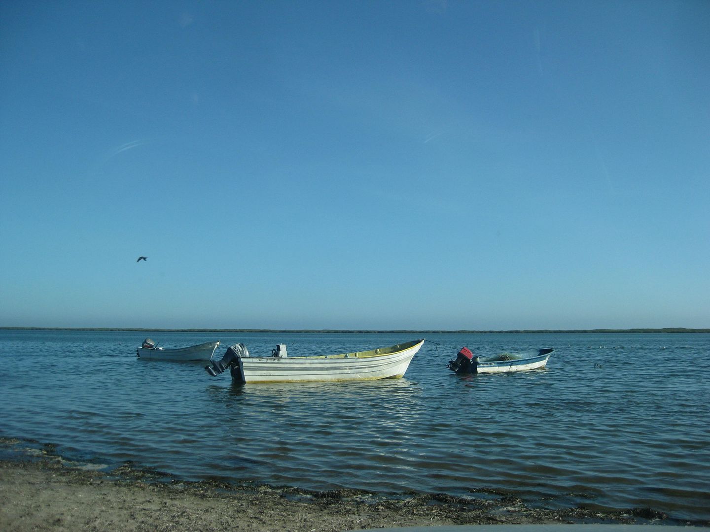
El Datil boats
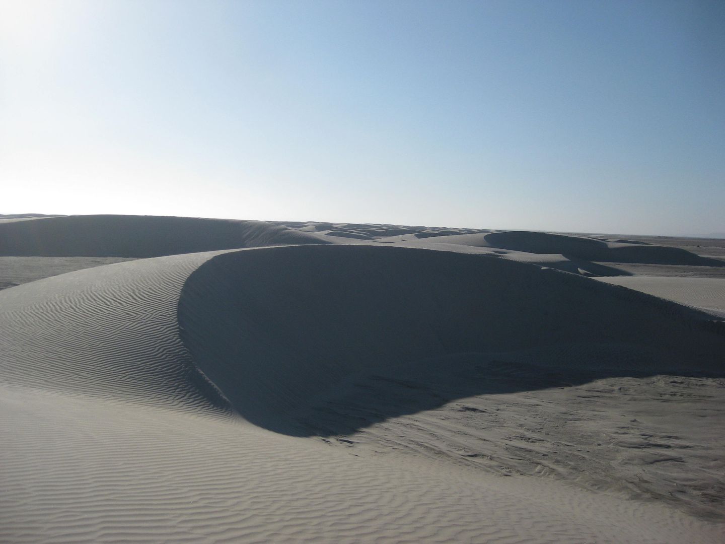
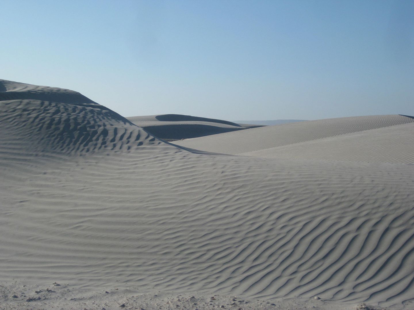
Sand Dunes
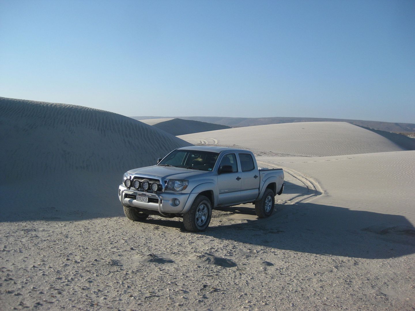
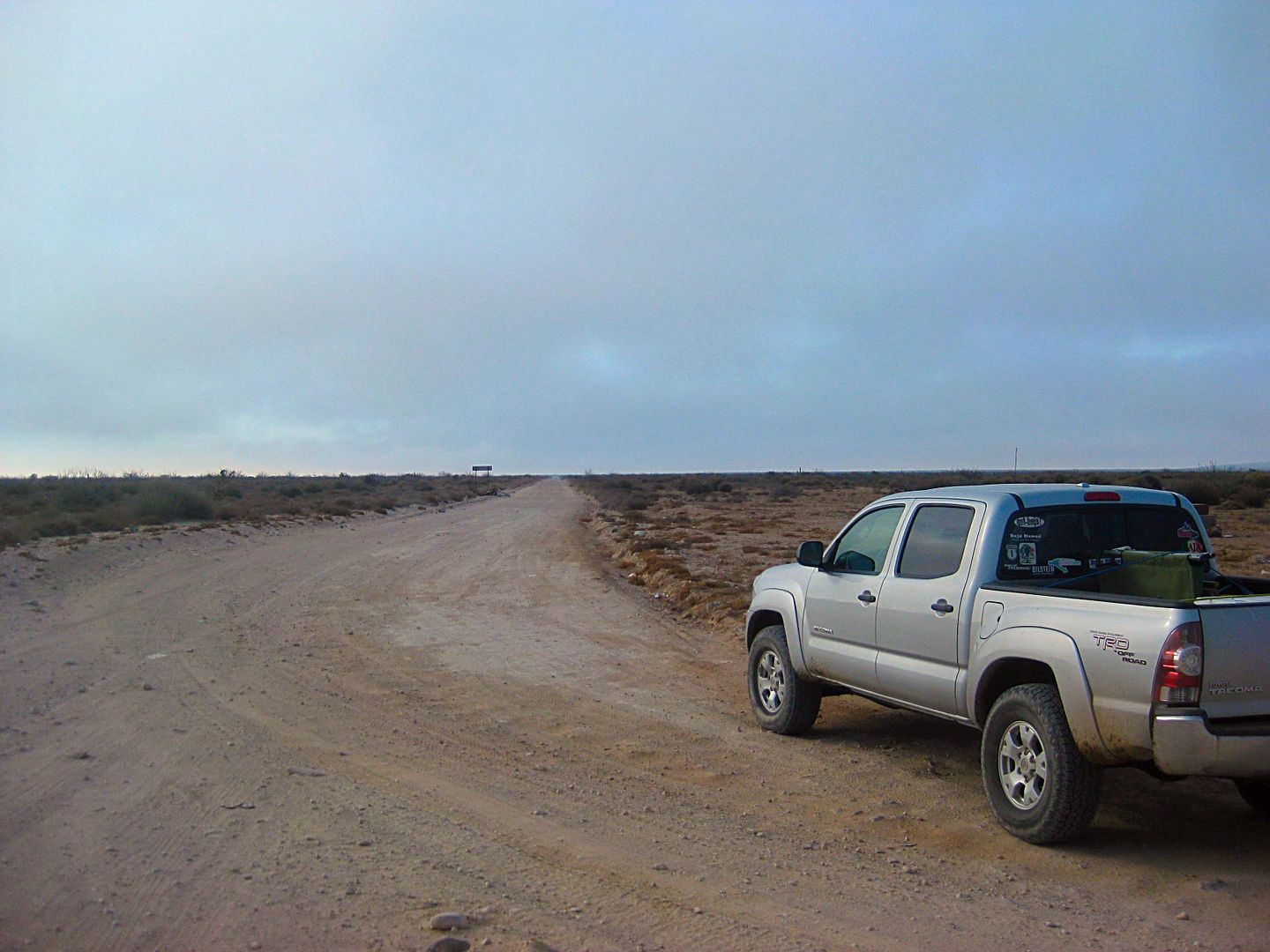
My ride, 2010 Tacoma Off Road 4x4
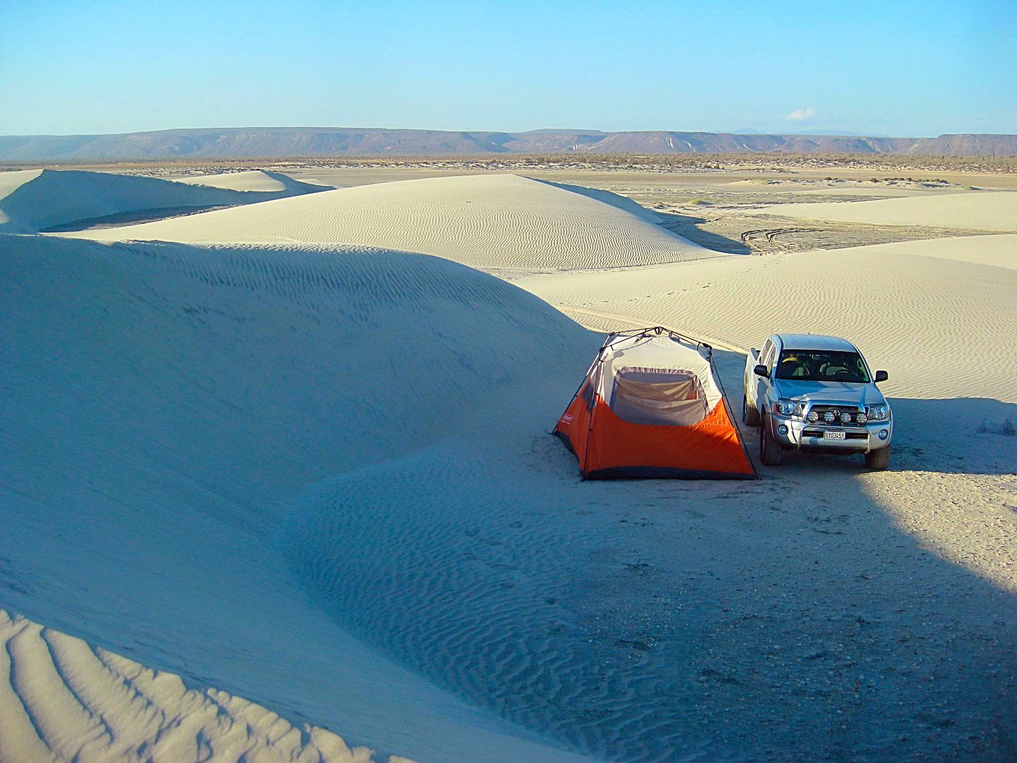
Camp Night 2.
Total miles traveled today: 396
[Edited on 12-30-2017 by David K]
|
|
|
StuckSucks
Super Nomad
Posts: 2305
Registered: 10-17-2013
Member Is Offline
|
|
I like the stealthy night 3 camp. Awesome photos!
|
|
|
David K
Honored Nomad
Posts: 64476
Registered: 8-30-2002
Location: San Diego County
Member Is Offline
Mood: Have Baja Fever
|
|
DAY 3 (Thu. AUG 3)
The evening on the sand dunes was great. I could hear the sounds of the Pacific far in the distance. I saw only one vehicle heading north to El Datil
on the Salina (salt flat) road before it got dark. I was about a half mile from the road and partially hidden by the dunes.
Thursday morning, I was packed up and on the road at 8:30. My body was telling me it was still on Pacific time, as it seemed like 7:30!
I passed a ranch, there was no sign with a name, but the map has El Datilón where it was. The road curves from east to south and crosses an arroyo
just past the ranch. The map shows a road fork before the arroyo crossing, but it was not very noticeable. The road was graded and maybe obscured the
fork.
The map shows another ranch called El Batequi de San Juan on the south side of the arroyo, but there was none. This map (Baja California Almanac) is
the best there is of Baja dirt roads, but it does have a few errors, as most maps do.
Eventually, the road from El Datil joins the high road used to reach San José de Garcia from San Juanico and was the road that forked at Mile 46.7.
The ranch of La Ballena is passed and the village of Cadeje is driven through. It has an abandoned army camp and an airstrip (with tires across the
runway to prevent it from being used, just any old time).
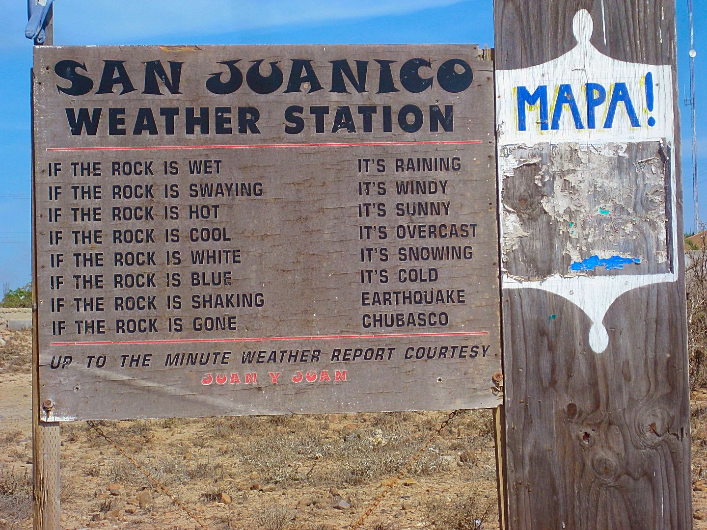
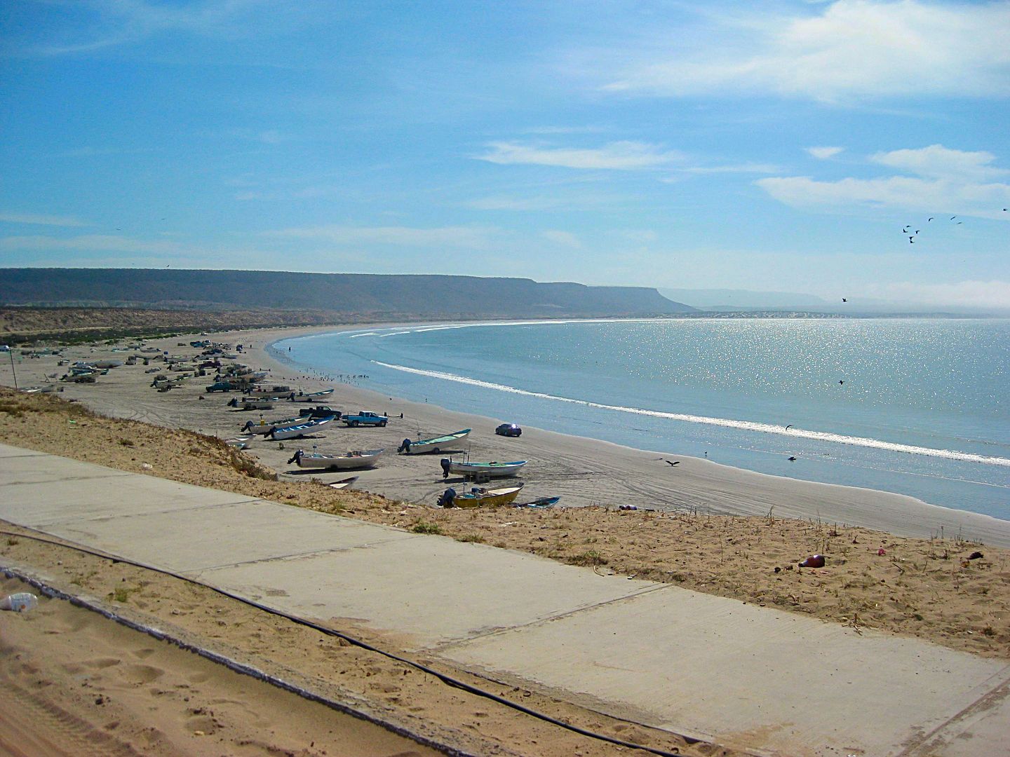
I came to a paved highway at the entrance to the town of San Juanico, also known as "Scorpion Bay" by surfers.
Let me add some road log details to continue from yesterday:
0.0 El Datil
10.0 (approx.) Leave salt flats and head inland, eastward.
13.3 Pass by a ranch (on left) and soon head across arroyo to the south.
20.1 T Junction with the high road. Turn right (south) for San Juanico.
25.6 Rancho La Ballena. The cross-mountain road from Mulegé had come in here, but a different route to Cadeje may be the best way after recent
hurricane damage?
31.9 Cadeje, a small village.
40.4 San Juanico, "Scorpion Bay". Large town.
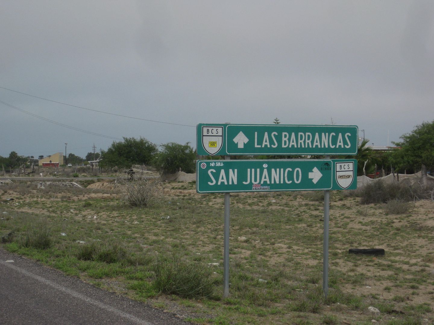
Paved road goes south to Las Barrancas, 30.2 miles.
I drive around San Juanico once and noted a couple restaurants. While I did see signs for a motel, I was not seeing much of anyplace that looked like
one on my quick drive by. Maybe rooms in people's homes are rented? Like other surfer locations, maybe secrecy is strictly enforced to keep away
newbies? LOL The surfers on the Internet have a strict code of silence! So as to not create "waves" I don't spend a lot of time at surfer locations
and move on.
The new-ish paved road to San Juanico from the south was in good condition to Las Barrancas. The 4.5-mile paved road from Las Barrancas to the
Insurgentes-La Purísima road had some pot holes to dodge.
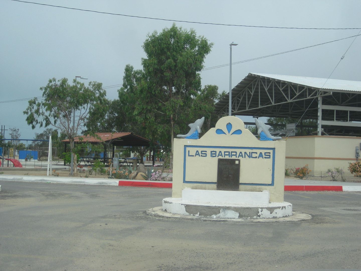
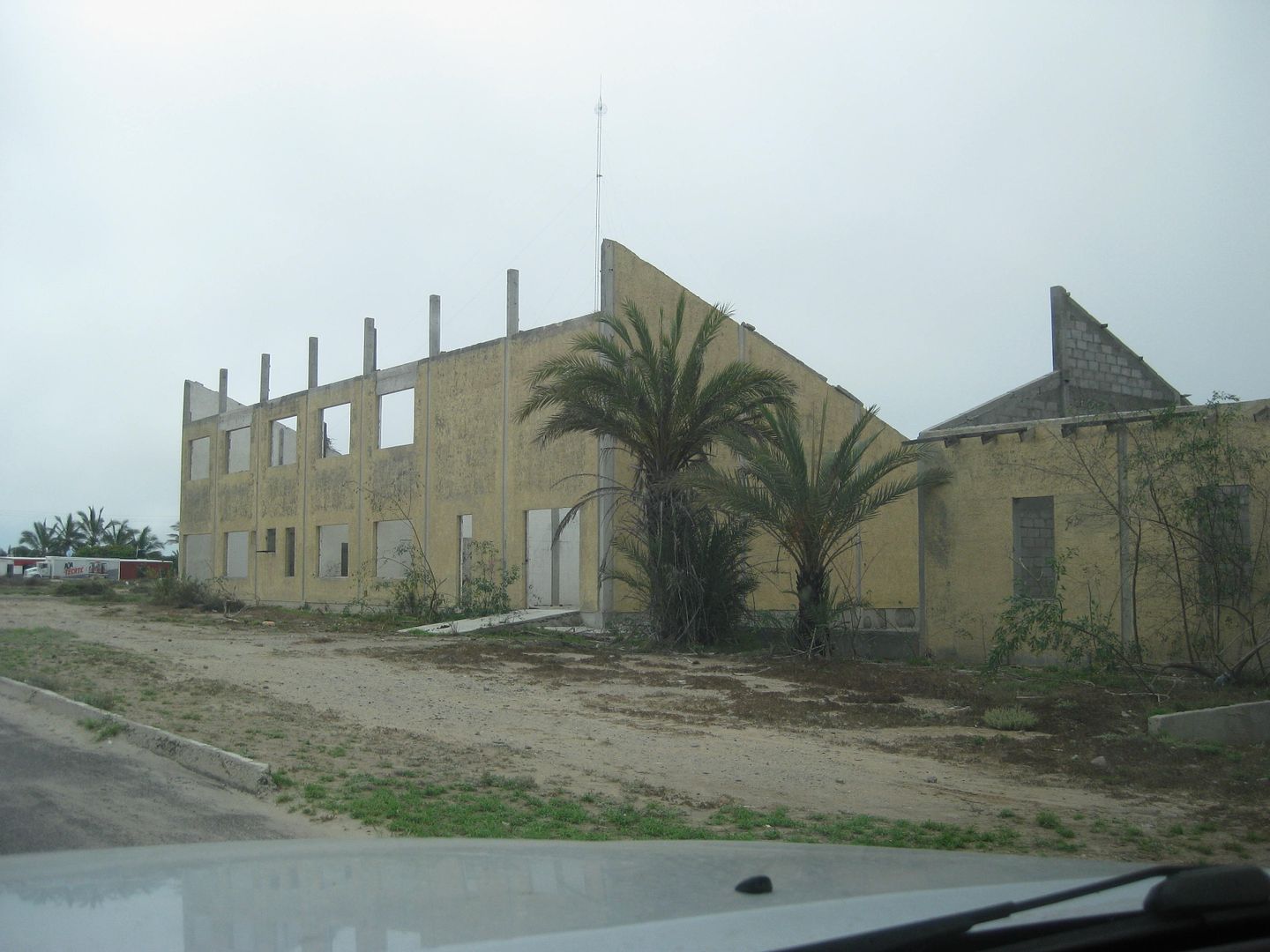
Las Barrancas was the location of a German/Mexican solar energy facility many years ago, long abandoned.
PHOTOS:
T Junction (El Datil road meets the High road)
Arroyo San Raymundo at Rancho La Ballena (just ahead on right).
Nearing Cadeje
Oasis at Cadeje
Three miles to San Juanico
Looking north from pavement at San Juanico.
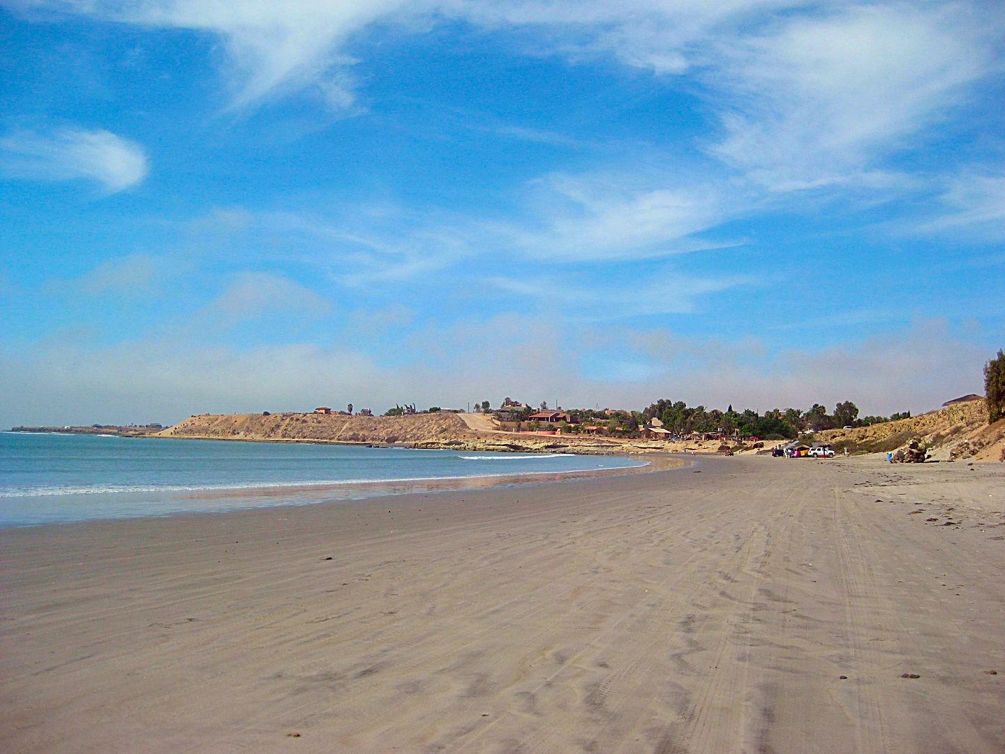
Beach at San Juanico
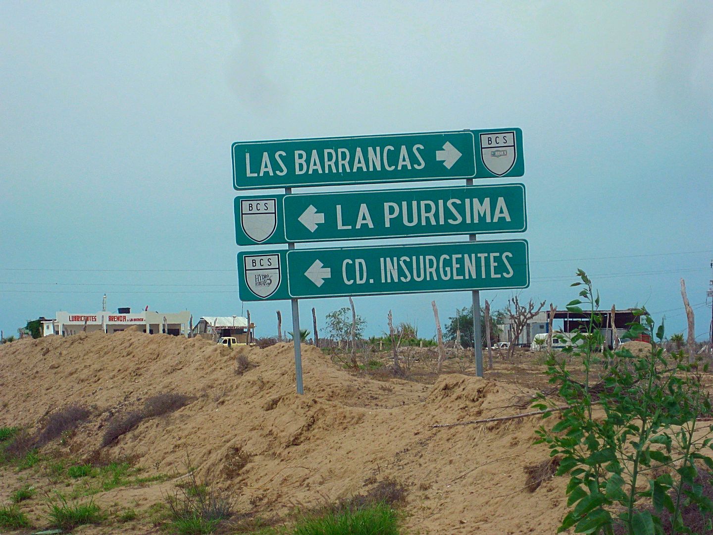
30.2 miles south of San Juanico, at the entrance to Las Barrancas.
Looking west at road junction.
Coming up next: La Purísima, San Miguel Comondú, and López Mateos.
|
|
|
BajaTed
Senior Nomad
Posts: 859
Registered: 5-2-2010
Location: Bajamar
Member Is Offline
|
|
Awesome Pics and portrayal of Baja Dave, they make me sigh like a girl
Es Todo Bueno
|
|
|
Tres Rios
Junior Nomad
Posts: 45
Registered: 7-26-2017
Member Is Offline
|
|
Thanks for the trip report David K.... was wondering what kind of tire pressures you are running when driving in the sand and what king of air
compressor you are using to re-inflate tires for our trip down the east coast Baja in December????
|
|
|
David K
Honored Nomad
Posts: 64476
Registered: 8-30-2002
Location: San Diego County
Member Is Offline
Mood: Have Baja Fever
|
|
Quote: Originally posted by Tres Rios  | | Thanks for the trip report David K.... was wondering what kind of tire pressures you are running when driving in the sand and what king of air
compressor you are using to re-inflate tires for our trip down the east coast Baja in December???? |
My tires are Hankook Dynapro ATMs (265/75-16). The street pressure is 34 psi for my truck (did the chalk test to calculate ideal street pressure).
Off pavement, there are various opinions.
Most of the time I drop to ~25 psi for dirt roads (resists punctures from sharp rocks and improves the ride for occupants).
If flotation needs improving in the sand, then 15-20 psi works for most situations.
This trip, I was not as heavily loaded as my typical camping trips and did not need to deflate on the beach. But, when I did in the past, 18 psi
worked with these tires.
In extreme situations or when running mud terrain style tires or 3-ply sidewall (BFG All Terrain TAs, etc) tires, then dropping to 10 psi is common
for sand driving. Some Nomads drop them to 10 psi for all off road driving.
*The way to decide if you need to lower the pressure is if the vehicle begins to spin any tires or just struggles to move ahead. I drive onto the deep
sand and if it acts like it wants to bog in, I stop and deflate. The truck then moves ahead effortlessly. 4WD-HIGH RANGE in sand. Low Range provides
too much torque power and tends to cause the tires to spin, and that digs you in! NEVER SPIN TIRES IN SAND... STOP and let out more air!
I have the popular Tsunami MV-50 air compressor. About 6 psi per minute to refill. 2.5 min. per tire usually.
[Edited on 8-16-2017 by David K]
|
|
|
David K
Honored Nomad
Posts: 64476
Registered: 8-30-2002
Location: San Diego County
Member Is Offline
Mood: Have Baja Fever
|
|
Just wait... the good stuff is still coming!
|
|
|
ehall
Super Nomad
Posts: 1906
Registered: 3-29-2014
Location: Buckeye, Az
Member Is Offline
Mood: It's 5 o'clock somewhere
|
|
Wow. What a trip. Waiting for the rest.
|
|
|
David K
Honored Nomad
Posts: 64476
Registered: 8-30-2002
Location: San Diego County
Member Is Offline
Mood: Have Baja Fever
|
|
DAY 3 continued...
It is 4.5 miles from Las Barrancas (the San Juanico highway junction) to the La Purísima/Insurgentes highway.
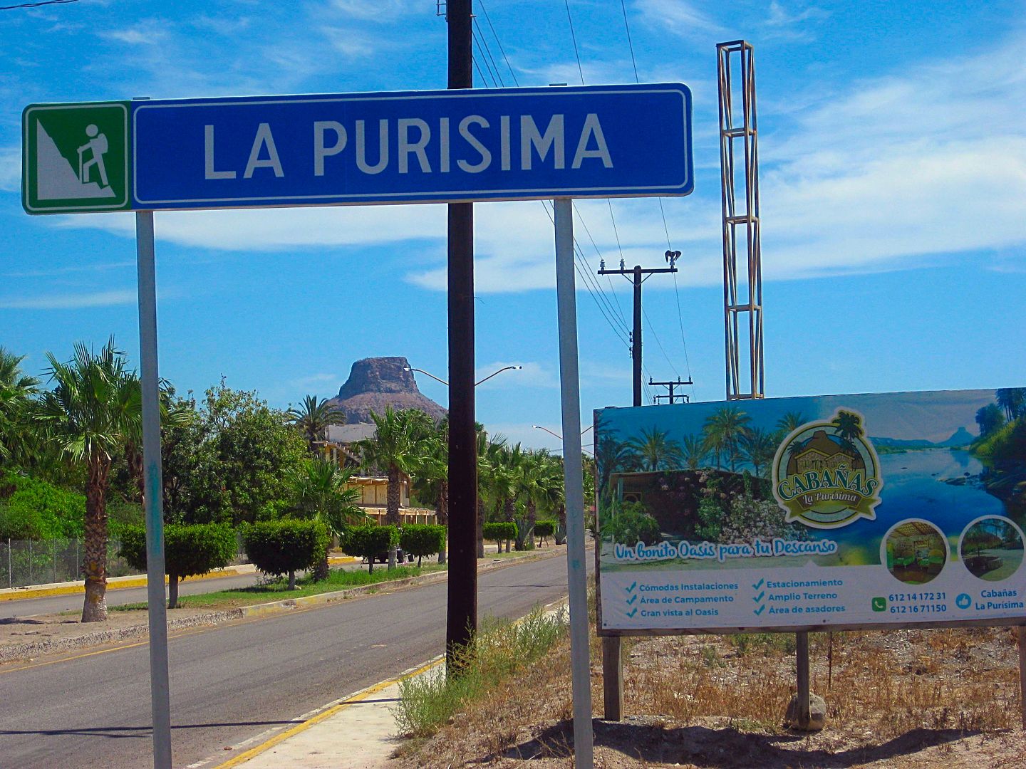
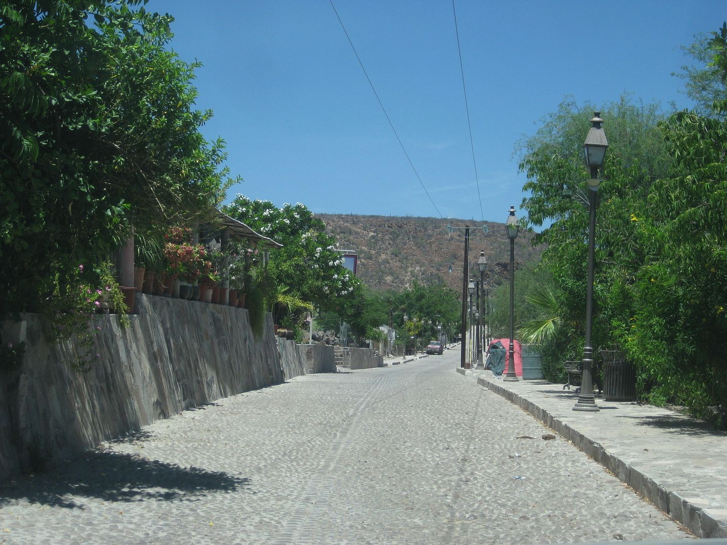
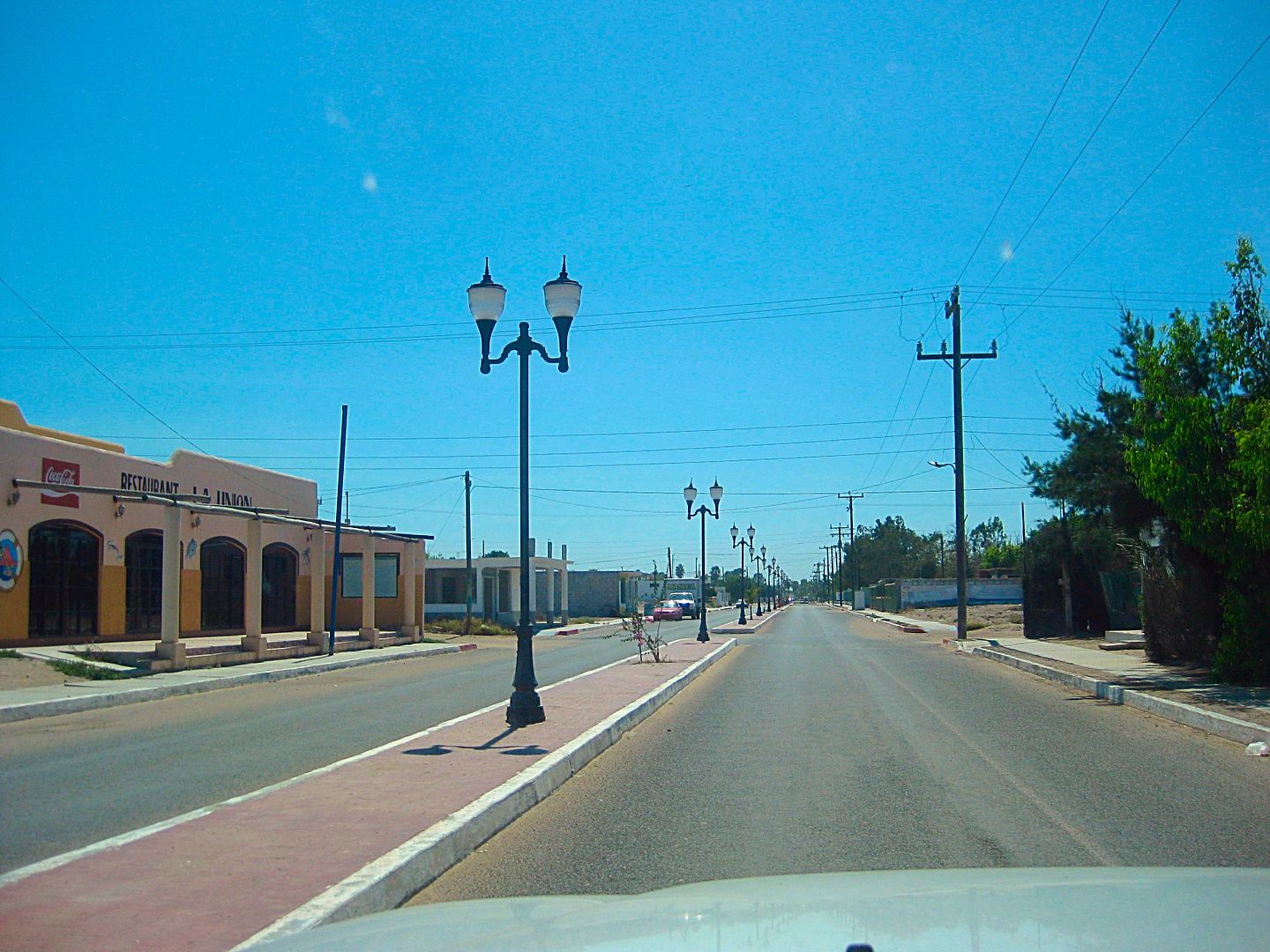
I drive north to La Purísima to cover that highway. I drove into La Purísima from Comondú and La Purísima out to Hwy. 1 near Bahía Concepción
already this year (TRIP #2, Feb.). I wanted to cover the paved road into town, for the guide.
From the Las Barrancas road to the old, dirt San Juanico road, on the La Purísima highway, it is 12.5 miles. It is 4.2 miles more into La Purísima
and to the restaurant Otho and motel Posada del Angel. The mission site is just a block beyond Otho and a block north.
I have lunch at Otho from 12:10-12:50 and head south on the highway. lunch was fish dinner plate and a Jamaica drink for 150 pesos, with tip.
16.7 miles back down the highway is the Las Barrancas road and 14.4 additional miles is Francisco Villa and the paved highway north to San Miguel
Comondú. Like La Purísima, I previously went into Comondú from the north and east and wanted to cover the south, paved road, also.
It is 22.6 miles to the entrance of San Miguel Comondú, where the blacktop becomes cobblestone. 0.2 mi further is the street to the right, passing
the boutique motel Don Mario and continues on to San José Comondú, where the mission was from 1736 to 1827. The mission was founded in 1708, but 22
miles to the north and now called Comondú Viejo (see my TRIP #2 report).
Just past the street corner, ahead if you don't turn right, on the left, was where gasoline from 20-liter containers can be purchased. The Baja Sur
state government cracked down on independent gasoline sales, so no longer are signs posted where you can buy gas in towns without a Pemex station. You
just need to ask! 20 liters was 380 pesos. Very fair if you consider how far it must be brought in from.
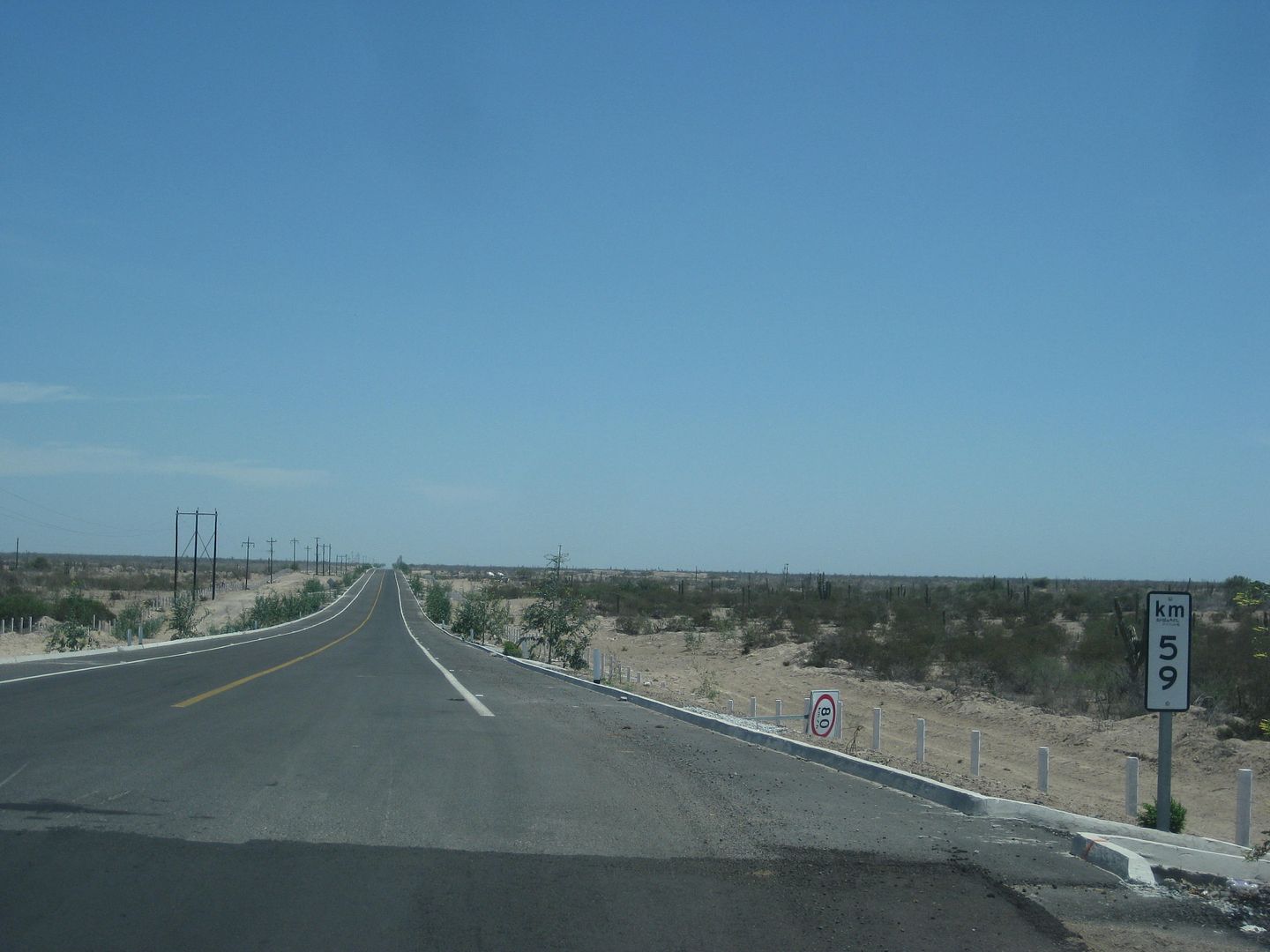
Back south I go to Francisco Villa and continue southward on the highway to Ciudad Insurgentes. There are no pot holes or not many on the La Purísima
or Comondú highways, but from Francisco Villa south, there are some! In 3 miles, however, a brand new, very wide paved highway begins, and lasts for
19.5 miles! There are 4 miles of older highway, then again a wider highway starts.
Nearing Ciudad Insurgentes, I take the paved road west to López Mateos, a fishing town and whale watching center on Magdalena Bay. It is 20 miles to
town. I drive around and go to the Hotel Refugio, recommended by 'Mula' on Baja Nomad forums, who has a home there. The hotel owner (Róman) was very
nice and the room was air conditioned, very small, but comfortable at 350 pesos (=US$20.17). The WiFi only works in the dining room area, which was
not serving food in the summer... because whales are not there then! I made a couple posts and checked email. I slept well... but the mosquitos got me
when I was in the dining room area and outside.
End of Day 3.
229 miles traveled.
PHOTOS:
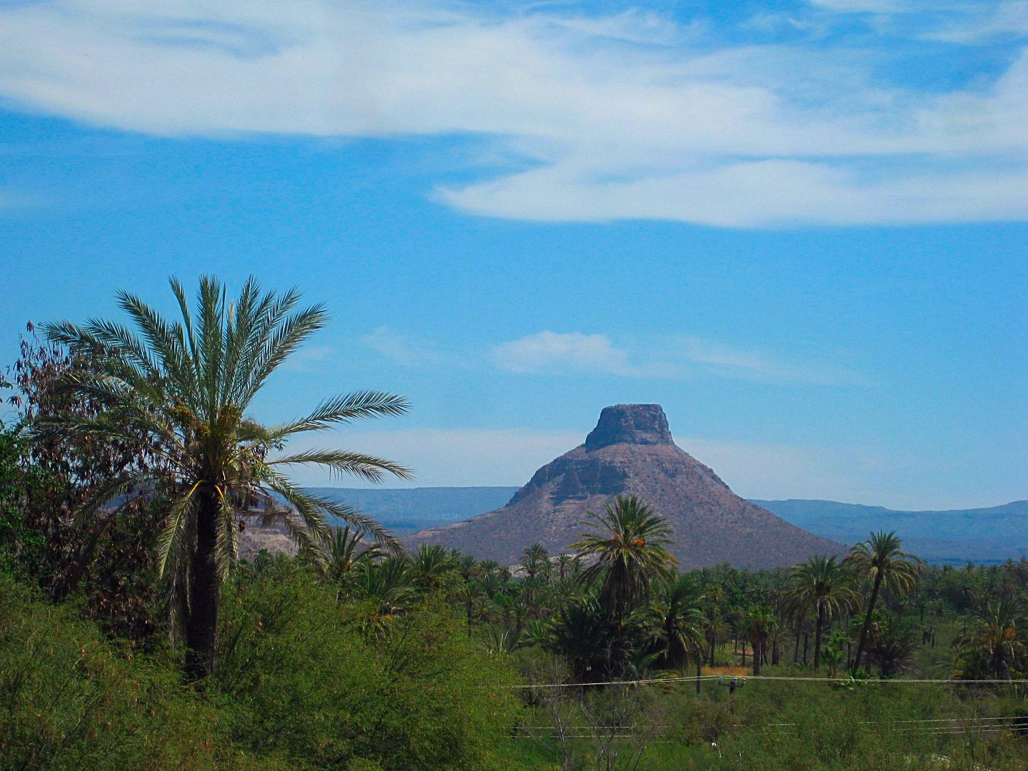
Highway nearing La Purísima
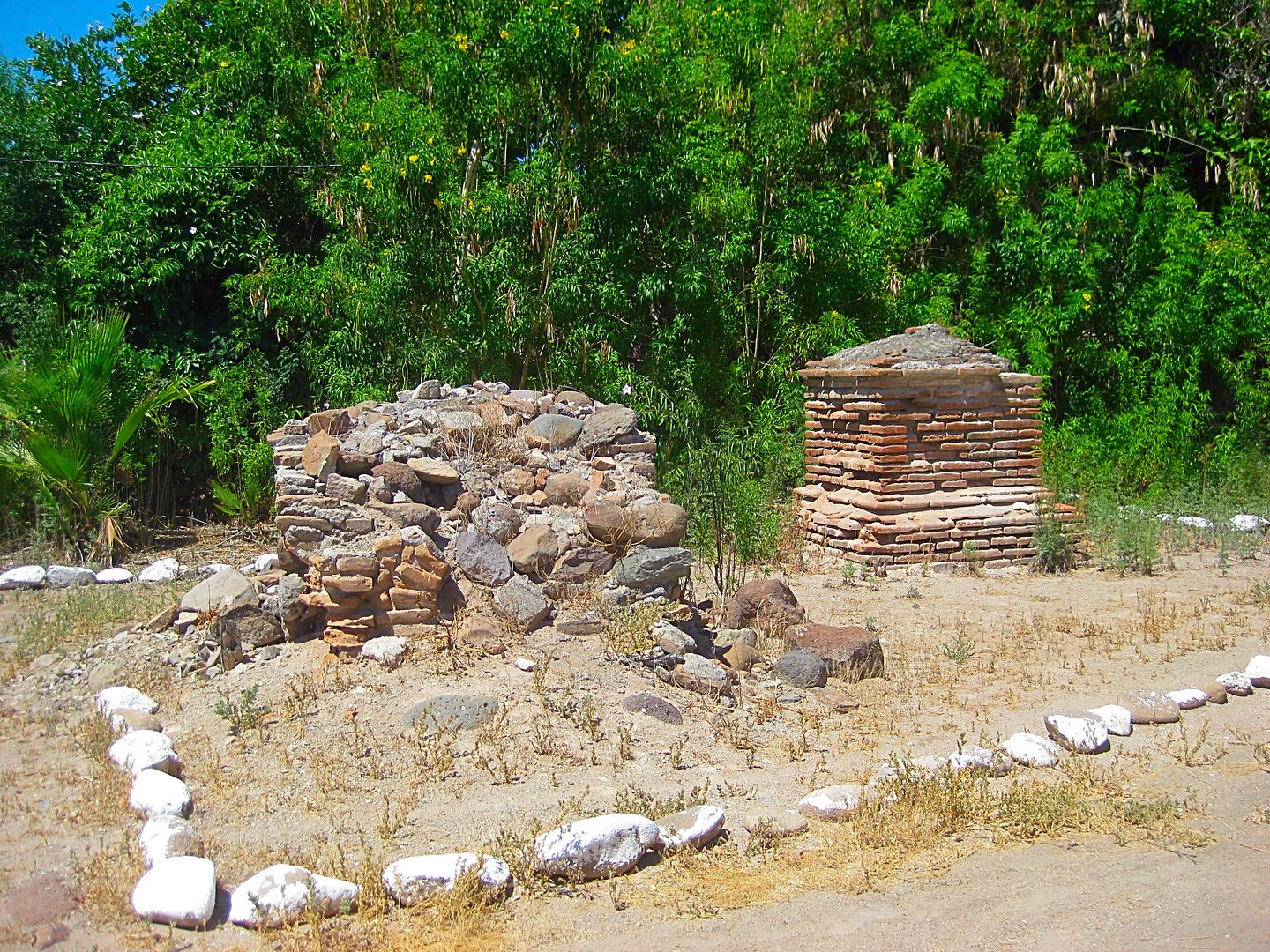
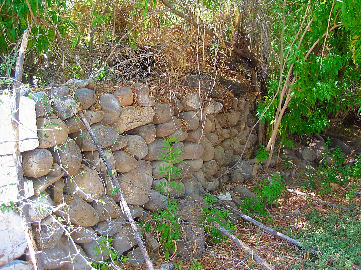
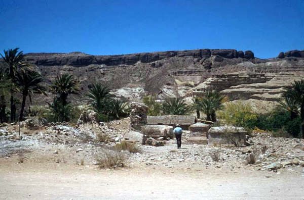
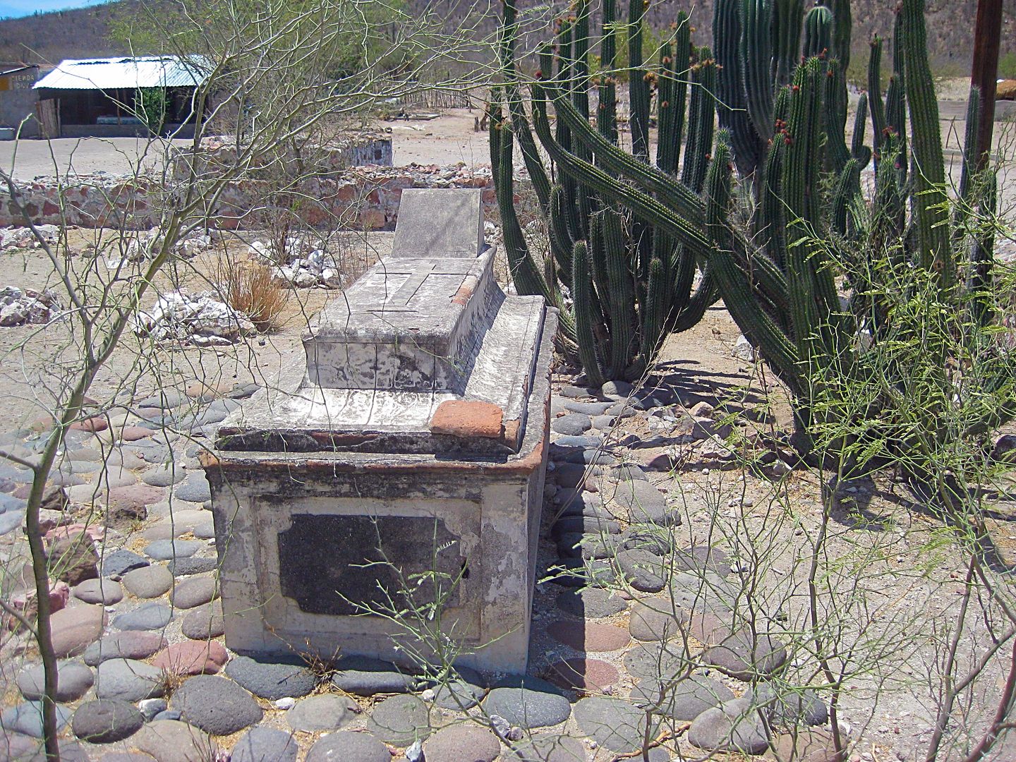
El Pilon, the famous landmark near La Purísima
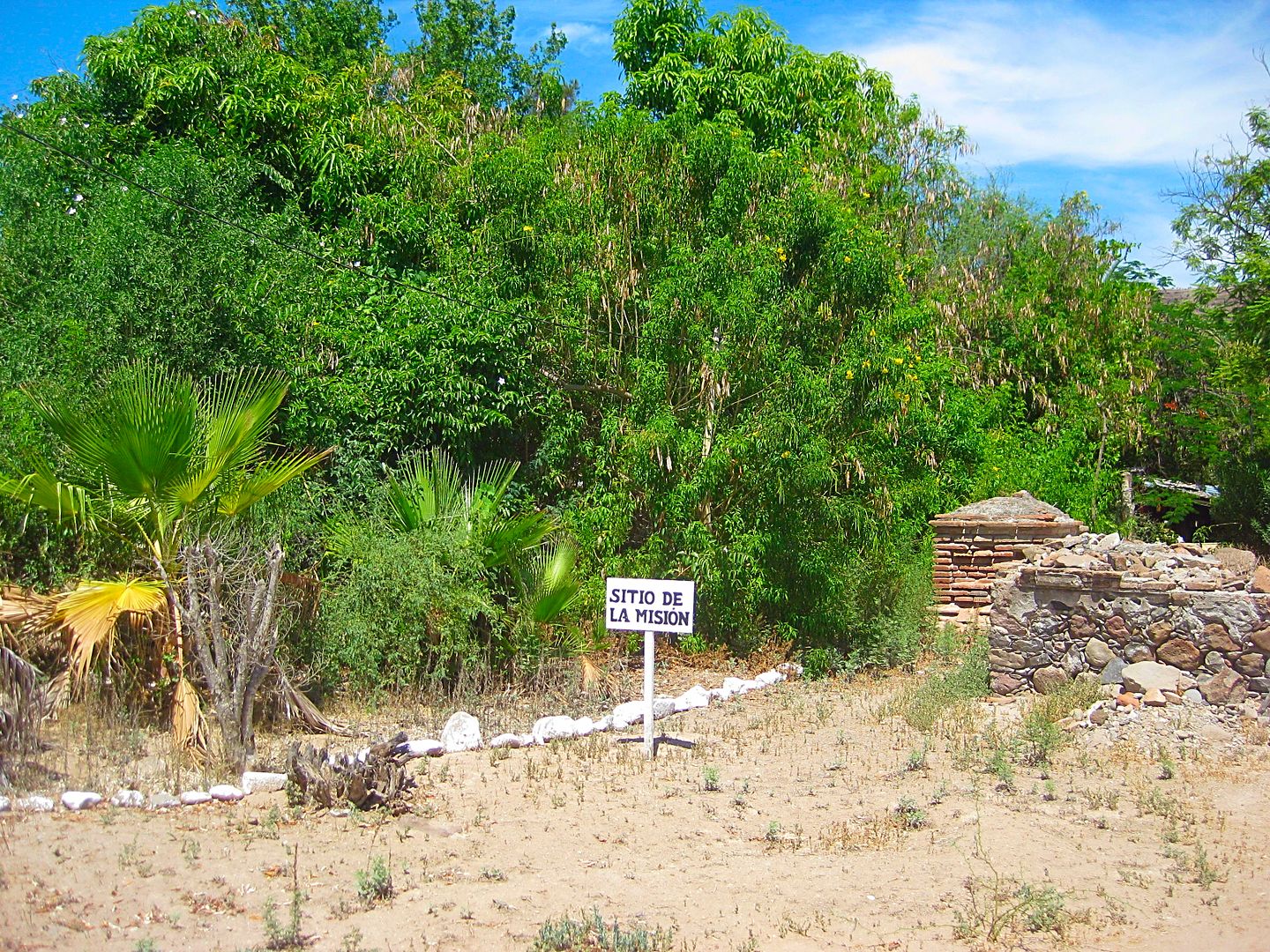
Only a pair of tombs and a wall mark the once prosperous Spanish mission.

The mission in 1906 (photo by Arthur North)

The mission ruins in 1956 (photo from Howard Gulick)
The tombs in 1956.
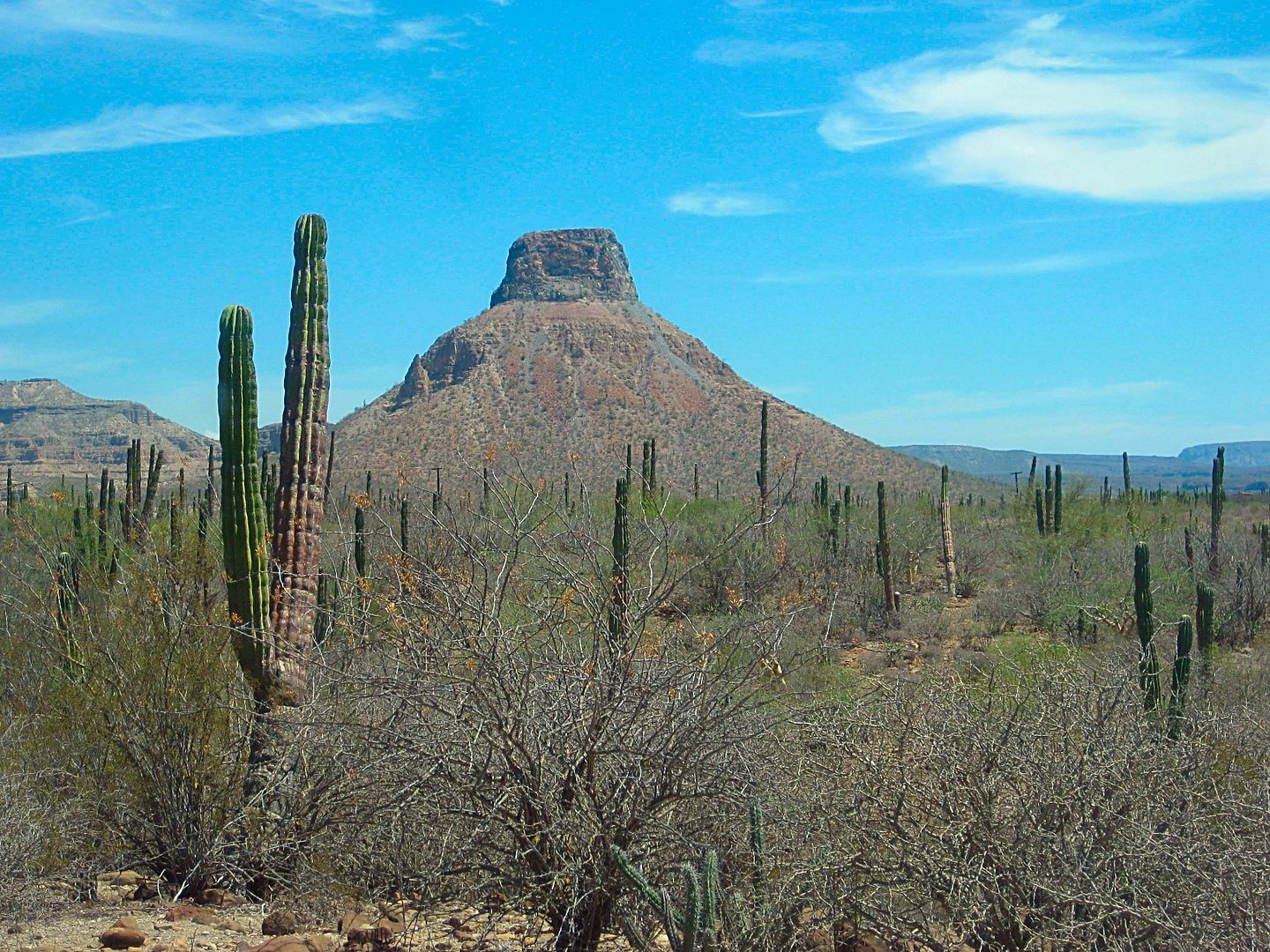
I drive up to the cemetery and took this desert foreground photo of El Pilon.
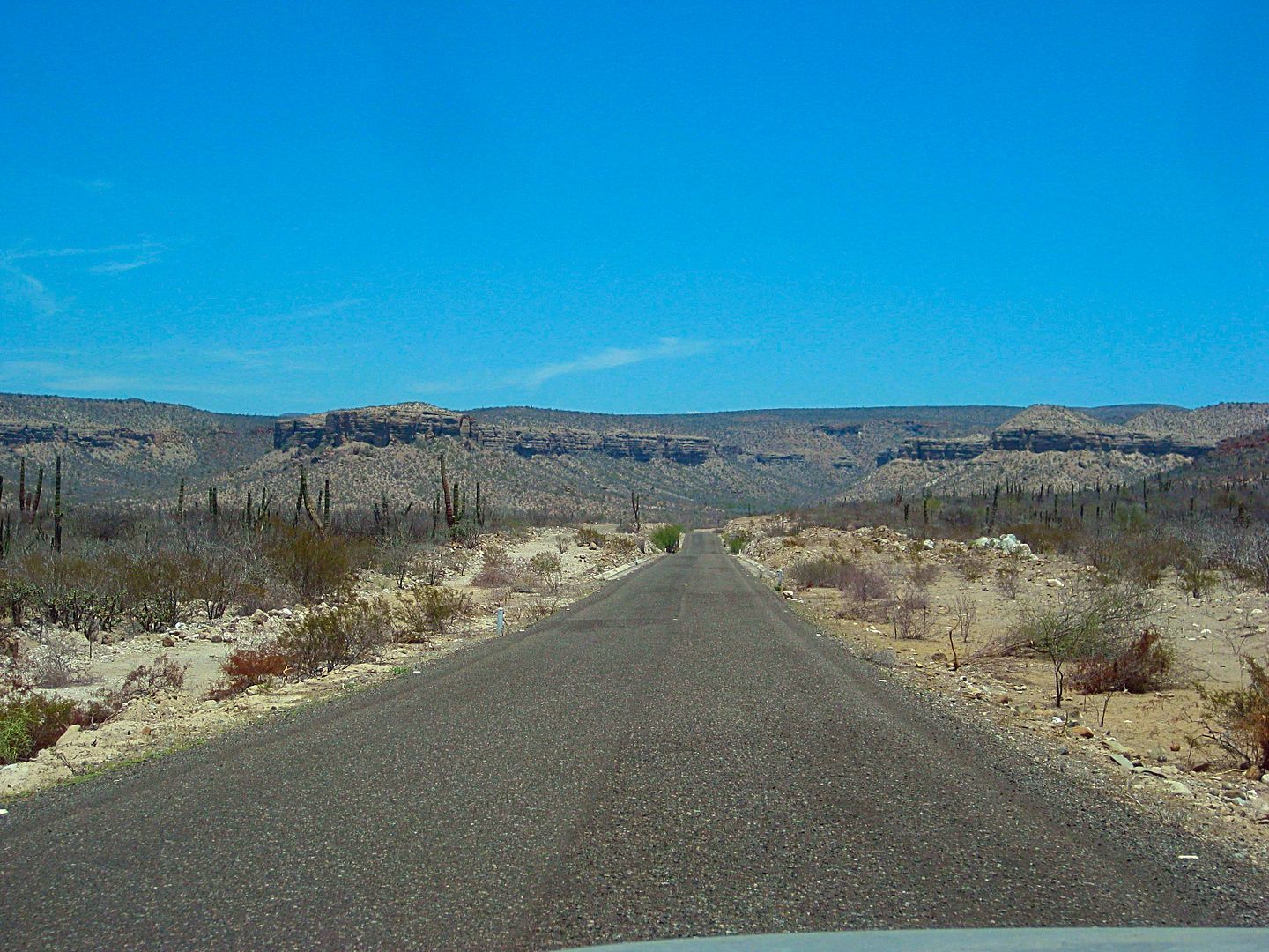
The "El Camino Real" mission road as it comes to La Purísima from the south and east (Comondú, San Javier, and Loreto).
This is the paved road north into San Miguel Comondú from Francisco Villa.
New, wide highway north of Insurgentes.
López Mateos
Day 4, is a big one... stay tuned!
|
|
|
David K
Honored Nomad
Posts: 64476
Registered: 8-30-2002
Location: San Diego County
Member Is Offline
Mood: Have Baja Fever
|
|
Does anyone want a map of this area or are we all good with where I am on Day 3?
|
|
|
kevin_in_idaho
Nomad
Posts: 143
Registered: 12-13-2016
Member Is Offline
|
|
Awesome reading and viewing!
|
|
|
Meany
Nomad
Posts: 453
Registered: 2-14-2009
Location: santa paula,calif
Member Is Offline
|
|
Thanks Dave. Love the trip report. Keep it coming.
|
|
|
BornFisher
Super Nomad
Posts: 2103
Registered: 1-11-2005
Location: K-38 Santa Martha/Encinitas
Member Is Offline
|
|
That`s a good Baja/travel fix right there!
"When you catch a fish, you open the door of happiness."
|
|
|
David K
Honored Nomad
Posts: 64476
Registered: 8-30-2002
Location: San Diego County
Member Is Offline
Mood: Have Baja Fever
|
|
DAY 4-a (FRI Aug. 4, 2017)
I am on the road at 7:43 am and heading away from López Mateos.
I don't want to say too much about López Mateos because I was not there very long and didn't have any Nomads to show me the highlights. My son lived
there for a couple months in 2012 working for Mag Bay Outfitters (their son and my son were best friends from 4th grade on and we used to take him
camping with us to Baja and the desert). It is off season, humid, mosquitos, and most restaurants were closed... again no whales or tourists in the
summer. There is a huge building that looked like a museum for whale watchers out at the dock where they must get on boats to see the beasties up
close. Closed now, naturally.
Back east to the Insurgentes-La Purísima highway where I turn south.
1.1 miles south is a Pemex station and I fill up. 15.71 pesos/liter. Someone asked about the cost of diesel, and there, it was 16.48/liter.
The junction with Mexico Highway 1 is 0.3 mi south of the Pemex (1.4 mi south of the López Mateos highway). I continue south on the now, 4-lane
highway. Kilometer markers are not as consistent on some Baja Sur sections of highway and a lot of that is because of new highway widening and not
getting around to replacing the markers. The corner of Hwy. 1 where the way to Loreto and to La Paz meet is Km. 0 going to Loreto and should be Km.
237 from La Paz (but I didn't see a marker until Km. 235 just over 1.2 miles south).
The Puerto San Carlos highway (Mexico #22) was 15.9 miles south of Insurgentes, or about Km. 211.5. In fact, the Km. 212 marker was 0.4 mi north... so
the estimating of missing kilometer marker locations works.
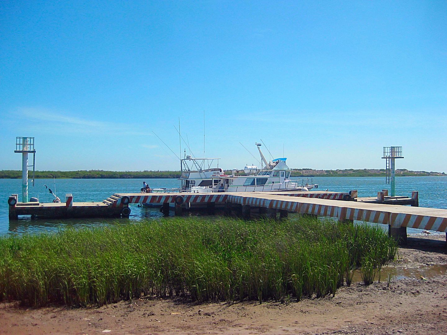
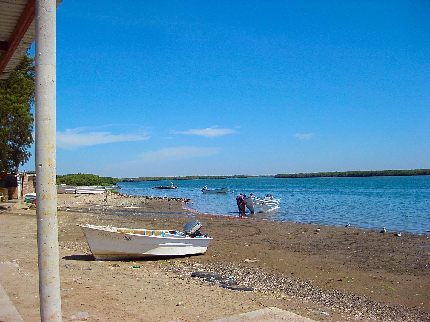
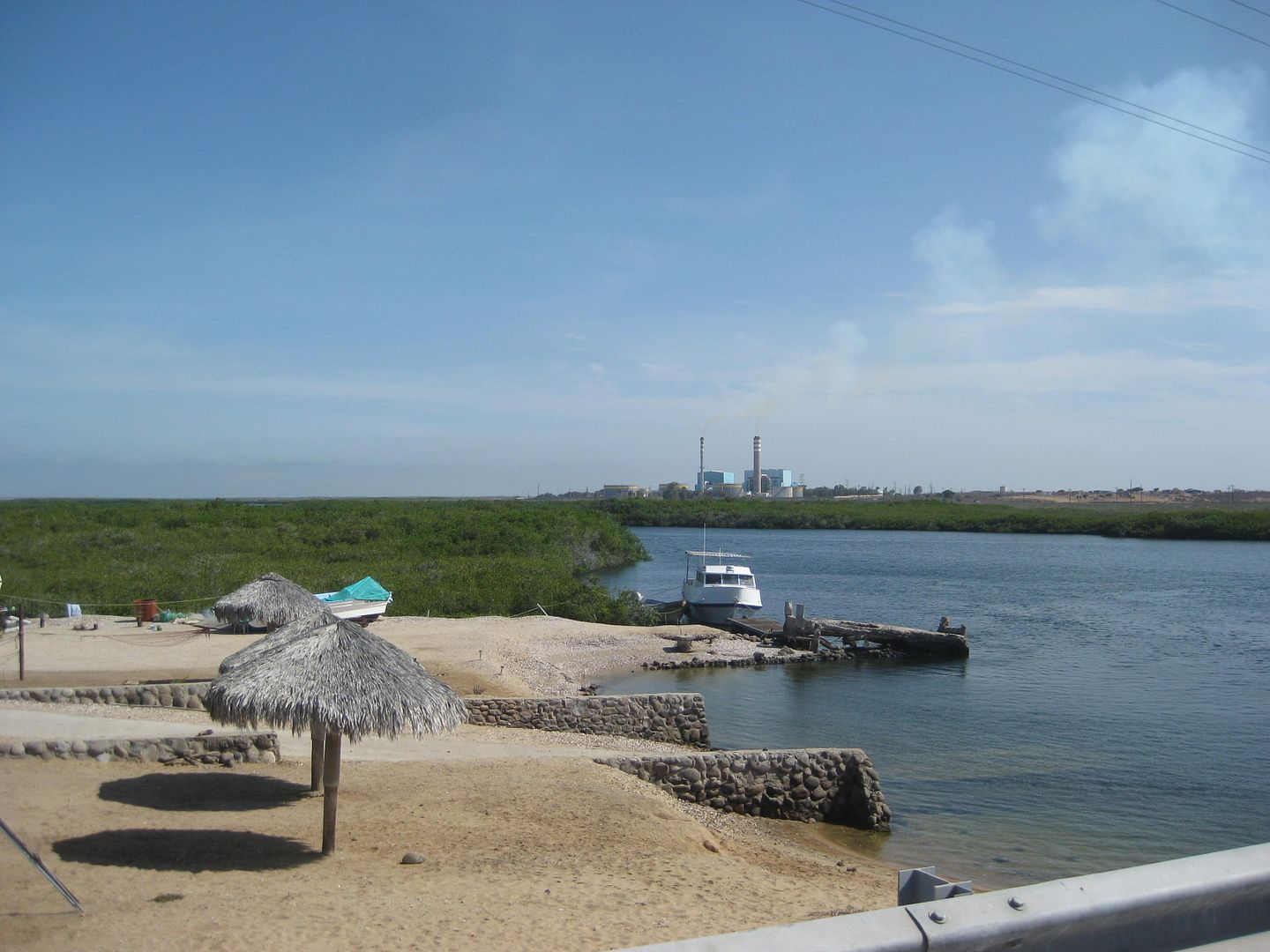
I drive out the 35 miles (57 kilometers) to San Carlos and was quite pleased with the nice town appearance, the beach palapas just before town, and
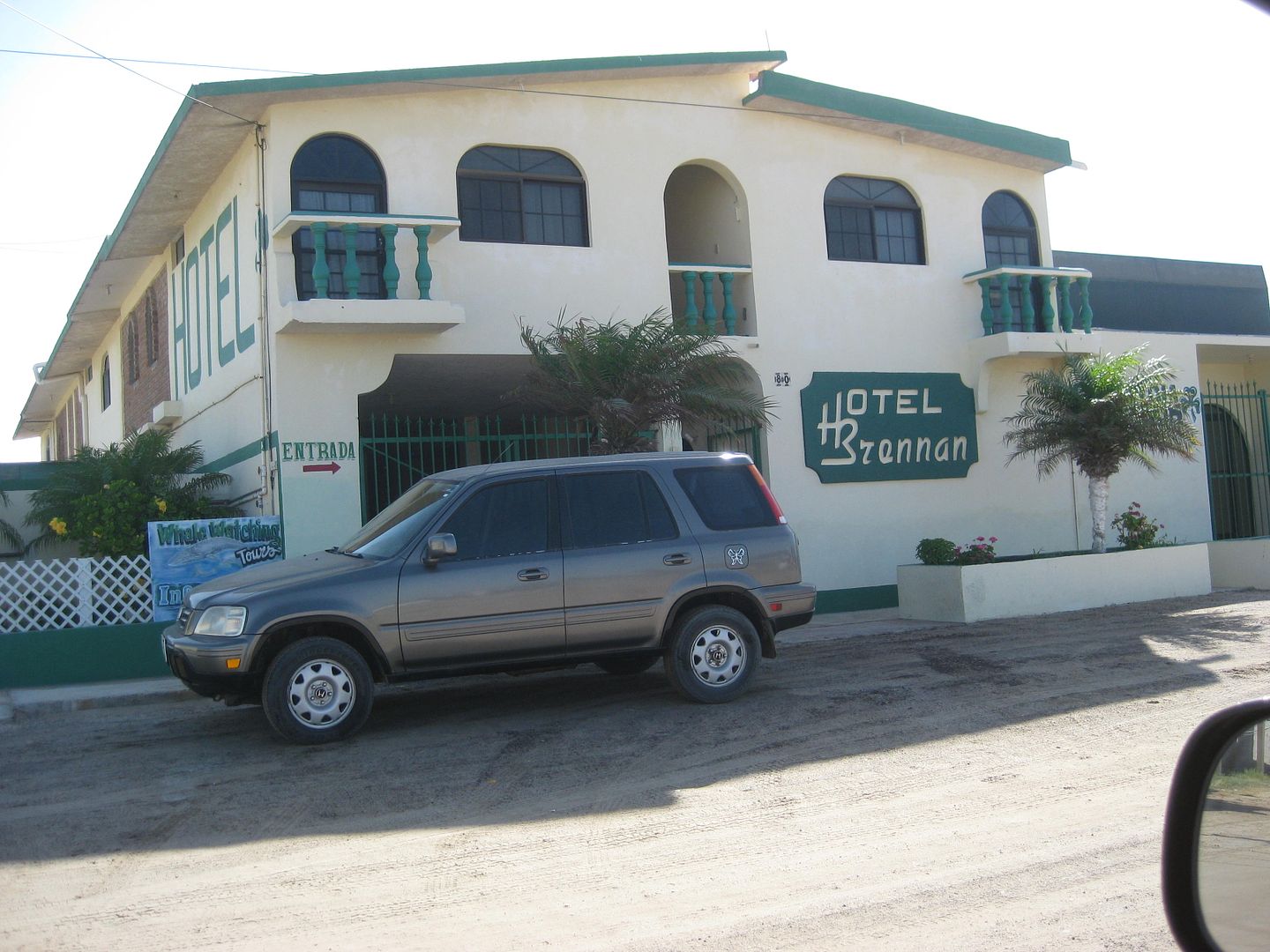
just a better feel for what was available there to serve visitors. I saw three hotels (motels): Mar Y Arena (at the entrance to town), Alcatraz, and
the Brennon (with an Irish theme).
At a market in the middle of town, I bought three bags of ice for my chest (60 pesos) as my ice from home was finally in need of supplementing. I also
knew it would be awhile before I was able to get more. I only needed the ice for milk (cereal), Costco chicken/mozzarella/artichoke brats, and to cool
the beer and drinking water.
Back out to Ciudad Constitución I go and turn south on Mex 1. I top my gas tank as I am going off grid for a couple days. 19 liters (5 gallons) for
the 94 miles since I filled at Insurgentes means I got 18.8 m.p.g. for the easy, paved driving.. and the station's pump was accurate! The station was
at Km. 210.5, 1/2 mile south of the San Carlos junction, west side of the highway.
For many years, many have reported the local police being extra alert for tourists who do not stop fully at the many stop signs... even pulling some
over who did stop fully. I have never had that experience in this town and usually don't even see any cops. Maybe because I travel in the hot summer?
However, this day there were trucks with machine gun mounts and labeled as Municipal Police (not military) cruising up and down the main street.
Didn't affect me at all, but it was pretty extreme to see.
The south end of town is at Km. 208, the 4 lane highway returns to two lanes, and an R.V. park and motel is at Km. 206.
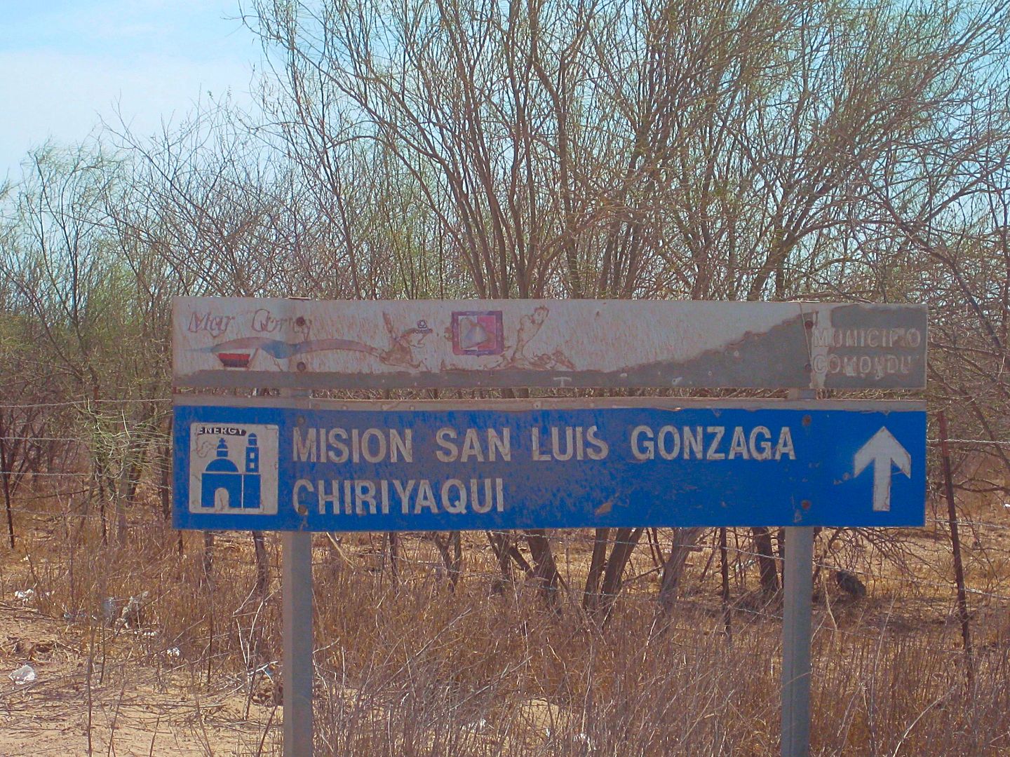
At Km. 195 is the road east to Mission San Luis Gonzaga, and beyond. Finally, back into the dirt! I drop my tires to 25 psi to soften the ride on this
washboard, graded road. The road is quite good and I am cruising at 50 mph until some cement vados (dips) pop up after many miles and have me hitting
the brakes! The dips are at mile 8.0, 9.4, 9.6 and 10.2.
The only fork or turn in the road is at mile 12.3, and you go right. Ahead leads to a dam project (El Ihuagil).
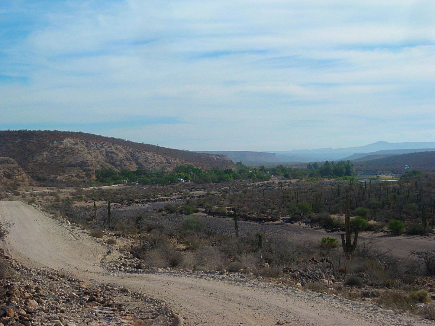
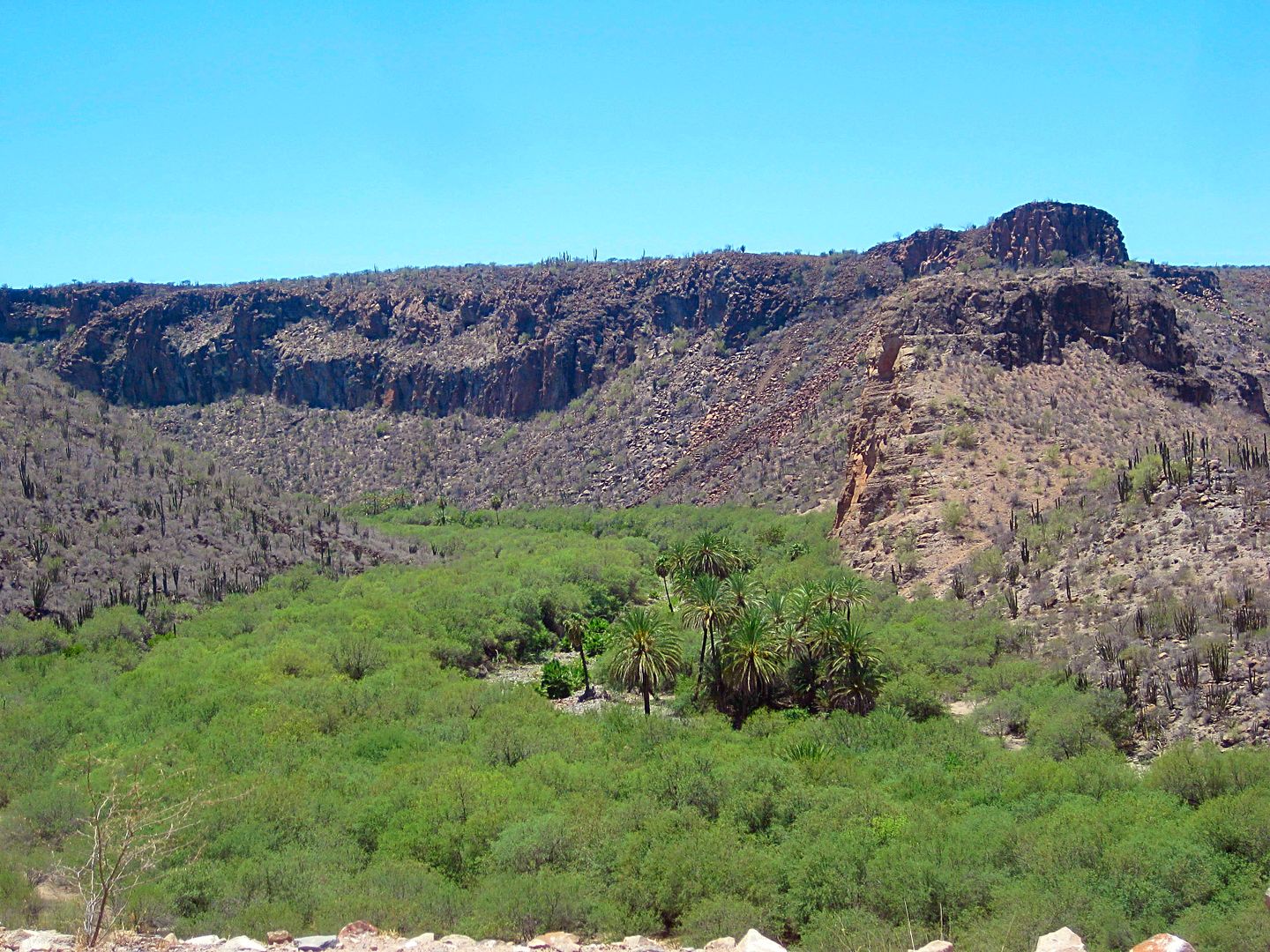
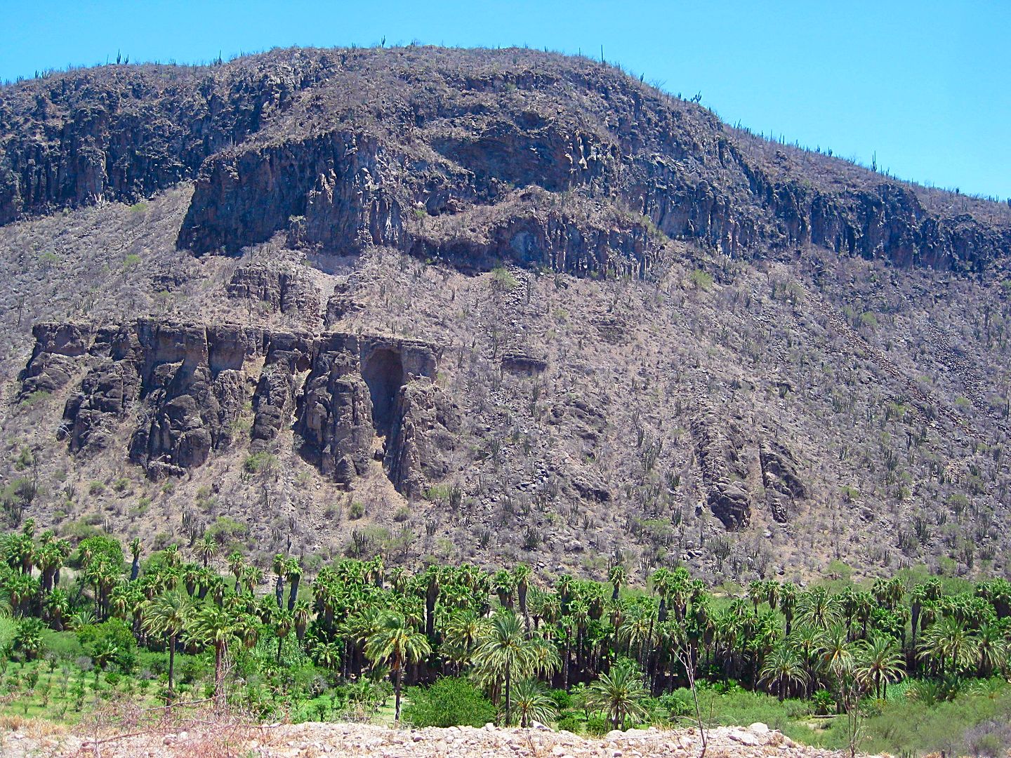
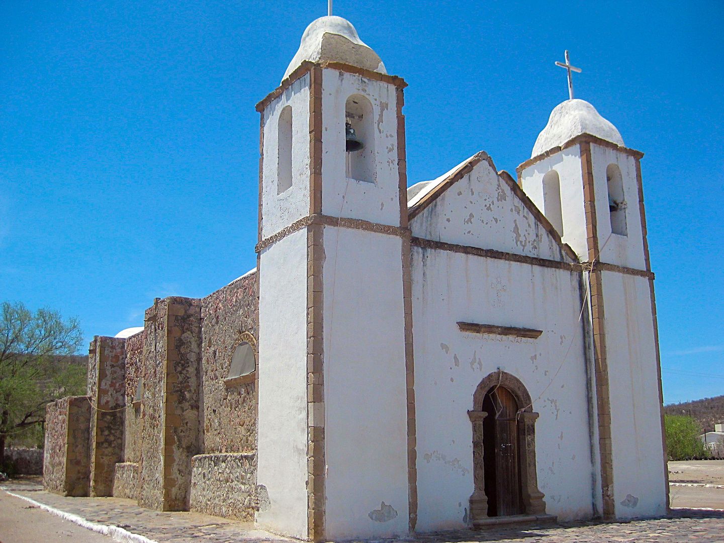
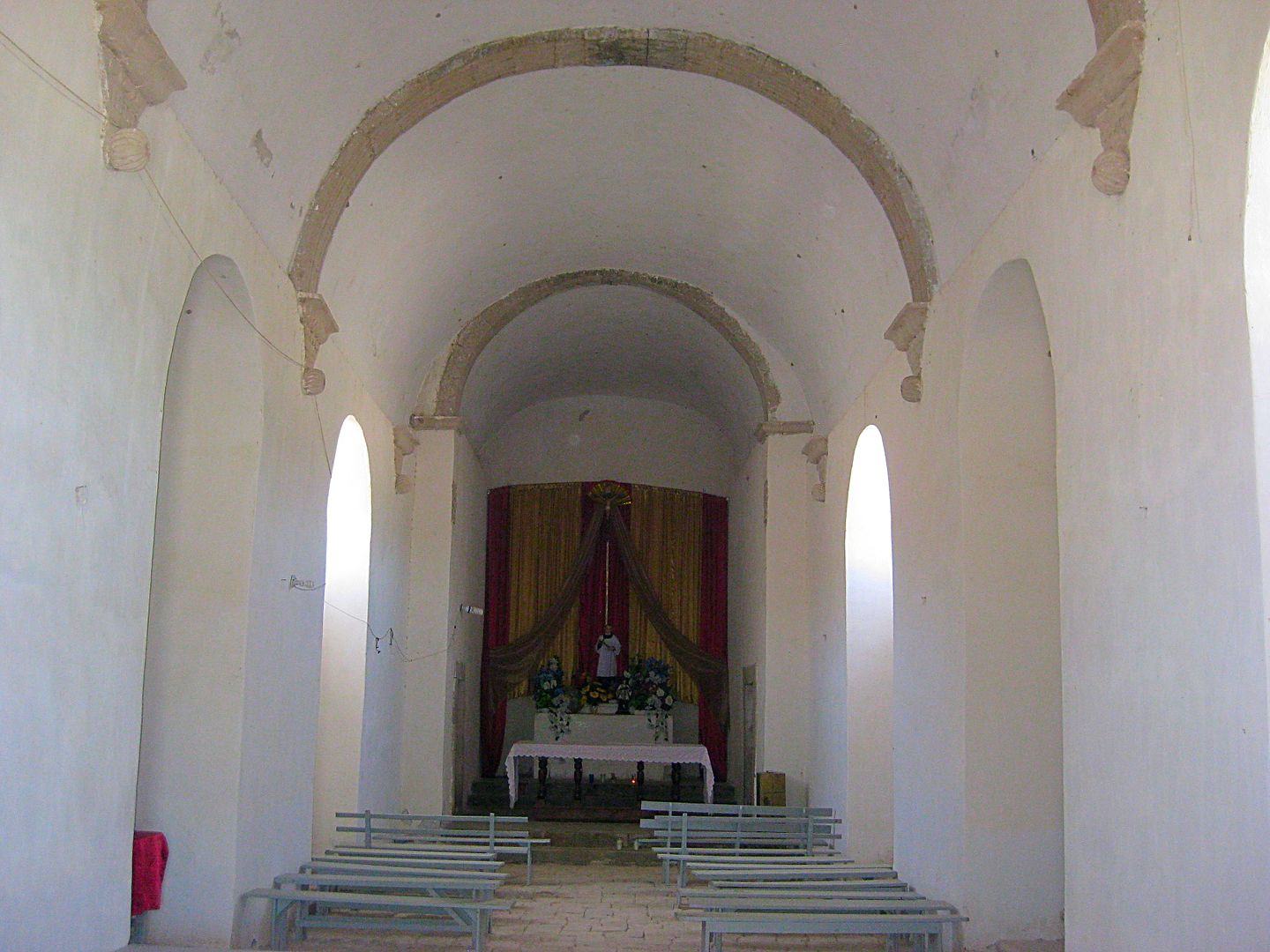
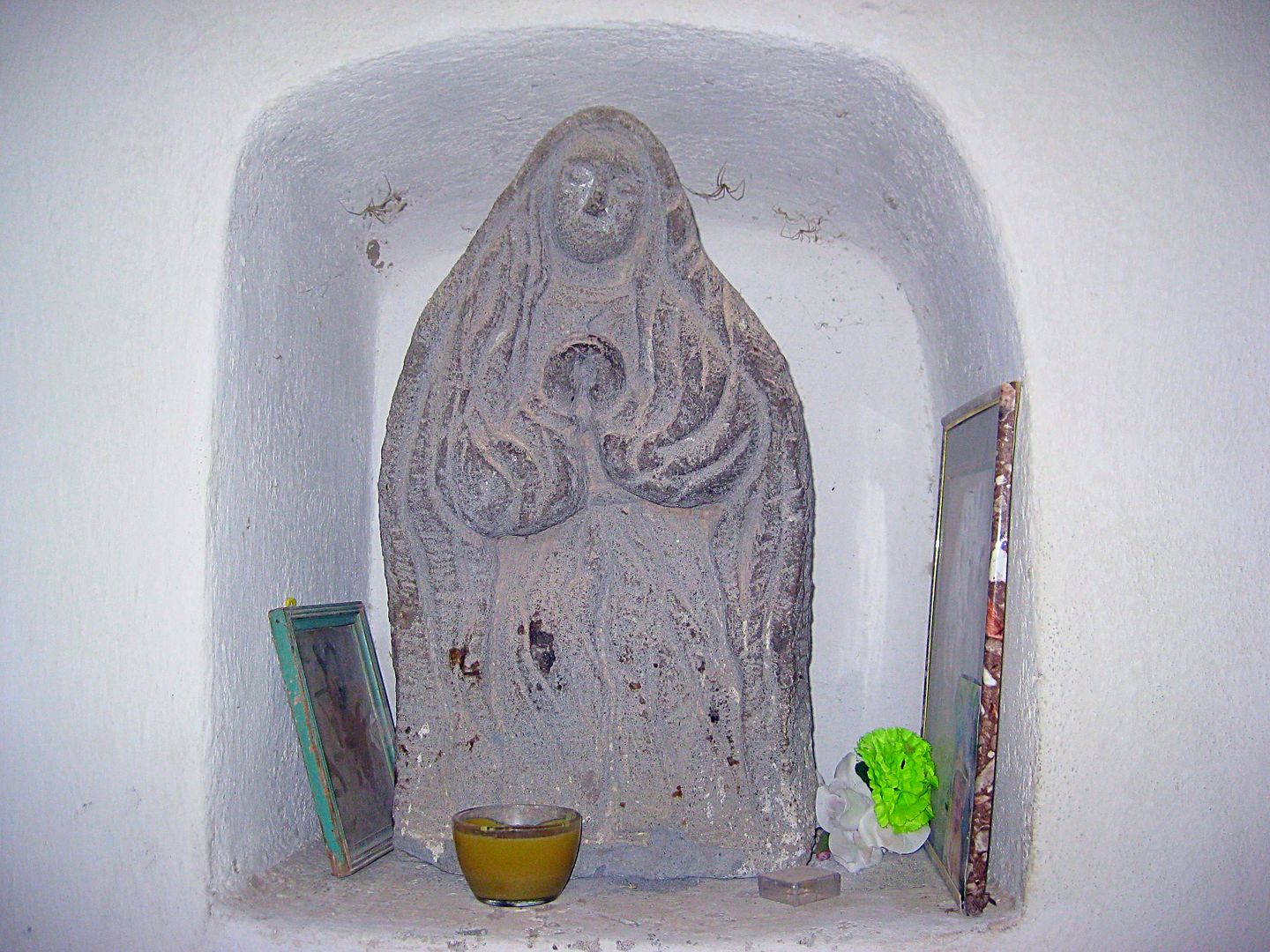
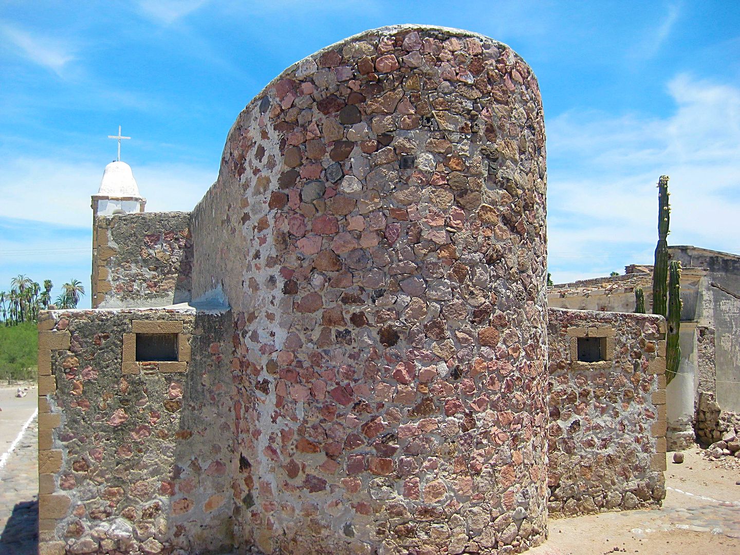
Arrive at the 1737 founded mission (stone church built 1753-1758) at mile 22.3 from Hwy. 1. There is much interest in this mission that is based on
the writings of one of the long-term resident Jesuits who was stationed here, Johann Jakob Baegert, S.J. from 1751 to 1768. His 1772 book,
'Observations in Lower California', (translated and re-published in 1952) are full of details of the life of the Native Californians and the geography
of California (what is called Baja California today). The church is one of the few intact Jesuit California missions to survive to modern times.
Resting in the shade of the building next to the church were a man and woman on fat tire mountain bikes. It is Mike and Rebecca from Canada and they
are riding the length of Baja, following the advice of this web page: https://bajadivide.com/ .
After I got home, three days ago, I got an email from Mike with a link to his blog page with photos, posted from La Paz. He mentions how we met... and
how I bumped into them again, two days later... Here is their story: http://www.zerotocruising.com/kenny-chesney-visit and what Mike wrote about our meeting:
Our plan, whenever possible, is to find shade between noon and 3:30 (or later) and simply hide from the sun, and we took advantage of the walls of
the building adjacent to the mision to do exactly that. As we sat enjoying our lunch, a lone gringo drove up in a pickup and began taking pics. We
struck up a conversation with him and learned that David was not only a life-long fan of Baja California, but that he had written and published a book
on the old missions of the region. And unlike us, he was actually working that day, researching material for his upcoming book, a new travel guide for
Baja. After sharing contact details, we said farewell, and he continued on his way while we resumed hiding from the sun.
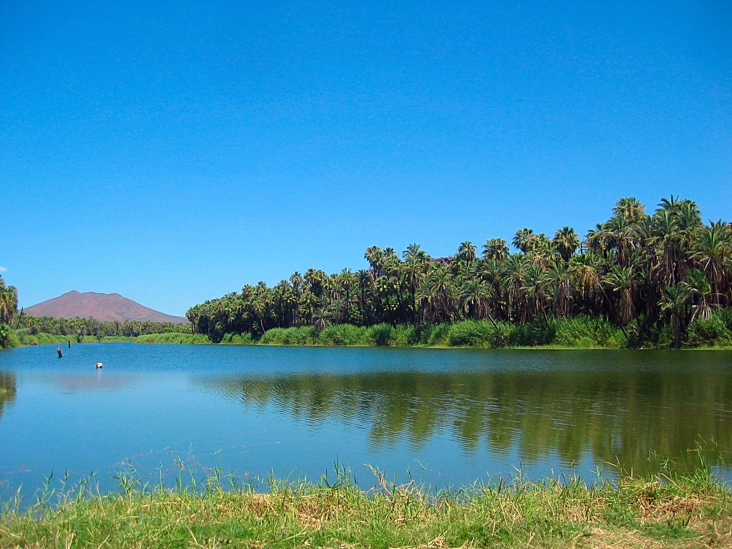
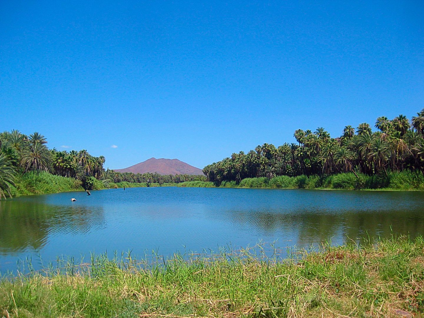
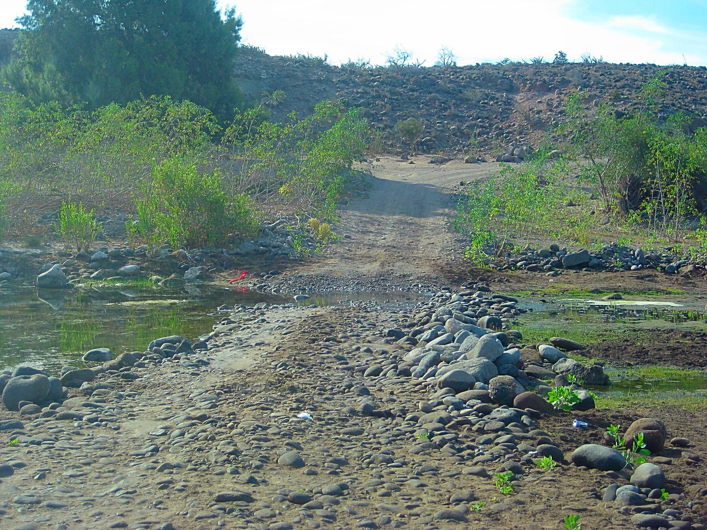
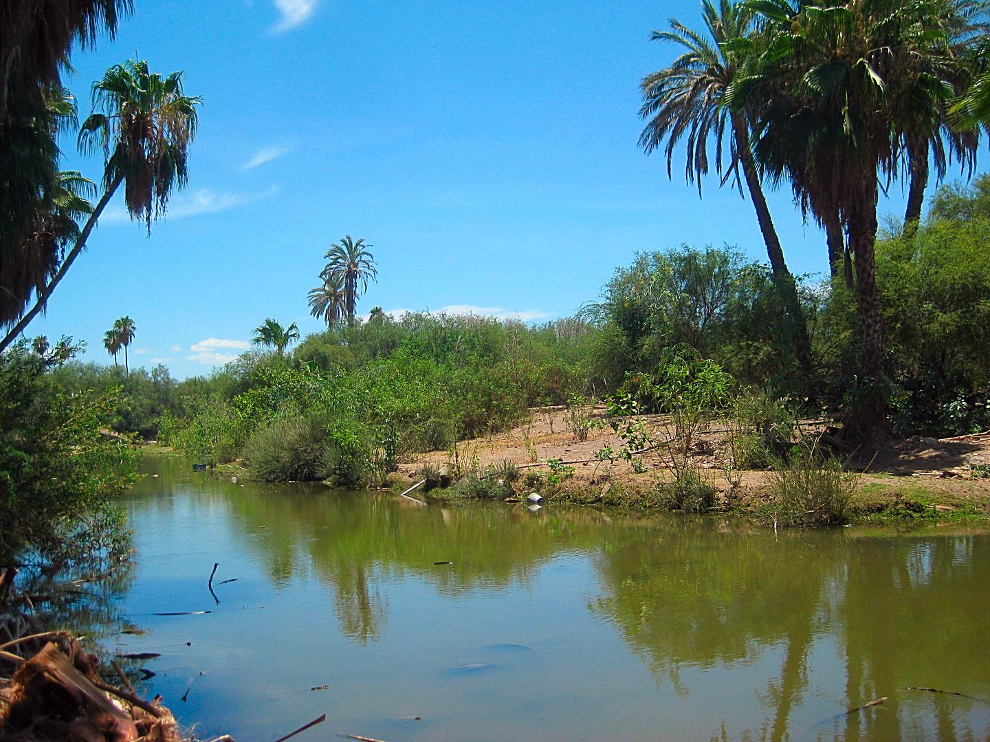
I walk over to the mission dam and small lake it creates, take photos all around and after spending about an hour there, leave at 1:24 pm.
My next goal is to see the mission site, typically called La Pasión. It was the final location (1741-1768) for the mission of Los Dolores, founded
along the gulf coast in 1721. San Luis Gonzaga was a visita (satellite mission station) of Dolores before becoming a separate mission, with its own
priest.
The missions are a link to our past, our culture, and some of the oldest structures in California (Upper or Lower). I strongly urge anyone with
interest into seeing the past of California, Mexico, or Spain to see the missions or just go to their locations, even if the original mission building
is gone or in ruins. While I would appreciate if you purchased my book www.oldmissions.com, at least enjoy the data and photos on my web page at Vivabaja.com devoted to the 27 missions of Baja: http://www.vivabaja.com/bajamissions/
PHOTOS:
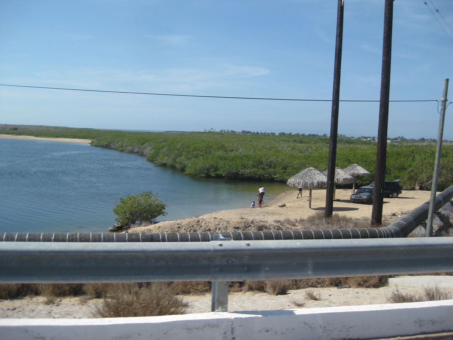
Boat launch and palapas at bridge near San Carlos
Entrance to Puerto San Carlos
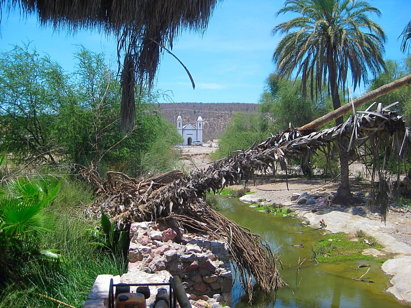
Mission church as seen from the dam.
To be continued...
|
|
|
David K
Honored Nomad
Posts: 64476
Registered: 8-30-2002
Location: San Diego County
Member Is Offline
Mood: Have Baja Fever
|
|
AAA Map
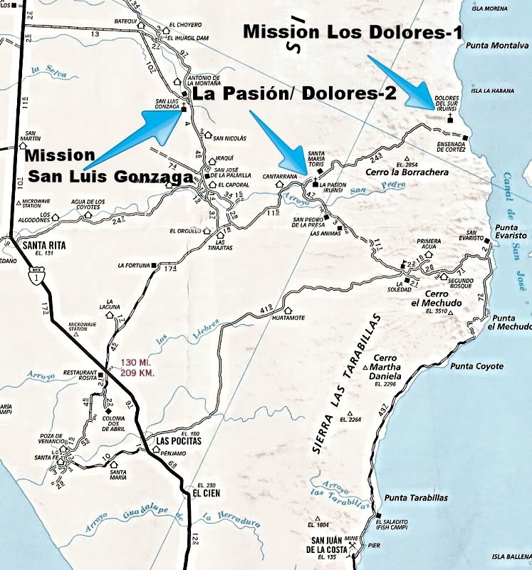
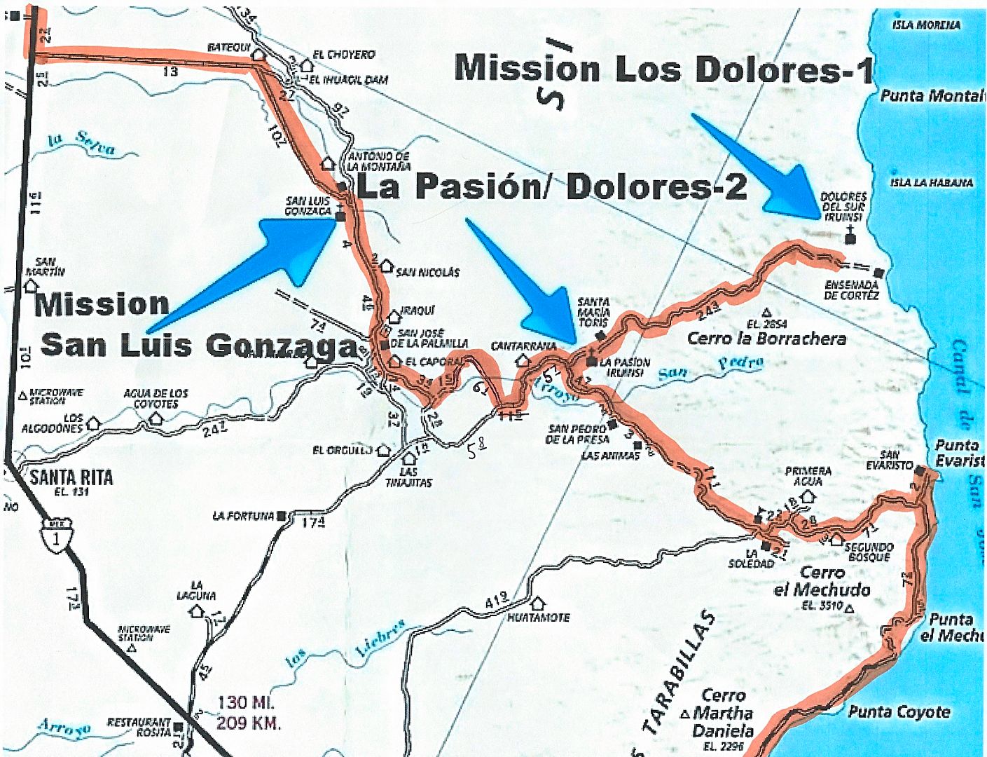
Edited to show road I was on (6.1 mile section) that continued beyond the 1.5 mile section of poor road on the AAA map. That spot = T junction for
Rancho Merecuaco. The 'new section' goes 6.1 miles looping around La Tortuga hill, crossing Arroyo San Pedro/La Presa, and meeting the graded road. It
was 5.7 miles east to the La Pasión junction. I subtracted 5.7 from the AAA's 11.5 giving 5.8 miles on the balance of the graded road going west.
[Edited on 8-19-2017 by David K]
|
|
|
tiotomasbcs
Super Nomad
Posts: 1837
Registered: 7-30-2007
Location: El Pescadero
Member Is Offline
|
|
Was it hot in La Purisima, Comondu? Went up there once in July and retreated back down to the beaches near San Juanico for the much cooler camping.
Has anyone ever stayed at the boutique Hotel in Comondu?? Shari had a fantastic travelogue from that area a few years ago...mission wines, David?!
BackRoads Baja ( Higginbotham) still available? Curious where you visited in Todos Santos. Good info. Tomas
|
|
|
fishbuck
Banned
Posts: 5318
Registered: 8-31-2006
Member Is Offline
|
|
I recognize Hotel Brennan.in San Carlos.
"A ship in harbor is safe, but that is not what ships are built for." J. A. Shedd.
A clever person solves a problem. A wise person avoids it. – Albert Einstein
"Life's a Beach... and then you Fly!" Fishbuck
|
|
|
David K
Honored Nomad
Posts: 64476
Registered: 8-30-2002
Location: San Diego County
Member Is Offline
Mood: Have Baja Fever
|
|
| Quote: Originally posted by tiotomasbcs | | Was it hot in La Purisima, Comondu? Went up there once in July and retreated back down to the beaches near San Juanico for the much cooler camping.
Has anyone ever stayed at the boutique Hotel in Comondu?? Shari had a fantastic travelogue from that area a few years ago...mission wines, David?!
BackRoads Baja ( Higginbotham) still available? Curious where you visited in Todos Santos. Good info. Tomas |
It was near 100°, no big deal, it is summer and I hate cold
Yes, people on Nomad have stayed at the Don Mario hotel. Search perhaps to find posts. Shari's report was excellent, yes.
You can find all Baja books on Amazon or AddAll Rare Books.
A lot has changed since Backroads Baja was written. It was (and is still) an excellent book.
I will be in Todos Santos (in this report) in a couple more days... stay tuned!
|
|
|
| Pages:
1
2
3
..
5 |
|


