| Pages:
1
2
3
4
5 |
David K
Honored Nomad

Posts: 64476
Registered: 8-30-2002
Location: San Diego County
Member Is Offline
Mood: Have Baja Fever
|
|
DAY 4-b (FRI. Afternoon)
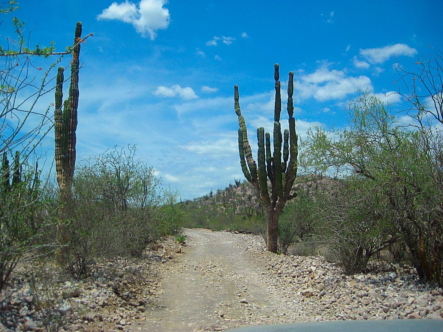
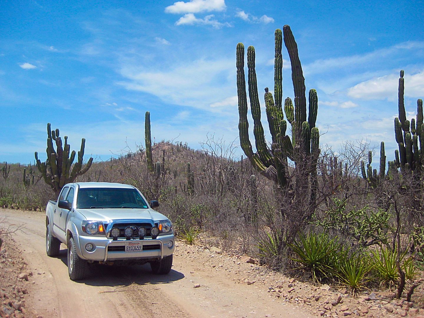
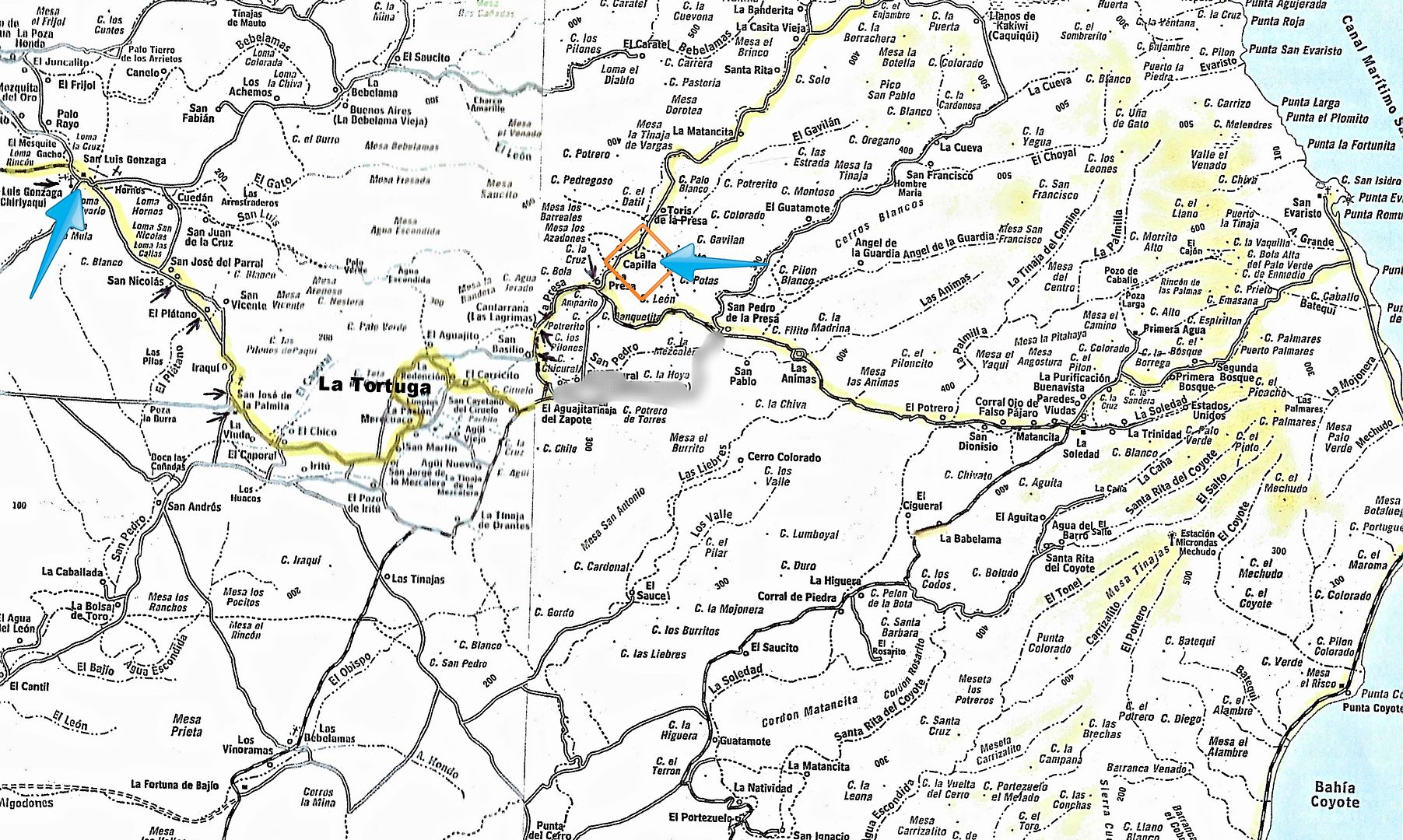
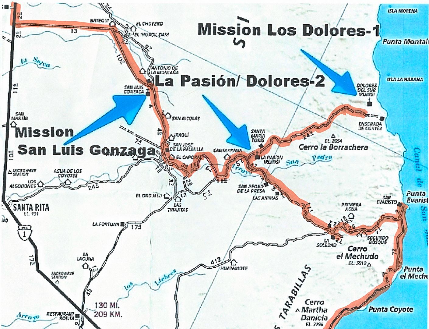
From Mission San Luis Gonzaga, my next goal was La Pasión, the final location of Mission Los Dolores. It would be less obvious to find being that any
walls have long ago fallen, and a goat ranch, La Capilla, was operating on the site.
The road headed south from San Luis Gonzaga and there are many forks and no signs to give a hint. I did have live tracking both on my inReach device
and on my smartphone with the Earthmate app (pretty good Baja maps, considering).
There was a junction I had pre-marked, but instead of right (which was in the wrong direction but the better road to use, I think), I took a left
going towards my goal. I did get there okay, but it went a little more north before returning to the watershed I was intending to follow to La Presa
and La Pasión.
I will do a little road log and compare to satellite and maps, then try to show my route on maps... This is fun for me and if you don't go to
unexpected places then you might not see unexpected and cool things!
Total (Partial) Miles
0.0 (0.0) Mission San Luis Gonzaga (1:24 pm)
5.3 (5.3) Curve right, ranch on left.
7.4 (2.1) Ranch house (El Plátano?), concrete creek crossing, oasis.
8.1 (0.7) Fork, main travel goes left.
8.9 (0.6) San José de la Palmita (?)
10.2 (1.3) Ranch (El Caporal ?), process building, road junction.
12.2 (2.0) Ranch
15.5 (3.3) T intersection. Rancho Merecuaco is 0.4 mi right (south). Go left.
19.4 (3.9) Weather Station, ranch houses.
20.0 (0.6) Big arroyo crossing (Arroyo San Pedro on AAA map, Arroyo La Presa on Baja Almanac).
21.6 (1.6) Major Graded Road (3:22 pm)
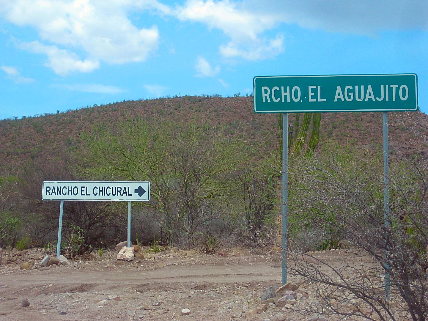
22.5 (0.9) Road right signed to El Chicural & Aguajito.
24.9 (2.4) Rancho Cantarana
26.8 (1.9) Rancho La Presa (closed to visitors)
27.3 (0.5) Junction. Ahead to El Solano & San Evaristo. Left to La Pasión, Santa María de la Toris, Los Burros. Turn left.
29.1 (1.8) Ranch on left and a road to the right crosses arroyo to the mission site. Turn right, cross arroyo. If ranch gate is closed, turn left just
past and drive along the fence to get to the other side of the ranch house.
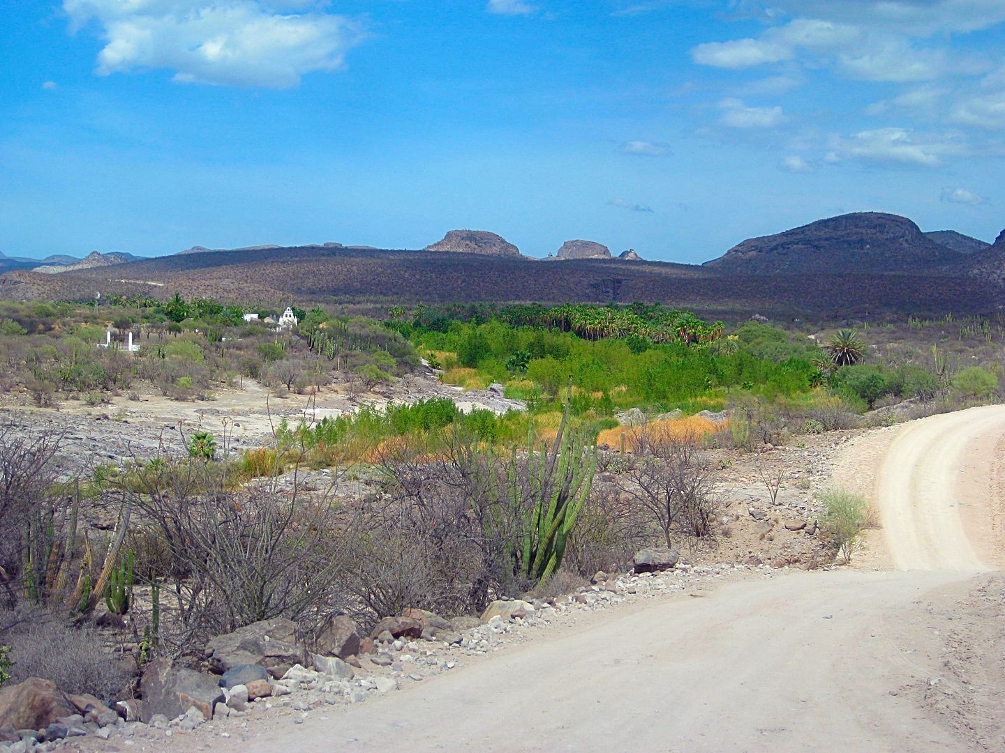
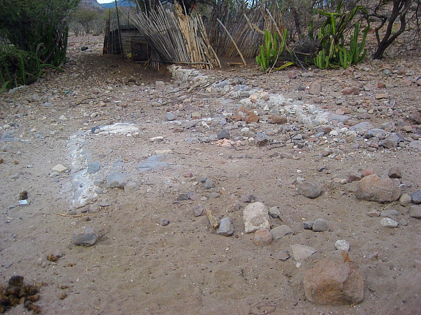
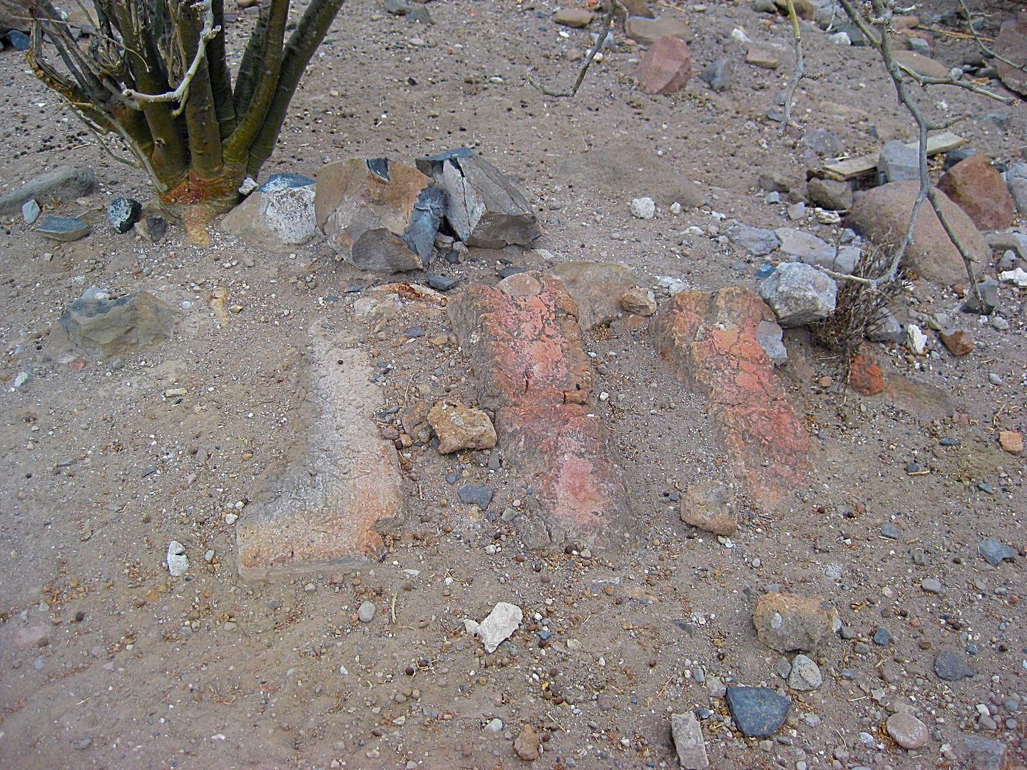
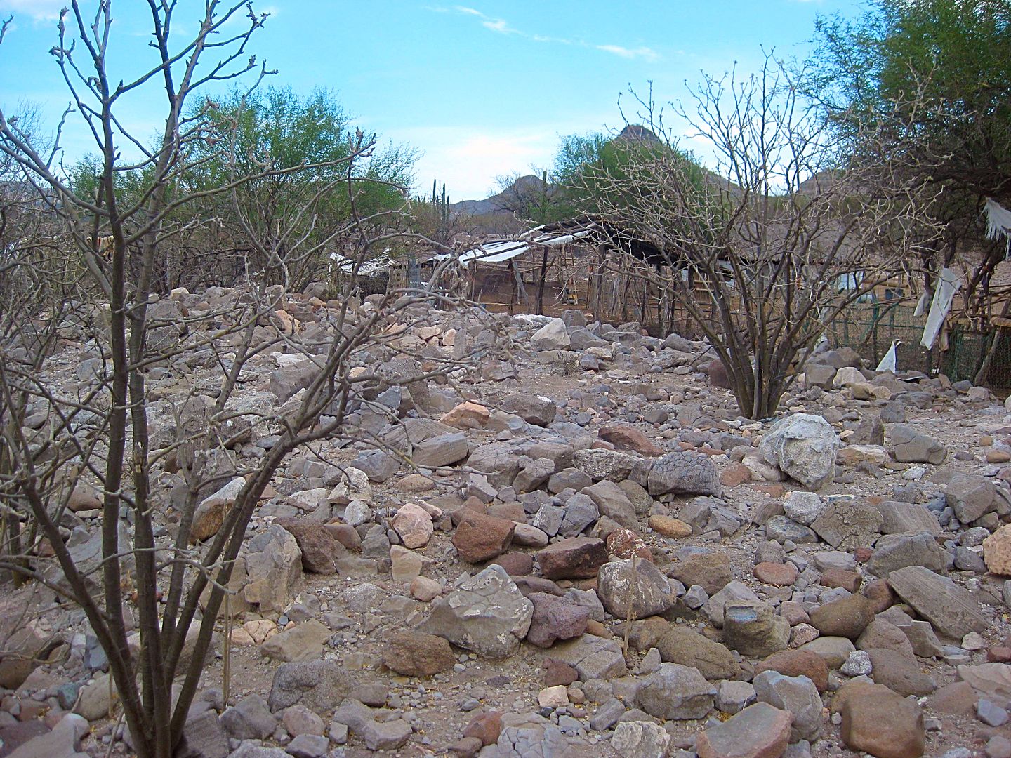
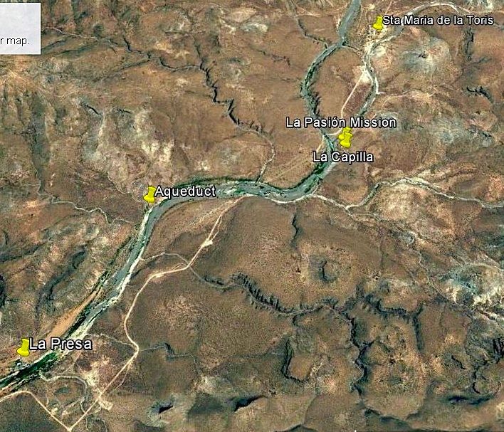
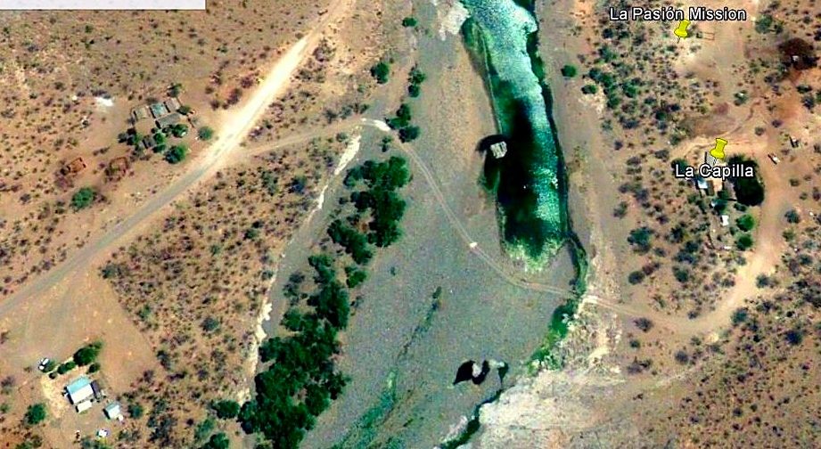
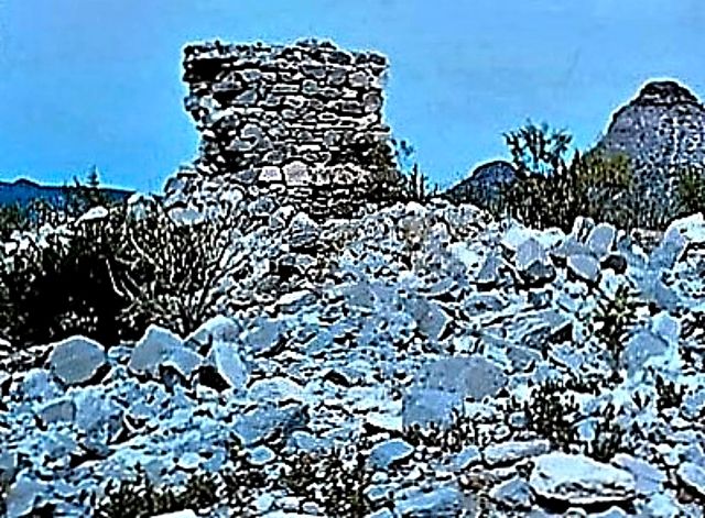
29.3 (0.2) Rancho La Capilla and Mission Los Dolores Chillá (La Pasión) ruins. The ranch owner, 'Modesto' tells me visitors are welcome!
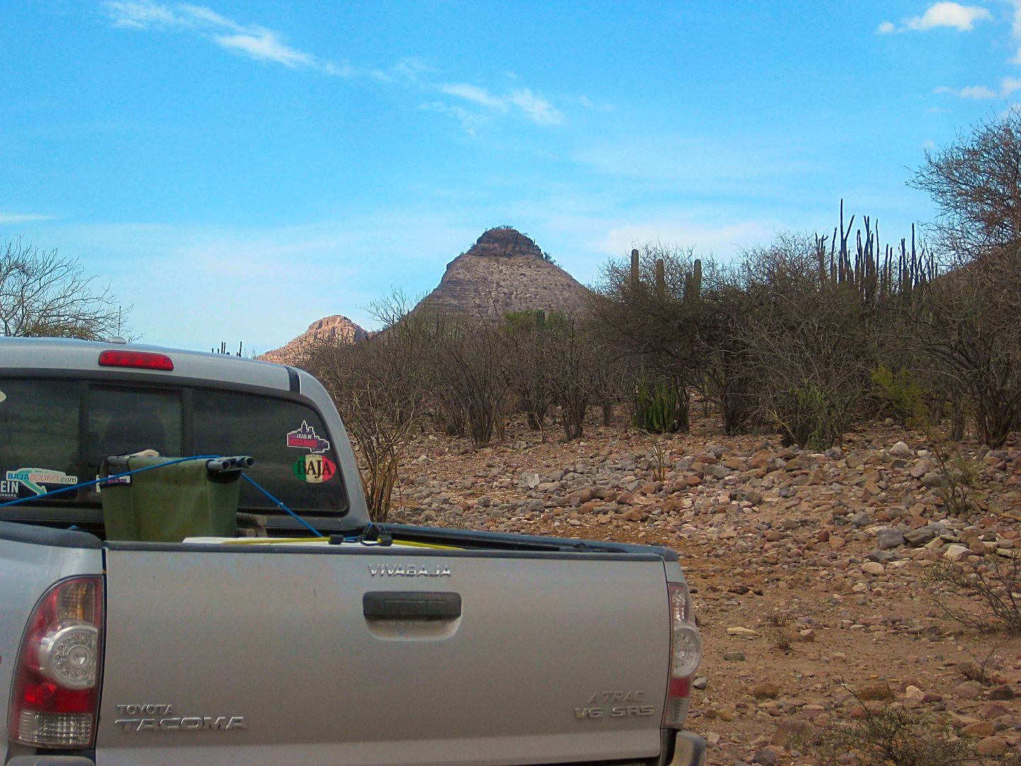
PHOTOS:

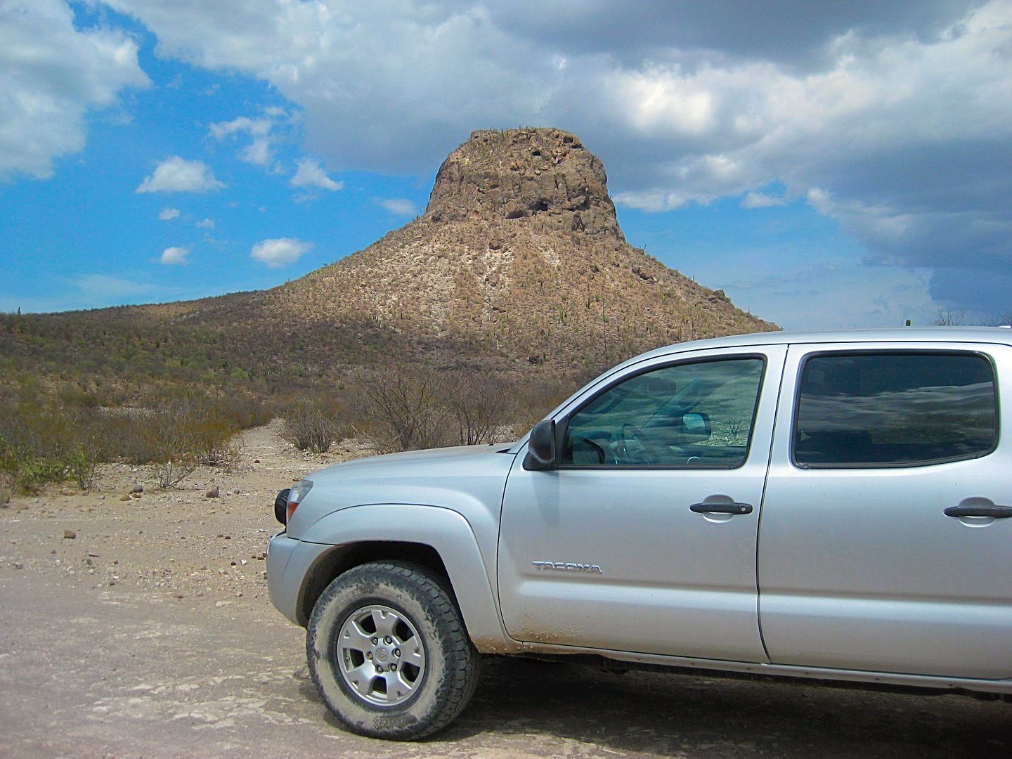
I call this double hill, La Tortuga!
(note to my BajaNomad.com forum amigos: I am also sharing on TacomaWorld.com forums and they like to see Tacomas)
Rancho La Presa, a historic ranch and had advertised as a guest facility under the name "Mission Dolores". It was closed to outsiders today. Their
Facebook page has been inactive for 2 years and their website is no longer on line.
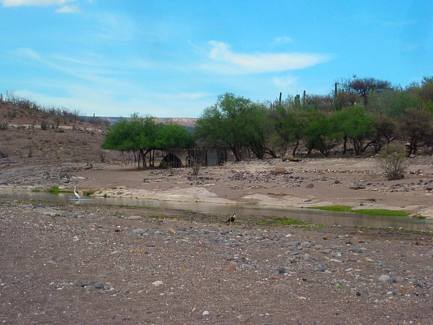
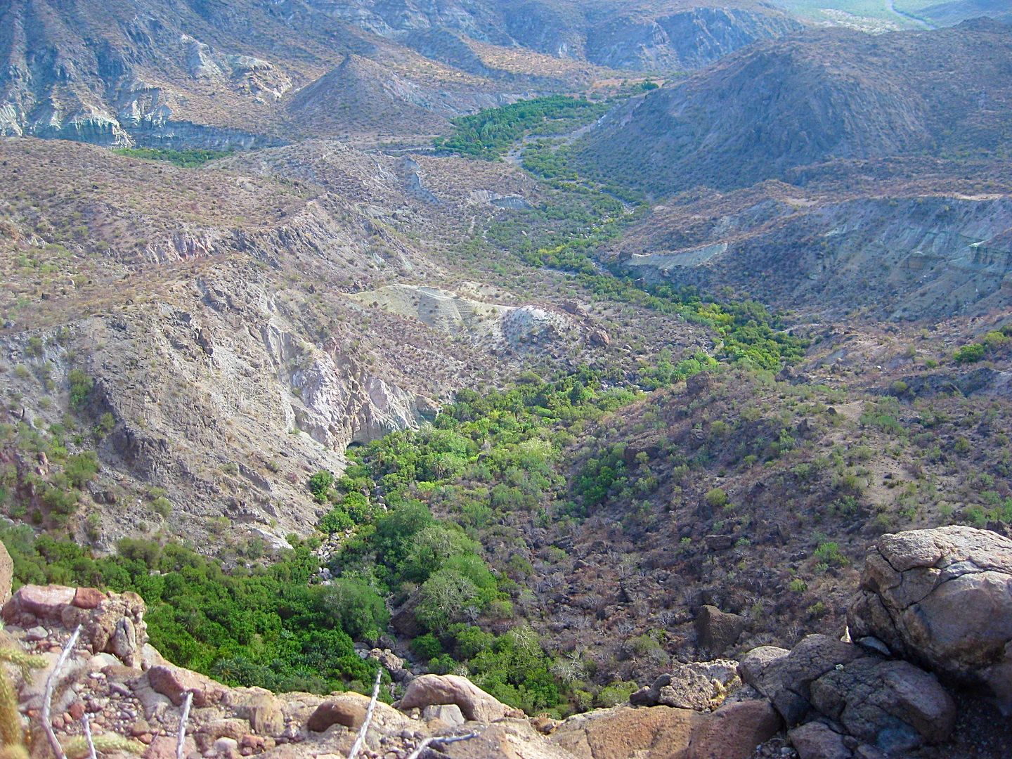
Crossing the arroyo to the mission site, a large white bird in the creek.
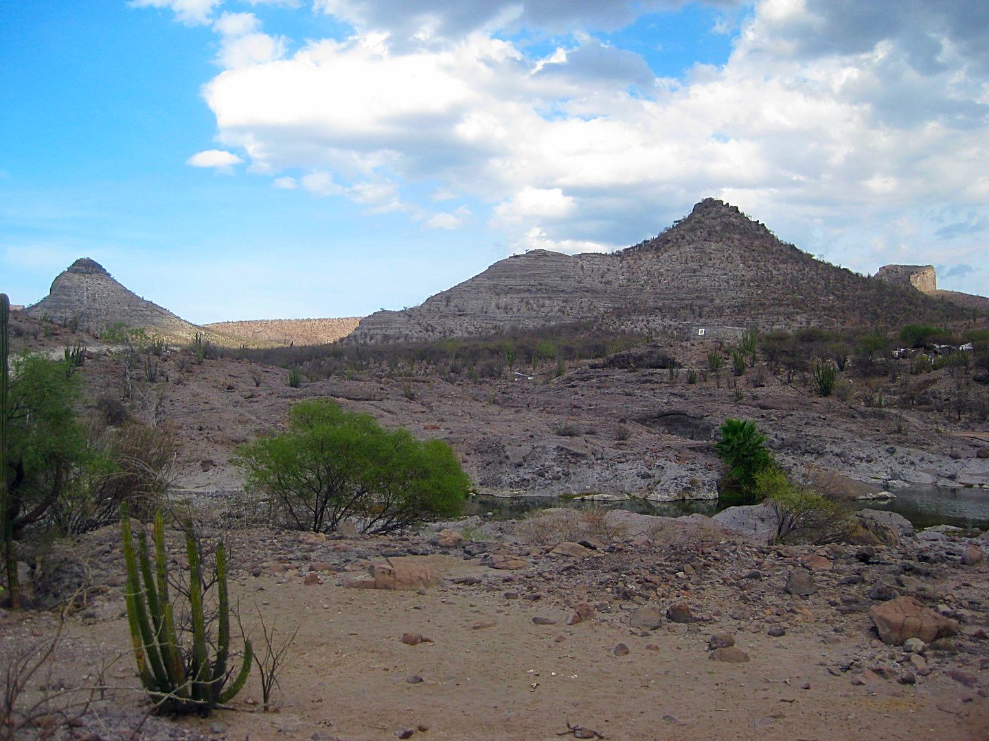
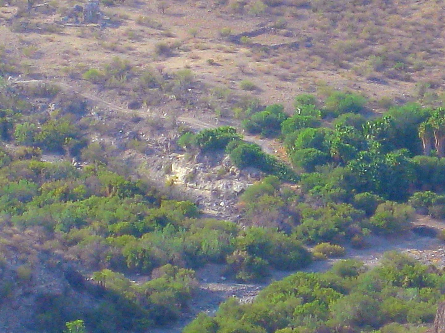
The Dolores mission was moved here in 1741. However, the location had been the visita of La Pasión before then.
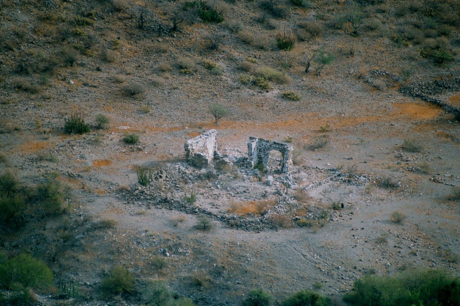
There was much more at the site than I had expected or seen in Jack Swords' or Baja Okie's photos (or remember seeing)!
Primary site, the round-topped hill in the background can be seen in a 1950 photo when a wall was still standing here.

Photo from Marquis McDonald in 1950

Photo from Jack Swords in 2000.
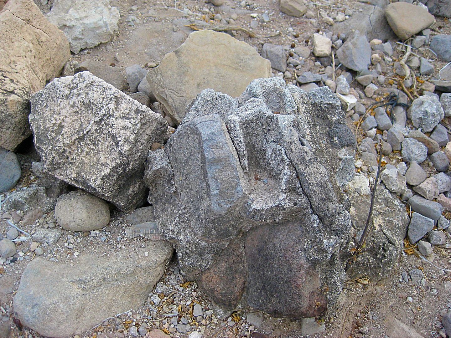
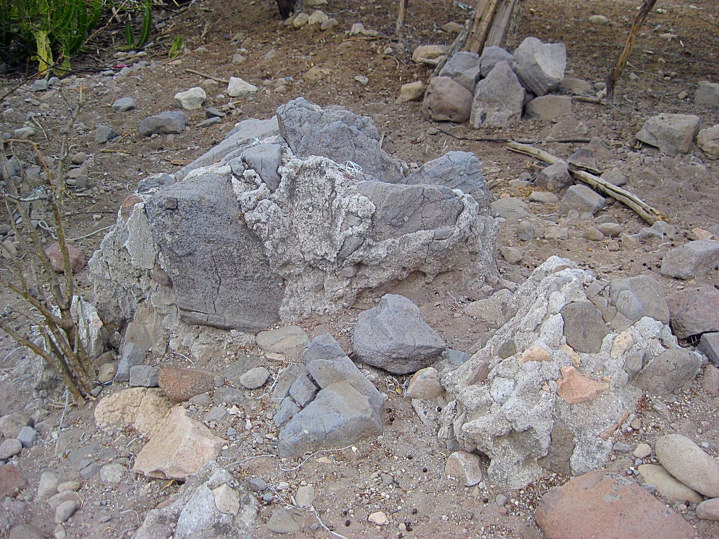
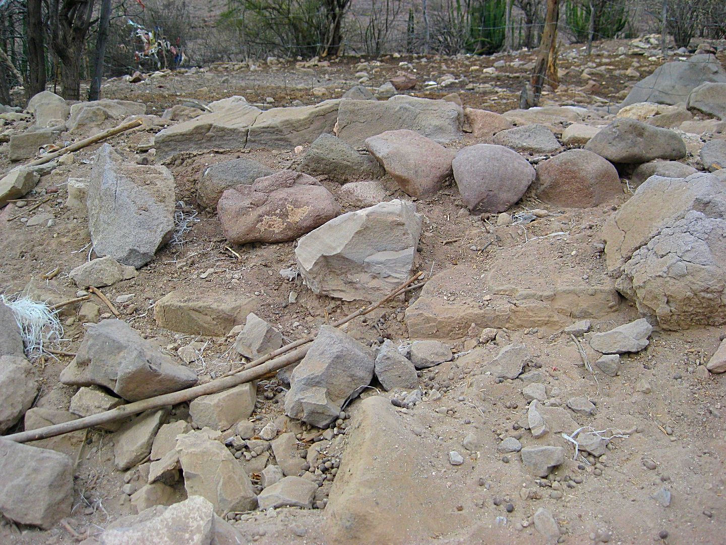
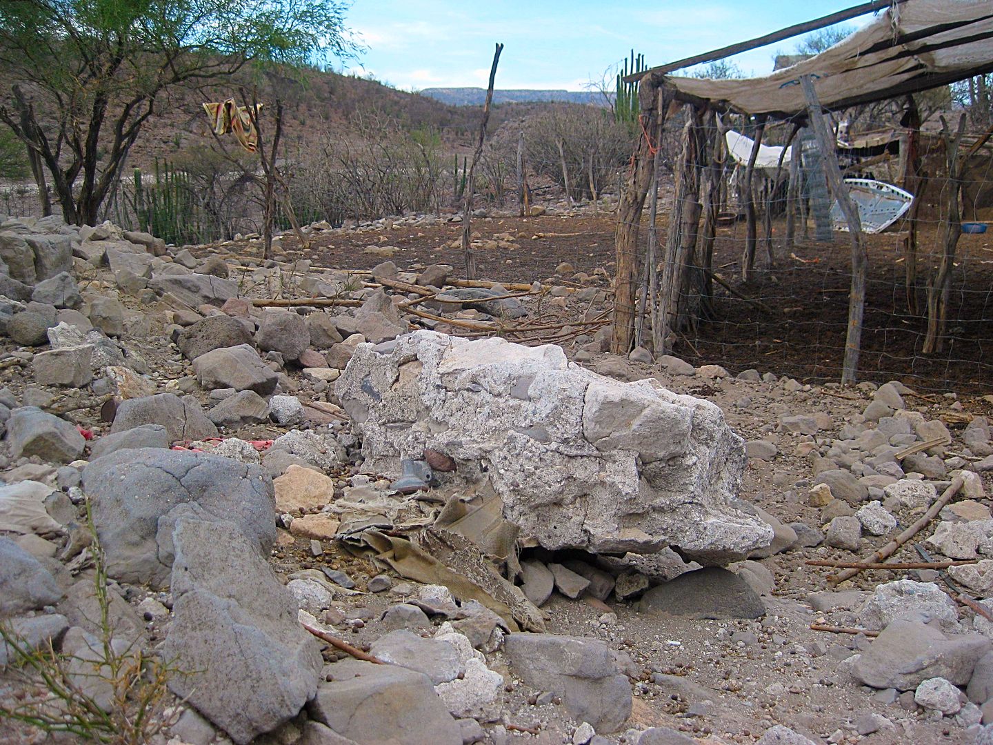
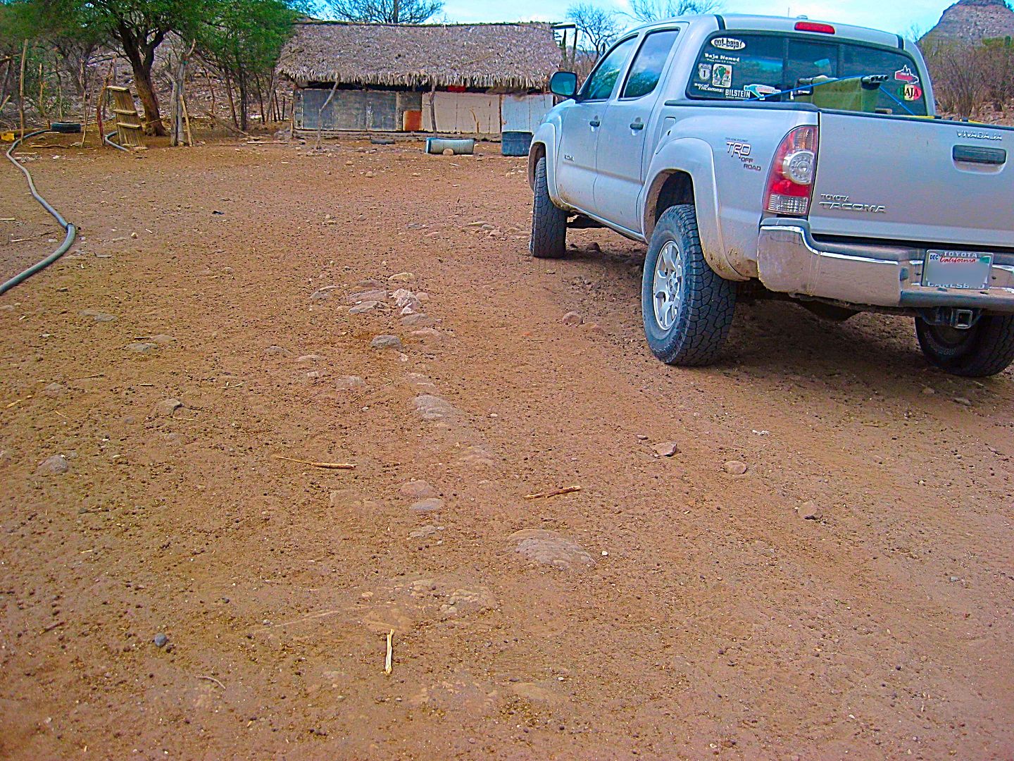
There were foundation lines everywhere... I didn't even realize I parked on a site until I walked back to my truck!
Here is that hill, just east of La Capilla/ La Pasión, as seen in the 1950 and other photos.
The view to the site (on the right), across the arroyo, from the graded road going east.
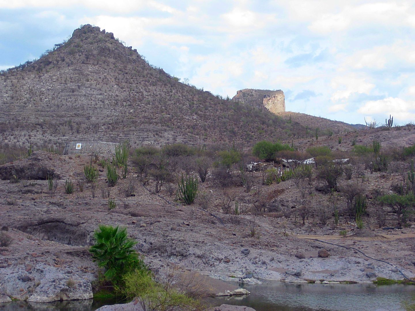
Between the pila on the low hill and the goat ranch, La Capilla.
PHOTOS are the only 100% way we have to preserve the historic sites before natural or human activity erases them.
From here I go on to see if I can get a clear view of the first Dolores mission buildings, near the gulf coast, but way down in a canyon!
STAY TUNED! I will create some maps to go with my drive this afternoon.
[Edited on 8-19-2017 by David K]
[Edited on 8-19-2017 by David K]
|
|
|
TMW
Select Nomad
Posts: 10659
Registered: 9-1-2003
Location: Bakersfield, CA
Member Is Offline
|
|
Good stuff David, keep it coming.
|
|
|
David K
Honored Nomad
Posts: 64476
Registered: 8-30-2002
Location: San Diego County
Member Is Offline
Mood: Have Baja Fever
|
|
2009 and 2003 Baja Almanac Maps
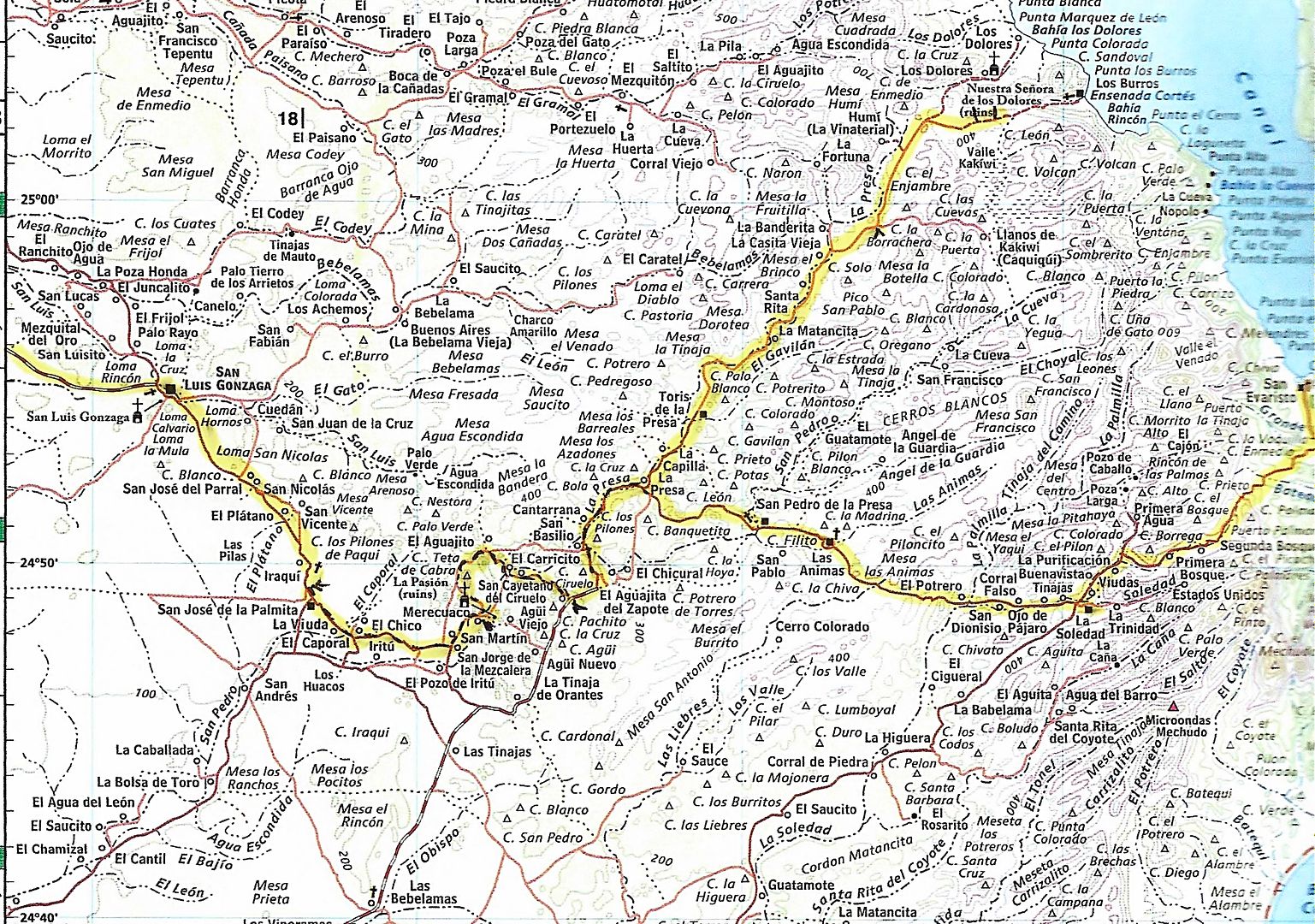
My route is highlighted... a few dashed lines and pointers added to help me follow the route as I was matching with my GPS track onto the Almanac map.
La Pasión is incorrectly shown by Merecuaco. It is at La Capilla, 2 miles east of La Presa (where the two yellow highlights meet). La Capilla is on
the south side of the road, not north, as shown. Past La Capilla, 'Toris de la Presa' was called Santa María de la Toris on the road sign.
The 2003 Baja Almanac
It had a trail shown as a major graded road, south of La Presa. Blurred it away.
Edited to show road I was on (6.1 mile section) that continued beyond the 1.5 mile section of poor road on the AAA map. That spot = T junction for
Rancho Merecuaco. The 'new section' goes 6.1 miles looping around La Tortuga hill, crossing Arroyo San Pedro/La Presa, and meeting the graded road. It
was 5.7 miles east to the La Pasión junction. I subtracted 5.7 from the AAA's 11.5 giving 5.8 miles on the balance of the graded road going west.
Here is the mission region from space:
Zoom in:
La Pasión was the visita location name. When Mission Los Dolores relocated to La Pasión, the missionaries generally referred to it by the location
name, not the official mission name (Nuestra Señora de los Dolores Chillá, and sometimes as Dolores del Sur as there was a visita named Dolores,
near Loreto).
The same thing occurred at Todos Santos, which was the visita name. When it was elevated to a mission, the official name was Santa Rosa de las Palmas,
but the location name 'Todos Santos was used. When the La Paz mission moved to there, it replaced Santa Rosa, but it was more often called Todos
Santos, still!
Clearing up these mission names was one of my book's goals.
[Edited on 8-19-2017 by David K]
|
|
|
David K
Honored Nomad
Posts: 64476
Registered: 8-30-2002
Location: San Diego County
Member Is Offline
Mood: Have Baja Fever
|
|
By all means, take photos of the site! It may be the last ones taken before it is gone!
Thank you, Marquis McDonald, for your seeking to see all of Baja's 'Lost' Missions, as many where back then before most roads (1949-1950).
|
|
|
David K
Honored Nomad
Posts: 64476
Registered: 8-30-2002
Location: San Diego County
Member Is Offline
Mood: Have Baja Fever
|
|
Hey, this is just Day 4, afternoon... I am still going to look for the Dolores Overlook, drive down to the gulf coast (Los Burros) and camp.
That part changed... Part 4c coming up next... and 10 more days to go! Hey, relax... I didn't work this hard every day, I had two easy days of the 14!
I did go to a doctor today about some neck pain the crept up during the drive...
|
|
|
David K
Honored Nomad
Posts: 64476
Registered: 8-30-2002
Location: San Diego County
Member Is Offline
Mood: Have Baja Fever
|
|
DAY 4c-5a, Friday Evening-Saturday Morning
Having my fill of the old stones and foundation outlines from this long ago Spanish California mission, I moved on east (well northeast) to see how
close I could get to the Dolores overlook.
Mission Nuestra Señora de los Dolores Apaté was the 9th California mission, founded in 1721. It was the result of the failure at the Ligüí
/Malibat mission location (1705-1721). The benefactor for that mission (the third in California) suffered bankruptcy and his funds dried up. The
Jesuits kept the mission going but it was in a bad location and was raided often by hostile Pericú Indians.
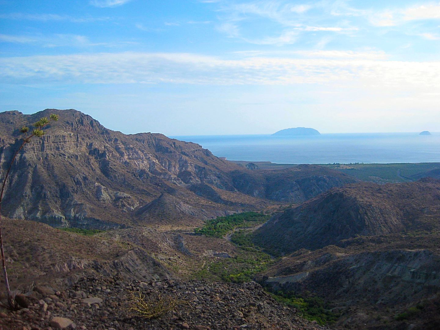
When new funding was found, the mission also began anew, far to the south of Ligüí and with a new name. First established close to the beach, where
shallow wells provided fresh water (probably where Rancho Dolores is today), within two years, the mission was moved into the canyon just east of the
beach about 2 miles away.
Ruins with standing walls have survived at Dolores Apaté along with other walls, a man-made storage cave, irrigation canals, etc. No road goes to
Dolores, so one must get there from the sea or hike down a very steep Camino Real trail from above. This isolated location did not serve the Guaycura
Natives who lived beyond the canyon, so Padre Clemente Guillén had long desired to move the mission, and he did in 1741, to La Pasión. That site was
known to the Indians as Chillá or Tañuetía (The Place of Ducks).
My time limits and energy availability prohibited me from making the 1,000 foot drop and return from the location down there. I would have to try and
find a point on the ridge that the road to Los Burros comes close to and see if I could get a photo from above, as others had done.
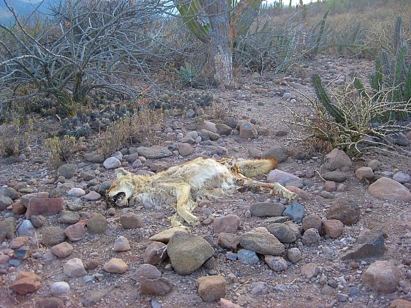
The hike was short to the first place I could see the site, but it wasn't ideal. I tried to find another vantage point and came across a dead coyote.
Reaching for my camera, in my pocket, it wasn't there!!! PANIC!!!
It was late, the sun was nearing the horizon and I was bush whacking near the cliff edge for a photo op. How did it get out of my pocket!!??
Well circling back between the thorny plants I finally found it. A young ocotillo-like plant grabbed the camera leash, that was dangling out of my
pocket. I saw my camera hanging on the small plant, above the ground. Wow, relief!
I took more photos of what I thought were the ruins, my eyes are not so good anymore, but when I looked at the zoom image on my camera, it seemed I
got it.
I got my truck turned around on the very rocky road. I originally had hoped to go down to Los Burros (Ensenada Cortez) but the one steep grade to this
point was really bad and I was no longer feeling like another steep drop to go down, then back up the next morning. I drove back westward and found a
bit of a sandy arroyo to put up my tent. The tent was to protect me from bugs if there were any. Mosquitos love me and all the B vitamins in the world
don't deter them. The sun was going down, I made my dinner of brats from Costco, and all was good.
The next morning, after seeing on the GPS/map I am very near another possible view point of the mission, I drive just 1/4 mile back east, see the path
to the north and it is drivable for about 500 feet. I hike the remaining distance to the cliff egde and take more photos. I have not (until now)
examined those photo... So we are all seeing what I got today, for the first time! Cross your fingers...
PHOTOS:
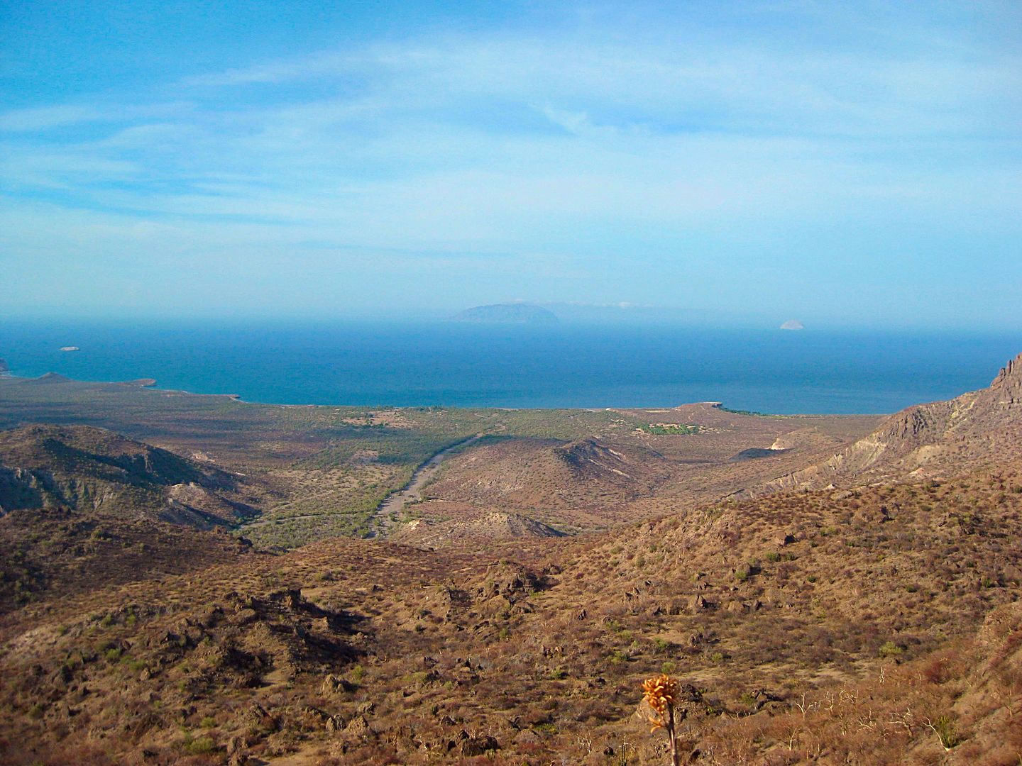
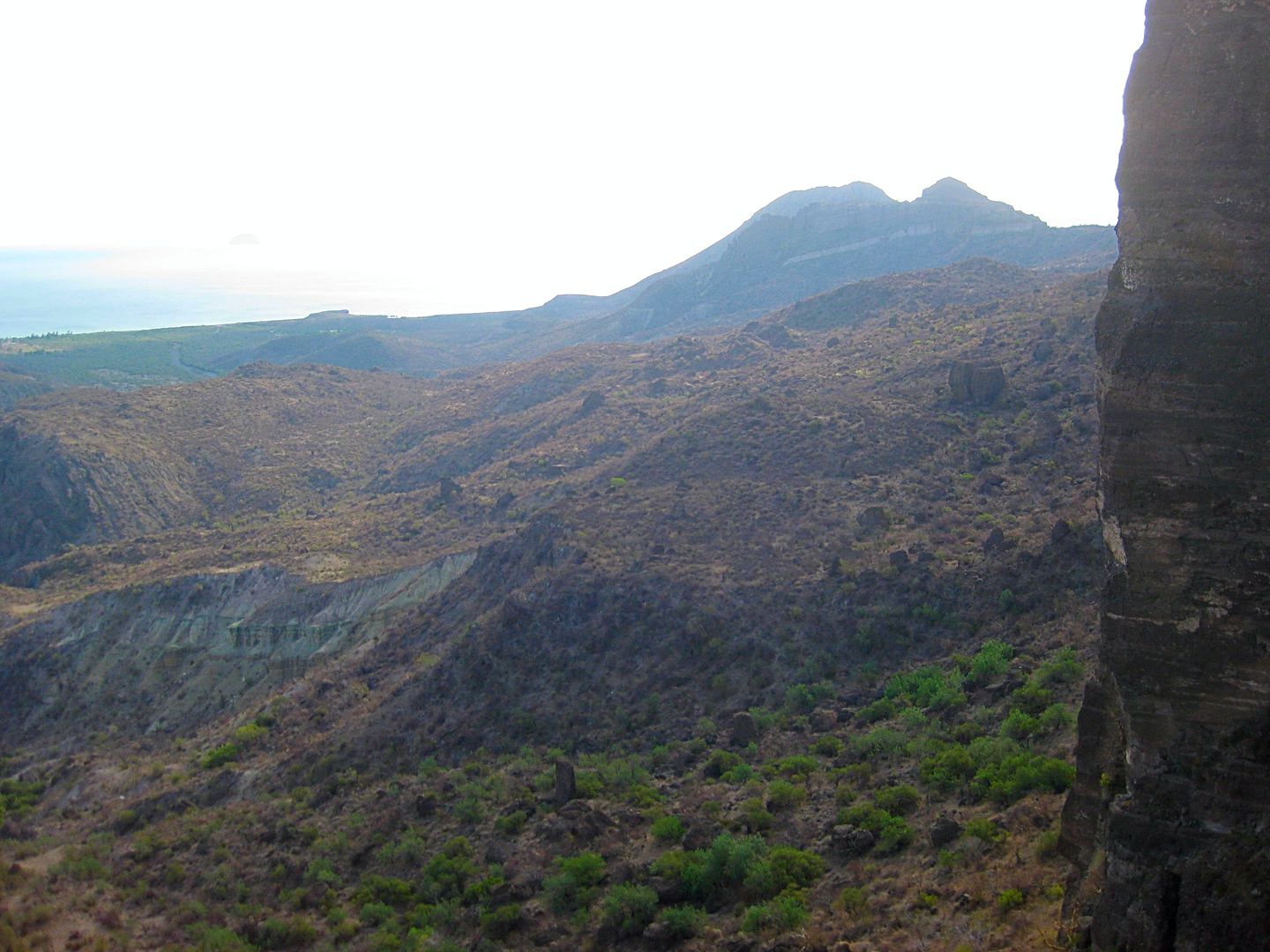
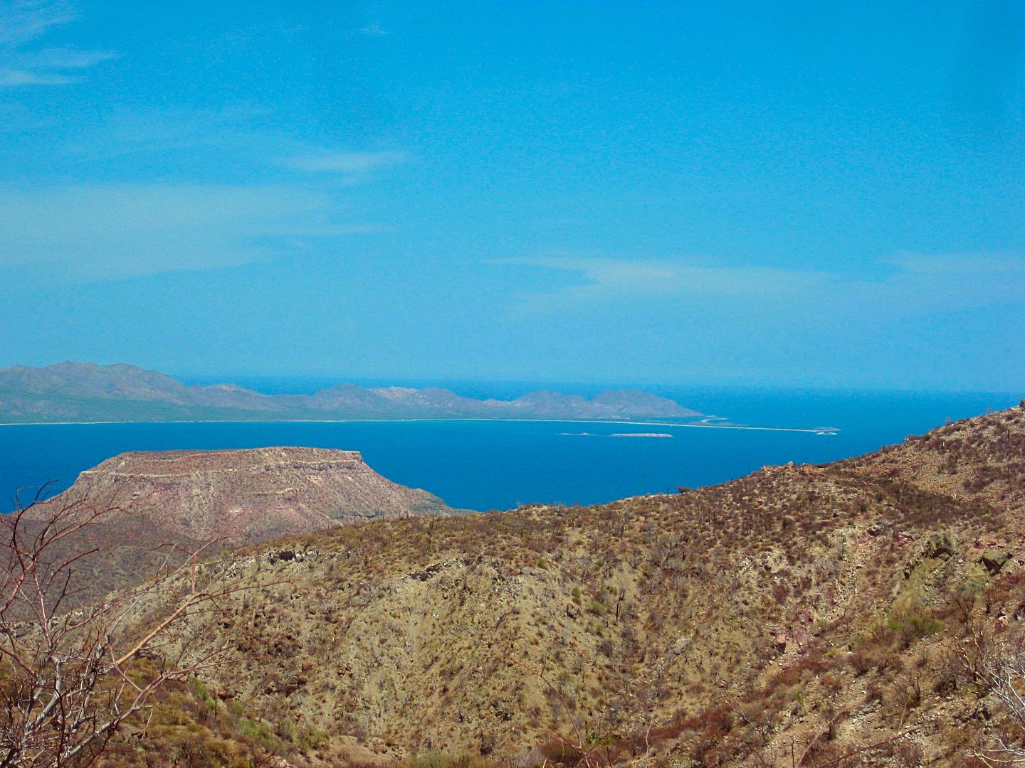
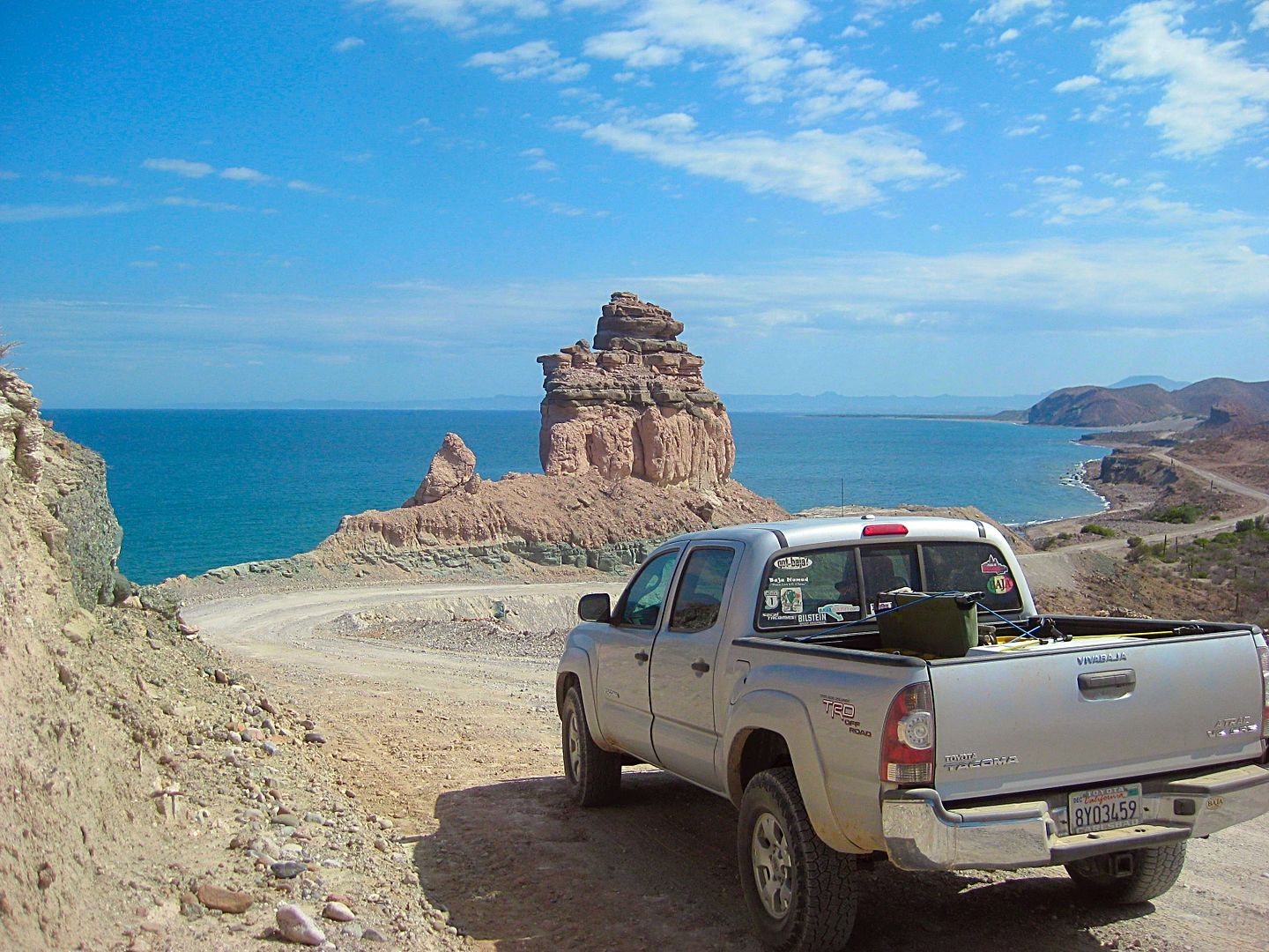
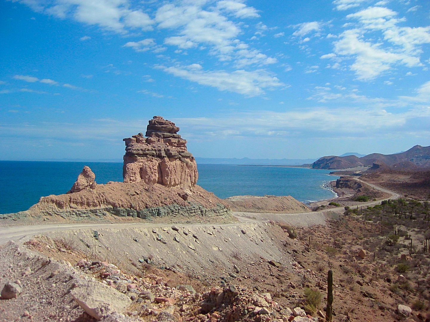
View of Rancho Dolores trees, Gulf of California (Sea of Cortez) and islands.
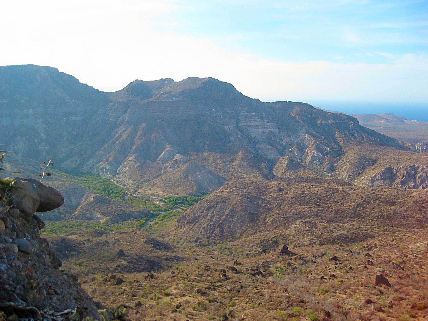
View up the canyon to where I think the mission ruins are about.
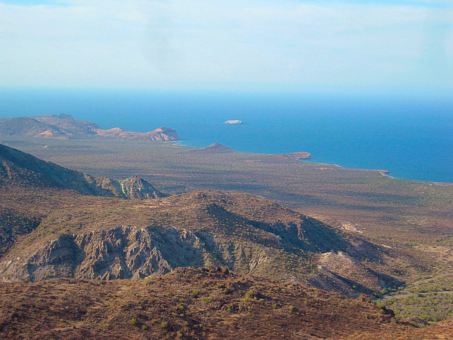
View closer to the coast, looking north.
First zoom attempt. That square corral I knew was near the ruins.
I need to find a better spot along the cliff... I lose my camera... find it... and take a photo of the coyote, which probably saved me from losing my
camera forever!
The new spot was not better, so I return to my truck and go find a camp spot. Here is the photos from Saturday morning after hiking to the edge of the
gint cliff...
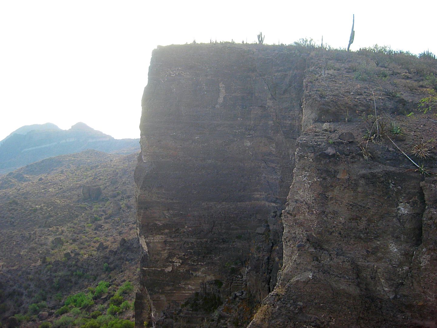
Cliff face and Sea of Cortez... morning sun washing photo a bit.
Now, for the mission:
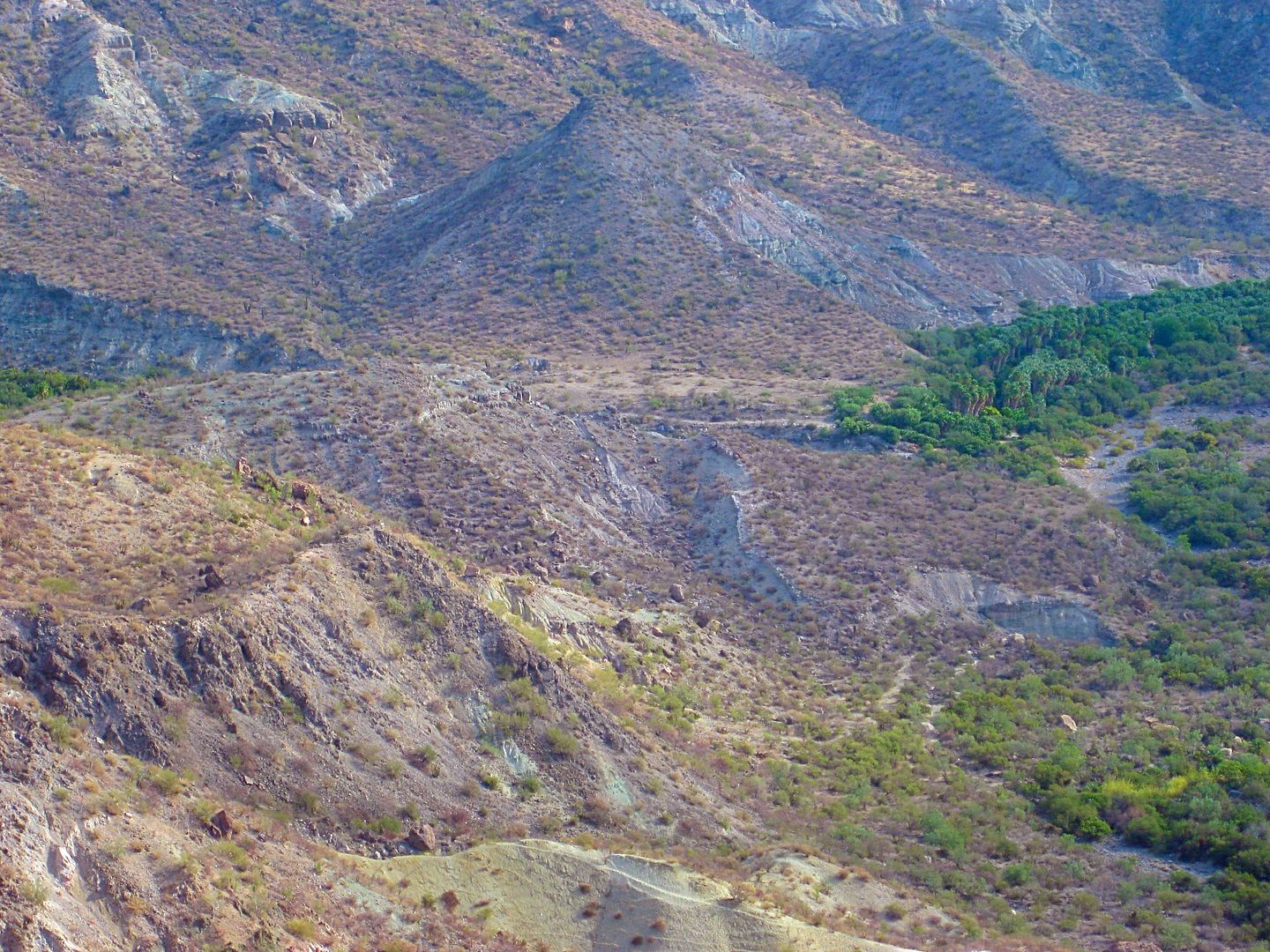
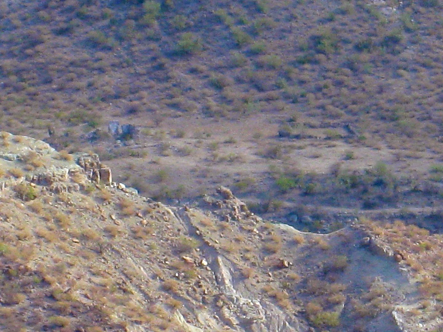
EUREKA! That's it, left of the square corral walls.
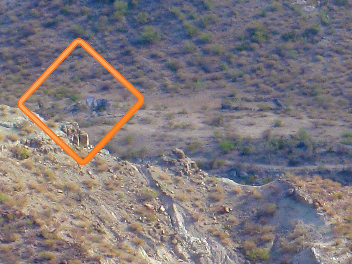
That pointy hill helps spot it. Here is a regular view from another spot.
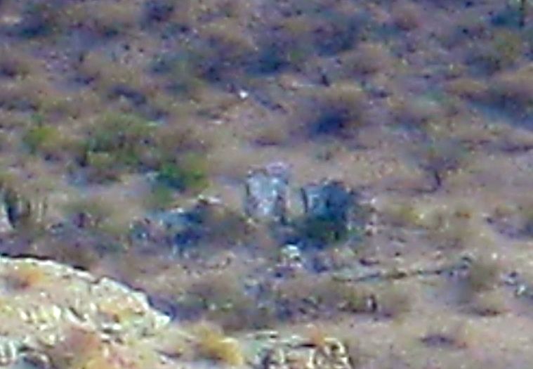
Okay, check...
Here's a better photographer's (Jack Swords) view, with a better camera, a few years ago, March 2001, a different angle too:
Coming up next, the long crossing of the mountains, seeing Mike and Rebecca again (the Canadians on bikes), a low tire pressure light comes on, and
the steep drop to San Evaristo... and on to La Paz!
|
|
|
Mexitron
Ultra Nomad
Posts: 3397
Registered: 9-21-2003
Location: Fort Worth, Texas
Member Is Offline
Mood: Happy!
|
|
Awesome report!
Two things: 1. Come out to Texas and do landscaping work with me in the summer and it will cure your aversion to the cold.
2. Take me with you next time, lol!!!
|
|
|
David K
Honored Nomad
Posts: 64476
Registered: 8-30-2002
Location: San Diego County
Member Is Offline
Mood: Have Baja Fever
|
|
Quote: Originally posted by Mexitron  | Awesome report!
Two things: 1. Come out to Texas and do landscaping work with me in the summer and it will cure your aversion to the cold.
2. Take me with you next time, lol!!! |
That's okay... I still like it warm over cold no matter how hot it can get or how hard it is to sleep in the heat. The AC at night does spoil you, I
must say!
Let's go, you buy the gas and I'll buy the beer!
I edited the earlier map and mileage notes post having just compared my route with the AAA map. It may not show as much as the Almanac map does, but
for navigating while driving, it is easier to use.
Here is the new edits:
Edited to show road I was on (6.1 mile section) that continued beyond the 1.5 mile section of poor road on the AAA map. That spot = T junction for
Rancho Merecuaco. The 'new section' goes 6.1 miles looping around La Tortuga hill, crossing Arroyo San Pedro/La Presa, and meeting the graded road. It
was 5.7 miles east to the La Pasión junction. I subtracted 5.7 from the AAA's 11.5 giving 5.8 miles on the balance of the graded road going west.
Total (Partial) Miles to La Pasión (Rancho La Capilla)
0.0 (0.0) Mission San Luis Gonzaga (1:24 pm)
5.3 (5.3) Curve right, ranch on left.
7.4 (2.1) Ranch house (El Plátano?), concrete creek crossing, oasis.
8.1 (0.7) Fork, main travel goes left.
8.9 (0.6) San José de la Palmita (?)
10.2 (1.3) Ranch (El Caporal ?), process building, road junction.
12.2 (2.0) Ranch
15.5 (3.3) T intersection. Rancho Merecuaco is 0.4 mi right (south). Go left.
19.4 (3.9) Weather Station, ranch houses.
20.0 (0.6) Big arroyo crossing (Arroyo San Pedro on AAA map, Arroyo La Presa on Baja Almanac).
21.6 (1.6) Major Graded Road (3:22 pm)
22.5 (0.9) Road right signed to El Chicural & Aguajito.
24.9 (2.4) Rancho Cantarana
26.8 (1.9) Rancho La Presa (closed to visitors)
27.3 (0.5) Junction. Ahead to El Solano & San Evaristo. Left to La Pasión, Santa María de la Toris, Los Burros. Turn left.
29.1 (1.8) Ranch on left and a road to the right crosses arroyo to the mission site. Turn right, cross arroyo. If ranch gate is closed, turn left just
past and drive along the fence to get to the other side of the ranch house.
29.3 (0.2) Rancho La Capilla and Mission Los Dolores Chillá (La Pasión) ruins. The ranch owner, 'Modesto' tells me visitors are welcome!
|
|
|
StuckSucks
Super Nomad
Posts: 2305
Registered: 10-17-2013
Member Is Offline
|
|
Just curious, but is that your cot riding on its edge? Is there a reason for edge placement (vs riding flat)? A space-saving thing?
|
|
|
David K
Honored Nomad
Posts: 64476
Registered: 8-30-2002
Location: San Diego County
Member Is Offline
Mood: Have Baja Fever
|
|
Yes... and because military checkpoints often want to open the containers, I do not need to remove the cot from on top of them each time.
I have two large Costco containers (one for dry food good, kitchen stuff; one for camping stove, tarps, propane, bug spray, fire logs).
Also, as you can see the top of it, I have a 5-Day ice box with a bungee to keep the lid down tight. There is also a box of fire logs (I never needed)
and my tent. My chair is next to the cot.
Inside the truck, the back seats are folded down and I have a flat of water bottles, my clothes bag, single wide air mattress, snacks for the road,
and my tire air pump.
When I go camping with Elizabeth, we take a second ice box for more crushed ice and beers/waters only in it. Food goes in the other with block ice. A
bigger queen air mattress, additional beach gear camping box, etc.
|
|
|
David K
Honored Nomad
Posts: 64476
Registered: 8-30-2002
Location: San Diego County
Member Is Offline
Mood: Have Baja Fever
|
|
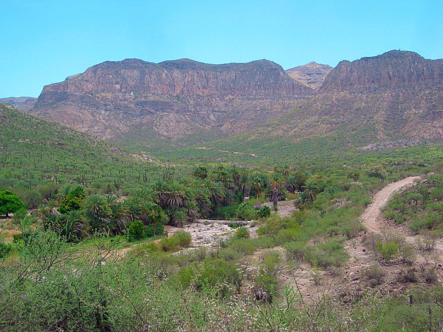
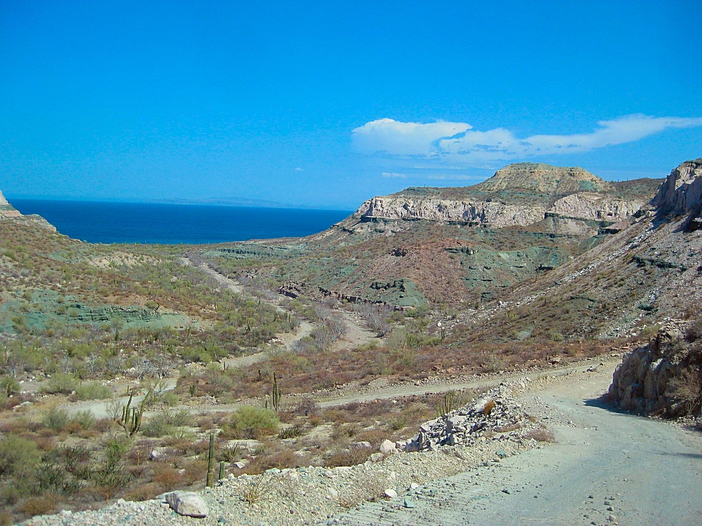
Day 5 Continued... Dolores Overlook to La Paz
Well, I was satisfied after all those bumpy miles and hiking to see the 1721-1741 Dolores mission. Back to my truck and return to the road past La
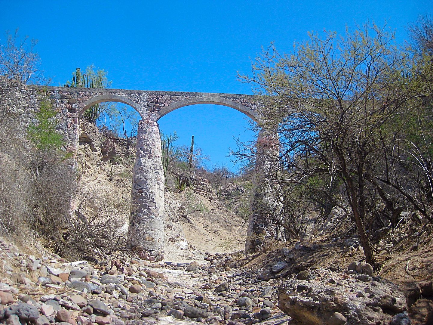
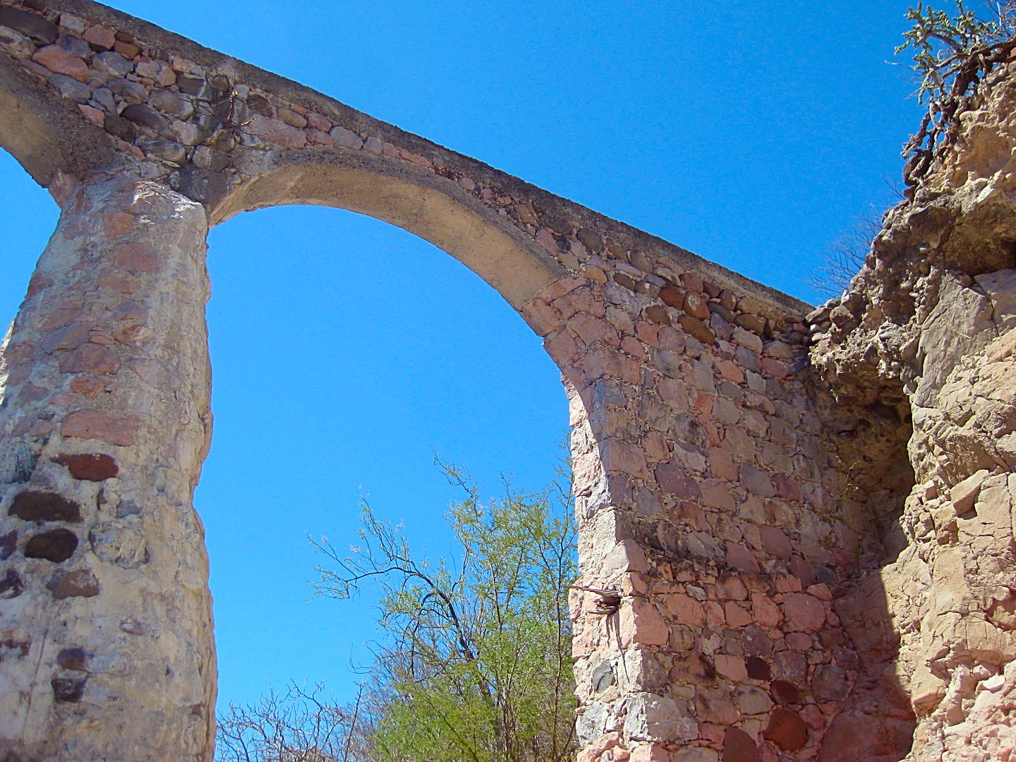
Pasión. On the north bank of the arroyo, before Rancho La Presa, is an aqueduct used to bring water to the old ranch from the water source at La
Pasión. The ranch was the property of one of Baja's first Mexican governors during the transition period in the 1820s, Fernando de la Toba. He is
buried there. Jack Swords managed to see the grave as well as the impressive aqueduct. Two pages of photos beginning here: http://www.vivabaja.com/swords/page4.html
From Jack Sword's:
The governor's grave:

The aqueduct:

I could see that aqueduct on Google Earth and where I could park my truck and hike to it...
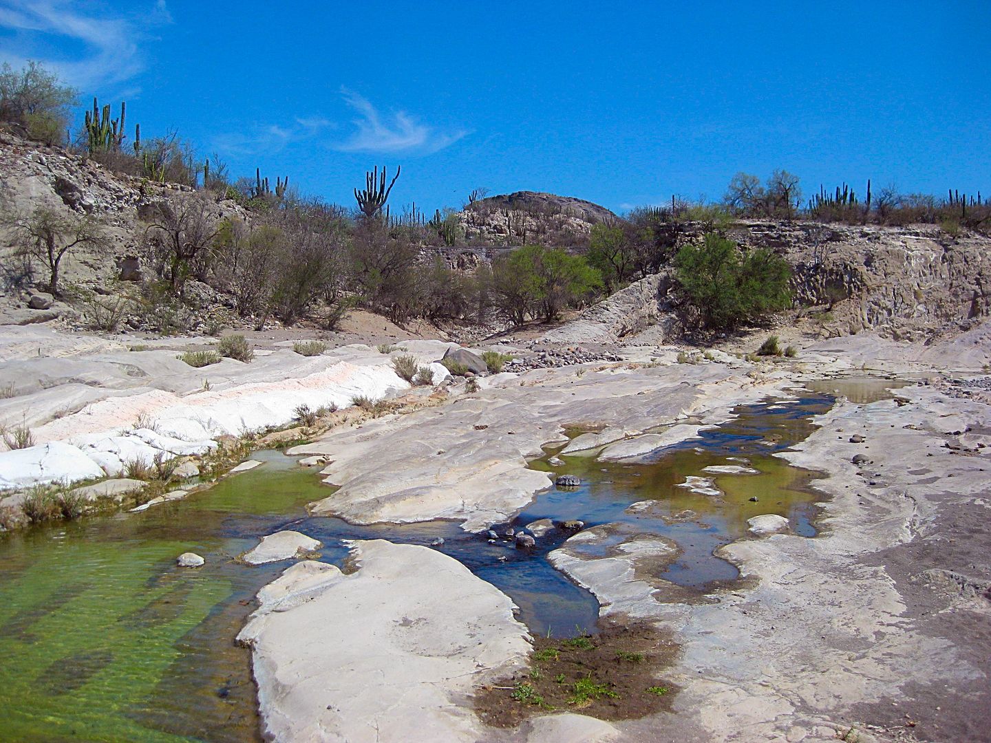
See it?
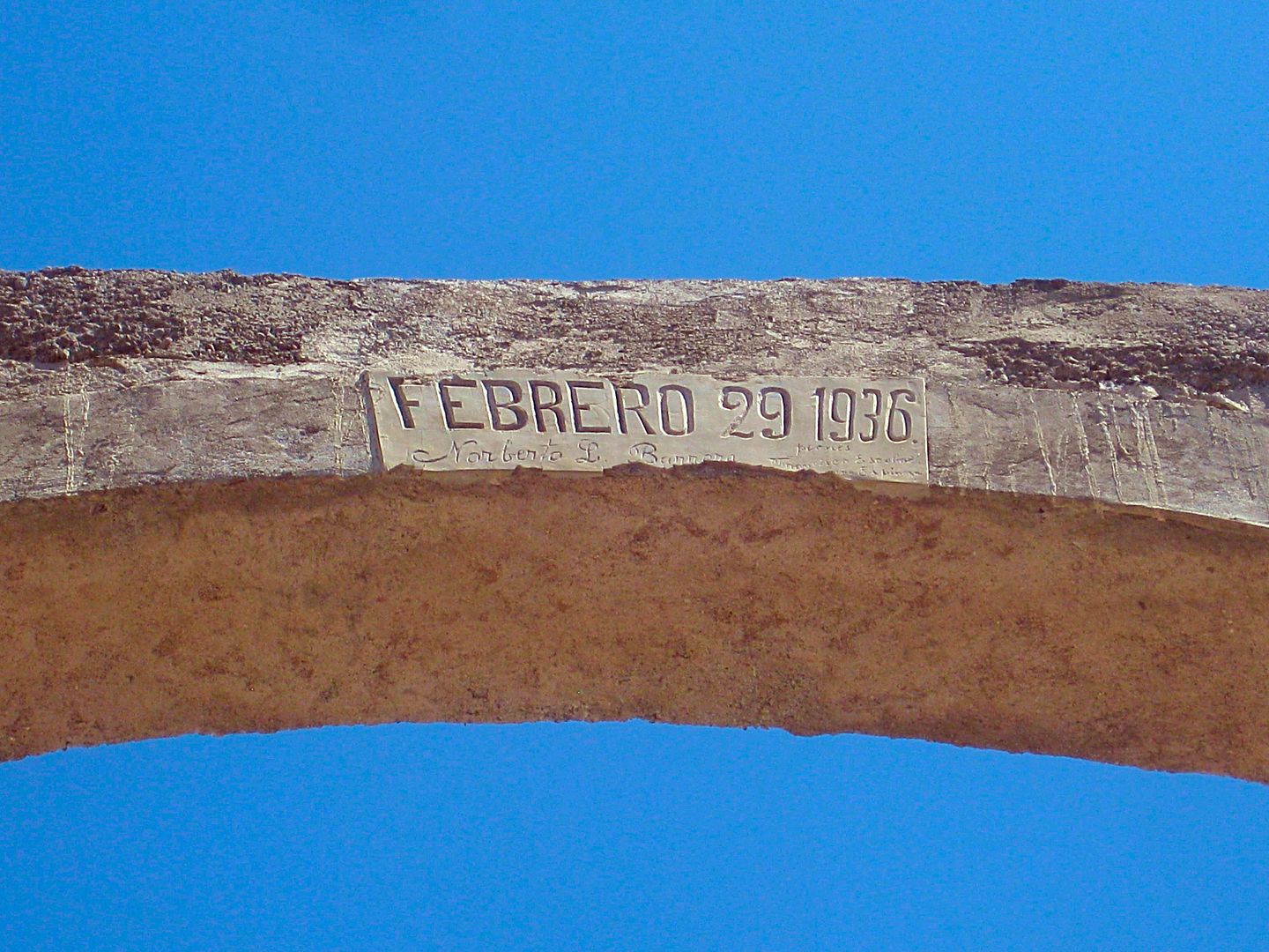
So, 1936 was a leap year?
Very cool even if this isn't over 100-years old.
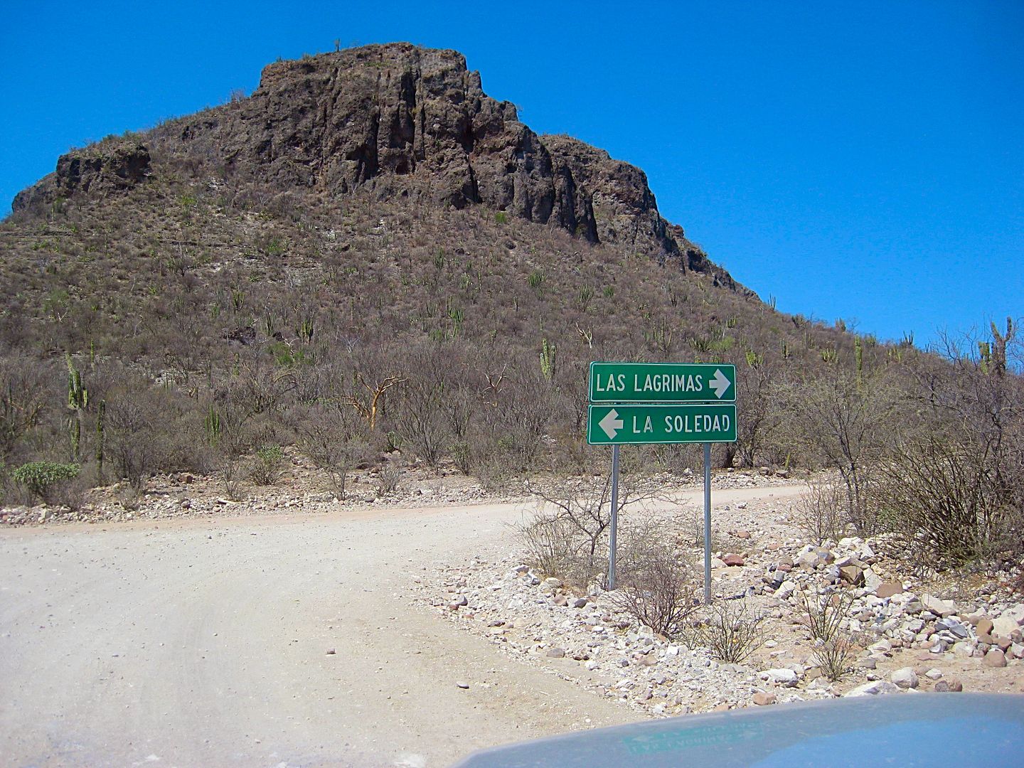
Back at the major graded road, near La Presa, ~Km. 56. Las Lagrimas is another name for Cantarrana, the ranch west of La Presa.
I am turning left here. Set odometer to 0.0
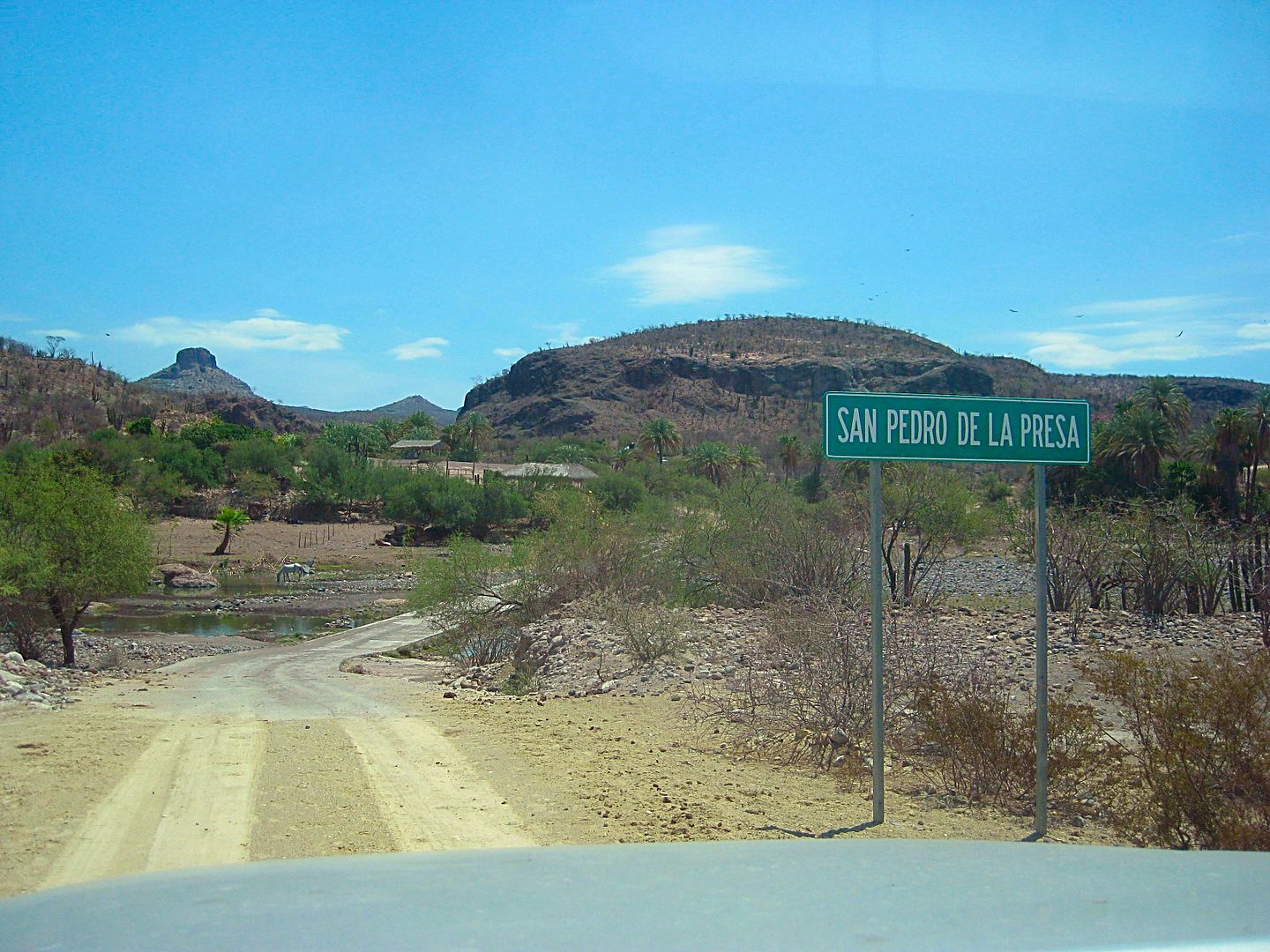
4.8 miles: I come to San Pedro de la Presa. AAA map says 4.7, so we are close!
Km. 63.5
7.4 miles: Rancho Las Animas was 2.6 miles from San Pedro de la Presa, at Km. 68.
Some pretty wild mountain country and a few big grades were concrete surfaced. This big one was 2 miles from Las Animas, at Km. 71+:
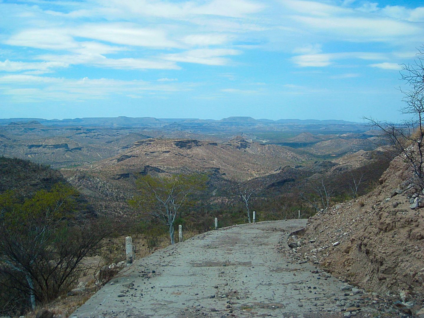
9.4 miles
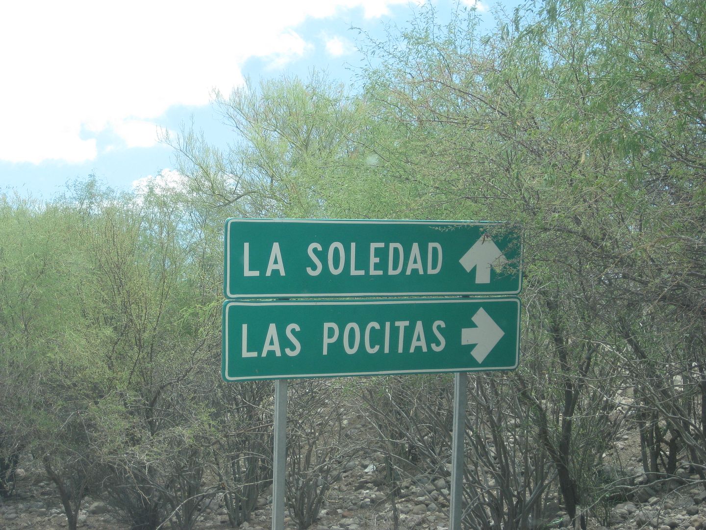
17.8 miles: Major Intersection near Km. 85. Las Pocitas is out on Hwy. 1.
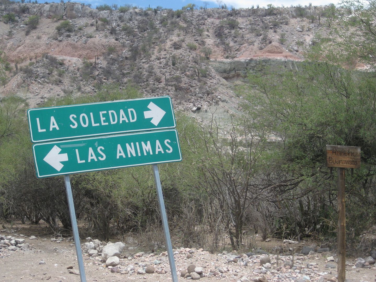
Lots of signs!
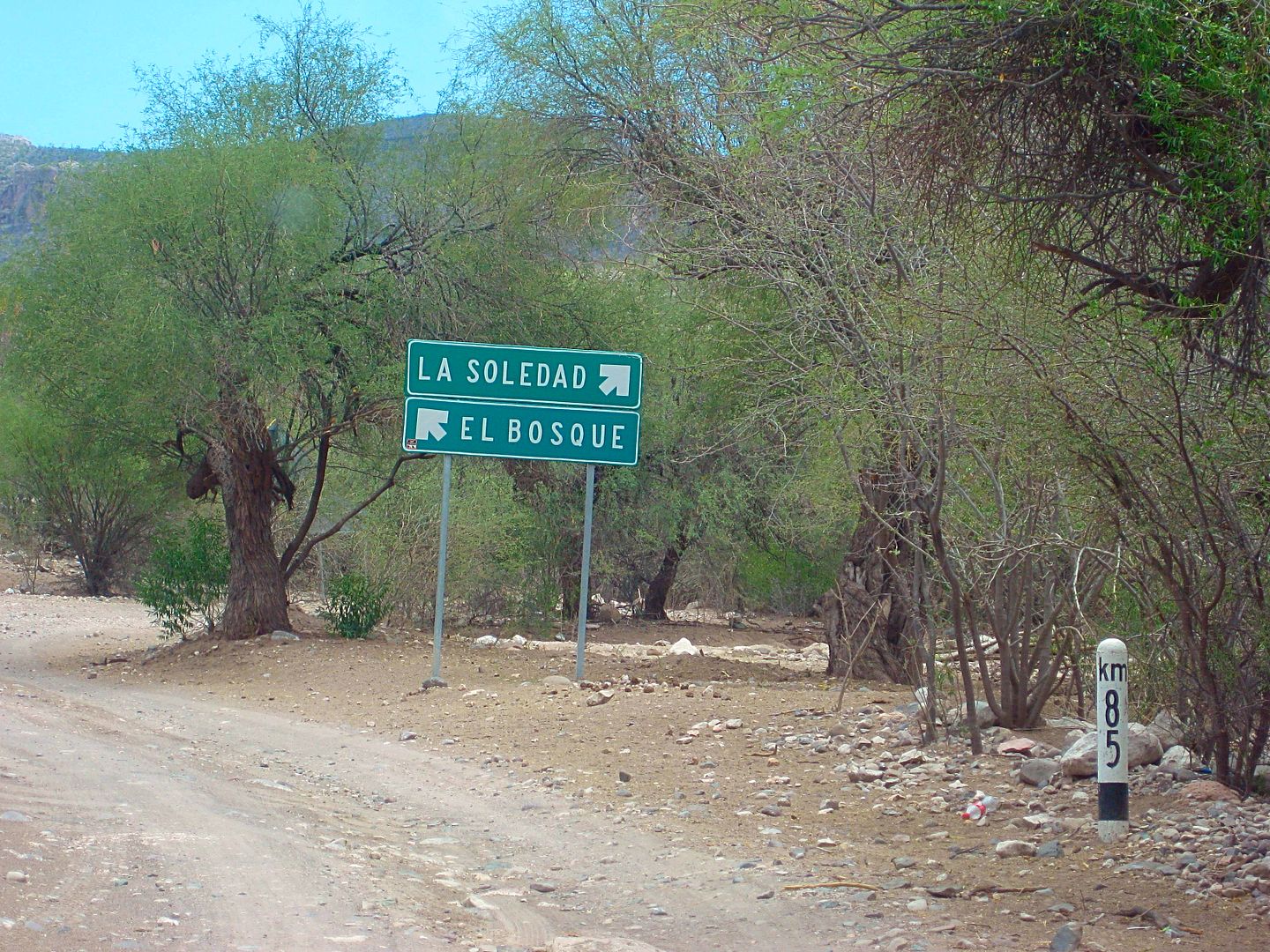
18.0 miles: Here is the Km. 85 post, and a fork. La Soledad is a dead end road, 0.8 miles (1.3 kms.) to the right. A ranch and an impressive church
are there. But at just over a kilometer away, the Km. 88 post at La Soledad is not correct. A large school is here at the junction of roads, serving
area ranches. The same was true at Santa María de la Toris, near La Pasión.
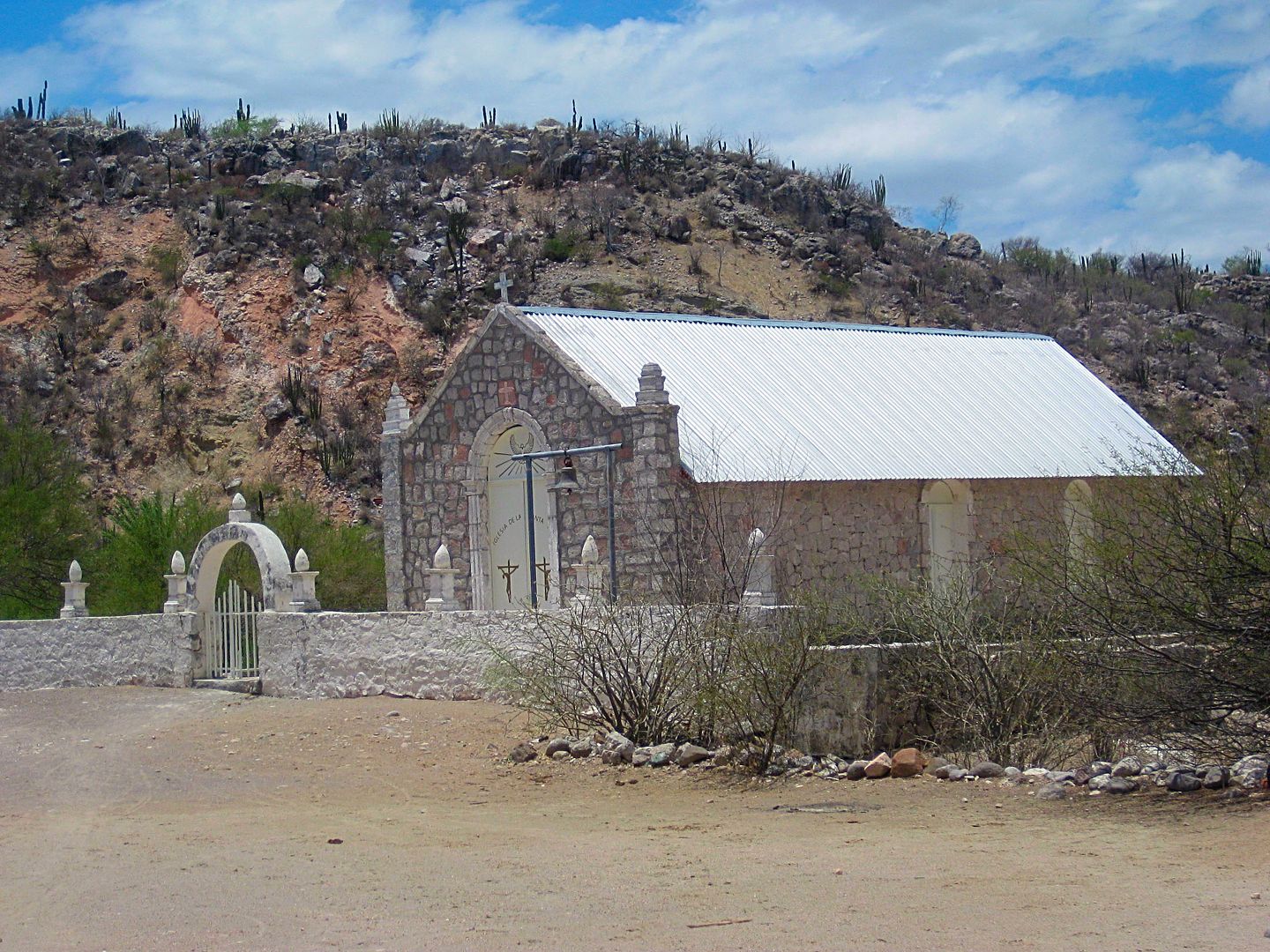
18.8 miles: Church at La Soledad
I turn around and go back to the school area and take the road signed El Bosque (for the way to San Evaristo and La Paz). Set odometer to 0.0 here.
0.0 Km.85, schools, near La Soledad on map
1.8 Rancho Las Paredes, gasoline for sale per signs.
2.3 La Vibora Blanca & La Purificación signs.
4.3 El Primer Bosque road north.
4.8 El Bosque road south.
7.5 Top of big grade. View of gulf. elev. 1,680'.
11.5 Bottom of grade, coast road (but not in sight of coast). San Evaristo is 1.6 miles to the left and the road ends in 2.4 miles at a ranch facing
some salt mine works. One business for visitors on the beach, otherwise a fishing camp.
I think this was Segunda Bosque?

Top of grade to gulf coast. Isla San José off shore.
Salt works at the end of the road north.
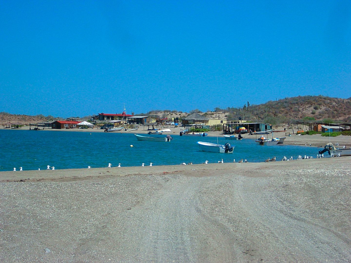
San Evaristo is an attractive fishing camp.
Reset odometer to 0.0 for the run to La Paz.
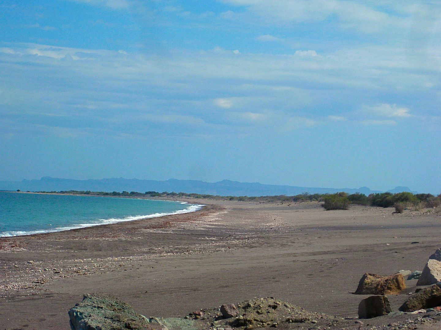
18.8 miles Punta Coyote. This beach was just south, where the road left the coast.
29.0 An extensive shrimp farm with many canals, using old slat flats, out of sight of the ocean.
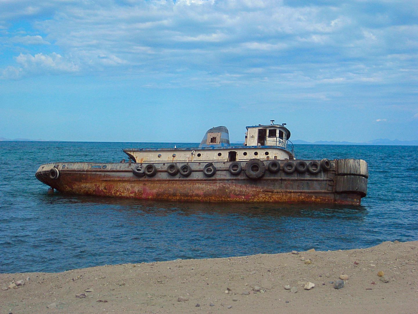
Bad luck boat, near San Juan de la Costa.
42.1 miles: Pier for San Juan de la Costa. A paved road, used for mine vehicles is separated from the non-workers dirt road, next to the beach.
However, without signs, you must figure how to get to that road, as it is the only way south. The beach road was washed out ahead and is a lagoon now.
43.5 Beach Cabins on the left, here you must fork to the right, leaving the beach road. Beach route dead ends in 0.9 mi.
44.3 T Junction, turn left.
44.5 Meet paved road, turn left (south). Just ahead (south) is a sign directing northbound traffic to turn off the highway, this leads them to the
other side of the lagoon/ washed-out-road. Km. 38.5
Reset odometer to 0.0: San Juan de la Costa
8.3 miles El Califin beach.
9.5 miles Km. 23 Beach.
21.3 miles Km. 4 El Mogote road.
23.6 Pemex/ market at the junction with Mexico Highway 1. Km. 17 west of La Paz.
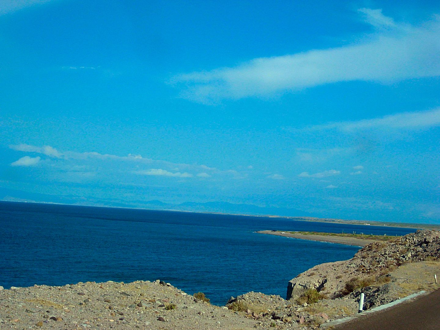
Nearing La Paz, this is the view looking east, across the bay to La Paz. which is a 'west coast' city, on the east side of the Baja peninsula!
I get to Harald's home very shortly, Karl ('Fernweh') is there as well. Harald ('4x4abc') has been living in the La Paz area for many years and Karl
is a more recent arrival. Both are from Germany but have lived many years in the United States before moving to Mexico. Harald is an author of books
on using and driving 4x4s. He maintains many great information pages at www.4x4abc.com.
I am offered his guest room and it was great, AC, WiFi, and a swimming pool! As many on Baja Nomad know, Harald had a terrible accident and broke his
right leg, below the knee, about 6 weeks ago. It was so bad, the local doctors said it would need amputating! With help from friends and Nomad
donations, a specialist was brought in from Mexico City, and hopefully, the leg will be fully functional. When I was there, he was very mobile but
wheelchair bound only. Not much more I could do but help with the pool and other small things. Harald had everything well under control.
That evening, Karl took us to dinner in La Paz and a very nice fresh seafood place. The name is a secret, I am told, so you will need to force it from
him! LOL This time of year, restaurants are not busy!
Great sleep, had Wifi so I could talk with my wife and post onto Nomad or Tacoma World and Facebook, a little.
Tomorrow, the tire will get fixed. It got a sharp puncture before dropping off the mountain above San Evaristo. It was a slow leak, so I waited to La
Paz, just in case what I did makes it worse. I simply added air every 20 miles or so.
Coming up next, Sunday Day 6... LA PAZ and a needed rest!
Total Miles for DAY 5: 181... almost 11 hours since leaving camp.
[Edited on 8-20-2017 by David K]
|
|
|
Beagle
Nomad
Posts: 258
Registered: 10-25-2014
Location: Outer Rim
Member Is Offline
|
|
Great report! Great info! Great Pics!!! Thanks for the education, David.
|
|
|
Jack Swords
Super Nomad
Posts: 1094
Registered: 8-30-2002
Location: Nipomo, CA/La Paz, BCS
Member Is Offline
|
|
You just illustrated my favorite part of Baja! Very nice photos making me miss that area even more. Still lots of adventure left in Baja.
|
|
|
David K
Honored Nomad
Posts: 64476
Registered: 8-30-2002
Location: San Diego County
Member Is Offline
Mood: Have Baja Fever
|
|
I am rewarded by reading replies like yours, thank you! 9 more days to go, not all are as intense, but a couple may be!
|
|
|
David K
Honored Nomad
Posts: 64476
Registered: 8-30-2002
Location: San Diego County
Member Is Offline
Mood: Have Baja Fever
|
|
| Quote: Originally posted by Jack Swords | | You just illustrated my favorite part of Baja! Very nice photos making me miss that area even more. Still lots of adventure left in Baja.
|
There is a sense of purpose when I go to historic sites. It is almost instinctive for me to return to these places as if I had been there before. In
some cases I have, however San Luis Gonzaga, La Pasión, Los Dolores, and Guadalupe de Huasinapí wee four mission locations I have not personally
seen. It was through your eyes and camera, as well other Nomad's, and authors such as Ed Vernon, Howard Gulick's, Marquis McDonald's, and Arthur
North's I could have a look at these centers of activity in a land that continues to be harsh and rugged.
DAY 5 MILES: 181, left camp at 8:38 am. I think I got to Harald's about 7:00 ?
|
|
|
Jack Swords
Super Nomad
Posts: 1094
Registered: 8-30-2002
Location: Nipomo, CA/La Paz, BCS
Member Is Offline
|
|
Are you visiting Real de Santa Ana? See U2U.
|
|
|
David K
Honored Nomad
Posts: 64476
Registered: 8-30-2002
Location: San Diego County
Member Is Offline
Mood: Have Baja Fever
|
|
No, I was there in 2001 (with Jimmy Smith and jeans) and 2012 (with BajaTripper, Zuly, and Baja Angel).
I posted photos of both visits then and are on my website.
However, this trip was research for the Baja Bound Road Guide and there is already plenty of sights included. Jimmy didn't want the location
published... and it was behind a locked gate in 2012 (the rancher gave us the key).
|
|
|
David K
Honored Nomad
Posts: 64476
Registered: 8-30-2002
Location: San Diego County
Member Is Offline
Mood: Have Baja Fever
|
|
DAY 6 (SUN. Aug 6, 2017) Near La Paz to La Paz.
Harald's home has the outdoors in focus as living outside is where life should be lived.
His kitchen and living room are outside, the guest room is next door, and his mission chapel meditation room is attached. All his building ideas were
gleaned from a Spanish/ Moorish villa photographs he saw in a magazine.
The project is new, but fortunately, plants grow quickly in the tropics. Plants chosen were gathered out on Harald's 4X4 trips and he has a lot of
room for expansion.
Monday's only project was plugging my tire's newly acquired needle-hole. Harald could get out to examine it and make sure the plug went in at the
correct angle. It worked and held air for the next 10 days, and 2,000 miles!
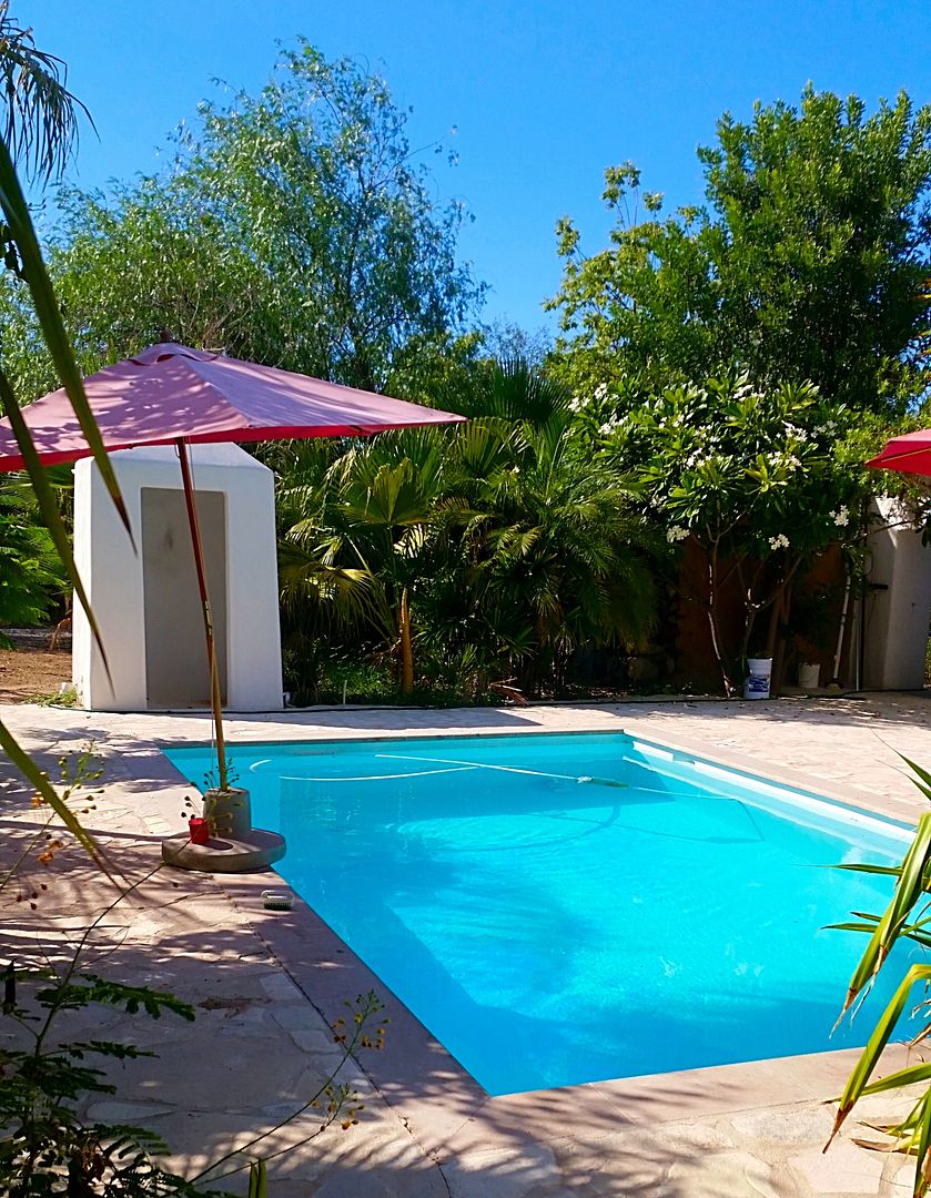
Now, I could visit with Harald and do any assistance while he is wheelchair bound. The only request was for me to use the swimming pool and clean the
steps, not reachable by the auto pool sweeper. Easy for me, and until the wind blows more, that pool was clean!
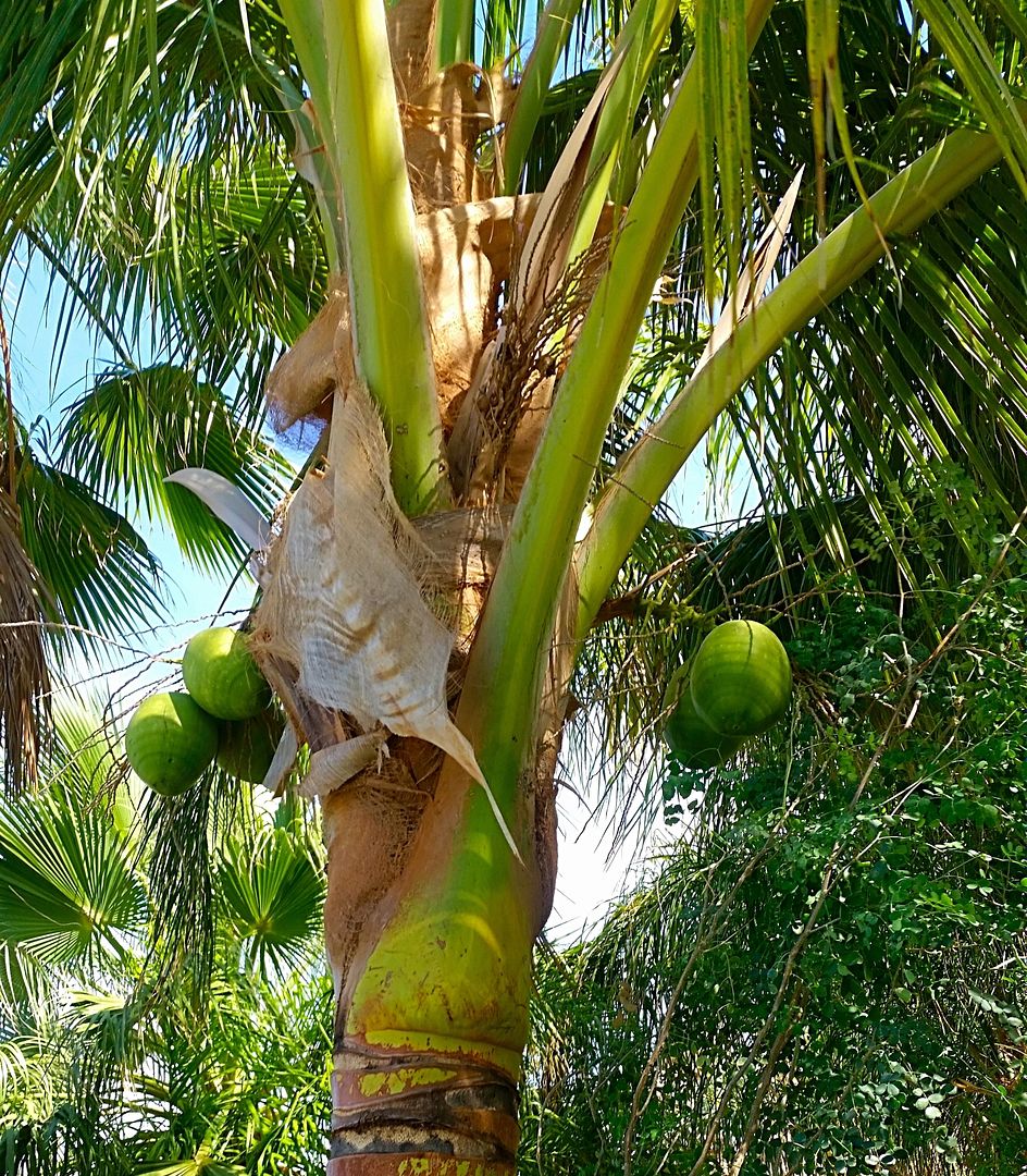
You know you are in the tropics when coconuts grow on trees... by the pool at Harald's:
Here was the very enjoyable pool, solar heated in the winter, but ideal when it was 102° in August, with humidity!
As the sun dropped, I took Harald to the Malecon and we found a cool outdoor burger joint (that also doubled as a surfboard rental shop... Harker's:
https://www.tripadvisor.com/Restaurant_Review-g150771-d77790...
I had the bacon cheese burger with fries and Harald had the sliders... and cold Pacificos. We watched the people walking, cruising, and the sun
setting. The La Paz Malecon is a great experience for casual dining outdoors.
Day 6 was a success... the work was done, and I was relaxed!
Day 7 would be a BUSY day collection data, photos, and meeting an old friend, for the first time, Osprey ('Jorge') on Baja Nomad and other writing
projects.
Stay tuned!
|
|
|
Barry A.
Select Nomad
Posts: 10007
Registered: 11-30-2003
Location: Redding, Northern CA
Member Is Offline
Mood: optimistic
|
|
Wonderful reports, David. Many thanks for all you do.
Barry
|
|
|
BajaOkie
Junior Nomad
Posts: 68
Registered: 3-4-2010
Member Is Offline
|
|
Excellent Report David, One of my favorite parts of Baja also. Great pictures and great descriptions.
|
|
|
| Pages:
1
2
3
4
5 |
|


