| Pages:
1
2
3
4
5 |
David K
Honored Nomad

Posts: 64478
Registered: 8-30-2002
Location: San Diego County
Member Is Offline
Mood: Have Baja Fever
|
|
Wait to you see when I get to Guadalupe de Huasinapí! That required a bit of crawling and hiking around!
|
|
|
David K
Honored Nomad
Posts: 64478
Registered: 8-30-2002
Location: San Diego County
Member Is Offline
Mood: Have Baja Fever
|
|
Enjoy the eclipse Barry, it starts soon and the clouds just burned away here. Not so big a deal where I am, but it should be a lot darker where you
are!
|
|
|
Barry A.
Select Nomad
Posts: 10007
Registered: 11-30-2003
Location: Redding, Northern CA
Member Is Offline
Mood: optimistic
|
|
Quote: Originally posted by David K  |
Enjoy the eclipse Barry, it starts soon and the clouds just burned away here. Not so big a deal where I am, but it should be a lot darker where you
are! |
Yep, the eclipse went off well, thank you. We had about 90% coverage of the sun here in N. CA and I had a welding-helmet to see it. Really cool!!!
The most amazing thing was the temp dropped significantly during and after the black-out, and in Redding that is a HUGE deal. LOL
|
|
|
David K
Honored Nomad
Posts: 64478
Registered: 8-30-2002
Location: San Diego County
Member Is Offline
Mood: Have Baja Fever
|
|
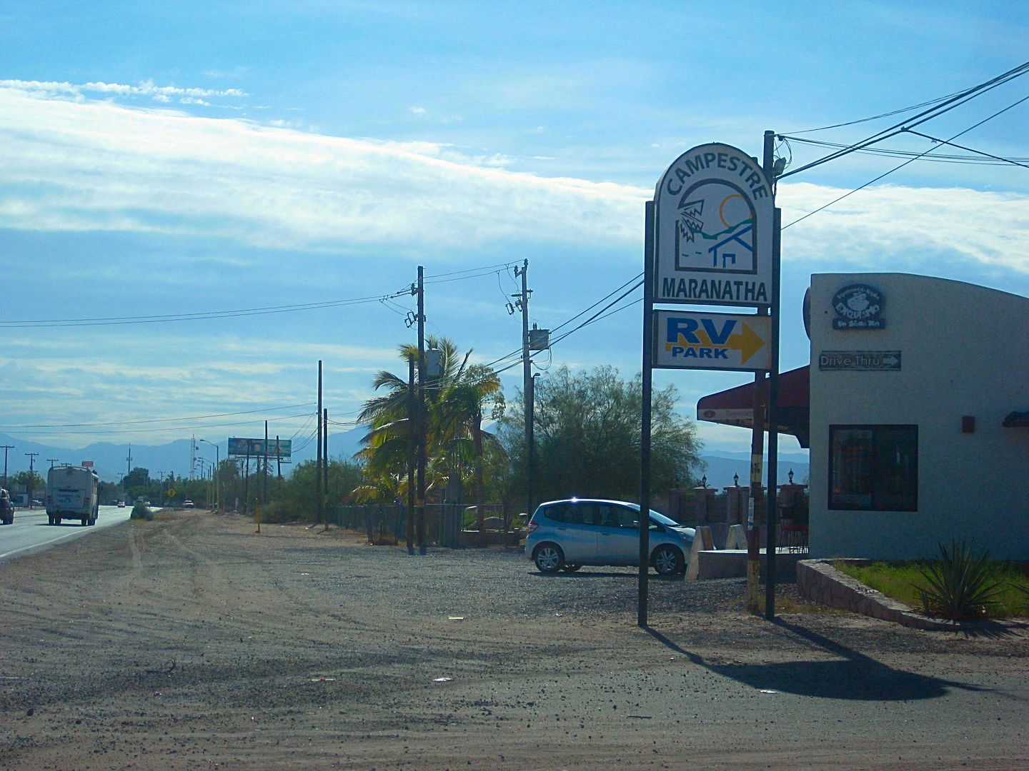
DAY 7 (MON Aug. 7, 2017): South to Todos Santos and Los Cabos
I was up and on the road at 8:08 and stopped at the Oxxo (they are everywhere) for a bag of ice, 21 pesos.
Made notes of Hwy. 1, La Paz entrance kilometer markers:
Km. 11 Campestre Maranatha Campground/ Café Exquisito, on right
Km. 10 Breakfast place on left 'Jalisco'
Km. 9 Airport Road
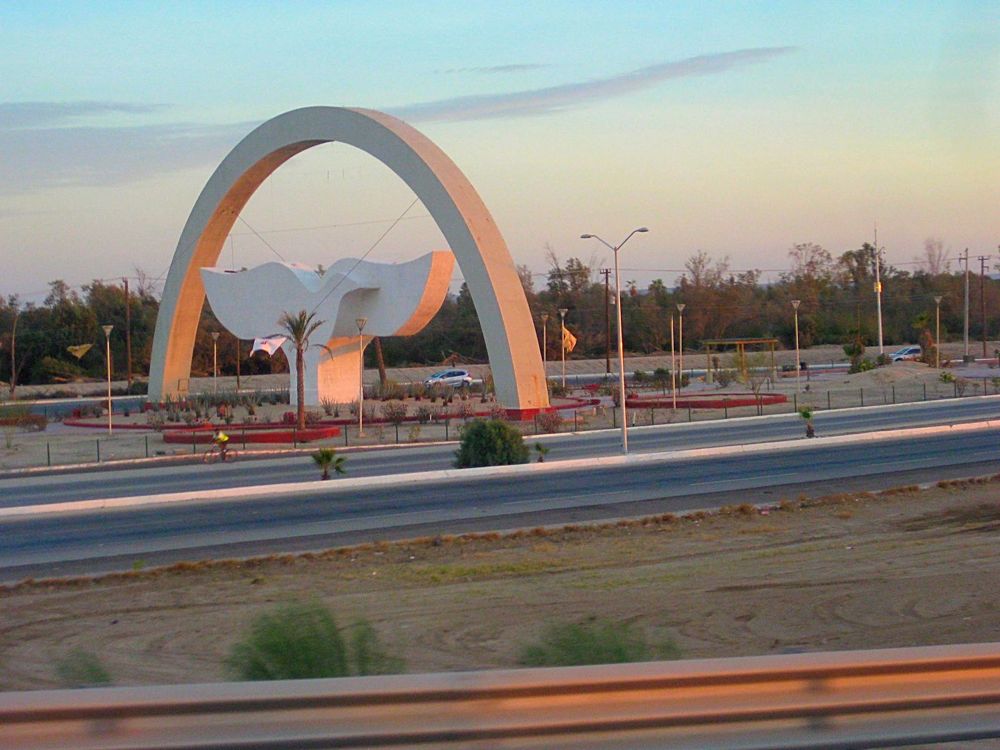
Km. 8 Dove or Whale Tale Monument (Malecon left, Cabo right)
You fork right at the Dove/Whale Tale and right again by the WalMart onto a levee road to cross over to the Todos Santos/Cabo San Lucas highway.
There does not seem to be any kilometer markers for almost 7 miles southbound on Hwy. 1, and then there it is Km. 200 (from Cabo via Los Barriles).
Pass through the farm center of San Pedro around Km. 189
Km. 185: Fork, Left to Los Barriles and Los Cabos vis Hwy. 1 or right to Todos Santos and Cabo San Lucas (Mex. #19). Unlike the other kilometer
markers, Hwy. 19's numbers get bigger going south.
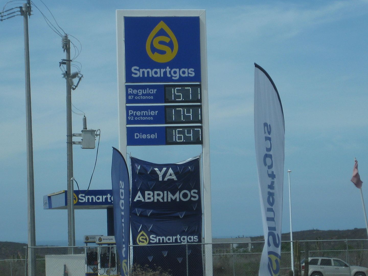
Km. 46 New non-Pemex gasoline dealer, SmartGas
The bypass around Todos Santos is at Km. 47+. It is 4.6 miles long and totally stays out-of-sight of Todos Santos. I drove around twice to go through
town on the first paved road then on the bypass to map and record it.
On the first paved road...
Km. 49 Pemex
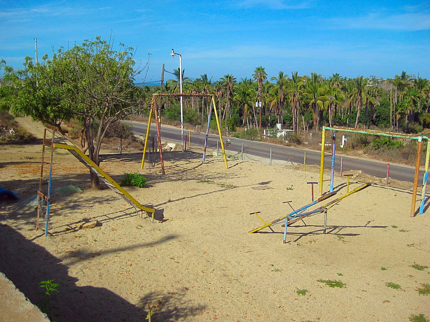
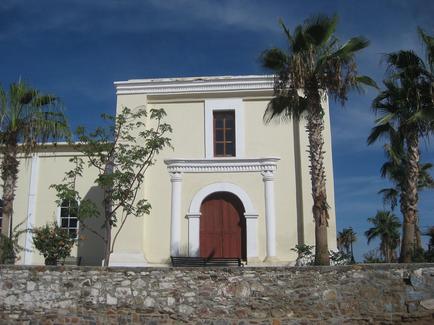
Km. 49.5 Playground and church on the left (east) side.
The playground was the location of the first Todos Santos Mission, founded in 1733 with the name Santa Rosa de las Palmas, it was California's 13th
mission. Bad luck followed when the Pericú Revolution began the following year. Padre Taraval was saved, but his Jesuit brothers at Santiago and San
José del Cabo were murdered and their mission burned. La Paz mission was also attacked. The Jesuits and Spanish soldiers took over two years to
regain control of the southern four missions.
In 1748, the mission on La Paz Bay was moved to Todos Santos and replaced Mission Santa Rosa there. 13 was an unlucky mission number!
Also, the mission at San José del Cabo was reduced to being a visita of Santiago (for the next 20 years). Four mission became two. It was a dramatic
period that ended with the Jesuit expulsion in 1768.
See, when I drive in Baja, I think of all the years people struggled there, it meant that much to all of them! The mission here in Todos Santos was
officially known as Nuestra Señora del Pilar de la Paz, but most documents written in the years that followed called the mission Todos Santos (the
original visita name before a mission was here). No Native name was recorded for the location.
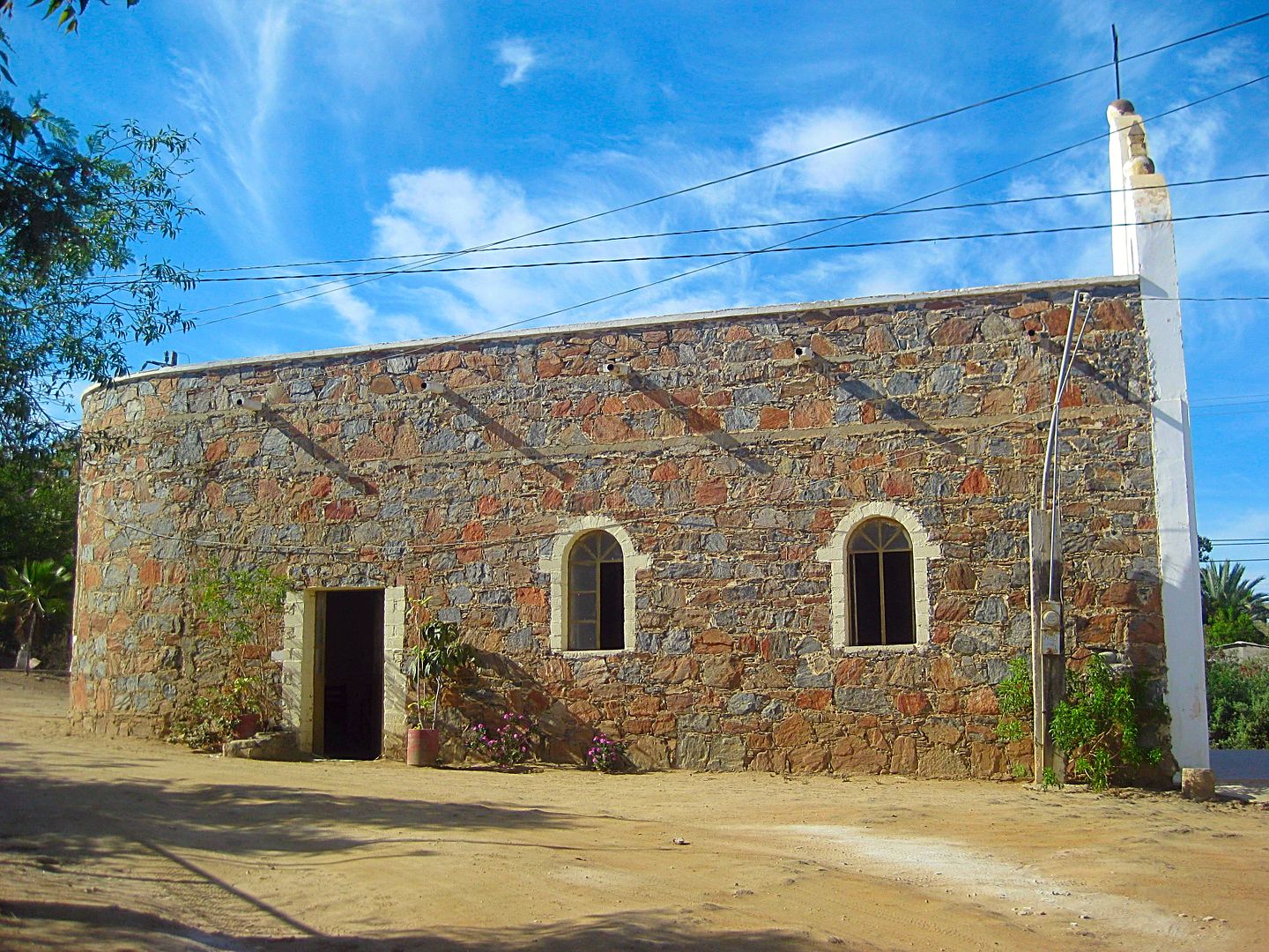
After I look through the 1970 church behind the playground, I try and find any signs of the 1733-1825 mission ruins (the mission moved again in 1825
to the church site in the town plaza, less than a mile south).
I do see some bricks and a survey pin of sorts, but no guarantees. 9:37 am.
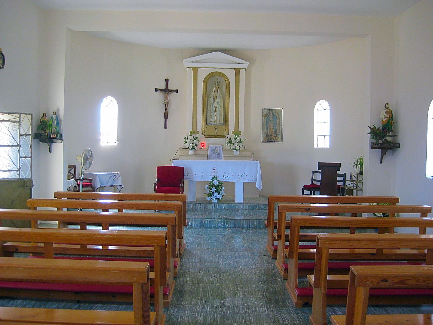
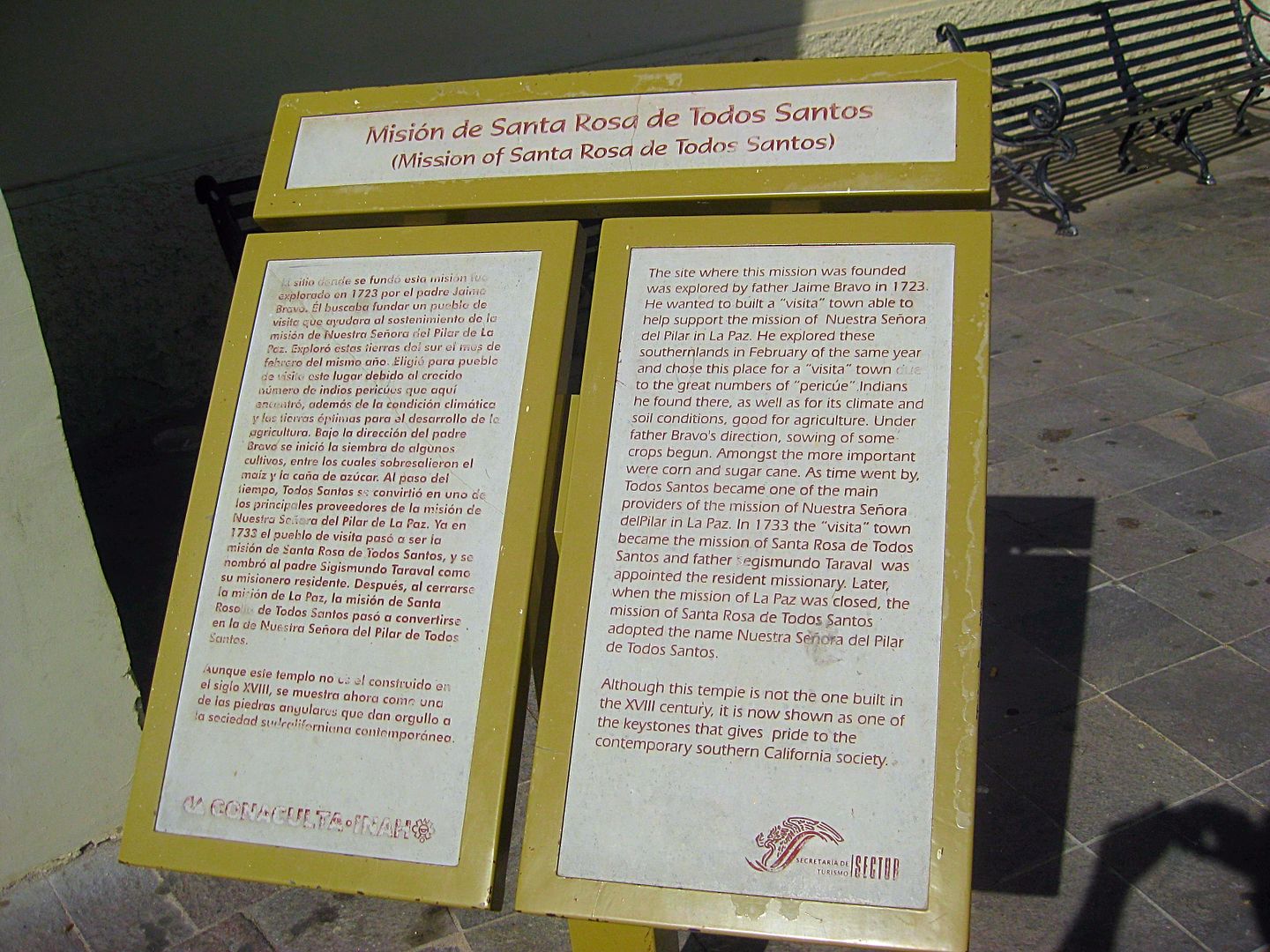
I arrive at the plaza and walk into the large church, modified since mission times with a new entry. Signs here do tell the mission story to enquiring
minds.
As I head out of town I spot a car wash operation (man with a hose and bucket) next door to a breakfast café. Success, I am hungry and my truck is
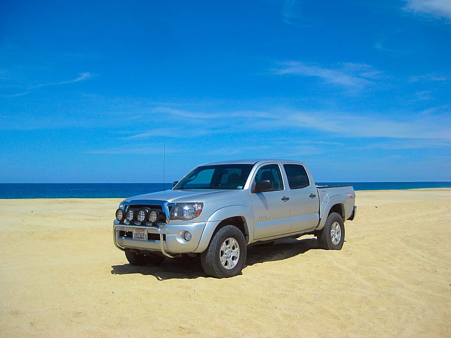
dirty (from El Datil salt flat oops). The restaurant is called La Valentina (110 pesos) and the car wash is El Cayito (90 pesos).
Todos Santos was very good to me this morning!
On south...
TO BE CONTINUED...
PHOTOS:
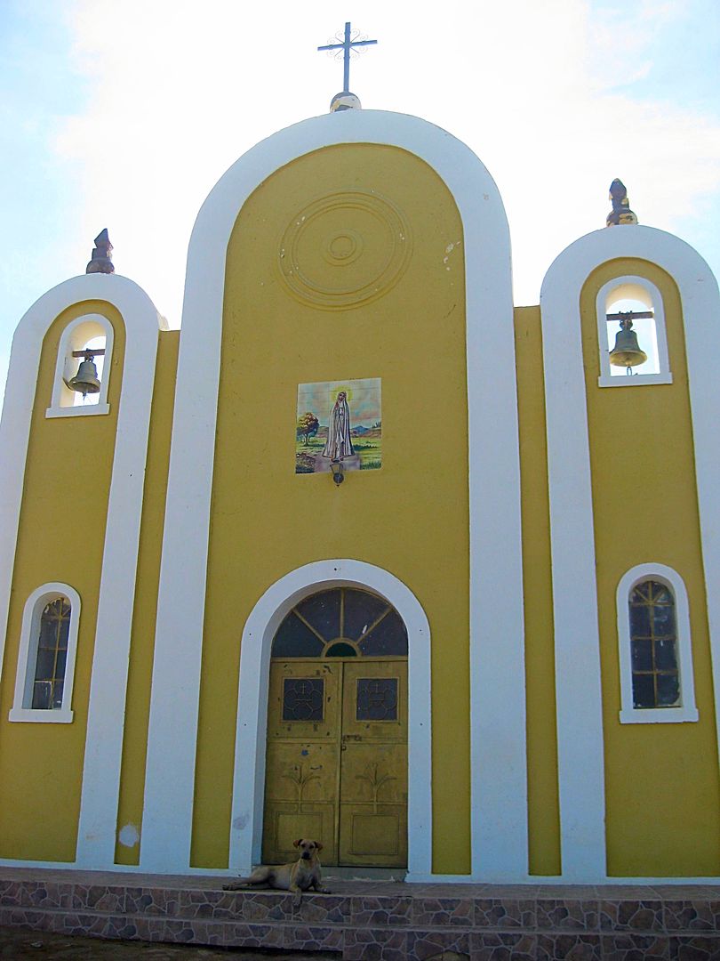
1970 church built next to 1733-1825 mission site (now playground).
Just above the east side of Hwy. 19, north entrance to Todos Santos... Visita Todos Santos in 1725, Mission #13 (Santa Rosa) in 1733, then Mission #7
(Pilar del la Paz) in 1748.
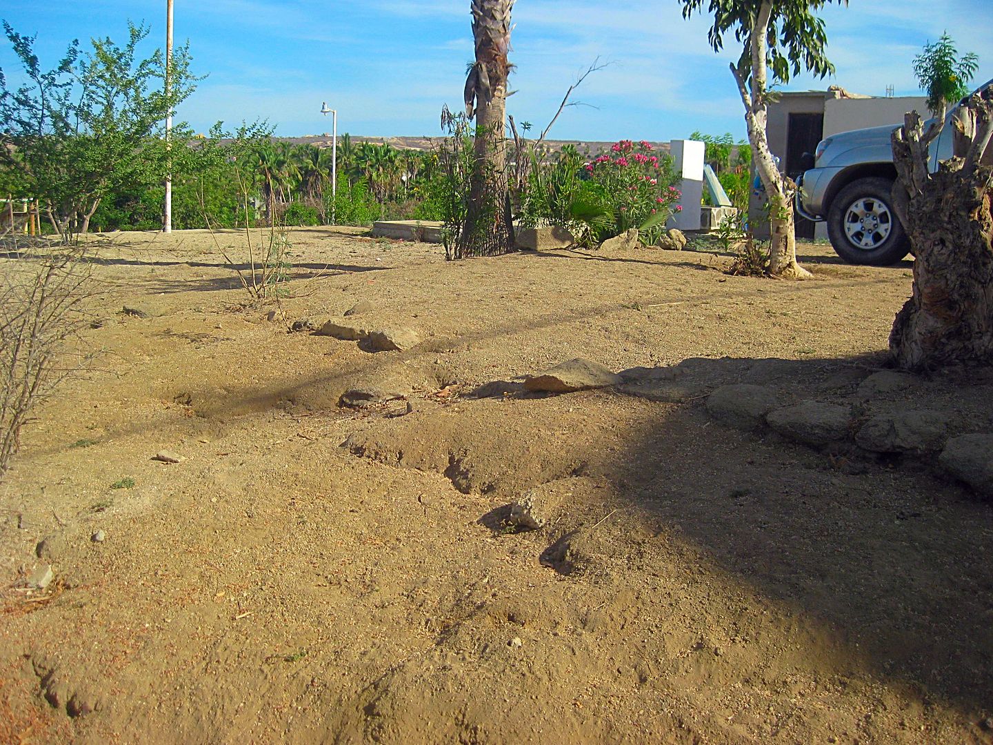
Mission floor or wall foundation?
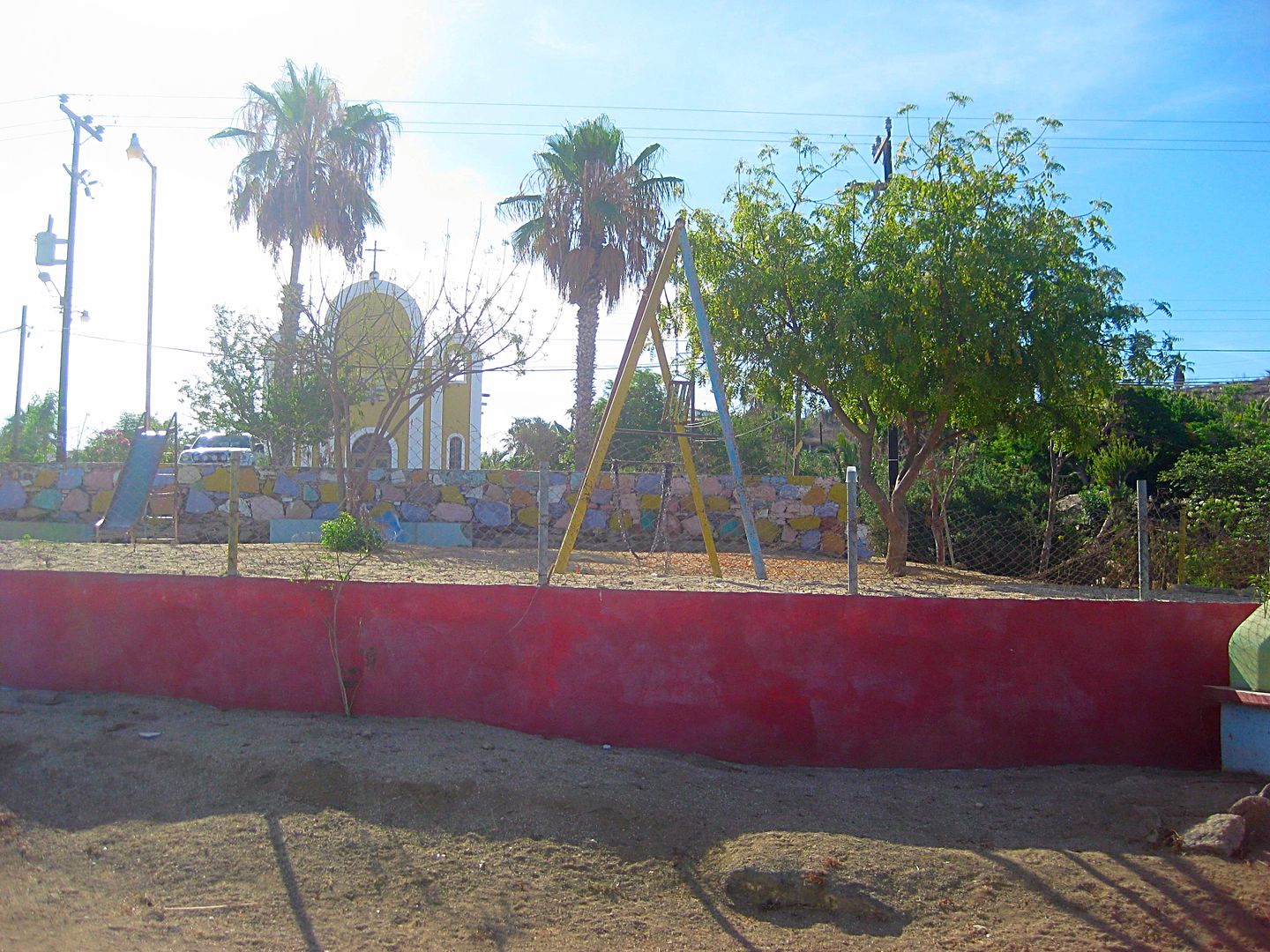
View from the highway, looking east. Playground and church.
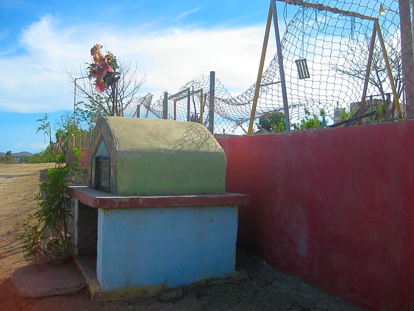
Prayer shrine in front of the playground. Pray for a mission museum here?
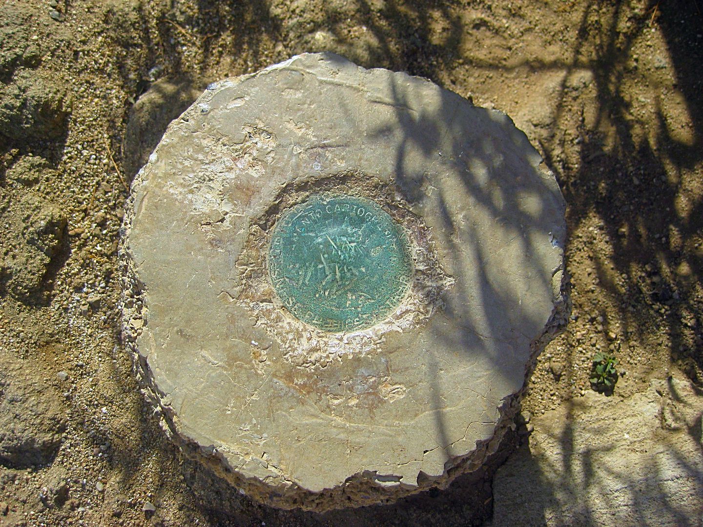
Some sort of survey pin near the corner of the 1970 church.
The 1825 Mission new location, original front entrance.
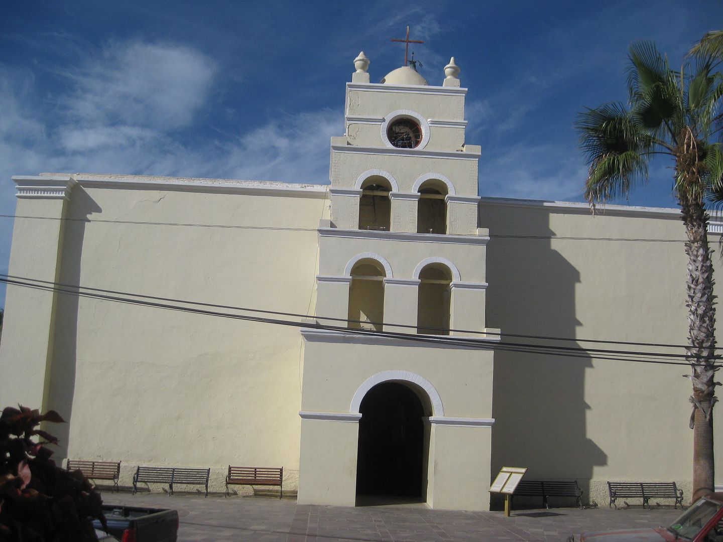
Addition cross entrance added early 1900s?
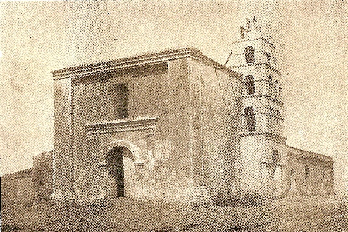
Photos by Joseph R. Slevin in 1919.
At least they are trying!
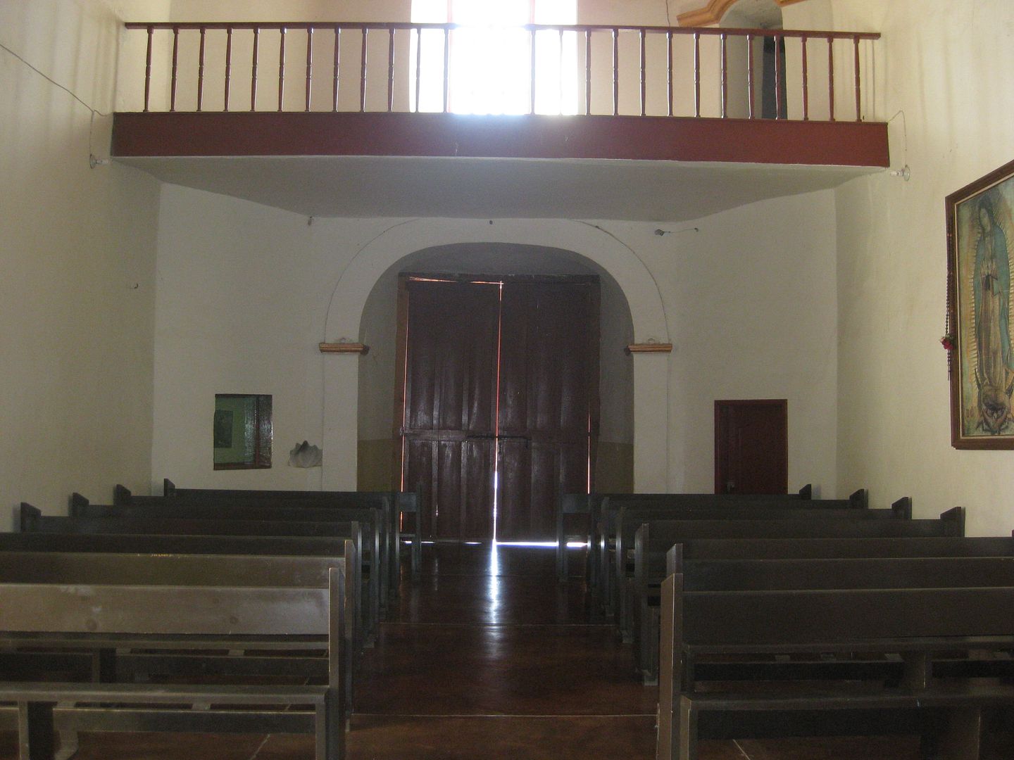
Original entrance.
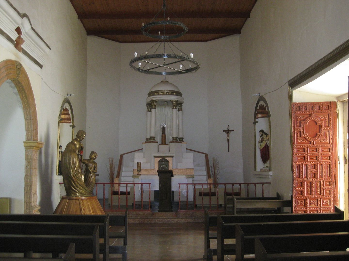
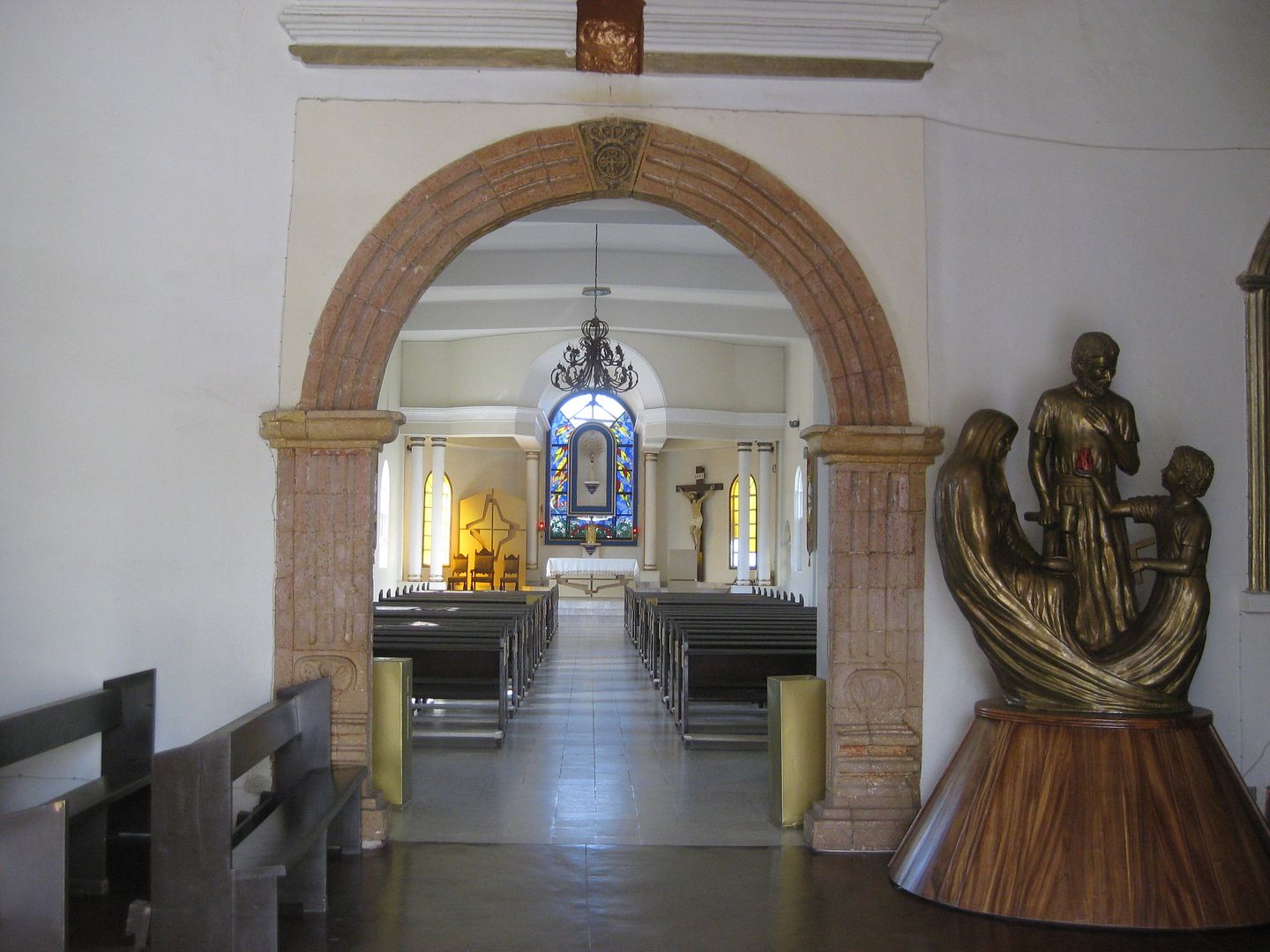
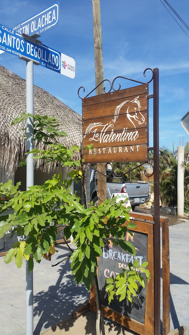
Breakfast here, car wash, next door.
Now, let's go see some beaches!
Stay tuned!
|
|
|
Alan
Super Nomad
Posts: 1617
Registered: 4-6-2005
Location: Yucaipa, CA/La Paz
Member Is Offline
|
|
Great travelog David, thanks! Years ago I took the San Juan de la Costa road up from La Paz to San Evaristo armed with only the AAA map. I searched
for nearly an hour for the road to La Soledad so I could make my trip a loop but never did find the turn!!! Had to just go back the way I came.
In Memory of E-57
|
|
|
David K
Honored Nomad
Posts: 64478
Registered: 8-30-2002
Location: San Diego County
Member Is Offline
Mood: Have Baja Fever
|
|
There was no sign at the junction but it was a major fork. Located inland, out of sight, from the coast, and just 1.6 miles south of the beach fishing
village.
|
|
|
Alan
Super Nomad
Posts: 1617
Registered: 4-6-2005
Location: Yucaipa, CA/La Paz
Member Is Offline
|
|
| Quote: Originally posted by David K | | There was no sign at the junction but it was a major fork. Located inland, out of sight, from the coast, and just 1.6 miles south of the beach fishing
village. |
Well I'm headed back down in a week. If the fishing and the weather cools I'll give it another
shot.
In Memory of E-57
|
|
|
AKgringo
Elite Nomad
Posts: 5805
Registered: 9-20-2014
Location: Anchorage, AK (no mas!)
Member Is Offline
Mood: Retireded
|
|
| Quote: Originally posted by Alan | | Quote: Originally posted by David K | | There was no sign at the junction but it was a major fork. Located inland, out of sight, from the coast, and just 1.6 miles south of the beach fishing
village. |
Well I'm headed back down in a week. If the fishing and the weather cools I'll give it another
shot. |
That arroyo track changes with every storm, or recent traffic not headed toward the mountain pass.
The best way to find the road, is to drive part of the way up the road to San Evaristo, then look back at the other side of the arroyo. You will be
able to see the road cut headed eastward up the ridge. I suspect you were looking too far up the arroyo for the junction.
If you are not living on the edge, you are taking up too much space!
"Could do better if he tried!" Report card comments from most of my grade school teachers. Sadly, still true!
|
|
|
David K
Honored Nomad
Posts: 64478
Registered: 8-30-2002
Location: San Diego County
Member Is Offline
Mood: Have Baja Fever
|
|
| Quote: Originally posted by Alan | | Quote: Originally posted by David K | | There was no sign at the junction but it was a major fork. Located inland, out of sight, from the coast, and just 1.6 miles south of the beach fishing
village. |
Well I'm headed back down in a week. If the fishing and the weather cools I'll give it another
shot. |
It is a very rough drive and while attractive views and oasis canyon palms are beautiful... it still is a slow drive. That you are in intense mission
country may be of interest.. the 1720s -1768.
Use Google Earth to see the roads and that junction before you drive, maybe?
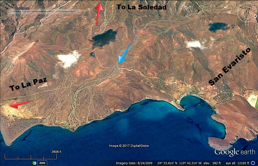
View looking west, the road up the mountain is 1.6 miles from the fishing village and junctions on a curve, where the blue arrow is pointing.
|
|
|
David K
Honored Nomad
Posts: 64478
Registered: 8-30-2002
Location: San Diego County
Member Is Offline
Mood: Have Baja Fever
|
|
DAY 7b South from Todos Santos
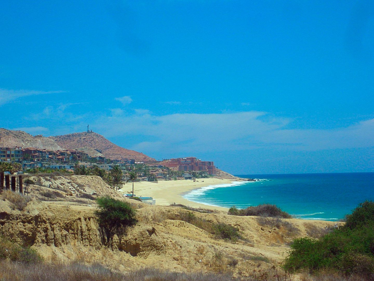
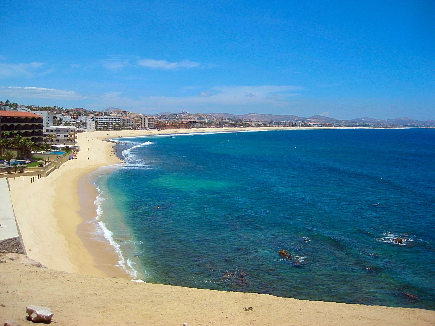
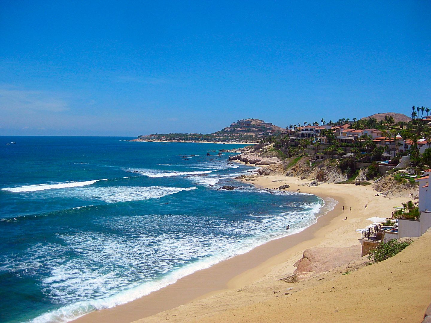
After my breakfast and car wash, I continued south of the original highway to Cabo San Lucas.
Km. 56: South junction of bypass highway. I drive back north on it to measure and GPS track it, since it is too new to appear on our favorite maps
(2010 AAA or 2009 Baja Almanac). I measure it at 4.6 miles long back to Km. 47+ on the original road. It is just 2 lanes and has separate kilometer
markers. There was nothing I noted along the 7-kilometer bypass that simply avoids going through Todos Santos for those who are bound for places on
south. The highway returns to 4-lanes-wide.
Km. 57+ Is an unmarked road off to the right (southwest) that goes to San Pedrito. See my Baja Bound article for more on this place (visited in 2012):
https://www.bajabound.com/bajaadventures/bajatravel/the_trop...
Km. 62 Pemex station El Pescadero
Km. 62.5+ Baja Beans R.V. Park
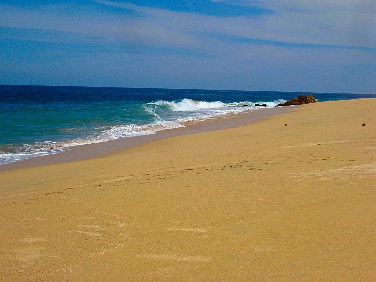
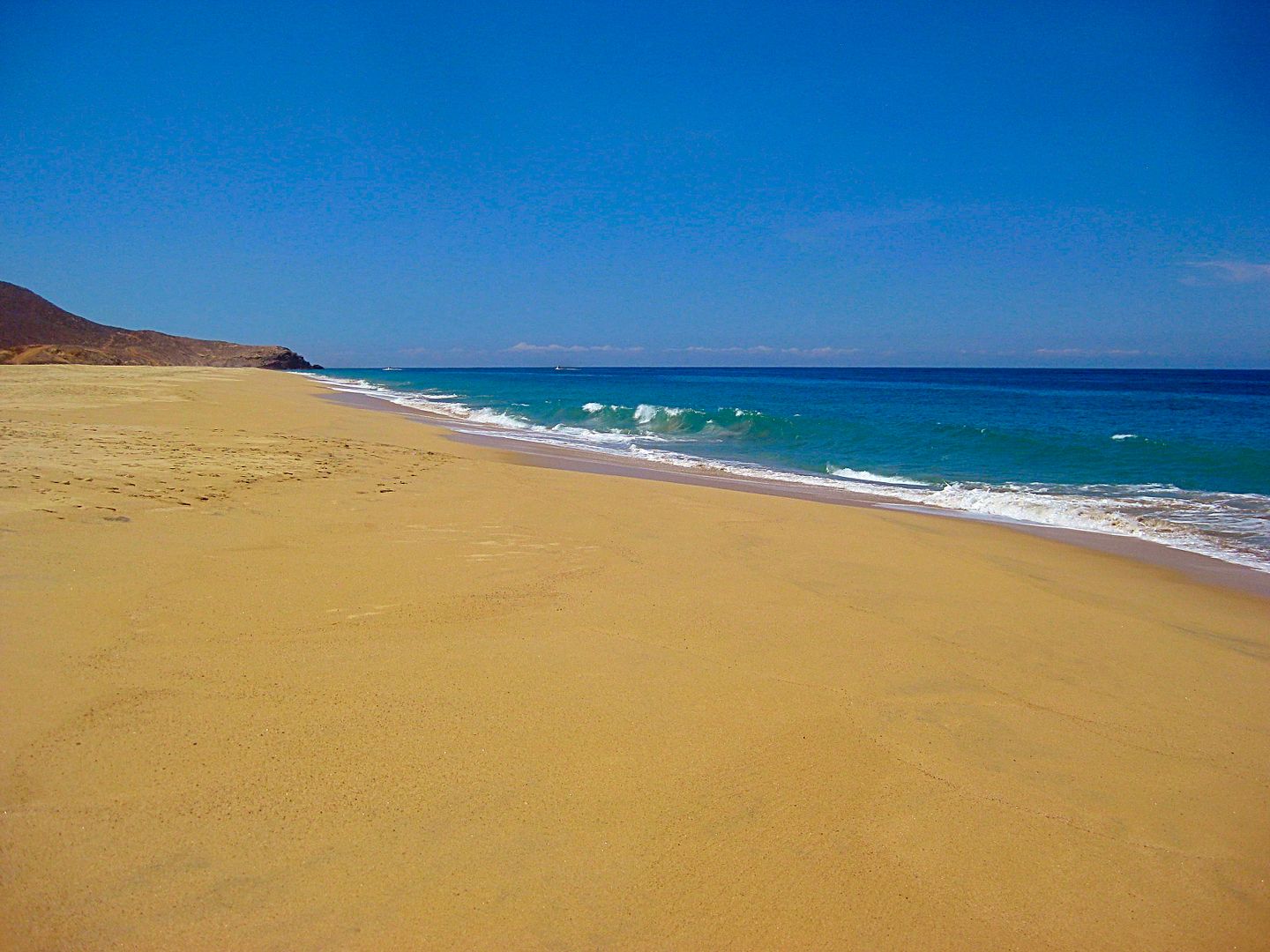
Km. 79 BajaBeachOasis.com on the sign. 0.3 mi to a big sand beach.
Km. 100 Puente El Migriño (bridge over big arroyo) and lots of off roader tracks in the dry river bed, below.
Km. 100.5 Road down to arroyo on south side of bridge, passes ATV rental business in 0.1 mi and arrives at the beach in 0.8 mi from the highway.
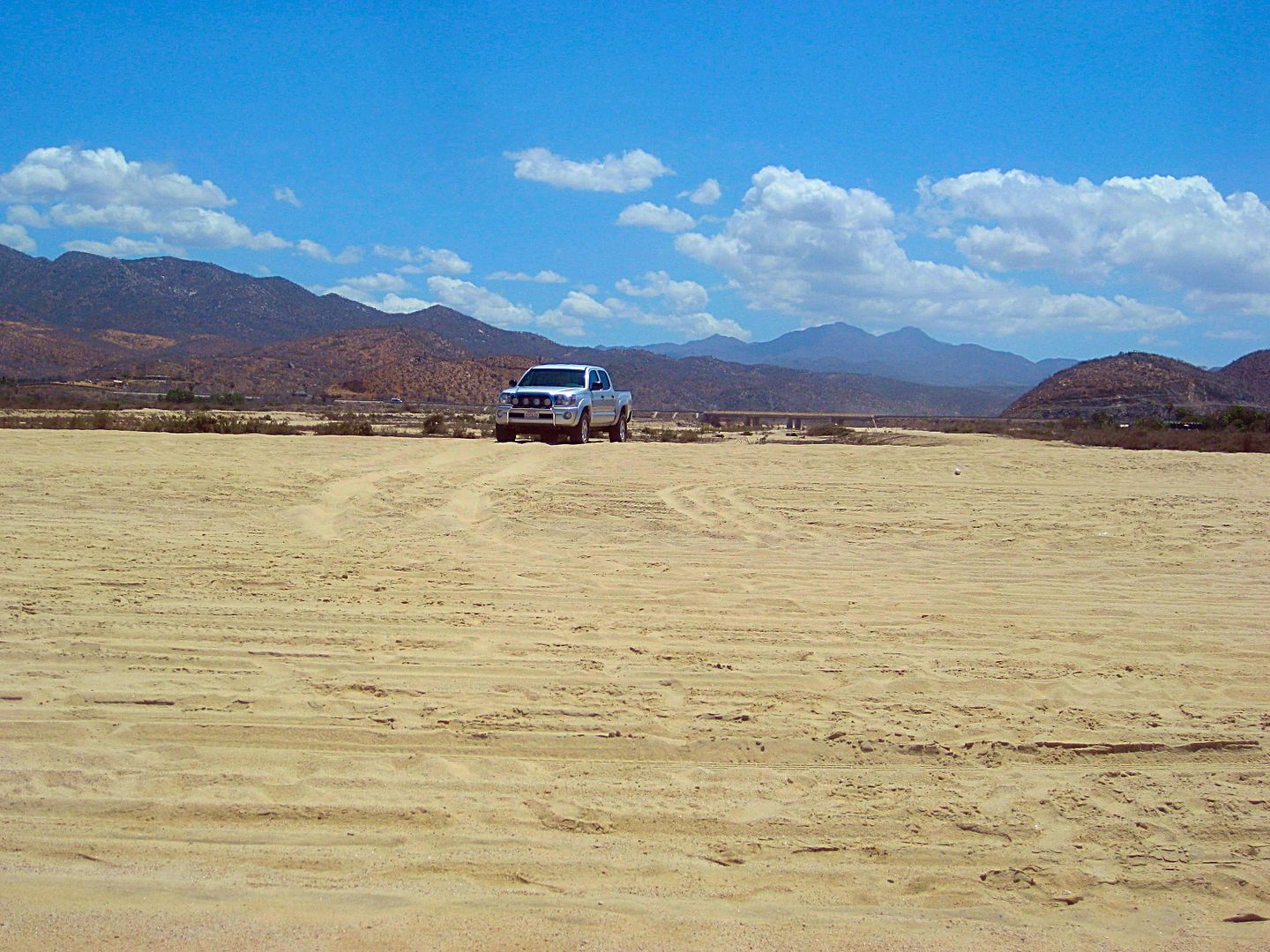
You can see the highway bridge, 3/4 mile to the east, El Migriño.
Km. 117 Los Cabos Bypass to go directly to San José del Cabo airport.
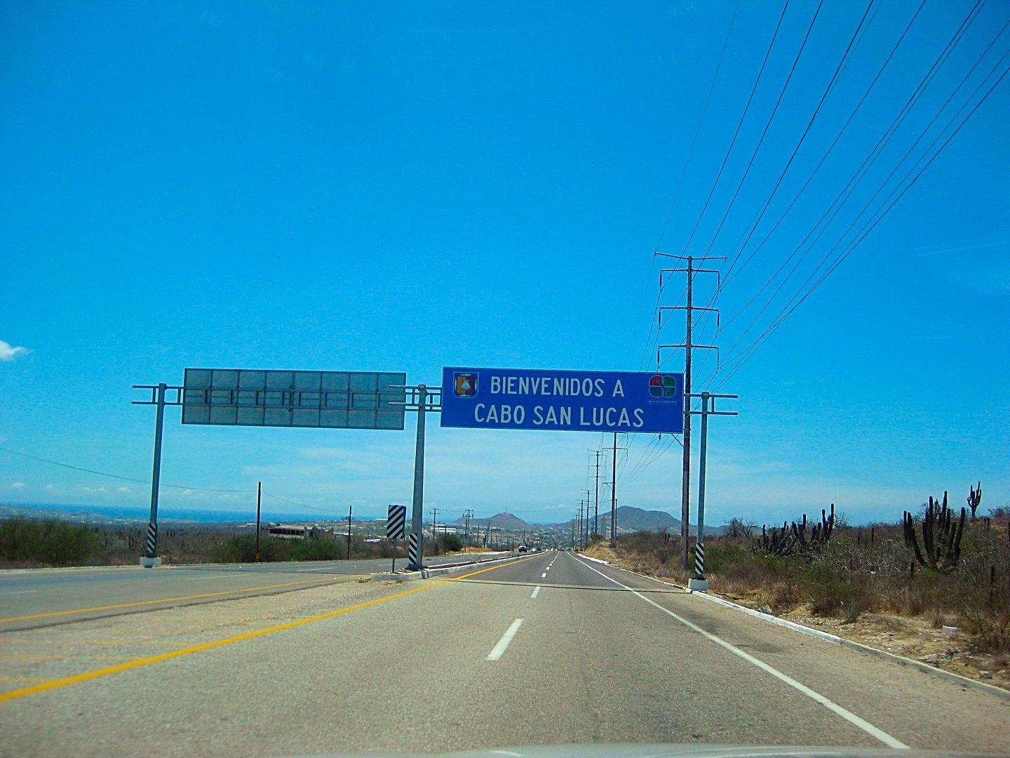
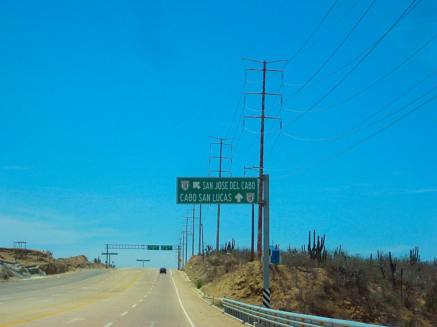
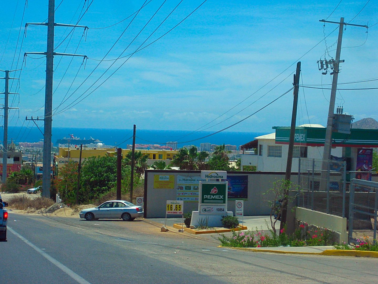
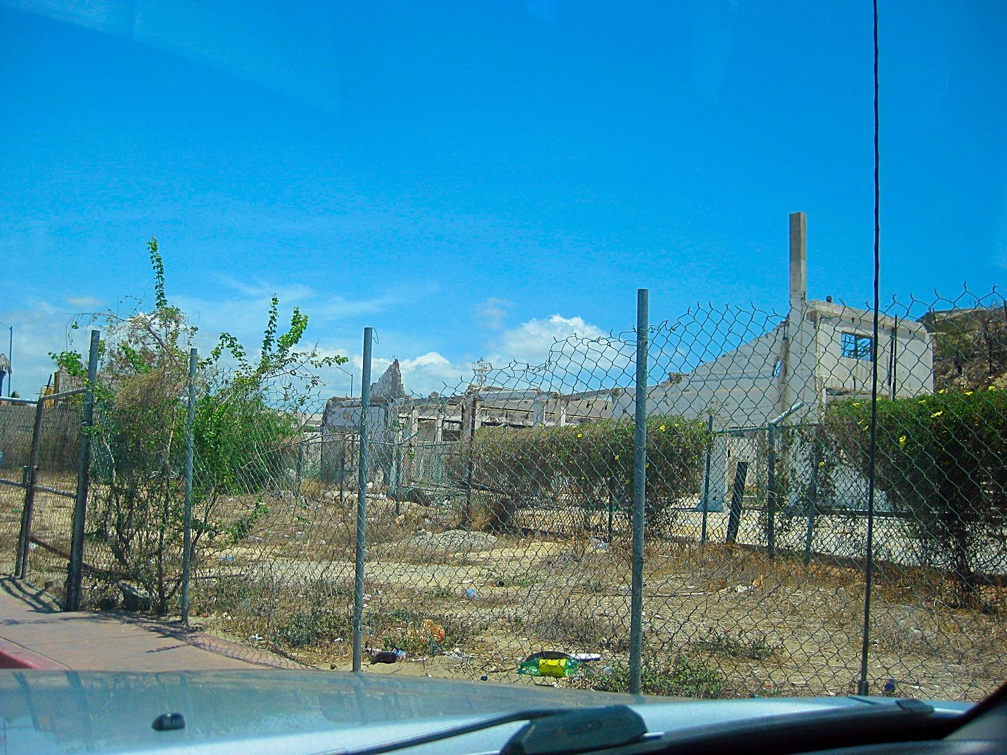
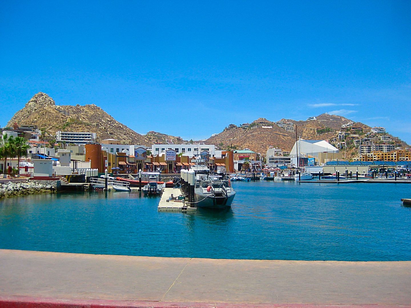
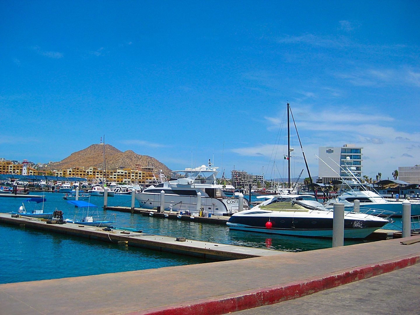
Km. 124 Enter Cabo San Lucas. It is a mess of traffic!
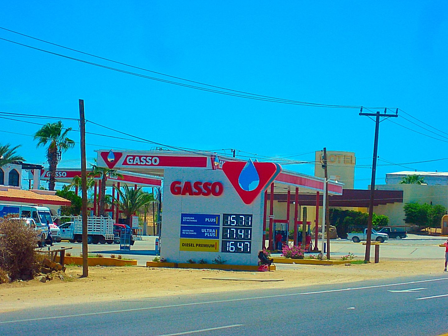
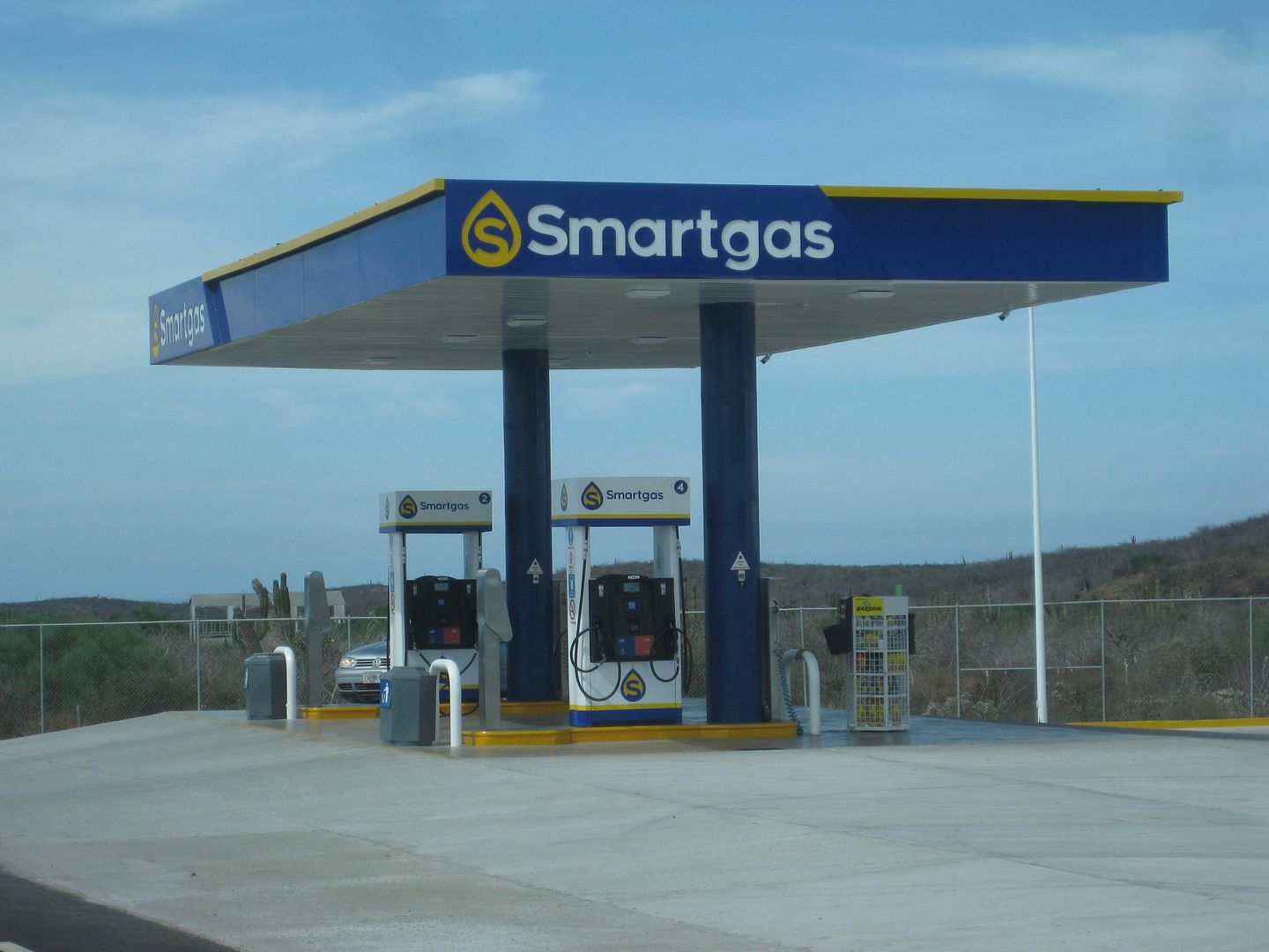
Here is the other new competition to Pemex for gasoline sales in Mexico, seen on this trip.
I drove to the abandoned fish cannery building where Km. 0 once was... the very south end of the Transpeninsular Highway. There was a ferry dock here
that went to Puerto Vallarta for a few years.
Have enough? Can I go now? Thanks!
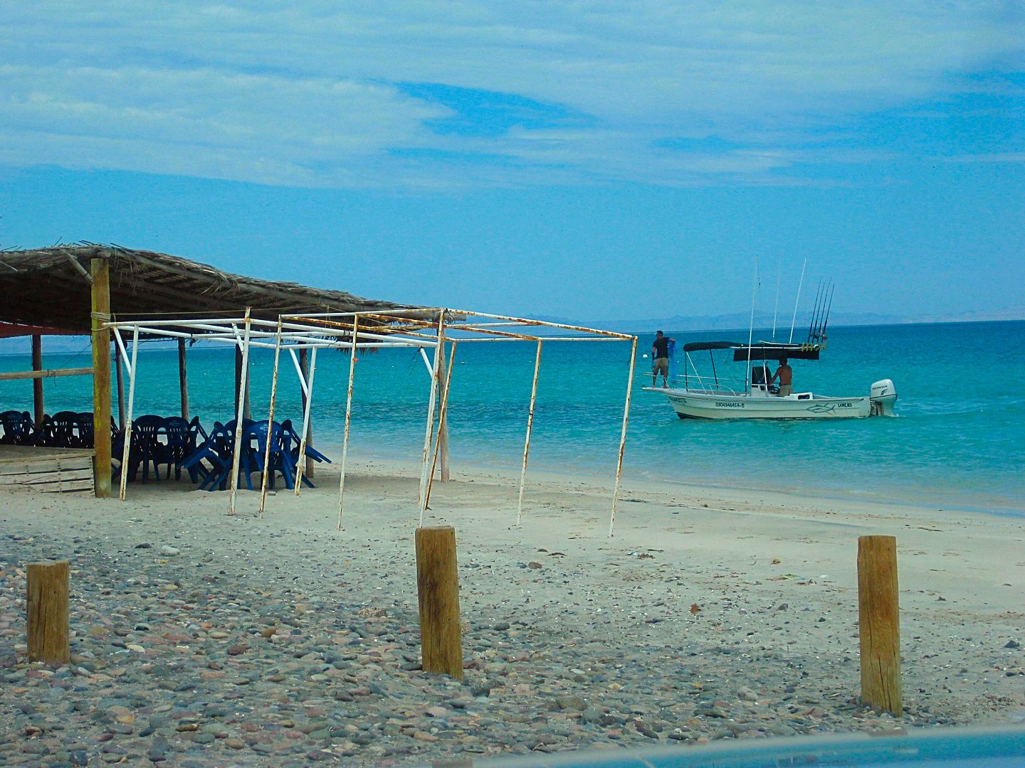
Km. 12.5 Playa Santa María
Km. 14.5 Chileno Bay Beach Parking
Km. 16 El Tule, open beach.
Km. 27.5+ View Parking...
Km. 28 beach access
It is such heavy traffic and no pull offs before I realize I miss the south entrance to San José del Cabo and go to the downtown entrance. I first
try to park near the mission site/ plaza... with only one narrow street going to it, and all other one-way streets going the wrong way, I abandon the
thought of circling the city again. I did get in front of it in 2012:
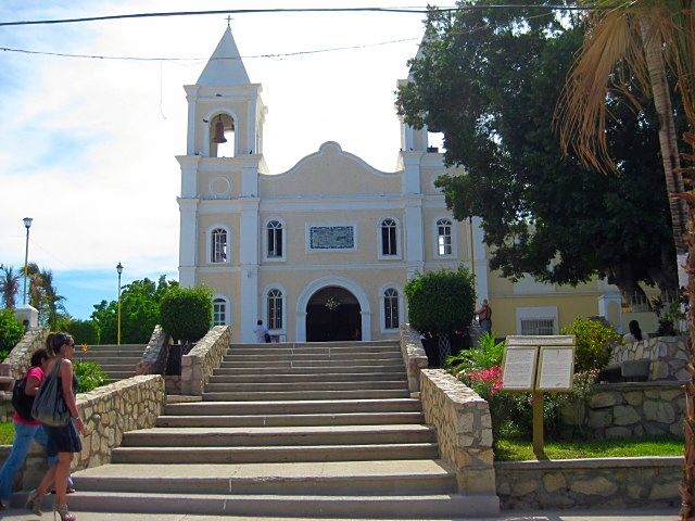
Church at final mission site for San José del Cabo, 2012 photo.
Baja Judy's business, found! All locked up. I had an email exchange with Jaime (Judy's husband) and he said they would not be there and with nobody in
Los Cabos in the summer, they aren't open. I just wondered who were the thousands of people on the highway, paying $3.43/ gallon if this was the 'dead
season'??
Km. 39 North edge of San José del Cabo
OK amigos... that's enough for now... When I return, I have photos of the drive north on Hwy. 1 back to La Paz. A nice visit with Jorge ('Osprey' on
Baja Nomad) and more to come!
|
|
|
Alan
Super Nomad
Posts: 1617
Registered: 4-6-2005
Location: Yucaipa, CA/La Paz
Member Is Offline
|
|
| Quote: Originally posted by David K | | Quote: Originally posted by Alan | | Quote: Originally posted by David K | | There was no sign at the junction but it was a major fork. Located inland, out of sight, from the coast, and just 1.6 miles south of the beach fishing
village. |
Well I'm headed back down in a week. If the fishing and the weather cools I'll give it another
shot. |
It is a very rough drive and while attractive views and oasis canyon palms are beautiful... it still is a slow drive. That you are in intense mission
country may be of interest.. the 1720s -1768.
Use Google Earth to see the roads and that junction before you drive, maybe?
View looking west, the road up the mountain is 1.6 miles from the fishing village and junctions on a curve, where the blue arrow is pointing.
|
AhHa! That's exactly where I was looking. Ran a ways up that wash before I figured I was being stupid since
I was solo. Never did see the road coming out of there but it was shortly after Odile so no telling what was there then.
In Memory of E-57
|
|
|
mtgoat666
Select Nomad
Posts: 17289
Registered: 9-16-2006
Location: San Diego
Member Is Offline
Mood: Hot n spicy
|
|
| Quote: Originally posted by David K | I just wondered who were the thousands of people on the highway, paying $3.43/ gallon if this was the 'dead season'??
|
The proletariat, lumpen proletariat and petite bourgeoisie.
The bourgeoisie typically go on holiday during the hot months.
|
|
|
David K
Honored Nomad
Posts: 64478
Registered: 8-30-2002
Location: San Diego County
Member Is Offline
Mood: Have Baja Fever
|
|
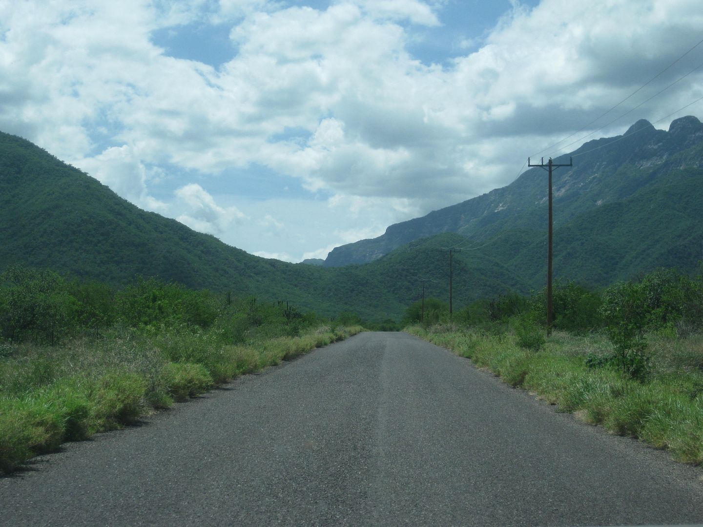
DAY 7c, North from Los Cabos
Km. 43 Airport Road, Pemex
Km. 46, Santa Anita
Km. 54.5 Narranjas Road
Km. 62.5 Paved road east to Las Casitas
Km. 65.5 Paved road west to Cadueño. Sideroad passes a water park (closed), goes through the little town, and pops back out to Highway 1 at Km. 66+.
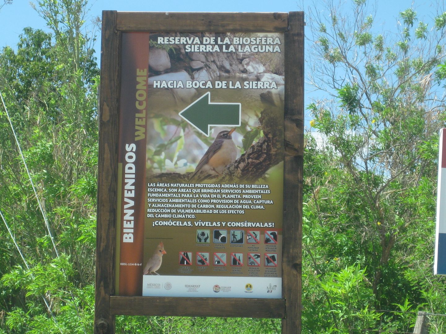
Km. 71 Paved road west to Miraflores, 1.5 miles. A paved road goes north from town to the foot of the mountain, Boca de la Sierra. There a hiking
trail and park is featured, 4.4 miles from Highway 1.
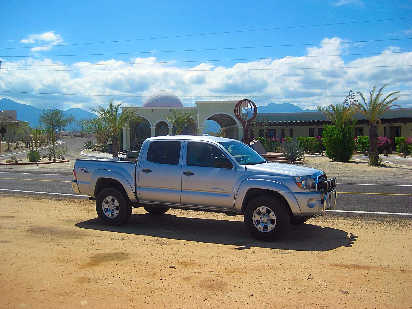
Km. 81.5 The Tropic of Cancer line. A museum/ rest area has been established here. On the first day of summer, the sun is directly overhead, at
noon.
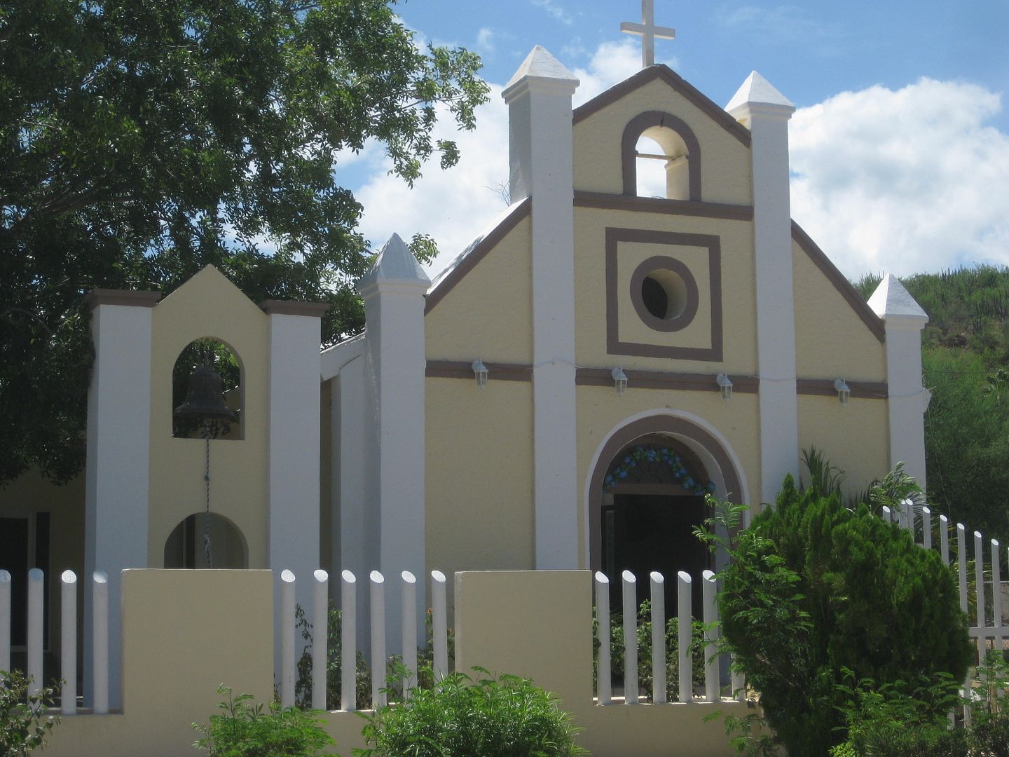
Church in Caduaño. Some historians say Caduaño was the final location of the Santiago mission for its final five years to 1795, when it was closed.
Paved road from Miraflores to Boca de la Sierra.
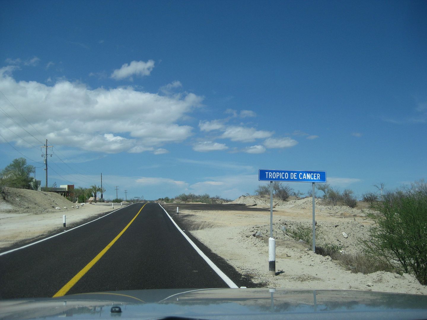
Tropic of Cancer.
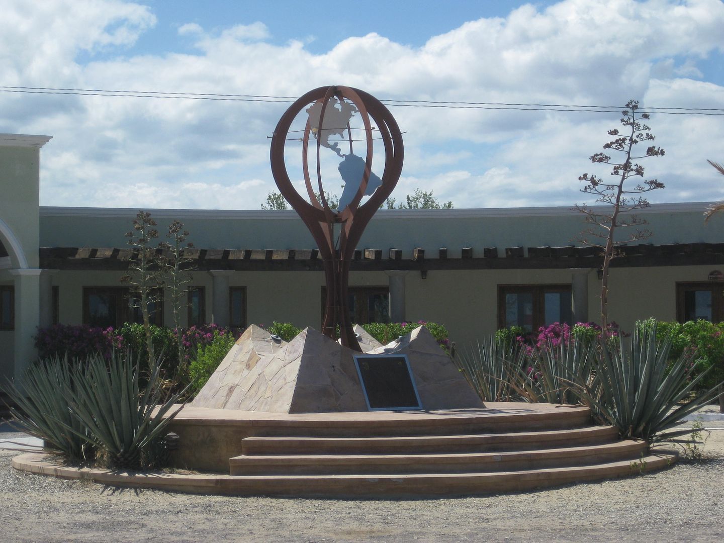
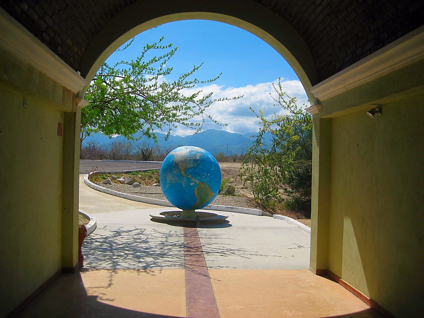
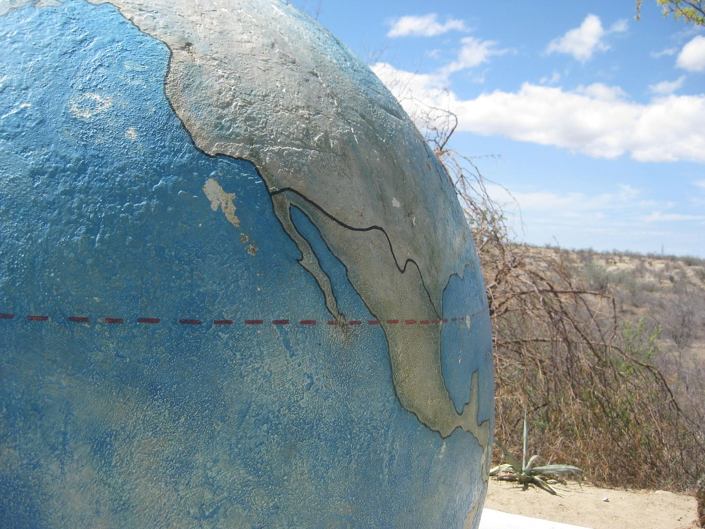
The dashed line is the Tropic of Cancer.
[Edited on 8-23-2017 by David K]
|
|
|
David K
Honored Nomad
Posts: 64478
Registered: 8-30-2002
Location: San Diego County
Member Is Offline
Mood: Have Baja Fever
|
|
DAY 7 continued... South to North
Km. 84.5 Paved road west to Santiago. Taking the road into Santiago, the long bridge over the riverbed is crossed and at Mile 1.5 is a Pemex
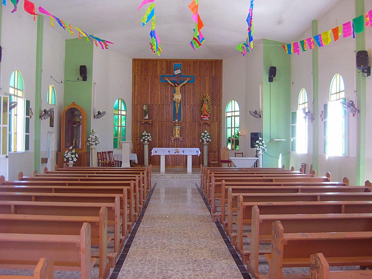
station and plaza. Continuing across town is the church at Mile 1.9 and was the location of Mission Santiago from 1736 following the Pericú Revolt.
Mile 2.4 from Highway 1 is the location of the Santiago Zoo and the end of the paved road. The zoo has had a lot of controversy over the treatment of
the animals and appears to have been closed, with signage painted over. There were some animals in pens, however.
Back on Highway 1...
Km. 89.5 To the left of the road and looking north, see the Bat Cave of Santiago. Read more in my article on Baja Bound: https://www.bajabound.com/bajaadventures/bajatravel/the_bat_...
Km. 92.5 Paved road east to La Ribera and Cabo Pulmo. Just off Highway 1, a dirt road leaves the La Ribera road to go under the highway bridge to the
bat cave. La Ribera is 12 kilometers from Highway 1 (7+ miles).
Km. 105 Buena Vista Resort
Km. 107 Buena Vista village
Km. 108.5 Los Barriles Pemex
Km. 110 Los Barriles paved main entrance.
Km. 127.5 San Bartolo
Km. 147 Graded road south to San Antonio de la Sierra, passing the famous Real de Sant Ana, the first commercial mine operation in California
(silver). This was also where the Santiago mission was first established.
Km. 155.5 San Antonio (former silver mine and capital of Baja California Sur) and the junction with the paved road north to San Juan de los Planes (20
kms.), La Ventana, etc.
Km. 163 El Triunfo. The silver mines here flourished after the San Antonio mines were exhausted. The mines operated between 1860 and 1926. The Boleo
copper mine people of Santa Rosalia tried to reestablish operations and built a loading dock at Ensenada de los Muertos to ship the silver bars out.
Km. 177.5+ Road north to San Blas and on to the La Paz-Los Planes highway.
Km. 185 Junction with Highway 19 to Todos Santos and Cabo San Lucas.
Km. 189 San Pedro
Km. 194 Pemex station.
Km. 200, final kilometer sign seen before La Paz.
Km. 200 + 7.0 miles = Km. 211+: Levee road west to Dove/ Whale Tail monument at the north entrance to La Paz. The levee road is 2 miles long between
the two parts of Highway 1. The Home Depot and Wal Mart are near the Dove end of the 'cut-across' road.
PHOTOS:
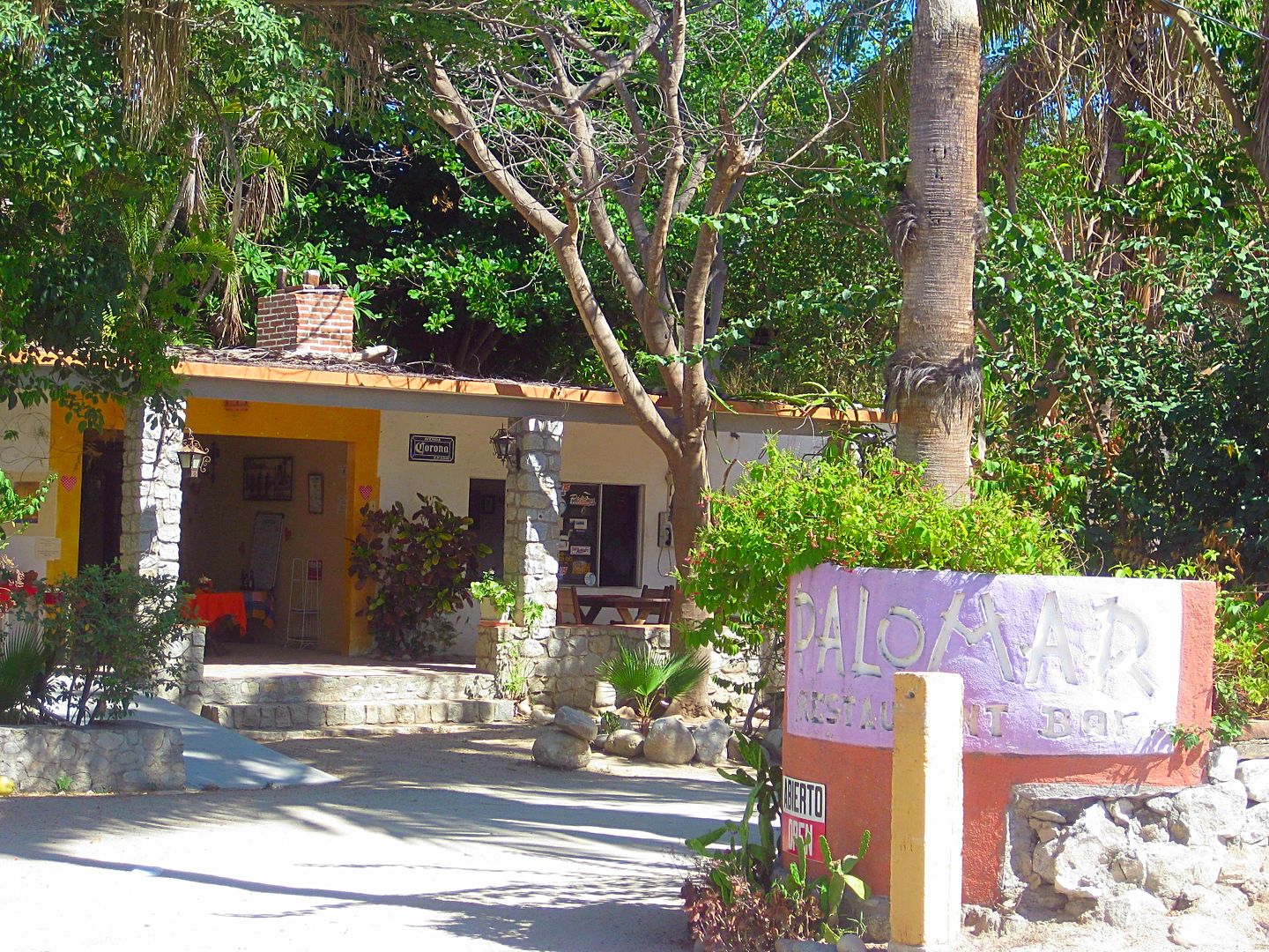
The Palomar Inn, Santiago, a restaurant, was once a popular Inn or hideaway for Hollywood celebrities!
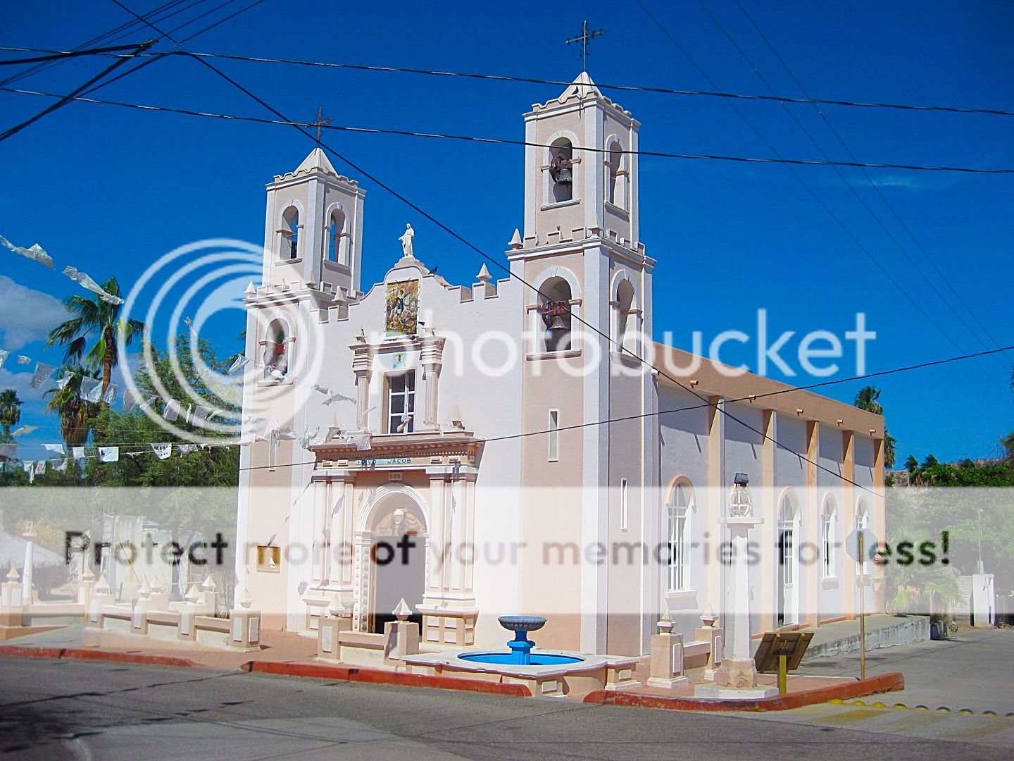
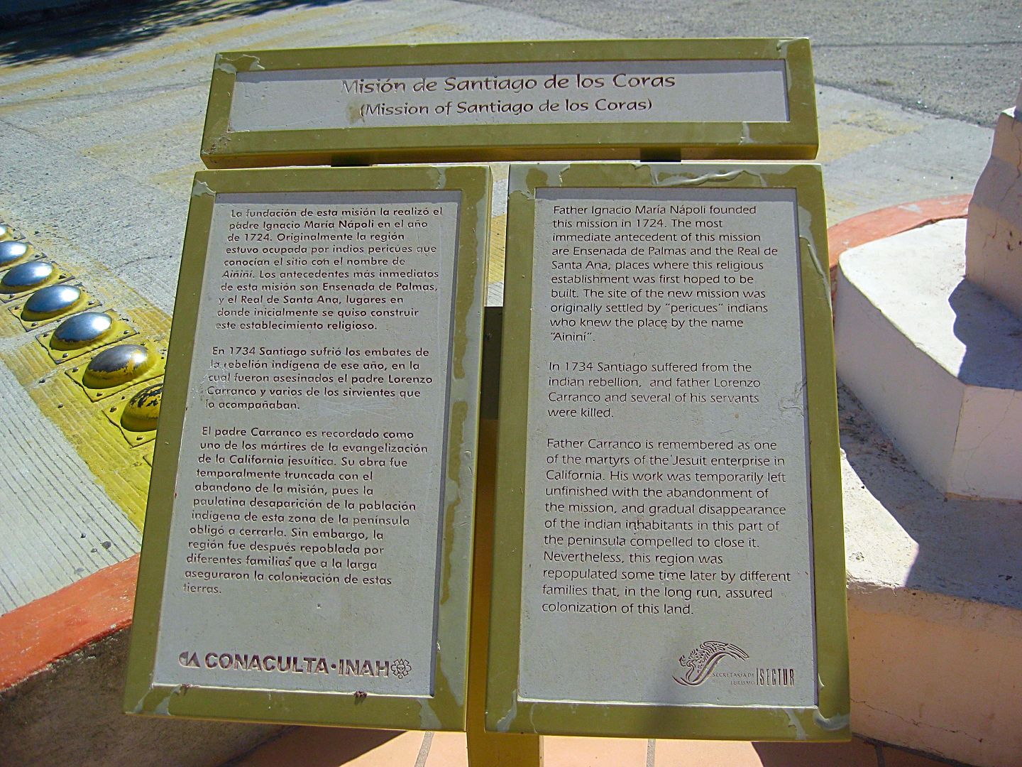
A modern church on the mission site of Santiago, California's 10th Spanish mission. The first mission attempt was to the north at Santa Ana (near
today's San Antonio) in 1722. That failed after the new wall collapsed during a hurricane and killed many natives.
In 1724, Padre Nápoli tried again, only further south (about 2 miles north of this location). That prospered until the Pericú Revolt of 1734 in
which the missionary at Santiago (Lorenzo Carranco) and the missionary at San José del Cabo (Nicolás Tamaral) were killed and burned. When the
Spanish and Jesuits regained control over two years later, the Santiago mission was moved to this spot.
The history of events in this rugged land is so fascinating. Read more details in my book, Baja California Land of Missions, www.oldmissions.com now in its fourth printing, thank you for your interest!
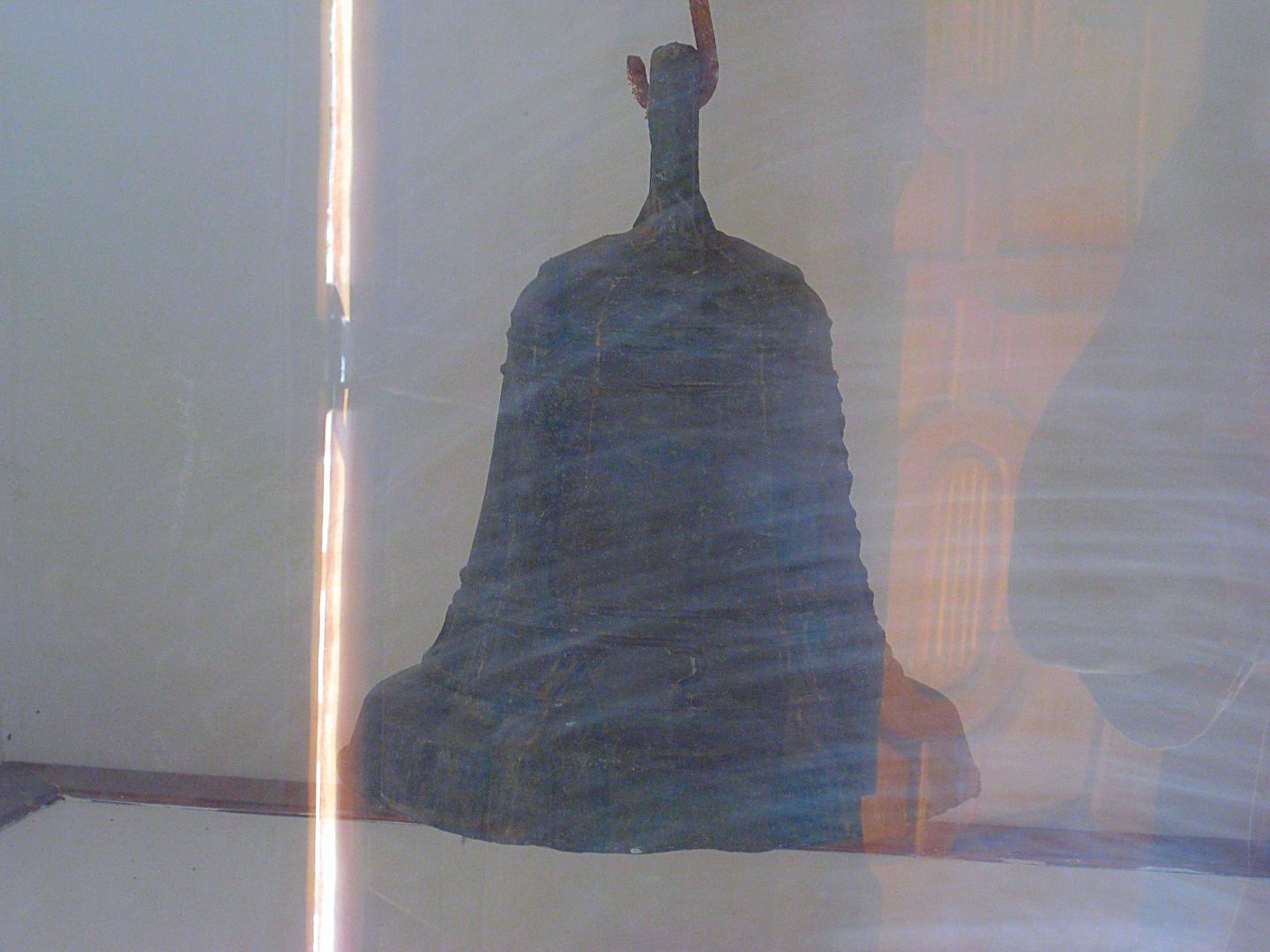
Just inside the church and behind a (less than clear) plexiglass window is this preserved mission bell.
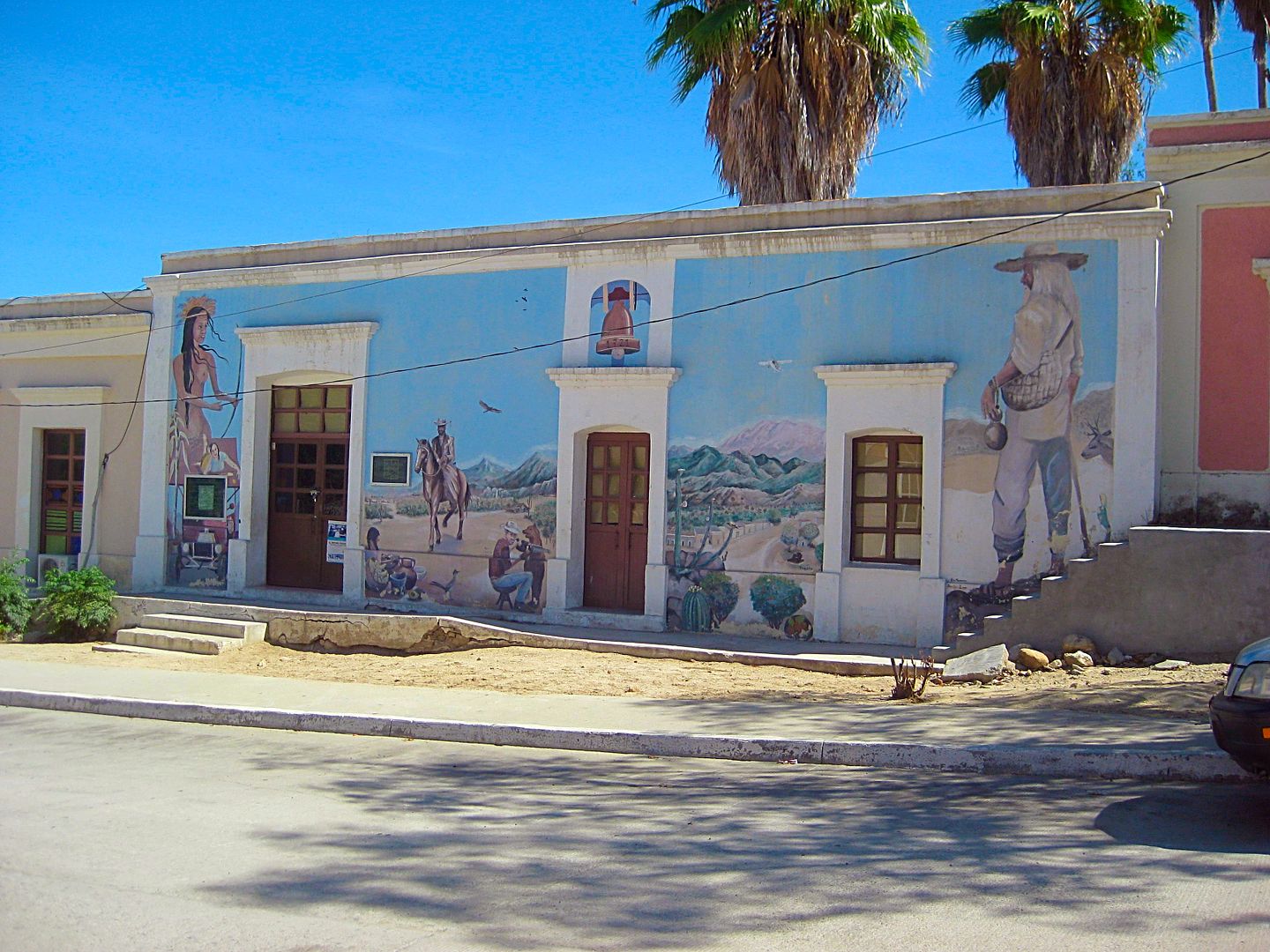
Across from the church in Santiago.
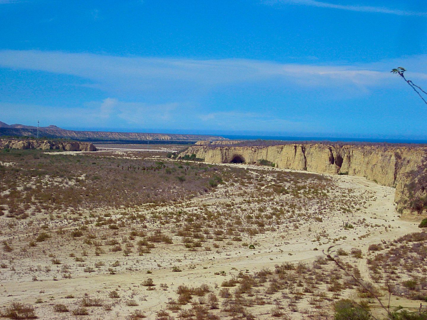
Off to the left of the highway, looking north... do you see it?
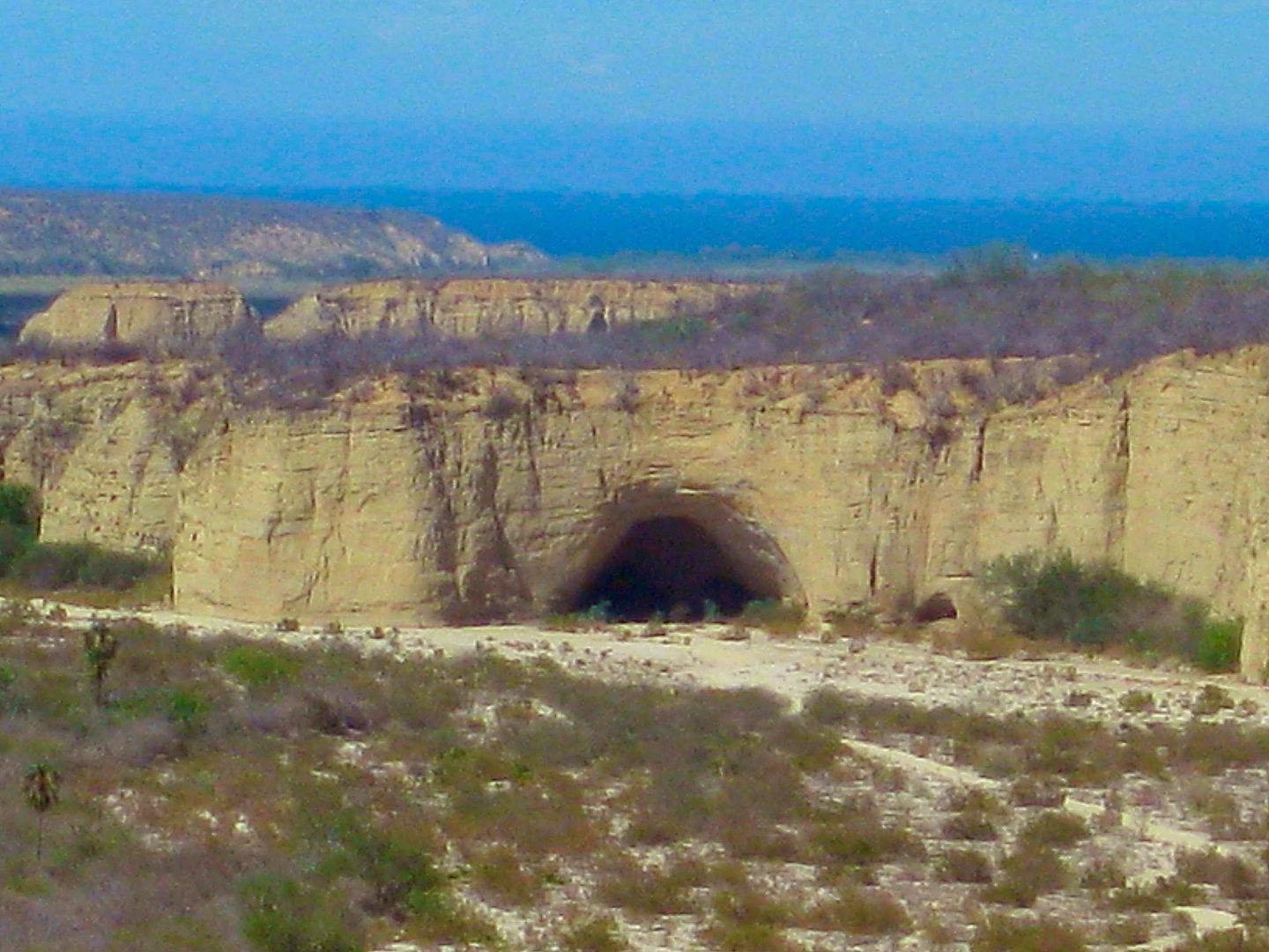
The Bat Cave!
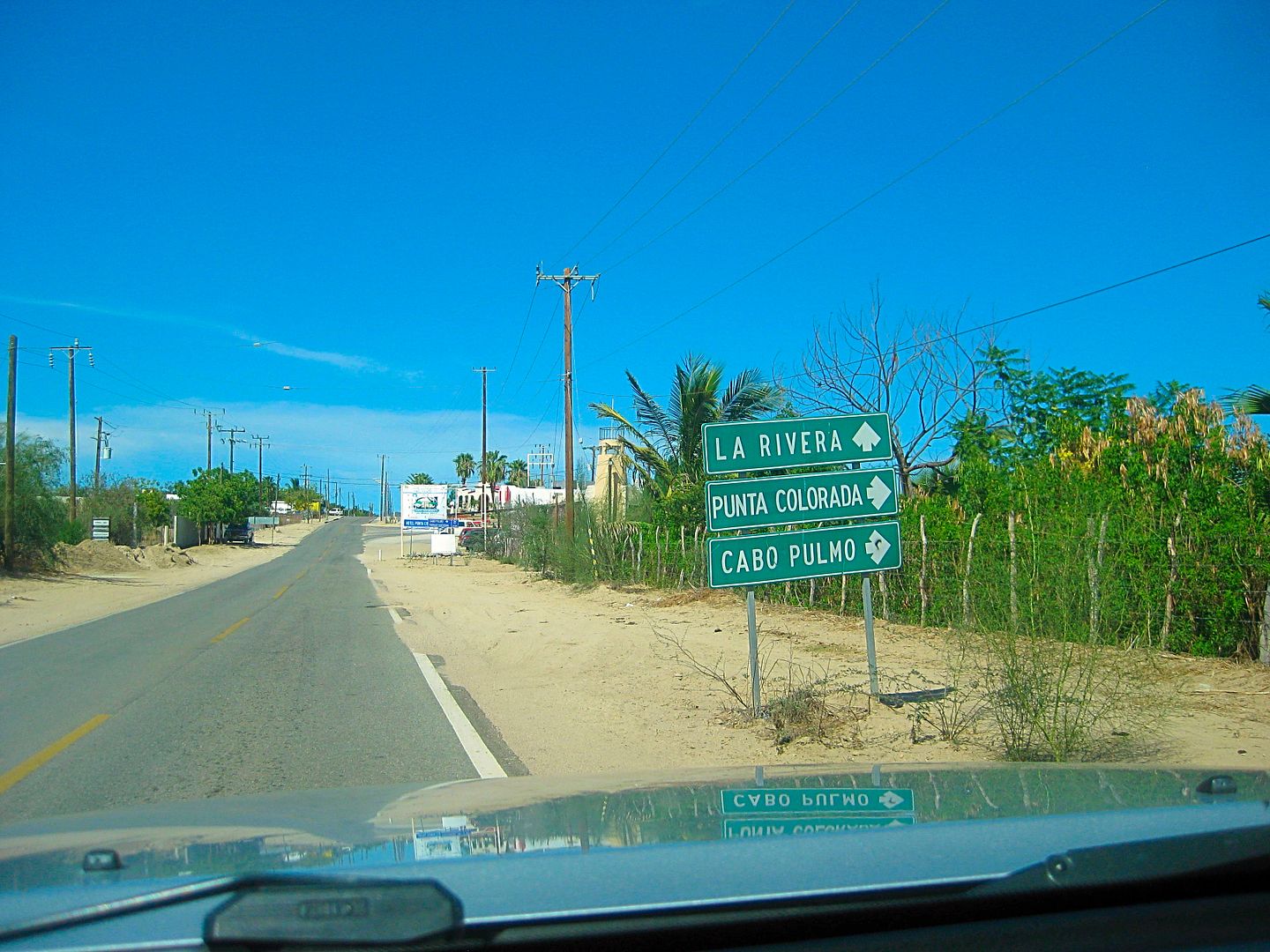
Entering La Ribera (the b and v are interchangeable in Spanish, at least here!)
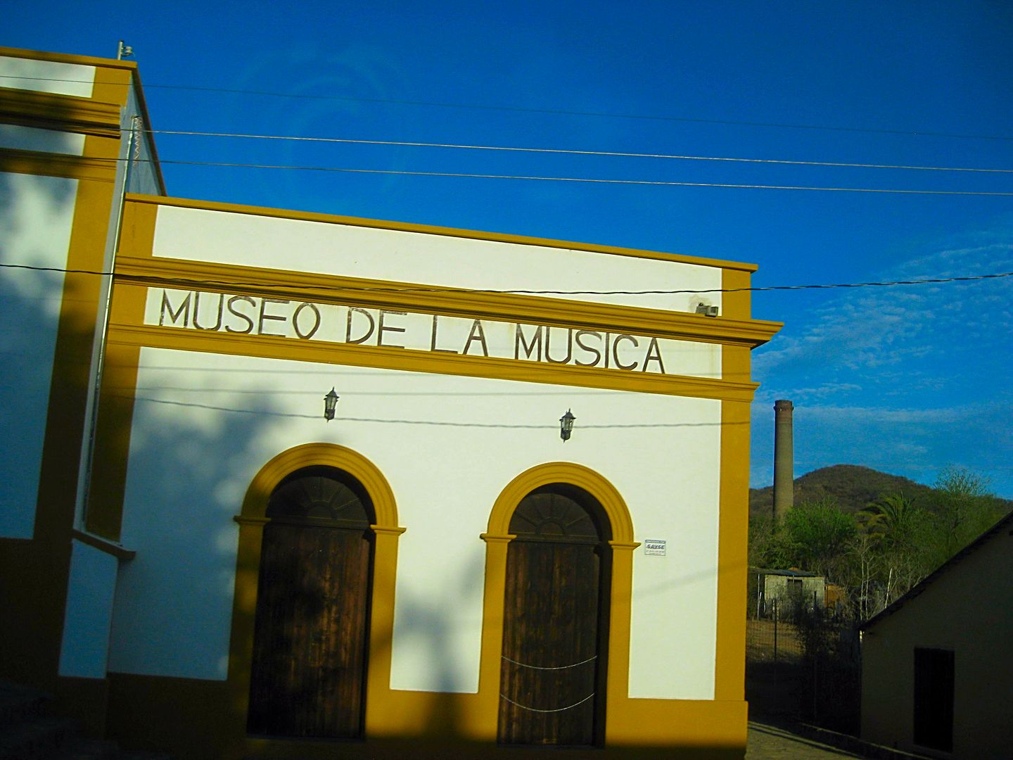
The Piano Museum in El Triunfo. One of the silver mine smoke stacks is in the background.
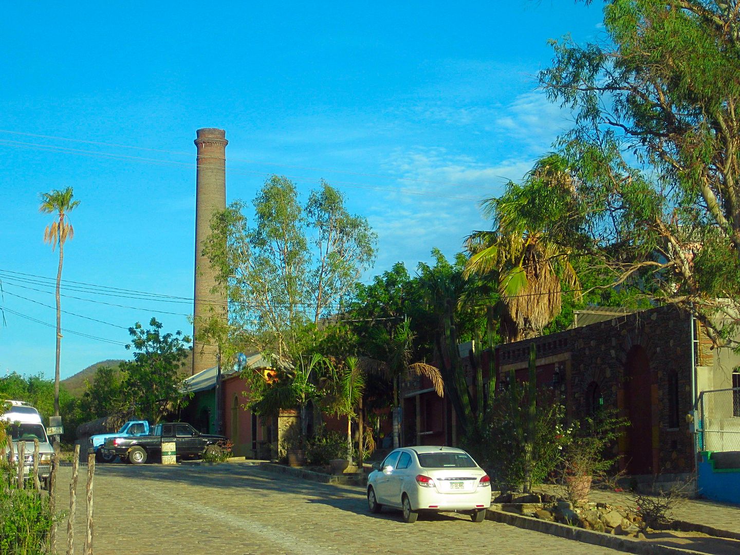
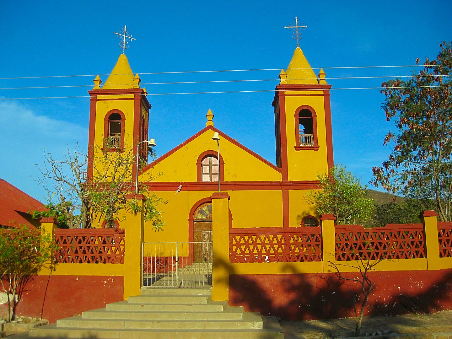
El Triunfo church
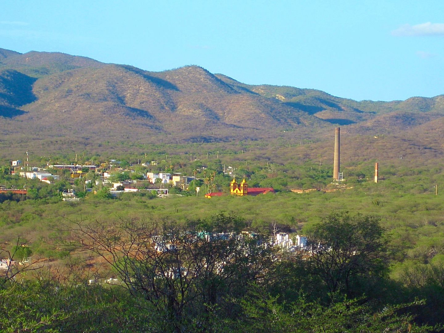
El Triunfo as seen from Highway 1, looking back if driving to La Paz.
The Dove of Peace (La Paz = The Peace) at the entrance to La Paz from the north. Others (including street namers) call this a "Whale Tail".
|
|
|
David K
Honored Nomad
Posts: 64478
Registered: 8-30-2002
Location: San Diego County
Member Is Offline
Mood: Have Baja Fever
|
|
Special note to Baja Nomads:
I finally got to meet George Bergin or "Jorge" or "Osprey" who had been so kind to review my book manuscript before it was printed and offered a
review along with authors Graham Mackintosh and Greg Niemann...
I wanted to present Osprey with his own, well deserved, printed copy of my book.
George and Lynda were very nice to visit with and I hope to help Osprey share his many stories in future posts here.
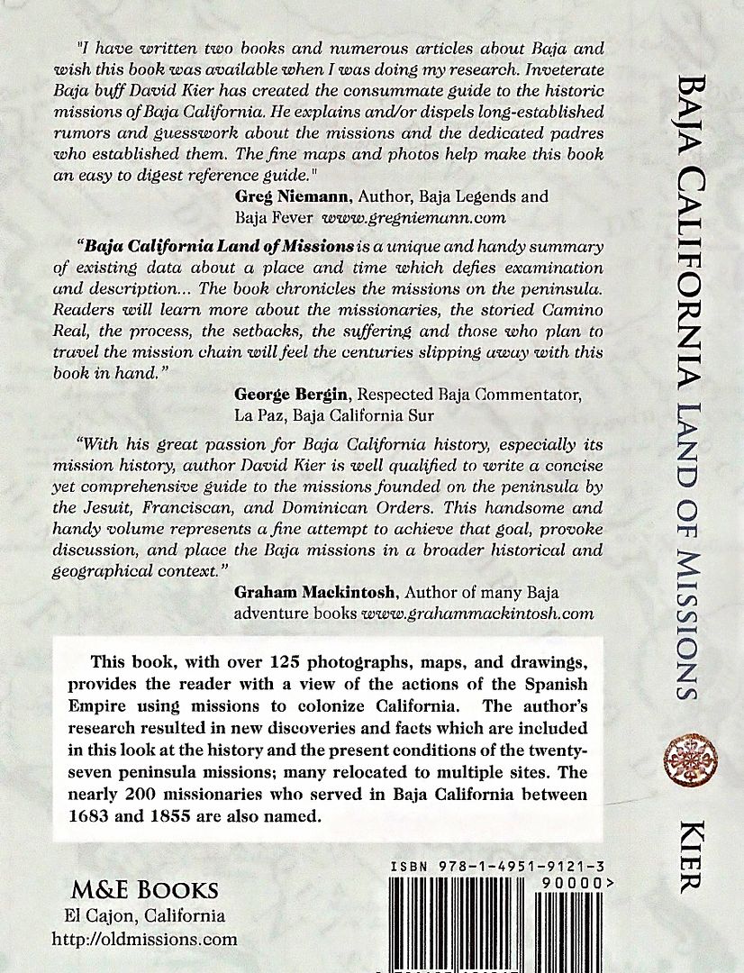
Here is the back cover, featuring George's review:
|
|
|
blackwolfmt
Senior Nomad
Posts: 802
Registered: 1-18-2014
Location: On The Beach With A Blackwolf
Member Is Offline
Mood: dreamin of Riden out a hurricane in Baja
|
|
Awzome stuff DK
So understand dont waste your time always searching for those wasted years
face up and make your stand and realize that your living in the golden years
|
|
|
David K
Honored Nomad
Posts: 64478
Registered: 8-30-2002
Location: San Diego County
Member Is Offline
Mood: Have Baja Fever
|
|
Great... glad you are liking it!
I am only HALF done... 7 more trip days to go!
They aren't all super heavy days, I am only human!
|
|
|
David K
Honored Nomad
Posts: 64478
Registered: 8-30-2002
Location: San Diego County
Member Is Offline
Mood: Have Baja Fever
|
|
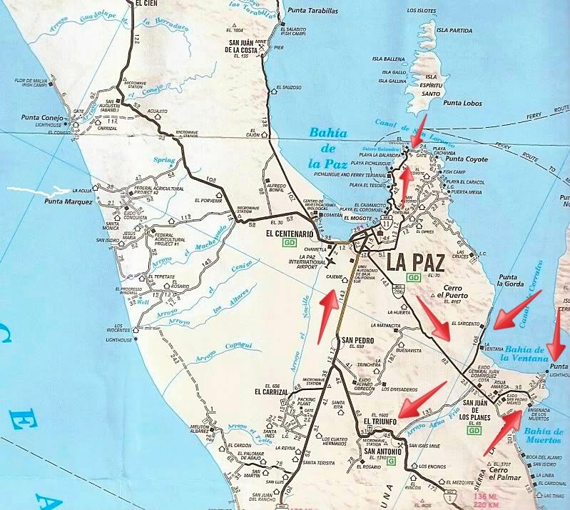
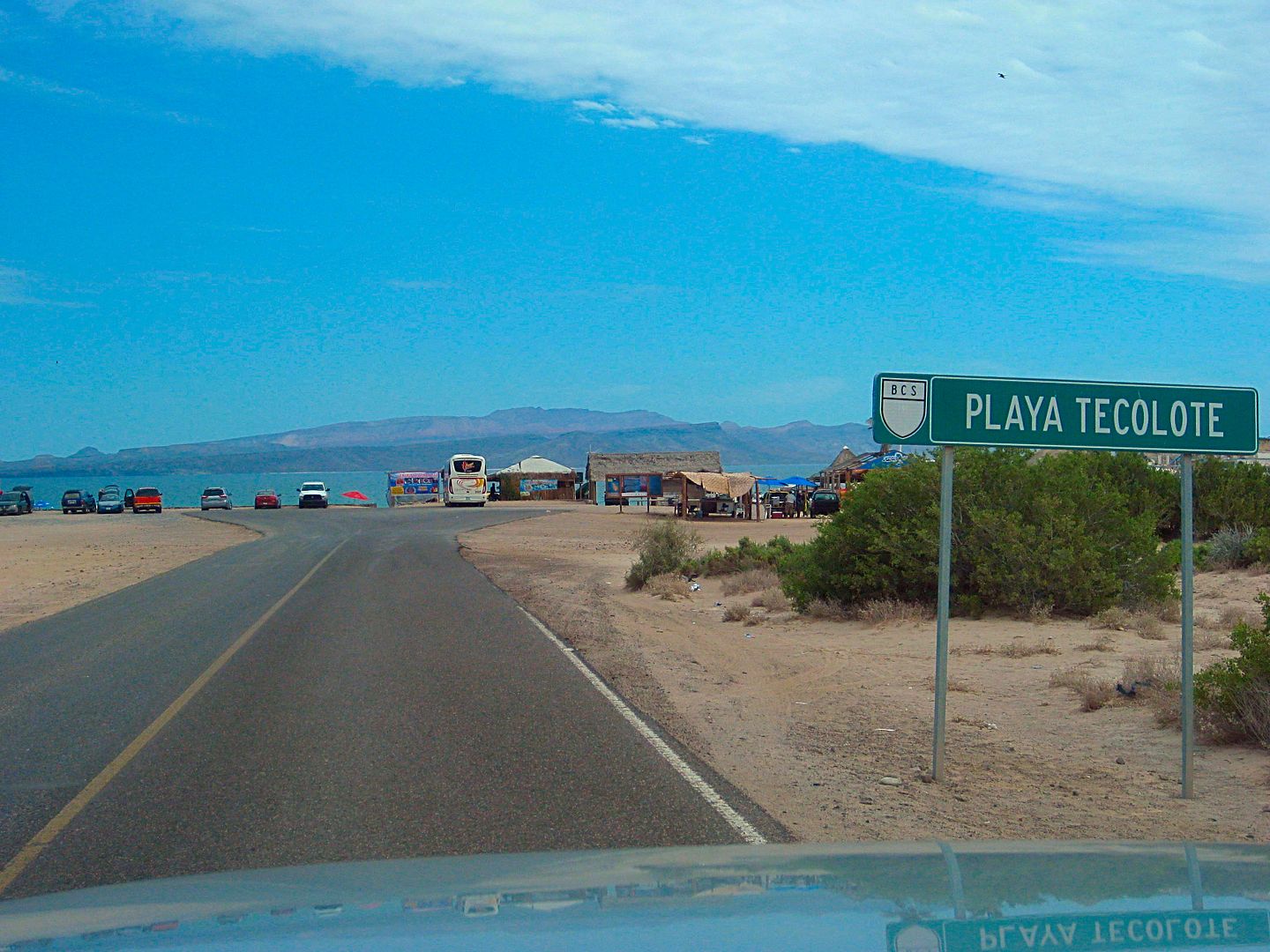
DAY 8: North and East from La Paz (Tecolote, Ensenada de los Muertos)
Perhaps an area map to help visualize the places I visited on DAY 8 is in order?
I took a look at the campground (RV Park) Campestre Maranatha, located behind the coffee shop Café Exquisito, at Km. 11 (between El Centenario and La
Paz) on the right (south) side of the highway.
I had breakfast near the airport road along Hwy. 1 at a place called "Jalisco" and it was very good and just 90 pesos (=$5.19)+ tip. This is located
by the Kilometer 10 marker, on the left (north) side of the highway.
The airport road is at Km. 9 and the "Dove" is at Km. 8. Going south to Cabo, you would fork right at the Dove and again just ahead, another right
onto the levee road. This time, I continue straight (left fork) which is now going north into downtown La Paz.
One thing that becomes obvious, particularly on the side streets, stop signs are just suggestions, more of a yield sign, maybe. If you do stop (when
there is no cross-traffic) and cars are behind you, plan on being rear-ended! LOL, no, didn't happen to me, but I sure can visualize it!
I top my gas tank in La Paz, having driven 325 miles since my last fill up. The price was 15.72 pesos/liter. The station offered an exchange of 16.50
pesos/dollar, but I had pesos purchased at 17.35/dollar. The truck took on 68.72 liters (18.15 gallons) meaning I got 17.9 MPG, which is great (mostly
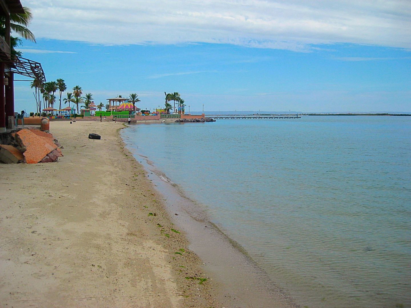
that this Pemex has honest liters). The cost was 1100 pesos plus a 20 peso tip for the attendant (nice personality and cleaned windows).
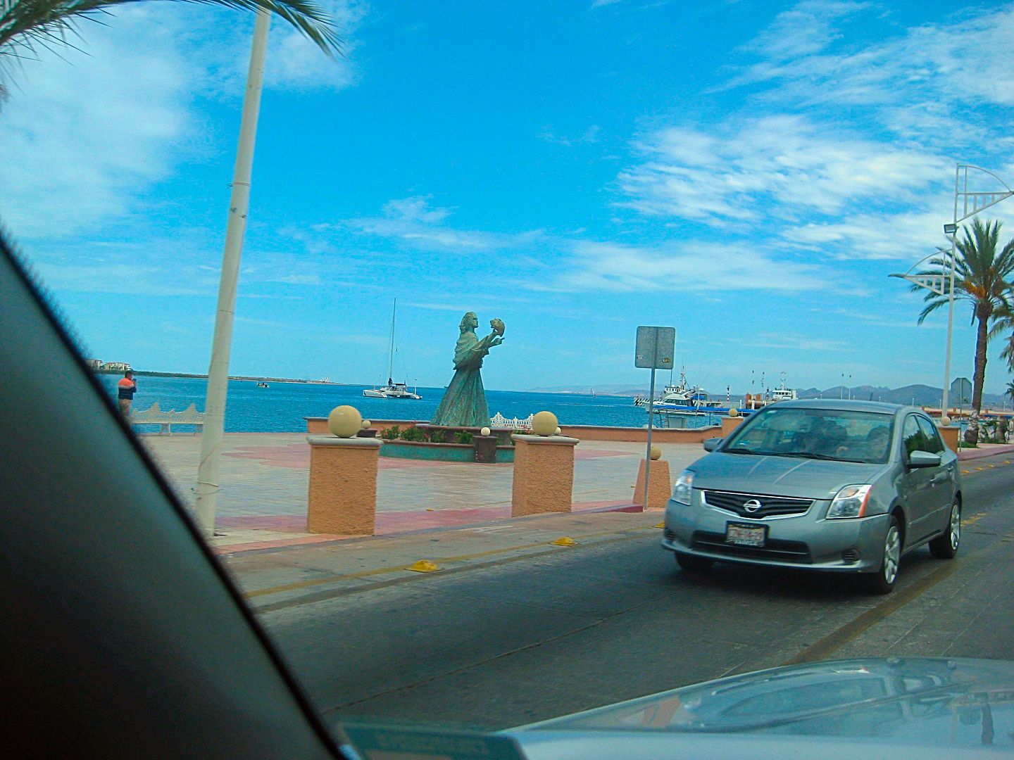
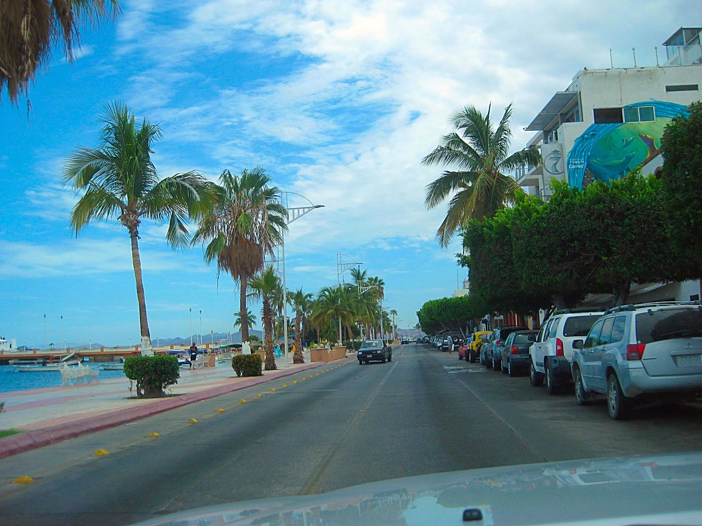
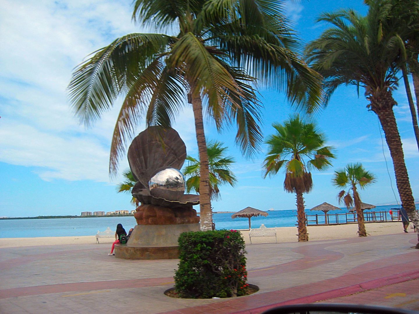
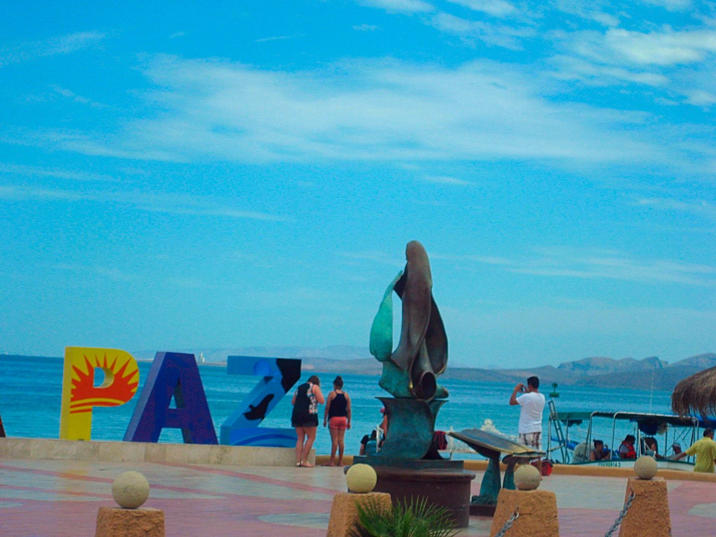
I drive along the Malecon (sea drive) and manage to take a few 'out-the-window' photos of the many interesting statues. I took many in 2012 when we
were last here. There is a new one, an oyster with a big black pearl inside.
That hamburger and surf board rental place (Harker) that Harald and I ate at was 1.2 miles from the Dove
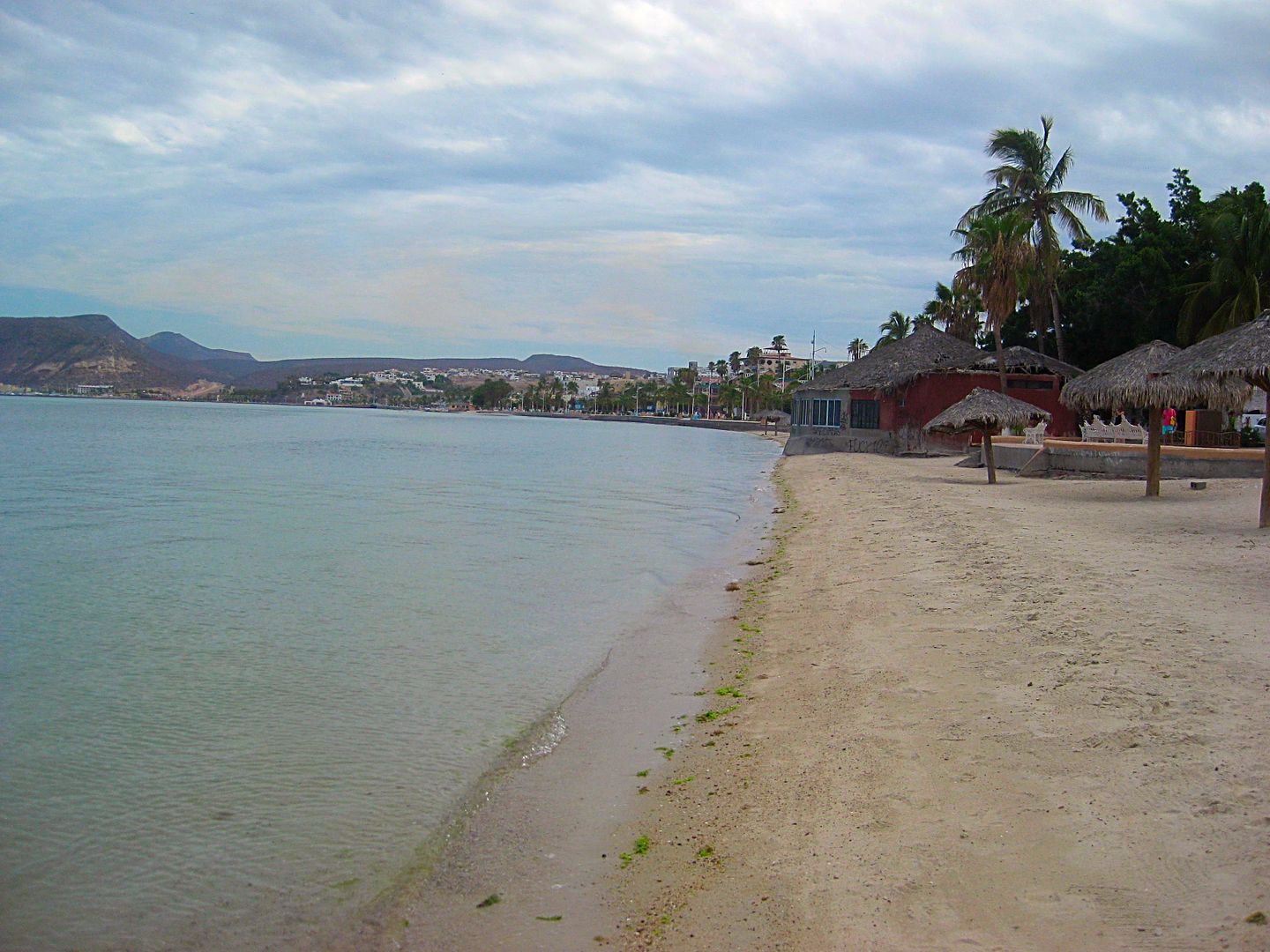
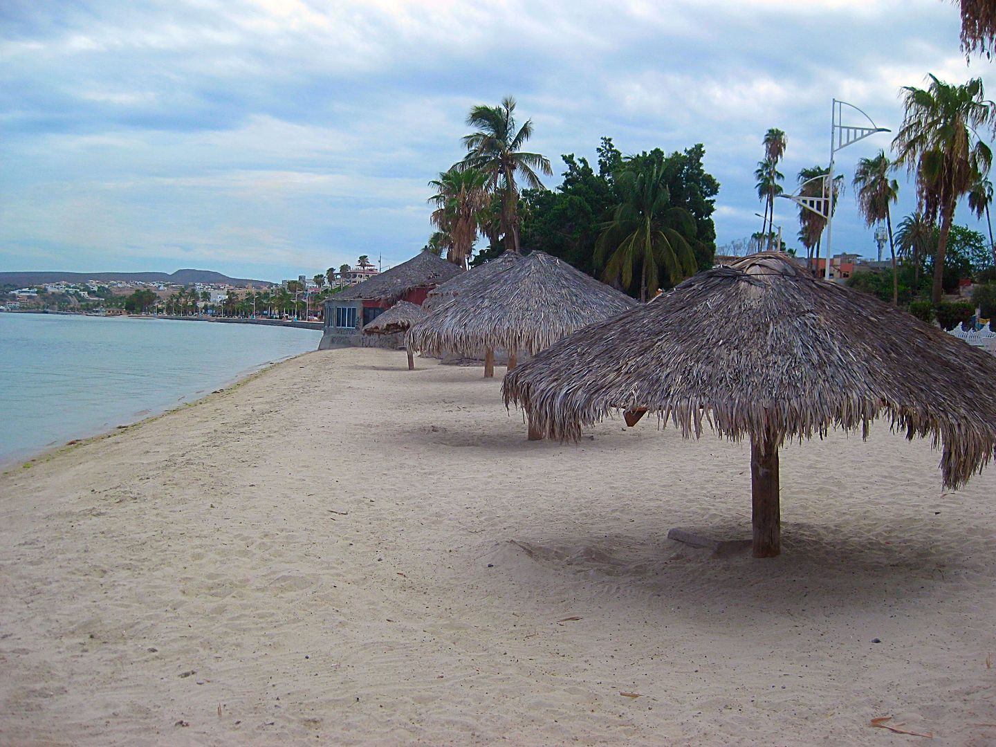
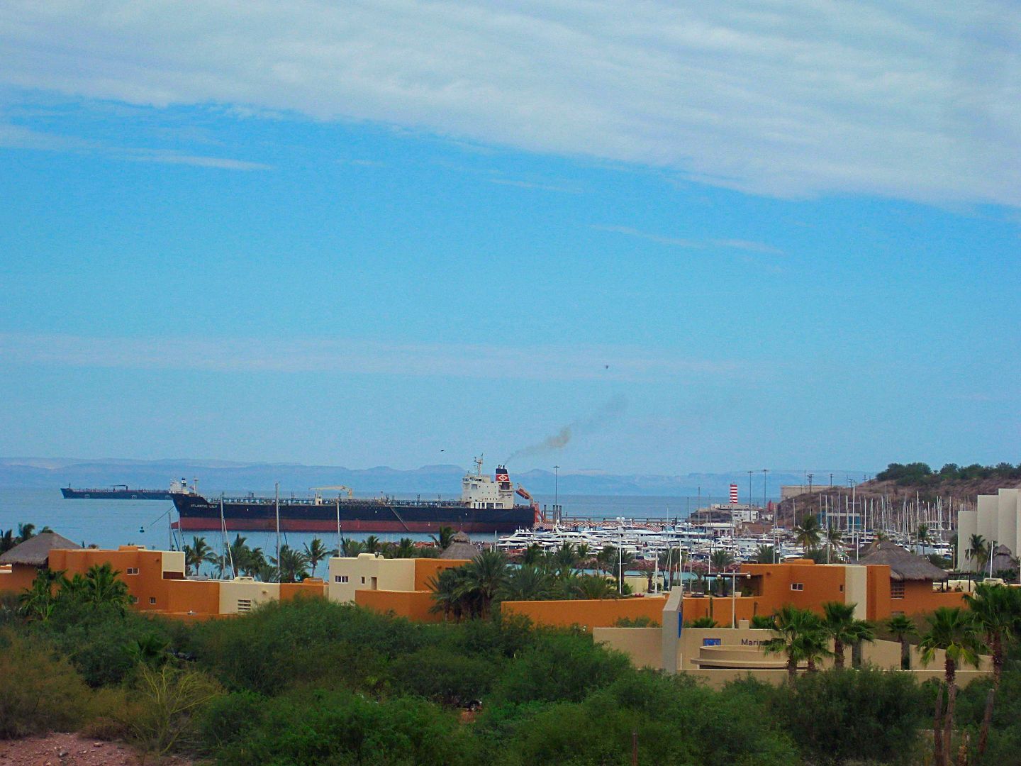
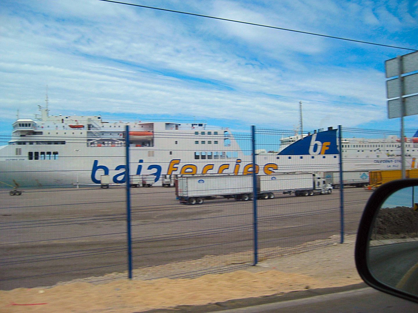
I do stop where I find a parking spot and walk across the street to the beach for a couple photos. Then, on north, past the ferry docks (transport
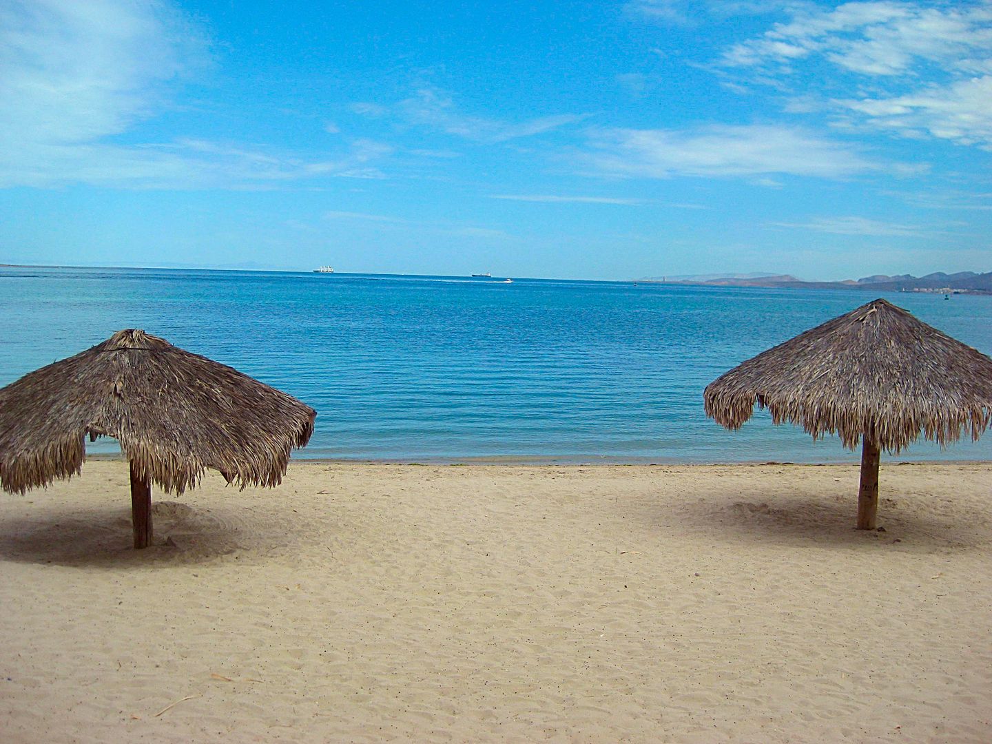
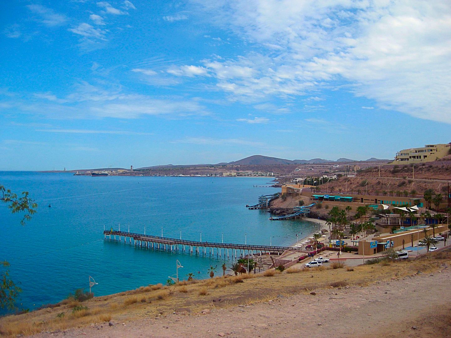
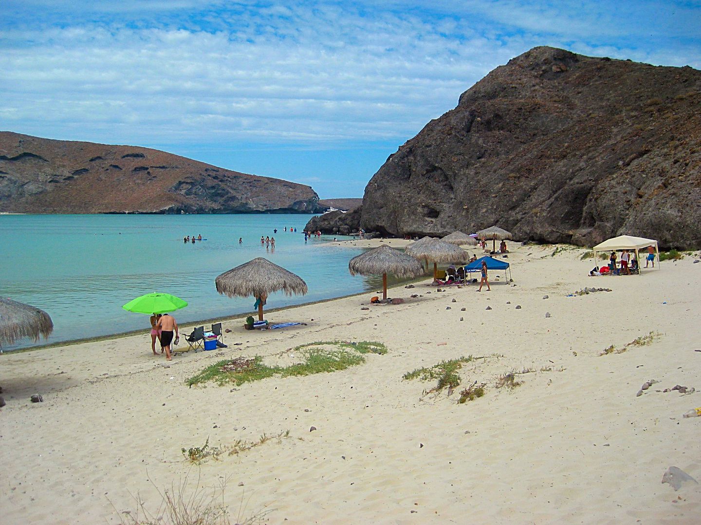
across the gulf to the Mexican Mainland) and to both Balandra Beach and Tecolote Beach, very popular and already busy on this Tuesday morning.
The Dove to the La Paz Bypass road (to access the ferry landing for cargo trucks and others without going through La Paz city) is 5.8 miles. There are
some kilometer markers and ...
Km. 13 is Tesoro Beach at Mile 8.7 from the Dove.
Km. 17 (11.4 miles from the Dove) is the Ferry Landing. Today two Baja Ferry ships were in port.
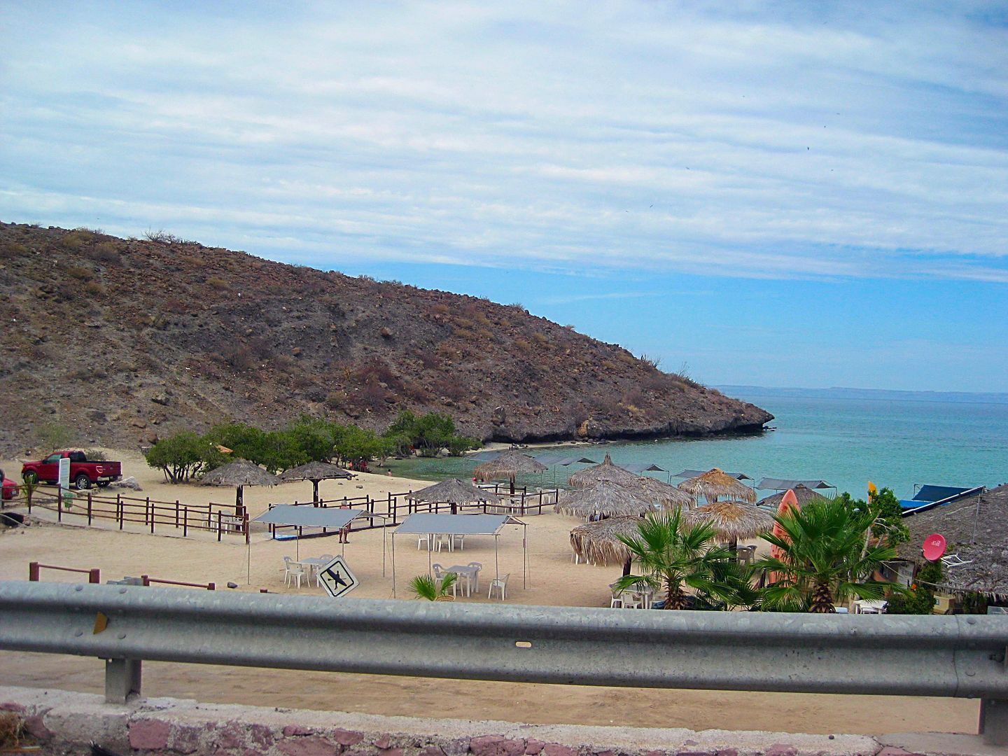
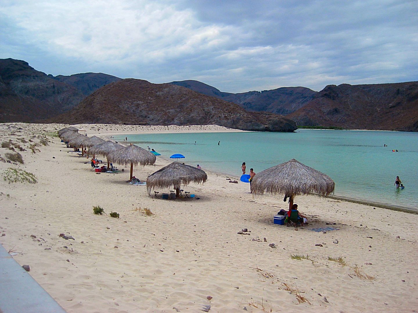
Km. 24 is the paved road left to parking for Balandra Beach. This is where the famous Mushroom Rock can be walked to. The beach parking lot was
filling up when I got there.
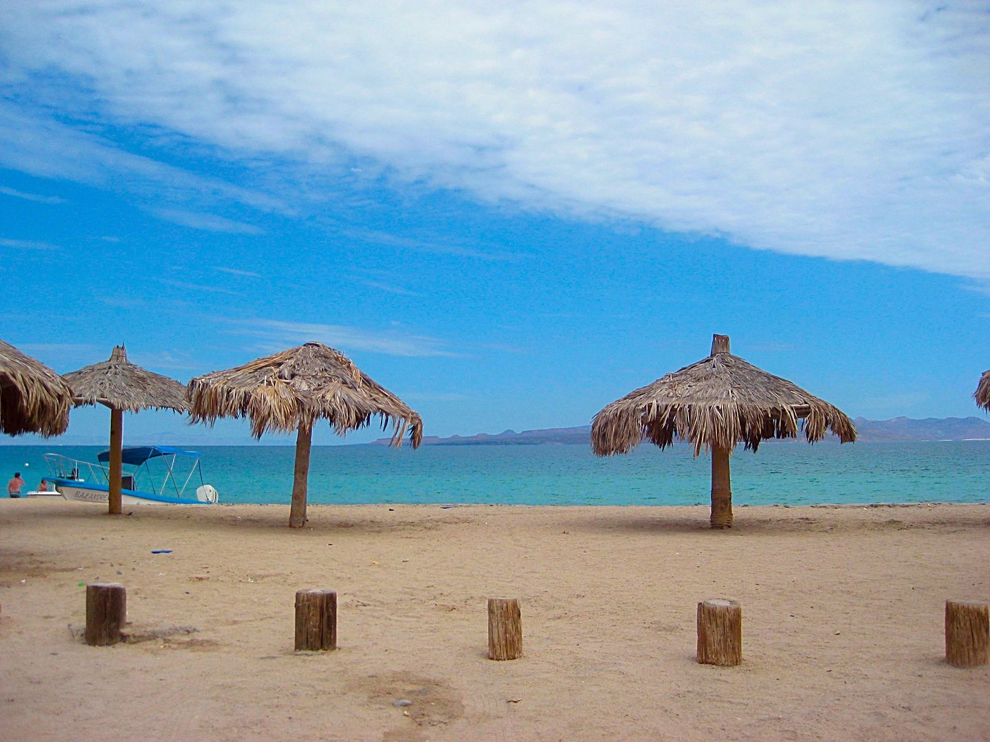
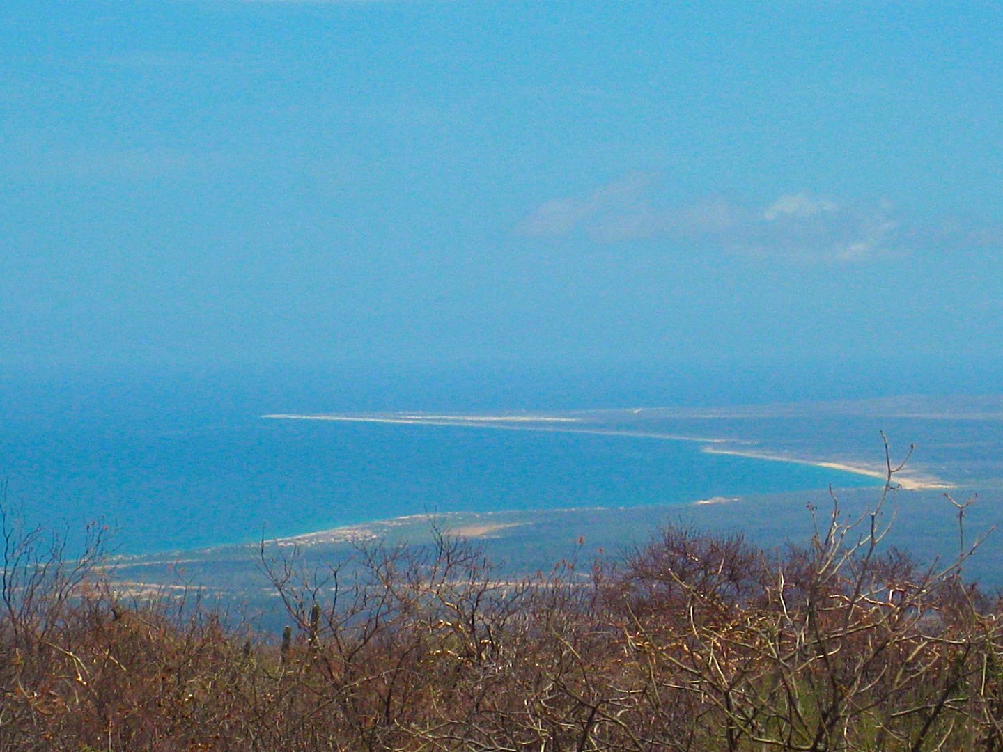
(=Km. 27) 1.8 miles north of the Balandra road is Tecolote Beach, a north facing beach across from Espíritu Santo Island.
Some photos then turn back south and drive 9.2 miles (~15 kms.) to the Bypass route that goes around the east side of La Paz, avoiding downtown.
These city bypass roads are called 'Libremiente' and most have them or someday will. Kilometer markers on the Libremiente begin on the north end...
Km. 6.5 is a big power plant.
Km. 17.5 is a Pemex station
Just south of the Pemex is the highway east to San Juan de los Planes and the coast.
A new set of kilometer markers is on this highway, and Kilometer 6 is 2.5 miles from the Libremiente road, which I will say is about Km. 4 for the San
Juan de los Planes road.
13.1 miles from Libremiente (~Km. 21) is a dirt road south to Los Divisaderos and San Blas and goes on to Hwy. 1. Signed as an "Eco-Tourism" road.
Km. 37 Paved road north to La Ventana and El Sargento....
TO BE CONTINUED!
PHOTOS:
Km. 11 RV Park and coffee shop
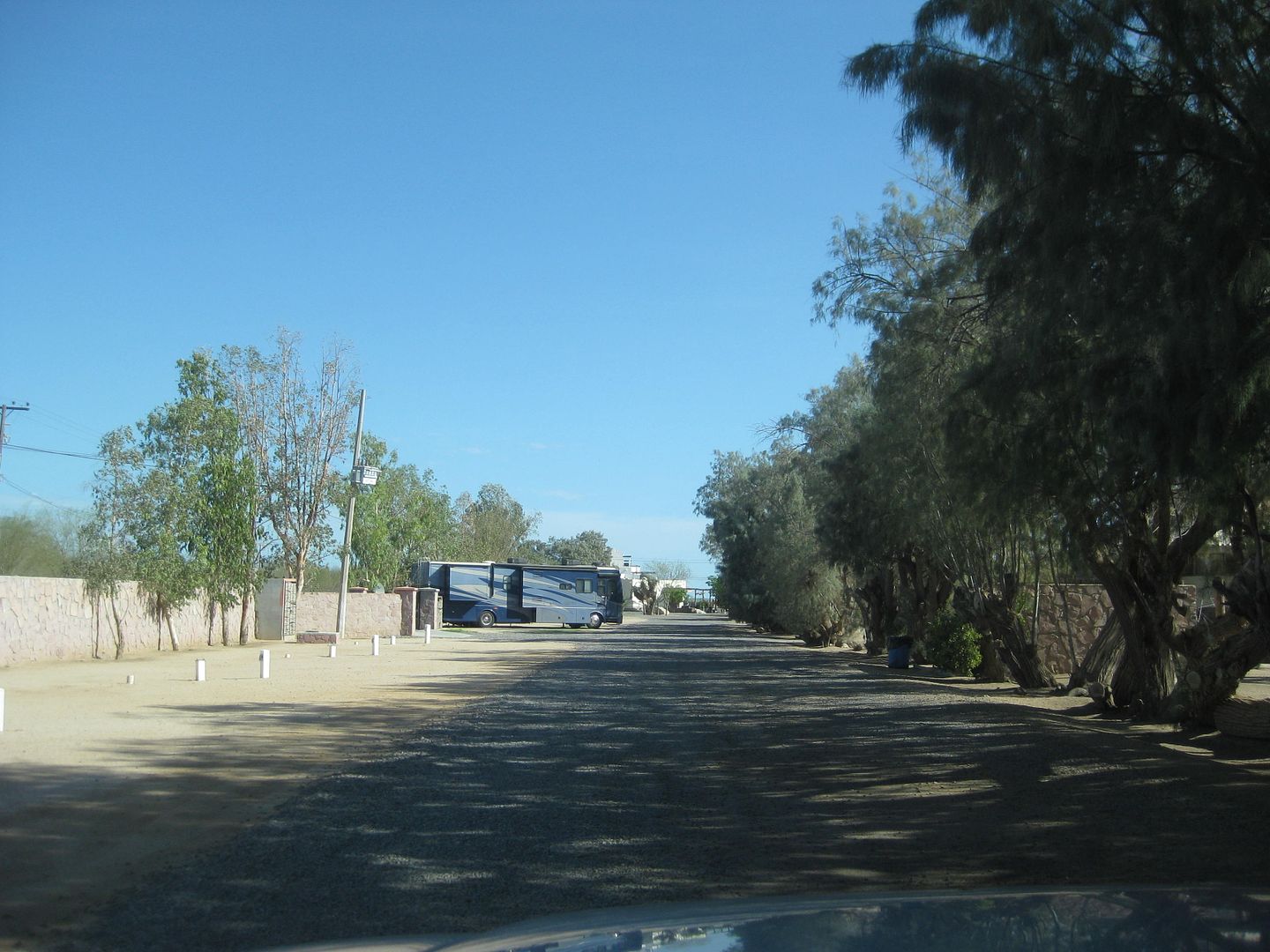
RV parking, nearly empty.
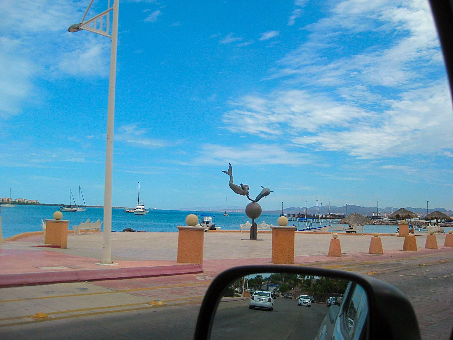
Malecon drive, La Paz
Balandra Beach
The Mushroom Rock is just around that point on the right.
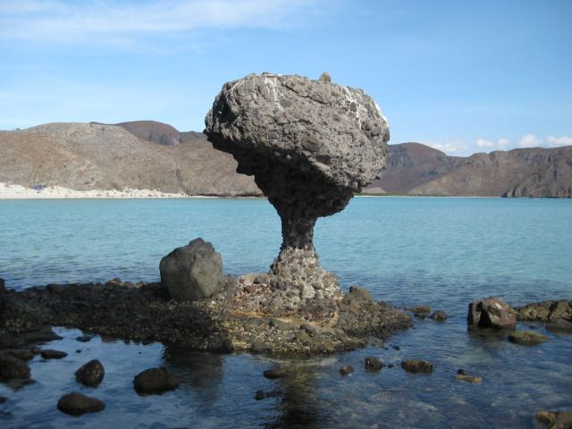
Photo from 2012.
View from highway to San Juan de los Planes. That is Punta Arena in the distance.
TO BE CONTINUED ...
[Edited on 8-24-2017 by David K]
|
|
|
danaeb
Senior Nomad
Posts: 991
Registered: 11-13-2006
Location: San Diego; El Centenario
Member Is Offline
Mood: groovy
|
|
The correct name for the beach is "Balandra".
Experience enables you to recognize a mistake every time you repeat it.
|
|
|
David K
Honored Nomad
Posts: 64478
Registered: 8-30-2002
Location: San Diego County
Member Is Offline
Mood: Have Baja Fever
|
|
Thank you! Fixed!!
I was anxious to get the photos posted and didn't even look at the map closely or recalled the correct name even though I may have heard it dozens of
times. I hope any other errors are pointed out so when the 'book' version is written I will have input from locals, too. Sorry, there wasn't more
notice so I could meet you and other La Paz area Nomads. It was a pretty fast-paced research trip.
[Edited on 8-24-2017 by David K]
|
|
|
| Pages:
1
2
3
4
5 |
|


