| Pages:
1
2
3
4
5 |
kevin_in_idaho
Nomad

Posts: 143
Registered: 12-13-2016
Member Is Offline
|
|
Love seeing the pictures and info. Have you ever taken your car on the ferry to mainland Mexico? We're thinking of doing Copper Canyon and the
Butterfly migration and might take the ferry over one way or the other.
|
|
|
David K
Honored Nomad
Posts: 64479
Registered: 8-30-2002
Location: San Diego County
Member Is Offline
Mood: Have Baja Fever
|
|
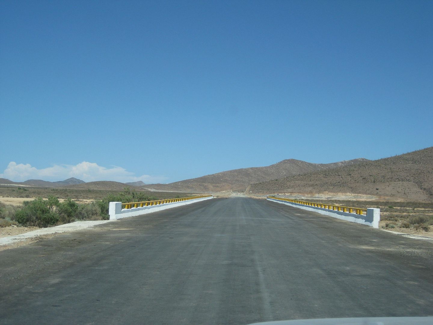
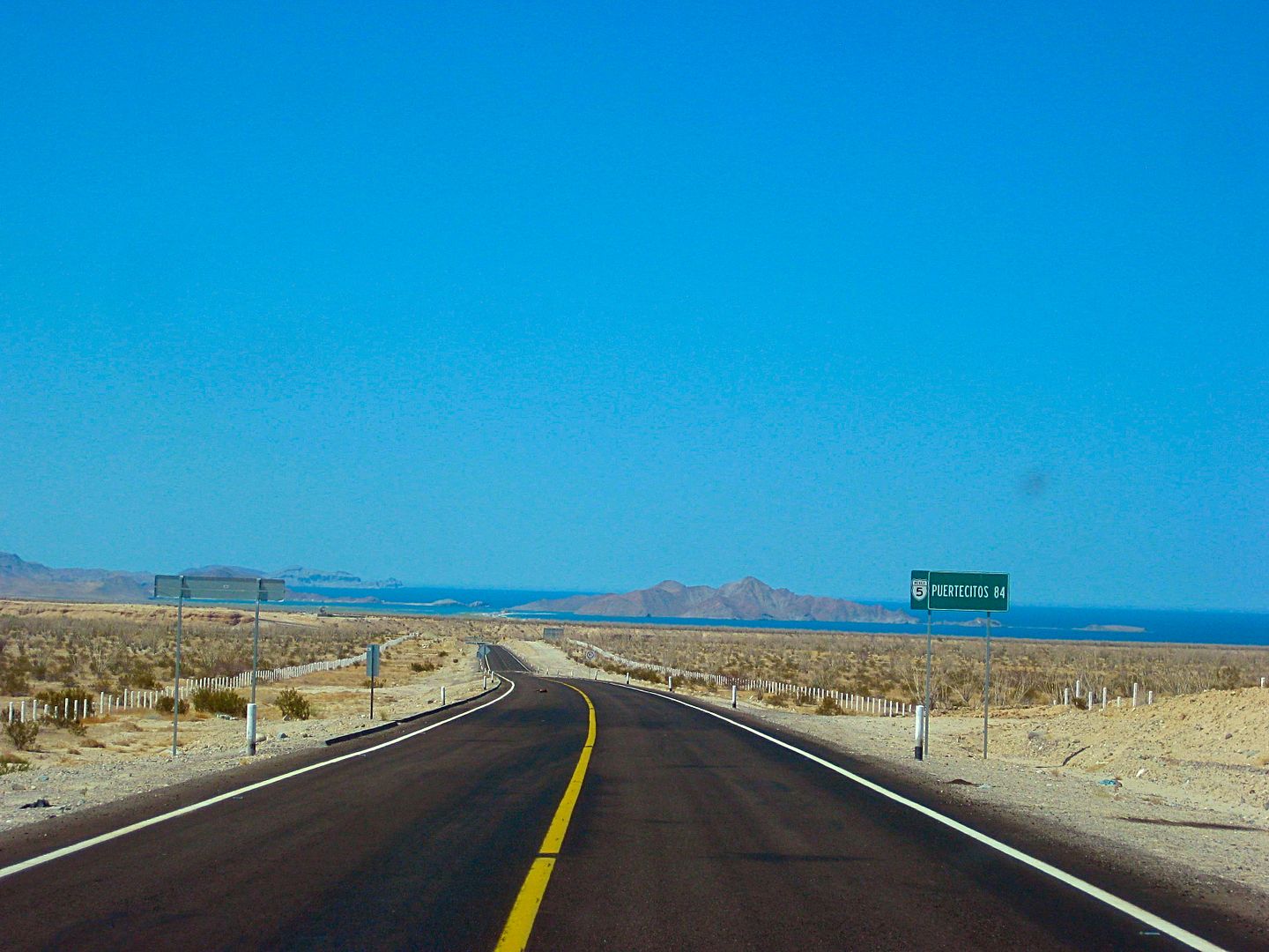
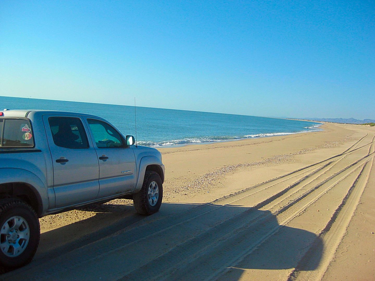
DAY 8 continued...
Km. 37 on the San Juan de los Planes road is the paved road north to La Ventana and El Sargento.
Taking this road north
Km. 6+ Beach access, 0.5 mi.
Km. 7.5 (Mile 4.6) RV Park
Km. 8 Playa Central, fenced ejido beach park north side.
Km. 8.5 Hotel
Km. 10 El Sargento; Oxxo Market/Pemex Station.
Km. 11+ End of pavement, beach to right.
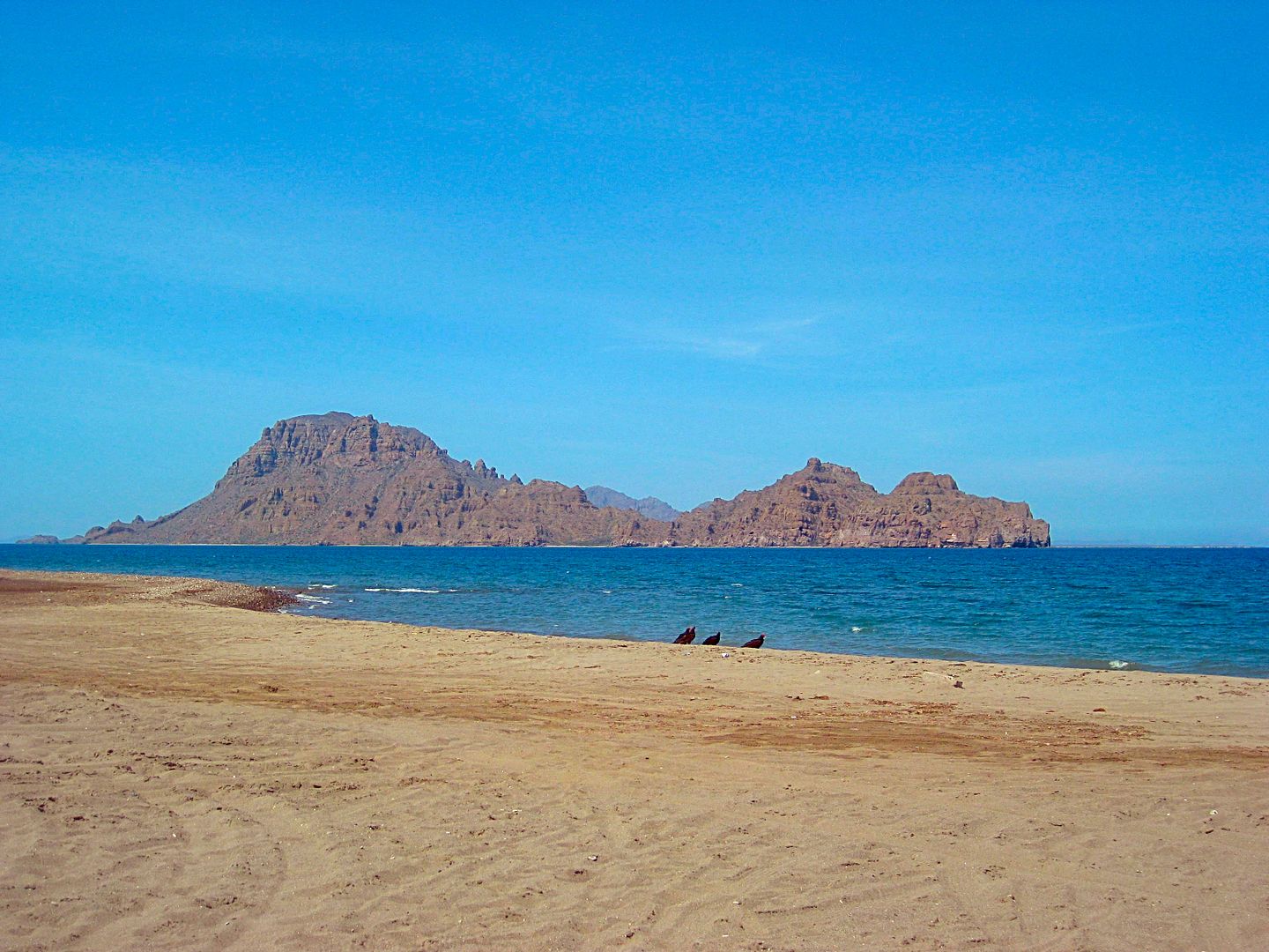
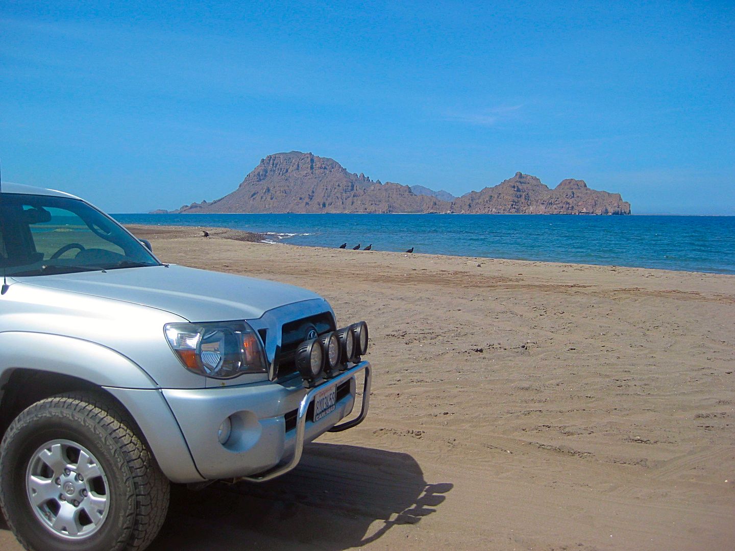
PHOTOS:
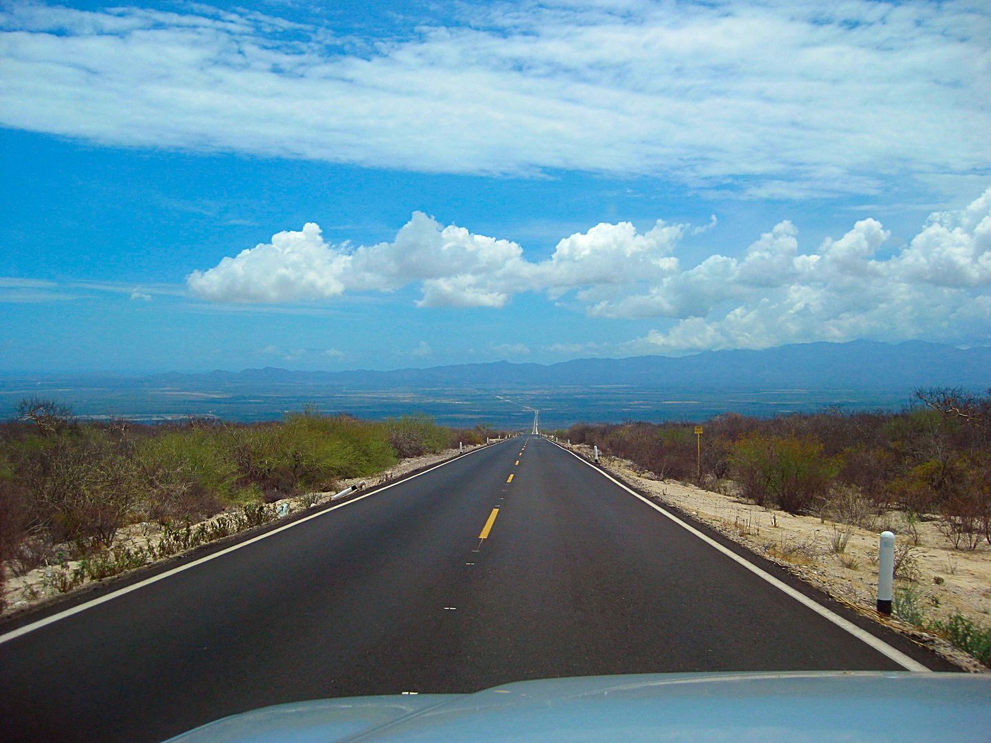
Westbound BCS Hwy. 286 to San Juan de los Planes.
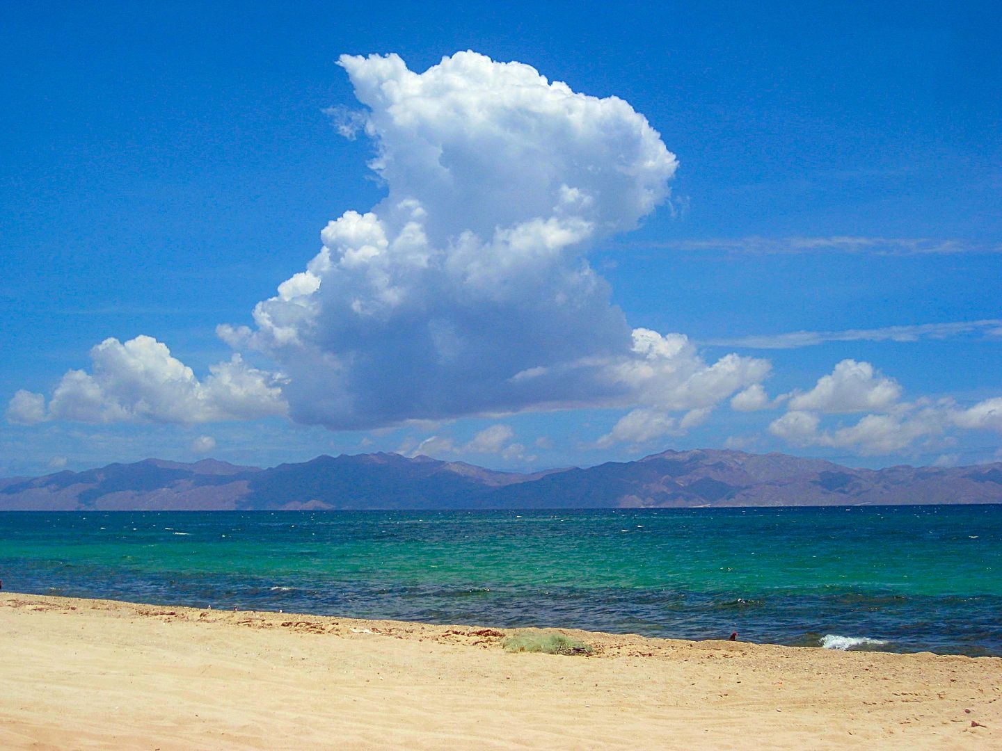
Isla Cerralvo
La Ventana
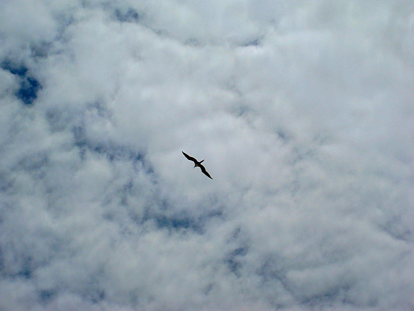
A figate bird
El Sargento
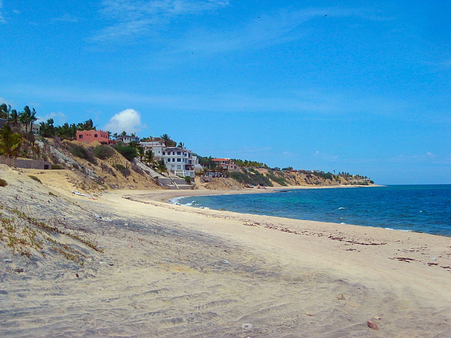
Back south at La Ventana
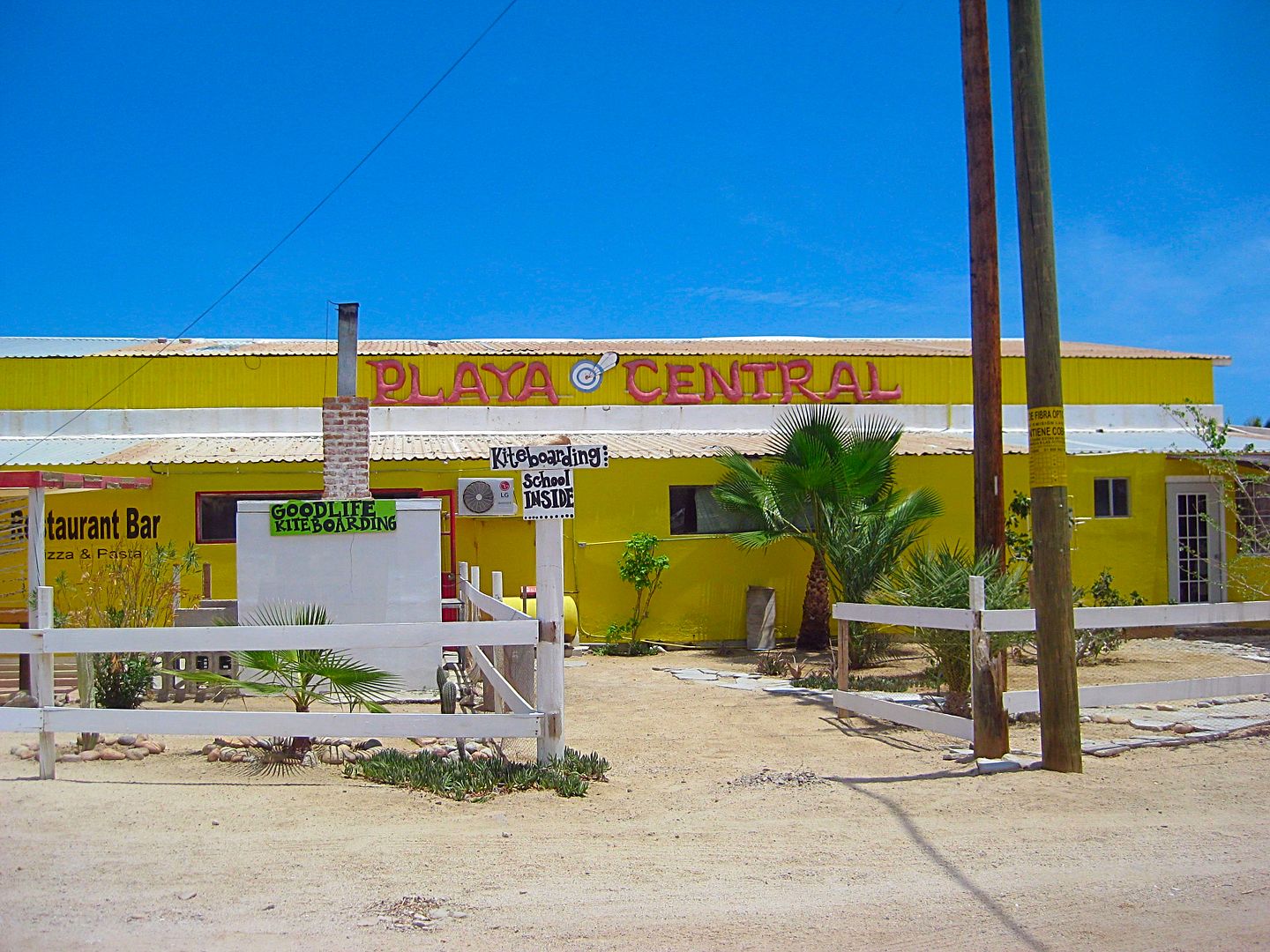
Km. 8, they were closed for the summer.
Km. 6+ (+0.5 mi. in)
La Ventana in the background, El Sargento beyond, up the coast.
NEXT, to Ensenada de los Muertos and Punta Arena... stay tuned!
|
|
|
David K
Honored Nomad
Posts: 64479
Registered: 8-30-2002
Location: San Diego County
Member Is Offline
Mood: Have Baja Fever
|
|
Quote: Originally posted by kevin_in_idaho  | | Love seeing the pictures and info. Have you ever taken your car on the ferry to mainland Mexico? We're thinking of doing Copper Canyon and the
Butterfly migration and might take the ferry over one way or the other. |
A long time ago...
1973 Santa Rosalia to Guaymas
1966 La Paz to Mazatlan
After the highway was finished (Dec. 1973), there was no need for a 'faster'/ paved way back home, as was the case those two times.
That is a great reason to do it. The Copper Canyon train ride was a kick... again, I was on it as a kid in the early 1960s, I think shortly after it
was opened.
|
|
|
David K
Honored Nomad
Posts: 64479
Registered: 8-30-2002
Location: San Diego County
Member Is Offline
Mood: Have Baja Fever
|
|
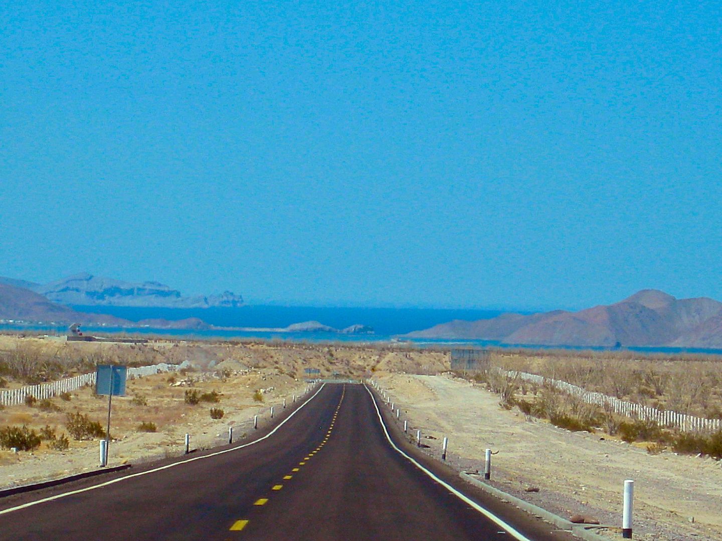
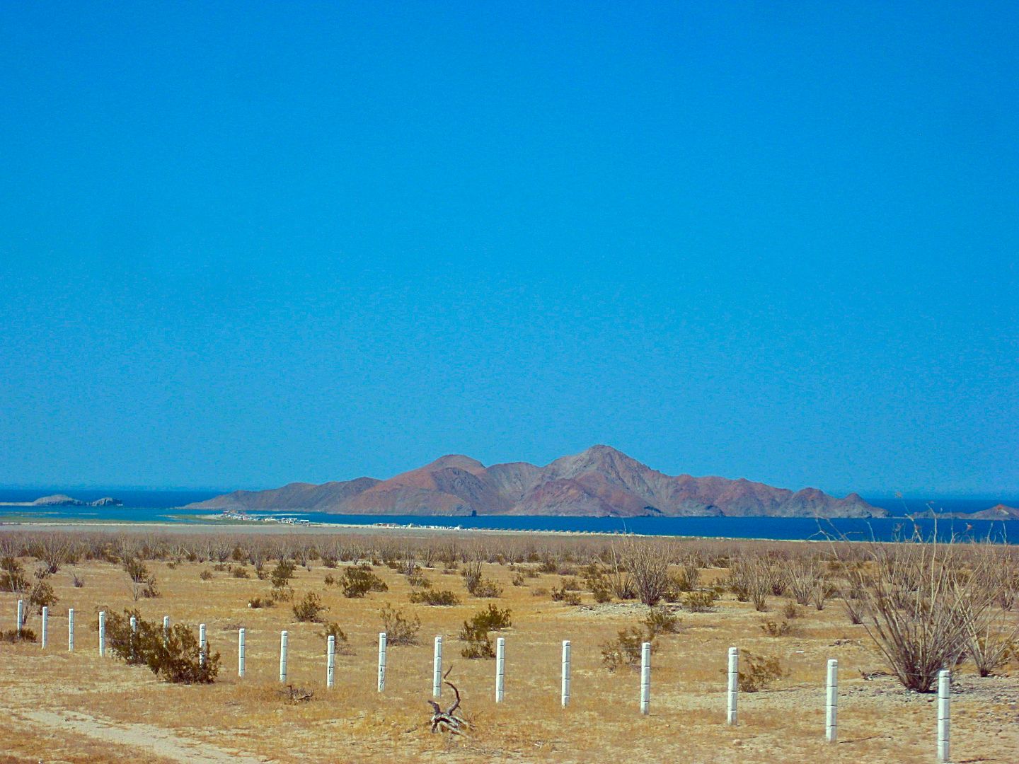
Back on the highway between La Paz and San Juan de los Planes...
Km. 37 El Sargento/ La Ventana highway junction.
Km. 39.5+ Pemex station, San Juan de los Planes
Km. 40.5 Paved road north to San Antonio on Hwy. 1 (20 kms. on sign, I measured it at 13.3 miles, as I returned to La Paz this way).
The road ahead passes through the town of San Juan de los Planes. Km. 0 in town.
Km. 3 Highway eastbound makes a 90° left (north) turn. A dirt road that continues east here is the road down to Los Barriles along the coast, called
Boca del Alamo, ~30 miles.
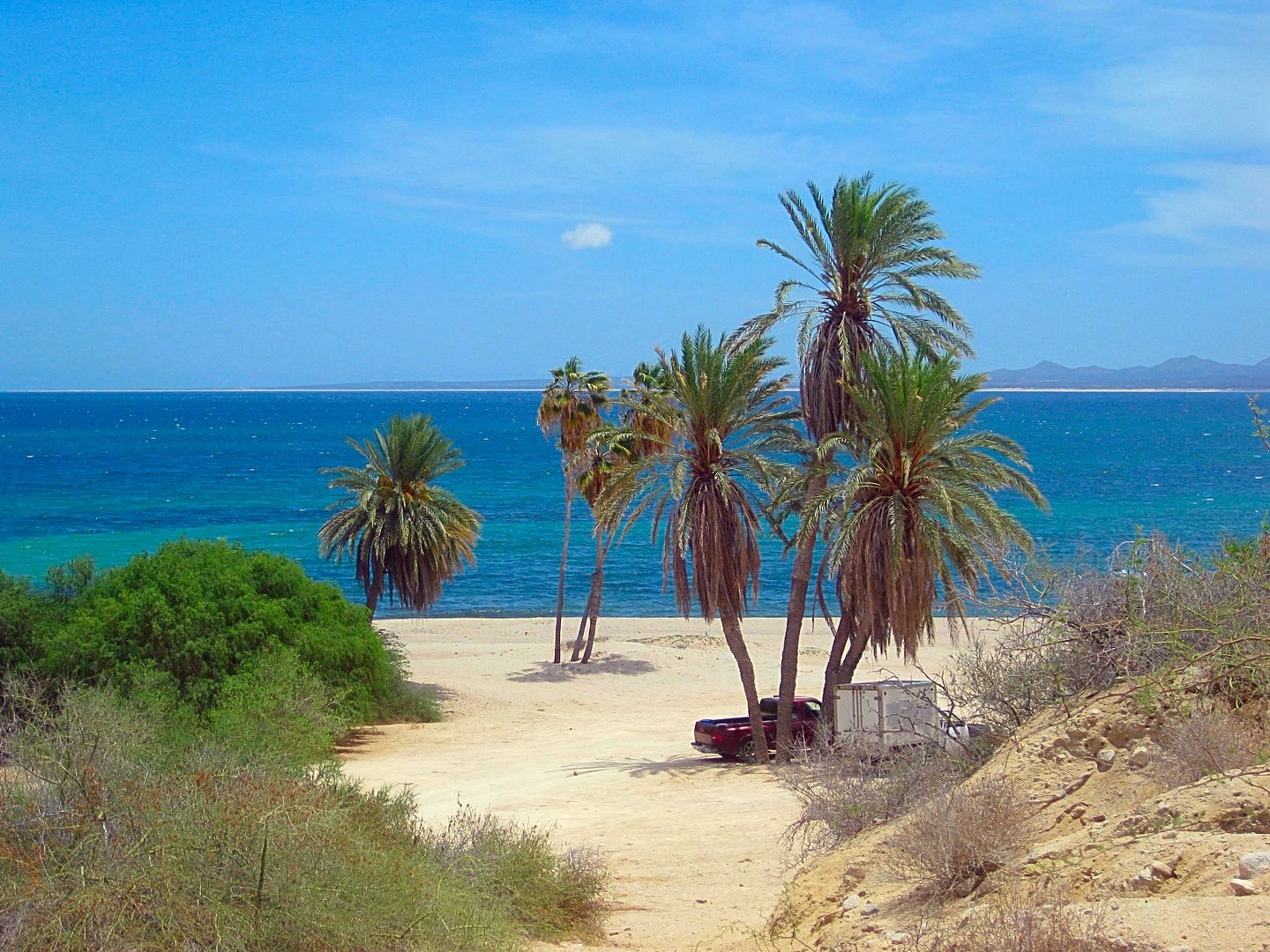
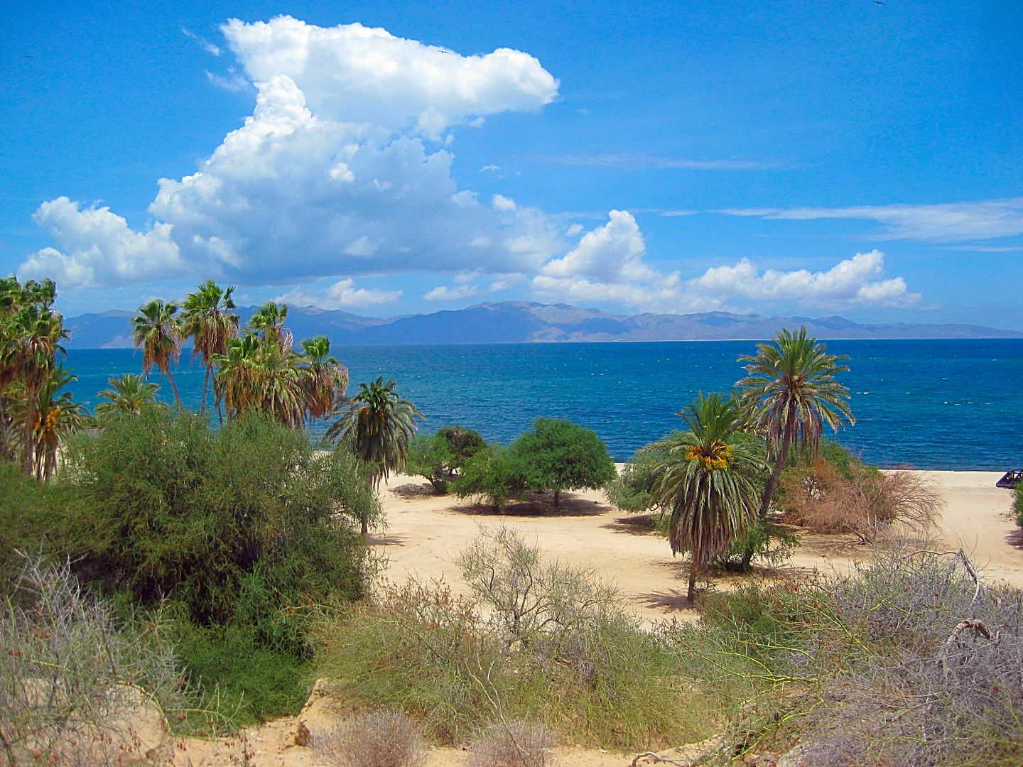
Km. 11.5 Dirt road to left goes to Punta Arena, 3.7 miles. A beautiful sand beach with a lighthouse.
=Km. 13 (0.9 mi from Punta Arena road) End of Pavement.
=Km. 14.5 (1.8 mi from Punta Arena road) Ensenada de los Muertos, boat launch.
Just beyond is a restaurant next to the silver ore docks built in the 1920s by the Boleo company.
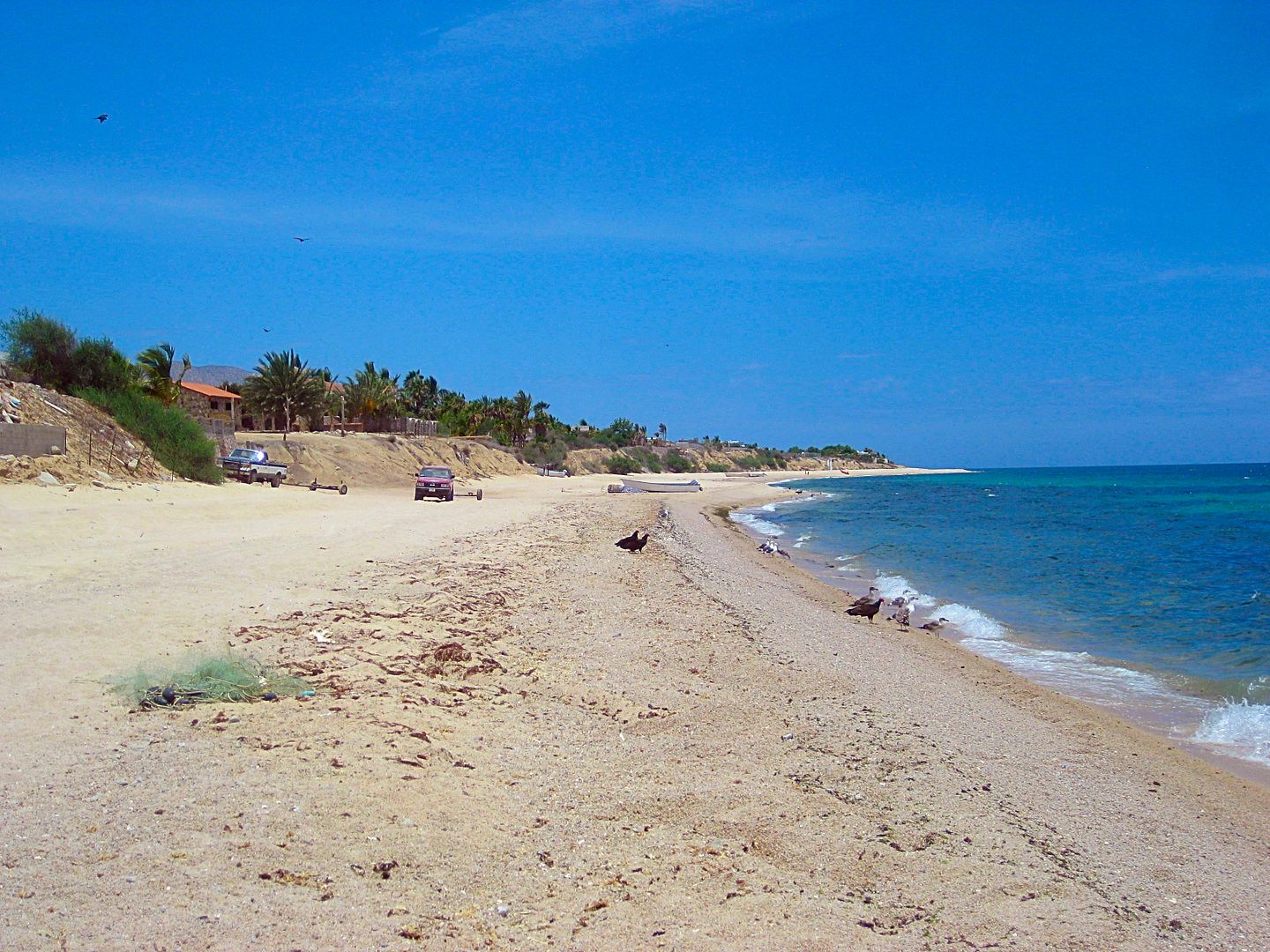
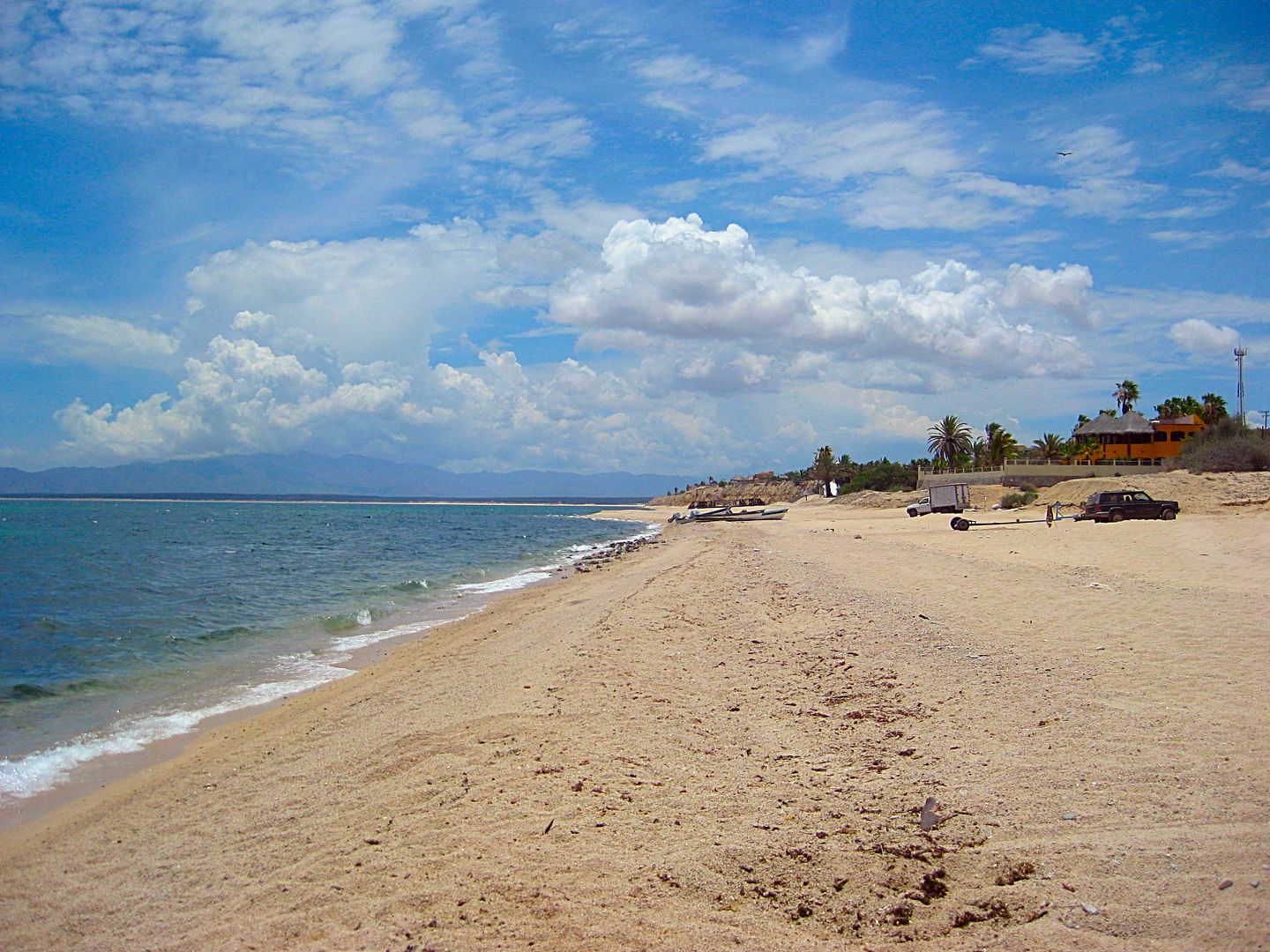
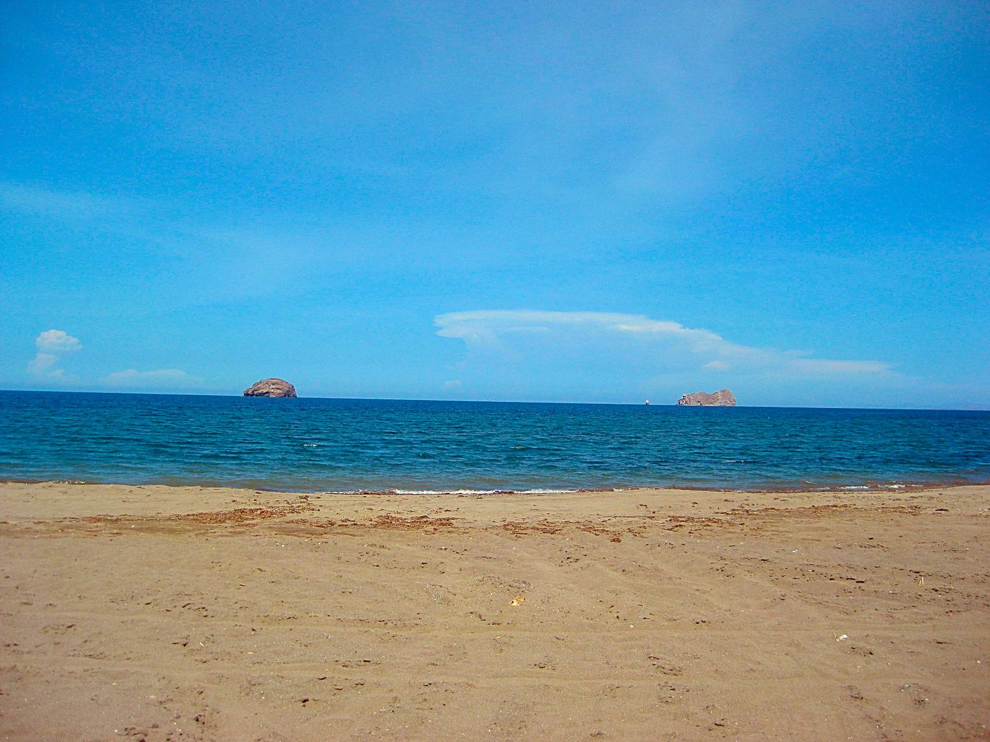
PHOTOS:
Ensenada de los Muertos:


Punta Arena:

Isla Cerralvo


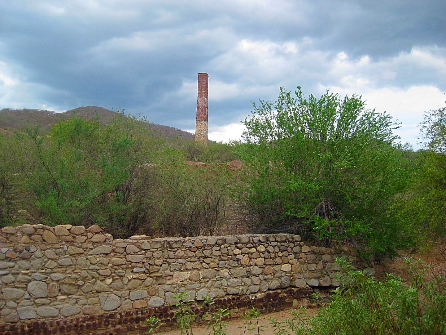
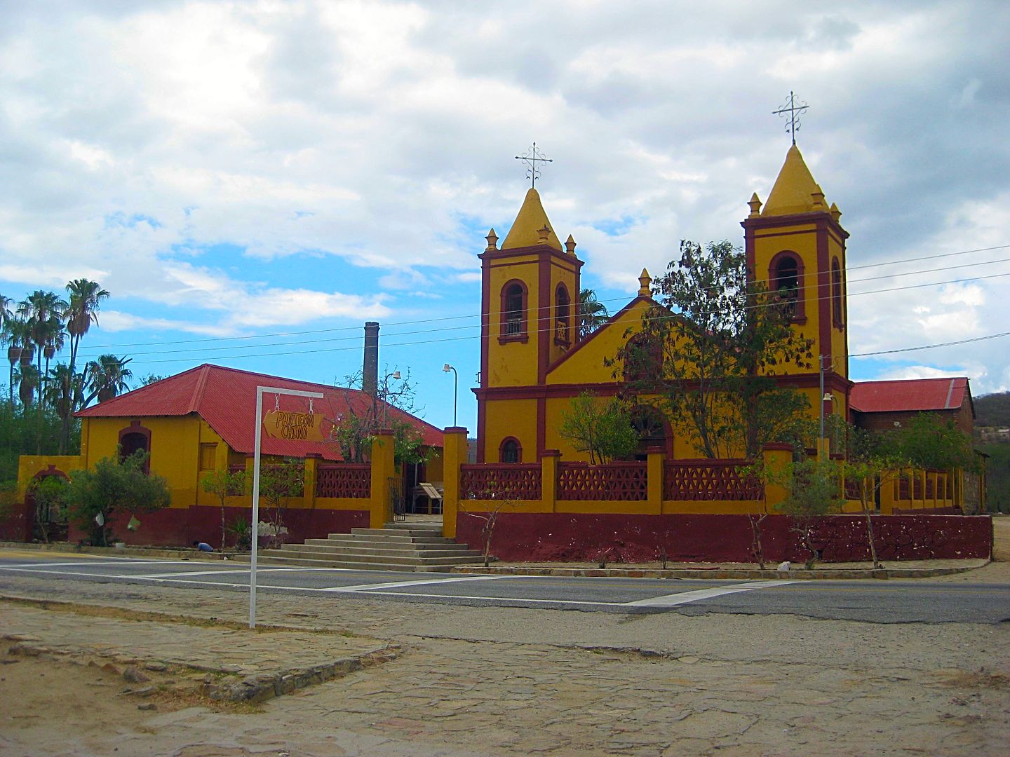
Returning to La Paz, I take the highway north to San Antonio then Highway 1 to La Paz. It is raining a bit as I drive around El Triunfo...
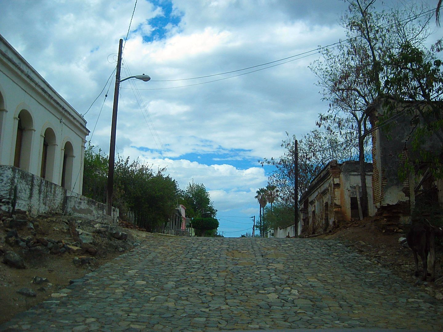
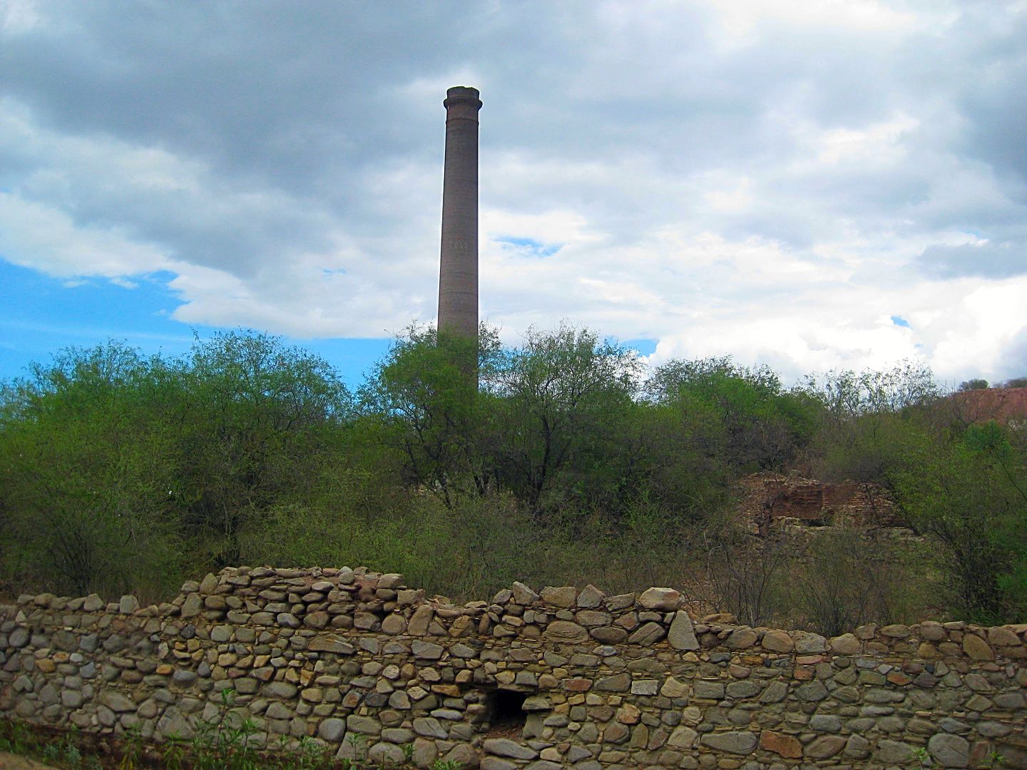
In 2012, we spent more time here with Steve and Zully.
People were selling pitayas (pitahayas) along the street and I bought a bag to take back to Harald's house for us to enjoy. 50 pesos for a couple
dozen, golf ball size or bigger, reds and white flesh pitayas. Perhaps one of the finest fruits on earth... at least to the natives of Baja
California!
The end of Day 8 and my last evening in the La Paz area. Thank you 4x4abc for your hospitality!
Tomorrow, I head north and west to the Pacific Coast at Punta Conejo then drive south on the Baja 1000 road to La Aguja and meet Rob and BajaLinda of
Playas Pacificas.
Stay Tuned for DAY 9!
|
|
|
BornFisher
Super Nomad
Posts: 2103
Registered: 1-11-2005
Location: K-38 Santa Martha/Encinitas
Member Is Offline
|
|
Very nice! I can almost smell the beach and feel the humidity from here!!
"When you catch a fish, you open the door of happiness."
|
|
|
David K
Honored Nomad
Posts: 64479
Registered: 8-30-2002
Location: San Diego County
Member Is Offline
Mood: Have Baja Fever
|
|
DAY 9 (WED. AUG. 9, 2017)
I say my goodbyes to Harald and leave his little compound oasis.
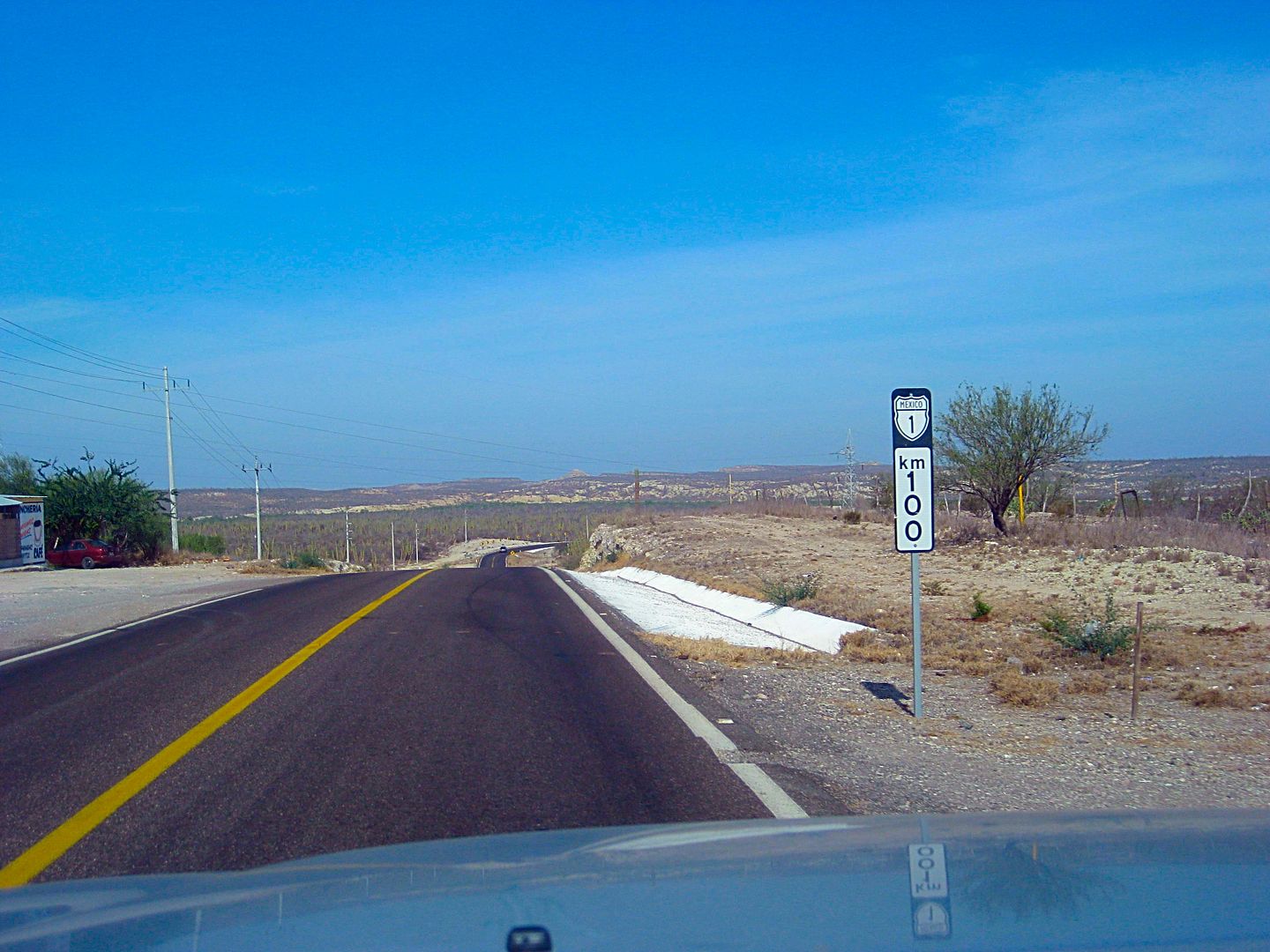
Some road notes driving north from La Paz on Highway 1...
Km. 17 Junction with paved road to San Juan de la Costa and on to San Evaristo (the way I came to La Paz, a few days earlier).
Km. 21 Federal Police Checkpoint (not military). Waved through.
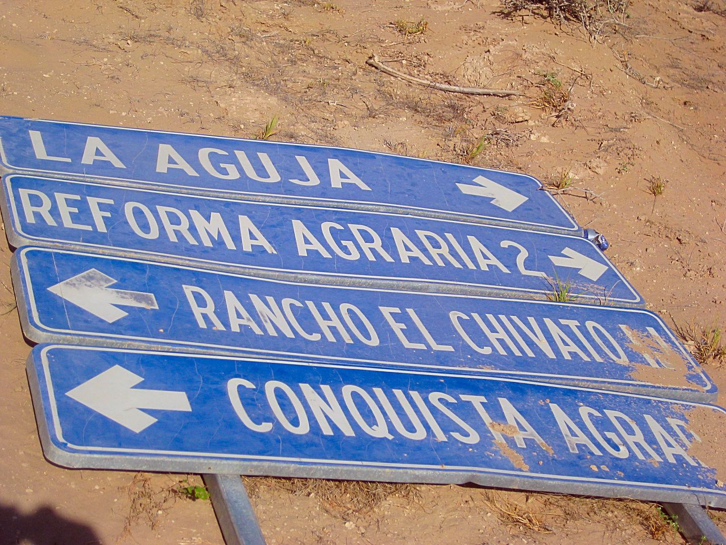
Km. 38+ Paved road west to Conquista Agraria, 28 kms. This is the fastest route to Playas Pacificas (La Aguja). However, I want to explore more, so I
continue north.
Km. 55.5 Dirt road west to La Aguja, 14 miles. I will come out this way in 2 days.
Km. 76.5 San Agustin, large home/building on the left.
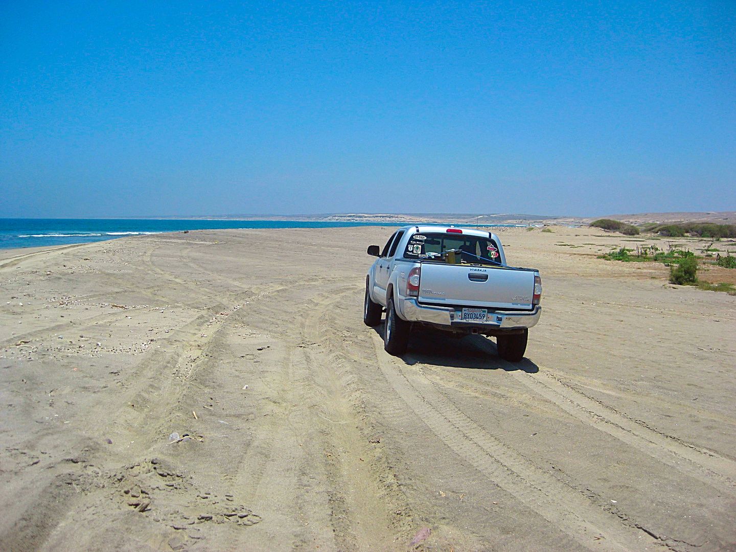
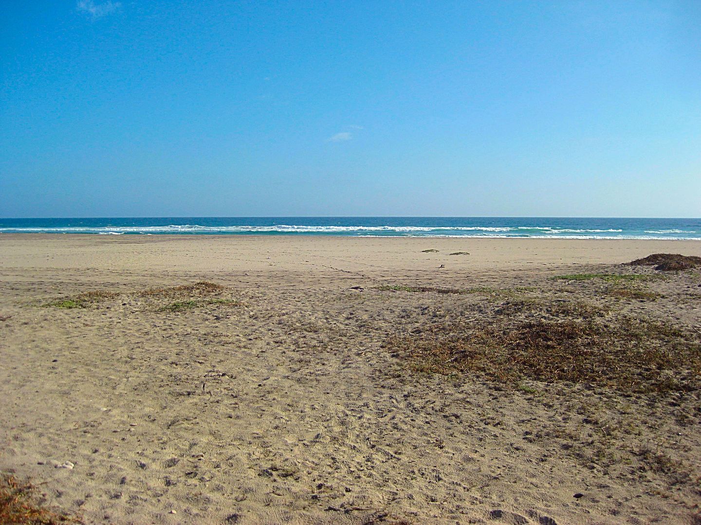
Km. 79.5 Punta Conejo road west. Dirt road, no typical government signs.
0.0 Highway 1
9.1 Fork, left for Punta Conejo and south.
9.4 Fishing camp, Punta Conejo. I was last here in 1985 and not much has changed!
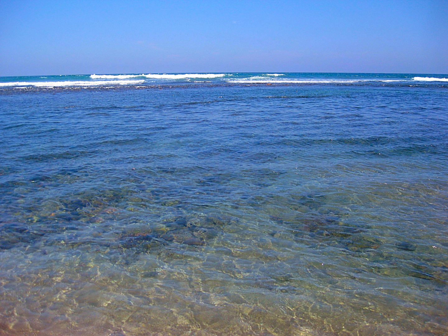
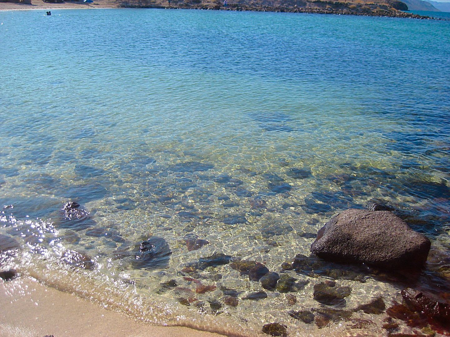
9.7 Punta Conejo Lighthouse, shoreline. The sea water is so clear!
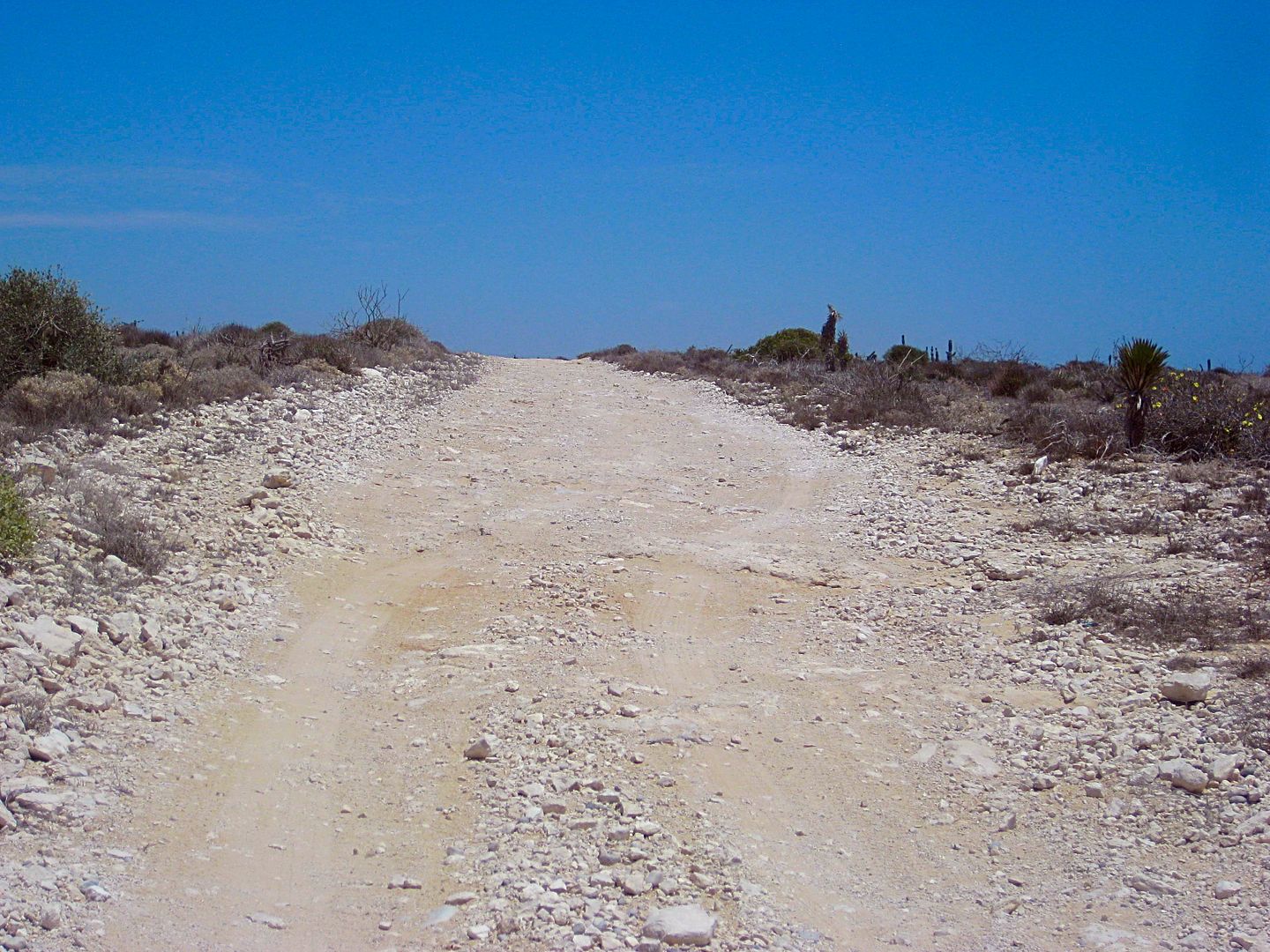
The road south is very rough on jagged rock face much of the distance south.
0.0 Punta Conejo Lighthouse
0.4 Ranch driveway
0.9 Beach access (0.1 to west)
2.3 Road to beach.
6.2 Abandoned ranch
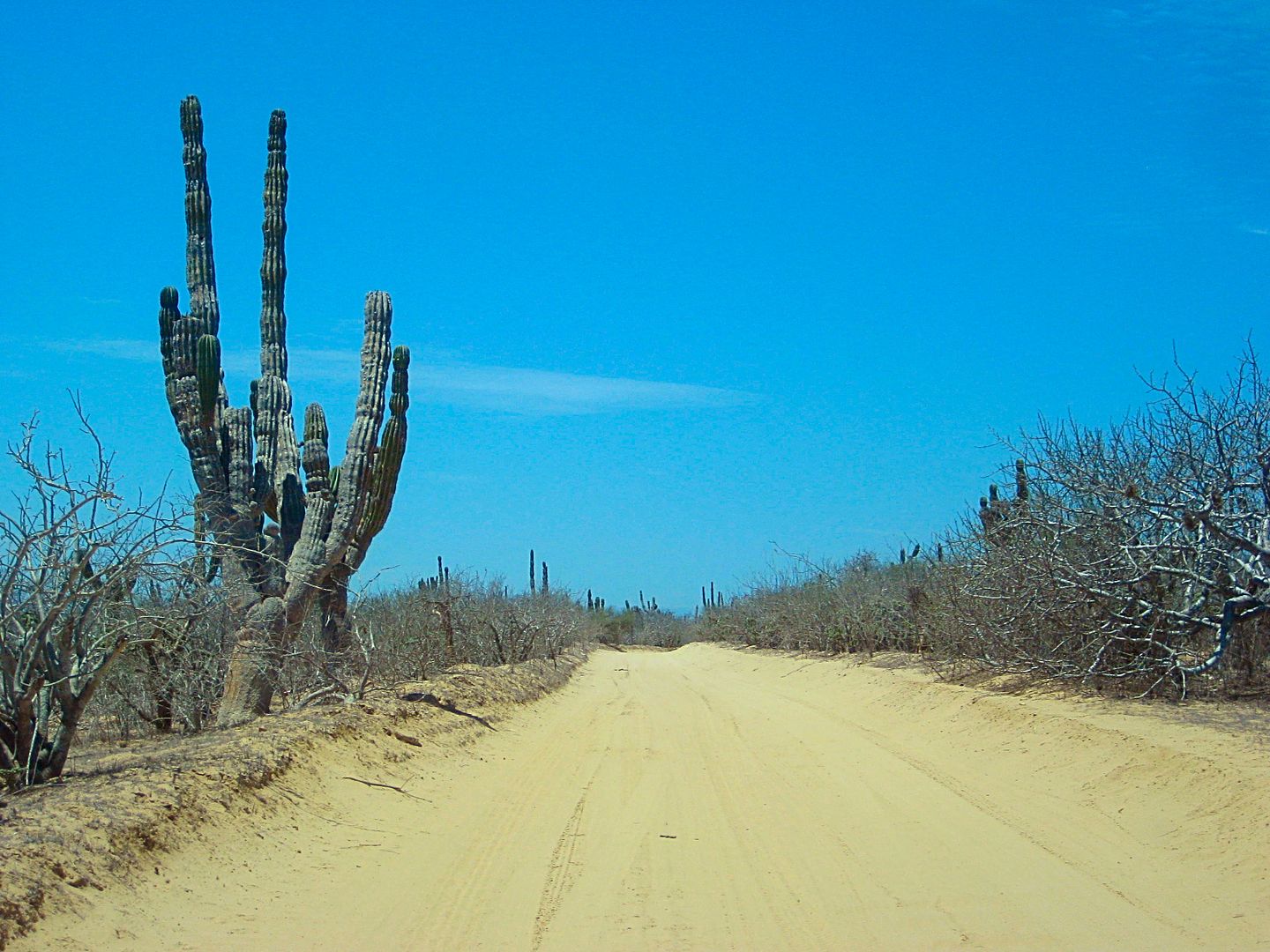
10.0 Playas Pacificas (La Aguja) entrance gate.
The next day, Rob shows me the road south and the farm villages nearby.
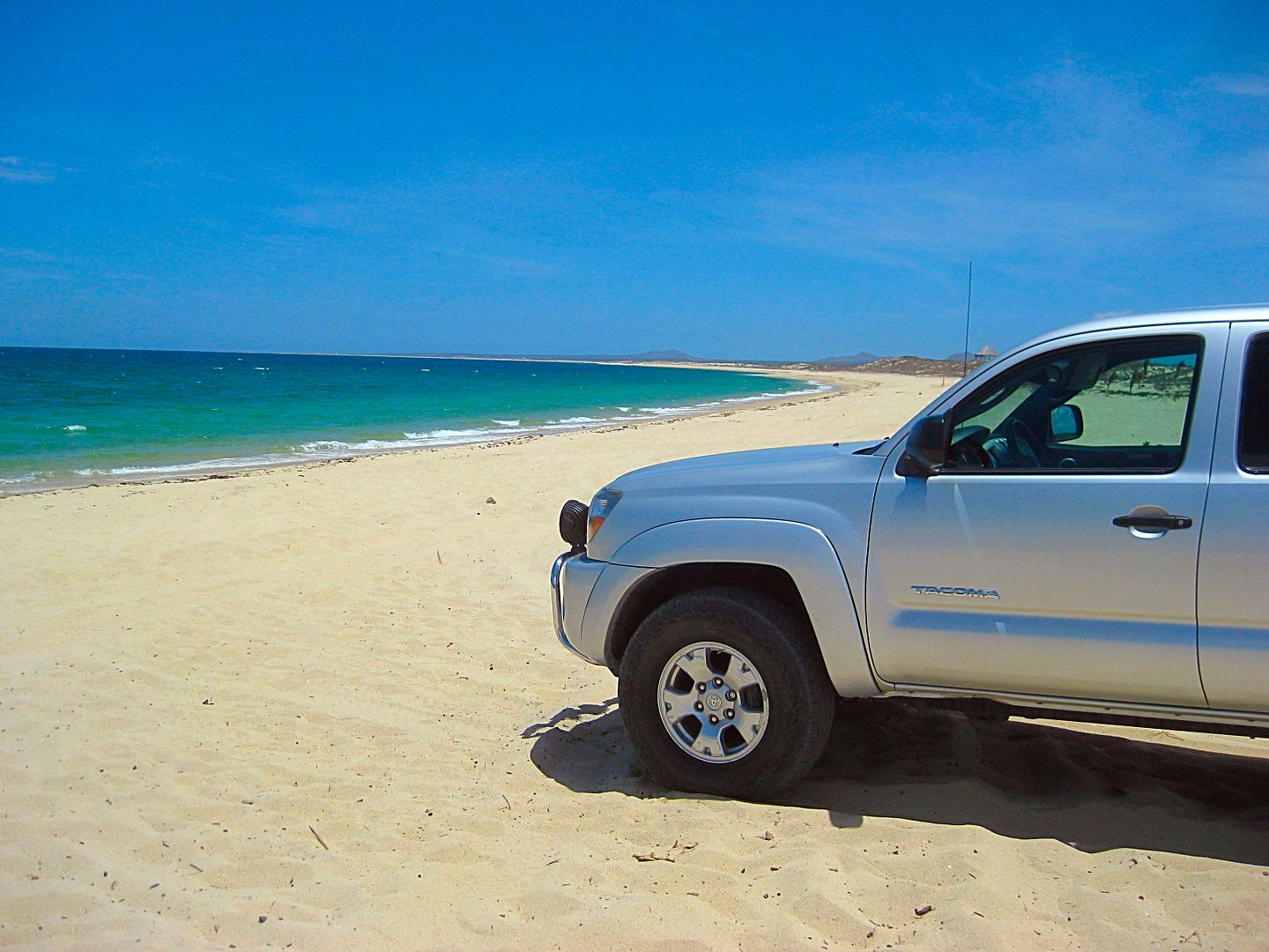
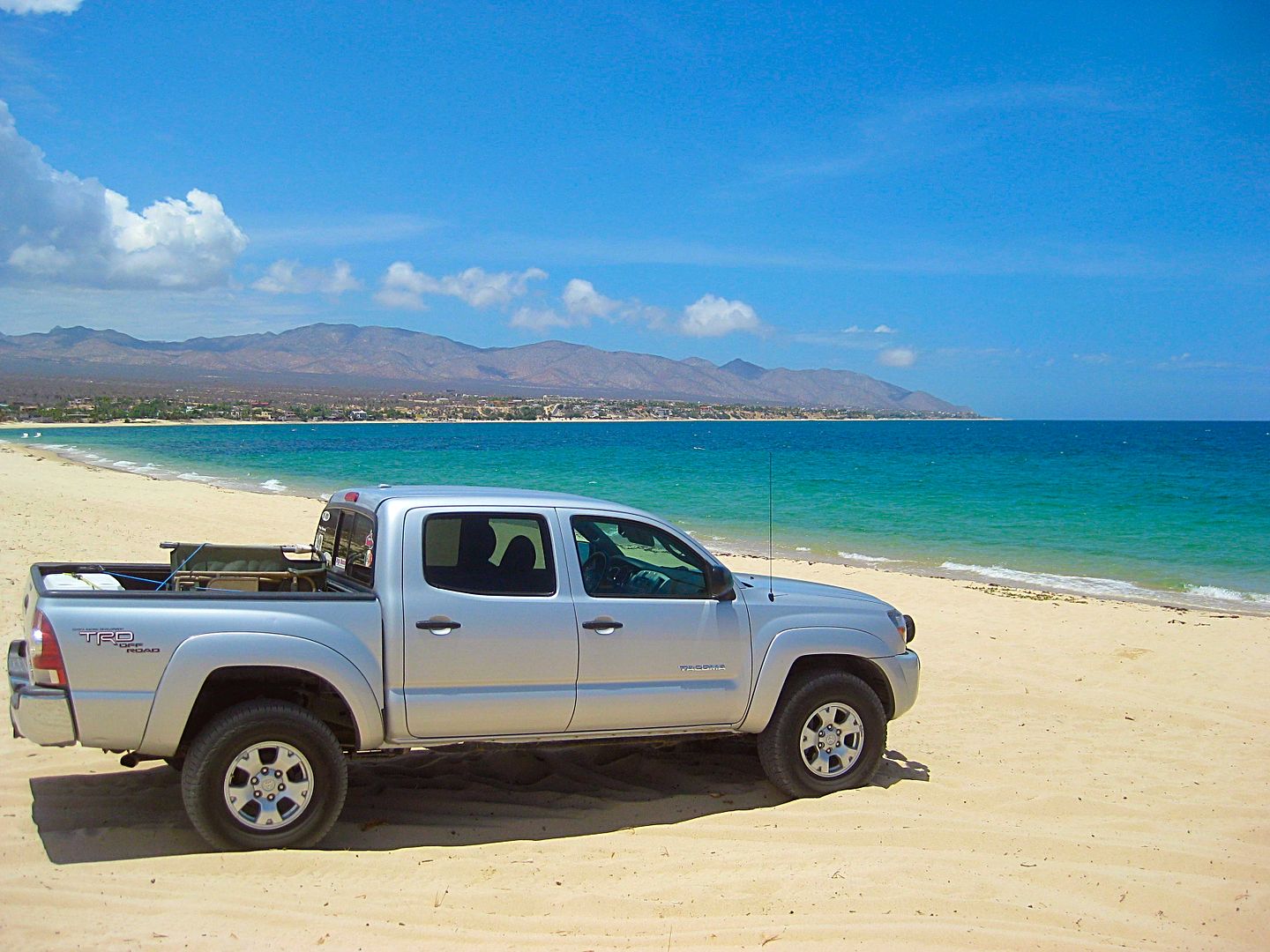
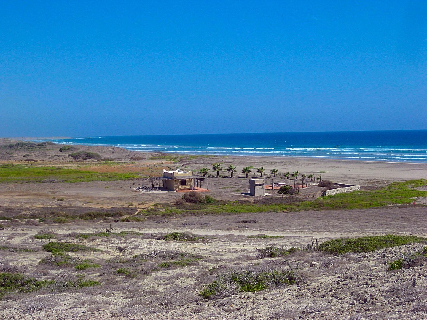
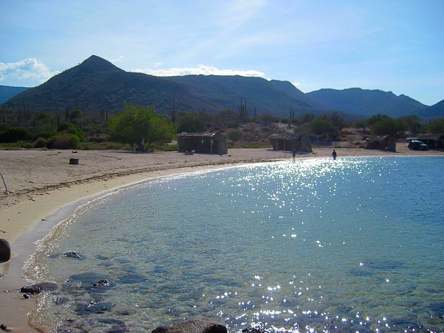
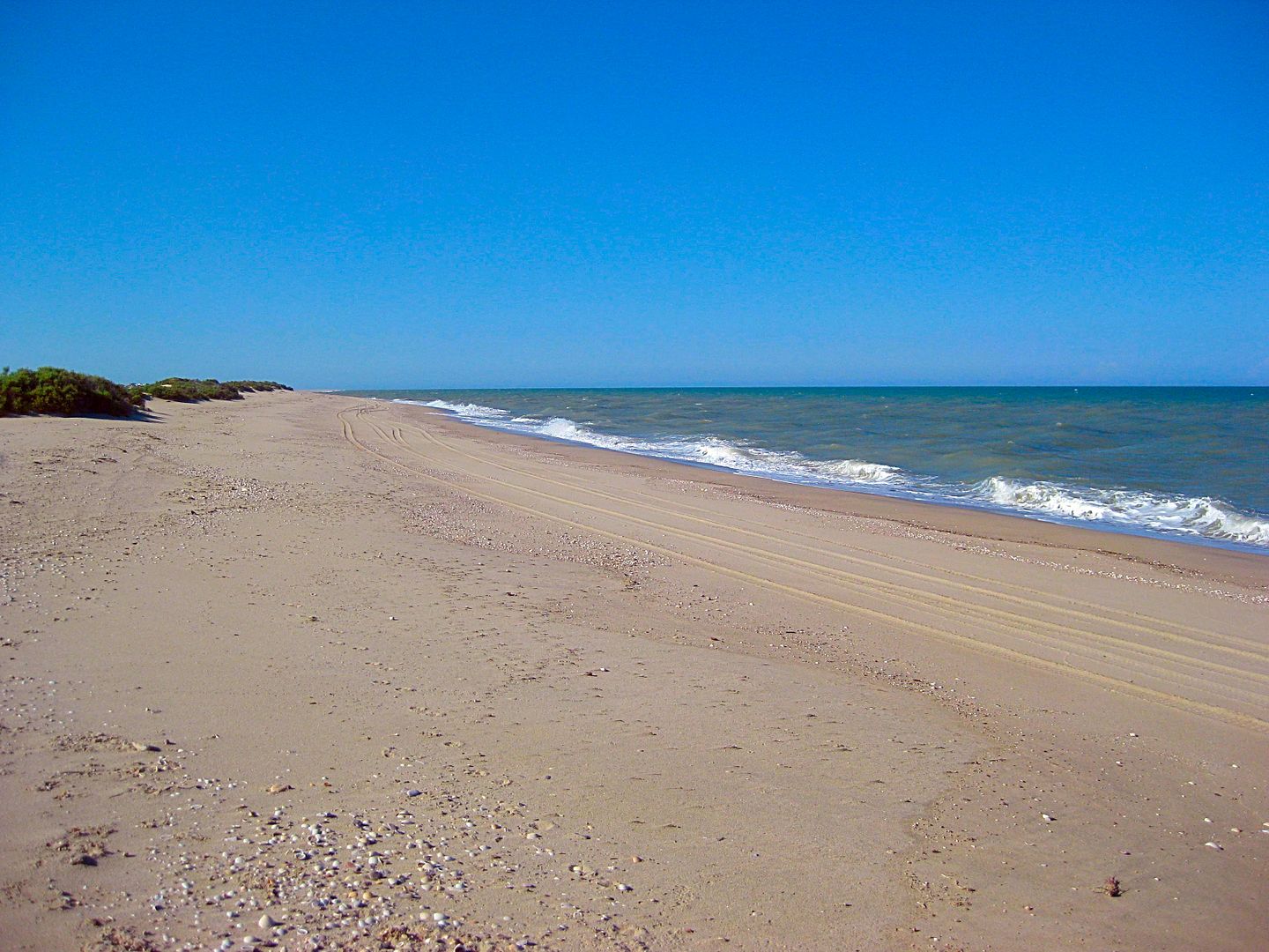
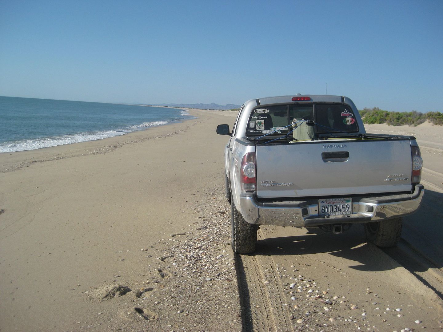
Rob and BajaLinda have a commanding view of the huge beach and coast to the south. I am offered a place to relax and they treat me like royalty. MANY
MANY THANKS! Linda is quite the gourmet cook, as well!
Mike Younghusband received a warm and helpful welcome when he and Don-Kay walked the length of Baja, a few years ago.
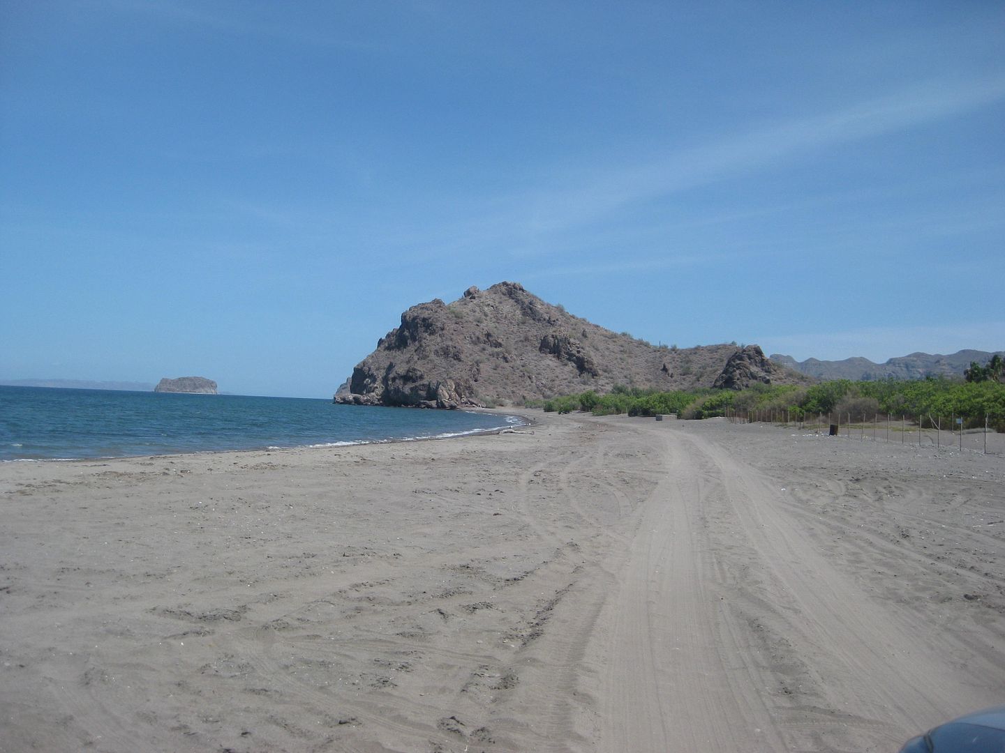
PHOTOS:
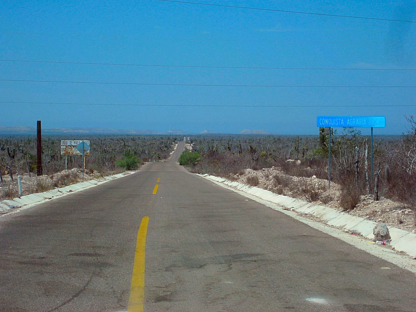
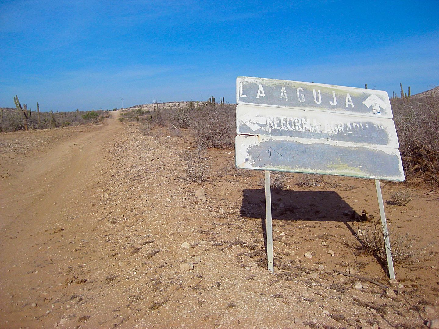
Road at Km. 38+ to Conquista Agraria and on to La Aguja.
Punta Conejo road, just off Hwy. 1 (Km. 79.5)
2017
1985 (I was hoping the new one it was close to where I took this photo)
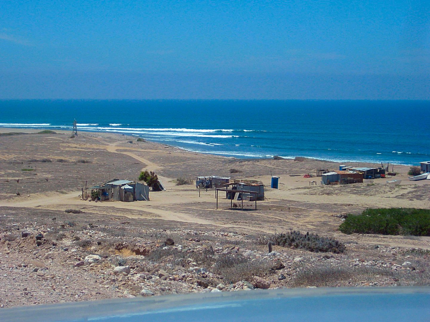
Punta Conejo
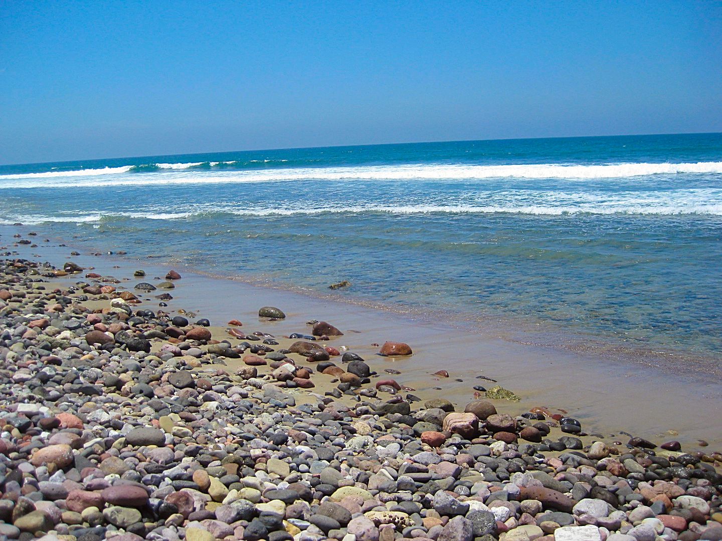
The Pacific sea water was so clear (compared to further north). This was at the lighthouse.
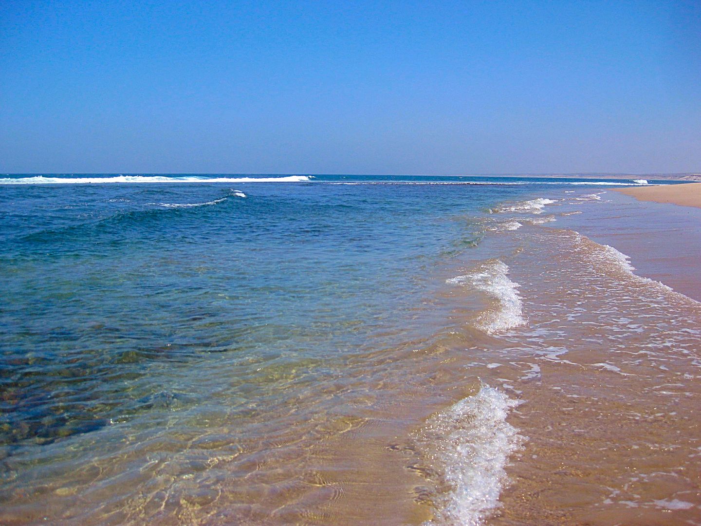
This was on the sand beach where the arroyo met the ocean, just south of the lighthouse. We camped here in 1985.
made a U-turn and went back to the lighthouse to record the road mileage from there to La Aguja.
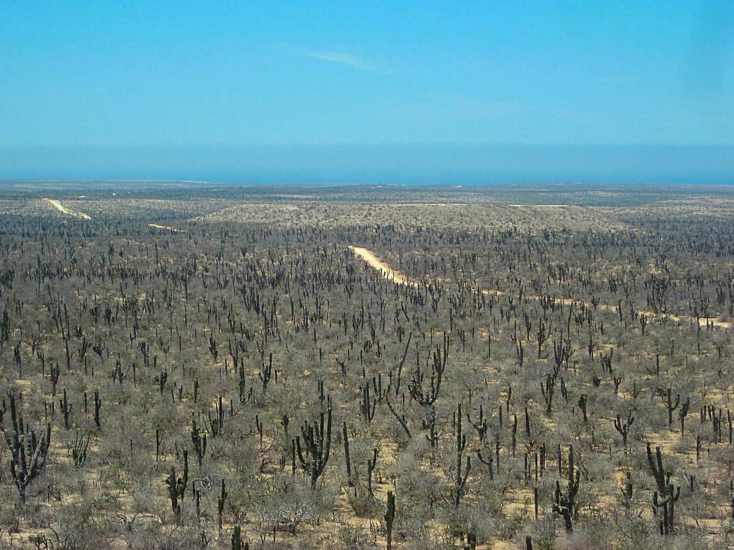
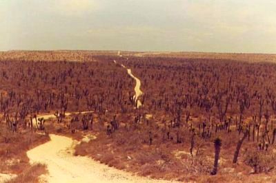
Baja... not Fiji!
You can't get the feel of a road in photos, always. The Baja 1000, since 1979 has used this road when it has run to La Paz. The first 1000s
(1967-1972) used Mex. 1, and was paved from Constitucion south to La Paz.
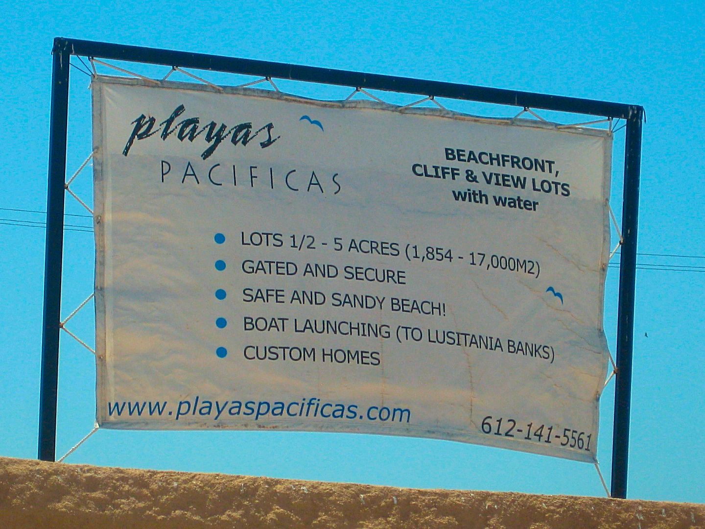
Rob and Linda have done much work to secure this land and have water rights and electrical power from La Paz.
See their web site for more details: www.playaspacificas.com
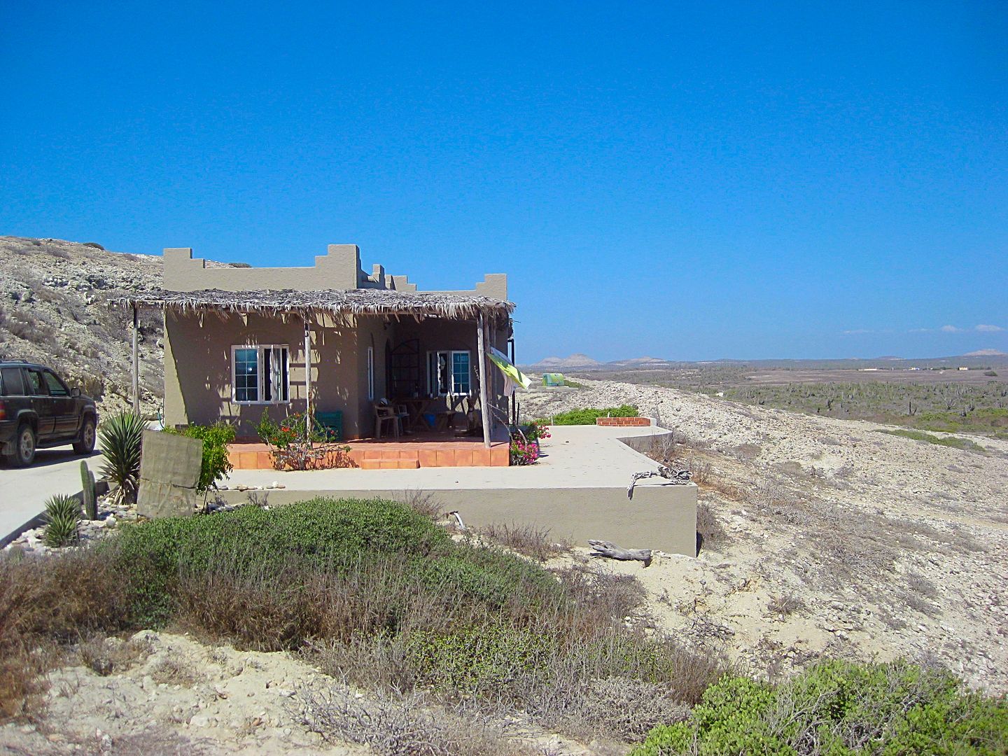
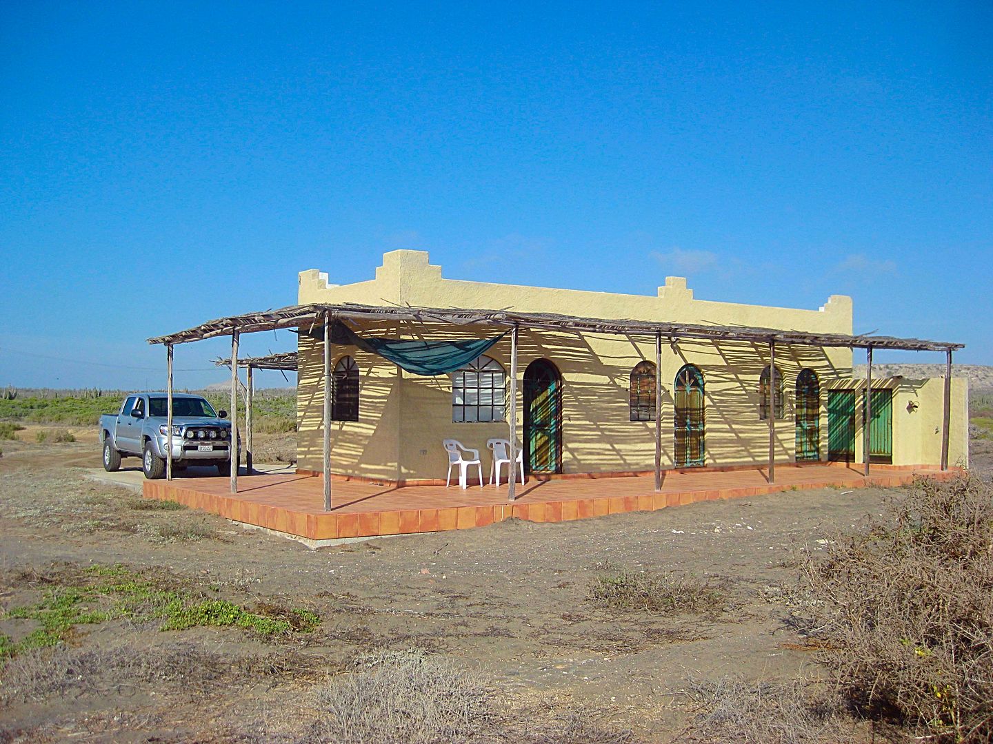
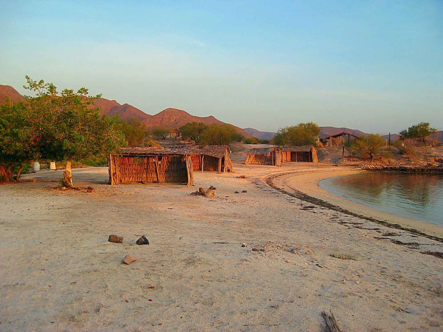
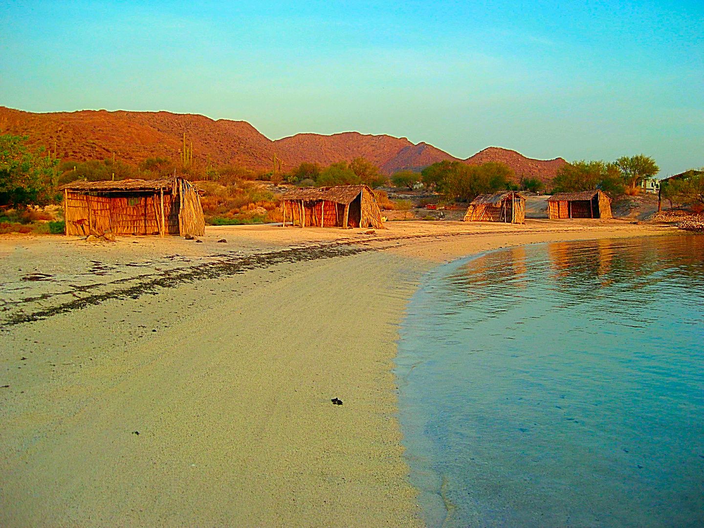
Rob and BajaLinda's home. Satellite Internet is how they talk to us on Nomad.
The guest house, as seen from their house.
My home for the next two nights... thank you... it was great!
The beach as seen from the guest house.
Yes, I went swimming... it was great!
The next day, Rob gives me a tour of the property, and nearby towns.
Stay tuned!
|
|
|
David K
Honored Nomad
Posts: 64479
Registered: 8-30-2002
Location: San Diego County
Member Is Offline
Mood: Have Baja Fever
|
|
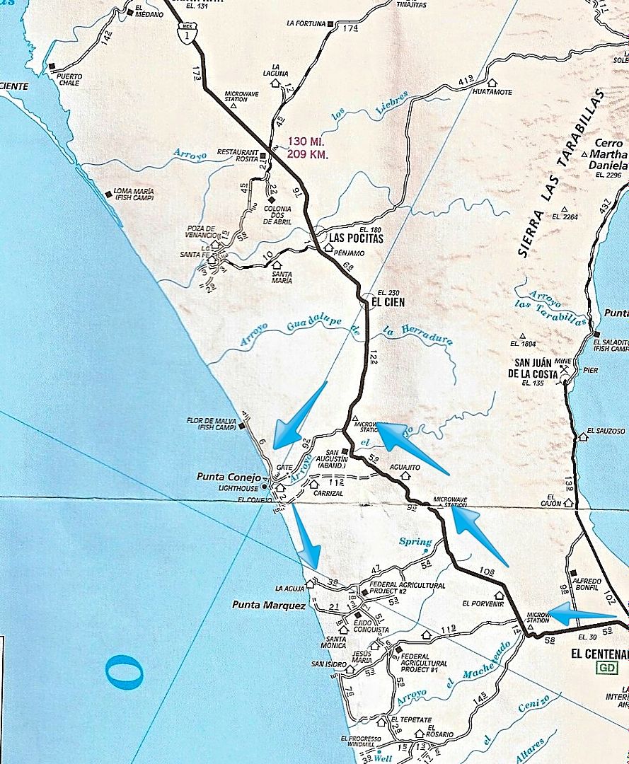
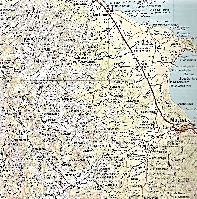
Map for DAY 9:
|
|
|
David K
Honored Nomad
Posts: 64479
Registered: 8-30-2002
Location: San Diego County
Member Is Offline
Mood: Have Baja Fever
|
|
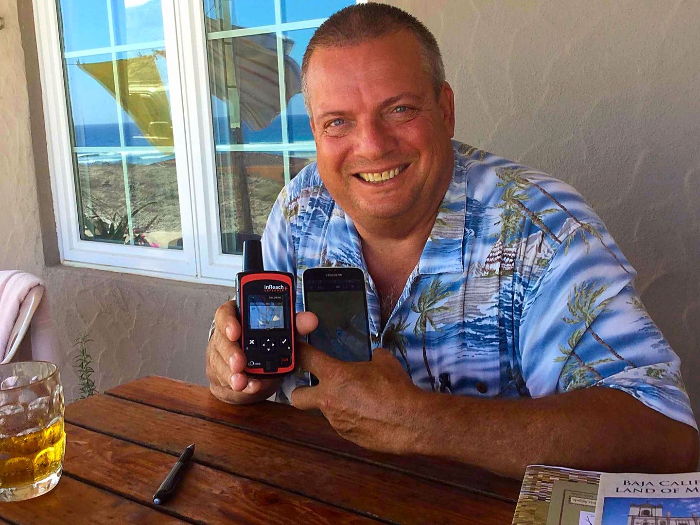
Rob took a photo of me holding the inReach satellite device and my cell phone (with the Garmin Earthmate app), which links to the inReach for texting
or emailing anywhere in the world as well as live, topo maps of my location and moving track.
|
|
|
David K
Honored Nomad
Posts: 64479
Registered: 8-30-2002
Location: San Diego County
Member Is Offline
Mood: Have Baja Fever
|
|
DAY 10 (THU. AUG 10. 2017)
Today, Rob wants to show me the project and nearby area.
After a delicious breakfast, we hop in the Tacoma and first drive up the hill above/ behind their home. Two homes are completed and occupied up there
and one home is below, between the guest house I am in and Rob & Linda's.
Other lots are outlined with painted rocks and there is a concrete road that goes up the hill. Lots have widespread views.
A small boutique style hotel (single level) is planned for the point in front. It would serve as a place for prospective homeowners to stay awhile and
maybe for their visiting guests, too?
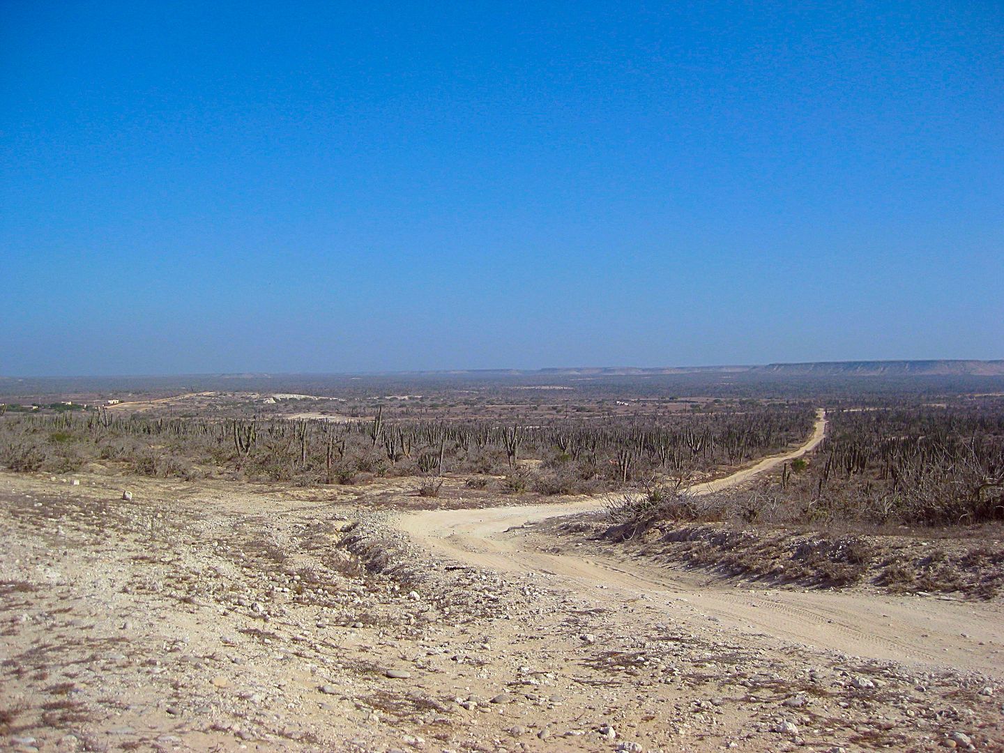
The land is secure, the water is secure, and the power is secure and a paved road is not far away at Conquista going to La Paz.
PHOTOS:
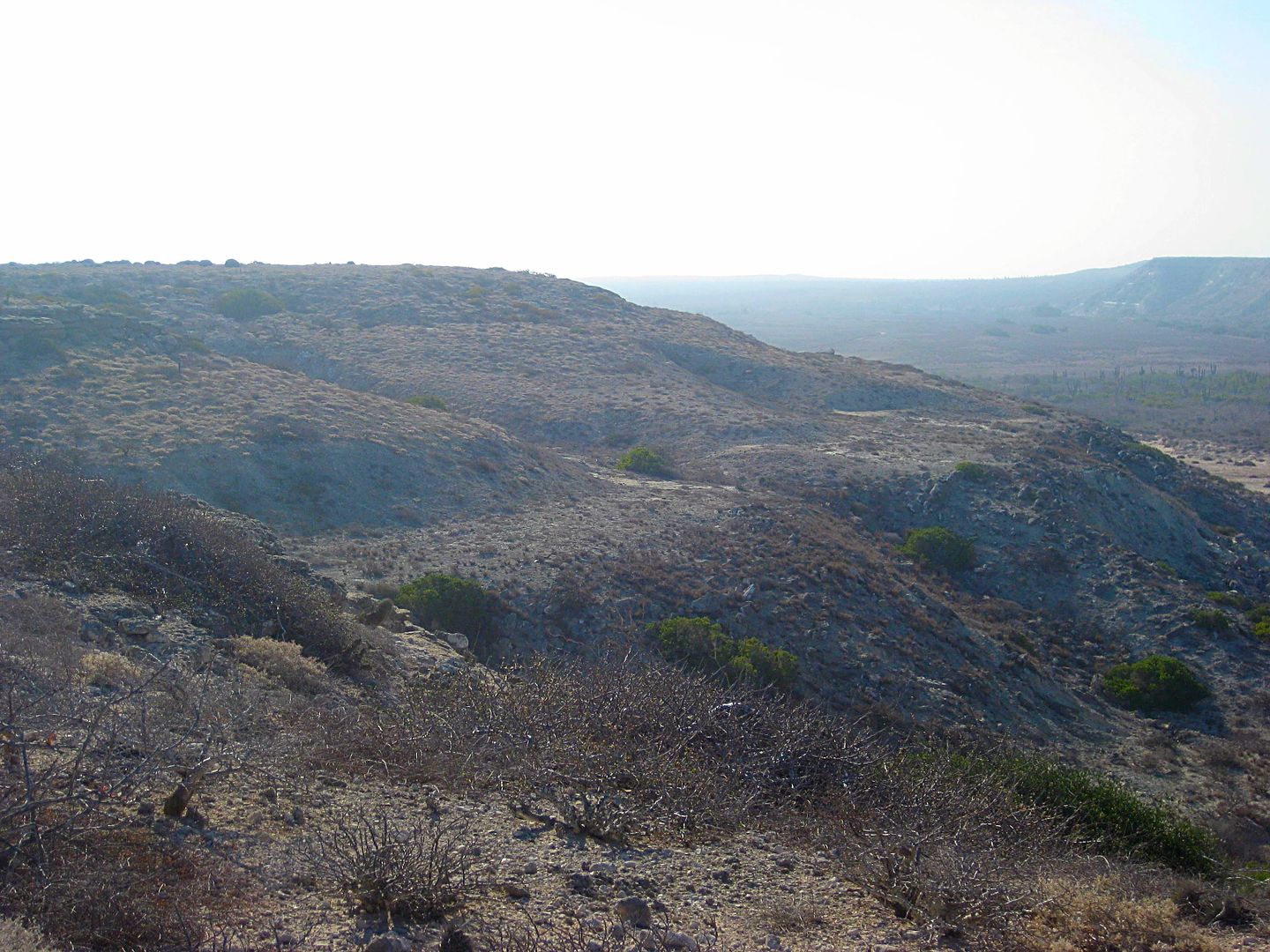
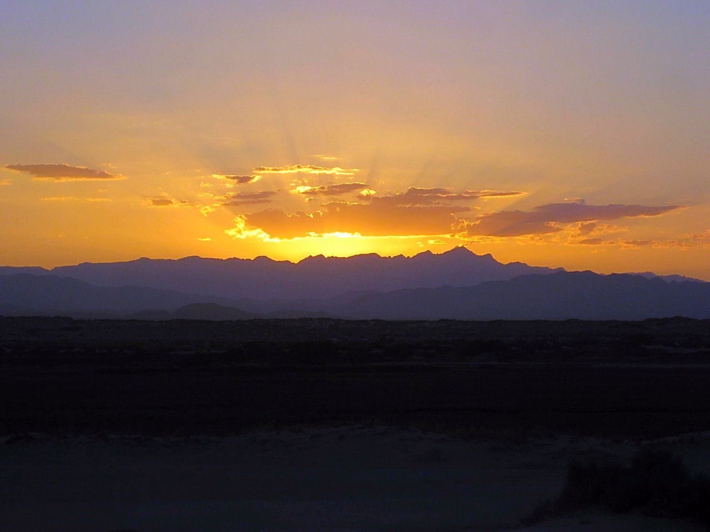
Ancient beach, because the sea levels used to be higher, naturally!
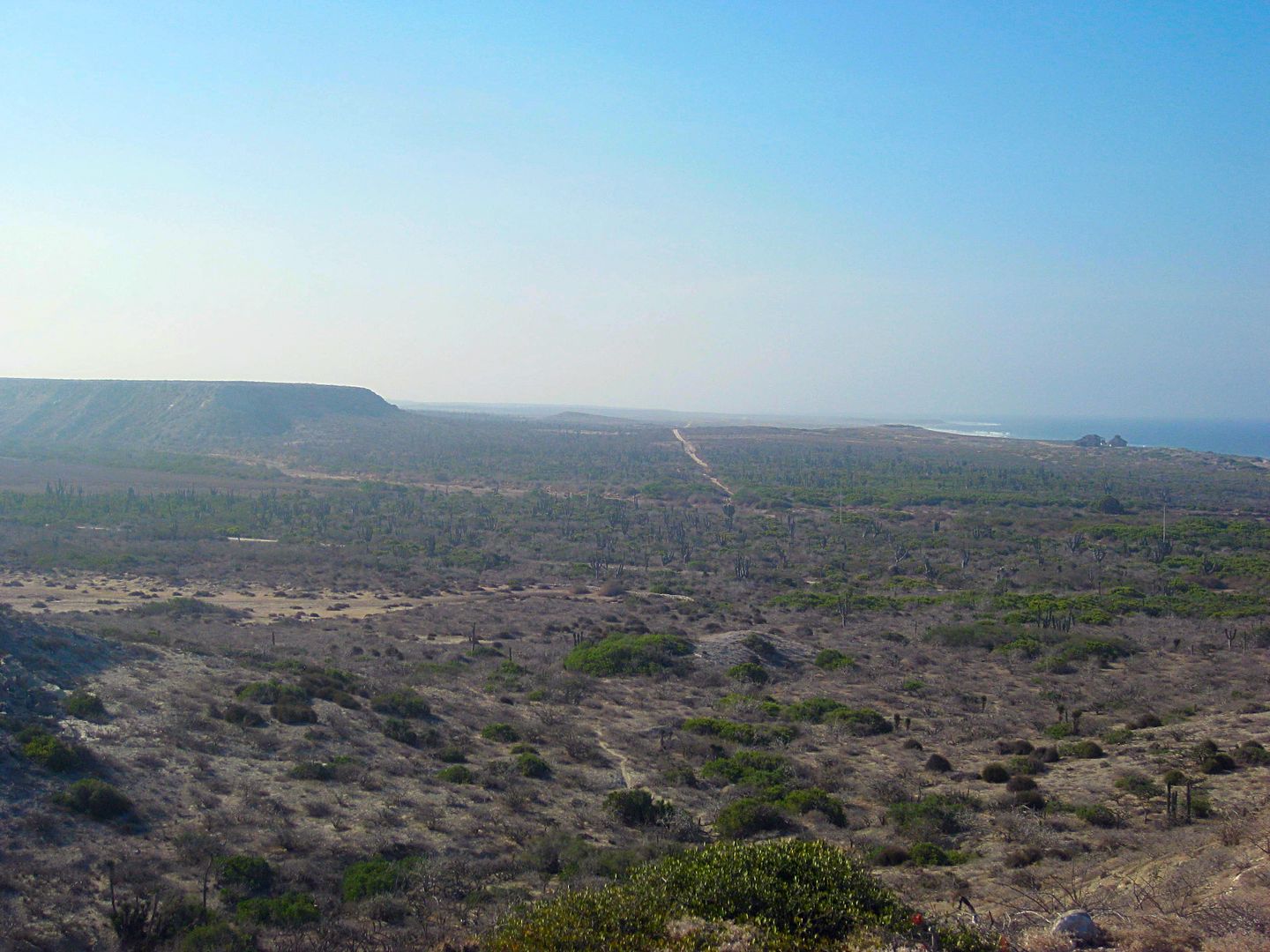
Looking south to Punta Marquez.
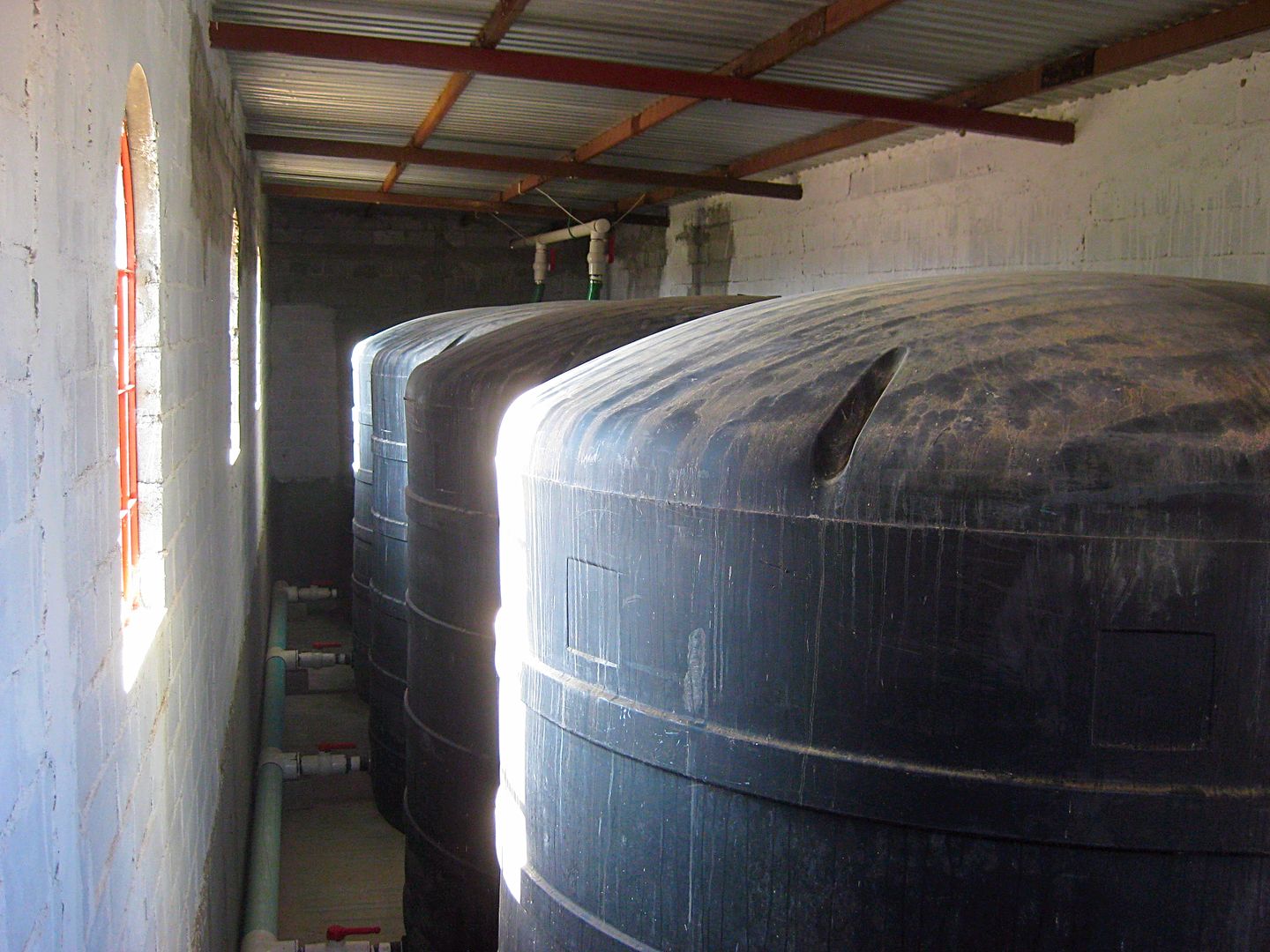
Rob's water works ensure plenty of back-ups from their well.
Heading south to Punta Marquez
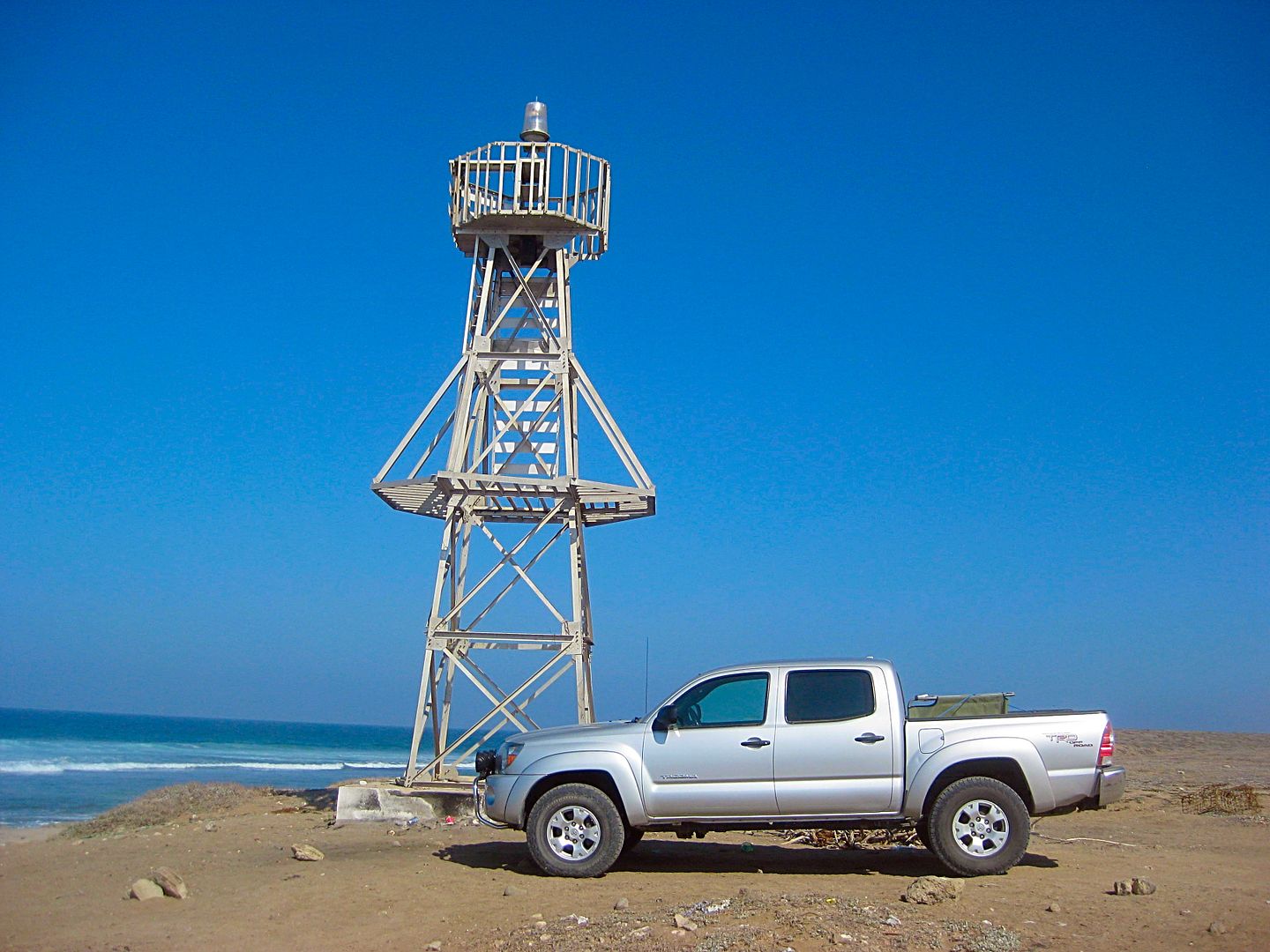
Punta Marquez Lighthouse
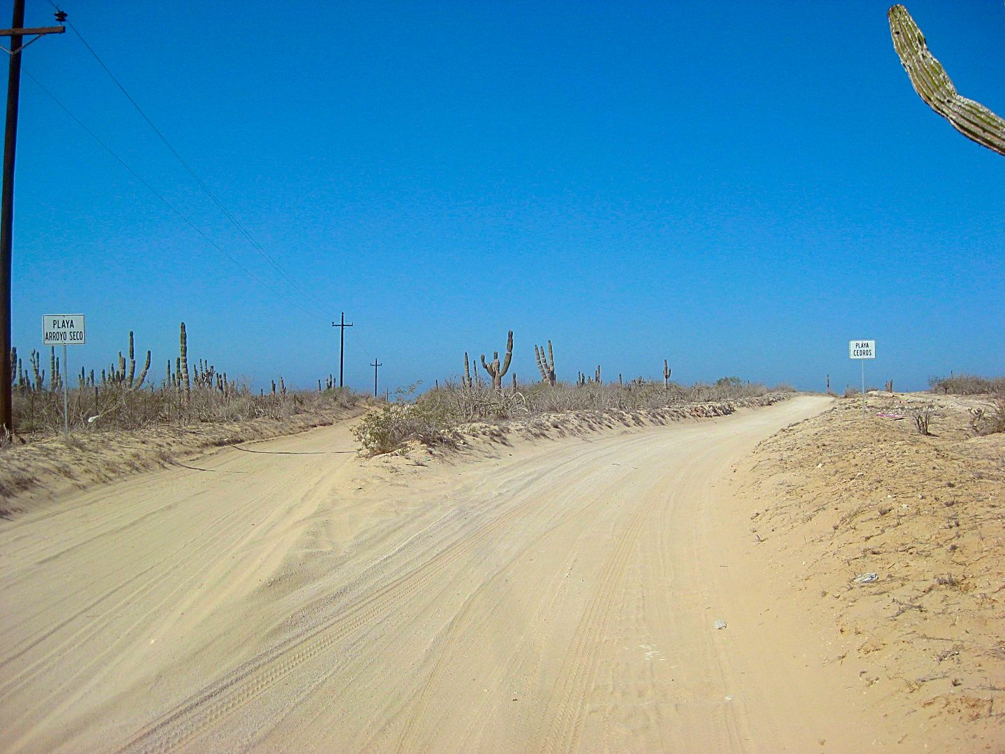
Looking back at this road split for westbound traffic heading to the coast (Playa Arroyo Seco & Punta Marquez).
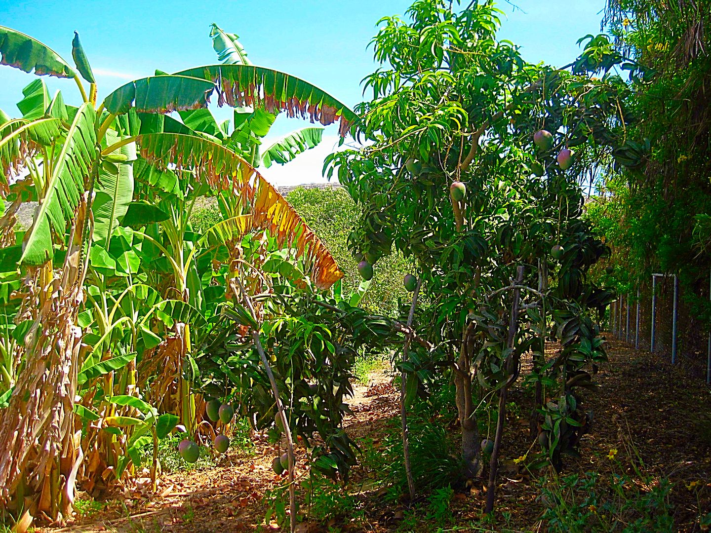
Back at the entrance to Rancho La Aguja/ Playas Pacificas are bananas, mangos, guavas, and other exotic fruit trees that grow easily with the well
water added.
End of the tour... thank you, Rob!
Now, I have amazing quiet time to work on my trip notes, tomorrow's plans, and take a walk and swim on the incredible beach out front!
The place begs you not to leave...
But, I have work to do... this is a job for me, after all! The Baja Bound Road Guide and Map still have some interesting roads to include!
|
|
|
David K
Honored Nomad
Posts: 64479
Registered: 8-30-2002
Location: San Diego County
Member Is Offline
Mood: Have Baja Fever
|
|
DAY 11a (THU. AUG. 11, 2017)
BajaLinda makes sure I don't leave hungry and makes a delicious breakfast (again)... these Baja trips are brutal! Thank you, Linda!
Their guest room has a few books, and now one more in case the history of the Spanish occupation of Baja California is of interest to guests?
Their gate out on the north/south road is 1.3 miles from the homes. The short road to Hwy. 1 for northbound traffic turns south from their gate but
soon bends eastward.
MILEAGE from Gate for Playas Pacificas:
0.2 & 0.4 Two roads turn south that continue down to Punta Marquez
3.6 Road comes in from the northwest.
4.0 Road south to Reforma Dos and Ejido Conquista (2.3 miles to paved road from La Paz)
4.2 Another road from Conquista
5.5 Fork, a road heads north. Continue ahead, eastward.
9.0 Junction with power line road coming from Conquista. Sign on the ground.
14.0 Highway 1, ~Km. 55.5 from La Paz.
There is widening on Hwy. 1, some kilometer markers have not been replaced.
Km. 110.5 Road west to Santa Fe.
Km. 112+ Los Pocitas, a road (a divided boulevard leaving Highway 1) to the north (northeast) goes approx. 42 miles to La Soledad and beyond to San
Evaristo, etc. A gift shop here is of interest selling local crafts and antiques.
Km. 127.5 Unsigned junction with the road north to Mission San Luis Gonzaga (approx. 30 mi) or La Presa/ La Pasión region (approx. 40 mi).
Km. 157 Santa Rita. Paved road west to Puerto Chale.
Km. 173 Road west to Puerto Cancún.
Km. 195 Road east to Mission San Luis Gonzaga, 22.3 mi / 1 hour.
Km. 206 Motel and RV Park, west side of highway.
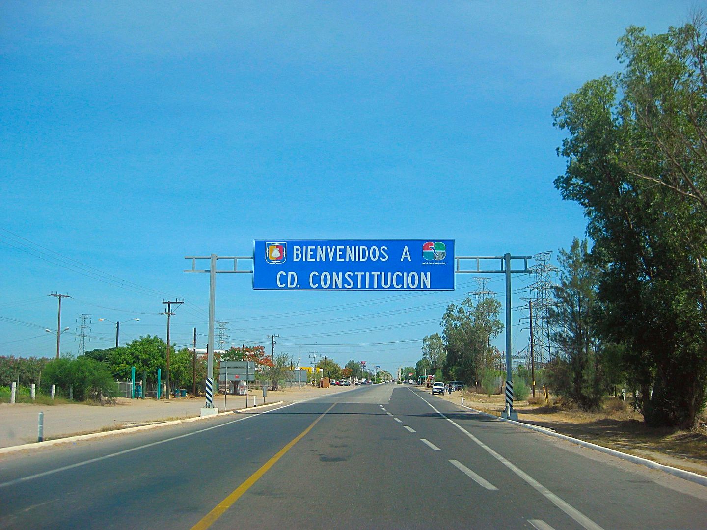
Km. 208 Enter Ciudad Constitución.
Km. 210.5 Pemex (one of many)
Km. 211.5 Hwy. 22 to Puerto San Carlos Junction.
Ok, a break from the road log...
So I pull into the Pemex, over on the left of the street. Get my tank filled (all women attendants, not bad, just rare). 15.73 pesos/liter, 50.9
liters in for the 205 miles traveled, 801 pesos. They try to sell me gas additive a couple times. I tell them that Pemex is good gas and the Toyota
doesn't need the additives.
I go to start the Tacoma to leave.. and the battery is dead.
2,000 miles of crazy places I have stopped and started and the truck is smart enough to not start in a city, at a gas station, and a block from an
Auto Zone store! The ladies had some kind of gizmo to jump the battery, but it doesn't work. I ask if one of them can come over and let me jump the
batteries, she consents (gets a tip)... and a zip down the street to the bright Auto Zone store, on the right side of the street (northbound).
I leave my truck running and go inside... and am very impressed! I would say it looked exactly like any big Auto Zone in the U.S.
I ask one guy if they check batteries and they do. The device even printed out a reading with the word REPLACE (in Spanish)! The new battery included
the install and what was nice, he plugged in something to my truck brain so none of my radio settings would be lost from removing the battery. My
Barreries + store didn't even do that (5 years ago).
Fortunately, I could use my debit card for the battery as I was running out of pesos... and had to use my stash of dollars for the last couple fuel
ups going home. They had the Good and the Better battery naturally. (4 year or 5 year). The cost was approx. $98 or $78, so I went with the $78 one.
It was smaller than what was in there, but it is still working for me, 2 weeks and 2,000 miles later!
What a relief... but this was a stress factor indeed. Now I needed to worry if this battery will start my truck in remote places. The extra time today
for this cut into my schedule and not wishing to be at the bottom of the Agua Verde grade and not be able to drive back up the same day, I opted to
only drive to the view point and leave my truck running!
Constitucion to Insurgentes is a four lane wide highway and Highway 1 swings to the east at Insurgentes (Km. 0 here, too).
Km. 1 Pemex station
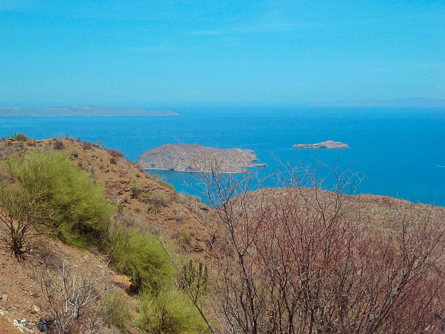
Km. 63.5 Paved junction for San Cosme and Puerto Agua Verde. A restaurant 'El Parguito' is at the junction.
Taking the paved road south for Agua Verde, the pavement ends at Km. 10 (6.2 mi).
Km. 17+ (10.5 mi) is the view to the sea way below. Photos and then turn around.
Back on Hwy. 1, soon begin the long grade down to the coast.
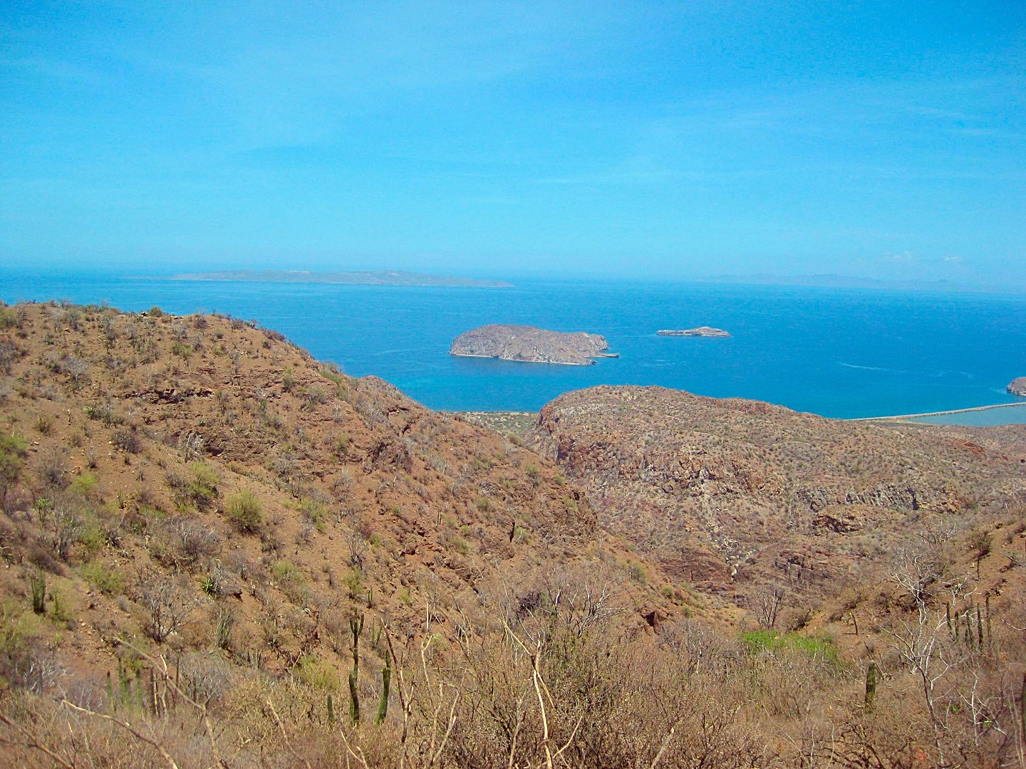
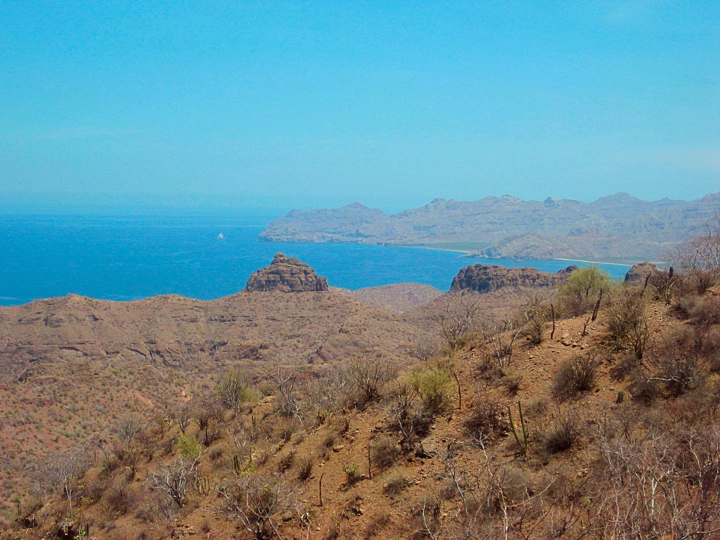
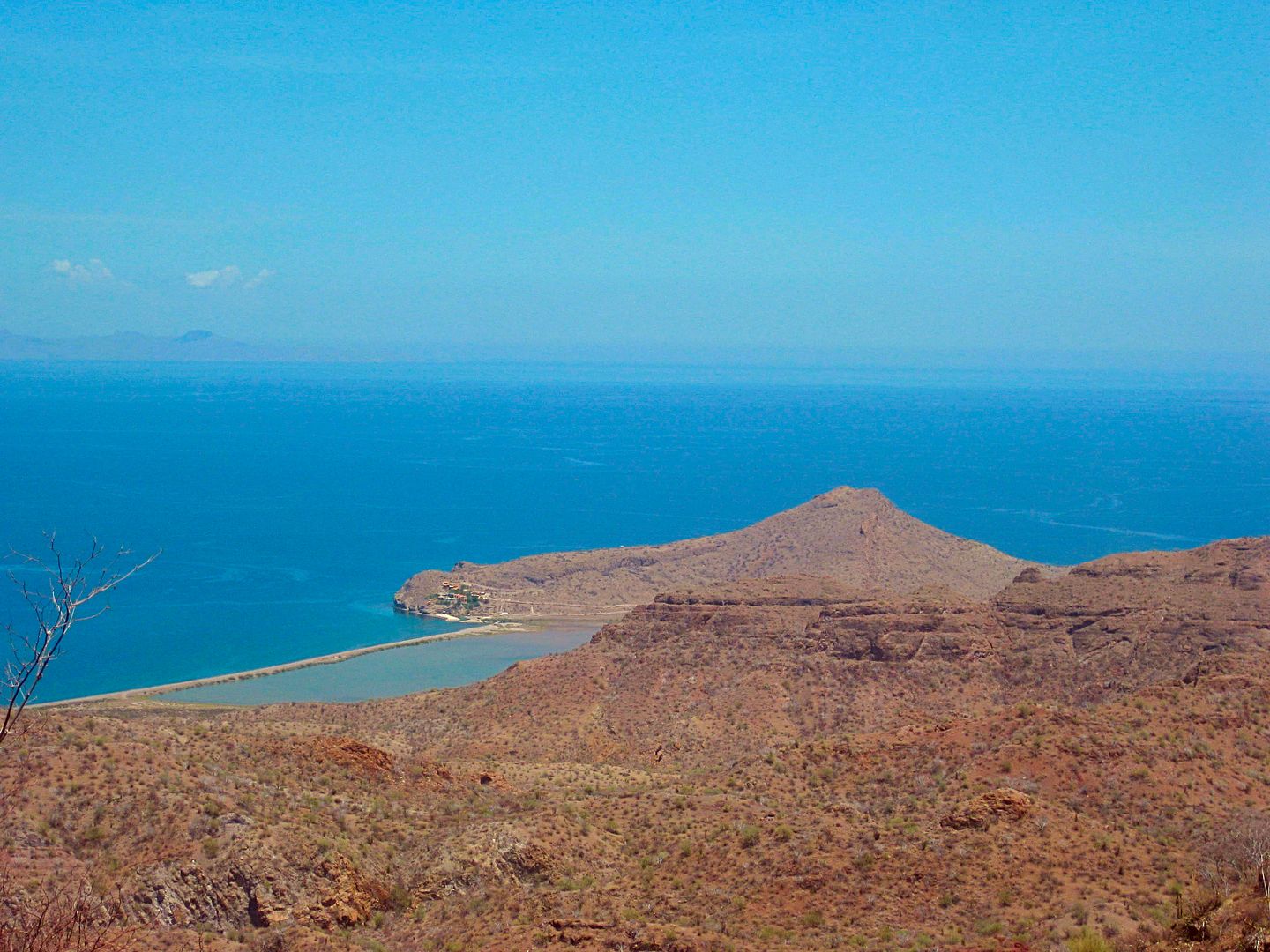
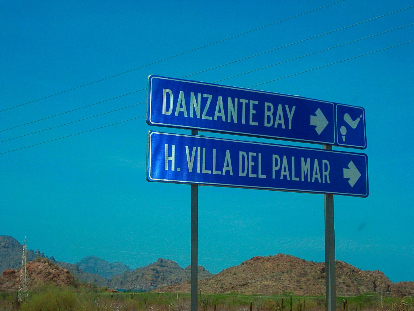
Km. 83 Villa del Palmar/ Danzante Resort (on Ensenada Blanca).
Km. 84+ Ligüí. Road to beach passes site of California's 3rd Spanish mission (1705-1721). Ruins washed away between 1973-2002 as flash floods
widened the arroyo. Even a new monument/ cross erected before 2009 has since been washed away.
The beach is 0.9 mi from the highway. The mission was at 0.5 mi.
Km. 113.5 Highway becomes 4 lanes as it nears Loreto.
Km. 116+ Loreto Airport road, east.
Km. 117+ San Javier road, east.
Km. 119/Km. 0 Main Entrance to Loreto.
To Be Continued...
PHOTOS:
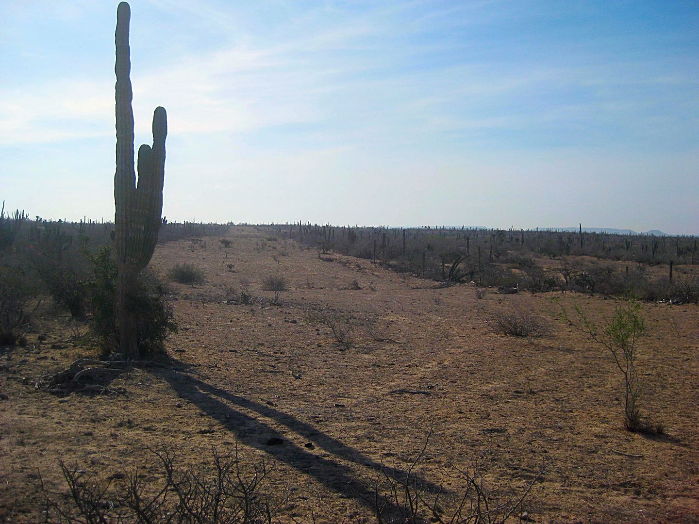
Jojoba Project. StuckSucks asked me to check out some weird zigzag crop patterns in the desert along the road out to Hwy. 1, he had seen on Google
Earth. Rob said it was a failed jojoba growing project.
With only a few exceptions, kilometer markers on the major roads in Baja off great locating tools and allowing one to not need to keep doing math in
the head using the odometer. This one is north from La Paz (62 miles away).
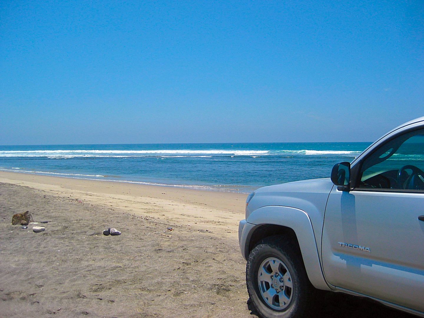
AGUA VERDE VIEWPOINT:
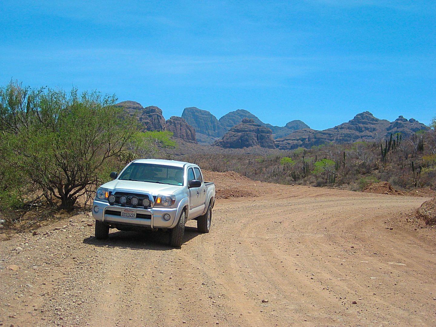
My truck parked by the viewpoint, running.
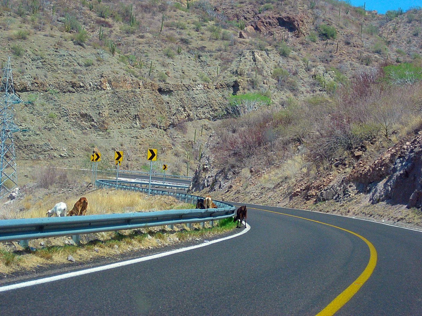
Goats on the grade down to Ligüí.
Isla Danzante as seen from Playa Ligüí.
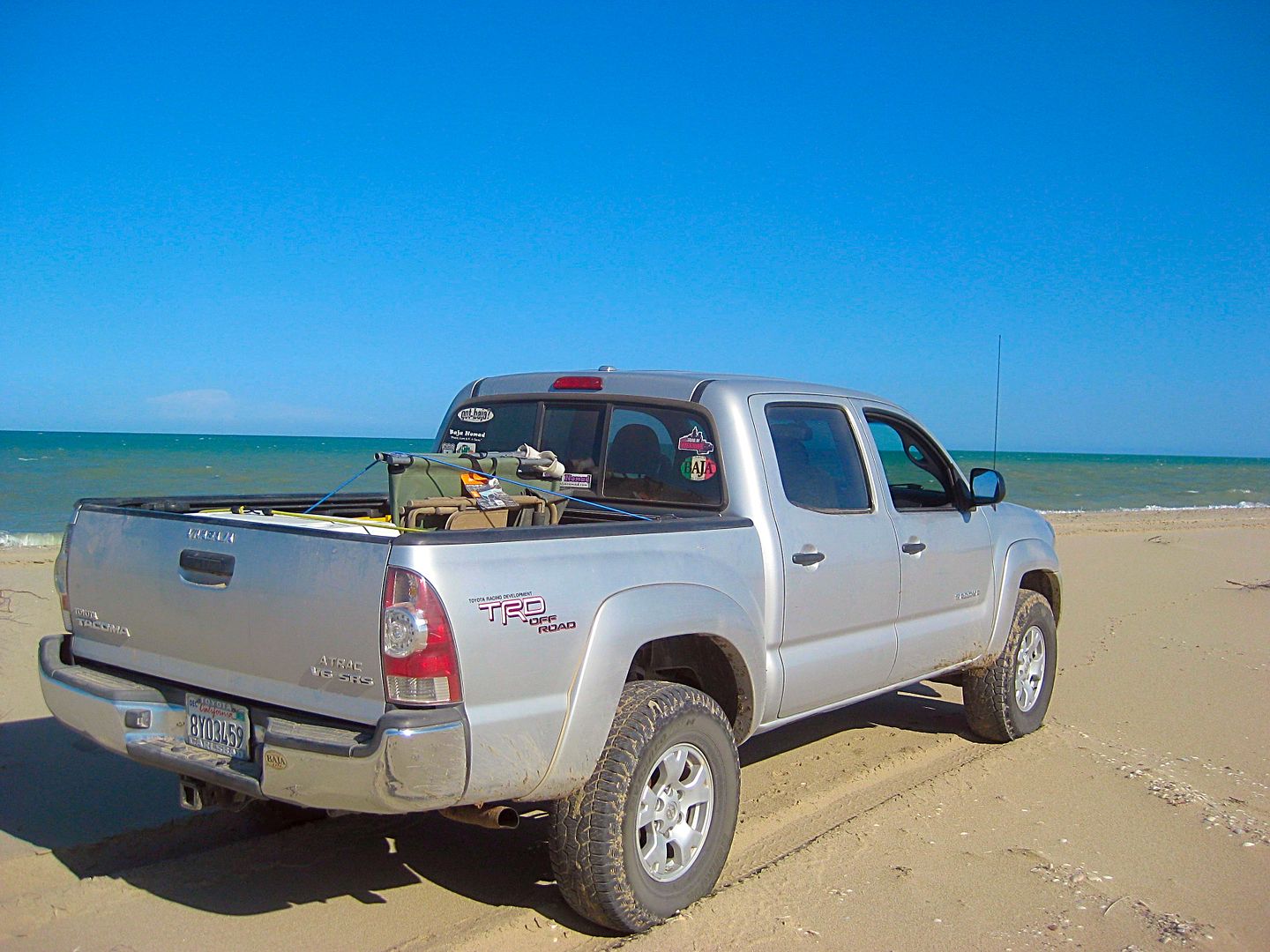
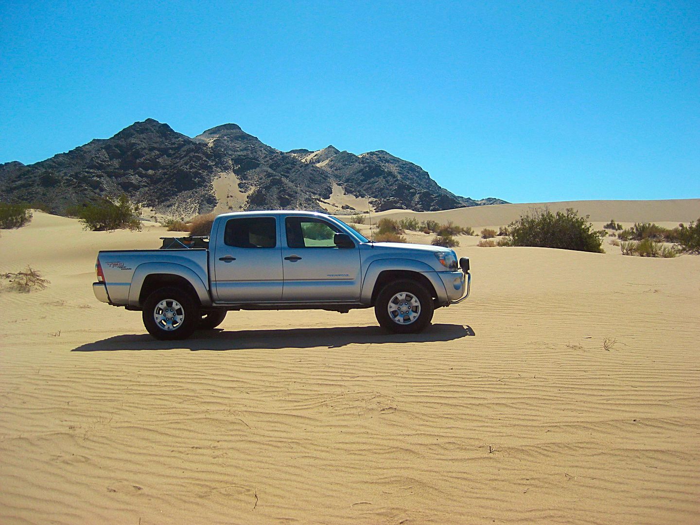
For the Toyota fans!
TO BE CONTINUED...
[Edited on 8-26-2017 by David K]
|
|
|
David K
Honored Nomad
Posts: 64479
Registered: 8-30-2002
Location: San Diego County
Member Is Offline
Mood: Have Baja Fever
|
|
I passed by Loreto and headed for Bahía Concepción for a nice camp for the afternoon and evening...
My go-to spot is La Perla, as nearby El Requesón is generally full of campers, all year. La Perla is quiet, farther from the highway to reduce the
trucker noise (oh, you can still hear Jake brakes, but it is tolerable).
La Perla is easiest reached by going in the paved El Requeson access off the highway at Km. 92 (turns to dirt soon) and at the coast, go south. There
is a back entrance to La Perla. It is at Km. 90.5+ and reached the original Transpeninsular road to La Paz, upon which you turn north. 0.4 mile for
the full distance to camp from the highway.
There is one large family at the opposite end. I hope to sleep under the stars, but when the sun got low, I spotted one mosquito so the Coleman
Instant tent was up, in a flash! The big family left before dark and the place was super quiet all night!
It was a restful night. I had a campfire and took one last swim in the bay. I only wish my wife could be with me here... She and I have had fun and
wild camps here at La Perla. Last time (2015) a thunderstorm hit us after our tent was up and filled with our sleeping gear. The rain eventually came
in sideways as the wind shifted. Waterfalls of water were pouring off the mountain top to the west... By dark, the rain and wind were gone, but our
tent and bedding were soaked! We laugh at that time, indeed!
Coming up next, Day 12... photos of my camp in the morning and north to Mulegé then west to EX-MISION de GUADALUPE! A great OFF ROAD day trip... and
ROUGH, but rewarding!!!
|
|
|
David K
Honored Nomad
Posts: 64479
Registered: 8-30-2002
Location: San Diego County
Member Is Offline
Mood: Have Baja Fever
|
|
DAY 12 (SAT. Aug. 12, 2017)
Good Morning from Bahía Concepción!
Today, my goal was to make the trip into the mountains west of Mulegé. I had never been in there and the 1720-1795 mission of Guadalupe de Huasinapí
was always an interesting story... well, to be honest, every one of the 27 missions in Baja has an interesting story!
Here is my camp location at La Perla on Saturday morning...
The beach actually faces north, looking here towards Punta Concepción which is almost across from Mulegé.
El Requesón, a sand spit that is opposite a small island.
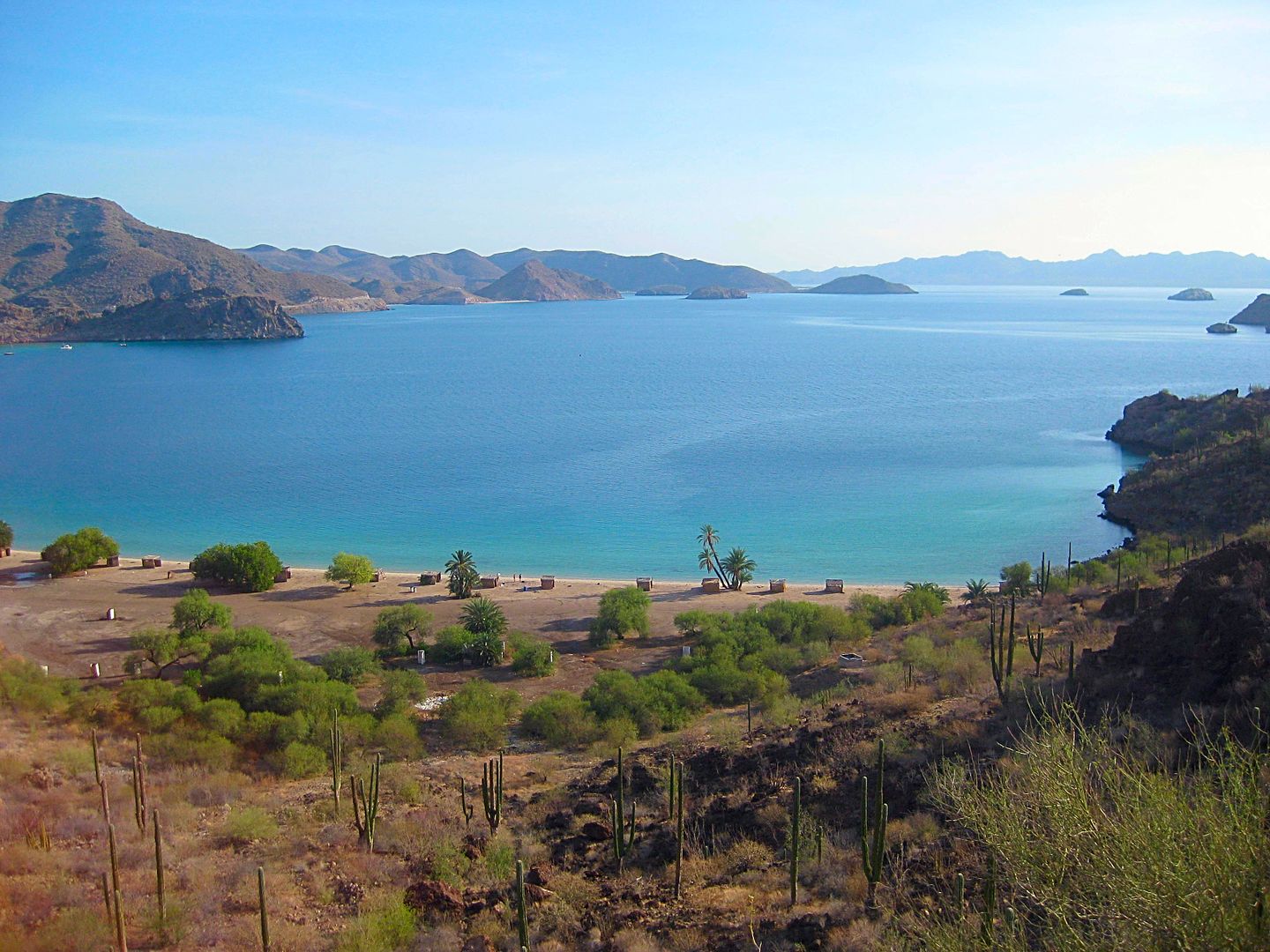
El Coyote and a popular photo location for over 60 years.
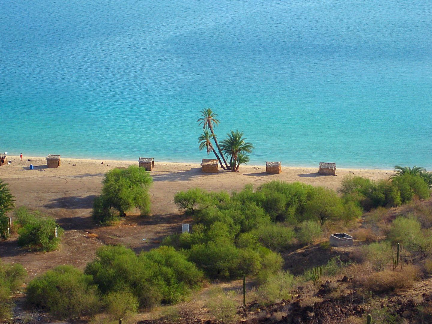
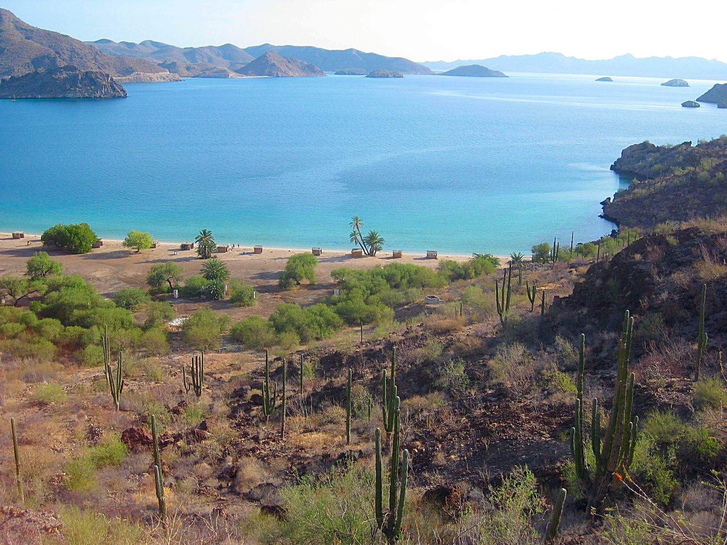
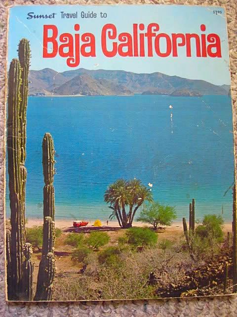
The cover of a 1971 book.
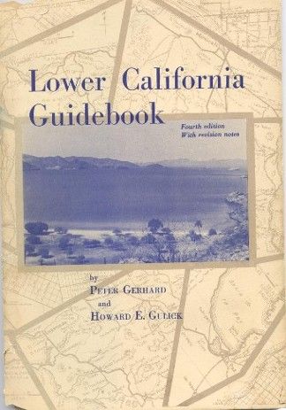
The cover of the most used Baja book of the late 1950s to early 1970s. Photo appeared on the 1962-1970 editions.
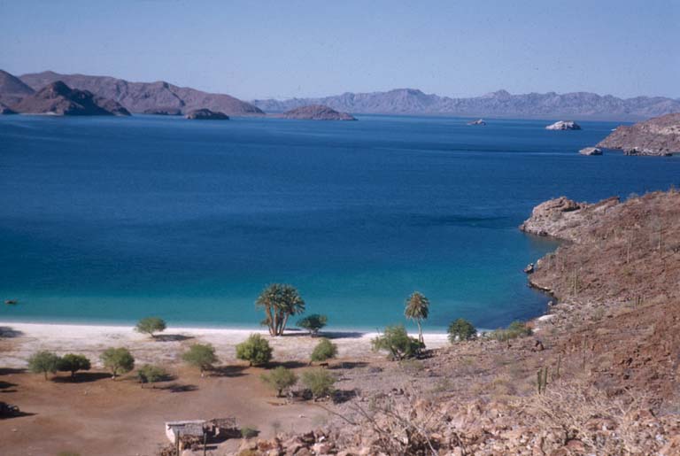
Howard Gulick's photo taken in 1952. Compared to mine taken in 2017, at the same location of the same beach. Not much has changed over 65 years, has
it?
At the south side of Mulegé, I top the gas tank off...
16.28 pesos/ liter
30.7 liters
Just beyond the entrance to Mulegé is a concrete street going west, Km. 135.5. This is the road to take for La Trinidad cave art, the rough road
across to the Pacific near San Juanico, and the rough road north from it to the mission site of Guadalupe.
STAY TUNED!
[Edited on 8-28-2017 by David K]
|
|
|
David K
Honored Nomad
Posts: 64479
Registered: 8-30-2002
Location: San Diego County
Member Is Offline
Mood: Have Baja Fever
|
|
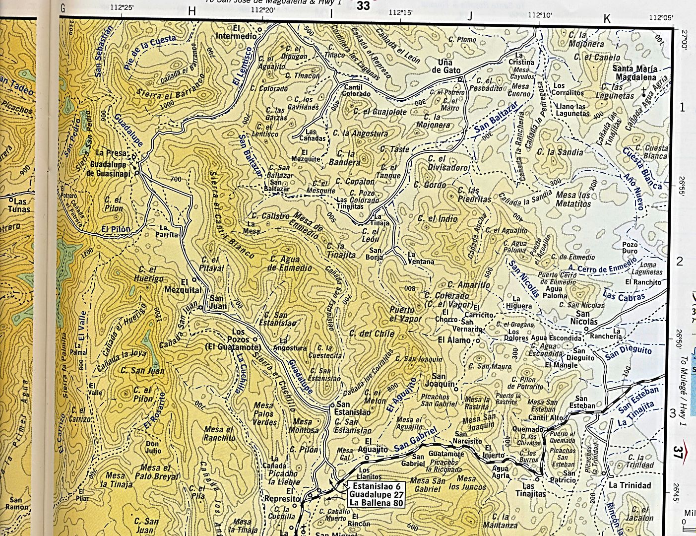
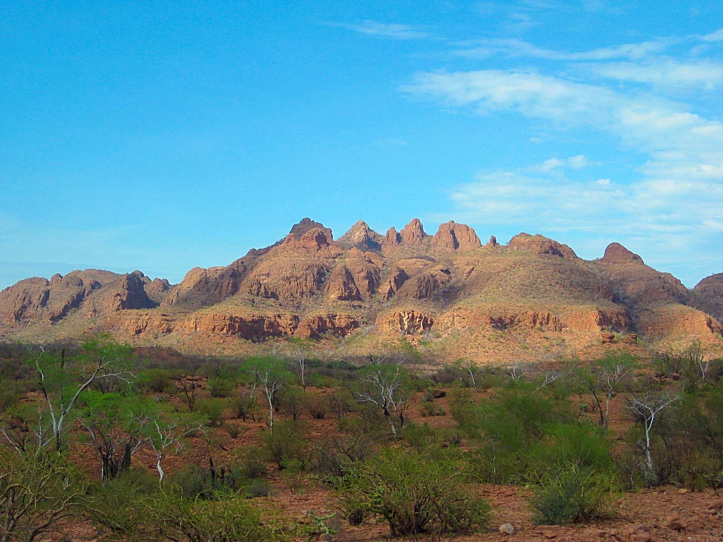
The area on the 2010 AAA map:
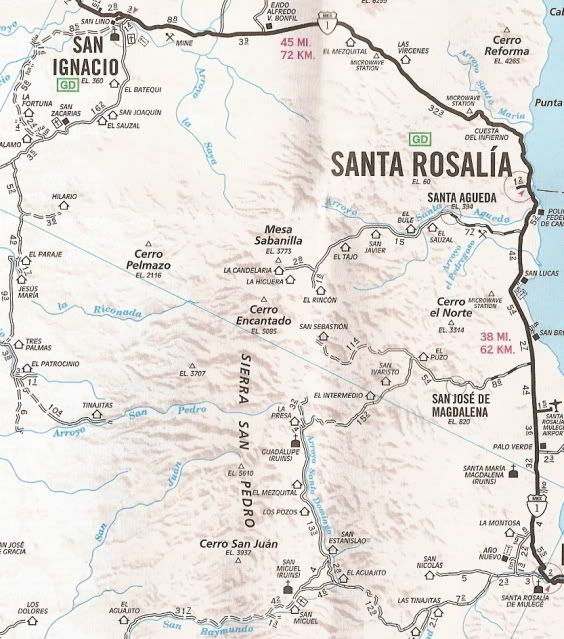
The road between San José de Magdalena and Guadalupe was washed out in 2014. I checked the Guadalupe side of it when I left the mission and it is
still abandoned and washed away. That was the preferred route and would have been a short cut out as I was going to Punta Chivato that evening.
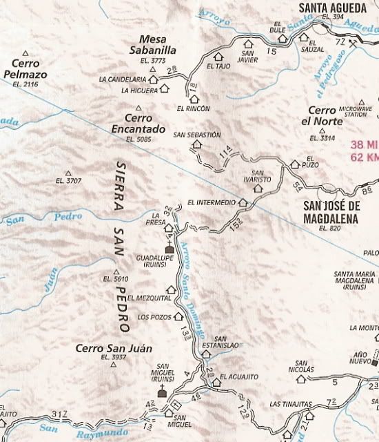
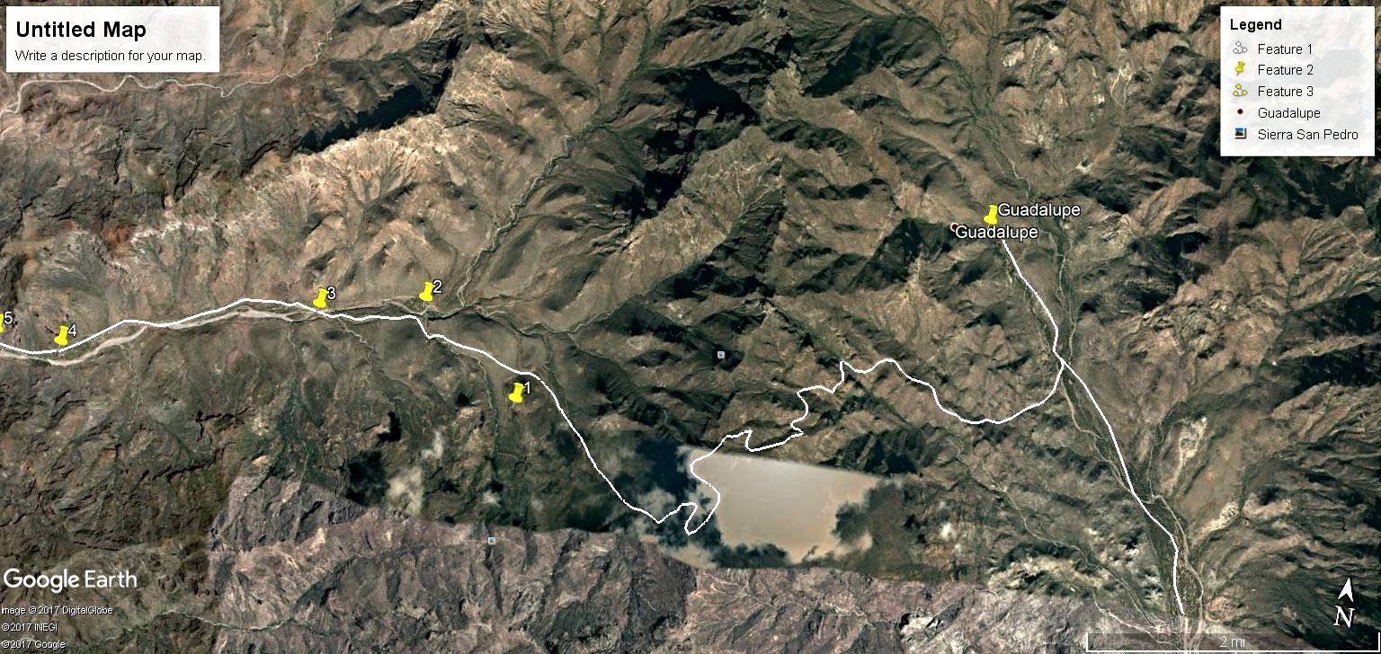
Here are my GPS track maps...
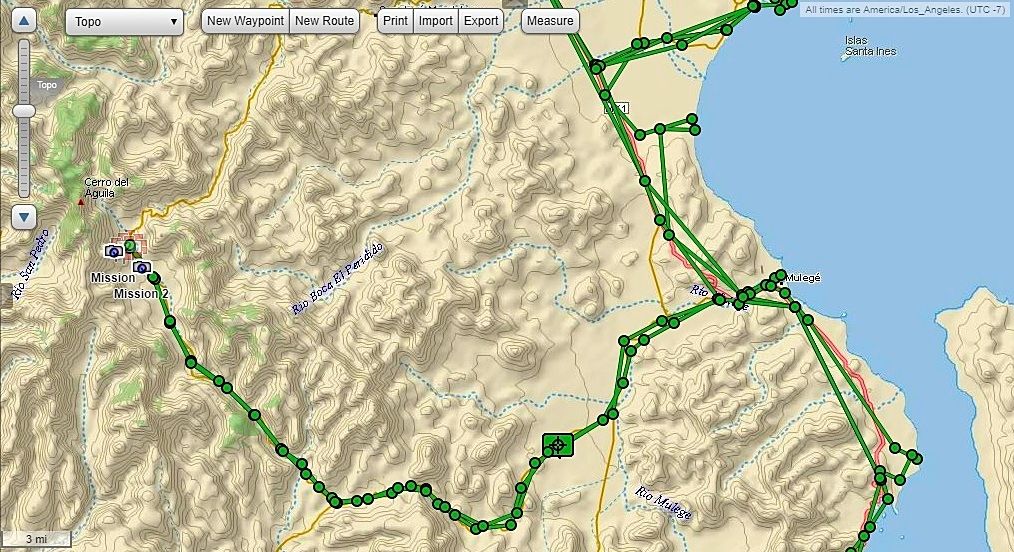
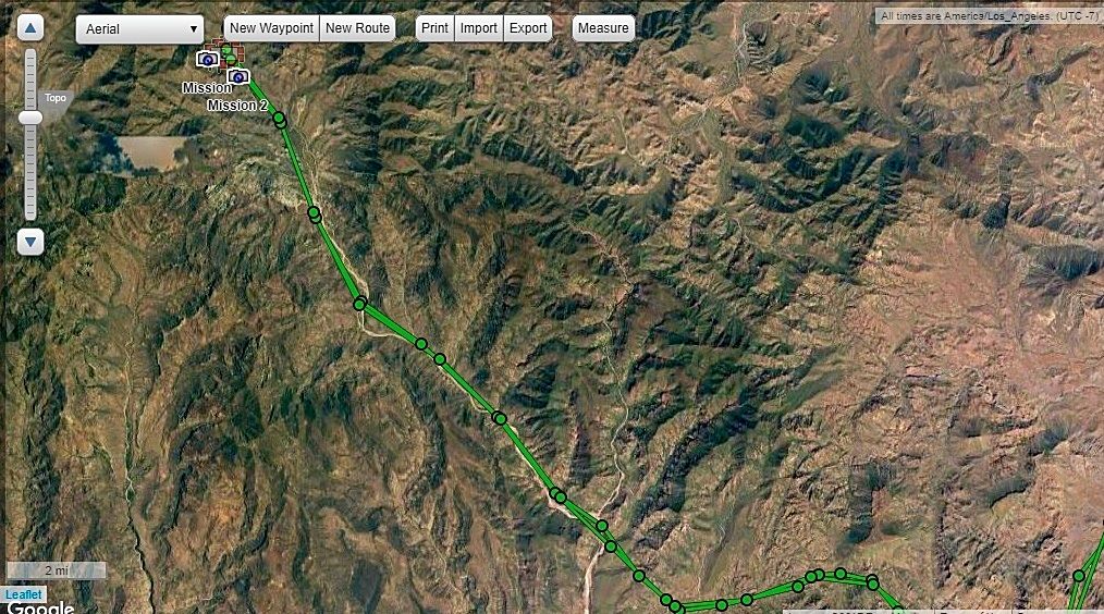
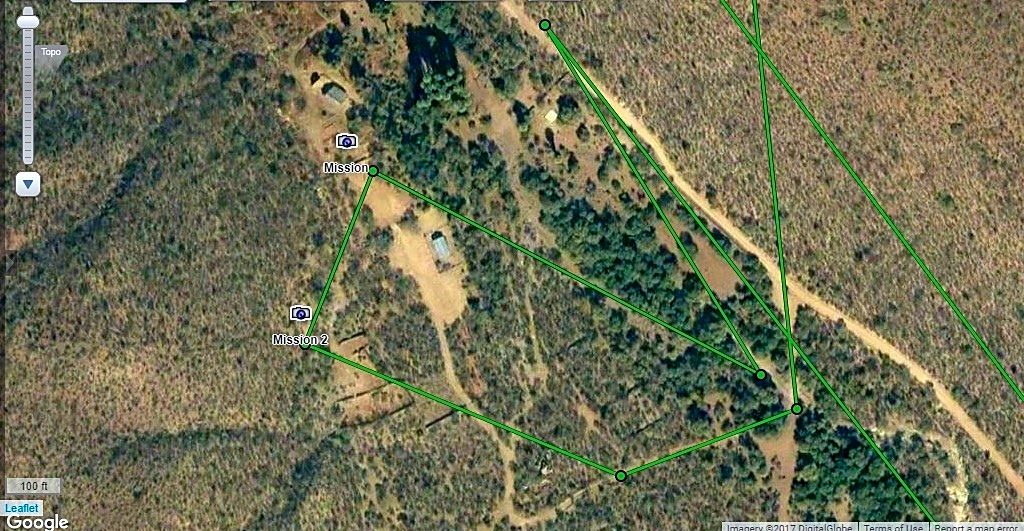
Close-up at the mission site. The two camera points (Mission, Mission-2) are where I saw mission walls seen in old photos.
The square outlines are old walls that were probably terraced gardens or animal pens. The building in the cleared area may have been made to be a
mission museum, as at other mission sites. It is abandoned and glass in a window was broken. The other building near the camera image 'Mission', is no
longer there.
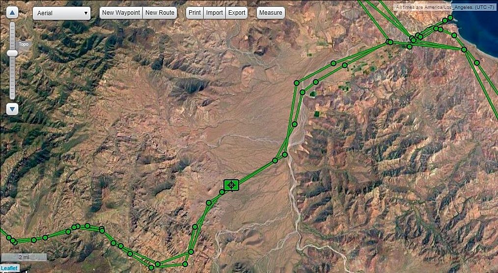
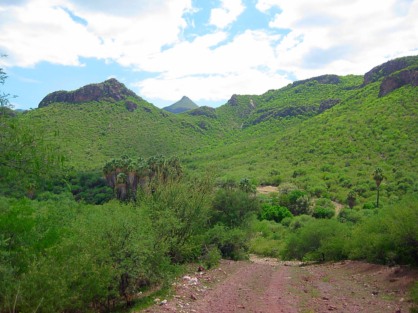
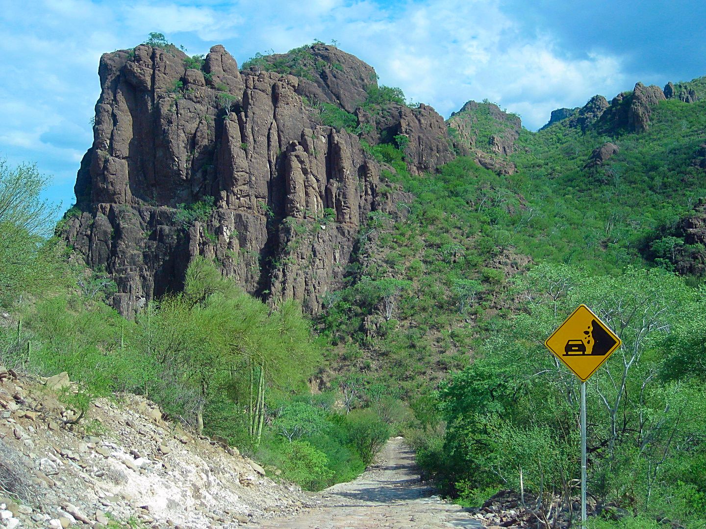
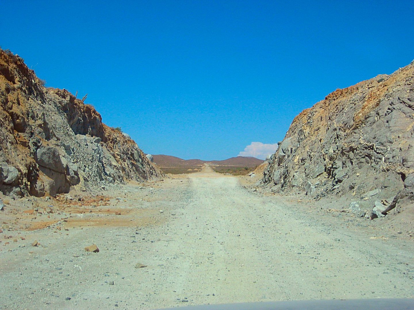
OK, the drive up...
11.1 miles from Hwy. 1, the second Trinidad junction.
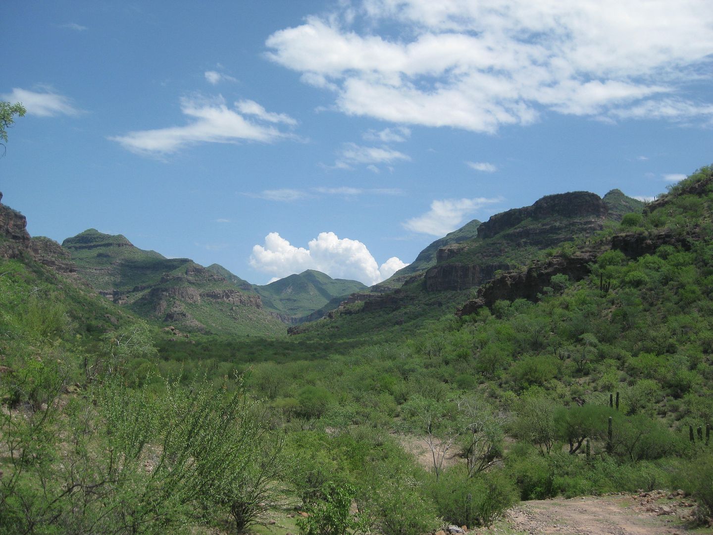
Nearing the sierra... this fast looking road would soon change!
Pitaya Dulce
25.2 miles from Hwy. 1 (Mulegé). The "Ex-Misión" is 16 miles away (closer to 26 kms.).
15.5 miles north of the La Ballena junction, you have almost arrived. The road ahead here goes 0.2 miles to the washed out road junction (that had
gone to San José de Magdalena) and 0.1 more to Rancho La Presa. Turning left at the Ex-Misión sign goes across the arroyo to a wide area where a
gate blocks driving closer to the mission. The gate is wired closed.
PHOTOS at the mission, next...
|
|
|
David K
Honored Nomad
Posts: 64479
Registered: 8-30-2002
Location: San Diego County
Member Is Offline
Mood: Have Baja Fever
|
|
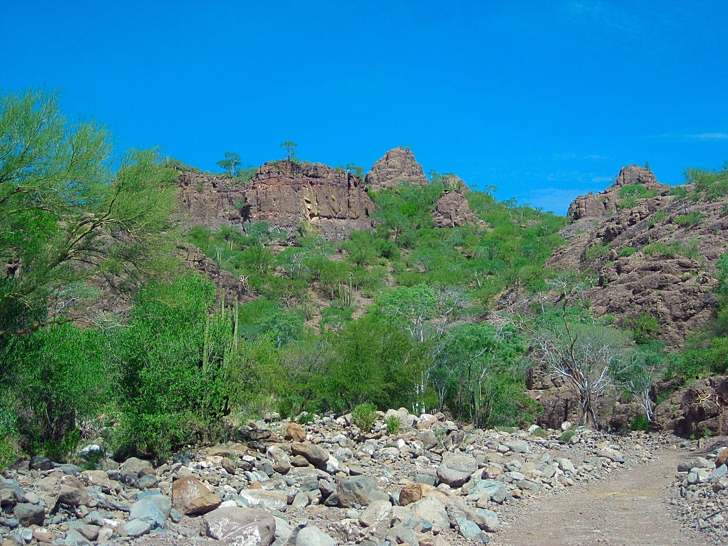
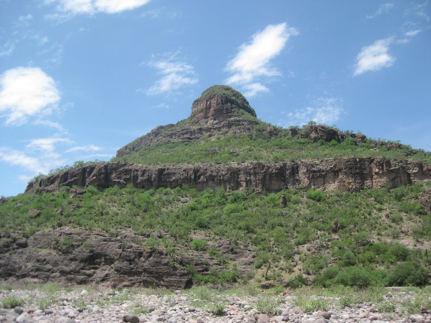
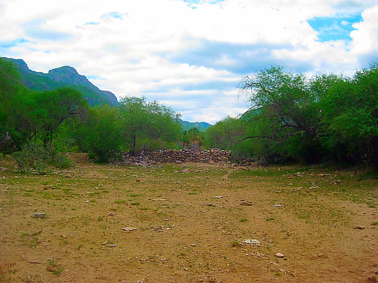
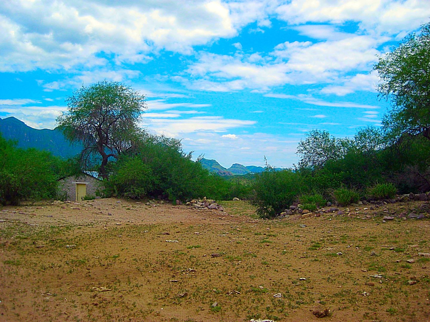
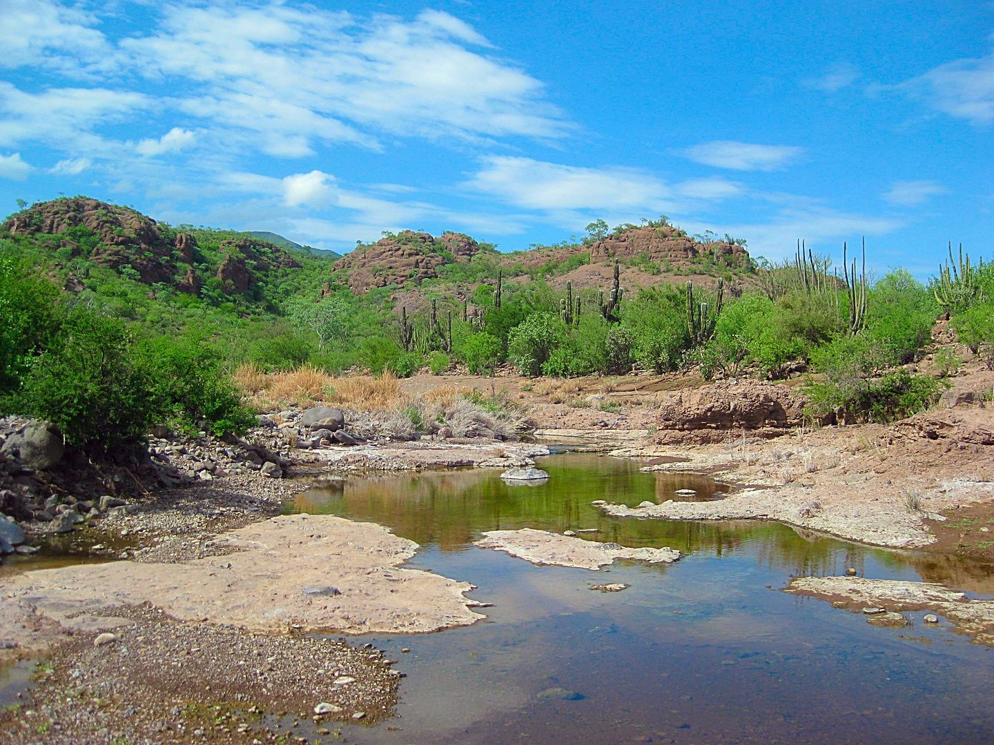
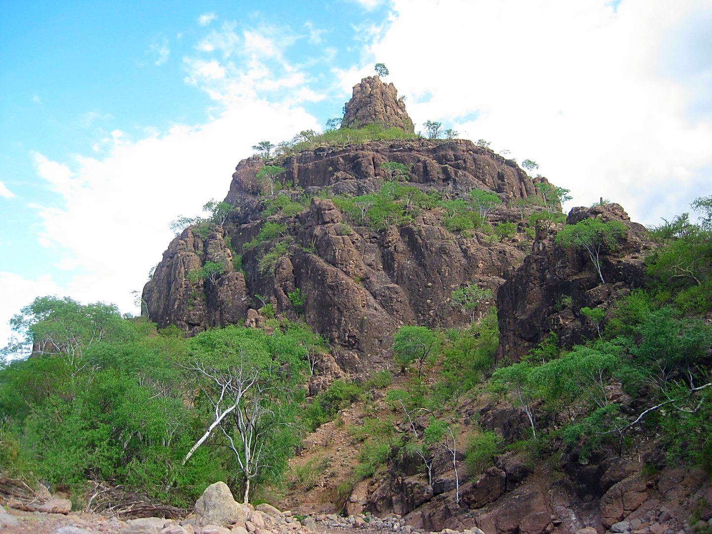
Mission Guadalupe de Huasinapí, founded December 26, 1720
I parked my truck near the gate and walked down to the arroyo to follow it to the bottom of the mission complex. I returned to my truck on the road
that the gate blocks, making a full circle.
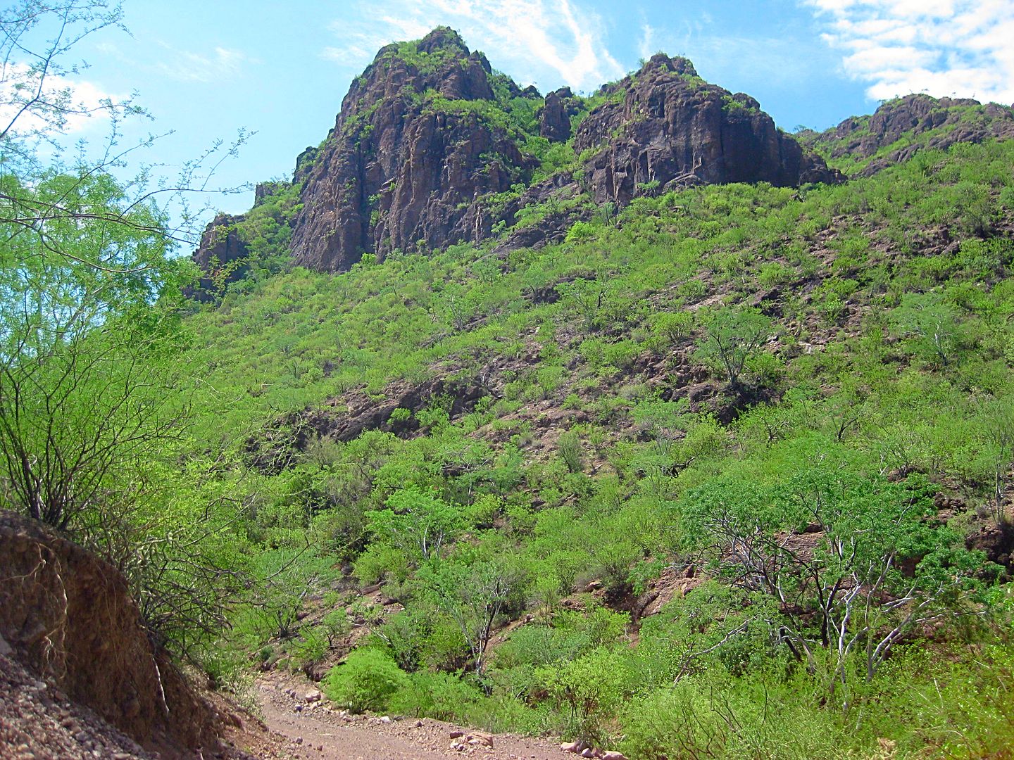
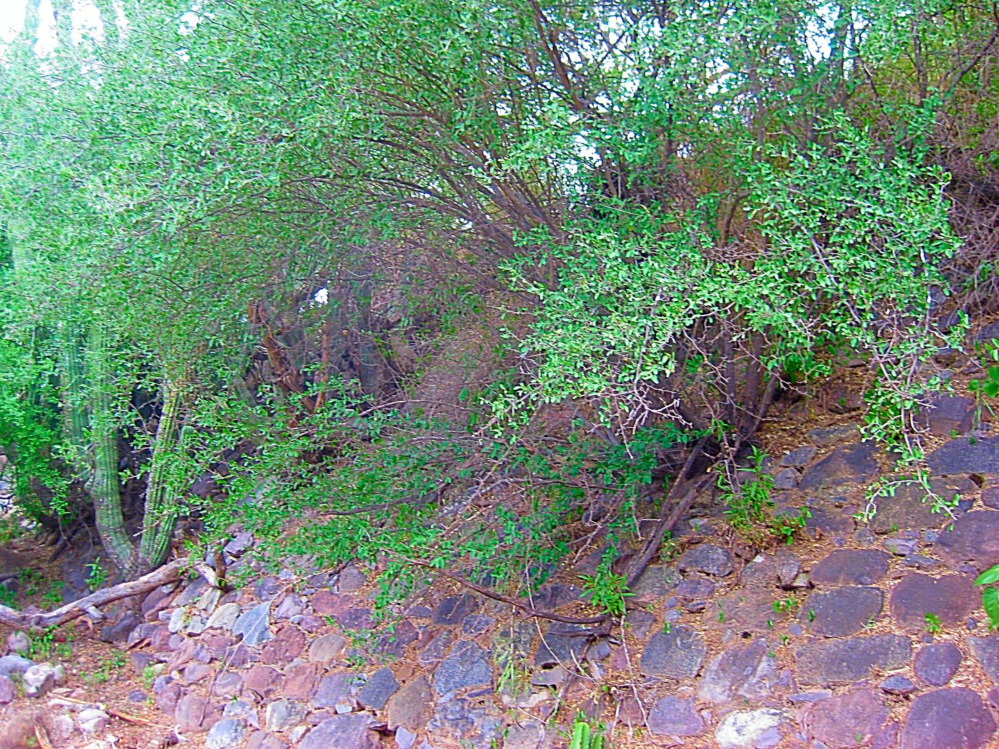
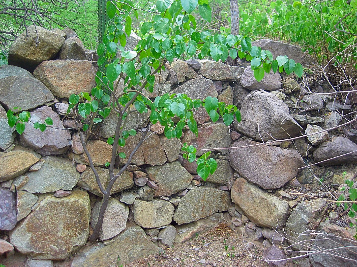
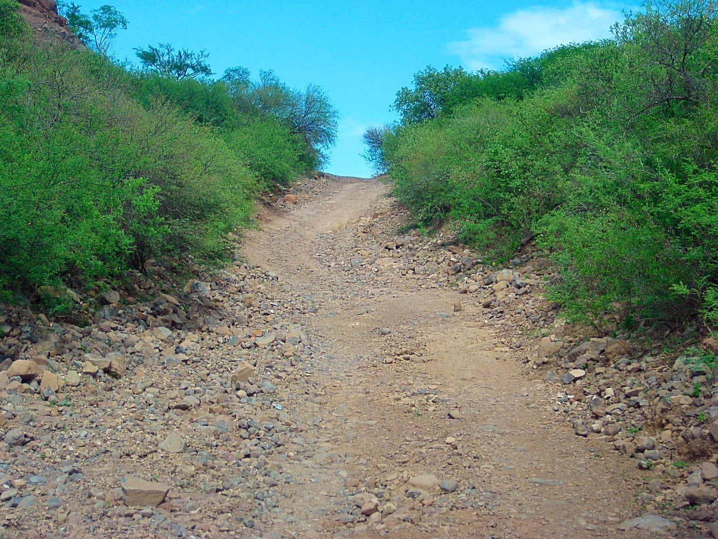
The site is heavily grown over as well as being surrounded by barbed wire. So, this is not for the casual mission seeker but more of something for the
seriously motivated ones. The road in should be a good filter to screen out the less serious. Nomad friends were last here in January 2016. I was able
to include one of their photos in my book that went to print in February. Other photos I had of the mission were from the 1990s and 1950.
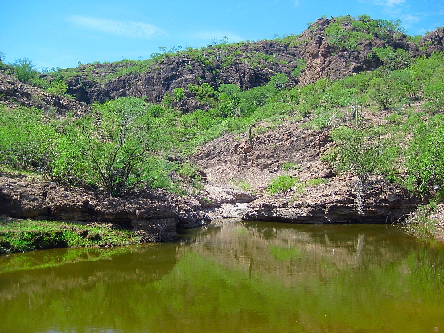
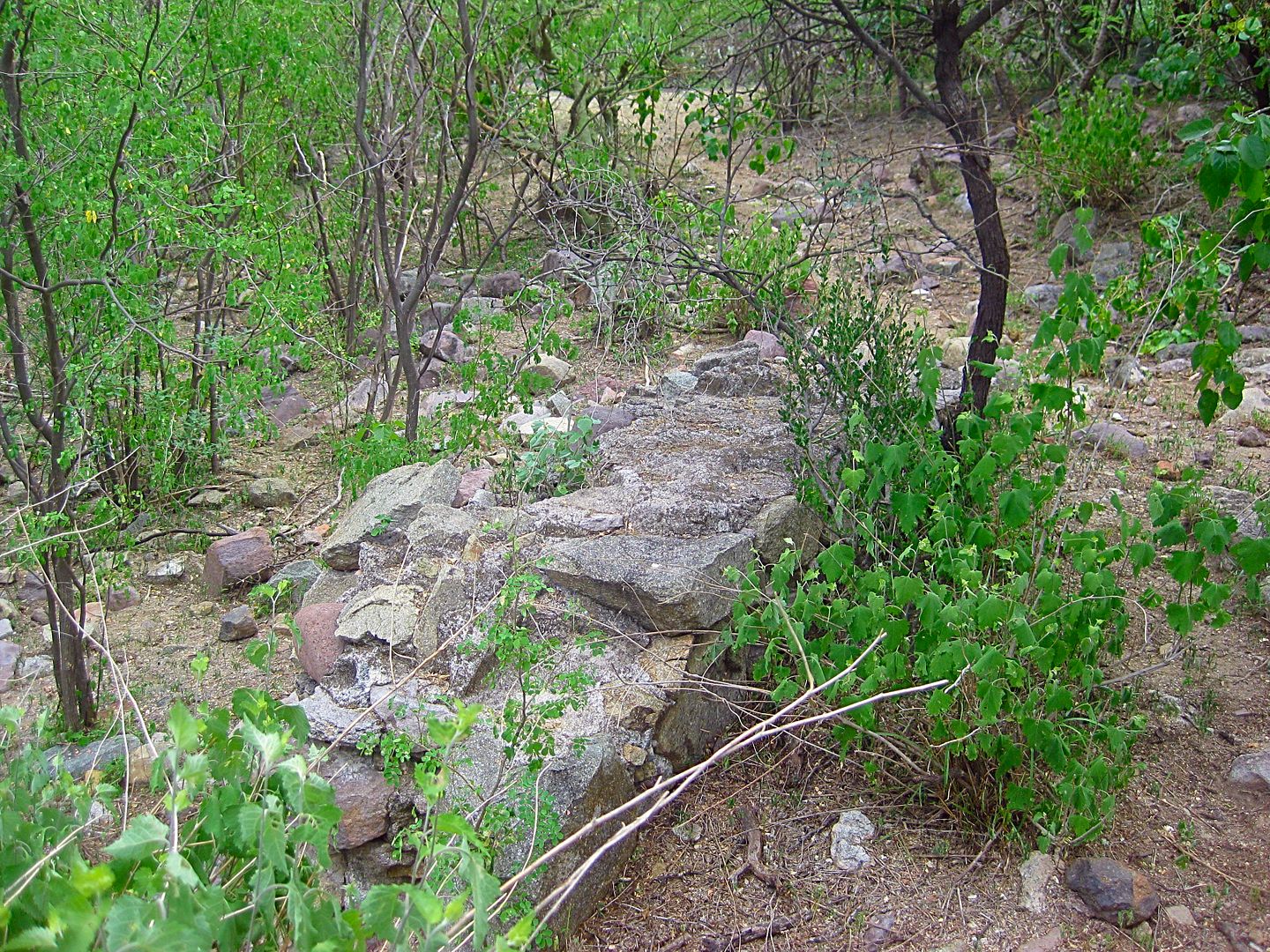
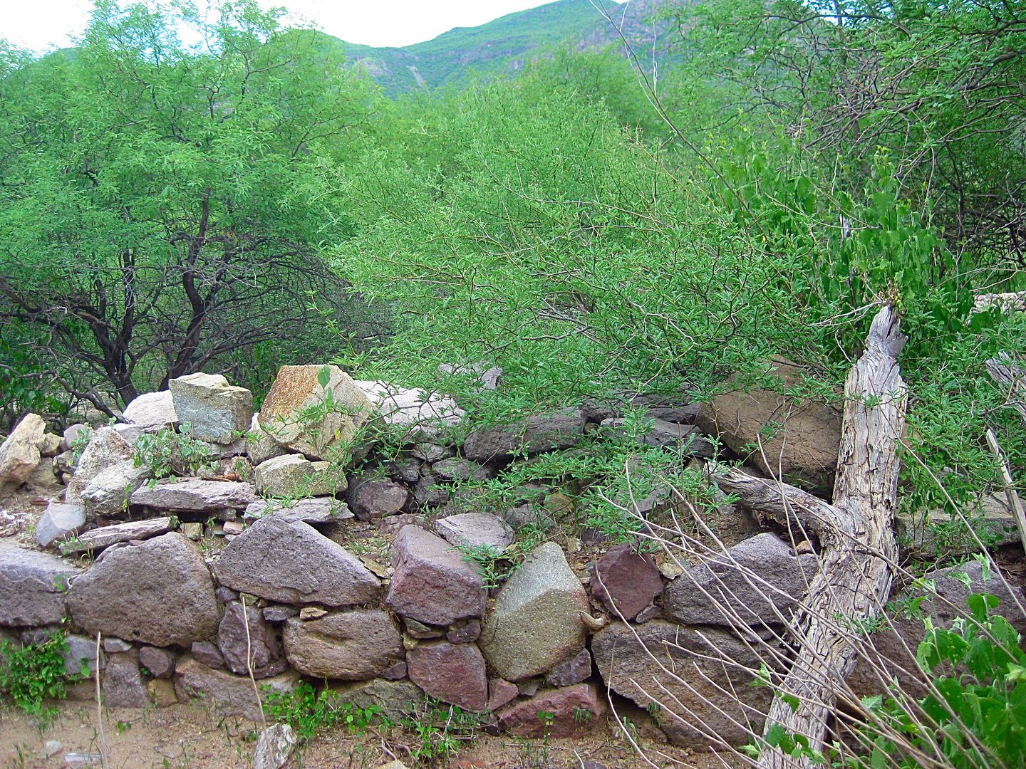
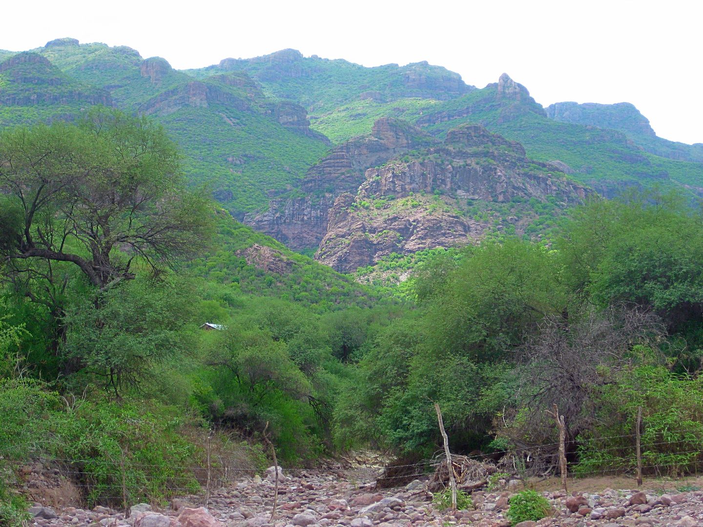
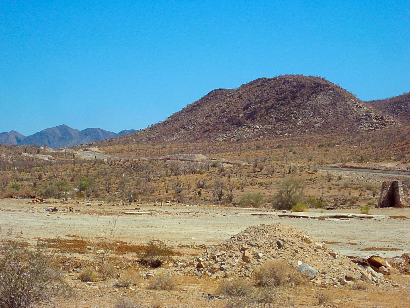
Walking up the arroyo from the road crossing, you discover how steep the slope is to your left (west) where the mission was established. Usually,
missions are on flat areas. This was a terraced mission site.
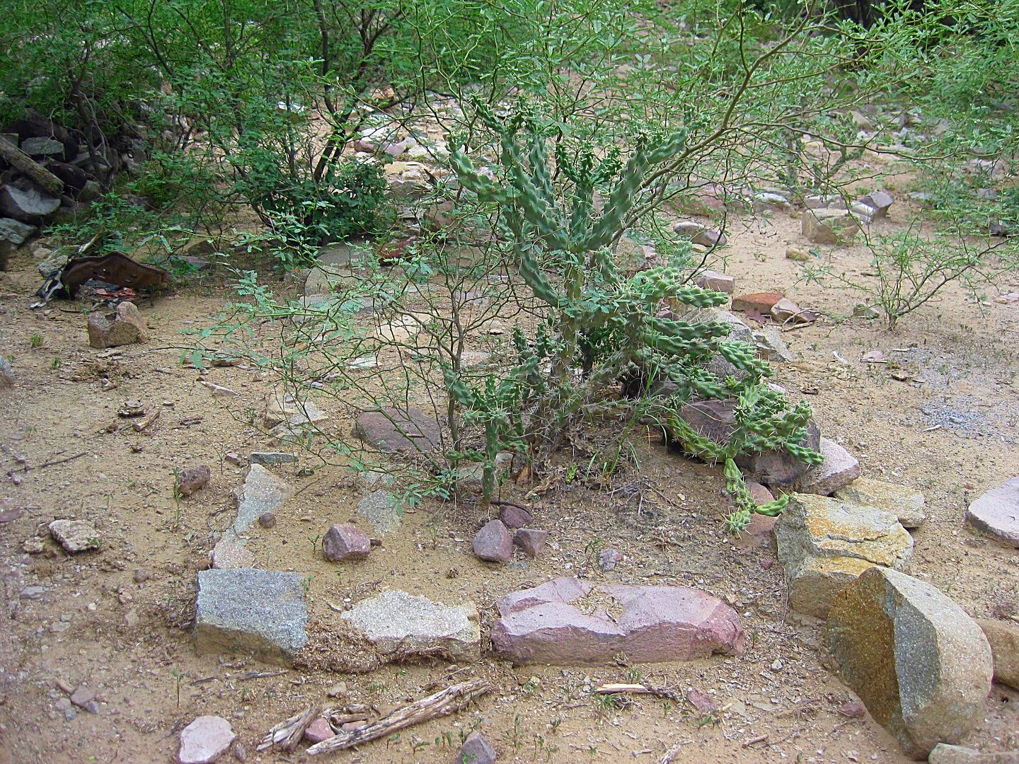
Then, I came to see this...
A most impressive retaining wall or was it a pila (reservoir)?
I climbed up at the first chance my almost 60-year-old body could find near this wall. Barbed wire strings were at the top. Once through, I soon found
this welcoming stepped walkway to this nearly 300-year-old California mission.
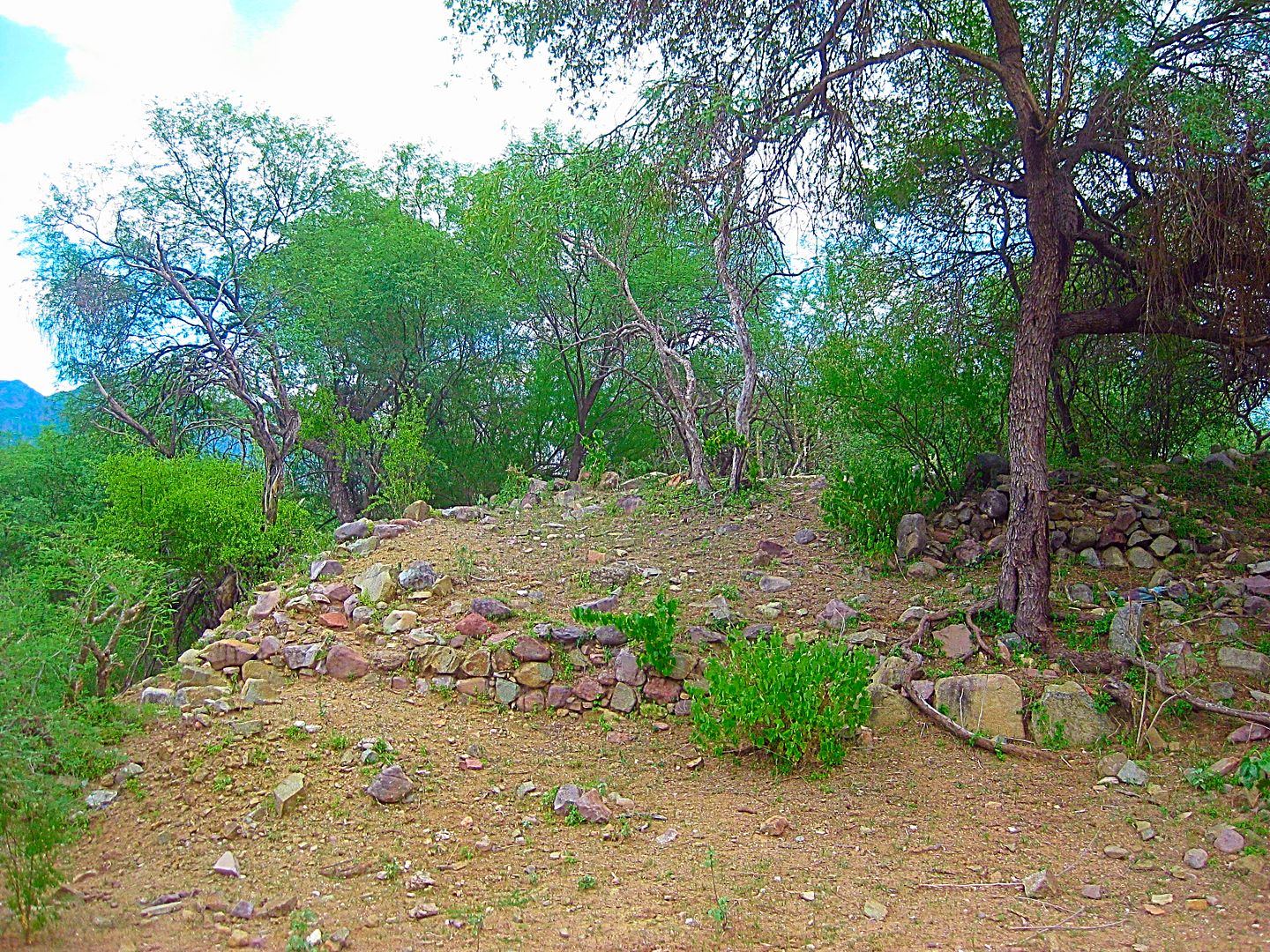
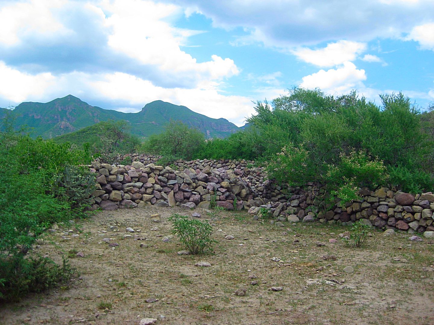
A 1744 report made by Padre Juan Antonio Balthasar said that Guadalupe had "the finest church in California."
In November of 1744, heavy rains caused the collapse of the church's adobe walls killing 100 Indian neophytes. A new stone and adobe mission church
was built about 1750. These stone foundations are what we see today.
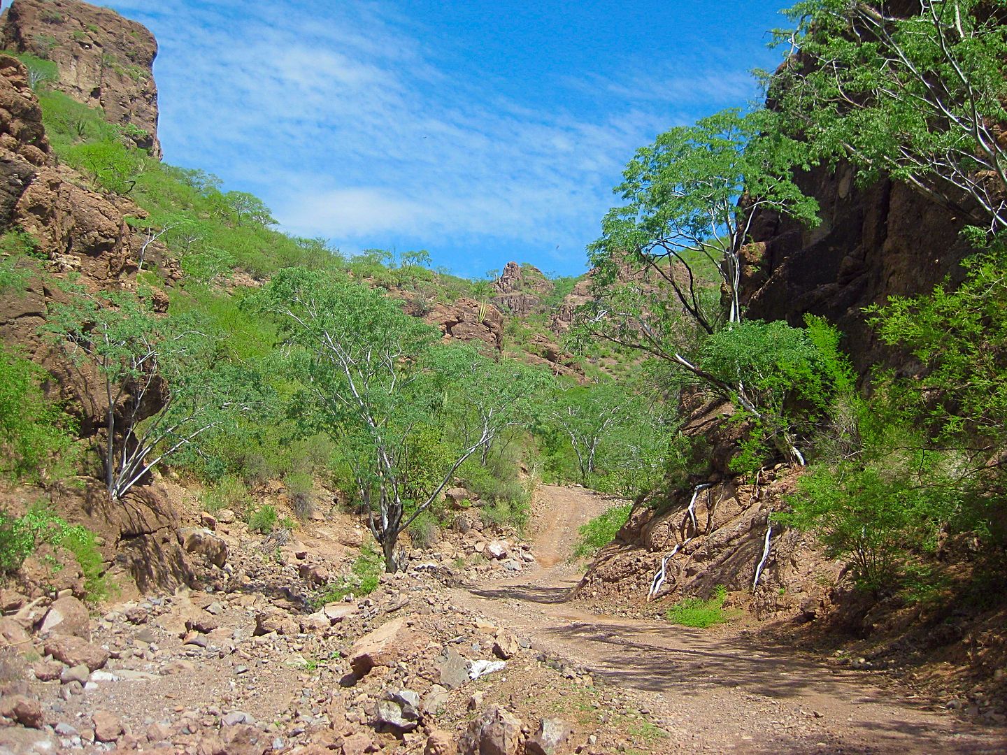
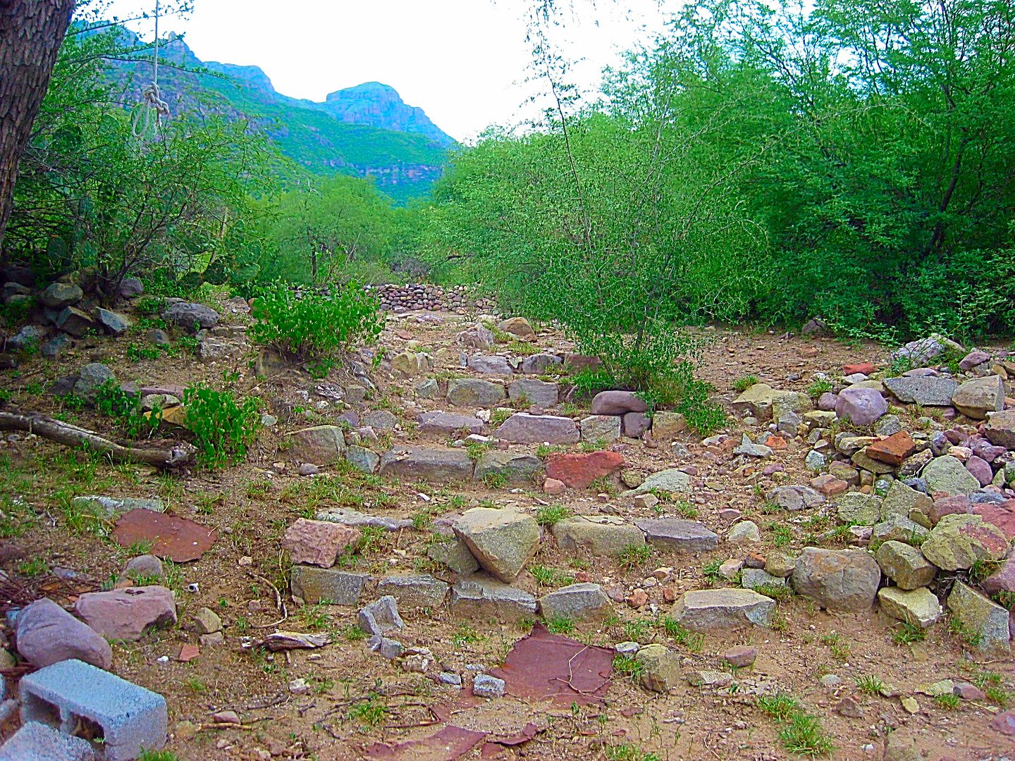
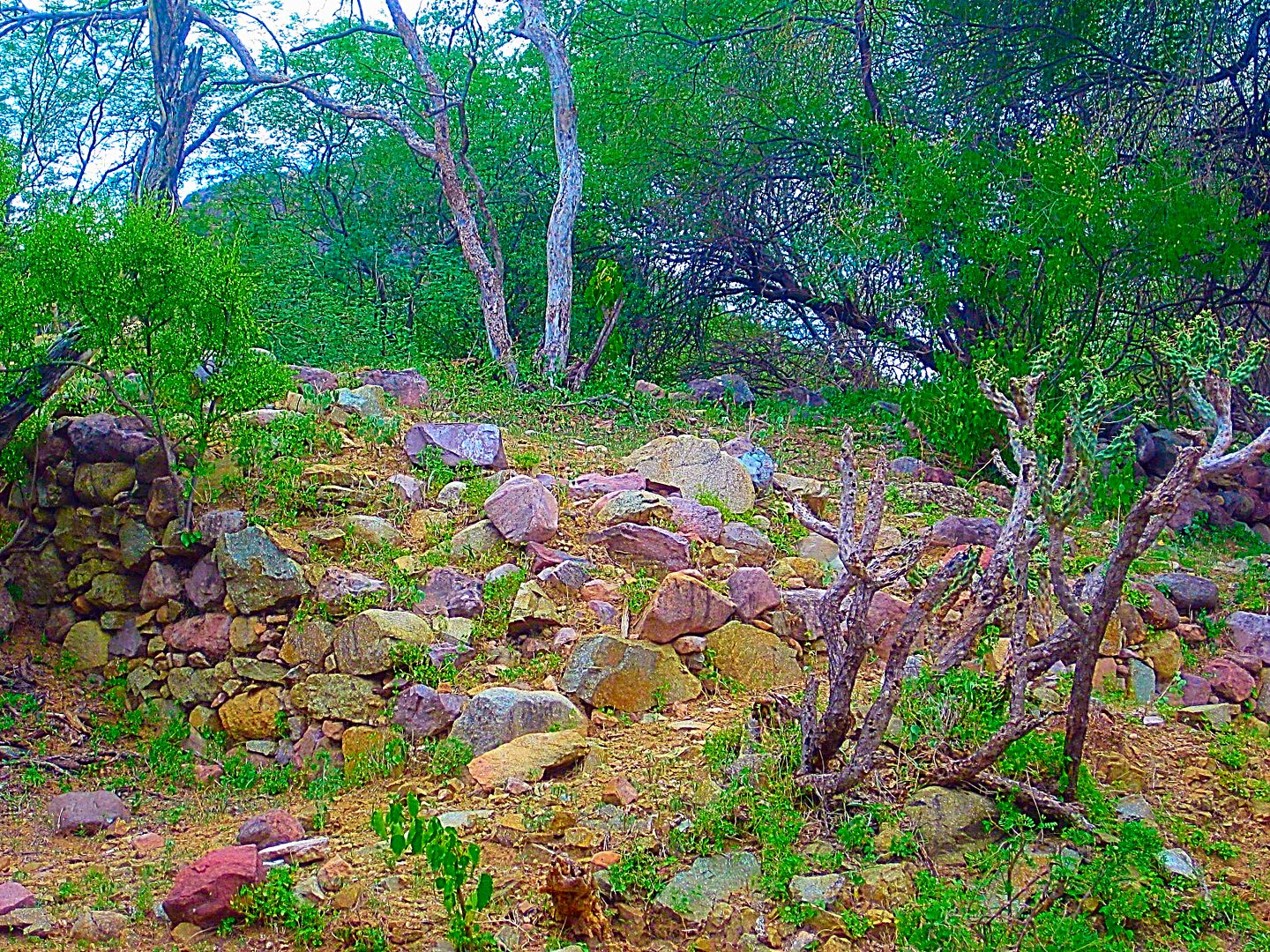
Looking south at the clearing and building that was possibly going to be a museum for the mission site. The road from the gate below ends here. I walk
back to my truck from this clearing down that road. First, a little more looking around, a bit higher up the slope...
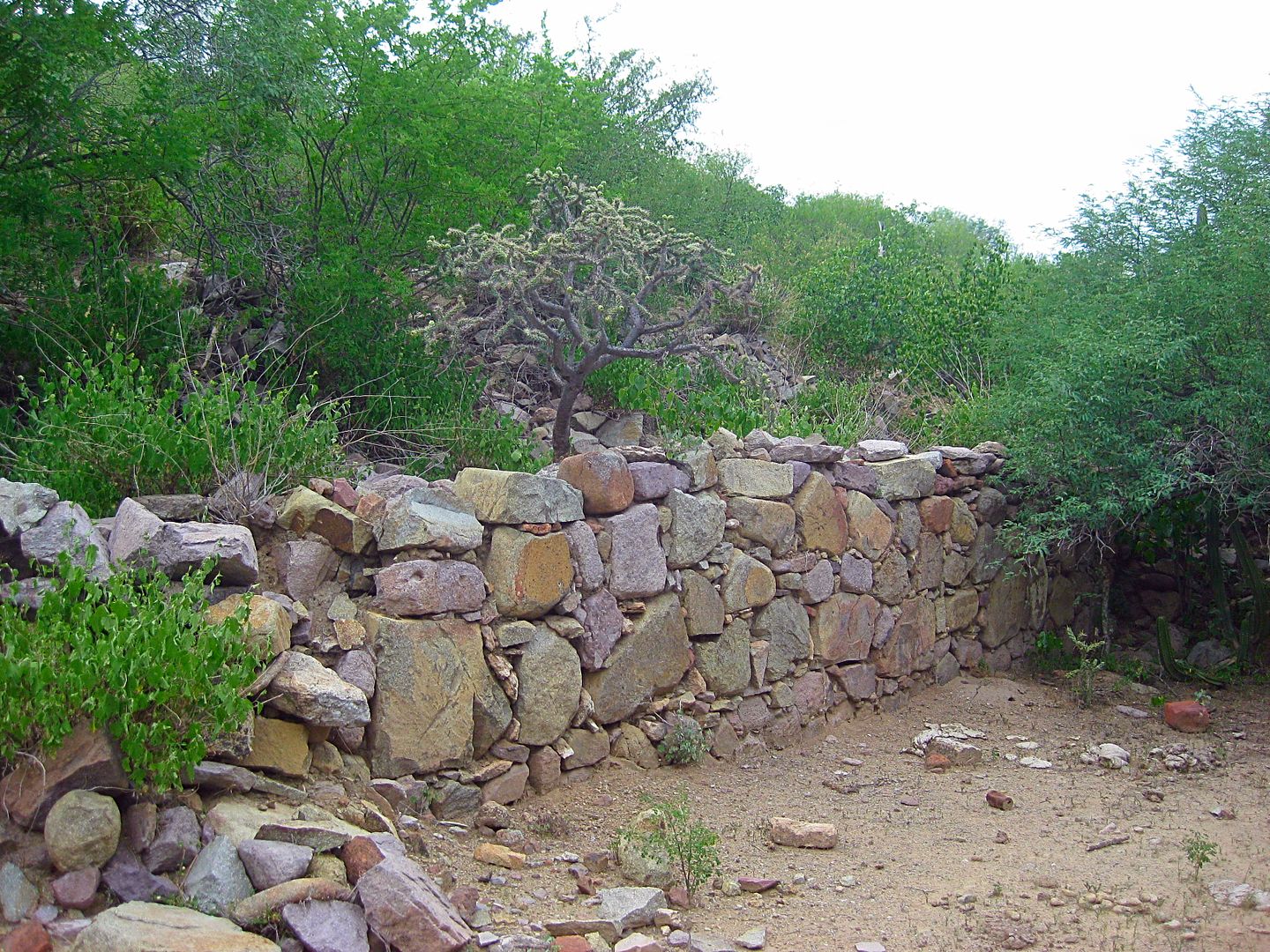
Bingo! This is the wall seen in Ed Vernon's Las Misiones Antiguas book, from a 1999 photo. Ed believed this was the west side of the church. If that
is the case, I am standing inside the mission church here.
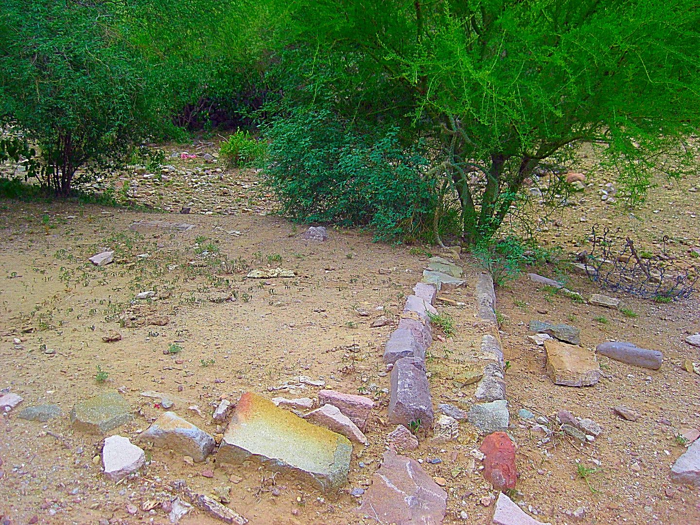
Leaving the site...
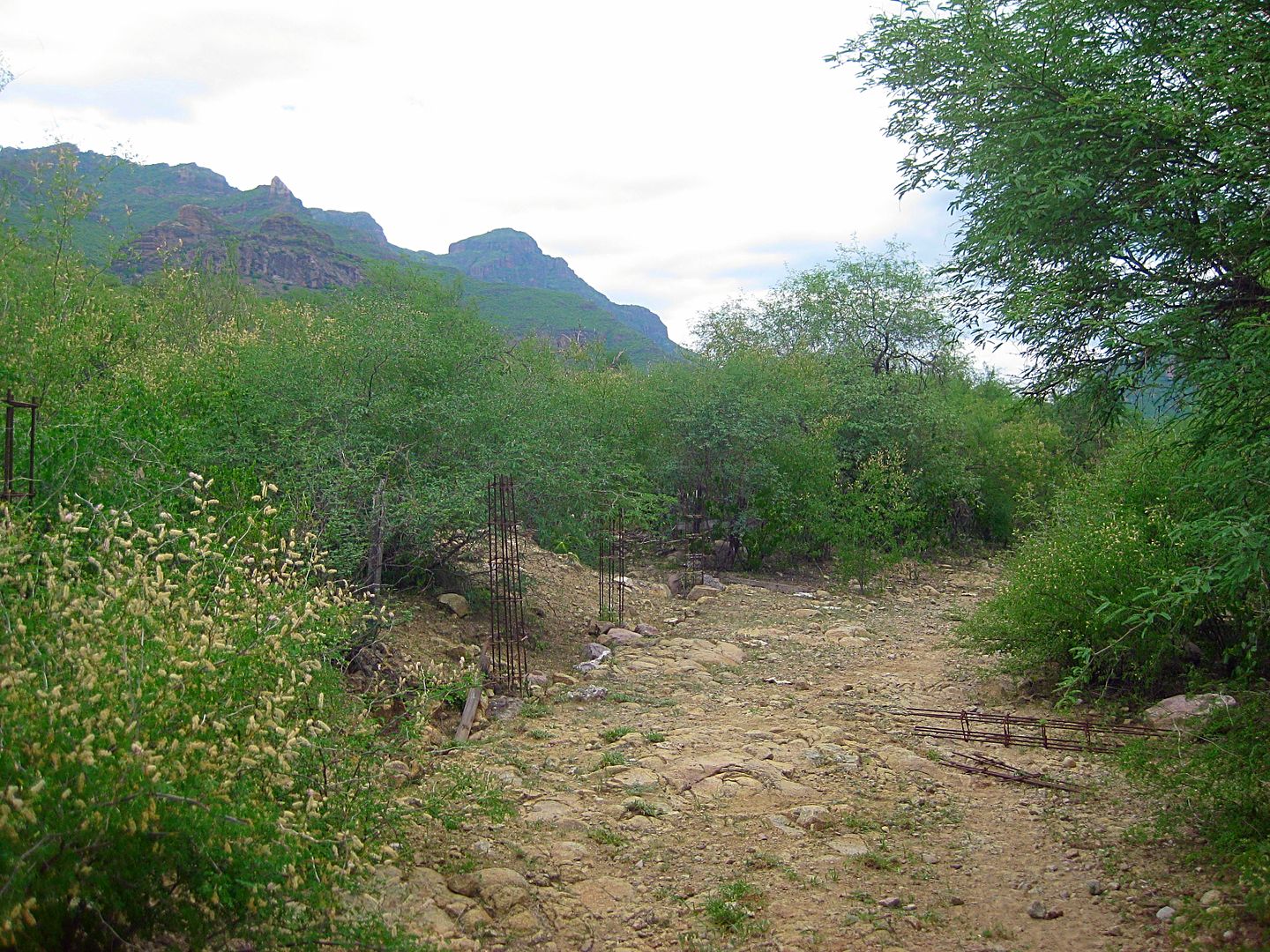
The road from the abandoned museum building to the gate was going to be lined with some concrete columns, the forms are along the way.
Crossing the arroyo on my way out. I take this photo looking north towards the mission area. The roof of that 'museum' building can be seen. The
mission ruins are just north and northwest, uphill from it.
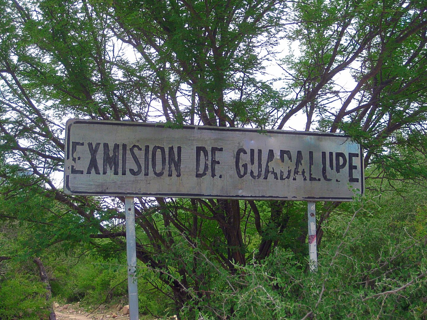
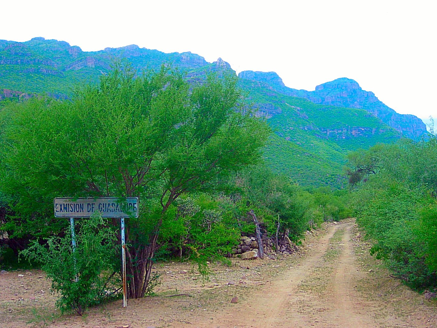
The sign is here to direct you to the site. There is barbed wire around it, but no other signs. Perhaps to keep cattle or goats out? Nobody lives at
the site. It is a natural 'museum' to connect with California history. Photographs preserve the location and we can see very little has changed in
over 50 years of photos. If you are up for a 40-mile rough drive from Mulegé, some climbing and crawling, to see California's past, then this is the
place. The great majority will get their curiosity fulfilled with these photos, most likely.
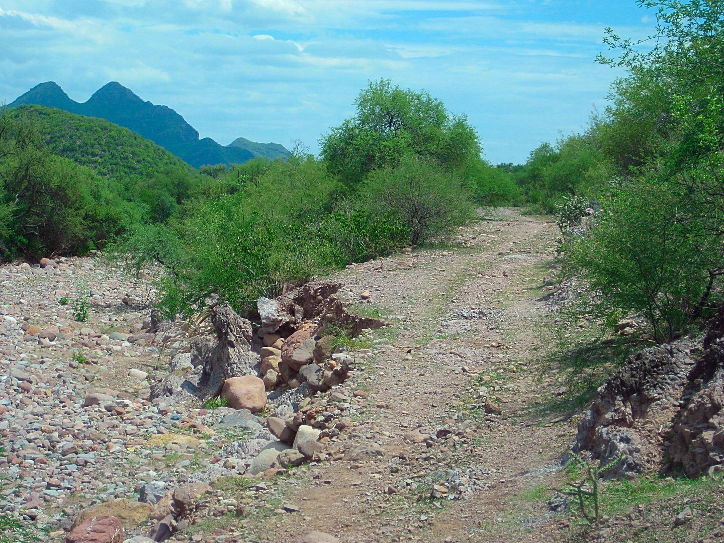
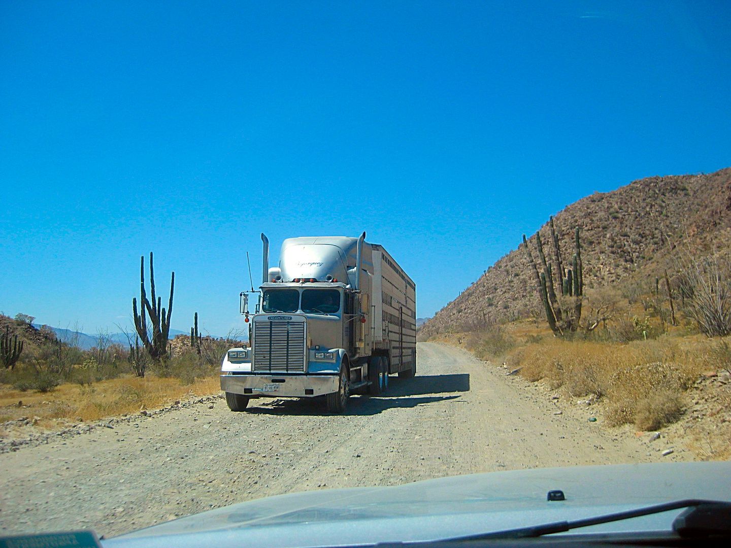
ROAD LOG:
Total / Partial Miles
0.0 0.0 Hwy. 1 Mulegé, Km. 135.5 (Ice Road) Concrete street going west.
1.1 / 1.1 End pavement
2.4 / 1.3 Construction equipment yard
2.7 / 0.3 Fork. Ahead is the original road, but rocky. Left (south) is alternate, rejoins in 3.2 miles.
5.1 / 2.4 Cattle Guard
6.0 / 0.9 Alternate road junction
8.3 / 2.3 Rancho Trinidad junction, south (small sign).
11.1 / 2.8 Rancho Trinidad junction, south (big signs).
24.6 / 13.5 Rancho El Aguajito
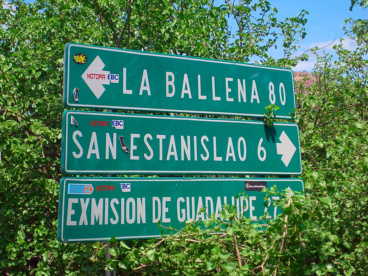
25.0 / 0.4 La Ballena Fork. Turn north for Guadalupe. Big signs.
25.8 / 0.8 Gate (always reclose behind you)
34.1 / 8.3 Fork. Go right. Left to ranch.
34.7 / 0.6 Gate.
36.9 / 2.2 Gate.
40.0 / 3.1 Road west.
40.1 / 0.1 Gate.
40.5 / 0.4 EX-MISION de GUADALUPE sign, turn left, cross arroyo, park near gate.
Less than 1,000 feet past the Ex-Mision sign is the fork (ahead to La Presa and right (uphill) is the washed out road to San José de Magdalena.
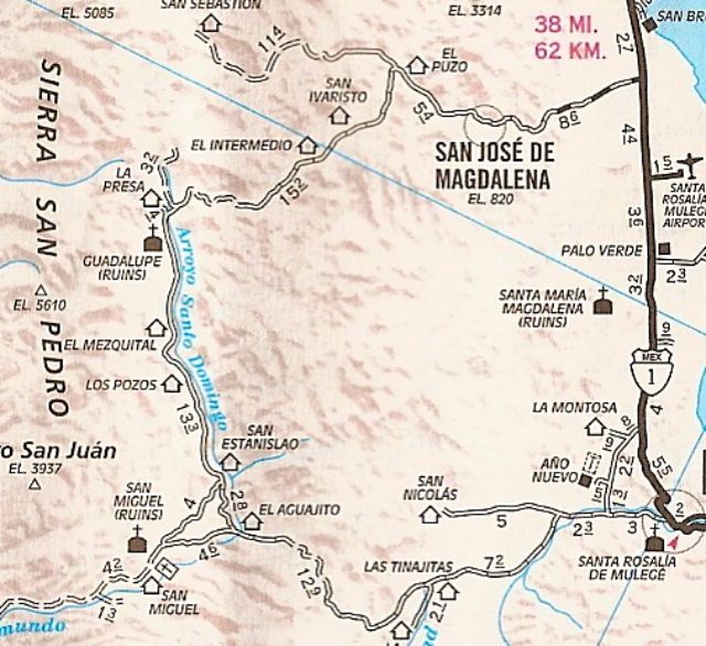
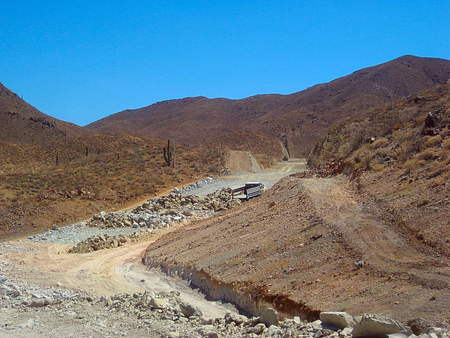
The AAA map mileages are different from mine, about 1 mile overall... so close. Leaving Mulegé, there are some changes. The road on to San Nicolas, I
think junctions at the cattle guard (Mile 5.1 on my log, 5.3 on AAA map). La Trinidad big sign junction was at Mile 11.1 for me, and 12.5 for AAA. The
La Ballena/ Guadalupe junction was 25.0 for me and 25.4 for AAA, so they are closing in! The fork just past the Ex-Misión sign is at Mile 40.6 for me
and 41.5 for AAA.
Coming next, a few photos of the drive back to Mulegé.
[Edited on 8-29-2017 by David K]
|
|
|
TMW
Select Nomad
Posts: 10659
Registered: 9-1-2003
Location: Bakersfield, CA
Member Is Offline
|
|
It would be interesting to see if anything has been done to open the road to Rancho Las Tunas which I think is on the road west you show at mile 40.
Rancho Las Tunas is open to San Ignacio and is maybe 7 or 8 miles from the junction.
I think it is at marker 1 as per the almanac
|
|
|
David K
Honored Nomad
Posts: 64479
Registered: 8-30-2002
Location: San Diego County
Member Is Offline
Mood: Have Baja Fever
|
|
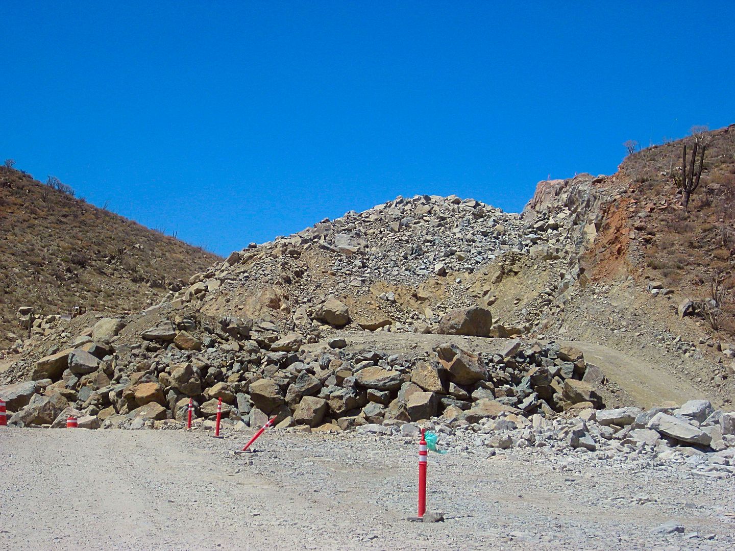
Yes, I presumed the road at Mile 40.0, I called "Road west" was that road to San Ignacio... but maybe only passable on motorcycles? Those storms of
2014 really waged war on the roads built the past 10-20 years to access this back country.
Here is the road that used to go through to San José de Magdalena... I got past this washout but was halted a bit beyond, 1.0 mi from the Ex-Mision
de Guadalupe sign...
Heading back towards the mission (on the other side of the palms) after turning around.
2003 Baja Almanac:
2009 Baja Almanac:
[Edited on 8-29-2017 by David K]
|
|
|
David K
Honored Nomad
Posts: 64479
Registered: 8-30-2002
Location: San Diego County
Member Is Offline
Mood: Have Baja Fever
|
|
Heading back to Mulegé
I think this steep graded was the peninsular divide, 1,825' above sea level. Mile 21.6 (from Mulegé), about 3 miles east of El Aguajito.
For this road, you better get your ass in gear!
Looking back from where I was.
A rugged day trip, allow 4 hours each way. How long you explore the mission is your call. I was only there for an hour, I think. It was a good hour,
however!
I was back to Mulegé before 6:30 pm. I had been texting with Russ out on Punta Chivato, who invited me over for dinner. I just needed to pick up some
tomatoes and an onion. There is great little store in Palo Verde, practically unmarked... and he had ice for sale, too. I was at Russ's about 7:30.
DONE DRIVING! (for today)
Stay tuned for DAY 13 of the 14 day trip.
[Edited on 8-28-2017 by David K]
|
|
|
David K
Honored Nomad
Posts: 64479
Registered: 8-30-2002
Location: San Diego County
Member Is Offline
Mood: Have Baja Fever
|
|
DAY 13 (Sunday Aug. 13, 2017)
Russ and I had a nice visit. His home is in a perfect location on Shell Beach, a private home area next to Punta Chivato. His view faces south towards
the entrance to Bahía Concepción.
Russ made us burritos and all was good.
I placed my cot out by his sea wall and had the stars above me. Tomorrow I would make the drive towards home so the final day would not be too
stressful a day's drive.
Sunday morning, I was on my way at 9:20.
Out to Hwy. 1 at Palo Verde and turning north...
The San Borjitas cave art access road is at Km. 156
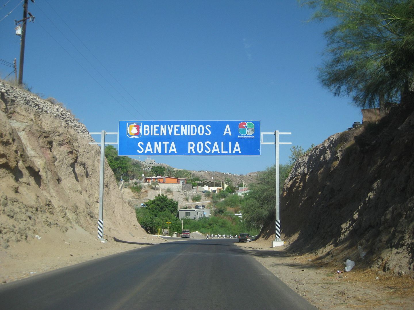
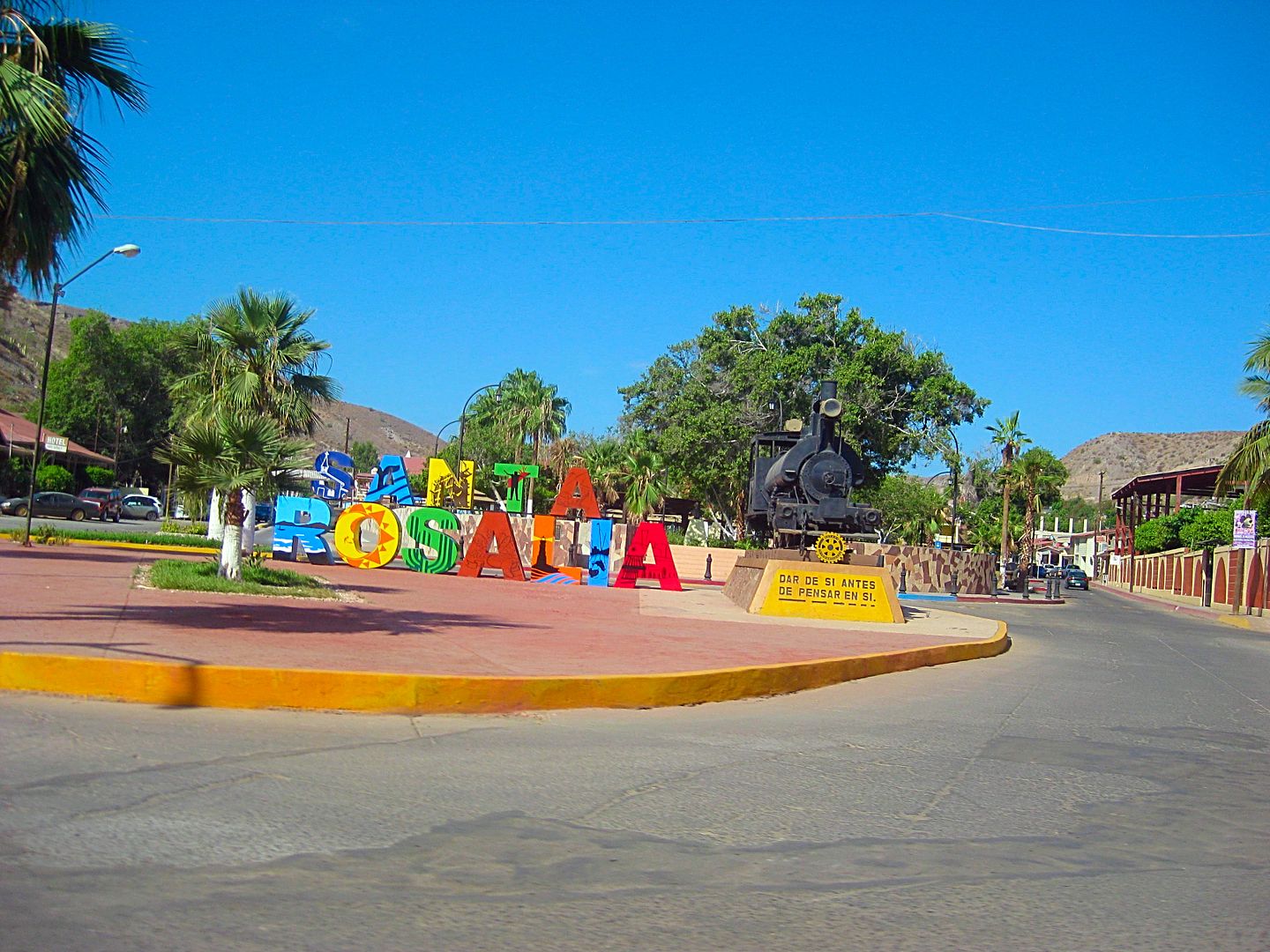
Santa Rosalia is Km. 195 (from Loreto) and here becomes Km. 0, northbound to the state border at the Eagle Monument.
Pemex fill-up at the first station northbound, on the east side, closest to the harbor: 16.28 pesos/ liter; 930 pesos; 57.13 liters; Dollars were
accepted at 16.00: 1. I was about out of pesos, so in dollars, it was $58.13 (I gave the attendant $60 and the change was his tip). I traveled 340
miles since the last fill up, mostly off road. In Mulegé, I added in 30.7 liters... So, 87.13 liters = 23.2 gallons for 340 miles = 14.6 MPG. With
all the dirt roads driven yesterday and the Mulegé gas station well known to not have honest pumps, I am not disappointed in the figure.
Some overall mileage notes that I scribbled down:
Santa Rosalía to Vizcaino (Bahía Tortugas jcn.) 88 miles (143 kms.)
Santa Rosalía to Paralelo 28° (Eagle) 136 miles (220 kms.)
My mileages have all been adjusted for the 3.5% slow odometer because I am using oversized tires. When compared to the Mexican kilometer posts, this
correction is spot on. On roads where I have deflated the tires down to 25 psi, the odometer slows down very close to accurate. My tires are
265/75-16, about 1" taller than the stock 265/70-16 tires.
At the Eagle Monument Pemex (near Guerrero Negro), 28° Parallel of latitude and the state border, Pacific Time Zone...
I add gas at the Pemex station. Very nice personal there. A US$20 bought me 320 pesos of gas (16:00: 1). 15.88 pesos/liter. 20.1 liters.
12:54 PM became 11:54 AM!
19.6 miles north is Villa Jesus María (the final Pemex station on Hwy. 1 until El Rosario, or if using Hwy. 5, until Gonzaga Bay).
108.7 miles north is the Highway 5 junction (Laguna Chapala). It is 1:58 pm.
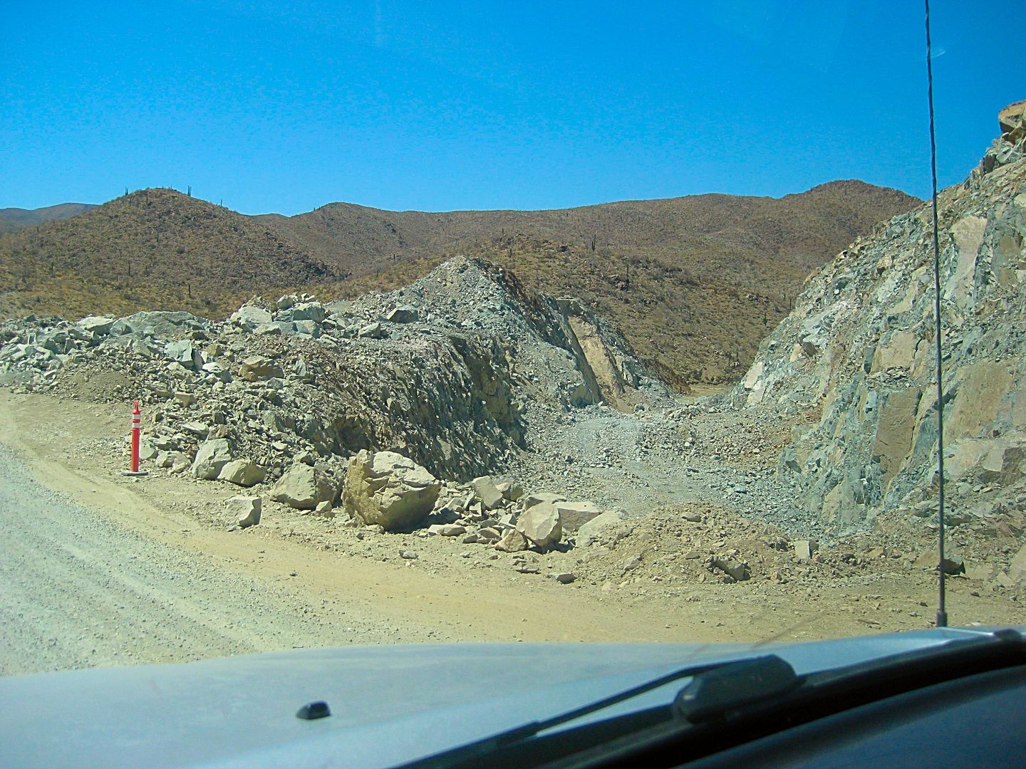
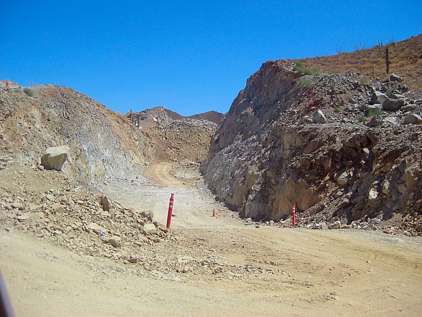
NEW ROADBED OPEN!
In the 2 weeks since I was last on this route, barriers blocking the new highway elevated roadbed (south of the original road) were removed and other
cars were on it. During construction, these detours could very well change back.
Mile 0.0 Hwy. 1 & Hwy. 5 Junction, 1:58 pm.
Mile 0.9 Fork right onto new roadbed.
Mile 3.5 original and new roads rejoin.
Mile 5.2 off of new roadbed.
Mile 8.0 Construction camp, leave new road alignment and head for Coco's Corner.
Mile 12.9 Coco's Corner 2:36 pm
Mile 16.8 Las Arrastras 2:45 pm Rejoin new road route.
Mile 22.3 On pavement and new bridges.
Mile 23.2 Km. 167 (just north of previous pavement start).
Mile 35.5 Gonzaga Bay Pemex, 3:12 pm
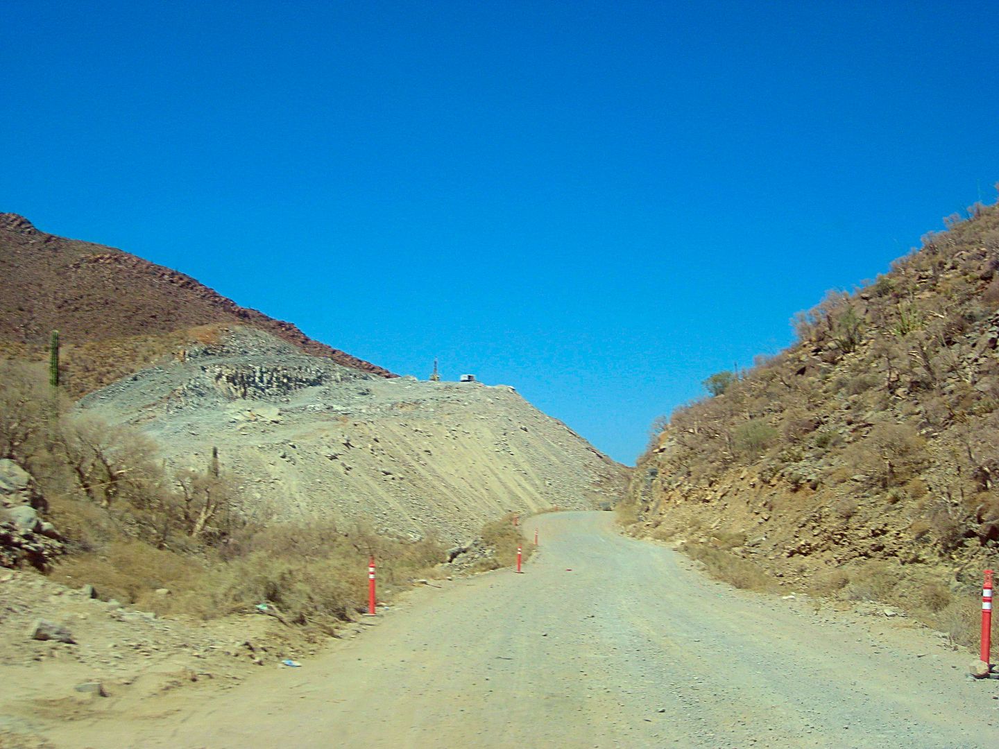
Paved bridge, new section, Chapala Valley.
New section, Chapala Valley.
Can you imagine how Arturo Grosso made the first road through here, in 1955? Picks and dynamite!
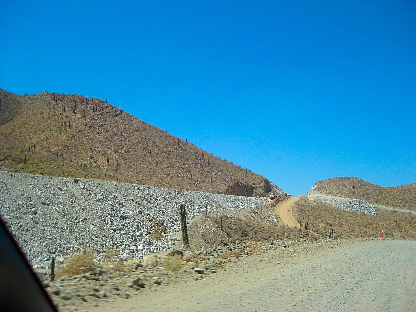
Here is where the highway leaves the original route (northbound) and shoots straight to Las Arrastras, bypassing Coco's Corner.
Nearing Coco's Corner.
Here at Las Arrastras, is where the new highway returns to the original route, on the north end of the Coco's Bypass.
Old and new routes criss-cross a few times.
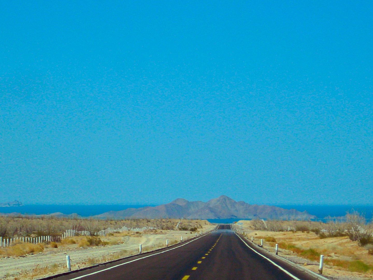
Gonzaga Bay, dead ahead!
Made it to Shell Island for my final rest stop and overnight of this 2-week research trip!
357 miles from Santa Rosalía and 112 miles from Laguna Chapala.
Good Night from Shell Island, Day 13.
One more day to go!
[Edited on 8-31-2017 by David K]
|
|
|
David K
Honored Nomad
Posts: 64479
Registered: 8-30-2002
Location: San Diego County
Member Is Offline
Mood: Have Baja Fever
|
|
DAY 14 (MON. AUG. 14, 2017) Headed Home!
I had a great evening under the stars.
Unless there is wind, Shell Island is an ideal beach camp and relaxing location. It is a 4WD only kind of place either for the deep sand on the beach
or the possible mud beds that surround it. It is an island and during the highest lunar tides, sea water surrounds this barrier island beach. The
access is at Km. 26 (another road cuts across from Km. 25). It is 1.3 miles to the mudflats and another 0.5 to the dry sand of the beach. The island
is about one mile to the south end (Bahia Santa Maria bay) and three miles to the north point (opposite Rancho Percebu campground). Camp where ever
you like or as much deep sand driving you can do.
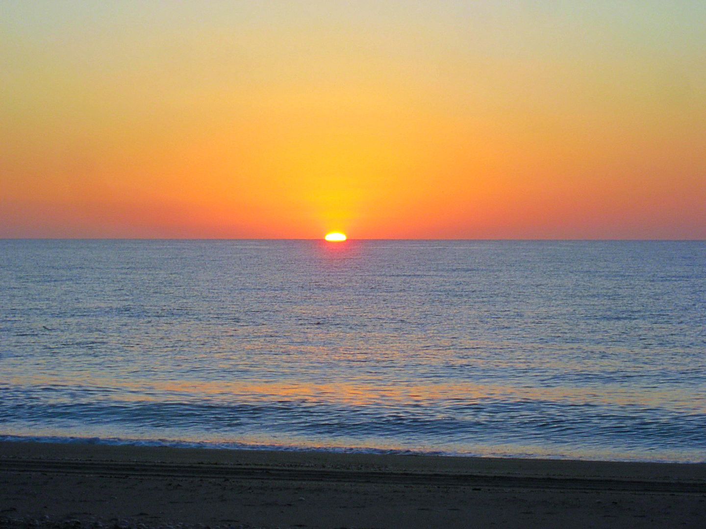
Monday Sunrise
I am packed and headed to San Felipe at 7:48 am.
In town, the car wash I have used most of the other times is open and can take me right away! Getting excess mud off the truck before going to the
border can really make a crossing easy. I was once threatened to be turned back because of the mud and dirt on my truck!
Car wash (exterior only) was just $5. I always give a tip because I appreciate the job they do!
The gas station in SanFelipe (at the ejido station, just north of town) was 15.91 pesos/ liter; offered an exchange rate of 17.60 pesos/ dollar and I
was good for the 300-mile drive home to north San Diego County.
There is a sand dune field about 60 miles north of San Felipe, a perfect rest stop.
Just another awesome trip and fantastic service from my Tacoma. In the 3,000 miles, I had one tire puncture that we plugged and the 5+-year-old
battery died on me, in the best place possible, a block from an Auto Zone store.
I took the Toll highway to Tecate (Mex. 2-D) which avoids the city of Mexicali. The toll was 75 pesos for Mexicali South; 24 pesos at La Rumorosa; and
70 pesos at El Hongo.
I was in the border line at 1:05 pm Monday and inside the USA at 2:09 pm. I got home at 3:57 pm.
SUCCESS!
Thank you to Baja Bound Insurance for sponsoring these mapping and research trips. I now have a lot of work to do to put these miles and notes into a
road guide format. I look forward to sharing my work with you all and we can help each other with some feedback at what is most useful for you to have
on your Baja travels.
Knowing that there are interesting and beautiful sites just out of sight may inspire you to see more of Baja than just going back to the same great
place over and over? The future map is hopefully going to be useful as well. Stay tuned!
David www.vivabaja.com
I welcome your questions and suggestions to improve this trip report!
|
|
|
TMW
Select Nomad
Posts: 10659
Registered: 9-1-2003
Location: Bakersfield, CA
Member Is Offline
|
|
["My mileages have all been adjusted for the 3.5% slow odometer because I am using oversized tires. When compared to the Mexican kilometer posts, this
correction is spot on. On roads where I have deflated the tires down to 25 psi, the odometer slows down very close to accurate. My tires are
265/75-16, about 1" taller than the stock 265/70-16 tires."]
Have you used your GPS to compare to your speedometer? On both my 2004 Tacoma and 2004 GMC after going to an inch taller tire the speedometer was
right on. 60mph was 60mph.
|
|
|
| Pages:
1
2
3
4
5 |
|


