| Pages:
1
2 |
Gscott
Junior Nomad

Posts: 70
Registered: 1-23-2017
Member Is Offline
|
|
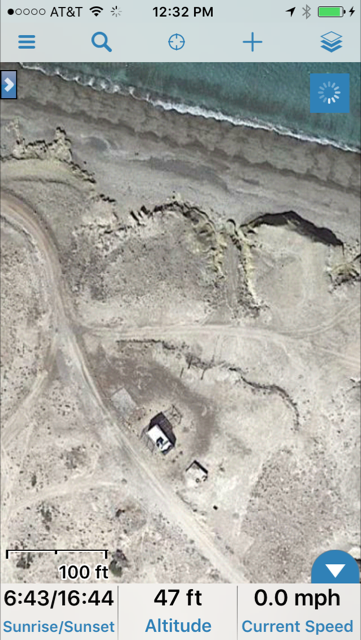
Gaia GPS maps
Anyone used this map app? Check out the level of detail at the link below (zoom all the way in to 500 feet or so) What do you think? I might give
it a try if you all think it looks decent. Looks to be about $20 on the Google Play store.
https://www.gaiagps.com/map/
|
|
|
AKgringo
Elite Nomad
Posts: 5807
Registered: 9-20-2014
Location: Anchorage, AK (no mas!)
Member Is Offline
Mood: Retireded
|
|
When I used the link provided by Gscott, the map centered on where I am now in Nevada County, CA. Coincidence, or am I really being followed? 
Anyway, I zoomed in on property that my family has owned since the 40s, and found errors right away. Fire breaks that my dad established between our
property and adjoining BLB land years ago, show up as roads.
They are only drivable on the ridges, and not continuous but someone (or an algorithm) connected the sections and even labeled them as an extension of
an actual existing road.
I have seen the errors before on some other source (not Google or Bing), so they are using old data.
If you are not living on the edge, you are taking up too much space!
"Could do better if he tried!" Report card comments from most of my grade school teachers. Sadly, still true!
|
|
|
David K
Honored Nomad
Posts: 64479
Registered: 8-30-2002
Location: San Diego County
Member Is Offline
Mood: Have Baja Fever
|
|
Gaia looks good until you zoom in... In some areas, it shows all the roads (along the coast, for example), but nothing much inland is shown when I
looked south of San Felipe.
|
|
|
bkbend
Senior Nomad
Posts: 693
Registered: 11-27-2003
Location: central OR or central baja
Member Is Offline
|
|
Quote: Originally posted by AKgringo  | When I used the link provided by Gscott, the map centered on where I am now in Nevada County, CA. Coincidence, or am I really being followed?
|
You're being followed, or your IP address is. I opened earlier this morning and it centered on Vancouver, BC. I thought it was where Gscott was at
when he posted the link. Now I assume it's because I'm using a VPN service which happens to be based in Canada and Vancouver is where I'm actually
jumping onto the internet.
Back to the topic -- I peeked at some favorite forest roads to my secret spots locally and the roads did not show up, a good thing. Switching to the
USGS layer brought them back, but for some reason that layer does nothing in Baja.
|
|
|
caj13
Senior Nomad
Posts: 998
Registered: 8-1-2017
Member Is Offline
|
|
judt got the National Geo North and south maps. look like they wioll do the trick. I often use GPS or phone for navigation, but when I'm planning -
or scheming, I like to have maps in front of me, I get alot better feel for distances, come across hidden gems etc!
|
|
|
kk6mbh
Newbie
Posts: 17
Registered: 1-31-2015
Location: Leucadia, CA
Member Is Offline
|
|
| Quote: Originally posted by Gscott | Anyone used this map app? Check out the level of detail at the link below (zoom all the way in to 500 feet or so) What do you think? I might give
it a try if you all think it looks decent. Looks to be about $20 on the Google Play store.
https://www.gaiagps.com/map/ |
I've used this one over the last five years or so from Yellowstone to San Juanico. The app gets better with with every update. To get the most out of
it I'd recommend upgrading to the Premium service. I use the website to plot courses and enter way points, which I save and then download to my iPhone
or iPad. In addition, you can access other users routes, trails and way points. It's not cheap but I've found it to be the best available for my
needs.
|
|
|
SteveWil
Junior Nomad
Posts: 29
Registered: 7-9-2010
Member Is Offline
|
|
Another one that I use (on Android ) is AlpineQuest GPS Hiking. Don't let the Hiking fool you, it has road maps also.
It kind of like Gaia but allow you to download google and bing Sat map so you can use off line.
You can spend a lot of time downloading maps at the different zoom levels before a trip.
|
|
|
StuckSucks
Super Nomad
Posts: 2306
Registered: 10-17-2013
Member Is Offline
|
|
| Quote: Originally posted by David K | | Gaia looks good until you zoom in... In some areas, it shows all the roads (along the coast, for example), but nothing much inland is shown when I
looked south of San Felipe. |
I use Gaia as a redundant map while racing in Baja. I can download HIGH resolution sat maps, as well as road maps, topo, etc. to use offline. I can
then overlay the race course, chase access roads and other information.
I am a lover of maps. I have detailed topo maps of the entire southwest US and Baja as well as many other flavors of maps. I discovered the wonders of
e-mapping (GPS, GIS, sat images) 20 years ago and have never touched a dead tree since. In my world, the e-version provides a greater degree of detail
and accuracy.
|
|
|
Road Runner
Newbie
Posts: 22
Registered: 10-27-2015
Member Is Offline
|
|
Depending on where you are (Rural, urban), google maps (For directions) can work really well. You can download the directions for offline use or use
it where mobile data is available. I've used this all around La Paz, Cabo, Todos Santos and los Barrilles areas and it worked great. Not sure how well
the Google maps will work for more remote areas and obviously they probably won't work well for offroad.
Metro PCS offers Unlimited Mexico data/call etc for $5 add on feature, so when ever I head down to Mex I activate this. It is very convenient to be
able to enter an address and have Google maps give directions instantaneously.
|
|
|
basautter
Senior Nomad
Posts: 862
Registered: 7-1-2013
Member Is Offline
|
|
I recommend both the Baja California Almanac and the AAA map. Neither is perfect, but between the two you will get to your desired location.
|
|
|
Gscott
Junior Nomad
Posts: 70
Registered: 1-23-2017
Member Is Offline
|
|
Thank you for those that took the time to evaluate GAIA. I could see it has some primitive roads but have no first hand knowledge of roads to know how
good it is.
Since I posted this I picked up a copy of the "Baja Topographic Atlas Directory" for a decent price. I'm pretty happy about that.
|
|
|
David K
Honored Nomad
Posts: 64479
Registered: 8-30-2002
Location: San Diego County
Member Is Offline
Mood: Have Baja Fever
|
|
The BIG spiral bound map book? Great find!
|
|
|
Jinete Viejo
Junior Nomad
Posts: 88
Registered: 1-23-2017
Member Is Offline
|
|
The GAIA map shows an area called "Zona Nucleo" due east of Guererro Negro on the opposite coast. It appears to be just south of La Trinidad where the
No Wimps trail turns west towards El Gato. What is this?
|
|
|
| Pages:
1
2 |


