| Pages:
1
2
3
..
9 |
David K
Honored Nomad
        
Posts: 65435
Registered: 8-30-2002
Location: San Diego County
Member Is Offline
Mood: Have Baja Fever
|
|
My (31) 2018-2021 Series BAJA CALIFORNIA MAPS
Without expensive software or professional IT assistance but great help from a couple of Baja Nomads with their knowledge and skills (John M &
Taco Felix)... I produced these maps to help the reader of the Baja Bound Book orient himself/herself to the surrounding area as they are using the
kilometer by kilometer or mile by mile road logs... or just to be inspired to see more of this magnificent peninsula.
The maps are all handmade using computer-aided drawing, as I have described in the other threads I posted to while making these. There is some
consistency in style and use of symbols but as each map was made individually, there are some differences. My idea was to make it a casual but
accurate map. One that shows only the places logged or visited in 2017 and just a few additional roads if they were mentioned in the road log. Not too
much stuff that wouldn't help with using the log, which has great details in it.
The base map is a terrain relief map based on actual satellite imagery. The base map only shows coastlines and mountains plus some of the federal
highways at the scale size I am using. Other paved roads and highways on the map (drawn in black) I added. All dirt roads and many paved roads were
drawn by me, tracing over satellite images so I am placing the roads I traveled accurately ... other than some jiggles from hand drawing them.
Icons for the map (highway signs, airplanes, gas pumps, mission churches, mine symbols, etc. were all created by John. Taco Felix helped with an
improved compass rose and the scale bar. Squares and circles are from me using the software in Word.
The base map is from a company that has this program for exactly this kind of map making, ArcGIS. These maps are for education and enlightenment and
discussion and enjoyment. They are here, free for your enjoyment. I have not been paid to make them... I made them on faith.
I will post them here from north to south, and where the peninsula is wider, from west to east. Not all areas of Baja have maps showing them. I
concentrated on areas that would benefit readers the most from these maps. One map is a larger scale than the rest (Gonzaga Bay Area) and the others
have been sized to fit the page/screen. So, while the rest may have all been drawn at the same scale, sizing them may have 1" being different amounts
of kilometers. The scale bar is in kilometers, showing 5, 10, 15, and most cases also 20. Rounded to the nearest mile, that is 3, 6, 9, and 12 miles
(3.1, 6.2, 9.3, 12.4 to be more exact).
Maybe in the future, They can be made universal and can fit together... make a wall map with them?
I have asked for your help to spot typos or corrections when I was making these, and you have, thanks. I imagine some of you will find more, and I
welcome the message. Maybe u2u or email me your findings?
In the (near) future, I would like to amend these maps with mileages placed along the side roads that lack kilometer posts. This may make them even
more fun to use or check out against your odometer?
With no AAA map since 2010 and no Almanac editions since 2009, a map with our favorite roads and sites in Baja seems like a great idea! If anyone
wants to contact me to produce more Baja maps, I am available!
I am just in need of a break now that I reached this point!
Would you like to have me plan a trip or advise on the roads I traveled the past couple of years, maybe have me lead a tour or just buy a copy of my
book on the history of the Spanish colonization of the Peninsula of California? See the link at the bottom of my posts for books.
BAJA CALIFORNIA (NORTE) Maps 1-15:
Map 1
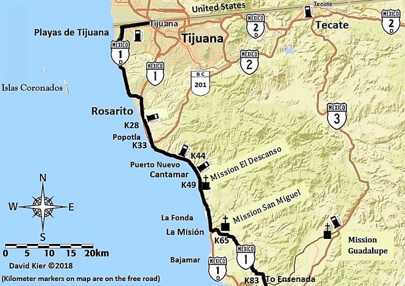
Map 2
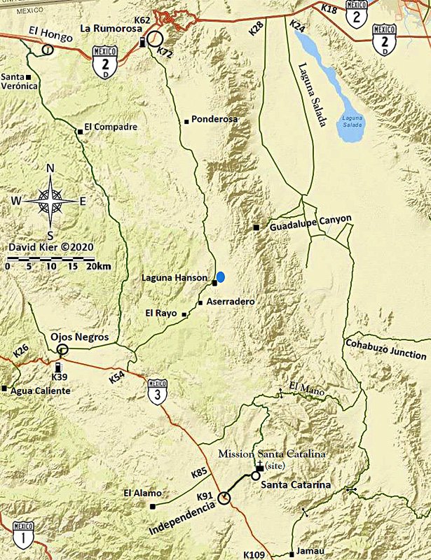
Map 3
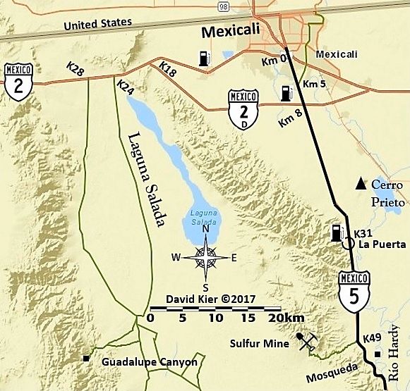
Map 4
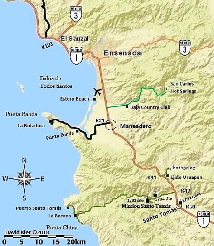
Map 5
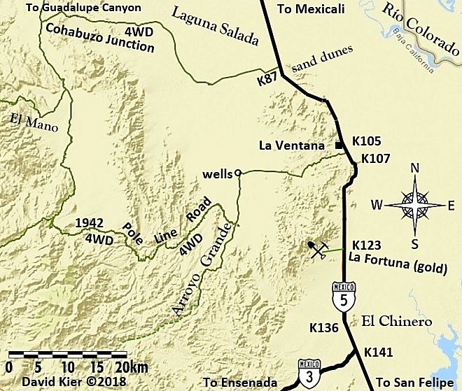
Map 6
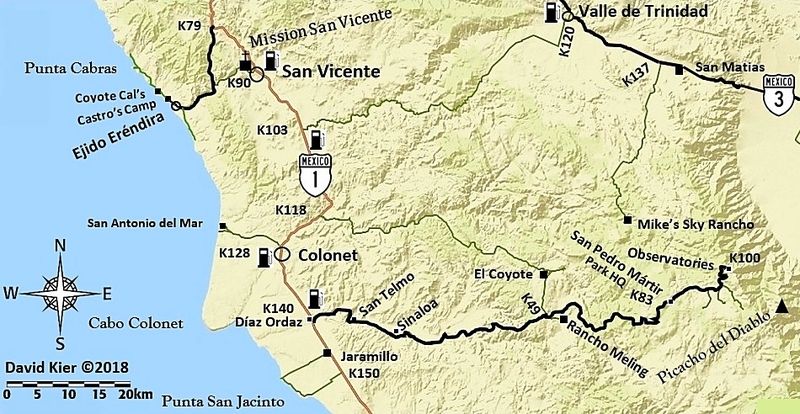
Map 7
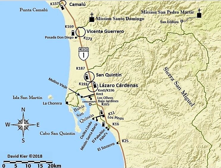
Map 8
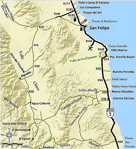
Map 9
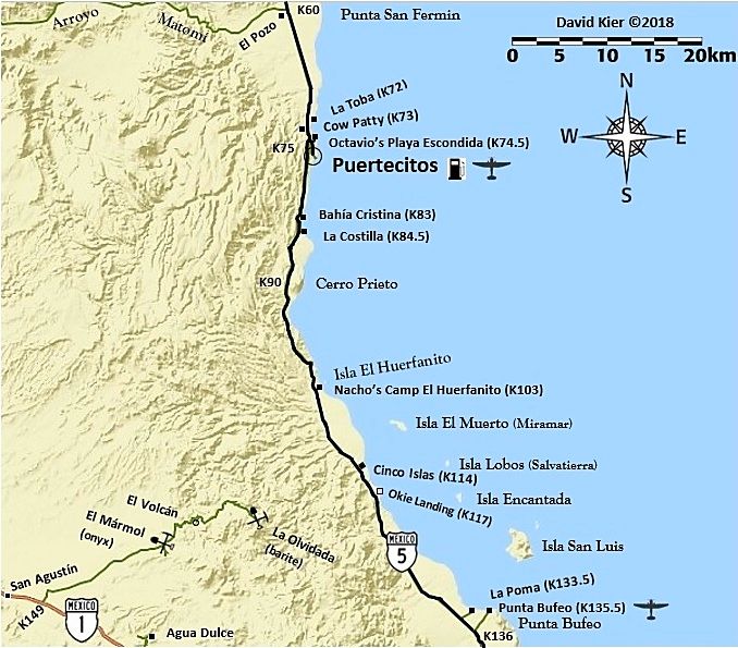
Map 10
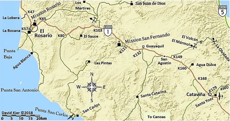
Map 11
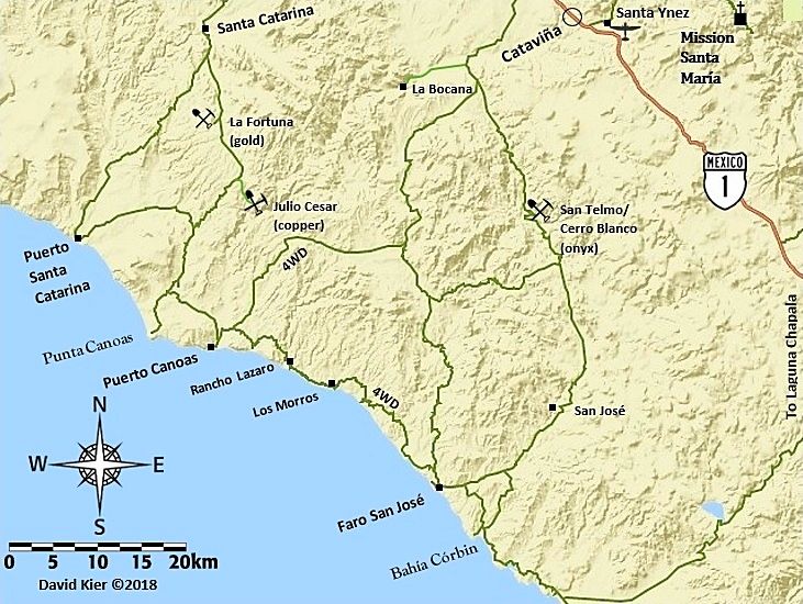
Map 12
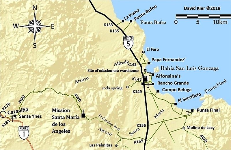
Map 13 (2021)
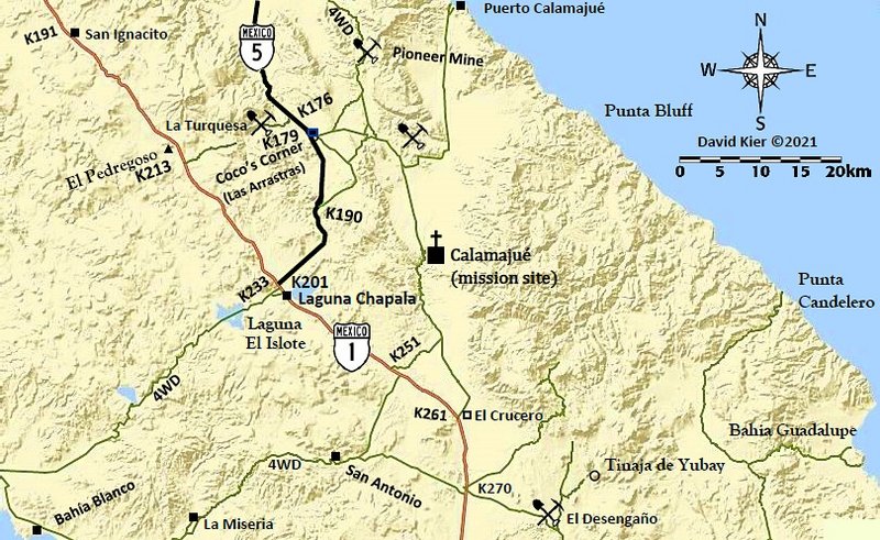
Map 14
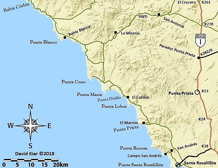
Map 15
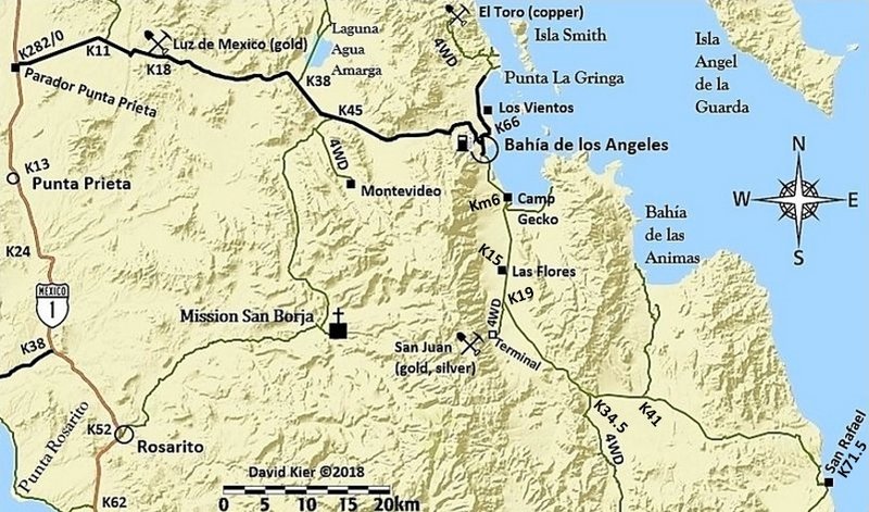
Map 16
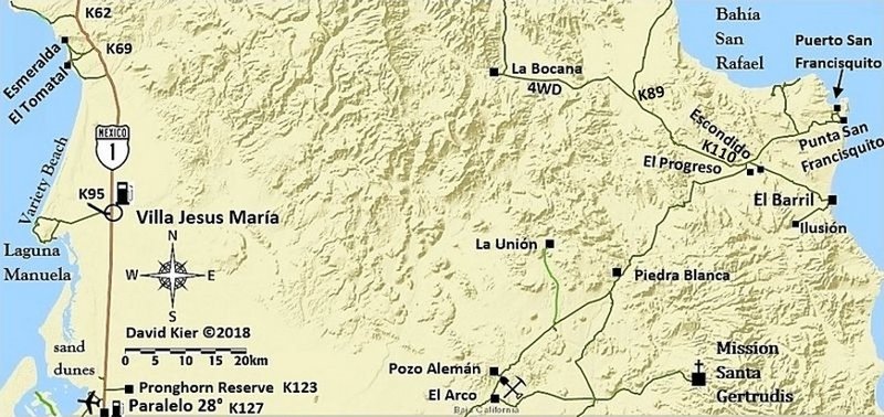
Baja California Sur, Maps 17-31
Map 17
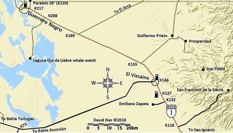
Map 18
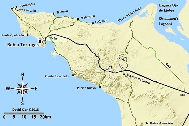
Map 19
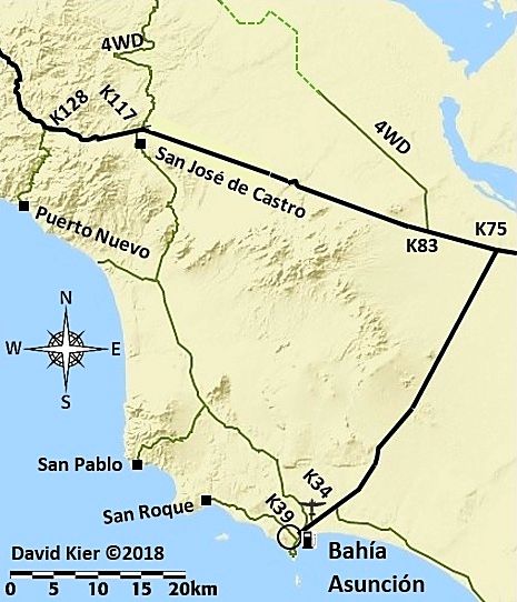
Map 20
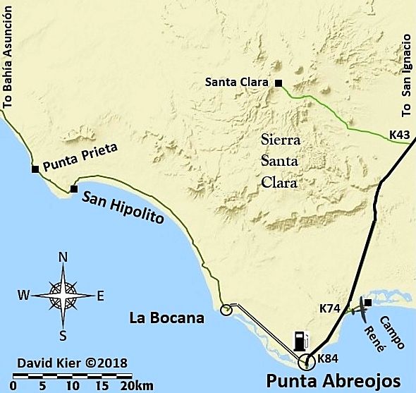
Map 21
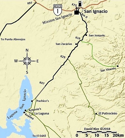
Map 22
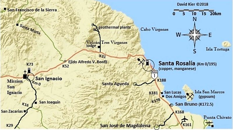
Map 23
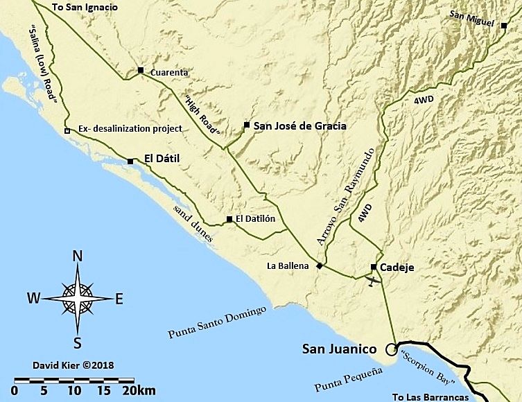
Map 24
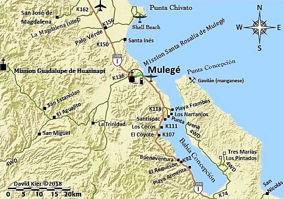
Map 25
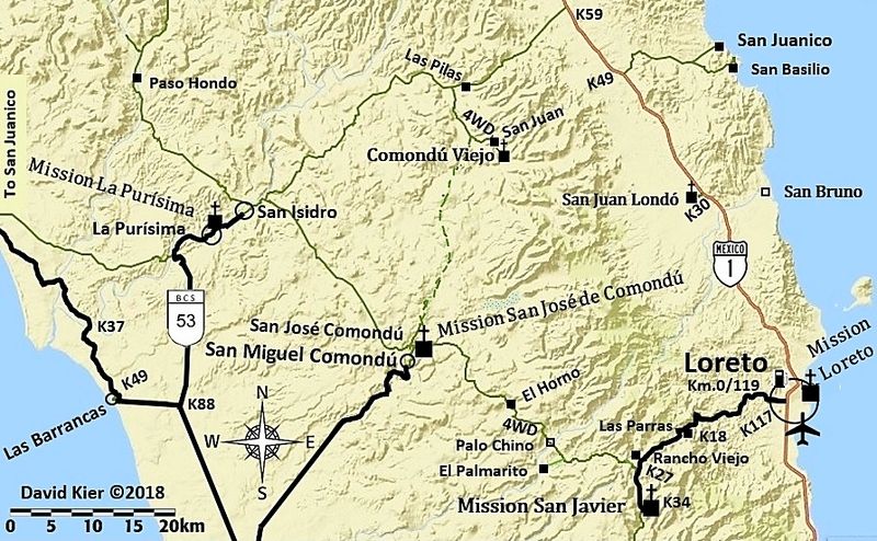
Map 26
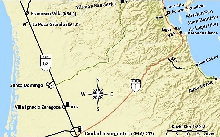
Map 27
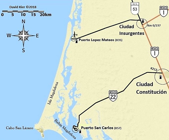
Map 28
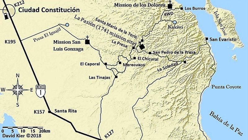
Map 29
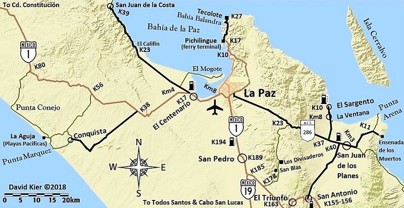
Map 30
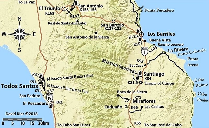
Map 31
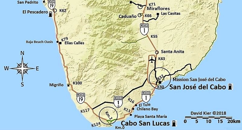
[Edited on 6-21-2021 by David K]
|
|
|
advrider
Super Nomad
   
Posts: 1920
Registered: 10-2-2015
Member Is Offline
|
|
Very nice, I think many will find these very useful!
|
|
|
Abel.Villesca
Newbie
Posts: 10
Registered: 11-6-2017
Location: Albuquerque, New Mexico
Member Is Offline
|
|
Fantastic! Thanks David.
|
|
|
StuckSucks
Super Nomad
   
Posts: 2374
Registered: 10-17-2013
Location: Pacific Plate
Member Is Offline
|
|
Thorough job!!
|
|
|
BajaBill74
Nomad
 
Posts: 255
Registered: 1-27-2014
Member Is Offline
Mood: Beyond Extatic!
|
|
You left out Santa Rosa, Ca. How do expect me to get home from Mulege?
What I'm doing at work is so secret, even I don't know what I'm doing!
One should believe in God, because even Google doesn't know everything.
|
|
|
chuckie
Elite Nomad
     
Posts: 6082
Registered: 2-20-2012
Location: Kansas Prairies
Member Is Offline
Mood: Weary
|
|
Keen! Nicely done!
|
|
|
mtgoat666
Platinum Nomad
       
Posts: 20555
Registered: 9-16-2006
Location: San Diego
Member Is Offline
Mood: Hot n spicy
|
|
Thanks for all the maps! Now I wont need to buy the book! 
Woke!
Hands off!
“Por el bien de todos, primero los pobres.”
“...ask not what your country can do for you – ask what you can do for your country.” “My fellow citizens of the world: ask not what America
will do for you, but what together we can do for the freedom of man.”
Pronoun: the royal we
|
|
|
4x4abc
Ultra Nomad
    
Posts: 4454
Registered: 4-24-2009
Location: La Paz, BCS
Member Is Offline
Mood: happy - always
|
|
San Jose de Garcia = San Jose de Gracia
Harald Pietschmann
|
|
|
4x4abc
Ultra Nomad
    
Posts: 4454
Registered: 4-24-2009
Location: La Paz, BCS
Member Is Offline
Mood: happy - always
|
|
San Juaquin = San Joaquin
Harald Pietschmann
|
|
|
TacoFeliz
Nomad
 
Posts: 268
Registered: 7-22-2005
Location: Here
Member Is Offline
Mood: Exploratory
|
|
Really nice job David. Two thumbs up!
Thank you.
|
|
|
nbentley1
Nomad
 
Posts: 140
Registered: 9-16-2016
Member Is Offline
|
|
These are great. Thanks for putting them together.
|
|
|
gator
Junior Nomad

Posts: 41
Registered: 8-28-2014
Member Is Offline
|
|
Awesome job. Must have taken a lot of work. Thanks for sharing.
|
|
|
MulegeAL
Nomad
 
Posts: 299
Registered: 8-25-2009
Location: PDX/Mulege
Member Is Offline
|
|
Nice maps David, thank you!
Of course now that you have published them and are taking a break:
Consider extending the road from Palo Verde at K156 to the rancho San Borja, which is check-in place to the well-known cave. The local guide here is
running tourists in there with a long F350 van, so how bad can it be?
Report this season is the last half is lots of arroyo rock driving.
|
|
|
fishbuck
Banned
Posts: 5318
Registered: 8-31-2006
Member Is Offline
|
|
Mission historian, cartographer, photographer, offroad adventurer...
DavidK: Renansance man.
Maybe we can mount a gopro on my plane and ad photos.
"A ship in harbor is safe, but that is not what ships are built for." J. A. Shedd.
A clever person solves a problem. A wise person avoids it. – Albert Einstein
"Life's a Beach... and then you Fly!" Fishbuck
|
|
|
rancho guillermo
Nomad
 
Posts: 158
Registered: 7-7-2016
Member Is Offline
|
|
A lot of work..very nice job. I am sure also some fun was involved in doing the research.
|
|
|
TMW
Select Nomad
      
Posts: 10659
Registered: 9-1-2003
Location: Bakersfield, CA
Member Is Offline
|
|
A job well done David, thanks.
|
|
|
ehall
Super Nomad
   
Posts: 1906
Registered: 3-29-2014
Location: Buckeye, Az
Member Is Offline
Mood: It's 5 o'clock somewhere
|
|
Nice work David.
|
|
|
David K
Honored Nomad
        
Posts: 65435
Registered: 8-30-2002
Location: San Diego County
Member Is Offline
Mood: Have Baja Fever
|
|
Well, they can only get better, right? For a casual look, non-computer guy attempt, and color blind, too! Not bad, right? If printed, they would
likely be in black and white... I could show what that would look like, might be cool?
|
|
|
David K
Honored Nomad
        
Posts: 65435
Registered: 8-30-2002
Location: San Diego County
Member Is Offline
Mood: Have Baja Fever
|
|
Black & White
Here are a couple of B&W views of one of the maps (Gonzaga Bay Area):
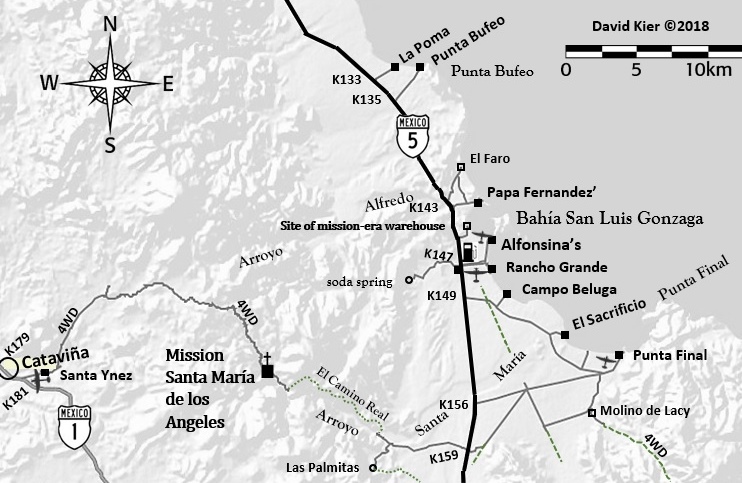
[Edited on 1-24-2018 by David K]
|
|
|
David K
Honored Nomad
        
Posts: 65435
Registered: 8-30-2002
Location: San Diego County
Member Is Offline
Mood: Have Baja Fever
|
|
Mileages
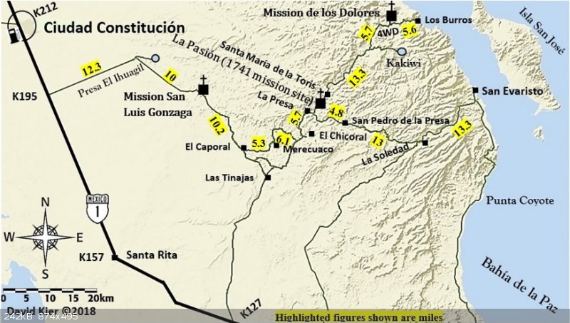
OK, I took the Dolores/San Evaristo map and added mileages along roads I drove. I found that at the map scale I am using mostly, anything less than 5
miles is too small to insert a number (a number that is big enough to see). So, I combined numbers for a section of road such as both sides of the
LaPasión mission site. Also, with the mountain terrain, it was very difficult to read the numbers, so I highlighted them.
I am not sure if this works or looks well???
|
|
|
| Pages:
1
2
3
..
9 |

