| Pages:
1
2
3 |
PaulW
Ultra Nomad

Posts: 3005
Registered: 5-21-2013
Member Is Offline
|
|
Cordornices road
Cordornices road
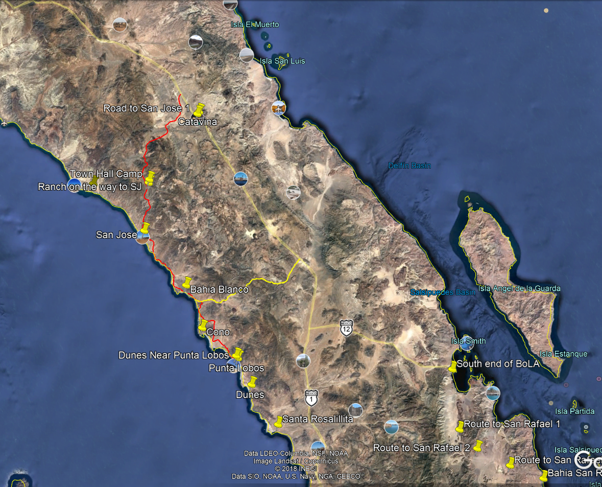
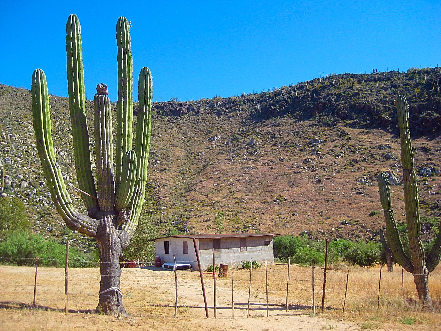
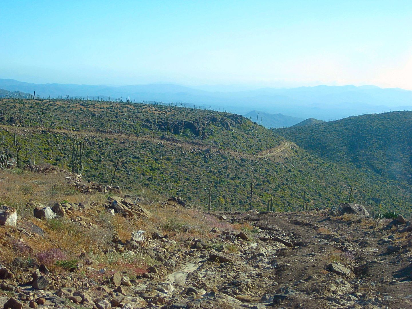
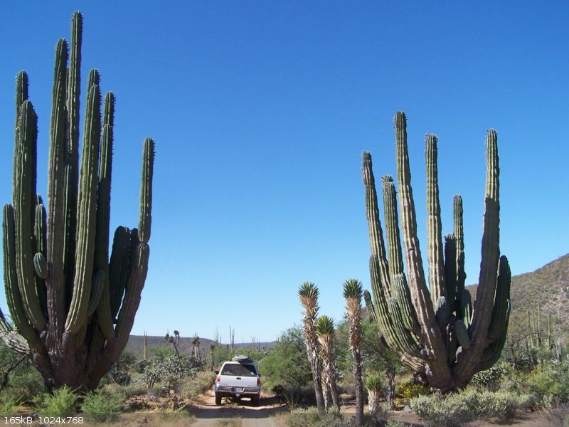
From Villa Jesus where we spent the night we drove to Santa Rosalillita, knocked on the door of a house by the basketball court and ask for breakfast.
This lady used to operate a cafe there and she accommodated us. From there we headed northwest. Stopped at Punta el Diablo (A nice place to spend the
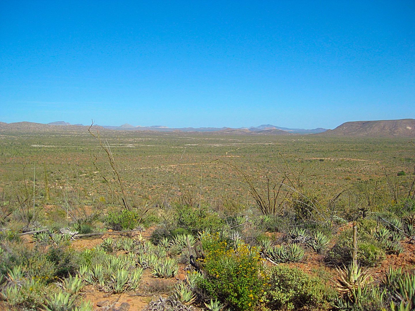
night when camping). It is a major surfing place, also called El Cardon. Drove on the sand dunes. From there we took the Cordornices road. Along the
way we stopped for lunch at the abandoned rancho - "San Antonio (Cordornices) (Ab)". Then back to Hwy 1. The trip leaders, Rich T., past trips
required payment to pass thru the green fence gates of “Rancho Cordornices”. This time nobody was around. Stopped at the next rancho to renew
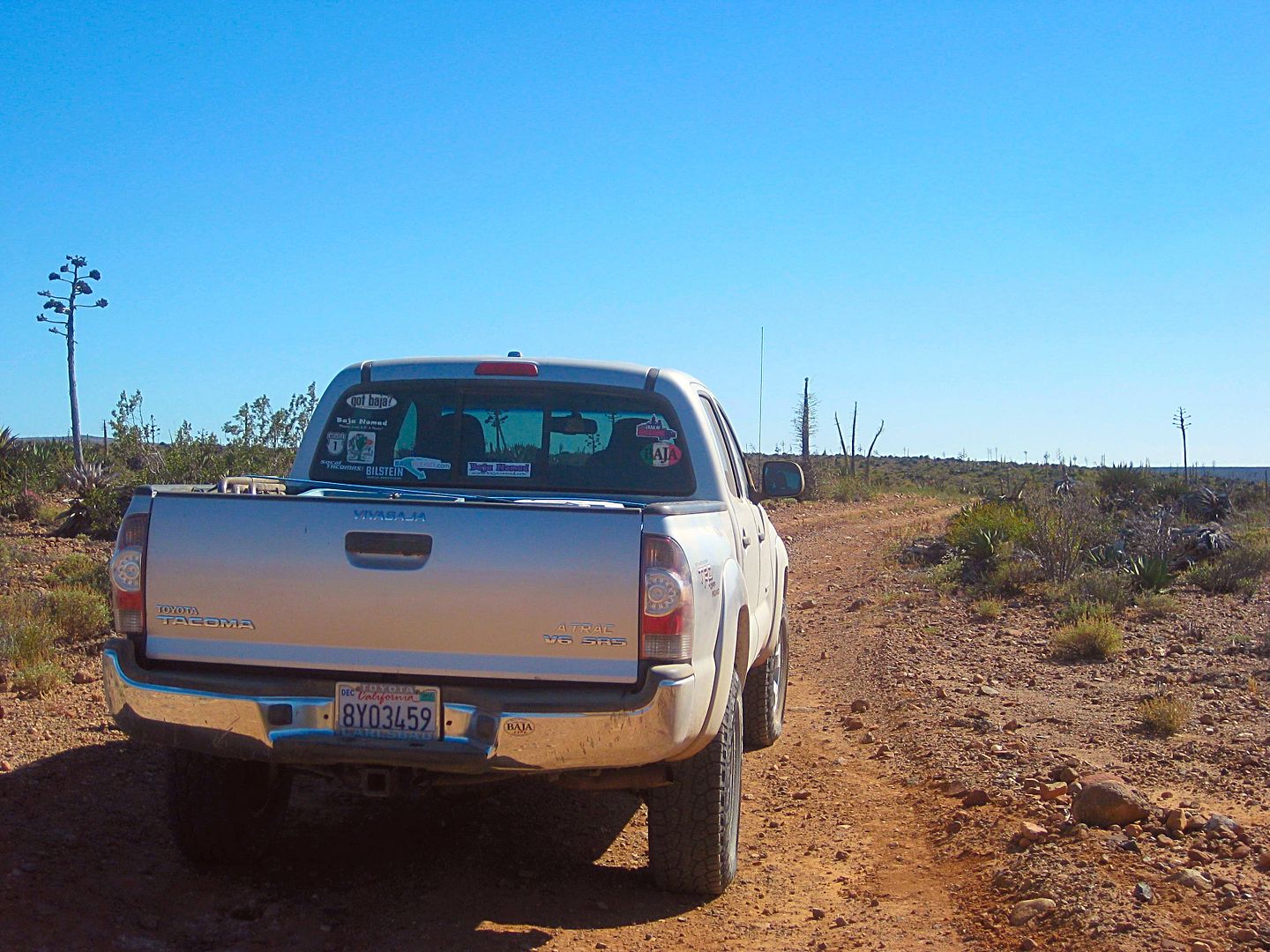
leader’s friendships. Gave them some snack food. Anyway, the road is shown on the Almanac. We found some severe washouts, but had no issue driving
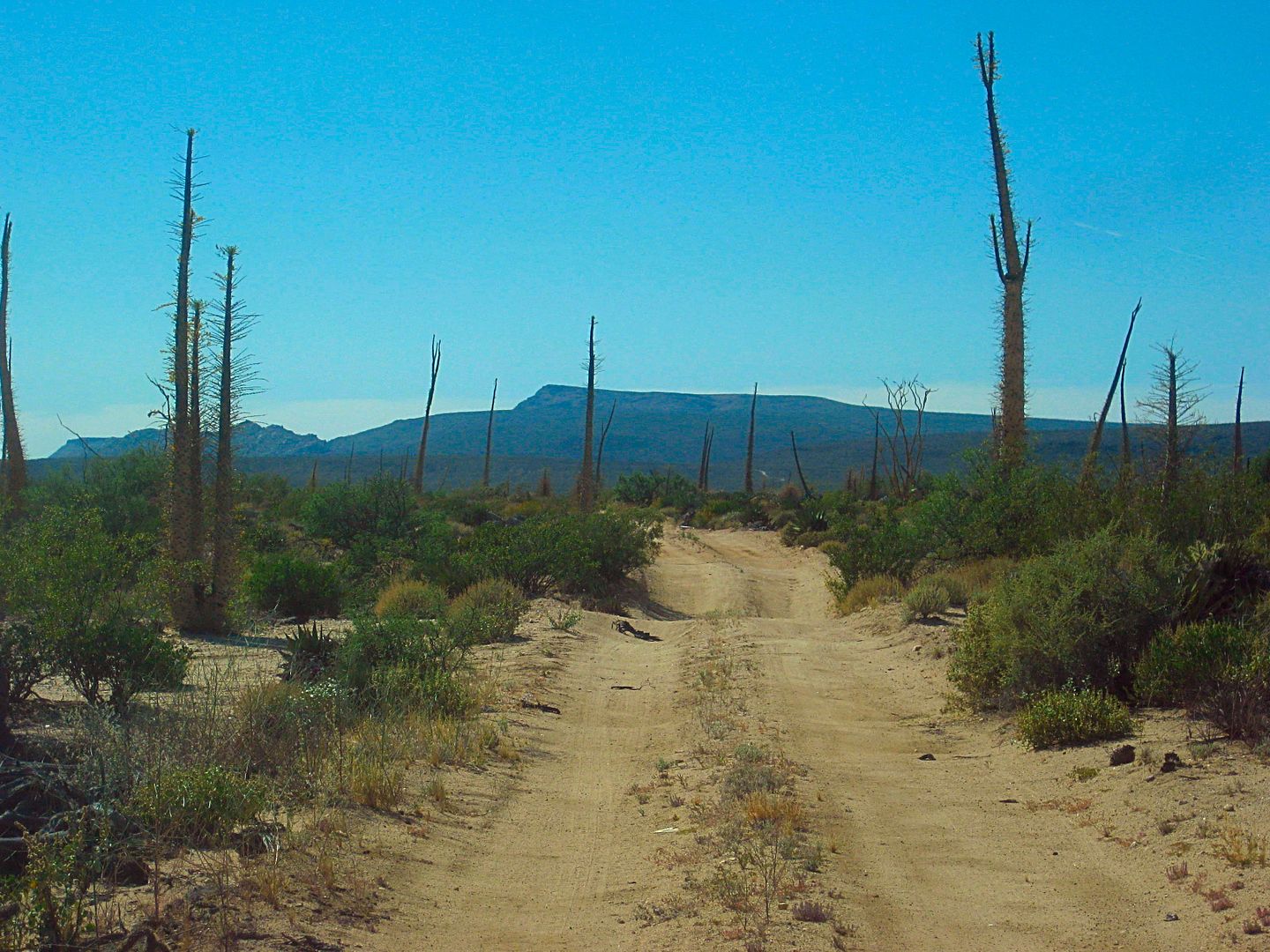
around and thru them. Good trip with very little bushes to drive thru. Two short very steep sections requiring 4Lo near the top of the mountains. Best
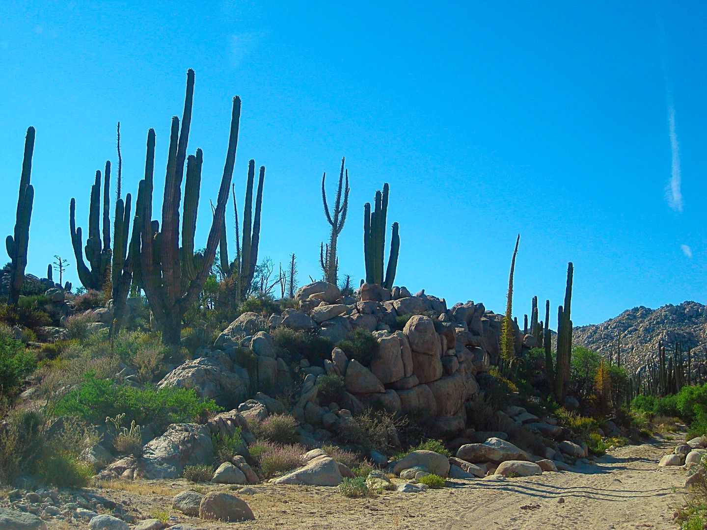
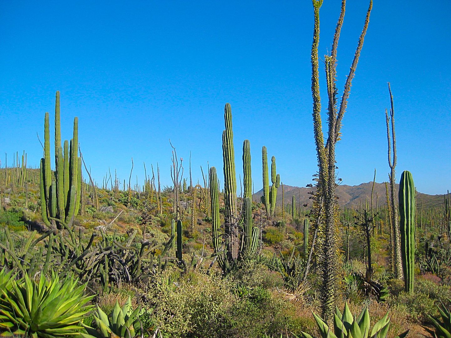
Cardon, Boojum, and barrel cactus forest we have ever seen. This road is a good one for a repeat.
Details: Exit going west toward Santa Rosillitia from Hwy1 at K38 find the place where we had breakfast at 28 40.1, -114 14.165
Begin the Cordornices road at 28 57.394, -114 32.06
find Rancho Cordornices 29 06.42, -114 30.763
Rancho San Antonio (ab) at 29 11.75606, -114 19.02191
Return to Hwy1 at k252
See the road on the Almanac
I might add this trip can be done in a long day from San Felipe with an optional overnight in LAB or camp at El Diablo.
This trail is relatively popular. Here is an example with pictures dated 2012
https://mexico.pueblosamerica.com/foto/rancho-codornices
The Inreach 10 minute track is shown below between leaving and returning to Highway 1

Attached is the GPS .USR file to allow the reader to make their own .GPX or Google Earth .KML file for viewing
Pictures will have to follow later.
Attachment: Cordornices Rd.usr (87kB)
This file has been downloaded 252 times
[Edited on 2-10-2018 by PaulW]
[Edited on 2-10-2018 by PaulW]
|
|
|
TMW
Select Nomad
Posts: 10659
Registered: 9-1-2003
Location: Bakersfield, CA
Member Is Offline
|
|
Good to know, thanks Paul.
|
|
|
TMW
Select Nomad
Posts: 10659
Registered: 9-1-2003
Location: Bakersfield, CA
Member Is Offline
|
|
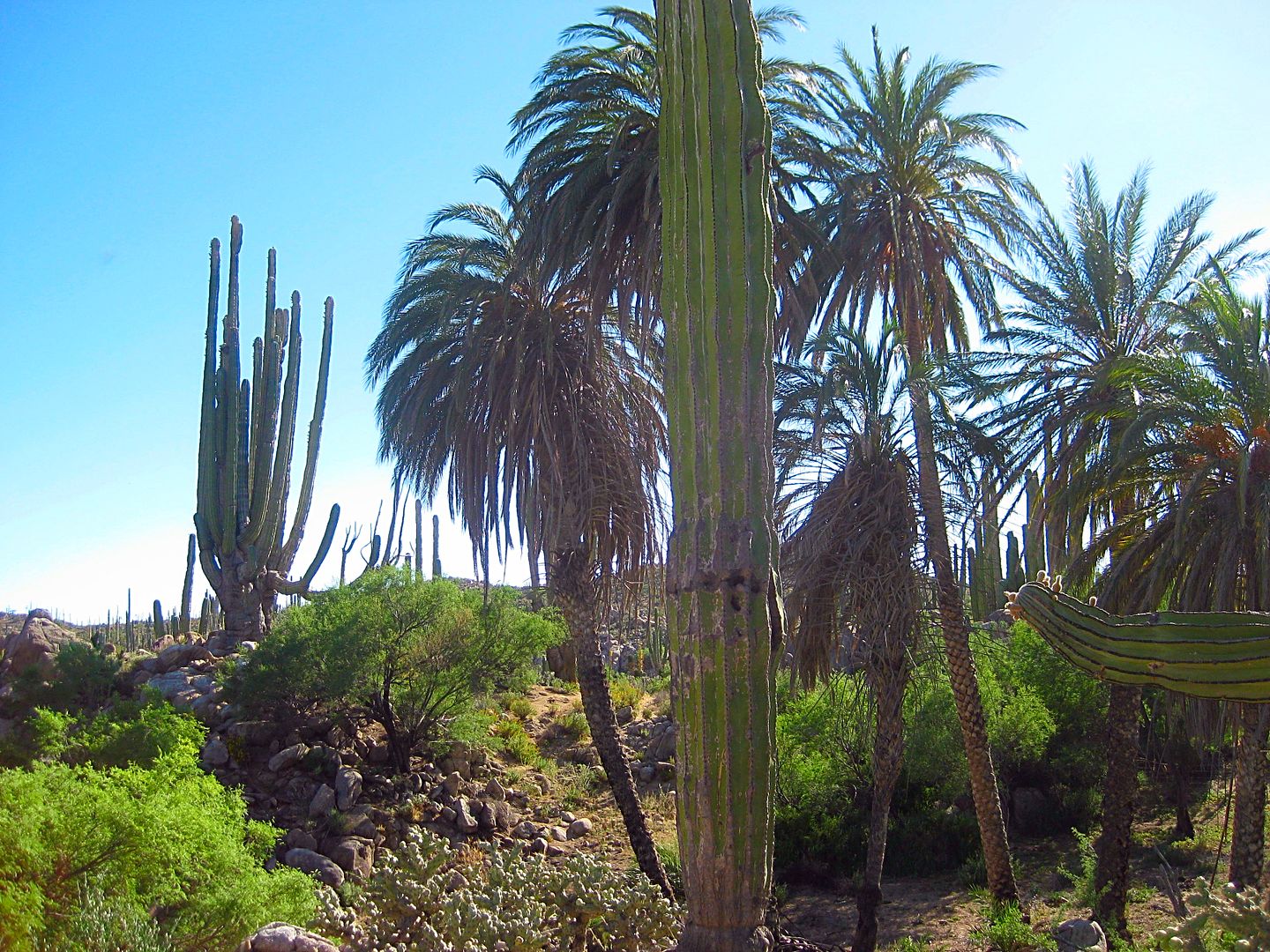
Paul, I have R. San Antonio AB (Codornices) at 29-11.75x114-19.02.
There are a couple of adobe building ruins and several palm trees and a well. The last time I was there the palm trees had been burnt, but still
standing.
|
|
|
Ateo
Elite Nomad
Posts: 5847
Registered: 7-18-2011
Member Is Offline
|
|
I wish I still owned a 4X4 truck.........
|
|
|
TMW
Select Nomad
Posts: 10659
Registered: 9-1-2003
Location: Bakersfield, CA
Member Is Offline
|
|
Only real men drive 4x4s, so disapointing.
|
|
|
Ateo
Elite Nomad
Posts: 5847
Registered: 7-18-2011
Member Is Offline
|
|
The divorce ate my 4X4. =(
|
|
|
David K
Honored Nomad
Posts: 64480
Registered: 8-30-2002
Location: San Diego County
Member Is Offline
Mood: Have Baja Fever
|
|
This is the road I traveled last year and rescued the couple at Rancho Miseria whose Ranger truck was broken down at the bottom of the long 4WD grade.
They were out of food and meds. Photos of the beautiful cactus Paul mentions, as well. It was my Trip #4 report.
|
|
|
woody with a view
PITA Nomad
Posts: 15937
Registered: 11-8-2004
Location: Looking at the Coronado Islands
Member Is Offline
Mood: Everchangin'
|
|
Word!
|
|
|
MulegeAL
Nomad
Posts: 298
Registered: 8-25-2009
Location: PDX/Mulege
Member Is Offline
|
|
Paul,
Thanks for that! Did that climb years ago on a bike, was tough climb to the top mesa.
And that cactus forest section is one of the best anywhere, even though it poked holes in my armor! I remember the old adobe at San Antonio too, date
palms, doves and some water.
Was really glad to get out to the highway without damage or a flat.
Hope to do it again but maybe north to south this time
|
|
|
TMW
Select Nomad
Posts: 10659
Registered: 9-1-2003
Location: Bakersfield, CA
Member Is Offline
|
|
Sorry about that. Hang in there and you'll get one again.
|
|
|
PaulW
Ultra Nomad
Posts: 3005
Registered: 5-21-2013
Member Is Offline
|
|
We were told the summit route was rebuilt due to flooding and supposedly is easier not, but steep.
Yes, real nice drive.
====
Quote: Originally posted by MulegeAL  | Paul,
Thanks for that! Did that climb years ago on a bike, was tough climb to the top mesa.
And that cactus forest section is one of the best anywhere, even though it poked holes in my armor! I remember the old adobe at San Antonio too, date
palms, doves and some water.
Was really glad to get out to the highway without damage or a flat.
Hope to do it again but maybe north to south this time |
|
|
|
JZ
Elite Nomad
Posts: 9233
Registered: 10-3-2003
Member Is Offline
|
|
Rode down that way with my 13yo and 15yo last year. We went down near Cativina and along the coast to Santa Rosalillita. Blew right by the turn back
up to Hwy 1 (Cordornices).
I want to go back and ride it now.
[Edited on 2-11-2018 by BajaNomad]
|
|
|
PaulW
Ultra Nomad
Posts: 3005
Registered: 5-21-2013
Member Is Offline
|
|
Thanks Tom,
My second edit fixed my error.

=========
| Quote: Originally posted by TMW | Paul, I have R. San Antonio AB (Codornices) at 29-11.75x114-19.02.
There are a couple of adobe building ruins and several palm trees and a well. The last time I was there the palm trees had been burnt, but still
standing. |
|
|
|
David K
Honored Nomad
Posts: 64480
Registered: 8-30-2002
Location: San Diego County
Member Is Offline
Mood: Have Baja Fever
|
|
Because of the new interest in this road... here is what I have to share:
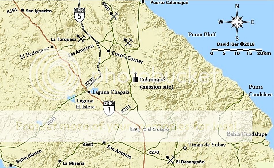
I accessed it from Km. 270+ and there were almost immediately some very attractive boojum trees.
From April 2017:
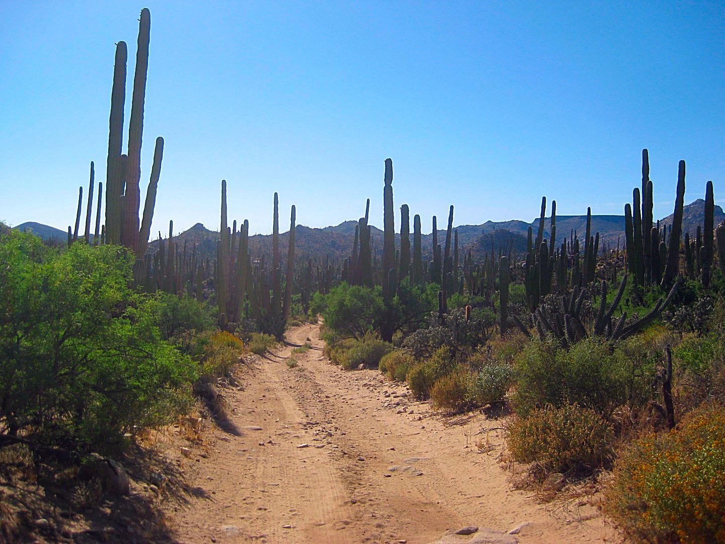
Of the several roads across Baja from Highway 1 down the center to the Pacific coast, the Rancho San Antonio road may be the scariest to do solo!
I was glad I had an inReach communicator so I could contact my friends who offered to come help or coordinate help if needed. I can send or receive
short text or email messages which help the day go by. My evening chats with Baja Angel (my wife Elizabeth) are comforting and make my being away so
far not so bad.
The difference between the inReach and the Spot device is the 2-way communicating. Right now, I am getting Spot locations for TW, I can't ask him what
he is up to or where he wants to go. I only see where he is and an I'm OK message.
I leave the highway at Km. 270.5, I drop the air pressure in my tires to 24 psi. It is 3:15pm. I will just go to where I find a camp spot or do a
night drive in order to give my new LED lamps a workout!
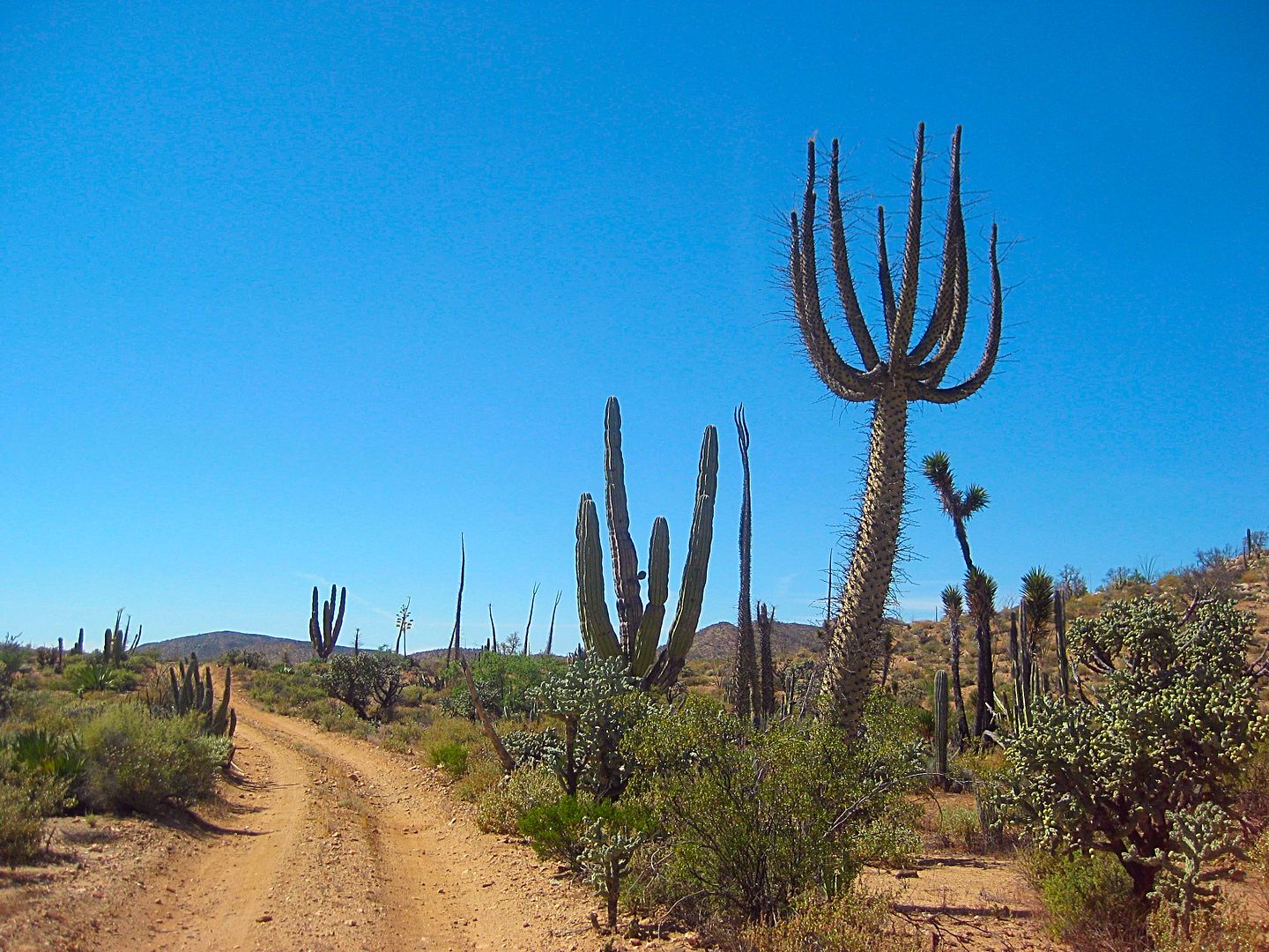
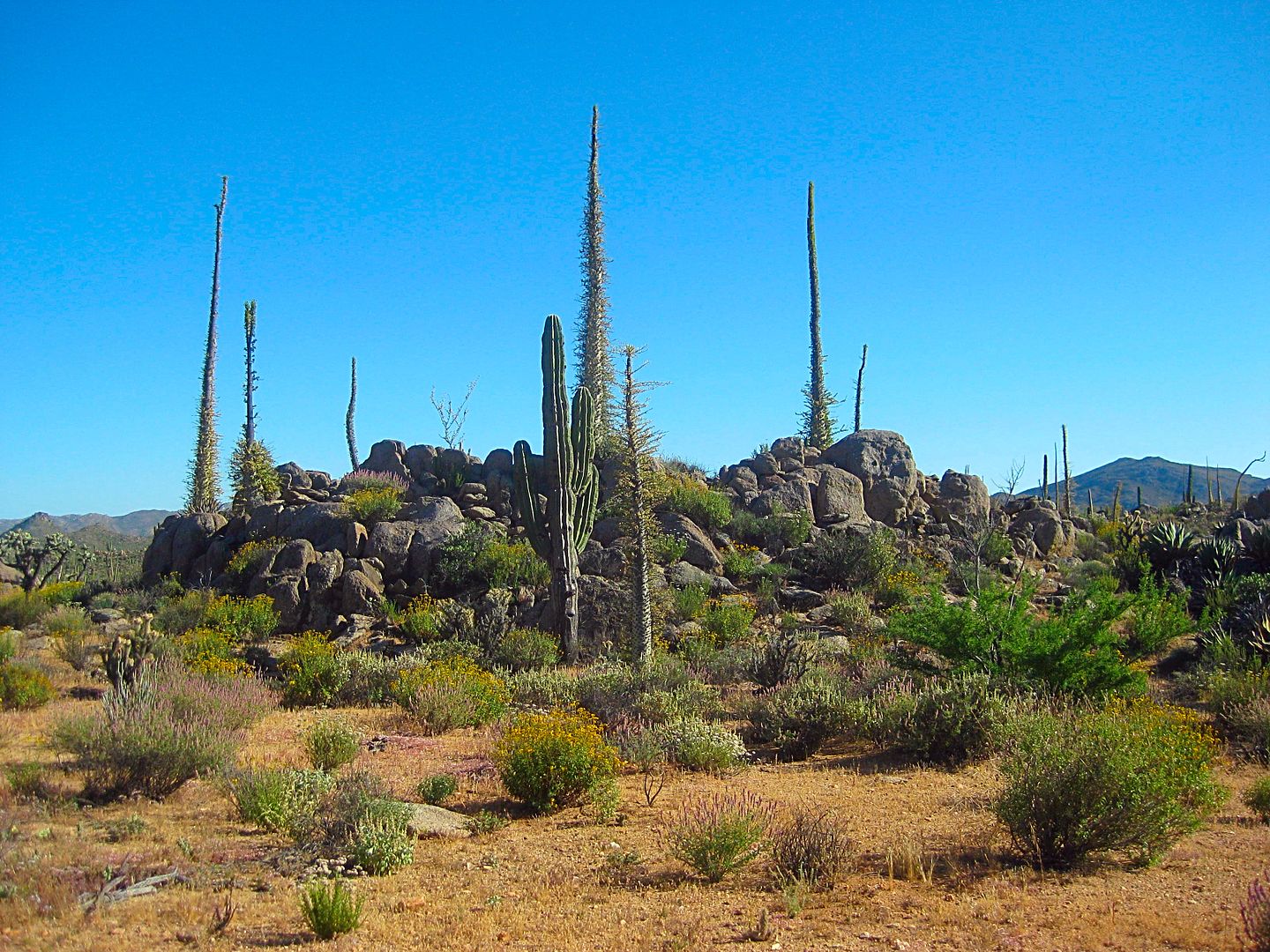
A welcoming boojum tree!
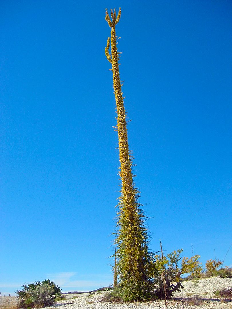
Fresh green coat on this tall one.
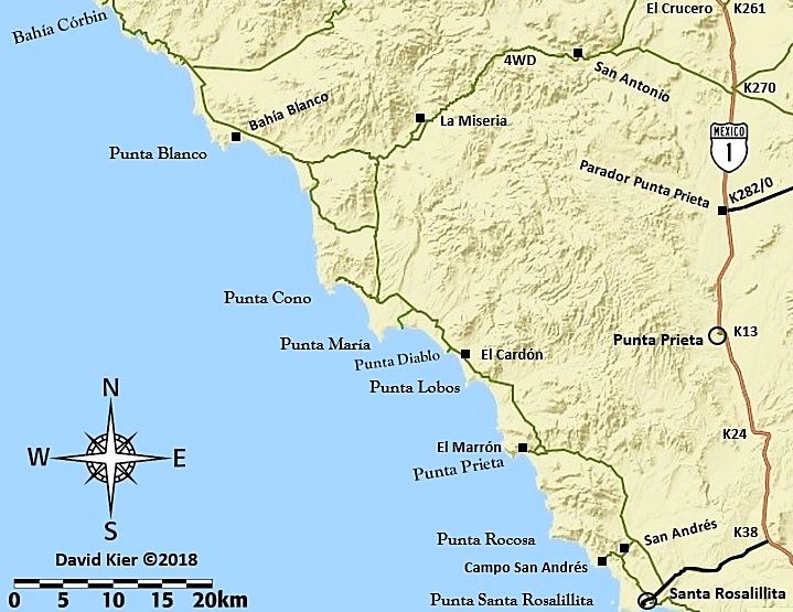
It is 9.3 slow miles on this short cut road to the one that is on most maps, 11 miles south of Chapala to San Antonio and Bahía Blanco.
From a high point, looking back at the road I was just on.
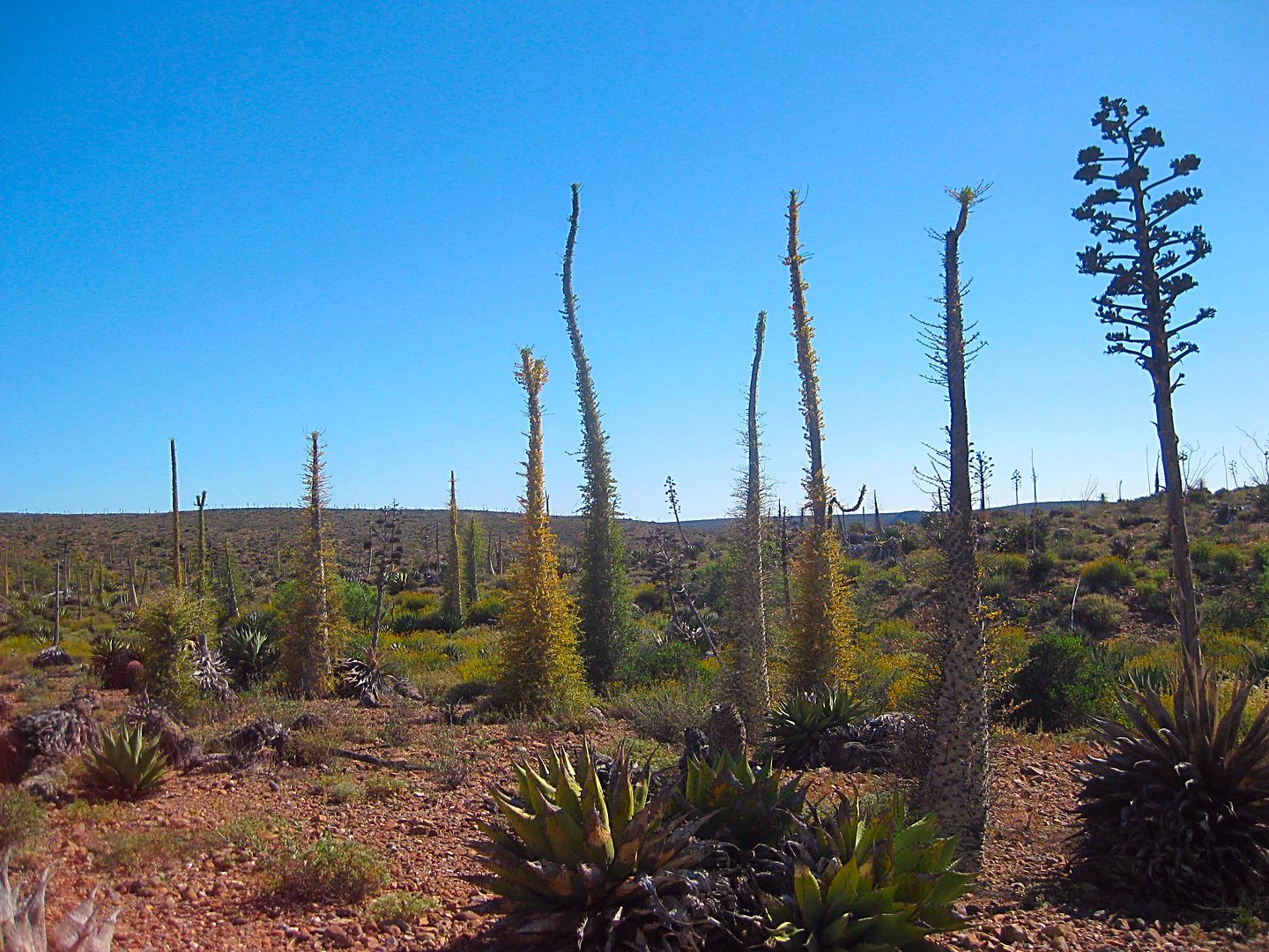
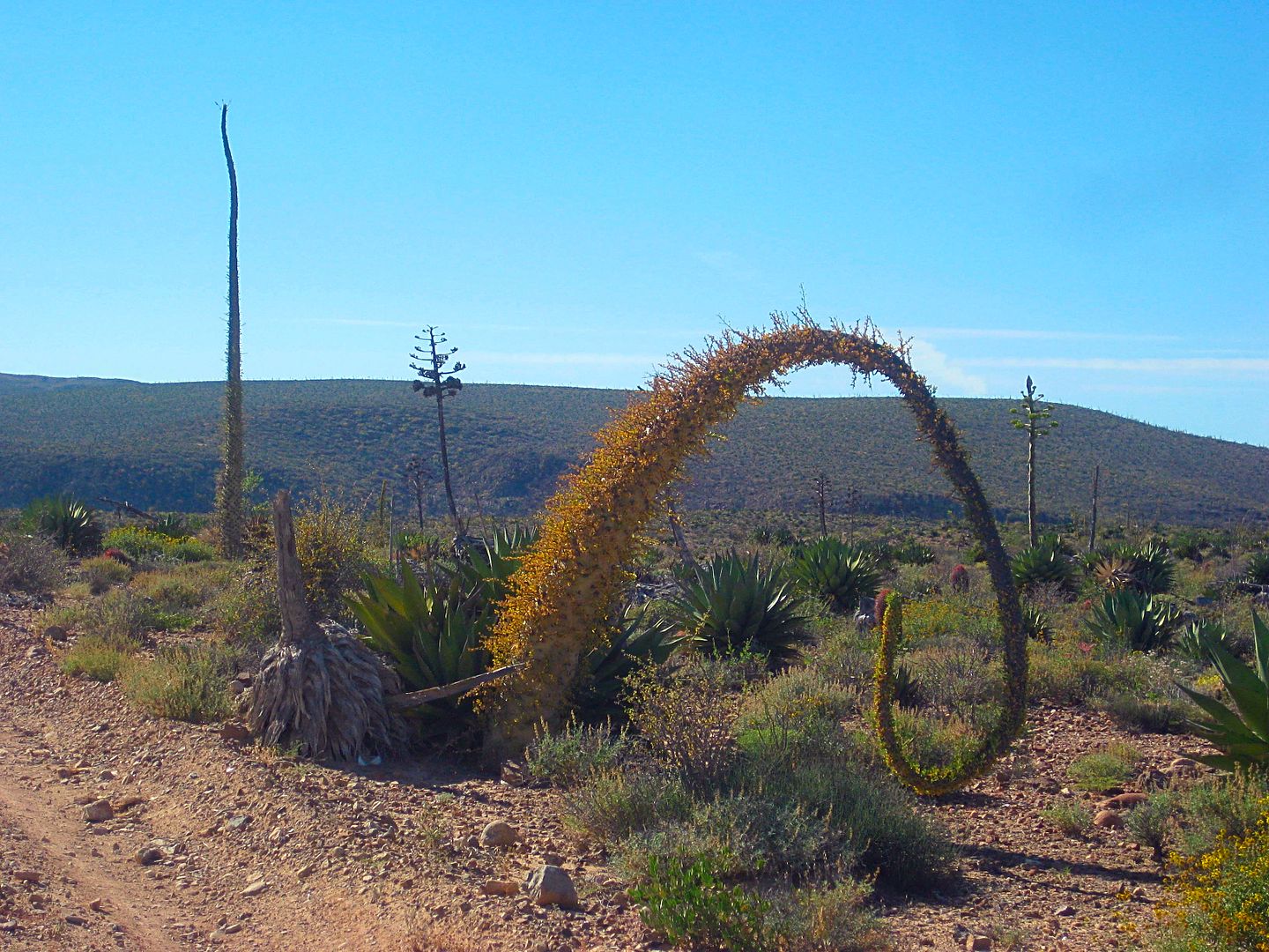
It's like Dr. Seuss must have visited Baja this far south?
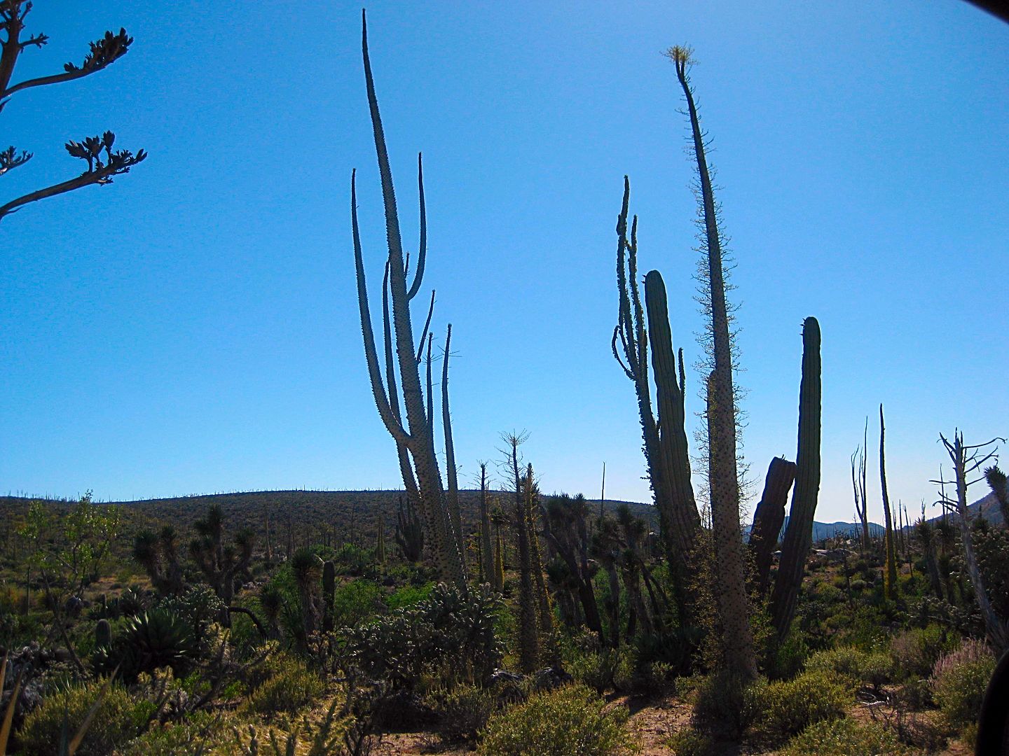
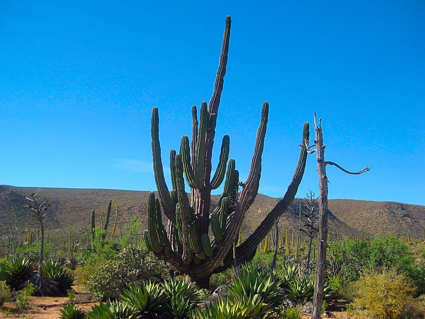
Some neat cardón trees in here, too!
Semi-abandoned ranch down on the left, 1.2 miles west of the junction with the two choices to Hwy. 1. The one I used from Km. 270.5 or the mapped one
from Km. 252.
I am seeing fewer tire tracks and more animal tracks.
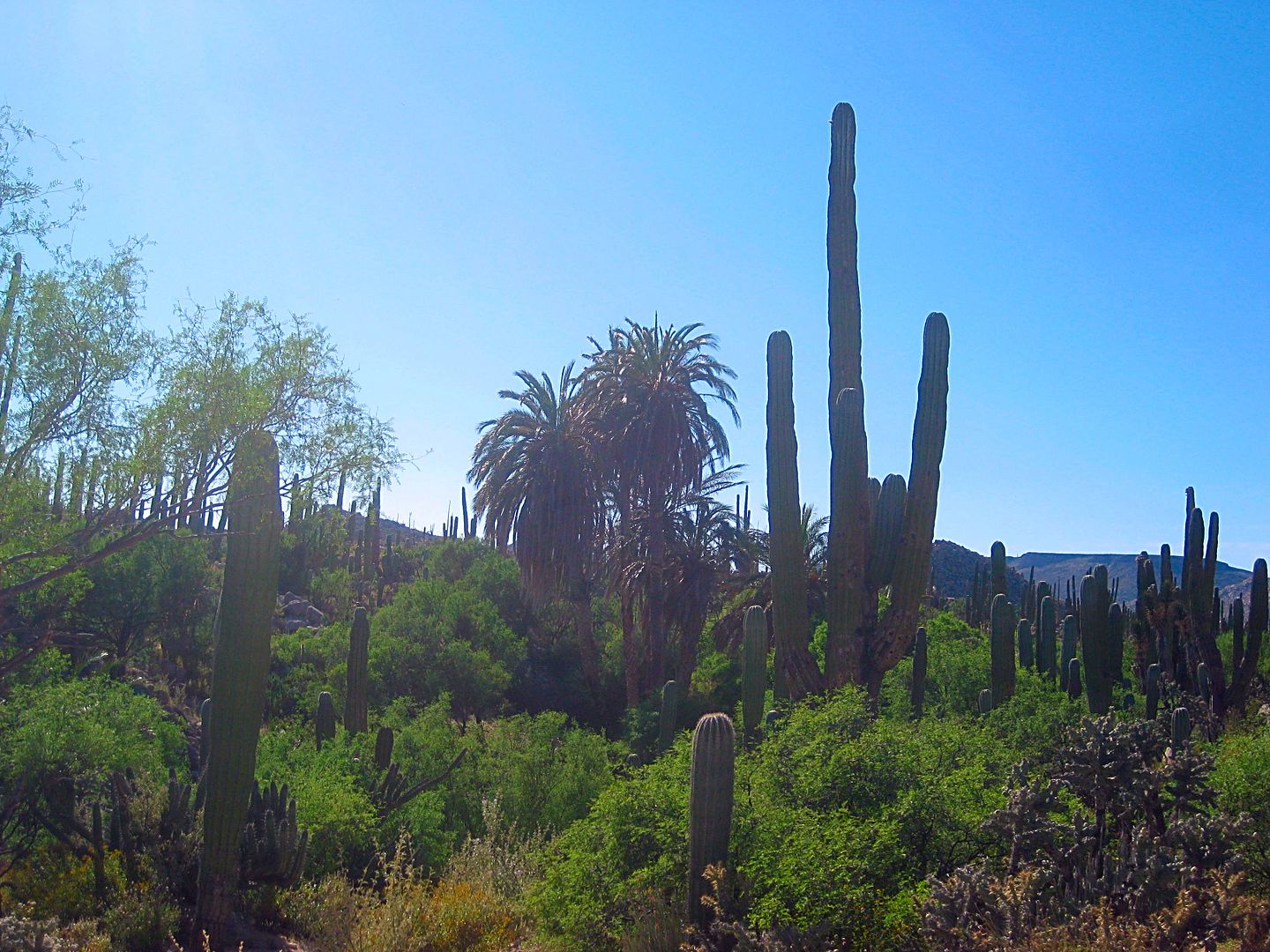
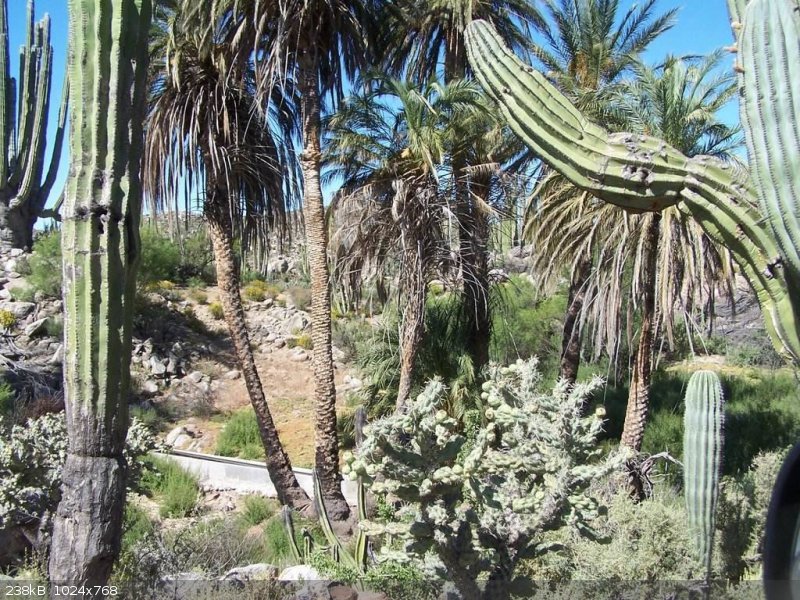
An oasis is a mile past the ranch. Soon a dam and reservoir are in the gully below. Another oasis is in the distance, but the road I am on turns away
from it before I am motivated to drive to it on a very unused track I saw. That would be the true Rancho San Antonio (Formerly 'Los Codornices'). It
was 4:18 pm.
Some have called it a mission because of the old adobe building and graves. Alas, this site was both far removed from the mission road system (El
Camino Real) and void of any farmland to grow enough food upon. It was strictly a cattle ranch.
The big grade!
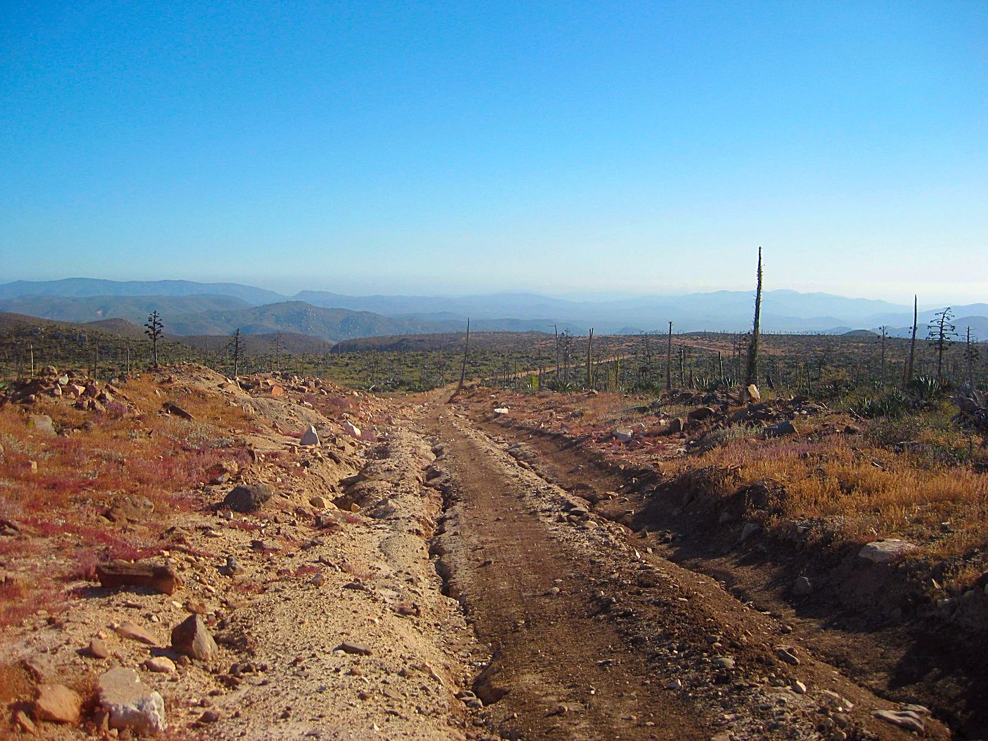
A dozer was obviously employed to improve the old ranch road, but the road has eroded away any fill dirt leaving gullies and landslides. I didn't stop
to photo the worst.
Going down, down, down. My big concern was what if I came to an impassable gully or boulder?
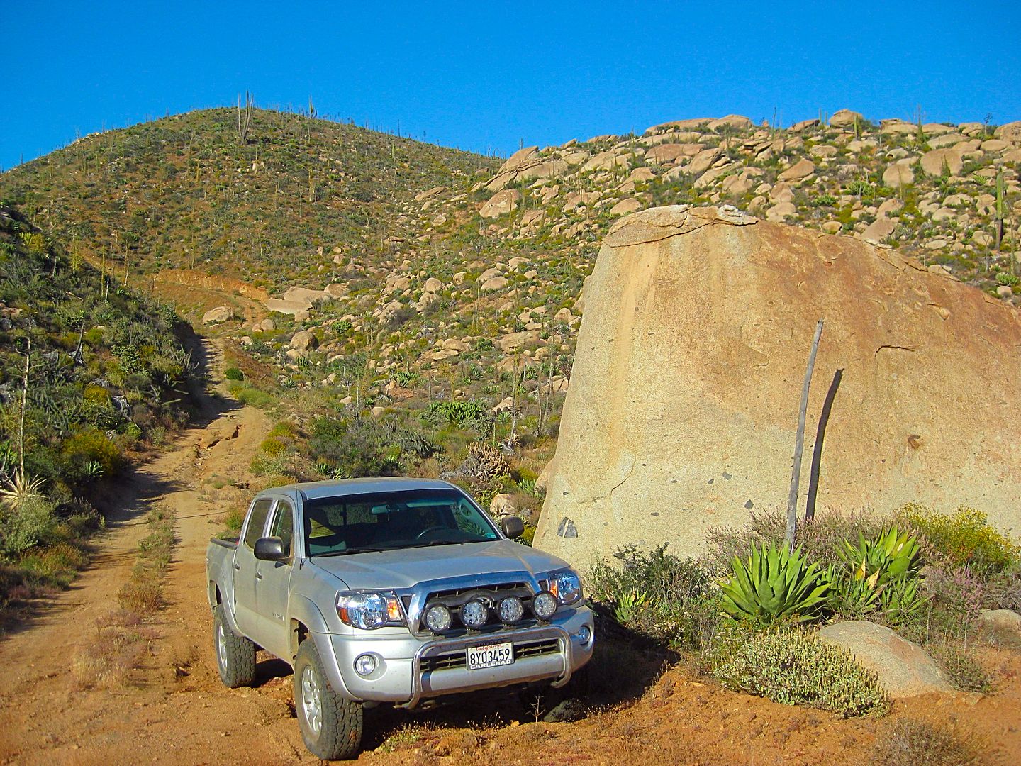
There was one boulder in the road, but I could get around it. Near the bottom was this huge one. Just one more grade ahead and it had the most
interesting blockage... a Ford Ranger. I just got by it by an inch between the mirrors. It was 5:18 pm and I was 9 miles from San Antonio and just 3/4
mile from the bottom of this big bad set of grades.
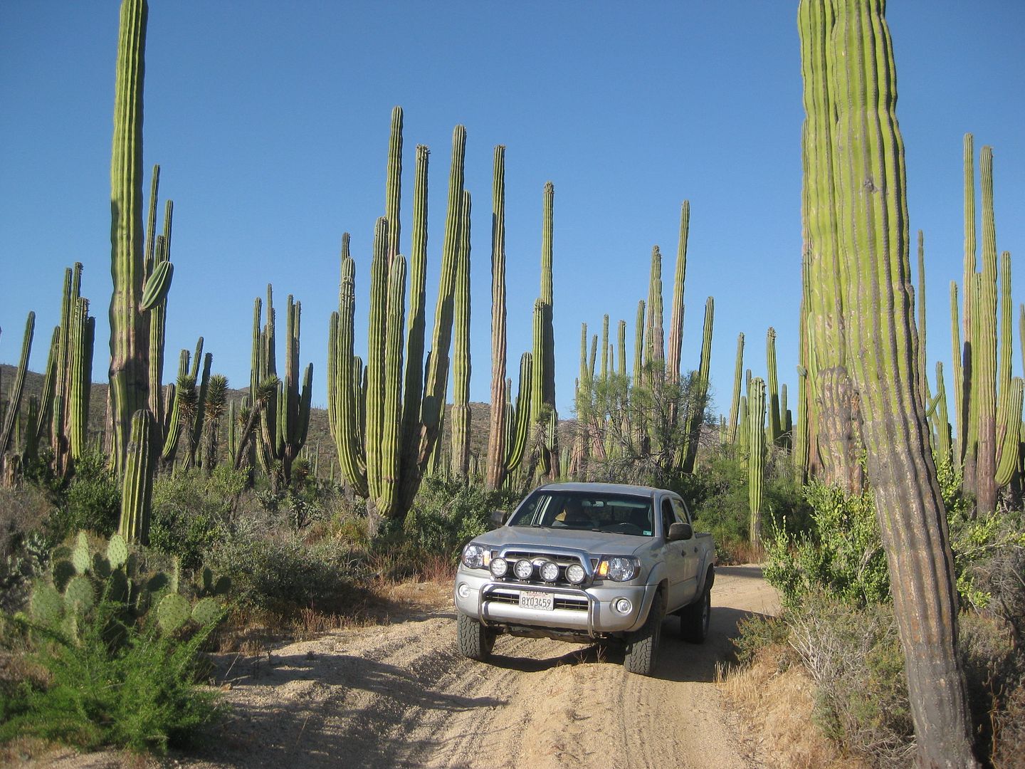
Nice drive through a cardónal before reaching the roadblock and help sign!
Details in the next installment... This Sunday will be a long night!
[Edited on 2-10-2018 by David K]
|
|
|
PaulW
Ultra Nomad
Posts: 3005
Registered: 5-21-2013
Member Is Offline
|
|
Good pics
|
|
|
David K
Honored Nomad
Posts: 64480
Registered: 8-30-2002
Location: San Diego County
Member Is Offline
Mood: Have Baja Fever
|
|
Thanks Paul... So, did you bypass La Miseria (see my map of the parallel roads there) or see it up close? It has a pool and hot tub... very unusual
for the area!
I would be curious of what happened to the caretaker couple I evacuated from there!
|
|
|
PaulW
Ultra Nomad
Posts: 3005
Registered: 5-21-2013
Member Is Offline
|
|
The road skirts all the buildings When going north we were on the right side of the valley. Then we did a U turn around the washout and continued
northerly. We could see the ranch buildings on the other side of the valley. Green fence gate at each end of the ranch property.
|
|
|
PaulW
Ultra Nomad
Posts: 3005
Registered: 5-21-2013
Member Is Offline
|
|
The map we use in San Felipe – Hand drawn from many sources
Many new names to digest

|
|
|
woody with a view
PITA Nomad
Posts: 15937
Registered: 11-8-2004
Location: Looking at the Coronado Islands
Member Is Offline
Mood: Everchangin'
|
|
No straight lines in nature! Water trough and if you see these you are on the right trail.
|
|
|
advrider
Super Nomad
Posts: 1847
Registered: 10-2-2015
Member Is Offline
|
|
Will be ridding that on motos next month from El Rosario to the mission to Bola, never ridden that are before and I'm really looking forward to it!
Dose anyone know if there is gas once we hit the highway of is it all the way back to the BOLA turn off for barrel gas? We might be close just not
sure?
[Edited on 2-11-2018 by advrider]
|
|
|
| Pages:
1
2
3 |


