| Pages:
1
..
6
7
8
9
10
..
18 |
PaulW
Ultra Nomad

Posts: 3005
Registered: 5-21-2013
Member Is Offline
|
|
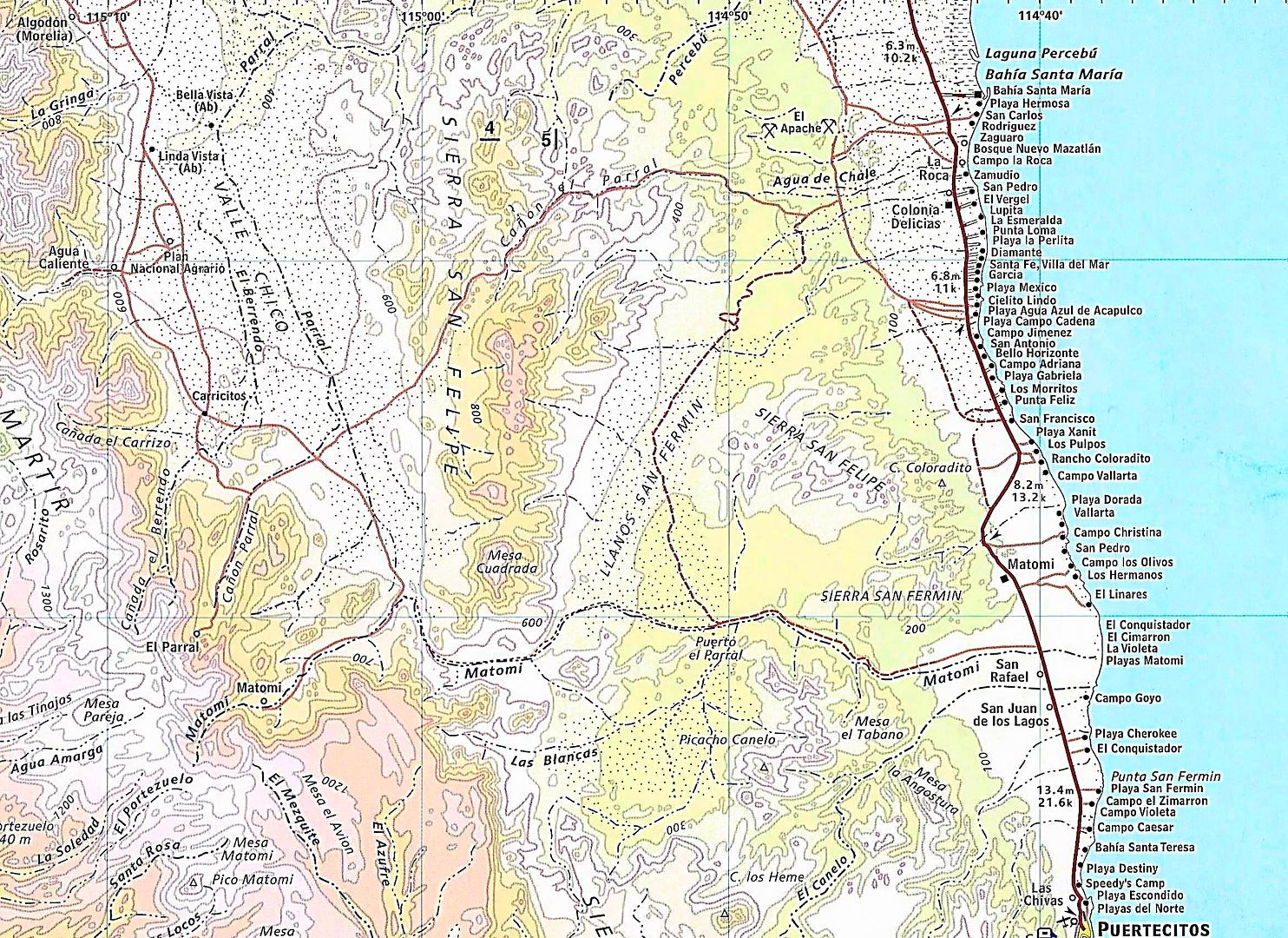
The arch still looks pretty fragile, but on closer inspection it has not deteriorated - if any over the years.
Time to go back after my absence of a couple of years.
If the Arch is the destination then a drive down the highway is our most common approach. That way the folks with SUVs can come along.
The turn from Matomi into Los Blancas where the arch is located is a little faint which ever way you go. Usually not many tracks to follow. Las
Blancas is clearly shown on the Almanac.
Let me clarify. Los Blancas is the drainage (arroyo) leading to the Cinnamon (Canelo) Preserve. The valley of Los Blancas is called Cinnamon valley.
Arroyo Cinnamon (El Canelo) is the next major drainage just south of Arroyo Matomi and there is a pretty good mountain range between Arroyo Cinnamon
and Arroyo Los Blancas. The main peak on the mountain range is named Picacho Canelo
Arroyo Cinnamon is a huge drainage an it is on my to do list to explore it upper reaches.
Arroyo Cinnamon (English translation) is shown on the Almanc as El Canelo (Spanish correct name)
|
|
|
David K
Honored Nomad
Posts: 64480
Registered: 8-30-2002
Location: San Diego County
Member Is Offline
Mood: Have Baja Fever
|
|
Quote: Originally posted by PaulW  | The arch still looks pretty fragile, but on closer inspection it has not deteriorated - if any over the years.
Time to go back after my absence of a couple of years.
If the Arch is the destination then a drive down the highway is our most common approach. That way the folks with SUVs can come along.
The turn from Matomi into Los Blancas where the arch is located is a little faint which ever way you go. Usually not many tracks to follow. Las
Blancas is clearly shown on the Almanac.
Let me clarify. Los Blancas is the drainage (arroyo) leading to the Cinnamon (Canelo) Preserve. The valley of Los Blancas is called Cinnamon valley.
Arroyo Cinnamon (El Canelo) is the next major drainage just south of Arroyo Matomi and there is a pretty good mountain range between Arroyo Cinnamon
and Arroyo Los Blancas. The main peak on the mountain range is named Picacho Canelo
Arroyo Cinnamon is a huge drainage an it is on my to do list to explore it upper reaches.
Arroyo Cinnamon (English translation) is shown on the Almanc as El Canelo (Spanish correct name) |
|
|
|
David K
Honored Nomad
Posts: 64480
Registered: 8-30-2002
Location: San Diego County
Member Is Offline
Mood: Have Baja Fever
|
|
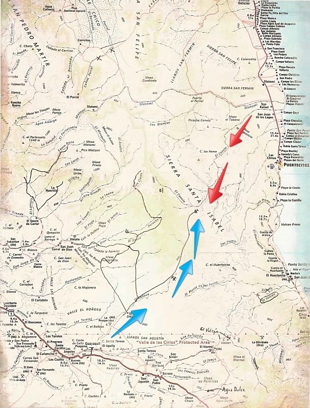
Here is the dream route... explored by bajalou, TW, and others... The lines drawn in are roads not on the Almanac. The arrows added are hopeful new
routes to cross from the gulf to Pacific side. The blue arrows are along the road from La Aguila on Hwy. 1 to an un-named mine, just SW of
Puertecitos.
|
|
|
TMW
Select Nomad
Posts: 10659
Registered: 9-1-2003
Location: Bakersfield, CA
Member Is Offline
|
|
Several years ago I tried riding my motorcycle down El Canelo where the red arrows are. Didn't get too far due to deep sand and rocks. I figured if I
could get to the mine it might be a short cut to cross on. If I remember right Baja Lou tried the same thing in a buggy with similar results.
|
|
|
David K
Honored Nomad
Posts: 64480
Registered: 8-30-2002
Location: San Diego County
Member Is Offline
Mood: Have Baja Fever
|
|
A D9 is such a great thing! BAJA CAT could drive it!
|
|
|
Ken Cooke
Elite Nomad
Posts: 8921
Registered: 2-9-2004
Location: Riverside, CA
Member Is Offline
Mood: Black Trans Lives Matter
|
|
I didn't remember this from the thread as I don't have personal experience visiting there as you and Paul do.
The plan:
On our San Felipe day, we will shop for fresh food, stop at the beach for a few hours, then stage in the Matomi area, setting up camp at about 4:00
pm.
Our Matomi run will hopefully allow for catching the sights of La Canela before we tackle the wash on our way to San Luis Gonzaga. I promised
everyone a day at the beach the following day, and it is likely that we will reach Hwy 5 at dusk that day. No worries as we will set up our base camp
in Gonzaga Bay for 2 nights.
Paul - We plan to tackle Matomi Wash first thing on day #5, so if we cannot see Cinnamon Valley on the afternoon of Day #4 or morning of Day #5, our
limited time in Gonzaga Bay will be affected. Hope for the best plan for the worst. This is El Imposible!

|
|
|
PaulW
Ultra Nomad
Posts: 3005
Registered: 5-21-2013
Member Is Offline
|
|
My only attempt on El Canelo I was with 3 sand rails and they only got 100 yards up from the road and we had to dig to get them unstuck so the trip
was aborted. Yes the sand was soft and deep. 4x4 is needed. The sand rails did not deflate their tires or we would have gotten further?
|
|
|
PaulW
Ultra Nomad
Posts: 3005
Registered: 5-21-2013
Member Is Offline
|
|
Ken,
Normal Matomi run is east bound. If done that way time is always short for a Las Blancas/Arch run.
A westbound run up Matomi should be planned for an early start because it is much slower when going west. Do it that way and you will understand.
Deep sand to start and rock crawling up hill is interesting.
|
|
|
Ken Cooke
Elite Nomad
Posts: 8921
Registered: 2-9-2004
Location: Riverside, CA
Member Is Offline
Mood: Black Trans Lives Matter
|
|
| Quote: Originally posted by PaulW | Ken,
Normal Matomi run is east bound. If done that way time is always short for a Las Blancas/Arch run.
A westbound run up Matomi should be planned for an early start because it is much slower when going west. Do it that way and you will understand.
Deep sand to start and rock crawling up hill is interesting. |
Paul,
I will let Chloe know this. Momentum is always helpful. Our group will be loaded down with water, gasoline, gear. We will plan accordingly. I have
to keep the days manageable so that we don't exhaust ourselves. This will be mid February, and the days will be short. Each driver will be aired
down, will have their own shovel on-board, and will have 4WD. We will expect the impossible, but not at the expense of not arriving in Gonzaga Bay.

|
|
|
rich t
Nomad
Posts: 102
Registered: 4-18-2016
Member Is Offline
|
|
Ken, what ever you do you should be thru the tight spot at Matomi by 1:00 P.M., from there it is about 3 hours to Gonzaga with a group, we ran it
twice during the 250 this year chasing for a truck and took about 1 hour to do the 15 mile stretch from the tight spot to hwy 5.
|
|
|
Ken Cooke
Elite Nomad
Posts: 8921
Registered: 2-9-2004
Location: Riverside, CA
Member Is Offline
Mood: Black Trans Lives Matter
|
|
| Quote: Originally posted by rich t | Ken, what ever you do you should be thru the tight spot at Matomi by 1:00 P.M., from there it is about 3 hours to Gonzaga with a group, we ran it
twice during the 250 this year chasing for a truck and took about 1 hour to do the 15 mile stretch from the tight spot to hwy 5.
|
Thanks for the intel Rich
|
|
|
David K
Honored Nomad
Posts: 64480
Registered: 8-30-2002
Location: San Diego County
Member Is Offline
Mood: Have Baja Fever
|
|
Going downhill in the deep sand/ gravel of Arroyo Matomí is easier, indeed. That's how the Nomad group did it in 2004: www.vivabaja.com/204
In June 2006 Baja Angel and I took my Tacoma up from Hwy. 5 to the Matomí waterfall... it was over 100° in the desert and until I deflated the
tires, my truck heated up! http://vivabaja.com/618/

Approaching the Narrows.
By-the-way, the narrows to Highway 5 is over 20 miles drive. It is over 30 miles to the waterfall...
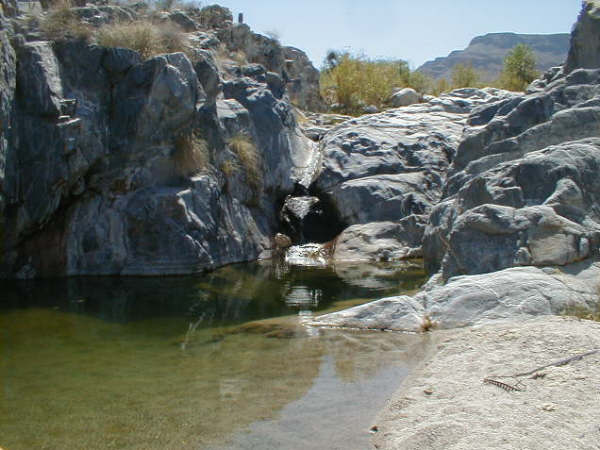
In June, the waterfall was down to a trickle! I have been there in June (1979) when the flow was 'normal', however.
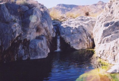
In February 2004. (Edie H. photo)

In February 2001. (Amo Pescar photo)
|
|
|
rich t
Nomad
Posts: 102
Registered: 4-18-2016
Member Is Offline
|
|
Ken, another option would be leave San Felipe, camp at Percebu, take Crazy Horse or Apache tears(El Parrel) to matomi(about 10 miles north of the bad
spot and follow it back out the hwy 5, the camping would be nicer at the beach and time wise would be about the same.
|
|
|
Ken Cooke
Elite Nomad
Posts: 8921
Registered: 2-9-2004
Location: Riverside, CA
Member Is Offline
Mood: Black Trans Lives Matter
|
|
| Quote: Originally posted by rich t | | Ken, another option would be leave San Felipe, camp at Percebu, take Crazy Horse or Apache tears(El Parrel) to matomi(about 10 miles north of the bad
spot and follow it back out the hwy 5, the camping would be nicer at the beach and time wise would be about the same. |
The camping should be incredible at the beach. That's a very good idea. A Campo with a restroom 10 miles from the trail instead of 100% primitive
camping will be easier since we will still be recovering from the Pole Line Road. Having an optional drive/nondrive day will be a treat. In the past,
when a nondrive day was planned at Baja Grande, participants chose instead to drive. I preferred to sit near the water and vegetate.
|
|
|
rich t
Nomad
Posts: 102
Registered: 4-18-2016
Member Is Offline
|
|
Ken, the whole loop is about 72 miles from Percebu thru crazy Horse to matomi and back to the hwy 5, I can send you the track if you want to check it
out.
|
|
|
David K
Honored Nomad
Posts: 64480
Registered: 8-30-2002
Location: San Diego County
Member Is Offline
Mood: Have Baja Fever
|
|
| Quote: Originally posted by rich t | | Ken, the whole loop is about 72 miles from Percebu thru crazy Horse to matomi and back to the hwy 5, I can send you the track if you want to check it
out. |
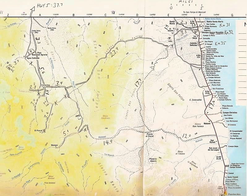
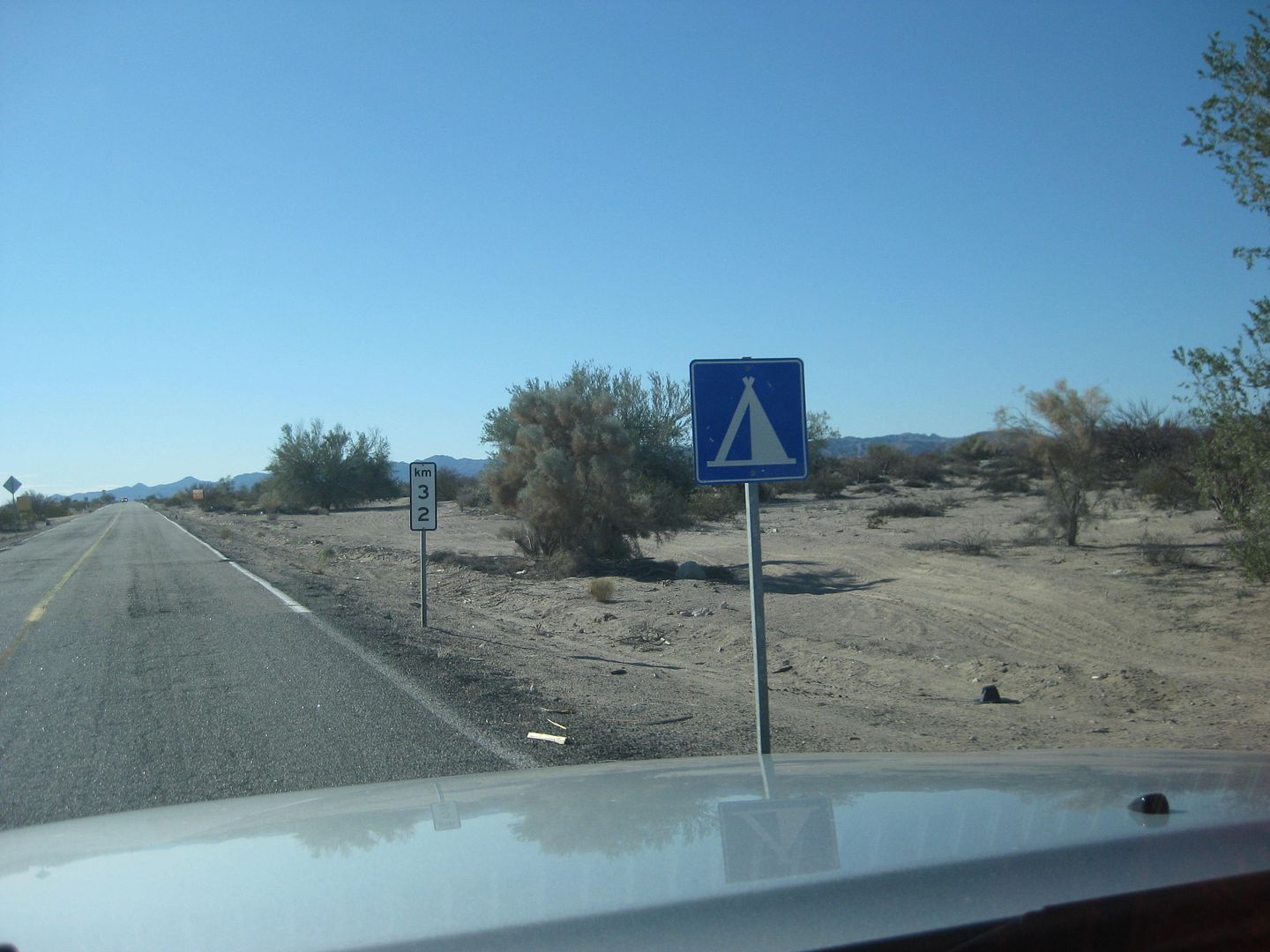
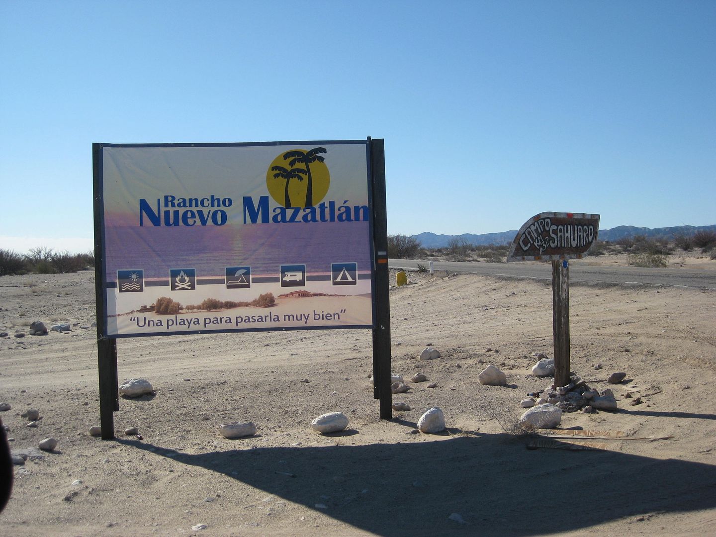
Camping at Percebu or Nuevo Mazatlan, going to Valle Chico via Cañada el Parral/ Azufre Wash/ Crazy Horse Canyon (three names for the same pass) and
drop into Matomi to tackle the Narrows. The good news is if it is not passable, just go back to Hwy. 5 the same route you just took.
From Hwy. 5 (Km. 32) west to Sulfur Mine/ Old Puertecitos Rd.: 4.4 miles. (fast old road)
South to Azufre Wash Rd.: 1.4 miles. (slow beat up road)
West to Valle Chico rd.: 24.6 miles. (Interesting pass through mountain)
South to Cañon Matomí: 8.3 miles (Slow whooped-out road)
The waterfall is 5 miles west, rough!
Hwy. 5 (Km. 60) is 27 miles east.
Total Hwy to Hwy without the waterfall visit is about 66 miles.
Puertecitos is at Km. 74.5 and Gonzaga Bay is at Km. 147.
MAP:
|
|
|
rich t
Nomad
Posts: 102
Registered: 4-18-2016
Member Is Offline
|
|
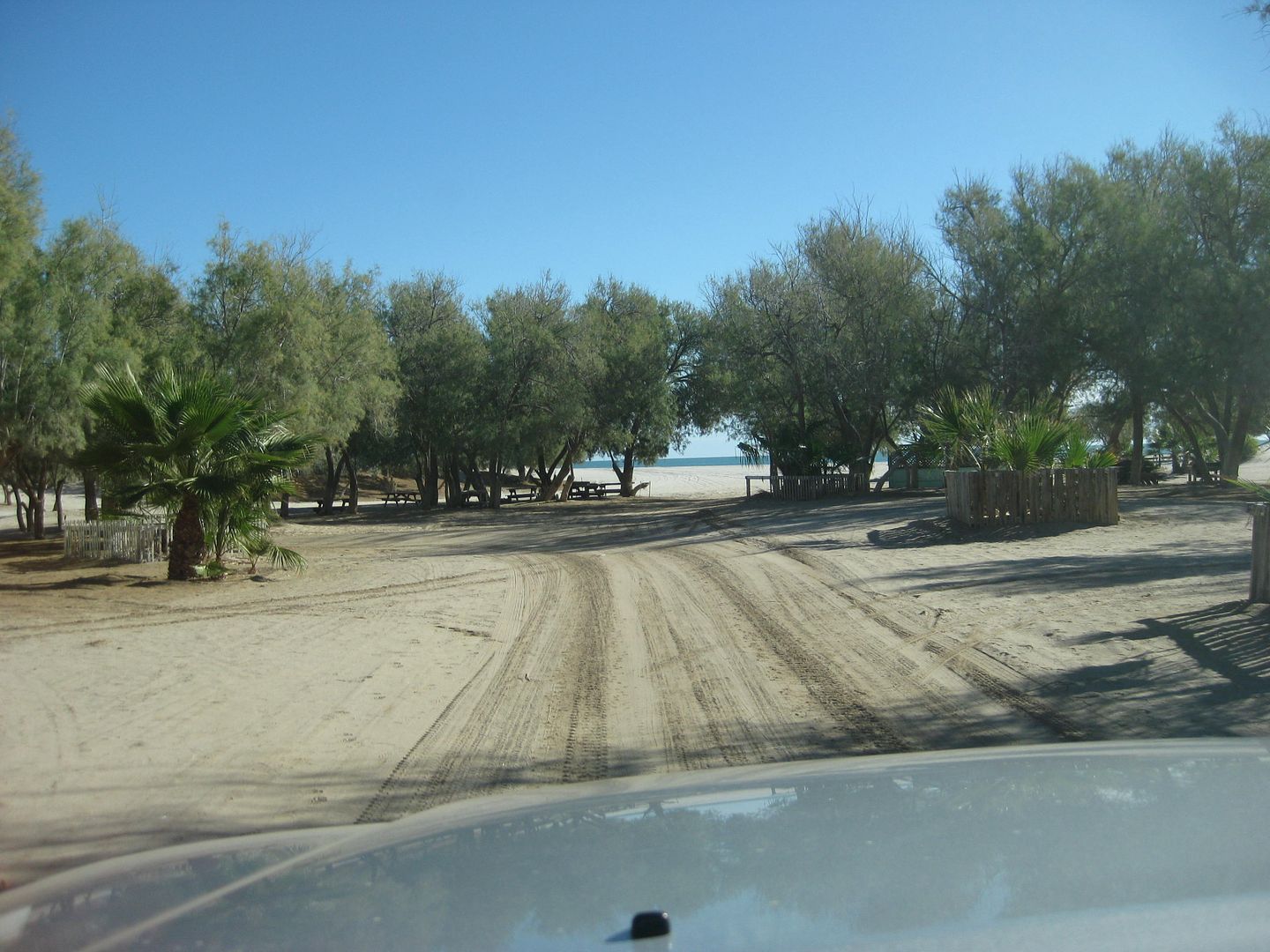
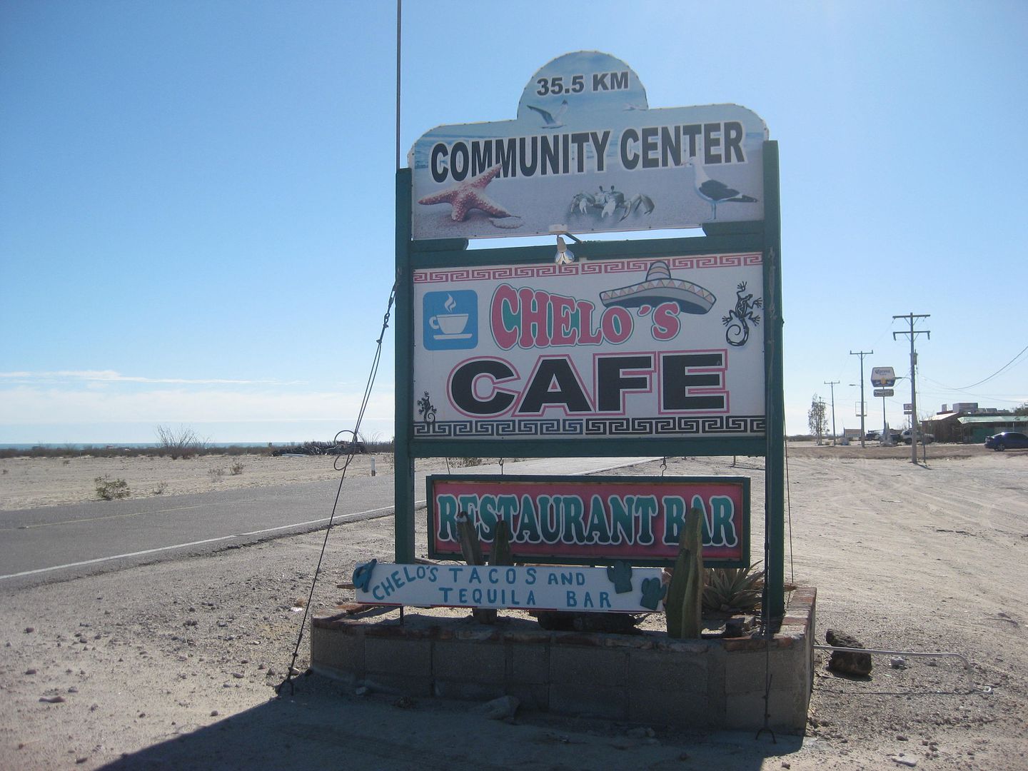
Nuevo Mazatlan is a nice place to camp, Percebu has the restaurant and bar, they may even open the restaurant early for breakfast if you have enough
people eating there. If you get to Percebu early enough you may be able to tour the Chenowith museum if the Chenowiths are around.
|
|
|
David K
Honored Nomad
Posts: 64480
Registered: 8-30-2002
Location: San Diego County
Member Is Offline
Mood: Have Baja Fever
|
|
Rancho Percebú (Km. 20.5+):
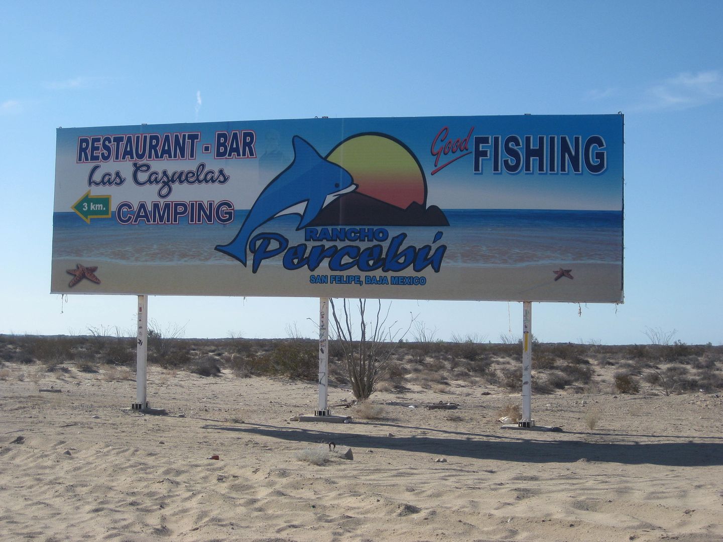
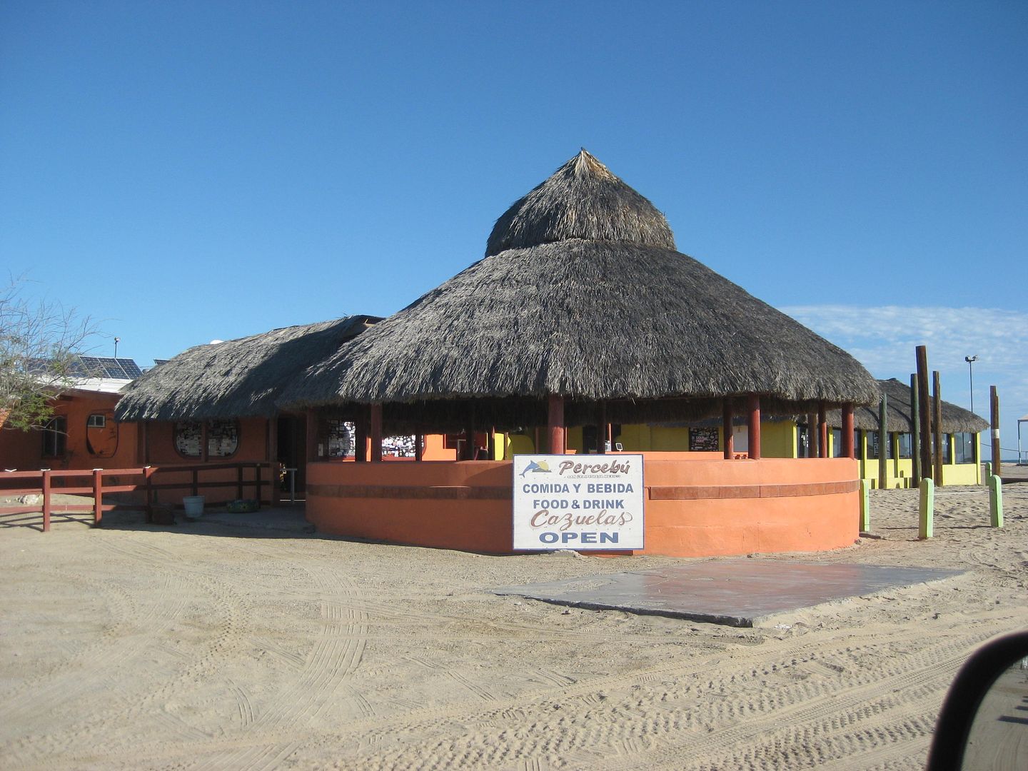
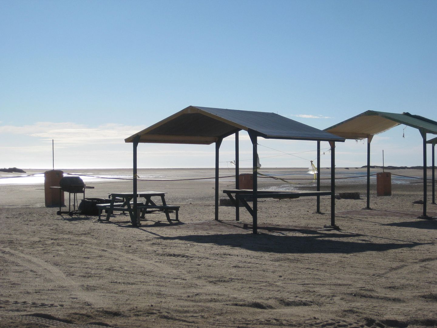
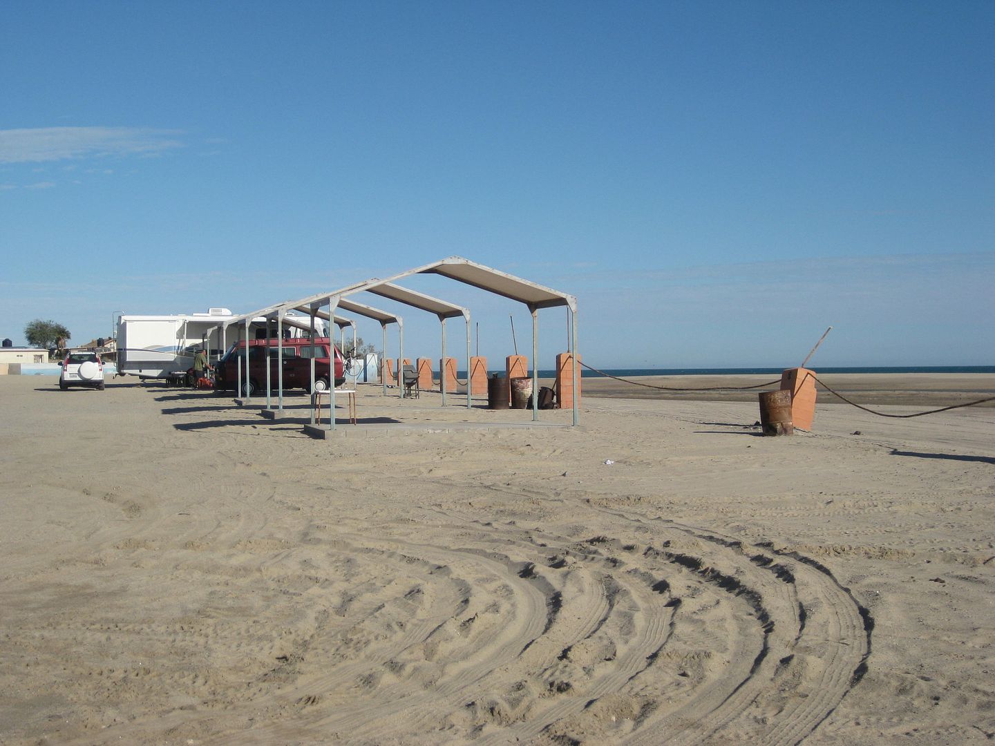
Nuevo Mazatlán (Km. 32)
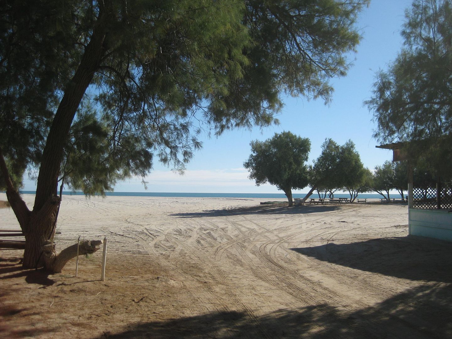
Restaurnts at Km. 35.5:
|
|
|
ehall
Super Nomad
Posts: 1906
Registered: 3-29-2014
Location: Buckeye, Az
Member Is Offline
Mood: It's 5 o'clock somewhere
|
|
| Quote: Originally posted by PaulW | Here is my chance to provide some interesting things about off roading in Baja.
Agree about the Dometec. We have a CFX 50 (50l) for our camping trips. Good investment because between camping trips is serves us for extra freezer
space. 12v and 110V unit.
We also have a CDR-11, (10.5l) 12volt only for day trips. Fits behind the seat and is for keeping lunch and drinks cool for our regular biweekly
desert trips. The 11 has the exact same control features as the 50, which is good to prevent vehicle battery discharge.
Both require an add-on 10A 12V circuit connected directly to the battery.
About radios forget the marine radio because of very low output and limited frequency choices. Get a Ham radio with the mod to add full spectrum
use. I have a Yaesu FT-2900R radio, replaced by the latest version FT2980R. I think 10 of the guys I wheel with in Baja are using the 2900R. Great
value.
GigaParts also sells the radio with the MARS Mod Level 3 to open up all the frequency spectrum.
Read here about location of antenna for Jeeps
https://www.jk-forum.com/forums/jk-cb-ham-radios-128/here-wh...
Forget about Firestick and go with a conventional VHF whip antenna 5/8 DB with NMO mount. Firestick units are specific for CB radios. Any HAM
vendor will fix you up correctly.
Do the above regarding radios and you will be able to talk to all the rest of us who have the proper equipment.
|
Hey Paul. I sent you a U2U. I want you to give me your opinion on the radio stuff I am about to order.
|
|
|
Ken Cooke
Elite Nomad
Posts: 8921
Registered: 2-9-2004
Location: Riverside, CA
Member Is Offline
Mood: Black Trans Lives Matter
|
|
Very helpful information on the Matomi and Percebu region David and Rich. Thank you. I haven't spent time there since 2010. Time really flies!
|
|
|
| Pages:
1
..
6
7
8
9
10
..
18 |


