David K
Honored Nomad

Posts: 64476
Registered: 8-30-2002
Location: San Diego County
Member Is Offline
Mood: Have Baja Fever
|
|
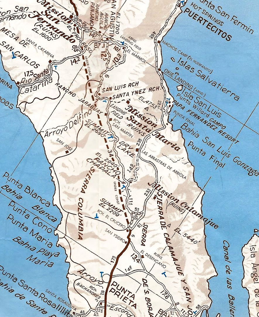
1973 AAA Baja Map (Sept. 1973)
The Baja Highway was under construction... at such a rapid rate in 1973 (San Quintin to San Ignacio). The southern crews advanced much more rapidly
than the northern crews.
In 1971-1972 Pavement was extended from Constitucion north to Santa Rosalia, in the south. The northern crews only advanced from Camalu to Colonia V.
Guerrero.
This map is dated September 1973. It shows the pavement south near Mission San Fernando/El Progreso. This is where it ended in July 1973 for us.
Construction of the roadbed was visible for another 30 miles, otherwise, we were on the old main road. This was the case until we reached the Laguna
Chapala Valley where we came upon new highway construction coming north. Pavement began in the area of Punta Prieta, but it was in sections, not
solid. Solid pavement didn't happen until near Villa Jesus Maria.
This map shows the northbound pavement to El Crucero (as it obviously would soon be shortly after the map was published). They then use a dashed line
to indicate the highway will be soon done. While it is not very accurate to the placement, it served its purpose until they could map the finished
product, the next year.
Many thanks to Nomad TMW (Tom) for sending me this and the 1971 map.
I hope to get the 1972 map someday to share!
There are 9 scans following... it will take me some time to post them all, so just stand by!
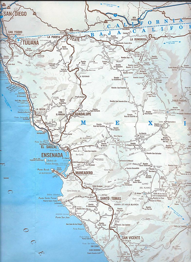
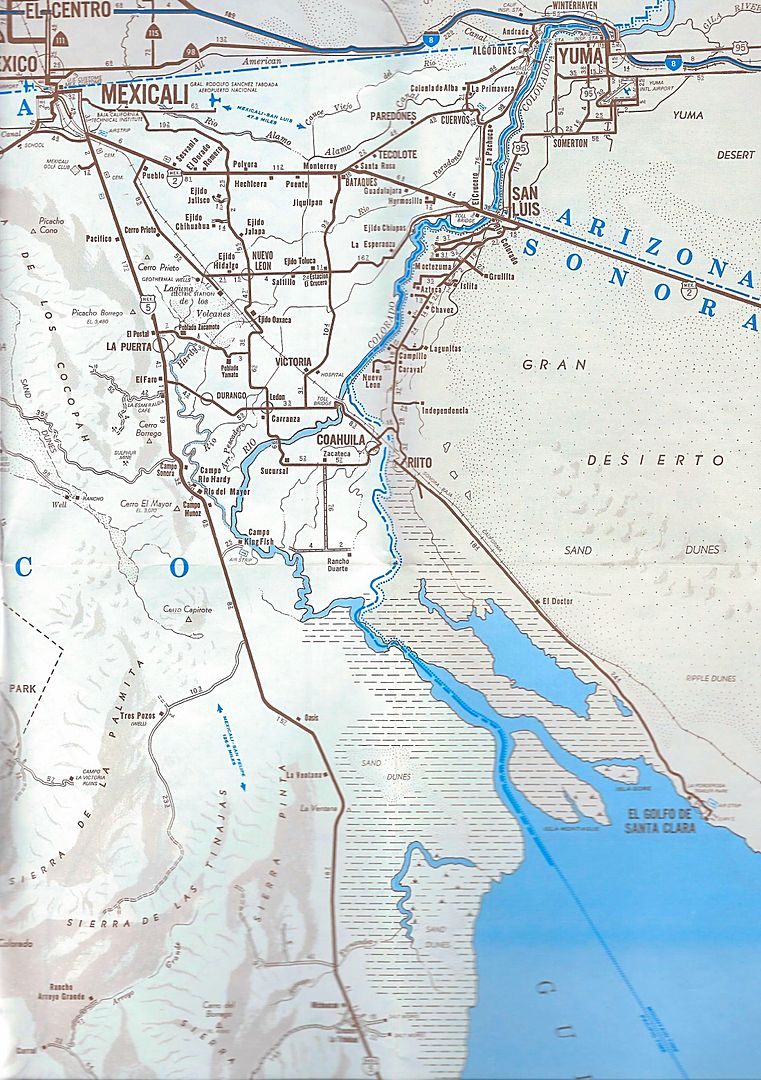
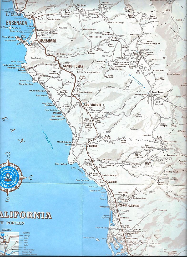
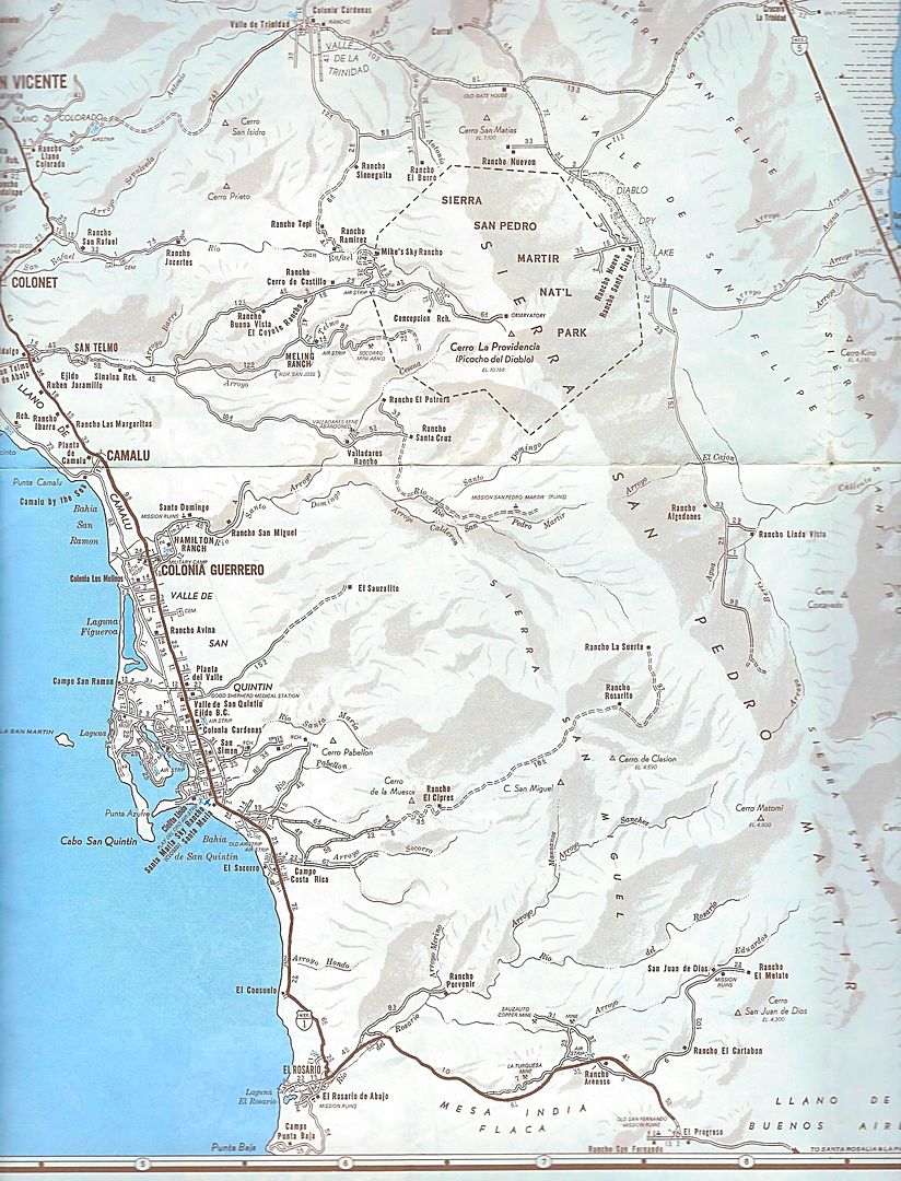
The rest of the peninsula is shown on a smaller scale map, as in previous editions...
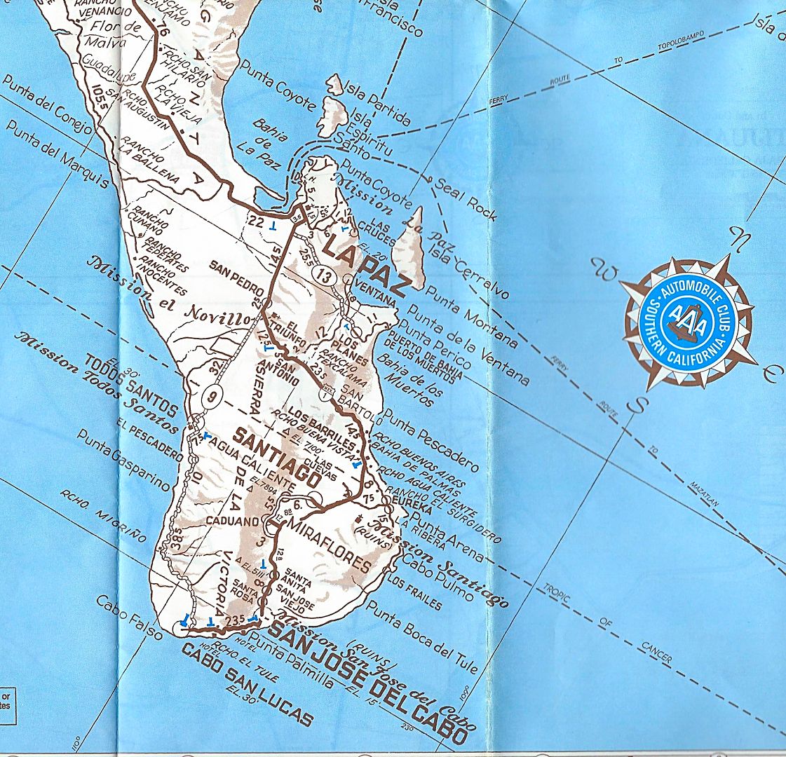
They corrected the placement of the highway south of Los Barriles over the 1971 edition. If anyone has the 1972 AAA map and would like me to show it,
please contact me. Thank you.
As always, if there is an area of the map you would like me to zoom in on, or if I missed scanning an area, just let me know!
|
|
|
David K
Honored Nomad
Posts: 64476
Registered: 8-30-2002
Location: San Diego County
Member Is Offline
Mood: Have Baja Fever
|
|
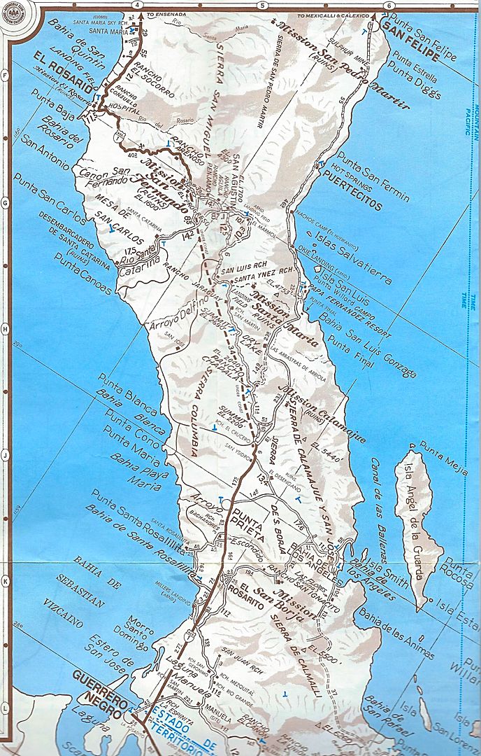
Here's a zoom of the under construction section:
|
|
|
David K
Honored Nomad
Posts: 64476
Registered: 8-30-2002
Location: San Diego County
Member Is Offline
Mood: Have Baja Fever
|
|
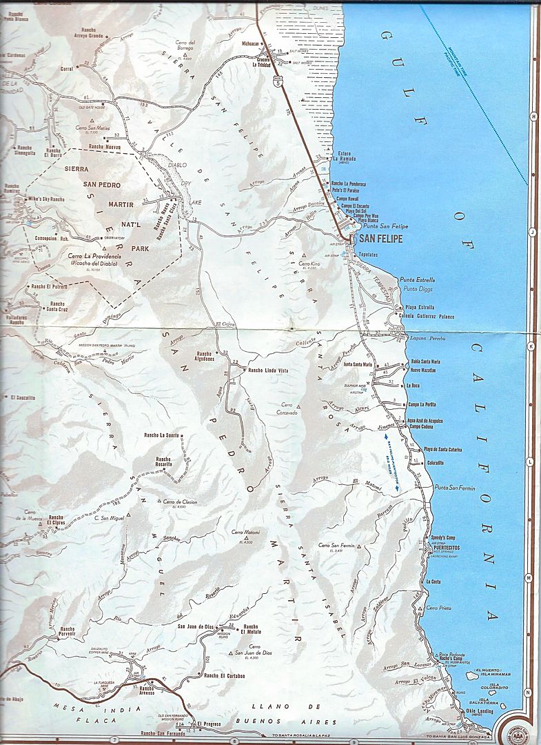
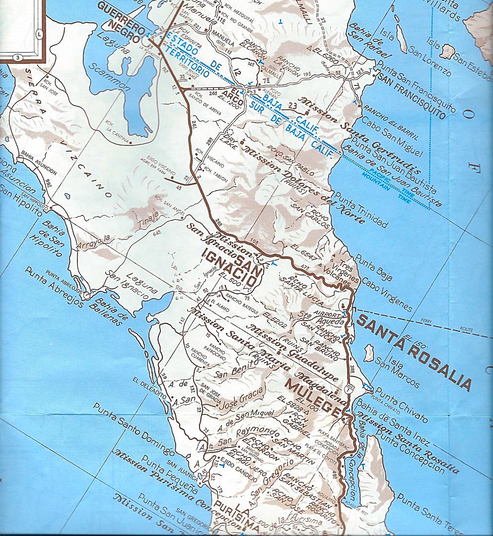
Zoom of the San Felipe-Puertecitos area:

|
|
|
gueribo
Nomad
Posts: 458
Registered: 10-16-2014
Member Is Offline
|
|
Very cool.
|
|
|
David K
Honored Nomad
Posts: 64476
Registered: 8-30-2002
Location: San Diego County
Member Is Offline
Mood: Have Baja Fever
|
|
Yes, the new highway under construction was such an amazing event for us who drove the Old Road of the 1960s and before!
It inspired me (at age 15) to self-publish a road guide to the road under construction (actually Tijuana to Loreto and San Javier and Puerto
Escondido)... I sold every one I made, and it was still in demand even after the highway was completed as I made update notes. What fun... I just
retired it. My next guide came a year later and would go all the way to the tip and other roads in Baja.
Map from my book, July 1973 research:
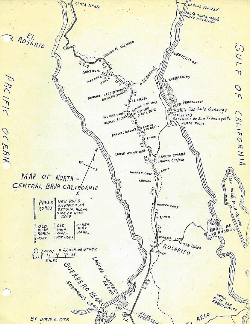
While stuff that was out of my sight I had to guess at, such as where the old main road was. Two places it is different than the map shows is west of
El Arenoso where it is actually south of the new road for much of that section. Interestingly, the Auto Club also have it wrong with the mine and
Aguajito on the wrong side of the highway. The other place is south of Laguna Chapala about where I have 'shacks', the old road is actually on the
west side of the highway to that worker camp (Punta Prieta?) along the first paved section. There was no signage for L.A. Bay, so I couldn't spot the
old road for it. The new L.A. Bay road came soon after.
[Edited on 3-12-2018 by David K]
|
|
|
David K
Honored Nomad
Posts: 64476
Registered: 8-30-2002
Location: San Diego County
Member Is Offline
Mood: Have Baja Fever
|
|
Bumping to bring up near the 1971 map post, easier to compare. If anyone has a 1972 AAA Map to share, please do! The Area around San Quintin and San
Ignacio (where highway construction was happening that year would be of most interest).
|
|
|
TMW
Select Nomad
Posts: 10659
Registered: 9-1-2003
Location: Bakersfield, CA
Member Is Offline
|
|
David have you ever looked at the library of congress for maps? I did a search for the 1972 AAA Baja map and it appears it is available.
https://www.loc.gov/maps/?all=true&c=50&dates=1972&a...
If you click on the map image it will take you to a request area that will take you to a sign in section.
[Edited on 5-24-2018 by TMW]
|
|
|
David K
Honored Nomad
Posts: 64476
Registered: 8-30-2002
Location: San Diego County
Member Is Offline
Mood: Have Baja Fever
|
|
Can you retrieve it?
I just went there. No AAA map image for me, as it seems to require joining something and create an account or password?
This request here is just for casual Nomad interest, so it can wait until a Nomad finds one to share such as you, me, and Barry have done in the past
with our map collections.
Thank you Tom!!!
|
|
|
TMW
Select Nomad
Posts: 10659
Registered: 9-1-2003
Location: Bakersfield, CA
Member Is Offline
|
|
I didn't go any further either as I didn't care to join. Maybe in the future.
|
|
|
SFandH
Elite Nomad
Posts: 6924
Registered: 8-5-2011
Member Is Offline
|
|
Looks like you'll have to go there to see the map. See the first paragraph.
http://www.loc.gov/rr/pdf/requestingmaterials.pdf
|
|
|


