geoffff
Senior Nomad

Posts: 643
Registered: 1-15-2009
Member Is Offline
|
|
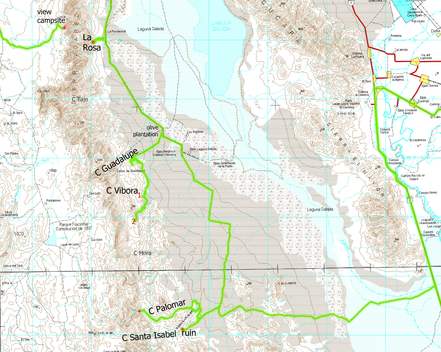
Short NE Baja Trip (2018) - Laguna Salada, Canyons, Sierra de Juarez
I had planned my road trip to include over two weeks of desert exploring, but I ended up breaking one of my front leaf springs on day four, so I never
got much past page 2 of my Baja Almanac. I was blown away by the outpouring of offers of support when DavidK asked for help on my
behalf here on Baja Nomad. I didn't end up being able to track down a replacement part, but It's very comforting to realize that such remote
assistance might be possible if I do someday find myself stranded somewhere out there!
After meeting up with DavidK in person in southern California (great to meet you!), I entered Mexico via the Tecate border crossing and camped the
next four nights in the Sierra de Juarez / Laguna Salada area:

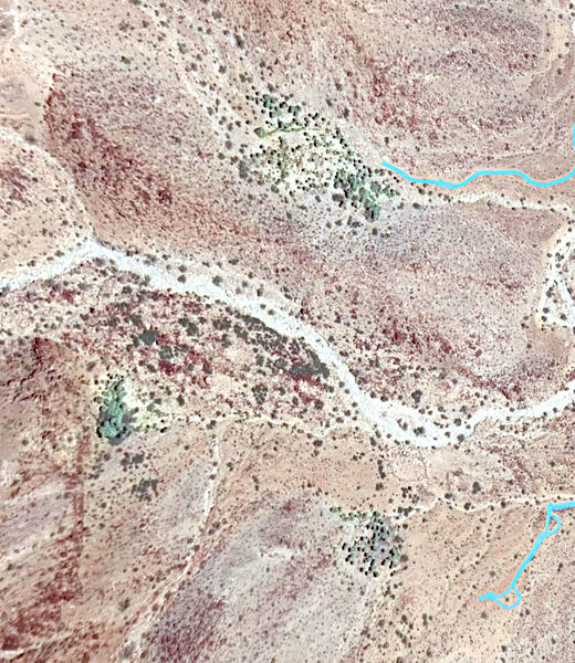
One of my hobbies when stuck at my desk in the city is to wander around in Google Earth following unmapped vehicle tracks visible in the satellite
imagery, looking for interesting campsite ideas. This time, I made for a site on the eastern edge of Sierra de Juarez that seemed like it would
provide a good view west out over Laguna Salada.
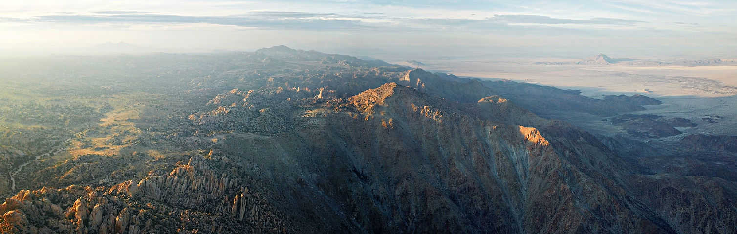
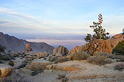
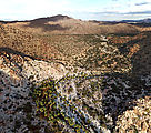
I took Highway 2 east of Tecate, and then headed south just before La Rumorosa into Sierra de Juarez.
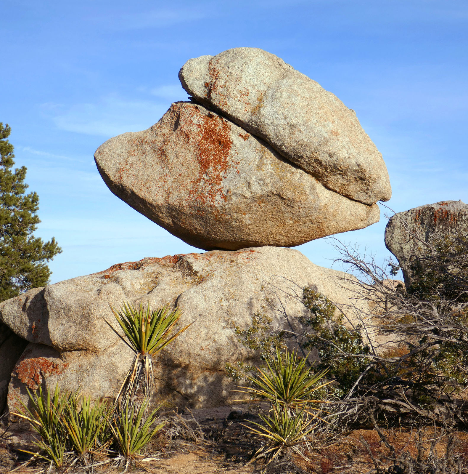
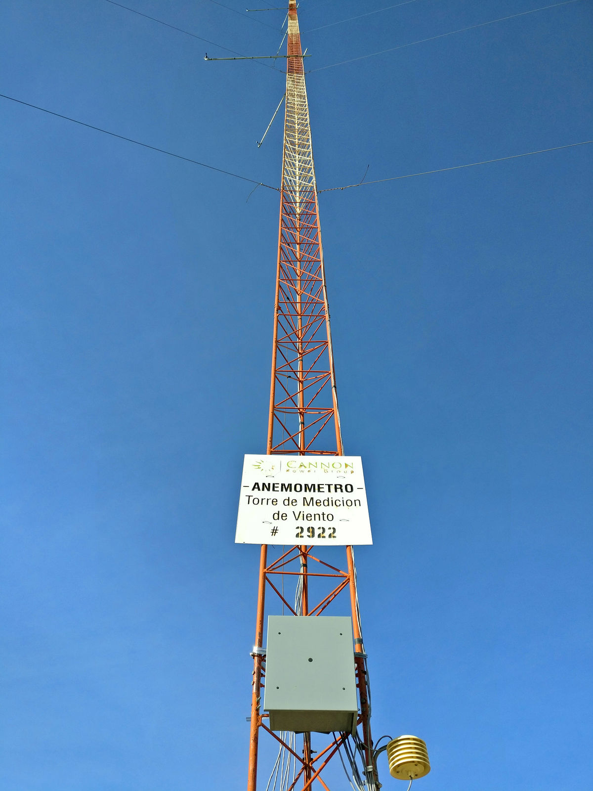
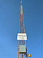
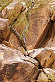
I love this high country, with its pines and junipers interspersed with giant boulder fields. I passed a couple towers that at first appeared to be
antennas, but they were marked "wind measurement". Perhaps there are plans to put wind turbines in here someday. It certainly was windy! I also passed
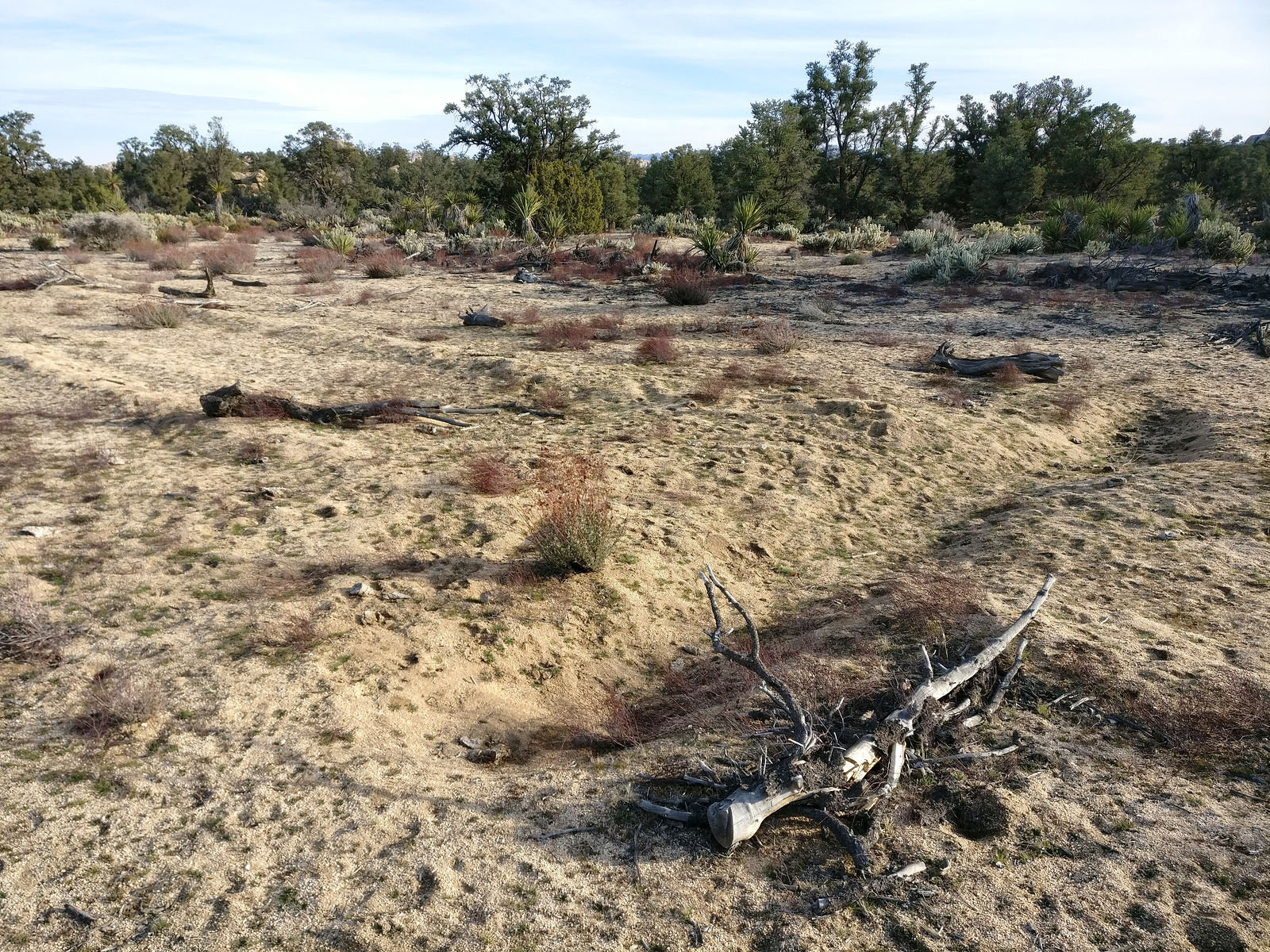
one of the old airstrips I had seen in satellite imagery, which had at some point been purposely deactivated by digging trenches. (32.3614,-115.9034)
(Click on these thumbnail photos to see full size...)
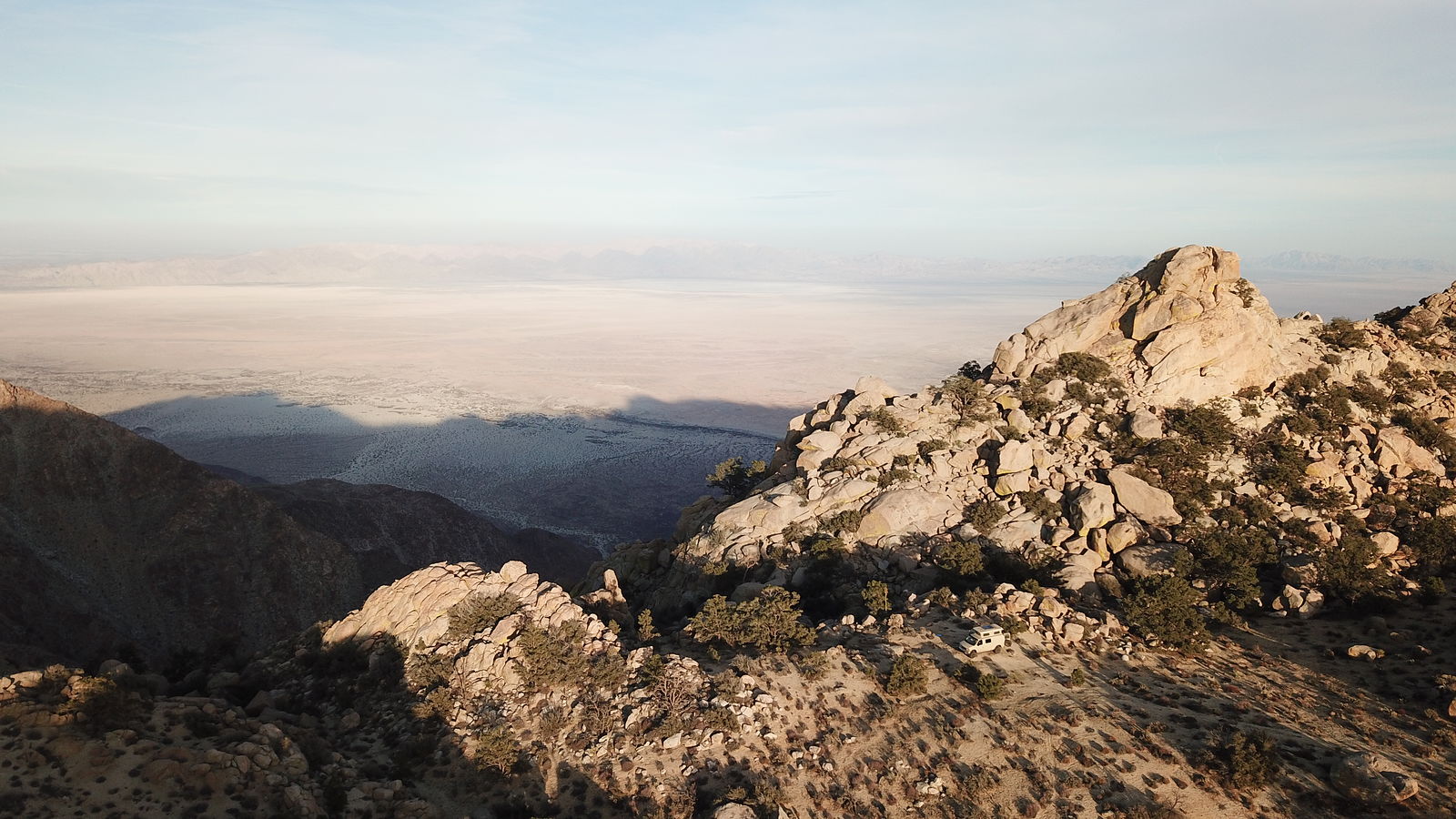
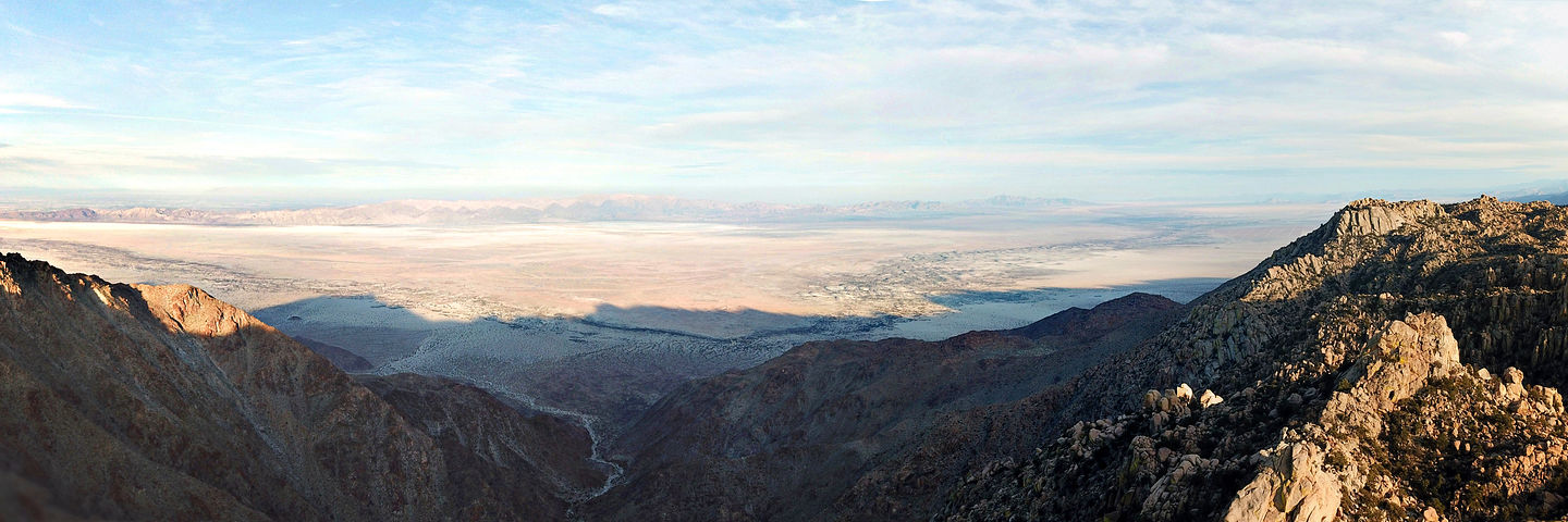
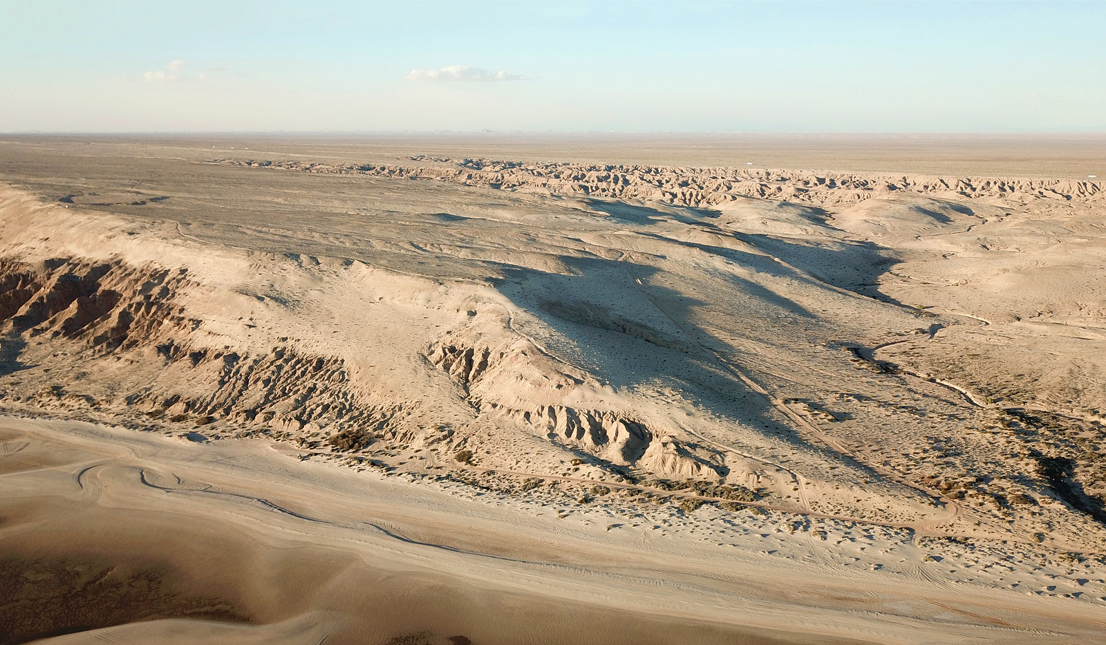
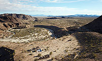
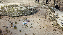
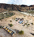
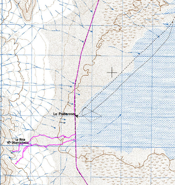
I ended up camping at the eastern edge of Sierra de Juarez, four miles west of (and 4600 feet above) "La Ponderosa" down on Laguna Salada. I had fun
taking aerial photos of this site. (32.3720,-115.8804)
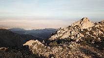  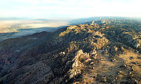   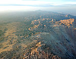 
Looking northeast towards the Mexicali sprawl:
[Edited on 4-25-2019 by geoffff]
|
|
|
geoffff
Senior Nomad
Posts: 643
Registered: 1-15-2009
Member Is Offline
|
|
Going down La Rumorosa grade of Highway 2 to Laguna Salada:
Laguna Salada
I drove south taking the "high road" along the west shore of Laguna Salada. (I've never tried the supposedly smoother road on the mud flat itself.) As
the mood struck me, I picked a few side canyons to explore as I passed by them.
The first canyon is marked as the "La Rosa" mine in my Baja Almanac, next to the "La Ponderosa" site.
This was pretty much directly below where I had camped the night before, though I drove 70 miles to get there!
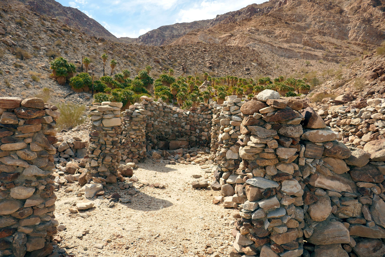
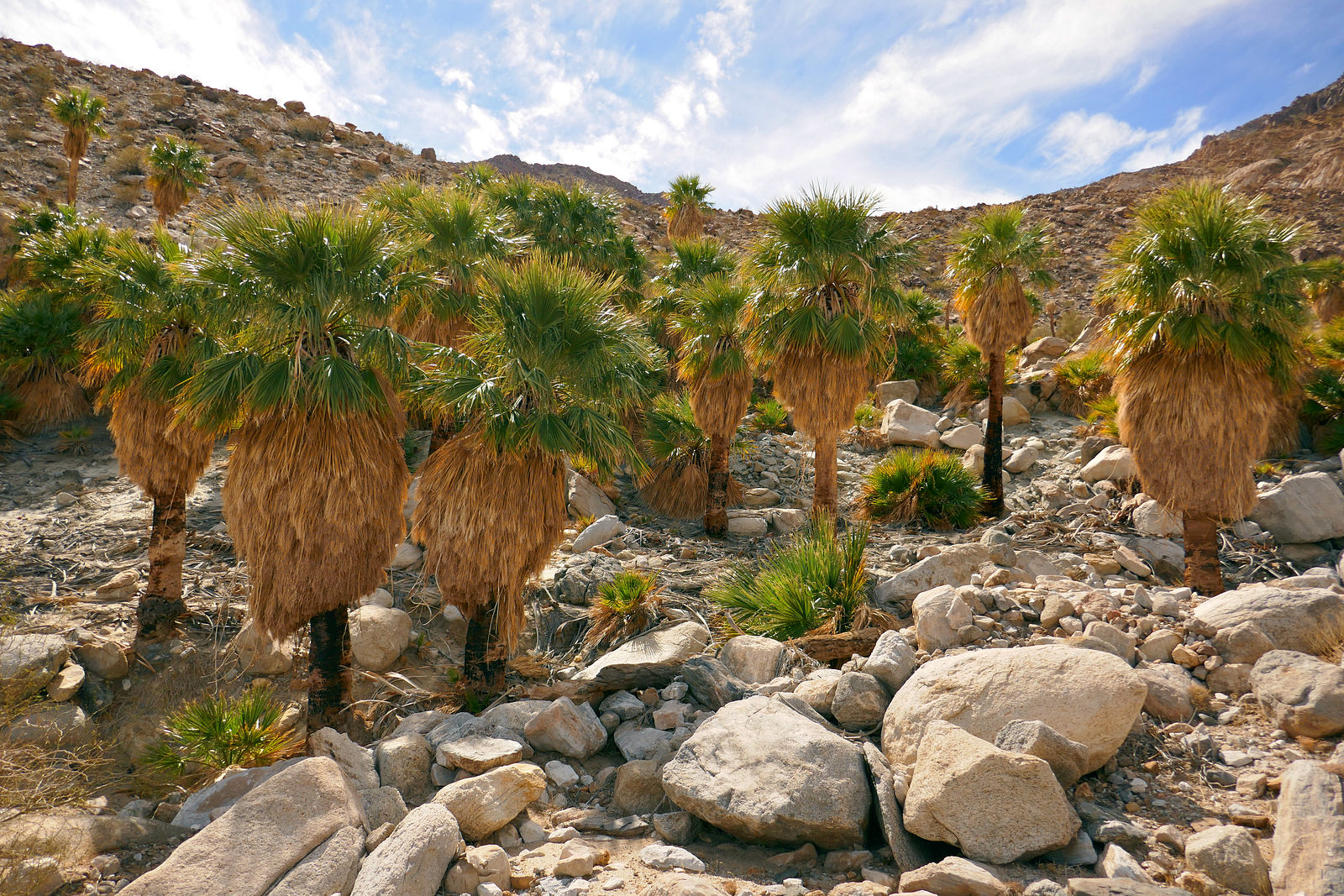
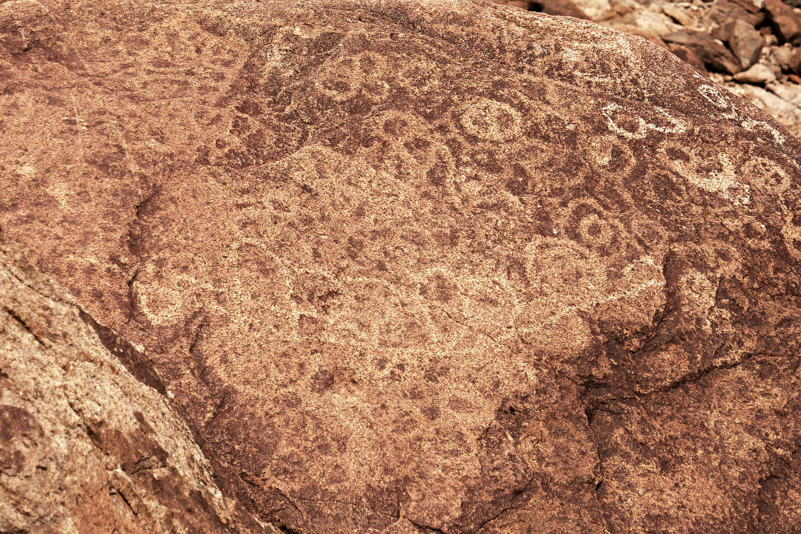
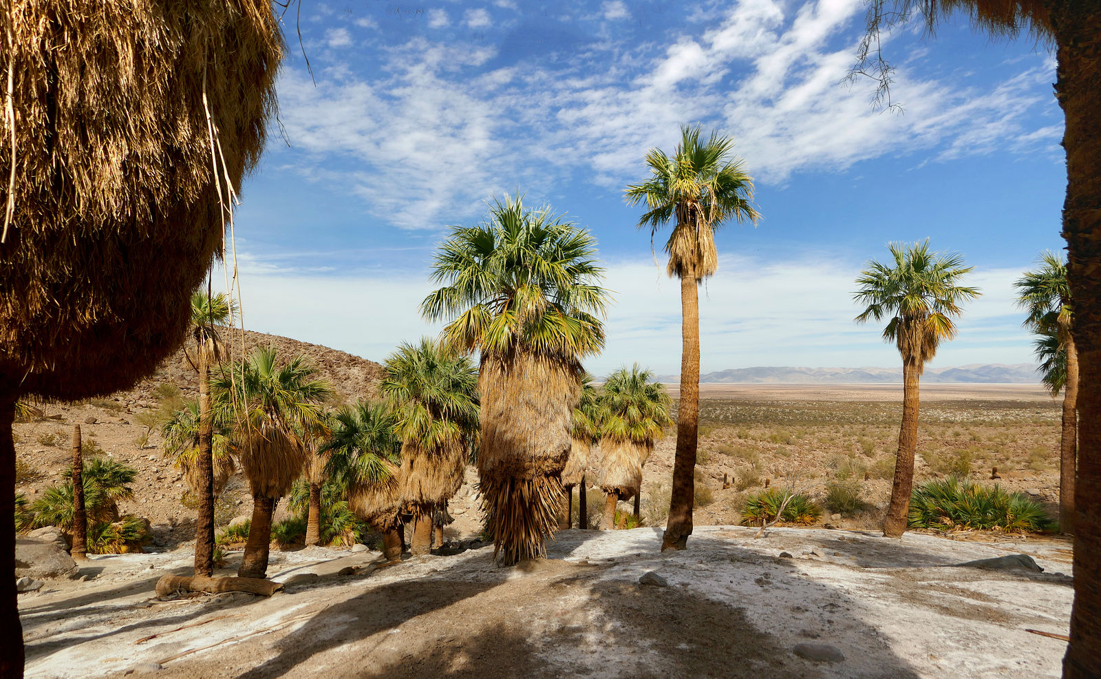
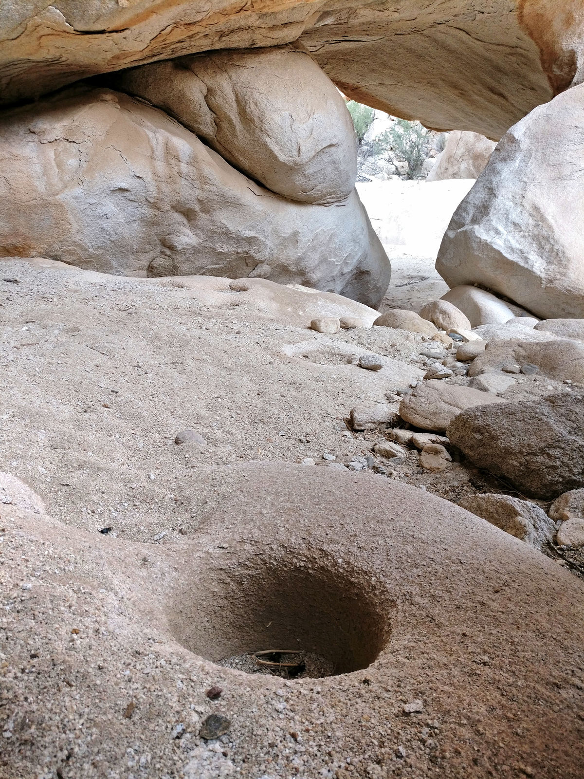
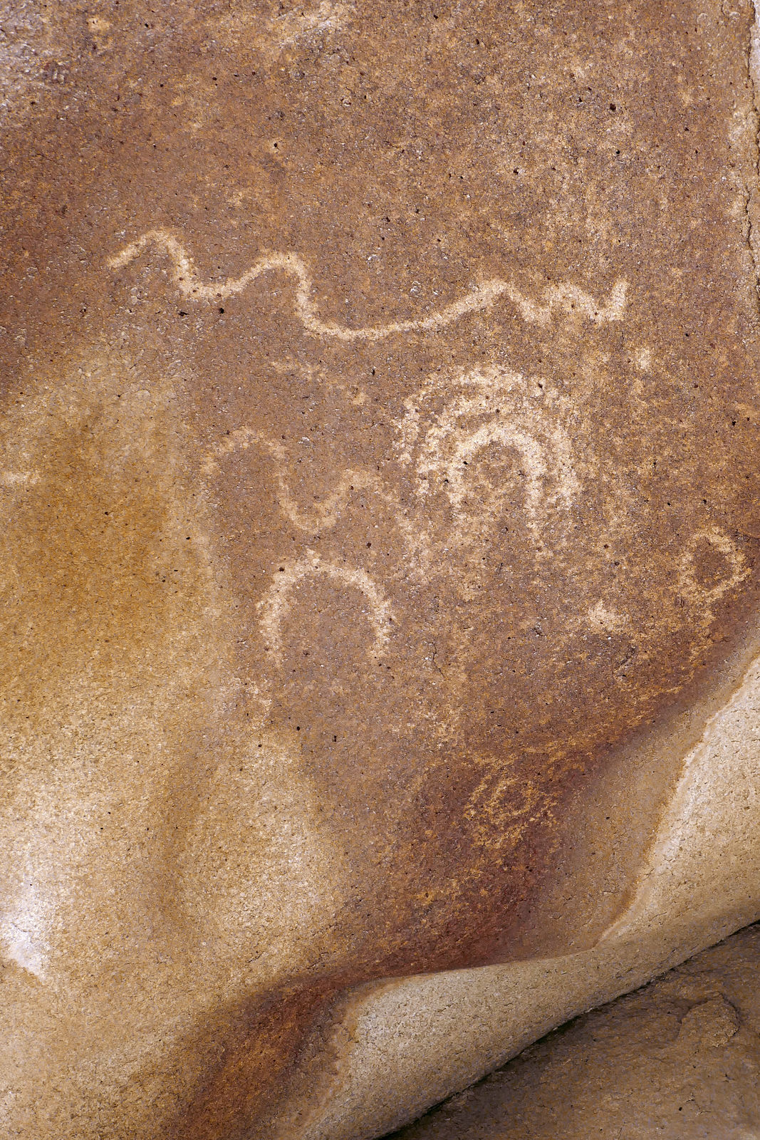
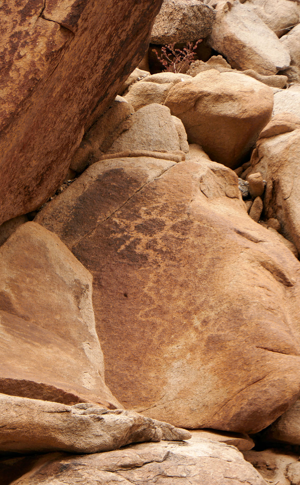
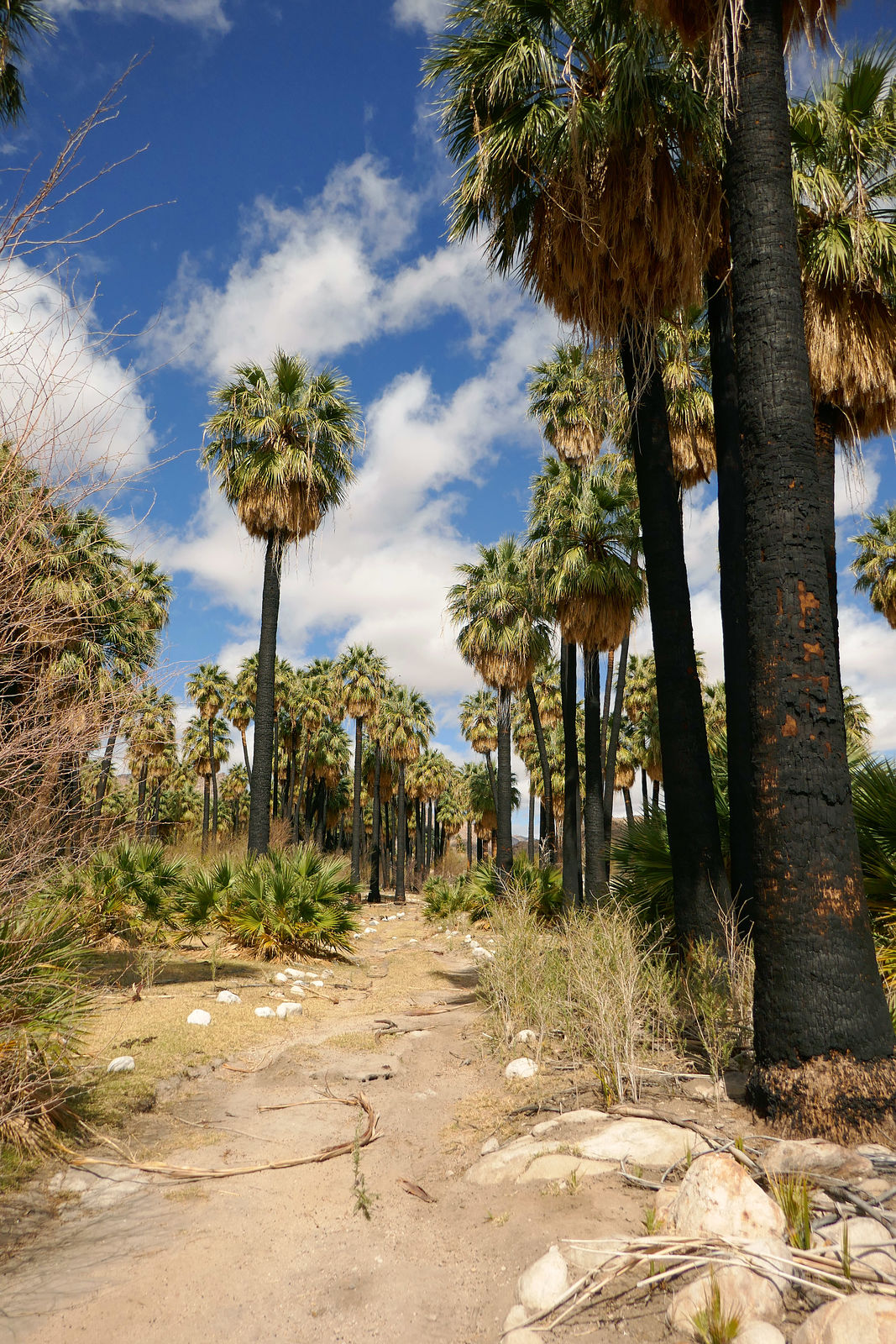
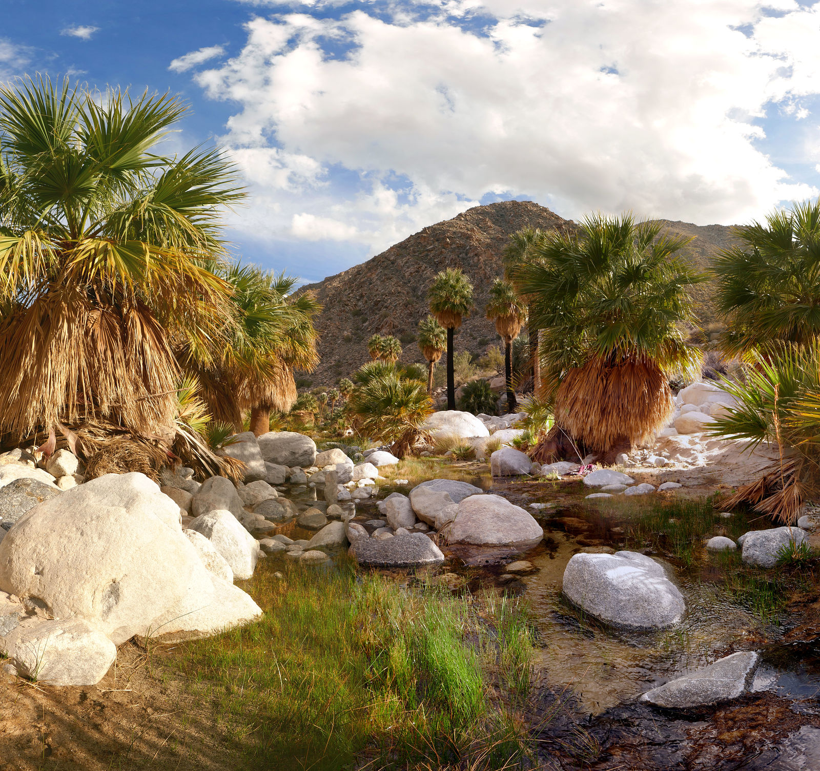
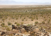
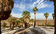
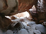
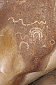
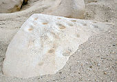
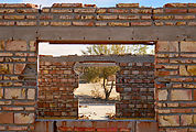
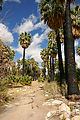
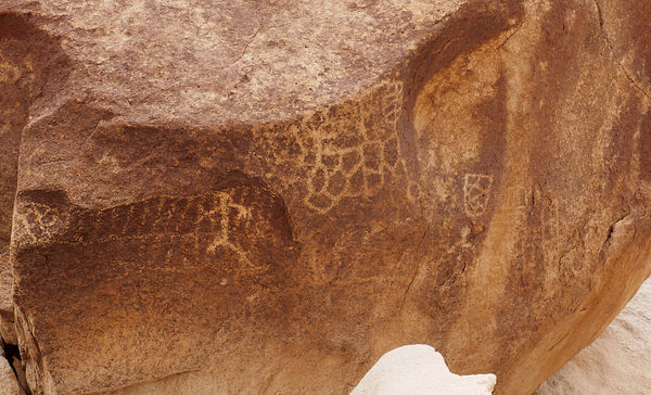
The first group of palm trees I came across was behind the ruins of a stone building. I found metates, petroglyphs, and plenty of nice shade. There
was evidence of these palms surviving a past wildfire. (I later found this to be not unusual.) (32.3517,-115.8276)
   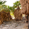        
Surface water in the desert attracts drinking bees:

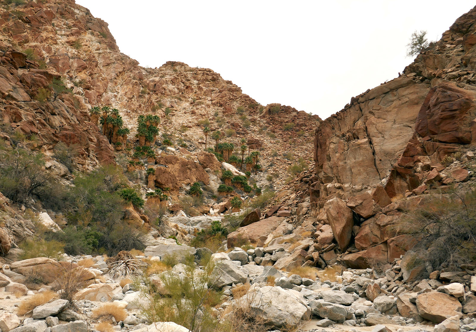
Less than a mile south is another canyon with an oasis of running water and palm trees. I couldn't spot any rock art here. (32.3483,-115.8278)
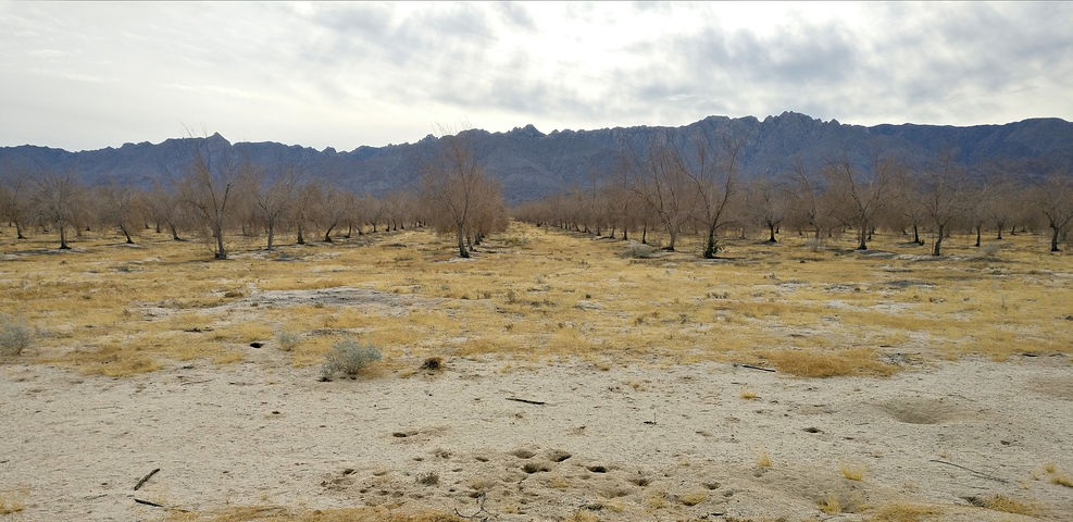
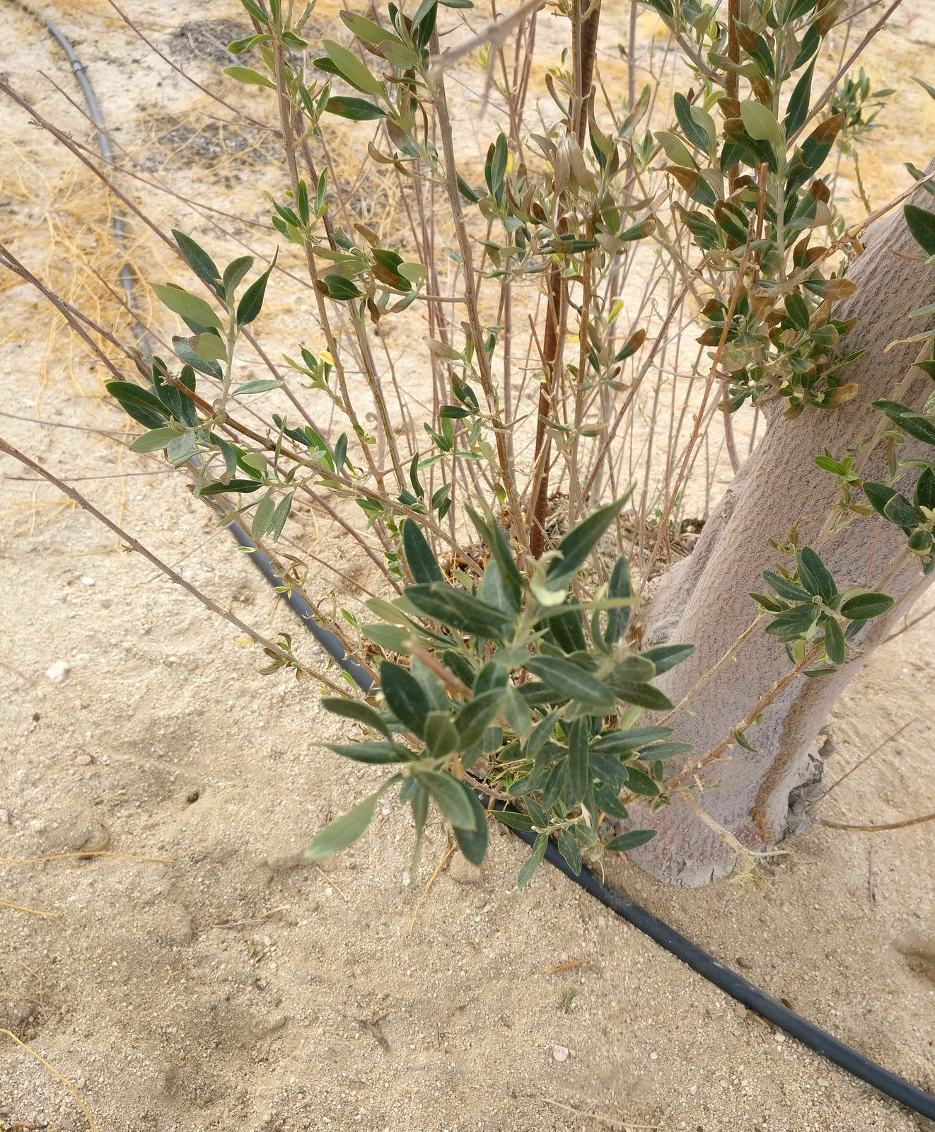
Continuing south, I passed what had been an active olive tree plantation on my previous trips. This time it seemed abandoned, and almost all the
olive trees were dead. A few trees were still desperately trying to survive without irrigation. (32.2301,-115.7246)
  
Vibora Canyon area
I then decided to explore some sites south of Guadalupe Canyon, in the Vibora Canyon area. These are minor unnamed canyons south of the larger canyon
marked "Vibora" on my maps.
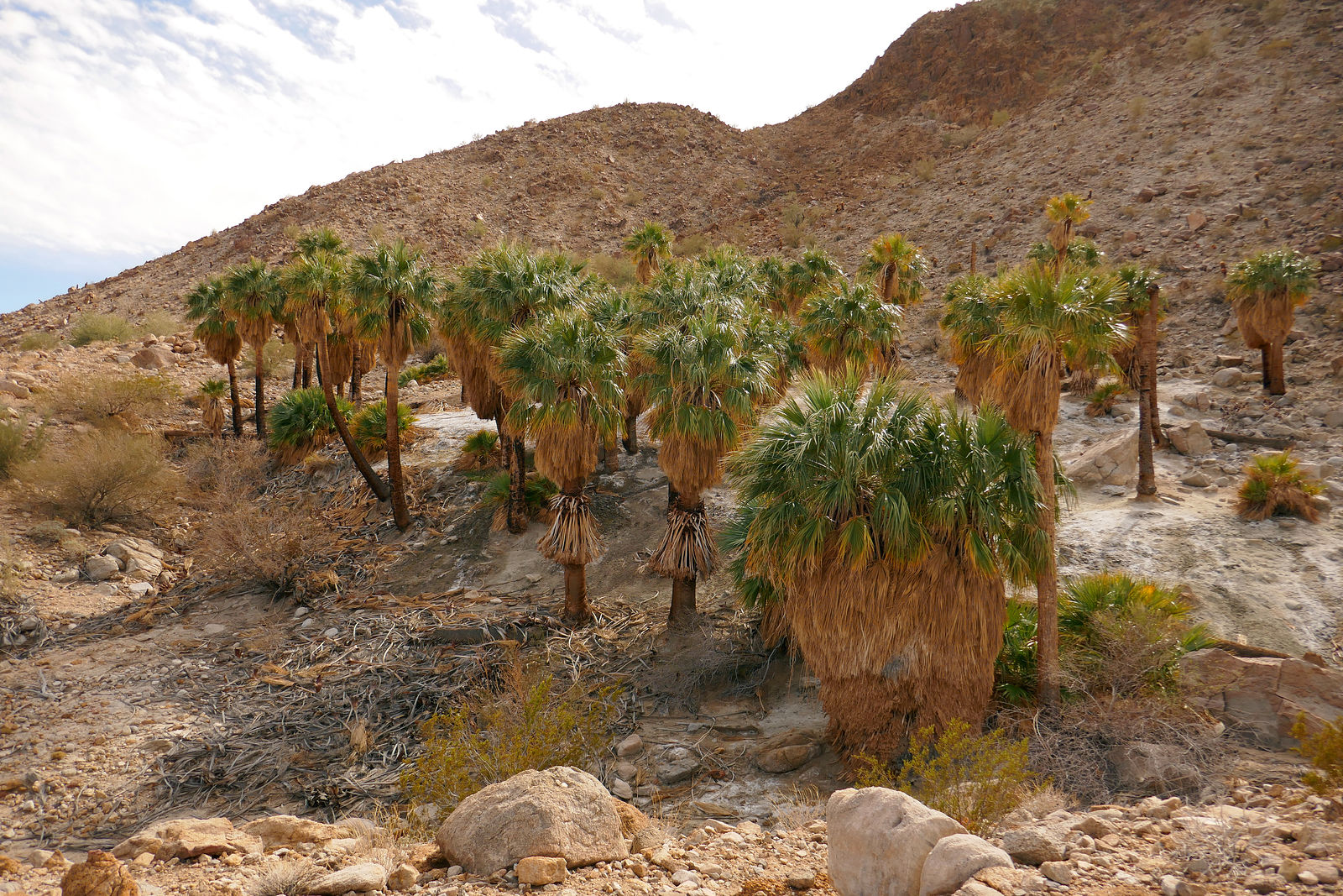
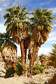
First canyon, with palms, metates, and rock art. I parked (and camped) within a mile of the site.
There was a second palm oasis canyon in the Vibora area, just a few miles south. This one required a few miles of hiking after the road entered the
wash. (32.0757,-115.7572)
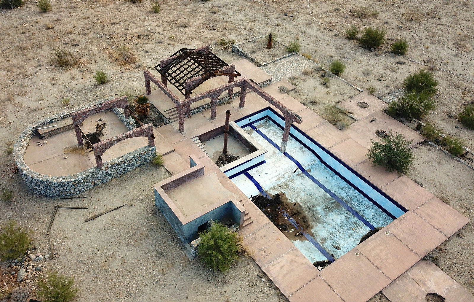
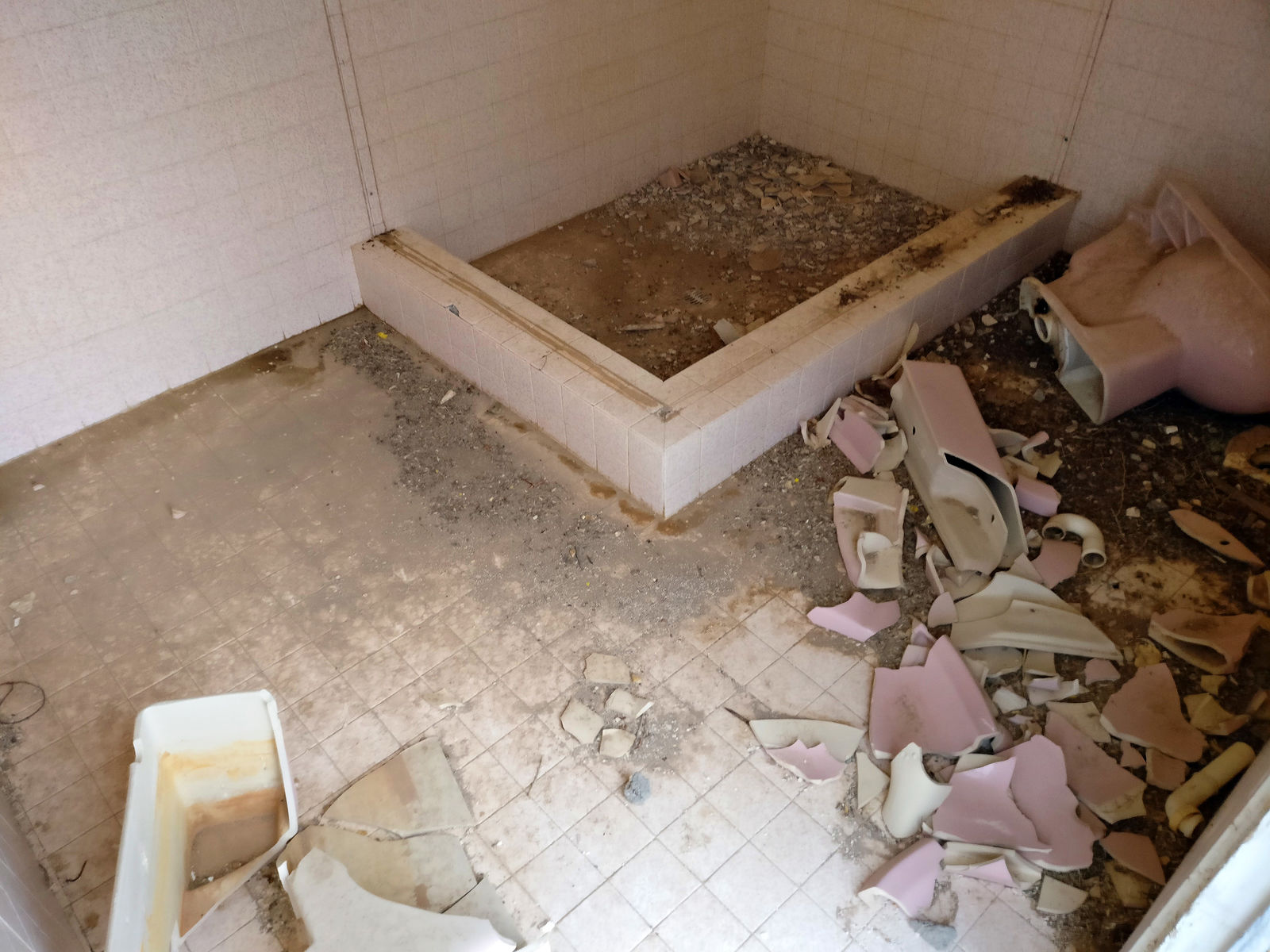
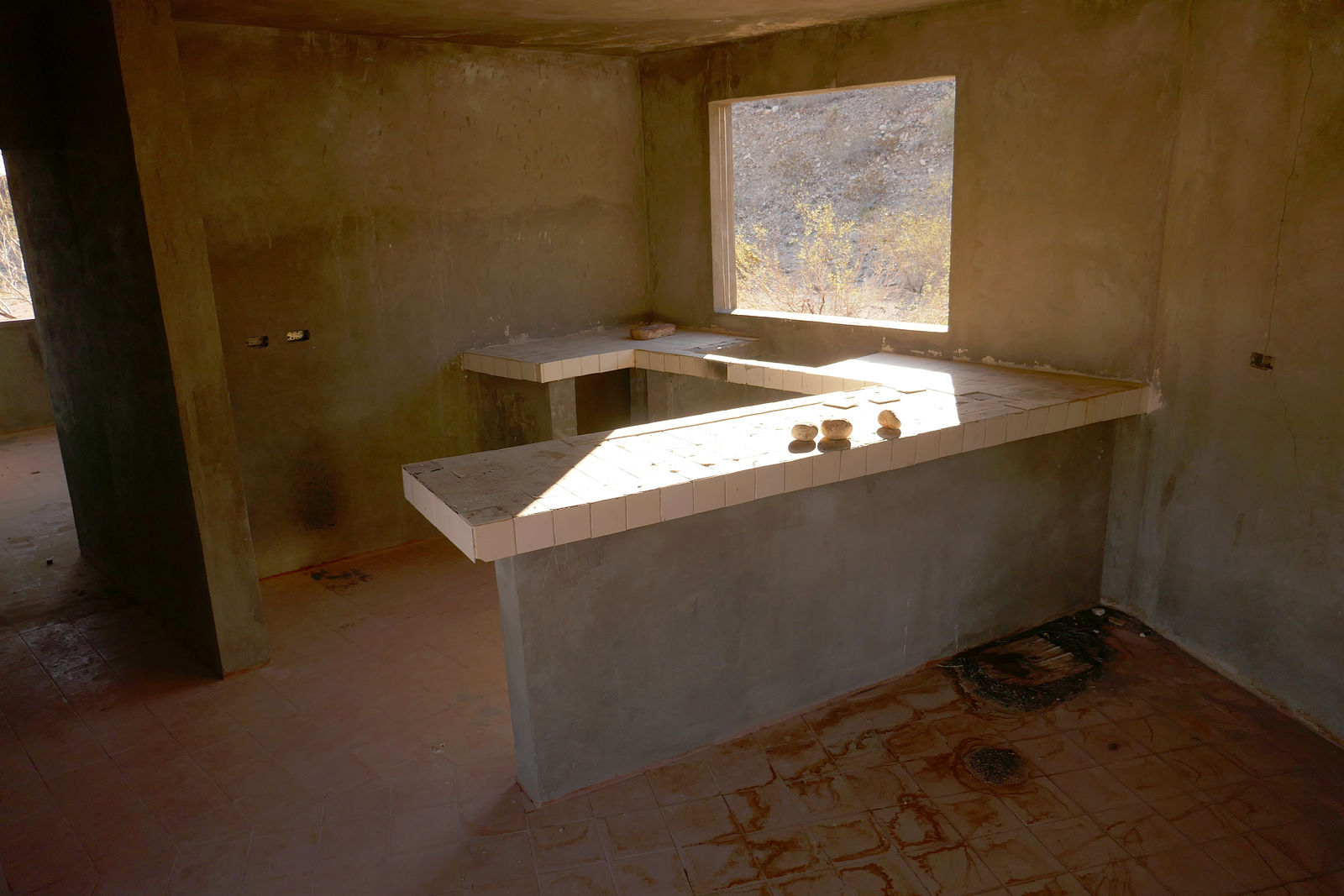
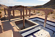
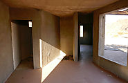
Santa Isabel Canyon - Resort Ruin
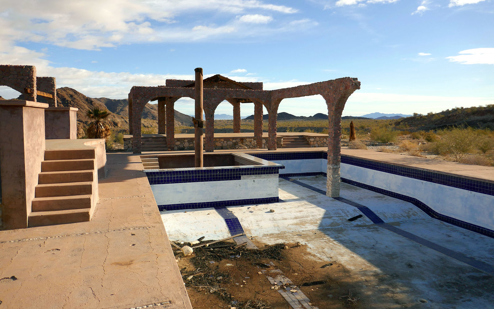
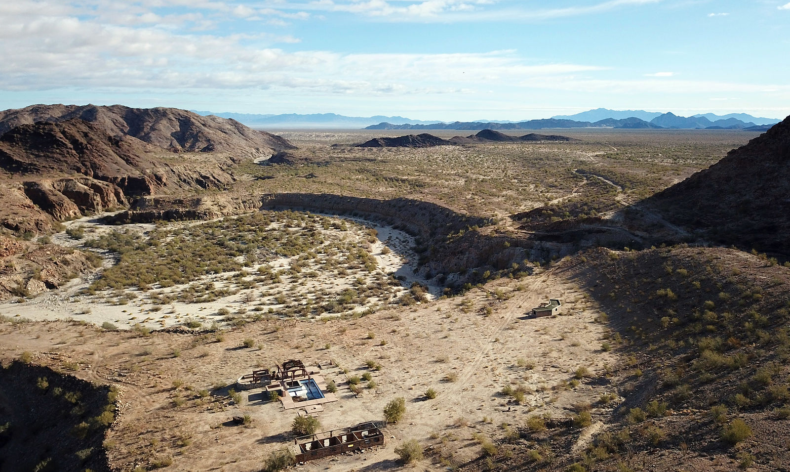
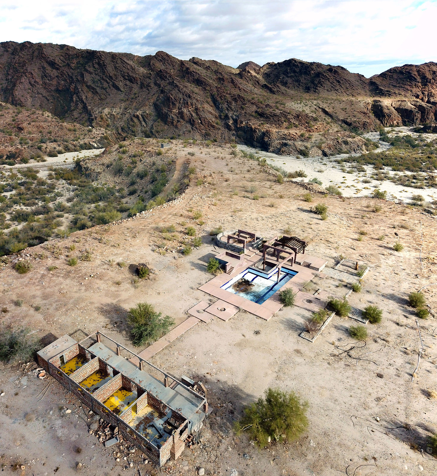
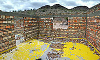
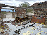
I read about this ruin resort in Rob Williams' Guadalupe Canyon Guidebook. Apparently, an army general was building a house and swimming pool in this
remote corner of the desert, but he was arrested and it has been abandoned since 1990. I found that the condition had deteriorated. The buildings had
been smashed up to extract any hardware of possible value, and also - I assume - just for the joy of smashing. (31.9080,-115.6729)
Does anyone know more about this story?
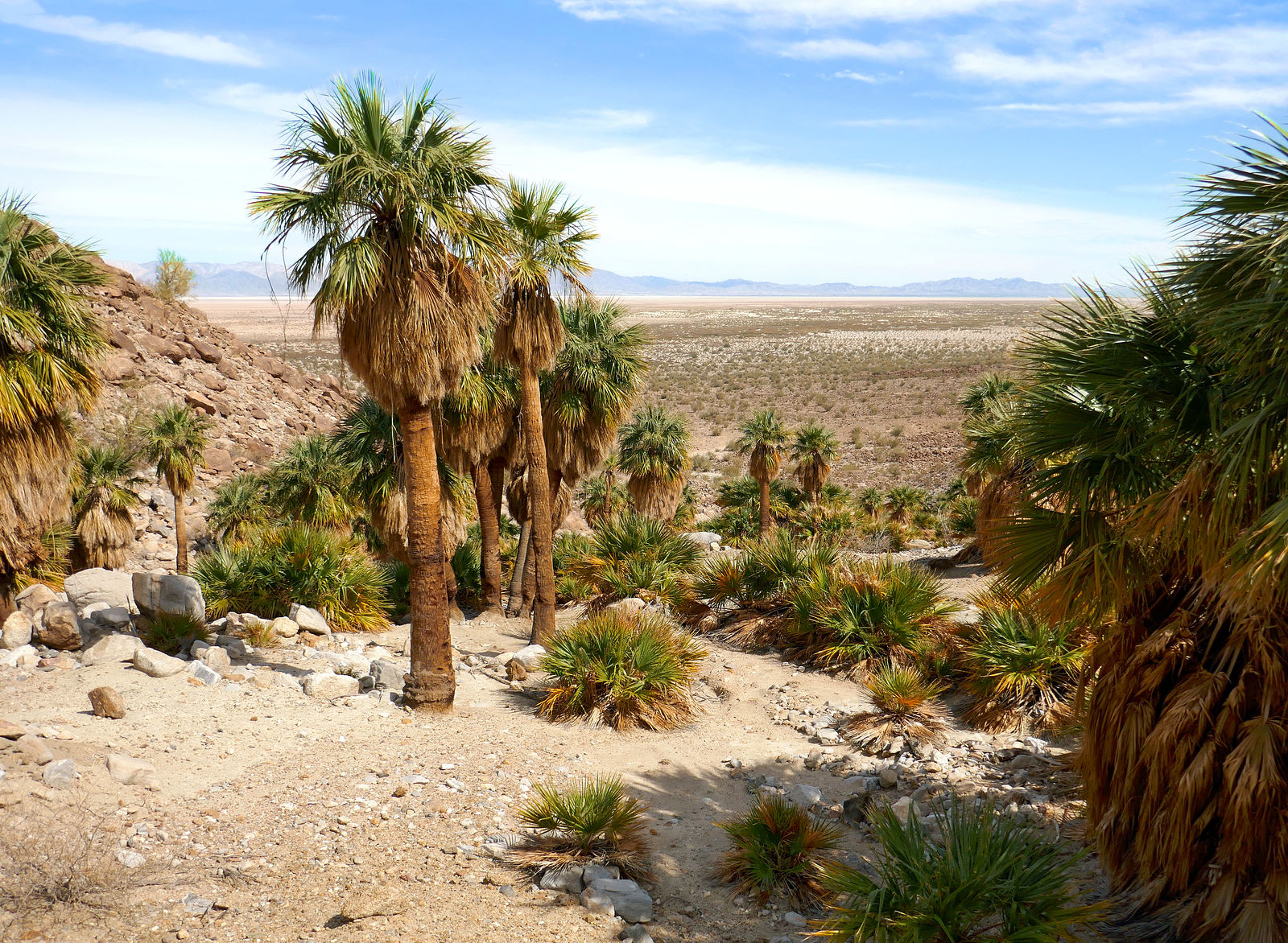
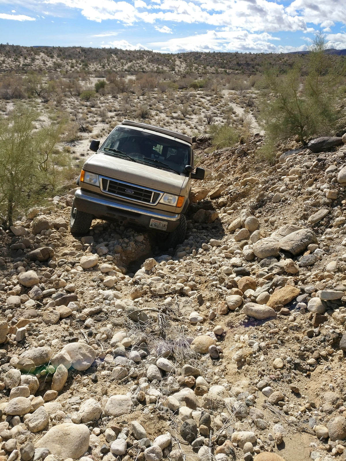
Palomar Canyon
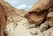
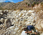
Next, I went north to Palomar Canyon, where I had read was a hot spring. The road is rough, with large exposed rocks in the washes. (Let's keep it
that way!) I had to drive carefully with my RV to make it all the way to the spring. At one point I stopped for a half hour of rock rearranging
because my van was too wide to pass between boulders:
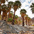
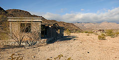
This is an abandoned home at the site marked "El Palomar" in my Baja Almanac. A fire had recently come through, but most of the palms look like they
will survive.
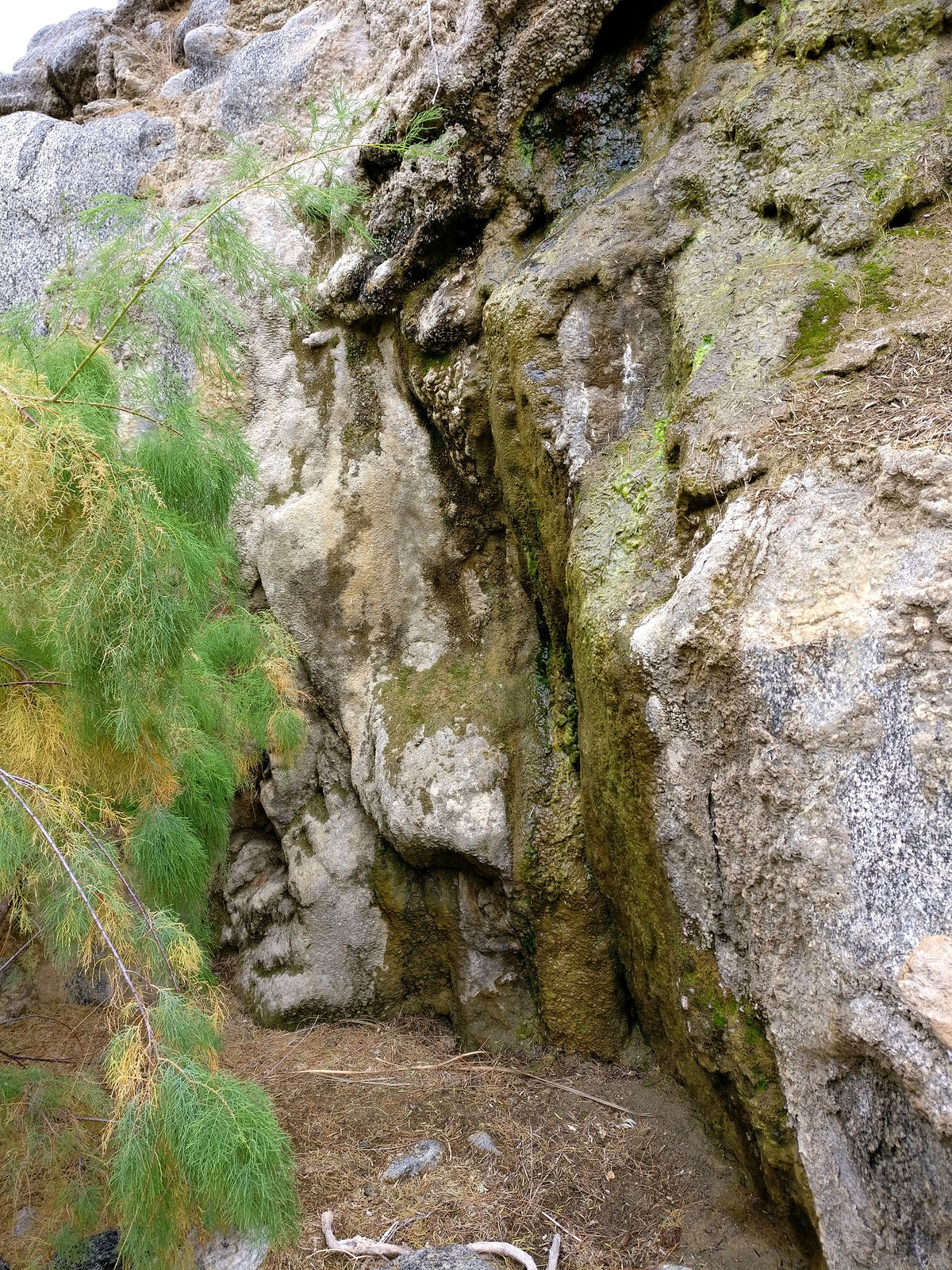
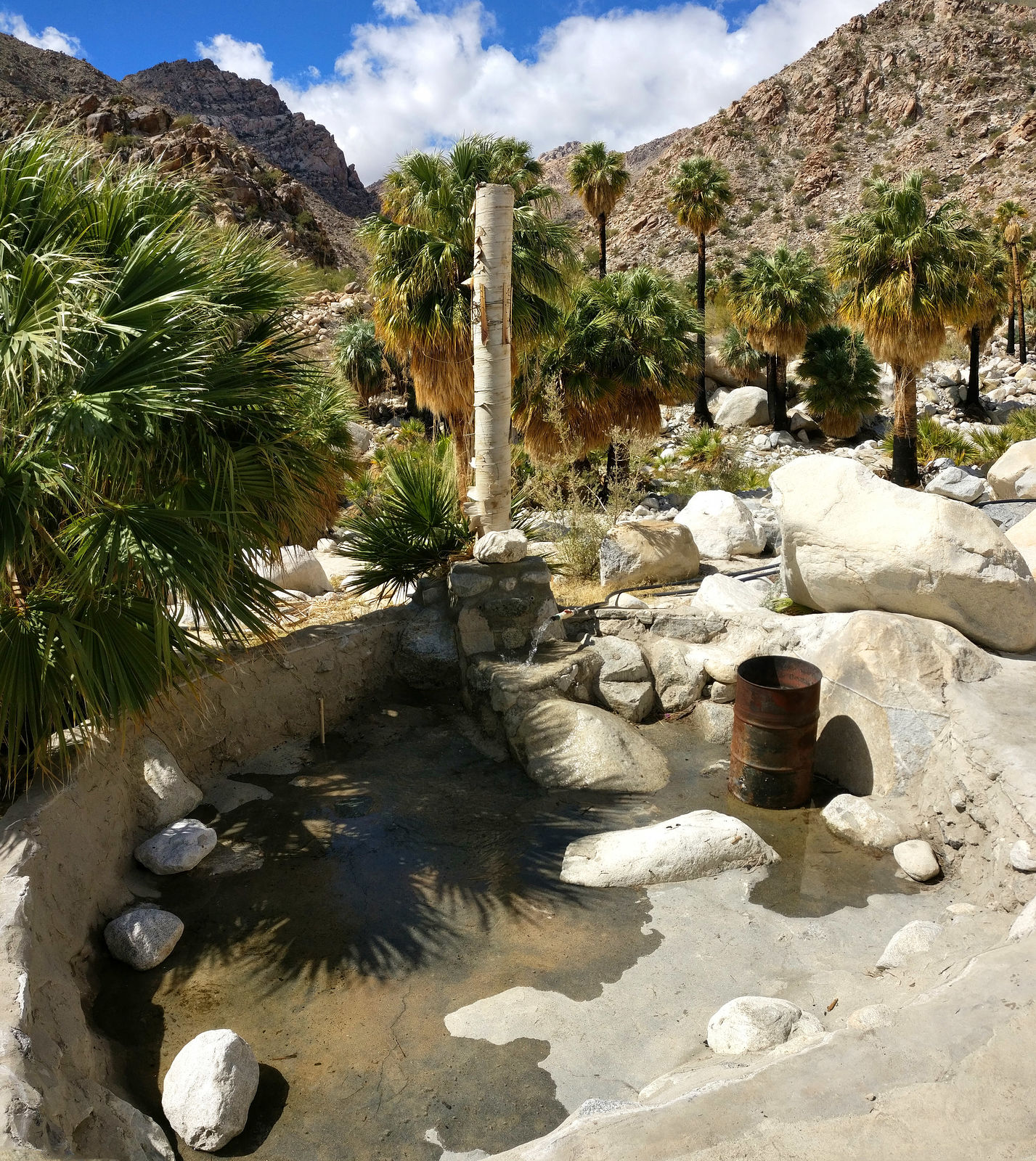
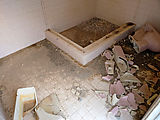
The hot spring itself was a beautiful surprise! The pool is well constructed of rocks and cement, and seems lovingly taken care of. It was empty when
I arrived (nice - avoids parasites). There are brooms for sweeping out dirt. The pool filled in a couple hours with 103° water piped from the hot
spring, creating a lovely warm (97°) soaking pool. There is a metal barrel positioned in the water in which a fire can be lit to heat the water
further.
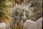
Exploring the oasis, I found some blue palm trees, and these mushrooms:
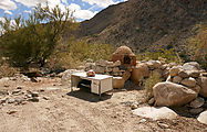
Cute oven
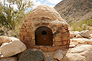
For some reason, there is a desk out there at the end of the road. Curiosity made me open one of the drawers, and I turned up a fun little stash of
goodies. What I found wasn't my thing, but it made me smile.
[Edited on 5-3-2018 by geoffff]
|
|
|
geoffff
Senior Nomad
Posts: 643
Registered: 1-15-2009
Member Is Offline
|
|
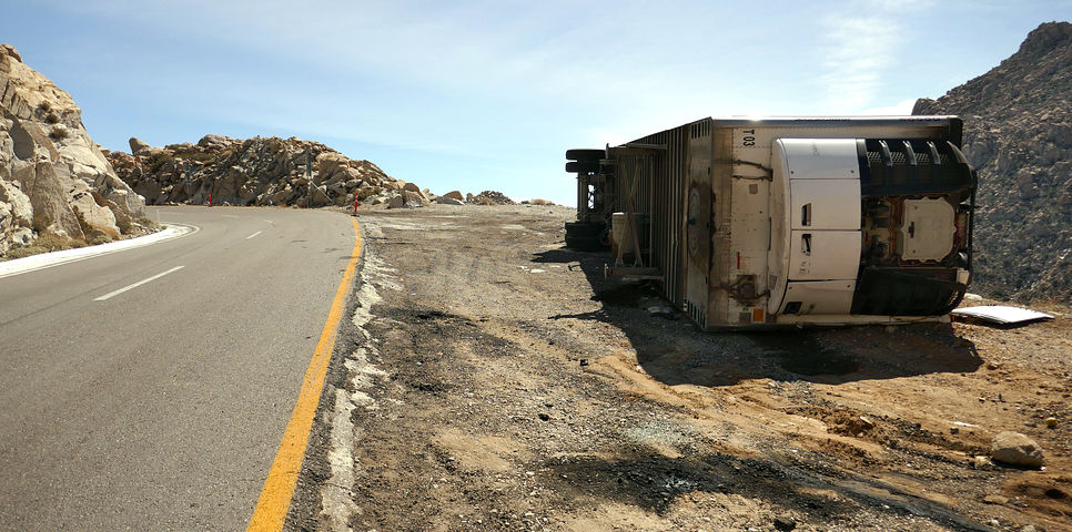
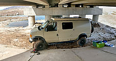
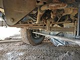
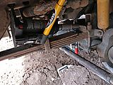
From here, I drove east over the mud flats of Laguna Salada, over to Highway 5.
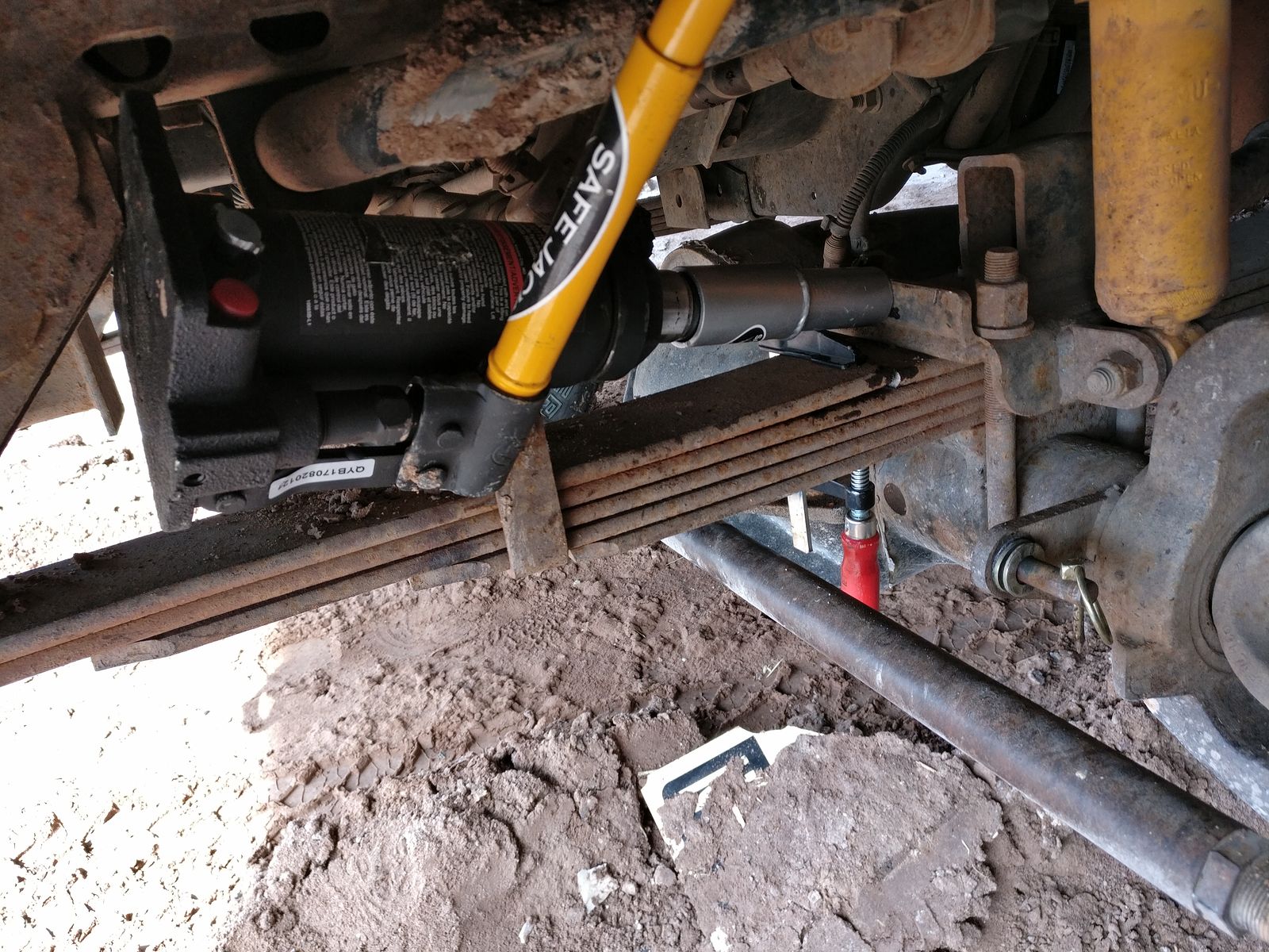
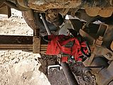
I must have hit one of the bumps in the road a bit too hard, because I discovered a front leaf spring had snapped.
To get out of the sun while assessing the damage, I pulled under a bridge where the highway crosses the briny water, and investigated the damage.
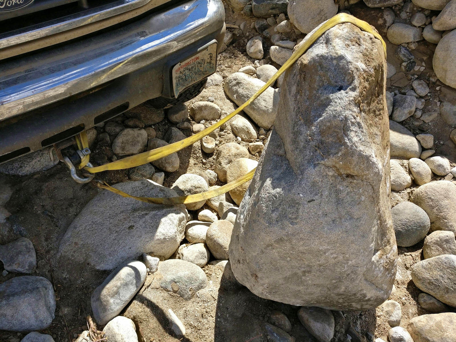
Using my bottle jack to pry things apart a bit, I managed to do a little field repair using ratchet straps to tightly hold the broken leaf spring ends
in place, but it slowly sunk in for me that my holiday was most likely over. I called Sportsmobile and learned that my broken spring was a custom part
that they no longer stock. Because a second intact leaf was there under the broken one (with partial military wrap), I figured my van was stable for
driving, but there was no way I would trust it solo driving rough roads far from civilization.
San Felipe area
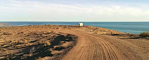
I drove through San Felipe, and down to the Percebú sand bar ("Shell Island") to decompress for a while. I camped there a couple nights, and sought
mechanical advice in San Felipe, but I learrned my van would require a replacement leaf to be fabricated and I didn't want to be dealing with car
repair for the remainder of my holiday.
       
Beach finds - lots of clams, and a dead whale.
 
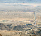
I spotted this drilling operation in the distance. Are they searching for water for future development? 

I left to do a bit more (mostly highway) exploring.
The "Oh $#!+ Dip", freshly painted. Always makes me smile! When I see it in time, that is.

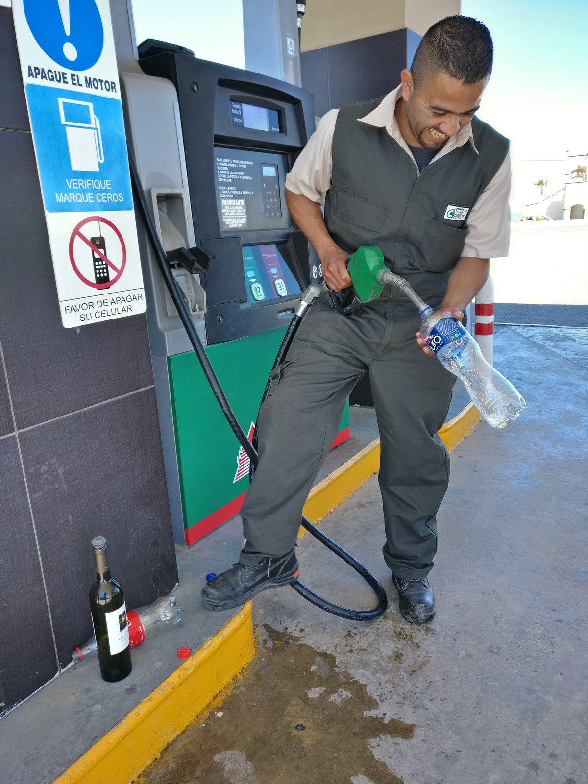
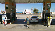
This guy and his dog were out of gas, so I offered to fetch some at the nearest Pemex. They don't sell red jugs for carrying fuel, but people
apparently just use old plastic drinking bottles to transport gas. I thought maybe my glass wine bottle would be a better idea (less dissolving,
perhaps?), but the attendants shook their heads and indicated it was a bad idea.
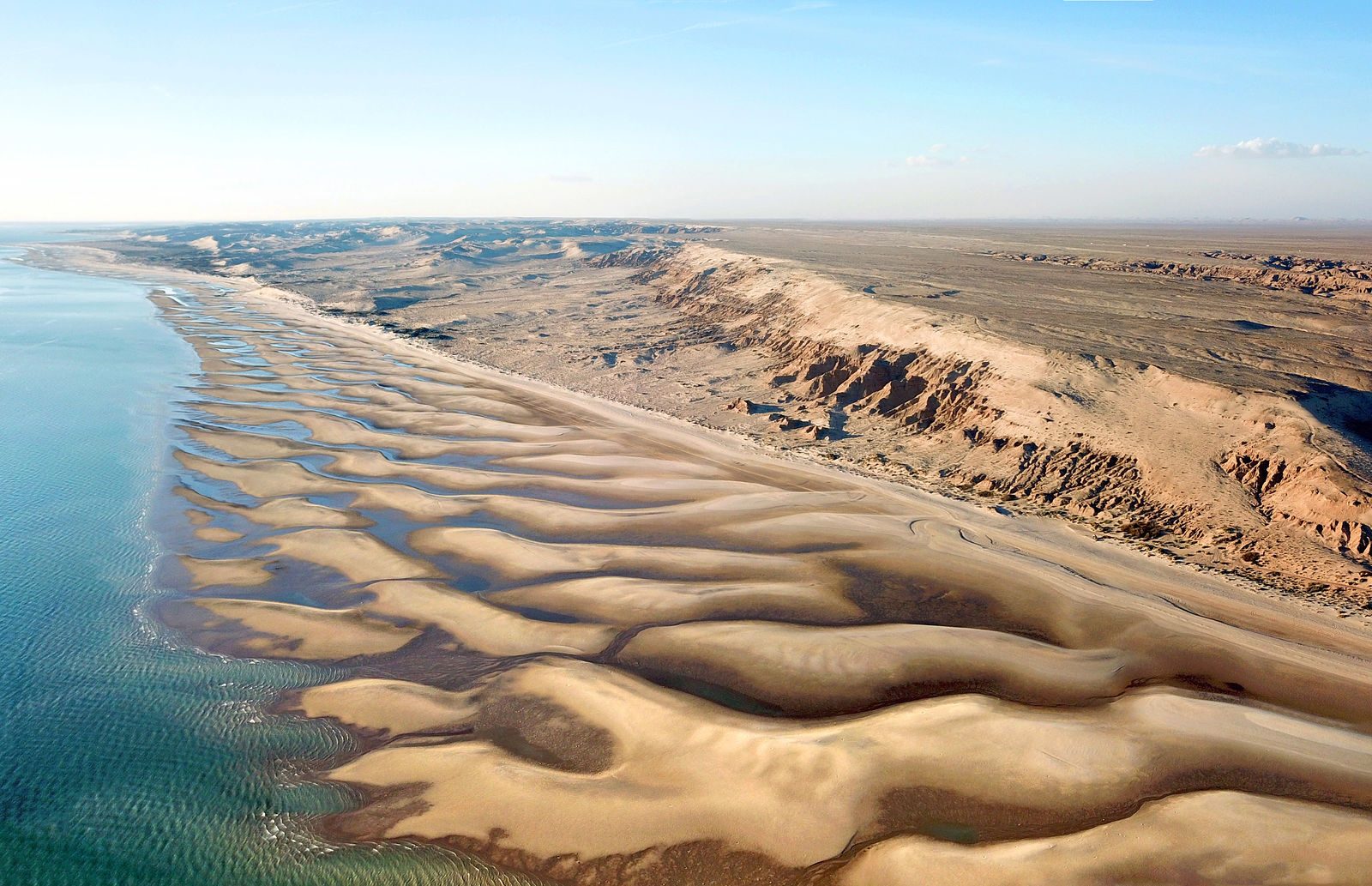
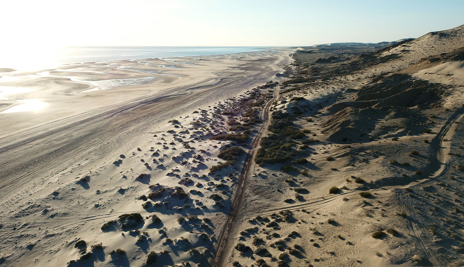
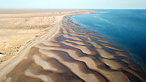
My last adventure was driving east around the top of the Gulf of California in the direction of Puerto Peñasco. I had spotted some nice beach access
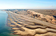
tracks just west of "El Tornillal" near Gulfo de Santa Clara. The area is beautiful, with lovely patterned sand bars at low tide, somewhat like the
Percebú area. (31.6115,-114.3608)
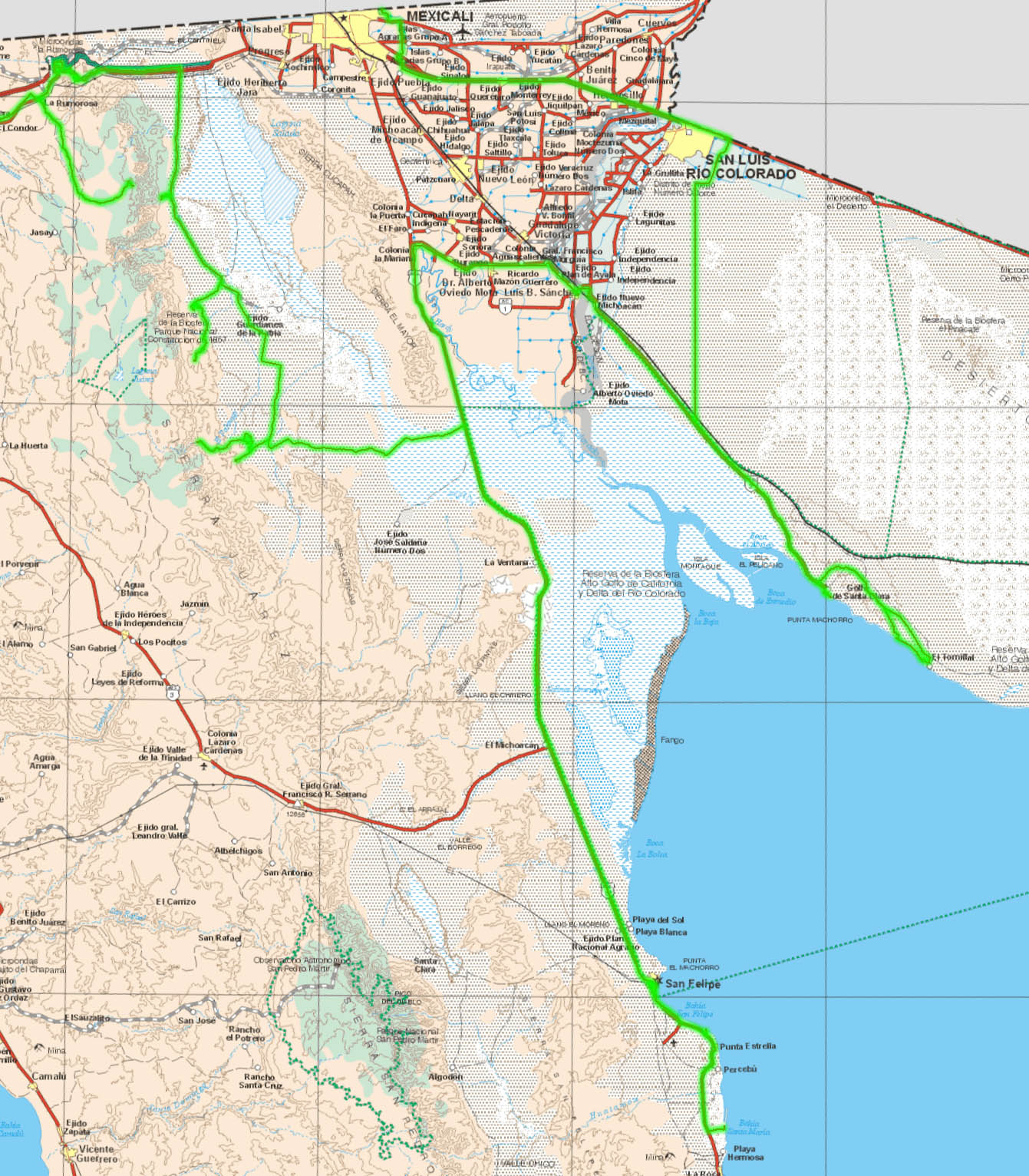
Here's the final GPS track map for my trip:

[Edited on 3-28-2018 by geoffff]
|
|
|
David K
Honored Nomad
Posts: 64479
Registered: 8-30-2002
Location: San Diego County
Member Is Offline
Mood: Have Baja Fever
|
|
It was a real pleasure to meet you and enjoy a dinner with Baja discussion!
I am just happy I was able to communicate with you and relay your situation to try and help!
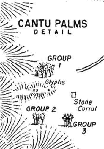
I will now, go enlarge your photos for a better look. Do you think the first palm area off the graded Guadalupe Canyon road was the famous Cantu Palms
(as they were called in old copies of Desert Magazine and older guidebook? It was about 17 miles south of Hwy. 2.
|
|
|
LukeJobbins
Nomad
Posts: 196
Registered: 3-11-2014
Location: Lemoore, Ca
Member Is Offline
|
|
Awesome looking trip and good finds. If you haven’t found a spring yet, Deaver springs does custom leaf springs. Top notch for off-road cars and
classics and everything in between. If I remember right they are in Orange County.
|
|
|
TMW
Select Nomad
Posts: 10659
Registered: 9-1-2003
Location: Bakersfield, CA
Member Is Offline
|
|
Some great exploring and pictures, thanks for sharing.
|
|
|
geoffff
Senior Nomad
Posts: 643
Registered: 1-15-2009
Member Is Offline
|
|
Quote: Originally posted by David K  | | I will now, go enlarge your photos for a better look. Do you think the first palm area off the graded Guadalupe Canyon road was the famous Cantu Palms
(as they were called in old copies of Desert Magazine and older guidebook? It was about 17 miles south of Hwy. 2. |
Wow, that's a remarkably "DavidK" question  But I like solving these puzzles,
too. But I like solving these puzzles,
too.
Yes, I think it's likely.
The detail map in the Aug 1946 issue shows three groups of palms (I only visited two of these, but I saw the third), and a stone corral. I did see a
stone corral in the right location. Compare their map and the satellite image from Google Earth. You can see the stone corral in the satellite image
too. The palms are no longer in the "perfect circle" described in the article, but it's a bit reminiscent.

Also, the Jan 1967 issue has a map that matches pretty well my map, with the diagonal road coming out of the lakebed from the northeast:

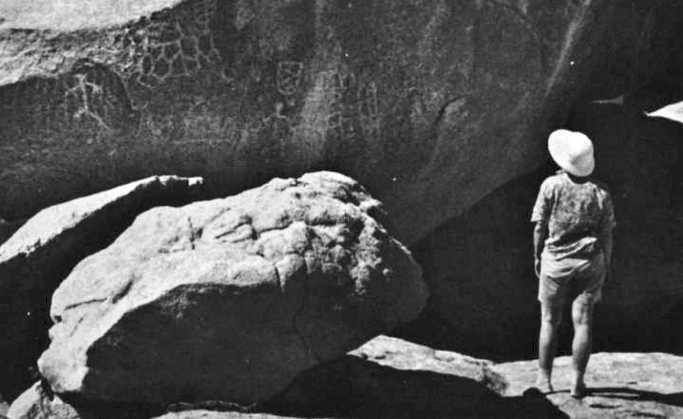
Also, one of my rock art photos matches one labeled "Palmas de Cantú" in "Rock Art of Baja California" by Campbell Grant 1974.
As a side note, I notice that I visted what this 1967 issue calls "Petroglyph Canyon" in the map above. I labeled it "Vibora 1". Their photo captioned
"After cooling off in a waterfall, the author hikes to the petroglyphs" matches my photo, and I also saw the three connected circles petroglyph they
describe.

-- Geoff
[Edited on 3-28-2018 by geoffff]
[Edited on 3-28-2018 by geoffff]
|
|
|
geoffff
Senior Nomad
Posts: 643
Registered: 1-15-2009
Member Is Offline
|
|
| Quote: Originally posted by LukeJobbins | | Awesome looking trip and good finds. If you haven’t found a spring yet, Deaver springs does custom leaf springs. Top notch for off-road cars and
classics and everything in between. If I remember right they are in Orange County. |
Yes, thanks, I will. In fact I already used Deaver for my rear springs some time ago!
-- Geoff
|
|
|
Maderita
Senior Nomad
Posts: 634
Registered: 12-14-2008
Location: San Diego
Member Is Offline
|
|
Those are some wonderful fotos Geoff, thanks for posting up!
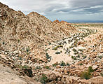
That was an obscure campsite on the plateau at the edge of the escarpment! I've only roamed around that section a couple times, scoping for potential
rockclimbing routes by horseback and dirtbike. Most of the climbing is just a few miles south, and another small area is a few miles north.
Yes, those clandestine airstrips were purposely "deactivated". There was drug running through the Sierra de Juarez in that area. The army would dig
trenches, sometimes concealing with brush, to "trip" and crash airplanes. Seems to me that the trafficking through there (Laguna Hanson to La
Rumorosa) has diminished somewhat in the past decade, and the army presence is less frequent.
Yes, the towers for wind measurement is the work of the Rumorosa Wind Project. Many times I wondered, if I climbed the tower and reversed the wires,
would it record a negative wind speed? !!
The first 5 test wind turbines were installed maybe 10 years ago south of Hwy 2, near La Rumorosa. They also generated a lot of publicity. Plans
were/are for hundreds more through the sierra. Expansion of the project stalled out for a several years. Then another 35 or 40 (by my quick visual
count) have been installed north of Hwy 2 in the past 2 or 3 years. The "pluma" which you drove through (barrier and guard shack/trailer) belongs to
the Wind Project.
Even the local ranchers don't know when more wind turbines will be installed. Some are eager to reap the "windfall" of money they hope to make from
leasing the land rights. Others recognize that it is destructive to wilderness, wildlife, and a visual blight. It's a frequent topic of conversation
and concern with my ranching amigos and climbing partners.
Sadly, things are changing quickly in those mountains. Go there and enjoy the unspoiled places while you can!
|
|
|
Paco Facullo
Super Nomad
Posts: 1301
Registered: 1-21-2017
Location: Here now
Member Is Offline
Mood: Abiding ..........
|
|
Well geofff, even with the mishap, looks like you still had one Hell of a trip. And outstanding photos !
Loved your trip report , great job !
|
|
|
David K
Honored Nomad
Posts: 64479
Registered: 8-30-2002
Location: San Diego County
Member Is Offline
Mood: Have Baja Fever
|
|
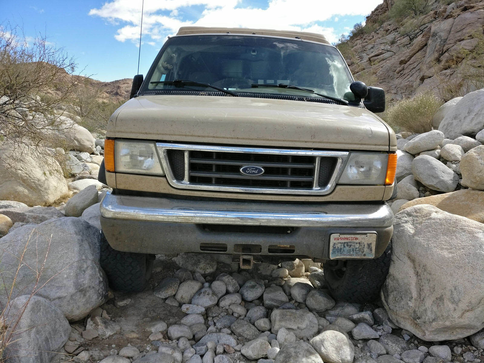
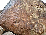
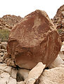
That boulder in 2008:

|
|
|
matthew_mangus
Junior Nomad
Posts: 81
Registered: 10-4-2019
Location: Portland, OR
Member Is Offline
|
|
| Quote: Originally posted by geoffff | From here, I drove east over the mud flats of Laguna Salada, over to Highway 5.
Here's the final GPS track map for my trip:
[Edited on 3-28-2018 by geoffff] |
Geoff, is there a clear route across the mud flats to the S of Laguna Salada or were you just making it up as you went along trying to stay on dry
ground?
I like to explore remote dirt tracks and beaches.
|
|
|
PaulW
Ultra Nomad
Posts: 3005
Registered: 5-21-2013
Member Is Offline
|
|
Geoffff's trip was 3 months after my trip and I should compliment him on getting up the washout approaching PolamarThat track definitely is rough. As
far an a track from Hwy5 I would recommend the traditional track from KM87. I hate mud that is always possible.
|
|
|
Ateo
Elite Nomad
Posts: 5847
Registered: 7-18-2011
Member Is Offline
|
|
Excellent report!!! Thank you for taking the time............
|
|
|