caboguy
Newbie
Posts: 8
Registered: 9-10-2009
Location: North Idaho
Member Is Offline
|
|
help headed south
I am headed to Loreto in October via Mexicali East through San Felipe. This will be my first time using this route, having gone through
Tecate-Ensenada in the past. I found the pictures and directions if you are headed north, I am hoping someone could help me out in case the reverse
directions are a little different.
|
|
|
David K
Honored Nomad

Posts: 64476
Registered: 8-30-2002
Location: San Diego County
Member Is Offline
Mood: Have Baja Fever
|
|
Just drive south, look for signs that read Mexico #5 or San Felipe to get out of Mexicali.
The original or west Mexicali border is easy... just follow the street with the train tracks in the center from the border and see lots of signs for
San Felipe. I know you want to use the east border, and there has been construction going on by it that caused detours. Just look for signs for San
Felipe, Mexico Highway #5. Online maps or even Google Maps on your phone may guide you through Mexicali.
When you get to San Felipe, top your gas tank! There are three stations along the right side before you get to the traffic circle (past the white
arches monument which the road also circles around) where the road to the airport and Puertecitos (Mex #5) turns right. One more station is after the
right branch. There are a dozen or more 4-way stops going through San Felipe. If you want to see the Malecon, shop, get fish tacos... go straight at
the traffic circle to the signal, take the one-way street to the right and then there is a left one block to the Malecon which is one way back to the
left... you will circle back to the main road into town and to that traffic circle. Tacos are on the malecon, and lots of shops for curios.
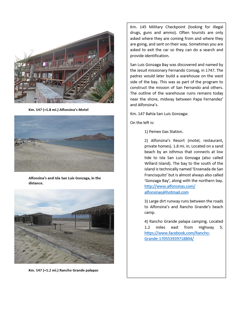
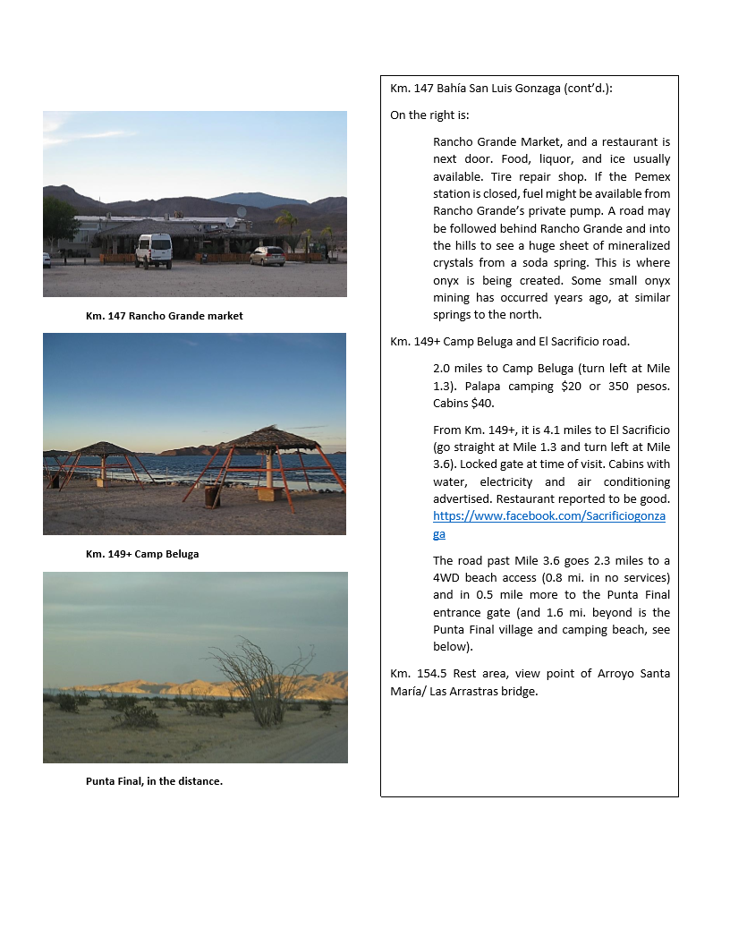
6 miles south of the traffic circle is where you turn left to use Highway 5 to Puertecitos, Gonzaga Bay and Laguna Chapala on Hwy. 1. This point is
Km. 0 for Hwy. 5 south of San Felipe. It is very narrow and has many steep dips. After Puertecitos (Km. 74.5) is the new highway and is wide and
fast... but do watch for falling rocks in the road. Gonzaga Bay has several places if you want to see the beautiful bay. Rancho Grande (across from
the market of the same name and just south of the gas station (Km. 147+) is the easiest place to drive to the beach for a look and then come back out
if you are not staying.
The pavement ended 20 kms. south when I last drove it (August '17) but more has probably opened up on the 30+ miles from Gonzaga to Laguna Chapala/
Hwy. 1. Please report back if you take a moment to record the road mileage or km. marker where the pavement ends or ?? Thank you!
|
|
|
caboguy
Newbie
Posts: 8
Registered: 9-10-2009
Location: North Idaho
Member Is Offline
|
|
Thanks David, we really appreciate the information!
|
|
|
David K
Honored Nomad
Posts: 64476
Registered: 8-30-2002
Location: San Diego County
Member Is Offline
Mood: Have Baja Fever
|
|
You are welcome... Just like any adventure, the hardest part is often taking the first step. Hey, if you get lost it will just make your campfire
story all the more interesting! Everything always works out on a Baja trip, if not we would have nobody left on Nomad to talk about it!
PS If you want photos heading south... see my Trip Report #1 from 2017.
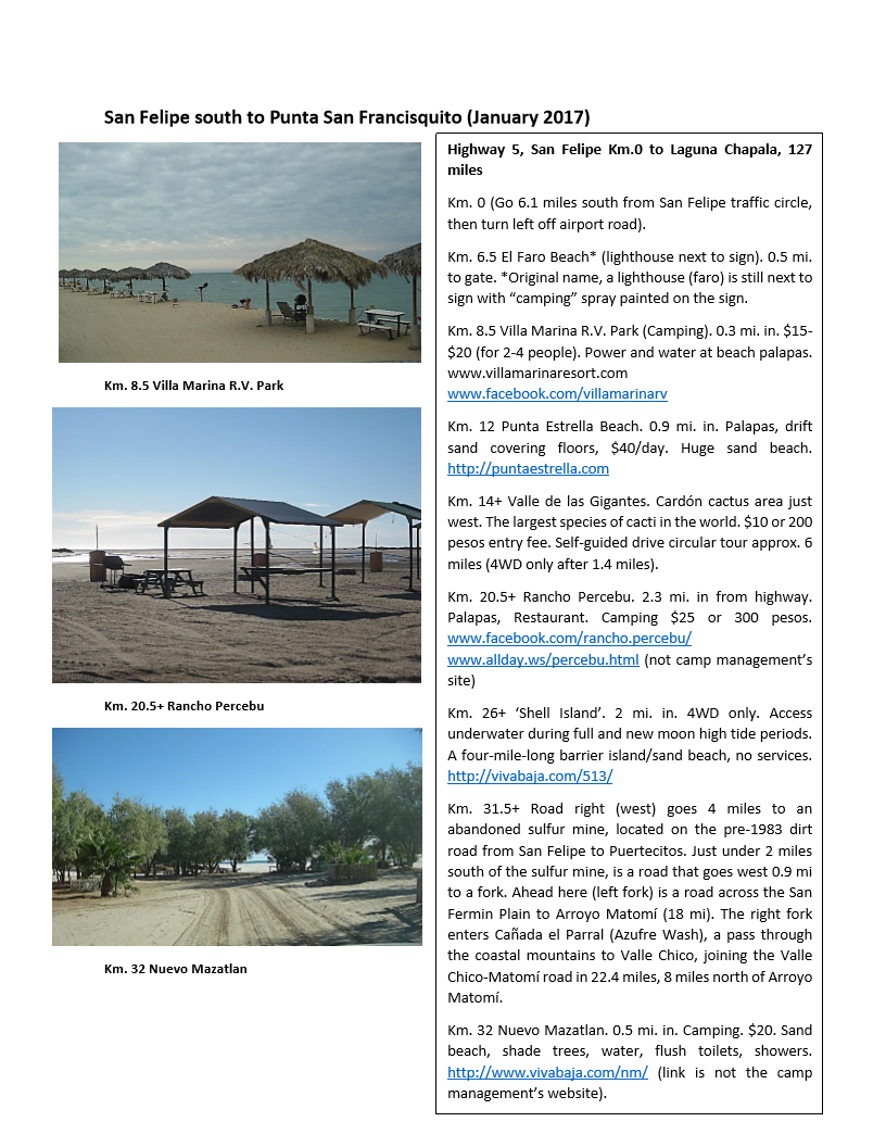
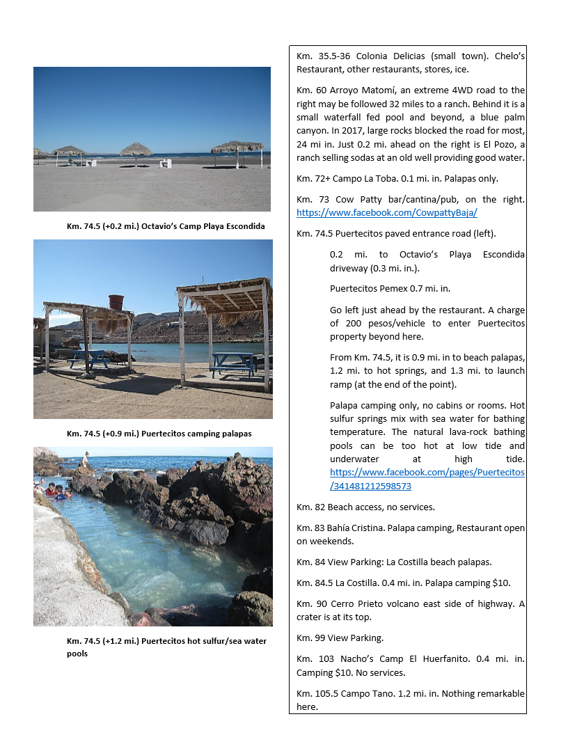
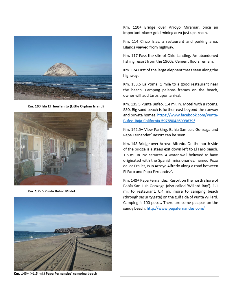
Here is what I turned it into (sample pages) for a road guide:
Work pages from San Felipe to Gonzaga...
[Edited on 6-19-2018 by David K]
|
|
|
BajaNomad
|
Thread Moved
6-20-2018 at 06:17 AM |


