| Pages:
1
2 |
JZ
Elite Nomad

Posts: 9349
Registered: 10-3-2003
Member Is Online
|
|
Holy crap! I'm gonna do this! Thank you.
|
|
|
AKgringo
Elite Nomad
Posts: 5847
Registered: 9-20-2014
Location: Anchorage, AK (no mas!)
Member Is Offline
Mood: Retireded
|
|
The old La Rumorosa grade was my intended route (going up it) this past fall, but mechanical difficulties forced me to scrub that trip. I'm thinking
this October or November it is going to be on my to do list!
If you are not living on the edge, you are taking up too much space!
"Could do better if he tried!" Report card comments from most of my grade school teachers. Sadly, still true!
|
|
|
JZ
Elite Nomad
Posts: 9349
Registered: 10-3-2003
Member Is Online
|
|
Hey Tom, I think a know where this is, but can you drop us some GPS coordinates?
|
|
|
advrider
Super Nomad
Posts: 1847
Registered: 10-2-2015
Member Is Offline
|
|
I think I rode the whole trail? We ended just North of Catavina and started the single track at the mud hills? Did I miss something? It was an awesome
trail and made me happy that I had installed the Rekluse on the 500 before this trip...
|
|
|
TMW
Select Nomad
Posts: 10659
Registered: 9-1-2003
Location: Bakersfield, CA
Member Is Offline
|
|
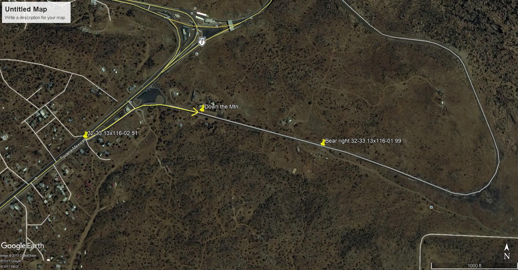
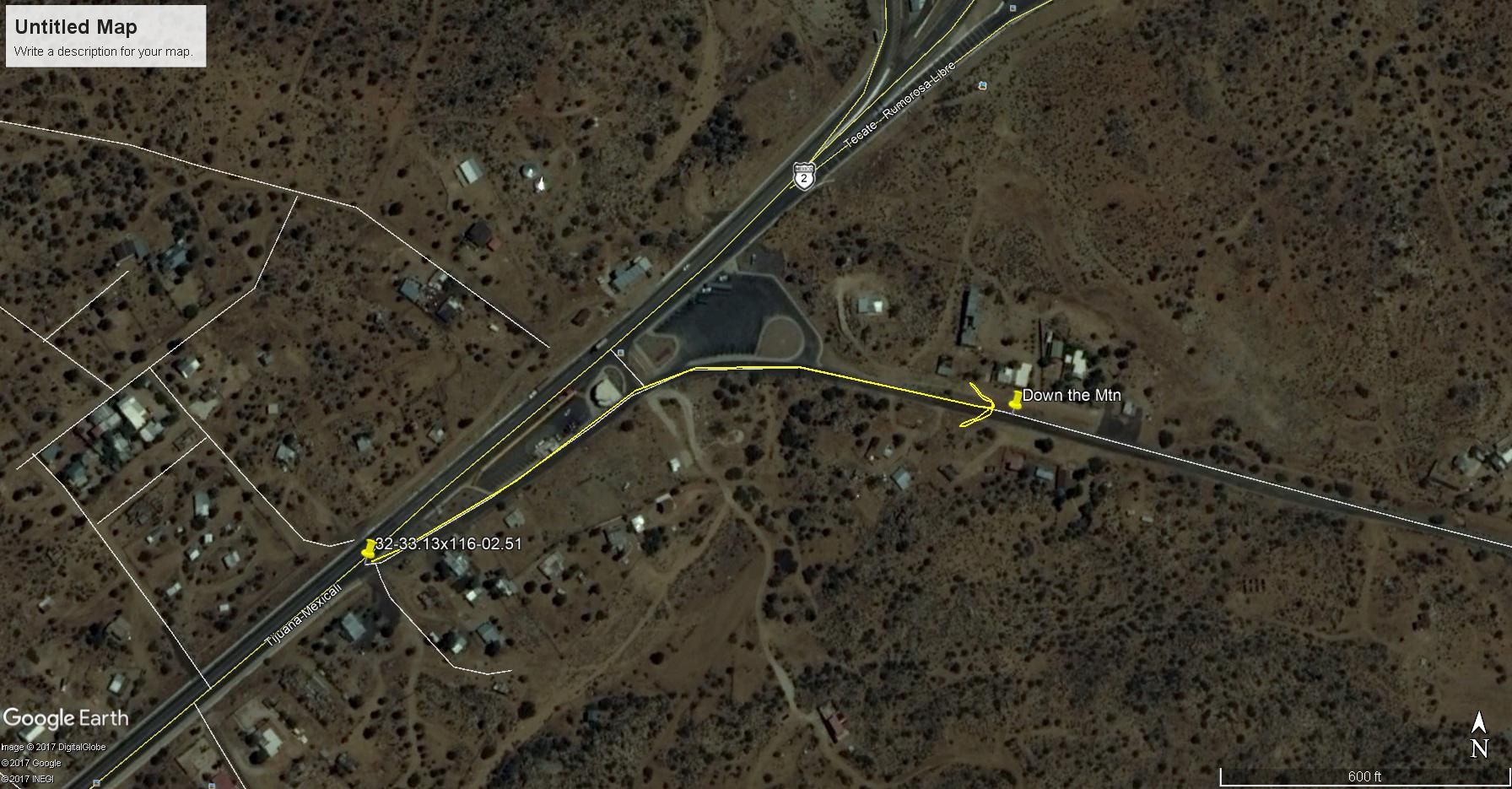
JZ, Just before the toll road heads down the mountain is the turnoff. You turn off to the right and a little later turn right onto a dirt road and
follow it down.
|
|
|
TMW
Select Nomad
Posts: 10659
Registered: 9-1-2003
Location: Bakersfield, CA
Member Is Offline
|
|
After you get down you can follow the arroyo toward the hwy and there is a road that goes east before the hwy. I suggest you get past the military
checkpoint on the hwy before trying to get on the hwy.
This may be a better view of the turnoff.
[Edited on 7-28-2018 by TMW]
|
|
|
JZ
Elite Nomad
Posts: 9349
Registered: 10-3-2003
Member Is Online
|
|
Thx. For some reason I can never figure out how to enter GPS coordinates in the format you are using.What is format is: 32-33 13 x 116-02 51?
Edit: looks like I need to put a zero at the end.
Highway turn-off
32° 33.130'N
116° 2.510'W
Turn off to the dirt
32° 33.130'N
116° 1.990'W
[Edited on 7-28-2018 by JZ]
|
|
|
JZ
Elite Nomad
Posts: 9349
Registered: 10-3-2003
Member Is Online
|
|
There are all kinds of crazy roads down there. Is it pretty obvious which way to go when you are on it? Looks like about 9 miles, but not quite as
many switch backs as I expected. How far East is the checkpoint?
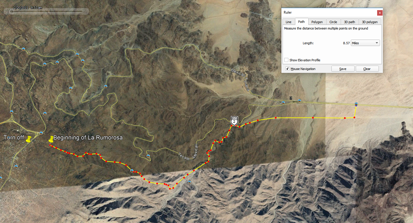
[Edited on 7-28-2018 by JZ]
|
|
|
JZ
Elite Nomad
Posts: 9349
Registered: 10-3-2003
Member Is Online
|
|
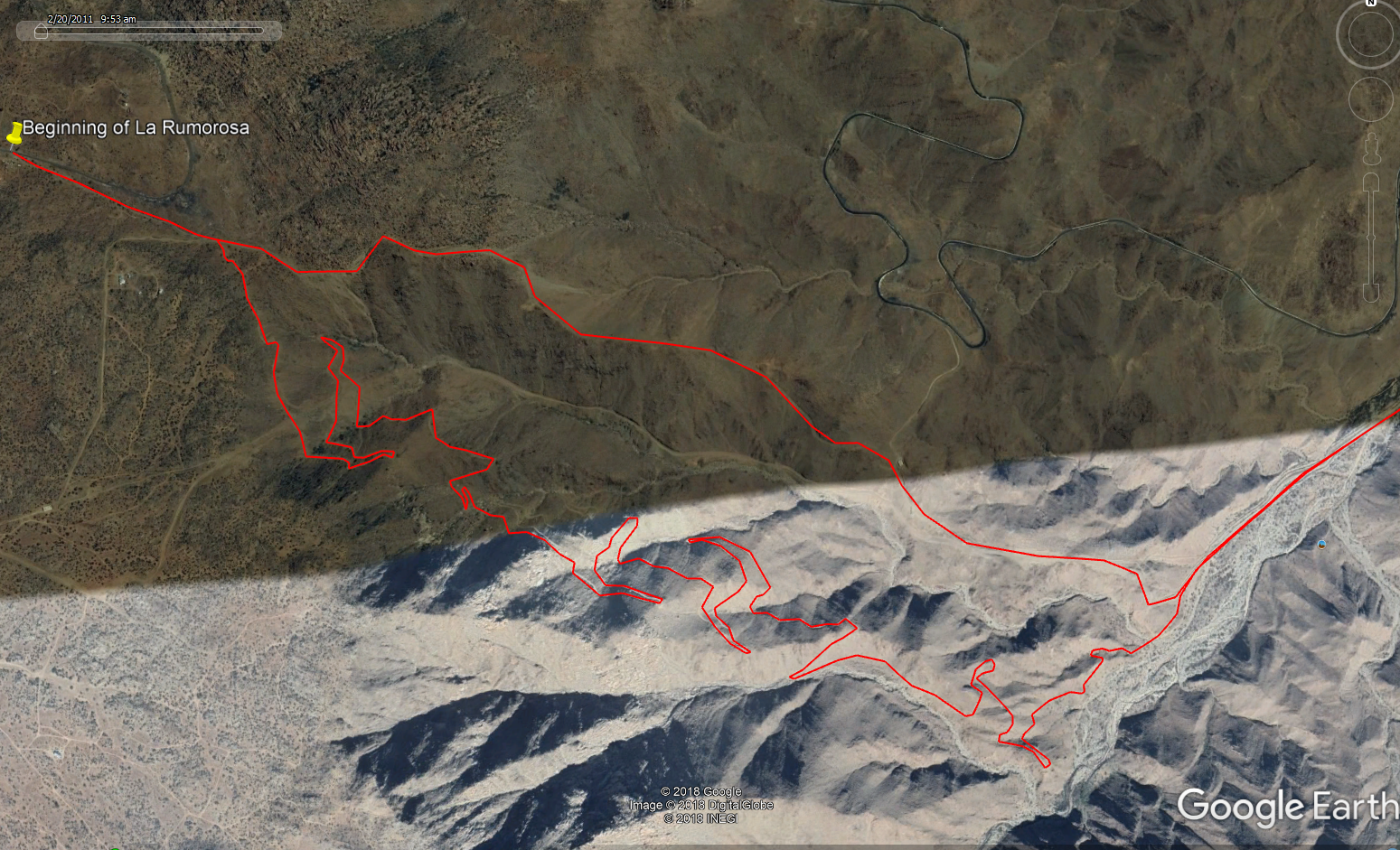
Ok, this bottom route looks a little more interesting. About 12 miles.
|
|
|
JZ
Elite Nomad
Posts: 9349
Registered: 10-3-2003
Member Is Online
|
|

https://youtu.be/T655AHrkAfw
|
|
|
TMW
Select Nomad
Posts: 10659
Registered: 9-1-2003
Location: Bakersfield, CA
Member Is Offline
|
|
The bottom red image is the grade. I don't remember what is on the top more straight image.
|
|
|
advrider
Super Nomad
Posts: 1847
Registered: 10-2-2015
Member Is Offline
|
|
ehall, do you have anymore info on the 22 day trail, what do you mean by both sides? Do you have a track you could share?
Quote: Originally posted by advrider  | I think I rode the whole trail? We ended just North of Catavina and started the single track at the mud hills? Did I miss something? It was an awesome
trail and made me happy that I had installed the Rekluse on the 500 before this trip...
|
[Edited on 7-29-2018 by advrider]
|
|
|
| Pages:
1
2 |


