| Pages:
1
2
3
4 |
David K
Honored Nomad

Posts: 64476
Registered: 8-30-2002
Location: San Diego County
Member Is Offline
Mood: Have Baja Fever
|
|
TRIP #8: (AUG. 2018) HWY 3 & Laguna Hanson road to HWY 2 + HWY 5 REVISIT to HWY 1.
EDIT: Photos sized for message boards and no watermarks are here: https://www.tacomaworld.com/threads/trip-8-aug-2018-new-hwy-...
This has been a long time to come, to get the final Baja Bound research trip done, but Baja wins in the end!
What I mean is, this was the final Baja Bound Road Guide research trip to make up for the 2 days I lost last October due to my brake fail between El
Coyote and Mike's Sky Rancho. Thanks to 'bajatrailrider' (Larry), I made a field repair and got my truck back home and to my mechanic.
So, the road guide was missing my detailing Hwy. 3 (other than Valle de Trinidad to Hwy. 5) and the Sierra Juarez road passing Laguna Hanson.
Well, I cleared three days this week and not only covered the rest of Hwy. 3 and the Sierra Juarez road, but I did a run south past Gonzaga Bay to get
the latest details on Hwy. 5 construction since I last was over in August 2017.
I left North County San Diego at 7 am and crossed at Tecate about 8:30. Green light and I tried parking in the empty inspection spot to easily get my
new FMM in that building. However, when I asked if I could, naturally I was told no and pointed to the street for parking.
As I detailed before, once you find a parking spot on the one-way cross-street near the crossing, you walk through a turnstile and follow the white
line/ arrows north (as if returning to the USA by foot) then across the Mexico entrance street and into the INM office. Paperwork filled out, you are
instructed to go back outside to the bank window for payment (180-day FMM). I ask the banker what hours and he said that if he is closed you can pay
the INM official inside). INM is open the same hours as the border (5am-11pm) officially. You go back in with your payment receipt and the INM officer
does his final stamp. Took about 10 minutes overall. I was the only person doing this. I asked him about the free 7-day FMM and if it still it had to
be returned (as instructed the past 2 years at Mexicali INM) or could be thrown away like the 180-day one. I was surprised when he said it should be
returned, yes... but it would be "okay" to throw it away!
I was only going for 3 days but did not want to do the return work on my way home... plus, I may go back to Baja again in the next 6 months (I hope).
Okay, so I head south and see BP and Arco stations as well as Pemex. Last October, I saw a BP under construction in Tecate. There are still mostly
Pemex stations, but the white ARCO stations are really bright and stand out. Also, all the stations are advertising prices since they are allowed to
compete and prices for Magna (Regular) ranged between high 18 and mid 19 pesos per liter... with a peso to dollar exchange between 17.60 and
18-something per dollar. In short, 87 octane gasoline was a hair over $4/gallon!
I did a quick stop at the Guadalupe mission/museum location and the Guadalupe Wine Museum (outside) and noted Laja and Mustafa's restaurant kilometer
locations.
Topped my tank in Ensenada: 19.05 pesos/liter; 18.00 pesos/dollar; 16 mpg on this leg.
Heading out of town towards Ojos Negros, I saw some gravel on the pavement just past Km. 15 where Bajaguy reported a landslide. All clear.
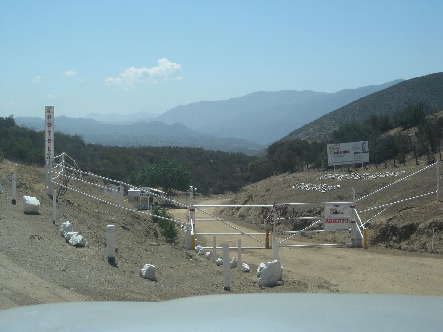
I had intended to drive into Agua Caliente hot spring resort at Km. 26, but the gate was chained closed... not inviting even though signs said "open".
There was a military checkpoint just past the Pemex by the Ojos Negros entrance road, waved on. I drove into Ojos Negros and back out.
Next, I did a quick stop at the Laguna Hanson/ Sierra Juarez turnoff at Km. 54.5. I would be returning to this spot in 2 days.
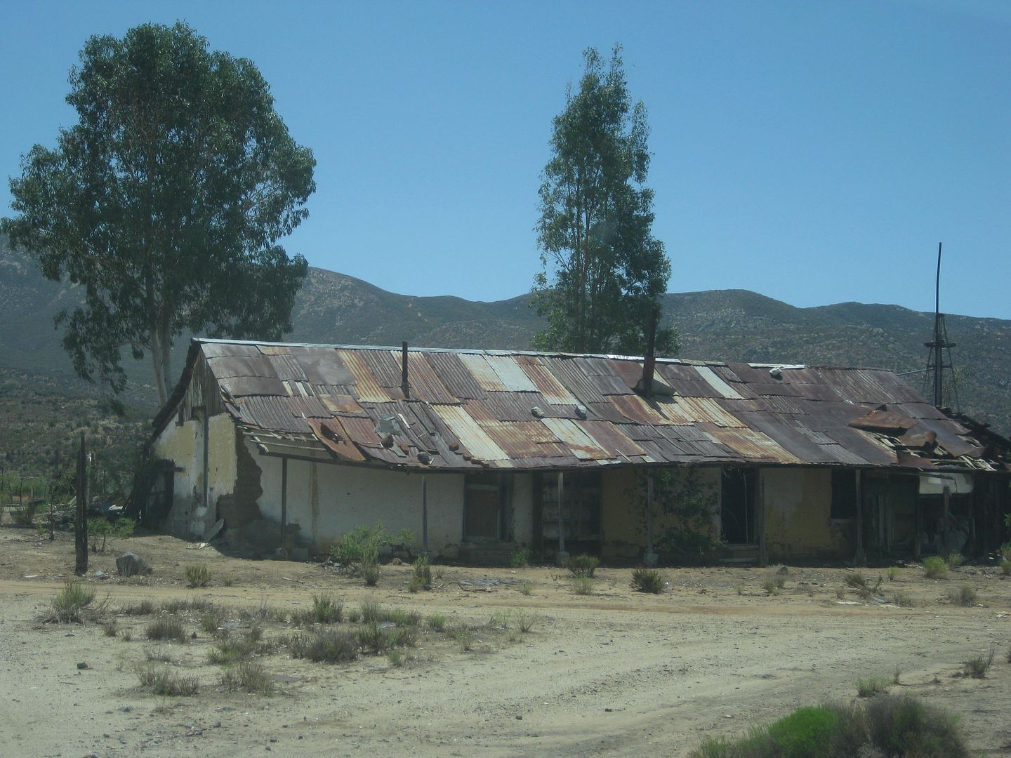
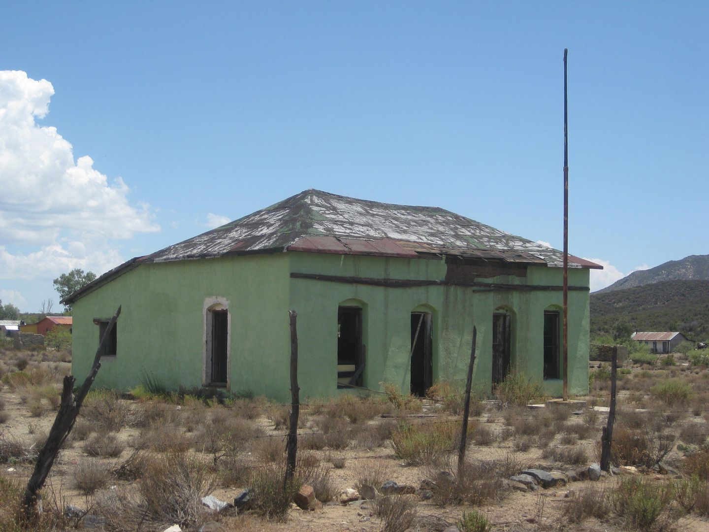
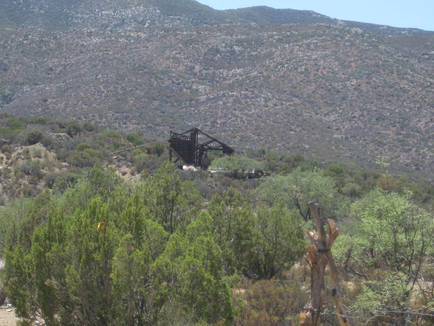
My first side trip was to check out El Alamo, a one-time huge gold mine town. The road is unsigned and the kilometer marker before it is only facing
the other lane and hidden by a shrub! It is Km 85 and the graded road to the west for El Alamo is at Km. 85.5.
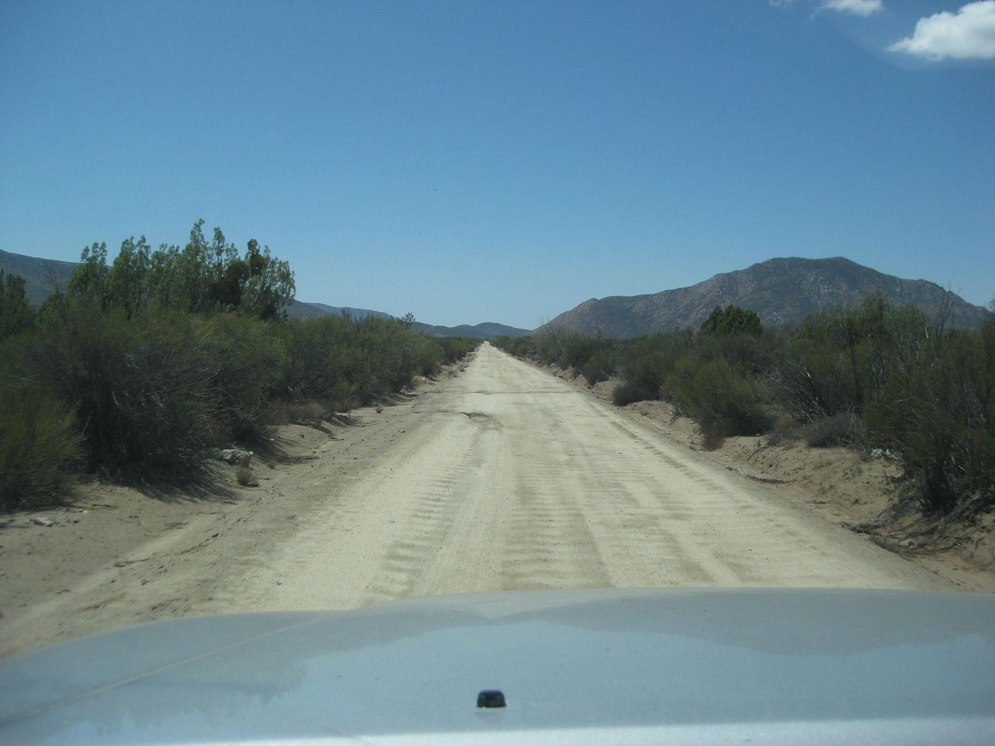
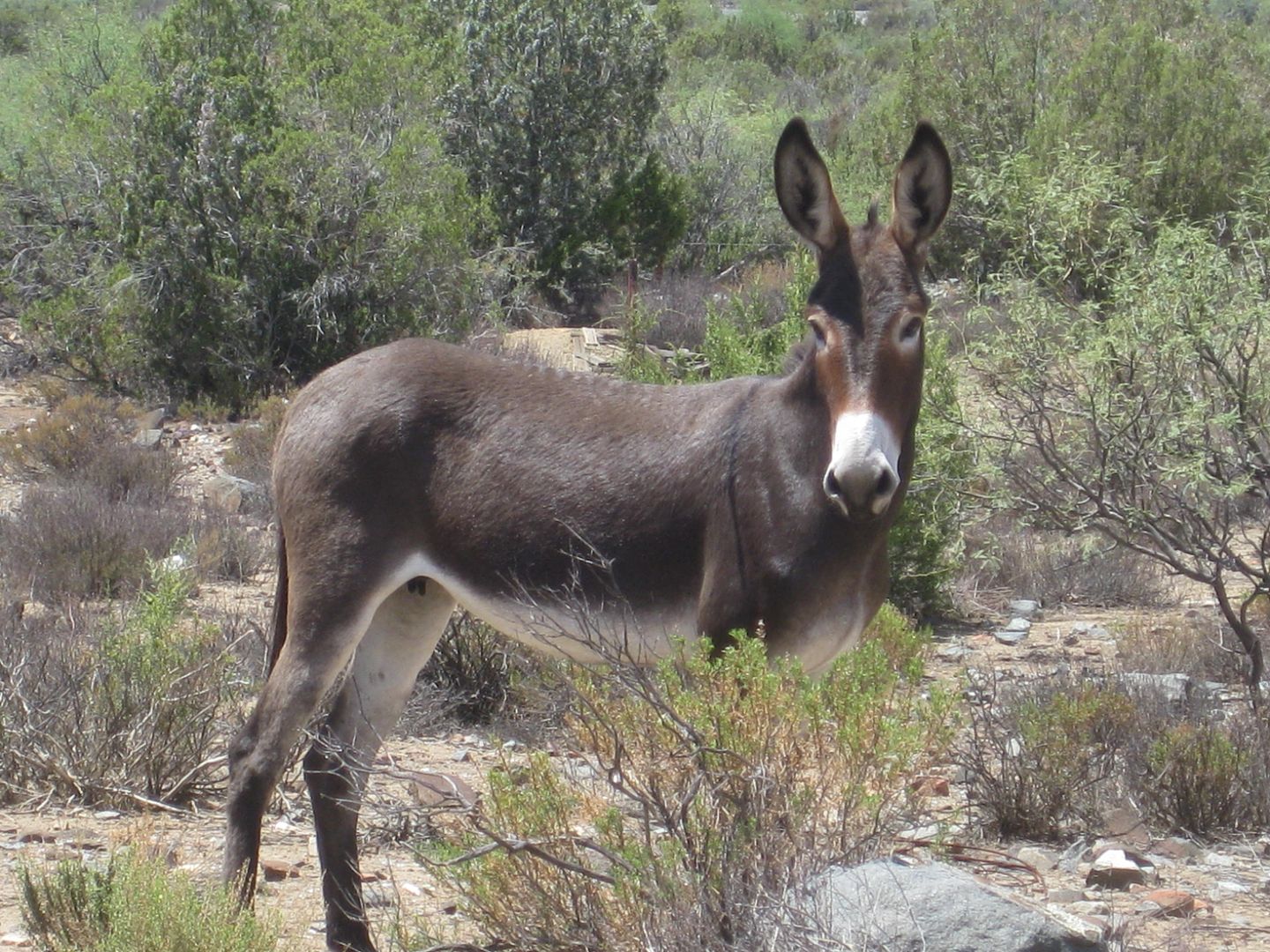
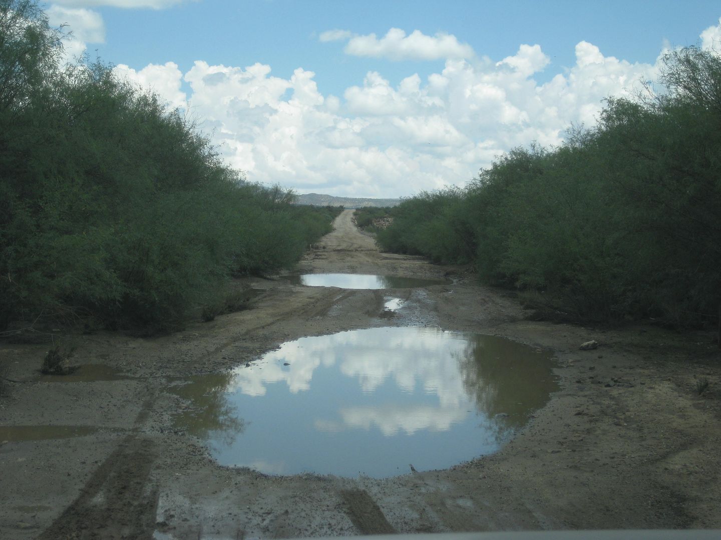
The road is pretty easy to drive with just one huge puddle to cross. it is 9.5 miles to 'town' and it was pretty deserted! A real ghost town indeed. I
could not get near the mine structures because of closed gates.
I will post some photos to this point and return to continue the report, later... Stay tuned!
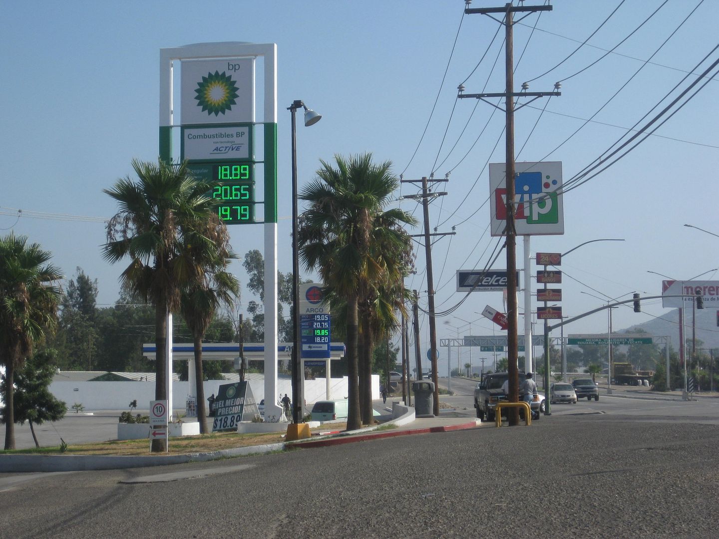
BP Tecate
Mission de Guadalupe, museum. Ruins are likely not the mission itself.
Museum of Wine

Ensenada at start of Hwy. 3.
Agua Caliente road
El Alamo road
OK, so that is about it for El Alamo...
Next stop, the final Spanish mission in Baja California, Santa Catalina 1797-1839.
Map:
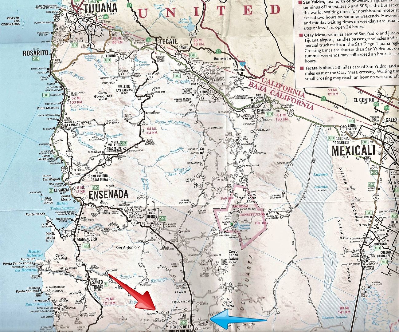
Red arrow is El Alamo and blue arrow is Mission Santa Catalina. Independencia is between the two.
[Edited on 6-5-2021 by David K]
|
|
|
David K
Honored Nomad
Posts: 64476
Registered: 8-30-2002
Location: San Diego County
Member Is Offline
Mood: Have Baja Fever
|
|
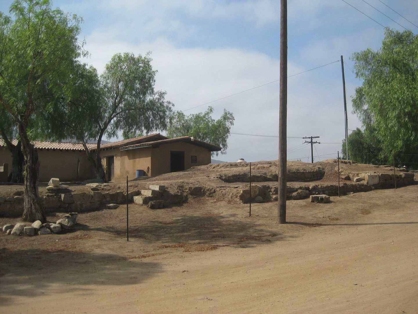
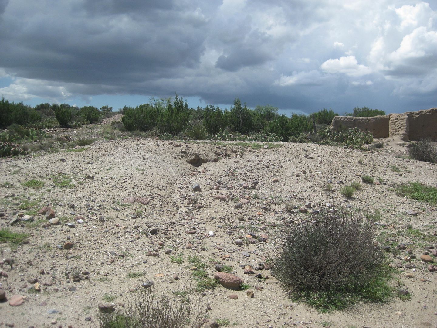
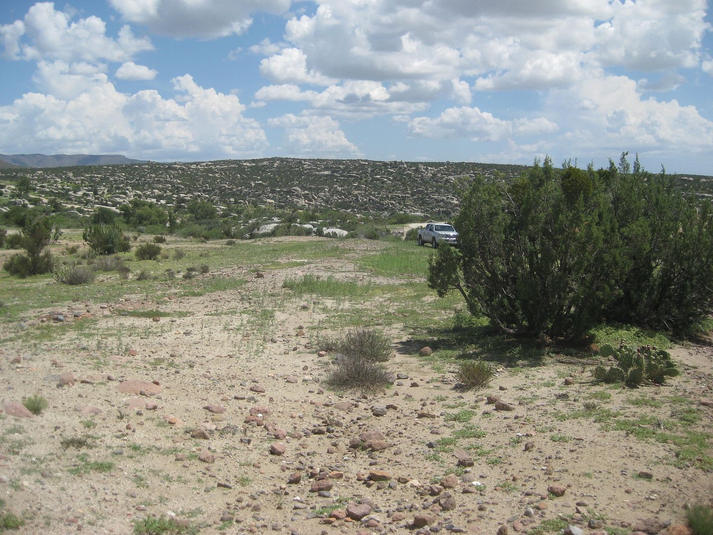
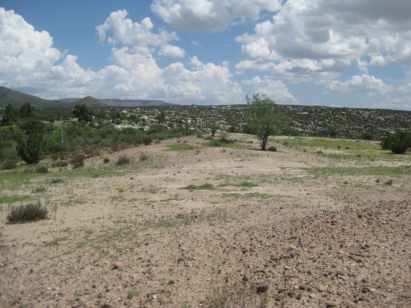
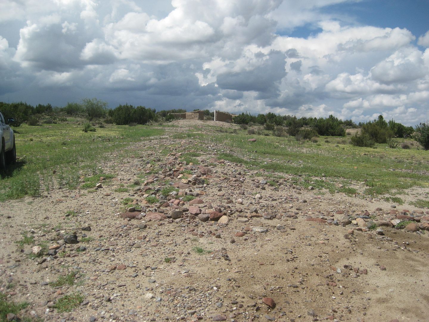
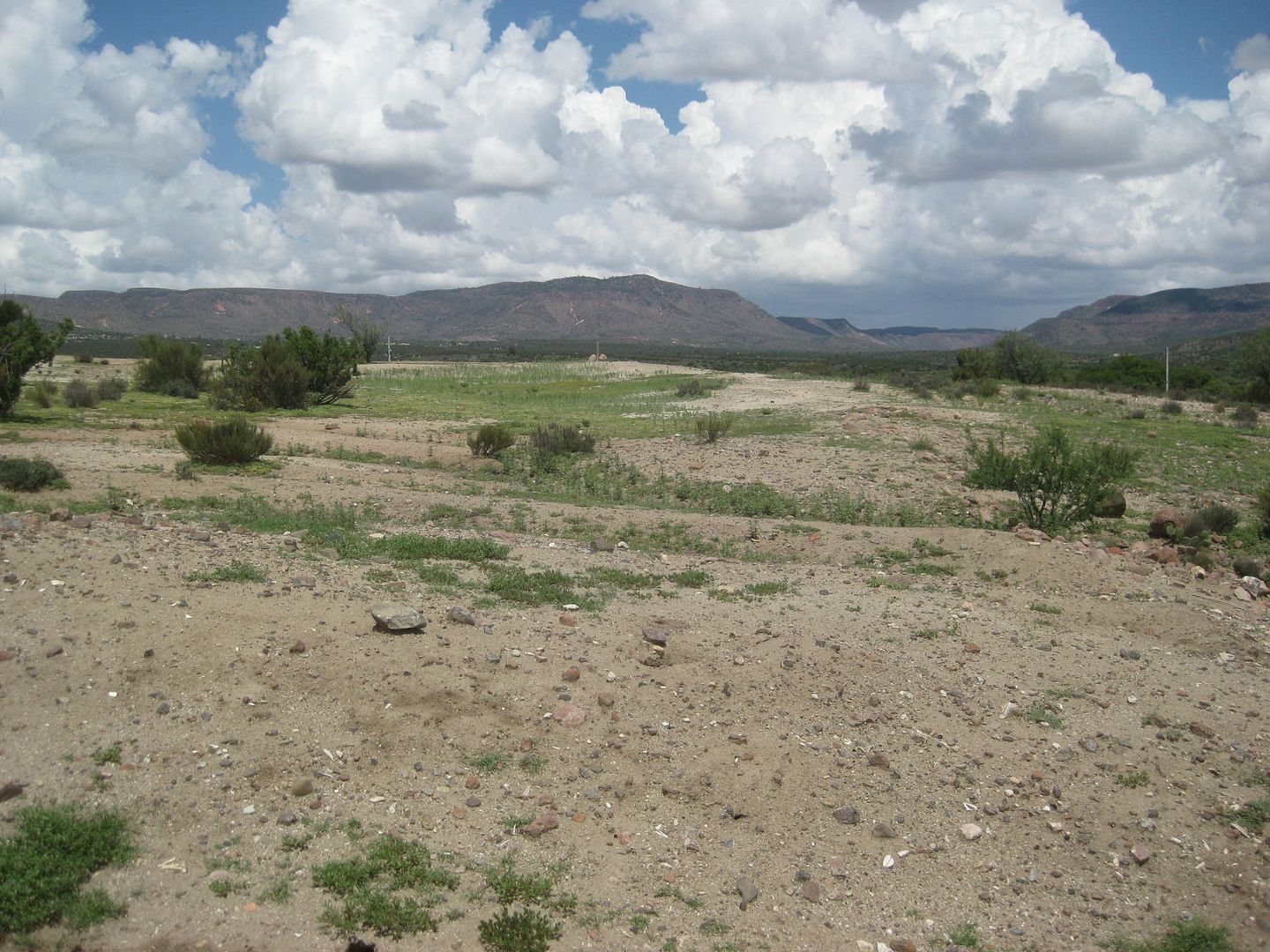
Mission Santa Catalina 1797-1839
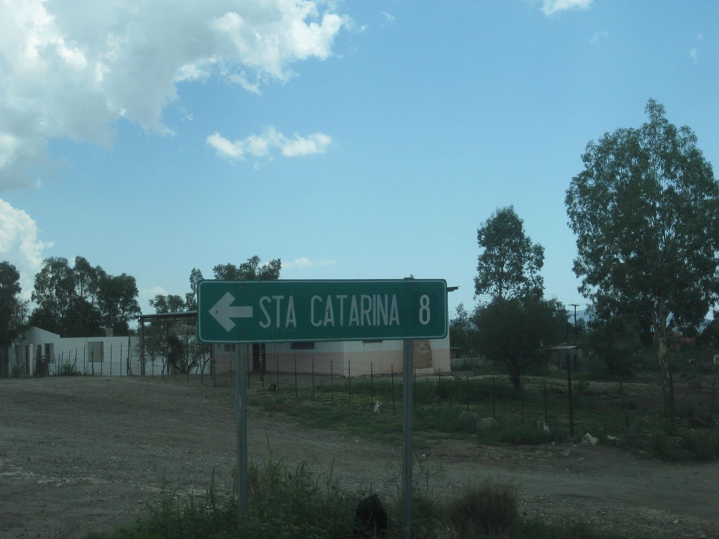
Back out to Hwy. 3, it is just 3.5 miles to Ejido de los Heroes de la Independencia at Km. 91 where the road to the Paipai Indian village of Santa
Catarina heads east.
My last time down this road to see the mission site was in June 2006 with Baja Angel (Elizabeth) and The squarecircle (Roy). We had just finished
doing radio relay help for Baja Pits during the Baja 500, south of Valle de Trinidad. www.vivabaja.com/606
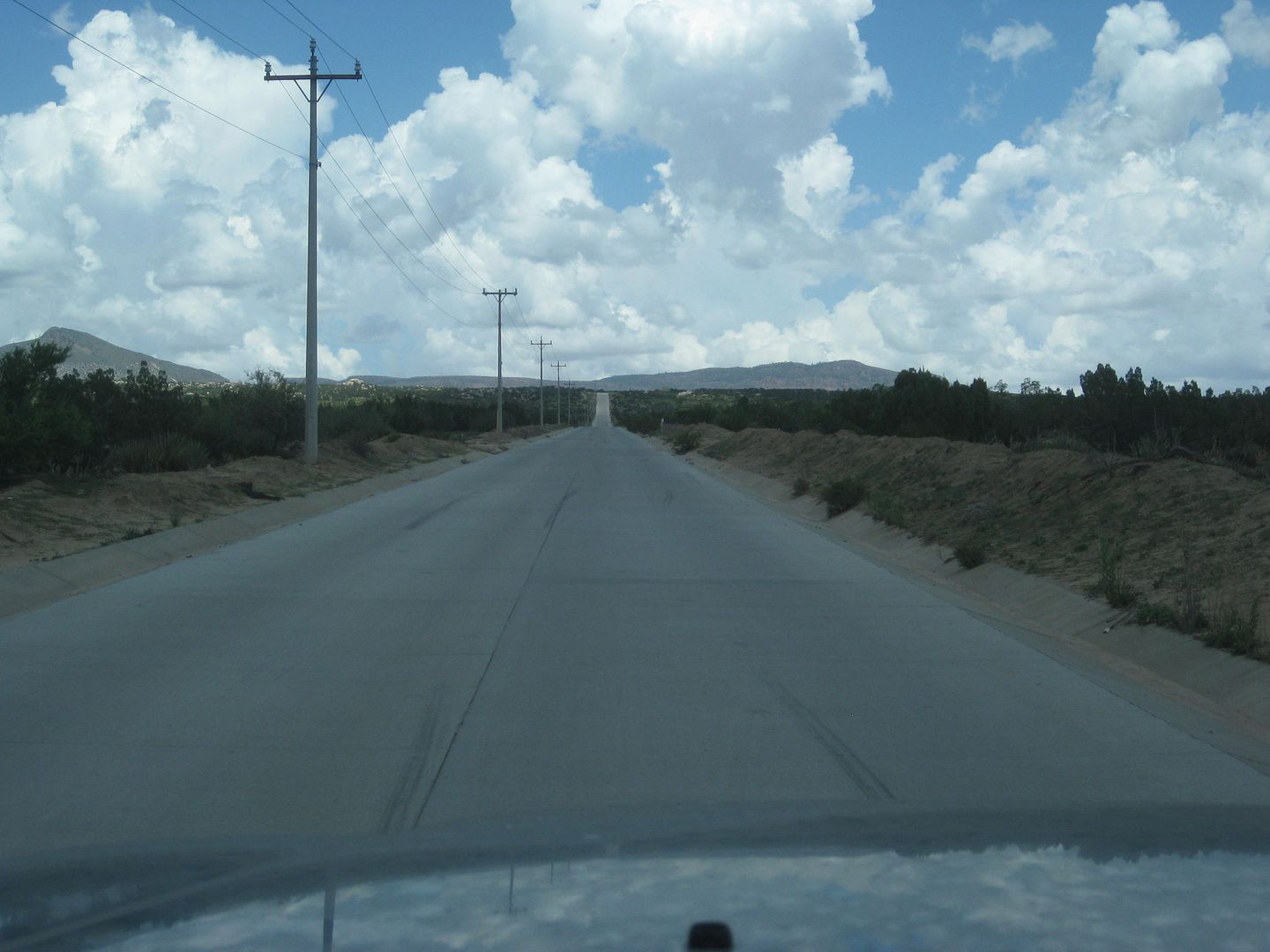
Since then the road has been paved (concrete) and power lines run the 5 miles. The town is just 1/2 mile from the mission site and has a slightly
altered spelling from the Dominican mission.
Where the concrete road ends, follow the power lines down and to the left, passing the large church. Work your way towards the left (north) and over a
small hill to the cemetery. Park here or if in a truck/ SUV, you can take the faint road to the left to the top of the hill and park.
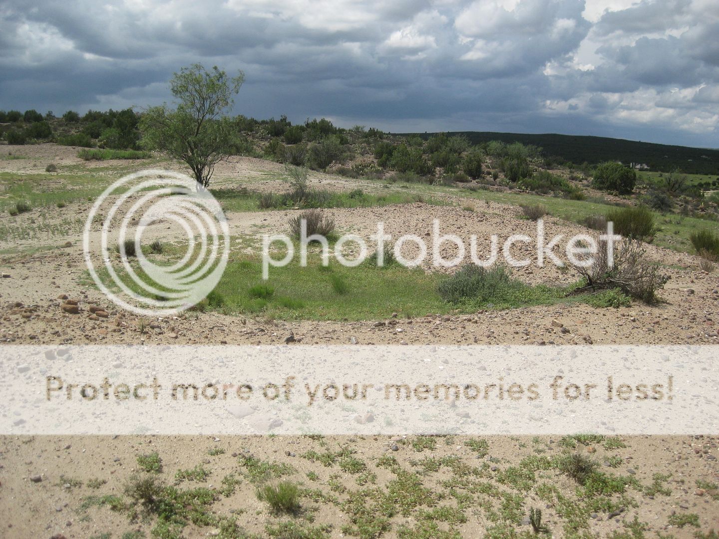
There is almost nothing of the mission beyond the large square that was the compound and some melted walls of a few rooms and the round watch tower
and perimeter wall.
Since my last visit, someone had an adobe wall built above or beyond the mission site as some sort of monument, it would seem.
I took many photos and will show just a few here, as they will most likely bore most of you! LOL Ok, a few more...
As I mentioned, this was the last Spanish mission in Baja. The two additional missions (El Descanso, Guadalupe del Norte) were established after
Mexico's independence, making them "Mexican missions".
Descanso was at first a new location for San Miguel after floods in 1809 forced a move, and it was known as San Miguel la Nueva. The Dominican Padre
Ahumada) moved it back to the old San Miguel site after some time. A new mission was built at Descanso, in 1830, by Padre Caballero. In 1834,
Caballero then founded Mission Guadalupe (del Norte) and closed both Descanso and San Miguel. In a sense, Guadalupe is the final site for what began
as San Miguel (at today's La Misión on Hwy. 1).
See how dark it is? It rained on me for a few minutes while driving!
The old tower remains at the NW corner and a new wall behind. Panning photos clockwise, then moving to each corner and taking photos:
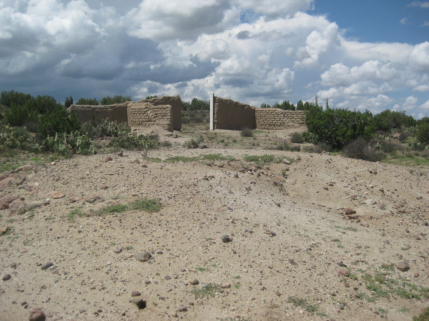
This was a row of rooms.
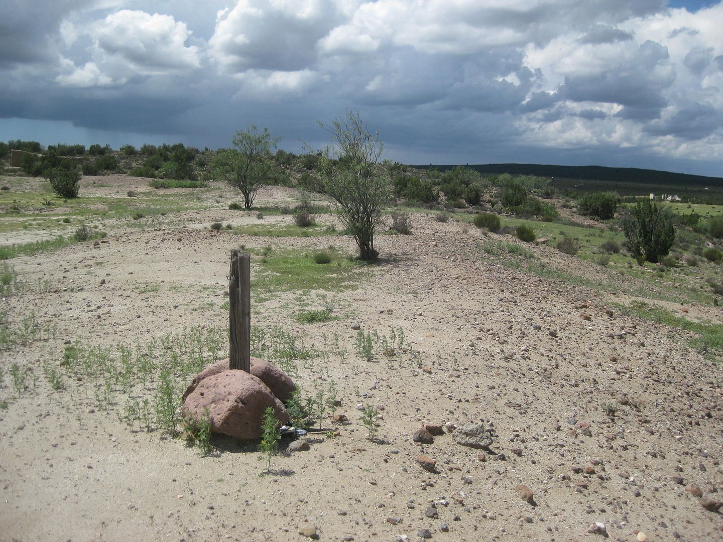
SE Corner marker.
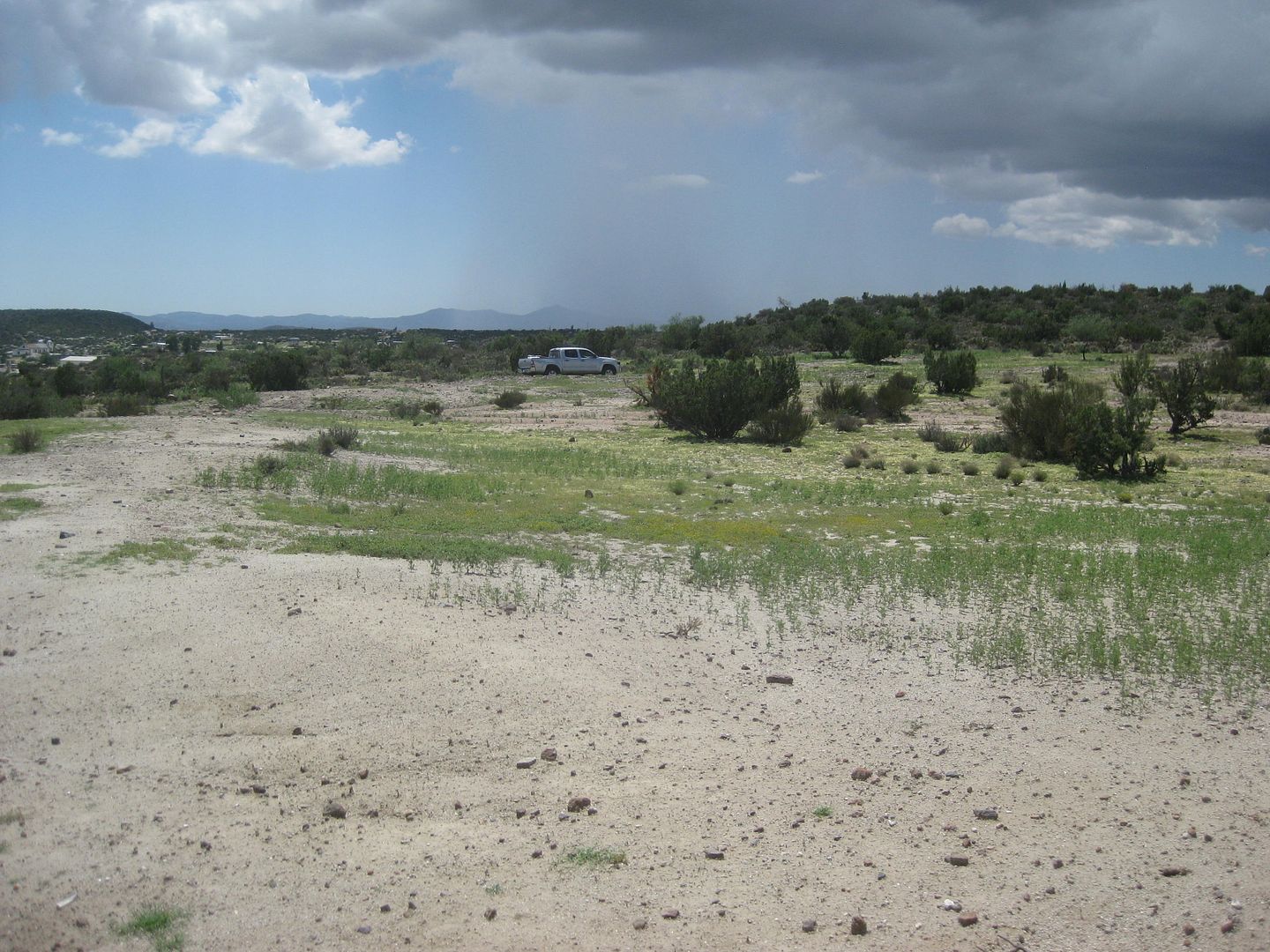
From the marker to the parking area by the SW corner/ compound opening.
The SW corner.
Looking to the SE corner from SW corner.
Rooms
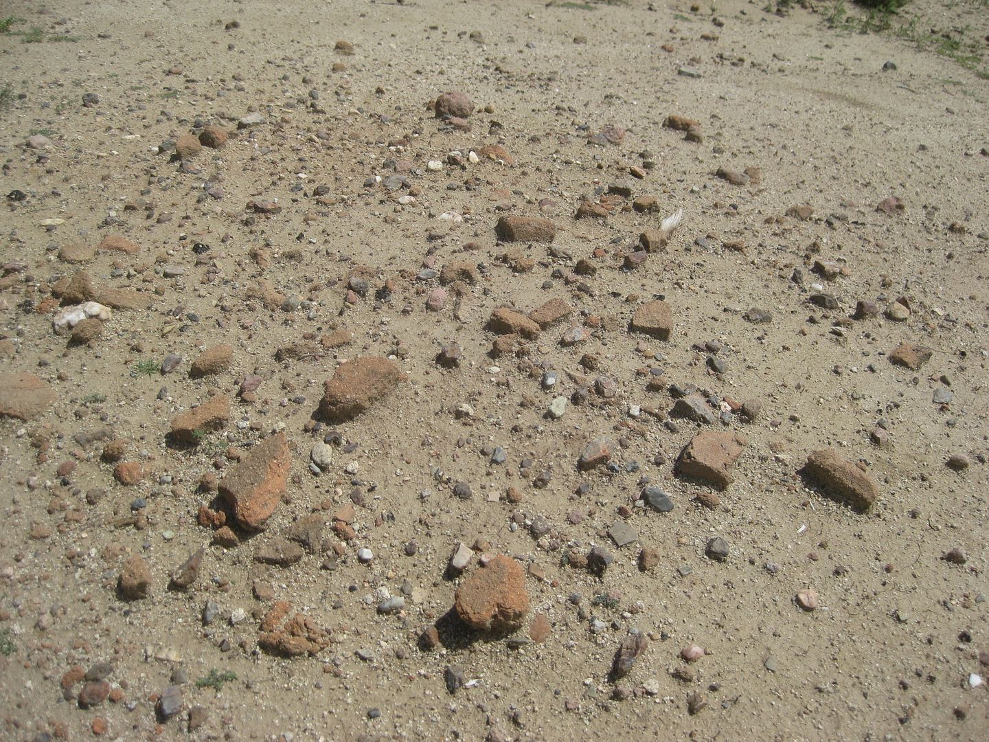
Pieces of adobe brick (from 1797?)
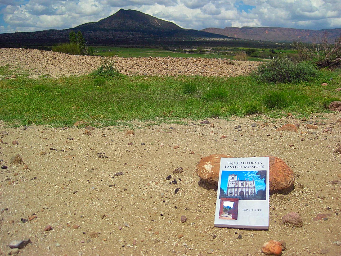
For scale, my book at a mission room. 
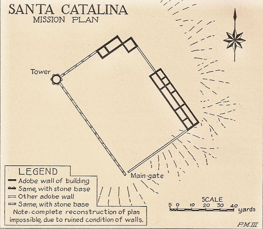
Here is the 1926 sketch of the mission site by Meigs:
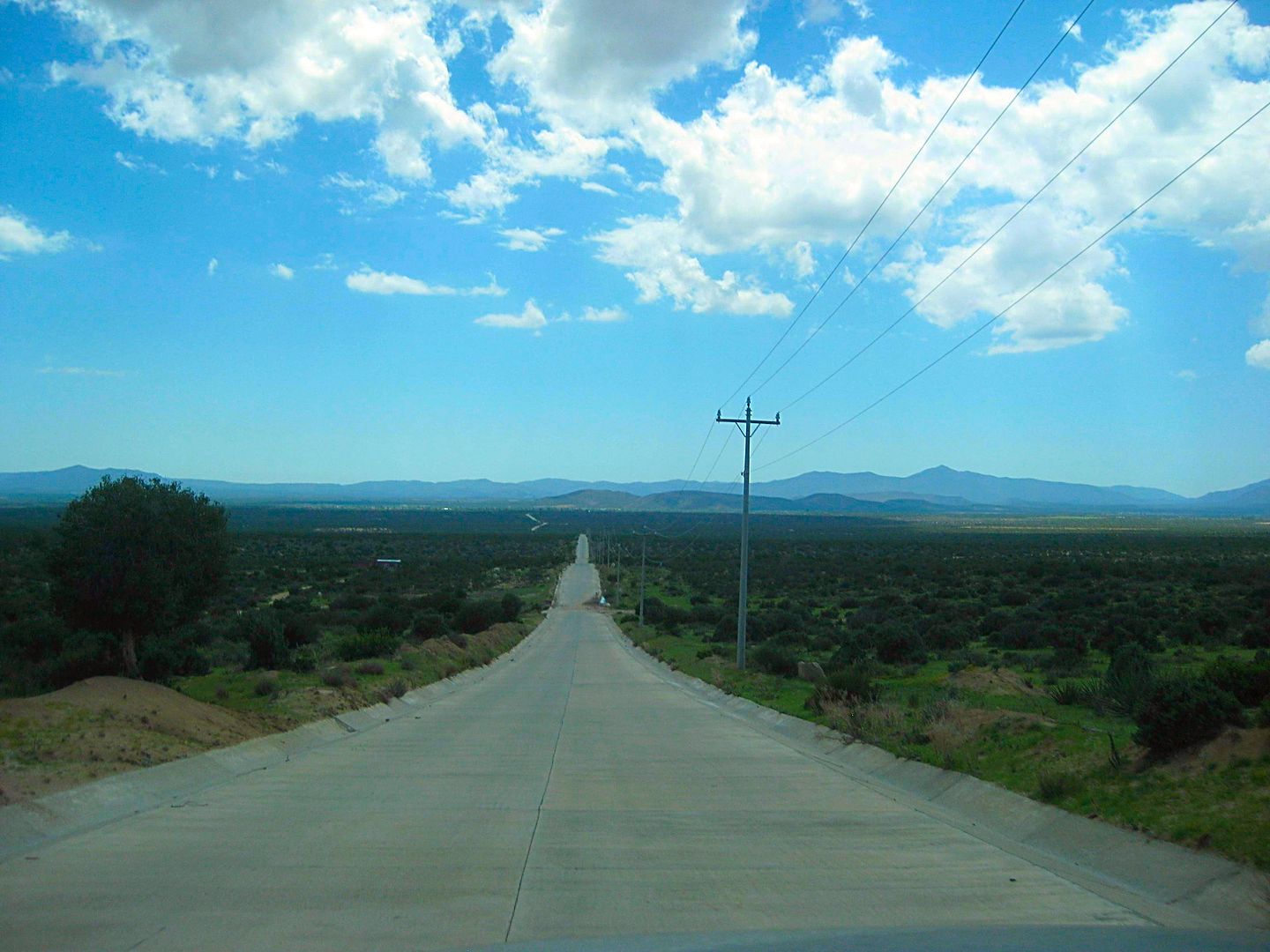
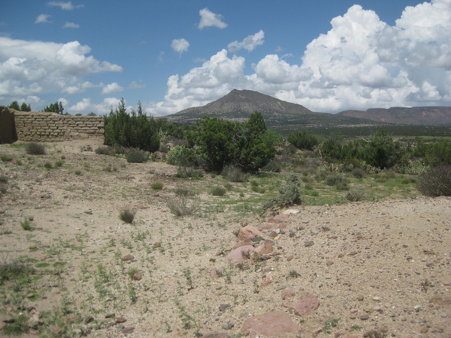
The return drive back to Hwy. 3 at Independencia.
More to come!
Here is a 2007 photo of the archeological dig to the adobe wall's stone-foundation, at a corner... Very impressive to see what is below the melted
adobe walls of these ruined mission sites!
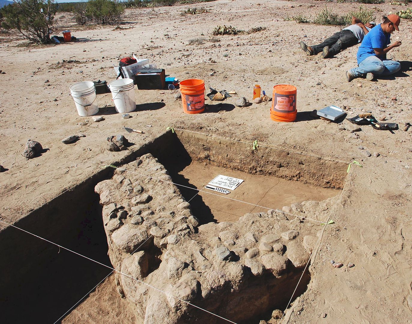
Photo from Dr. Lee Panich in 2007. The photo and the 1926 plan are in my book, as well... page 161-166 covers this mission.
[Edited on 8-18-2018 by David K]
|
|
|
ehall
Super Nomad
Posts: 1906
Registered: 3-29-2014
Location: Buckeye, Az
Member Is Offline
Mood: It's 5 o'clock somewhere
|
|
I always wondered why that road is concrete instead of pavement
|
|
|
David K
Honored Nomad
Posts: 64476
Registered: 8-30-2002
Location: San Diego County
Member Is Offline
Mood: Have Baja Fever
|
|
Highway 2-D is being converted to concrete near Rumorosa. How long has the Santa Catarina road been paved? I was last on it in 2006.
|
|
|
PaulW
Ultra Nomad
Posts: 3005
Registered: 5-21-2013
Member Is Offline
|
|
David,
Next time you pass Agua Caliente. Stop by the gate and honk your horn. The full time security guy in the small trailer will come and open the gate.
|
|
|
David K
Honored Nomad
Posts: 64476
Registered: 8-30-2002
Location: San Diego County
Member Is Offline
Mood: Have Baja Fever
|
|
LOL... I would wonder if there is a guard, why have a chained closed gate and why not put the gate by the trailer?
Thanks Paul.
|
|
|
David K
Honored Nomad
Posts: 64476
Registered: 8-30-2002
Location: San Diego County
Member Is Offline
Mood: Have Baja Fever
|
|
Continuing on Hwy. 3 past Independencia
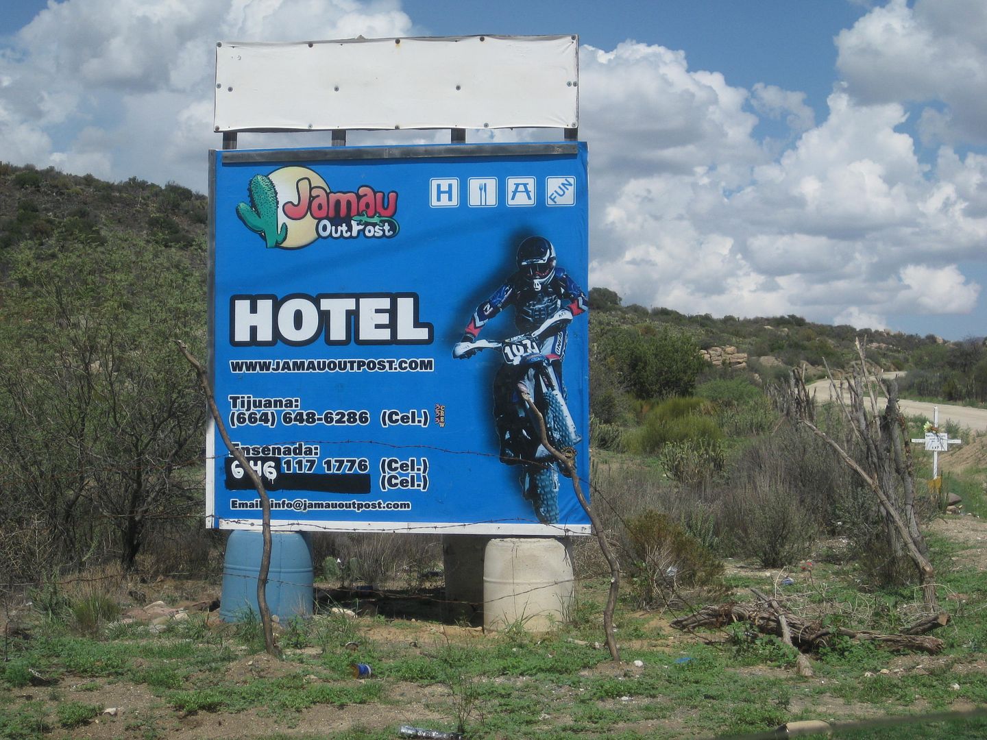
At Km. 109 is the road to Ejido Jamau and an off-road m/c rider resort:
At Km. 117.5 is what Score calls the "Goat Trail" or race course in or out of Valle de Trinidad. In fact, it was the Ensenada-San Felipe main road
before the highway was built in the mid-1970s. Originally it was BC Hwy. 16.
This photo was actually taken 2 days later on my drive back towards Ensenada.
Valle de Trinidad entrance road (and one of two Pemex stations here) is at Km. 120+ (a plus sign means about 1/4 km past the sign).
The orphanage made famous in the movie Dust to Glory, supported by Malcolm Smith, is at Km. 130+
The short way to put "Mike's Sky Rancho" on a sign...
Km. 137.5
I did a short drive on the Score race course north from Borrego Pit (Km. 179.5)...
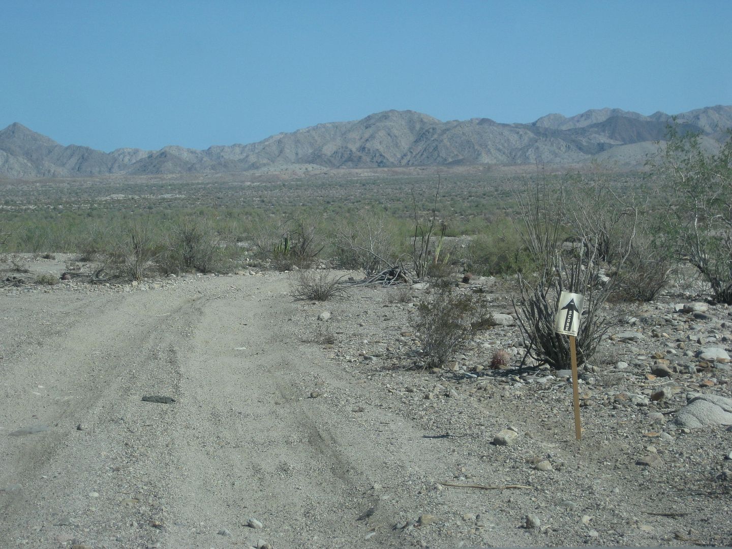
The road was VERY rough so I only went in about a mile. This would be the route (maybe) to access a new search area for the Lost Diaz Grave. Actually
Nomad 'Fatboy' has checked some of this area. Geoff and I want to look deeper in the Sierra Pinta range if we make another search.
Just a wave through at the smaller El Chinero checkpoint (on Hwy. 3) and again at the bigger one (on Hwy. 5).
At San Felipe, I get gas at the "ejido" Pemex (Km. 184) after hearing good things about it from PaulW. Indeed, it seems like honest pumps and good
persons working there. Magna was 19.35/liter and the exchange was 18.35:1 dollar. My truck took on 37.2 liters (9.8 gal.) for 185 miles giving me a
great 18.9 MPG! I love ethanol-free gasoline! Here it cost $4.00/gallon.
It is 4:40 pm and I head south to see if the tides will allow me to get across the marsh/muddy salt flats to Shell Island. It is just after a new moon
and it was really high.
Well, there was water in low spots but the flats were not underwater (I have crossed these when I could not see the ground, just the shrubs, more than
once).
About halfway across the flats, I sink in... oh balls!
I put it reverse and try to back out... I am in low range and my A-TRAC is always on in low range. However, my tires can do nothing more than spin in
the goo and A-TRAC hates spinning tires (as it is useless to spin, typically)...
One last resort that the Tacoma has, a rear locking differential ("for emergency only", says Toyota). When the rear is locked, A-TRAC is disabled
under 3 mph and only works on the front tires in that situation. This forces the tires to spin (in back) and I get out. Good thing, as I am alone, and
nobody is in Baja in August, except the most sincere Baja lovers!
I back out of the goo, and since my truck is now got mud splattered, I take a different tack and that worked!
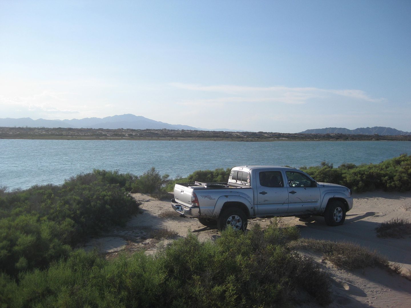
My truck on Shell Island, looking across the mainland of Baja California.
I go for a swim, make dinner, and sleep well. I see some meteors when I wake briefly before sunrise while it is still dark and a moonless sky.
END OF DAY 1 (Wednesday, August 15, 2018)
|
|
|
David K
Honored Nomad
Posts: 64476
Registered: 8-30-2002
Location: San Diego County
Member Is Offline
Mood: Have Baja Fever
|
|
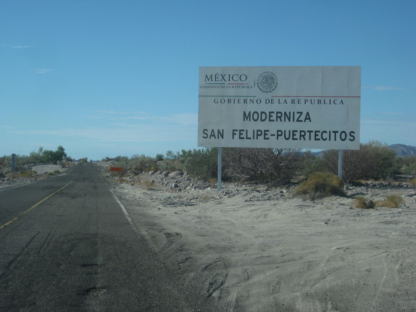
Thursday, August 16. Let's see what's happening on Hwy. 5 to Chapala!
It has been exactly one year since I last was over Highway 5 to the very south end.
In brief, it appears as if Mexico has abandoned this project of finishing the highway, other than adding some blacktop to the stretch of new road in
the Chapala Valley (and have not connected the south or west end of it, 1 mile from Highway 1). Basically nearly nothing in one year. I could drive
the north end new roadbed with no problem and using the nearly one added paved mile from Km. 167 (where the pavement ended in 2014).
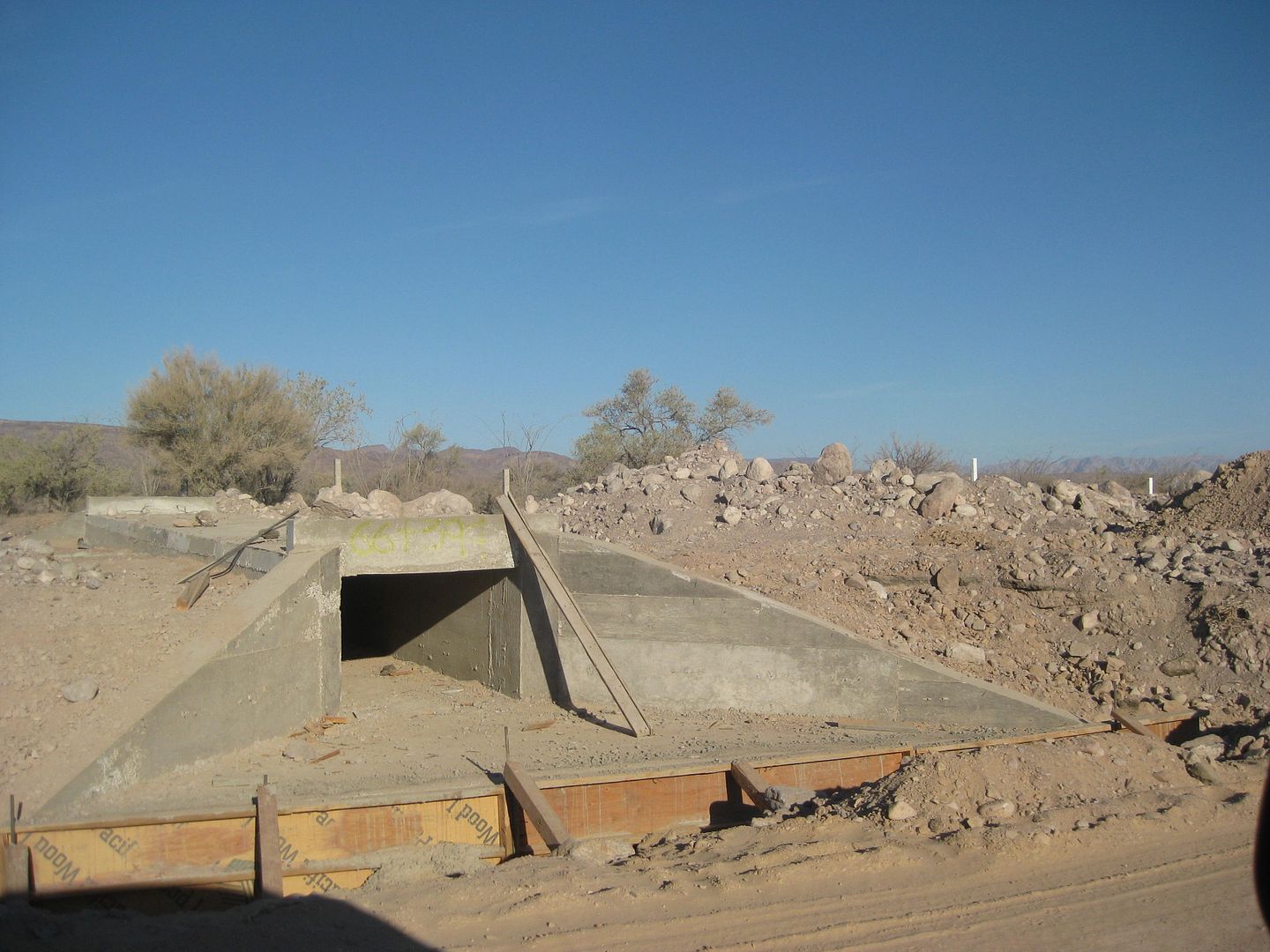
The Coco's Bypass (as we call it) was basically done except for the southern mile, which is through the mountain ridge and into the canyon (where the
worker camp is located). After weeks or months of neglect, rainwater has begun eroding the sides of the road. It is not well cleared or finish graded.
It is as if they just left the job uncompleted. So close to being done, too. A rough detour or access road goes down to the current Coco's route.
The worker camp has all the heavy Caterpiller equipment parked... almost nobody was there... but smoke was coming out of the kitchen shack. There was
one backhoe working on one of the ridge cut and I saw one water truck being driven.
I have GPS track maps and mileages to share. I can't be the only one who likes to know the location of new roads in Baja, can I?
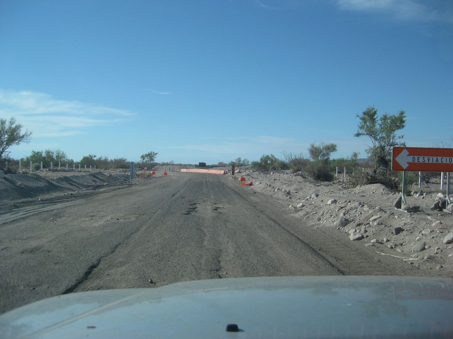
First, let's talk about where the workers are working... if they are the same ones? The new Hwy. 5 stretch from Arroyo Matomi to Cowpatty's near
Puertecitos is getting all the love and putting us onto a 7-mile dirt detour. It begins at Km. 61 (Arroyo Matomi road is Km. 60 and Rancho El Pozo is
at Km. 60.5) and ends at almost Km.73, where Cowpatty's cantina is.
Photos (Southbound and northbound, the next day, yesterday):
Northbound Friday:
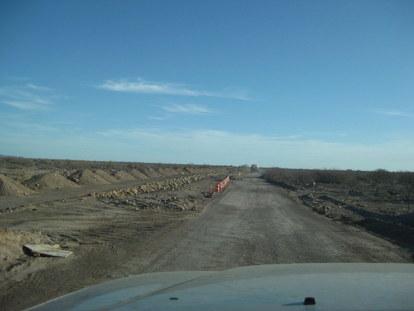
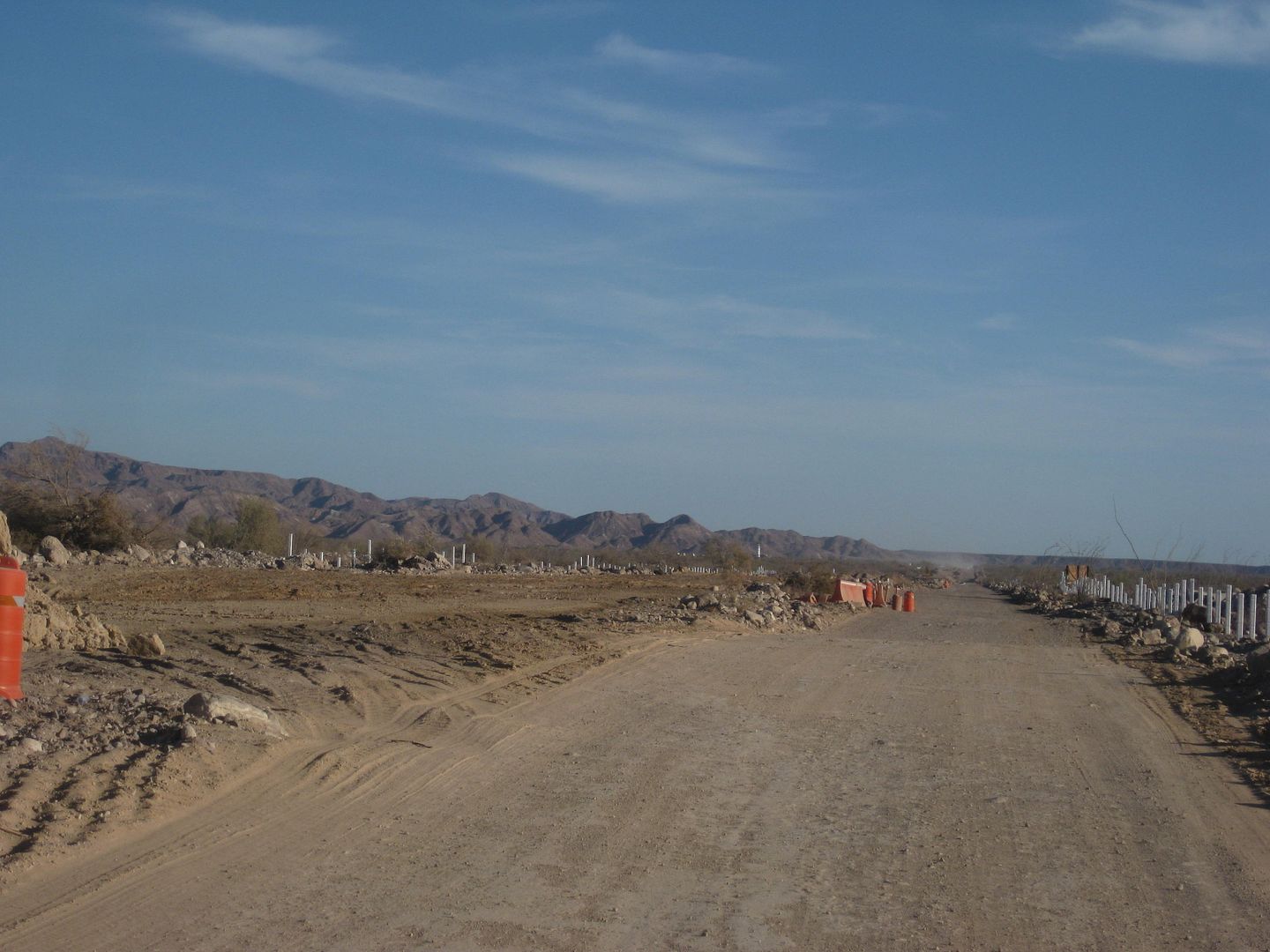
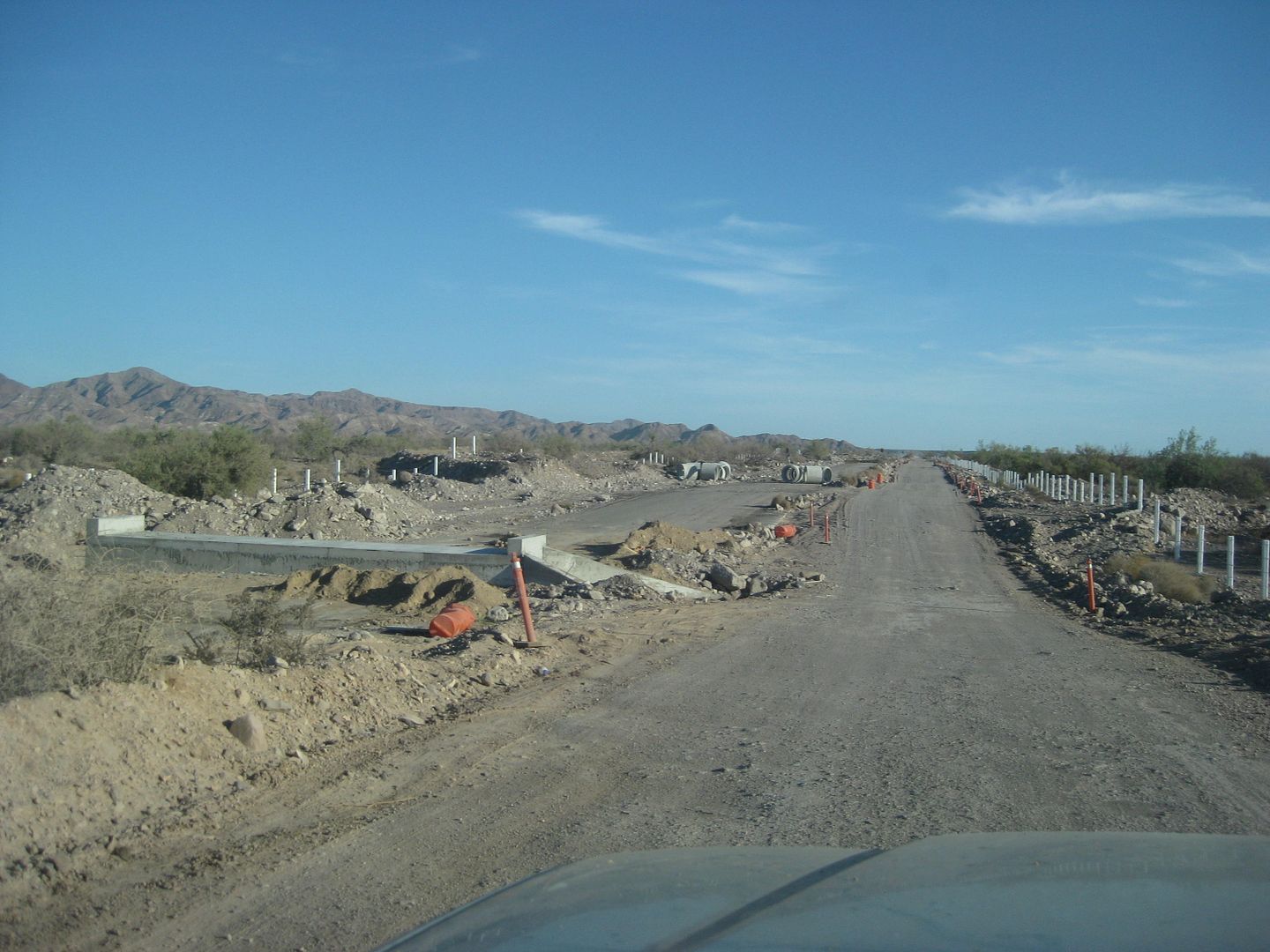
Basically, this will end the multiple short steep dips across Arroyo Matomi that have been there since about 1990.

The 7 miles of detour is between the red and blue arrows, for scale on the San Felipe to Puertecitos 51 miles long highway.
Next...
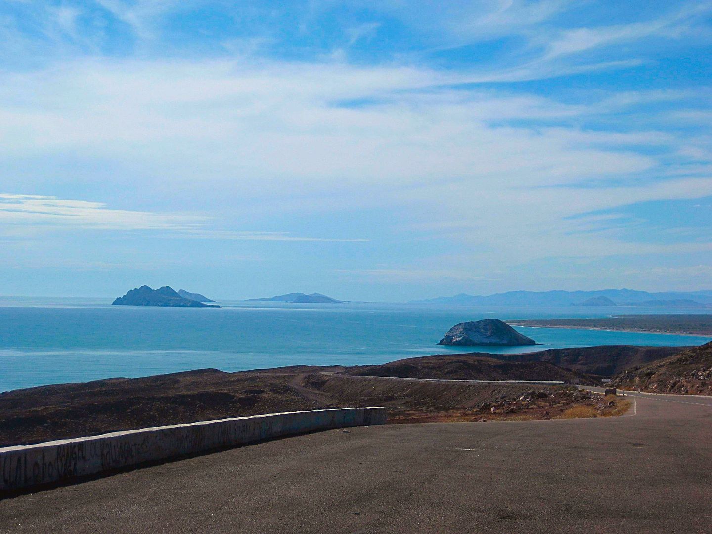
I always like stopping at the Km. 99 viewpoint.
Passing Papa Fernandez' road, soon come to the military checkpoint. They asked me where I was going and where I came from... no search... and I was on
my way!
The Pemex station at Km. 147 is still a Pemex station. There was word of it becoming a Union 76 station... but only Pemex signage. I got gas here on
my way back north, later today.
New sign at Km. 167.5, where the detour points you to the older road, alongside the new. However, the paved road continues ahead (as it did a year
ago) for about a kilometer and a half. There is even a Km. 168 sign added along the road.
More to come... including maps!
[Edited on 8-19-2018 by David K]
|
|
|
David K
Honored Nomad
Posts: 64476
Registered: 8-30-2002
Location: San Diego County
Member Is Offline
Mood: Have Baja Fever
|
|
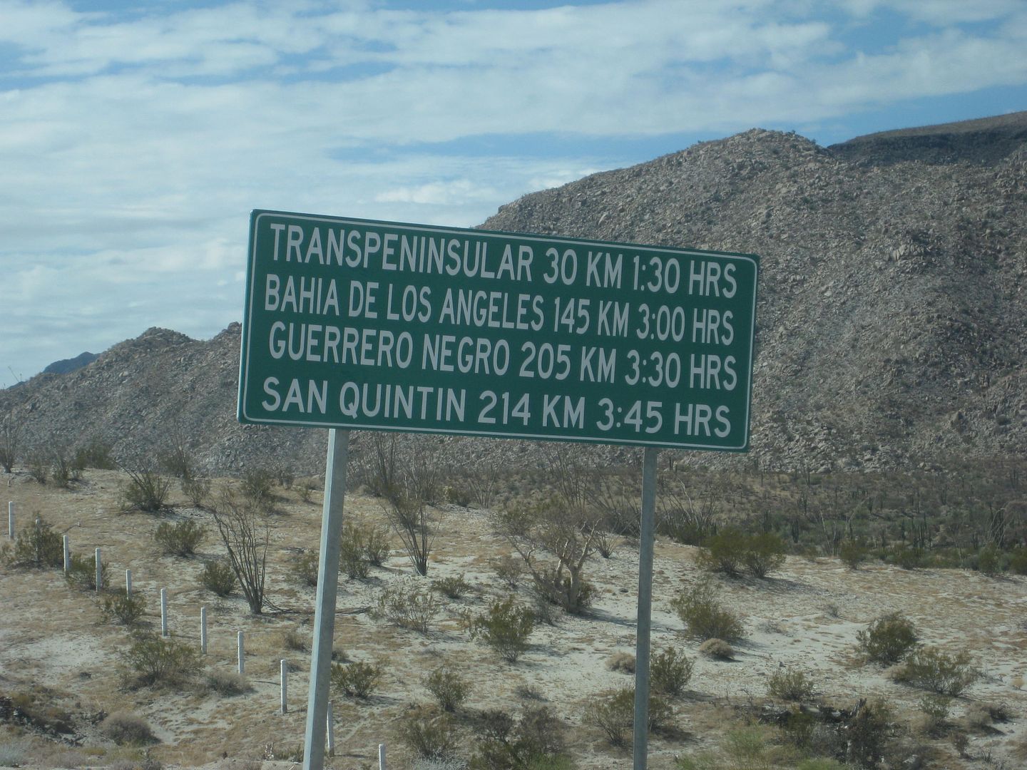
That is 30 km. to "Transpeninsular" (Chapala, Hwy. 1) is via the new bypass route, about 5 km + shorter than going through Coco's Corner.
The bypass is not finished and not fully open, either.
|
|
|
rts551
Elite Nomad
Posts: 6699
Registered: 9-5-2003
Member Is Offline
|
|
All the hwy 5 info has been posted before on Talk Baja along with continuous updates.
|
|
|
ehall
Super Nomad
Posts: 1906
Registered: 3-29-2014
Location: Buckeye, Az
Member Is Offline
Mood: It's 5 o'clock somewhere
|
|
Lot of great pictures and info David. Glad those killer vados are being fixed.
|
|
|
David K
Honored Nomad
Posts: 64476
Registered: 8-30-2002
Location: San Diego County
Member Is Offline
Mood: Have Baja Fever
|
|
Thank you Ed.
The best (I think) is coming next!
[Edited on 8-19-2018 by David K]
|
|
|
mjs
Nomad
Posts: 305
Registered: 2-20-2013
Location: Off grid in San Felipe
Member Is Offline
|
|
I appreciate the posts and info here as I'll never see it on FB.
|
|
|
David K
Honored Nomad
Posts: 64476
Registered: 8-30-2002
Location: San Diego County
Member Is Offline
Mood: Have Baja Fever
|
|
Thank you for posting!
Not only do many people have issues with Facebook, there are countless viewers here who never post or are not even Nomads.
I hope you enjoy what I have still to share.
|
|
|
rts551
Elite Nomad
Posts: 6699
Registered: 9-5-2003
Member Is Offline
|
|
Yes. That is why I said if you are not facebook challenged..,.mstr Monitor.
|
|
|
bajatrailrider
Super Nomad
Posts: 2423
Registered: 1-24-2015
Location: Mexico
Member Is Offline
Mood: Happy
|
|
David thank you for another great write and pictures your time and effort. As far as stupid book never. Keep up the good work love your write ups.
|
|
|
John Harper
Super Nomad
Posts: 2289
Registered: 3-9-2017
Location: SoCal
Member Is Offline
|
|
Another interesting and informative report. Great work, DK!!
John
|
|
|
David K
Honored Nomad
Posts: 64476
Registered: 8-30-2002
Location: San Diego County
Member Is Offline
Mood: Have Baja Fever
|
|
Baja is such a great gift... and never stops giving!
|
|
|
PaulW
Ultra Nomad
Posts: 3005
Registered: 5-21-2013
Member Is Offline
|
|
Quote: Originally posted by David K  | LOL... I would wonder if there is a guard, why have a chained closed gate and why not put the gate by the trailer?
Thanks Paul.
|
==== =
Sigh the Mexican way. To much trouble and cost to move the gate when security was needed in recent years.
The gate has been there for several years, and the nearest flat place is where his house (trailer) is located. The guy is very nice and walks briskly
to the gate, but for sure he has nothing else to do so napping is probably normal. Just be patient while gets to the gate.
|
|
|
PaulW
Ultra Nomad
Posts: 3005
Registered: 5-21-2013
Member Is Offline
|
|
I need to spend a lot more time traveling on Hwy 3. So much more to see that just the highway. Thanks for all the input.
Do you have interest in Jamau and the race summit travel. If so ask for easy directions for you truck. A trip I do each year just for fun.
|
|
|
| Pages:
1
2
3
4 |


