| Pages:
1
2
3
4 |
StuckSucks
Super Nomad

Posts: 2306
Registered: 10-17-2013
Member Is Offline
|
|
I have a question about the new section south of Matomi. Is that a new alignment of the highway running to the west of the current pavement or just a
clean-up of what is already there? Tell me more.
|
|
|
rts551
Elite Nomad
Posts: 6699
Registered: 9-5-2003
Member Is Offline
|
|
Quote: Originally posted by StuckSucks  | | I have a question about the new section south of Matomi. Is that a new alignment of the highway running to the west of the current pavement or just a
clean-up of what is already there? Tell me more. |
Right over the top of the old section. been going on for months. some sections are almost done.
|
|
|
David K
Honored Nomad
Posts: 64480
Registered: 8-30-2002
Location: San Diego County
Member Is Offline
Mood: Have Baja Fever
|
|
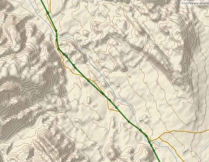
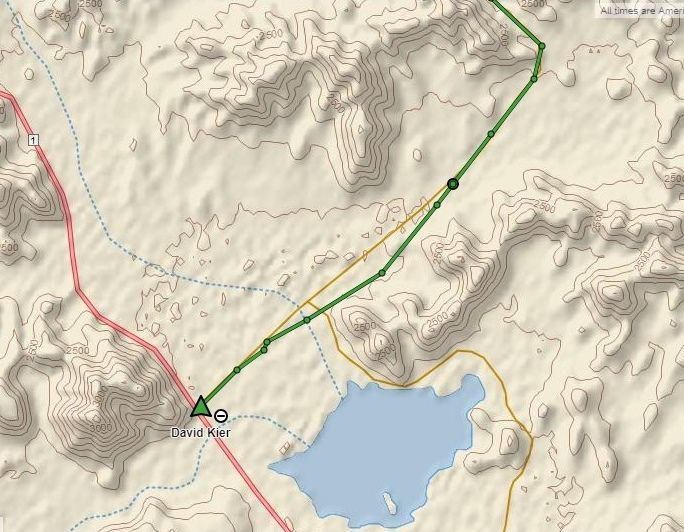
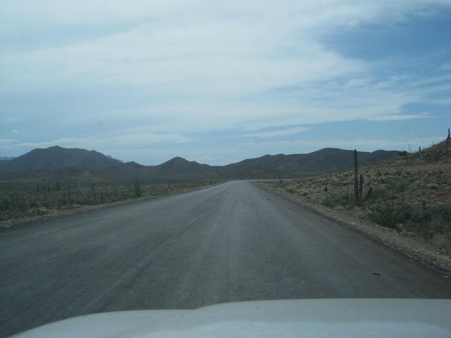
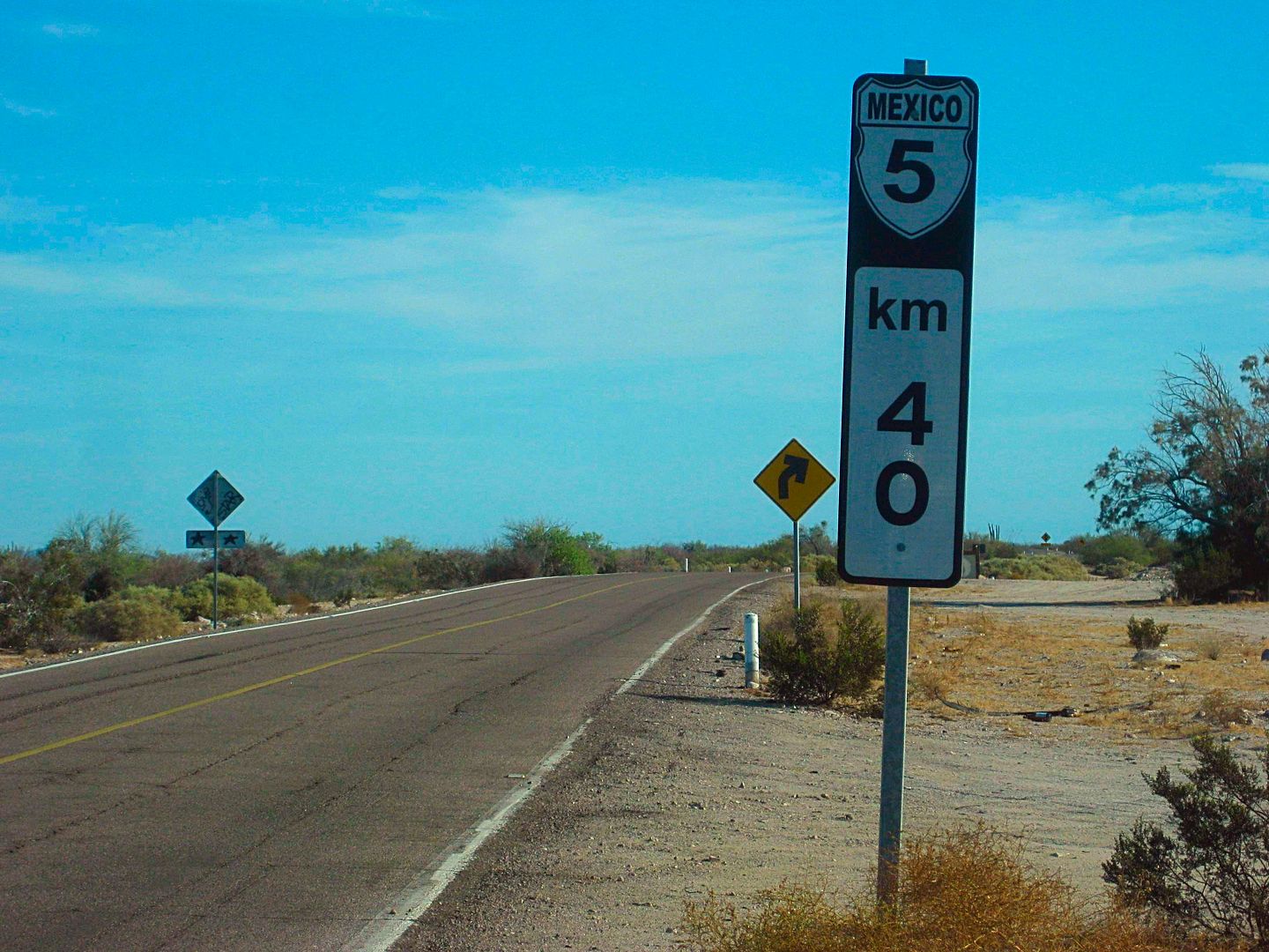
The NEW ROAD to CHAPALA AUG. 16 2018
As I mentioned earlier, except for a small crew, the work is currently dead... and has been dead long enough to the point where erosion is taking away
dirt from the sides of the road. They are so close to finishing, the logic of using up all the funds to blast through the mountain, only to not finish
it or at least open the completed or near completed parts is hard to reason.
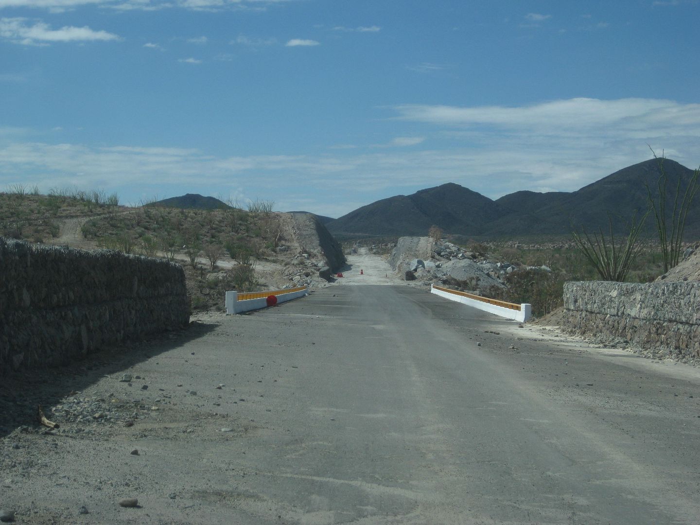
In January 2015 pavement reached what is now Km. 167.5 and over 3 1/2 years later they still have a detour sign pointing off to the older road here.
In 2017, just over 1 km. of new blacktop was added. In 2018, a Km. 168 post was added... and that is it for the north end paving. You may, however,
stay on the new roadbed over the bridges to Las Arrastras and decide to take the detour or old road via Coco's Corner or if you are in an SUV with
good tires and don't mind a couple of slow miles, take the new route (Coco's Bypass road) for interest.
Previous to this year, the unpaved section to Highway one was about 23 miles, via Coco's Corner.
Mile 0.0 (KM. 167.5) A detour road goes right, log continues on the new road. Most traffic still using old road, some use new, going around a
small sand berm. There are no missing bridges or hazards other than fallen rocks if using new highway route here.
Mile 0.3 (KM. 168) The last kilometer sign noted.
Mile 0.7 End of paving.
Mile 1.1 Another detour road down to the right to the older road.
Mile 1.6 On a very high bridge. Seen from older route below and to the west.
Mile 2.4 Detour road/old road crosses new. All traffic now uses the new road from here south.
Mile 3.3 Road west to La Turquesa Canyon (not driven this trip).
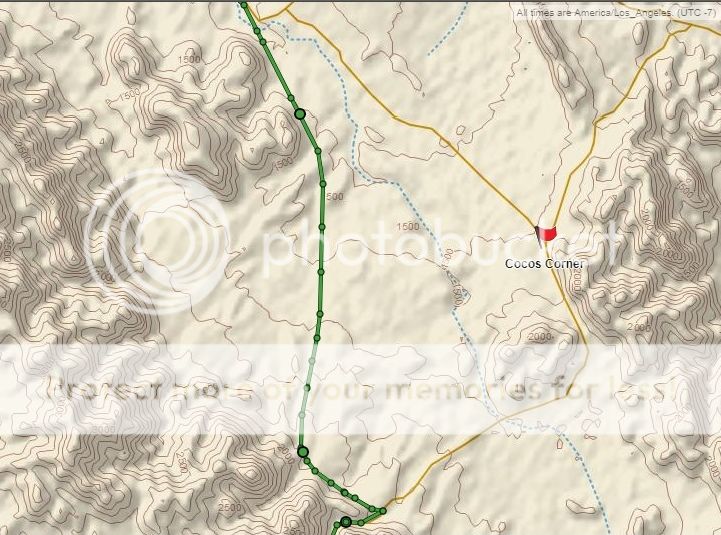
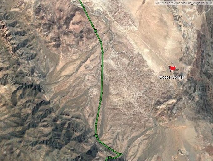
Mile 5.3 Detour route forks left to the old road via Coco's Corner. Most traffic still uses. Log continues on new highway route.
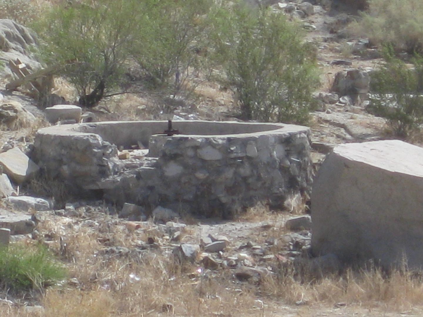
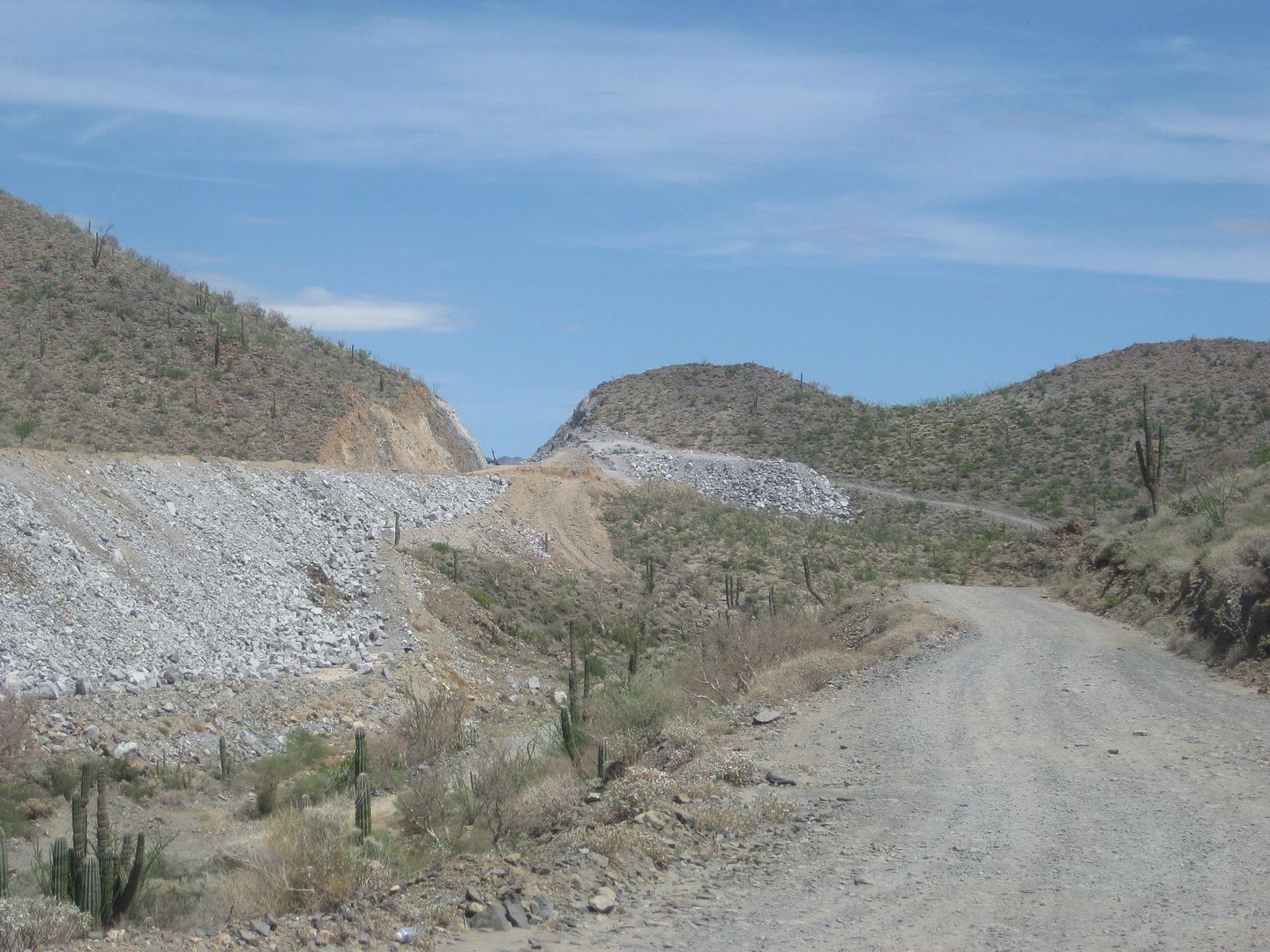
Mile 5.5 Las Arrastras Bridge. See caves and large arrastra (gold ore grinding wheel) down to the east of the highway. New road bed heads upslope,
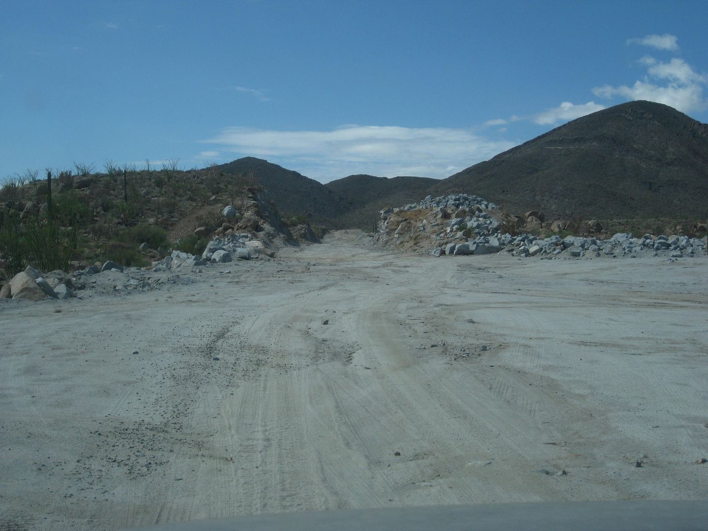
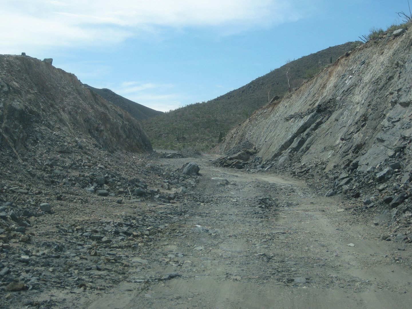
cutting through ridges. Road base never completed, many rocks to dodge and rain erosion for apparent abandonment of the project.
Mile 10.1 Leave new roadbed (which ends ahead at top of the mountain cut) on detour/access road going down 0.9 mi. to the older road, south from
Coco's Corner. This is an SUV/truck/4x4 style road.
Mile 11.0 On old road, damaged construction sign and orange cones are all that mark this junction.
Mile 11.8 Construction camp, parked equipment, almost no activity.
Mile 12.4 New highway will junction about here when completed, coming over the mountain from Mile 10.1 above. This will cut approx. 1 mile from this
logged distance when open.
Mile 14.0 Pavement.
Mile 15.5 Detour right, off the pavement to the older road for most vehicles.
Mile 18.5 End of pavement, large sand pile on road, only deep dust (silt) tracks from here to old (detour) road. 1 mile to Highway 1.
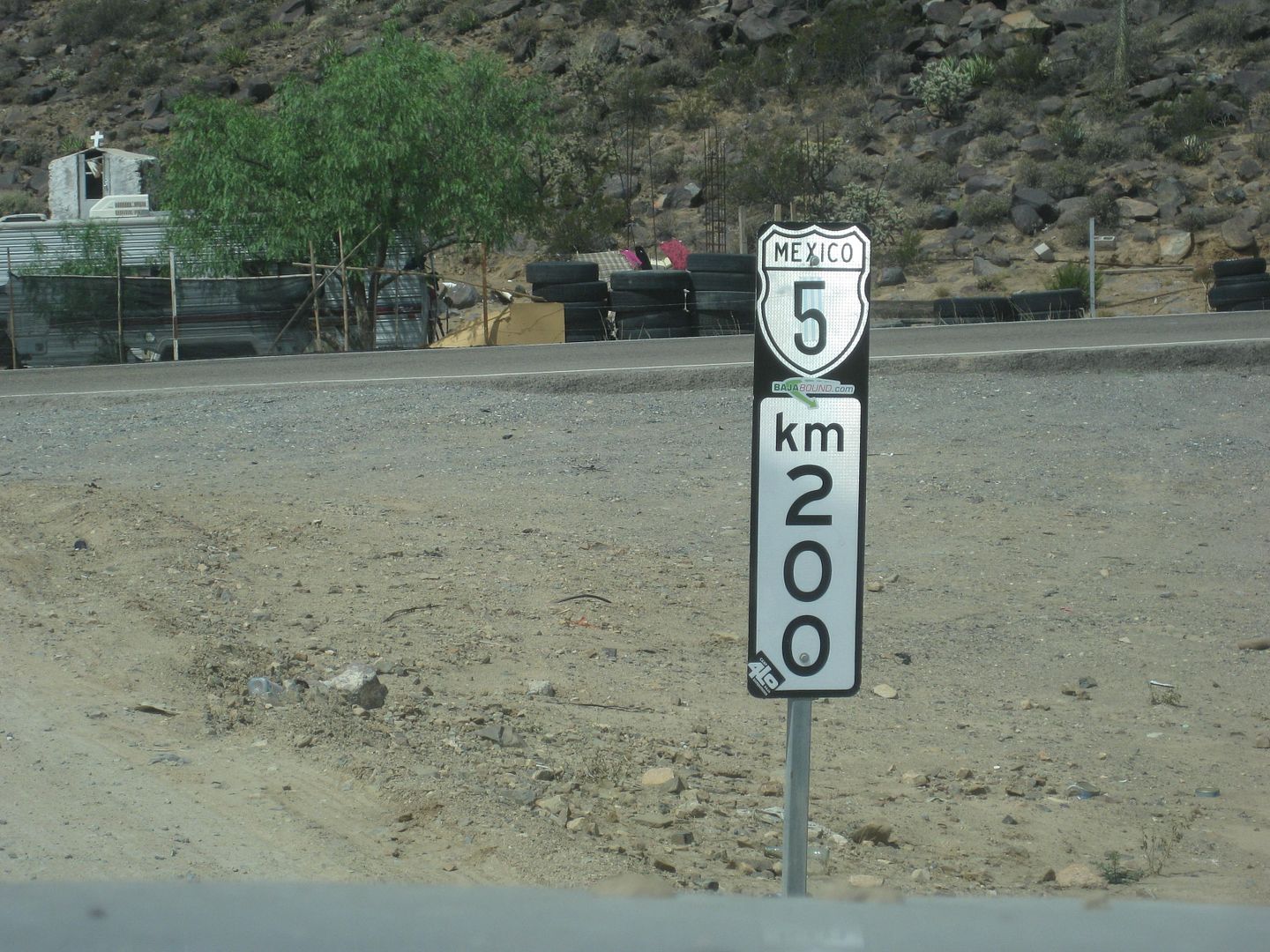
Mile 19.5 Highway 1/ Laguna Chapala/ Km. 200 sign for Hwy. 5 end. I will estimate the final kilometer will be reduced to 197 because with the small
detour it is 199 kms and the route will cut about 2 kilometers off when it is pushed through to the canyon.
This is 32.2 miles from the Gonzaga Pemex station (Km. 147+) and I estimate when the rest of the new road is open, another 2 kms. will be reduced from
the overall distance making it roughly 50 kms from Gonzaga Pemex to Highway 1 rather than the 200-147=53 kms the final sign would indicate.
Map and sat. image in some cases:
Km. 167.5 to Las Arrastras:
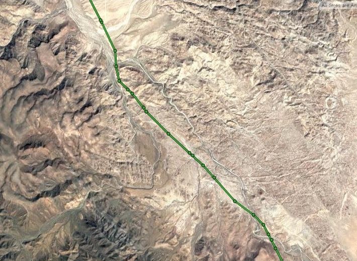
Coco's Bypass:
Laguna Chapala Valley:
OK, well that was a lot of work!
I hope it helps or in interesting!
I can add more details later. Let me know if you have questions.
I have more trip report coming: Gonzaga Bay, Octavio's at Puertecitos, and the Laguna Hanson road between Hwy. 3 and Hwy. 2.
  
[Edited on 8-30-2018 by David K]
|
|
|
David K
Honored Nomad
Posts: 64480
Registered: 8-30-2002
Location: San Diego County
Member Is Offline
Mood: Have Baja Fever
|
|
PHOTOS for this section...
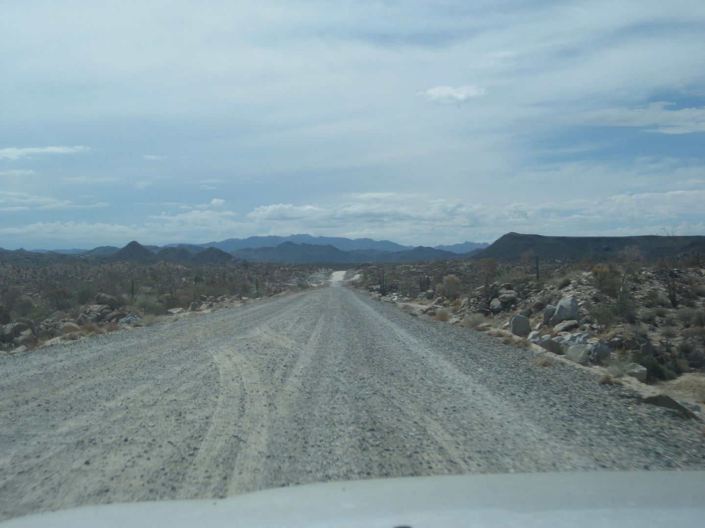
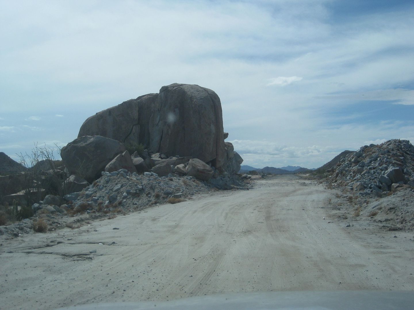
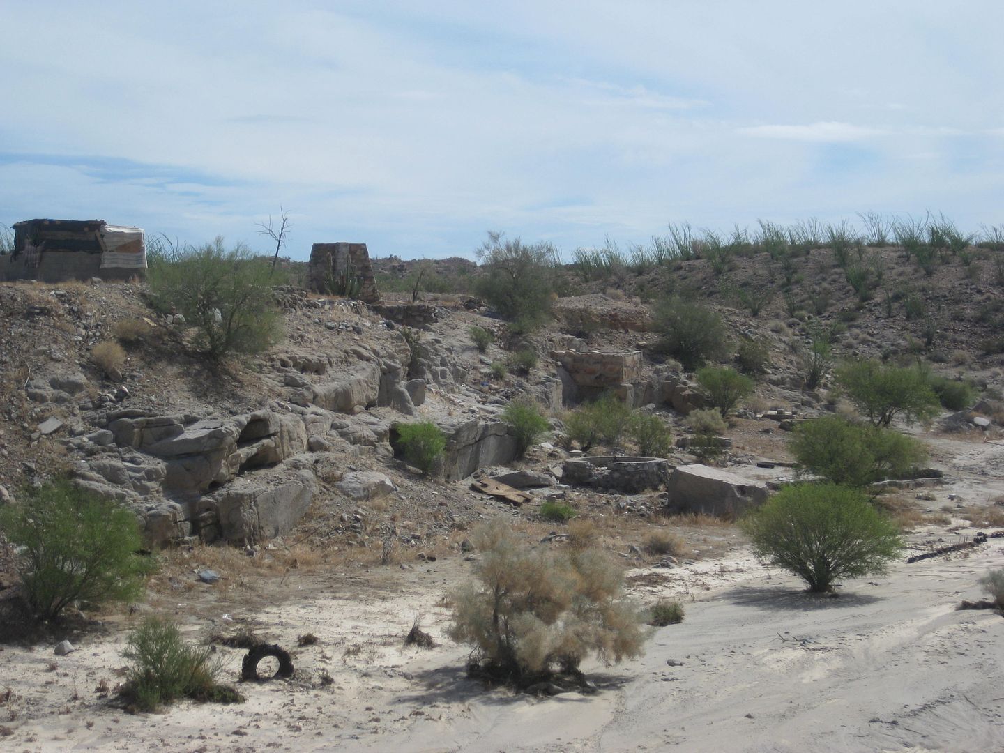
Las Arrastras from Highway 5 bridge.
Just past here was the detour down to the older road about where it enters the canyon.
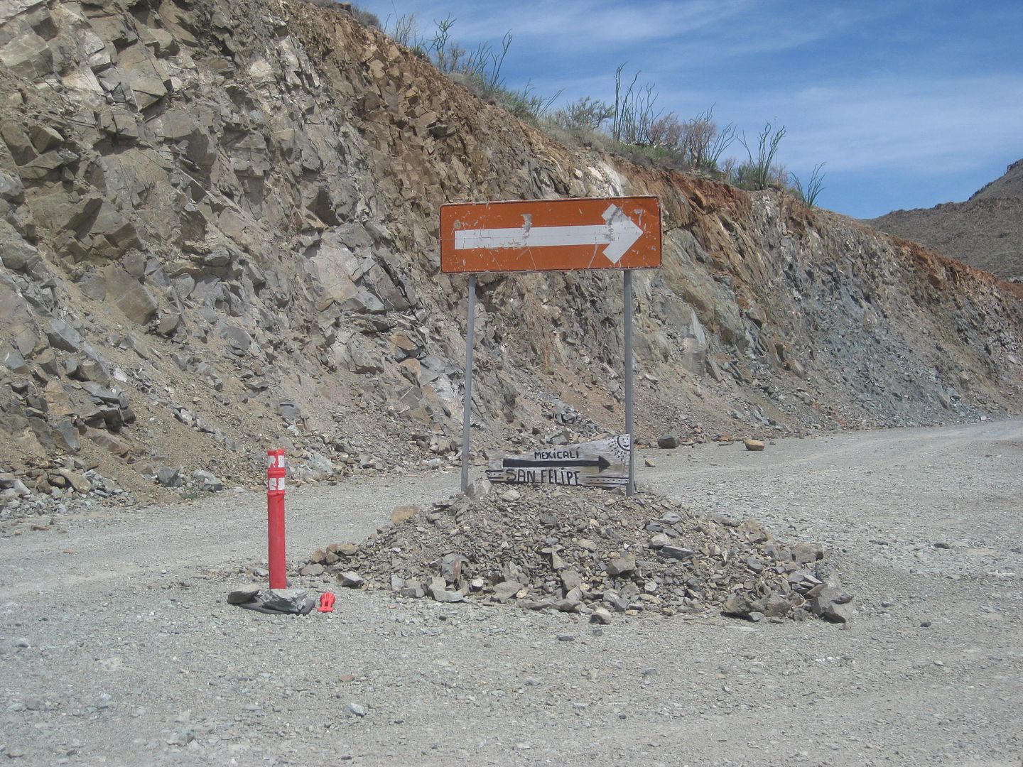
New pavement
End of Hwy. 5 at Hwy. 1.
Going back north to Gonzaga Bay...
Detour well signed, near Construction camp.
That's the section not yet open as seen from the old road.
Back at the Las Arrastras bridge.
Back to the Km. 167 area.
|
|
|
David K
Honored Nomad
Posts: 64480
Registered: 8-30-2002
Location: San Diego County
Member Is Offline
Mood: Have Baja Fever
|
|
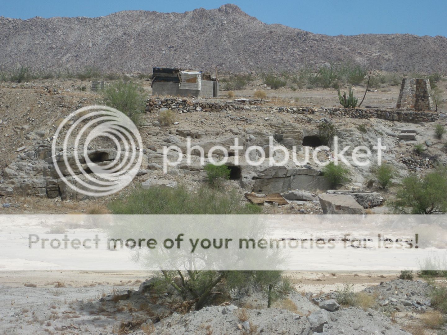
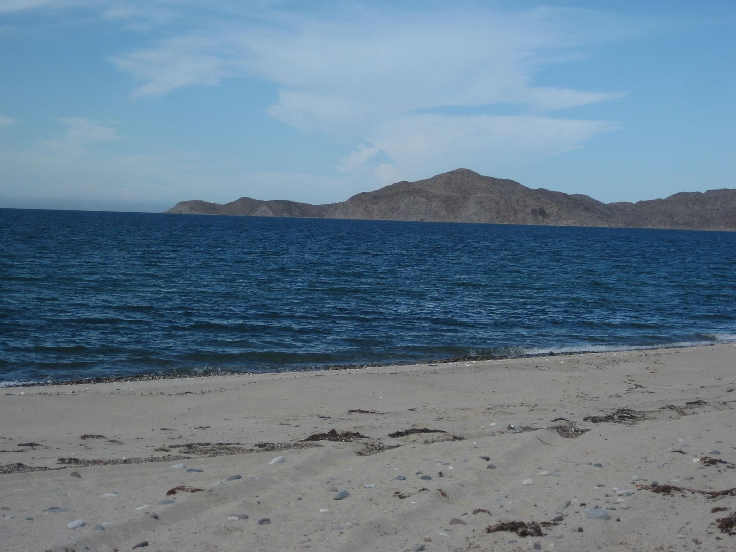
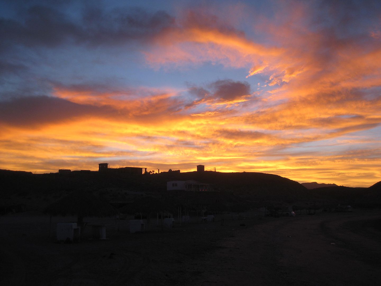
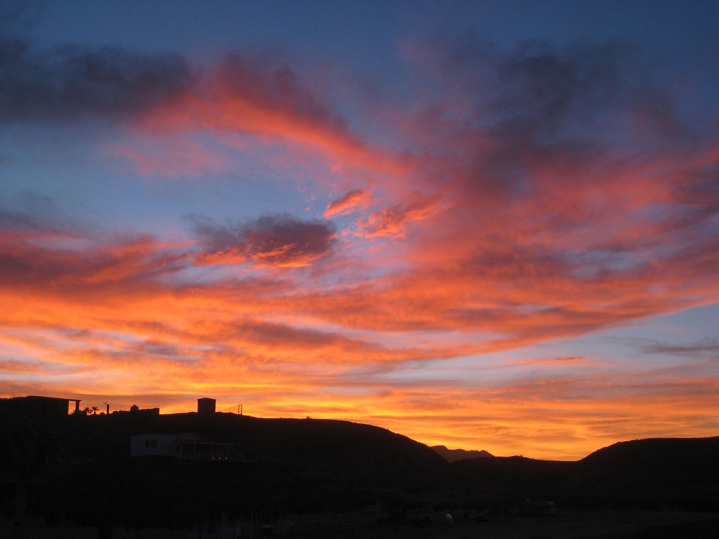
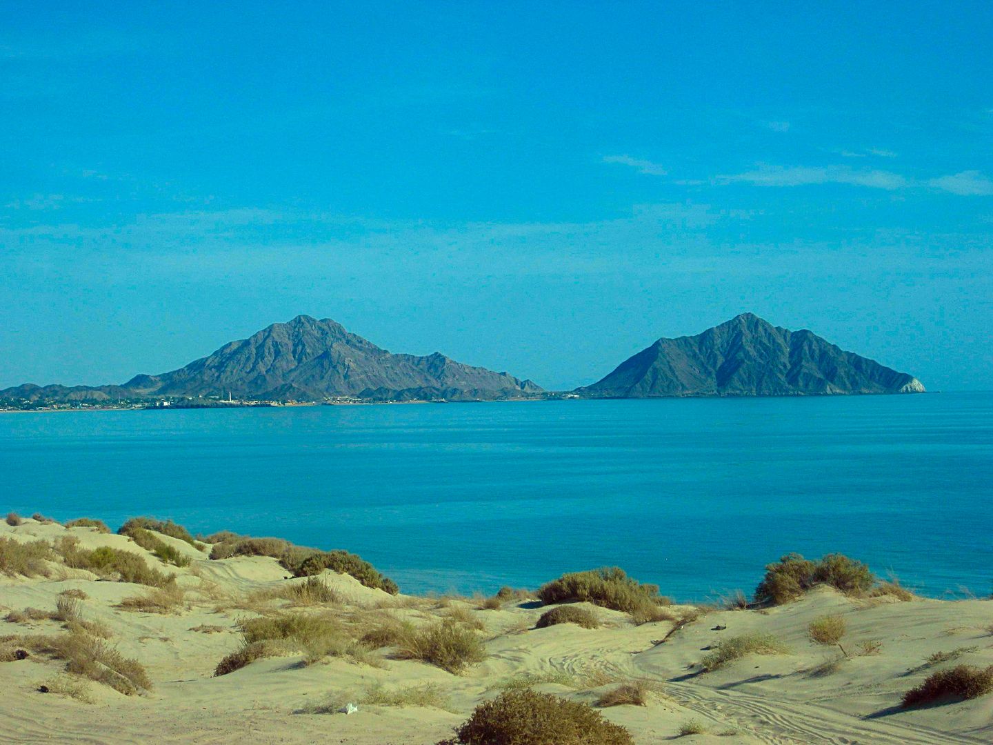
Gonzaga Bay... or Ensenada de San Francisquito!
Yes, technically Gonzaga is the small harbor between Papa Fernandez' and Alfonsina's. The bigger, open bay from Alfonsina's to Punta Final is the
Ensenada de San Francisquito. But, hey, nobody wants to say all that! Gonzaga Bay works for both!
I go to the bay between El Sacrificio and Punta Final, where I camped at New Years week 2017. A nice break from all the driving was needed. I had no
shade, but it was only 91° and some high clouds eased up on the sun.
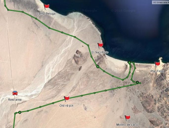
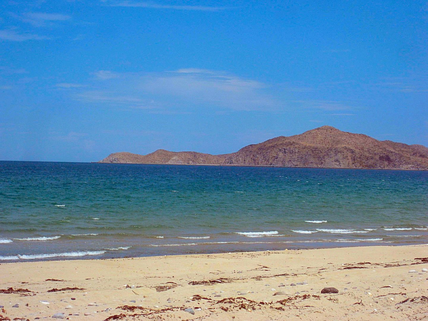
Punta Final
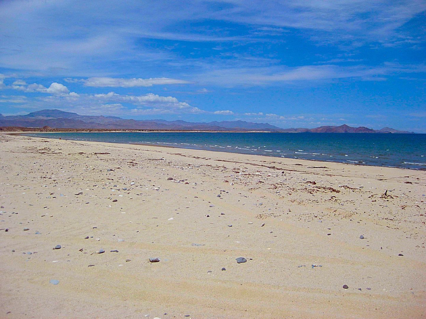
Looking northward towards El Sacrificio.
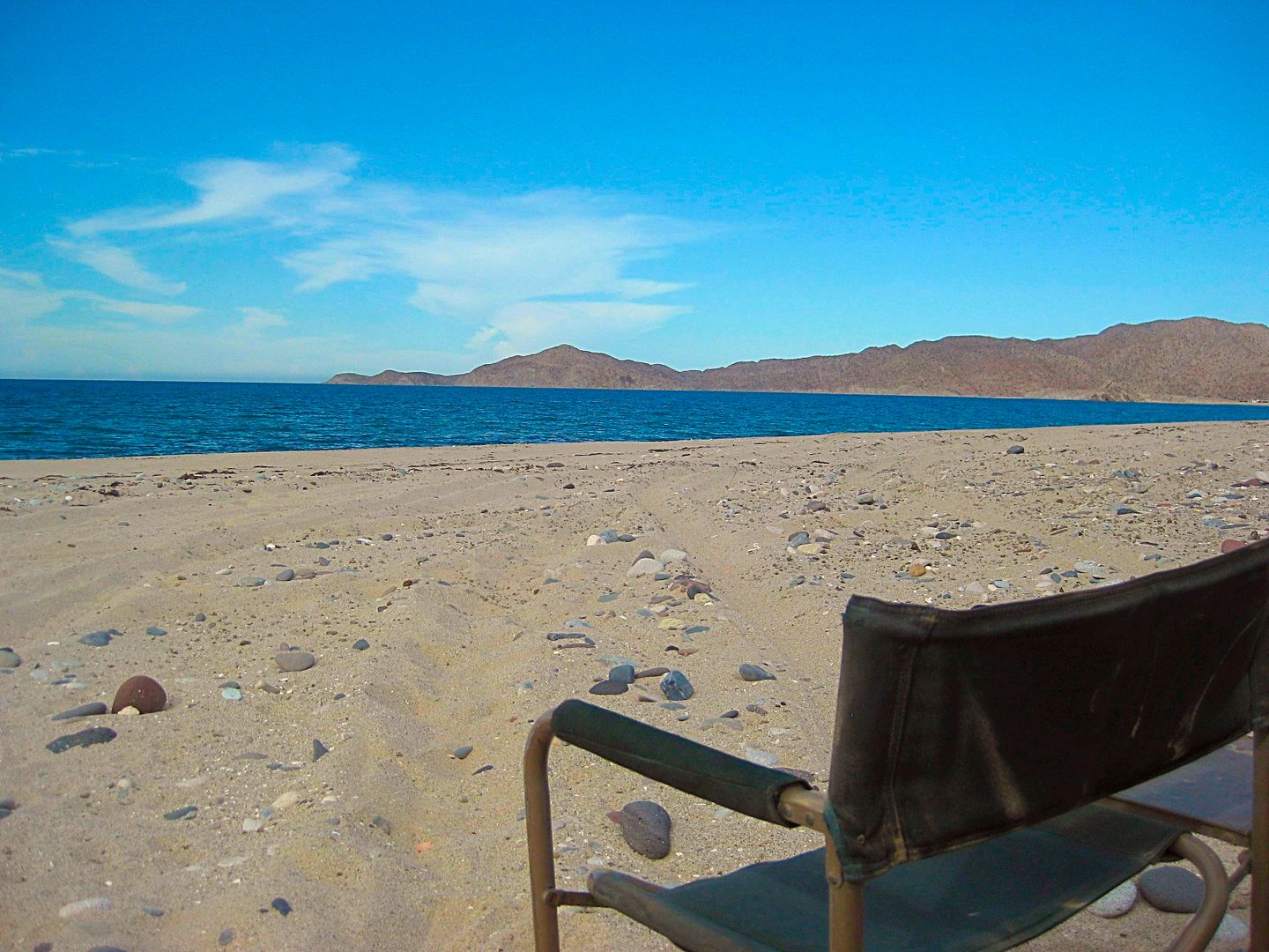
Where I 'chilled' for a few hours.
A bit later, after I take a soak...
A go around the area to collect a few twigs to add to my artificial log for a fire when it gets dark... and I see weird stripes ALL OVER the place.
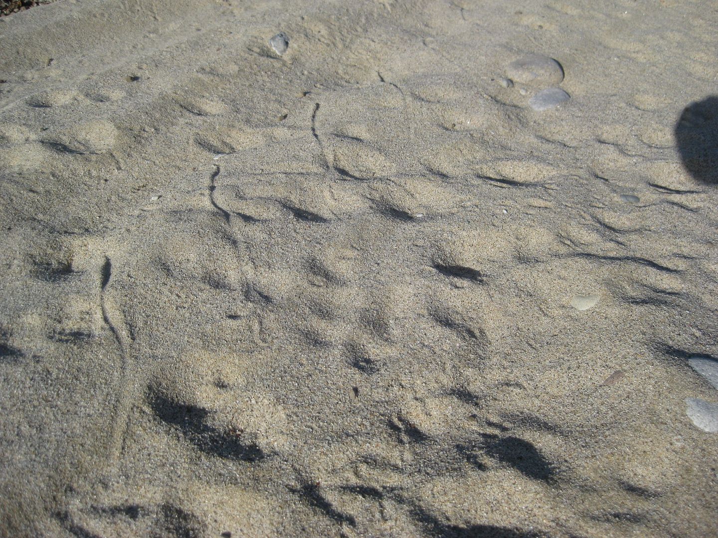
I have never seen so many sidewinder tracks!
I folded my chair, got in my truck, and left! LOL
I got $25 worth of gas at the Gonzaga Pemex... 22.6 liters, 445 pesos. It was 17.80 pesos per dollar and Magna was 19.69/liter. The attendant was a
young guy on his cell phone texting (service at Gonzaga or wifi?) but very nice! 20 peso tip!
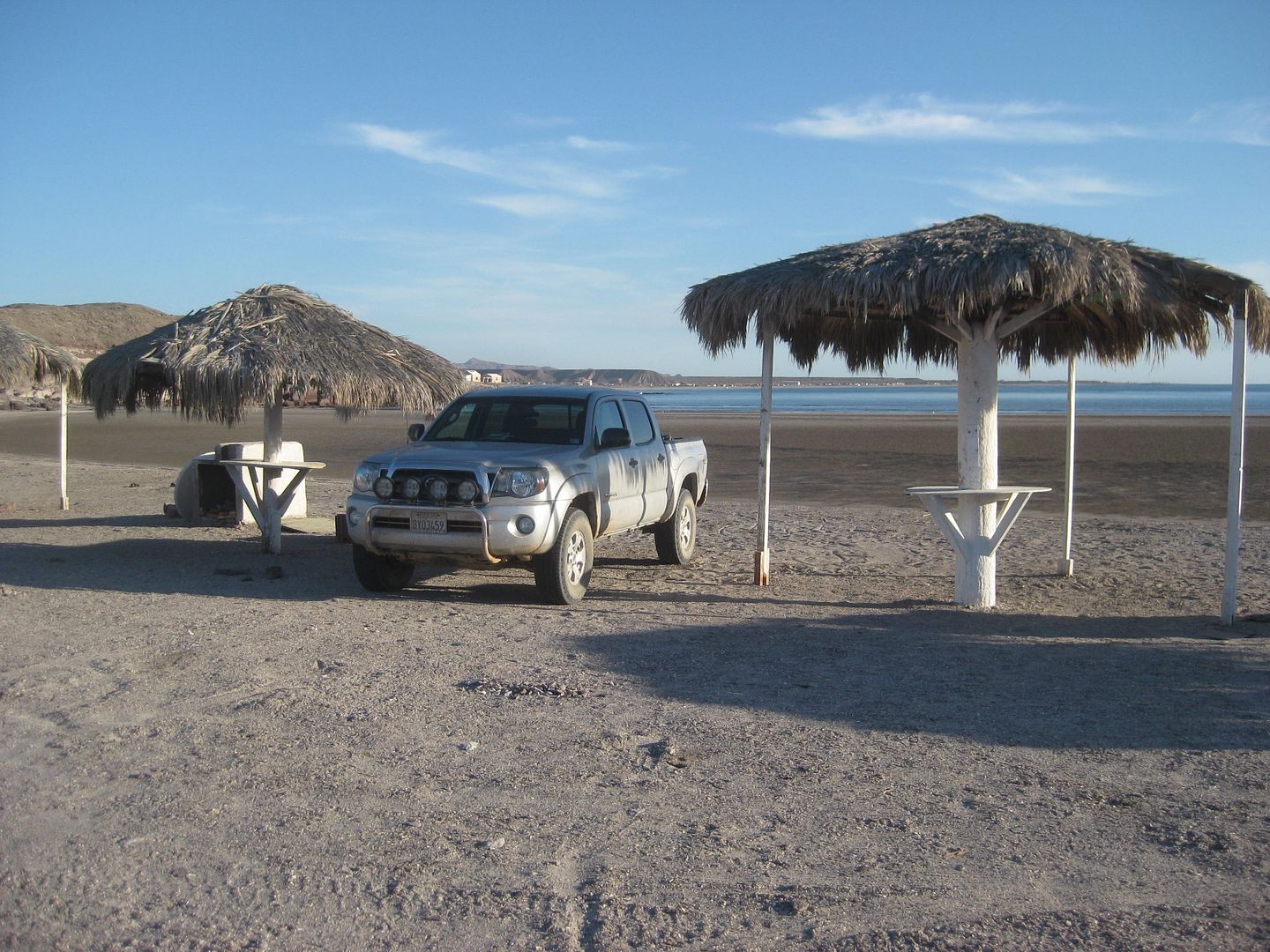
I drive north, a fast stop at the checkpoint, and am wondering where to crash for the night. I pull off on the Puertecitos paved sideroad (Km. 74.5)
and very soon is Octavio's Playa Escondida. It is hot, getting dark, and no other campers are there. Manuel tells me normally it is 250 pesos, but 200
is fine. I pull between palapas and make dinner.
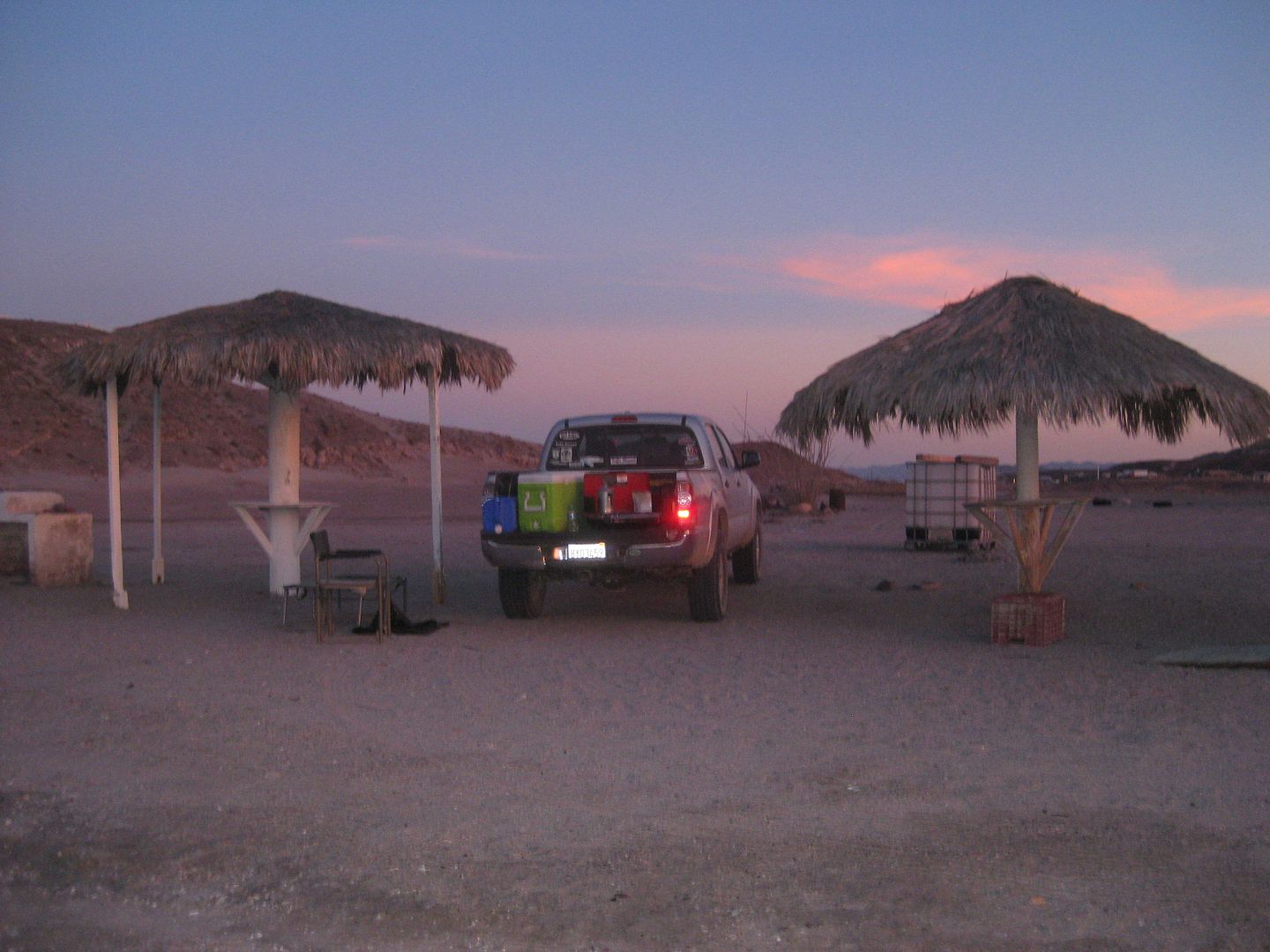
The next morning is beautiful...
Here is just before I leave.
Stay tuned for Day 3 report and photos.
[Edited on 8-19-2018 by David K]
|
|
|
David K
Honored Nomad
Posts: 64480
Registered: 8-30-2002
Location: San Diego County
Member Is Offline
Mood: Have Baja Fever
|
|
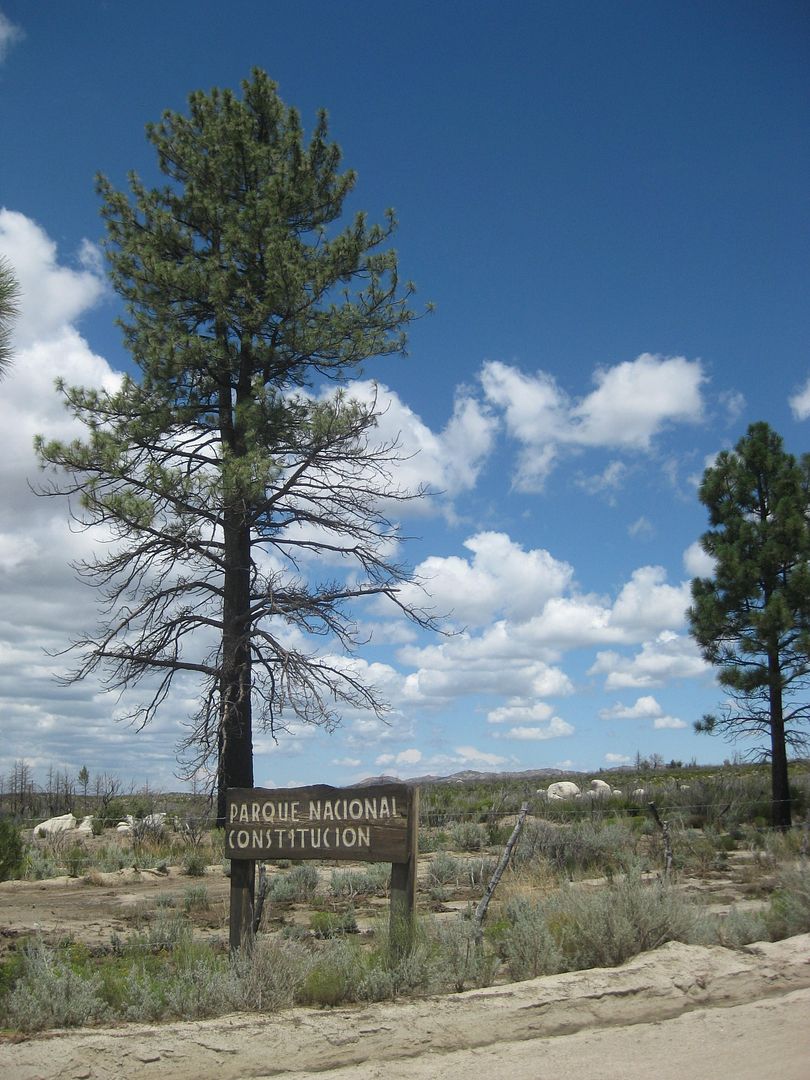
Friday Aug 17 Puertecitos to Laguna Hanson to Tecate
Can you guys believe it but I have never been to Laguna Hanson!
Close, from the north... but not to this famous body of water (or mostly mud) named after a murdered American... Here's what I researched for Cameron
Steele's Trail of Missions 2017 Itinerary:
Laguna Hanson: A shallow lake named after an American rancher who arrived in the area in 1872 and who was murdered in 1880, nearby, at Rancho El Rayo.
A fellow American named Harvey was found guilty of killing Hanson and cooking his remains in a large cast iron pot.
Great stuff, right?
On the way south and on the way north, between San Felipe and Puertecitos, I noted the dozens of campo km. marker locations... I will produce the list
and add it to Nomad as well as The South Campos Facebook page... if any of you have an interest.
Km. 20.5+
San Felipe is an attractive landmark with Punta El Machorro being the north end of Bahía San Felipe and Punta Estrella, the south end.
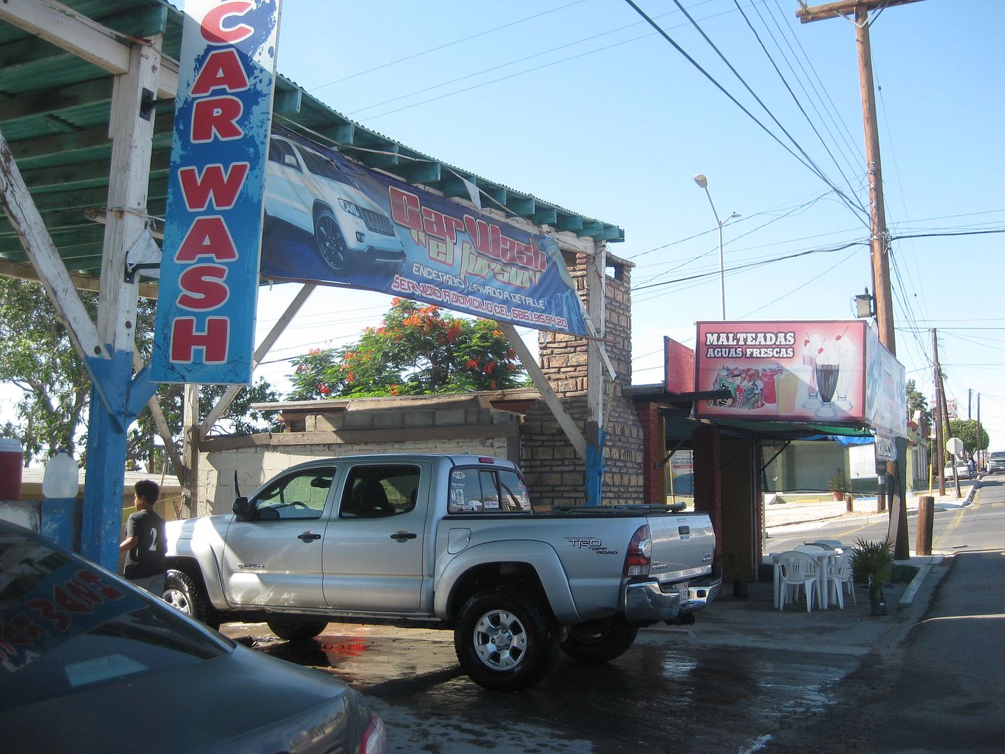
After getting in the salty mud two days earlier, I was so happy to find my favorite car wash open and waiting for business... about 8:30 Friday
morning...
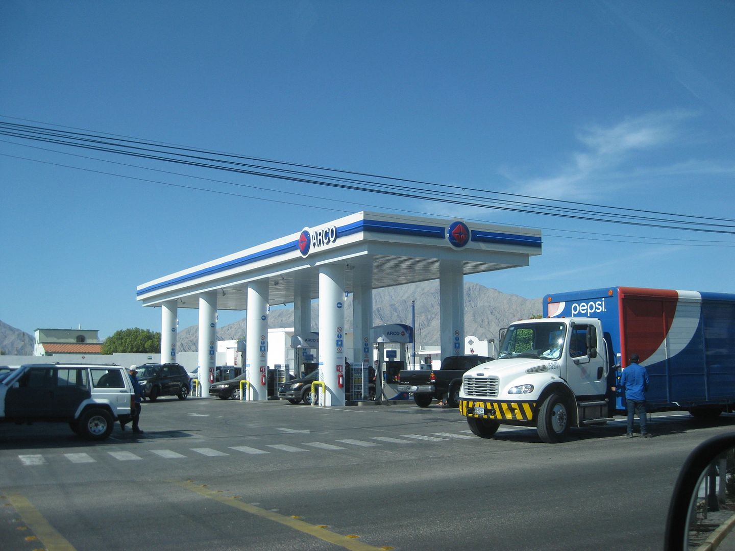
This was the big Pemex near the arches (km. 190)... now ARCO!
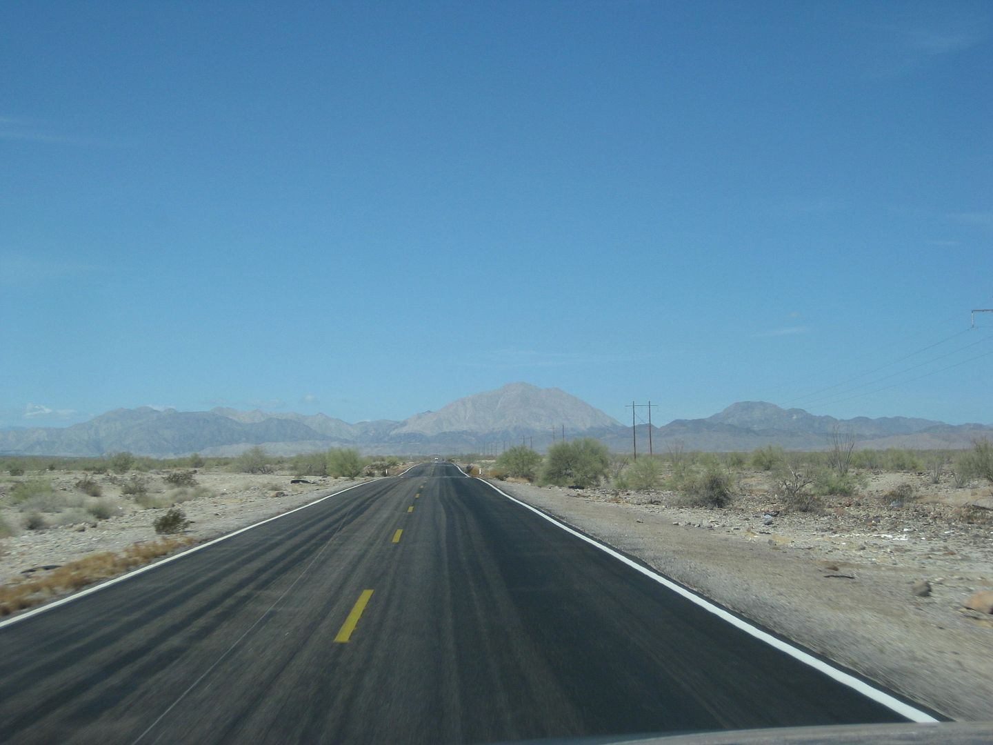
Hwy. 3 heading west. The checkpoint was amazingly fast and no search.
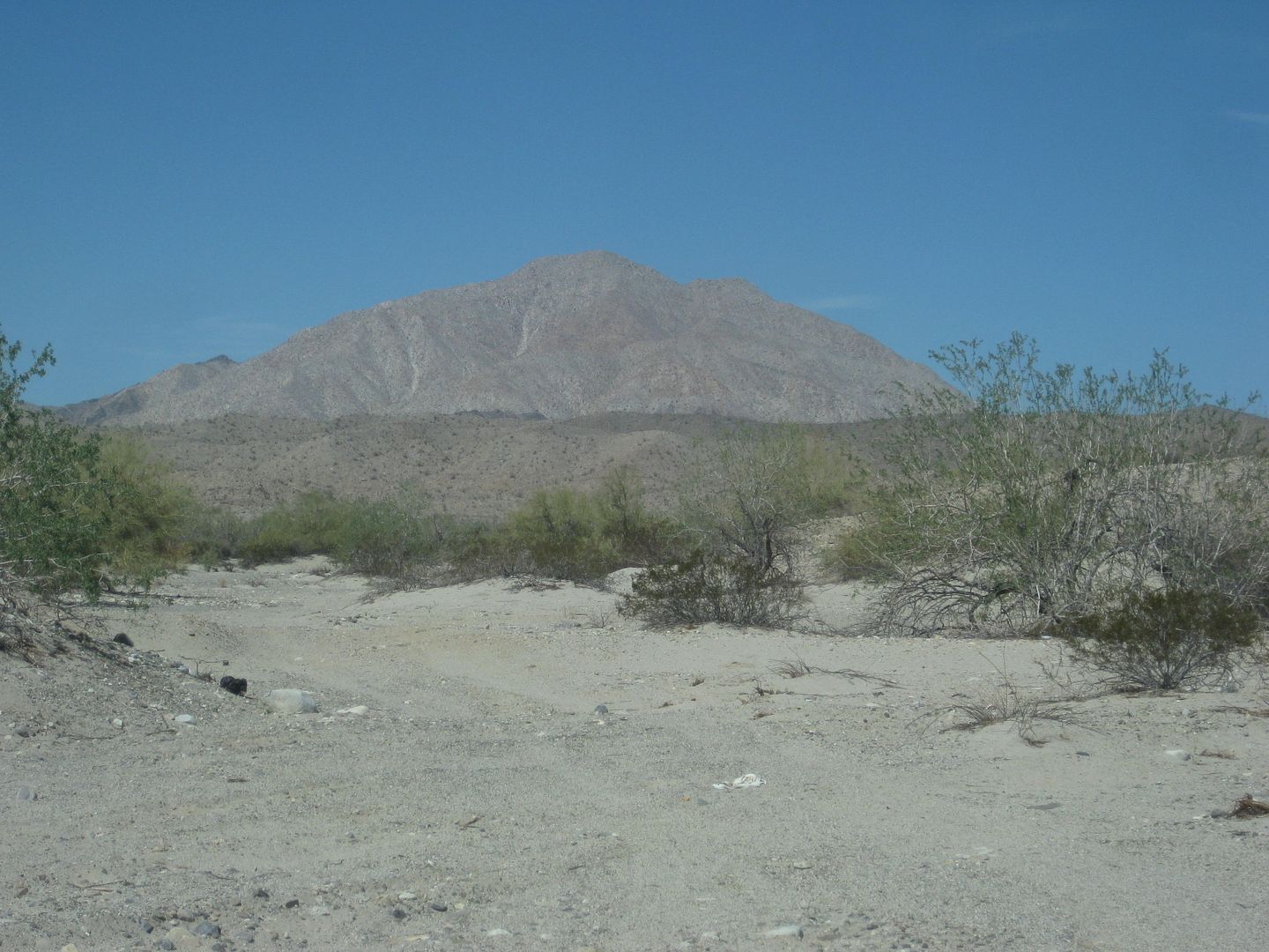
Borrego Mountain (El Arrajal).
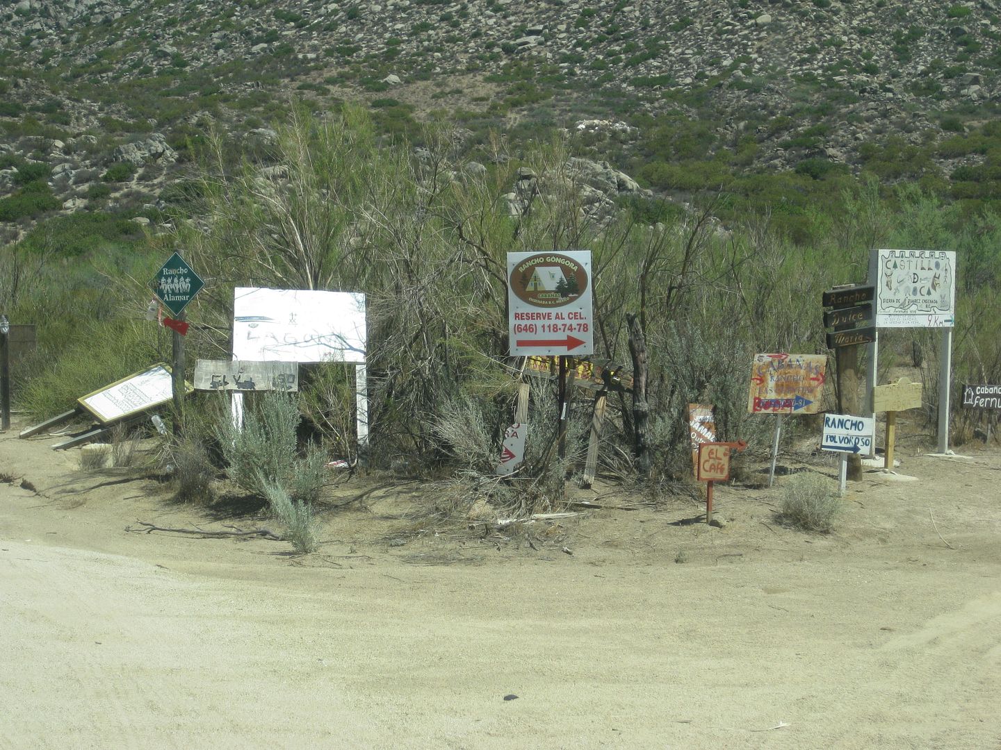
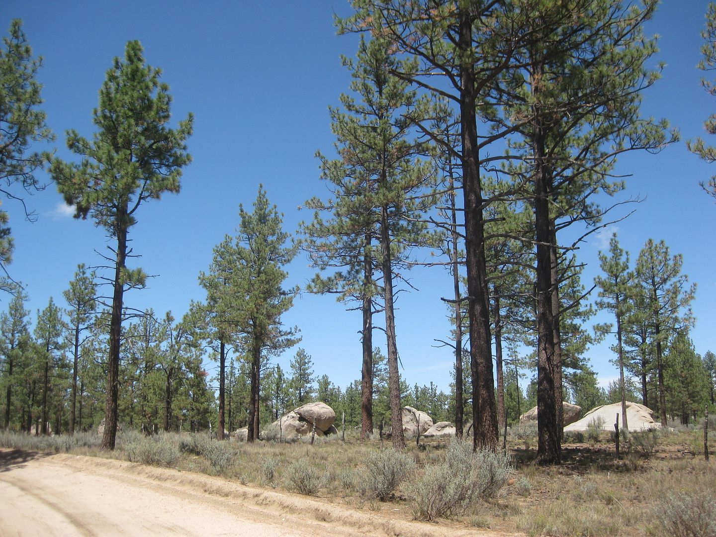
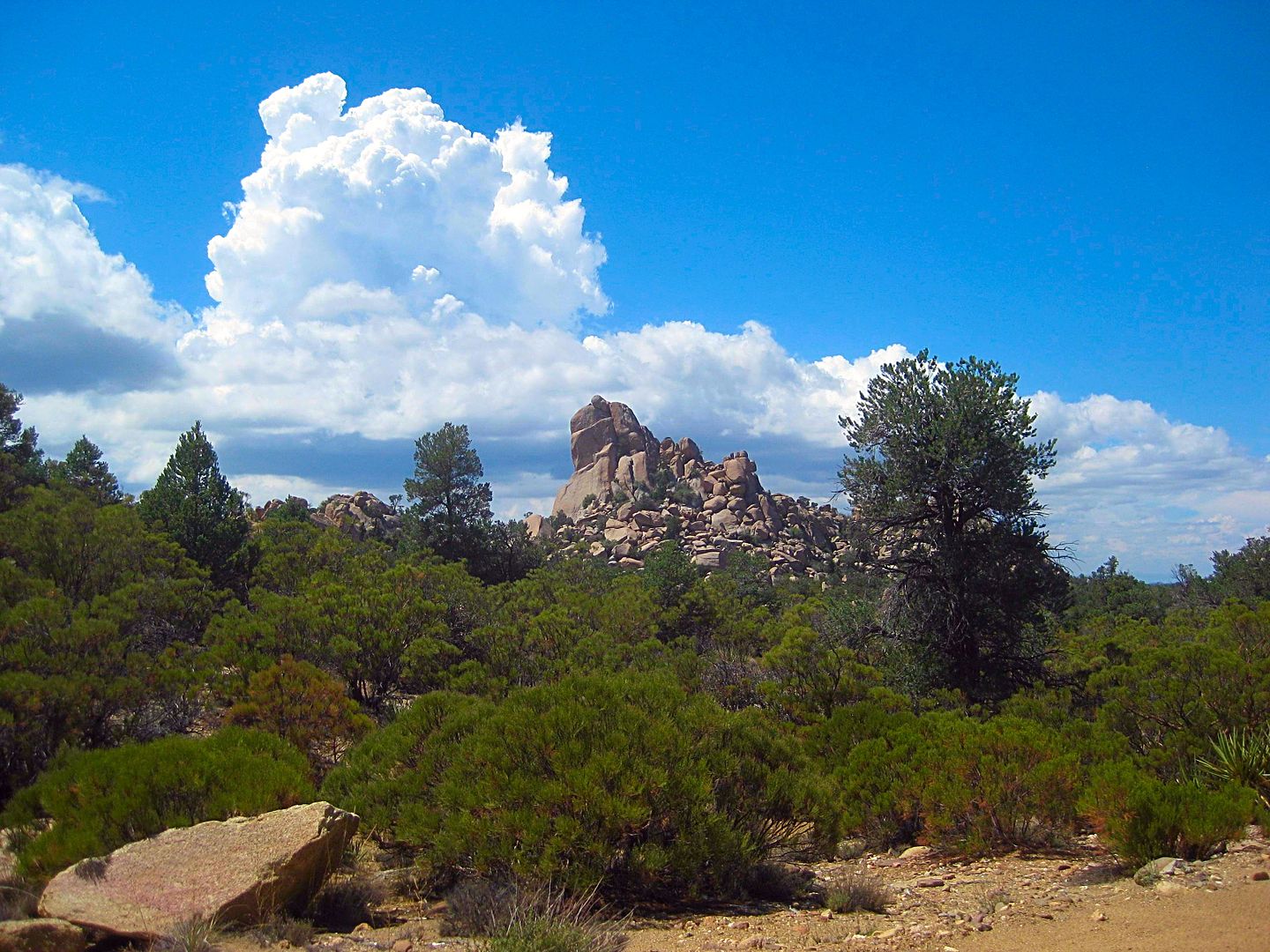
The road to Laguna Hanson begins at Km. 54.5 and there are a few forks along the way, mostly well signed!
A long steady climb from 3,000 ft to over 5,000 ft.
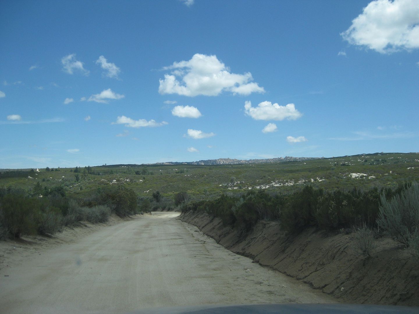
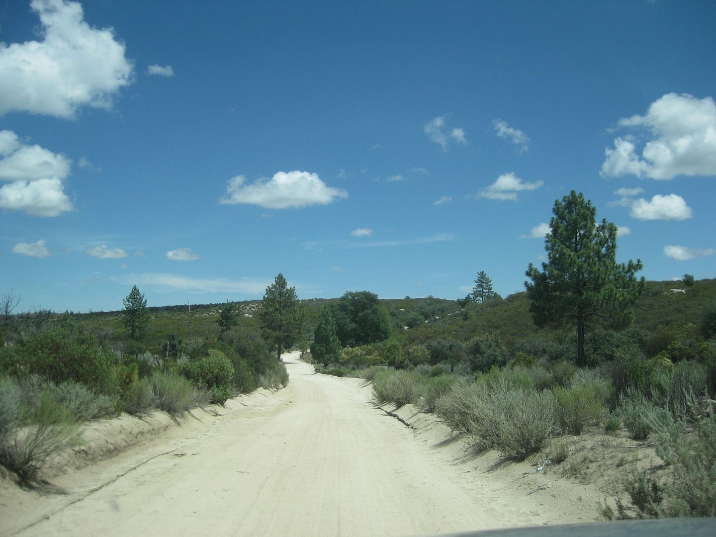
First pines at 5,000 ft and 11 miles from Hwy. 3.
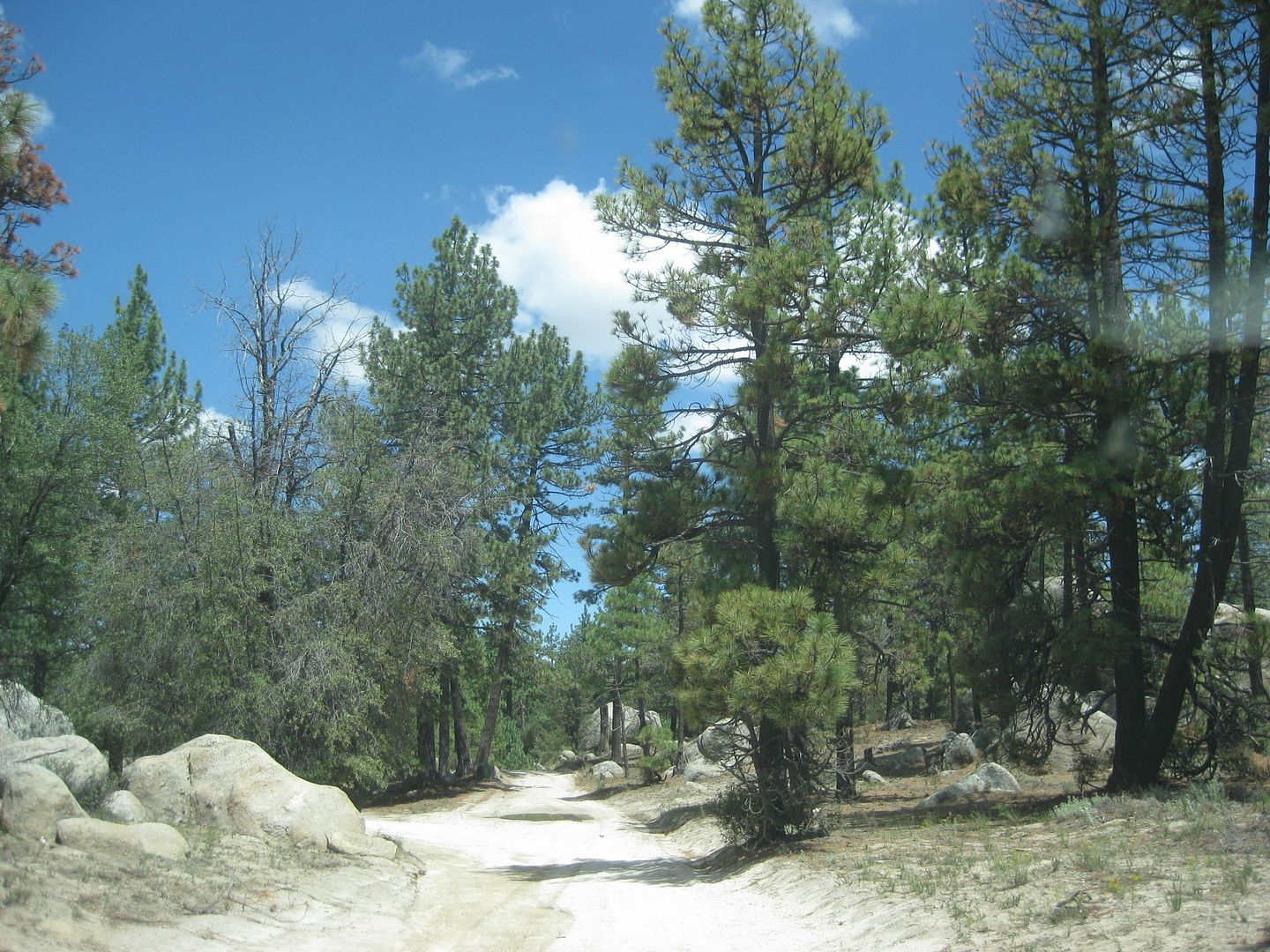
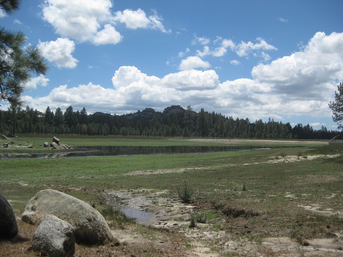
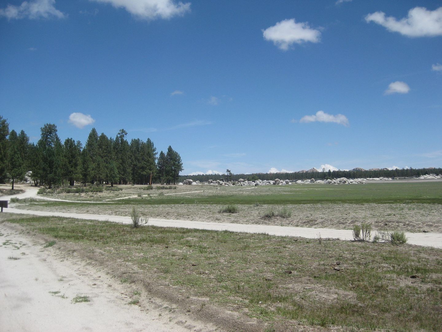
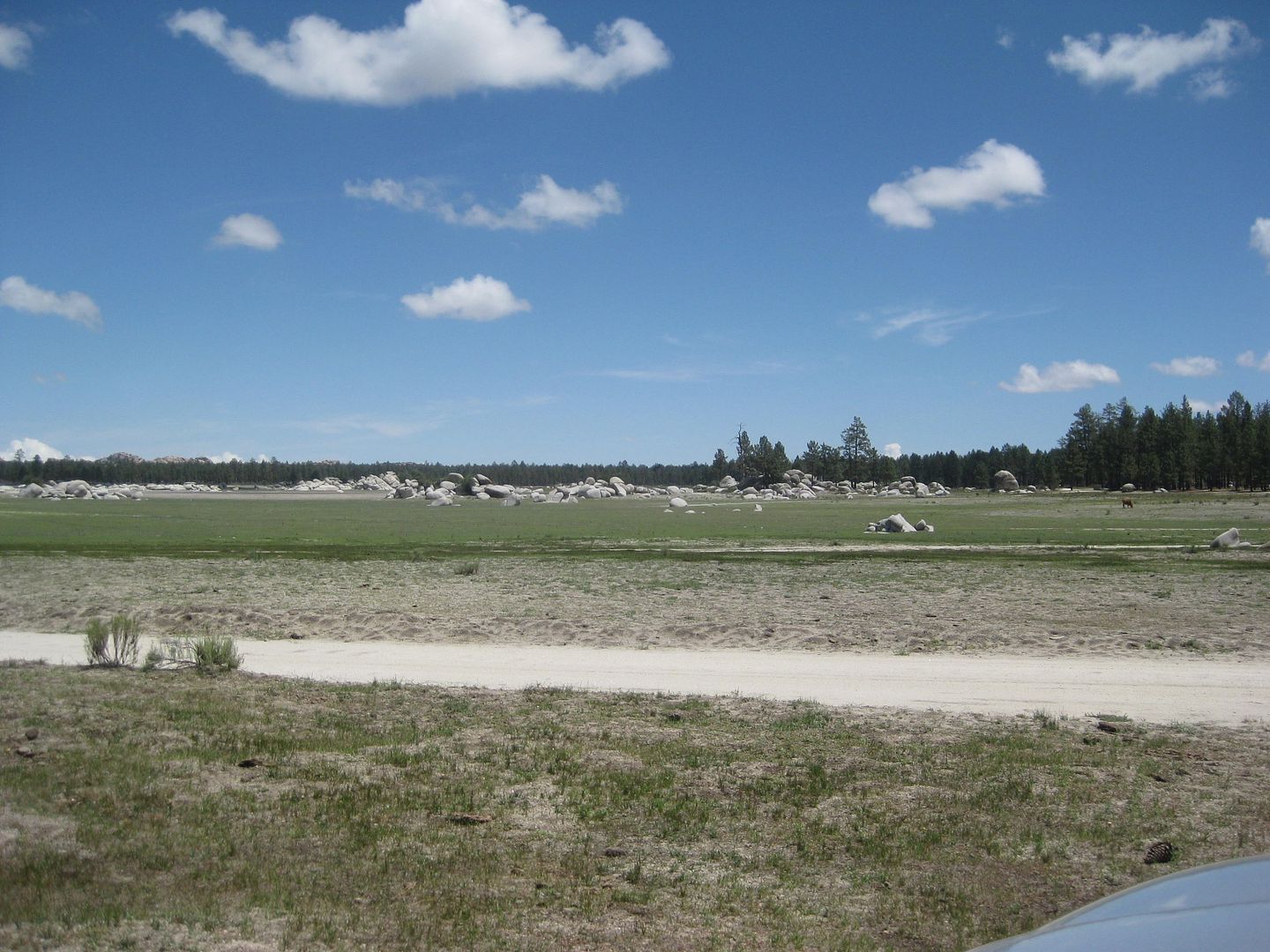
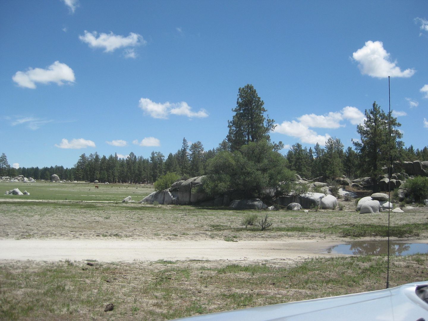
Laguna Hanson, south end... some water!
OK... I will make a road log and continue the trip up to La Rumorosa on Hwy. 2.
STAY TUNED!
|
|
|
David K
Honored Nomad
Posts: 64480
Registered: 8-30-2002
Location: San Diego County
Member Is Offline
Mood: Have Baja Fever
|
|
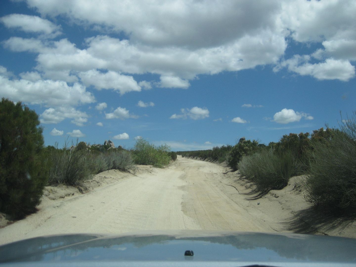
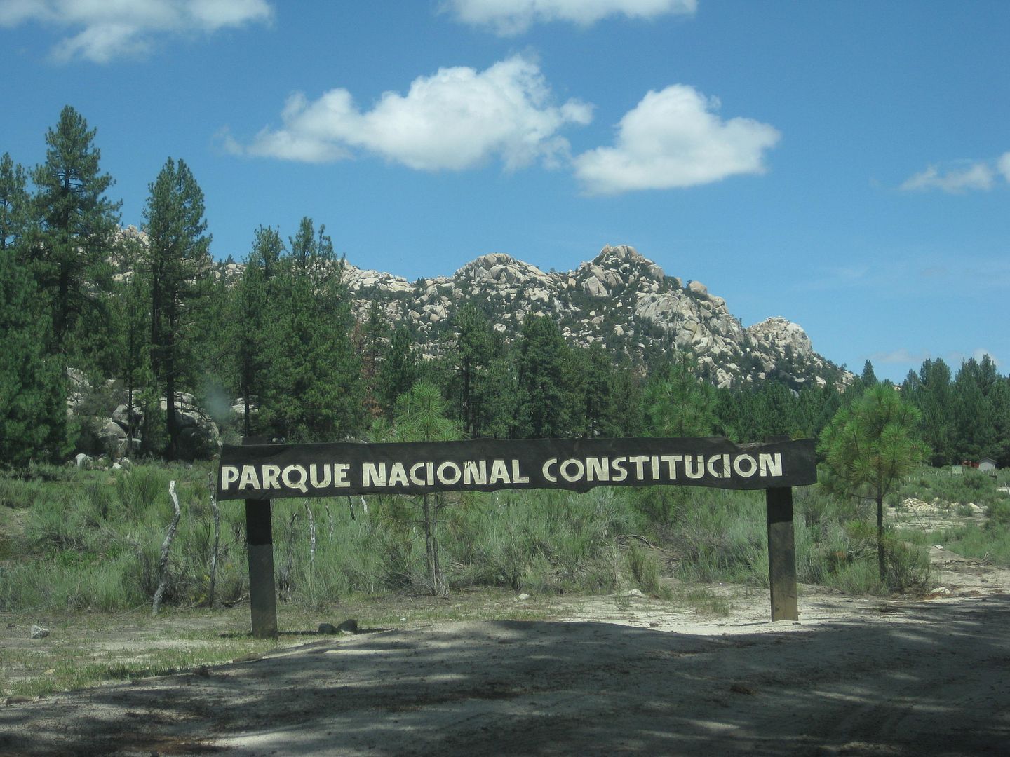
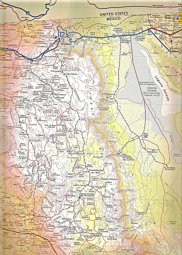
Road Log: Hwy. 3 to Hwy. 2 via Laguna Hanson
0.0 Miles Hwy. 3 at Km. 54.5 (from Ensenada).
2.7 Fork, go left
3.8 Fork, go right
4.8 Oak Grove
5.2 Fork, go left (elev. 4,000')
11.2 First pine trees (elev. 5,000')
13.7 Rancho El Rayo
15.1 Road right to Rancho La Botella, cattle guard crossing.
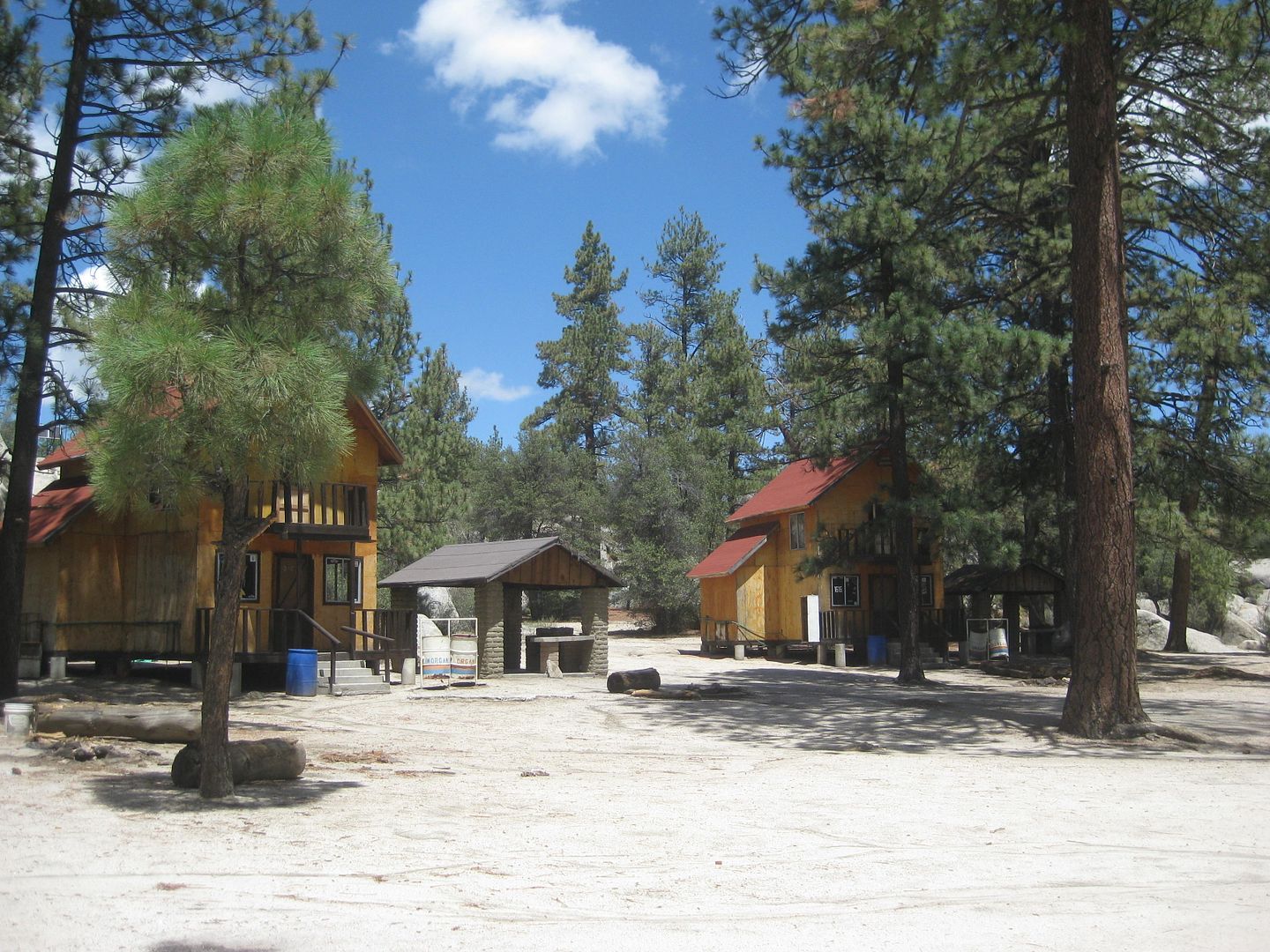
16.2 Aserradero (abandoned homes) a former sawmill, elev. 5,277'.
16.4 Food advertised.
17.5 Cabins for rent, food store "Oxxxo".
19.1 Fork, go left.
19.8 LAGUNA HANSON (cabins) 68 pesos camping fee, elev. 5,300'
20.5 Km. 60 sign (37.2 miles from La Rumorosa, Hwy. 2).
22.1 Road east to Rancho San Luis... located above the top of Guadalupe Canyon.
23.8 Km. 55 sign.
24.6 Rancho Rodeo del Rey, an abandoned/ deteriorated hotel/restaurant.
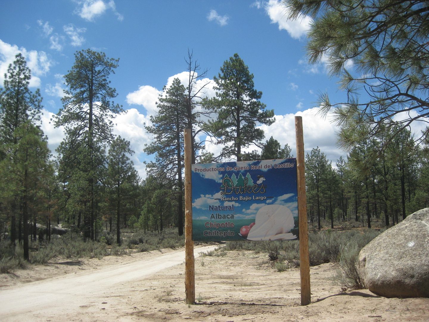
25.0 Rancho Bajío Largo road west.
26.9 Km. 50 sign.
35.6 Rancho El Topo road west.
35.7 Km. 35 sign.
40.4 Former mining area of La Milla.
41.4 Condor road west, elev. 4,916'.
41.9 Km. 25 sign.
42.7 Junction with a road southwest from Las Margaritas.
44.4 Road to the east.
45.6 Rancho La Ponderosa road east.
47.2 Km. 17 sign.
48.7 Rancho Nuevo road east
53.1 Km. 7, 'Inspection' station, open gate.
55.1 Blacktop paved road begins.
55.4 Parques Los Potrillos and El Tesoro campgrounds.
57.5 Highway 2 (Km. 72), La Rumorosa.
Here is the 2010 AAA map for a visual of the road location:
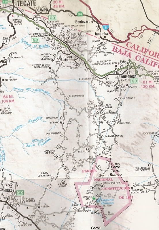
The 2009 Baja Almanac of the Sierra Juarez area:
[Edited on 8-20-2018 by David K]
|
|
|
David K
Honored Nomad
Posts: 64480
Registered: 8-30-2002
Location: San Diego County
Member Is Offline
Mood: Have Baja Fever
|
|
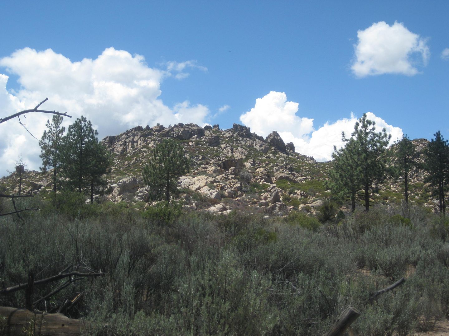
Photos going north from Laguna Hanson:
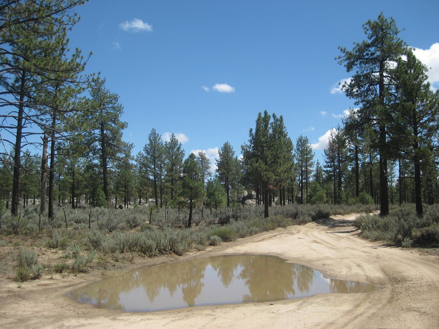
There were dozens of big puddles last Friday!
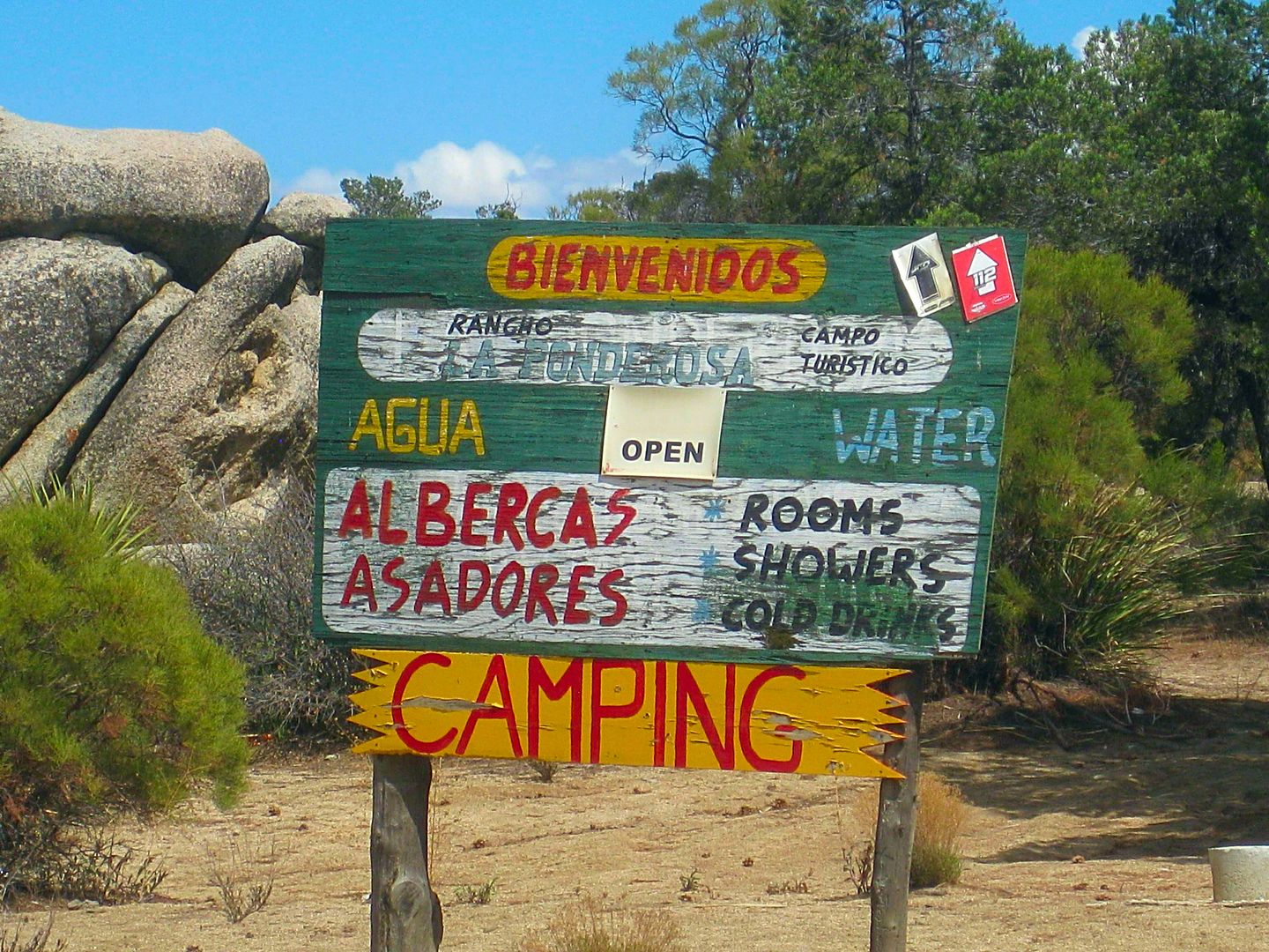
La Ponderosa has an inviting sign.
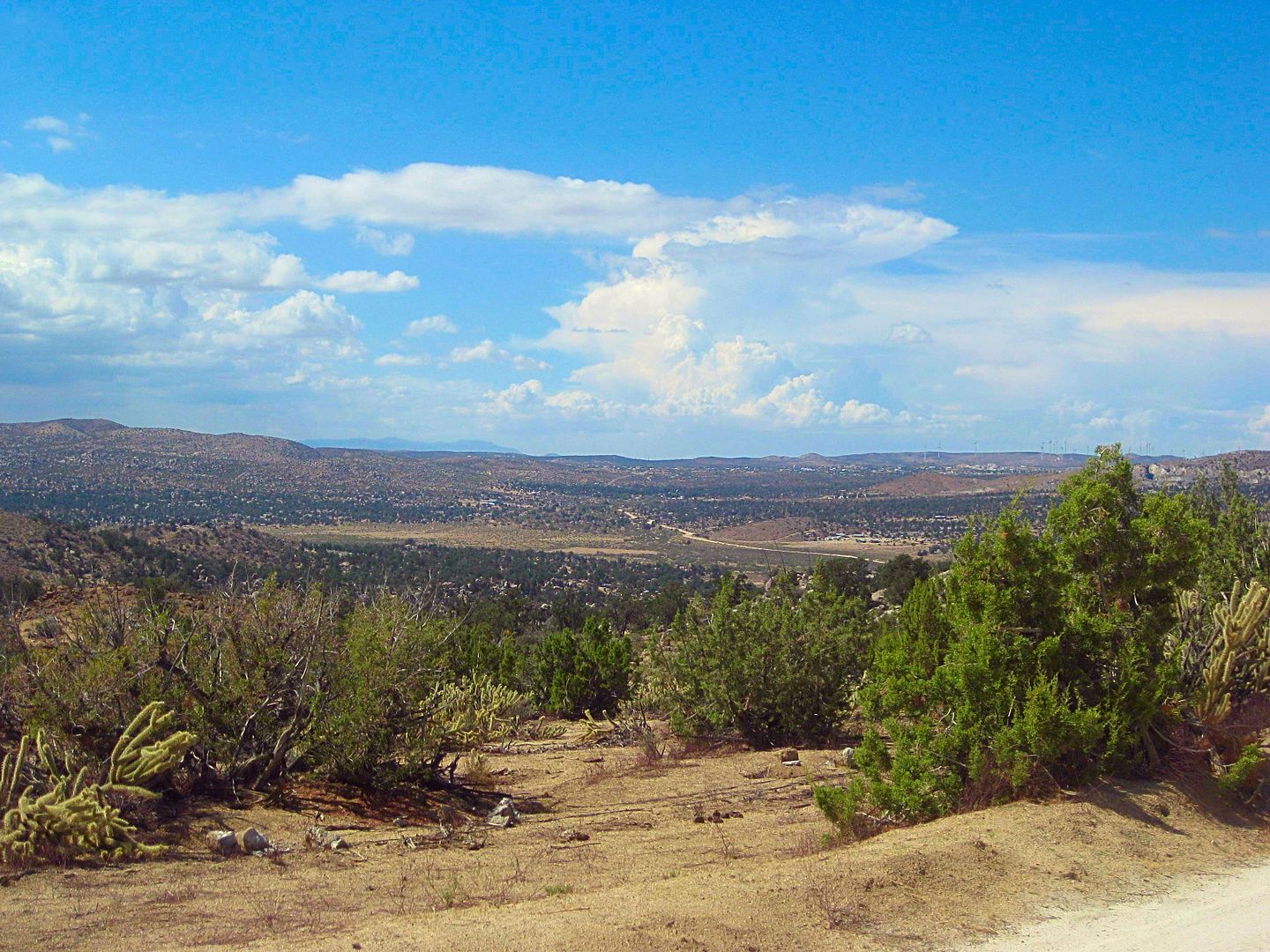
Coming down to La Rumorosa.
THE END!
I drive west, get on the toll highway and soon find it is down to one lane wide each way as they convert the blacktop to concrete for several miles.
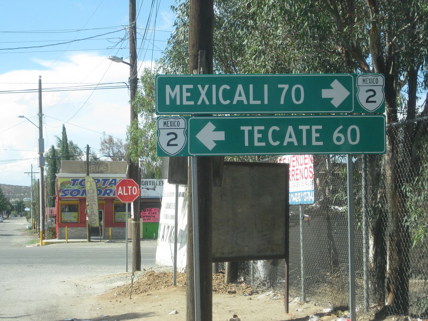
I reach the border at Tecate about 4 pm Friday and there is NO LINE. One car in front of me and my turn comes and the agent looked at my passport,
punched something into his computer, and asked me if I had anything to declare. I was on my way home.
Lots of data to crunch and then incorporate into the Baja Bound Guide including the updating of Highway 5.
The guide may be an online or printed, but either way, it is made to be updated as things change or more roads are added. No guide is 'current' as
something can change the day after I was there. The idea is to provide recent, detailed, and accurate road and location information to show some of
the many interesting places to visit in this fascinating peninsula of California!
Thank you and I hope you enjoyed traveling along with me!
|
|
|
David K
Honored Nomad
Posts: 64480
Registered: 8-30-2002
Location: San Diego County
Member Is Offline
Mood: Have Baja Fever
|
|
South Campos Kilometer List 2018
If I could see a sign, then I noted it... from Punta Estrella to Puertecitos. In many places the word 'Campo' was dropped from the name listed:
Km. 8.5 Villa Marina RV Park
Km. 11 La Jolla del Mar
Km. 12 Punta Estrella Beach
Km. 14+ Valle de los Gigantes
Km. 15.5 Pancho's
Km. 17 Rancho Los Potrillos
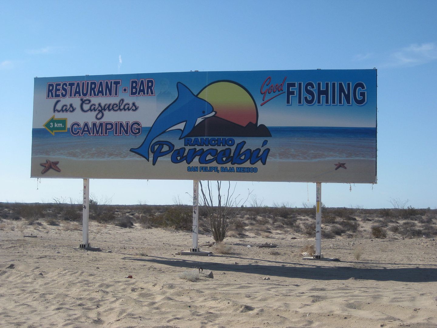
Km. 20.5+ Rancho Percebú
Km. 31 Bahía Santa María/ La Misión/ Playa Hermosa
Km. 31.5 Baja Beach Resort
Km. 32 Nuevo Mazatlán
Km. 32 El Sahuaro
Km. 33 Playa Linda
Km. 33.5 La Roca
Km. 34 Campo Delicias
Km. 34+ San Pedro
Km. 35+ El Vergel
Km. 35.5-36 Colonia Delicias
Km. 36.5 OM BAJA
Km. 36.5+ La Perlita
Km. 37.5 Diamante
Km. 37.5+ Santa Fe
Km. 38.5+ San Martin
Km. 39.5 Garcia
Km. 39.5+ Playa Mexico
Km. 40+ Rancho Anita
Km. 40.5 Cielito Lindo
Km. 40.5+ Agua Azul
Km. 41.5 Campo Cadena
Km. 42+ Campo Jimenez
Km. 42.5 Los Gorditos
Km. 43.5 Pelicano
Km. 44 Campo Badilla
Km. 45 Campo Adriana
Km. 45.5 Mar y Sol
Km. 45.5 Los Morritios
Km. 46 San José
Km. 47 Rudy's Camp
Km. 47.5 San Francisco
Km. 49 Los Pulpos
Km. 49+ Rancho Las Panteras (El Coloradito Parcela 55)
Km. 49.5 Consuelo (at curve in highway)
Km. 51.5 Playa El Sueño
Km. 52.5 Old Puertecitos Road (Score Race Route)
Km. 52.5+ Costa Verde
Km. 54.5 Playa Cristina
Km. 58.5 Los Olivos
Km. 60 Arroyo Matomí
Km. 60.5 El Pozo
Km. 61-72.5+ DETOUR for new highway work.
Km. 65 El Conquistador
Km. 68.5+ Zimarros
Km. 68.5+ La Violeta
Km. 72+ La Toba
Km. 73 Cow Patty
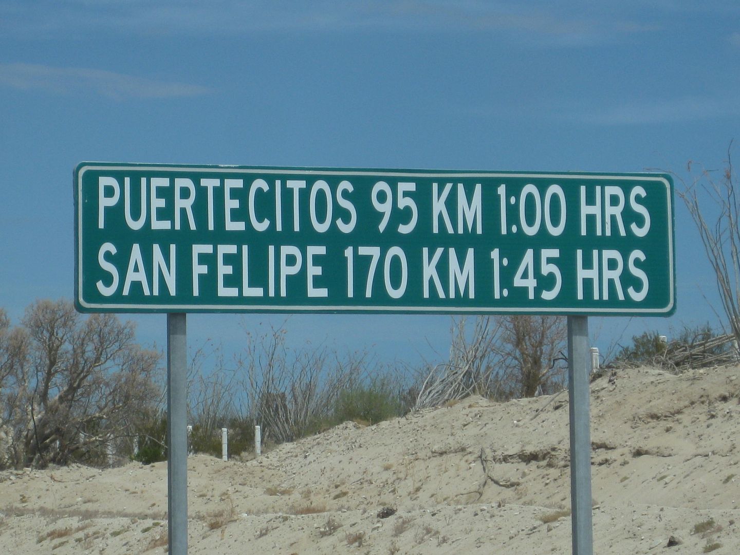
Km. 74.5 Puertecitos Road (Ocatcio's Playa Escondida access)
[Edited on 8-22-2018 by David K]
|
|
|
ehall
Super Nomad
Posts: 1906
Registered: 3-29-2014
Location: Buckeye, Az
Member Is Offline
Mood: It's 5 o'clock somewhere
|
|
Lots more great info. Thanks. Glad you got to see Laguna Hanson with water in it.
|
|
|
David K
Honored Nomad
Posts: 64480
Registered: 8-30-2002
Location: San Diego County
Member Is Offline
Mood: Have Baja Fever
|
|
I think there was more water in all the road puddles than in the lake! 
|
|
|
thebajarunner
Ultra Nomad
Posts: 3687
Registered: 9-8-2003
Location: Arizona....."Free at last from crumbling Cali
Member Is Offline
Mood: muy amable
|
|
Great Photos/ Excellent work as always
Thanks as always for the great photos and descriptions.
Been on all of those roads, most of them in the past year
Always enjoy the detail and quality of your reports
As to your critics
"Illegitimi non Carborundum"
Which loosely translates "Don't let the Ba$tards$ grind you down"
|
|
|
David K
Honored Nomad
Posts: 64480
Registered: 8-30-2002
Location: San Diego County
Member Is Offline
Mood: Have Baja Fever
|
|
Thank you, Dick.
They have tried to upset me for 18 years and I still know that folks like you enjoy tripping in Baja the way I do and report back.
I am seeing a lot of posts on Facebook about Danny Thompson's speed run. Pretty cool he is following his father so closely, so late in his life!
|
|
|
bajaric
Senior Nomad
Posts: 602
Registered: 2-2-2015
Member Is Offline
|
|
Nice report. I got rained on the Sierra Juarez a couple weeks ago. The rain there seems to run off quickly and the decomposed granite soil does not
grow very much grass even if it rains, its tough being a cow there. I think you should invest in a cargo net and an EZ up. The cargo net secures
stuff and discourages pilferage by thirsty roadside ratones and also you would have some shade.
|
|
|
David K
Honored Nomad
Posts: 64480
Registered: 8-30-2002
Location: San Diego County
Member Is Offline
Mood: Have Baja Fever
|
|
| Quote: Originally posted by bajaric | | Nice report. I got rained on the Sierra Juarez a couple weeks ago. The rain there seems to run off quickly and the decomposed granite soil does not
grow very much grass even if it rains, its tough being a cow there. I think you should invest in a cargo net and an EZ up. The cargo net secures
stuff and discourages pilferage by thirsty roadside ratones and also you would have some shade. |
A camper is a nice idea, as even an Instant Tent and air mattress is a small hassle. The problem is I use my truck for work/ tools/ parts and while
2017 was a HUGE year with 8 trips and 12,000 miles in Baja for the Baja Bound Road Guide and Map, this year, only the one trip (so-far) and us getting
older and poorer (lol) the number of Baja vacations may not be very high. So, the idea of a camper shell on my bed was passed over. I have never had
anything stolen out of my truck bed... in Baja or here in the USA. Knock on wood!
|
|
|
David K
Honored Nomad
Posts: 64480
Registered: 8-30-2002
Location: San Diego County
Member Is Offline
Mood: Have Baja Fever
|
|
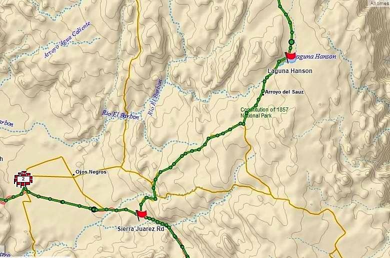
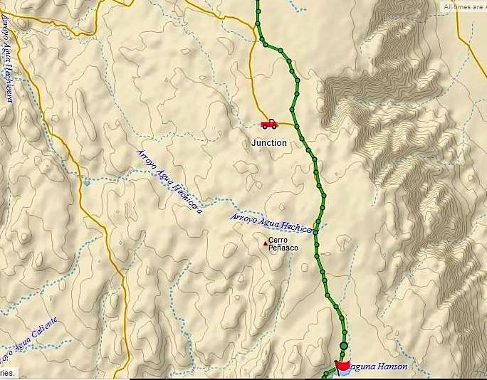
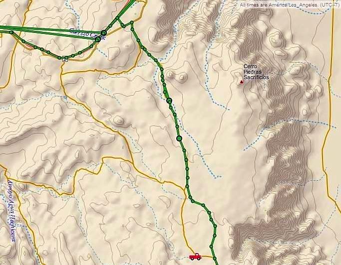
Here are my GPS TRACK maps for the Laguna Hanson road, going north from Hwy. 3 to Hwy. 2, La Rumorosa:
|
|
|
DouglasP
Nomad
Posts: 320
Registered: 6-23-2018
Member Is Offline
Mood: Goat hunter.
|
|
Damn, dude.....
I will never sign up for ghey book, so this is helpful for me.
I like beer, better than most people.
|
|
|
JZ
Elite Nomad
Posts: 9233
Registered: 10-3-2003
Member Is Offline
|
|
Facebook is horrible. Beyond horrible.
|
|
|
blackwolfmt
Senior Nomad
Posts: 802
Registered: 1-18-2014
Location: On The Beach With A Blackwolf
Member Is Offline
Mood: dreamin of Riden out a hurricane in Baja
|
|
DK, I dont always agree with ur opinions on certain subjects, But gotta say your pics maps ect.. of SOB are a WEALTH of info and very enjoyable too
look at and read, thanks for the grt work
So understand dont waste your time always searching for those wasted years
face up and make your stand and realize that your living in the golden years
|
|
|
David K
Honored Nomad
Posts: 64480
Registered: 8-30-2002
Location: San Diego County
Member Is Offline
Mood: Have Baja Fever
|
|
Thank you. It seems to be what I was born to, travel Baja and document my trips!
I still have all the pages of notes from our July 1973 trip to Loreto and the Baja highway was still nearly 200 miles from being done and maybe 75
miles on the old main road (Agua Dulce to Laguna Chapala) where the dozers hadn't even plowed the route yet. They built that final nearly 300 miles
(San Quintin to San Ignacio) all in 1973. Four years for just 20 final miles of Hwy. 5, still not done!
|
|
|
| Pages:
1
2
3
4 |


