| Pages:
1
2
3
..
5 |
TMW
Select Nomad

Posts: 10659
Registered: 9-1-2003
Location: Bakersfield, CA
Member Is Offline
|
|
Mulege to San Isidro Trail
Has anyone been on it to see if the road between Mulege and San Isidro is open to vehicles? How bad is the rock slide or whatever is blocking the
trail?
|
|
|
David K
Honored Nomad
Posts: 64478
Registered: 8-30-2002
Location: San Diego County
Member Is Offline
Mood: Have Baja Fever
|
|
Tom, did you catch the video of the surfers in a Tacoma doing that road, and manually moving rocks to get through? They did not know where they were,
but it was that road and it was a really good video.
|
|
|
AKgringo
Elite Nomad
Posts: 5805
Registered: 9-20-2014
Location: Anchorage, AK (no mas!)
Member Is Offline
Mood: Retireded
|
|
I have never tried to find that road, but I would like to! If you are looking for another vehicle to join the quest, what is your time frame?
I am still in Alaska, but plan on heading south in a couple of weeks. The rain squall that passed through today left the peaks above Anchorage white!
If you are not living on the edge, you are taking up too much space!
"Could do better if he tried!" Report card comments from most of my grade school teachers. Sadly, still true!
|
|
|
John M
Super Nomad
Posts: 1906
Registered: 9-3-2003
Location: California High Desert
Member Is Offline
|
|
Tacoma
David- I watched the video but did not catch the date it was made. There was much more greenery in the video than when we drove it a couple of years
ago. Bet TW knows the dates of our crossing.
I recognized parts from the video, particularly the steep switchbacks. Other parts of the video made me wonder if it is the same route as we did.
It is also referred to as the Guajademi road - or something very similar. A few years ago some folks from Mulege provided us with good info on whether
or not is was doable in a 4x4.
John M
|
|
|
AKgringo
Elite Nomad
Posts: 5805
Registered: 9-20-2014
Location: Anchorage, AK (no mas!)
Member Is Offline
Mood: Retireded
|
|
I remember watching the video quite a few months ago, but I can't think of what forum or key words to search for it would be.
The impression I had of what I remember viewing, is that the video was originally posted somewhere else, and was several years old. If I am correct,
there have been a couple of flash flood events since they made their run.
Wish I could figure out where to find it!
If you are not living on the edge, you are taking up too much space!
"Could do better if he tried!" Report card comments from most of my grade school teachers. Sadly, still true!
|
|
|
John M
Super Nomad
Posts: 1906
Registered: 9-3-2003
Location: California High Desert
Member Is Offline
|
|
Along for the fun
4X4ABC was along on our trip - I'll try to figure out when it was (April 2016) in the event the other video shows up - we can compare dates.
edited to add the correct date of our adventure.
John M
[Edited on 9-25-2018 by John M]
|
|
|
David K
Honored Nomad
Posts: 64478
Registered: 8-30-2002
Location: San Diego County
Member Is Offline
Mood: Have Baja Fever
|
|
Here is the video:
https://vimeo.com/146502907
AK, I searched "Isidro" and found it here: http://forums.bajanomad.com/viewthread.php?tid=90108
|
|
|
John M
Super Nomad
Posts: 1906
Registered: 9-3-2003
Location: California High Desert
Member Is Offline
|
|
Most recent posting?
On April 18 2018 willy Airstream (from Mulege) posted this, referring to the video:
Looks like they put a few extra miles on top of the mountain, but otherwise, it is the same route. In Feb 2014 it was not as overgrown, but the rocks
and steep drop offs and "where is the road" are the same. Local word is it is not passable now, but it always fun trying! Some fotos here
https://www.facebook.com/zgdesign/media_set?set=a.1015203606...
|
|
|
willyAirstream
Super Nomad
Posts: 1786
Registered: 1-1-2010
Member Is Offline
|
|
no recent news on the route to San Isidro, but....
Off topic, but of interest, I am sure. Folks in San Jose de Mag say the route to Guadalupe is now open, even graded. We are planning a trip Oct 6th
and I will post.
|
|
|
David K
Honored Nomad
Posts: 64478
Registered: 8-30-2002
Location: San Diego County
Member Is Offline
Mood: Have Baja Fever
|
|
Quote: Originally posted by willyAirstream  | no recent news on the route to San Isidro, but....
Off topic, but of interest, I am sure. Folks in San Jose de Mag say the route to Guadalupe is now open, even graded. We are planning a trip Oct 6th
and I will post. |
Well, that would be major! I went from the mission on that road and in less than two miles was washed out by an arroyo gully. I know a bit further
east, where it goes down the mountain, it was totally obliterated. Please keep us informed. This will be good news to the ranchers in the mission
valley and maybe will lead back to some restoration of the site?
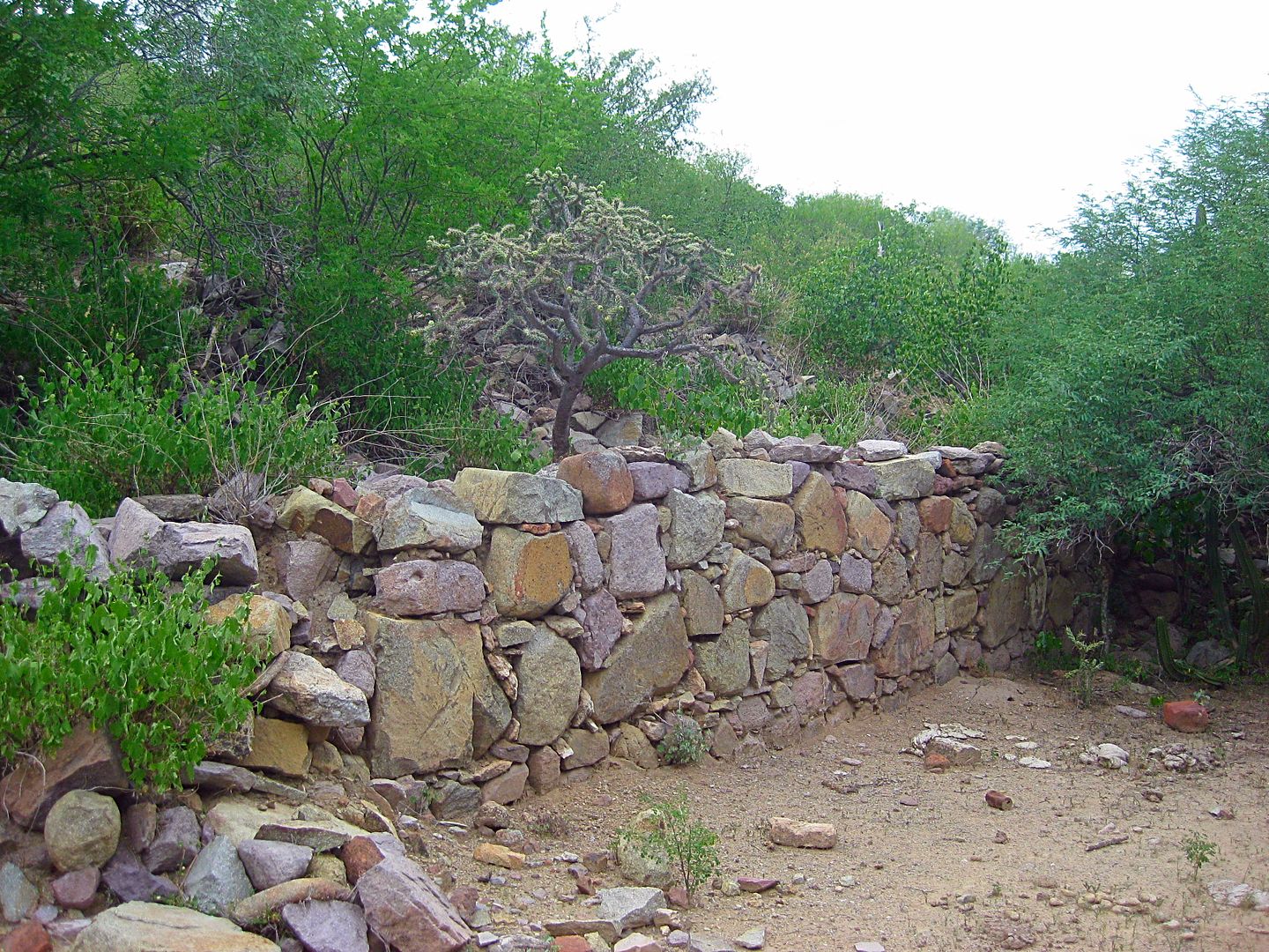
The mission church's west wall from the 1750s. This is west and uphill from the cinder block building in the clearing.
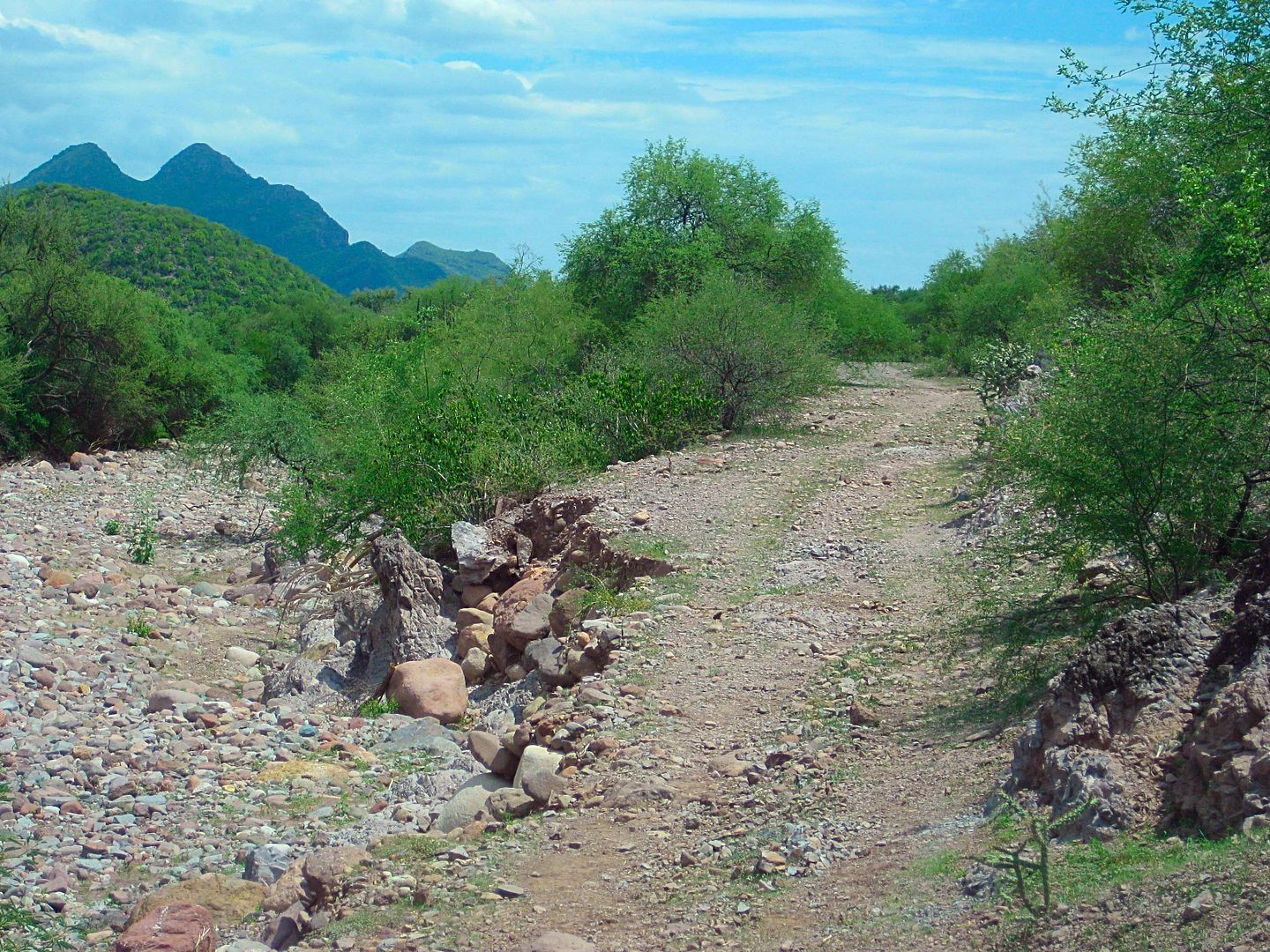
The first erosion on the road towards San José de Magdalena. The second washout beyond this one was complete, I had to turn around.
|
|
|
KurtG
Super Nomad
Posts: 1201
Registered: 1-27-2004
Location: California Central Coast
Member Is Offline
Mood: Press On Regardless!!
|
|
| Quote: Originally posted by willyAirstream | no recent news on the route to San Isidro, but....
Off topic, but of interest, I am sure. Folks in San Jose de Mag say the route to Guadalupe is now open, even graded. We are planning a trip Oct 6th
and I will post. |
That is great news. That has been a favorite day trip out of Mulege for many years.
|
|
|
TMW
Select Nomad
Posts: 10659
Registered: 9-1-2003
Location: Bakersfield, CA
Member Is Offline
|
|
John we did the route in April 2016, here is my trip report.
Some do refer to it as the Guajademi trail.
http://forums.bajanomad.com/viewthread.php?tid=83006
|
|
|
David K
Honored Nomad
Posts: 64478
Registered: 8-30-2002
Location: San Diego County
Member Is Offline
Mood: Have Baja Fever
|
|
While Guadajemi is off in another canyon, the trail past it to Mulegé was one of the routes of El Camino Real... Just for mules, not autos! Your auto
road forks to the west then north to Mulegé.
[Edited on 9-25-2018 by David K]
|
|
|
TMW
Select Nomad
Posts: 10659
Registered: 9-1-2003
Location: Bakersfield, CA
Member Is Offline
|
|
The video says it was from 3 years ago. I did the trail in April 2013 and April 2016 and I don't remember that much green in the road. But who knows
it could be the the same trail.
|
|
|
LaTijereta
Super Nomad
Posts: 1192
Registered: 8-27-2003
Location: Loreto
Member Is Offline
|
|
It’s open.. done earlier this year on UTVs out of Loreto...
Democracy is like two wolves and a lamb voting on what to have for lunch. Liberty is a well-armed lamb contesting the vote.
Ben Franklin (1759)
|
|
|
David K
Honored Nomad
Posts: 64478
Registered: 8-30-2002
Location: San Diego County
Member Is Offline
Mood: Have Baja Fever
|
|
Hi Kris... what was the road surface condition? Would it be okay for 2WD vehicles, in your opinion?
|
|
|
advrider
Super Nomad
Posts: 1847
Registered: 10-2-2015
Member Is Offline
|
|
Anyone have a set of tracks they can share? I would love to check that out on y moto this year?
|
|
|
David K
Honored Nomad
Posts: 64478
Registered: 8-30-2002
Location: San Diego County
Member Is Offline
Mood: Have Baja Fever
|
|
I actually put the road on my 2018 map, but when I showed it here to you guys I got lots of feedback that the road was gone, not passable, etc. Not
wanting to put anyone in danger, I erased over the center of the mountain part of it! LOL
|
|
|
advrider
Super Nomad
Posts: 1847
Registered: 10-2-2015
Member Is Offline
|
|
Thanks that helps. We went that way a couple of years ago but missed a turn and ended up in Loreto, still a fun ride....
|
|
|
KurtG
Super Nomad
Posts: 1201
Registered: 1-27-2004
Location: California Central Coast
Member Is Offline
Mood: Press On Regardless!!
|
|
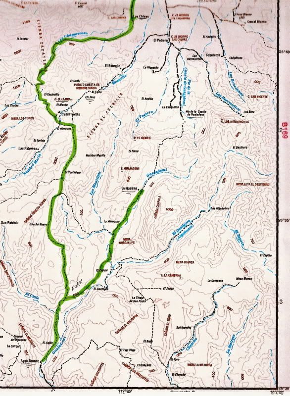
Here is my report from March 2012:
Trip Report/road log San Isidro-Mulege Mountain Route 3/22/2012
For reference our vehicle is a 2000 Explorer stock Bauer Ed. with 255/70/16 Michelin street tires run at about 22#.
The report is a mileage log and includes GPS data and elevation for key points. The log is as accurate as Garmin and Ford's odometer could provide.
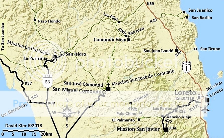
Mile Zero is starting North from San Isidro at 26.12.866x112.01.577.
Excellent road to Purisima Vieja at mile 12.3 then to Paso Hondo at mile 15.4. Both are oasis villages with some great scenery.
Mile 17.8-Springs and ponds on left.
Mile 18.3-Small village.
Mile 21.2-water crossing/palms and on to Buenos Aires at mile 25.9.
Mile 29.1-Agua Grande
Mile 32.2. 26.32.962x112.06.834. Elev.2100. Sign: El Llano straight, Guajadami to the right. Go straight.
From here the road is steep and rocky with a lot of erosion. Low range used to the top of high plateau at Mile 36.7. Elev. 3350 at
26.35.899x112.07.222.
Mile 37. Incredible views of deep gorge on right. Continue to climb to:
Mile 39.1. 26.37.146x112.06.743. Elev. 3765. High point overlooking the broad expanse of El Llano below. This is where the road ended when I
attempted this route some 15 years ago. The descending cuesta was the most difficult of the entire trip. Steep, sometimes narrow and off camber and
rough eroded rock with lots of loose stuff. This is an area to use extreme caution. We crept down in low range, 1st gear to arrive in the flats of
El Llano at:
Mile 40.6. 26.37.786x112.07.153. Elev. 2616. At this point we met a rancher with a Ford F350 4wd and a cattle rack who had 3-4 cattle loaded. We
told him we were going to Mulege and he said he was as well. That gave us a better feeling about actually completing the trip since I didn’t feel
we could climb back up that previous cuesta or at least really didn’t want to attempt it. He confirmed that that plateau is El Llano. As we
started up the next grade we saw him starting behind us. A rough ride for those cows! The road continues up and down a bit before a gate at the top
of the final cuesta at:
Mile 43.1. 26.39.029x112.08.07. Elev. 3429. Now down the cuesta, steep and rough but not nearly as bad as the earlier one. There has been traffic
up and down this area since we were on it and turned back a few months ago. I think we could now go up this one ok.
Mile 46.2. 26.40.320x112.07.130. elev. 1346. This position is right by the ranch at the bottom of the cuesta. Rancho El Llanito. It is relatively
new. This is the important coordinate for anyone doing this trip north to south since it is not shown on the maps and in my experience the Baja Atlas
and other maps are only an approximation of the roads in this area. From this point you are on the road that goes straight to Mulege. There are
occasional roads that come in from both side notably at Mile 50.8 which has a sign pointing back to Rcho El Llanito. I believe the other fork here
leads to the area of El Potrero and El Batiqui and Pia de la Cuesta Guajadami. I have motorcycled in that area but not since the hurricanes changed
some of the roads a few years ago. Note that I have not called this the Guajadami Road since it splits off from the old mission route and is
generally to the west of it. Continue straight into Mulege arriving at Hwy 1 (icehouse road junction) at MILE 67.3. This trip took about 6 hours so
an average speed of about 10 mph. Thanks to Mulegena for the trip report on Baja Nomads that inspired us to do this trip. The scenery was wonderful
although I would still rank the San Juan de la Pila road as the slightly more spectacular but I am really splitting hairs on that call. Do them both
and tell me what you think!
Kurt and Kathy, March 22, 2012
|
|
|
| Pages:
1
2
3
..
5 |


