| Pages:
1
2
3 |
StuckSucks
Super Nomad

Posts: 2306
Registered: 10-17-2013
Member Is Offline
|
|
San Francisquito, Google top, Mapbox bottom. I just realized I'm lucky to be grandfathered with Google Maps.
|
|
|
JZ
Elite Nomad
Posts: 9230
Registered: 10-3-2003
Member Is Offline
|
|
Mapbox looks pretty good. This is the closest I can get on BCN. Pier behind Beto's place at San Francisquito.
[Edited on 10-18-2018 by JZ]
|
|
|
willyAirstream
Super Nomad
Posts: 1786
Registered: 1-1-2010
Member Is Offline
|
|
David K are you reading this thread? Are your newly made maps scalable vector images ?
|
|
|
David K
Honored Nomad
Posts: 64479
Registered: 8-30-2002
Location: San Diego County
Member Is Offline
Mood: Have Baja Fever
|
|
Hi Richard,
I have glanced at it, yes. I will be replacing my phone soon (it is really old, at 3 years, or so)! I would like to try these Gaia downloads if I get
back to Baja much. I did so many miles the past two years, like when I met you at La Purísima in February 2017, I think it was?
I do not know what a "vector image" is, so maybe they are or not?
I will seek your help soon to do that mission cataloging thing on Facebook. Still busy with my recent move much of the day.
|
|
|
willyAirstream
Super Nomad
Posts: 1786
Registered: 1-1-2010
Member Is Offline
|
|
David, are your maps saved as jpg, tiff or PNG? Or saved out as svg. or dxf or?
What program are you using to make the maps?
|
|
|
David K
Honored Nomad
Posts: 64479
Registered: 8-30-2002
Location: San Diego County
Member Is Offline
Mood: Have Baja Fever
|
|
Jpg.
Word.
Thanks!
[Edited on 10-19-2018 by David K]
|
|
|
willyAirstream
Super Nomad
Posts: 1786
Registered: 1-1-2010
Member Is Offline
|
|
too bad, they will not be able to be imported. Using Word for graphics??? Try a program designed to make maps , vector maps.
|
|
|
David K
Honored Nomad
Posts: 64479
Registered: 8-30-2002
Location: San Diego County
Member Is Offline
Mood: Have Baja Fever
|
|
It is a multi-step process and Word is just one of the steps (where I get the lines for the roads, text for place names). The base maps (terrain,
coastline, and just federal highways) is from an Internet map source (ArcGIS). It is one that allows you to flip from terrain map to satellite images.
That is how I am able to correctly show roads I have traveled or mentioned in my guide. I draw the line for a road right over the road as seen from
space. Then I flip to the terrain map to use.
Basically, I had to invent my own method to make maps to show only the things I wanted to show, Google and other maps have wrong names for places in
Baja way too often. I didn't want a map so cluttered with data beyond what is needed to show the roads in my guide that it would be too busy to easily
use. I hope to someday see or help make a new Baja Almanac which would show everything.
What is a program to make maps or vector maps (link please)?
|
|
|
willyAirstream
Super Nomad
Posts: 1786
Registered: 1-1-2010
Member Is Offline
|
|
https://goo.gl/1bxQWZ
|
|
|
StuckSucks
Super Nomad
Posts: 2306
Registered: 10-17-2013
Member Is Offline
|
|
It appears exporting from Word to an appropriate format could be a challenge, no?
|
|
|
David K
Honored Nomad
Posts: 64479
Registered: 8-30-2002
Location: San Diego County
Member Is Offline
Mood: Have Baja Fever
|
|
That goes to a Google search page.
If you have done this I would like the link to the one you use and that way we are on the same page to get you what you want.
|
|
|
willyAirstream
Super Nomad
Posts: 1786
Registered: 1-1-2010
Member Is Offline
|
|
i use inkscape for vector graphics it is free - open source.
you will need the search page to get familiar with the basics, before you begin
|
|
|
David K
Honored Nomad
Posts: 64479
Registered: 8-30-2002
Location: San Diego County
Member Is Offline
Mood: Have Baja Fever
|
|
Quote: Originally posted by willyAirstream  | i use inkscape for vector graphics it is free - open source.
you will need the search page to get familiar with the basics, before you begin |
From the link you gave me, I looked at three pages and saw no "inkscape" listed. I certainly may have missed it, I am feeling old! I am trying to help
Richard... but I have a few other things going on so a link (or more) that you use would do wonders.
|
|
|
mtgoat666
Select Nomad
Posts: 17295
Registered: 9-16-2006
Location: San Diego
Member Is Offline
Mood: Hot n spicy
|
|
| Quote: Originally posted by David K |
It is a multi-step process and Word is just one of the steps (where I get the lines for the roads, text for place names). The base maps (terrain,
coastline, and just federal highways) is from an Internet map source (ArcGIS). It is one that allows you to flip from terrain map to satellite images.
That is how I am able to correctly show roads I have traveled or mentioned in my guide. I draw the line for a road right over the road as seen from
space. Then I flip to the terrain map to use.
Basically, I had to invent my own method to make maps to show only the things I wanted to show, Google and other maps have wrong names for places in
Baja way too often. I didn't want a map so cluttered with data beyond what is needed to show the roads in my guide that it would be too busy to easily
use. I hope to someday see or help make a new Baja Almanac which would show everything.
What is a program to make maps or vector maps (link please)? |
Don’t use Word!
Use ESRI ArcGIS. It’s expensive, but you can use the student version for cheap.
Woke!
“...ask not what your country can do for you – ask what you can do for your country.” “My fellow citizens of the world: ask not what America
will do for you, but what together we can do for the freedom of man.”
Prefered gender pronoun: the royal we
|
|
|
willyAirstream
Super Nomad
Posts: 1786
Registered: 1-1-2010
Member Is Offline
|
|
google inkscape gives you this link
https://inkscape.org/release/0.92.3/
Inkscape is only good to copy bitmap images and add text and routes etc all in vector. It is not a true map builder. ( but way better than Word
) Start with the link above and goats link and begin your research.
for printing you will need a non compressed file type like tiff or pdf at 300dpi or a vector image. So building a map in vector format solves both.
|
|
|
David K
Honored Nomad
Posts: 64479
Registered: 8-30-2002
Location: San Diego County
Member Is Offline
Mood: Have Baja Fever
|
|
Again, Word is used only for text and lines. It was one of several steps I discovered how to make a map that showed what I wanted to show.
I thought I showed everyone here how I made my maps last year?
In any case, thanks for the link.
|
|
|
unbob
Nomad
Posts: 407
Registered: 8-7-2006
Member Is Offline
|
|
| Quote: Originally posted by Goyo | | There's a discount for a multiple year subscription. I paid $60 for 5 years which seems like a bargain. |
$48
for 5 years - https://www.gaiagps.com/adventure_alan/
"I'm too young to be this old!"
|
|
|
unbob
Nomad
Posts: 407
Registered: 8-7-2006
Member Is Offline
|
|
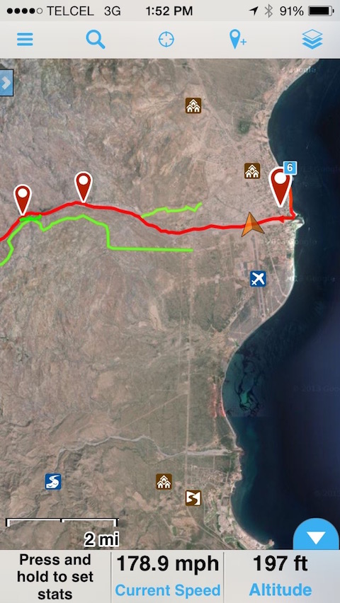
| Quote: Originally posted by StuckSucks | You'll be happy with Gaia. Here is an example output of tracking (easy to overlay course on a map):
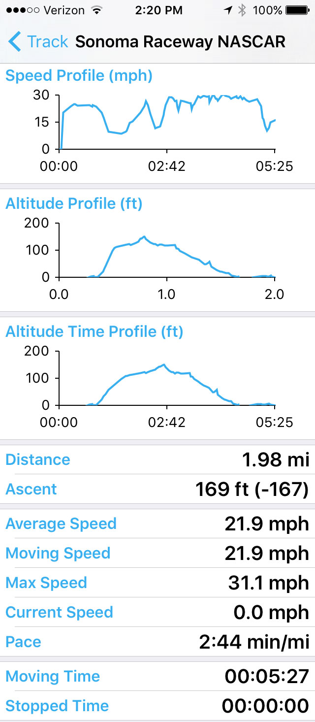
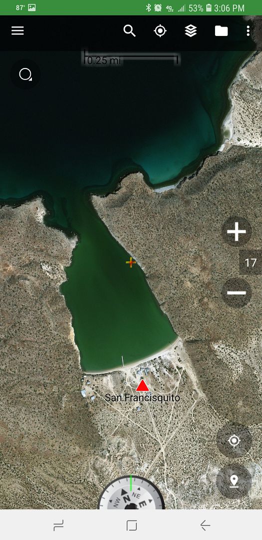
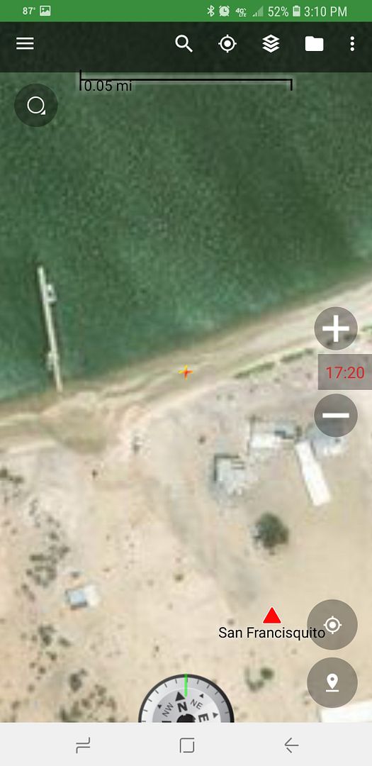
Here is what an older version of the app looks like. I imported the Baja Sur 500 course (red) and chase roads (green) into Gaia which I use along side
my truck's built-in Lowrance GPS. Of course you can zoom way the hell in to see real detail. The gold triangle is your current location (I was flying
out of Loreto at the time of the screenshot).
|
Where is "Elapsed Time" or "Record Duration" ???
"I'm too young to be this old!"
|
|
|
StuckSucks
Super Nomad
Posts: 2306
Registered: 10-17-2013
Member Is Offline
|
|
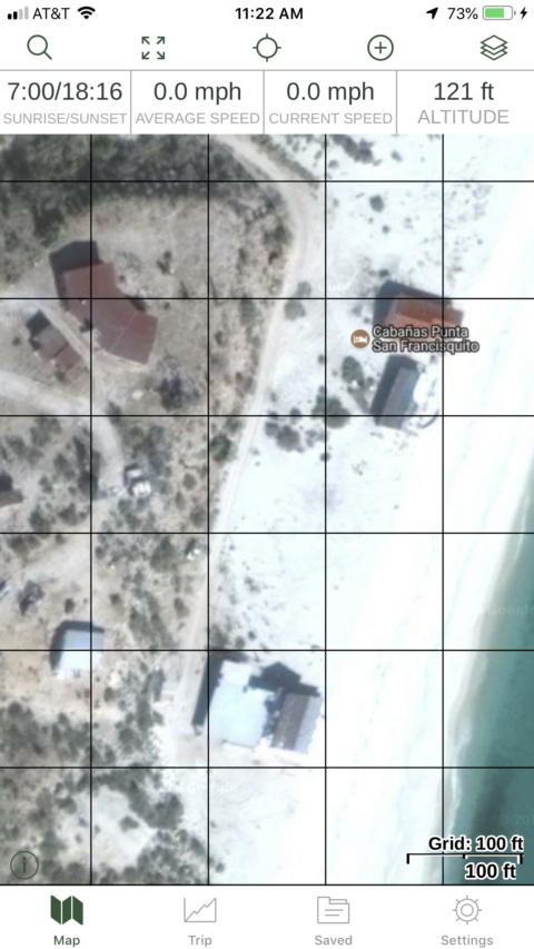
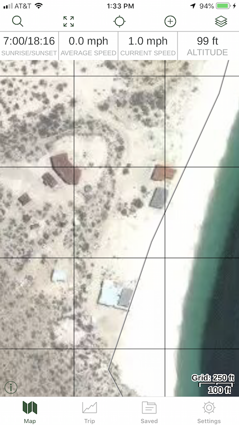
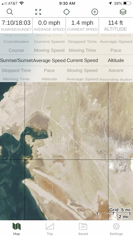
Look at the bottom of the screen where it says "press and hold, and current speed and altitude." Those are all selectable with about a dozen or more
flavors of data to display. On the newer version of the app, they are at the top:
|
|
|
Goyo
Junior Nomad
Posts: 39
Registered: 1-2-2015
Member Is Offline
|
|
Thanks everyone for posting all the screen shots! Looks great.
|
|
|
| Pages:
1
2
3 |


