| Pages:
1
2 |
gueribo
Nomad
 
Posts: 464
Registered: 10-16-2014
Member Is Offline
|
|
Gueribo Trip Report #2: San Bruno Ruins
Next we sought the ruins of San Bruno, a mission-era fort near the Bay of San Bruno.
In Baja, one connection leads to another. We began by contacting Necky, a guide with a particular interest in mission history. He was very excited
about the idea of going to San Bruno, as he’d never been there before. His dream is to visit all the Baja missions, and hopefully the missions in
the U.S.
The ruins of San Bruno are on private property, and are a protected historic site. Necky suggested we stop by the Loreto Mission Museum and ask who we
should contact about getting permission. After a few phone calls, we had our permissions and were all set to go. Necky recommended that we ask
Rodolfo, another guide and mission historian, to accompany us, as he had been to the site before.
We headed north, turning off at the now-abandoned military checkpoint. Rodolfo said it’s been a fruitless effort, so the checkpoint is no longer
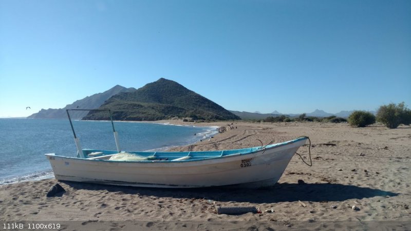
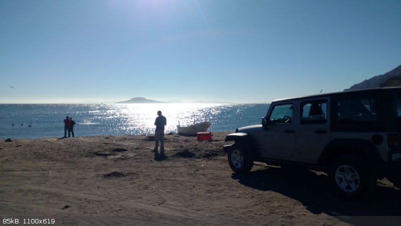
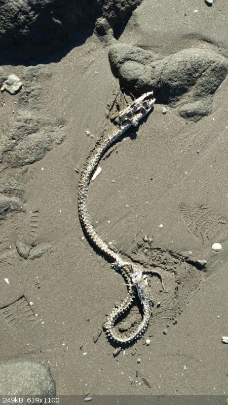
manned. We continued toward the coast to first visit the Bay of San Bruno. It’s a stunning little bay, well-worth visiting. We spent some time
enjoying the beauty and combing the vacant fish camp. There’s also a very pretty estuary nearby, with mangroves. The bay itself was the landing site
of the Atondo-Kino expedition in the late 1600s, following a failed attempt at a settlement in La Paz.
[Edited on 1-29-2019 by gueribo]
|
|
|
gueribo
Nomad
 
Posts: 464
Registered: 10-16-2014
Member Is Offline
|
|
The estuary:

|
|
|
gueribo
Nomad
 
Posts: 464
Registered: 10-16-2014
Member Is Offline
|
|
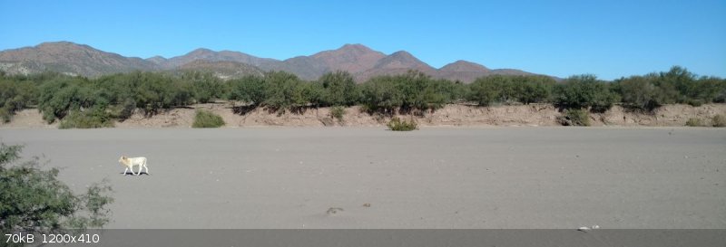
In order to reach the ruins of the fort, we needed to cross the arroyo of San Juan Londó. This is the same arroyo that leads to the ruins of the
Londó visita. We weren’t the only ones making the crossing.
|
|
|
gueribo
Nomad
 
Posts: 464
Registered: 10-16-2014
Member Is Offline
|
|
On the other side we followed the dirt road, winding among the bufa (bunchgrass), matacora, torote, copal, frutilla, mesquite, and pino salado (salt
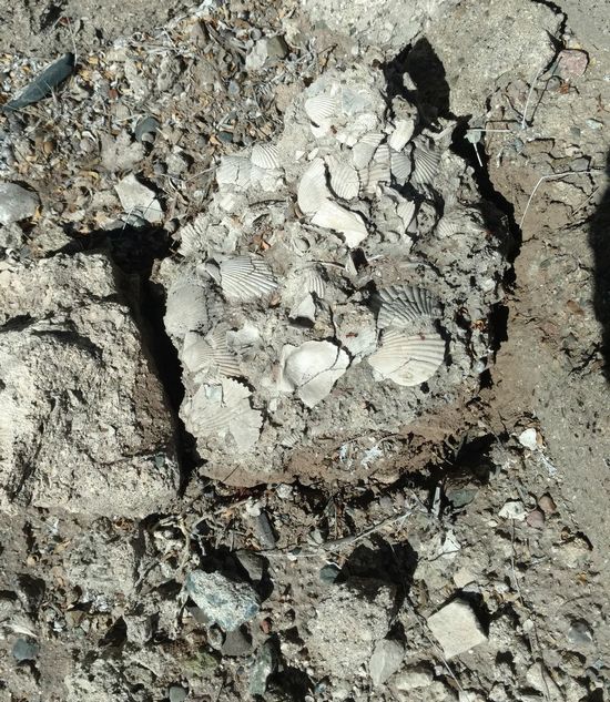
cedar, an invasive species). As we neared the site, a distinctive whitish hill loomed closer. The soil here is marine sediment—full of shells, and
ideal for burning to make “cal” for mortaring stones together to build a structure.
|
|
|
gueribo
Nomad
 
Posts: 464
Registered: 10-16-2014
Member Is Offline
|
|
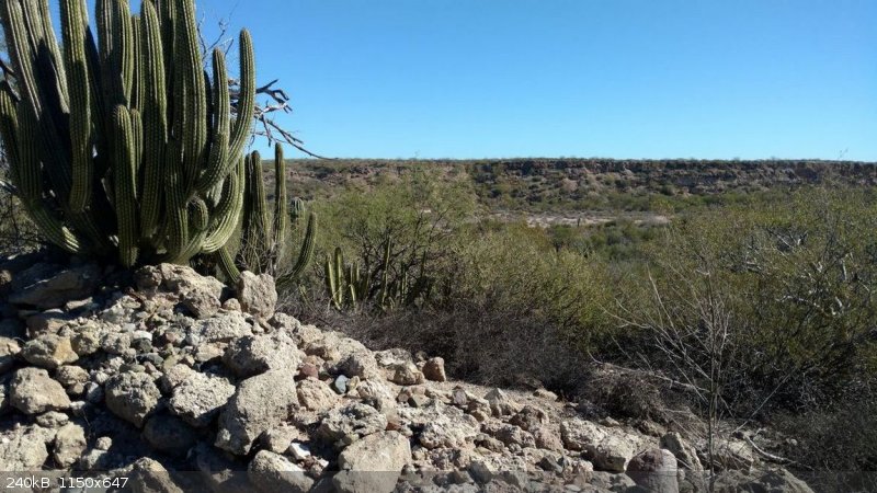
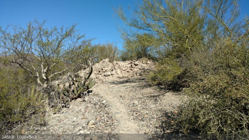
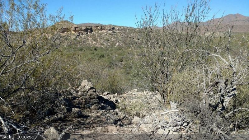
The fort is reduced to a mere foundation now. Rodolfo said that in the 1940s, a guy from town came and hauled off all the square worked stones to
build his house. Today, all that’s left is the rubble of the foundation.
|
|
|
gueribo
Nomad
 
Posts: 464
Registered: 10-16-2014
Member Is Offline
|
|
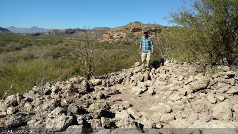
From the ruins looking southwest, you can see the landmark hill El Pilón de Las Parras (the conical hill visible from Loreto and the road to Mission
San Javier). Looking southeast, you can see Isla Coronados, one of the islands off the coast of Loreto. The photo below is looking northwest. Here’s
Necky at the ruins:
[Edited on 1-27-2019 by gueribo]
|
|
|
gueribo
Nomad
 
Posts: 464
Registered: 10-16-2014
Member Is Offline
|
|
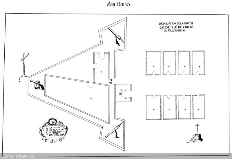
The original plan included a fort, soldiers’ quarters, and a chapel. The chapel and soldiers’ quarters were never built; Rodolfo said he visited
the site with a team of archaeologists who never found any additional ruins. This was a short-lived venture, and it’s likely that the fort became
storage or an overnight camp. Clearly visible, though, are the three lookout piles that form the points of the triangular structure in the plan below
(copied from Ed Vernon’s book, Las Misiones Antiguas):
|
|
|
gueribo
Nomad
 
Posts: 464
Registered: 10-16-2014
Member Is Offline
|
|
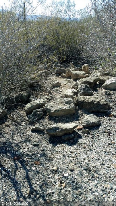
Below the site, I found what Rodolfo suspected might be a grave. It was a small pile of stones, two of them worked into squares. He said he would
inquire of the archaeologists to see if they found it too, and what they thought. The ground around the site is littered with small glazed ceramic
shards, likely from plates and cups. Rodolfo said it’s a particular kind of pottery called Mayolica, made by the Mayo family in Puebla.
Once there was a grand development scheme at San Bruno Bay. Developers were planning a community bigger than Loreto, with hopes of selling hundreds of
expensive homes—until the U.S. economy crashed and funding was lost.
Now, the gobernadora bushes are re-taking the space. According to one legend, a native woman presented some Spanish ladies with a large tortoise shell
filled with tuna fruits (from cholla), garnished with bunches of this local plant. Because of this gift, the Spaniards called the native woman “la
gobernadora,” and the plant was known ever after as “la hierba de la gobernadora.”
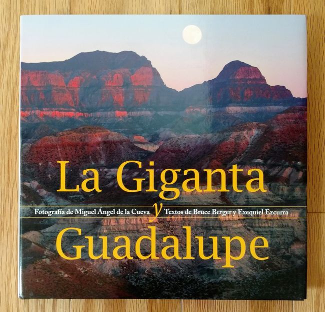
Back in town, Rodolfo presented me with a copy of a book, “La Giganta y Guadalupe,” a compilation of stunning photography and essays promoting the
preservation and conservation of these beautiful mountains. I was humbled by his lovely gift. I’ve been deeply blessed by the generous people of
Baja, who open their homes and hearts to travelers, sojourners, and strangers.
|
|
|
gueribo
Nomad
 
Posts: 464
Registered: 10-16-2014
Member Is Offline
|
|
Later I met Graham Mackintosh in town for coffee, and he spoke of his memories of El Bule and Rancho Viejo. He’s working on a new writing
project—a kayak journey. Can’t wait to read it.
Tomorrow—the ruins of Londó.
One more photo of San Bruno Bay and the fish camp:
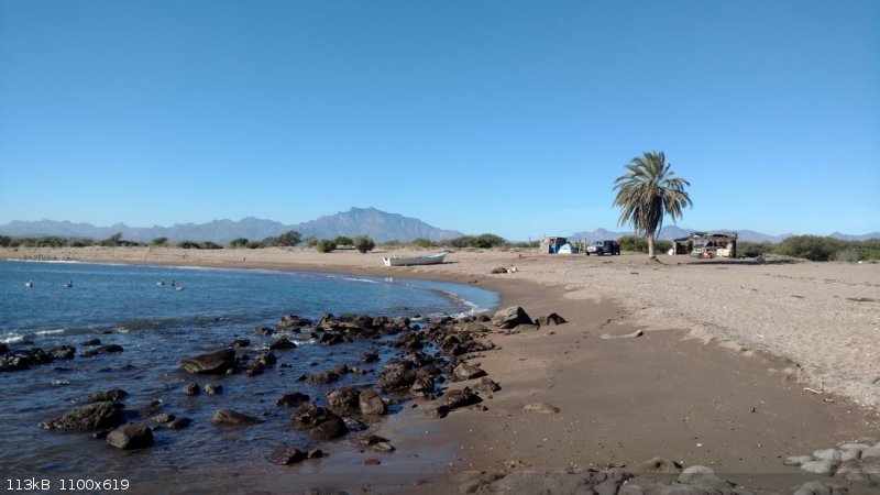
[Edited on 1-27-2019 by gueribo]
|
|
|
gueribo
Nomad
 
Posts: 464
Registered: 10-16-2014
Member Is Offline
|
|
And the view from the ruins toward the gulf:
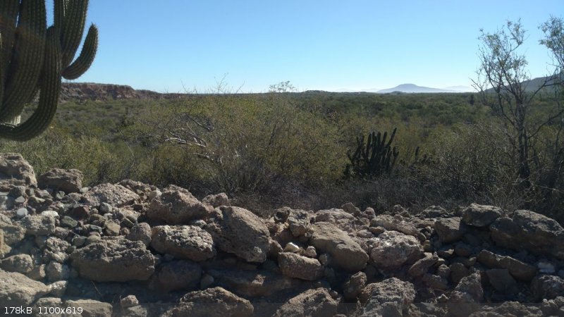
|
|
|
David K
Honored Nomad
        
Posts: 65243
Registered: 8-30-2002
Location: San Diego County
Member Is Offline
Mood: Have Baja Fever
|
|
Thank you for sharing. San Bruno is the oldest European ruin in California... 1683-1685.
Kino aquired the knowledge from the failures at La Paz and San Bruno that would help Loreto succeed in 1697.
|
|
|
fishbuck
Banned
Posts: 5318
Registered: 8-31-2006
Member Is Offline
|
|
Awesome.
"A ship in harbor is safe, but that is not what ships are built for." J. A. Shedd.
A clever person solves a problem. A wise person avoids it. – Albert Einstein
"Life's a Beach... and then you Fly!" Fishbuck
|
|
|
advrider
Super Nomad
   
Posts: 1898
Registered: 10-2-2015
Member Is Offline
|
|
WOW! What an adventure...
|
|
|
Bajaboy
Ultra Nomad
    
Posts: 4375
Registered: 10-9-2003
Location: Bahia Asuncion, BCS, Mexico
Member Is Offline
|
|
Good stuff...thanks for sharing.
|
|
|
Bubba
Senior Nomad
  
Posts: 957
Registered: 2-17-2009
Location: Pismo Beach, Ca.
Member Is Offline
|
|
Great report!
Making America Great Again
|
|
|
David K
Honored Nomad
        
Posts: 65243
Registered: 8-30-2002
Location: San Diego County
Member Is Offline
Mood: Have Baja Fever
|
|
The photo of San Bruno I have in my book was given to me by Ed Vernon (2002 author of Las Misiones Antiguas The Spanish Missions of Baja
California)...
Photo from Ed Vernon ca1999:
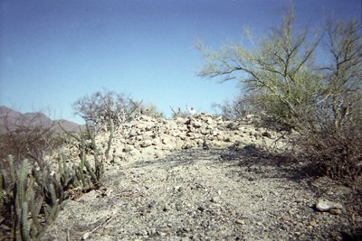
Photo from Gueribo January 2019:

San Bruno was established October 6, 1683, and abandoned May 8, 1685.

Photo from David K in May 2019
[Edited on 5-31-2019 by David K]
|
|
|
David K
Honored Nomad
        
Posts: 65243
Registered: 8-30-2002
Location: San Diego County
Member Is Offline
Mood: Have Baja Fever
|
|
I love comparing photos of the same place from several years apart.
|
|
|
gueribo
Nomad
 
Posts: 464
Registered: 10-16-2014
Member Is Offline
|
|
Me too, David. The ruins did appear largely unchanged. Rodolfo intends to return with a drone, for a better aerial view.
|
|
|
David K
Honored Nomad
        
Posts: 65243
Registered: 8-30-2002
Location: San Diego County
Member Is Offline
Mood: Have Baja Fever
|
|
I saw a drone video of it on one of the Mexican Facebook pages I visit but couldn't find it again... Hate that about Facebook, great data gets lost.
|
|
|
David K
Honored Nomad
        
Posts: 65243
Registered: 8-30-2002
Location: San Diego County
Member Is Offline
Mood: Have Baja Fever
|
|
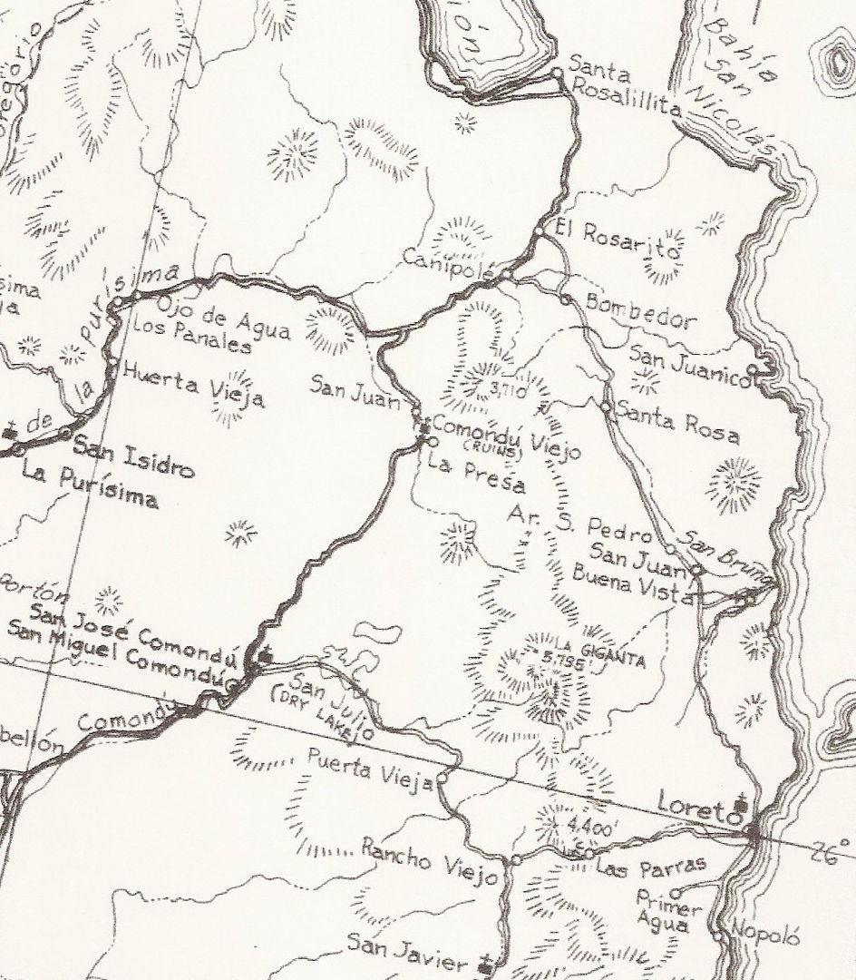
San Bruno is on this 1962 map, as a geographic feature, an arroyo. It is where the 1683-1685 colony was located. Gerhard & Gulick describe Londó
as the 1705 chapel and a ranch of the Kino-Atondo colony but San Bruno is not mentioned.
|
|
|
| Pages:
1
2 |

