| Pages:
1
2 |
David K
Honored Nomad

Posts: 64479
Registered: 8-30-2002
Location: San Diego County
Member Is Offline
Mood: Have Baja Fever
|
|
The Summit (part of the 1942 Pole Line Road) Prerunning San Felipe 250 Video
https://www.facebook.com/GlezRacingTeam/videos/2246059078775...
|
|
|
PaulW
Ultra Nomad
Posts: 3005
Registered: 5-21-2013
Member Is Offline
|
|
Missing. The new big bar lock gate which is now unlocked.
BTW, there are now 2 fence gates that are not locked. The big bar gate is between the two fence gates.
|
|
|
PaulW
Ultra Nomad
Posts: 3005
Registered: 5-21-2013
Member Is Offline
|
|
BTW, the last 5 pole Line runs have bypassed the summit. I for one will not use that summit route again for the Pole Line. Much better alternatives
are in use with no conflict.
I forget - do we have historic conclusive evidence which summit of the three possibilities was used in 1942? For a long time only the north or "race
summit" has been passable.
|
|
|
David K
Honored Nomad
Posts: 64479
Registered: 8-30-2002
Location: San Diego County
Member Is Offline
Mood: Have Baja Fever
|
|
The original summit is easy to figure unless you are wondering about very close-by detours and short cuts. The top of the summit is named "Portezuelo
de Jamau" the pass that was the main trail to the Colorado River from the missions of San Vicente and nearby Santa Catalina. Before the Spaniards used
it, it was an Indian route. In WWII, that same pass was used to run the telephone line from Ensenada to San Felipe and on to the Punta Diggs Radar
Base (actually at Punta Estrella which was named Punta Radar).
The road ran right up the valley to the pass (low point between the hills) then a switchback down to the desert floor at Arroyo el Saiz where it
crosses it and heads eastward to El Chinero then south to San Felipe.
In 1959 and 1960, Howard Gulick (travel author and cartographer for the Lower California Guidebook) logged the Pole Line road through Portezuelo de
Jamau. In 1959, he and his friends traveled west (from Hwy. 5) and in 1960, it looks like he traveled east on it. Howard's 35mm photographs are
preserved for future students of Baja-ology!
Here are 5 of his photos, west to east, both sides of the summit (Portezuelo de Jamau)... look closely and you can see the Pole line road in the
distance in some...
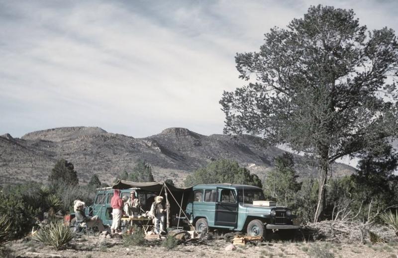
Camp on the west side of the summit... in the long valley.
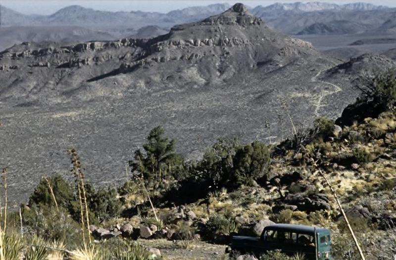
On the summit and see the Pole Line road in the distance that Ken Cook's tour has used (but not this year to avoid the gated farm at the bottom of the
grade).
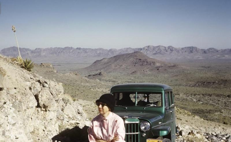
Rest stop climbing the grade from the desert side on the 1942 Pole Line Road. Now, Race Summit road (or an earlier Score route if detoured).
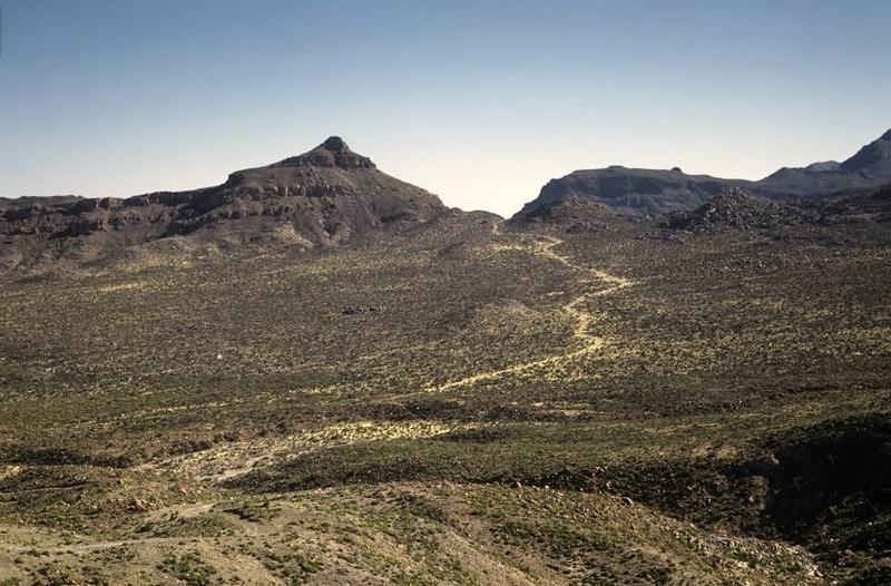
Partway down the summit looking at the Pole Line road heading east.
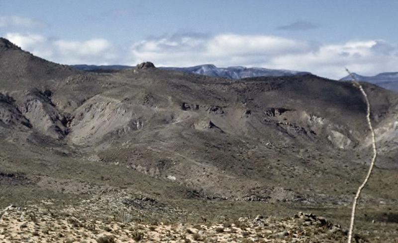
Paul, you will like this, looking west at the summit road from 1.5 miles east from the base. See the switch back grade and there even looks to be a
close-by detour way back in 1959/1960?
|
|
|
David K
Honored Nomad
Posts: 64479
Registered: 8-30-2002
Location: San Diego County
Member Is Offline
Mood: Have Baja Fever
|
|
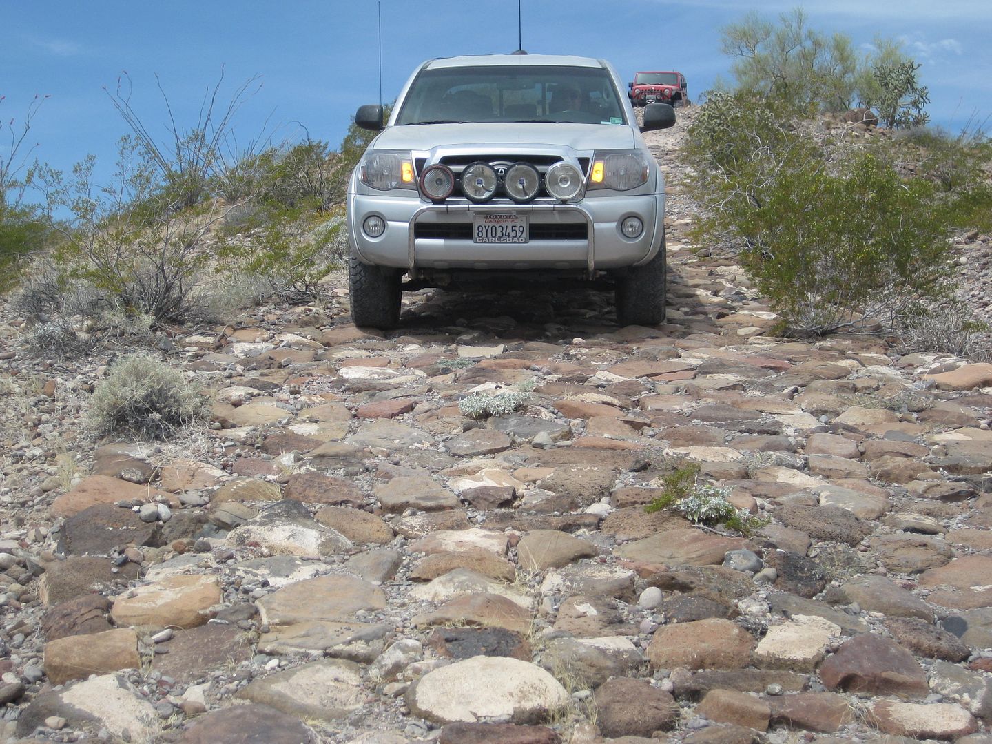
My 2015 photo of the Summit grade from east of it on Pole Line Road:
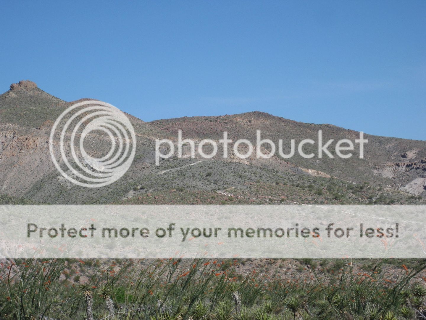
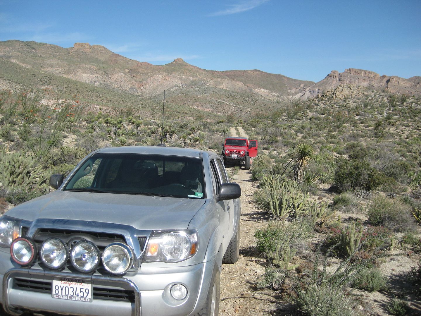
Further east is sections of 1942 cobblestone paving!...
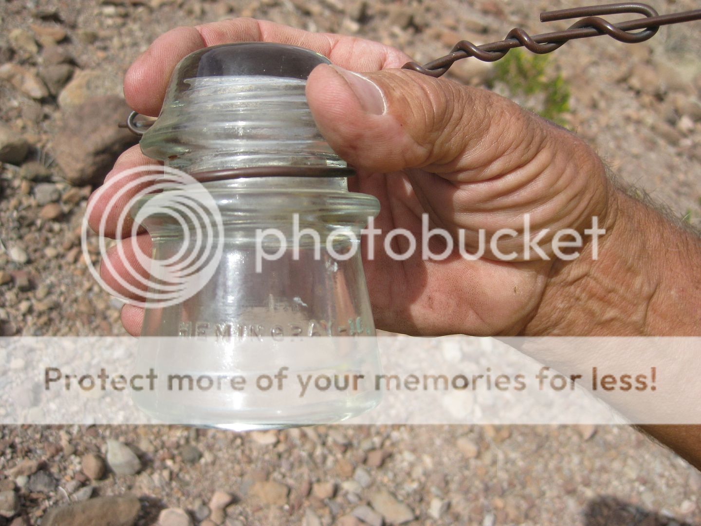
Seeing (now) 77-year-old telephone poles in the Baja desert installed by the U.S. Army is pretty special!
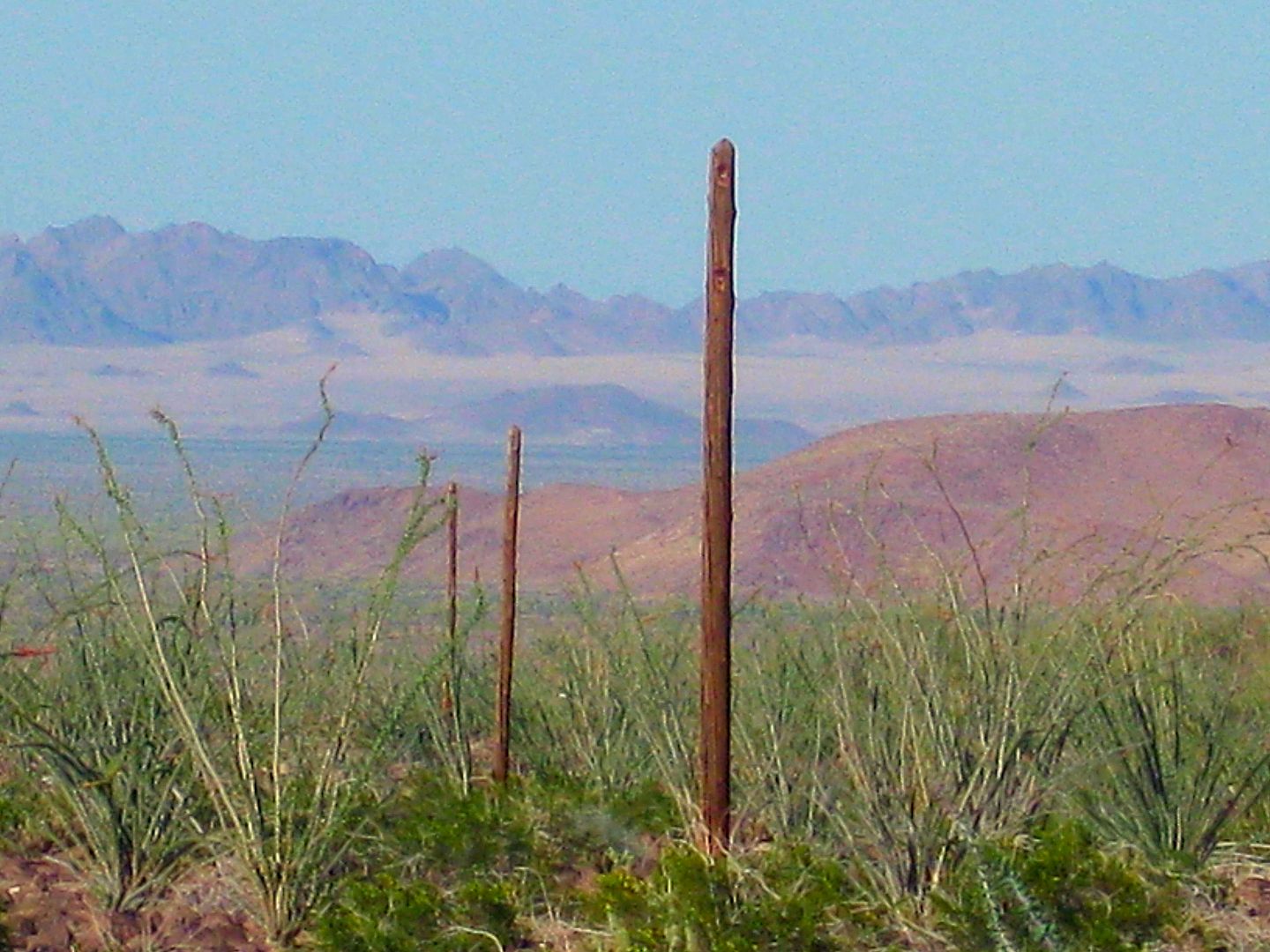
Finding intact insulators is something great!
[Edited on 3-29-2019 by David K]
|
|
|
PaulW
Ultra Nomad
Posts: 3005
Registered: 5-21-2013
Member Is Offline
|
|
Which Summit?
Thanks David,
Nothing like a proper review.
More, there are three summits.
1)
“Portezuelo de Jamau” is the north summit commonly called the race summit. Over the year’s routes have changed for both south side and the north
pole line road side. On the south side a road was dozed above and west of the traditional valley road to accommodate the ranchers wishes for
protection of his cattle. The valley road has substantial locked gates with no go arounds these days. The south side is now has restricted access
except for the current San Felipe race. Any other time there is a substantial locked gate with no go around.
On the north side SCORE dozed a road on a ridge to avoid the severe washouts shown on your picture of the old rout looking west. That original track
is now fenced off with a locked fence gate at the top and an unlocked fence gate at the bottom in the Saiz drainage. Just north of the summit over the
years several tracks have been created to avoid the direct track which is difficult. That difficult area is shown in the video. The current San Felipe
race avoids that difficult track.
2)
The middle summit is called Saiz summit. It has been traversed both directions by several Nomads, but these days it has a locked gate on the south
side. Refer to Tom, N Johns, and other reports. I think it may be possible to get to the locked gate from the north now days, but I have no attempts
to report. Tom verified that that gate would be very difficult to breach. The images posted show that that track over the summit was doable back then.
3)
Summit Jamau is the south summit is where the actual pole lines went. N Johns posted pictures of the pole line posts. I do not recall if there are any
reports of a vehicle getting over the summit. From recent GE images it appears that it probably cannot even be hiked. From GE images one can see the
cliffs. From the south many rancher parcels must be crossed and I cannot find anyone who have recently got to the summit (or near the summit) since
the old images that N Johns and others posted.
Contact me is anyone wants to attempt Saiz or Jamau summit approaches, either hike or combination of drive/hike.
|
|
|
TMW
Select Nomad
Posts: 10659
Registered: 9-1-2003
Location: Bakersfield, CA
Member Is Offline
|
|
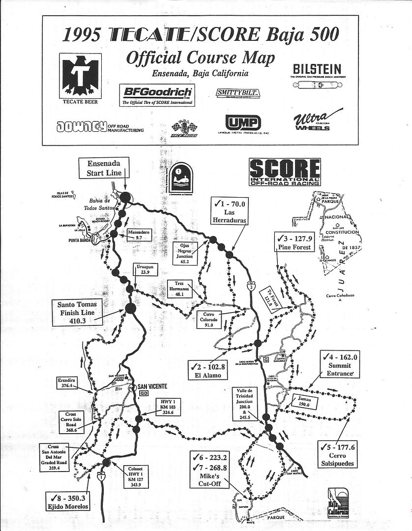
I drove up and down the Saiz summit in my 93 Toyota 4x4 back in the mid-90s. SCORE wanted to use it in a Baja 500 race so my brother and I went over
the race summit then over the Saiz summit. In my opinion it was no worse than the race summit back then. SCORE did not use it in the race because too
many racers complained against it.
SCORE called it the new summit and had it marked as Cerro Salsipuedes.
This is the original map with the section over the summits. That part was taken out for the race.
[Edited on 3-30-2019 by TMW]
|
|
|
bajaguy
Elite Nomad
Posts: 9247
Registered: 9-16-2003
Location: Carson City, NV/Ensenada - Baja Country Club
Member Is Offline
Mood: must be 5 O'clock somewhere in Baja
|
|
West to Ensenada
What is the route used from the summit west to Ensenada and how is it found??...Any remnants of poles, wires or road??
|
|
|
TMW
Select Nomad
Posts: 10659
Registered: 9-1-2003
Location: Bakersfield, CA
Member Is Offline
|
|
I don't think there are any poles or other hardware in the summit area. Others can correct me but I think the last pole is seen going up basketball
hill, which is several miles east or southeast of the summits.
[Edited on 3-30-2019 by TMW]
|
|
|
PaulW
Ultra Nomad
Posts: 3005
Registered: 5-21-2013
Member Is Offline
|
|
Which summit?
Don't be confused about the road vs the pole line. Of course the road was just for access and the pole line went over hill and dale mostly nearby.
Then at the NE approach to the base of the 3 summits the pole line deviated a far way from the road. The access road used in 1942 went over the N
summit and the pole line went over the S summit.
The last pole that was reported to be located on the route of what we call Jamau summit which is the south summit (source N. Johns). Apparently the
pole line progressed from that summit SW into the ranch land to be forever lost and forgotten??

|
|
|
TMW
Select Nomad
Posts: 10659
Registered: 9-1-2003
Location: Bakersfield, CA
Member Is Offline
|
|
Are you saying they trucked the telephone polls over the north summit to the base of the south summit then hand carried them up the south summit and
put them in the ground. If so that seems like a lot of work to save a few miles.
|
|
|
PaulW
Ultra Nomad
Posts: 3005
Registered: 5-21-2013
Member Is Offline
|
|
No idea tom
Logically they trucked them up the road to the S summit from the south. Back then per Niles report that road to the summit was functional - he drove
it. Never read anything about a functional road up or down the S summit. If you study GE you can see tracks at the north approach and from the summit
down a little ways.
Sure would be nice to discover some archive photos from 1942.
Quote: Originally posted by TMW  | | Are you saying they trucked the telephone polls over the north summit to the base of the south summit then hand carried them up the south summit and
put them in the ground. If so that seems like a lot of work to save a few miles. |
|
|
|
TMW
Select Nomad
Posts: 10659
Registered: 9-1-2003
Location: Bakersfield, CA
Member Is Offline
|
|
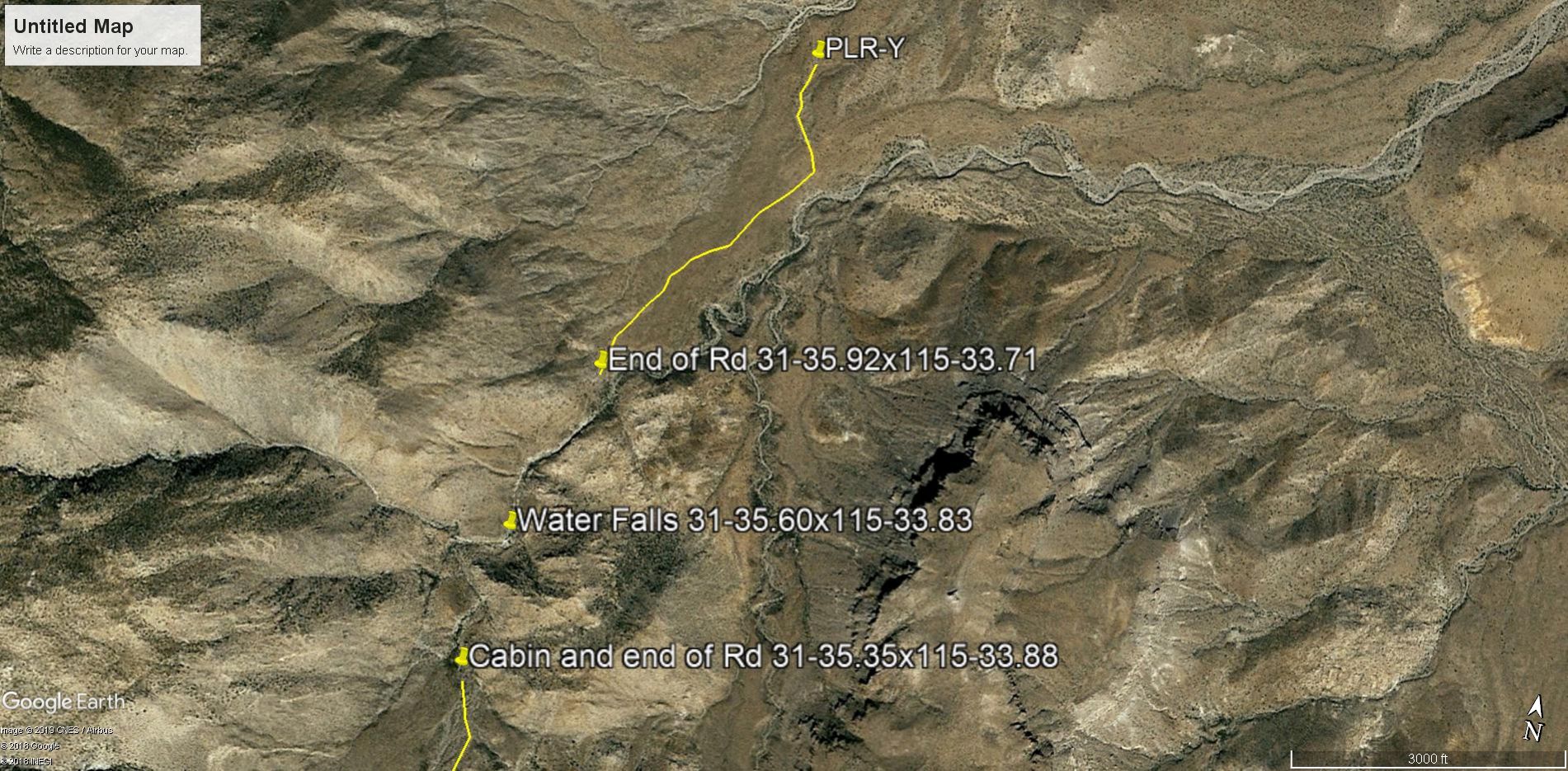
If you use Zoom Earth, Bing Maps, you can follow the south summit road pretty easy. At least to the bottom of the summit where the cabin is but
everything David has written says it is at or near 31-35-355x115-33-883. That's in degrees-minutes-seconds.
https://zoom.earth/#31.586243,-115.565575,17z,sat
It's only about a mile north of there to the end of the road coming from the north at 31-35-55x115-33-43. The water falls where we stopped was at is
31-35-35x115-33-50. It was hard going for us because we walked in the bottom of the arroyo. Coming back to the trucks we followed a cow trail on the
north side next to the arroyo. I'm thinking maybe that cow trails follows the arroyo down to the cabin area.
Maybe 15 years ago a friend and I were driving around back there and came upon a plane crash. The wings and engine were missing. It was at
31-30-40x115-34-02.
|
|
|
David K
Honored Nomad
Posts: 64479
Registered: 8-30-2002
Location: San Diego County
Member Is Offline
Mood: Have Baja Fever
|
|
Of all the Gulick 1959 & 1960 photos, I have only seen a telephone pole in one (looks like the canyon west of Basketball Hill).
Paul, how did you hear the poles were so far south of the road they built in 1942 (north summit/ Portezuelo de Jamau)?
4x4abc, you thought you could dig up more data on the construction of that road, beyond the website stuff I had posted (The Defense of California)...
any luck with that?
Maybe someday we will see photos from 1942? It must have been very top secret at the time, however?
|
|
|
PaulW
Ultra Nomad
Posts: 3005
Registered: 5-21-2013
Member Is Offline
|
|
Tom, your coords agree with the roads I collected from GE. The WPs I have plotted with a "T" are yours. For the S summit I did not plot your WPs back
then, but did plot the roads. Your WPs are what kicked off my study for a Norra route using the Saiz summit and that led to more data that included
the S summit.
David, I thought you had posted a description with pictures showing a drive from the south over the S summit to the road end. Remember the post that
showed the cabin? And my faded memory thought there were Pole descriptions?
Anyway in my mind I thought the poles went up the S summit. Maybe I just made an incorrect conclusion?
Then there is the question of what big storm after 1942 destroyed the S summit?
|
|
|
David K
Honored Nomad
Posts: 64479
Registered: 8-30-2002
Location: San Diego County
Member Is Offline
Mood: Have Baja Fever
|
|
Nomad from Mexicali 'Emerson' (Toyota Land Cruiser wagon), 'The squarecircle' (Land Rover LR3), and 'TW' or another third person (sorry, getting old
sucks) explored the south summit road (Cañon de Jamau) from both ends.
The bottom end, identified as the location of the Jamau shack of Gulick's photos, is approached by the road that forks south off the Pole Line Road
just a few miles from the base of the original Pole Line Road (north) summit.
They hiked in from that road end... no road up the canyon to the cabin.
They then drove up the summit (north summit) and around only to discover a locked gate partway up to the top of the south (Cañon el Sáiz) summit.
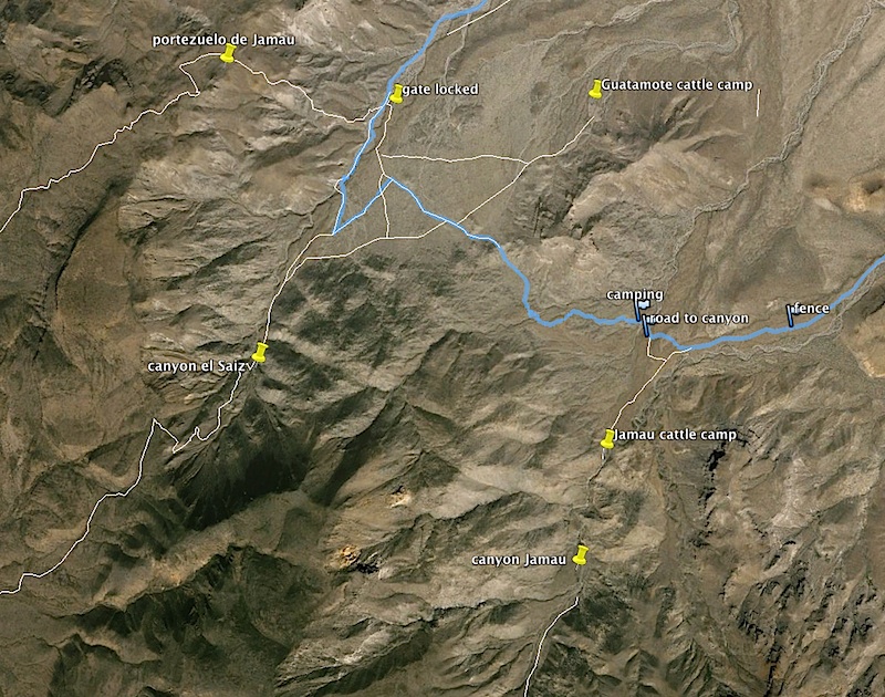
Here ia a map from Harald that IDs the three summit roads (north or Portezuelo de Jamau; Center/south or Sáiz; South or Cañon Jamau which does not
go through to the desert floor)
|
|
|
TMW
Select Nomad
Posts: 10659
Registered: 9-1-2003
Location: Bakersfield, CA
Member Is Offline
|
|
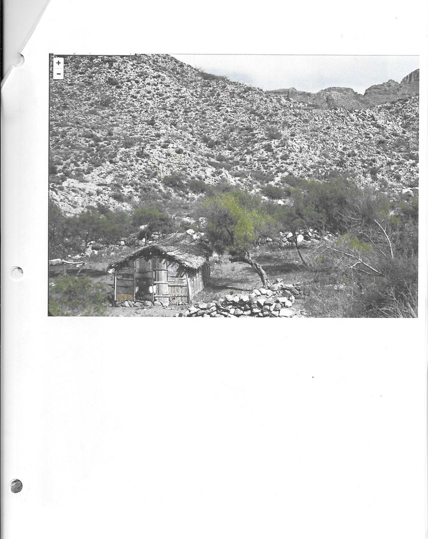
We walked to the water falls before turning back. It looks like the cabin was not too much further.
[Edited on 4-1-2019 by TMW]
|
|
|
TMW
Select Nomad
Posts: 10659
Registered: 9-1-2003
Location: Bakersfield, CA
Member Is Offline
|
|
Here is the Cabin.
|
|
|
David K
Honored Nomad
Posts: 64479
Registered: 8-30-2002
Location: San Diego County
Member Is Offline
Mood: Have Baja Fever
|
|
Thanks, Tom, I thought it was you with Roy and Emerson. You all are GREAT Nomads who are willing to explore and share.
Of course, there are more roads over the summit both north and south of these three in discussion. To the north, I know of (and have driven) Mano
Canyon from the top to the desert. There is a road or two from Valle de Trinidad over to Arroyo Grande or a parallel drainage. I know Roy has talked
about it.
|
|
|
TMW
Select Nomad
Posts: 10659
Registered: 9-1-2003
Location: Bakersfield, CA
Member Is Offline
|
|
For background info on the summits especially summit 3 go to
Three Summits Study. http://forums.bajanomad.com/viewthread.php?tid=78583
Exploring Summit #3. http://forums.bajanomad.com/viewthread.php?tid=79324
[Edited on 4-1-2019 by TMW]
|
|
|
| Pages:
1
2 |


