| Pages:
1
2 |
OCEANUS
Nomad

Posts: 139
Registered: 10-11-2008
Location: Dana Point; L.A. Bay
Member Is Offline
|
|
Thank you Nomads!
These are all great ideas, and I particularly like the recommendations of taking coastal roads and getting out to the islands for a day on the water.
We are going to have to pick and choose the ones we want to focus on for this trip, and save the others for future runs...nothing wrong with planning
even more trips to Baja.
|
|
|
LukeJobbins
Nomad
Posts: 196
Registered: 3-11-2014
Location: Lemoore, Ca
Member Is Offline
|
|
For hiking, San Pedro de mártir.
|
|
|
OCEANUS
Nomad
Posts: 139
Registered: 10-11-2008
Location: Dana Point; L.A. Bay
Member Is Offline
|
|
I've had San Pedro de Martir on my list for awhile now. What's the drive time from Mex 1 up to the campground?
Is it worth it for 1-2 nights?
Or would it best to save it for a longer trip?
|
|
|
JZ
Elite Nomad
Posts: 9269
Registered: 10-3-2003
Member Is Offline
|
|
Here are all the tracks and waypoints you need for San Evaristo.
Attachment: Area Around San Evaristo.kmz (15kB)
This file has been downloaded 239 times
|
|
|
David K
Honored Nomad
Posts: 64493
Registered: 8-30-2002
Location: San Diego County
Member Is Offline
Mood: Have Baja Fever
|
|
Quote: Originally posted by OCEANUS  | I've had San Pedro de Martir on my list for awhile now. What's the drive time from Mex 1 up to the campground?
Is it worth it for 1-2 nights?
Or would it best to save it for a longer trip? |
Detailed in this trip report: http://forums.bajanomad.com/viewthread.php?tid=87976
Here is some of that trip report (DAY 4 of 6):
-----------------------------------------------------------------------------------------------------------
I left El Rosario at 9 am after filling my gas tank at Antonio's service station. It is still a Pemex station, but things are changing in Mexico. The
price per liter of Magna (87 octane) was 16.39 pesos (62.03 per gallon or US$3.56).
Driving north, I noted that the road up into the Sierra San Miguel (lower San Pedro Mártir), passing near San Isidoro, is paved now where it leaves
Hwy. 1. This is at Km. 187.5. TW, The squarecircle, and John M recently traveled this route: http://forums.bajanomad.com/viewthread.php?tid=81801
I passed by the observatory highway (Km. 140.5, San Telmo de Abajo) to top my fuel tank before going up the mountain. The Pemex station is at Km. 139,
just north of town. The price here was 16.29 pesos/liter. It is 71 miles from El Rosario and it took 3.7 gallons to top the tank. That was 19.2
miles/gallon (I love ethanol-free gasoline) which is good for about 2-3 mpg better than I ever get on California gasoline highway driving!
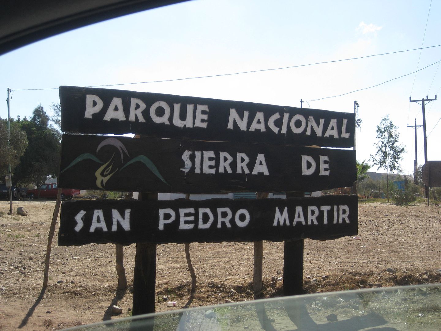
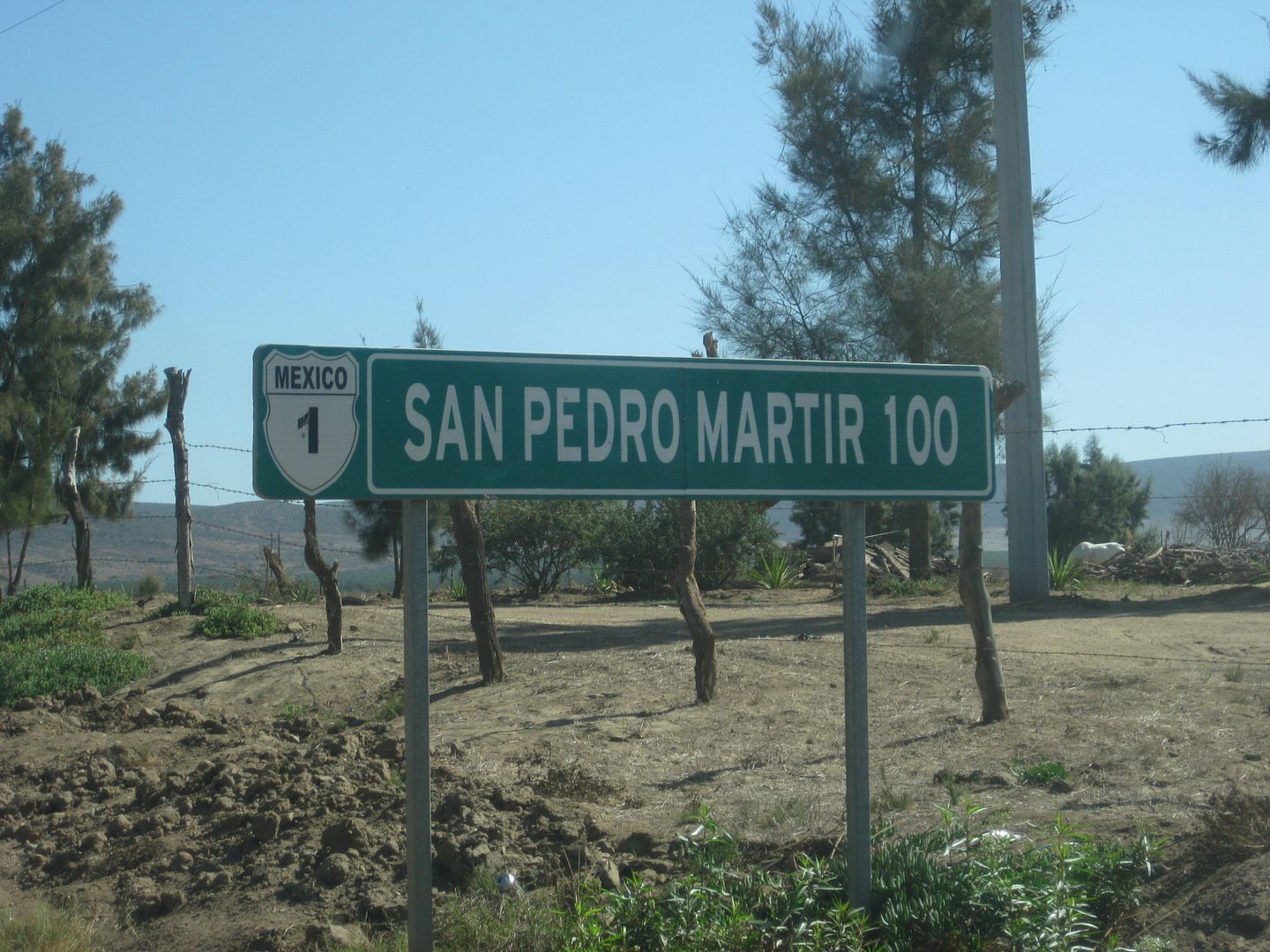
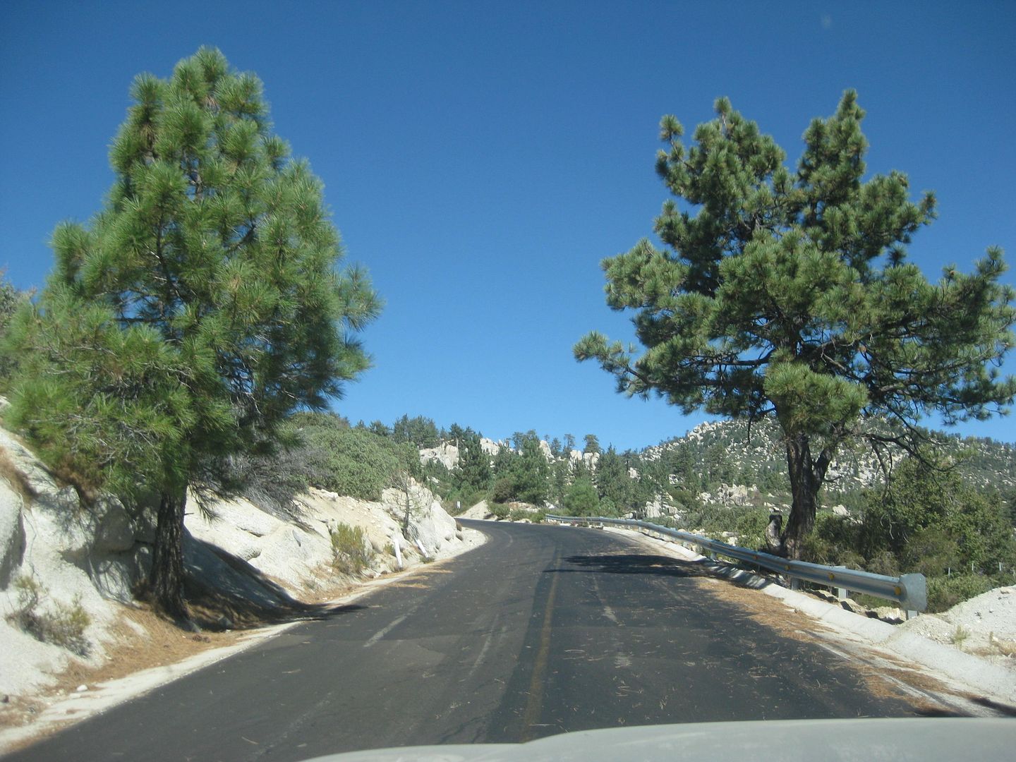
Back to the highway junction to head up to the San Pedro Mártir. The junction is 130 feet above sea level. This (now) paved road goes 100.5
kilometers (62 miles) and climbs to 9,280 feet above sea level!
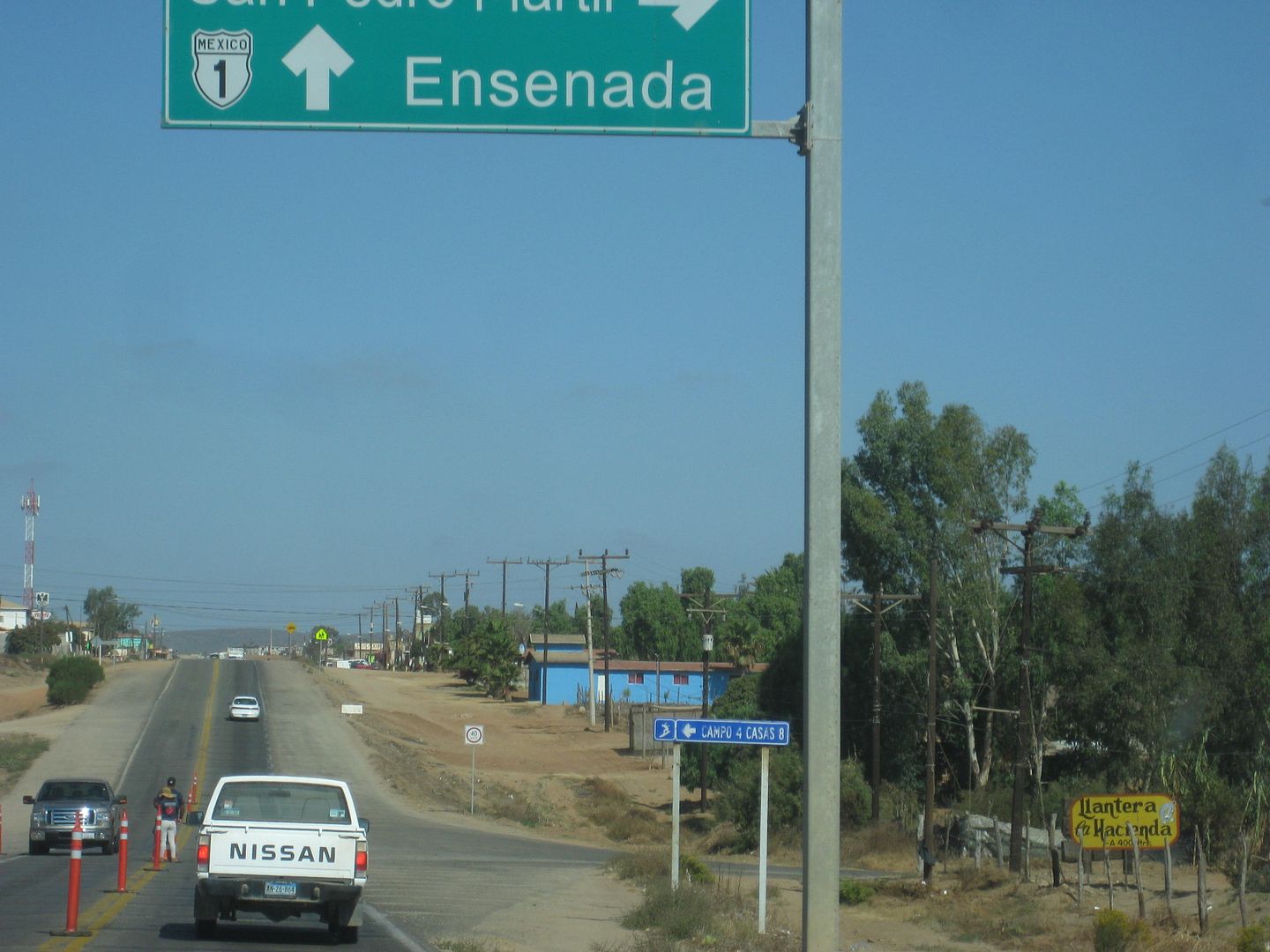
The junction, northbound. Red cross was on the highway asking for donations here.
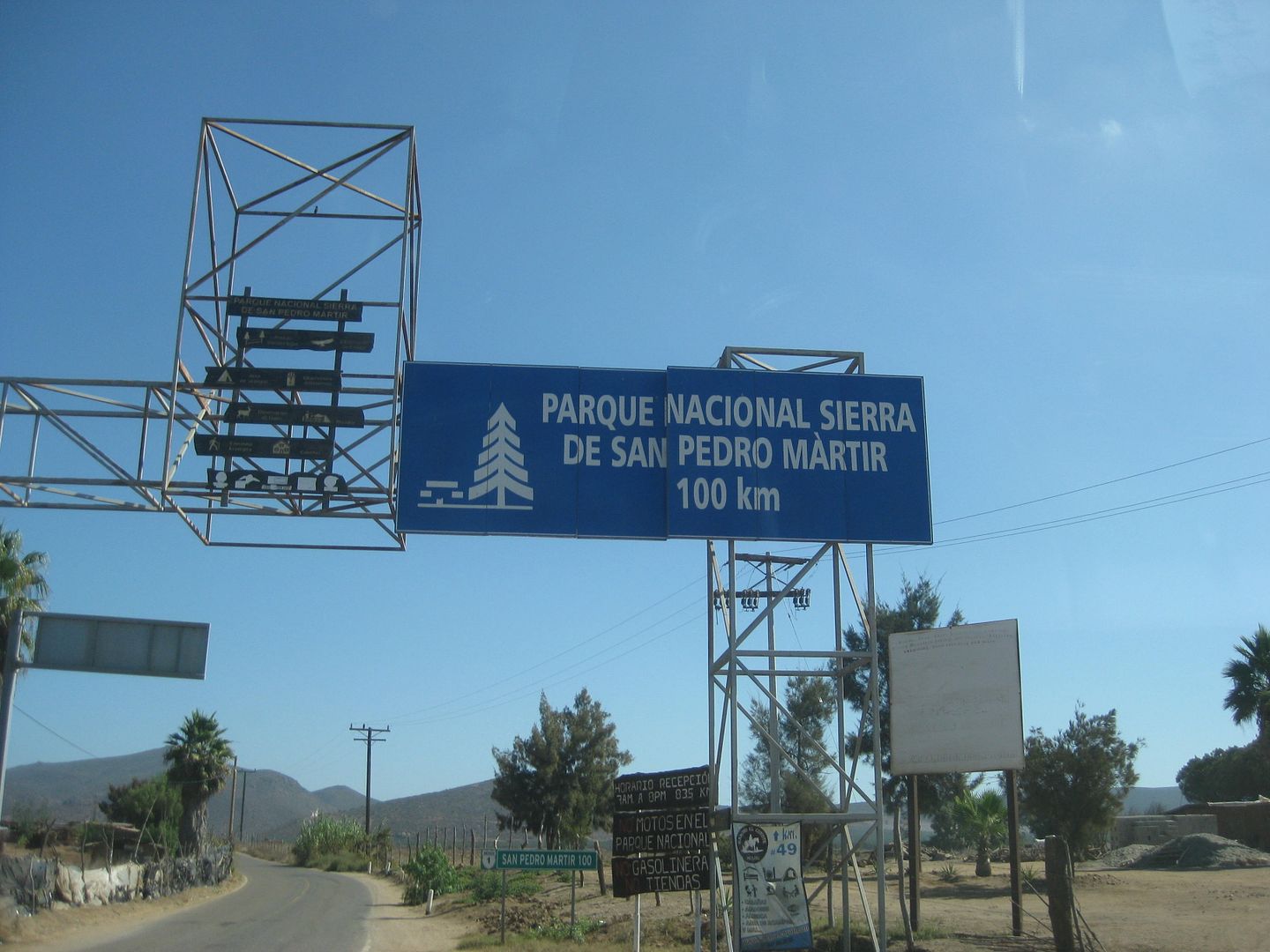
Overhead signs after making the turn.
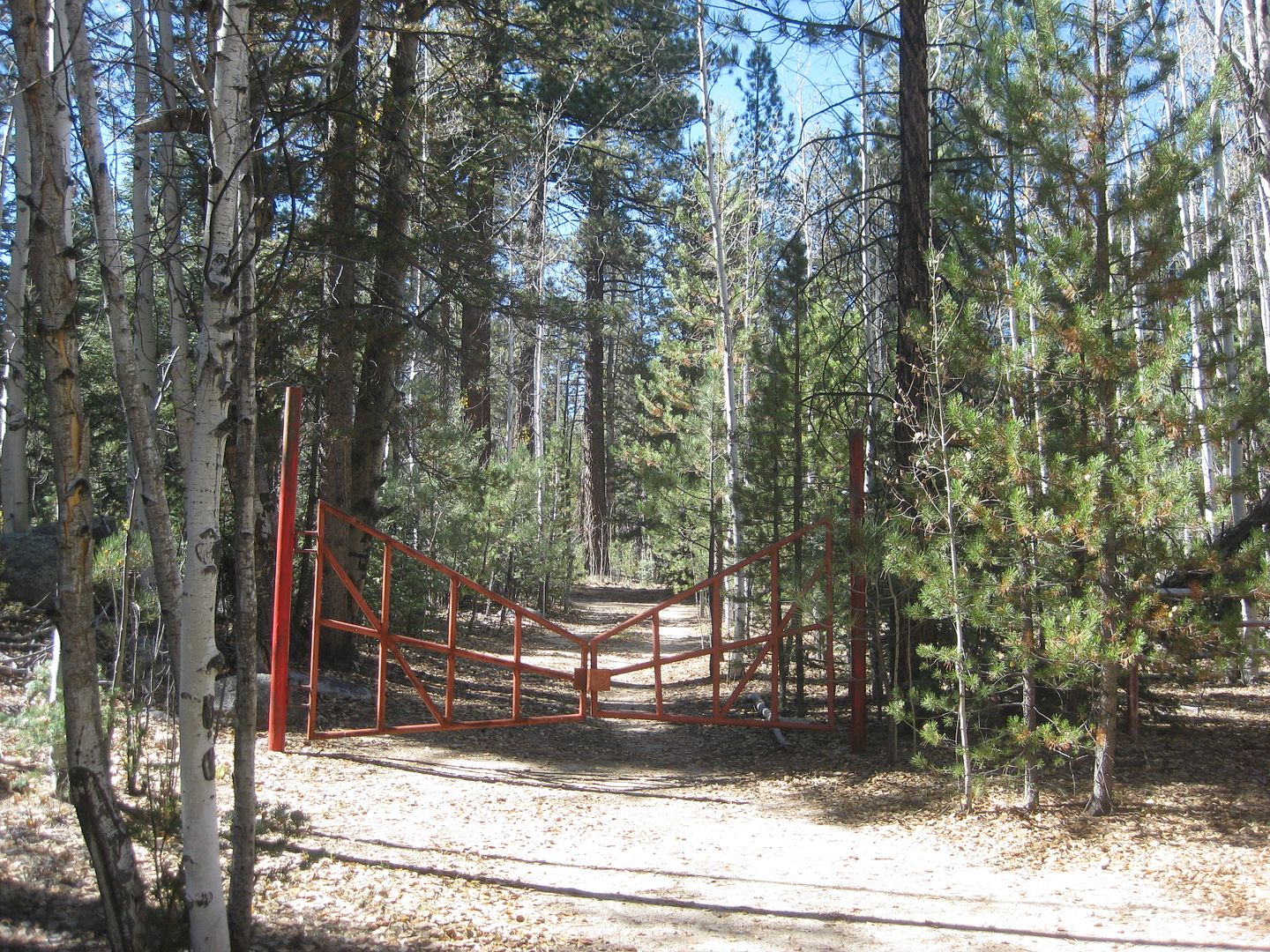
This is the distance to the observatory complex. There is a gate at Km. 97.5 (elev. 8,705') only open for three hours (10 am-1 pm) unless there is
work going on at the telescopes. There is no view other than of the trees at the gate. Time your trip to arrive early and hope you can get through. A
call box is at the gate where you are to ask it be opened. The call box was out-of-order.
ROAD LOG:
0.0 Highway 1, elevation 130'.
4.2 Narrow bridge
5.6 San Telmo (now a ghost town) was an important visita od Mission Santo Domingo and a farming supply center until recent years when many have moved
down to Highway 1 for more opportunity.
11.3 (Km. 18+) Hacienda Sinaloa a town of farm workers with one small store.
17.0 (Km. 27.5) Road right goes into the hills to Valladares and Santa Cruz.
17.6 Signed road left to Ranchos (Las Choyas, Cortez, El Papalote). Road begins a steep climb.
22.0 1,000' elevation.
24.0 2,000' elevation.
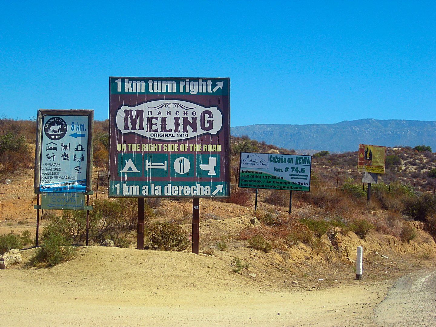
30.3 (Km. 49) Road north to El Coyote guest ranch (rooms, camping, meals).
30.6 (Km. 49.5) Road to right to Meling Ranch, a guest ranch with a long history. Rooms, meals, camping, airstrip.
34.0 3,000' elevation.
39.0 4,000' elevation.
39.3 (Km. 63.5+) Road south to El Potrero.
40.6 (Km. 66) Socorro mine site. Not much left from the early 1900s when the Meling/Johnson family worked the placer goldfield. A water ditch was
constructed about 1896 by Harry Johnson for some 20 miles along the mountainside from the San Rafael River for the water needed at Socorro.
41.6 (Km. 67+) Road left, signed to La Joya. Badly eroded from last winter's rains, this ranch and the former Dark Skys Inn (Rancho La Concepción)
was once reached this way, but today may be impassable.
43.4 (Km. 70) 5,000' elevation.
45.0 6,000' elevation.
45.2 (Km. 73) Fire break road to the right (yellow gate).
Km. 73.5+ Road right 0.3 mi. to the former Los Manzanos RV Park/Campground. Abandoned.
Km.74.5+ La Cienega de Soto resort project.
48.1 (Km. 77.5) Former park entrance payment gate, ex-ranger station (6,800').
48.6 7,000' elevation.
51.0 8,000' elevation.
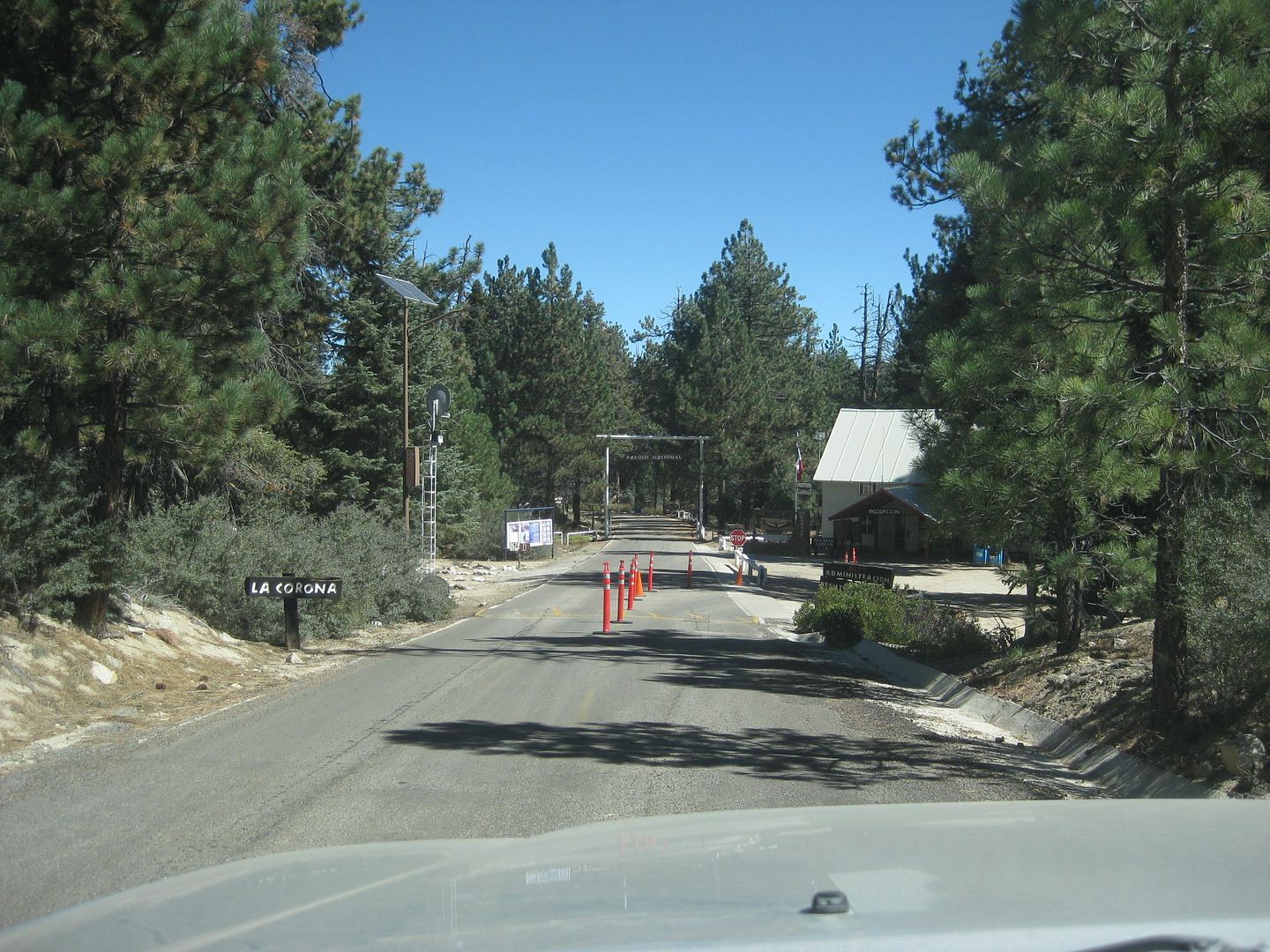
51.7 (Km. 83.5) Park Entrance Payment Ranger Station 'La Corona'. Elevation: 8,259'.
Km. 84 Campo Cacomixtle, El Condor, Cimarron, and more, on both sides of the highway.
Km. 86.5 Capilla San Pedro. A small chapel on a hilltop.
56.3 (Km. 91) Road south for La Tasajera (10 km.). Locked gate at Mile 1.9.
56.8 Museum (closed).
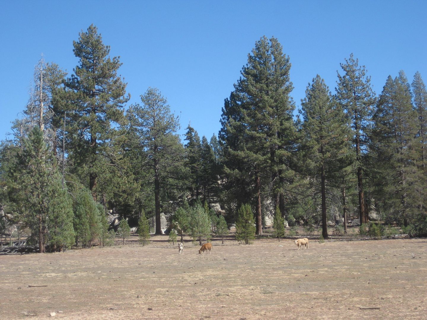
57.8 (Km. 93+) The Aguaje del Burro road to the right goes 2.0 miles to a covered spring. This was an old cattle camp.
58.2 (Km. 93.5+) Mirador El Altar road right (elev. 8,000'). It is 0.3 mi. to the El Mirador trail. A right fork just off the highway goes 2.2 miles
to a pretty area.
58.9 (Km. 94.5+) Pass a military camp and a side road left to the Venado Blanco trail.
60.3 (Km. 97.5) Parking area (left) and gate restricting access to the observatories. 8,705'. A phone box on the left (out-of-order) to request
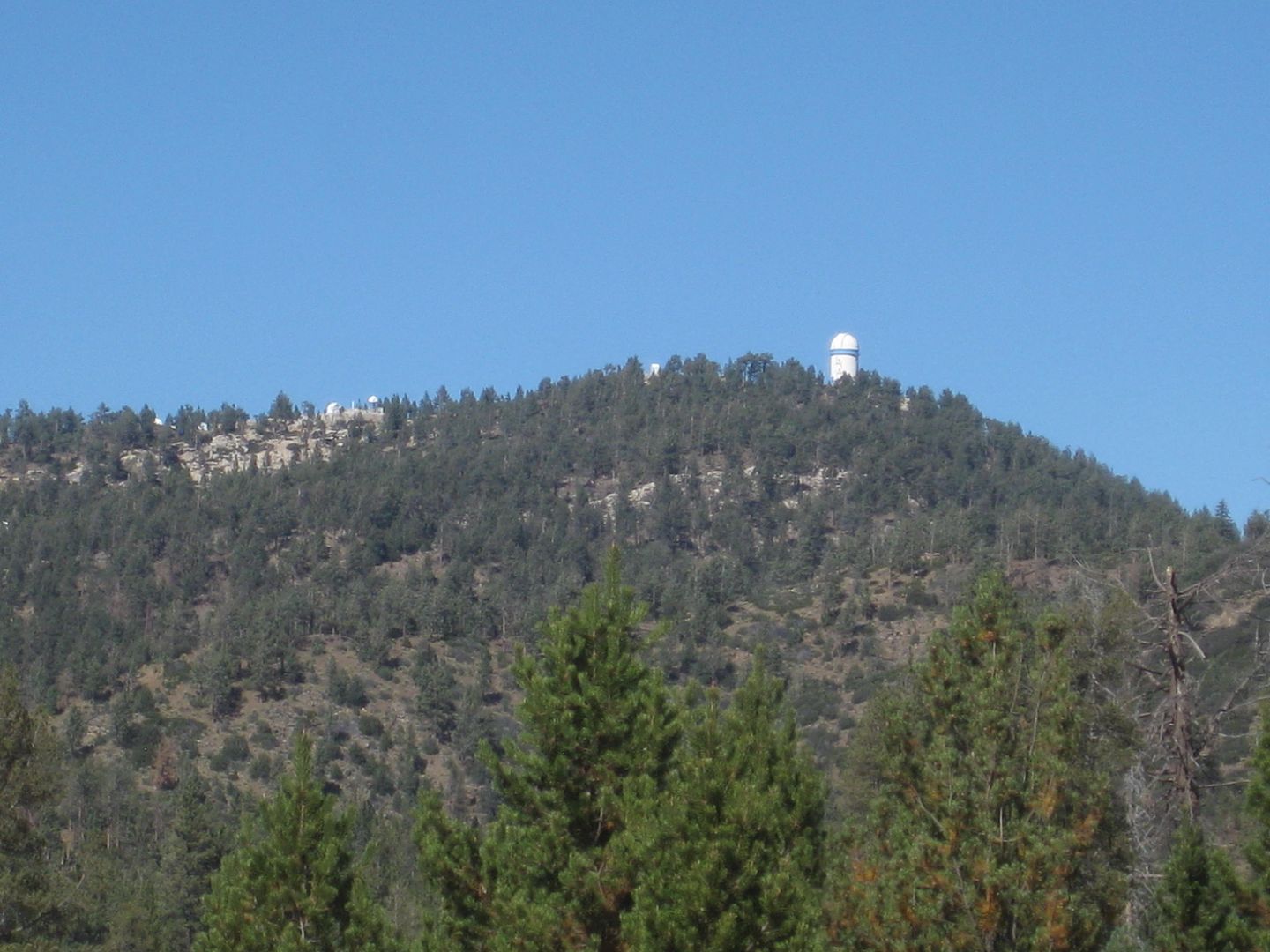
passage. It is 3 kilometers and over 500' higher to the end of the road at Mexico's largest telescope.
61.2 (Km. 99) 9,000' elevation.
62.1 (Km. 100+) Elev. 9,280'. The highest point reached by automobile in Baja California. The national observatory.
Two condors are circling above! The black and white wings set them apart from common vultures.
The road north 4.9 miles to Rancho El Coyote is at Km. 49 (2,622').
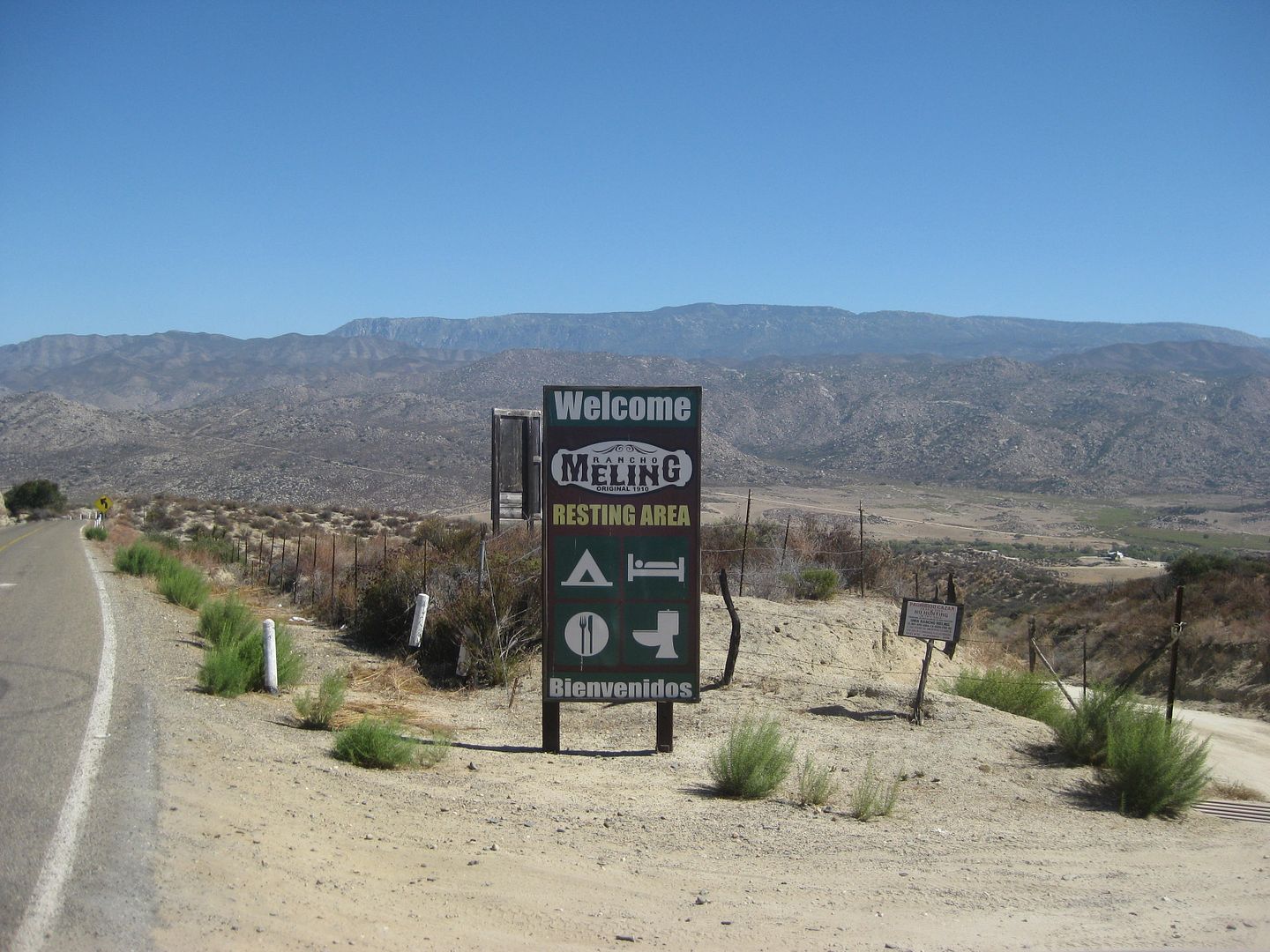
The Meling road is just 1/4 mile past the El Coyote road and drops down to the ranch, 0.9 mi. I stop by on my way down the mountain and take photos
and get rates.
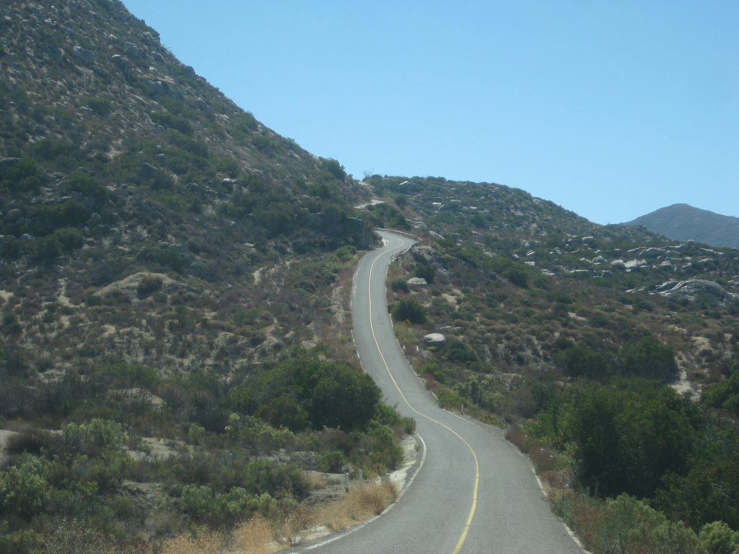
Begin the next steep climb.
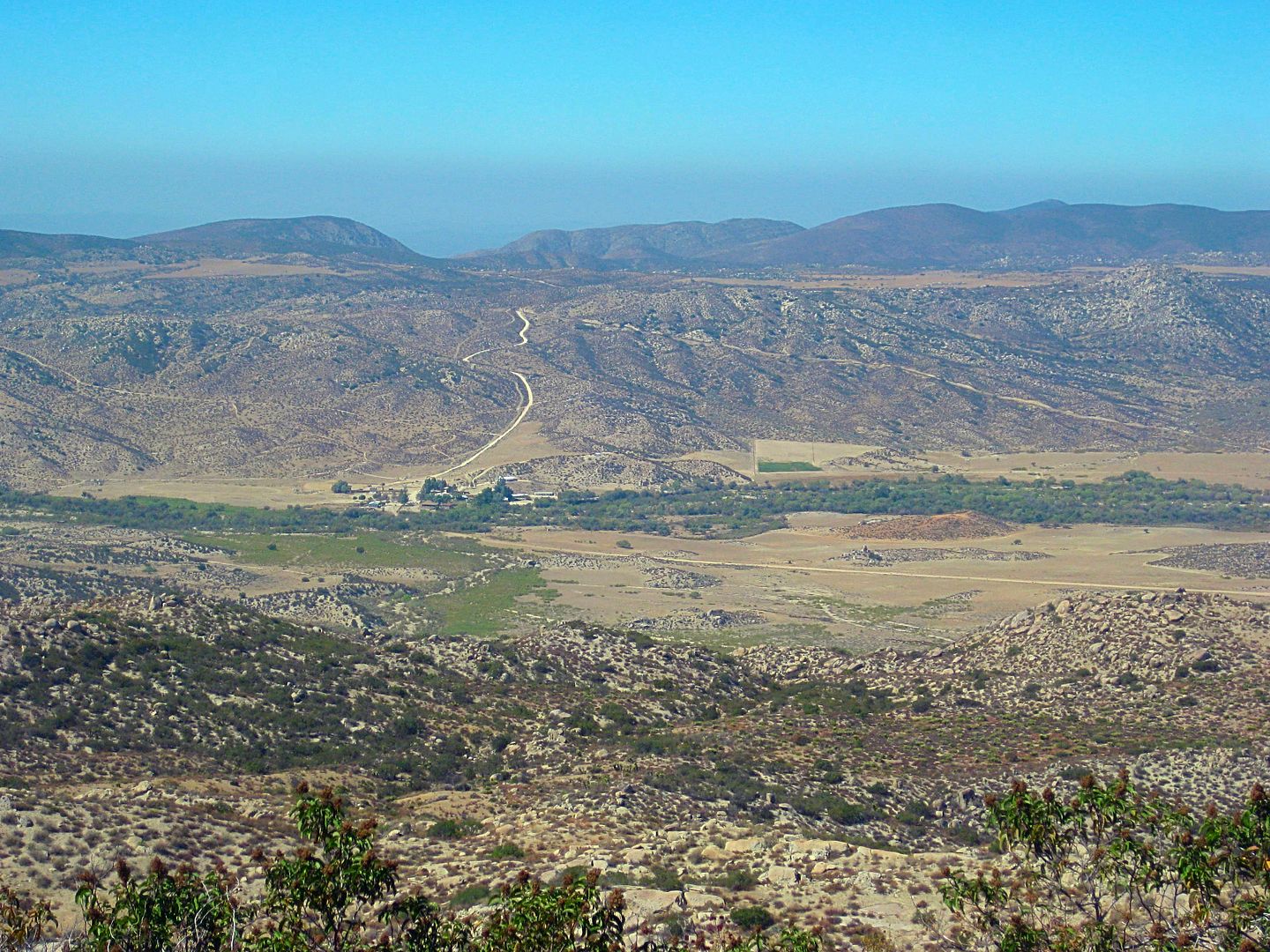
View back down to Meling Ranch. The 0.9-mile dirt road from the highway down to the ranch is clearly seen. The airstrip is on this side of the ranch,
the line running to the right edge of the photo.
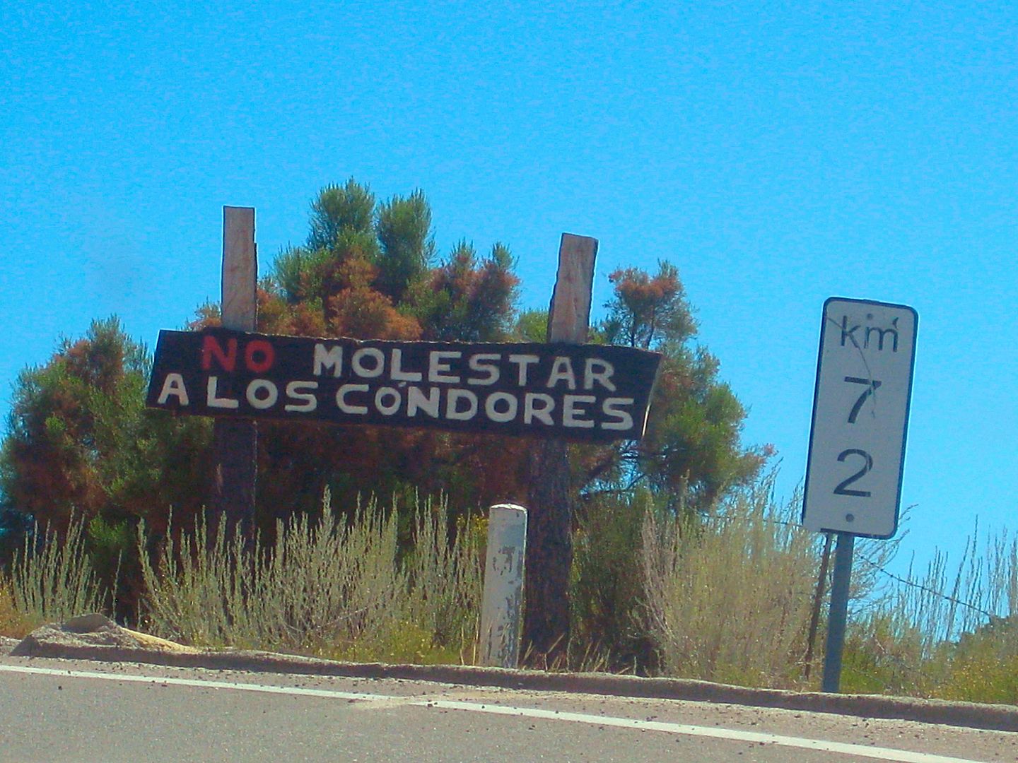
Don't bother the condors!
TO BE CONTINUED...
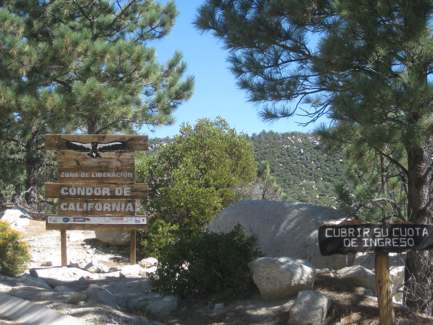
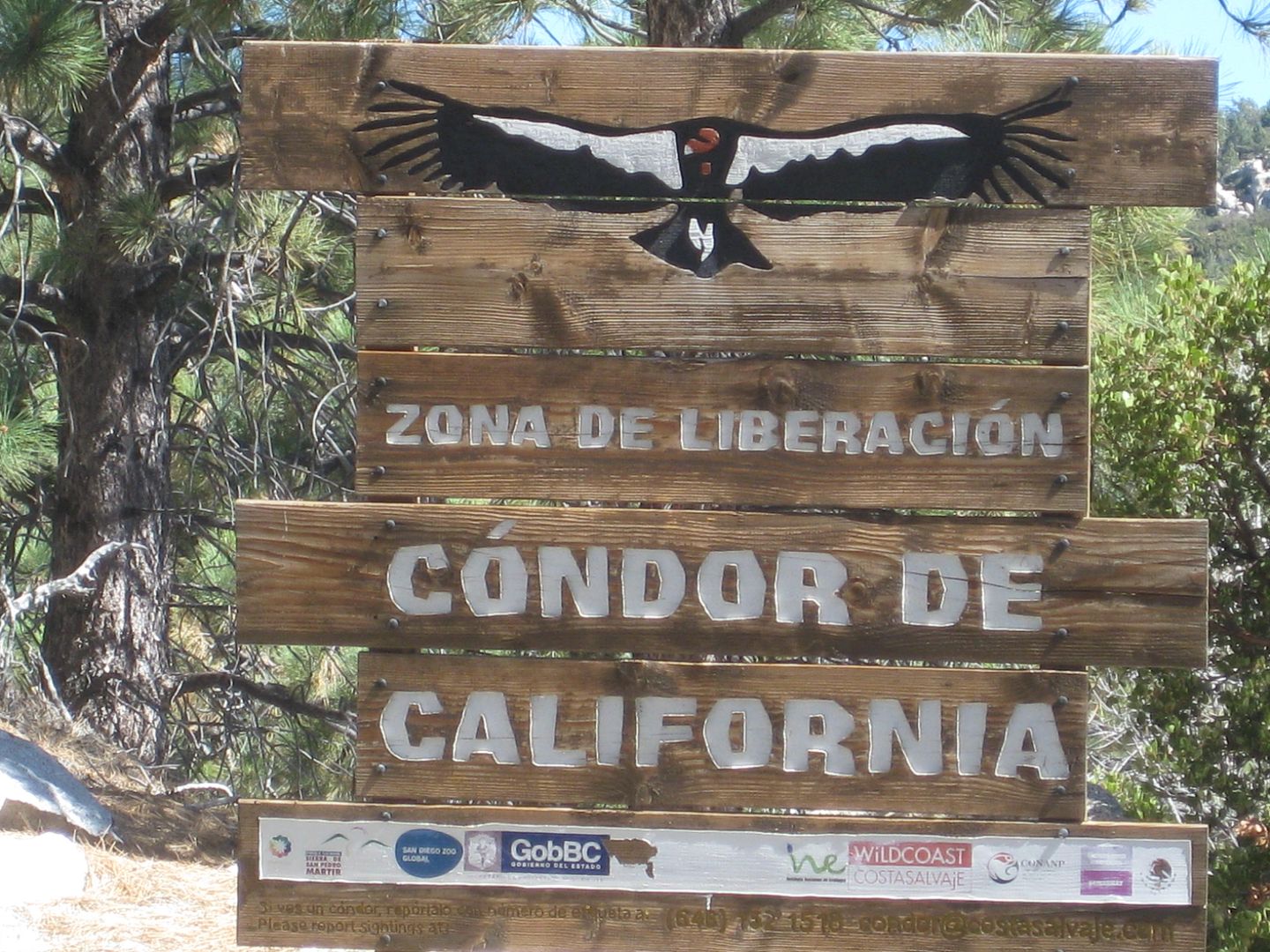
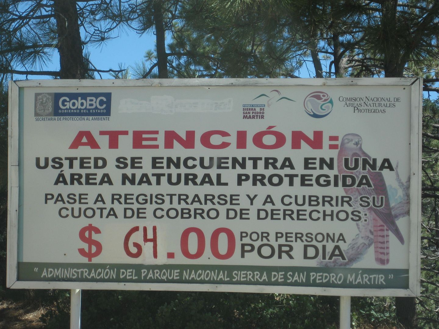
Only 64 pesos per day to enter and stay in the park (US$3.68).
The former park entrance is passed near Km. 78 and the new entrance ranger station is at Km. 83.5 at La Corona, 8,259'.
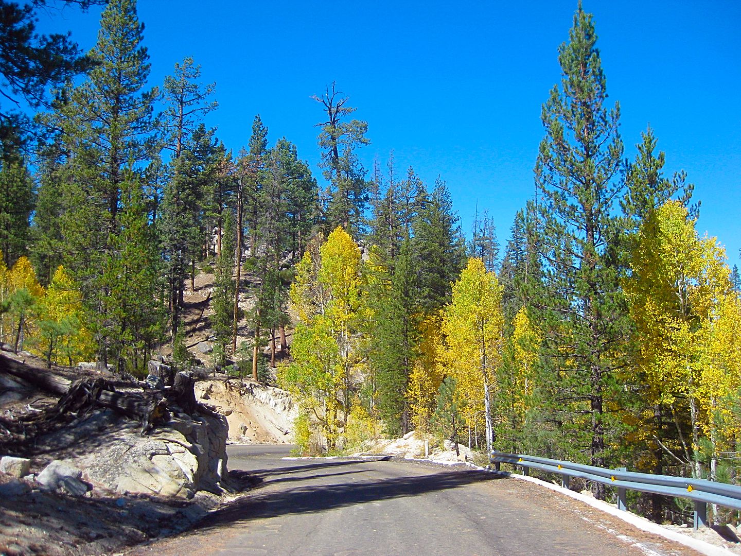
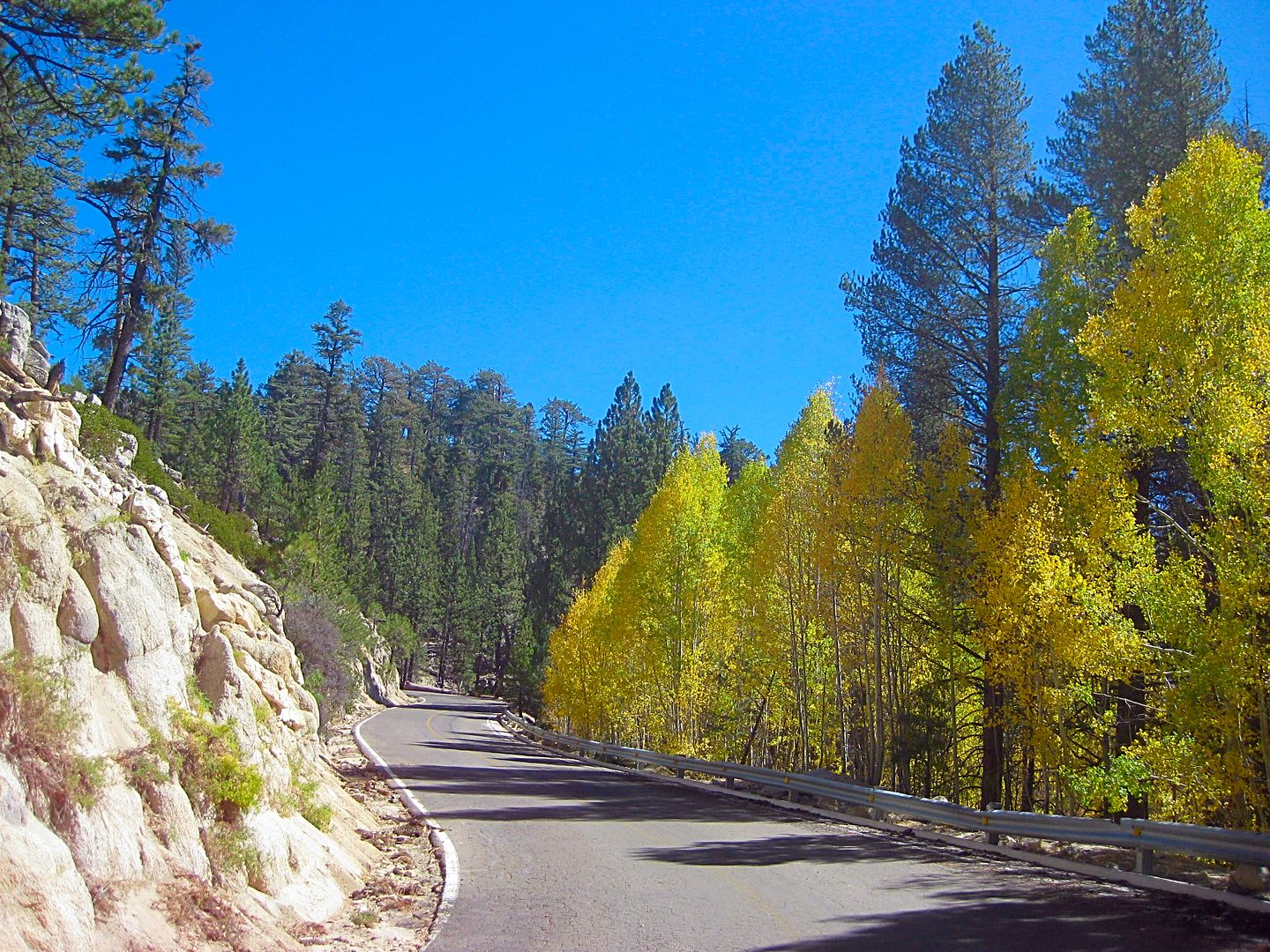
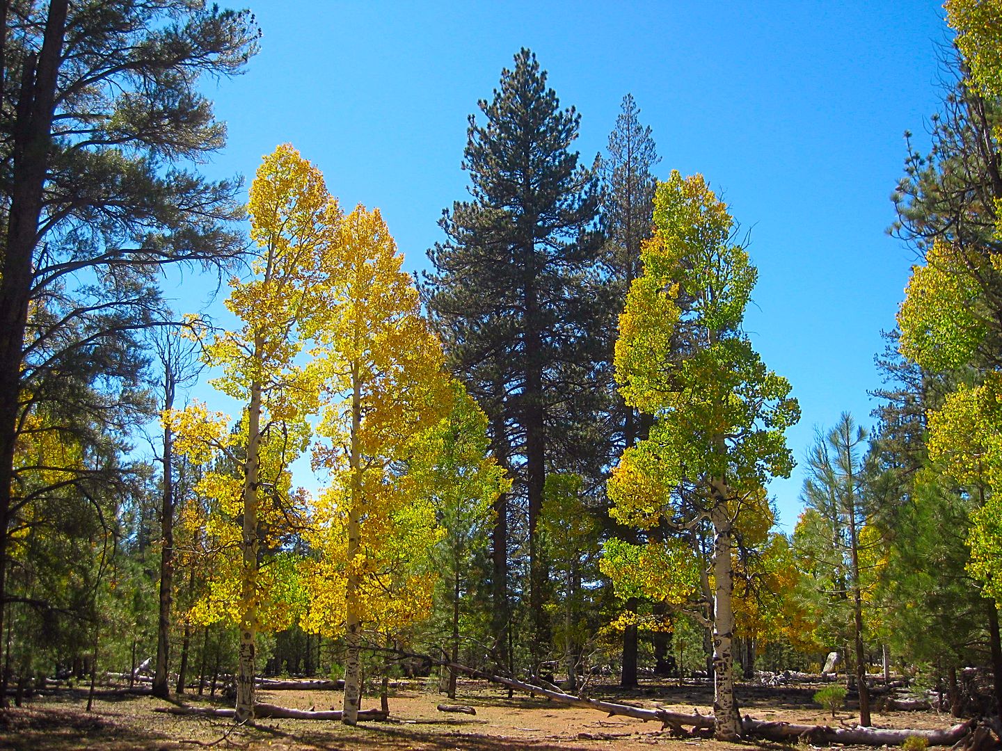
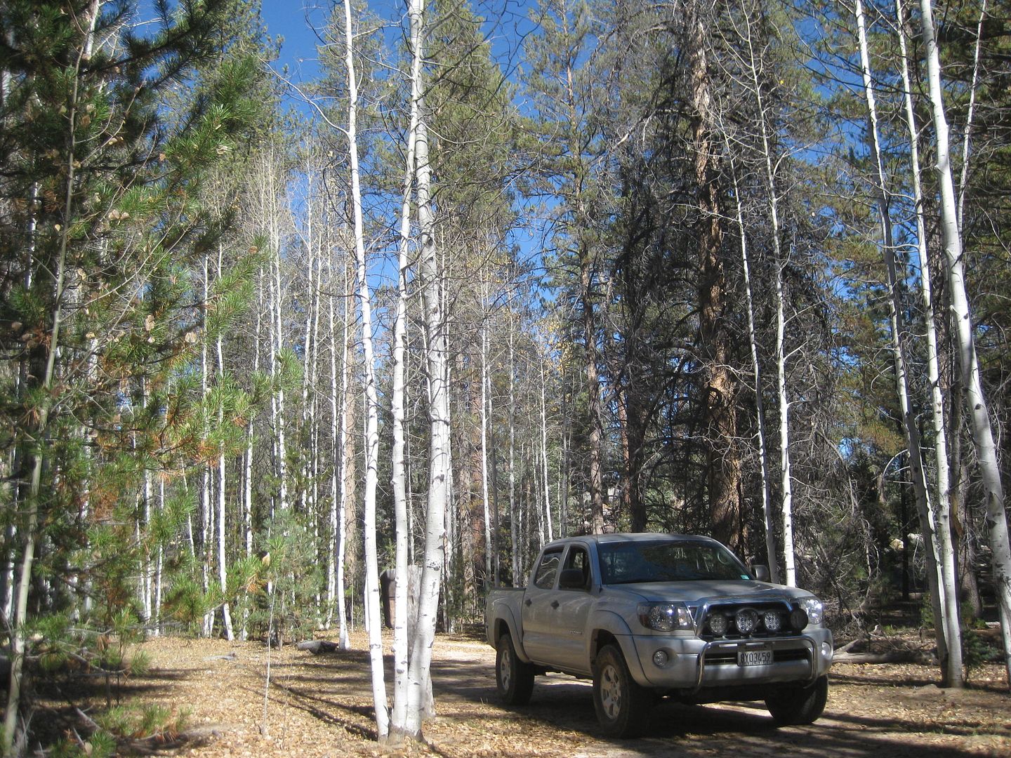
Aspen trees are really outstanding!
More to come!!
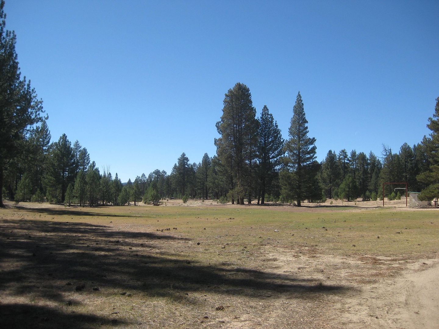
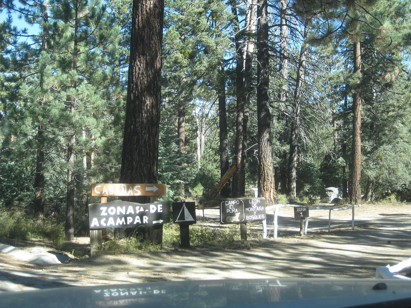
Just past the ranger station are several camping areas, each named for forest animals. Some are near the paved road and others are a ways off the
road. Most have trash cans, pit toilets, and a few have fire pits and bar-b-ques. Note, that once you pass these signed camping places around Km.
84/85, there is no camping allowed. The rest of the park is for day use only.
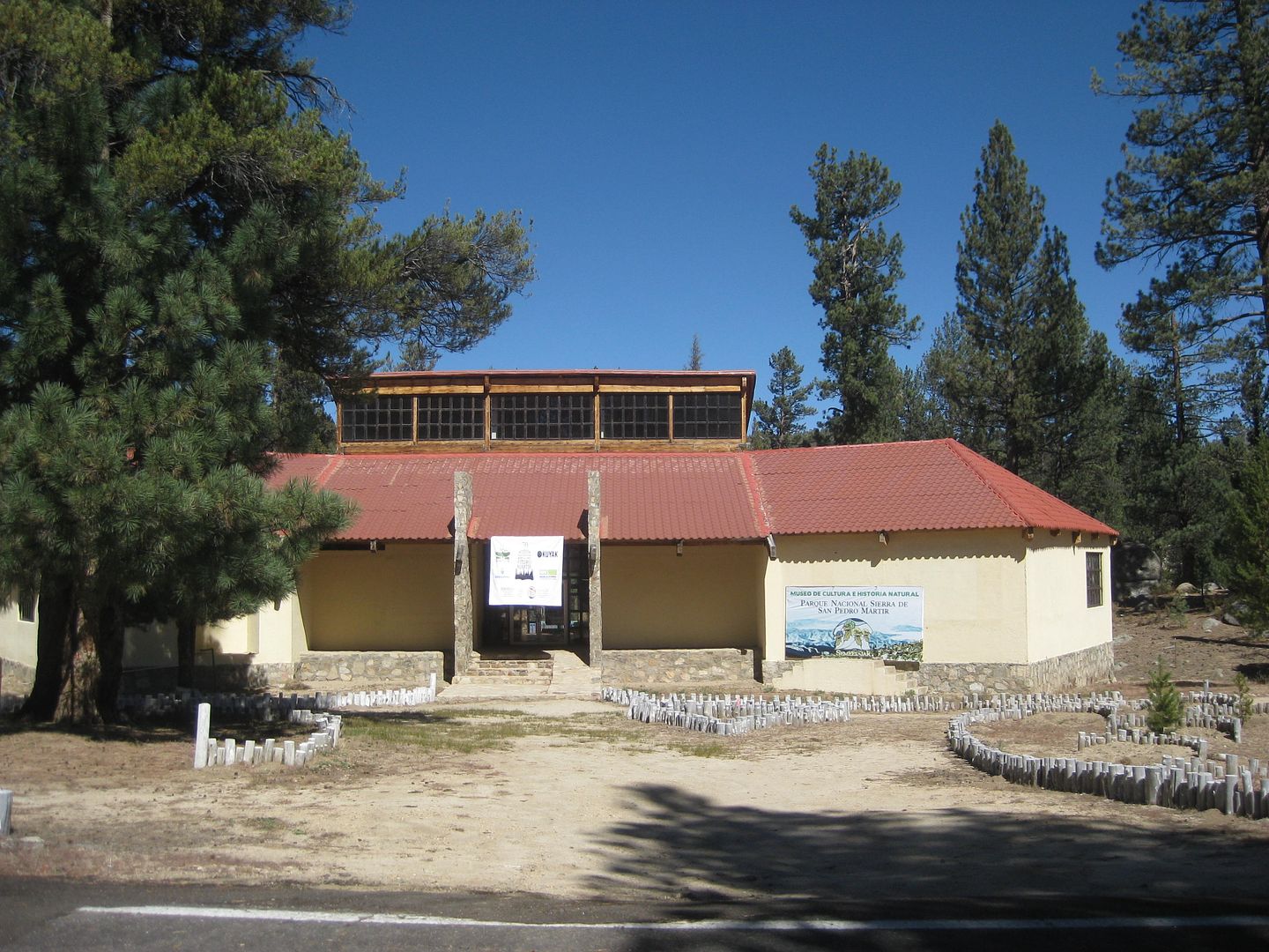
The park museum, it was open at least once, when the governor was here to cut the ribbon. Graham Mackintosh attended. His excellent book, 'Nearer my
DOG to Thee' is wonderful reading: http://www.grahammackintosh.com/Pages/NearerMyDogtoThee.aspx
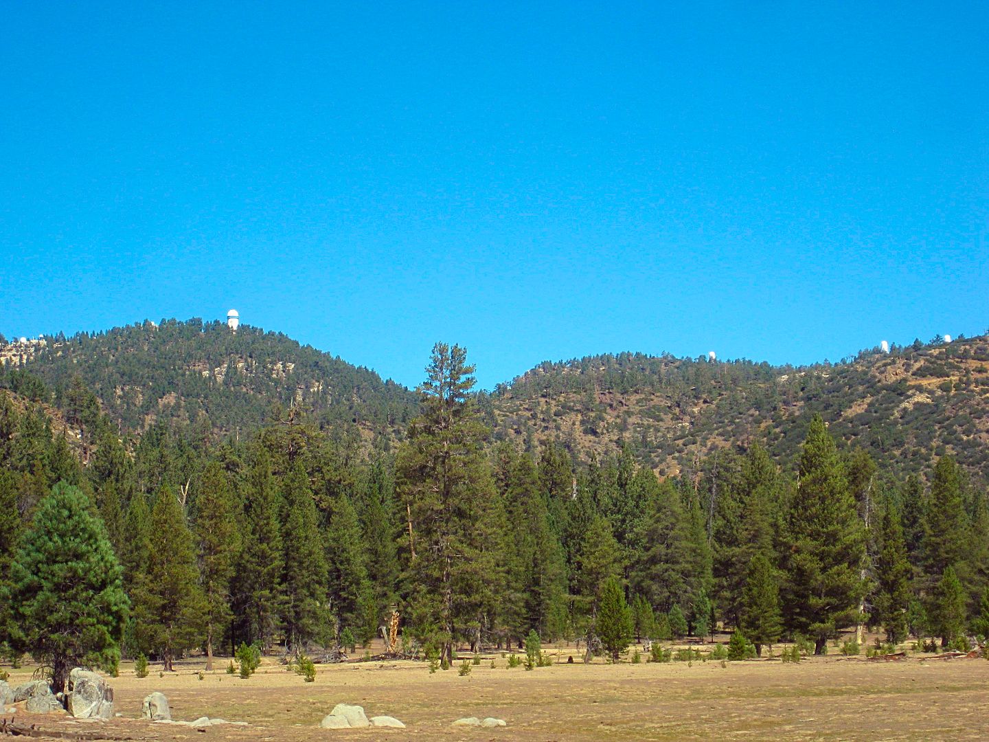
At least three new observatories have been added since my last visit. They are over on the ridge to the right.
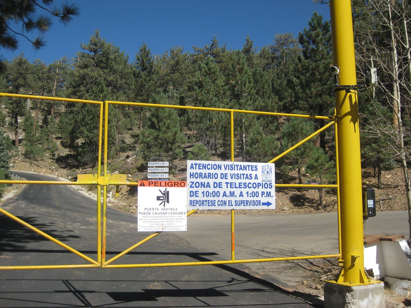
Km. 97.5 The gate, 8,705'... says open 10 am to 1 pm. I get there just a few minutes after 1. I hadn't planned on camping in the high altitude, but
the close-up photos of the observatories and one of the world's best viewpoints were worth the cold night sleep.
I turned around and took the time to check out many of the signed side roads off the paved road.
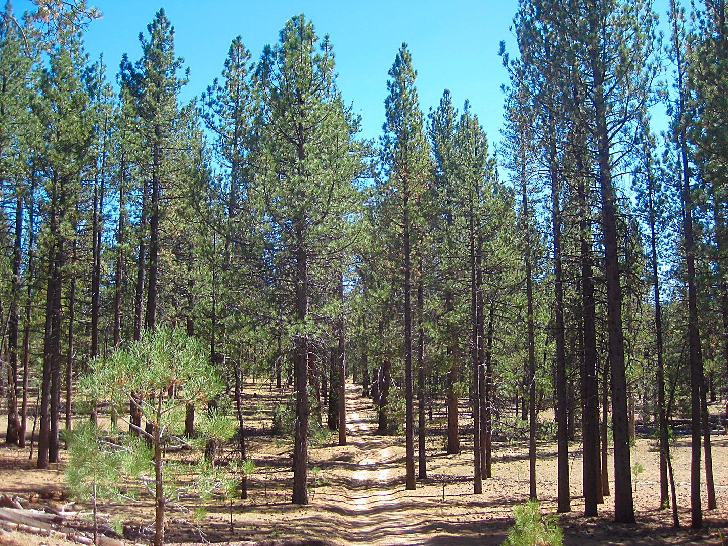
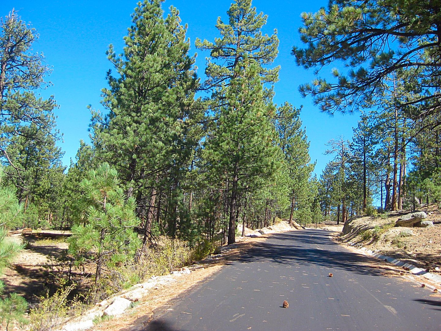
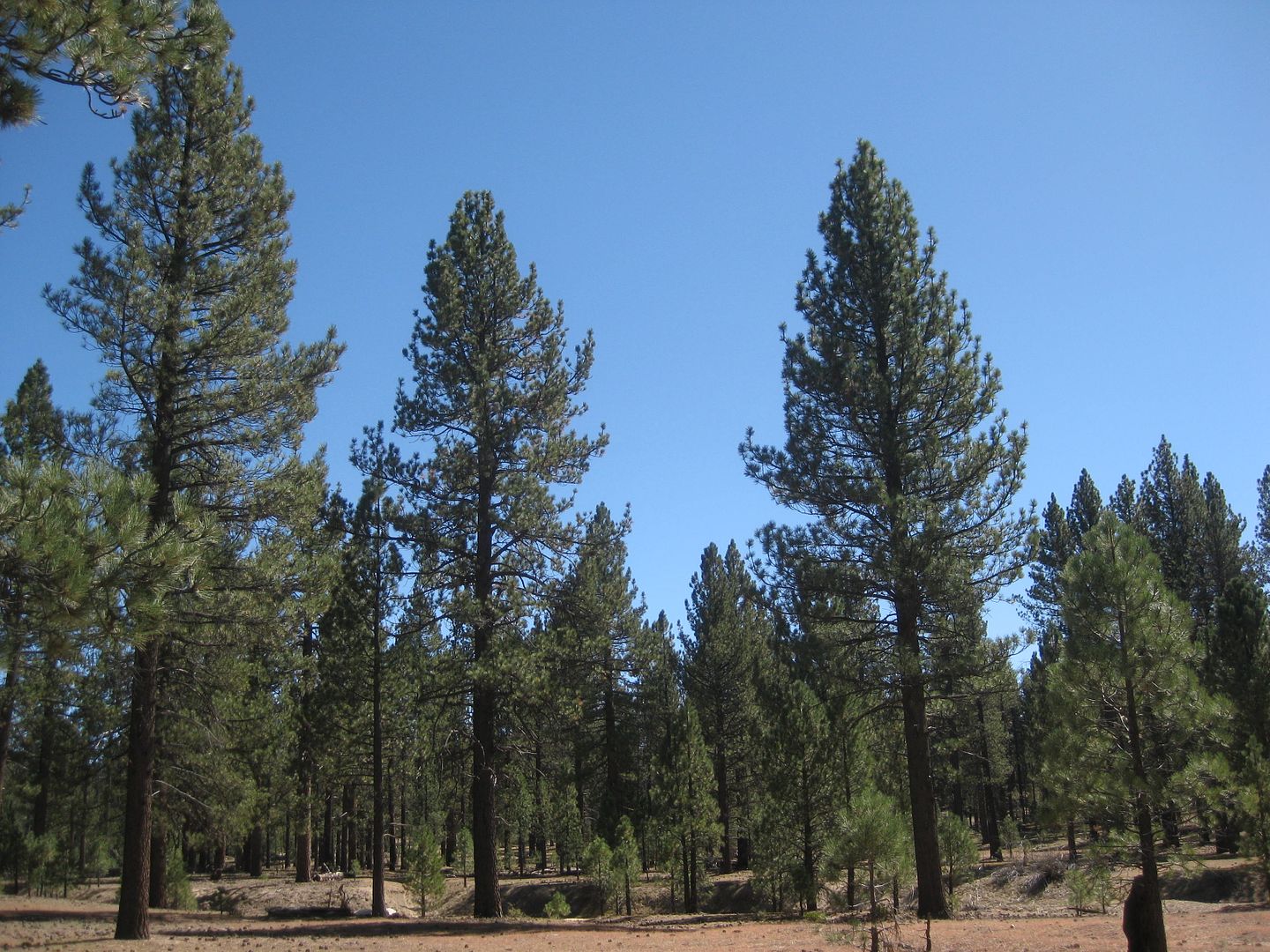
Notice the size of these trees compared to the road.
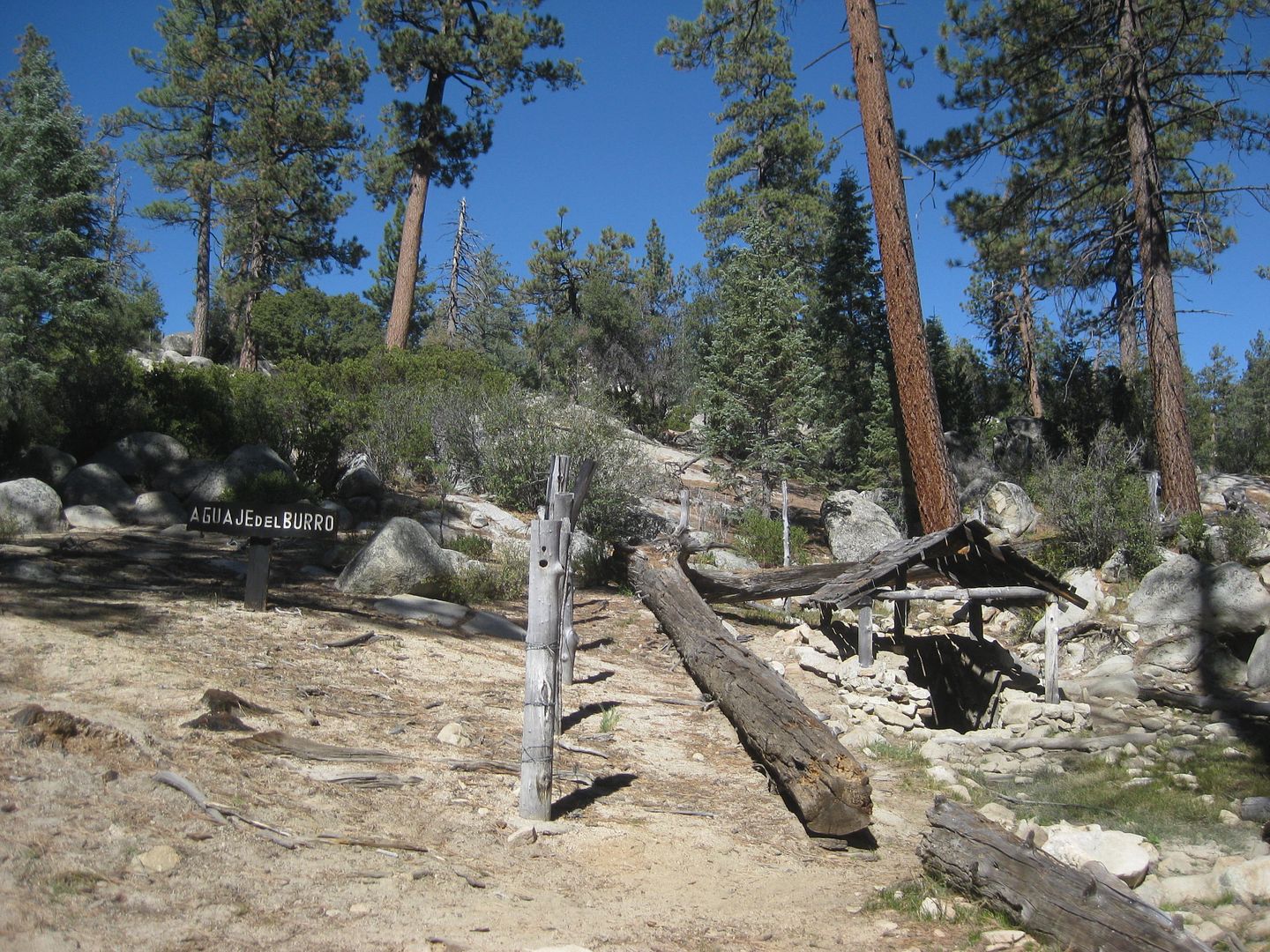
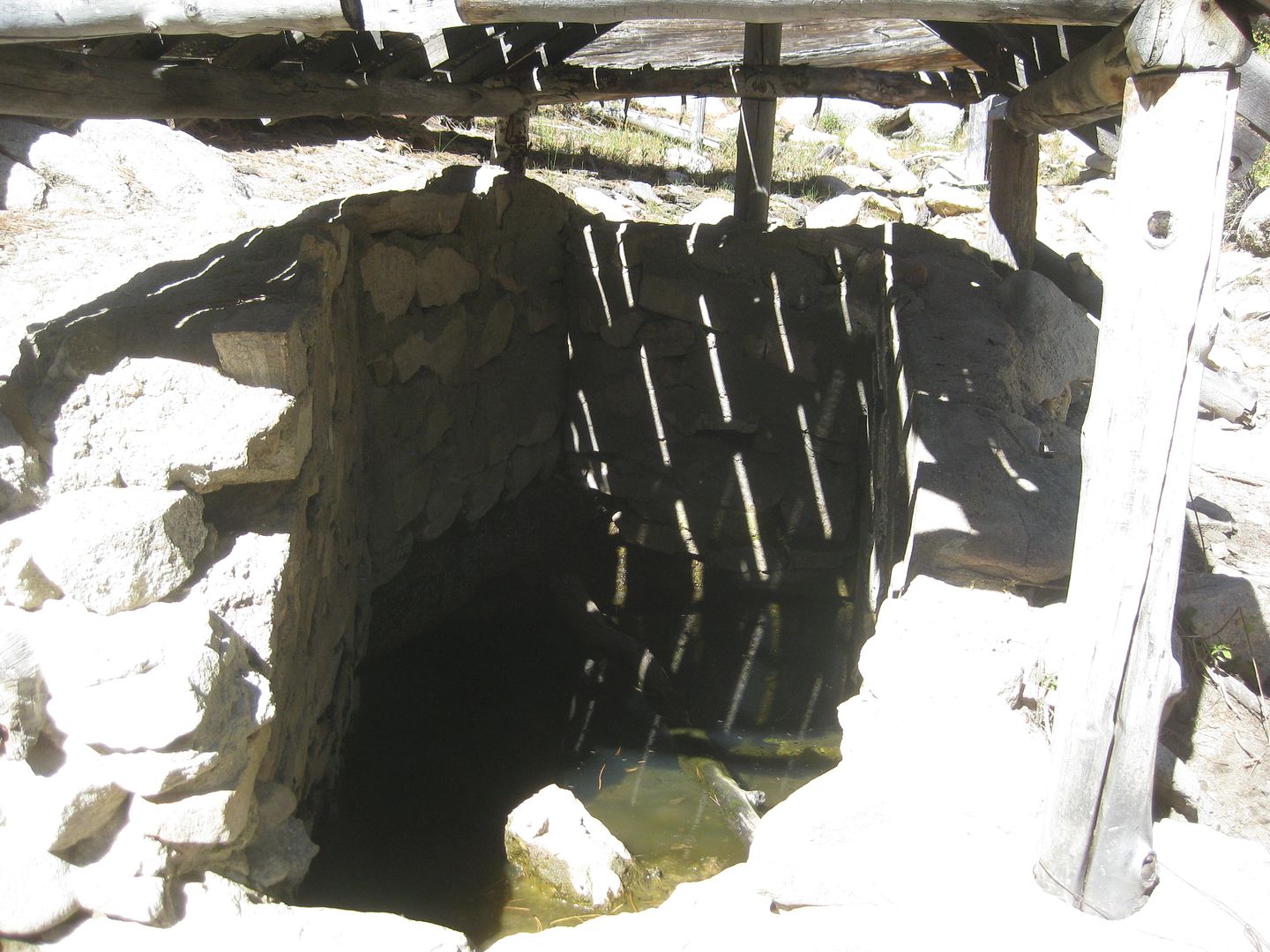
Aguaje del Burro, a spring.
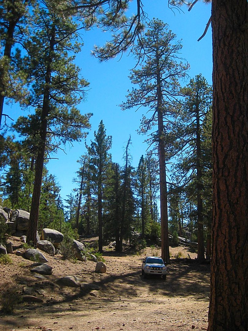
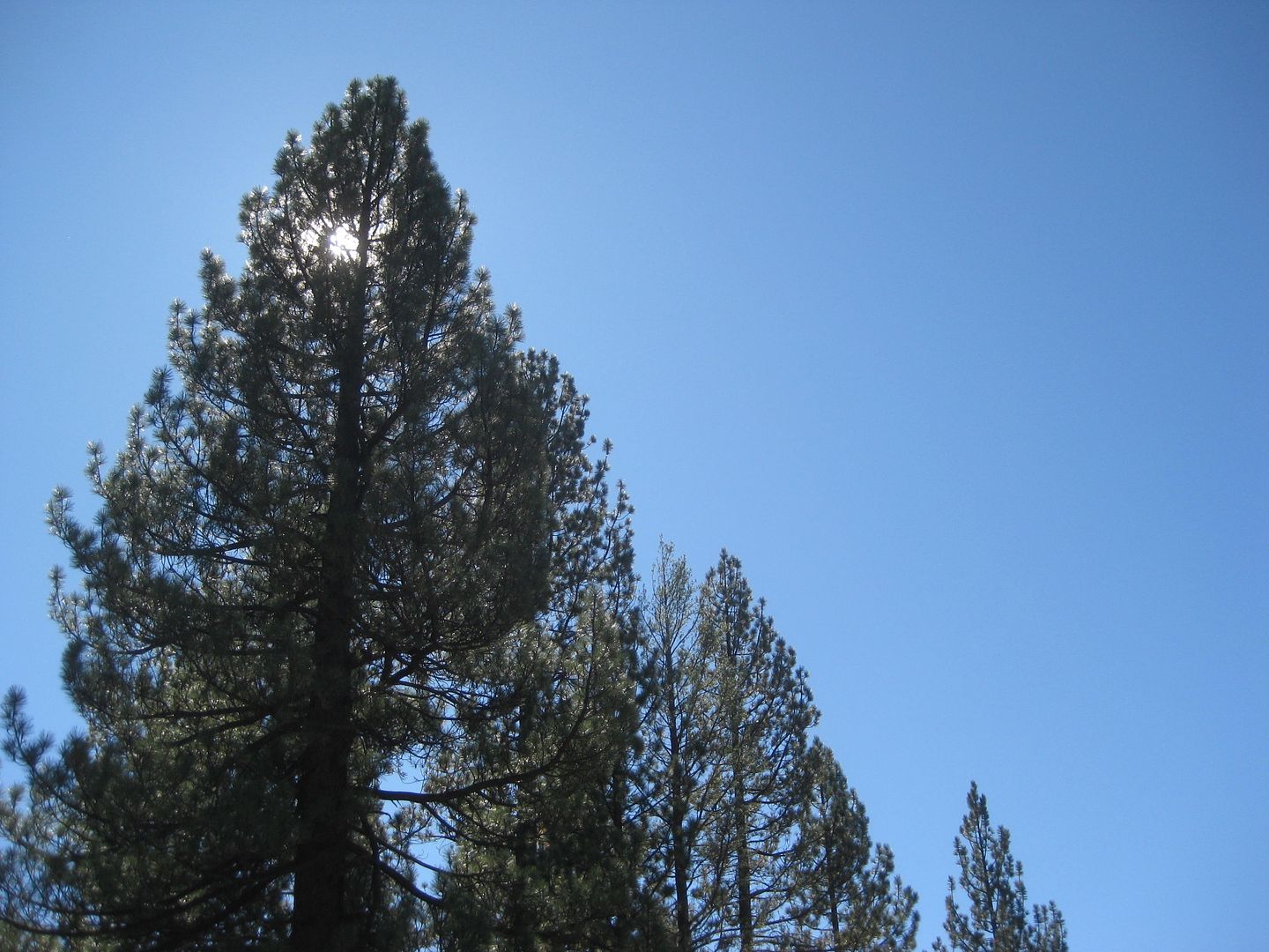
Some tall trees!
To Be Continued...
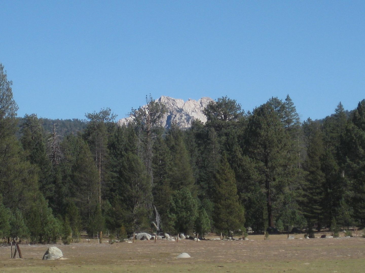
The twin peaks of Baja's highest mountain, El Picacho del Diablo (10,154').
La Tasajera road gate.
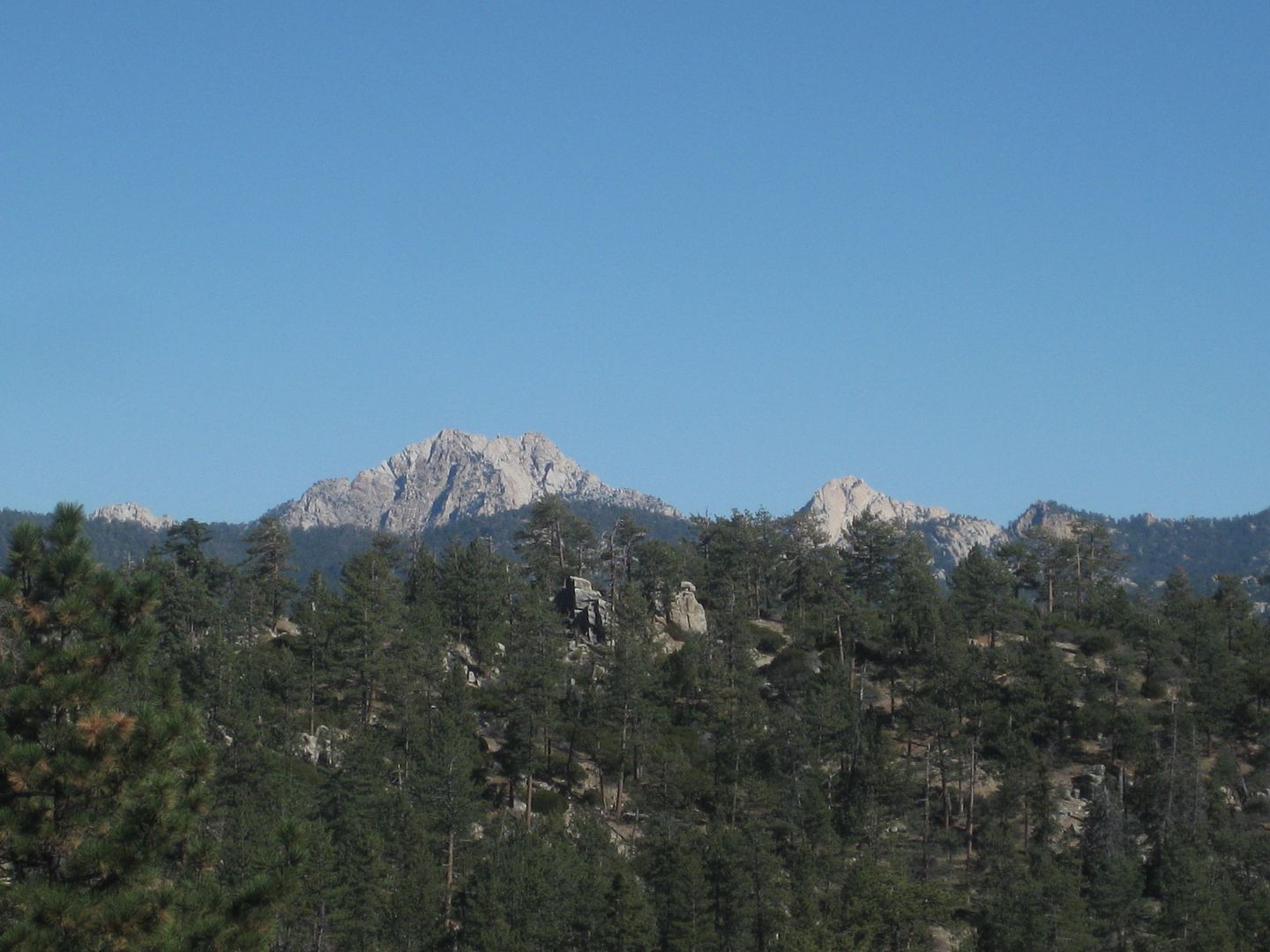
Diablo Mountain top.
END OF DAY 4.
Tomorrow, the observatory (I hope)!
-----------------------------------------------------------------------------------------------------------
The rest of the TRIP #7 report from October 2017: http://forums.bajanomad.com/viewthread.php?tid=87976
[Edited on 5-8-2019 by David K]
|
|
|
basautter
Senior Nomad
Posts: 862
Registered: 7-1-2013
Member Is Offline
|
|
I would recommend getting the book "The Baja Catch" by Neil Kelly and Gene Kira. It's a great starting point for fishing. "The Baja Adventure Book"
is dated, but still a good reference. David K has a good book on Missions if that is part of your agenda.
The Baja Almanac is a great map, if you can find one for a reasonable price (out of print and usually very expensive). The AAA Baja Map is also good,
and probably more easily obtained.
If you have a GPS unit, I recommend the E32 map (see below link). It's the best map of Baja I have used so far.
http://cartografiagps.com/en/
I take a SPOT for "I am ok" messages via satellite and emergencies. There are additional devices for two way satellite texting (Garmin InReach).
https://www.findmespot.com/en/
https://explore.garmin.com/en-US/inreach/
Have fun!
[Edited on 5-8-2019 by basautter]
[Edited on 5-8-2019 by basautter]
|
|
|
LukeJobbins
Nomad
Posts: 196
Registered: 3-11-2014
Location: Lemoore, Ca
Member Is Offline
|
|
San Pedro can be a day trip. Good road all the way. About 2 hours off the highway. Only campground camping allowed and exact change required for
entry. It was either 68 or 72 peso per person per day last week. I can’t remember exactly.
|
|
|
blackwolfmt
Senior Nomad
Posts: 802
Registered: 1-18-2014
Location: On The Beach With A Blackwolf
Member Is Offline
Mood: dreamin of Riden out a hurricane in Baja
|
|
Great pics DK,,Those are some gorgeous Pondys for sure
So understand dont waste your time always searching for those wasted years
face up and make your stand and realize that your living in the golden years
|
|
|
David K
Honored Nomad
Posts: 64493
Registered: 8-30-2002
Location: San Diego County
Member Is Offline
Mood: Have Baja Fever
|
|
Thanks... from my trip report in October 2017. It was COLD at 8,000 feet!!! I did get a personal tour of the observatory site by the head guy the next
day, so it was worth it to complete the guidebook research for that road.
|
|
|
OCEANUS
Nomad
Posts: 139
Registered: 10-11-2008
Location: Dana Point; L.A. Bay
Member Is Offline
|
|
Thank you Nomads for the SPM info. We usually get up to the Eastern Sierra for a backpacking trip every Summer, but with all the snow up in the
backcountry this year, looks like the "Baja Sierra" will be an awesome surrogate.
|
|
|
Marc
Ultra Nomad
Posts: 2747
Registered: 5-15-2010
Location: San Francisco & Palm Springs
Member Is Offline
Mood: Waiting
|
|
Can you budget more time? Seven days doesn't seem enough.
|
|
|
BajaMama
Super Nomad
Posts: 1106
Registered: 10-4-2015
Location: Pleasanton/Punta Chivato
Member Is Offline
Mood: Got Baja fever!!
|
|
Just north of Catavina turn right onto the road to El Marmol, the old onyx mine. There is a graveyard, school house, and lots of onyx for the taking
(but outside the fenced areas). Your son will love it.
North of El Rosario, just after the military check station, turn left onto the well marked road to La Lobera. A sea lion rookery, and beautiful views
and scenery. Your son will love that, too.
Each of these excisions will not take more than 2 hours. That's all I got.
[Edited on 5-15-2019 by BajaMama]
[Edited on 5-15-2019 by BajaMama]
|
|
|
StuckSucks
Super Nomad
Posts: 2307
Registered: 10-17-2013
Member Is Offline
|
|
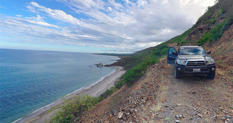
| Quote: Originally posted by JZ |
Someone just showed me this route (plus a little more in the dirt). Looks like a great day trip, ride from La Paz. Looking forward to doing it in a
couple months. |
I almost forgot -- I shot a photo sphere along this road.
|
|
|
JZ
Elite Nomad
Posts: 9269
Registered: 10-3-2003
Member Is Offline
|
|
That is a narrow road.
|
|
|
StuckSucks
Super Nomad
Posts: 2307
Registered: 10-17-2013
Member Is Offline
|
|
Perfect for "high school" trucks.
One of Cameron Steele's "Rip to the Tip" shows ran along this section and had some great footage. Would be quick/easy work on a bike.
|
|
|
honda tom
Nomad
Posts: 493
Registered: 8-28-2003
Location: middle calif
Member Is Offline
|
|
JZ's suggestions are spot on... hit the coast and get to the islands. June is not bad on the sea of cortez… early june is better however, and on a
boat it doesn't matter. In Loreto the Mission Hotel is the nicest, but also the highest priced I think about 120 per nite. Just 2 blocks down on the
beach is the Oasis at about 70 per nite. Great food and very nice rooms. I always enjoy pulling up to the different island beaches with my kids....
something they'll never forget.
|
|
|
JZ
Elite Nomad
Posts: 9269
Registered: 10-3-2003
Member Is Offline
|
|
| Quote: Originally posted by StuckSucks |
Perfect for "high school" trucks.
One of Cameron Steele's "Rip to the Tip" shows ran along this section and had some great footage. Would be quick/easy work on a bike.
|
Gonna run it in about 45 days. Your posts always inspire me. Can't wait to experience it with my two boys.
Wife and daughter might actually come on this trip too.
[Edited on 5-17-2019 by JZ]
|
|
|
| Pages:
1
2 |