David K
Honored Nomad

Posts: 64476
Registered: 8-30-2002
Location: San Diego County
Member Is Offline
Mood: Have Baja Fever
|
|
PHOTOS at MISSION SITES (most recent)
EDIT, 12-2022: To see mission (and on page 2, visita) photos, without the Photobucket watermark, go to this page on VivaBaja: https://vivabaja.com/mission-site-photos/
Photo/ Year mission founded/ Location/ Photo year
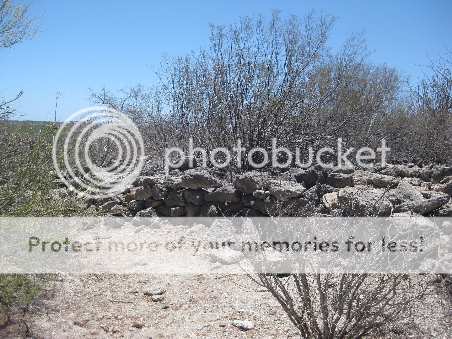
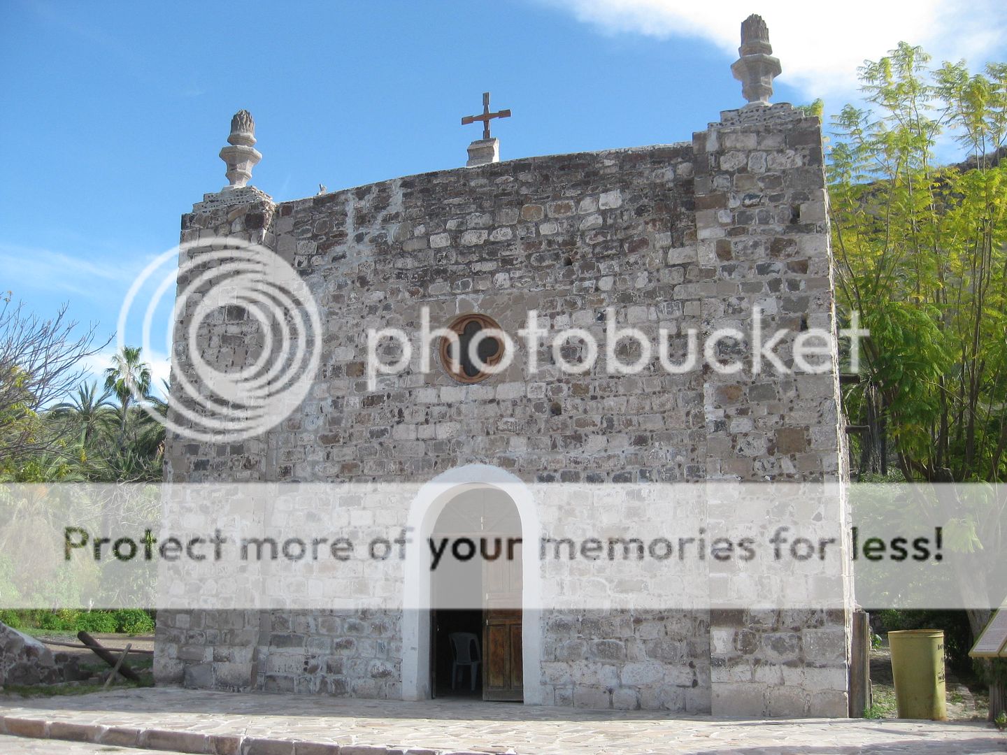
1683 SAN BRUNO (in 2019)
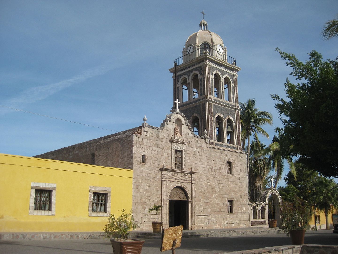
1697 LORETO (in 2017)
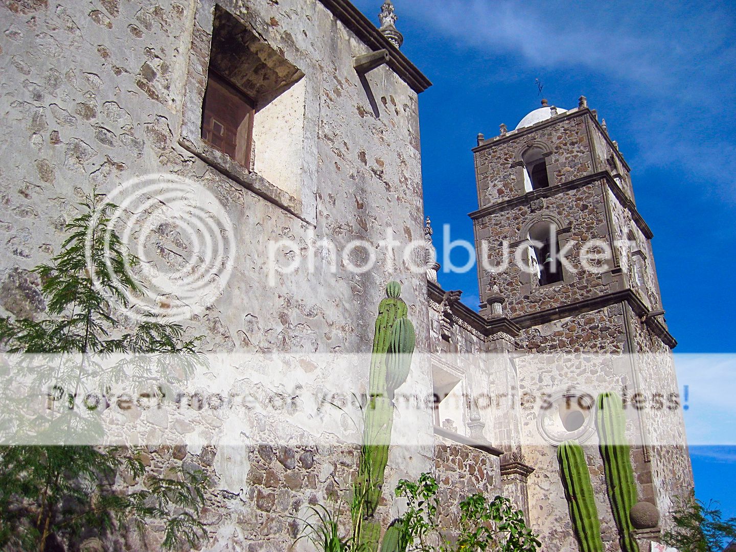
1699 SAN JAVIER (in 2017)

1705 LIGUI (in 2017) [no ruins remain]

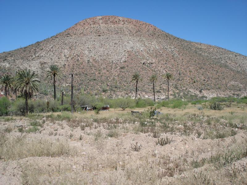
1705 MULEGE (in 2019)
Visita de LONDO (in 2019) [Visita of Loreto ~1705]

1708-1736 COMONDU (first site, in 2017)
1736-1827 COMONDU (chapel at final site, in 2017)
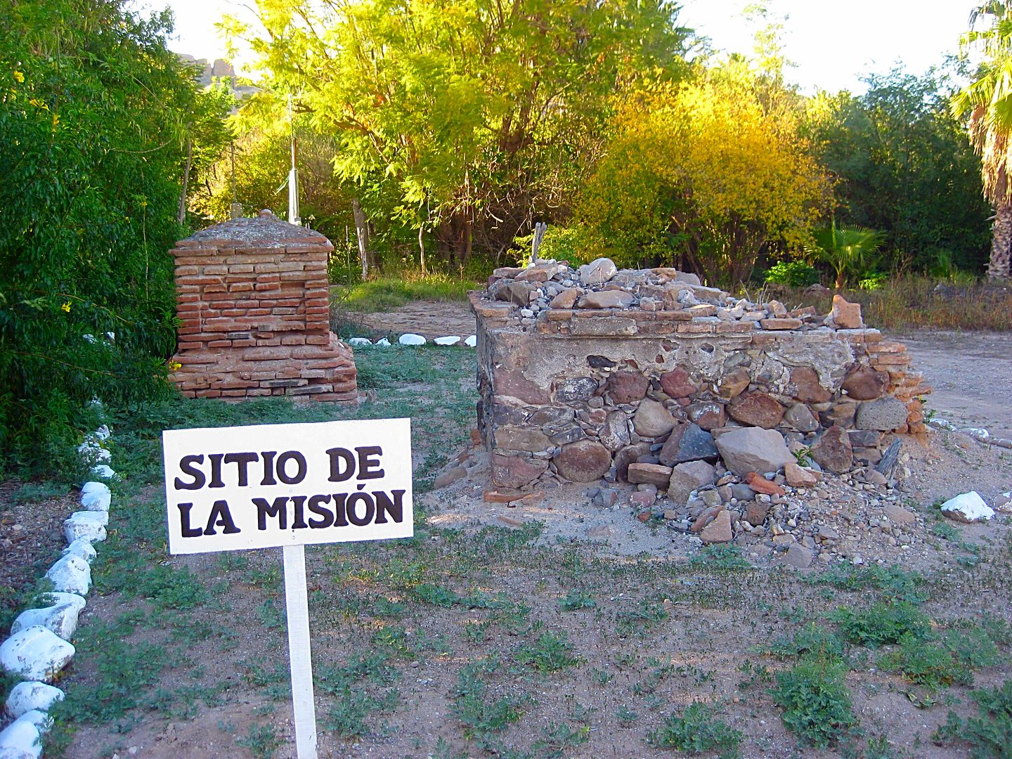
1720 LA PURISIMA [no church ruins remain, in 2017]
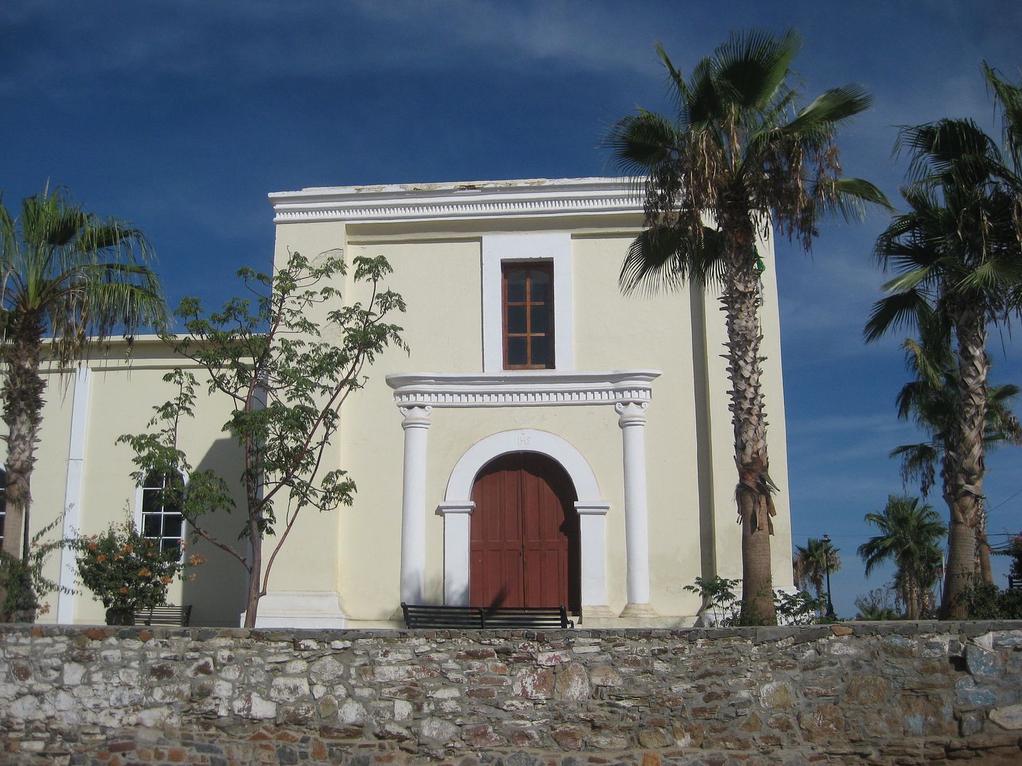
1720 PILAR DE LA PAZ [final site in Todos Santos, in 2017]
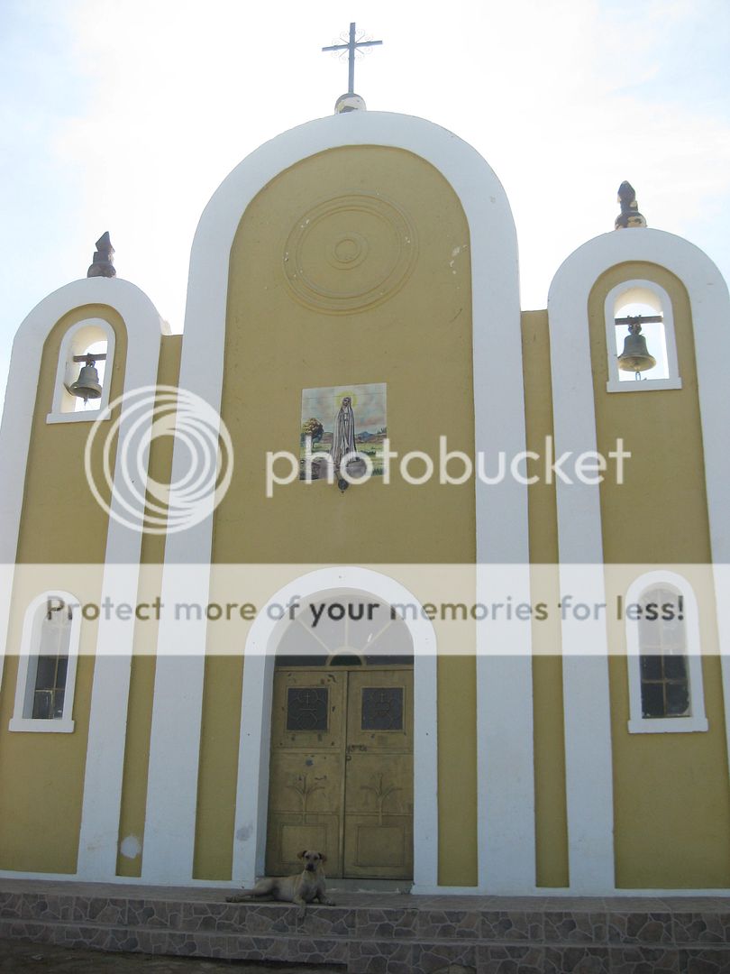
1720 GUADALUPE (in 2019)
more to come...
[Edited on 12-15-2022 by David K]
|
|
|
David K
Honored Nomad
Posts: 64476
Registered: 8-30-2002
Location: San Diego County
Member Is Offline
Mood: Have Baja Fever
|
|

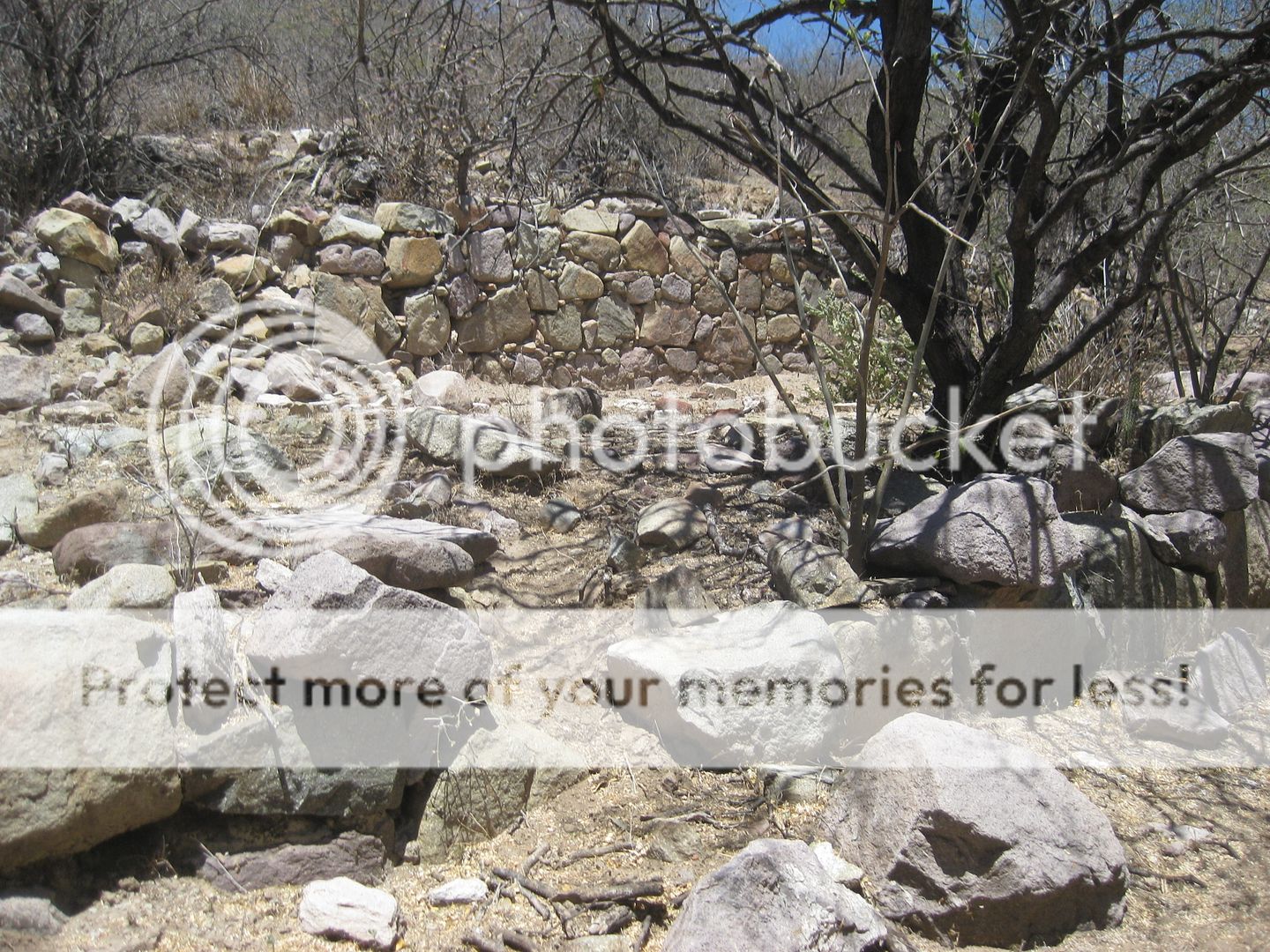
1721-1741 DOLORES (APATE, in 2017) [view from cliff overlook]
1741-1768 DOLORES (CHILLA/ LA PASION, in 2017) [rubble and foundations]
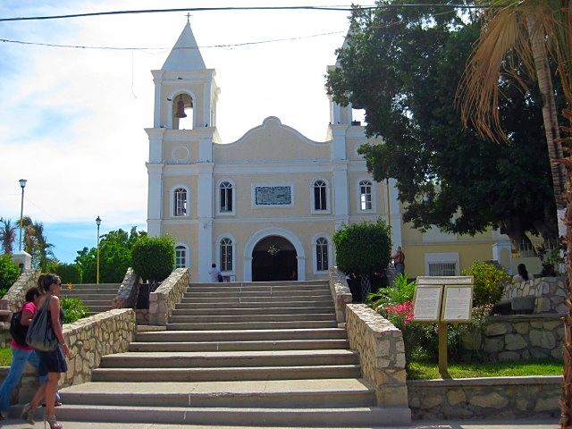
1724 SANTIAGO [modern church on site, 2017]
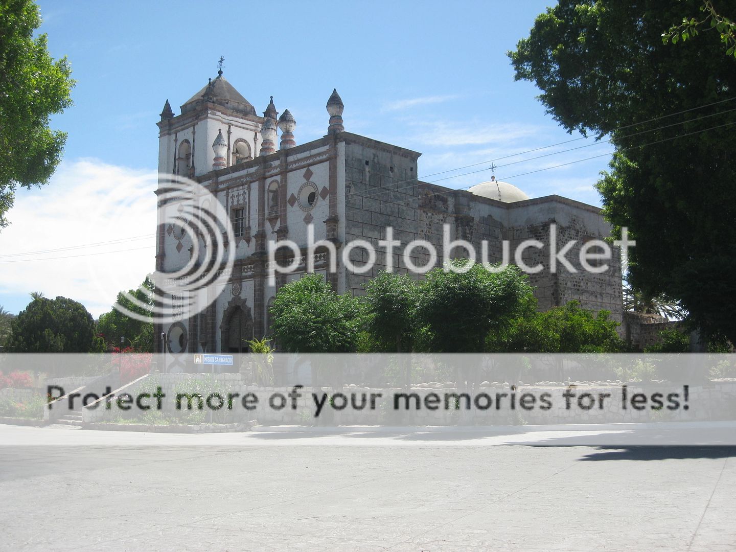
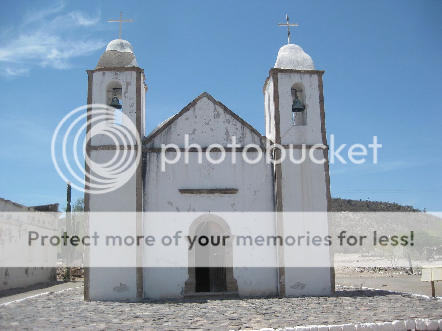
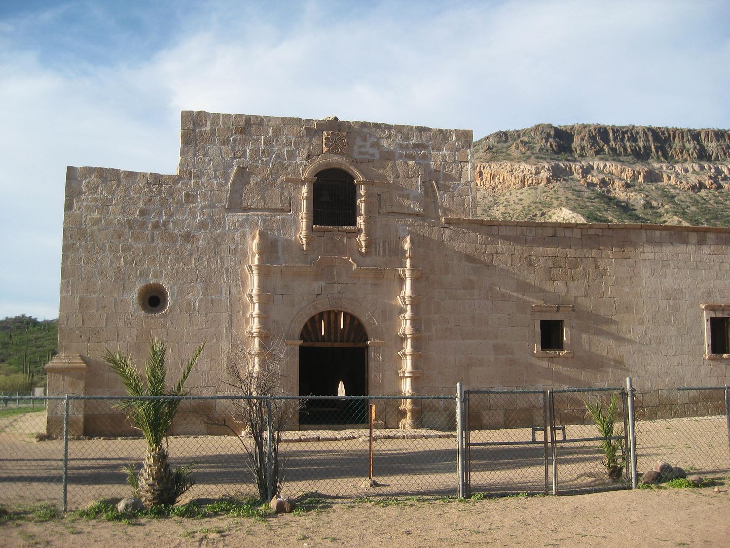
1728 SAN IGNACIO (in 2019)
1730 SAN JOSE DEL CABO [modern church on site, in 2012]
1733 SANTA ROSA [modern church on site, in 2017]
1737 SAN LUIS GONZAGA (in 2017)
1752 SANTA GERTRUDIS (in 2017)
Visita de SAN PABLO (in 2019) [Visita of Santa Gertrudis]
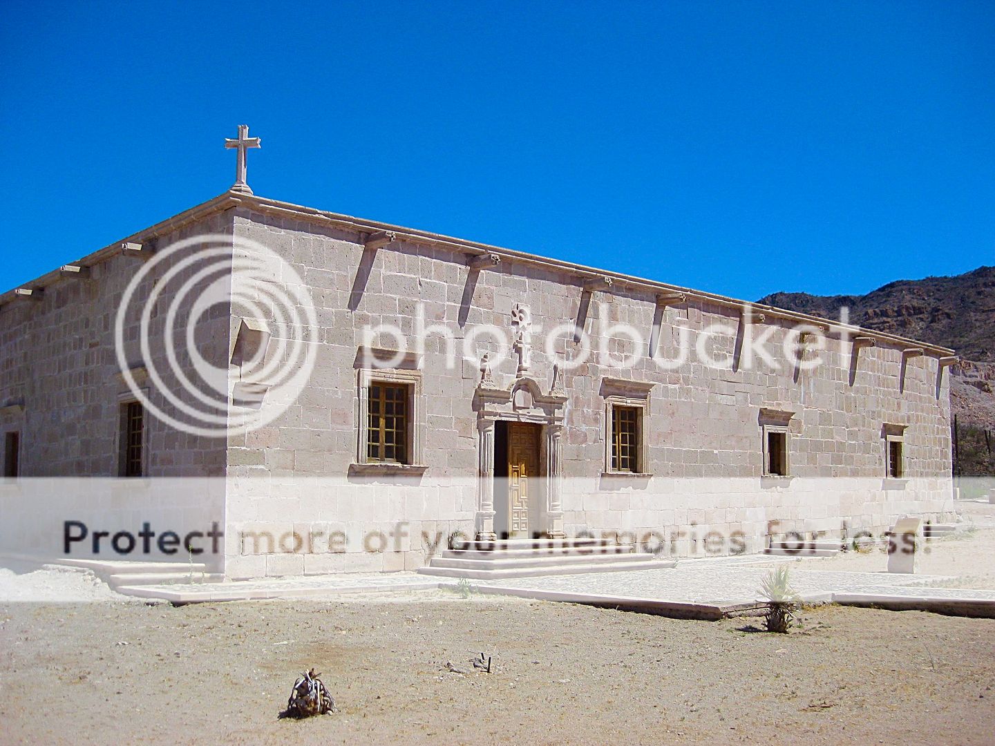
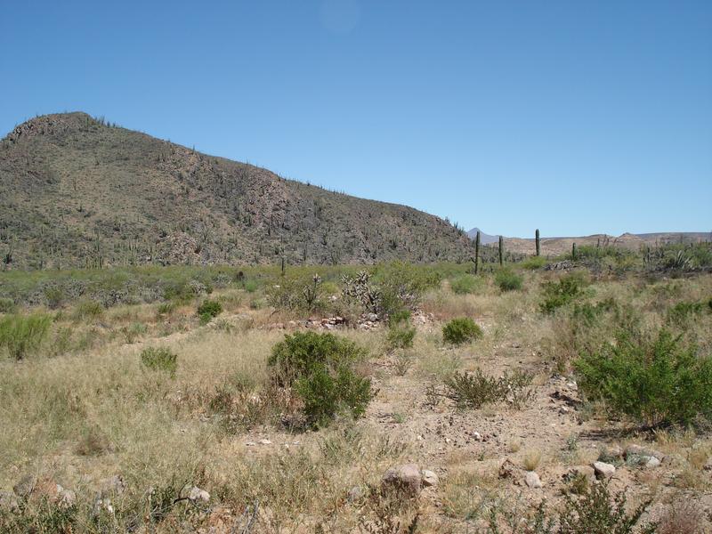
1762 SAN BORJA (in 2017)

1766-1767 CALAMAJUE (in 2016) [first site of mission renamed Santa María]
1767-1775 SANTA MARIA (in 2010)

1769 SAN FERNANDO (in 2017)
Visita de SAN JUAN DE DIOS (in 2017) [Visita of San Fernando]
To be continued...
[Edited on 9-3-2022 by David K]
|
|
|
David K
Honored Nomad
Posts: 64476
Registered: 8-30-2002
Location: San Diego County
Member Is Offline
Mood: Have Baja Fever
|
|
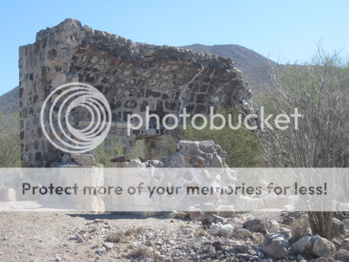
1774-1802 EL ROSARIO (first site, in 2017)
1802-1822 EL ROSARIO DE ABAJO (final site, in 2017)
1775 SANTO DOMINGO (in 2017)
1780 SAN VICENTE (in 2017)

1787 SAN MIGUEL (in 2017)
1791 SANTO TOMAS [final site, 1799-1849, in 2017]
1794 SAN PEDRO MARTIR (in 2004, Jack Swords photo)

1797 SANTA CATALINA (in 2018)
1830 EL DESCANSO (in 2017)
1834 GUADALUPE (del Norte, in 2017)
[Edited on 9-3-2022 by David K]
|
|
|
David K
Honored Nomad
Posts: 64476
Registered: 8-30-2002
Location: San Diego County
Member Is Offline
Mood: Have Baja Fever
|
|
Addition mission sites, not included in the above photos:
The previous posts are arranged by date, from the oldest mission site to the newest and not all multiple sites are shown. Nearly half the missions
moved one or more times during their years of operation.
I did include photos at the two sites of Comondú, Los Dolores, Santa María, and El Rosario, above.
The other missions that had more than one site include:
San Javier, La Paz, Santiago, San José del Cabo, Santo Domingo, San Miguel, Santo Tomás, and San Pedro Mártir.
The first San Javier mission site is today called Rancho Viejo, about 5 miles north of San Javier. Nothing is reported that remains from the 1799-1710
mission there.
La Paz Mission (Nuestra Señora del Pilar de la Paz) was first near La Paz Bay, but the exact location has been lost to modern construction. A plaque
is on a La Paz city street but in reality, is probably not the correct spot. It is believed to have been a few blocks south where old drawings show
palm trees growing. In 1748, the mission was moved to Todos Santos and replaced Mission Santa Rosa there. In 1825, the mission moved one more time, a
mile south to today's town plaza.
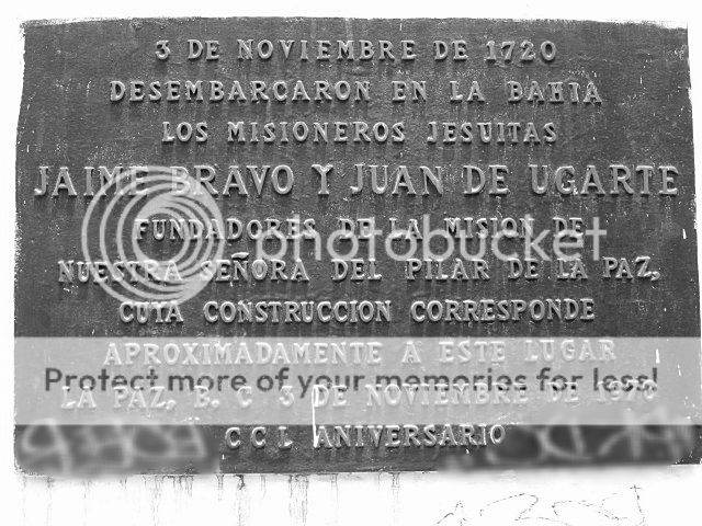
See the Santa Rosa photo in the first batch for the second site of La Paz mission, as it was the same as Santa Rosa, which it took over in 1748.
The Santiago mission has a more colorful but also confusing history. I have it detailed well in my book. Basically, it was first called Santiago de
los Coras and was where the silver mine of Real de Santa Ana would be established, years later. The mission was abandoned after a year and after
regrouping in La Paz, the padre tried again further south and renamed it Santiago el Apóstol (at Aiñiní) in 1724. The 1734 Pericú Revolt destroyed
the mission, killed the padre and others, and did so also at San José del Cabo. In 1736, after regaining control over the Native hostiles, the
mission was moved about 2 miles south to where the town of Santiago is today. The destroyed location is at a ranch and visitors are not welcome.
Jack Swords managed to get a couple of photos of foundation stones when he visited the ranch:
[Edited on 7-20-2019 by David K]
|
|
|
David K
Honored Nomad
Posts: 64476
Registered: 8-30-2002
Location: San Diego County
Member Is Offline
Mood: Have Baja Fever
|
|
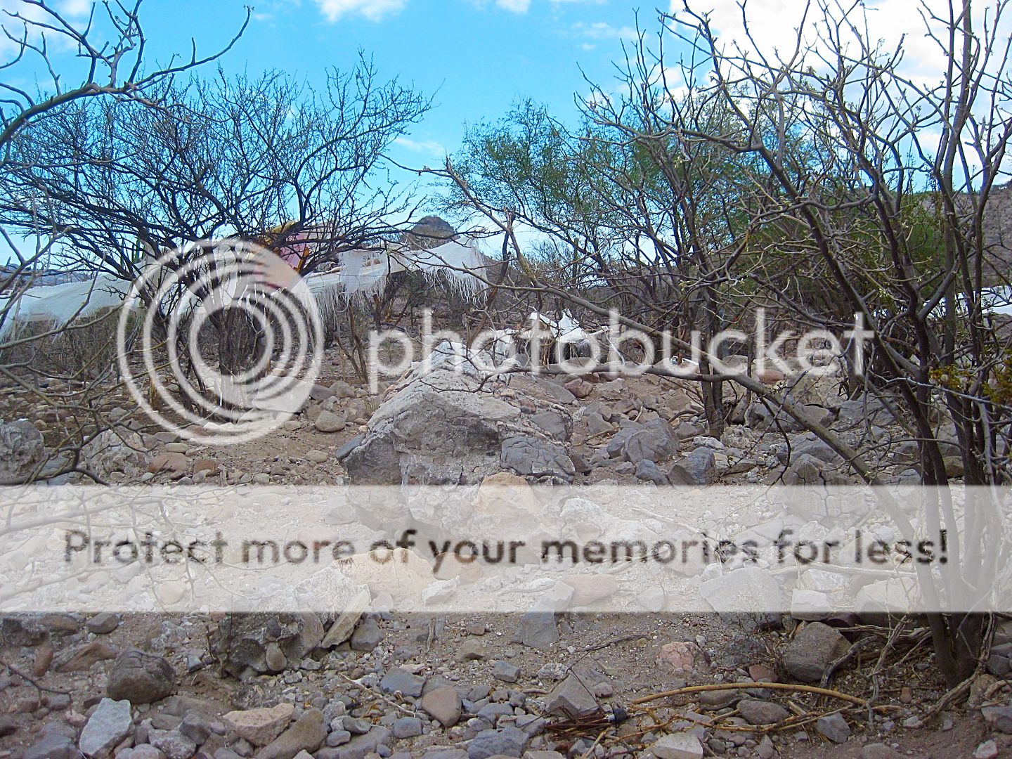
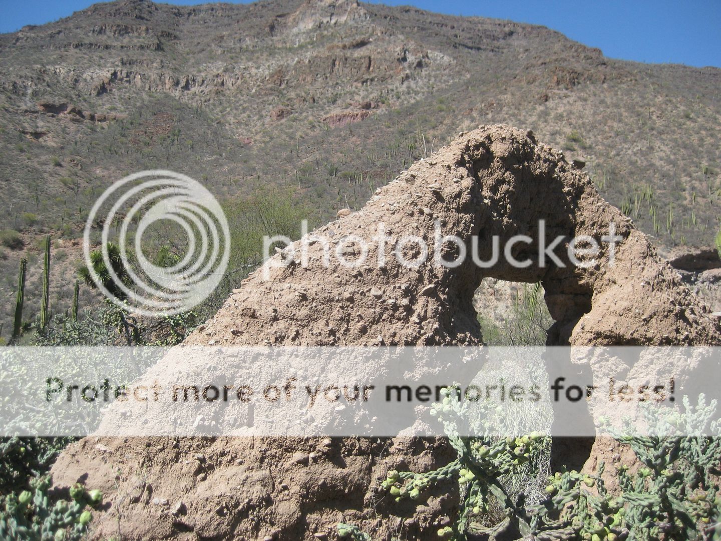
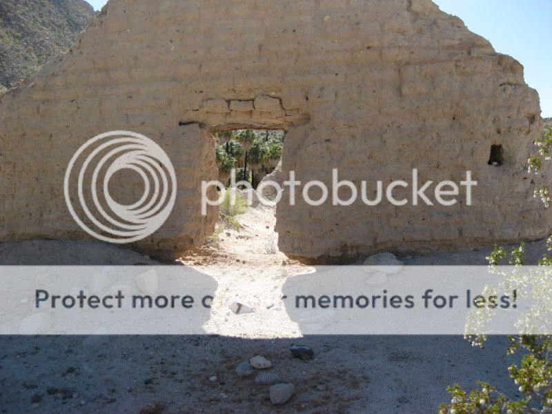
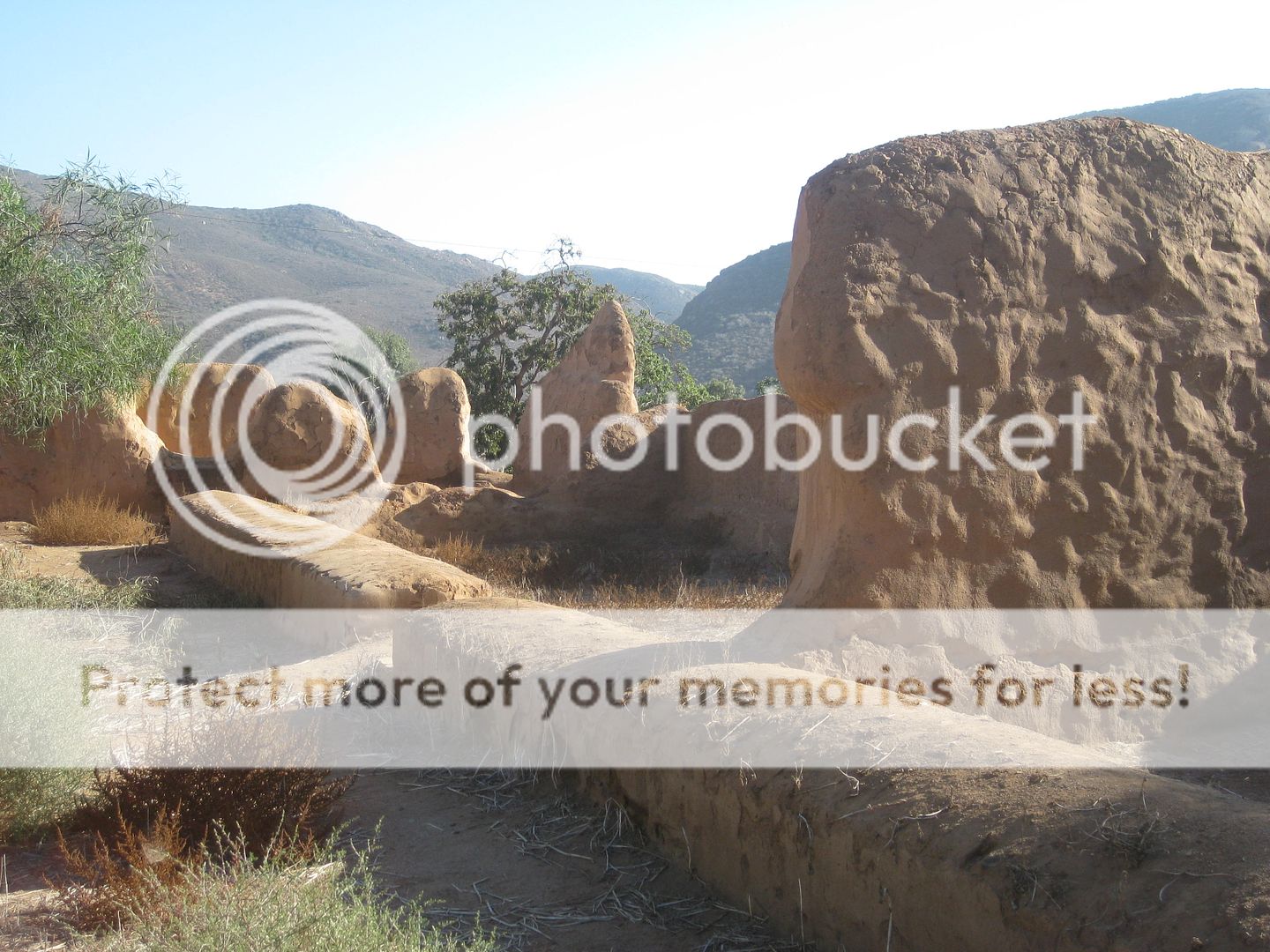
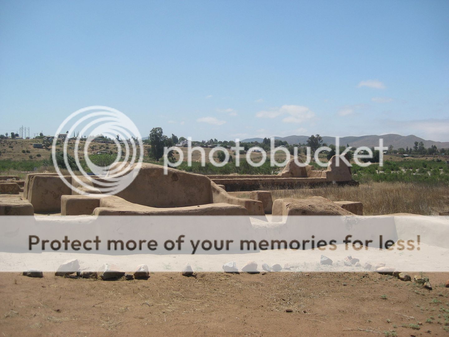
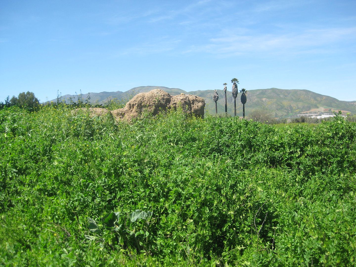
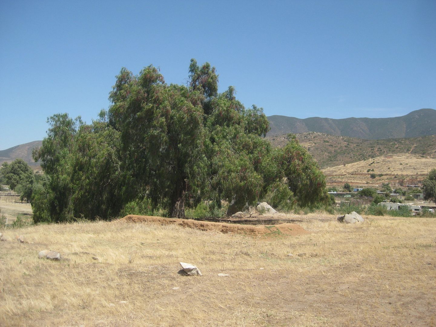
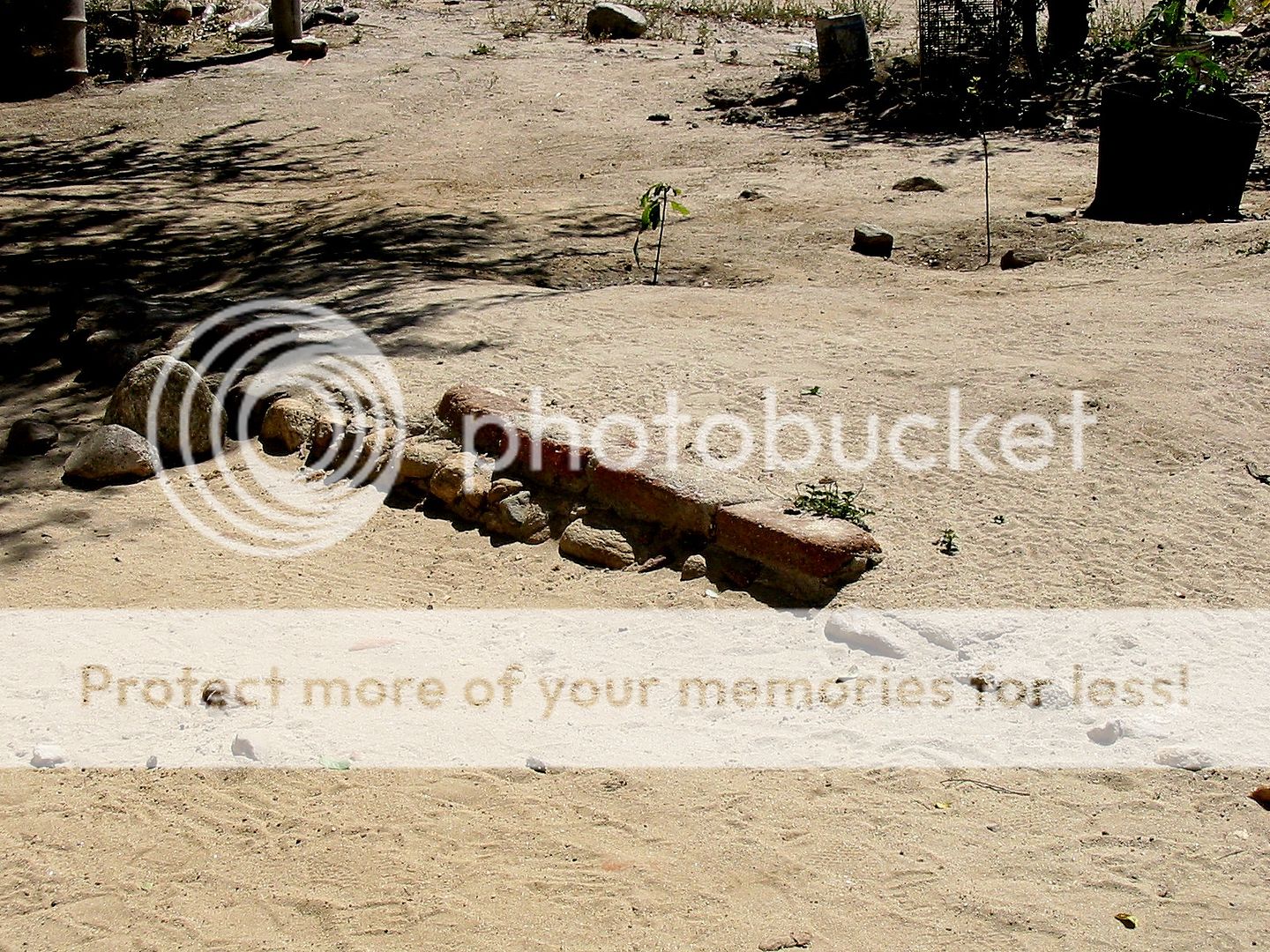
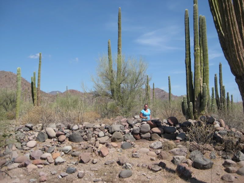
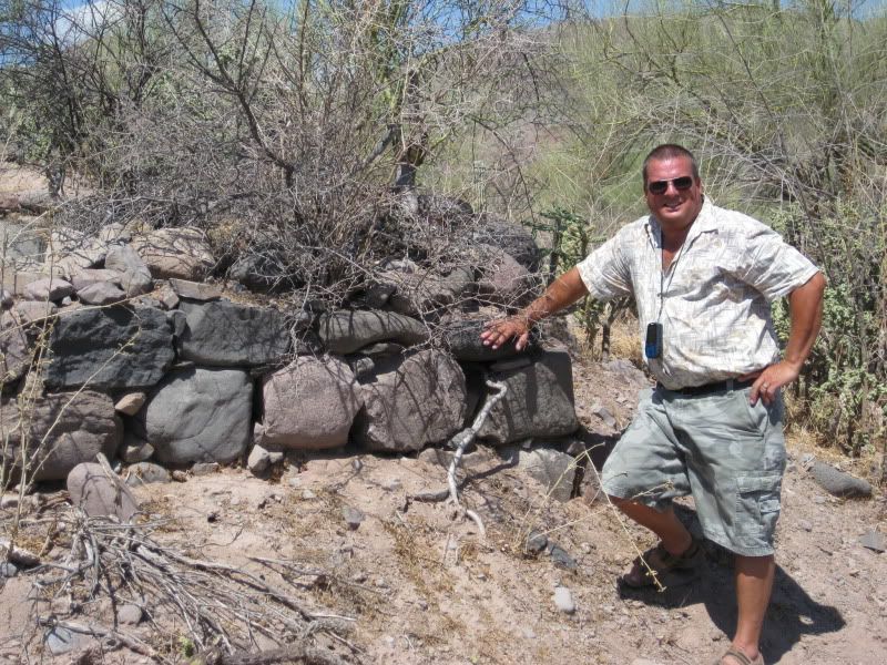
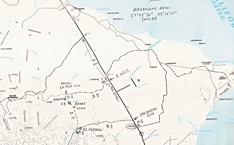
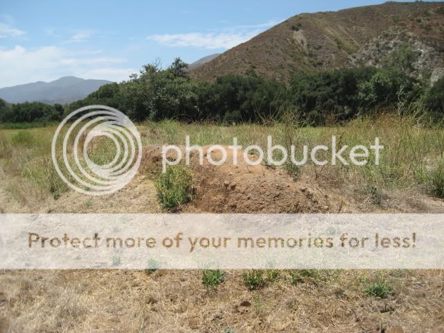
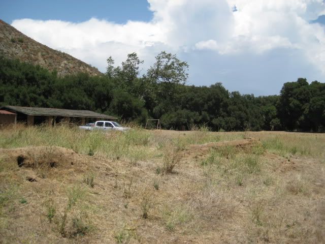
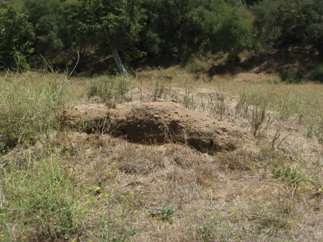
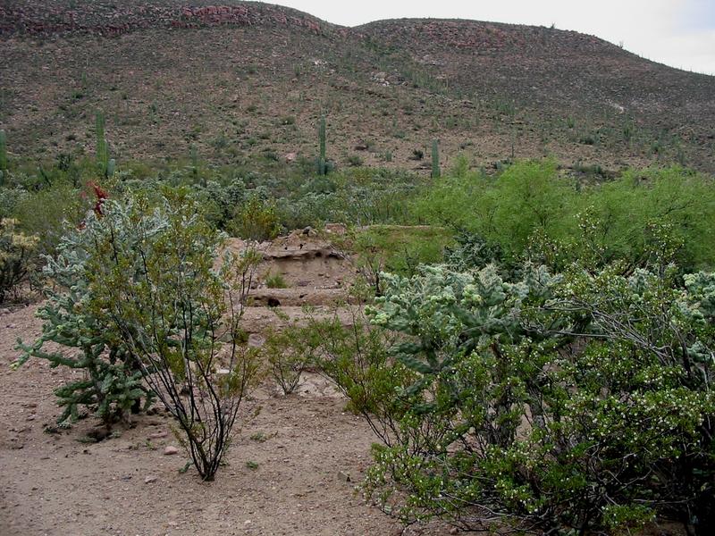
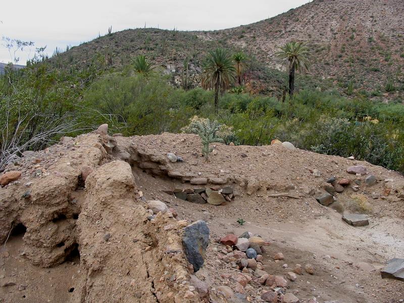
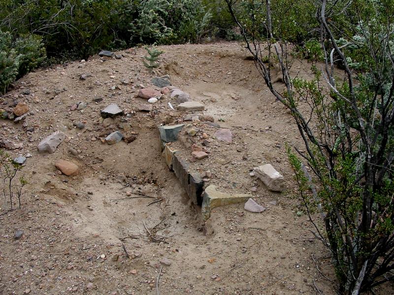
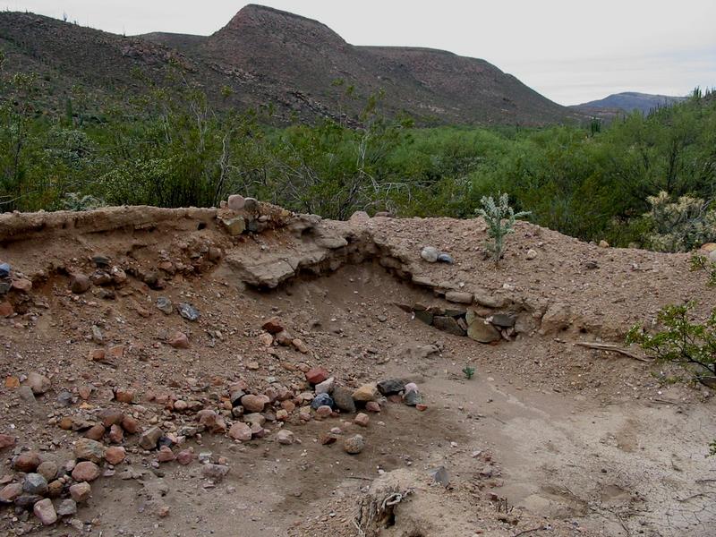
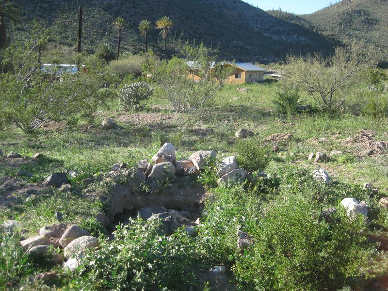
La Magdalena
A true mystery is out in the desert northwest of Mulegé...
A mission visita called La Magdalena in the letter written by Mulegé's Padre Palóu. In 1770, he mentions it as a possible new location for his
mission, following devastating floods.
Some have written it was developed by the Jesuits but others credit the Dominicans. Whoever built it had an extensive aqueduct bringing water to a
pila, near the buildings from the river near today's San José de Magdalena.
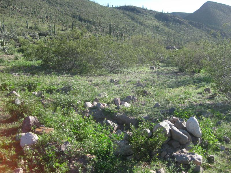
Flash floods in 2014 destroyed nearly all the building ruins as the arroyo widened. The pila remains but will someday be lost, as well.
Some maps and books have called this site "Mission Santa María Magdalena" over the years since Arthur North [in Camp and Camino in Lower California]
made the mistake that this Magdalena was one the Jesuits described as a proposed or started mission. Baja has several Magdalenas. The problem was that
others copied North's error.
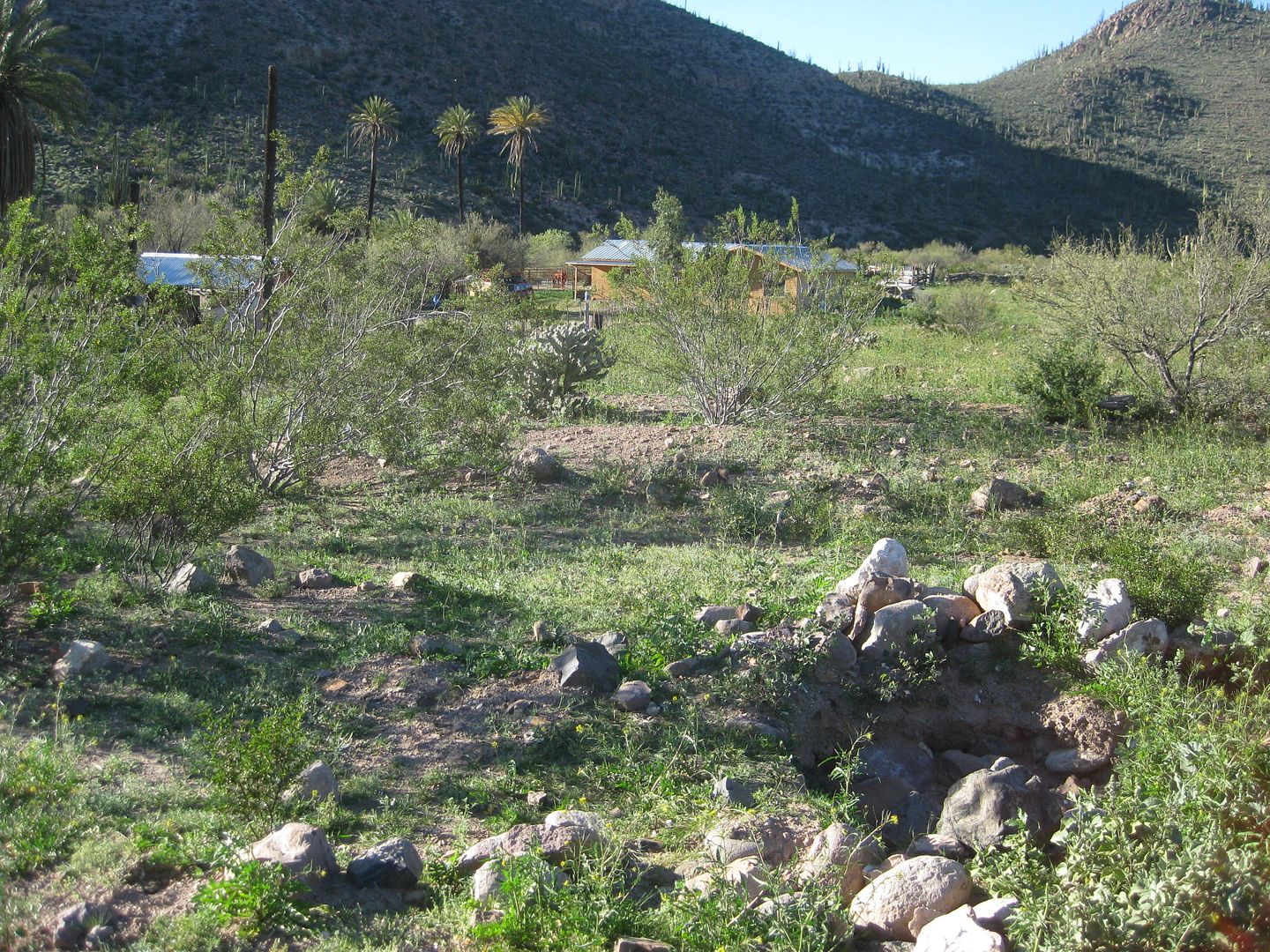
In 2009, La Magdalena:

Aqueduct
La Magdalena, 0.6 mile southeast of Rancho La Posa:
[Edited on 12-15-2022 by David K]
|
|
|
4x4abc
Ultra Nomad
Posts: 4163
Registered: 4-24-2009
Location: La Paz, BCS
Member Is Offline
Mood: happy - always
|
|
there is a lot more, David
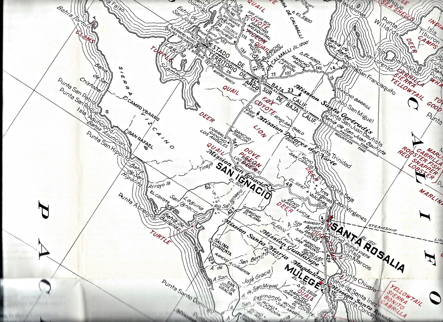
27° 3'26.02"N, 112°10'11.33"W
missionary or not - the question remains, why would someone build something right in the path of an Arroyo flood path?
Harald Pietschmann
|
|
|
David K
Honored Nomad
Posts: 64476
Registered: 8-30-2002
Location: San Diego County
Member Is Offline
Mood: Have Baja Fever
|
|
The arroyo grew over the past 250 years. Look at what happened to Ligüí, and that was a mission. I will look at your waypoint when I get back on my
PC.
Edit: In the newest (2018) sat image, it looks like the pila may have vanished? I see a possible room by your waypoint. Use the time slider to see
images back to 2004 as to how much the arroyo has grown.
[Edited on 7-21-2019 by David K]
|
|
|
4x4abc
Ultra Nomad
Posts: 4163
Registered: 4-24-2009
Location: La Paz, BCS
Member Is Offline
Mood: happy - always
|
|
there are 2 sets of ruins in this alluvial fan
and with alluvial fan, or flood plain, I don't mean the Boca de Magdalena
I mean the nameless Arroyo coming from the south-west
the rancho not far from the ruins is in a safe spot, why not the ruins?
and now the flood waters of Boca de Magdalena are eating away at them too


Harald Pietschmann
|
|
|
David K
Honored Nomad
Posts: 64476
Registered: 8-30-2002
Location: San Diego County
Member Is Offline
Mood: Have Baja Fever
|
|
Nice photo capture of the pila and the room you spotted. All mission sites have a lot to share with history buffs. When you are on a vacation doing
research, there is limited time devoted to each mission site. However, if you live in Baja, and have an interest, you could spend much more time
searching the surroundings for these archives of the past.
There is almost nothing in the history books I have that mentions Magdalena (this one). I mentioned what Palóu wrote in 1770.
North and McDonald (and some others since) called it "Santa María Magdalena" (in error), Gerhard and Gulick call it the "ruined Magdalena chapel."
This was just beyond the village of Boca de Magdalena. Today, that village is just a few goat-ranch houses along the big arroyo.
Sebastian Viosca (United States Consul in La Paz, 1861) wrote a report saying "the Jesuits founded the abolished mission of La Magdalena on these
plains, about 5 leagues distant from Mulegé." He continues, "On the north of these plains is the place called Rondin."
|
|
|
David K
Honored Nomad
Posts: 64476
Registered: 8-30-2002
Location: San Diego County
Member Is Offline
Mood: Have Baja Fever
|
|
In 1962 (and others), the Auto Club map shows the location as Mission Santa María Magdalena. In the north, they also show another mission that never
was, Dolores del Norte!
[Edited on 9-3-2022 by David K]
|
|
|
David K
Honored Nomad
Posts: 64476
Registered: 8-30-2002
Location: San Diego County
Member Is Offline
Mood: Have Baja Fever
|
|
The next mission site with multiple locations...
... that I have photos of is Santo Tomás. (Moving north from El Rosario)
The Santo Tomás mission was founded after San Miguel to fill the wide gap between San Vicente and San Miguel, in 1791. The mission was moved in 1794
due to lack of sunlight and insect problems. It was moved a second time in 1799 to the final site, where the town of Santo Tomás would grow near.
Here are the first (1791) site photos:
The first location was in a sycamore and oak picnic area almost 4 miles west of Hwy. 1 (KM. 47). I was last there in 2011.
In 2017, I found that the picnic area was closed and the road into it was fenced off.


My photo in 2005:
In 1975 (Academicanachist photo):
In 1967 (Michael Mathes photo):

[Edited on 9-3-2022 by David K]
|
|
|
4x4abc
Ultra Nomad
Posts: 4163
Registered: 4-24-2009
Location: La Paz, BCS
Member Is Offline
Mood: happy - always
|
|
Quote: Originally posted by David K  | In 1962 (and others), the Auto Club map shows the location as Mission Santa María Magdalena. In the north, they also show another mission that never
was, Dolores del Norte!
|
that only brings up more questions
on today's map where would Rancho Las Delicias and Rancho Santa Lucia be?
[Edited on 9-4-2022 by BajaNomad]
Harald Pietschmann
|
|
|
David K
Honored Nomad
Posts: 64476
Registered: 8-30-2002
Location: San Diego County
Member Is Offline
Mood: Have Baja Fever
|
|
Let's keep this thread on missions. The map shows Mission Santa María Magdalena at the location of the La Magdalena ruins in the photos.
Let's start a new thread on comparing the old AAA maps to today's reality. OK, Harald? I can break out the 1962 AAA guide and see if those ranches are
mentioned and also compare Gulick's map and guide of 1962 for a more correct look.
Here is the new thread to discuss the map, Harald: http://forums.bajanomad.com/viewthread.php?tid=93050
[Edited on 7-22-2019 by David K]
|
|
|
David K
Honored Nomad
Posts: 64476
Registered: 8-30-2002
Location: San Diego County
Member Is Offline
Mood: Have Baja Fever
|
|
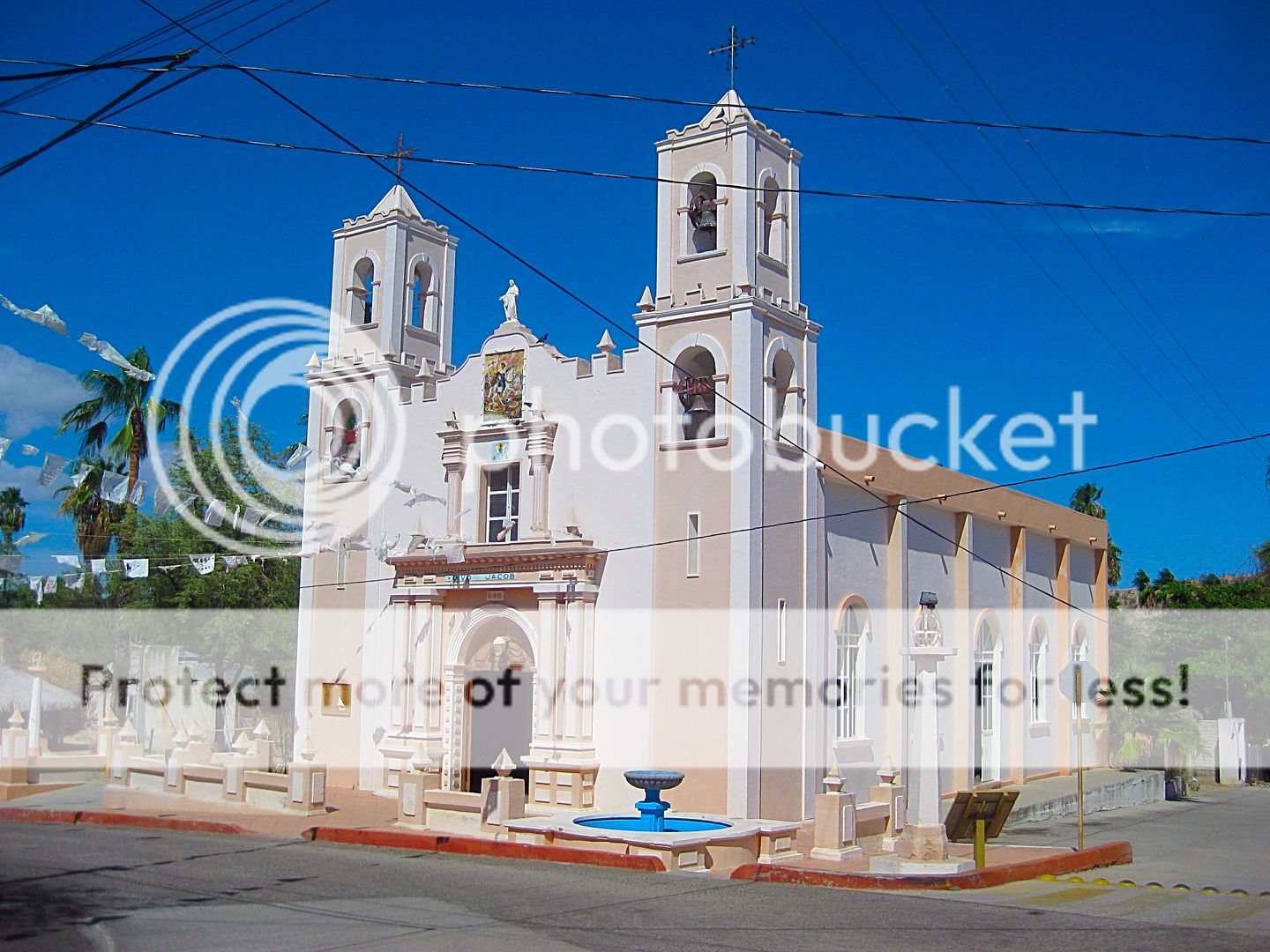
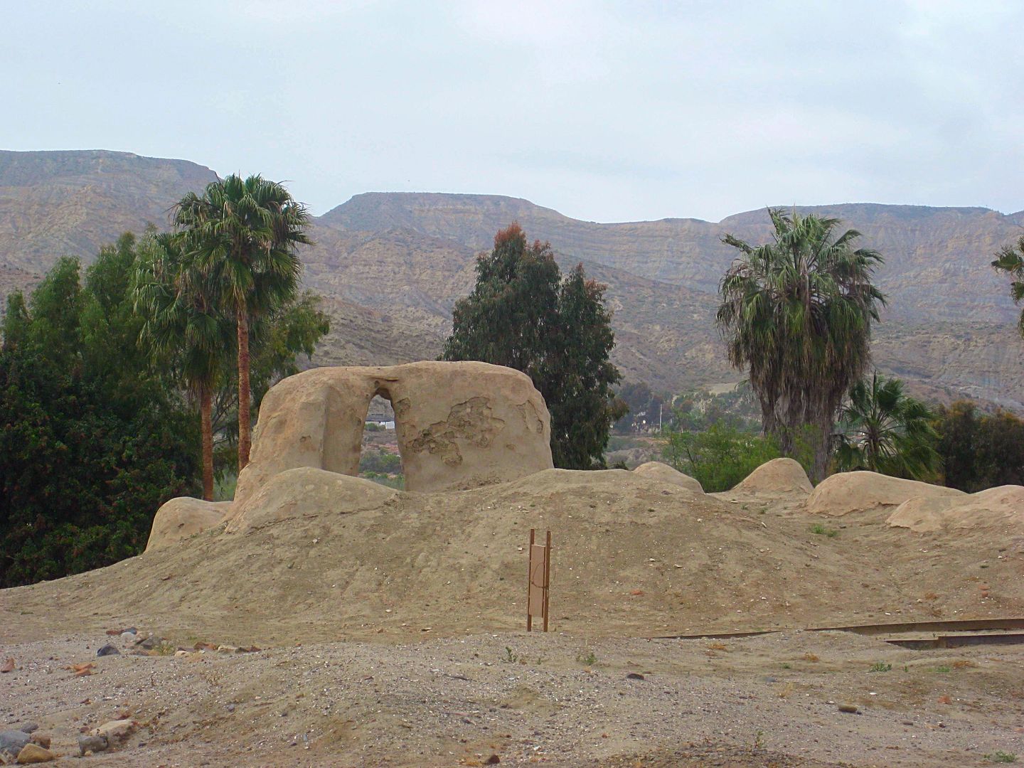
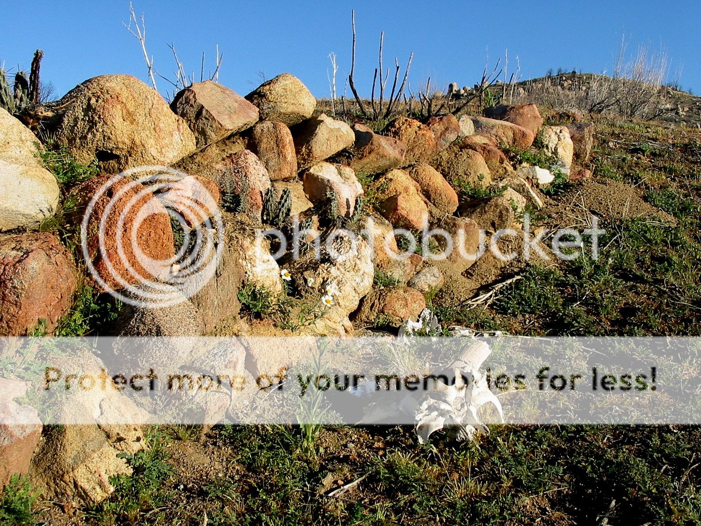
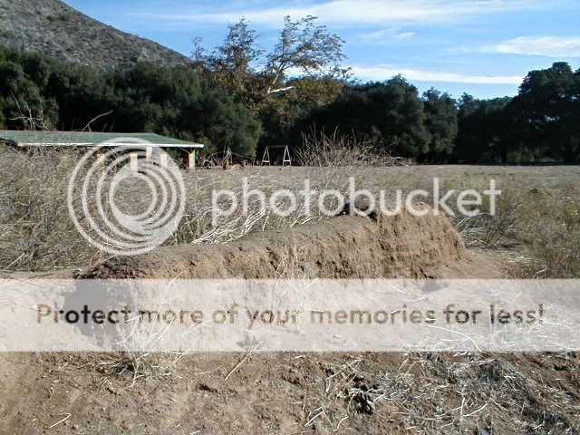
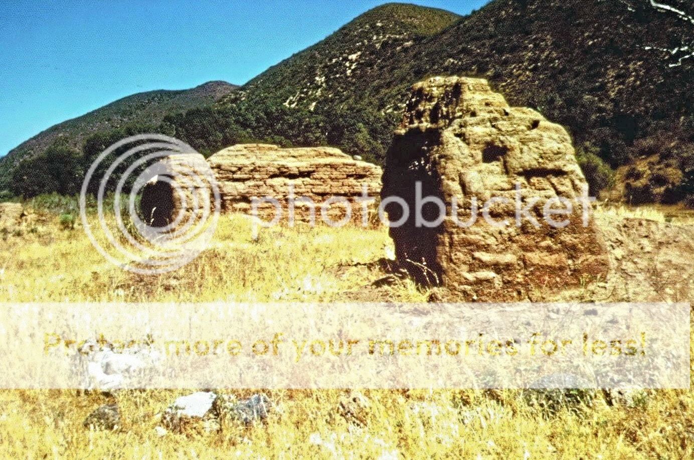
San Miguel Arcángel (1787-1834)
The next mission with multiple sites I have photos of is San Miguel. The main site is in the town of La Misión, next to Hwy. 1, in the schoolyard.
This was the second site for this mission. The first location was about 7 miles inland and moved in just one year. There were no remains from the
first site at El Encino, according to Peveril Meigs, in 1928.
In 1809, shortly after a new priest arrived (Tomás de Ahumada), a flash flood had ruined the farmlands in the river valley. By 1810, Ahumada moved
the mission north some 8 miles to El Descanso. The mission was called San Miguel la Nueva (New San Miguel) after the move. This year is sometimes used
to begin the date of a mission at Descanso, however, it was simply a new location for San Miguel. It is not yet know when, but Ahumada moved back to
the Old mission site at some point before he changed duties in 1815 when Padre Felix Caballero arrived. It is believed that Ahumada (and maybe
Caballero) operated both the new and old San Miguel missions together.
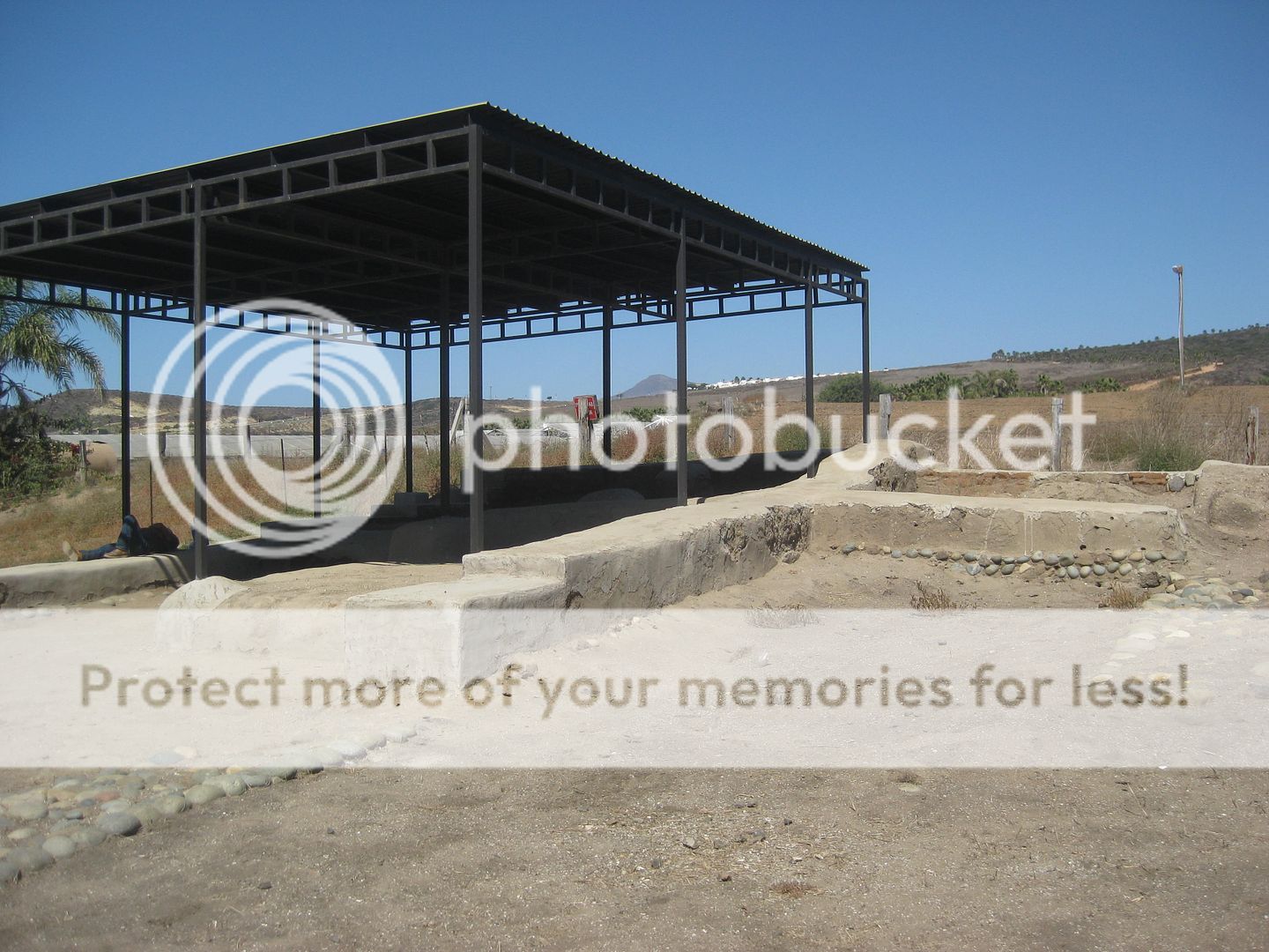
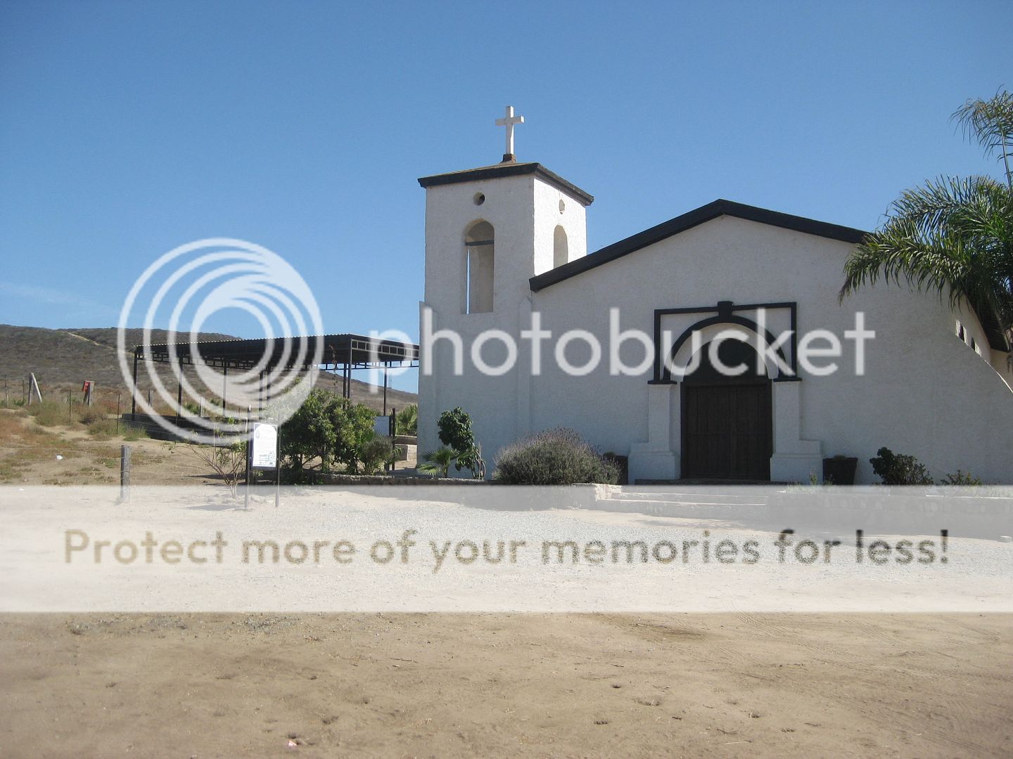
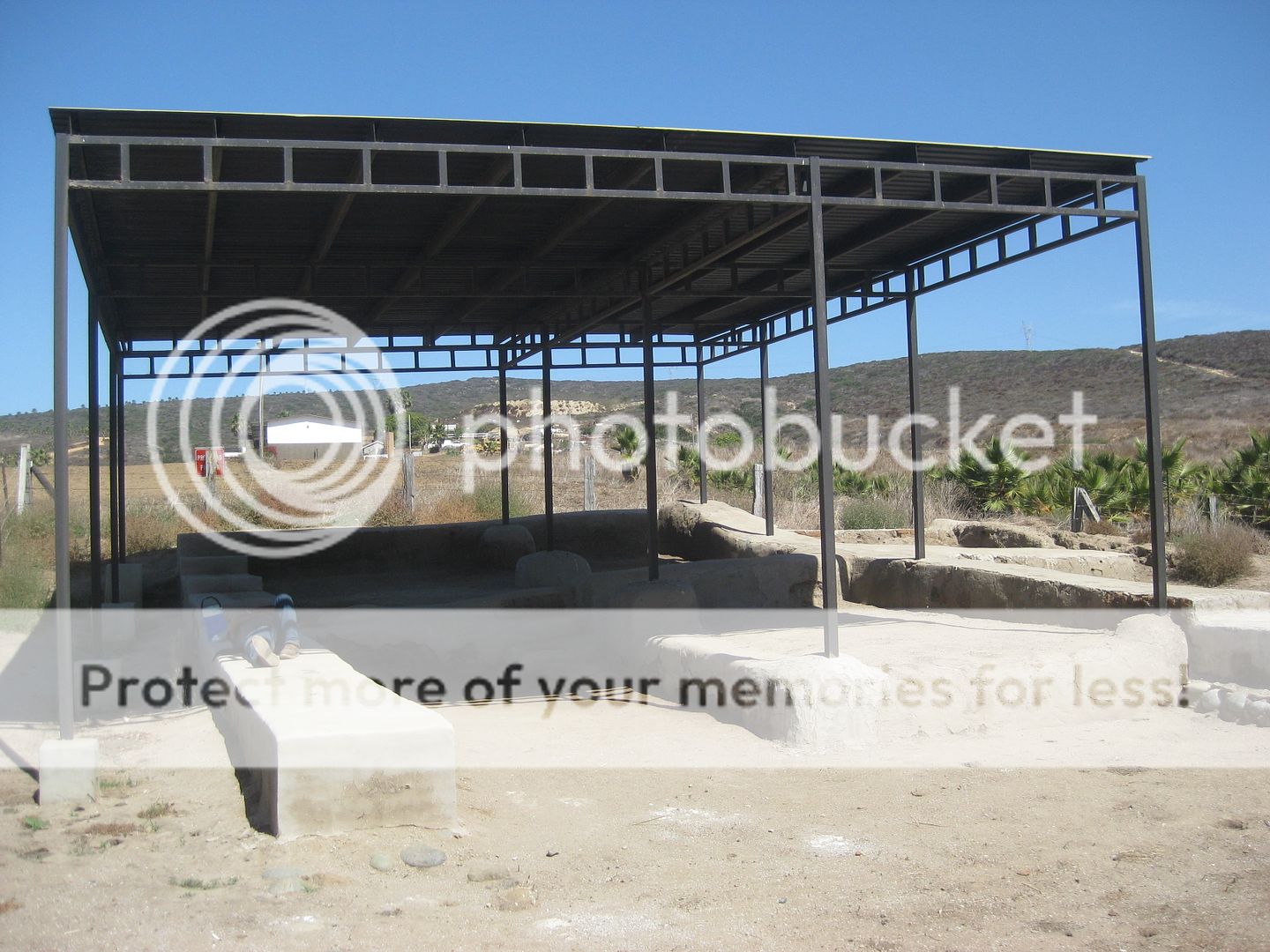
In 1830, Caballero built a new church at Descanso and it is that we see ruins of today, next to a modern church. The 1810 mission site is believed to
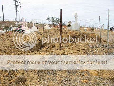
be adobe ruins now part of a cemetery on the south ridge of the valley.
Here are photos of the 1810 Descanso (New San Miguel) ruins. Thank you Jack Swords for the photos):
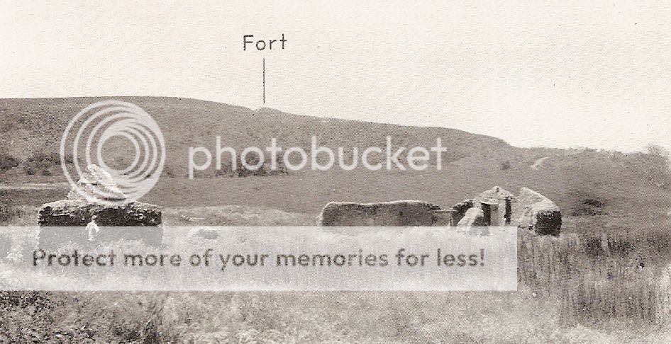
Here is a 1926 photo by Peveril Meigs of the 1830 Descanso mission. The 1810 mission ruins up on the ridge is what Meigs identifies as a fort in his
photo. Meigs did not have the records of the Dominicans when he published in 1935, so he guessed that Ahumada moved to Descanso in 1817 (vs. 1810) and
that wrong date continues to this day as being given as the founding of Descanso.
Here are the 1830 ruins as seen today, some under an awning:
[Edited on 9-3-2022 by David K]
|
|
|
Barry A.
Select Nomad
Posts: 10007
Registered: 11-30-2003
Location: Redding, Northern CA
Member Is Offline
Mood: optimistic
|
|
Very cool pictures, David. Many thanks, and very interesting.
|
|
|
Jack Swords
Super Nomad
Posts: 1094
Registered: 8-30-2002
Location: Nipomo, CA/La Paz, BCS
Member Is Offline
|
|
The figure walking in one of the photos of Descanso 1810 up on the ridge is Max Kurillo, I believe you know him. This was a joint effort to find
Meigs' "fort."
Nice to see all of the photos in one place, nice collection.
|
|
|
David K
Honored Nomad
Posts: 64476
Registered: 8-30-2002
Location: San Diego County
Member Is Offline
Mood: Have Baja Fever
|
|
Yes, Max and I are business and writing partners.
The next edition of the book we did in 2012 (The Old Missions of Baja & Alta California, 1697-1834) is coming out this year.
I renamed it with a bit shorter title, too. Stay tuned for details.
I did know that was Max in your photo... Ed Vernon was also there, but not sure if it was the same trip?
Ed passed away in 2016...
We enjoyed sharing mission discoveries and hoped to make Baja history more fun for the travelers down this peninsula which is so full of historic
sites!
Ed's beautiful coffee-table size book from 2002 was a great source for mission details.
I joined up with Max and Erline to help with the Baja mission data I was amassing in this book that correctly organizes the California missions in the
order they were founded.
Soon after our Old Missions book was out, it was clear that a new and more detailed look at the peninsula missions was in order and in a format that
could fit into the glove box or backpack. First published in 2016, and now at the printers a 7th time with updates and new photos for 2019. I could
not be more pleased. Many Baja Nomads have a part in this book, too. Your photos, Jack, included. While I have replaced many older photos with newer
ones I have taken since 2016, your Loreto photo will always remain. I also have your photo at San Pedro Mártir, the only Baja mission I have not seen
in person! Thanks!
[Edited on 12-15-2022 by David K]
|
|
|
David K
Honored Nomad
Posts: 64476
Registered: 8-30-2002
Location: San Diego County
Member Is Offline
Mood: Have Baja Fever
|
|
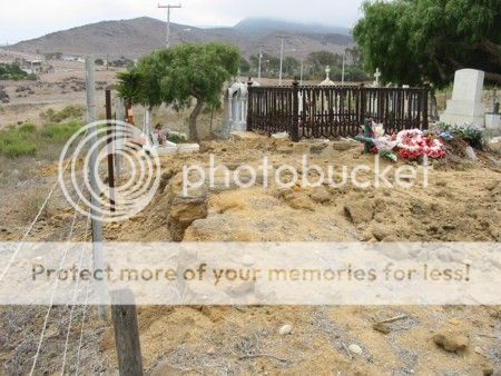
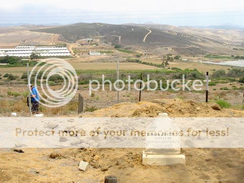
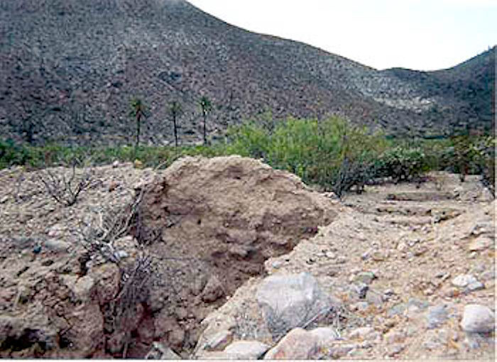
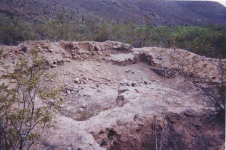
San Juan de Dios
A visita chapel of Mission San Fernando that was destroyed by a farmer's tractor in 2006.
The site had been documented by INAH, yet it was not marked with signage or even seen from the road. I photographed it in 2000 and returned agin in
2003. Jack Swords did also, around 2003. I had learned the location from Sony Espinoza (one of Mama's sons) who was camping in the palms next to the
river there.
Today, a ranch has been set up in the palms and named Rancho Las Palmas. The mission visita church was on the right (south) side of the road and
hidden by bushes before 2006. After the area was scraped, nothing was ever done on the site to justify the destruction.
In 2017, the rancher at Las Palmas told me it was Sony who did the destruction when he was intoxicated.
INAH's plot plan:
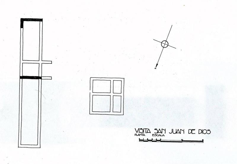
PHOTOS:
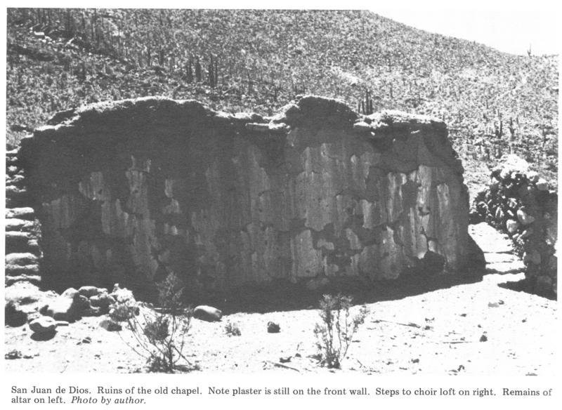
In 1977
In 2000
In 2000
In 2003 from Jack Swords:
In 2008 by David M:
In 2017, some remains uncovered...

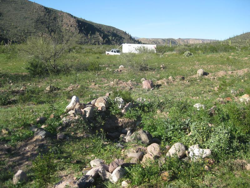
On the site, looking north to the road where my truck is parked by the water tank.
It is 21.7 miles from Highway 1 at KM. 103+ to Rancho Las Palmas & the San Juan de Dios site.
[Edited on 7-24-2019 by David K]
[Edited on 12-15-2022 by David K]
|
|
|
David K
Honored Nomad
Posts: 64476
Registered: 8-30-2002
Location: San Diego County
Member Is Offline
Mood: Have Baja Fever
|
|
A newer 'quick' look at the missions (and visitas), from north to south, is on this web page: https://vivabaja.com/mission-site-photos/
More mission photos and details begin on this page (1 of 4): https://vivabaja.com/missions1/
|
|
|
|


