| Pages:
1
2
3
4 |
David K
Honored Nomad

Posts: 65453
Registered: 8-30-2002
Location: San Diego County
Member Is Offline
Mood: Have Baja Fever
|
|
The 1962 & 1955 AAA BAJA MAP Discussion
Quote: Originally posted by 4x4abc  |
that only brings up more questions
on today's map where would Rancho Las Delicias and Rancho Santa Lucia be? |
I see Santa Lucia between San Ignacio and Santa Rosalia, a bit south of the road. Las Delicias looks to be about where Palo Verde is (Punta Chivato
road junction). Are these the two in question?
[Edited on 7-28-2019 by David K]
|
|
|
David K
Honored Nomad
Posts: 65453
Registered: 8-30-2002
Location: San Diego County
Member Is Offline
Mood: Have Baja Fever
|
|
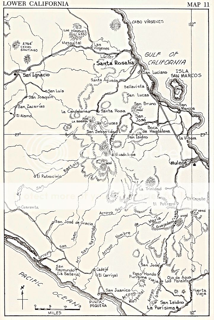
1962 Lower California Guidebook
Howard Gulick's map does not have either ranch shown:
|
|
|
David K
Honored Nomad
Posts: 65453
Registered: 8-30-2002
Location: San Diego County
Member Is Offline
Mood: Have Baja Fever
|
|
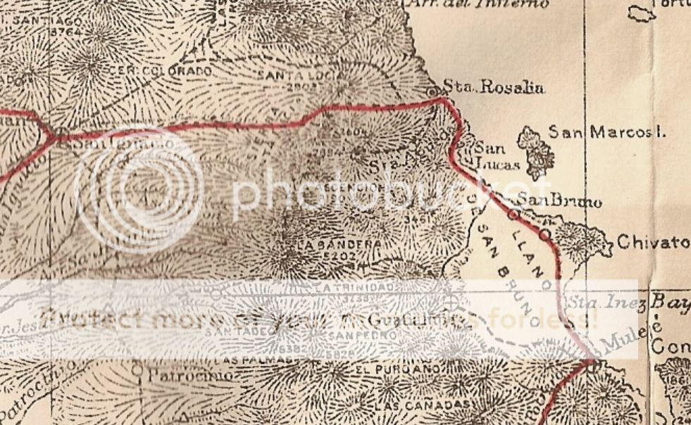
On the 1930 map is Rancho Las Delicias (but not Santa Lucia):
|
|
|
David K
Honored Nomad
Posts: 65453
Registered: 8-30-2002
Location: San Diego County
Member Is Offline
Mood: Have Baja Fever
|
|
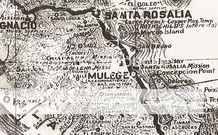
On the 1941 map is Santa Lucia, but not Las Delicias:
|
|
|
David K
Honored Nomad
Posts: 65453
Registered: 8-30-2002
Location: San Diego County
Member Is Offline
Mood: Have Baja Fever
|
|
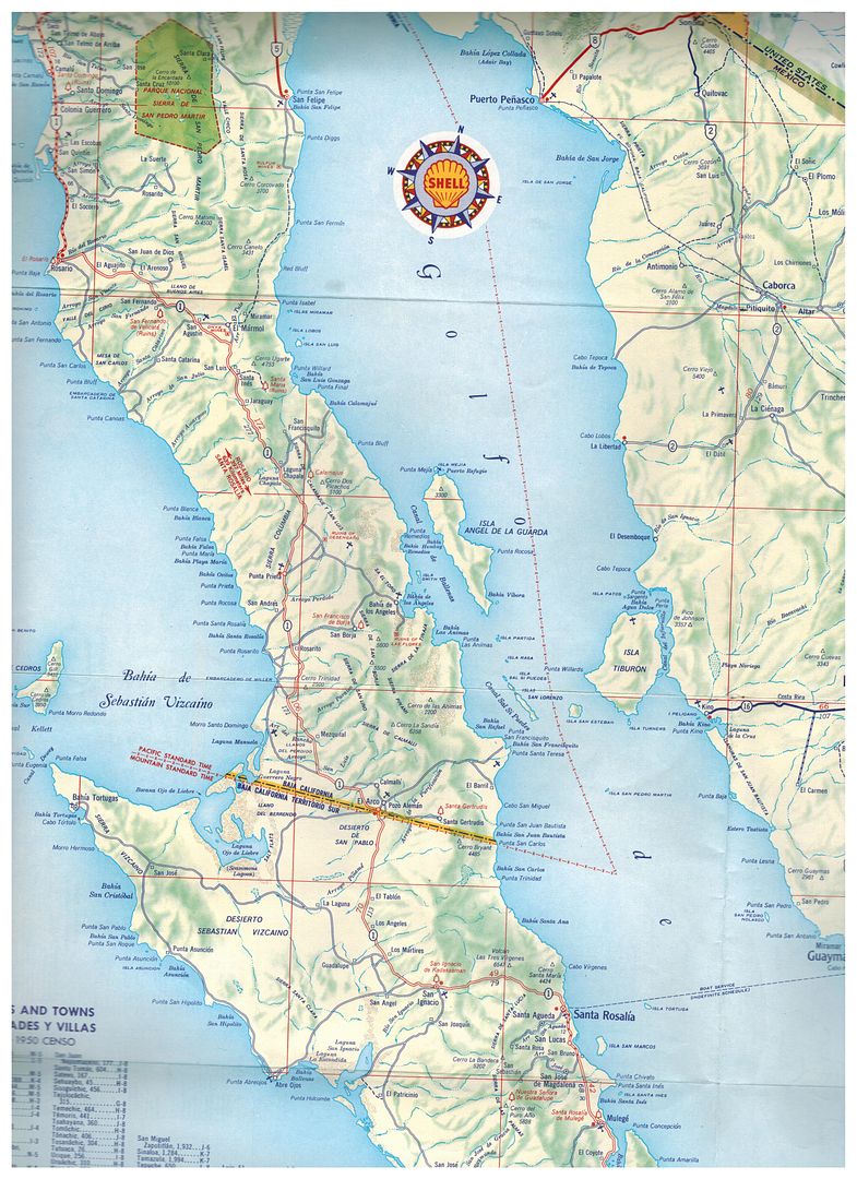
The 1958 Shell map has neither:
|
|
|
David K
Honored Nomad
Posts: 65453
Registered: 8-30-2002
Location: San Diego County
Member Is Offline
Mood: Have Baja Fever
|
|
The 1905 Nelson map (published in 1919) does have a mountain named Santa Lucia in the area. No Delicias near Palo Verde, however.
When Nelson saw the Magdalena ruins near Mulegé, he mistook them to be the Guadalupe mission... and that error is on this map.
[Edited on 7-22-2019 by David K]
|
|
|
4x4abc
Ultra Nomad
Posts: 4455
Registered: 4-24-2009
Location: La Paz, BCS
Member Is Offline
Mood: happy - always
|
|
the location Lucifer shows one of the major mines around Santa Rosalia, In the early years it was a small settlement, like all mines at the time.
Later everyone was moved to Santa Rosalia.
Rancho Santa Lucia is in the mountains between Santa Rosalia and San Ignacio. Far away from the locations given in the maps.
27°18'39.89"N, 112°34'10.57"W
it only proves how inaccurate these maps are. They give you a general idea, but rarely a precise location.
But they are fun to compare with today's information.
Haven't found anything yet on Rancho Las Delicias. It is shown on the west side of the road, so it can't be Palos Verdes.
Harald Pietschmann
|
|
|
David K
Honored Nomad
Posts: 65453
Registered: 8-30-2002
Location: San Diego County
Member Is Offline
Mood: Have Baja Fever
|
|
| Quote: Originally posted by 4x4abc | the location Lucifer shows one of the major mines around Santa Rosalia, In the early years it was a small settlement, like all mines at the time.
Later everyone was moved to Santa Rosalia.
Rancho Santa Lucia is in the mountains between Santa Rosalia and San Ignacio. Far away from the locations given in the maps.
27°18'39.89"N, 112°34'10.57"W
it only proves how inaccurate these maps are. They give you a general idea, but rarely a precise location.
But they are fun to compare with today's information.
Haven't found anything yet on Rancho Las Delicias. It is shown on the west side of the road, so it can't be Palos Verdes. |
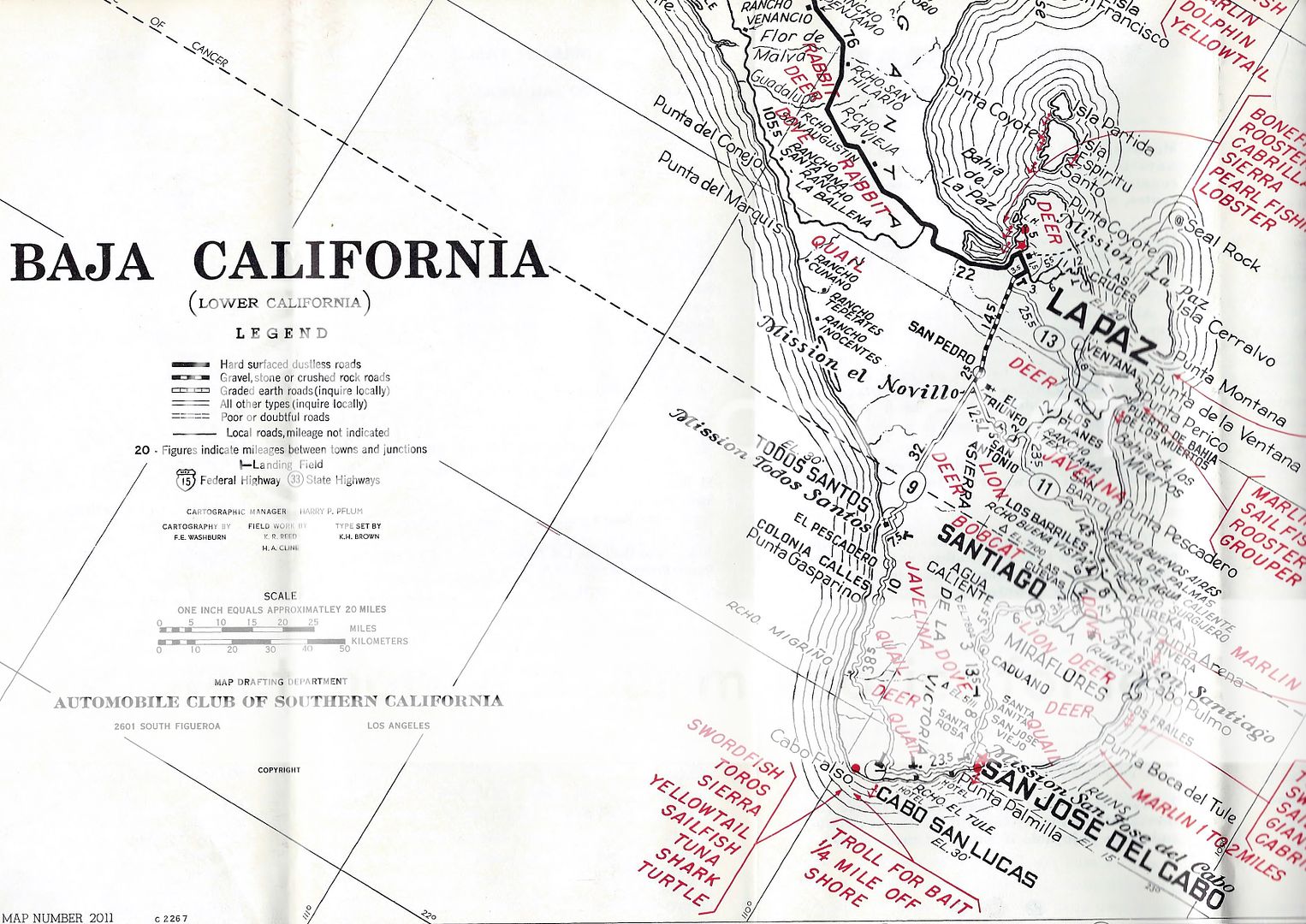
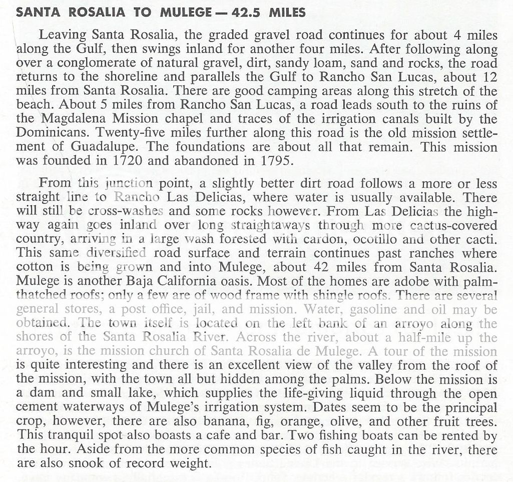
In the 1962 AAA guide, Las Delicias is quite the reference, on the main road. The same is mentioned in the 1964, 1966, 1968, & 1971 guides.
In 1972, the name Las Delicias is gone and the road south of Santa Rosalia is now paved.
Let me know if you want to see a scan.
|
|
|
David K
Honored Nomad
Posts: 65453
Registered: 8-30-2002
Location: San Diego County
Member Is Offline
Mood: Have Baja Fever
|
|
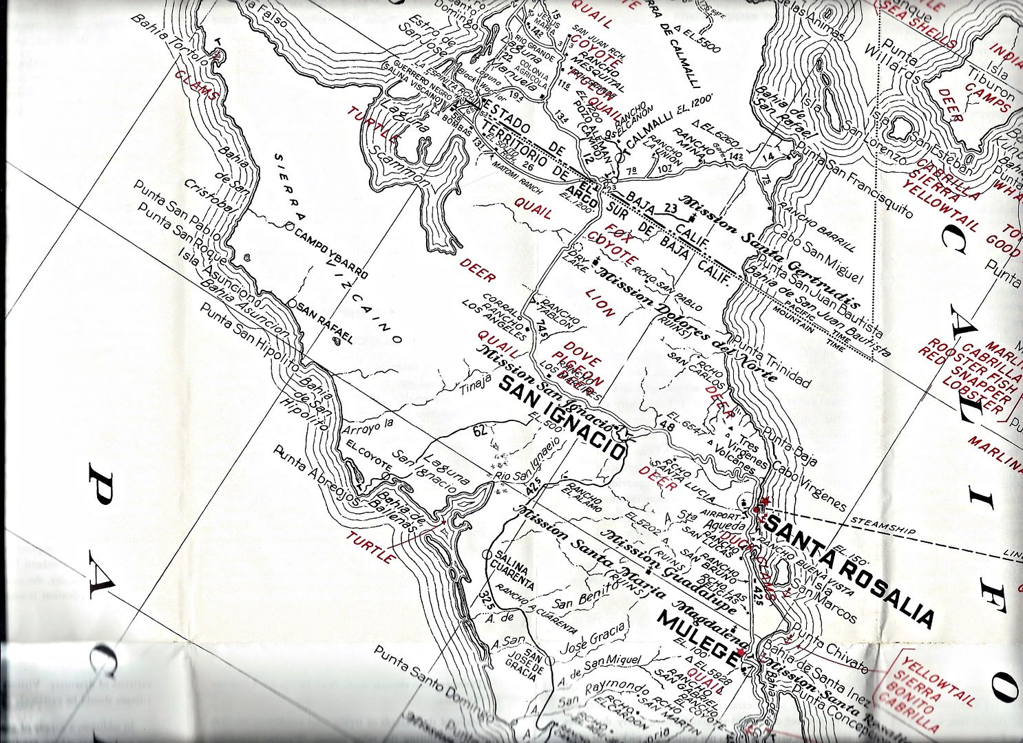
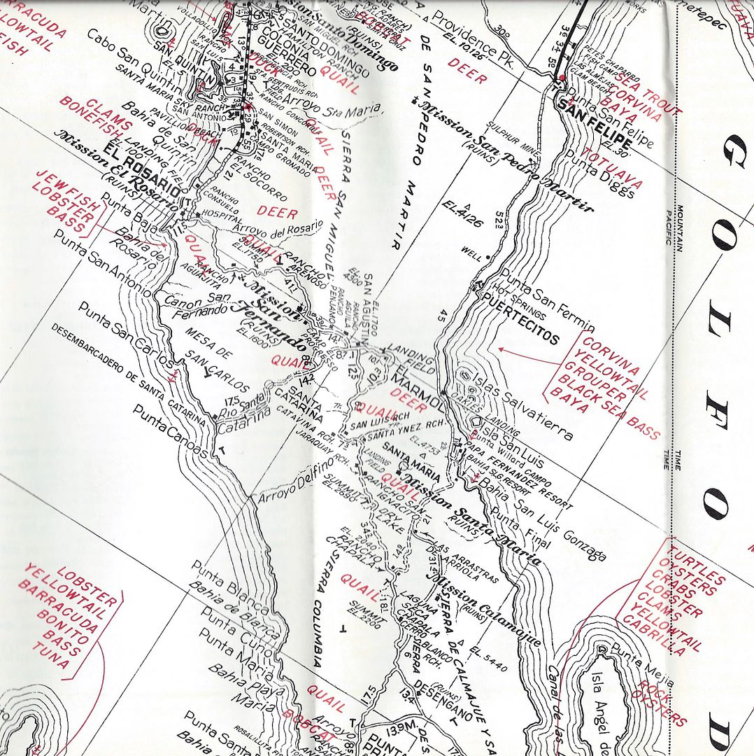
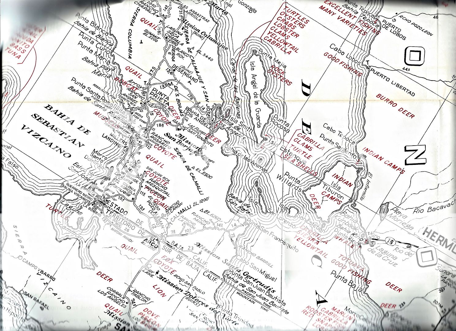
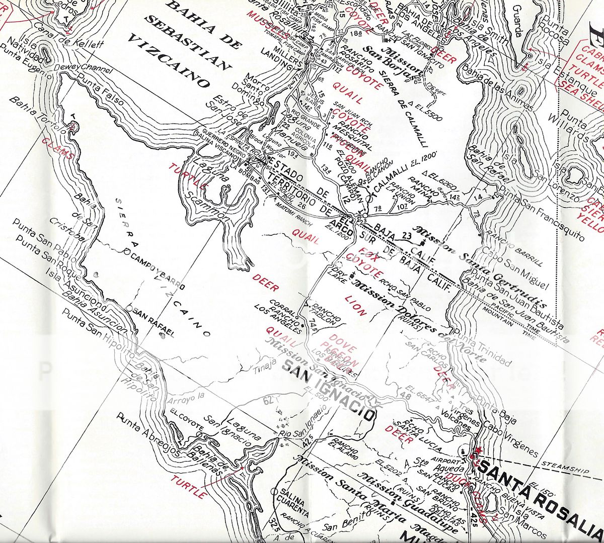
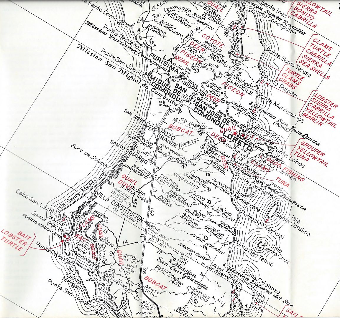
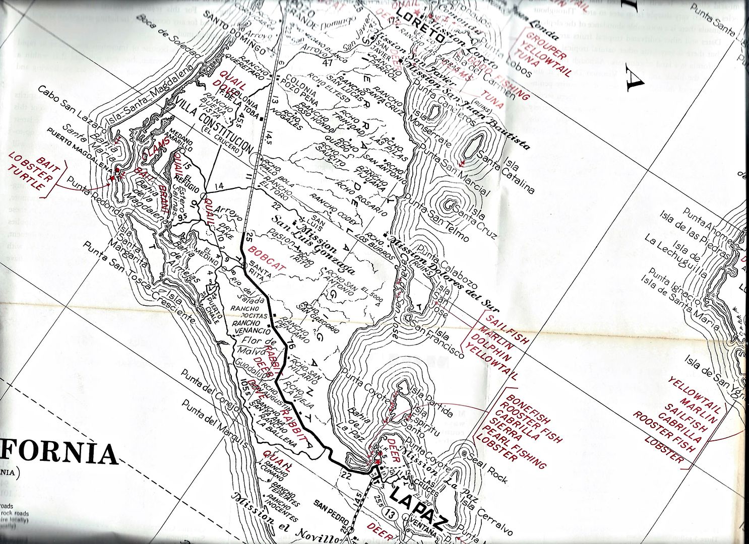
The rest of the 1962 AAA map...
|
|
|
4x4abc
Ultra Nomad
Posts: 4455
Registered: 4-24-2009
Location: La Paz, BCS
Member Is Offline
Mood: happy - always
|
|
| Quote: Originally posted by David K |
In the 1962 AAA guide, Las Delicias is quite the reference, on the main road. The same is mentioned in the 1964, 1966, 1968, & 1971 guides.
|
Is there a distance given to Las Delicias?
That way we could locate the site
Harald Pietschmann
|
|
|
David K
Honored Nomad
Posts: 65453
Registered: 8-30-2002
Location: San Diego County
Member Is Offline
Mood: Have Baja Fever
|
|
The maps of 1962 (AAA and Gulick's) show the Baja California I was so lucky to experience, as we drove south, just three years later, going to Gonzaga
Bay, in 1965. In 1966, we drove the Tijuana to Cabo road (taking over 2-weeks) and then up to La Paz via Todos Santos where we boarded the ferry to
Mazatlan for a paved return to San Diego.
In those days, Highway 1 pavement ended about 70 miles from Ensenada, north of Colonet. It didn't begin again until about 100 miles north of La Paz.
South from La Paz, the pavement ended in 10 miles and the new graded roadbed ended just past San Bartolo.
It was my job to read Gerhard & Gulick's Lower California Guidebook as we passed point mentioned along the way. Perhaps that is why my memory of
the trip (and my love of maps and guides) is so strong?
Nice palm tree! 
|
|
|
David K
Honored Nomad
Posts: 65453
Registered: 8-30-2002
Location: San Diego County
Member Is Offline
Mood: Have Baja Fever
|
|
| Quote: Originally posted by 4x4abc | | Quote: Originally posted by David K |
In the 1962 AAA guide, Las Delicias is quite the reference, on the main road. The same is mentioned in the 1964, 1966, 1968, & 1971 guides.
|
Is there a distance given to Las Delicias?
That way we could locate the site |
Nope... just midway between San Lucas and Loreto... like near where Palo Verde is today. I will scan the page... 1962 edition:
[Edited on 7-23-2019 by David K]
|
|
|
4x4abc
Ultra Nomad
Posts: 4455
Registered: 4-24-2009
Location: La Paz, BCS
Member Is Offline
Mood: happy - always
|
|
I think, I found the location for Rancho Las Delicias
called Boca de Magdalena on the INEGI topo
27° 4'37.41"N, 112° 6'55.12"W
Harald Pietschmann
|
|
|
David K
Honored Nomad
Posts: 65453
Registered: 8-30-2002
Location: San Diego County
Member Is Offline
Mood: Have Baja Fever
|
|
| Quote: Originally posted by 4x4abc | I think, I found the location for Rancho Las Delicias
called Boca de Magdalena on the INEGI topo
27° 4'37.41"N, 112° 6'55.12"W |
Boca de Magdalena is the arroyo name on some maps and was the village name (to the west where the arroyo leaves the mountain pass) as shown on the
Gulick map (near the ruins of La Magdalena).
Your waypoint is in a flood plain near the Palo Verde airport road and other than a building, I don't see any signs of an important rancho with trees,
gardens, corrals.
I will still bet that the village of Palo Verde grew up from that rancho... but who knows for sure? The old road and the paved road seem to be one in
the same in this section. So, Las Delicias would be along the highway.
|
|
|
4x4abc
Ultra Nomad
Posts: 4455
Registered: 4-24-2009
Location: La Paz, BCS
Member Is Offline
Mood: happy - always
|
|
you are right, there isn't much left of that Rancho
especially after hurricane Odile
but the 2004 Google image shows what we are looking for:
the old road
the new paved road
a road connecting to Boca de Magdalena
and the ranch is on the west side of the old road!
image also shows significant more vegetation, indicating a source of water

Harald Pietschmann
|
|
|
David K
Honored Nomad
Posts: 65453
Registered: 8-30-2002
Location: San Diego County
Member Is Offline
Mood: Have Baja Fever
|
|
Nice close-up! Maybe do a zoom in on the AAA map and 1930 map. Then, measure the distance to where they have Las Delicias from a couple of points,
like Punta Chivato, Santa Rosalia, and Mulegé. Let's compare those distances and maybe we can decide where Las Delicias was. On the 1930 map, there
is a well clearly shown and a black square maybe by it for the ranch? I bet the well was at the ranch, too?
|
|
|
4x4abc
Ultra Nomad
Posts: 4455
Registered: 4-24-2009
Location: La Paz, BCS
Member Is Offline
Mood: happy - always
|
|
distances given on these maps are not worth much
remember the location of Rancho Santa Lucia
or take the Santa Rosalia - Mulege road log you copied
4 miles along the coast? then 4 miles inland?
no way
12 miles to San Lucas?
no way
Harald Pietschmann
|
|
|
4x4abc
Ultra Nomad
Posts: 4455
Registered: 4-24-2009
Location: La Paz, BCS
Member Is Offline
Mood: happy - always
|
|
if I transcribe to location from map to satellite I get to this location:
27° 3'44.56"N, 112° 6'21.53"W
there is even a Pila there
but that one is connected to the water line coming from El Perdido
no vegetation - no sign of a former Rancho
so, I'll stick with the first one
Harald Pietschmann
|
|
|
David K
Honored Nomad
Posts: 65453
Registered: 8-30-2002
Location: San Diego County
Member Is Offline
Mood: Have Baja Fever
|
|
Interesting, and I did see trees by the pila...? I will keep my eyes open for Rancho Las Delicias in travel books from the past. Maybe there is a
mileage somewhere?
|
|
|
Ateo
Elite Nomad
Posts: 5948
Registered: 7-18-2011
Member Is Offline
|
|
How dare you show my secret spot of Scorpion Bay!
|
|
|
| Pages:
1
2
3
4 |


