| Pages:
1
2
3 |
4x4abc
Ultra Nomad

Posts: 4163
Registered: 4-24-2009
Location: La Paz, BCS
Member Is Offline
Mood: happy - always
|
|
that was at the Santa Ines airfield
Harald Pietschmann
|
|
|
geoffff
Senior Nomad
Posts: 643
Registered: 1-15-2009
Member Is Offline
|
|
Quote: Originally posted by Nikno  |
DC-3 at about 29.29250, -114.11585
This wreckage was described by Erle Stanley Gardner in "Hovering Over Baja" so it crashed before 1961. I don't have the exact coordinates and I am
unsure if there is still any wreckage visible. I can't see anything on satellite images. If anyone knows the exact location or has seen this wreckage,
please reply. I would like to hike up here and check it out if I can get more information. |
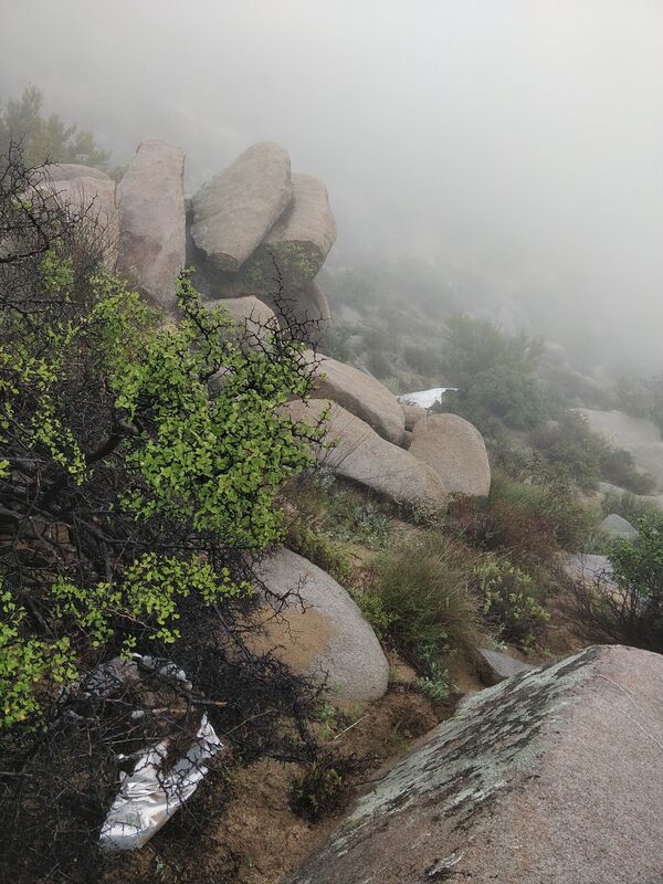
I hiked up to that DC-3 wreck a couple weeks ago.
The weather was surprisingly dreary. Rainy and foggy. Somehow appropriate for visiting a site where people met their end. But the cool weather made
exercise much easier! The coordinates for the crash site are only a bit over a mile from the end of the road, but it’s more of a scramble and
bushwhack than a hike. It ended up taking me 6 hours round-trip to get up there and back down. My total track length was 6 miles with all the
meanderings. 1900 ft. elevation gain. I spotted a few cairns to mark the way.
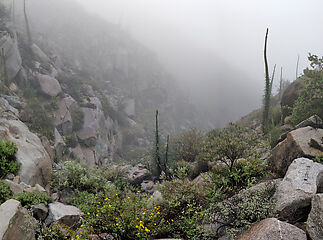 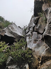 
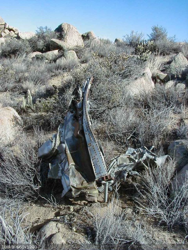
I spotted about 10 wreckage pieces on the southeast slope of Cerro la Gobernadora, just south of the GPS coordinates you gave above. In total, far
less than a complete airplane! Because of the dense fog, I couldn't see very far.


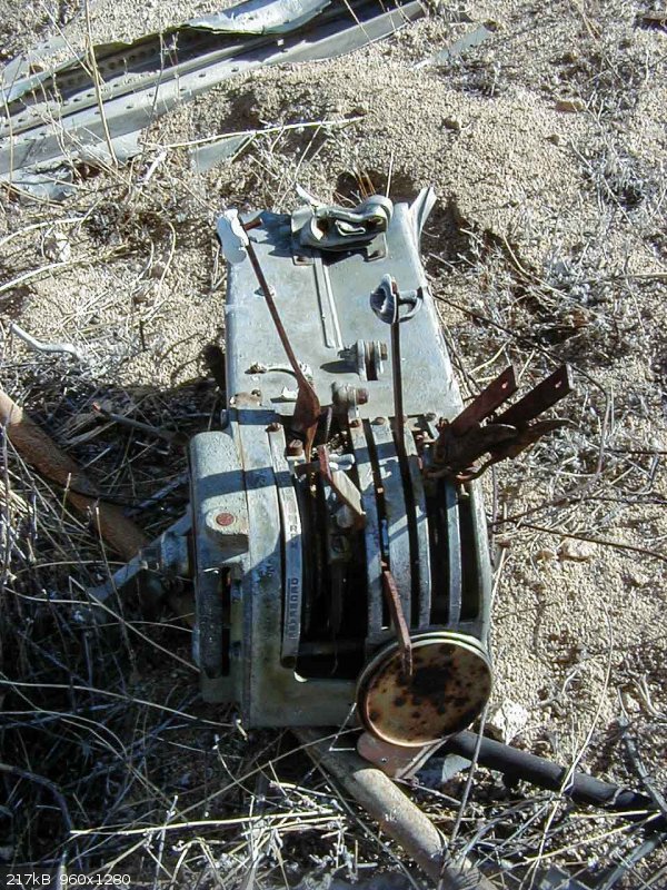
What does this say? "...ome..."


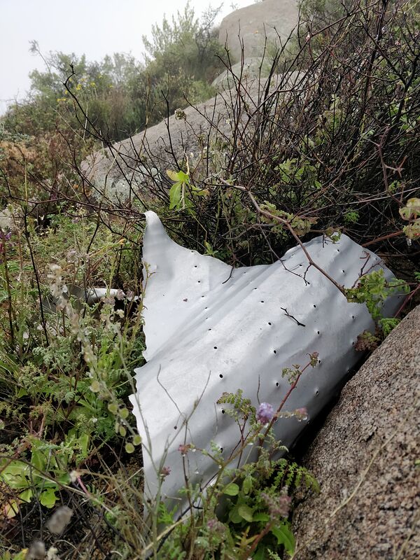
"Wing Flaps"


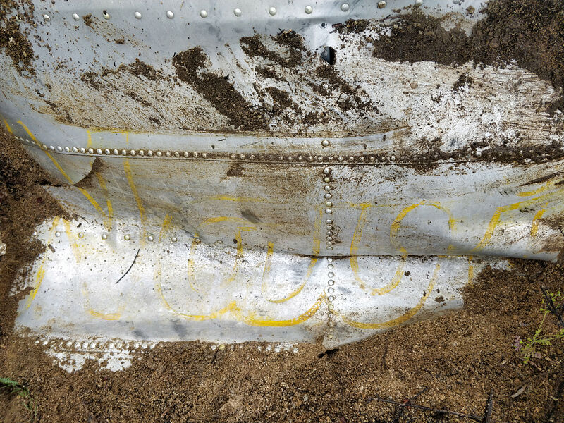
What does this say? "Navi..."

Track log


My meanderings from looking for wreckage pieces. (Looking northwest in Google Earth.) I didn't bother climbing the last few feet to the top of the
peak because there would be no view in that fog.
-- Geoff
|
|
|
geoffff
Senior Nomad
Posts: 643
Registered: 1-15-2009
Member Is Offline
|
|
My guess is this is the fateful flight: https://aviation-safety.net/database/record.php?id=19491209-... It's a DC-3 that crashed on Dec 9, 1949. The story about the cargo of lobsters
matches what Erle Stanley Gardner wrote in his book Flying over Baja [edit: Hovering over
Baja].
The aluminum wreckage pieces are in pretty amazing shape for having been lying around out there for 71 years!
[Edited on 3-24-2020 by geoffff]
|
|
|
David K
Honored Nomad
Posts: 64480
Registered: 8-30-2002
Location: San Diego County
Member Is Offline
Mood: Have Baja Fever
|
|
Amazing find! Too bad the weather was so socked-in. BillB had a great photo from up there looking down to El Crucero and south. I could not find the
photo... Why was the plane so far off course, I wonder?
Thank you Geoff!
PS Gardner's book is 'Hovering Over Baja'
[Edited on 3-24-2020 by David K]
|
|
|
geoffff
Senior Nomad
Posts: 643
Registered: 1-15-2009
Member Is Offline
|
|
| Quote: Originally posted by David K |
Amazing find! Too bad the weather was so socked-in. BillB had a great photo from up there looking down to El Crucero and south.
|
Well, there's another part to my story.... The above trip was actually my second attempt hiking up there! A few days earlier I had
made a first attempt, but needed to turn back after getting 2/3 of the way to the wreck site. I was running out of water and daylight, and the route I
picked wasn't ideal. I did get some great views though!

Looking southwest

Cute snake!

Looking back up at Cerro la Gobernadora
I still haven't been able to find those BillB photos here on Baja Nomad.
-- Geoff
|
|
|
David K
Honored Nomad
Posts: 64480
Registered: 8-30-2002
Location: San Diego County
Member Is Offline
Mood: Have Baja Fever
|
|
Stellar!
That is a very similar photo to the one from BillB, only he was higher up.
A Rosy Boa?
Will you have a full trip report for us?
|
|
|
Paco Facullo
Super Nomad
Posts: 1301
Registered: 1-21-2017
Location: Here now
Member Is Offline
Mood: Abiding ..........
|
|
Oh My,, How cool is that !
Thanks for a MOST interesting adventure ... That snake is gorgeous !
Since I've given up all hope, I feel much better
|
|
|
LancairDriver
Super Nomad
Posts: 1587
Registered: 2-22-2008
Location: On the Road
Member Is Offline
|
|
| Quote: Originally posted by geoffff | My guess is this is the fateful flight: https://aviation-safety.net/database/record.php?id=19491209-... It's a DC-3 that crashed on Dec 9, 1949. The story about the cargo of lobsters
matches what Erle Stanley Gardner wrote in his book Flying over Baja [edit: Hovering over
Baja].
The aluminum wreckage pieces are in pretty amazing shape for having been lying around out there for 71 years!
[Edited on 3-24-2020 by geoffff] |
That is amazing to see the condition of the metal after 71 years.
Great pictures!
|
|
|
BillB
Newbie
Posts: 16
Registered: 9-20-2004
Member Is Offline
|
|
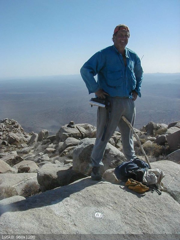
Nice work Geoff. I found a couple of photo's from the DC-3 crash site that I took in 2002. Note the survey marker at the top of la Gobernadora. As
ESG said, this is the tallest mountain in the area, and had the pilot been about 30 feet higher, he would have made it. My guess is the fog you
experienced was exactly what that pilot was experiencing during his fateful flight.
|
|
|
mtgoat666
Select Nomad
Posts: 17298
Registered: 9-16-2006
Location: San Diego
Member Is Online
Mood: Hot n spicy
|
|
what is the logo/name i see on the airplane skin in your pics?
Woke!
“...ask not what your country can do for you – ask what you can do for your country.” “My fellow citizens of the world: ask not what America
will do for you, but what together we can do for the freedom of man.”
Prefered gender pronoun: the royal we
|
|
|
geoffff
Senior Nomad
Posts: 643
Registered: 1-15-2009
Member Is Offline
|
|
I've been wondering that! Maybe someone can help me piece together the fragments?
|
|
|
David K
Honored Nomad
Posts: 64480
Registered: 8-30-2002
Location: San Diego County
Member Is Offline
Mood: Have Baja Fever
|
|
| Quote: Originally posted by BillB | Nice work Geoff. I found a couple of photo's from the DC-3 crash site that I took in 2002. Note the survey marker at the top of la Gobernadora. As
ESG said, this is the tallest mountain in the area, and had the pilot been about 30 feet higher, he would have made it. My guess is the fog you
experienced was exactly what that pilot was experiencing during his fateful flight.
|
Thanks Bill for providing the 2002 hike pictures!
|
|
|
bajapedro
Nomad
Posts: 143
Registered: 3-2-2016
Member Is Offline
|
|
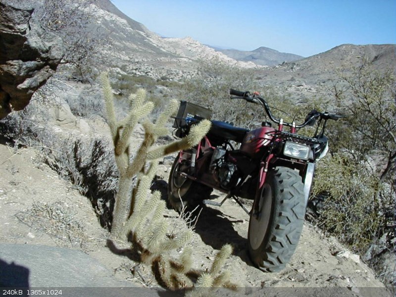
Now Bill, how far up the mountain did that Rokon make it?
|
|
|
pacificobob
Super Nomad
Posts: 2237
Registered: 4-23-2006
Member Is Offline
|
|
Debris fields from cfit [controlled flight into terrain] usually are fairly large. Exactly opposite of the 9/11 Pentagon crash site.
|
|
|
BillB
Newbie
Posts: 16
Registered: 9-20-2004
Member Is Offline
|
|
| Quote: Originally posted by pacificobob | | Debris fields from cfit [controlled flight into terrain] usually are fairly large. Exactly opposite of the 9/11 Pentagon crash site.
|
Rokons are amazing machines, and do well in the desert and can go up sandy washes with ease.
|
|
|
BillB
Newbie
Posts: 16
Registered: 9-20-2004
Member Is Offline
|
|
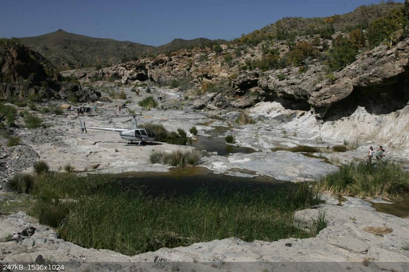
But there is an easier way...
|
|
|
David K
Honored Nomad
Posts: 64480
Registered: 8-30-2002
Location: San Diego County
Member Is Offline
Mood: Have Baja Fever
|
|
Pretty cool to drop into Arroyo El Volcán in a copter!  
|
|
|
BillB
Newbie
Posts: 16
Registered: 9-20-2004
Member Is Offline
|
|
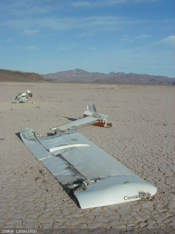
Here is what remains of another small plane wreck. This was on one of the dry lakebeds NW of BOLA. I took this in 2001, but when I returned a few
years later, there was even less of it left.
|
|
|
John M
Super Nomad
Posts: 1906
Registered: 9-3-2003
Location: California High Desert
Member Is Offline
|
|
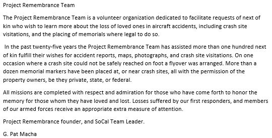
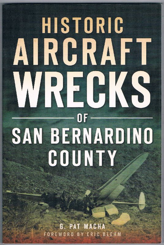
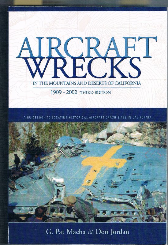
Aircraft wrecks though not in Baja
Several years ago we had occasion to meet a fellow, G. Pat Macha, while conducting a research project on the Victorville Army Flying School of WWII.
Pat had investigated the site of a B25-D Mitchell bomber that crashed shortly after takeoff on October 2, 1944 from VAFS killing all three crew
including Marie Michell Robinson a graduate of the Women Airforce Service Pilots. We were doing research focused on the base, not just on the crash.
Pat Macha has developed an effort, Project Remembrance - detailed below.
His efforts have brought closure for many families impacted by these tragic accidents.
John M
|
|
|
pacificobob
Super Nomad
Posts: 2237
Registered: 4-23-2006
Member Is Offline
|
|
There are mountain passes in Alaska that have aircraft wreckage scattered across the mountain sides. I know of 20 mile stretches more than a dozen
crash sites. All CTIF.
|
|
|
| Pages:
1
2
3 |


