David K
Honored Nomad

Posts: 64490
Registered: 8-30-2002
Location: San Diego County
Member Is Offline
Mood: Have Baja Fever
|
|
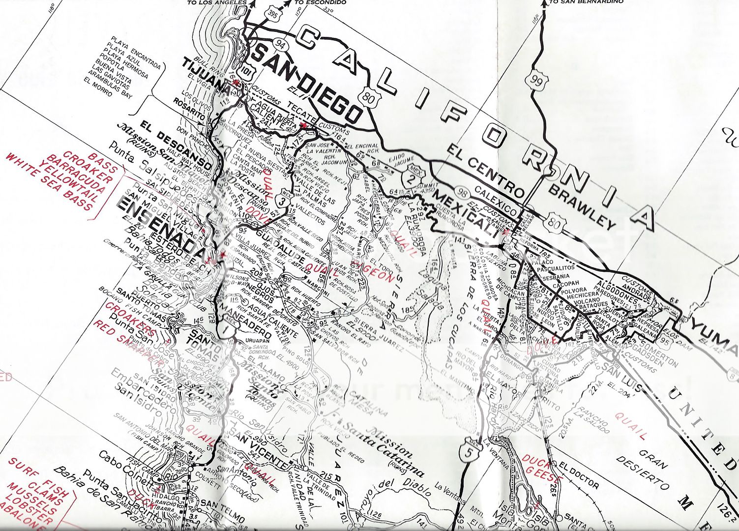
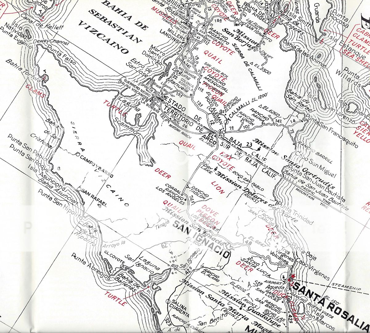
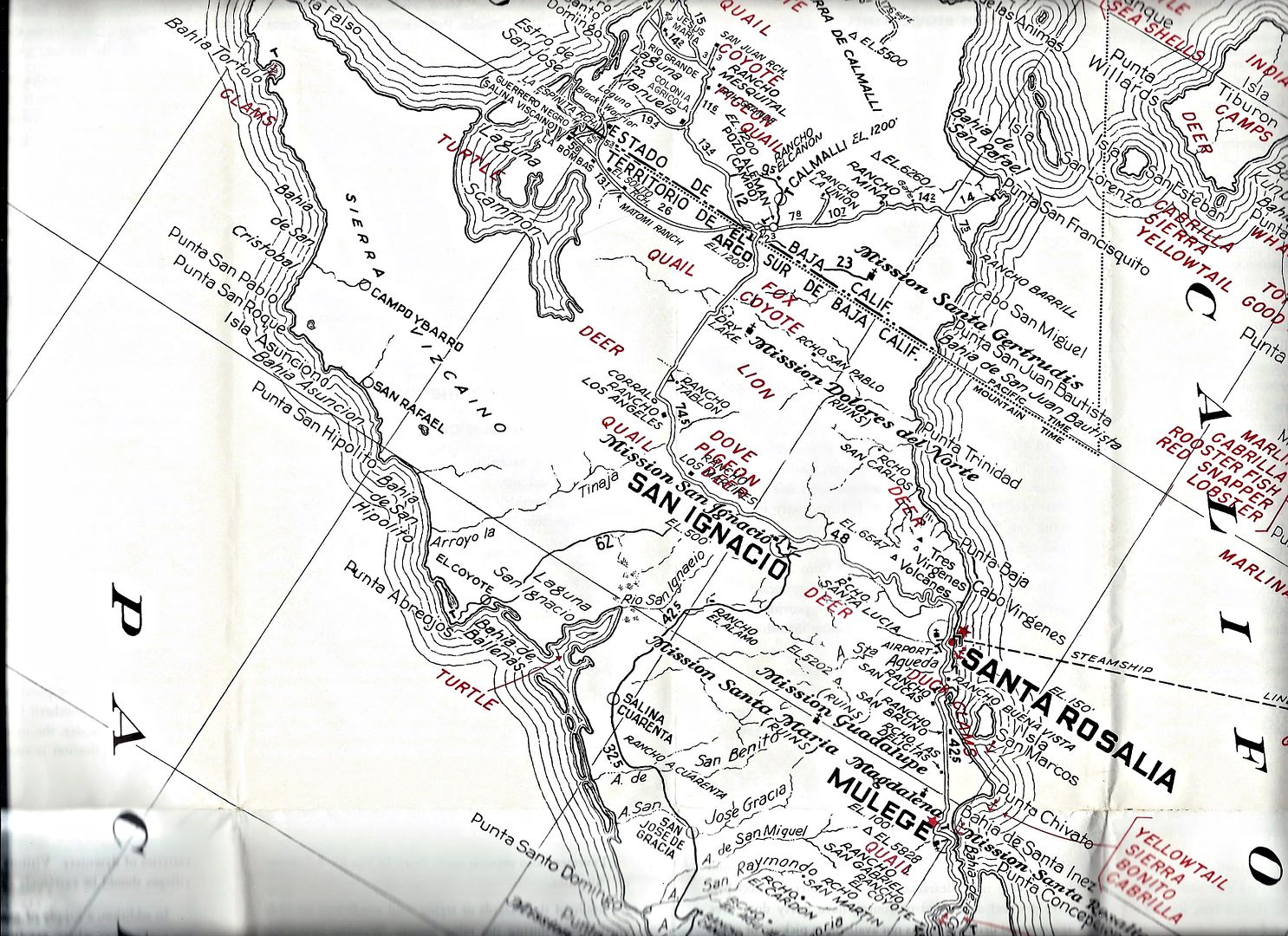
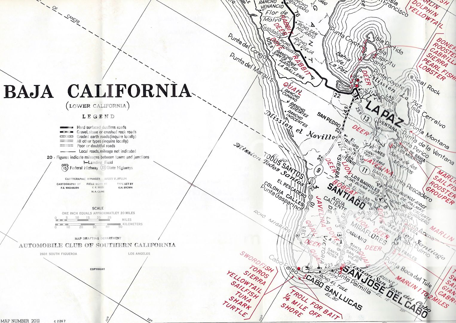
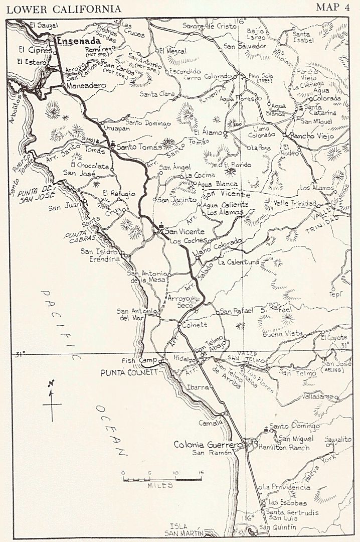
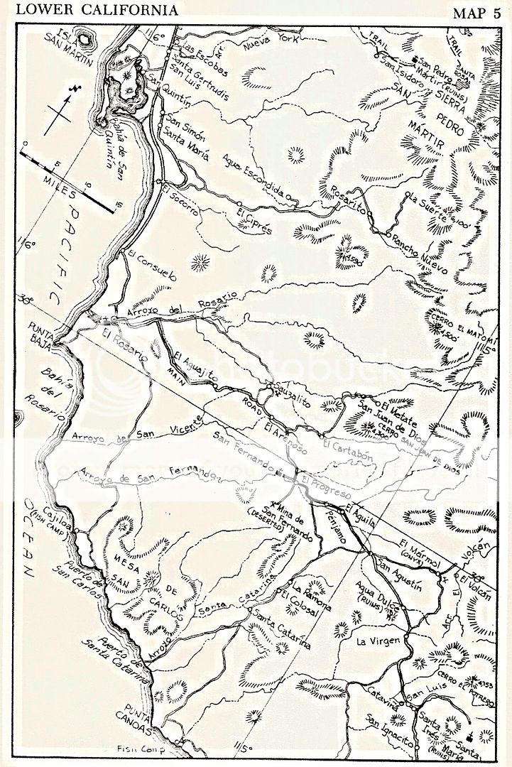
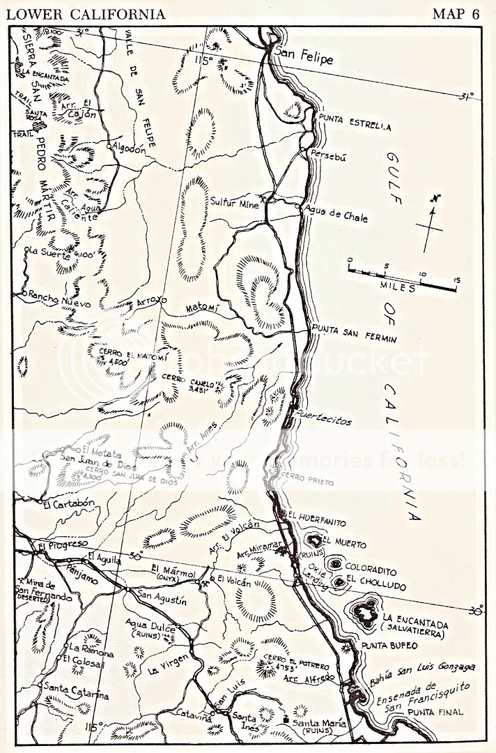
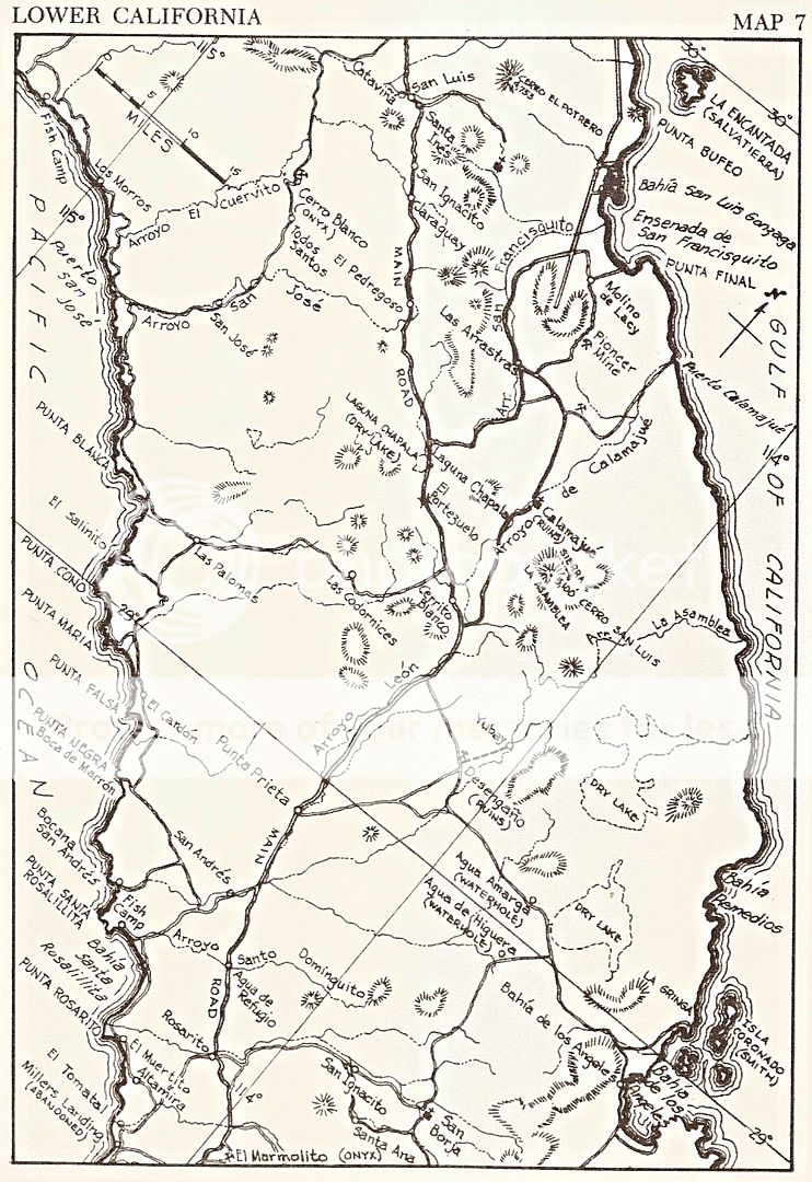
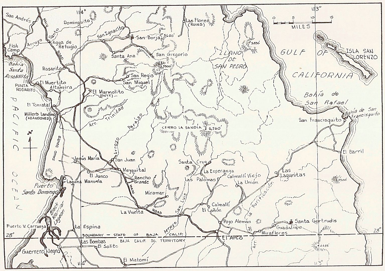
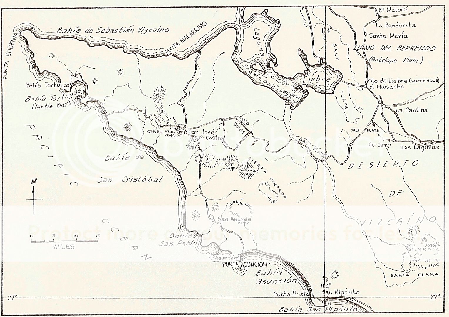
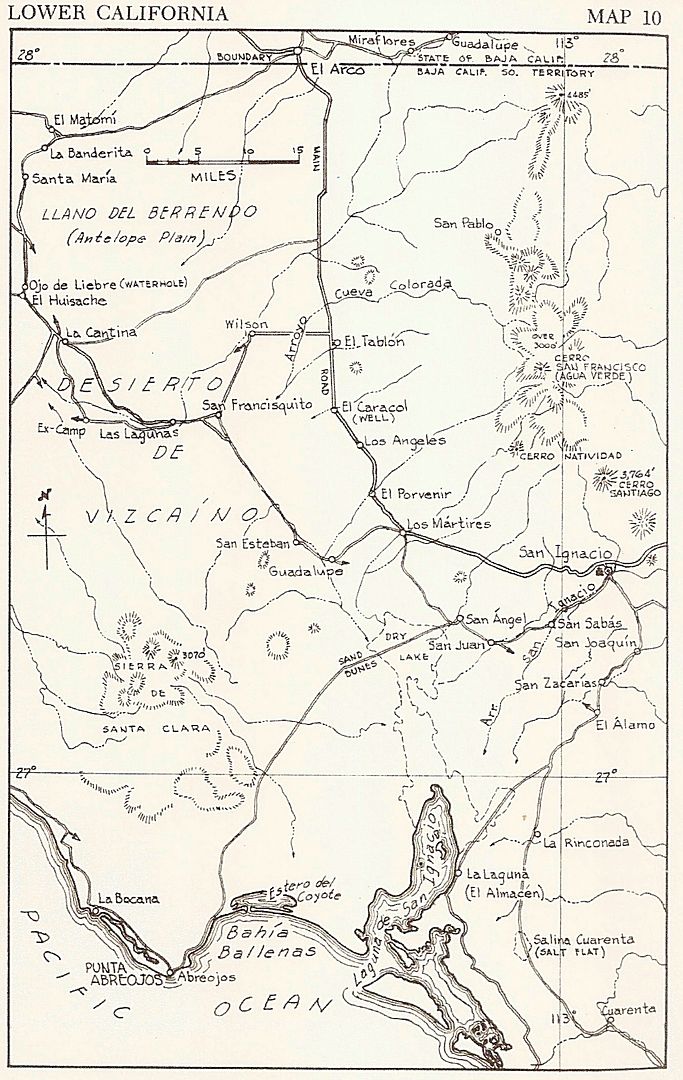
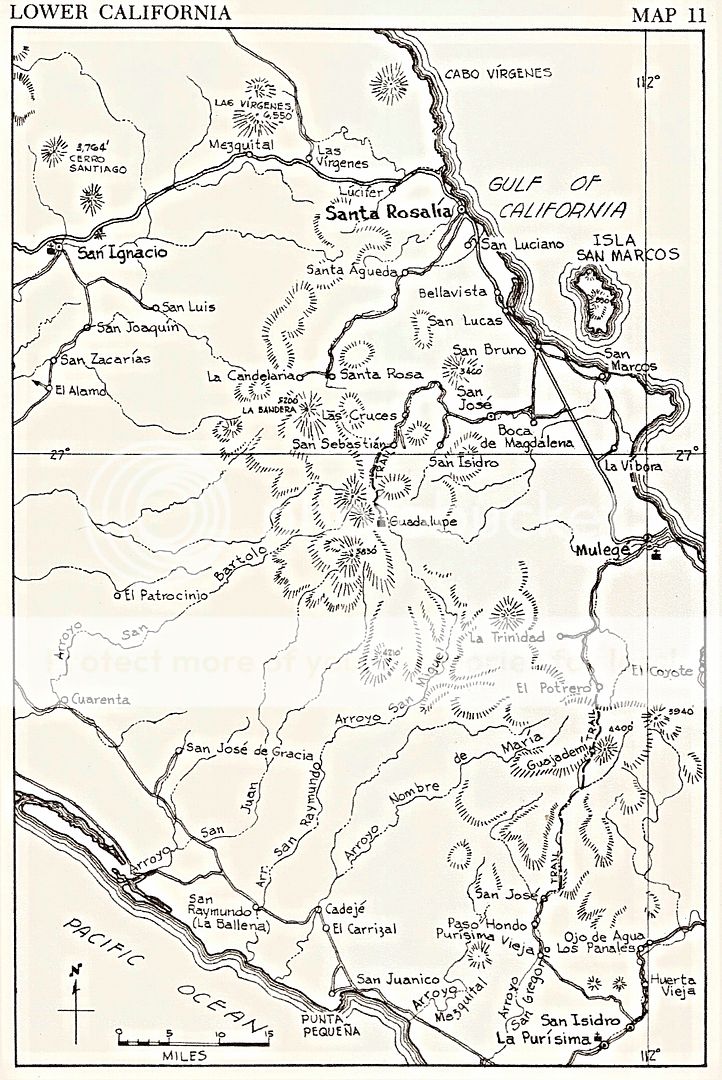
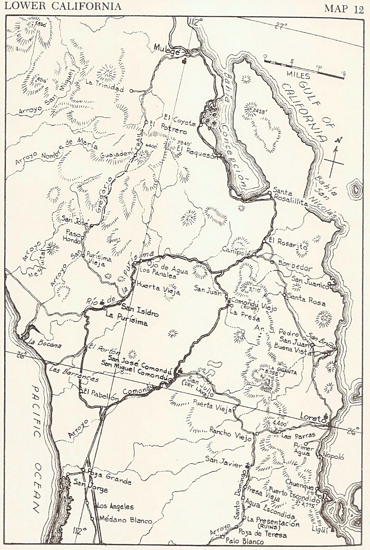
1962 Auto Club Map of Baja California and 1962 Gulick Maps
This was the 'current' map when my folks and I began Jeep'n down the peninsula. More detailed maps were in the Lower California Guidebook bu Howard
Gulick (also a 1962 edition) that had many more roads and areas of the peninsula than the Auto Club map had.
|
|
|
David K
Honored Nomad
Posts: 64490
Registered: 8-30-2002
Location: San Diego County
Member Is Offline
Mood: Have Baja Fever
|
|
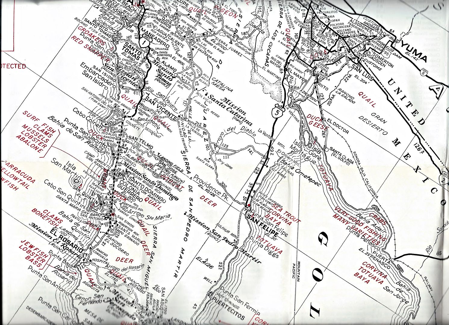
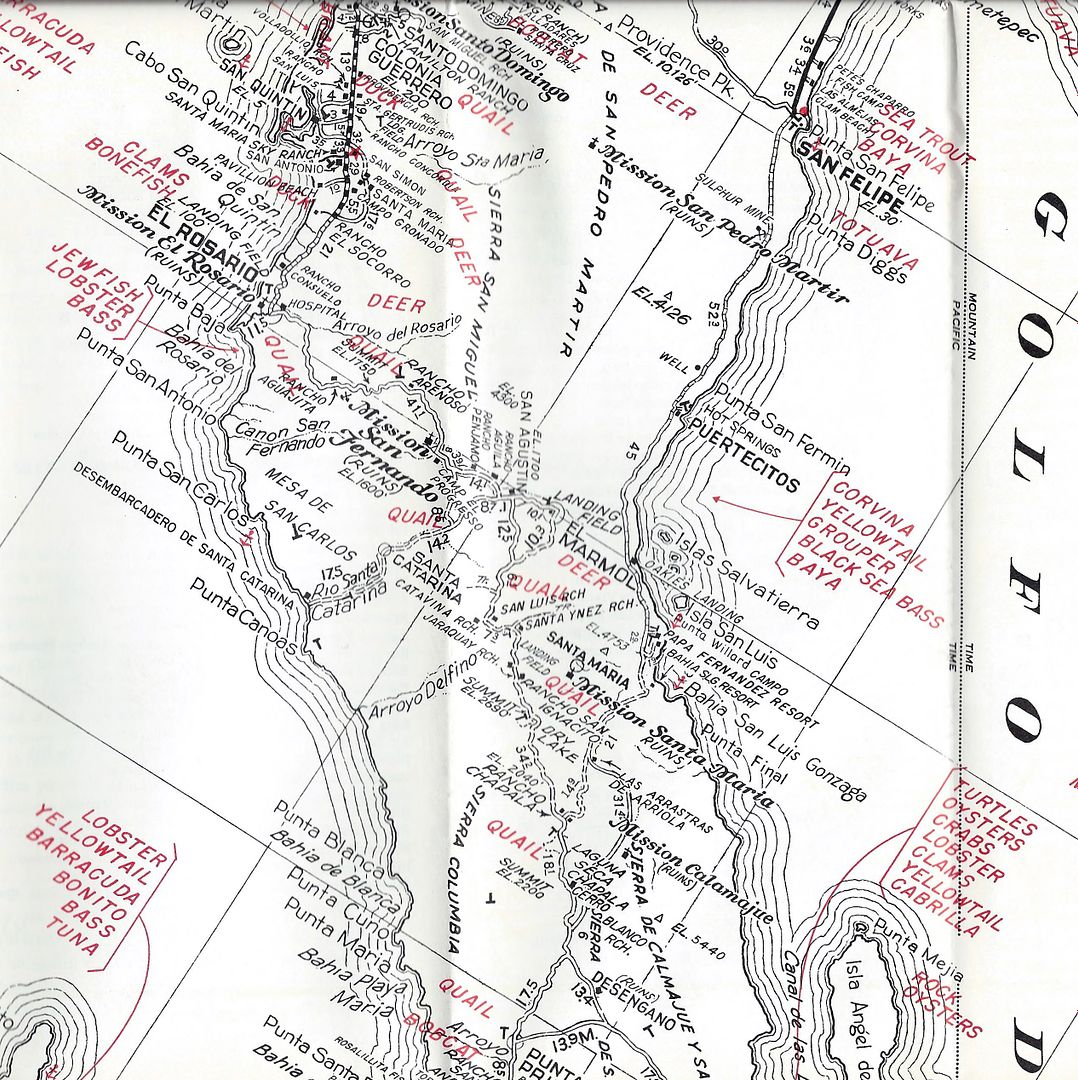
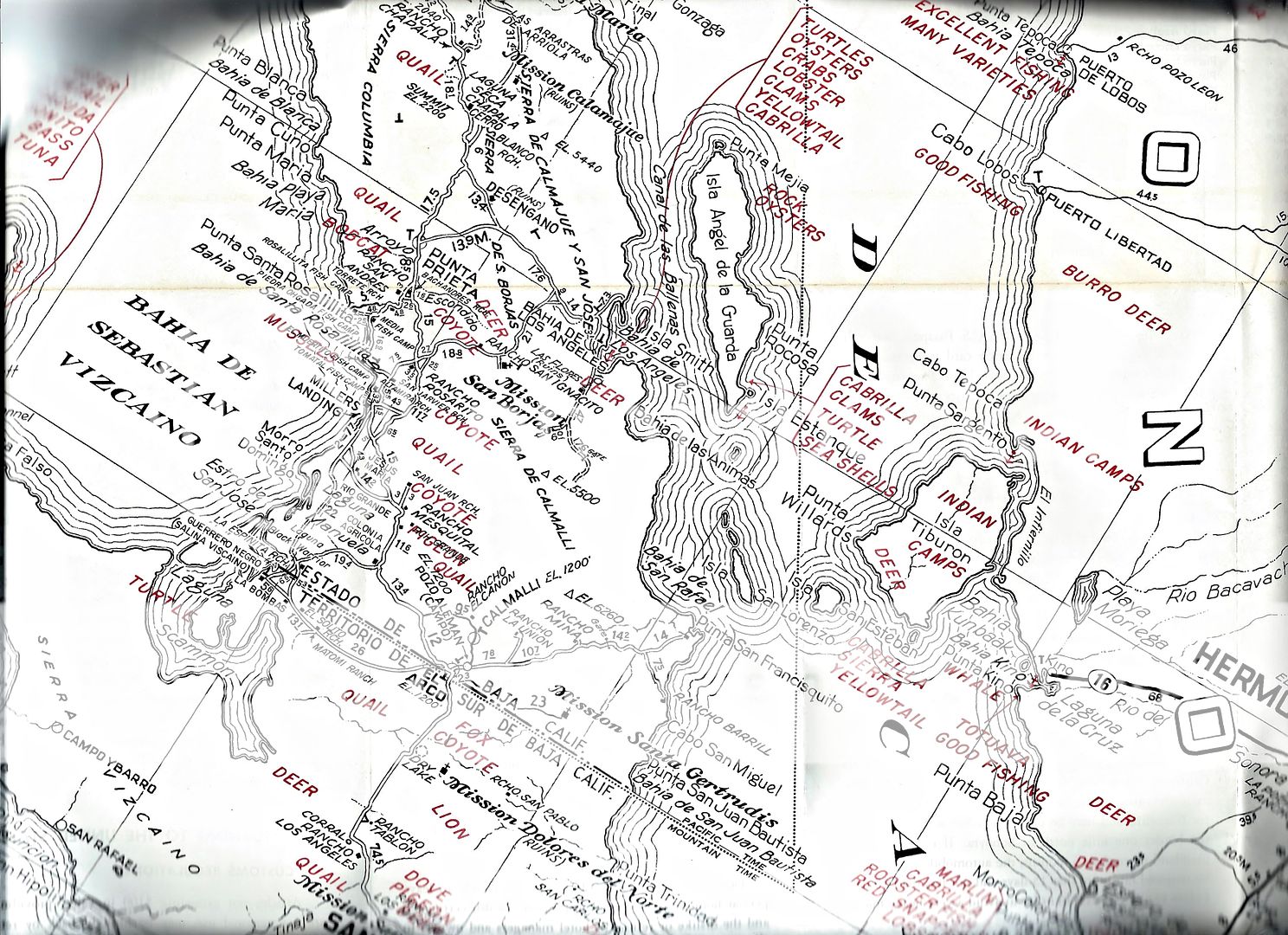
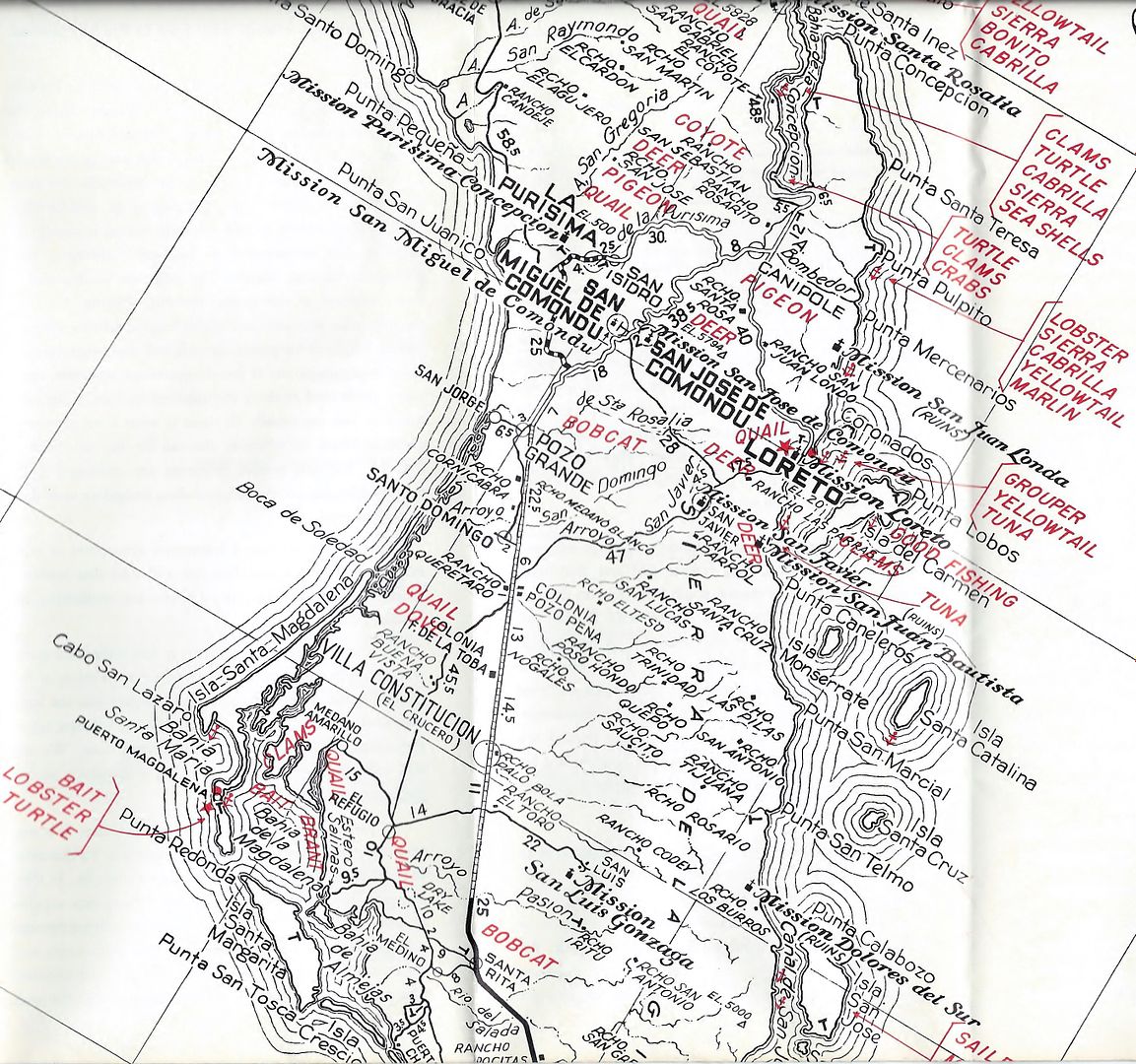
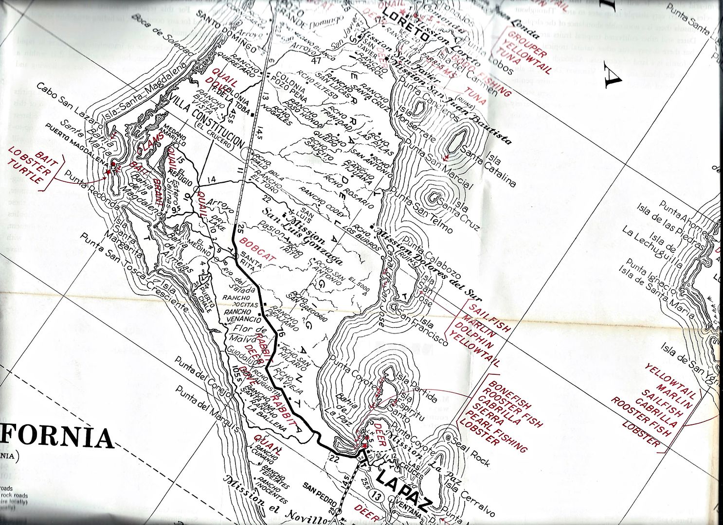
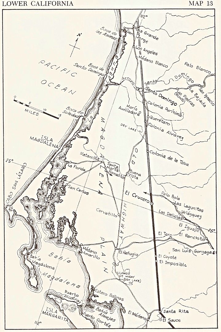
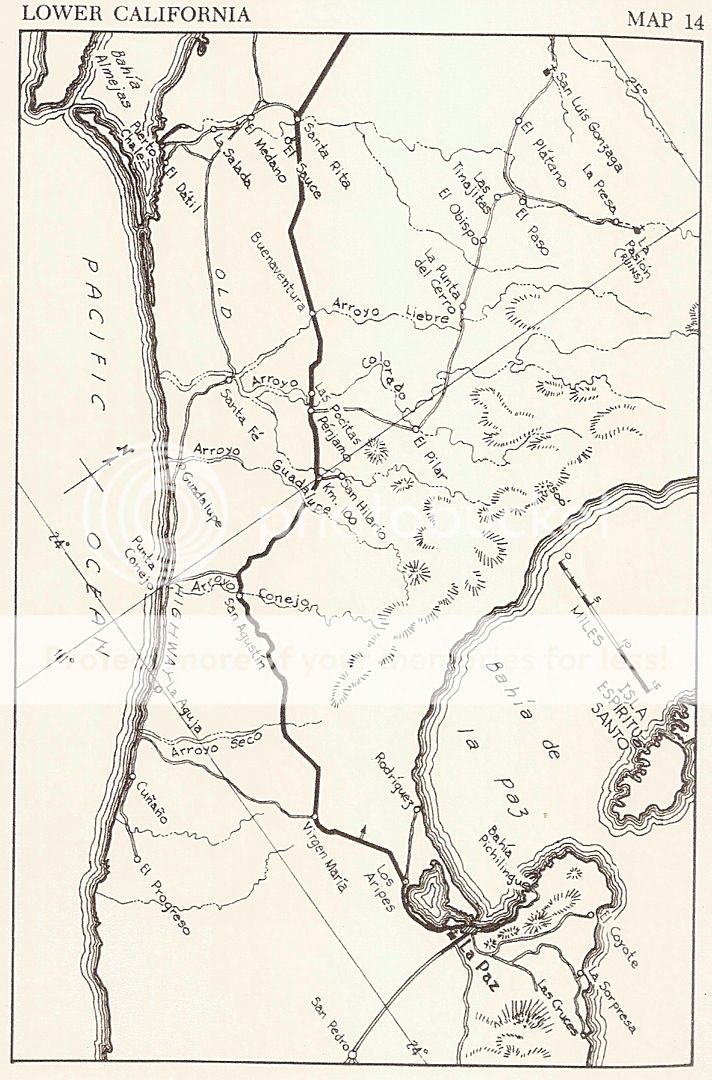
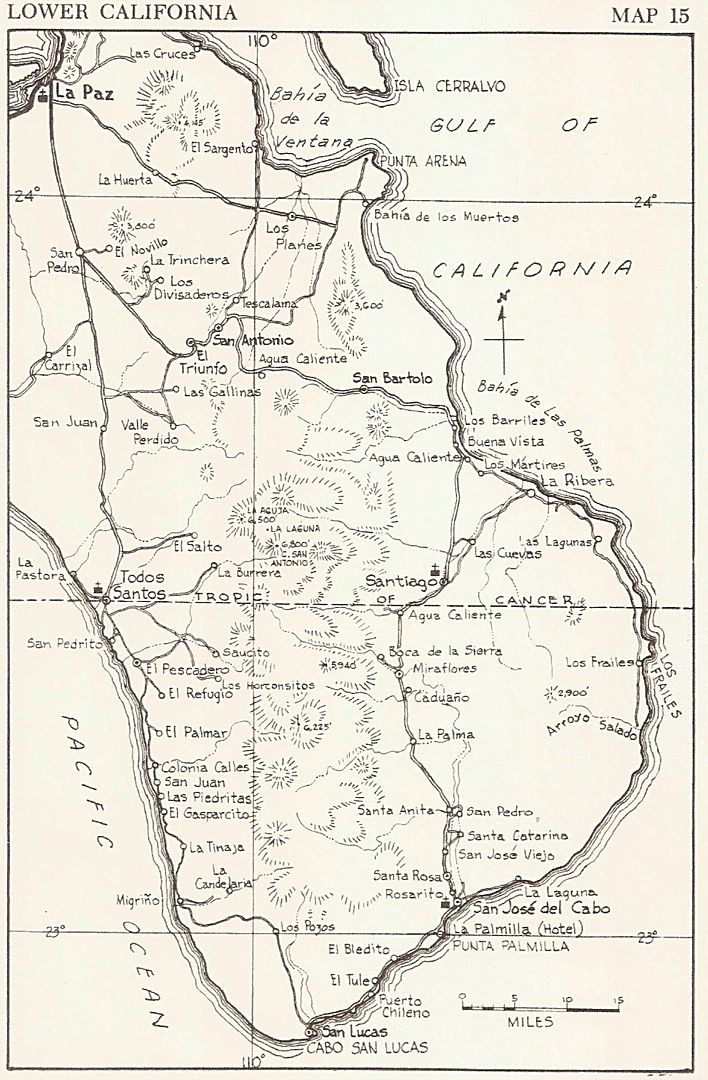
1962 Gulick maps from the Lower California Guidebook
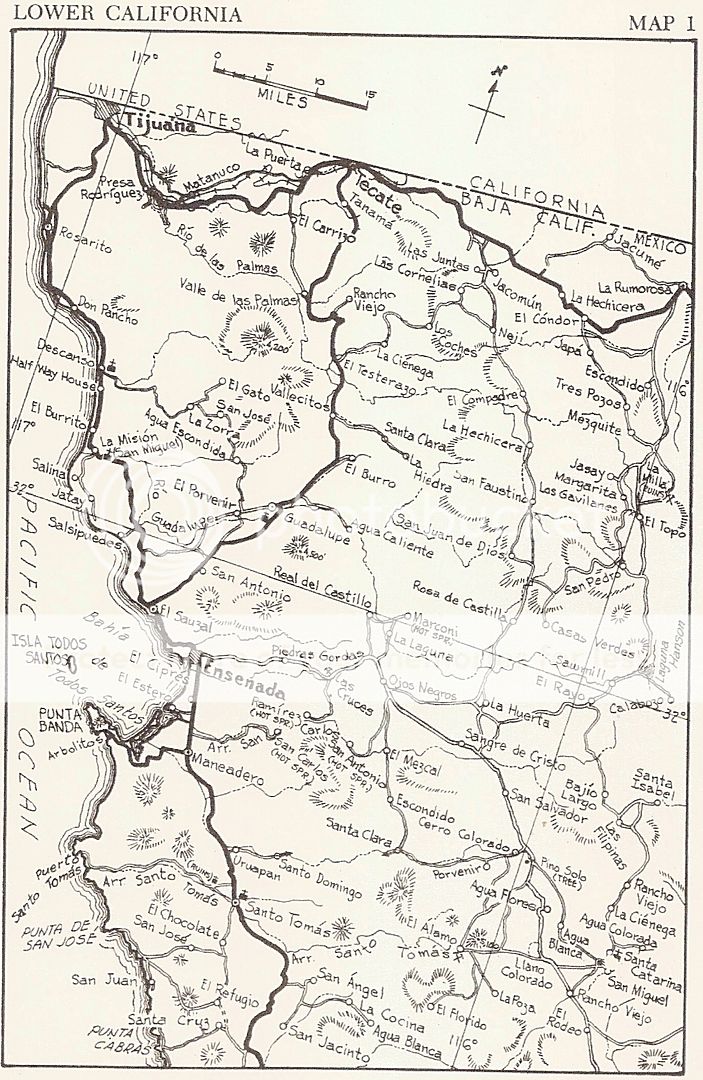
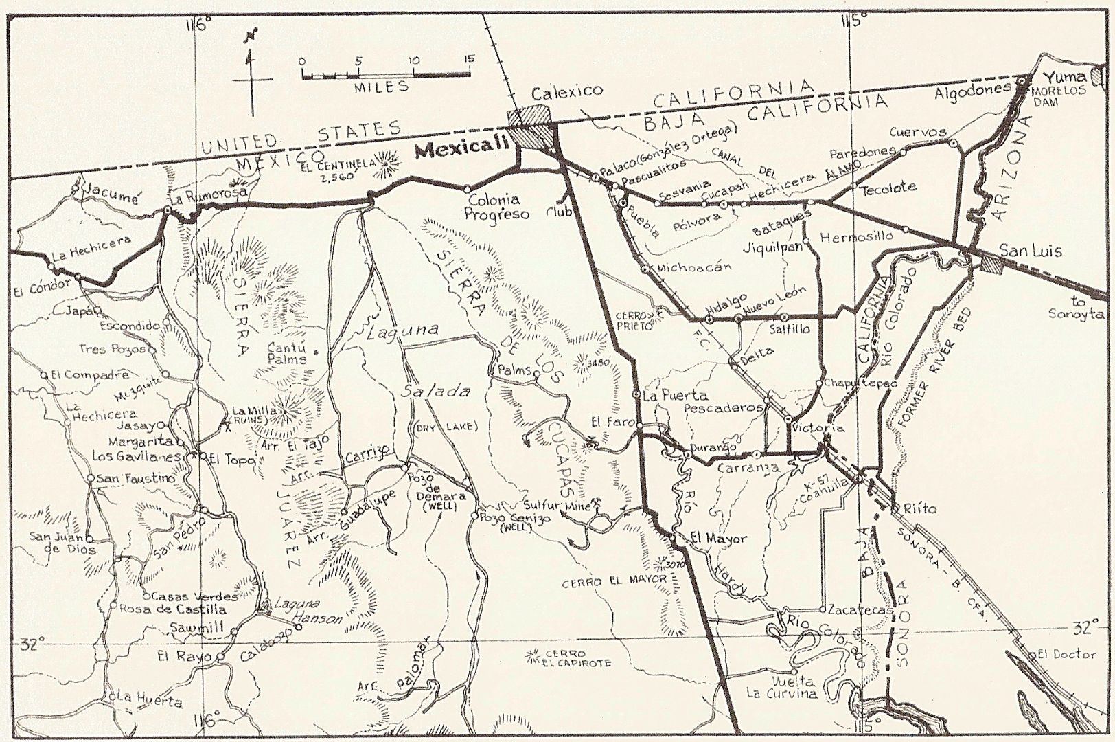
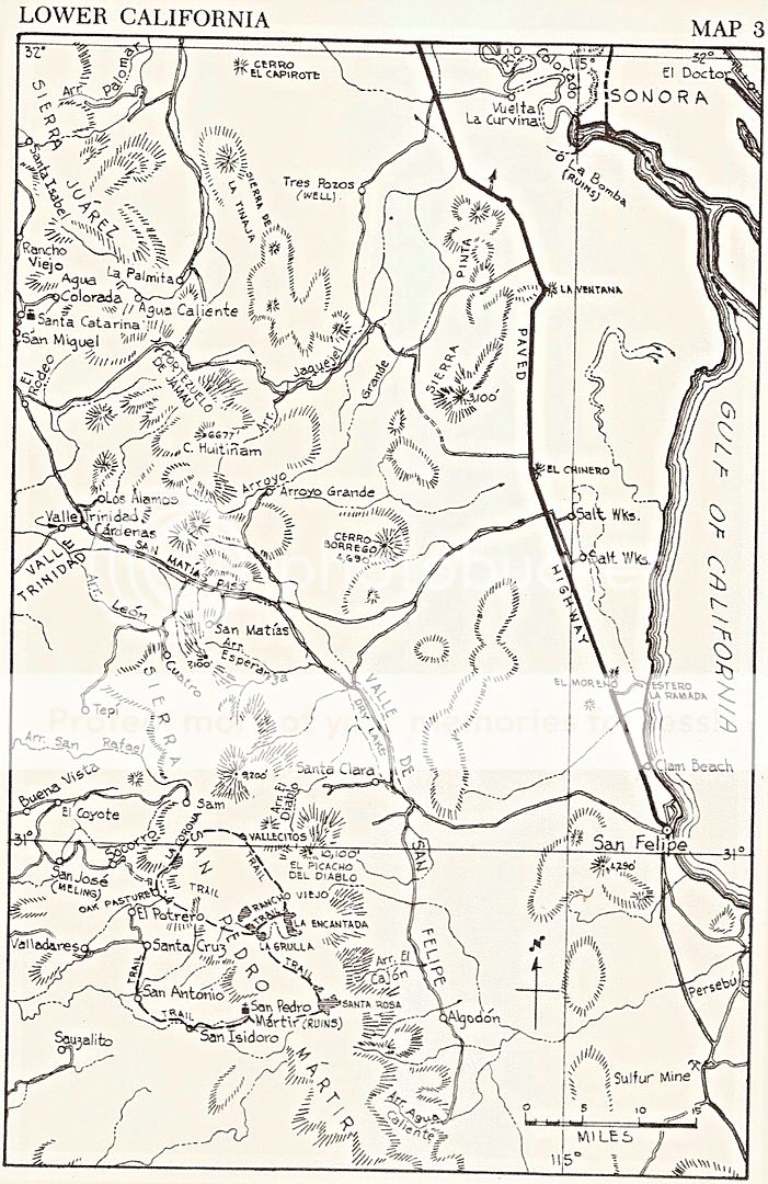
[Edited on 10-24-2019 by David K]
|
|
|
David K
Honored Nomad
Posts: 64490
Registered: 8-30-2002
Location: San Diego County
Member Is Offline
Mood: Have Baja Fever
|
|
These 1962 maps closely mimic the roads as we found them in out first Baja travels by Jeep (1965-1968)...
Hwy. 1: Pavement southbound ended just north of Colonet and began again, 800 miles away, about 100 miles north of La Paz. It ended again 10
miles south of La Paz.
Ensenada to San Felipe road was paved for 10 miles out from Ensenada.
Hwy. 5 pavement south ended in San Felipe.
Graded ("improved") roads ran:
From north of Colonet to just past the San Quintín area;
From San Ignacio to Mulegé;
From Pozo Grande (south of Comondú) to the paving out from La Paz;
From the pavement south of La Paz to just past San Bartolo... and from Todos Santos north to the pavement out of La Paz (making the cape loop,
clockwise);
From San Felipe to Puertecitos.
The rest of these roads were unimproved, single lane, dirt roads or "Jeep trails". They may have originally been made with a dozer but the only
maintenance since was with hand tools!
--------------------------------------------------------------------------------------------------------------------------
After 1968, the Highway 1 road construction and paving began to gain momentum... La Paz to Cabo San Lucas construction was high priority.
By 1970, the work north and south from La Paz was rapid with new graded roadbed completed to Santa Rosalia. A new route bypassed Comondú in favor of
Loreto. The road south was paved to Cabo San Lucas via Los Barriles.
Paving south from Ensenada was much less ambitious. Pavement reached Camalu.
By 1972, the road was paved north to Santa Rosalia and new highway grading was underway to San Ignacio. Paving south of Ensenada reached Colonia V.
Guerrero.
By 1973, paving north reached San Ignacio and road work was heading directly towards Guerrero Negro, bypassing El Arco. Paving southbound reached San
Quintín.
In mid-1973, pavement south had passed through El Rosario and ended 40 miles beyond (Mission San Fernando junction). Roadbed construction extended
nearly to Rancho Santa Ynez but traffic was detoured to the old main road, at Agua Dulce. Construction coming north reached the Laguna Chapala valley
and paved sections began near Punta Prieta with solid paving beginning near Villa Jesus Maria. There was no Eagle Monument or traffic circle yet.
Highway 1 was opened by Mexico's president on December 1, 1973, at the base of the new, 140 ft. tall, Eagle Monument.

|
|
|
|


