| Pages:
1
2 |
PaulW
Ultra Nomad

Posts: 3005
Registered: 5-21-2013
Member Is Offline
|
|
Agua Caliente
Agua Caliente
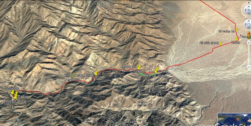
Nov 27 trip to the end of the road .
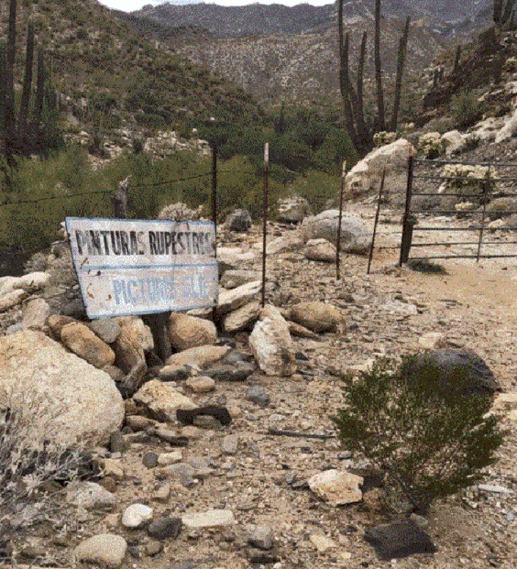
Started at the Ranch at the intersection on west valley road and the road south toward Matomi. The typical place where most folks stop is at the
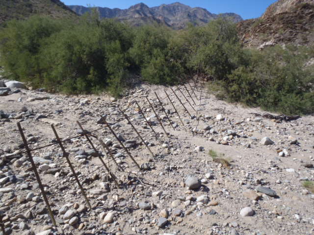
corral. From that point is it is short walk up the wash to view the Rock art. Easy to find because there is a substantial fence at that point. One can
drive to the gate and park then scramble down hill over big boulders to get to the rock art. Walk on the near side of the fence (east side) to avoid
being trapped on the wrong side of the fence and unable to get to the rock art. The rock art is in pretty bad shape now days.
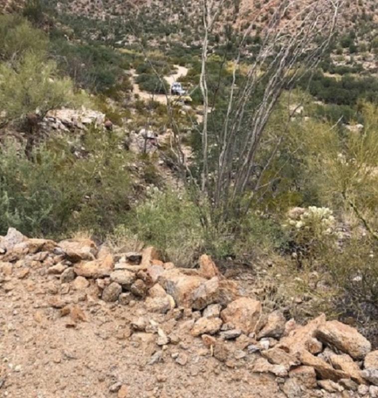
My hike started at the corral
 upload online picture upload online picture
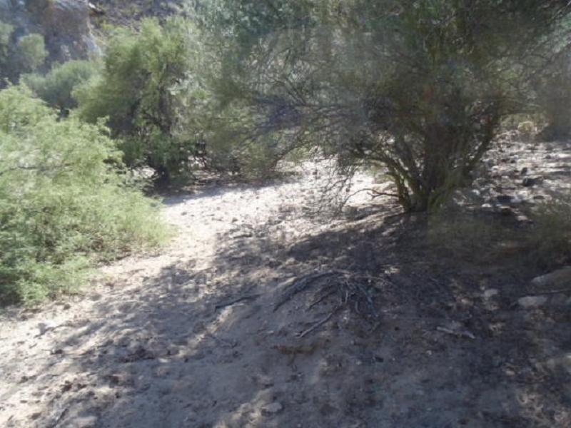
Walked down to the wash starting in the above pic.
The wash looks like this (all looking east)
 gif upload gif upload
Arriving at the Rock art at the fence
 upload my picture upload my picture
Next looking NW to the gate
 web upload image web upload image
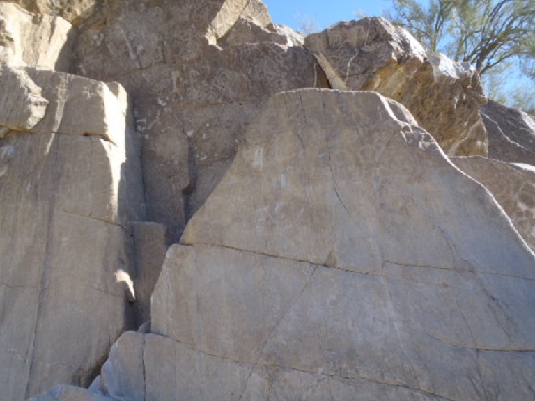
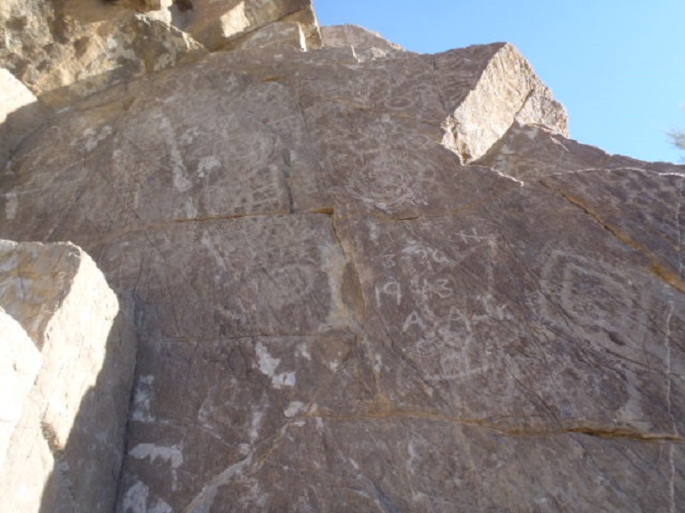
Rock art
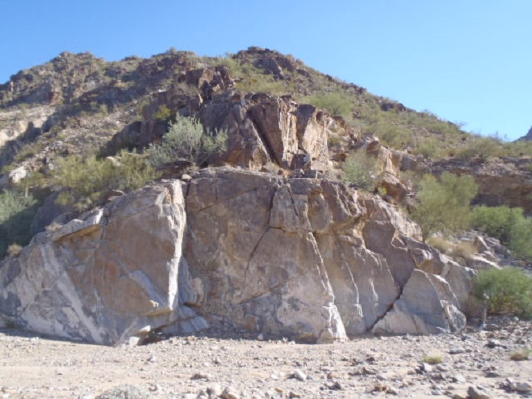
I climbed up that crack above to get the next pic
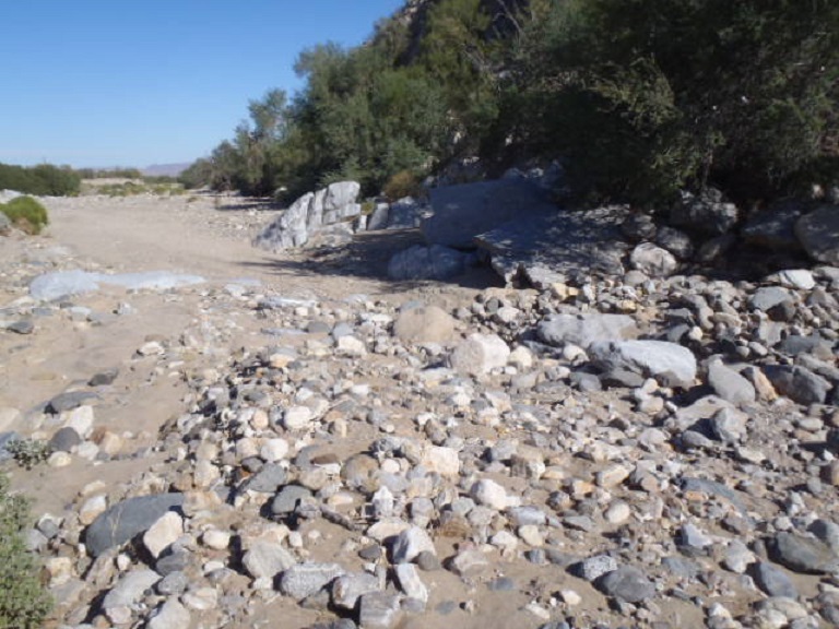
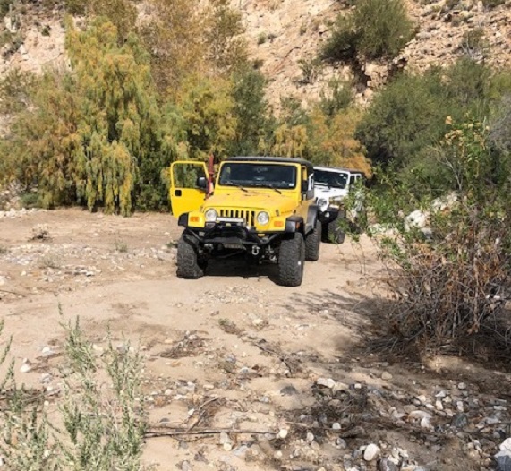
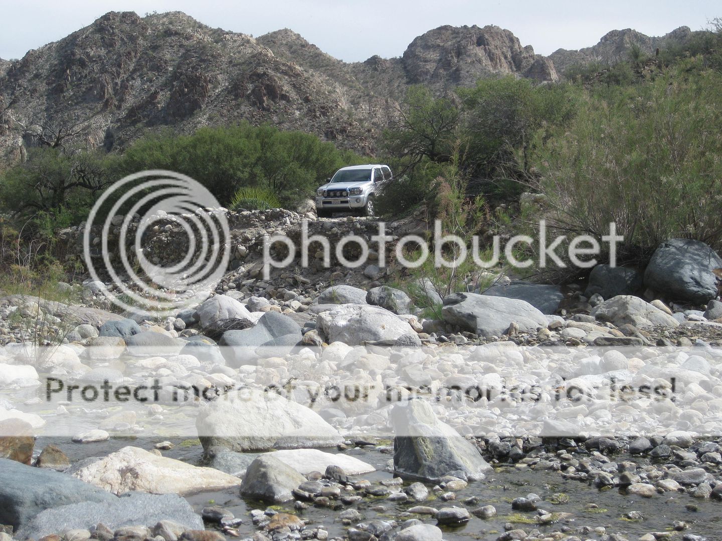
The road to just past the gate is easy. Then it becomes more difficult with many stops to decide where the path should go. Turns out the ranch hands
have been pruning the bushes to a point (minimal). We could see machete slashes for the trimming. If one was to zoom in on the track it is Easy to see
where we had issues because the GPS dithers at those places. What we had to do was look for a path the force out way thru the willow like bushes that
were higher than the Jeeps. I followed cow paths and I found that the heavy branches were pruned sometime in the past. Still I had to use my pruning
saw where overhanging branches leaning over my path were too big to pass.
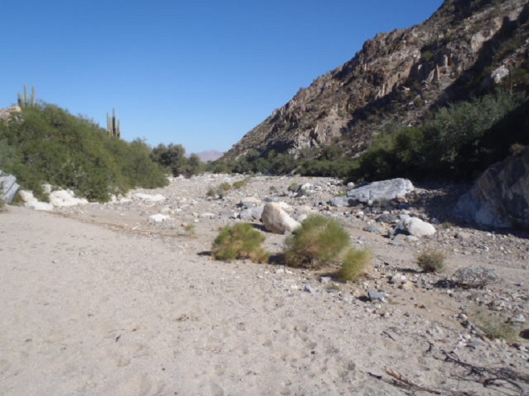
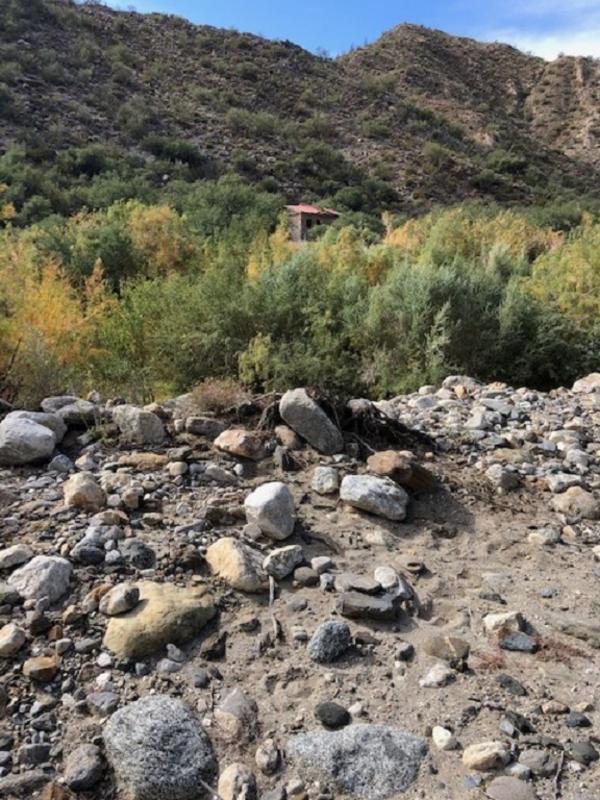
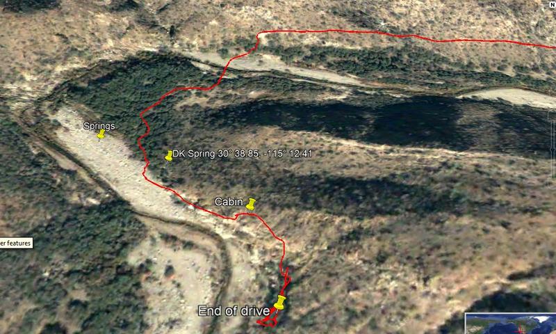
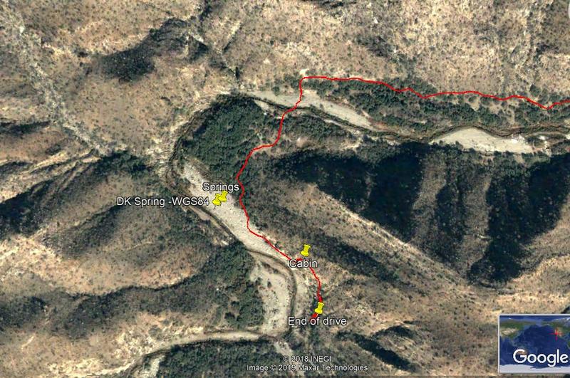
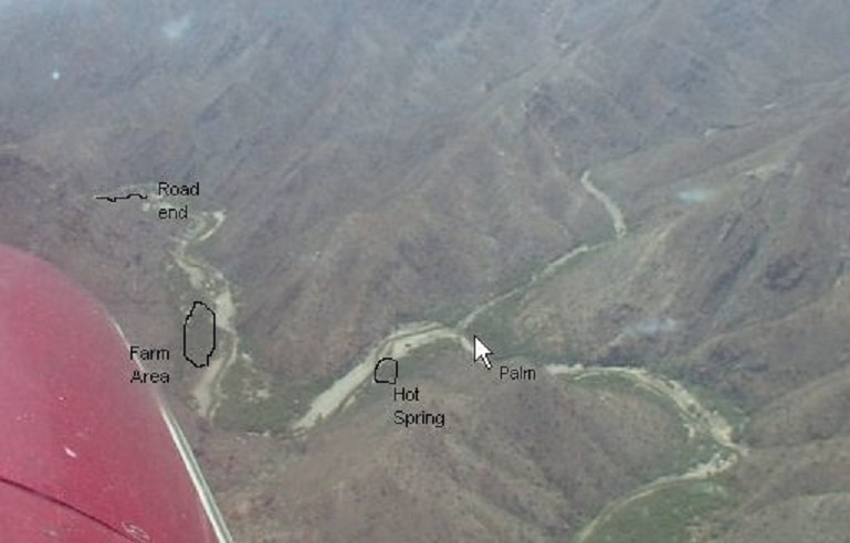
On my track I annotated the end of the road on my GPS map. Also noted is the end of vehicle travel, the cabin, and the spring. There is no evidence
of any spring along the way, but we had to cross the gully many times and each place had muddy water. That spring notation courtesy of Lou Wells from
20 +years ago.
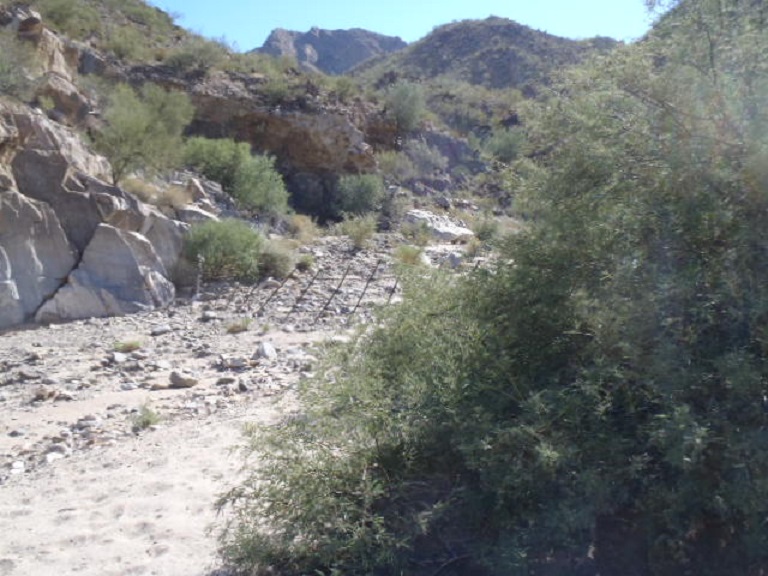
Our hike from where we parked was short as we came to a substantial fence with no gate. The bushes were much heavier with no path for us to force
thru. I found a sign indication Property boundary but did not have my camera or phone – shucks.
Heading into the first difficult place in the gulley
<a href='https://postimg.cc/sBNDt4xr' target='_blank'><img src='https://i.postimg.cc/sBNDt4xr/1-R-IMG-0187-R.jpg' border='0'
alt='1-R-IMG-0187-R'/></a>
Came to the cabin
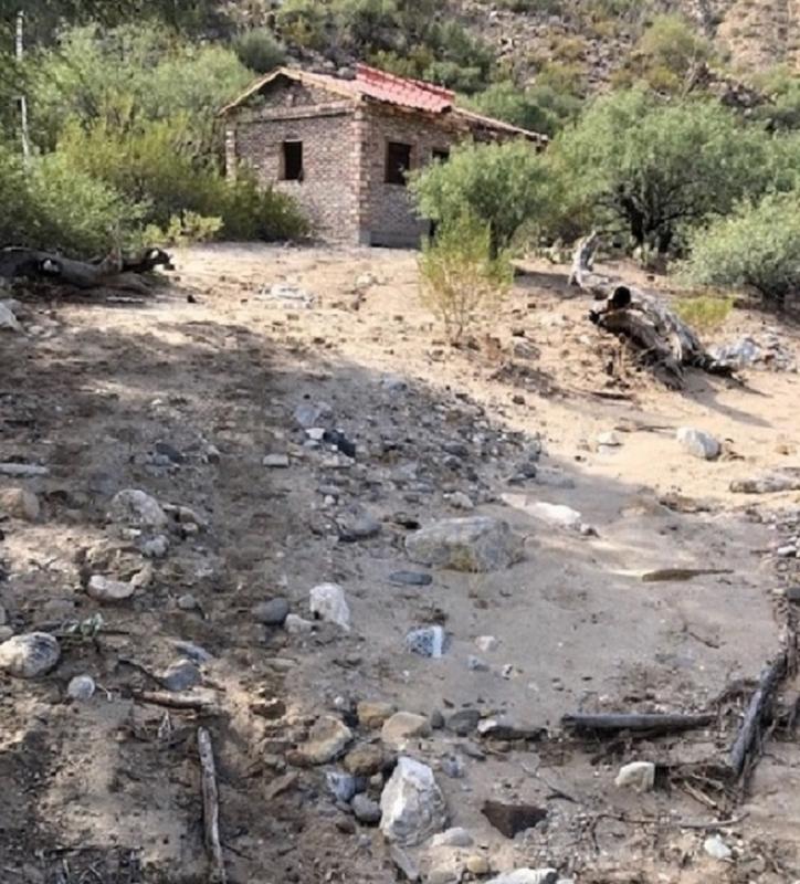 photoupload photoupload
Side road heading east. Side road is bad and leads to an abandoned shack
Arrived back at the gate
Last of all here is the image from back in the day from a Cessna 182. Courtesy of Lou Wells

Obviously, nothing similar these days.
I would guess Lou’s Palm tree is at the side canyon, and I noted that place on my track
Google image
 images shares images shares
Attachment: Auga Caliente.kml (121kB)
This file has been downloaded 241 times
|
|
|
4x4abc
Ultra Nomad
Posts: 4163
Registered: 4-24-2009
Location: La Paz, BCS
Member Is Offline
Mood: happy - always
|
|
Good Job!
and a track log!
finally we have arrived in the 21st century
Harald Pietschmann
|
|
|
PaulW
Ultra Nomad
Posts: 3005
Registered: 5-21-2013
Member Is Offline
|
|
Hard to accept that the valley has changed?
No water in the pila.
Evidence of cow tracks, but did not see any.
Crossed the gulley several times and only found puddles. No flowing water. The most notable place that could possibly be a spring was at 30° 39.149,
- 115° 11.621
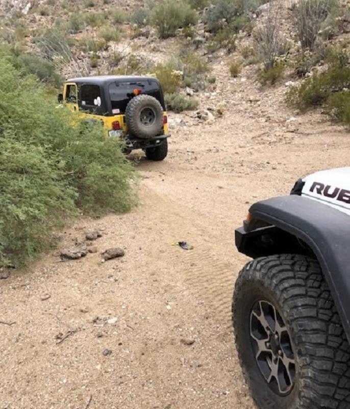
Both of us had to use our rear locker to get up the bank twice to get up the other side.
|
|
|
PaulW
Ultra Nomad
Posts: 3005
Registered: 5-21-2013
Member Is Offline
|
|
From http://www.vivabaja.com/404/
David’s hot spring 30°38.85', 115°12.41
|
|
|
rts551
Elite Nomad
Posts: 6699
Registered: 9-5-2003
Member Is Offline
|
|
Looks like someone in the past has defaced the paintings. Too bad. Thats why people should be kept away.
|
|
|
David K
Honored Nomad
Posts: 64476
Registered: 8-30-2002
Location: San Diego County
Member Is Offline
Mood: Have Baja Fever
|
|
The points you have called DK Spring and Spring are wrong, The hot spring is across the arroyo. We all posted using Map Datum NAD27 Mexico back then,
to match with the Baja Almanac and topo maps. This was before Google Earth (Map Datum WGS84). On the first page I have a waypoint at a road junction,
and include the map datum used: 30°47.03', 115°09.95' (NAD27)
See my web pages:
2004: http://www.vivabaja.com/404/page6.html
2000: http://www.vivabaja.com/baja_2001/page2.html and http://www.vivabaja.com/baja_2001/page3.html
The BajaLou photo that I added text and circles to show the hot spring location on the west side of the arroyo where the arroyo is going north/south.

|
|
|
PaulW
Ultra Nomad
Posts: 3005
Registered: 5-21-2013
Member Is Offline
|
|
From http://www.vivabaja.com/404/
David’s hot spring 30°38.85', 115°12.41 NAD27Mexico
Converted
Now 30 38.857, -115 12.452 WGS84
[url=https://postimages.org/]
FYI the point moved 75.7meters
 [/url] [/url]
[Edited on 12-8-2019 by PaulW]
|
|
|
David K
Honored Nomad
Posts: 64476
Registered: 8-30-2002
Location: San Diego County
Member Is Offline
Mood: Have Baja Fever
|
|
Well, still not west enough but closer. The hot spring in my photos is across the stream and on the terrace. The hot water flows down to the canyon
floor and creates a hot stream paralleling the cool stream before they join near the bend in the canyon.
As you come up the canyon, it is on the right bank.
Of course, after flash floods over the past dozen years, things change!
I wish you had seen it.
|
|
|
PaulW
Ultra Nomad
Posts: 3005
Registered: 5-21-2013
Member Is Offline
|
|
I was curious about your original coords.
Turns out not very accurate with the GPS you were using back then.
FYI: Another way to get more accurate coords is to use your iPhone
For deg Min you get accuracy to 4 digits to the right of the decimal
Here is how. Go the the place you want accurate coords and take a picture. Of course you must have "location" active in your settings.
Get the free app called EXIF which allows access to the phone picture met data including accurate coordinates in deg, min, sec with 3 significant
figures in seconds.
Somebody with Android can give details for the same thing.
Of course plotting the coords on Google Earth is problematic since there are issues they have stitching the photos together. Look an my track for Agua
Caliente near the beginning (W of the air strip) and see how my GPS track does not follow the image of the road. Not my GPS issue but it shows an
example of the Google Earth error.
|
|
|
David K
Honored Nomad
Posts: 64476
Registered: 8-30-2002
Location: San Diego County
Member Is Offline
Mood: Have Baja Fever
|
|
Well, I can look at the satellite image and see where the spring is/was. I was there twice. New Year's 2001 and April 2004. It was the same both
times. Padre Linck was there in 1766 and described it... So, the hot spring has history. I have been busy but will make some new Google Earth points
and images to share here. If you look at my photos, you can see where it is plus the BajaLou aerial picture, I circled where it was and you had that.
|
|
|
PaulW
Ultra Nomad
Posts: 3005
Registered: 5-21-2013
Member Is Offline
|
|
Did you ignore what I said about the road vs track and the big error that GE has there
|
|
|
David K
Honored Nomad
Posts: 64476
Registered: 8-30-2002
Location: San Diego County
Member Is Offline
Mood: Have Baja Fever
|
|
Sorry, I didn't mean to ignore anything. I have been using my phone so it isn't as easy to read or see. I will get back on my PC and show you the
approx spot. The circle on the aerial photo is correct just not pinpointed.
|
|
|
David K
Honored Nomad
Posts: 64476
Registered: 8-30-2002
Location: San Diego County
Member Is Offline
Mood: Have Baja Fever
|
|
Paul (and others seeking the hot spring original location)
OK, using my GPS from back in 2004, the waypoint I recorded on it (at map datum WGS84, in degree-decimal seconds) is: N30°38'50.8", W115°12'27.4"
Converting to decimal degrees (most common GPS posting setting): N30°38.846', W115°12.456'
Here are the two waypoints on Google Earth similar to the area and direction you used.
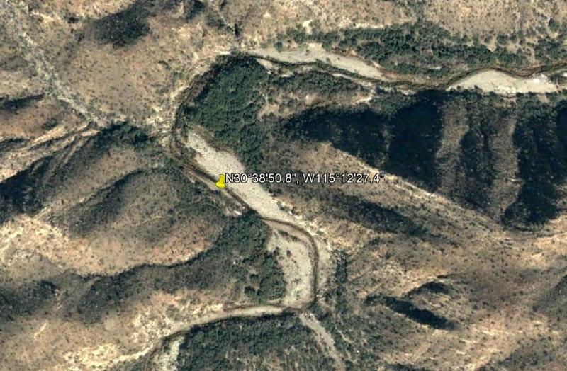
Decimal seconds
Decimal minutes
This shows that both decimal minutes and decimal seconds are the same point on Google Earth.
------------------------------------------------------------------------------------------------------------------
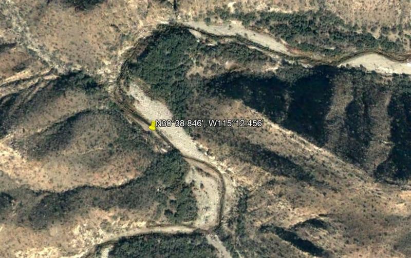
Here is the Google Earth view that most closely simulates BajaLou and Warnout's flight photo, with my hot spring waypoint... looking eastward. Just
below is the aerial photo with my notations...
You can see my circle made in 2004 (before Google Earth made aerial mapping so much easier!) and the waypoint pin map, made today, are almost
identical.
==========================================================================
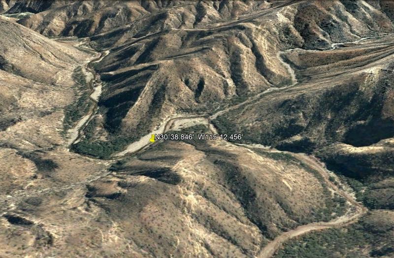
OK so, here is what the fuss is about. Yes, the canyon has likely changed... but the hot spot still should be on the same side of the canyon floor.

The main source spring. It is on the right side of the canyon as you are walking upstream. Here the canyon is going southward and the spring is on a
bench to the right, west side.

Here is the hot stream flowing towards the camera from where it dropped off the bench, on the right. My friend ('jide') is crouching where the water
flows down from the spring, on the right. A hot tub, lined with rocks, is right there. However, the spring water is so hot, bathing is impossible
without bringing cool water from the canyon stream over somehow. The canyon stream is about 50 feet away (to the left in the photo).

Looking down the hot stream to where the previous photo was taken. This is the hot tub and the hot waterfall into it from the spring (to the left of
the photo). The water was measured at 140°F by the Hot Springs book author who was here. Jide and I went about 300 feet down the hot stream before it
was cool enough (about 105°) to dip in.

I climbed high up on the ridge to get a better look towards the hot spring, it is on the right, down there. That barrel cactus was close to 7 feet
tall!
|
|
|
Geothermal-Shane
Junior Nomad
Posts: 83
Registered: 5-14-2005
Member Is Offline
|
|
I have been to Agua Caliente twice, first in June 2004 and again in June 2005. On both occasions the road gradually deteriorated above Ejido Agua
Caliente. We camped up the canyon and hiked to the springs both times, the source was about as hot as described here, we were able to get into the
stream below the spring that was at a tolerable temperature but not very deep. Found the pool in David K's photo but it had cow poop in it. It was
still quite magical. In 2005 it was possible to drive a bit further up the canyon with 4wd, and a local crew was working up there on constructing a
very small reservoir that would provide water for the ejido. I recall they were driving what appeared to be late 70s Dodge Power wagons. Not sure what
became of that project or if it was ever completed. Also saw the largest (6' long) rattlesnake I have ever encountered up by the hot spring.
Anyway, if it is of any interest here are the coordinates in decimal degrees I had recorded in 2005:
Gate: N 30°39.380' W 115°10.194'
End of the passable section of road: N 30°38.983' W 150°12.058'
Hot Spring: N 30°38.988' W 115°12.410'
Blue Palm: N 30°38.597' W 115°12.900'
After reading this, my question is, has erosion caused the source to become obscured or emerge elsewhere in the canyon? And exactly how far might one
be able to drive up the canyon?
Thanks for posting this, mi gusta! 
[Edited on 12-11-2019 by Geothermal-Shane]
[Edited on 12-11-2019 by Geothermal-Shane]
|
|
|
David K
Honored Nomad
Posts: 64476
Registered: 8-30-2002
Location: San Diego County
Member Is Offline
Mood: Have Baja Fever
|
|
Thanks Shane... good to see you back here again!
You can see from Paul's photos and Google Map, they got their Jeeps to the canyon near the spring and noted the cabin built closer to the Palm
location. Sadly, they didn't walk the canyon floor otherwise the smell of sulfur and steam rising would have given away the spring (if it is still
flowing). The two times I drove up the canyon, we got no closer than 1 mile from the spring. Note "End of Road" on the aerial photo.
|
|
|
PaulW
Ultra Nomad
Posts: 3005
Registered: 5-21-2013
Member Is Offline
|
|
Nice to have the historical review of what was there 14-15+ years ago.
My trip concentrated on being able to drive thru the heavy undergrowth and negotiate the steep places. The area where the spring was at was very wet
and we were concentrating on getting thru and up the other side of the drainage. Not a good place to stop without getting wet feet.
So since I live so close I will plan a do-over and see what is near my driving path - After the holidays.
Climbing up the hillside is probably not in the cards due to the heavy undergrowth?
|
|
|
Geothermal-Shane
Junior Nomad
Posts: 83
Registered: 5-14-2005
Member Is Offline
|
|
Thanks David, I haven't ventured so far southward in a while, but it has remained on my mind. I'm hoping to get back to my favorite spots again soon.
Looking forward to any reports people have on Agua Calienete in Valle Chico. That area is amazing, I have a picture of a friend and I standing beneath
a 40 foot tall cardon around there. I will try to post some pics if I can get them scanned, I was using a disposable camera in those days.
From my recollection, the spring was on the right side of the canyon as you were hiking up, a bit away from the more dense riparian zone. Hiking the
canyon did involve a bit of navigation through trees and shrubs with no trail, but it was doable. I imagine that flooding over the years could have
reshaped the canyon's alluvial structure, so who knows how the spring area has been reshaped and the surroundings colonized by emergent vegetation.
[Edited on 12-12-2019 by Geothermal-Shane]
|
|
|
PaulW
Ultra Nomad
Posts: 3005
Registered: 5-21-2013
Member Is Offline
|
|
Can you view Wornout's latest trip?
https://www.relive.cc/view/vKv24535Lo6?fbclid=IwAR3hzFAy2kc5...
|
|
|
David K
Honored Nomad
Posts: 64476
Registered: 8-30-2002
Location: San Diego County
Member Is Offline
Mood: Have Baja Fever
|
|
Yes, I watched his Relive video yesterday on Facebook... I did ask him a question but he has yet to respond... The question was why did they not go
any further up the canyon? Was the road washed-out (still)? That was my findings in March 2017, when I was last in there... not much beyond the gate/
petroglyphs the road was washed out with a cliff! There was a rough cut Jeep path detouring the new cliff, but traveling alone, I didn't chance going
further. Photos are in my Trip #3 report. http://forums.bajanomad.com/viewthread.php?tid=85989
The cliff in the road...
[Edited on 4-5-2020 by David K]
|
|
|
PaulW
Ultra Nomad
Posts: 3005
Registered: 5-21-2013
Member Is Offline
|
|
David Wrote:
The cliff in the road...
So that cliff is still there and the road continues drivers side along the bank then down into the place pictured with all the standing water
Maybe I forgot to mention. After the wet swampy area after the spring there is a steep bank to go up. However there are minimal rocks on the approach.
Traction up that bank is not good and the other Jeep had to do it over with a faster start.
And I don't think anyone would want to try to drive up the wash to the rock art. It is doable, but pretty rough going. The wash at that point is
strongly fenced at that point and one cannot drive further up the wash. To get the the rock are it is a short walk from the corral with a good place
to park. Walking to the rock art from the sign on the road at the fence gate is not recommended. There is no trail and it looks like tough going along
the fence line. The hike to the rock art starts at the left side of the corral. and leads into the wash.
Most of the people driving with Wornout on his trip consisted of 2wd sand rails And stopped to turn around at the place after the cliff.
[Edited on 2-13-2021 by PaulW]
|
|
|
| Pages:
1
2 |


