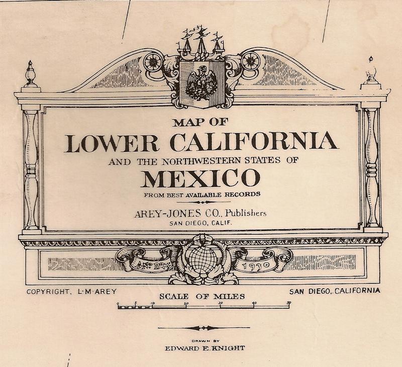
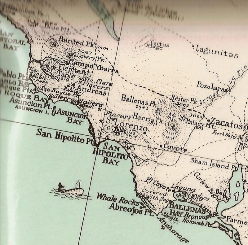
entertaining - but the 1925 map has so many serious mistakes that it can not be taken seriously
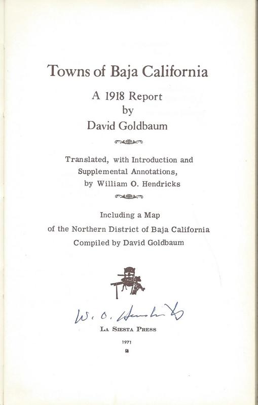
Well, it was hand drawn from 20 years of travels by David Goldbaum, who lived in Ensenada (street named after him).
Read more about his Baja Norte research in this book from La Siesta Press, in
1971:
Great maps. I tried to save the "1925" map but it seems to only save in low resolution, no zoom. Guess I could snip hi res sections and stitch them
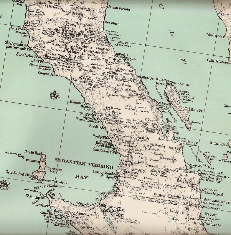
together. These are good for identifying turn of the century place names that have since changed. e.g. Agua Dulce, near Real del Castillo, now
called Agua Caliente, if that is the same place.
Great maps. I tried to save the "1925" map but it seems to only save in low resolution, no zoom. Guess I could snip hi res sections and stitch them
together. These are good for identifying turn of the century place names that have since changed. e.g. Agua Dulce, near Real del Castillo, now
called Agua Caliente, if that is the same place.
Ric, I added the map link to www.vivabaja.com and it is zoomable so try it there. You do have to click on the Expand arrows to make the map full page, first.
As for Agua Dulce (Sweet Water)... that would be a spring of drinking water and not a hot spring (Agua Caliente), typically. I will take a look, so
thanks for asking!
DK, on closer examination you are probably right. Agua Caliente is in Arroyo Jacalitos. What Goldbaum called Agua Dulce appears to be a few miles
southeast of there. Probably a spring that supplied water to Real del Castillo back in the old days, possibly at what is now shown as Agua de Cruz in
the BCA. I wonder if anyone has ever been to that hot spring called Agua Caliente.
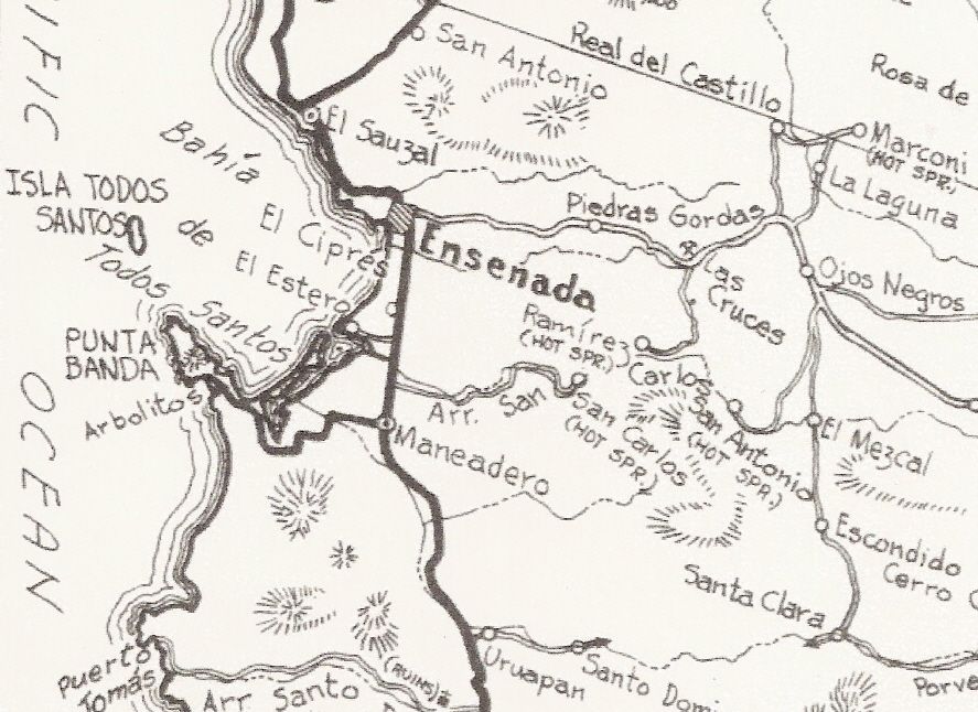
I see 'Jacalitos'... but not 'Agua Caliente' there or near there?
There is the Marconi Hot Springs (or was, reported not open or running) in the general area NE of Ojos Negros. Then the hot springs near the L.A.
Cetto winery in Guadalupe Valley (aka 'Russian Valley Hot Springs').
The hot springs in San Carlos Canyon, SE of Ensenada are shown.
Agua Caliente is not shown on the Golbaum map; it is shown in the BCA, NE of Ojos Negros in Arroyo Jacalitos. Jacalitos is on the Goldbaum map.
Maybe the same hot spring is called Marconi if I remember right by Gulik ?? - I know there is a hot spring thread that shows where I am talking
about
edit, ahh there it is. Have been researching around this area recently so just happened to have remembered
Great maps. I tried to save the "1925" map but it seems to only save in low resolution, no zoom. Guess I could snip hi res sections and stitch them
together. These are good for identifying turn of the century place names that have since changed. e.g. Agua Dulce, near Real del Castillo, now
called Agua Caliente, if that is the same place.
On the UWM website, if you click the download icon to the left of the print icon, it shows me three sizes. If I choose the last one (large) I get the
full-size image.
The grand nephew of David Goldman produced a film about the expedition and how they retraced the steps to see what has changed between 1905 and today.
The film is on the film festival tour now and will be showing in San Diego soon. Nomads have seen many previews of the film, called The Devil's Road.
I might have a bit in it as they did film an interview with me a couple years ago. My book was their source for mission data.Pancho of San Rafael is
in the film and in this preview...
Geoff, I was able to save the map in high resolution. Thanks for that tip.
I tried to make it to the "Marconi Hot Springs" near Real del Castillo a few months ago, but did not make it. I saw a post on the hot springs thread
that there is not much to see there but I wanted to see for myself. Started in Tecate round 9am, drove east to Condor then south on a rough dirt
road. Those fires last October created a huge burn scar in the Sierra Juarez, it was not reported very much but it was a big, hot fire; thousands of
acres burned. You could see all kinds of tin cans and stuff laying around where the undergrowth was burned off. I got so engrossed in looking around
lost track of time, then headed south past Laguna Hanson but by the time I got to the turnoff to Real del Castillo it was getting dark. Made it to km
55 on Hwy 3 and then to Ensenada in the dark, got stuck in huge Friday night rush hour traffic jam, finally got to friend's place at Bufadora around
7:30 pm. Will have to try it again some day when travel restrictions are lifted.
Juan M. thanks for posting the map from the Gabb expedition. I happened to be reading that account on line, after I found a reference to it in the
appendix of a book that J Harper brought to my attention; The Central Desert of Baja California, Homer Aschmann.
For the history buffs sitting around covid bound, the Gabb report can also be seen here, starting on page 834 of this Harvard-digitized edition of
Browne's monumental Lower Resources of the Pacific Slope.
Account of a trip up the peninsula, along the old Mission Trail aka El Camino Real, including from San Ignacio to San Borja
I have a question for DK / Max or anyone else who might know regarding the Mission bells. Gabb noted some abandoned prospecting for minerals around
Mission San Fernando, and another source said that copper was mined there by the Missionaries, and used for cooking implements and even some of the
bells for the later missions. Ever heard of that?
Copper was mined not too far south of Mission San Fernando around 1900-1910 time period. I visited the San Fernando mine 20 years ago. A couple photos
of it are on my website.
I don't recall the padres ever writing they had anything to do with mining. They were so involved with raising food, nothing else such as mining was
possible.
To smelt the ore into metal was beyond their capability, I think.
Bells are bronze, I think, and forged either in Europe or on the mainland. I can ask Max!
"If it were lush and rich, one could understand the pull, but it is fierce and hostile and sullen.
The stone mountains pile up to the sky and there is little fresh water. But we know we must go back
if we live, and we don't know why." - Steinbeck, Log from the Sea of Cortez
"People don't care how much you know, until they know how much you care." - Theodore Roosevelt
"You can easily judge the character of others by how they treat those who they think can do nothing for them or to them." - Malcolm Forbes
"Let others lead small lives, but not you. Let others argue over small things, but not you. Let others
cry over small hurts, but not you. Let others leave their future in someone else's hands, but not you." - Jim Rohn
"The best way to get the right answer on the internet is not to ask a question; it's to post the wrong answer." - Cunningham's Law
Thankyou to Baja Bound
Mexico InsuranceServices for your long-term support of the BajaNomad.com Forums site.
Emergency Baja Contacts Include:
Desert Hawks;
El Rosario-based ambulance transport; Emergency #: (616) 103-0262