David K
Honored Nomad

Posts: 65561
Registered: 8-30-2002
Location: San Diego County
Member Is Offline
Mood: Have Baja Fever
|
|
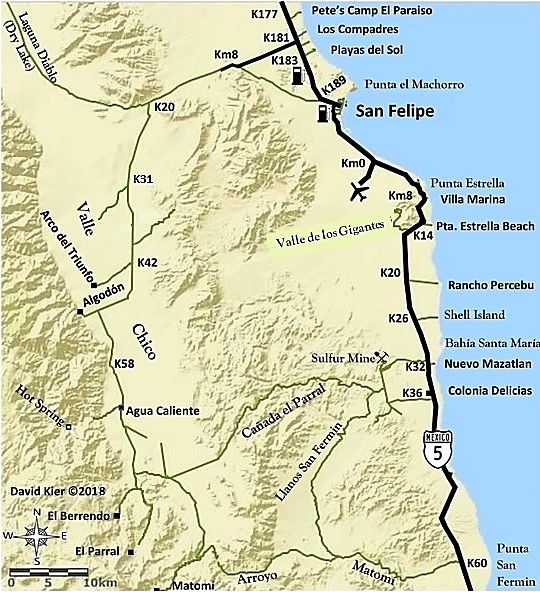
Agua Caliente/ Valle Chico Hot Spring
In 2017, a flash flood had cut the road soon after the gate but a new detour track was begun.
In 2001 & 2004, the road ended just a mile from the hot spring so an easy hike from there. A few years ago, some of you San Felipe guys drove all
the way to the area of the hot spring but didn't see the main spring on the right bank of the canyon or the hot flowing stream that came from it. It
was very impressive!
In 2001:

Tub filled by the spring.

Steam rising from the stream created by the hot spring.
In 2004:

The 140° source spring.

The tub just below the spring, and the hot stream flowing down the canyon. The cool-water stream is in the center of the canyon and the two blend in a
few hundred feet.

The hot stream just below the source spring. Nomad 'Jide' is at the tub, too hot to soak in. We go down the hot stream far enough so the temperature
dropped enough for a soak.

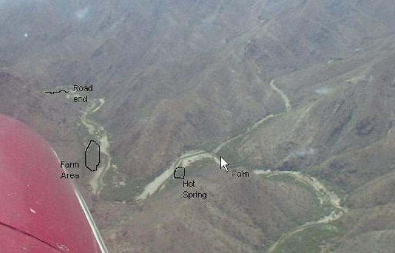
Baja Lou sent me this photo, looking east, which I added notes to. The road in 2001-2004 ended because of brush and boulders at the point shown. The
"Farm Area" was a marijuana(?) project I found in 2001:
In 2001:

Drip irrigation lines in place.
In 2004, all the drip tubes had been hacked up by machete, I imagine by the army(?).
The tubing in my photos was brand new... it is 'drip tape', which is thin and flat until filled with water, which drips out every foot. It is cheap
irrigation for just one season. There were bags of fertilizer, too... brought in by burros. I even saw the receipt from a U.S. irrigation store!
The two workers doing the weeding (no, not that.. they were removing new weeds ahead of planting seeds for the new crop) asked if they could get a
ride into San Felipe with us! On Amigos de Baja (pre-Nomad) we called this a "cilantro farm"!
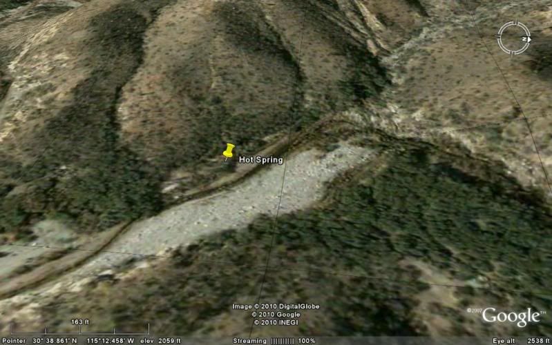
On Google Earth:
HOT SPRING GPS (WGS84): 30°38.85' N, 115°12.47' W
GPS from Google Earth, which has better imaging there since my last look. THAT IS WHERE THE HOT SPRING WAS (2001-2004). I could see the hot water
stream, separate from the mountain stream, and where it began. My 2004 GPS reading when put on Google Earth shows it in the middle of the arroyo and
not on the bank (west side). I don't know if my Garmin was goofy or when put on Google Earth throws it off 50-100 feet?
[Edited on 2-12-2021 by David K]
|
|
|
David K
Honored Nomad
Posts: 65561
Registered: 8-30-2002
Location: San Diego County
Member Is Offline
Mood: Have Baja Fever
|
|
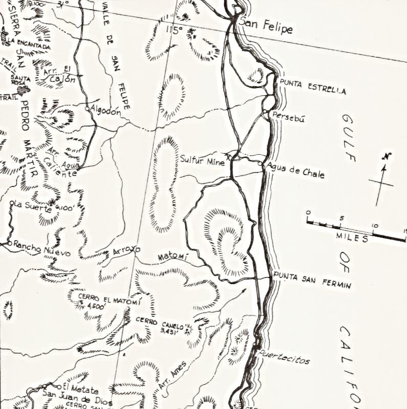
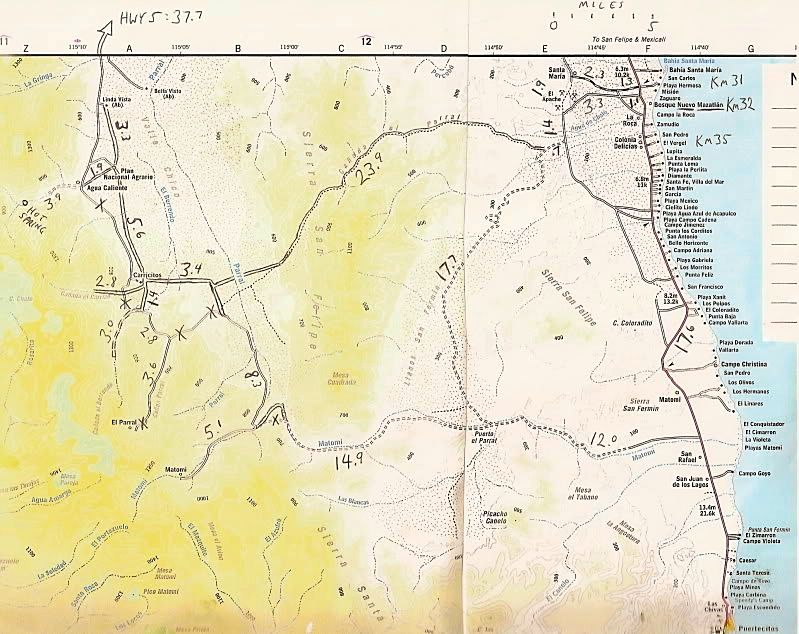
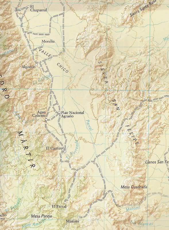
On Maps
Quote: Originally posted by David K  | The very interesting thermal springs inside Agua Caliente Canyon (east slope of the Sierra San Pedro Martir, facing San Felipe) has been on maps for
almost 100 years... in a region one map shows as 'unexplored'!
1919:
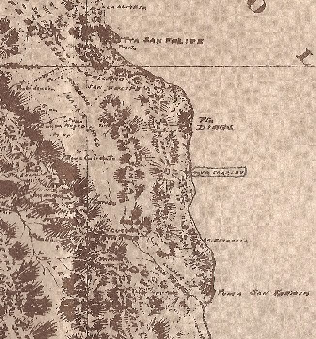
(note east of Agua Caliente: 'Agua Charley' circled on the coast... later Mexicanized into 'Agua de Chale' and today is Nuevo Mazatlan. Named for a
well dug by 'Charley the Chinaman' to water his goats.)
1930:
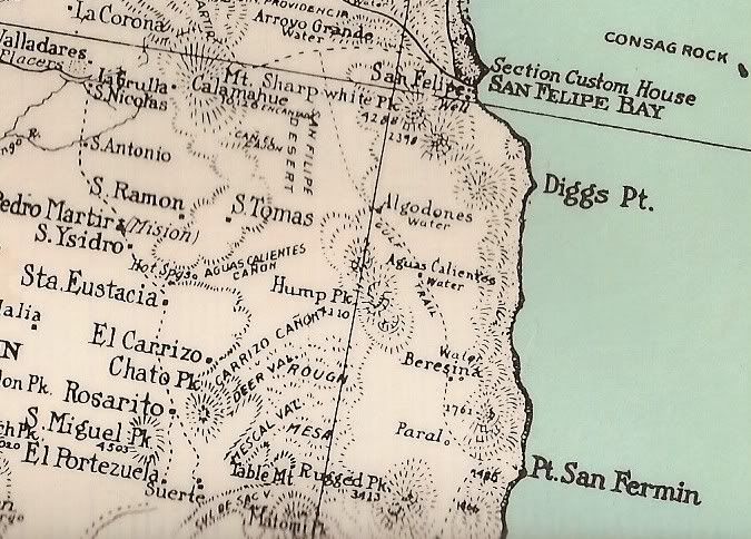
Great map for detail, but some errors: Algodones shown too far east, a second Aguas Calientes shown, 'Paral' too far east...
1941:
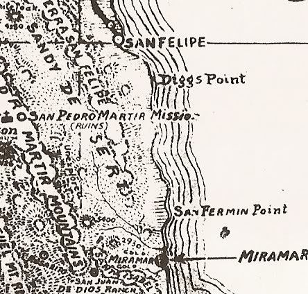
(note: 'Unexplored') in Valle Chico
1962:
Howard Gulick (Lower California Guidebook) made the first modern, accurate maps of Baja.
1972:
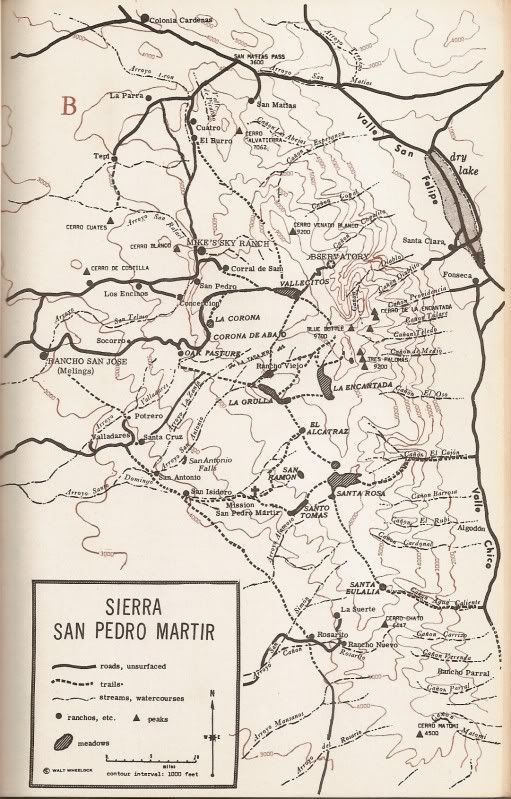
(Third edition of 'Camping and Climbing in Baja', detailed the roads and canyons facing Valle Chico in 1967)
1975:
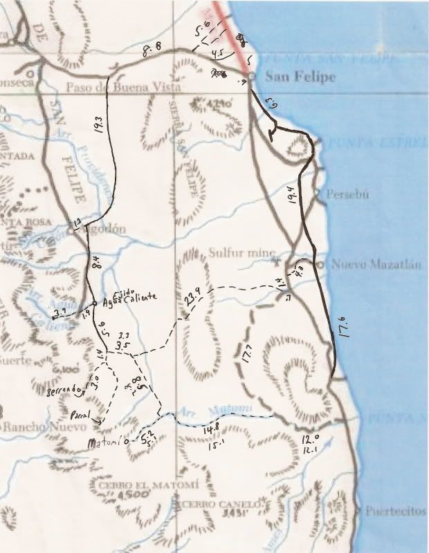
(some additions by me in '06 to the Baja Calif. Guidebook map)
1982:
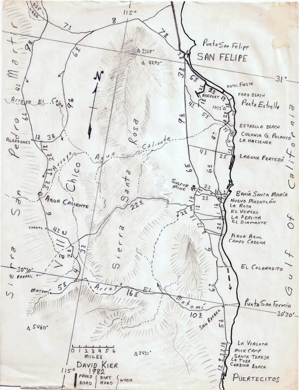
(One of my maps)
2003:
(Baja Almanac with additions by me in 2006, every road showing a mileage I have traveled. X'ed roads were abandoned before my first map trips in
1978.)
2008:
Nat'l Geo. map with long abandoned old roads and missing some other roads.
|
|
|
|
PaulW
Ultra Nomad
Posts: 3113
Registered: 5-21-2013
Member Is Offline
|
|
Agua Caliente
Nov 27 2019 trip to the end of the road .
Started at the Ranch at the intersection on west valley road and the road south toward Matomi. The typical place where most folks stop is at the
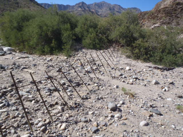
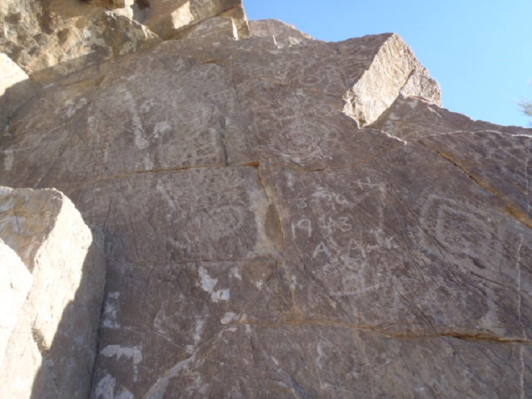
corral. From that point is it is short walk up the wash to view the Rock art. Easy to find because there is a substantial fence at that point. One can
drive to the gate and park then scramble down hill over big boulders to get to the rock art. Walk on the near side of the fence (east side) to avoid
being trapped on the wrong side of the fence and unable to get to the rock art. The rock art is in pretty bad shape now days.
My hike started at the corral
 upload online picture upload online picture
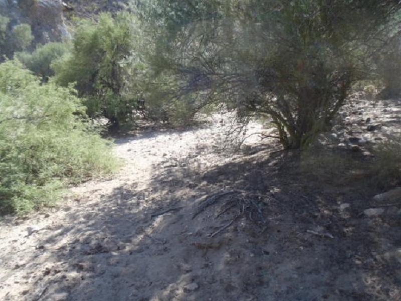
Walked down to the wash starting in the above pic.
The wash looks like this (all looking east)
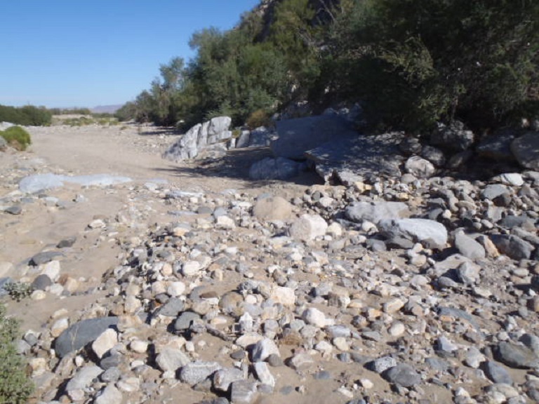
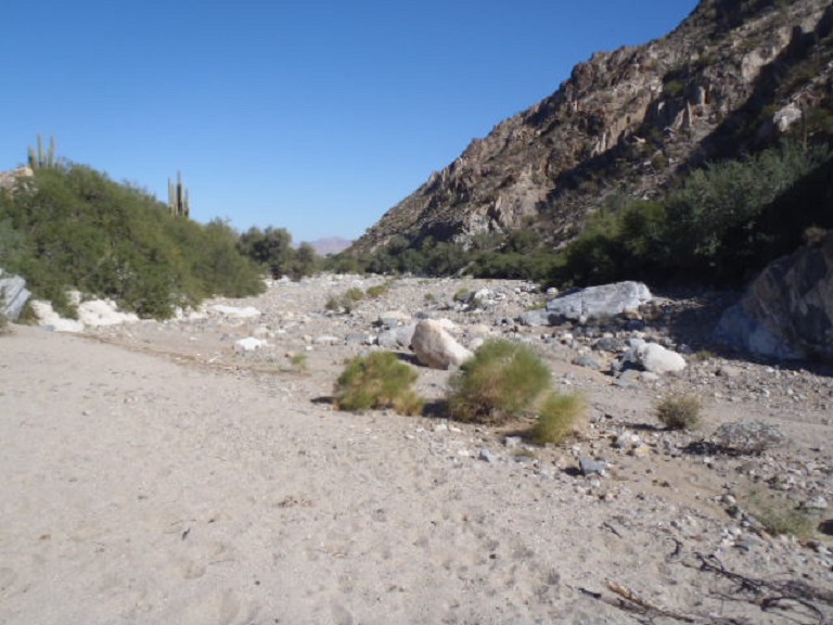 gif upload gif upload
Arriving at the Rock art at the fence
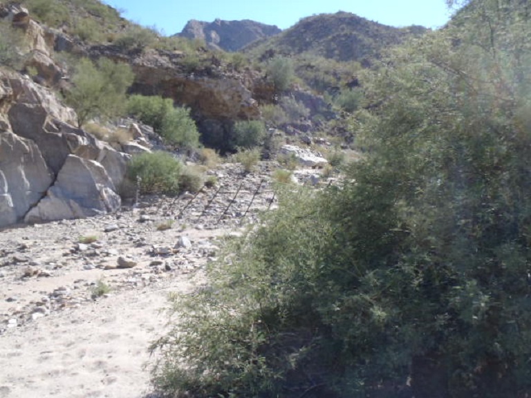 upload my picture upload my picture
Next looking NW to the gate
 web upload image web upload image
Rock art
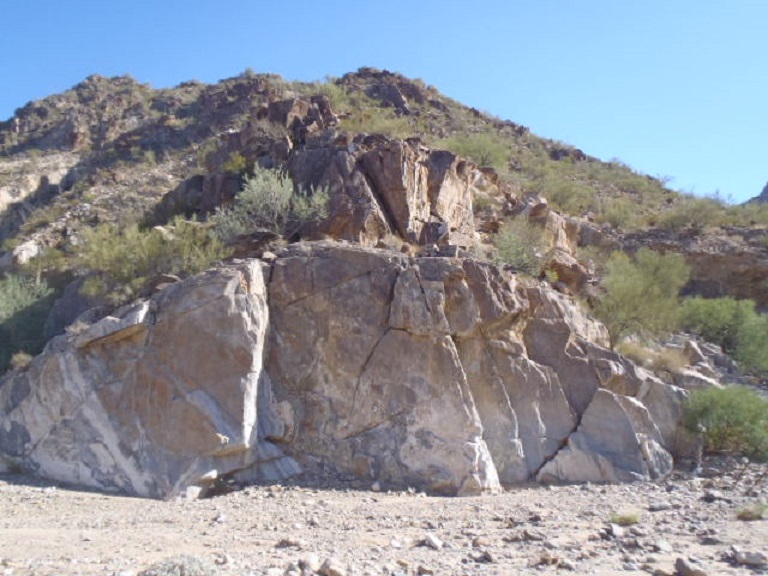
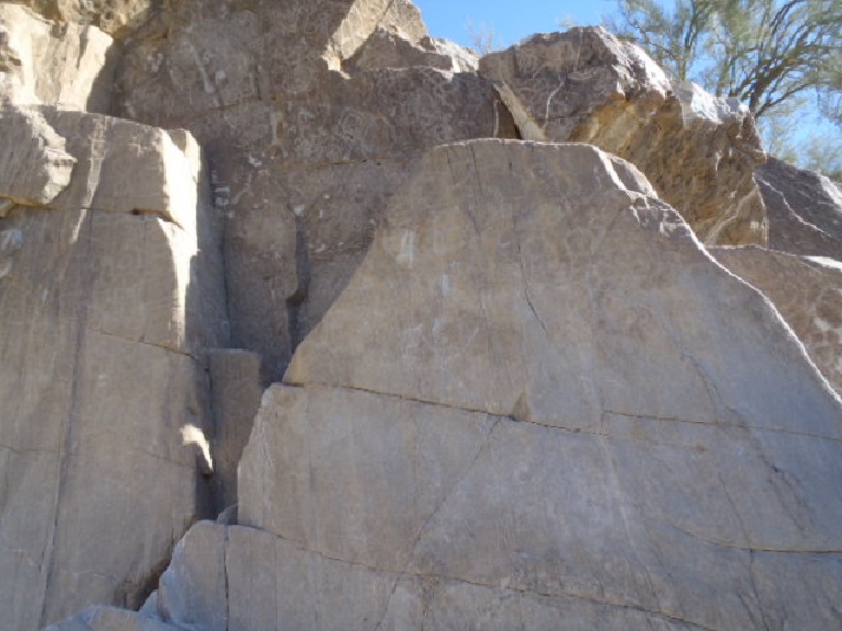
I climbed up that crack above to get the next pic
The road to just past the gate is easy. Then it becomes more difficult with many stops to decide where the path should go. Turns out the ranch hands
have been pruning the bushes to a point (minimal). We could see machete slashes for the trimming. If one was to zoom in on the track it is Easy to see
where we had issues because the GPS dithers at those places. What we had to do was look for a path the force out way thru the willow like bushes that
were higher than the Jeeps. I followed cow paths and I found that the heavy branches were pruned sometime in the past. Still I had to use my pruning
saw where overhanging branches leaning over my path were too big to pass.
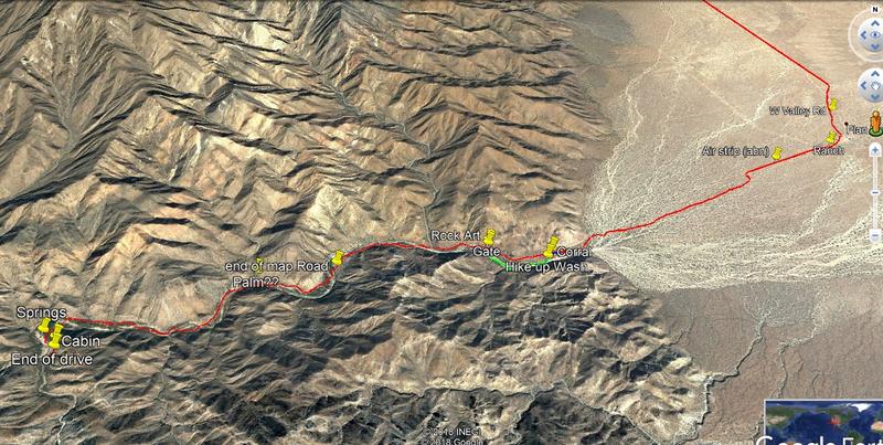
On my track I annotated the end of the road on my GPS map. Also noted is the end of vehicle travel, the cabin, and the spring. There is no evidence
of any spring along the way, but we had to cross the gully many times and each place had muddy water. That spring notation courtesy of Lou Wells from
20 +years ago.
Our hike from where we parked was short as we came to a substantial fence with no gate. The bushes were much heavier with no path for us to force
thru. I found a sign indication Property boundary but did not have my camera or phone – shucks.
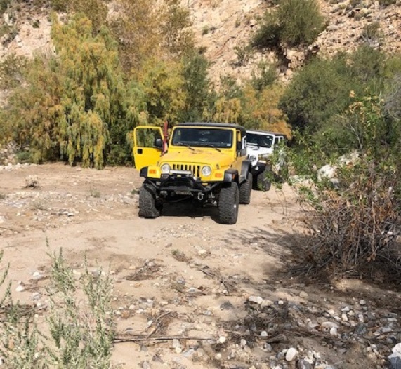
Heading into the first difficult place in the gulley
<a href='https://postimg.cc/sBNDt4xr' target='_blank'><img src='https://i.postimg.cc/sBNDt4xr/1-R-IMG-0187-R.jpg' border='0'
alt='1-R-IMG-0187-R'/></a>
Came to the cabin
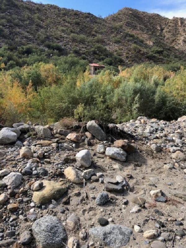
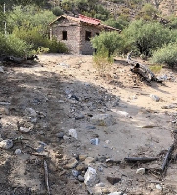 photoupload photoupload
Side road heading east. Side road is bad and leads to an abandoned shack
Arrived back at the gate
Last of all here is the image from back in the day from a Cessna 182. Courtesy of Lou Wells
Obviously, nothing similar these days.
I would guess Lou’s Palm tree is at the side canyon, and I noted that place on my track
Google image
 images shares images shares
[Edited on 2-12-2021 by PaulW]
[Edited on 2-13-2021 by PaulW]
|
|
|
HeyMulegeScott
Senior Nomad
Posts: 719
Registered: 8-25-2009
Location: Orygone/Mulege
Member Is Offline
|
|
PaulW - Did you find a rock tub? I did it in 2018 and it was a bit underwhelming as far as hot springs go. https://www.awaywewinnebago.com/baja-adventuring/
|
|
|
David K
Honored Nomad
Posts: 65561
Registered: 8-30-2002
Location: San Diego County
Member Is Offline
Mood: Have Baja Fever
|
|
If you got to the warm stream (sulfur smell, warm water) you were likely within 100 feet of the source. Huge volumes of super-hot (140°) water pumps
to the surface, creating that stream. That stream was along the right-hand side of the canyon floor just past the left bend, as you walk... turning
from west to south.
The source was on the right hand bank (or bench/ terrace) of the arroyo (as you walk upstream) and there was about a 3-foot drop making a steaming
waterfall to the sandy canyon floor. There was a rock-lined bathing tub at that point but the water was far too hot to get in that tub. From the tub,
the hot stream heads down the canyon floor, eventually meeting the cool stream in the center of the canyon floor, about where that 90° bend is.
2001: the tub and hot stream looking downstream to the canyon bend.
2004: the same location. Note, the source spring is just 10-20 feet or so to the left and above from of the tub.
Jide is at the point where the hot waterfall comes down to the tub. I am down the hot stream looking back.
Of course, in the 16+ years since I was last there, flash floods could have covered the tub and obliterated things. I would be curious to see photos
at the same location, to compare. Because of either inaccurate GPS or errors with Google Earth pointing to the spot, nobody on Nomad has been to where
the tub and source spring was, that I know of. Best luck hot spring fans... and take lots of photos, please!
|
|
|
PaulW
Ultra Nomad
Posts: 3113
Registered: 5-21-2013
Member Is Offline
|
|
=== =
Saw nothing like that. I will look non my next trip.
[Edited on 2-13-2021 by PaulW]
|
|
|
PaulW
Ultra Nomad
Posts: 3113
Registered: 5-21-2013
Member Is Offline
|
|
David Wrote:
The cliff in the road...
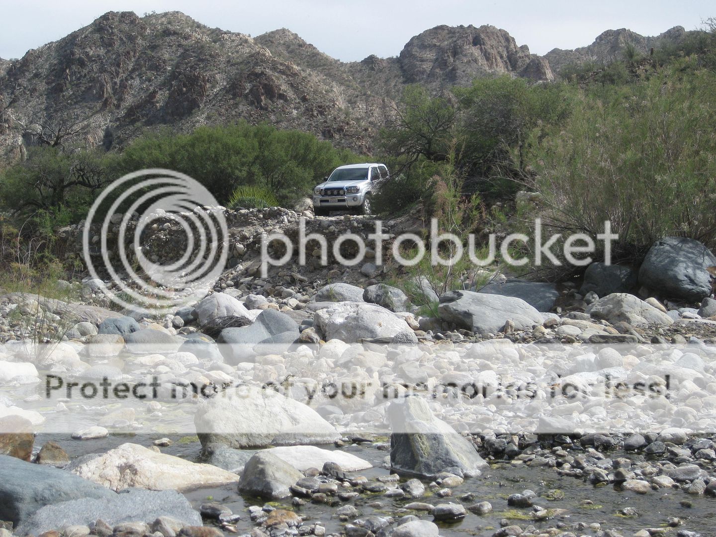
So that cliff is still there and the road continues drivers side along the bank then down into the place pictured with all the standing water
Maybe I forgot to mention. After the wet swampy area after the spring there is a steep bank to go up. However there are minimal rocks on the approach.
Traction up that bank is not good and the other Jeep had to do it over with a faster start.
And I don't think anyone would want to try to drive up the wash to the rock art. It is doable, but pretty rough going. The wash at that point is
strongly fenced at that point and one cannot drive further up the wash. To get the the rock are it is a short walk from the corral with a good place
to park. Walking to the rock art from the sign on the road at the fence gate is not recommended. There is no trail and it looks like tough going along
the fence line. The hike to the rock art starts at the left side of the corral. and leads into the wash.
Most of the people driving with Wornout on his trip consisted of 2wd sand rails And stopped to turn around at the place after the cliff.
[Edited on 6-13-2023 by BajaNomad]
|
|
|
HeyMulegeScott
Senior Nomad
Posts: 719
Registered: 8-25-2009
Location: Orygone/Mulege
Member Is Offline
|
|
I hiked quite a ways back through some heavy brush. I think what David shows in his photos is long gone.
|
|
|
PaulW
Ultra Nomad
Posts: 3113
Registered: 5-21-2013
Member Is Offline
|
|
Here is a summary of my recent trips.
11-7-2019. Wornout trip#1. The first hike to the wall art. Did not drive past the Corral.
11-27-2019 (posted above) Full drive with Chloe. Did not look for springs. Used my pruning saw to get enough room for the Jeeps. Very slow progress.
4-8-2020 Trip added to the link with John B. Walked to the wall art from the gate. Note --See the images with coordinates. Did not look for springs.
Not obvious from the road.
2-5-2021 Wornout trip #2with 22 rigs
2-9-2021 Solo trip and got stuck and had to winch my way free. Did not get as far as the springs.
Future trip I will stop at the willows and mow them down so I can see where to drive and look for springs. I suspect I will have to walk to the spring
location so I will take my hand held GPS to log the place.
Note My posts above have been edited. Go look to see the changes.
Anyway I updated the .KML file to add the pertinent WPs. Attached
[file]42574[/file]
[Edited on 2-15-2021 by PaulW]
Attachment: Agua CalienteRR.kml (122kB)
This file has been downloaded 407 times
|
|
|
David K
Honored Nomad
Posts: 65561
Registered: 8-30-2002
Location: San Diego County
Member Is Offline
Mood: Have Baja Fever
|
|
Paul... I just now looked at you new kml... and you still have "David Spring" in the middle of the arroyo rather than where it is... across the arroyo
on the far bank.
View looking west.
|
|
|
David K
Honored Nomad
Posts: 65561
Registered: 8-30-2002
Location: San Diego County
Member Is Offline
Mood: Have Baja Fever
|
|
The hot spring is on the side of the arroyo canyon, not in the center.
I posted this above, using Google Earth to eyeball it:
On Google Earth:
HOT SPRING GPS (WGS84): 30°38.85' N, 115°12.47' W
|
|
|
David K
Honored Nomad
Posts: 65561
Registered: 8-30-2002
Location: San Diego County
Member Is Offline
Mood: Have Baja Fever
|
|
YES! By George, you got it!
Within 50 feet I would say you should see steam and within 100 feet you should smell sulfur or rotten eggs!
|
|
|


