David K
Honored Nomad
        
Posts: 65382
Registered: 8-30-2002
Location: San Diego County
Member Is Offline
Mood: Have Baja Fever
|
|
1948 Baja Geology Map
Has some interesting trail, town data.
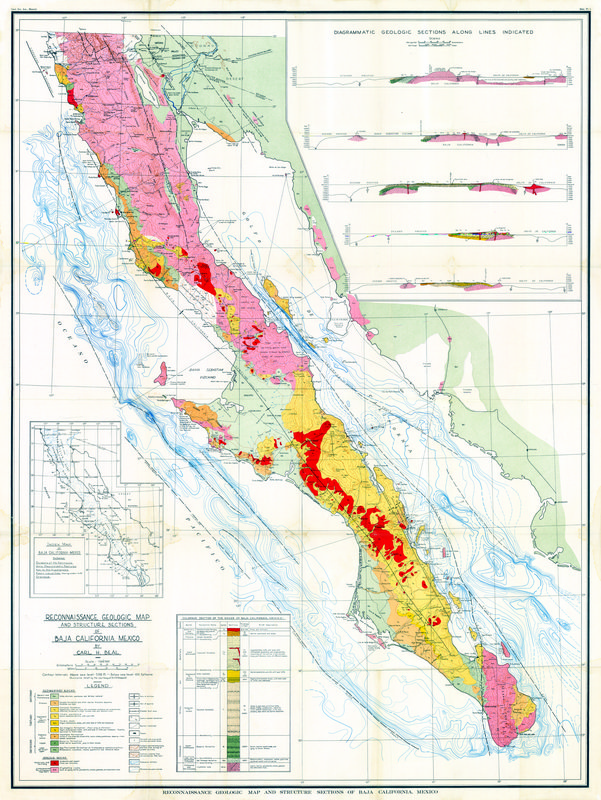
A couple close ups:
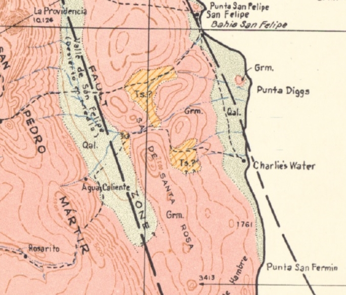
Charlie's Water = Agua de Chale (Nuevo Mazatlan)
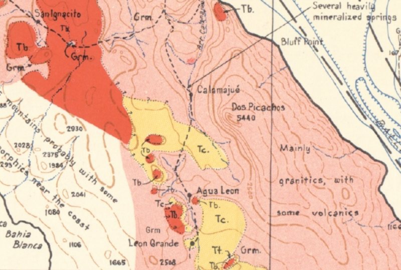
Leon Grande is of interest. Rather than take the gold ore east to L.A. Bay, the trail goes north to Calamajué, and off the map: the Pioneer Mine,
Molino de San Francisquito (de Lacy), and the shipping port at Punta Final (Puerto de San Francisquito).
EDIT:
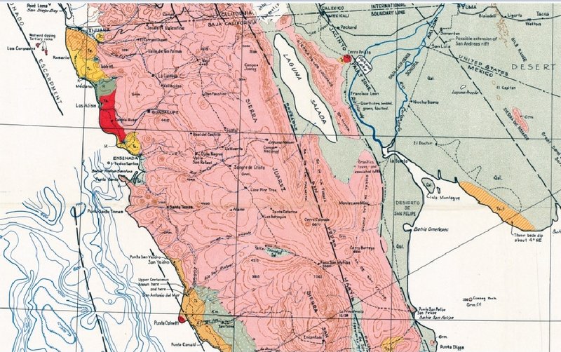
The full map in sections:
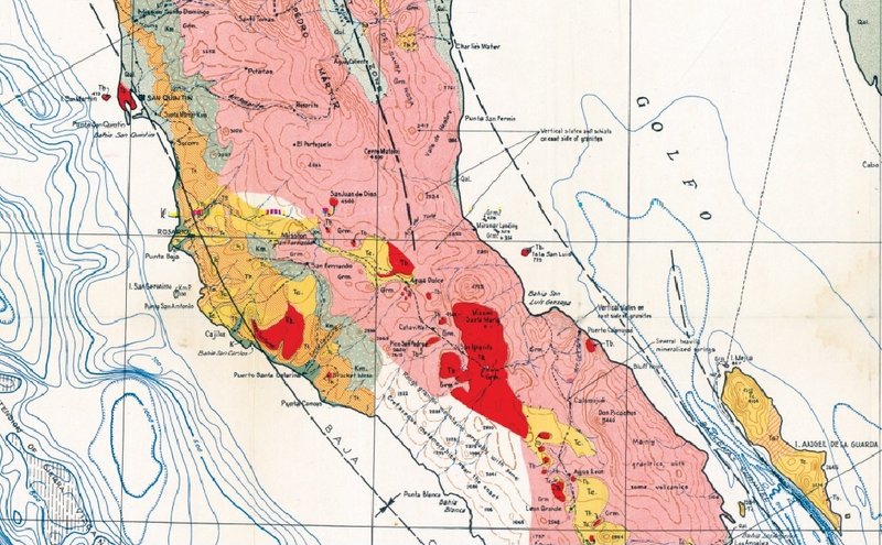
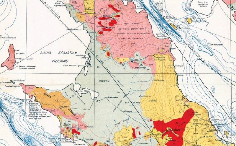
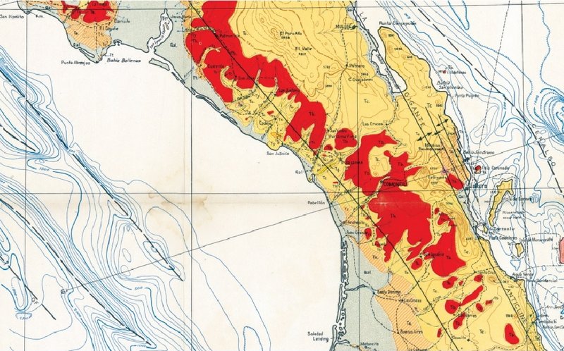
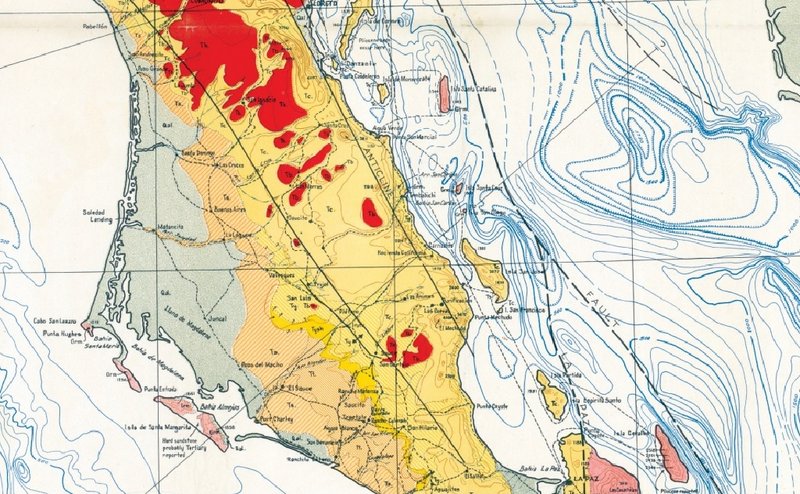
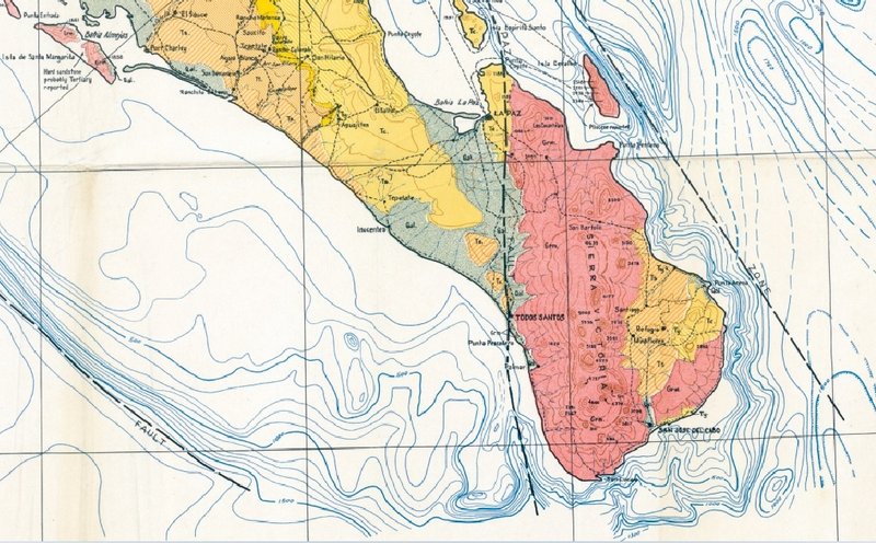
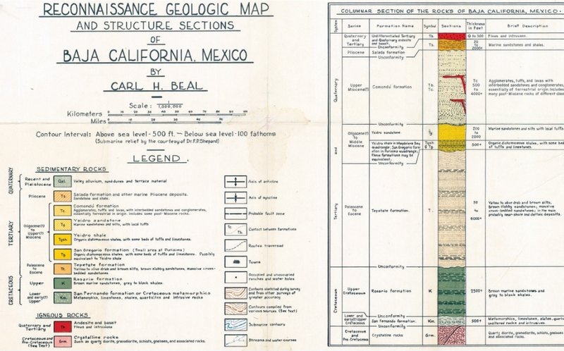
[Edited on 4-26-2021 by David K]
|
|
|
pacificobob
Super Nomad
   
Posts: 2340
Registered: 4-23-2006
Member Is Offline
|
|
some years ago i was loaned and promptly lost a book that was half geologic guide to baja half novel. i would love to learn more about baja geology.
a guide structured according to what a motorist would see along
the highway would be cool.
|
|
|
Bajabus
Senior Nomad
  
Posts: 892
Registered: 8-30-2002
Location: Elias Calles B.C.S. or NC USA
Member Is Offline
Mood: My friends..it's good.
|
|
I love old maps. In my youth I would spend hours at the Flagstaff library pouring over old maps looking for long abandoned mine sites. I would
painstakingly recreate them in pencil and then go off in search.
Thanks for posting this one David.
"Preventive war was an invention of Hitler. Frankly I would not even listen to anyone seriously that came and talked of such a thing."
Dwight David Eisenhower
|
|
|
coronamike
Junior Nomad

Posts: 45
Registered: 5-28-2006
Location: Morro Bay
Member Is Offline
|
|
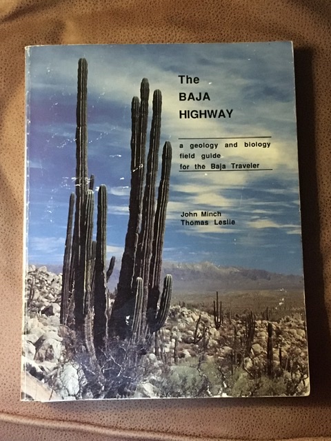
A good geology book is:
The Baja Highway by John Minch and Thomas Leslie.
|
|
|
coronamike
Junior Nomad

Posts: 45
Registered: 5-28-2006
Location: Morro Bay
Member Is Offline
|
|
[Edited on 4-23-2021 by coronamike]
|
|
|
coronamike
Junior Nomad

Posts: 45
Registered: 5-28-2006
Location: Morro Bay
Member Is Offline
|
|
|
|
|
David K
Honored Nomad
        
Posts: 65382
Registered: 8-30-2002
Location: San Diego County
Member Is Offline
Mood: Have Baja Fever
|
|
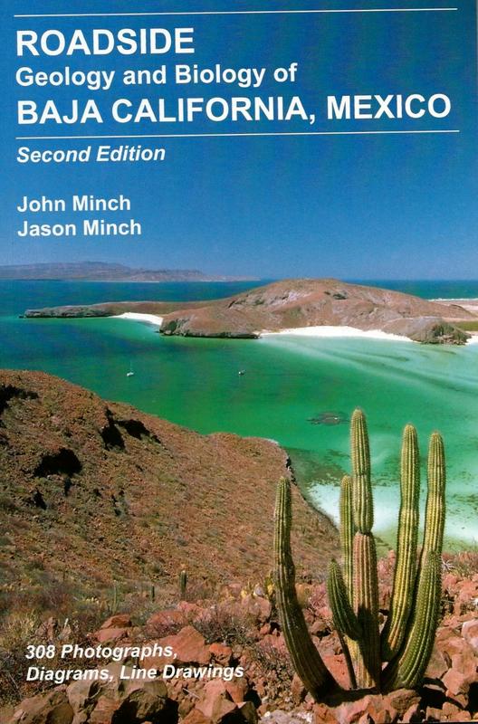
Newest edition 2017
|
|
|
pacificobob
Super Nomad
   
Posts: 2340
Registered: 4-23-2006
Member Is Offline
|
|
found a used copy on Amazon...thanks
|
|
|
RFClark
Super Nomad
   
Posts: 2470
Registered: 8-27-2015
Member Is Offline
Mood: Delighted with 2024 and looking forward to 2025
|
|
For those interested in such things here is a link to a 1921 geological survey of Baja California as far south as Todo Santos. There are pictures,
maps and drawings.
https://www.jstor.org/stable/pdf/30065653.pdf?refreqid=excel...
|
|
|
David K
Honored Nomad
        
Posts: 65382
Registered: 8-30-2002
Location: San Diego County
Member Is Offline
Mood: Have Baja Fever
|
|
We have discussed Leon Grande and Agua Leon at some length here on Nomad. Search 'Leon' to find the posts.
These were major sites in the 1920s but vanished from most maps in the later decades.
I knew a prospector who said he worked the area northwest of Punta Prieta...
|
|
|
coronamike
Junior Nomad

Posts: 45
Registered: 5-28-2006
Location: Morro Bay
Member Is Offline
|
|
David, where can I find the geo map you posted at the top of this thread? A higher res version would be great.
|
|
|
bajaric
Senior Nomad
  
Posts: 665
Registered: 2-2-2015
Member Is Offline
|
|
Great thread! Thanks for all the great maps DK
The trail that passed Agua Leon, a water hole, on the way south to Punta Prieta was mentioned by travelers in the 1920's. This trail appears to be
pretty far west of present day Hwy. 1, which of course then did not exist.
The geological article linked above has a good description at the very end of why sea shells are found at elevations far above sea level in Baja due
to the land being raised up.
[Edited on 4-25-2021 by bajaric]
|
|
|
David K
Honored Nomad
        
Posts: 65382
Registered: 8-30-2002
Location: San Diego County
Member Is Offline
Mood: Have Baja Fever
|
|
An internet friend, who is a geologist, sent me those... The whole peninsula map that the smaller area ones came from was too big to email me. So, I
have to request areas of Baja for close-up looks. He is a contestant in the NORRA Mexican 1000 this week, so it will need to wait.
|
|
|
David K
Honored Nomad
        
Posts: 65382
Registered: 8-30-2002
Location: San Diego County
Member Is Offline
Mood: Have Baja Fever
|
|
Quote: Originally posted by bajaric  | Great thread! Thanks for all the great maps DK
The trail that passed Agua Leon, a water hole, on the way south to Punta Prieta was mentioned by travelers in the 1920's. This trail appears to be
pretty far west of present day Hwy. 1, which of course then did not exist.
The geological article linked above has a good description at the very end of why sea shells are found at elevations far above sea level in Baja due
to the land being raised up.
[Edited on 4-25-2021 by bajaric] |
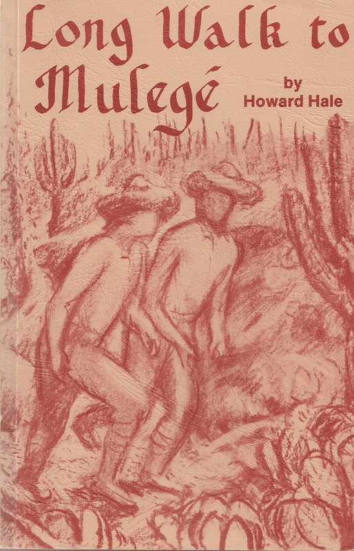
De nada Ric... I hope we can go out checking that place. Yes, the route was well described in Howard Hale's book! Long Walk to Mulege.
|
|
|
Bajabus
Senior Nomad
  
Posts: 892
Registered: 8-30-2002
Location: Elias Calles B.C.S. or NC USA
Member Is Offline
Mood: My friends..it's good.
|
|
Actually the guy at the desk came to know me and was very helpful.
"Preventive war was an invention of Hitler. Frankly I would not even listen to anyone seriously that came and talked of such a thing."
Dwight David Eisenhower
|
|
|
David K
Honored Nomad
        
Posts: 65382
Registered: 8-30-2002
Location: San Diego County
Member Is Offline
Mood: Have Baja Fever
|
|
Nice job! Thanks Lance.
|
|
|
bajaric
Senior Nomad
  
Posts: 665
Registered: 2-2-2015
Member Is Offline
|
|
Nope.
Here is a clue:
DK thought the spring of the lion was near
it was only the Deer
The map of the Aleman
was more spot on
From the mouth of the lion
look to the south
a straight road to nowhere
that Hale did mouth
To nowhere no more; to the Parador
southwest of the mouth, low hills and a spring
The water that the Lion did bring
[Edited on 4-28-2021 by bajaric]
|
|
|
David K
Honored Nomad
        
Posts: 65382
Registered: 8-30-2002
Location: San Diego County
Member Is Offline
Mood: Have Baja Fever
|
|
There once was a man named Stroppe
Who built a Bronco that was non-stop
As he said with a grin, while sipping his gin,
If PJ is my driver, at the podium we will stand on top!
|
|
|

