| Pages:
1
2
3
4 |
gueribo
Nomad

Posts: 458
Registered: 10-16-2014
Member Is Offline
|
|
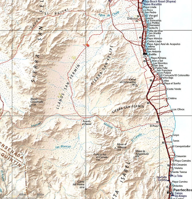
Quote: Originally posted by David K  | | Glad it is getting a friendly nod. Two of the cartographers from Benchmark and I will be on a Slow Baja Podcast to share how we made it... recording
it this Friday. |
Very cool. Looking forward to the discussion.
|
|
|
David K
Honored Nomad
Posts: 64479
Registered: 8-30-2002
Location: San Diego County
Member Is Offline
Mood: Have Baja Fever
|
|
| Quote: Originally posted by gueribo | | Quote: Originally posted by David K | | Glad it is getting a friendly nod. Two of the cartographers from Benchmark and I will be on a Slow Baja Podcast to share how we made it... recording
it this Friday. |
Very cool. Looking forward to the discussion. |
Thanks! I am looking forward to news about your book, as well!
My missions book (that you contributed data to) is now at the printers a 10th time to keep up with the needs of my distributor, Sunbelt! Loving the
desire out there to learn more from the past!
|
|
|
geoffff
Senior Nomad
Posts: 643
Registered: 1-15-2009
Member Is Offline
|
|
| Quote: Originally posted by David K | | Two of the cartographers from Benchmark and I will be on a Slow Baja Podcast to share how we made it... recording it this Friday.
|
Neat! I'm also looking forward to hearing this!
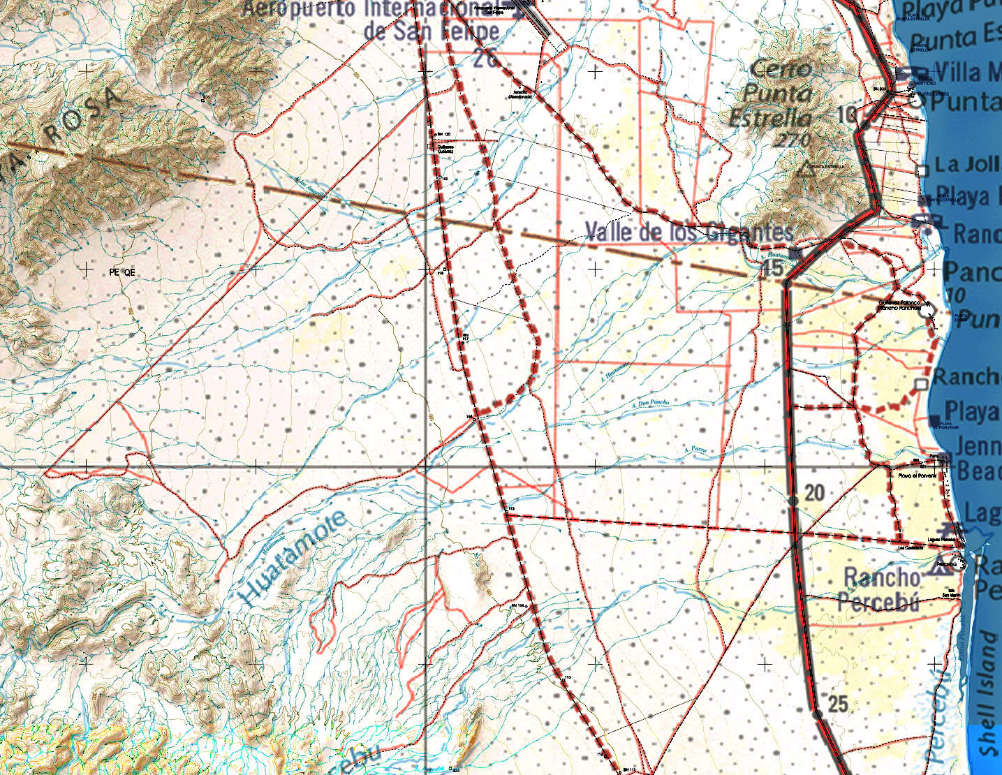
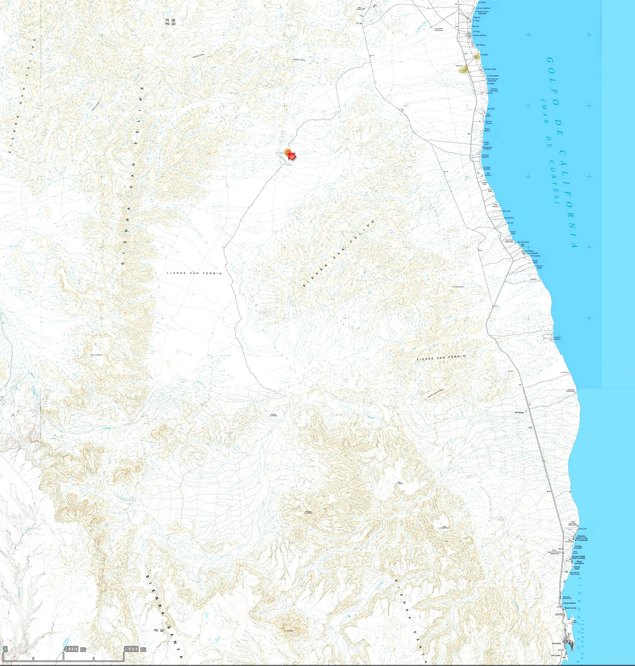
Here is an overlay with Benchmark over INEGI. It's kind of difficult to see (click to enlarge), but what I see in this area is that the Benchmark map
includes most of the INEGI roads, and that Benchmark has added a number of other roads:

[Edited on 5-21-2021 by geoffff]
|
|
|
geoffff
Senior Nomad
Posts: 643
Registered: 1-15-2009
Member Is Offline
|
|
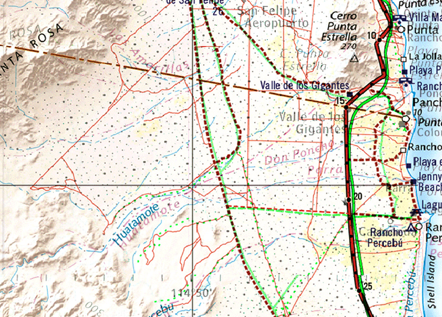
And here's that same area comparing the new Benchmark map with our old favorite, the Baja Almanac (colors changed for contrast). The Baja Almanac was
never spatially accurate enough for GPS use, though many years ago I did scan pages and try.
|
|
|
PaulW
Ultra Nomad
Posts: 3005
Registered: 5-21-2013
Member Is Offline
|
|
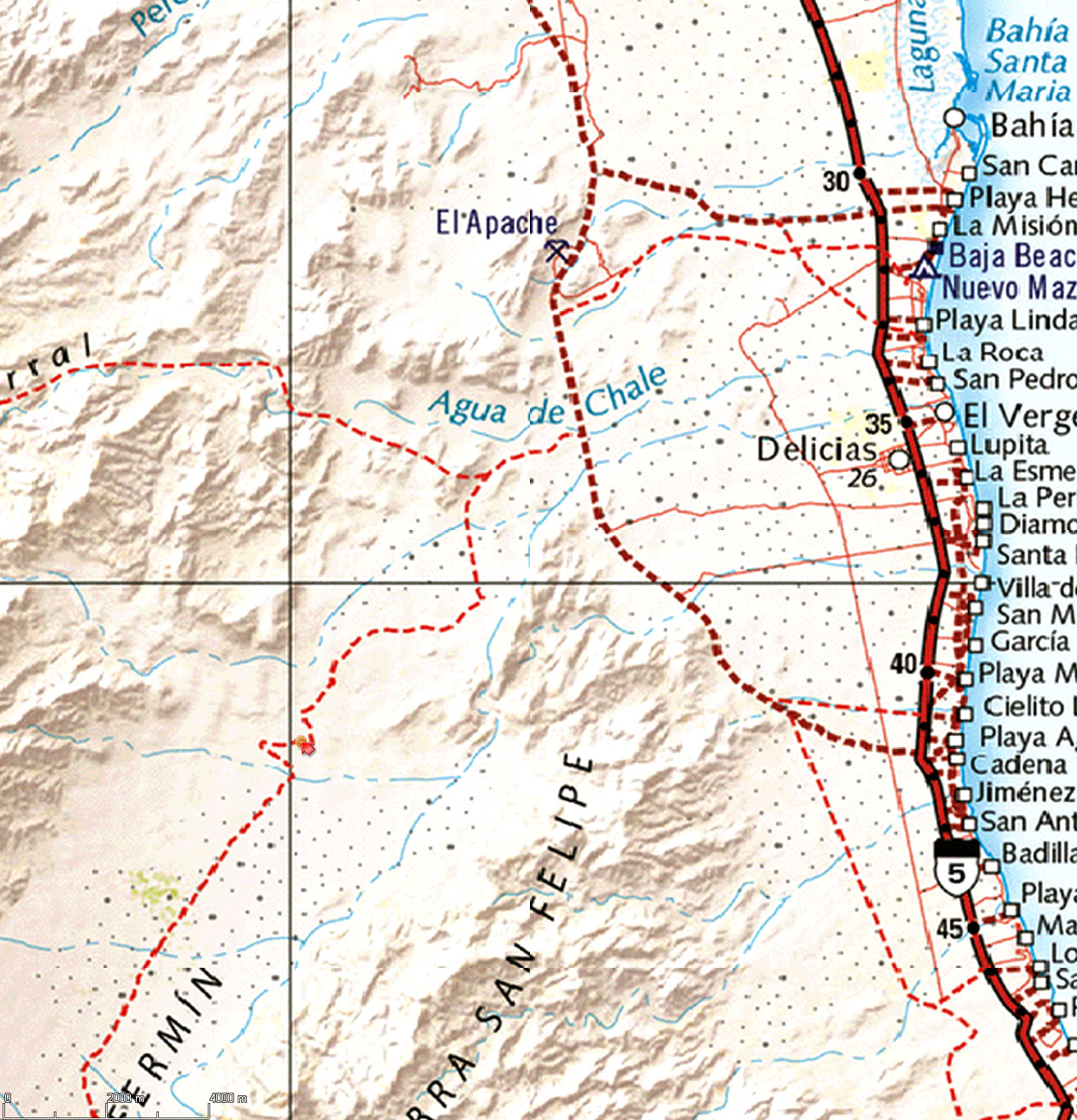
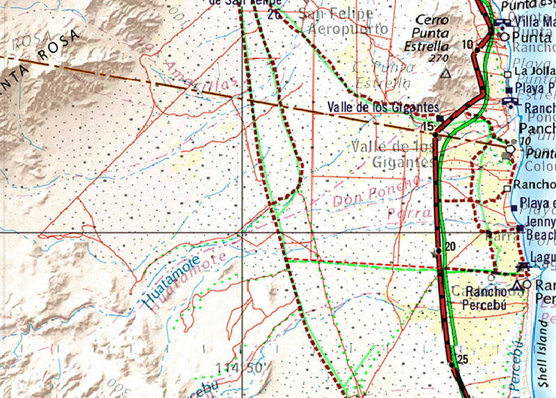
For reader interest.
You mention Apache Tears. Here is a screen shot from my GPS that shows the roads near that place.
And yes I have driven all of the roads shown. That is what I have been doing over the years
rquote=1212319&tid=96027&author=David K]Paul, the base map (INEGI) that Benchmark used already had minor roads on it, including Parral (Crazy
Horse), San Fermin (Apache Tears), etc. I did correct the west end of the Cañon el Parral road, showing the route across the valley floor that
followed the fence line. The INEGI base map showed the ancient route that went southwest after exiting the mountains. [/rquote]
[Edited on 5-21-2021 by PaulW]
|
|
|
David K
Honored Nomad
Posts: 64479
Registered: 8-30-2002
Location: San Diego County
Member Is Offline
Mood: Have Baja Fever
|
|
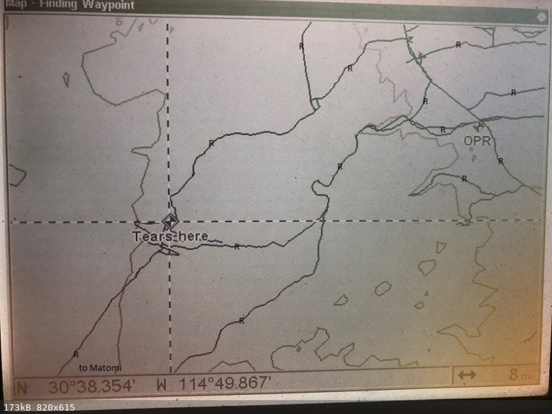
Nice... Geoffff, do you want to show the area adjoining south of the map you posted, so Paul might see the Llanos de San Fermin (Apache Tears) road
(sulfur mine to Arroyo Matomí)?
|
|
|
PaulW
Ultra Nomad
Posts: 3005
Registered: 5-21-2013
Member Is Offline
|
|
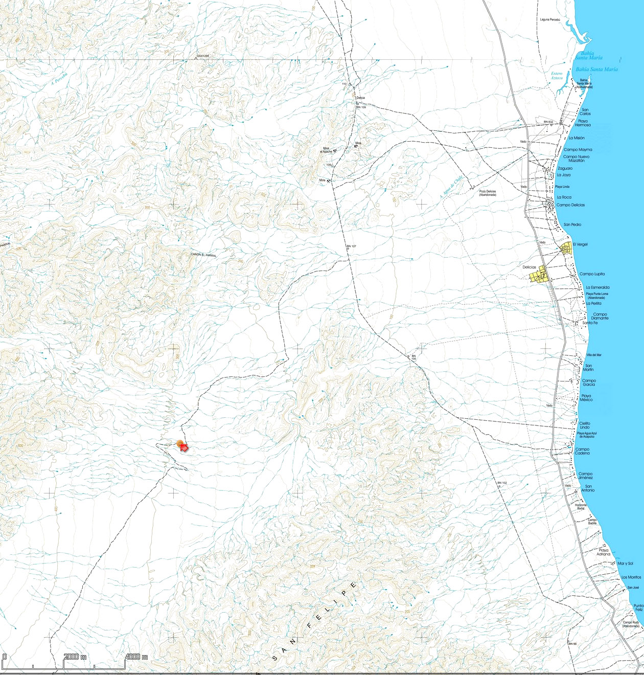
For those unfamiliar.
The generally flat ground east of the mountains including Apache Tears is well known as Llanos San Fermin. I explored years back with much failure due
to lack of ability to get thru the cactus vegetation. IMO it is a place to avoid except for travel on existing roads.
It extends from Matomi north to close to the Sulfur mine area. The north end is mostly barren and the area south is heavy vegetation.
|
|
|
PaulW
Ultra Nomad
Posts: 3005
Registered: 5-21-2013
Member Is Offline
|
|
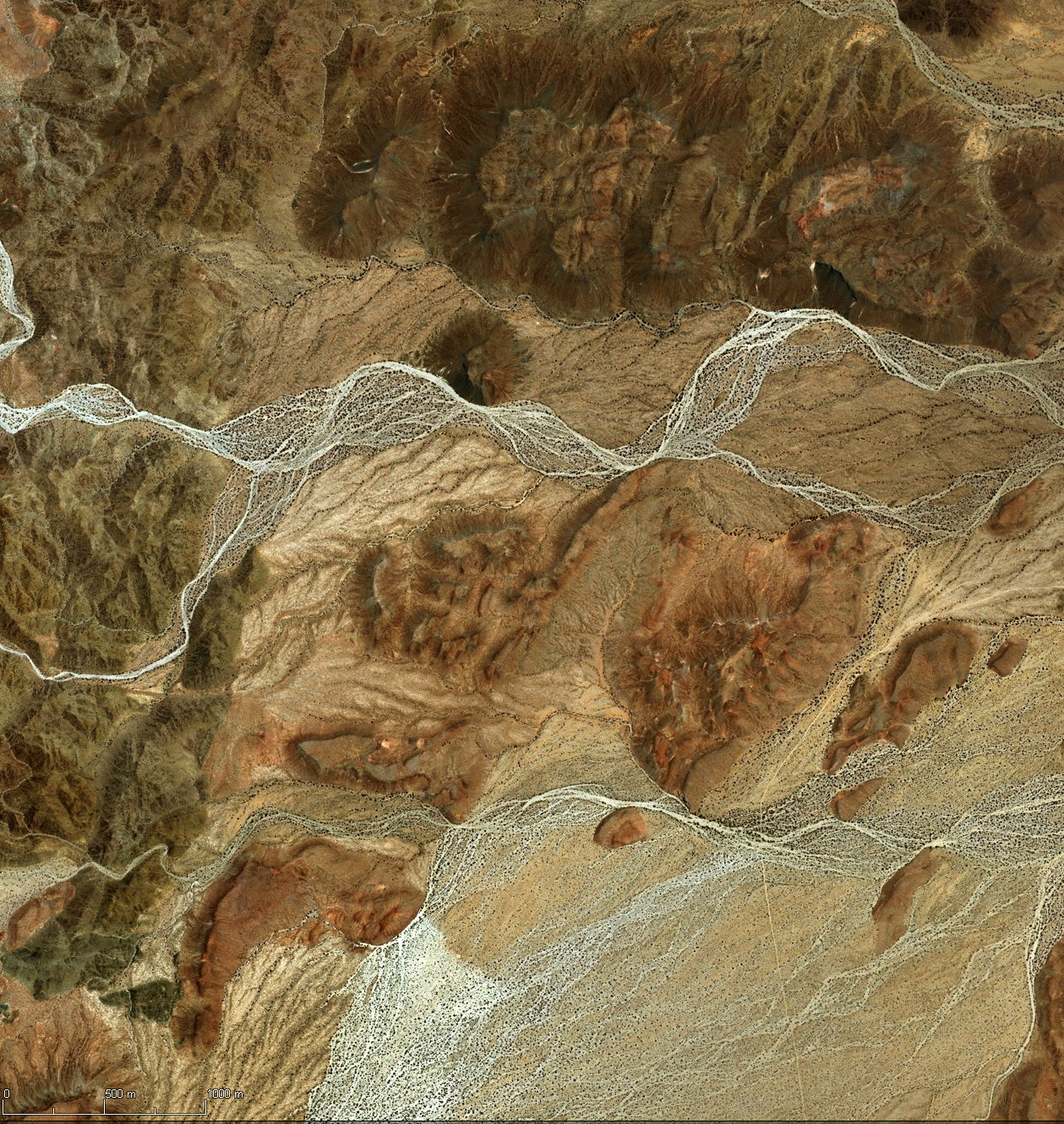
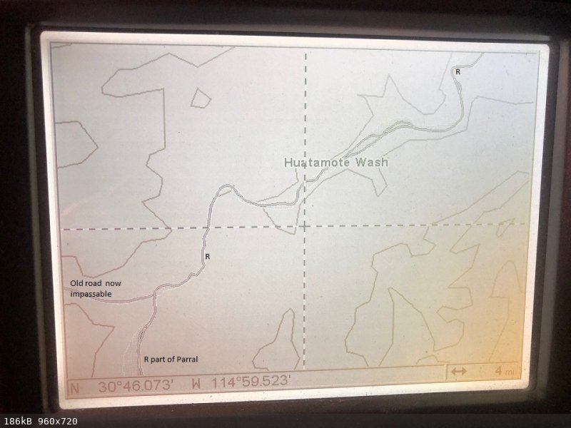
Here is an example screen shot from My GPS map showing Huatamote road connecting to the Parral road.
The road in the wash generally follows the water path and changes year by year due to flooding from the wet season. In some places you may find a
wide gravel section and in other places you may find boulders to drive over. Most years it is passable with any typical 4X4 with a bit of clearance.
|
|
|
geoffff
Senior Nomad
Posts: 643
Registered: 1-15-2009
Member Is Offline
|
|
This is the Tears area in Benchmark, INEGI, Baja Almanac. Click little images to open.
|
|
|
geoffff
Senior Nomad
Posts: 643
Registered: 1-15-2009
Member Is Offline
|
|
Oh, and including Motami:
 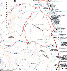
[Edited on 5-21-2021 by geoffff]
|
|
|
geoffff
Senior Nomad
Posts: 643
Registered: 1-15-2009
Member Is Offline
|
|
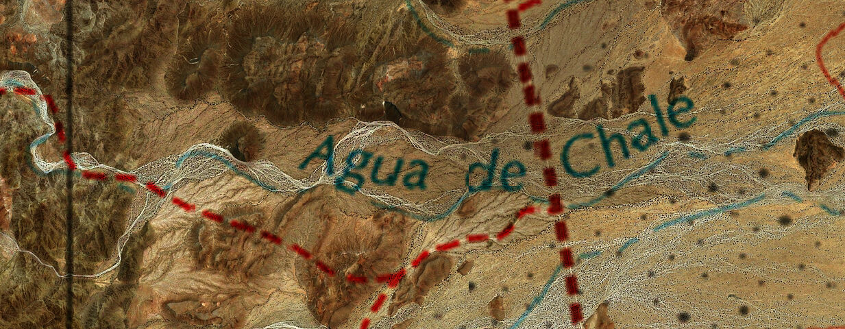
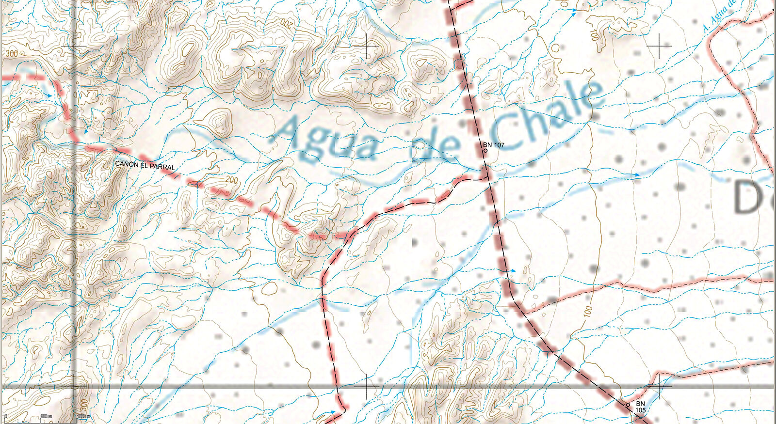
Curious how both Benchmark and Baja Almanac made the same mistake with the Agua de Chale road, sending the start of the road straight over the
mountains rather than along the wash. Satellite imagery doesn't show a road going straight over the mountains. INEGI doesn't show this road at all, so
can't blame them!
 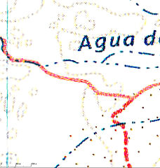 
Did Benchmark use the Baja Almanac as a source?
[Edited on 5-21-2021 by geoffff]
|
|
|
advrider
Super Nomad
Posts: 1847
Registered: 10-2-2015
Member Is Offline
|
|
I had ordered mine on Amazon but when I found out Baja bound already had them for sale I cancelled with Amazon. Much rather support a smaller company
and one that is on this form. Looking forward the getting them..
|
|
|
PaulW
Ultra Nomad
Posts: 3005
Registered: 5-21-2013
Member Is Offline
|
|
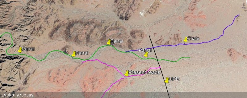
Roads near Chale/Parral
GPS Screen Shot
Notice on the GPS image at the cursor then see that WP on the GE image.
So, on the GPS plot is seems we no longer use the wash route (upper) but are using the higher ground route.
That upper Chale route is not very recent like the other tracks shown on the GPS image.
GPS
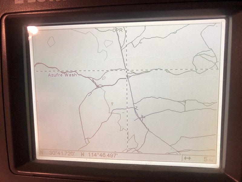
Google I drew the maroon Chale track based on coords from the GPS.

INEGI H11B67 clearly shows the main drainage is Parral. It also shows Chale just north of Parral (near OPR) and joining Parral where the upper and
lower roads join up stream as seen on the GPS image.
These roads being discussed on not on the INEGI topo but were added when the Almanac was made.
No error on the Almanac/Atlas just an omission of recent roads.
|
|
|
geoffff
Senior Nomad
Posts: 643
Registered: 1-15-2009
Member Is Offline
|
|
Comparison of Benchmark with PaulW's recent map of San Felipe area trails:
|
|
|
PaulW
Ultra Nomad
Posts: 3005
Registered: 5-21-2013
Member Is Offline
|
|
Mistake? Curious how you decided that.
In all my research I have never found a road that used Chale as I know it. I bet if I go along my Chale path there will in fact be a road as shown
below? But probably not west of OPR.
The actual roads shown in my other post go from OPR heading to Parral on a wash to the south then going west. As shown on my GPS map there was a road
path north of Parral and west of OPR.
I still think the Atlas guys are correct to omit that old path north of the shown roads.
The Atlas look’s fine IMO.
Below is my latest try to explain the two arroyos. I used Google earth to find the landmarks to define where the Chale path goes.
| Quote: Originally posted by geoffff | Curious how both Benchmark and Baja Almanac made the same mistake with the Agua de Chale road, sending the start of the road straight over the
mountains rather than along the wash. Satellite imagery doesn't show a road going straight over the mountains. INEGI doesn't show this road at all, so
can't blame them!
Did Benchmark use the Baja Almanac as a source?
[Edited on 5-21-2021 by geoffff] |
|
|
|
geoffff
Senior Nomad
Posts: 643
Registered: 1-15-2009
Member Is Offline
|
|
Well I am not sure, as I haven't personally explored the area -- but take a look at your tracks overlaid with the Benchmark map. (This was a bit
tricky as your screenshot seems to have been taken at an angle.) What I assume to be a "mistake" is the Benchmark's dotted line going over the two
hills southwest of the word "Agua" in this image. If there is a road, I can't imagine it going directly over the top of these hills -- and if I zoom
into the satellite imagery, I don't see a road there.


It's not a big mistake, but if it is a mistake, then what's curious is that both the Baja Almanac and Benchmark somehow made the same mistake.
[Edited on 5-24-2021 by geoffff]
|
|
|
David K
Honored Nomad
Posts: 64479
Registered: 8-30-2002
Location: San Diego County
Member Is Offline
Mood: Have Baja Fever
|
|
Guys, they both use INEGI maps so they both share the same potential errors. Agua de Chale is the former name for Nuevo Mazatlan. Follow that arroyo
from the sea back west into the hills.
|
|
|
geoffff
Senior Nomad
Posts: 643
Registered: 1-15-2009
Member Is Offline
|
|
But that's the other point I made earlier -- the INEGI map doesn't show this road! Only Benchmark and Baja Almanac.

|
|
|
David K
Honored Nomad
Posts: 64479
Registered: 8-30-2002
Location: San Diego County
Member Is Offline
Mood: Have Baja Fever
|
|
Benchmark had my map, an AAA map, and the Almanac. They added roads that were important to show. The arroyo that is called Agua de Chale on INEGI is
probably not, at least in Cañon El Parral.
|
|
|
geoffff
Senior Nomad
Posts: 643
Registered: 1-15-2009
Member Is Offline
|
|
(My above post updated with INEGI map image overlaid with Benchmark)
|
|
|
| Pages:
1
2
3
4 |