| Pages:
1
2
3
..
5 |
nbentley1
Nomad

Posts: 140
Registered: 9-16-2016
Member Is Offline
|
|
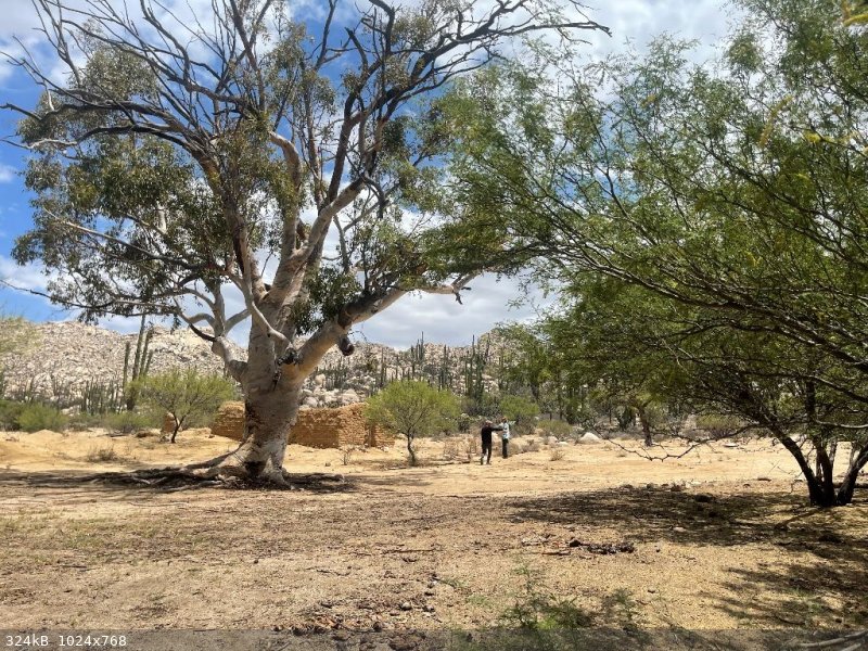
Abandoned mine
We recently took the less traveled road from Punta Santa Maria (Seven Sisters area) to meet mex 1 south of Laguna Chapala. About 15 miles from the
main road we stumbled upon an oasis. Once we hiked out to it we found an old adobe structure, non native trees and what appeared to be an abandoned
mine. Anyone know the story of this place? thanks
|
|
|
JZ
Elite Nomad
Posts: 9233
Registered: 10-3-2003
Member Is Offline
|
|
Not sure I'd open that up to see what is down there.
|
|
|
BajaNomad
|
Thread Moved
7-20-2021 at 11:02 AM |
AKgringo
Elite Nomad
Posts: 5808
Registered: 9-20-2014
Location: Anchorage, AK (no mas!)
Member Is Online
Mood: Retireded
|
|
To me it looks more like they wanted a well, or cistern for a ranch. Perhaps the original excavation was to create the adobe for the structure?
If you are not living on the edge, you are taking up too much space!
"Could do better if he tried!" Report card comments from most of my grade school teachers. Sadly, still true!
|
|
|
StuckSucks
Super Nomad
Posts: 2306
Registered: 10-17-2013
Member Is Offline
|
|
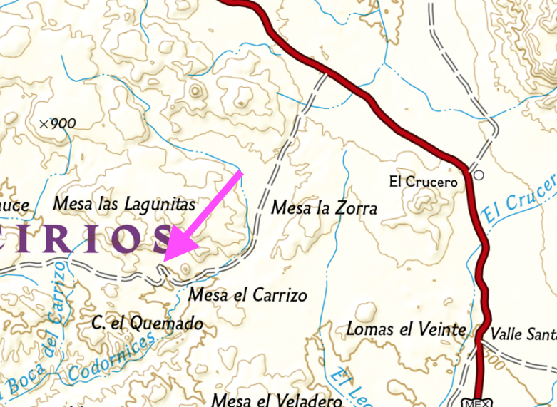
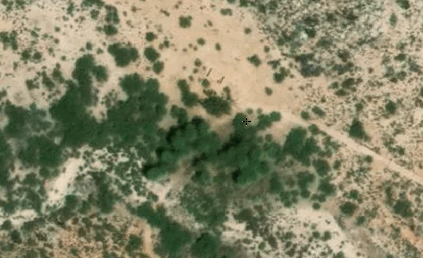
Looked around your location, which is only ~5 miles from the highway and found nothing. At 9.8 miles from the highway I found a bunch of trees
(oasis?), and can see what appears to be an adobe structure at a place named Codornices. Could the "mine" have been a water well?
|
|
|
nbentley1
Nomad
Posts: 140
Registered: 9-16-2016
Member Is Offline
|
|
The hole was filled in, but you could see support beams that made it look like a mine structure. Don't know for sure, but it was a cool find.
|
|
|
nbentley1
Nomad
Posts: 140
Registered: 9-16-2016
Member Is Offline
|
|
StuckSucks, that for sure looks like the spot.
|
|
|
mtgoat666
Select Nomad
Posts: 17296
Registered: 9-16-2006
Location: San Diego
Member Is Online
Mood: Hot n spicy
|
|
That pic looks like hand-dug well. If it was a mine shaft, you would see other excavations around area (prospects, other s shafts or adits, etc),
and see waste rock piles.
Hand dug wells often have timber on side walls, so hole does not collapse.
Woke!
“...ask not what your country can do for you – ask what you can do for your country.” “My fellow citizens of the world: ask not what America
will do for you, but what together we can do for the freedom of man.”
Prefered gender pronoun: the royal we
|
|
|
nbentley1
Nomad
Posts: 140
Registered: 9-16-2016
Member Is Offline
|
|
Quote: Originally posted by mtgoat666  | That pic looks like hand-dug well. If it was a mine shaft, you would see other excavations around area (prospects, other s shafts or adits, etc),
and see waste rock piles.
Hand dug wells often have timber on side walls, so hole does not collapse. |
Good point, well it is then
|
|
|
John M
Super Nomad
Posts: 1906
Registered: 9-3-2003
Location: California High Desert
Member Is Offline
|
|
TW may know
He and I drove past that place a couple of years ago and I think at the time he knew something about it. Now, I'll email him and ask him to comment.
Hope he remembers.
John M
|
|
|
David K
Honored Nomad
Posts: 64480
Registered: 8-30-2002
Location: San Diego County
Member Is Offline
Mood: Have Baja Fever
|
|
When I drove by in 2017, I came from Km. 270.5. there was an abandoned or unoccupied ranch 1.2 miles west of the junction with the Km. 252 road. I
think that was the place pictured at the top?
https://caltopo.com/l/CLEJ
0.8 mile past the adobe was old Rancho Codornices/ San Antonio. That is where an oasis is, lots of trees.
https://caltopo.com/l/E98A
[Edited on 7-21-2021 by David K]
|
|
|
TMW
Select Nomad
Posts: 10659
Registered: 9-1-2003
Location: Bakersfield, CA
Member Is Offline
|
|
Just before the jct where the road from Hwy 1 KM270 comes in there is a white house to the north on a hill. A rancher lives there or use to. I met him
several years ago. Next time in the area you could ask him about the place you found.
The place above that StuckSucks has an arrow is an abandoned ranch. It has a well and there are many palm trees. Someone set them on fire several
years ago. Also some one put up a fence and made a detour to avoid the place. There is another ranch close by to the east that is abandoned. People
have lived there on and off over the years.
|
|
|
David K
Honored Nomad
Posts: 64480
Registered: 8-30-2002
Location: San Diego County
Member Is Offline
Mood: Have Baja Fever
|
|
Exactly, we posted the same time, TW.
I also took the detour that bypassed old San Antonio/ Codornices. I wanted to have a closer look but didn't turn back... https://caltopo.com/l/KST0
Rancho La Miseria would change everything, a few miles further, down the mountain slope! https://caltopo.com/l/AVU5
[Edited on 7-21-2021 by David K]
|
|
|
TMW
Select Nomad
Posts: 10659
Registered: 9-1-2003
Location: Bakersfield, CA
Member Is Offline
|
|
As I remember Rancho Codornices/San Antonio there was two buildings and they were near several palm trees. The building shown by nbentley1 is not it.
|
|
|
David K
Honored Nomad
Posts: 64480
Registered: 8-30-2002
Location: San Diego County
Member Is Offline
Mood: Have Baja Fever
|
|
| Quote: Originally posted by TMW | | As I remember Rancho Codornices/San Antonio there was two buildings and they were near several palm trees. The building shown by nbentley1 is not it.
|
I think so, as mentioned, they were nearly a mile apart.
I have had to tell people who thought San Antonio was a mission site, it was only an old ranch site.
|
|
|
PaulW
Ultra Nomad
Posts: 3005
Registered: 5-21-2013
Member Is Offline
|
|
Rancho Codornices
Been there twice TMW has teh exact identification. We drove both roads to that abandoned rancho.
Cistern or well is pictured. I think cistern was filled for the abandoned stream to the south. Usually these old ranchos do not have a mine. No
evidence of tailings should prove that.
Several nearby structures that are dissolving into the earth are can still be detected.
That big tree is really a great specimen.
|
|
|
David K
Honored Nomad
Posts: 64480
Registered: 8-30-2002
Location: San Diego County
Member Is Offline
Mood: Have Baja Fever
|
|
| Quote: Originally posted by Lance S. | | Quote: Originally posted by David K | | Quote: Originally posted by TMW | | As I remember Rancho Codornices/San Antonio there was two buildings and they were near several palm trees. The building shown by nbentley1 is not it.
|
I think so, as mentioned, they were nearly a mile apart.
I have had to tell people who thought San Antonio was a mission site, it was only an old ranch site. |
David probably already knows this but in case anyone else is interested... The location of the old Rancho Codornices was considered for a mission
Cabacera. This was after they had pretty much decided on the site at Calamajue. The Jesuits called it La Hermosura, The Cochimi called it Keda.
They were thinking that if Laguna Chapala had water they could use the two locations together for a mission based on raising cattle but with little or
no agriculture. I don't know why they thought Chapala would have water the second time visiting it, they had been there the year before in 1766.
Shows how desperate they were to find a site between San Borja and San Fernando.
The lower end of Arroyo San Jose (near Faro San Jose) was also considered. |
Interesting!
Mission San Borja was opened in 1762. It was a visita of Mission Santa Gertrudis since 1759. The Jesuit in charge at San Borja was Wenceslaus Linck.
In February (to April) 1766, Linck led a major expedition to seek out new mission sites and find a route to the Colorado River (also to again prove
California was not an island).
It was Linck, during this expedition, who discovered Velicatá (the future site of Mission San Fernando). Velicatá was an excellent location for a
mission, but being so far from San Borja, an intermediate mission was established first. This would be at Calamajué in October 1766 with its abundant
(but salty) year-round stream. Crops failed and the water was undrinkable. In May 1767, the mission was moved and now identified as Mission Santa
María de los Angeles.
Before the Jesuits could establish the mission at Velicatá, they were all removed and sent back to Europe under false pretenses.
Velicatá would become a mission during the Franciscan period, in 1769. It was the first California mission founded by Junípero Serra, in fact (not
San Diego).
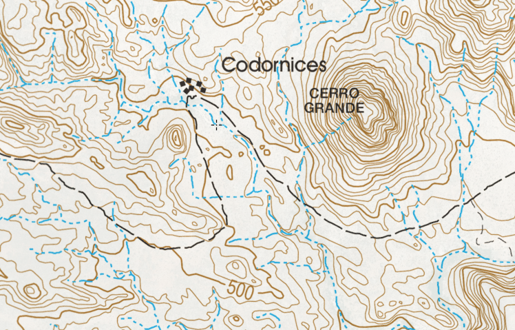
Map (south half) of Padre Wenceslaus Linck's 1766 expedition from San Borja (showing Keda and Codornices in close proximity):
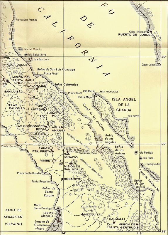
Question: Lance, where did you read about La Hermosura?
|
|
|
4x4abc
Ultra Nomad
Posts: 4163
Registered: 4-24-2009
Location: La Paz, BCS
Member Is Offline
Mood: happy - always
|
|
at least Laguna Chapala is in the wrong place on this map
Harald Pietschmann
|
|
|
David K
Honored Nomad
Posts: 64480
Registered: 8-30-2002
Location: San Diego County
Member Is Offline
Mood: Have Baja Fever
|
|
Several points are off, including San Ignacio (today's Rancho San Ignacito, between San Borja and Rosarito). Yubay as well, plus there's two of them!
San Borja and Calamajué are off, too.
The map is valuable only as showing the progress of Linck on each day and the Native place names.
[Edited on 7-21-2021 by David K]
|
|
|
4x4abc
Ultra Nomad
Posts: 4163
Registered: 4-24-2009
Location: La Paz, BCS
Member Is Offline
Mood: happy - always
|
|
what would Las Palomas translate to on today's map?
Harald Pietschmann
|
|
|
4x4abc
Ultra Nomad
Posts: 4163
Registered: 4-24-2009
Location: La Paz, BCS
Member Is Offline
Mood: happy - always
|
|
is there a published log of Linck's journey?
Harald Pietschmann
|
|
|
| Pages:
1
2
3
..
5 |


