| Pages:
1
2 |
David K
Honored Nomad

Posts: 64558
Registered: 8-30-2002
Location: San Diego County
Member Is Offline
Mood: Have Baja Fever
|
|
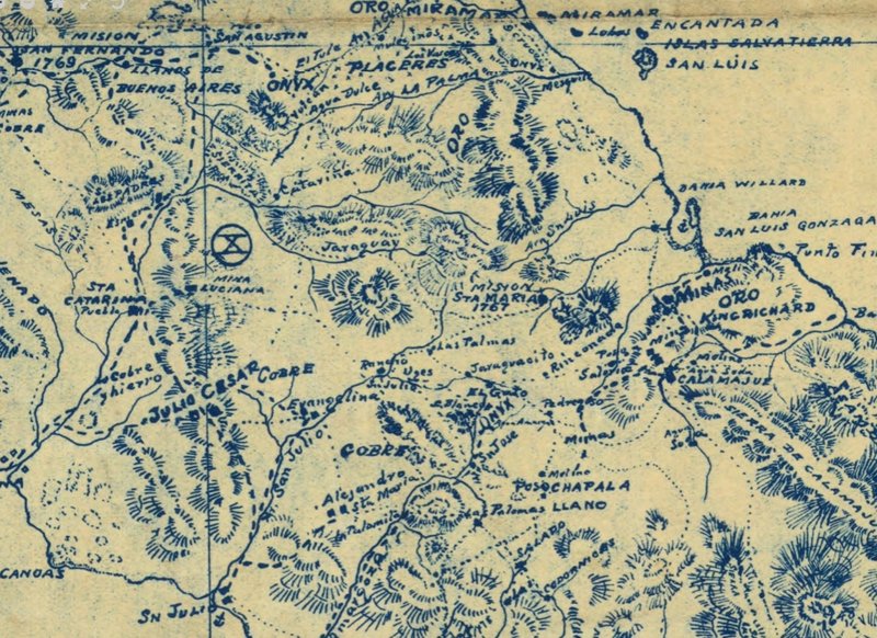
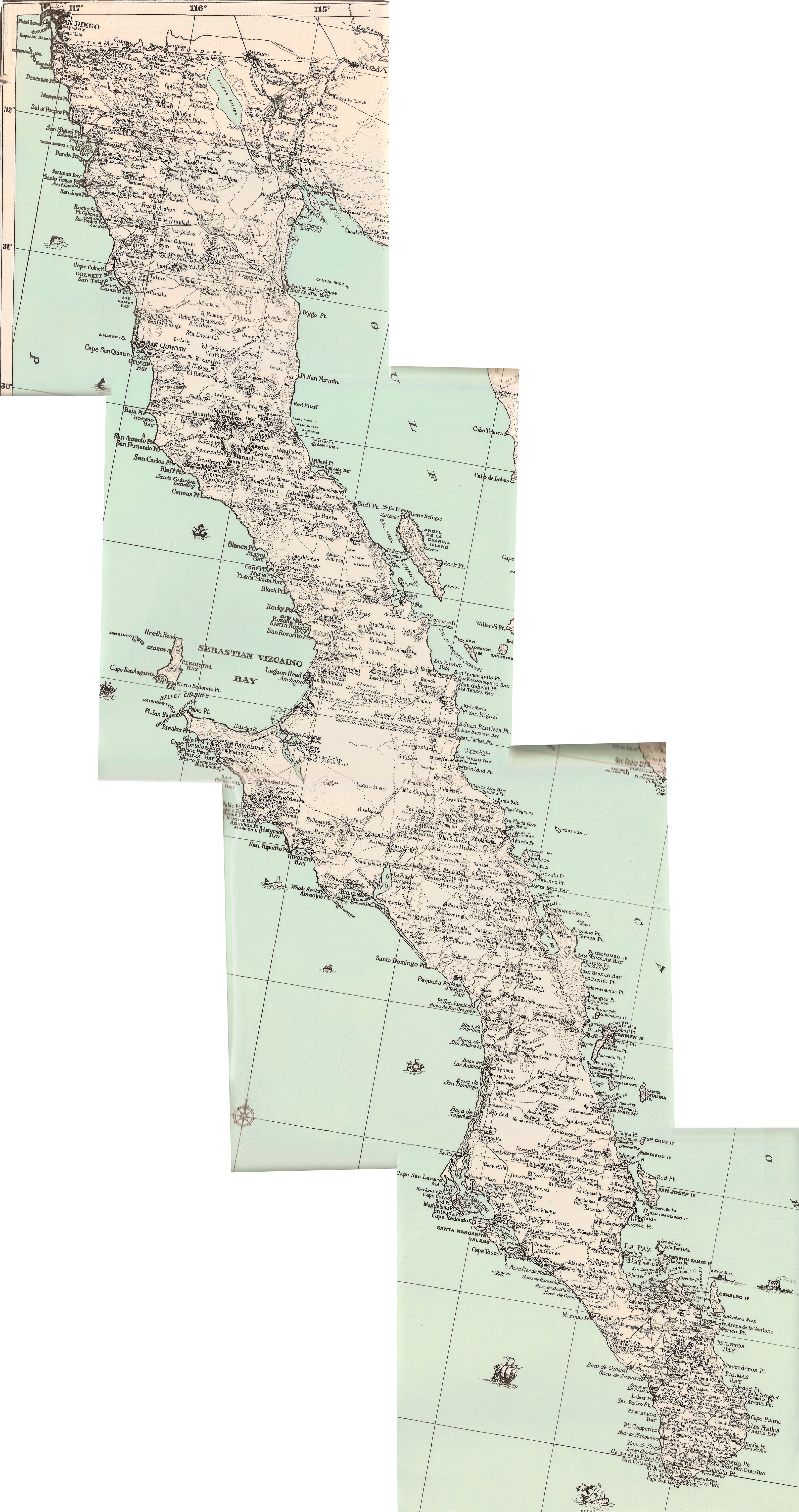
Maps compared 1918 to 1962
I tried to crop the maps so they each show the same area of Baja. 1918, 1919, 1922, 1930 all have north at the top. The 1962 Gulick maps are sectional
and oriented so the most area fits, with the different top directions going northwest. The Gulick maps are the most accurate as for road and rancho
placements.
Perhaps some of you who are better at this can play around a bit more with lining things up? I can email you the scanned images if you like.
1918
1919

1922

1930
1962 (2 part)

'Fish Camp' is Puerto Canoas today and San Julio on the older maps.
|
|
|
geoffff
Senior Nomad
Posts: 644
Registered: 1-15-2009
Member Is Offline
|
|
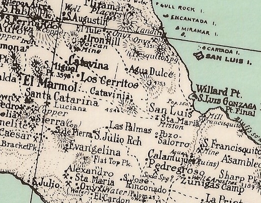
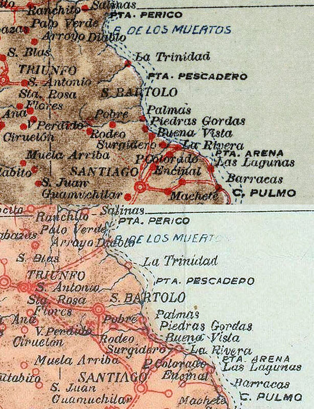
These two maps?
1922
1946
The 1922 and 1946 maps look pretty much identical to me, except for a few additional roads drawn in on the 1946 map. These are the only differences I
could spot:

|
|
|
geoffff
Senior Nomad
Posts: 644
Registered: 1-15-2009
Member Is Offline
|
|
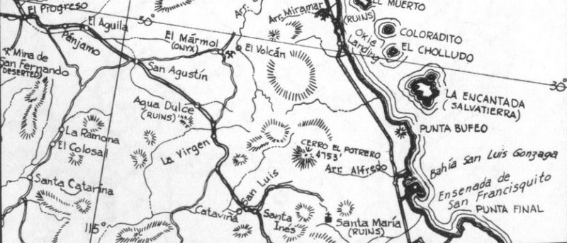
Oh, here is the Punta Final area discussed earlier (1922/1946):

|
|
|
David K
Honored Nomad
Posts: 64558
Registered: 8-30-2002
Location: San Diego County
Member Is Offline
Mood: Have Baja Fever
|
|
Thank you geoffff!
Lance, does this work for you?
Good job, Geoff!!
Q: Do you have this 1930 Baja map preserved on your site the same way the 1922 and 1946 maps are above? If not I can send you the high res scans. Here
are the Postimages.org images:


|
|
|
geoffff
Senior Nomad
Posts: 644
Registered: 1-15-2009
Member Is Offline
|
|
no, I don't have the 1930 map scan yet. That would be great! Also, I can share with you a list of what I have collected so far.
|
|
|
David K
Honored Nomad
Posts: 64558
Registered: 8-30-2002
Location: San Diego County
Member Is Offline
Mood: Have Baja Fever
|
|
Quote: Originally posted by geoffff  | | no, I don't have the 1930 map scan yet. That would be great! Also, I can share with you a list of what I have collected so far.
|
Great...
I will email you my 1930 map scans and maybe you can stich them into one full, zoomable map?
|
|
|
geoffff
Senior Nomad
Posts: 644
Registered: 1-15-2009
Member Is Offline
|
|
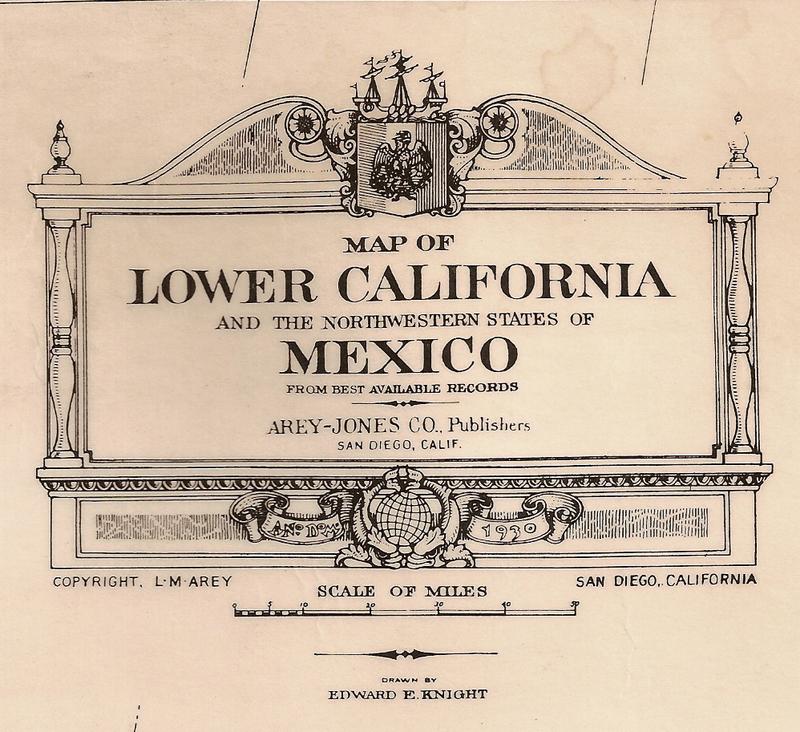
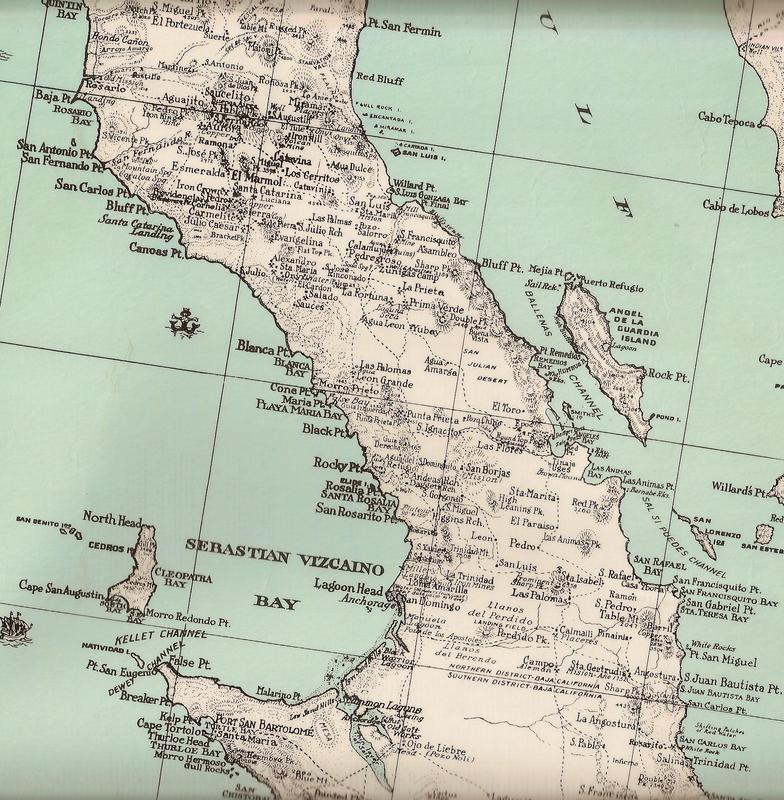
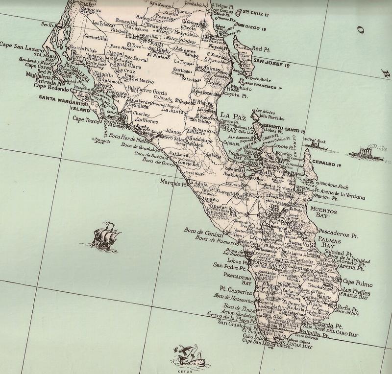
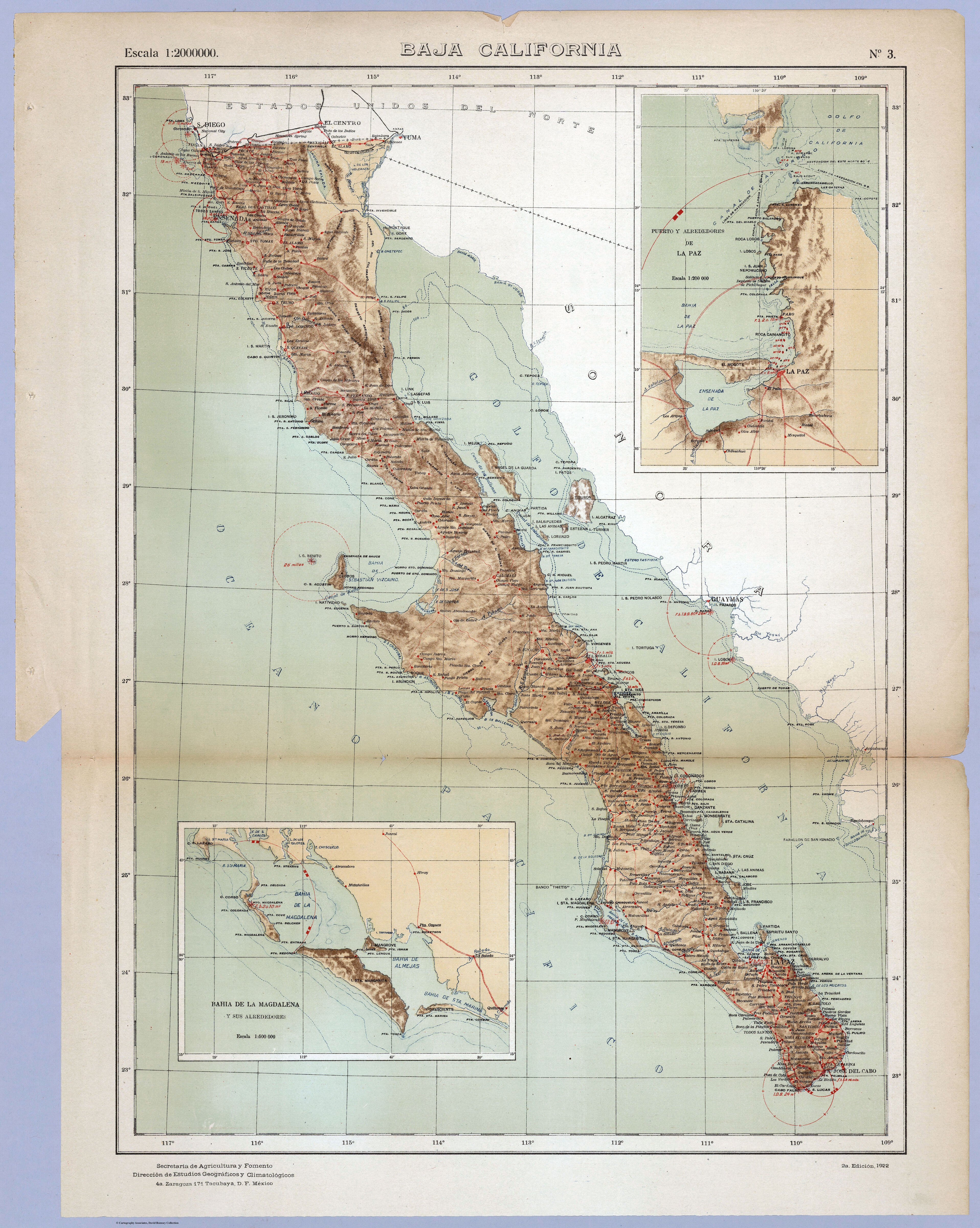
Here is the above 1930 map from DavidK, stitched into a single image:
1930--Baja--Lower-California--byEdwardEKnight.jpg
|
|
|
geoffff
Senior Nomad
Posts: 644
Registered: 1-15-2009
Member Is Offline
|
|

|
|
|
David K
Honored Nomad
Posts: 64558
Registered: 8-30-2002
Location: San Diego County
Member Is Offline
Mood: Have Baja Fever
|
|
Super!
This interesting map was for sale at the Birch (Scripps) Aquarium giftshop several years ago.
I had it laminated. So glad my scans of it could be made into a single image.
Thank you, geoffff!
|
|
|
David K
Honored Nomad
Posts: 64558
Registered: 8-30-2002
Location: San Diego County
Member Is Offline
Mood: Have Baja Fever
|
|
I know have the 1930 map at VivaBaja.com for anyone's quick find.
Here are the maps now linked, all of which have a zoom-in or enlargement ability for close study!
David Kier's Baja California Maps Combined
Baja California, Mexico 'Zoom-In' Topo & Satellite Map
1747 Padre Fernando Consag 'Zoom-In' Map
1757 Jesuit Mission 'Zoom-In' Map
1768 Baja and Mexico 'Zoom-In' Map
1823 Baja & Alta California 'Zoom-In' Map
1904 Postal Route 'Zoom-in' Map
1905-1906 E.W. Nelson Expedition 'Zoom-In' Map (printed in 1919)
1918 Goldbaum Baja Norte 'Zoom-In' Map (printed in 1925)
1922 Baja California 'Zoom-In' Map
1930 Baja California 'Zoom-In' Map
1934 Auto Club 'Zoom-In' Map
1962 Baja road maps by Howard Gulick (thanks to Doug Eernisse)
1971 Reconnaissance Geologic Map of Baja Norte (3 parts):
...Northern Baja Norte
...Central Baja Norte
...Southern Baja Norte
Mexican Topographic Maps from INEGI
(choose scale, area, and click PDF or GeoPDF where available)
Exciting New El Camino Real Website and Google Earth Map
|
|
|
| Pages:
1
2 |


