| Pages:
1
2 |
KasloKid
Nomad

Posts: 326
Registered: 8-29-2009
Member Is Offline
|
|
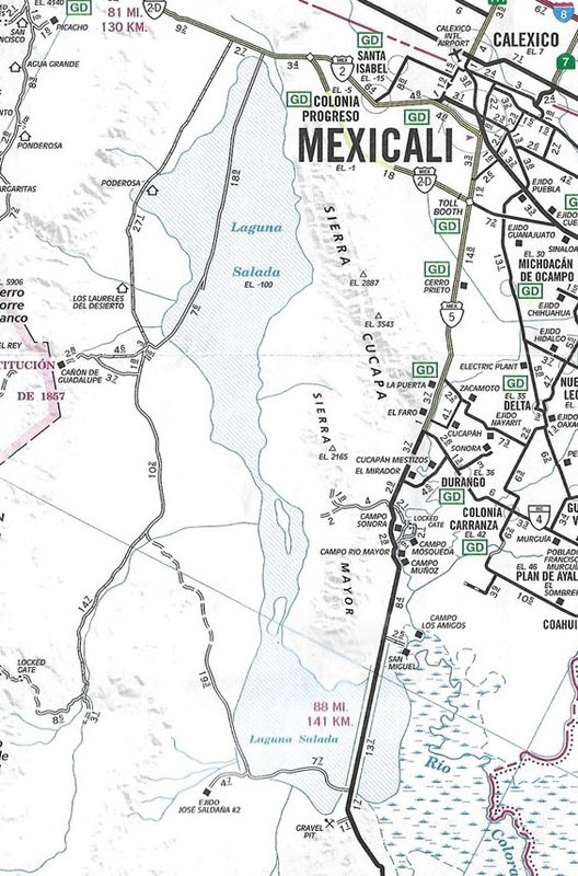
Laguna Salada
Does anyone have knowledge about the status of Laguna Salada? Is it still a wet or dry lake? Friends are hopeful of riding through in a couple of
weeks.
|
|
|
TMW
Select Nomad
Posts: 10659
Registered: 9-1-2003
Location: Bakersfield, CA
Member Is Offline
|
|
I don't think there has been any rain for a while so my guess is that it's dry. They're going to ride anyway so if it's wet turn around if not keep
going. They should be able to radio the chase crew as to the condition. A little mud doesn't hurt and can make it fun.
|
|
|
AKgringo
Elite Nomad
Posts: 5815
Registered: 9-20-2014
Location: Anchorage, AK (no mas!)
Member Is Offline
Mood: Retireded
|
|
I did not go anywhere near Laguna Salda on the trip I just returned from, but I covered a lot of ground, and saw water in many places that I wouldn't
have expected to find it.
What I would worry about is finding a mud or silt bog that has dried just enough to make it look a firm surface!
If you are not living on the edge, you are taking up too much space!
"Could do better if he tried!" Report card comments from most of my grade school teachers. Sadly, still true!
|
|
|
David K
Honored Nomad
Posts: 64486
Registered: 8-30-2002
Location: San Diego County
Member Is Offline
Mood: Have Baja Fever
|
|
They may need a Plan B?
The graded road on the west side is the wet surface alternative.
|
|
|
mtgoat666
Select Nomad
Posts: 17326
Registered: 9-16-2006
Location: San Diego
Member Is Offline
Mood: Hot n spicy
|
|
Quote: Originally posted by KasloKid  | | Does anyone have knowledge about the status of Laguna Salada? Is it still a wet or dry lake? Friends are hopeful of riding through in a couple of
weeks. |
Was pretty full of water last month after the big rains. Probably still a lot of wet areas, or areas with mud hiding below dry surface.
Woke!
“...ask not what your country can do for you – ask what you can do for your country.” “My fellow citizens of the world: ask not what America
will do for you, but what together we can do for the freedom of man.”
Prefered gender pronoun: the royal we
|
|
|
Maderita
Senior Nomad
Posts: 634
Registered: 12-14-2008
Location: San Diego
Member Is Offline
|
|
| Quote: Originally posted by KasloKid | | Does anyone have knowledge about the status of Laguna Salada? Is it still a wet or dry lake? Friends are hopeful of riding through in a couple of
weeks. |
Good news. Sorry for the delay in responding - just in from Baja last night. The Laguna Salada road is open now. Some work was done to open the main
track. Any other track is 4x4. Do not drive off the main track due to mud hiding below a dry appearing crust.
Enter from the Pavarotti sign at Highway 2D.
Then look for these tires to loacte the main track: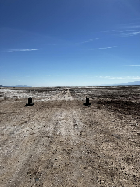 [/url] [/url]
Follow sticks with orange/red tips.
The main track will pass close by all of the emergency beacon towers.
That route is now passable with 2WD all the way to the abandoned olive grove and Ejido Manatou. 2WD to the creek at the mouth of Guadalupe Canyon.
The entrance to Guadalupe Canyon is now 4WD. Some campsites may have been opened. I know people who have hiked up the canyon this month.
The canyons ejected significant loose sand with Tropical Storm "Kay" on September 10. Some sand crossed the "high road" above Laguna Salada to the
west.
If you need more info about Canyon Guadalupe, I can update after I get word from the owner.
|
|
|
KasloKid
Nomad
Posts: 326
Registered: 8-29-2009
Member Is Offline
|
|
Thanks for all the input. I'll pass info onto friends and let them make the decision to go or not. I know they'd like to get further sounth and get
back onto Mex 5 at the sand dunes but that might be a stretch.
A few years back, the road leading out to 5 just north of the dunes, I got sucked into thinking the what looked solid ground adjacent to the road
turned out, wasn't.... discovered a lot of hidden mud. My bike and me went over and slid for 50+ feet. Mud dried like concrete in crevises I didn't
know existed.
|
|
|
David K
Honored Nomad
Posts: 64486
Registered: 8-30-2002
Location: San Diego County
Member Is Offline
Mood: Have Baja Fever
|
|
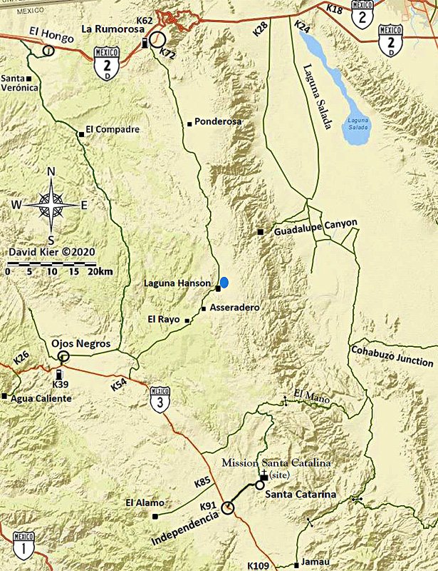
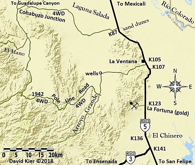
There is a dry (elevated) graded road from the sand dunes west then north, around the edge of the Laguna Salada... SCORE uses it, goes to Cohabuzo
Junction (and there is another road that goes north of Cohabuzo, as shown on this Auto Club map of 2010 and earlier. Cohabuzo Jcn. is approx. where
the mileage 14.7 is on the map):
On my maps, I only show the Cohabuzo Jcn. route, as that is what I drove:
[Edited on 11-1-2022 by David K]
|
|
|
KasloKid
Nomad
Posts: 326
Registered: 8-29-2009
Member Is Offline
|
|
Thanks David. Passing this info on...
|
|
|
John M
Super Nomad
Posts: 1907
Registered: 9-3-2003
Location: California High Desert
Member Is Offline
|
|
Kaslo
Please check your U2U
John M
|
|
|
KasloKid
Nomad
Posts: 326
Registered: 8-29-2009
Member Is Offline
|
|
Thanks John
U2U sent
Chuck
|
|
|
StuckSucks
Super Nomad
Posts: 2307
Registered: 10-17-2013
Member Is Offline
|
|
Ah, "Cohabuzo Jct" -- was trying to pull that name out of my brain cell. Thanks!
|
|
|
4x4abc
Ultra Nomad
Posts: 4165
Registered: 4-24-2009
Location: La Paz, BCS
Member Is Offline
Mood: happy - always
|
|
Cohabuzo Junction
how did it get its name?
Harald Pietschmann
|
|
|
David K
Honored Nomad
Posts: 64486
Registered: 8-30-2002
Location: San Diego County
Member Is Offline
Mood: Have Baja Fever
|
|
On the older AAA maps was a Cerro Cohabuzo just west of this junction. Score named the junction when Baja races used it from the AAA map.
|
|
|
David K
Honored Nomad
Posts: 64486
Registered: 8-30-2002
Location: San Diego County
Member Is Offline
Mood: Have Baja Fever
|
|
Harald, Cerro Cohabuzo first appeared on the 1967 edition Auto Club map and continued on each one through the 2000 edition. In 2001, it was removed.
Stuff like this is why I wanted to share every AAA map I could to see how things changed from year to year... Mostly on how roads were shown or
pavement progressed. Also, to see errors corrected, all in fun. Sort of a where's Waldo game.
I made a web page just for the AAA maps (1927-2010) plus the covers of the maps, as it changed, are included: https://vivabaja.com/automobile-club-maps/
|
|
|
PaulW
Ultra Nomad
Posts: 3008
Registered: 5-21-2013
Member Is Offline
|
|
To many place names are missing for both the AAA and INEGI maps.
Thanks for the Cohabuzo place history.
1967 was before GPS and the AAA maps were best. Not much exploring of routes otherwise. I wonder when the INEGI maps became in use?
|
|
|
4x4abc
Ultra Nomad
Posts: 4165
Registered: 4-24-2009
Location: La Paz, BCS
Member Is Offline
Mood: happy - always
|
|
so, only AA has it on its maps
Harald Pietschmann
|
|
|
Maderita
Senior Nomad
Posts: 634
Registered: 12-14-2008
Location: San Diego
Member Is Offline
|
|
Cohabuzo Junction is also on the BC Road & Recreation Atlas (2021).
|
|
|
David K
Honored Nomad
Posts: 64486
Registered: 8-30-2002
Location: San Diego County
Member Is Offline
Mood: Have Baja Fever
|
|
Yes, I put it there since it is a 'major' point of refernce for so many years with racers and desert explorers.
The mountain name could have been from local ranchers when asked by Auto Club staff or on some other maps used in the 60s? It is not on the 1962
Howard Gulick Lower California Guidebook maps (I suspect there may be some truth that Gulick assisted the Auto Club with improving their 1962 map for
1967).
By-the-way, Cerro Santa Isabel is the name now used for Cerro Cohabuzo, today (see it on Benchmark Atlas, Almanac, and Inegi topos).
GPS: 31° 54' 10.9" N 115° 49' 54.5" W
|
|
|
David K
Honored Nomad
Posts: 64486
Registered: 8-30-2002
Location: San Diego County
Member Is Offline
Mood: Have Baja Fever
|
|
I think AA's (Alcoholics Annonymous) maps may only show liquor store locations to avoid?!!
All kidding aside...
It does seem to only be on the Auto Club of Southern California's maps (AAA for short as it is part of the American Automobile Association).

|
|
|
| Pages:
1
2 |


