| Pages:
1
2 |
mtgoat666
Select Nomad

Posts: 17302
Registered: 9-16-2006
Location: San Diego
Member Is Offline
Mood: Hot n spicy
|
|
I wonder is there is a Mexican discussion forum that analyzes and discusses old maps of the USA?
have any of you asked the local ranchers what the call that arroyo?
[Edited on 12-5-2022 by mtgoat666]
Woke!
“...ask not what your country can do for you – ask what you can do for your country.” “My fellow citizens of the world: ask not what America
will do for you, but what together we can do for the freedom of man.”
Prefered gender pronoun: the royal we
|
|
|
David K
Honored Nomad
Posts: 64480
Registered: 8-30-2002
Location: San Diego County
Member Is Offline
Mood: Have Baja Fever
|
|
Quote: Originally posted by AKgringo  | | It is interesting that at the western side of the drainage it is spelled Teraiso, but toward the east it is Teraizo. |
I have found it interesting that consistent spelling in Spanish is not so important, is it?
Santa Ynez has another sign spelled Santa Inez and the name is often spelled Santa Inés.
Santa Rosalillita has been spelled as Santa Rosaliita by some, recently.
Is it Pancho or Poncho? La Jolla or La Joya (the second is proper).
Fun stuff, yes?
|
|
|
4x4abc
Ultra Nomad
Posts: 4163
Registered: 4-24-2009
Location: La Paz, BCS
Member Is Offline
Mood: happy - always
|
|
would Mexicans discuss organic food?
Harald Pietschmann
|
|
|
David K
Honored Nomad
Posts: 64480
Registered: 8-30-2002
Location: San Diego County
Member Is Offline
Mood: Have Baja Fever
|
|
| Quote: Originally posted by lencho |
To me, "Rosalillita" seems like a non-standard spelling for that diminutive; where did you see it first pop up?
BTW, for many native Spanish speakers, "Rosalillita" and "Rosaliita", do have distinctly different pronunciations.
[Edited on 12-5-2022 by lencho] |
The bay and point were named Santa Rosalia. By the late 1950s to early 1960s, the name was modified to 'little Santa Rosalia' or Santa Rosalillita to
prevent confusion with the large French-owned copper mine town. See the maps. The first maps on my page with a odd spelling Rosalita or Rosaliita are
on Mexican maps from the past 20 years.
It was only in recent years that maybe young folks started spelling it Rosaliita, in error or in confusion? Are there any other Spanish words with two
i's together? The two L's is a single letter in Spanish, and used very frequently, as you know.
The sign on Hwy. 1 is still spelled correctly:

|
|
|
David K
Honored Nomad
Posts: 64480
Registered: 8-30-2002
Location: San Diego County
Member Is Offline
Mood: Have Baja Fever
|
|
| Quote: Originally posted by lencho | Yep.
Personally, I'd consider that uncommon use to form diminutives in Mexican Spanish, which is why I am curious who originally came up with the "illita"
spelling. The "iita" spelling, far from being "odd", would be the more likely by a literate Spanish speaker.
Looking at your map collection, the first instance I see of the "illita" spelling is Gulick's '58 map; did he (a non-native speaker) transcribe it
that way? If so, maybe those later "odd" spellings are attempts to correct it.
BTW, the "Ll" and "Ch" as single letters have not been part of the Spanish alphabet since 1994.  |
Intersting... so is ñ still it's own letter?
Gulick's first edition (1956) map shows Bahía Santa Rosalía (no inhabitants).
Gulick's second edition (1958) shows and mentions Bahía Santa Rosalillita (a seasonaly occupied fish camp), as do the other editions (1962 &
1967).
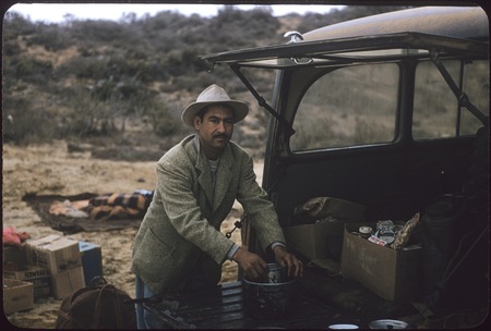
I am not sure how well Howard understood Spanish, however he usually traveled with a Mexican friend from Ensenada, Faustino Pérez [good way to
interview locals about locations]. Faustino appears in many of Howard's archived photos. This one is at El Consuelo, in 1956, which was where the road
south of San Quintín left the coast for El Rosario.
Other than the Gulick/Pérez ground research, here is what I find on the maps I have saved online:
Every Auto Club map from 1962 to 2010 spells it Rosalillita, so their cartographers are in agreement with Howard and the sign on Hwy. 1.
1973 Geology Map spell the village Rosalillita
1984 Mexican Tourism Map spells the point and village Rosalillita
1987 Pronto Mapas (Mexican) spells it Rosalillita
1992 Kevin Healey's Traveler's Reference Map spells it Rosalillita
2003 Baja Almanac spell the village Rosalillita (but the point & bay Rosaliita)
2004 Mapa Turístico spells them all Rosalillita
2005 EIGAS Map spells it (poorly) Rosalita
2009 Baja Almanac spells all (town, point, bay) Rosalillita [a correction from 2003 point & bay?]
2004-2016 Mexican SCT maps spell the town (poorly) Rosalita and the bay/ point Rosaliita
When I go to the oldest INEGI Topo Map (1974) it is all (village, point, bay) spelled Rosaliita. However, given INEGI's record of mistakes on their
Baja maps, I don't give it much consideration, LOL!
Anyway, those overhead highway signs aren't cheap... SANTA ROSALILLITA is the winner! Ha!

[Edited on 12-5-2022 by David K]
|
|
|
David K
Honored Nomad
Posts: 64480
Registered: 8-30-2002
Location: San Diego County
Member Is Offline
Mood: Have Baja Fever
|
|
Please, search for more data!
I have done as much as I could, today, with documenting what I have at VivaBaja.com.
Maybe because I 'grew up' with the 'llita' spelling, I am partial to it. Call it historical preservation, maybe.
|
|
|
David K
Honored Nomad
Posts: 64480
Registered: 8-30-2002
Location: San Diego County
Member Is Offline
Mood: Have Baja Fever
|
|
How do you explain the highway signage? You don't think they got it from Gulick's 1958 book, do you?
Remember, Gulick traveled with a native speaker (Faustino Pérez), so don't be too hard on his spelling. Have you gone over the other thousand-plus
place names on his maps? How about the Auto Club's maps...? The last several editions all have correct spellings of every place in Baja (as I recall)
including 'Santa Rosalillita'. The author of their (AAA) final guidebook (2004) is a friend, I will shoot him an email withn our questions. He
traveled with and knew the map's cartographers.
There are other places were the spelling seems odd. Take Puertecitos, for example. Why isn't the word for Little Ports 'Puertocitos' as many spell it?
I think I recall reading it is a languge thing, like you say the 'ii' together is, for Little Rosalia. When Gulick first drove to Puertecitos, it was
uninhabbited, yet he spelled it on his map, so not from locals there. It would be neat to see the base map he used for the coastline and possible
names along the coast. His map archives are at UCSD... I have always wanted to spend a day there!
Links to both the Gulick photo album, as well as his entire photo collection are online (links at VivaBaja.com)!
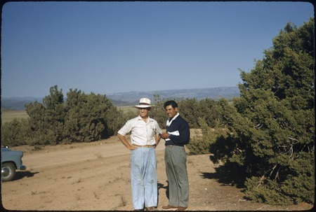
Howard and Faustino, near Ojos Negros, Aug. 27, 1955.
|
|
|
David K
Honored Nomad
Posts: 64480
Registered: 8-30-2002
Location: San Diego County
Member Is Offline
Mood: Have Baja Fever
|
|
I emailed him just now, and gave him the link to this thread.
Here he is at a Pyramid Resort Book Author Signing event, in 2007:
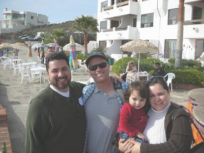
With Antonio (Baja Cactus) and family.

With Doug (Baja Nomad) behind camera, GeoRock (standing by Doug) and sitting next to the late MaryAnn Humfreville (RIP), at the evening's tequila
tasting event.
|
|
|
4x4abc
Ultra Nomad
Posts: 4163
Registered: 4-24-2009
Location: La Paz, BCS
Member Is Offline
Mood: happy - always
|
|
looks like all Mexican maps have it as Santa Rosaliita
all Gringo maps have it as Santa Rosalillita
most maps (1900 and later) David has on his site are by US authors
very few are Mexican
I work with INEGI maps almost every day
they show a lot of corrections and additions reflecting ongoing research
if in doubt, I trust INEGI over anything else
Harald Pietschmann
|
|
|
David K
Honored Nomad
Posts: 64480
Registered: 8-30-2002
Location: San Diego County
Member Is Offline
Mood: Have Baja Fever
|
|
Americans made more maps about Baja, thus more maps on my page to view. I have posted many Mexican maps as well.
In fact, the entire INEGI collection is accessed from my page as well.
I have asked for ANY Baja map be submitted for consideration, too. They just need to be somewhat accurate and potentially interesting.
Please email me maps you have that could enhance my page! www.vivabaja.com/maps
[Edited on 12-6-2022 by David K]
|
|
|
mtgoat666
Select Nomad
Posts: 17302
Registered: 9-16-2006
Location: San Diego
Member Is Offline
Mood: Hot n spicy
|
|
| Quote: Originally posted by David K | Americans made more maps about Baja, thus more maps on my page to view. I have posted many Mexican maps as well.
In fact, the entire INEGI collection is accessed from my page as well.
I have asked for ANY Baja map be submitted for consideration, too. They just need to be somewhat accurate and potentially interesting.
Please email me maps you have that could enhance my page! www.vivabaja.com/maps
[Edited on 12-6-2022 by David K] |
Lots of maps here: https://historicalcharts.noaa.gov
Many I have not seen you post here
Woke!
“...ask not what your country can do for you – ask what you can do for your country.” “My fellow citizens of the world: ask not what America
will do for you, but what together we can do for the freedom of man.”
Prefered gender pronoun: the royal we
|
|
|
David K
Honored Nomad
Posts: 64480
Registered: 8-30-2002
Location: San Diego County
Member Is Offline
Mood: Have Baja Fever
|
|
| Quote: Originally posted by mtgoat666 | | Quote: Originally posted by David K | Americans made more maps about Baja, thus more maps on my page to view. I have posted many Mexican maps as well.
In fact, the entire INEGI collection is accessed from my page as well.
I have asked for ANY Baja map be submitted for consideration, too. They just need to be somewhat accurate and potentially interesting.
Please email me maps you have that could enhance my page! www.vivabaja.com/maps
[Edited on 12-6-2022 by David K] |
Lots of maps here: https://historicalcharts.noaa.gov
Many I have not seen you post here |
Intersting site, thanks... However, if you examine what they have, almost none of Baja California other than coastal outlines. 95% are USA maps. I
looked at the 8 pages of listings after clicking on the peninsula.
|
|
|
David K
Honored Nomad
Posts: 64480
Registered: 8-30-2002
Location: San Diego County
Member Is Offline
Mood: Have Baja Fever
|
|
From David Brackney, 2004 Auto Club Guide author
| Quote: Originally posted by David K | I emailed him just now, and gave him the link to this thread.
Here he is at a Pyramid Resort Book Author Signing event, in 2007:
With Antonio (Baja Cactus) and family.
With Doug (Baja Nomad) behind camera, GeoRock (standing by Doug) and sitting next to the late MaryAnn Humfreville (RIP), at the evening's tequila
tasting event.
|
My email to Dave Brackney about our questions:
Hola Dave,
So, on Baja Nomad we are having a discussion about the spelling of Santa Rosalillita vs. Rosaliita.
The bay, point, (and now a village) were originally Santa Rosalia, but after the early 1950s, with increased traffic, the name was modified to prevent
confusion with the French copper mine town. Howard Gulick's 1958 map is the earliest I have with the new spelling (Rosalillita) and the auto club's
1962 map was the first with the same spelling (1959 still showed it as Santa Rosalia). Nearly all maps adopted the new name in the 60s.
However, INEGI topo maps (which has many errors with place names in Baja) spelled it Rosaliita and other Mexican made maps started using that spelling
after 2000. All the auto club maps to 2010, spelled it Rosalillita. Their maps generally all had correct place name spellings since 1967.
Do you know how place spellings were derived by the club? Did it come from field work interviewing locals or from some existing base map, maybe both?
I am not speaking of mountain peaks named after the cartographer's children, for copyright purposes, lol.
This is the tread on Baja Nomad if you want to see the conversation, which turned to the Rosalillita/ Rosaliita question in the latest exchanges: http://forums.bajanomad.com/viewthread.php?tid=98308
Dave's reply:
So, on to the topic at hand. For that I wish the late cartographer John were still with us. He first joined the Auto Club sometime back in the 1970s,
I believe, and took dozens of trips to Baja before retiring back around 2007. (He passed away in 2012.) I accompanied John on a number of trips and
got to see him in action. John was hard-working, meticulous and took his job seriously. He was full of stories and taught me a lot, especially his
road-rating system (graded dirt, vs. dirt, vs. poor road, etc.).
John used INEGI topographic maps as his base. These were great for getting the lay of the land (quite literally), but yes, in many cases they did
contain outdated or inaccurate information. John did his best to get the story straight and as thorough as he could. Unfortunately, though, he only
made two Baja trips a year -- one of three weeks, and one of two weeks. That was nowhere near enough to keep things current, especially with all the
growth that was taking place in the major cities. Also, John's Spanish skills were not all that strong, so he may have missed out on the chance to
update a lot of info. (There just aren't that many English-speakers out on the ranchos!)
When I came on to the scene (late 1990s), my primary task was research and writing, but wherever I went I was looking at roads and updating
information. Case in point: One day in 1998 I was driving through the ejido land southeast of Mexicali when I came across a town whose name did not
appear on the Auto Club map. All the signs identified it as Colonia Carranza, but our map showed it as Ledón. I stopped and asked a couple of locals
about this, and they assured me that Colonia Carranza was the correct name. The change was made for the next edition of the map.
As time went by, I learned just how outdated some sections of the Baja map were. I remember all too well getting hopelessly lost in Tijuana and
Mexicali as I followed our maps and the travelogues in previous editions of the guidebook. In some instances they were many years, even decades out of
date! Fortunately again, when I reported this to my manager, he directed the cartography department to focus more of its research/charting efforts on
Baja. As time went by, I came to rely on my own field work, interviews and (most importantly) common sense than on government-issued maps.
I'm proud of the work I did, but in the end it was all for naught. The world was digitizing quickly, Baja was growing fast, and the "great recession"
was upon us. In 2008 the Club axed the travel editorial department (taking my job and many others with it), and two years later the final Baja map was
published. It was a sad ending to a Club legacy that dated back nearly a century, to the early 1920s, when the first travelogues and rudimentary maps
appeared.
For anyone creating or updating a Baja map, I would recommend they use multiple sources -- perhaps INEGI, perhaps Google Maps, other maps created over
the years, but most importantly field research, in-person interviews and (did I mention it above?) common sense.
So there you go. This may not be the definitive answer you sought, but I do hope it helps. I could of course go on and on about travels in Baja, but I
hope this helps, and gives you something useful to pass along to others.
Questions? Comments? Let me know.
|
|
|
David K
Honored Nomad
Posts: 64480
Registered: 8-30-2002
Location: San Diego County
Member Is Offline
Mood: Have Baja Fever
|
|
To see all the Auto Club maps we have been able to scan (1927-2010): https://vivabaja.com/automobile-club-maps/
Just two remain to be added (1992 & 1996) that we have in our collection... Once those two are added, I intend to do a year-to-year comparison
listing what has been added or changed from the previous year. Well, as best I can, anyway. I am sure Nomads will help me spot any I missed!
We are missing a few editions as you can see from the web page links. The 1970 edition I have the biggest hope to find. This was a major period in
Hwy. 1 construction from La Paz north towards Santa Rosalia.
1969 map has the pavement to about 110 miles from La Paz. This was about where it bagan for us in 1966.
The 1971 map shows the pavement all the way to Santa Rosalia!
So, the 1970 map will be interesting to see if it shows the new road alignment between Insurgentes and Ligüí/ Puerto Escondido, where no road
existed before. Also, the new roadbed grading from Ligüí north to Santa Rosalia, as reported in the 1970 Cliff Cross guidebook.
If you have it or any of the others listed as "missing", please contact me so we can add it. Thank you!
|
|
|
David K
Honored Nomad
Posts: 64480
Registered: 8-30-2002
Location: San Diego County
Member Is Offline
Mood: Have Baja Fever
|
|
Sure... I am sure the source was not Gulick but someone in charge who decided to prevent any confusion between the two Santa Rosalia's, even though
they are in different states (& territories).
Look what little Rosario or Rosarito (south of Punta Prieta, where the highway curves shaply to the west) did... it rebranded itself as "New Rosarito"
Nuevo Rosarito... Even though it had the name before Playas de Rosarito, near Tijuana!
Yes, Rosarito was originally a visita of Mission San Borja named El Rosario... before becoming little. Now it is both little and new! LOL
I guess it really is about the correct spelling for Little Santa Rosalia?
Rosalita would be so easy (and even appears on some maps). Is Rosalillita or Rosaliita proper Spanish? As Dave from the Auto Club mentioned, visually
both are difficult choices to read.
[Edited on 12-8-2022 by David K]
|
|
|
| Pages:
1
2 |
|


