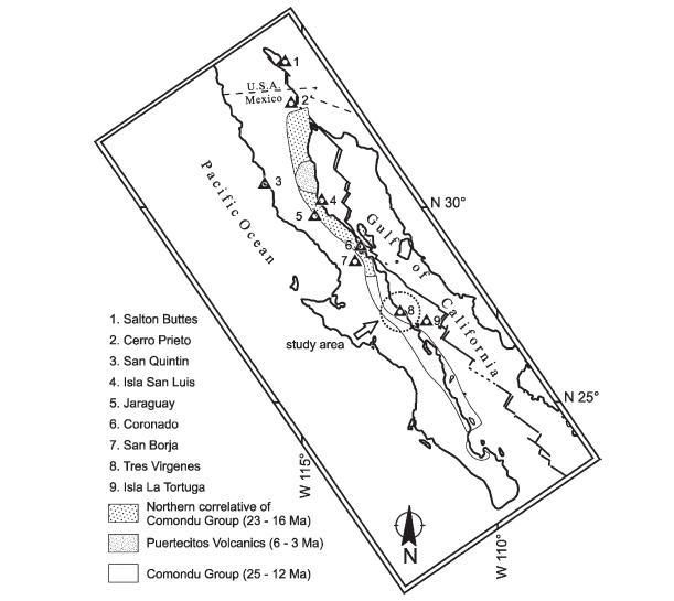
The Reforma 2000 Expedition will be carried out in two tripsone in January, and one in May to Baja California, Mexico. The goal of the January trip
was to visit as many destinations as possible and lay the groundwork for research in May, when more detailed scientific fieldwork will be completed.
In the end, the team hopes to gain a better understanding of the volcanic hazards and approximate ages of these significant volcanoes. The
expedition is funded by the National Geographic Societys Committee for Research and Exploration.
.....A couple of hours later, as the sun was setting over the Pacific Ocean, Keith, Brian and I scrambled to the summit and set up camp amidst the
palmetto trees. An aluminum cross with a bust of Jesus Christ, with an inscription for the miners of Santa Rosalia marked the summit shelf, a flat
area 3 meters by 3 meters. On the summit, and a nearby peak, broadcast towers transmitting seismic information stood 10 meters high. When wed walk
by, an electronic noise would transmit data to a computer somewhere on the globe--probably at the University of Mexico...... |


 We are ready to evacuate..apparently
bigger shakes happen in the afternoon as the ground heats up....uh huh..there is so much gossip flying around...but I would like to be here to find
out from the specialists...they are bringing apparatus also to detect tidal waves etc. No bajamatic....this isn't my way of drawing attention to
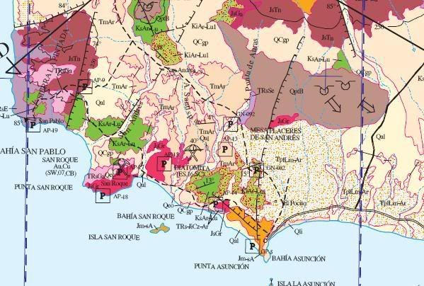
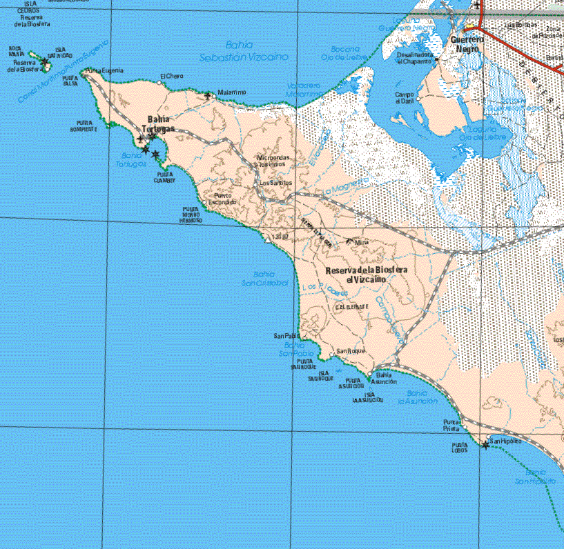
asuncion
We are ready to evacuate..apparently
bigger shakes happen in the afternoon as the ground heats up....uh huh..there is so much gossip flying around...but I would like to be here to find
out from the specialists...they are bringing apparatus also to detect tidal waves etc. No bajamatic....this isn't my way of drawing attention to
asuncion Return when things settle down.
 It'll either be there
when you return or it won't.
It'll either be there
when you return or it won't.