Originally posted by dezertmag
Hi Gang,
I was trying to see if I can come " close " to where this might be, and I found some very small formations that I placed a tag at. Take a look and
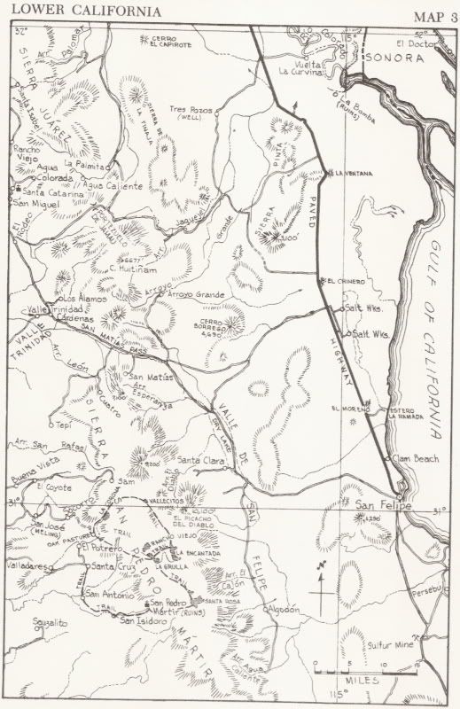
see what you think. I used the instructions as follows " According to Henderson's directions, a line drawn on the hydrographic chart of the Gulf of
California from Sharp Peak (31 degrees 22 minutes N. Lat., elevation 4,690, 115 degrees 10 minutes W. Long.) to an unnamed peak of 2,948 feet, NE from
Sharp Peak (which I think is Cerro del Borrego -about twelve miles away) will roughly follow the divide of a range separating the
watershed that flows to the sea. Somewhere near the center of that line, plunging down the westerly slope, is a rather deep rock-strewn arroyo. On the
north rim of this arroyo, and set back a short distance, is a small mesa-like protrudence, or knob of land.
Ok... I can't seem to post the pixs... Can anyone help with this??? I don't have them on a site they are on my computer...
John
DezMag |