Originally posted by David K
| Quote: | Originally posted by Sharksbaja
So very cool, gracias David. I wonder how many of these are still undiscovered. I see you got the credit you deserved. Tommy Afrika was a busy
guy
Here is a list I have from Google Earth:
List of Missions ... Mexico & California
Refs.: Wikipedia / Baja ... Wikipedia / California
MEXICO: Baja California Norté & Baja California Sur
Jesuit Establishments (1683-1767)
Misión San Bruno (1683-1685)
(1) Misión Nuestra Senora de Loreto Conchó (1697-1829)
(2) Misión San Francisco Javier Vigge Biaundó (1699-1817)
Visita de San Juan Bautista Londó (1699-1745)
(3) Misión San Juan Bautista Malbat (Liguí) (1705-1721)
(4) Misión Santa Rosalia de Mulegé (1705-1828)
(5) Misión San Jose de Comondú (1708-1827)
(6) Misión La Purisima Concepción de Cadegomó (1720-1822)
(7) Misión de Nuestra Señora del Pilar de La Paz Airapí (1720-1749)
(8) Misión Nuestra Senora de Guadalupe de Huasinapi (1720-1795)
(9) Misión Santiago de Los Coras (1721-1795)
(10) Misión Nuestra Senora de los Dolores del Sur Chillá (1721-1768)
(11) Misión San Ignacio Kadakaamán (1728-1840)
(12) Misión Estero de las Palmas de San José del Cabo Añuití (1730-1840)
(13) Misión Santa Rosa de las Palmas (Todos Santos) (1733-1840)
(14) Misión San Luis Gonzaga Chiriyaqui (1740-1768)
(15) Misión Santa Gertrudis (1752-1822)
(16) Misión San Francisco Borja (1762-1818)
Visita de Calamajué (1766-1767)
(17) Misión Santa María de los Angeles (1767-1768)
Visita de la Presentación (1769-1817)
Franciscan Establishments (1768-1773)
(1) Misión San Fernando Rey de España de Velicatá (1769-1772)
Established by Father Junipero Sierra in and taken over by the Dominicans, this is the only Franciscan mission built in Baja.
Dominican Establishments (1774-1849)
Misión San Fernando Rey de España de Velicatá (1772-1818)
Established by Father Junipero Sierra in and taken over by the Dominicans, this is the only Franciscan mission built in Baja.
(1) Misión Nuestra Señora del Santísimo Rosario de Viñacado (1774-1832)
Visita de San José de Magdalena (1774-1828)
(2) Misión Santo Domingo de la Frontera (1775-1839)
(3) Misión San Vicente Ferrer (1780-1833)
(4) Misión San Miguel Arcangel de la Frontera (1797-1834)
(5) Misión Santo Tomás de Aquino (1791-1849)
(6) Misión San Pedro Mártir de Verona (1794-1824)
(7) Misión Santa Catarina Vírgen y Mártir (1797-1840)
Visita de San Telmo (1798-1839)
(8) Misión El Descanso (San Miguel la Nueva) (1817-1834)
(9) Misión Nuestra Senora de Guadelupe del Norte (1834-1840)
David does this jive with your info. |
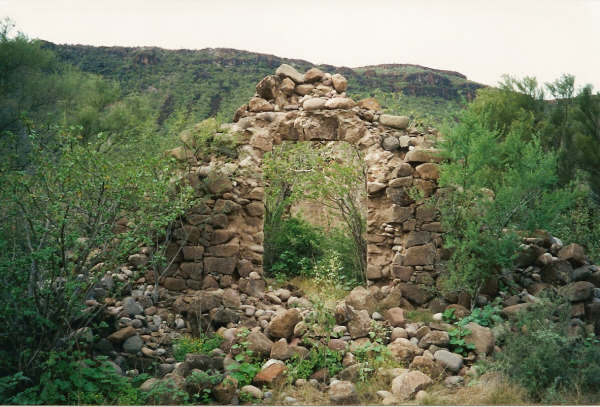
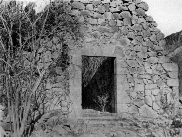
See my Baja Missions web page, featuring photos from Jack Swords, Kevin in OK, academicanachist, Ed Vernon and I: http://www.vivabaja.com/bajamissions/
The years each mission operated are given. However, there is new research always making changes, so we keep an open mind!
Some of the mission names in that Google list are not correct, La Presentacion should be grouped with the Franciscan section (note the date, after the
Jesuits were expelled)... Santa Catarina is the name of the village today, but the mission was Santa Catalina...
OK, back to the Charger game now... |