Open invitation to Nomads and non Nomads. alike.5th Annual nomad trail ride,will be taken place in San felipe,(destination still in the works)
the dates are Feb 19- Monday21 Presidents day.Saturday 19 we will have a get together maybe pot lock, small meeting about the trail ride,Sunday 20 we
will do the ride early in the morning, if you guys have any ideas as where to go place your opinion,Chuck(Bajawarrior), mention that we can do a run
to Gonzaga Bay have lunch in Alfonsinas pay Coco a visit.I was thinking maybe something Local , like the canyons in the San Felipe area, maybe Bajalou
has some input on this.We are open to sugestions on where to go for the ride...You can get to San felipe on your best convinience we will stablish a
meeting place and time. I will leave Friday Morning on the 18th...Don't forget your insurance, coolers for the Pacificos and get ready to have fun...
2008 NOMAD TRAIL RIDE TO MATOMI CANYON
surfer jim - 1-12-2011 at 11:43 PM
I'm in. Prefer to ride the canyons near S.F. as I will continue south for....surf!
I would like to do a ride Saturday also. Looking for ideas.
PREZ DAY WEEKEND 2004 (a look back in time)
David K - 1-13-2011 at 01:30 AM
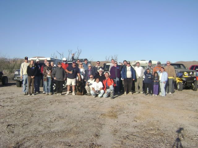
Some images from the '04 Matomi Gang Reunion (a repeat of the fun we had in 2001 for President's Day Weekend):
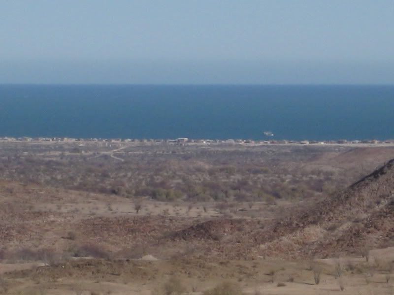
The group camp was at Nuevo Mazatlan (Km. 31)... the former site of Charlie's goat ranch and well from 1919... the name was 'Mexicanized' into Agua de
Chale over the years.
Original tourist camp owner Luis Castellanos Moreno changed the name to 'Nuevo Mazatlan' in 1966 to appeal more to vacationers. Luis planted the trees
creating an oasis back in the late 1960's. The beach is huge, just beyond the trees...
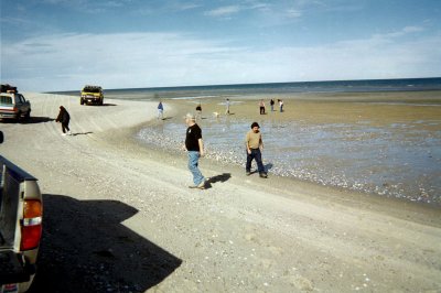
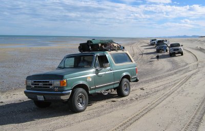
Shell Island was the Saturday excursion... just 3 miles from Nuevo Mazatlan...
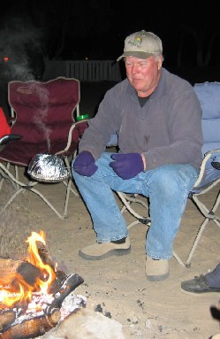
That night, Mexray showed us how to make Jiffy Pop on the fire!
GeoRock enjoyed a cigar...
TW joined us the next morning...
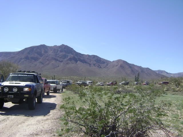
Nine vehicles were in the Matomi Canyon run on Sunday... we made stops along the way to check out interesting rocks or photo ops.
Having a geologist along was great!
The great Mike Humfreville and Mary Ann were with us...
Tunaeater (Paul) and El Comandante Loco (Rudy) at the Matomi Falls...
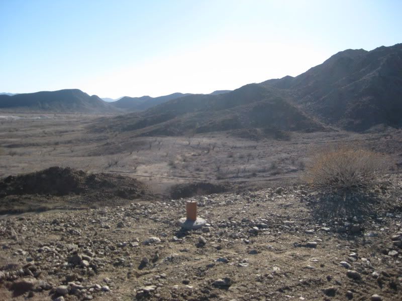
The Group, at Rancho Matomi:
Photo from GeoRock's automatic camera at Rancho Matomi.
From the left: Bob H & Audrey, MaryAnn & Mike Humfreville, Pat & MexRay,
Steve & Edie H, David K, GeoRock & Pete, Bill W & TW.
On the Hummer: Alicia, Sarah, Brittany. In front: Surfer Jim (+Shelby the wonder dog).
Tunaeater & Rudy left before photo taken
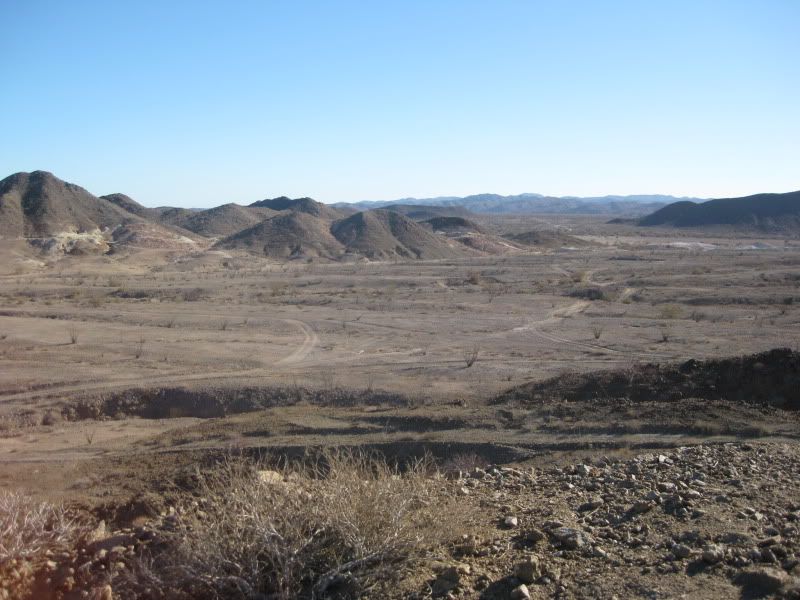
Drive back was down Arroyo Matomi... one of the few dry washes you can drive in for over 30 miles!
Where ever you guys go this President's Day... you will have a blast in the company of other Baja amigos!BajaWarrior - 1-13-2011 at 05:26 AM
Staying local is good too Jose. If we make the run to Matomi Ranch the we'll all know the condition of the wash leading to it. Regardless, it'll be
fun.
So this is a Sunday drive with a feast Saturday night and a Shell Island tour on Saturday as well maybe even sneak in a Sulphur mine trip only 4.2
miles West.
We have plenty of room with two houses on the same property so if someone needs a bed let me know. Also, large lot for RV's if needed.
Let's do this.
BajaRob, are you in? We can put you right up in front on your Polaris.
Can you get the word out for to friends and neighbors?
BajaLou, and El Dorado gang, are you in?
[Edited on 1-13-2011 by BajaWarrior]TMW - 1-13-2011 at 10:56 AM
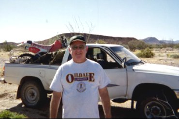
I'm ready. I got a new (used 2004) Toyota and also a newer (2004 XR250) MC than shown in pix above, may or may not bring it. Rudy, Tunaeaters dad,
emailed me and plans to join us too.BajaWarrior - 1-13-2011 at 05:30 PM
Quote:
Originally posted by TW
I'm ready. I got a new (used 2004) Toyota and also a newer (2004 XR250) MC than shown in pix above, may or may not bring it. Rudy, Tunaeaters dad,
emailed me and plans to join us too.
Excellent, and I'm looking forward to meeting the both of you!
Who else wants to get dirty and have fun doing it?
Bump.David K - 1-13-2011 at 06:54 PM
I do, I do...BAJACAT - 1-13-2011 at 09:44 PM
David thanks for the pictures from the previous Matomi gang, and I hope you can join us..
Chuck I like your idea Saturday we can do a shell island trip and then later a quick trip to the sulphur mine and then the feast on saturday night..On
Sunday to Matomi driving down the wash is fun.
Does anybody know what happen to Will ( Gadget)..?surfer jim - 1-14-2011 at 11:23 AM
For anybody thinking about joining the ride that hasn't been before I thought some details might be helpful.
Vehicle: I would think any pickup/suv should be able to do this trip. 4 wheel drive may be needed but depends on route. . Good tires are necessary.
Area is mostly "flat". No hill climbs/ water crossings. You should not expect any damage to vehicle .
Radio: CB radio is useful but not needed.
Travel: We have trail leader and a "sweep" vehicle to lead and follow so nobody gets stuck/lost/ect. Speed is slow and safe ( 20mph?) and FUN.
Frequent stops to take photos/explore.
Camping: We usually have a "central" location where most people meet . Anyone is welcome or stay wherever you like and just meet for the ride.
People: Some will have known each other for years - many others will know each other only through NOMADS forum - time to put a
face on those screen name.
Overall: Casual fun trip for all ages. If you want to explore some remote area in the safety of a group this is the time.
Note: Since destinations are not yet determined 4 wheel drive may be needed/advised.
[Edited on 1-15-2011 by surfer jim]David K - 1-14-2011 at 11:39 AM
The condition of Arroyo Matomi if you guys go that way just may warrant 4WD. I needed to pull Westy down the Matomi wash as the gravel/ sand was too
deep for his Baja Bug to fight through (in 2001). Also, the steep grades and big rocks between Valle Chico and Rancho Matomi may be better done in
4WD... Good driving skill may get through in 2WD, however. Wild Bill driving LN's 2WD Cherokee got in and out okay in 2001.
4WD: It is better to have it and not need it... than to need it and not have it!BAJACAT - 1-15-2011 at 11:54 AM
Quote:
Originally posted by surfer jim
For anybody thinking about joining the ride that hasn't been before I thought some details might be helpful.
Vehicle: I would think any pickup/suv should be able to do this trip. 4 wheel drive may be needed but depends on route. . Good tires are necessary.
Area is mostly "flat". No hill climbs/ water crossings. You should not expect any damage to vehicle .
Radio: CB radio is useful but not needed.
Travel: We have trail leader and a "sweep" vehicle to lead and follow so nobody gets stuck/lost/ect. Speed is slow and safe ( 20mph?) and FUN.
Frequent stops to take photos/explore.
Camping: We usually have a "central" location where most people meet . Anyone is welcome or stay wherever you like and just meet for the ride.
People: Some will have known each other for years - many others will know each other only through NOMADS forum - time to put a
face on those screen name.
Overall: Casual fun trip for all ages. If you want to explore some remote area in the safety of a group this is the time.
Note: Since destinations are not yet determined 4 wheel drive may be needed/advised.
[Edited on 1-15-2011 by surfer jim]
Thanks Surfer Jim, for elaborating more on the trip, for the
destination still in the works Im going to have to really in the SF area nomads to gater some intel, on whats available due to past rains.But what
ever it is its going to be fun..be prepare 2 spares, maybe extra fuel tires plugs air comp, you guys know the drill..
[Edited on 1-15-2011 by BAJACAT]David K - 1-15-2011 at 01:12 PM
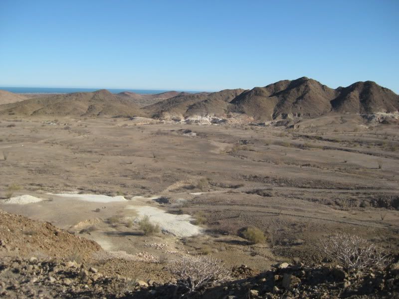
The eastside San Pedro Martir canyons are a great set of destinations for day trips or weekend explorations.
Arroyo Matomi is the southernmost, has palms and year-round water to the ranch site.
Arroyo Parral is the next one (going north) and if the gate is open, one can drive to within a mile of the ranch site (road was washed out to te
ranch). Palms, water, beautiful.
Arroyo Berrendo is next with blue palms on the canyon floor and also growing out of the sides of the cliffs above. A half mile walk along the stream
brings you to a huge boulder grotto. One rock is the size of an office building.
Arroyo Carrizo had a fence blocking the road into the canyon. A short hike didn't show us much in 2004.
Arroyo Agua Caliente has a cool running mountain stream and 140ºF hot water spring that creates a hot water stream that runs for several hundred feet
before it merges with the mountain stream... Hot and cold running water in Baja! A palm and corral are reported to be past the hot spring... No palms
below the spring, however. It was reported the ejido cut them down. Big flash floods would also make it hard for them in here.
Arroyo El Cajon has some painted rock art at the mouth of the canyon and a stream that runs into the desert. A walk up the canyon soon changes from
desert to mountain climate and vegetation.
There are more canyons between Agua Caliente and El Cajon, as well as more canyons north of El Cajon.
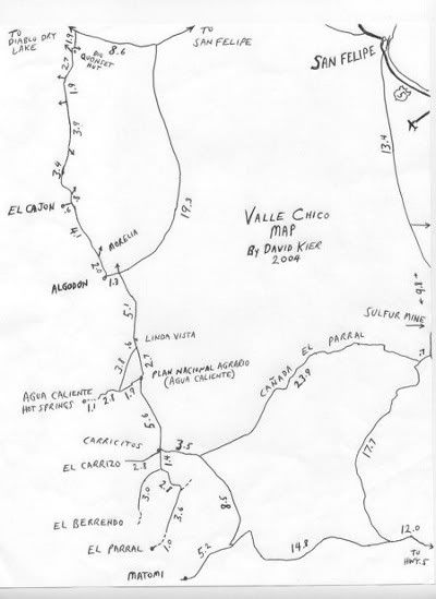
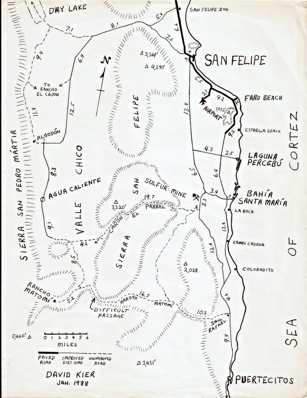
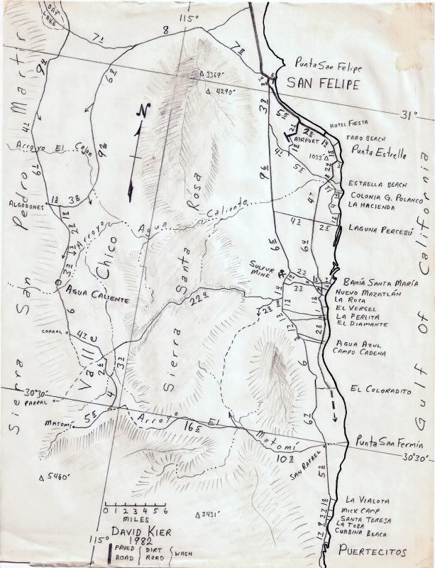
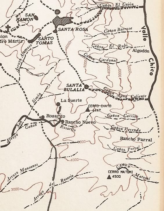
Here are a couple maps I sketched over the years... not a lot changes in Valle Chico.
2004:
1988:
1982:
Robinson's 1972 map, zoomed on the southern half of Valle Chico canyons: El Comadante Loco - 1-15-2011 at 05:50 PM
David:
Great maps!!!
ThanksDavid K - 1-15-2011 at 08:17 PM
It is a great area to explore! BAJACAT - 1-15-2011 at 08:27 PM
SO David are you in.?David K - 1-15-2011 at 11:06 PM
No, sorry Jose... unless I get some work... I am dead in the water here.
Help DK get back to Baja... (and off Baja Nomad so much): Hire him to upgrade your sprinkler system, drains, lighting, drip irrigation!!!
Hey Lou
BajaRob - 1-16-2011 at 12:00 PM
Are you back at the Ranch? Would Diablito and/or Diablo Canyons be a good day trip?
Hey Chuck
BajaRob - 1-16-2011 at 12:55 PM
Yes, yes and yes. Let's do it.BAJACAT - 1-16-2011 at 07:03 PM
BajaRob, that sounds good too. I never been in Diablo canyon..David K - 1-17-2011 at 12:42 PM
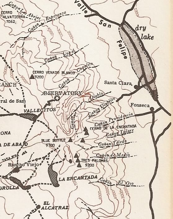
Here is the Robinson map listing each canyon NORTH of El Cajon... and includes Diablo Canyon:
'Cerro de la Encantada' is Diablo Mountain on this map.
[Edited on 1-17-2011 by David K]
Thanks David
BajaRob - 1-17-2011 at 03:38 PM
Wish that you guys could make it.David K - 1-17-2011 at 03:40 PM
Quote:
Originally posted by BajaRob
Wish that you guys could make it.
Keep sending out good wishes... maybe we will if I land a sweet job!BajaWarrior - 1-17-2011 at 08:04 PM
Quote:
Originally posted by BajaRob
Yes, yes and yes. Let's do it.
That's great Rob!
Please assemble our local guys and gals and I guess we should plan a Saturday night feast as well. We can host that no problem.
We can also accommodate overnight guest and there is plenty of room for RV's and we'll extend house privledges to those as well.
Jump in Nomads, it going to be fun!
Contact me (Chuck) if you need anything.
[Edited on 1-20-2011 by BajaWarrior]BAJACAT - 1-17-2011 at 10:39 PM
Thanks, Chuck for your help, this sounds goods already...
So, Shell Island and quick trip to the sulphur mine on Saturday, follow by a feast.Chuck are we doing like last time, people should bring what they
what to each.(you bring it , you cook it you eat it.)...or maybe we can do a pot lock.David K - 1-17-2011 at 11:23 PM
Check the tide calendar for that Saturday... It is a full moon on Friday, and if the tides are near 18'+, then there will be mud to drive through...
it is an island after-all.BajaWarrior - 1-18-2011 at 05:22 AM
Quote:
Originally posted by BAJACAT
Thanks, Chuck for your help, this sounds goods already...
So, Shell Island and quick trip to the sulphur mine on Saturday, follow by a feast.Chuck are we doing like last time, people should bring what they
what to each.(you bring it , you cook it you eat it.)...or maybe we can do a pot lock.
That's the plan. We have three cart BBQ's for speedy cooking of your favorite meal.
Shell Island entrance could be muddy but passable.BajaRob - 1-19-2011 at 12:23 PM
Who is coming?BAJACAT - 1-19-2011 at 07:05 PM
ME.
OK
BajaRob - 1-20-2011 at 11:57 AM
Who else?TMW - 1-20-2011 at 12:02 PM
Me
OK
BajaRob - 1-20-2011 at 04:06 PM
Who else?bajalou - 1-20-2011 at 05:08 PM
Quote:
Originally posted by BajaRob
Are you back at the Ranch? Would Diablito and/or Diablo Canyons be a good day trip?
Diablo is a good day trip. You park to the south and walk over a gravel ridge, then up the canyon. Should be plenty of water. A half mile or so up
the canyon is pools etc.BajaWarrior - 1-20-2011 at 06:26 PM
Quote:
Originally posted by bajalou
Quote:
Originally posted by BajaRob
Are you back at the Ranch? Would Diablito and/or Diablo Canyons be a good day trip?
Diablo is a good day trip. You park to the south and walk over a gravel ridge, then up the canyon. Should be plenty of water. A half mile or so up
the canyon is pools etc.
That's exactly what I want to hear then, sounds like your in Lou, and some E.D.R residents too?
BajaRob, I'm in!bajalou - 1-20-2011 at 07:12 PM
Yes, I'm in - but I'm not in Baja right now to check with other EDR folk.desertcpl - 1-20-2011 at 07:14 PM
Quote:
Originally posted by BajaRob
Who is coming?
I will goBAJACAT - 1-20-2011 at 09:50 PM
I like the Diablo idea, who wants to go to Diablo canyon...?TMW - 1-21-2011 at 09:33 AM
OK with me. I'll go anywhere, anytime for any reason.BajaWarrior - 1-23-2011 at 06:32 AM
Alright we have a good little group so far but we need some more participants to make this an epic event so come on!David K - 1-23-2011 at 11:26 AM
Chuck... would you guys go to Valle Chico via the quartz mountain... then on to Diablo Canyon?BajaWarrior - 1-23-2011 at 07:13 PM
Quote:
Originally posted by David K
Chuck... would you guys go to Valle Chico via the quartz mountain... then on to Diablo Canyon?
That is a good one...I remember it took us 3 hours just to reach Quartz Mtn. from my place and it is all wash all the way.
Let me talk to BajaRob about this one as he is planning his end and people from Bahia Santa Maria.
Otherwise to get to Diablo Canyon would be turn at the road near the Rockodile sign and then out? How far from there? That could be the mellower way
to go but definatley a return route would be with a stop in town for Tacos so I think it's a good way to go then in the morning, via Quartz Mountain.
BajaRob? What say you?
BW El Comadante Loco - 1-23-2011 at 08:03 PM
Hey TW and fellow Nomads
I have 3 more guys who may join us. TW you have met them at my place. Fred and Manuel both from Sacramento and Jeronimo from Crestline... May be
able to get some more guys interested...bajalou - 1-23-2011 at 08:12 PM
The road by the Rockadille sign is closed to anyone except residents, but a mile or so South at the San Felipe Storage is a road to by-pass El Dorado
communities. I think it's only about 35 miles from El Dorado to the canyon, great road most of the way and pretty good the rest. Depending on when
you started, you could come through the Chanote (past quartz cn.) and get to Diablo Cn. at a reasonable time. (I think). Set up for lunch in the
parking area and those wanting exercise can hike over and up the canyon. Coming out, stop at Jose's for a beer or soda.
If any of you that hasn't been in the area want, click on the blue "Valle Chico Area" at the bottom of this post. It will take you to a online map I
made a while back. Put your cursor over a item and the name appears, click on it and sometimes a box pops up with 1 or more pictures of the spot.
Gives you a idea of whats in and around Valle Chico. Diablo is to the north and west of where the map opens up.
[Edited on 1-24-2011 by bajalou]BajaWarrior - 1-23-2011 at 08:17 PM
BajaLou,
I'm thinking that we from our end go to Quartz Mtn. and perhaps all meet there like last time ('09) then on to Diablo Canyon or is that too far out of
your way?bajalou - 1-23-2011 at 08:31 PM
Sounds good Chuck, or maybe meet up at the fossil beds. They are a couple miles south of Morela Jct. and interesting if you haven't been there
before. Quartz mtn. itself is about 10 miles south of the fossil beds. Could work with either one. (I just got back to Baja about 130p today and
haven't rounded up a posse for this yet.)David K - 1-23-2011 at 10:04 PM
This sounds great... Perfect President's Day style run... Geology, 4 wheeling, friendships!
I sure hope things change fast for me so we can go!BAJACAT - 1-24-2011 at 10:16 PM
I see a trip in 2011, with you DK,come on, I promise I will not bug you with Baja stuff, maybe a little.
I like that Idea Lou I like it alot, Santa Martha via Quartz mtn to phosiles site to Diablo and on the return tacos in SF,, that sounds great...
[Edited on 1-25-2011 by BAJACAT]David K - 1-24-2011 at 11:19 PM
"Santa Martha via Quartz mtn to phosiles site to Diablo"
Jose, you better bring me along... if there is any hope of you finding places spelled like that in Baja!! mcfez - 1-25-2011 at 07:34 AM
If there was a earlier invite, we would had come! Sounds like a great ride.
For any if you that needs a secured area for your motor homes or whatever...feel free to email me for use of my lots in Campos Ocotillio, a mile away
from the Rockadille sign .
Have fun....I'll be workingBajaWarrior - 1-25-2011 at 06:35 PM
BajaLou,
I know the condition of the road from Hwy. 5 at (near) the Rockodile sign to Laguna del Diablo but the road from there to Diablo Canyon would it be
passable for a 2WD Nissan Sentra with large off road tires aired down if necessary?
My friend Fernando (Nomad lurker) would like to join us on the trip if possible.
I know last Presidents trip it was hardpack from Quartz Mtn to El Cajon Cyn. and all the way back to Hwy. 5
BWBajaWarrior - 1-25-2011 at 06:37 PM
Quote:
Originally posted by mcfez
If there was a earlier invite, we would had come! Sounds like a great ride.
For any if you that needs a secured area for your motor homes or whatever...feel free to email me for use of my lots in Campos Ocotillio, a mile away
from the Rockadille sign .
Have fun....I'll be working
Plan for next years event, happy to have you along...bajalou - 1-25-2011 at 06:47 PM
Quote:
Originally posted by BajaWarrior
BajaLou,
I know the condition of the road from Hwy. 5 at (near) the Rockodile sign to Laguna del Diablo but the road from there to Diablo Canyon would it be
passable for a 2WD Nissan Sentra with large off road tires aired down if necessary?
My friend Fernando (Nomad lurker) would like to join us on the trip if possible.
I know last Presidents trip it was hardpack from Quartz Mtn to El Cajon Cyn. and all the way back to Hwy. 5
BW
Chuck, it's mostly hard packed and sometimes graded road with a short (1/2 mile?) stretch that is sandy. Large, low pressure tires should have no
problems. The locals use these roads all the time. There are now by-passes for the worst sandy/raced stretches. Tell him to come along.
LouDavid K - 1-25-2011 at 06:50 PM
Lou, how close can a 4WD get to the canyon? How long of a walk to the pool or petros/ metates... What all is there to see?BAJACAT - 1-25-2011 at 07:46 PM
Quote:
Originally posted by David K
"Santa Martha via Quartz mtn to phosiles site to Diablo"
Jose, you better bring me along... if there is any hope of you finding places spelled like that in Baja!!
I know, no wonder when I was asking for directions to Bajia de los
Anjeles,from my trip to San Vorja mition, they where looking at me lile if was on drugs
Chuck can we meet at your house on Saturday, and take off from there to Shell island...what would be a perfect time to start the saturday field
trip....bajalou - 1-25-2011 at 09:53 PM
Quote:
Originally posted by David K
Lou, how close can a 4WD get to the canyon? How long of a walk to the pool or petros/ metates... What all is there to see?
2WD or 4WD - all park at the same place and walk over the hill to the stream bed and up to the pools.Less than a quarter mile on trails over the hill
and maybe 1/2 mile or so up the canyon - or as far as someone wants to walk. You can go clear to the top from here.
Click on the blue "Valle Chico Area" at the bottom of my signature and see some pictures. Almost every icon showing will have a name if you hover the
cursor over it, and many will have pictures if you click on them.BajaWarrior - 1-25-2011 at 10:22 PM
Thanks Lou, I'll pass it on to Fernando.
David, you know him. He was at the event at Pat and Oscars. We happen to work for the same organization.
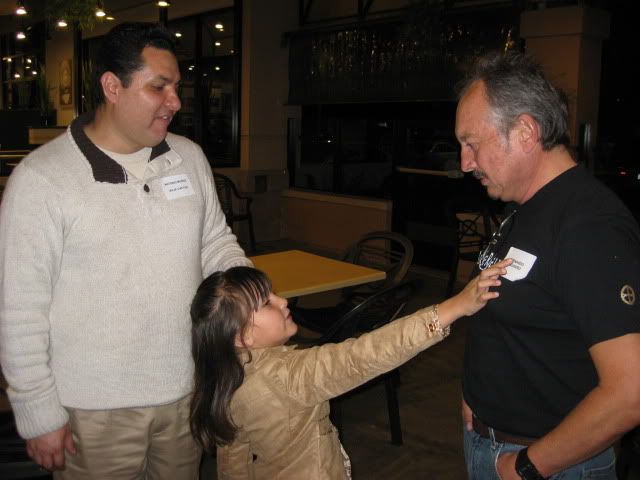
Fernando, looks like your going!David K - 1-25-2011 at 11:16 PM
Quote:
Originally posted by BajaWarrior
Thanks Lou, I'll pass it on to Fernando.
David, you know him. He was at the event at Pat and Oscars. We happen to work for the same organization.
Fernando, looks like your going!
Fernando was very cool at Itzel's event... Here he is (on the right) with 'BajaCactus' and Itzel....
mcfez - 1-26-2011 at 07:39 AM
Quote:
Originally posted by bajalou
Quote:
Originally posted by David K
Lou, how close can a 4WD get to the canyon? How long of a walk to the pool or petros/ metates... What all is there to see?
2WD or 4WD - all park at the same place and walk over the hill to the stream bed and up to the pools.Less than a quarter mile on trails over the hill
and maybe 1/2 mile or so up the canyon - or as far as someone wants to walk. You can go clear to the top from here.
Click on the blue "Valle Chico Area" at the bottom of my signature and see some pictures. Almost every icon showing will have a name if you hover the
cursor over it, and many will have pictures if you click on them.
Real great map Lou!
There's a military post up in the foothills where they can see up and down the valley (we got stopped by them for a inspection). Looks like past the
abandon school house area that is shown on your map. My question to you Lou (or anyone)..anyone with some background info on the history of this
school? Where, when, what's?
I'll make the run next year for 100% sure.bajalou - 1-26-2011 at 08:30 AM
The school was already abandoned when I first started looking around out there in 94. The army has used it as a outpost for several years. You can
usually see a lookout up on the ridge above it. There are a lot or ranches scattered around out there that are off the main roads so at one time a
school probably made sense. Now less people live at these ranches full time.mcfez - 1-26-2011 at 12:44 PM
Quote:
Originally posted by bajalou
The school was already abandoned when I first started looking around out there in 94. The army has used it as a outpost for several years. You can
usually see a lookout up on the ridge above it. There are a lot or ranches scattered around out there that are off the main roads so at one time a
school probably made sense. Now less people live at these ranches full time.
Yes...I know where that lookout is up on the ridge above it. It surprised the daylights out of us!
I had no idea that once upon a time there was so much activity out there. Thanks for the info Lou.
Esperanza Beach
mcfez - 1-26-2011 at 12:52 PM
Is the the road to Esperanza Beach?bajalou - 1-26-2011 at 02:43 PM
Looks like it might be.BAJACAT - 1-26-2011 at 10:33 PM
Chuck can we meet at your house on Saturday, and take off from there to Shell island...what would be a perfect time to start the saturday field
trip....BajaWarrior - 1-27-2011 at 05:24 AM
Quote:
Originally posted by BAJACAT
Chuck can we meet at your house on Saturday, and take off from there to Shell island...what would be a perfect time to start the saturday field
trip....
Hi Jose,
Anytime during the day would be great as Shell Island is only three miles to the North from us. Also, the Sulphur Mine is only 4 miles to the West of
us so maybe we can check that out too.
So get there and we'll figure out who else is coming and we'll get it done.
Today is Thursday and I'm leaving for our Beach House tomorrow morning and won't be back until Sunday night so I'll be off line 'till then.
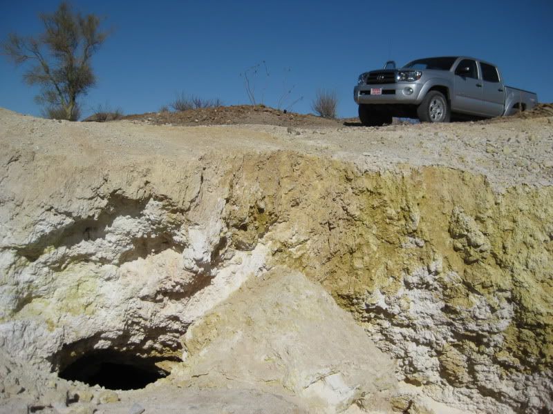
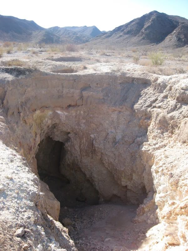
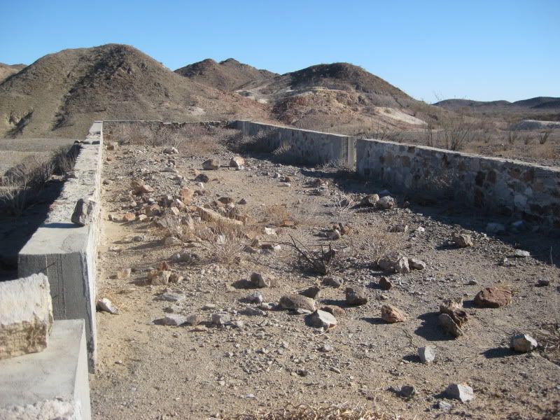
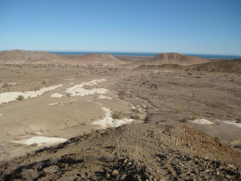
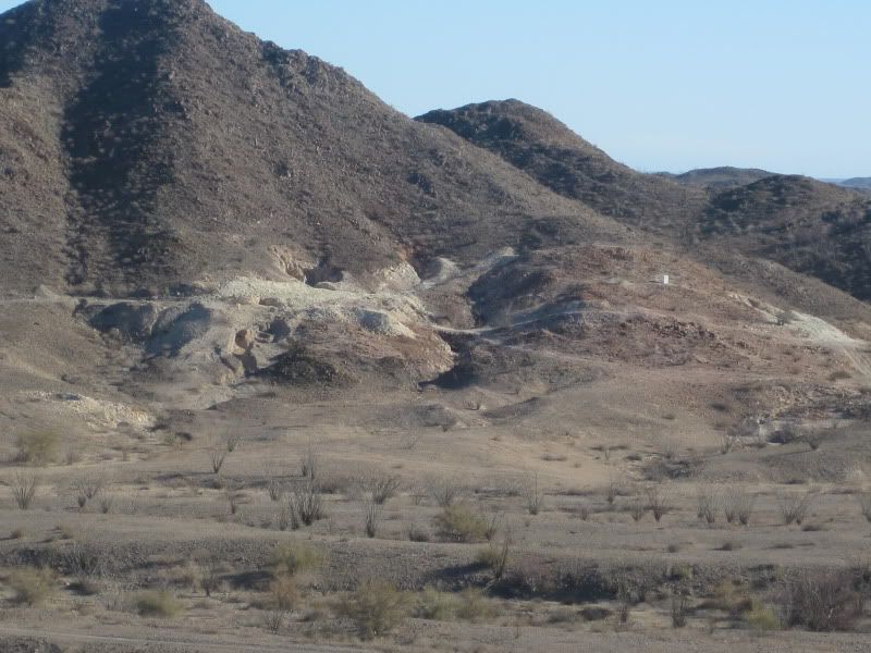
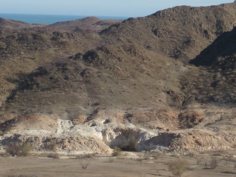
Sulfur (Azufre) Mine 'El Apache'
David K - 1-27-2011 at 10:18 AM
There is a lot to see and poke around in the 2 mile long valley and side gullies...
2010:
Panorama facing east, rotating from north to south:
Here is Bahia Santa Maria, from the sulfur mine, zoom:
2006:
2004 (President's Day):
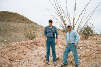
Sarah (13) and I at Sulfur Mine (photo taken by GeoRock)
2001 President's Day Weekend First Group Event:
Amo Pescar, Mike Humfreville and BajaBoy in this photo.
Mike Humfreville
El Camote and David KNeal Johns - 1-27-2011 at 12:21 PM
I'm licking my wounds from $5,000 flood damage so I will not make it this time, have a good one.
NealDavid K - 1-27-2011 at 12:24 PM
Quote:
Originally posted by Neal Johns
I'm licking my wounds from $5,000 flood damage so I will not make it this time, have a good one.
Neal
Wow... Are the books okay?????? Neal Johns - 1-27-2011 at 01:38 PM
House and contents OK, Some backyard washed away and damage to concrete "seawall" between house and Lytle Creek.bajalou - 1-27-2011 at 04:22 PM
Sorry about that Neal - at least it wasn't as bad as the flood in Lytle Creek in 36 or so.
We'll miss you on the run.David K - 1-27-2011 at 06:13 PM
Quote:
Originally posted by Neal Johns
House and contents OK, Some backyard washed away and damage to concrete "seawall" between house and Lytle Creek.
I think since you live in such a dangerous location... what with the annual fires and floods in Lytle Creek, you should bring you books down here for
safe keeping!!
(I am glad the house and you both are fine)!!
Sulfur mine area is cool
mcfez - 1-27-2011 at 06:44 PM
I was told about this place a long time ago....and that it had "yellow rocks" that one can set on fire! So we go and explore.....
And set fire to a rock! Yes...it will catch on fire. Don't breath the fumes though.
The kids went ape when they saw this.BajaWarrior - 1-28-2011 at 05:33 AM
Quote:
Originally posted by BAJACAT
Chuck can we meet at your house on Saturday, and take off from there to Shell island...what would be a perfect time to start the saturday field
trip....
Jose, sounds good. I was hoping to get out to the Sulphur mine but since DK has posted such detailed photos of the area there's not much else to see.
Hopefully he wont post any more photos of Shell island so there is still something left to the imagination...
I was considering a trip to Cabo this spring but can't afford the fuel cost, would you have detailed photos of Cabo as well so I don't have to leave
my living room?
[Edited on 1-28-2011 by BajaWarrior]BajaWarrior - 1-28-2011 at 06:00 AM
BTW, we're leaving in just an hour (Friday Dec. 28th) for the our Beach House so talk to you guys when we get back on Monday.
BajaRob, I'll see ya in camp...BAJACAT - 1-28-2011 at 07:25 AM
Hey Chuck, if we go by DK photos we will never have to leave our house, he has been allover the place
just kidding DK
David who came out with the idea on the firts trip..David K - 1-28-2011 at 09:22 AM
Quote:
Originally posted by mcfez
I was told about this place a long time ago....and that it had "yellow rocks" that one can set on fire! So we go and explore.....
And set fire to a rock! Yes...it will catch on fire. Don't breath the fumes though.
The kids went ape when they saw this.
Here is Lorenzo de Baja lighting a rock on fire (yes, sulfur)!
David K - 1-28-2011 at 09:24 AM
Quote:
Originally posted by BAJACAT
Hey Chuck, if we go by DK photos we will never have to leave our house, he has been allover the place
just kidding DK
David who came out with the idea on the first trip..
It still doesn't come close to being there... you see so much more... as well as feel, hear, smell... all things a photo can't give you.captain4tuna - 1-28-2011 at 09:30 AM
Sounds like fun.....my husband and I are seriously thinking about it......What do we need to do? We are still in the discussion stage yes?
Thanks....RieDavid K - 1-28-2011 at 09:34 AM
Show up in a 4WD or Baja Buggy
Baja Warrior has a home in Playa Hermosa section of Bahia Santa Maria (Km. 31 south of San Felipe)... where most will start from. Camping nearby at
Nuevo Mazatlan (Km. 32) or out on Shell Island (Km. 26), or ???captain4tuna - 1-28-2011 at 12:55 PM
Perfect....See you there....David K - 1-28-2011 at 08:39 PM
I wish!
I have to make some dinero before I can reward myself with another trip to Baja!
It isn't looking real good, so please go and have a great time . Then, please post photos and tell us all about it!
If anyone in San Diego County would like their sprinkler system fixed, upgraded to modern water saving devices, or needs a new one installed... Please
contact me!!
(Amigos, sorry for the shameless plug... but after 30 years of success in this field, I have never seen things so bad and I am maybe too old to learn
a new trick?)BAJACAT - 1-29-2011 at 09:05 AM
Ha, this is looking better already,
I hope you get a quicky (job), so you can join us DK... I will pay for your first 3 fish tacos in SF.BAJACAT - 1-31-2011 at 08:44 PM
whats the fastes way from San Diego to San felipe.Last time i whent I cross in Mexicali, but it took me for ever to get to SF, Im thinking maybe to
used the side toll rd by laguna Salada or maybe the Ojos Negros route....bajalou - 1-31-2011 at 09:34 PM
Probably San Ysidro or Tecate and toll road to Hghy 5.
Mexicali to San Felipe is 120 miles so it takes a while.
[Edited on 2-1-2011 by bajalou]David K - 2-1-2011 at 12:05 AM
5 hours or less from your house to San Felipe, Jose... 250 miles.
Go to Tecate, then east on 2 out of town and onto 2-D... After Laguna Salada and before Mexicali, take the toll shortcut to Hwy. 5... MUY MUY RAPIDO!BAJACAT - 2-1-2011 at 09:45 PM
Quote:
Originally posted by David K
5 hours or less from your house to San Felipe, Jose... 250 miles.
Go to Tecate, then east on 2 out of town and onto 2-D... After Laguna Salada and before Mexicali, take the toll shortcut to Hwy. 5... MUY MUY RAPIDO!
Thanks DK, thats the rout Im taking, I dont like going through Mexicali. I will go SD to Otay and in 20
minutes Im in Tecate, if I go SD to Tecate USA side is like and hour.
I hope you can score some work so can join us... say hi to Elizabeth AKA BAJA ANGEL...David K - 2-2-2011 at 09:02 AM
Thanks Jose... I sold a job yesterday and also had a promissing estimate... The sunny weather helps a lot!
May be??? Are you going solo or is family joining you?BAJACAT - 2-2-2011 at 11:19 PM
Family is going, my kids are ready, they enjoy last time.. The wife is looking foward to eat at RICE & BEANS in the malecon, thats why Im leaving
early Friday morning..(18th)BajaWarrior - 2-4-2011 at 05:25 AM
Bump!David K - 2-4-2011 at 09:31 AM
BajaRob, are you monitoring this thread? Can you post daily weather observations from Bahia Santa Maria for interest and to keep the thread bumped up?
I sure hope you guys all have a great time... There's nothing better than four wheeling with amigos in Baja!BajaWarrior - 2-5-2011 at 08:35 AM
We're getting close gang! Only two more weeks. We have a pretty good group so far but there is always room for more.
Fernando, I'll see you this week, been busy! TW, captain4tuna, all others needing accomidations, lets talk...BAJACAT - 2-5-2011 at 10:23 AM
yes nomads 2 more weeks to join the fun wagon,,
I was told that the brother of the guy that owns Rice & Beans has a restaurant also, has anybody have any input on this, I think the place is
close to R&B... maybe the same block..bajalou - 2-5-2011 at 12:10 PM
Quote:
Originally posted by BAJACAT
yes nomads 2 more weeks to join the fun wagon,,
I was told that the brother of the guy that owns Rice & Beans has a restaurant also, has anybody have any input on this, I think the place is
close to R&B... maybe the same block..
Rosita'sBajaWarrior - 2-5-2011 at 05:06 PM
Quote:
Originally posted by bajalou
Quote:
Originally posted by BAJACAT
yes nomads 2 more weeks to join the fun wagon,,
I was told that the brother of the guy that owns Rice & Beans has a restaurant also, has anybody have any input on this, I think the place is
close to R&B... maybe the same block..
Rosita's
You can't beat the fish filet with garlic sauce at Rositas but the mixer in the Margaritas taste like gasoline!
DK
BajaRob - 2-6-2011 at 09:18 AM
Will do. Today's high will be 70 with clear sky and big wind.
The Weather Underground has reporting stations at EDR (2), San Felipe Beach, Villa Marina KM 8.5 and Percebu.
Just back from Cabo with a side trip to Laguna Hills, the site of this weekends Rattlesnake Gulch Golf Tourney put on by Jimmy Joe and Marianne.David K - 2-6-2011 at 09:21 AM
Hi Rob,
Hope you guys had fun in Cabo! Did you drive down past Gonzaga Bay on the newest pavement? Was there still lots of "bang bang bang" (fist slapping
open palm of other hand)?BajaRob - 2-6-2011 at 09:31 AM
We did it the easy way on the Carnival Spirit and rented a Jeep in Cabo. We spent some quality time with Mike at Lattitude 22 and at Buzzards in
Laguna Hills.BajaWarrior - 2-6-2011 at 05:09 PM
Quote:
Originally posted by BajaRob
We did it the easy way on the Carnival Spirit and rented a Jeep in Cabo. We spent some quality time with Mike at Lattitude 22 and at Buzzards in
Laguna Hills.
Hey Rob,
I'll be down this Friday on a solo trip then back again for the event weekend with the Family. Lets get together and talk about the details of the
trip...
Chuck
Hey Chuck
BajaRob - 2-7-2011 at 09:27 AM
Sounds good. We should get with Lou as the destination is in his backyard.
Rob
Chuck
BajaRob - 2-7-2011 at 12:52 PM
What time would you be available to meet Lou and I @ EDR?
Current SF weather
BajaRob - 2-7-2011 at 02:35 PM
71 f with clear skies and slight breeze. Primobajalou - 2-7-2011 at 02:44 PM