Originally posted by Taco de Baja
| Quote: | Originally posted by Ken Cooke
| Quote: | Originally posted by Barry A.
| Quote: | Originally posted by Ken Cooke
| Quote: | Originally posted by Barry A.
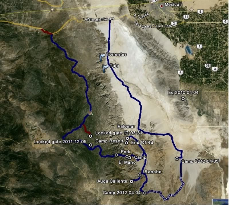
------to be picky----- I question the designation "highway 5 N/S".. Surely that is not correct!?!?!?! Highway 5 would be much further east, it seems
to me?!?!?!?!
Barry |
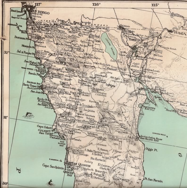
Barry - I utilized GPS data to assemble the map. Trust me, I spent hours on this particular map. |
Hmmmmmmmm, OK I trust you. Maps are sure fun. 
Barry |
N31 51.754 W 115 10.962 |
N31 51.754"; W115 10.962" Does indeed plot on Hwy 5 at a dirt road intersection.
However, your point labeled "HWY5 N/S" on your map is at: N31 46.60"; W115 15.00".
This is at a road intersection a little over 6 miles southwest of Hwy 5 (as the cuervo flies) with a couple of routes that make their way to Hwy 5,
including the N31 51.75"; W115 10.96" intersection.... |


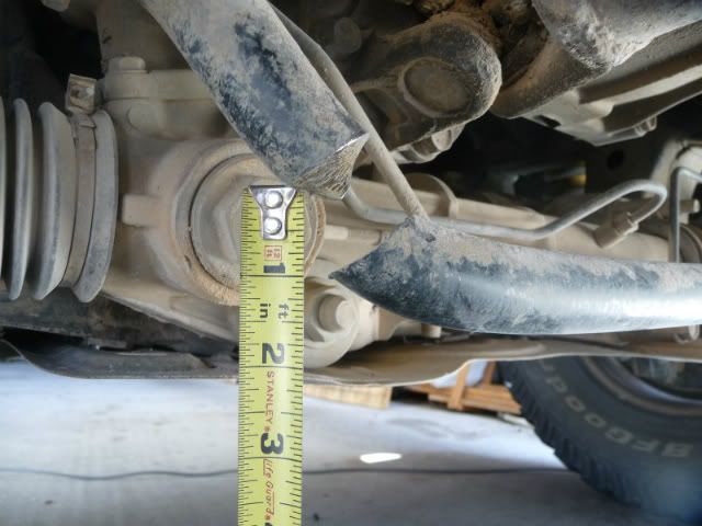


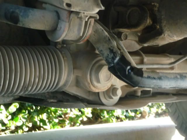
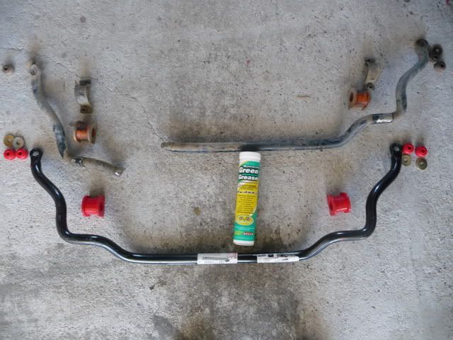
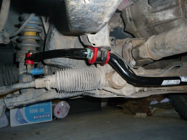
 . Looks like a new anti-sway bar is a little over $100 at the TRDParts4U.com (Toyota of Dallas). Not as bad as I first
thought for a hunk of steel over an inch in diameter (27mm).
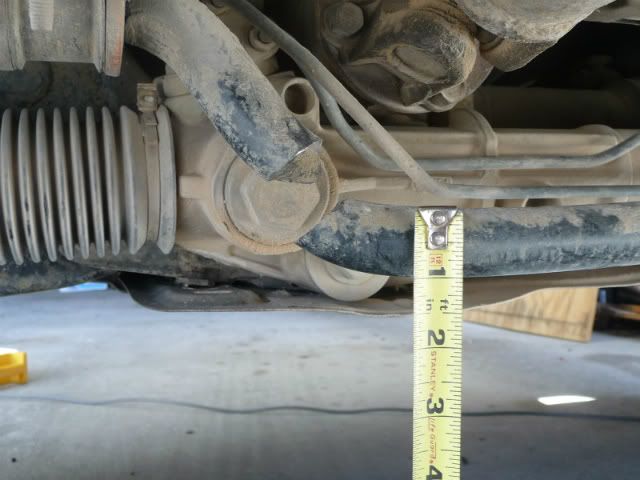
. Looks like a new anti-sway bar is a little over $100 at the TRDParts4U.com (Toyota of Dallas). Not as bad as I first
thought for a hunk of steel over an inch in diameter (27mm). 1st gear and 4-low will creep down most slopes with no braking.