BajaNomad

coast road to San Evaristo

elfbrewery - 11-14-2014 at 01:30 PM

Anyone know what the road conditions are currently like from La Paz to San Evaristo along the coast road? Would like to explore it in a couple weeks.

Cheers!

AKgringo - 11-14-2014 at 01:50 PM

I have been wondering the same thing. Since I am cooling my heels in Centennario in between dental appointments, I should go check it out!
I will give it a go tomorrow and report back.
What I would really like to know, is what is the road headed west from there back to Mex 1 like? I drove it two years ago and there was unrepaired storm damage then that was slow going, but a lot of fun.
Any body been on it lately?
G.L.

sd - 11-14-2014 at 06:04 PM

I went in May 2014. It is a nice drive. Me in a Toyota Tacoma 4WD. Some soft gravel areas. High clearance is nice to have, 2WD would have been OK. A slow drive.

Go and have fun, take food and drinks, nothing there, just fisherman and incredible views.

latina - 11-14-2014 at 06:21 PM

We have done that trip after rain and we used our 4 wheel drive a lot...but the funniest thing was that about halfway to San Evaristo we came across the only other car we saw the whole day...a big old chevrolet...with the lone driver, who was somewhat intoxicated...and relayed that the road was good....I guess he was used to it and we never saw him stuck on the way back...too funny.
Anyways it really is a beautiful drive with some incredible rock formations and lots of great views...Just like sd said make sure you've got lunch and dinner because there is nothing available once you pass the last gas station, including gas....:)

Jack Swords - 11-14-2014 at 06:48 PM

Great way to go is La Paz to Evaristo, then over the mountains through Mission San Luis Gonzaga to the highway and back to La Paz. Several small villages and very nice people.

drove it today

AKgringo - 11-15-2014 at 04:57 PM

I made a day trip to San Evaristo today, if you have driven it in the last few years expect it to be about the same, or slightly better if you were there shortly after the storm in Oct of 2012.
From the Pemex at the junction with hiway 1, it was 67 miles, and driving moderately it took three hours, about half of that was on the last 15 miles!
The paved road to San Carlos is in pretty good shape, with the few assorted potholes and washed out shoulders like most of the roads around here. Do not follow the arrow on the highway sign pointing the way to San Evaristo, it dead ends a few hundred yards later where there used to be culverts. Even mud boggers haven't been using it lately.
Right after the river crossing, turn right then keep left on the dirt road headed toward the beach and cross through the mine's ore loading facility and follow the coast parallel to the mine road. The road has been recently graded and is in better shape than most of the dirt roads I have driven this trip, but there are always a few surprises!
From about mile 50 on, there are rough spots and good road, becoming progressively more challenging heading north. The places where the road runs across or up the arroyos are soft, but I never had to put my hubs in. There are long stretches in the last 15 miles that are one lane, so I don't recommend pulling a trailer past the Portugese camp until you have checked out the road.
In 2012, I took the road through the mountains back to Hiway 1, so I knew where to find the road to see what it was like. I expected to reach a choke point about five miles up the pass, but where I was still in 2wd drive last trip, I was in first and second low range 4wd for about a half mile until I found a place I could safely make a three point U-turn!
I got out and looked for tracks, but mine were the only ones there. I don't know if the road is passable, but I know I wasn't equipped to go find out alone!
If anyone goes through there in a quad or dirt bike, I would sure appreciate a report.
The trip to San Evaristo is certainly worth your while, and early morning is the best light. I'm glad I went!

monoloco - 11-15-2014 at 08:00 PM

Thanks for the report, I'm thinking about heading over there soon.

Jack Swords - 11-16-2014 at 11:51 AM

We do this with several other folks each year. We turn off the highway just S of constitution and go thru Gonzaga (mission, interesting village) and across the stream to the S and thru the mountains to just short of Evaristo. Usually we camp in a dry streambed overnight. We have driven in from Las Pocitas and another route. Very nice people and small villages. Coming down to Sea of Cortez is dramatic. Rarely used 4WD except for exploring other roads (like past Mission La Pasion etc.) We will be in La Paz the first week of December and plan on another trip up into that area this year. Lots of water in the steams even on a dry year. A worthwhile trip.

elfbrewery - 11-16-2014 at 04:39 PM

and thanks from me, too. We'll take the coast road this time and see about doing overland another day. I've wanted to do this trip for several years; this info may make it happen.

David K - 11-16-2014 at 05:58 PM

Post photos please! :light::cool::tumble:

motoged - 11-16-2014 at 06:59 PM

Gracias, everyone for the road info :saint:

Hope to ride there in a month or so...will take lots of pics...

AKgringo - 11-17-2014 at 09:46 AM

Before anyone takes the road through the mountains to San Evaristo, I thought I should update my concerns about the dramatic descent toward the Sea of Cortez that Jack Swords so aptly described.
In 2012, on the grade climbing up from the junction with the Evaristo road, I crossed a very narrow section of road that was stripped down to bed rock. It was also quite a side slope, and if the approaches to that spot, or some other one are any worse than before, getting stuck is the least of your worries!
I wanted to get a look at it, but as I said before, the road below that section was washed out so badly that it was very slow rock crawling. An old man with an old dog can easily drive in further than they could walk out, so I turned around three or four miles short of the cliffs.
I also need to repeat that in one of the only places that still had dirt on the road, there were no tracks!
If anyone wants to have a go at the trail in the next week or so, U2U me, I might be up for an overnighter.
G.L.

4x4abc - 11-17-2014 at 10:37 AM

drove up San Evaristo yesterday
road good
the mountain pass is impassable
saw AKgringo's tire tracks
it will take a long time before they get the dozer out there

I have rebuilt the pass many times with my own hands (a few strong friends are an asset)

http://carlosnpainter.smugmug.com/Travel/Baja-California-Nov...

AKgringo - 11-17-2014 at 11:45 AM

4x4ABC, Thanks for a second opinion! I am curious, how far up the pass did you go, and what were you driving?
Also, I own a dozer, and would hate to have to fix that road with steel tracks without front loaders or trucks laying out some fill on those rocks.

motoged - 11-17-2014 at 11:58 AM

Great pics....and insight into the best parts...Thank you :saint::cool:

4x4abc - 11-17-2014 at 07:08 PM

Quote:
Originally posted by AKgringo
4x4ABC, Thanks for a second opinion! I am curious, how far up the pass did you go, and what were you driving?
Also, I own a dozer, and would hate to have to fix that road with steel tracks without front loaders or trucks laying out some fill on those rocks.


I just had a quick look at the first grade and decided not to continue
damage is usually quite extensive after major storms
only a dozer can fix that in a reasonable time
but nobody really needs the road

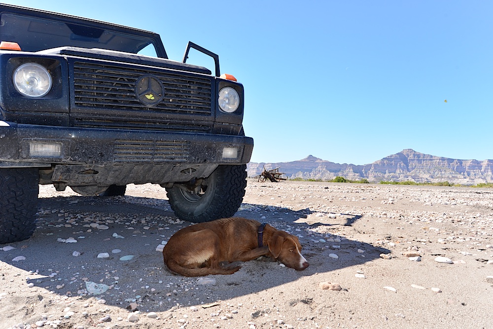
drove a G500 yesterday

motoged - 11-17-2014 at 07:22 PM

Quote:
Originally posted by 4x4abc
....drove a G500 yesterday


And????? How was it?

4x4abc - 11-17-2014 at 08:15 PM

how was the car?
the finest

how was the drive up the coast?
divine

4x4abc - 11-17-2014 at 08:24 PM

will you ask "What are you wearing?" next

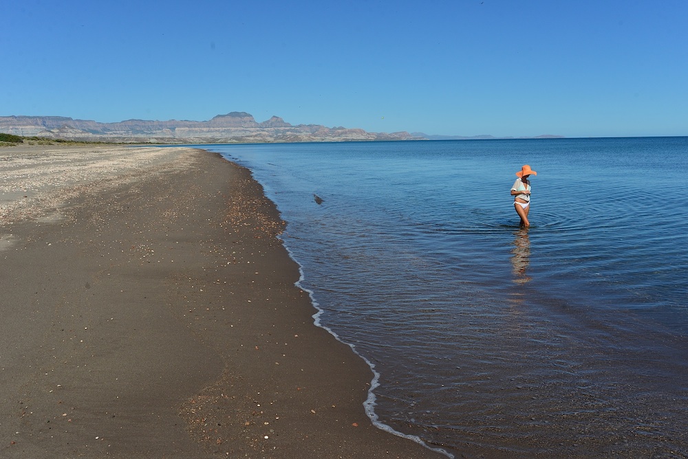
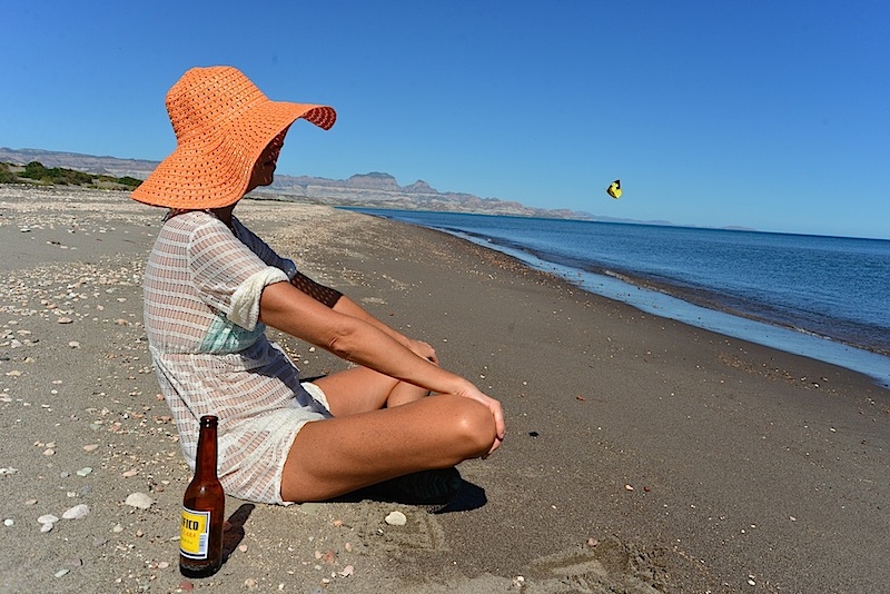
I can show you what she was wearing


and she talks to butterflies


guess, I will need to wash the car


dtbushpilot - 11-17-2014 at 08:24 PM

Great pictures and trip report 4x4, thanks for the link.

Genecag - 11-17-2014 at 11:31 PM

wow, great trip and report!

David K - 11-18-2014 at 12:16 AM

Quote:
Originally posted by 4x4abc
drove up San Evaristo yesterday
road good
the mountain pass is impassable
saw AKgringo's tire tracks
it will take a long time before they get the dozer out there

I have rebuilt the pass many times with my own hands (a few strong friends are an asset)

http://carlosnpainter.smugmug.com/Travel/Baja-California-Nov...


Nice job!


AKgringo - 11-18-2014 at 08:31 AM

4x4abc, I gotta ask, did you take the work party picture, or are you the supervisor on the left? Oh well, what are friends for if you can't use them?
By the way, I now have another case of vehicle envy.

4x4abc - 11-18-2014 at 11:50 AM

I took the pictures - but I worked as hard as the others (pictures in between)

[Edited on 11-18-2014 by 4x4abc]

David K - 11-18-2014 at 02:48 PM

Harald, thanks for the photos... I looked at the smugmug site and saw how one can post photos from it that will fit Nomad's size restriction of 800 pixels:

1) Click photo thumbnail photo to share.
2) Click the 'Share' on the lower left of the enlarged photo.
3) Click on 'Copy' to the right of the 'Large' link from the many choices (Tiny to Original) for 800 pixel images.
4) Paste that link on your Nomad post by clicking this button: and pasting the link in the place provided that pops up. Click OK.

Multiple photos, add an extra space between the links.

Examples:


This is an 800 pixel wide photo, 200 less than the ones first posted in this thread.

More from Harard...

Mission San Luis Gonzaga Chiriyaqui, founded July 14, 1737:


Just wonderful, thank you!

[Edited on 11-18-2014 by David K]

motoged - 11-18-2014 at 04:09 PM

David,
I post all my pics from Smugmug and don't have to diddle around with any of that. :light:

And Harald posted pics on his own as well...

[Edited on 11-18-2014 by motoged]

4x4abc - 11-18-2014 at 05:01 PM

so many pictures - so little time

David K - 11-18-2014 at 05:28 PM

Quote:
Originally posted by motoged
David,
I post all my pics from Smugmug and don't have to diddle around with any of that. :light:

And Harald posted pics on his own as well...

[Edited on 11-18-2014 by motoged]


Yes... but if you don't pick the LARGE (800 pixel) link to post on Nomad, and put up the original (1000 pixel+) link... you stretch the page OFF the screen. Nomad is 800 pixels wide, not my doing, but common on forums. The text on this page as well as Harold's posted pics are stretched off the monitor, requiring sideways scrolling... or reducing screen size making reading and viewing less that appealing.

90% of the Nomads have honored this request by Doug, and I try to show how easy it is to post the correct size photos to help others.

4x4abc - 11-18-2014 at 07:45 PM

hey David, treat yourself to a good size monitor
I buy them used and none has ever failed

motoged - 11-18-2014 at 08:08 PM

Yes, scrolling the page sideways an inch or two is such a chore. :lol:

David K - 11-18-2014 at 10:59 PM

Quote:
Originally posted by 4x4abc
hey David, treat yourself to a good size monitor
I buy them used and none has ever failed


Well, it's not hard to pick the correct link, I was only offering assistance. Doug can come here and resize it for you, as he does in other threads... Just trying to save him the effort.

I sent you a u2u question about the mission photos earlier...

Alan - 11-19-2014 at 09:45 AM

Quote:
Originally posted by Jack Swords
Great way to go is La Paz to Evaristo, then over the mountains through Mission San Luis Gonzaga to the highway and back to La Paz. Several small villages and very nice people.
I looked all over for that road over the mountains last year but never found it so just retraced my way back home.

David K - 11-19-2014 at 09:49 AM

Google Earth is a great way to pre-plan your trip on back country roads, as you can see all roads and note the GPS at forks and junctions using your mouse.

Jack Swords - 11-19-2014 at 11:28 AM

If you preload where you are going into your tablet or smart phone (if it has GPS) you can use Google Earth off line with no connection to wifi nor phone service. Turn on GPS and GE will show where you are. Google maps will do the same thing. I use a Galaxy 11 inch tablet to oversee where I may be going on GE, then turn on the GPS and get unlost. GE lets you store 2 GB of data, so don't use stuff you won't need. Preload, zoom in and out to the levels you will want over terrain you will be on. Dirt roads in Baja show up very well on GE. There are ways with a laptop to store data from GE in files so you can save chunks of 2 GB GE data and therefore be on an extended trip. 2 GB covers lots of getting unlost terrain.

AKgringo - 11-19-2014 at 11:56 AM

Alan, the road/trail is easier to spot heading south down the grade into the first arroyo south of San Evaristo.
The access to it probably changes with every flood or road repair, but generally you need to head up the arroyo looking for a place to double back to find the cut heading kind of southeast up the ridge. It is more or less across the arroyo from the road to San Evaristo.
Hope that helps.

elfbrewery - 12-4-2014 at 02:31 PM

I've added my trip report in Trip Reports. It refers to this thread as well.

The link is http://forums.bajanomad.com/viewthread.php?tid=76653#pid9512...

Current Road Conditions: La Paz to San Evaristo

preston - 8-11-2015 at 06:15 PM

Hi:

It's been a couple of years since I last posted. Personal and job situations have lead me to move to Tennessee ... so no Baja trips from there.

I am planning a trip to San Evaristo from La Paz in mid-October with some amigos from Mexico City. We don't have a of of money, so plan to rent a VW Jetta. I've read through the thread and everybody seems to say that 2WD SUV can make the trip. I need some opinions:

Can I make this trip in a VW Jetta (coastal route from La Paz to San Evaristo)?

Also, another quick question about San Evaristo: we are planning to hire a Panga for some exploration/fishing. From my research, it seems as though there are some fisherman in San Evaristo who are willing to take tourist out. Anybody know if these guys have fishing poles? I'm used to the Panga captains in BOLA and other areas having fishing poles ... but Evaristo is not exactly a hot tourist destination.

Any information will be helpful ... and I will post a trip report ... "my return to Baja".

sd - 8-11-2015 at 07:42 PM

I visited about 2 years ago and visited with several panga fishermen. I did not see any rods or reels. Bring EVERYTHING you will need, food, beer, water, tackle, sleeping bag, tent, etc. Start with a full tank of gas of course.

Always nice to bring these guys some tackle, line, weights - everything will be appreciated.

I was in a Tacoma 4WD. Jetta would be too little clearance for my comfort.

A pretty place!!

Have fun!

AKgringo - 8-11-2015 at 09:53 PM

Preston, I have been there a couple of times, and I agree with SD that unless you are able to pre-arrange something, you will be in a fantastic place with whatever you brought with you.

As far as the Jetta, the locals drive cars like that in there 'IF' the road is in good shape. Driving a fully loaded rental car in there,,,well at least you will have two or three guys to push!

As I stated earlier in this thread, I drove my Kia Sportage in there in 2wd shortly after a storm, but it was just me and my dog and an ice chest in a rig with pretty good tires, gears, and clearance.

elfbrewery - 8-12-2015 at 07:31 AM

Preston,
If you want your trip to go without a hitch, then get 4WD.
If you can't afford it, then go as far as you can comfortably go and have a picnic. The scenery is great up till you hit the squirrelly hills. Then it's deep dirt on the other side to San Evaristo. It is a beautiful village, but finding anything there is a treasure hunt with little result.
Go, but go in safety and resources.

preston - 8-12-2015 at 07:39 AM

Wow .... as always, thanks for the quick responses and information. I think we'll just have to reach deeper in the wallet for a high clearance SUV. Decision made.

And as I suspected, we will need to bring our own fishing gear .... thanks for the confirmation. Should be a great trip!!

Trip report to follow ... still 2 months away.