from a nomad 15 year ago.......
Back when Leo Hetzel was starting his "around the world" trip (which ended with him breaking his leg in Hawaii), he went down to baja becuase he heard
about these points that would fire on a large WNW. After much trial and tribulation (this was before Mex 1), he finally got to where he thought these
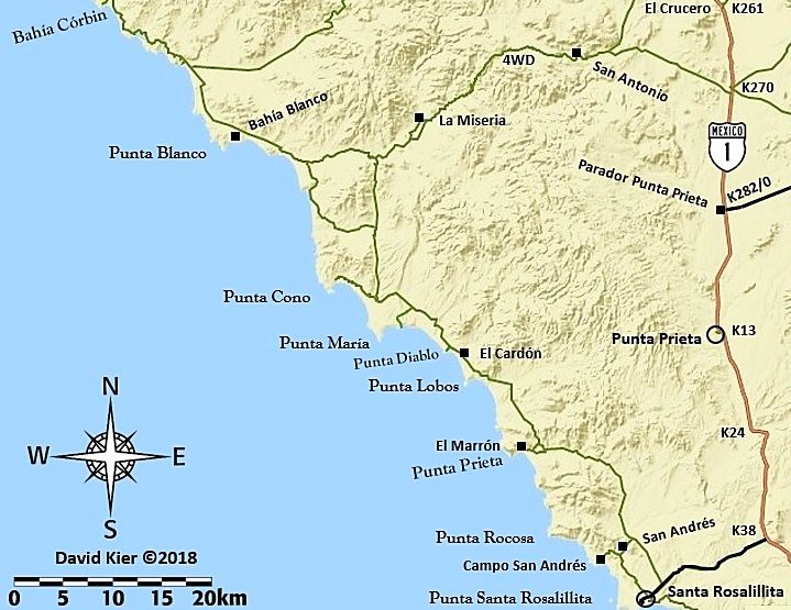
mystics points were, but it also coincided with an unusually long flat spell. Being a patient man, he holed up in a little rancho around where El
Cardon is now, and he waited, and waited, and waited. While waiting, he noticed that the rancheros from the surrounding area would come by once a week
and have a little rodeo. This rodeo would last all day, and after sundown, a party would rage untill dawn. After a few weeks or so, he figured out the
rodeo's main attraction. Since the rancheros all had to work during the week, he was able to avail himself of the charms of Rosa, Lupita, Carmella,
Xoctil, Angelica, Karina and Catalina. After a few weeks of this, he made the realization that they were all sisters!!! Well, Papa eventually got wind
of what Leo was doing and told Leo to leave or else...
Well, Leo never did get to surf the place, it never broke, but not wanting to disappoint Severson over at Surfer Magazine, he wrote this big article
about how great the place was, and of course he named it the seven sisters!!!!!! |