edm1
Senior Nomad

Posts: 568
Registered: 8-23-2006
Location: Oak Hills, Ca
Member Is Offline
|
|
Solo and First-time Baja Norte Trip - Part 2A
Intro: http://forums.bajanomad.com/viewthread.php?tid=25757
Part 1: http://forums.bajanomad.com/viewthread.php?tid=25799
Part 2B: http://forums.bajanomad.com/viewthread.php?tid=25844
Part 3: http://forums.bajanomad.com/viewthread.php?tid=26053
Part 4: http://forums.bajanomad.com/viewthread.php?tid=26055
Aired-down for a milder ride, but damage has been done
After breakfast (coffee and some pastries for me) I feed my dog and take him for a walk around the
park. There are not too many campers; I could count those I can see to 8. Other campers are still
in bed.
Then, we go back in the RV and drive to a flat clean spot so I can get under to air down the tires
to 30 psi (from 50) hoping that the ride will be softer and so I could go faster on the trail. I
also inspect the RV oil and coolant levels, electrical/electronic components. Next I inspect the
cargo bays underneath, the tire carrier, and the exhaust pipes. At this time I notice 2 things that
need attention: 1) the right-hand exhaust pipe is very loose; 2) my rear-mounted dual-tire carrier
is loose as if the pins are worn out or somehow shows excessive play.
I grab the proper wrenches to tighten the exhaust manifold flange. Three nuts and it's fixed.
Regarding the tire carrier, I decide not to do anything at this time. (It turns out later in the
day that one of the pins had developed a crack).
Before moving on, I drive around the park a little bit to take some pictures. Then it's time to hit
the trail, it's now 8:50AM. I glance at my laptop/GPS and notice it's Friday the 13th; I wish
myself luck; I may need it.
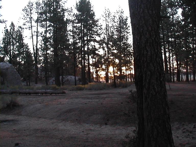
Photo: Laguna Hanson
The trail from Laguna Hanson towards Mex Hwy 3 is not much different than the trail up north. I am
disappointed that airing down from 50 to 30psi has little effect, so I'm back to driving slowly;
it's still a teeth-rattling ride, although a bit milder. While driving I keep an eye on the tire
carrier (by turning on the rear/backup monitor) as I'm now concerned about the possibility of it
falling off (or folding down, as it is a fold-down carrier; a pin holds it upright).
After an hour into the trail, I go down to check the tire carrier. It's bad. The pin that holds the
carrier upright had develop a crack and is ready to break. It takes me a little while to remove the
pin as it has expanded somehow in its hole. Once off, the pin is replaced by a 1/2-inch spare bolt
I had brought. This sets me back an hour.
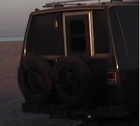
Photo: TireCarrier
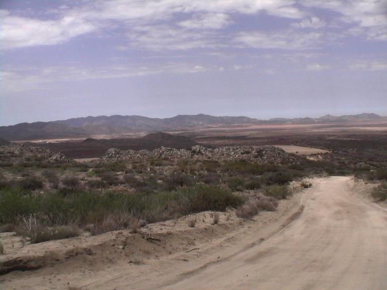
Photo: Mex Hwy3 Approach
It's now 11:00AM and I am relieved to hit the Hwy3 pavement. It's a good highway, I say to myself,
and start to relax and enjoy the local landscape. But it isn't for long. After about 20 miles into
the highway topes start appearing at populated areas of town. (topes = speed bumps). Going over the
first topes isn't too good; it is a jarring experience. The next one is a little better. After
going over a few topes, however, and because of the condition of my tire carrier, I stop and check
the integrity of the carrier again. Bad news; the carrier is loose again because the spare bolt I
had installed earlier is now bent. So, I stop at general stores or hardware-looking
houses/buildings along the way and ask for a pin or tornillo, showing them my cracked pin and/or
bent bolt. After wasting 30 minutes looking for a replacement bolt, I give up and take the advice
of one Mexican to get the bolt in Valle Trinidad, a town about 15 miles away down ahead. Before
proceeding though, I turn the bolt 180 degrees hoping that perhaps the bolt will un-bend.
Then I take the exit to Valle Trinidad, and after half a mile I getv to an auto parts store where I
ask to buy a pin or Grade 8 bolts. No hay pins; but, they have Grade 5 bolts. Great, I said and
bought 6 for $5, just in case these bolts will get bent, too, I thought. I install one of them and
everything is tight. It's now 12:41PM and I'm back on my way.
As I approach the Sea of Cortez it grows warmer, hotter, although I'm getting closer to the sea.
That's not how it's suppossed to be, I mused. It's contrary to the fact that whenever I drive from
Los Angeles to the inland valleys during the summer, it gets warmer, hotter. This is something
different.
Before I reach Hwy5, I go through a military checkpoint. I take my dog out and tie him in the front
winch hook so that the young soldiers can inspect the inside of the RV. The process takes just a
couple minutes. One young soldier asks for my dog's name and if my dog bites and I oblige but say
No to biting (I lie, of course, my dog bites in certain circumstances) and he goes ahead and pets
my dog, before I could get the dog back into the RV. Uzi doesn't bite, this time.
As I turn right into Hwy5 only 3 minutes later, I'm surprised there is another military checkpoint.
WTH, I say to myself, what for? Thank God they just wave me through as if the previous checkpoint
had already relayed to them I've just been inspected.
The drive to San Felipe is uneventful, although the heat is now starting to bother my dog and me.
The breeze is warm contrary to my expectations. Sea breeze is supposed to be cool, right? In San
Felipe I decide to top off my gas tank at the Pemex station and buy some ice, not to mention take
some needed stretch.
In Search of Shell Island - Take 1
The drive along the sea is a pleasant one despite the warm breeze. There are a lot of
unfinished/in-progress developments (resorts, condominiums, etc.) along the way. I'm almost there,
I say, when my GPS position shows just a few miles north of Percebu, and Bahia Sta Maria is just
several miles south.
Since there's still a lot of daylight left, I decide to explore. In fact I don't know exactly where
Shell Island is; all I know is: Bahia Sta Maria is just south of Shell Island. I could have asked
nomads the exact GPS coordinates or the specific trail entrance; instead, I made finding it a part
of the adventure. It couldn't be that difficult given a very small area (NOT!).
If I enter the trail to Rancho Percebu, there must be some trails leading south, I guessed, even if
the GPS doesn't show any. Instead, I see a trail leading north and back to the highway. So, I take
the Percebu trail and drive toward the beach. This area is heavy into development and there's no
way, I say to myself, this could be anywhere near Shell Island which is supposed to be secluded. I
drive south and north along the houses looking for public beach access. No such way. I turn around,
and as I head back toward the highway, I immediately spot a trail leading north, which I take. The
soft sand gradually deepens while I float over the trail (at this time my tires are on highway
pressures - 50psi). Soon the trail parts into a very tight left and a similarly tight right turn,
which makes me stop, since I haven't a clue where each turn leads. I see a couple of houses to the
right and a truck moving towards me.
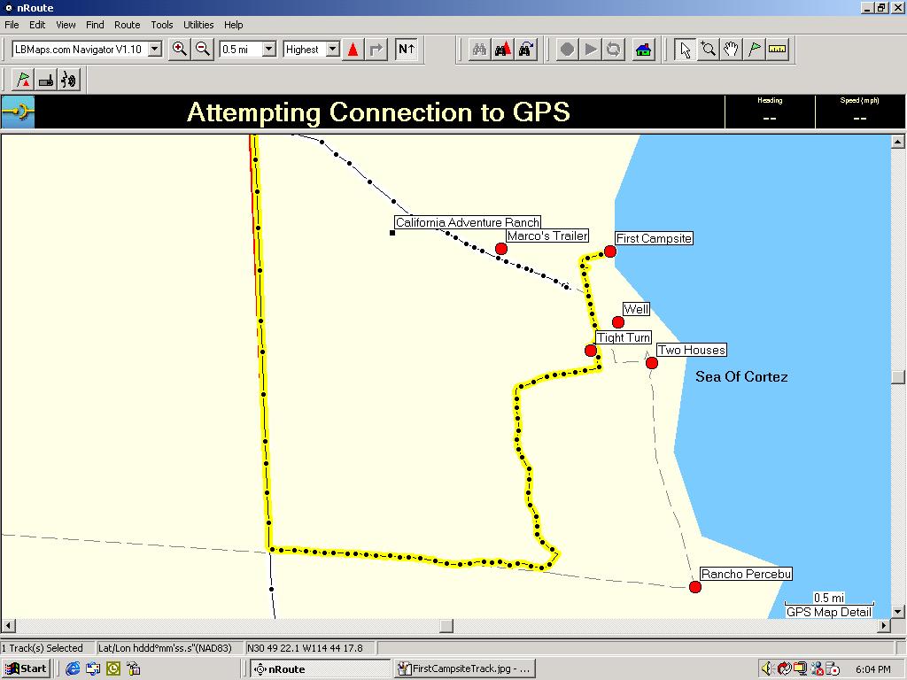
Photo: GPS Track - California Adventure Ranch
An English-speaking Mexican
I decide to take the left turn but that requires a two point turn. As I reverse and turn I feel the
slippage. I shift the RV into neutral, and engage the locker. I resume reversing and the rear
wheels start to dig in. I stop and reach for the shovel in the roof rack over the cab and shovel a
few scoops around the tires. I catch my breath and look around. By now the driver of the truck has
de-embarked and walked my way and he's asking me "are you OK, where are you going? An english
speaking Mexican; his name is Marco. Without being asked, Marco grabs the shovel on the ground and
scoops a few more. I say thank you and take the shovel from him and I scoop a few more. I do not
expect anyone who'd come and shovel for me, expecially someone I've just met by accident. But Marco
is just one hell of a guy. I shift the RV forward first then reverse and another forward and now
I'm totally turned to the trail leading to the north. I get down, pick up my shovel, briefly
exchange pleasantries with Marco (I tell him I'm vacationing from Ca and just driving through the
trails; he's a caretaker / waterman for the ranch north of Percebu, and he lives in a trailer
nearby). As I get back to the RV I yell to him I'll stop by your trailer so we could have a few
drinks.
Stuck in sand for the first time
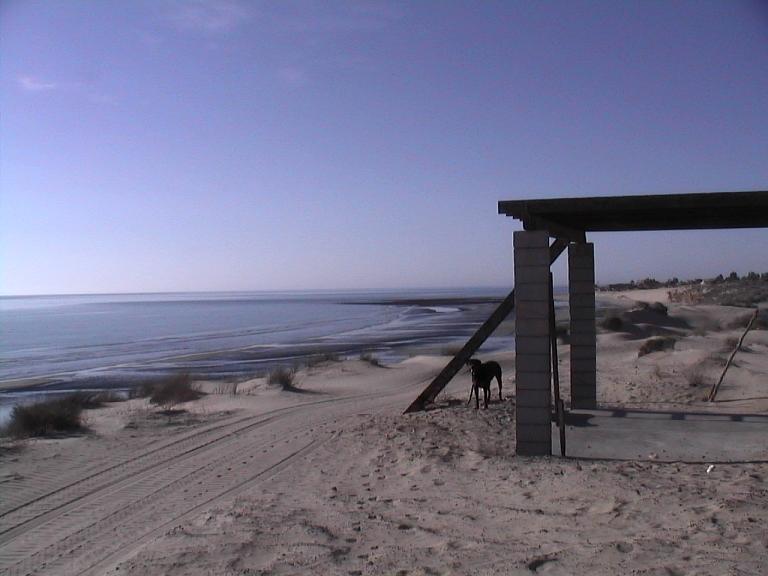
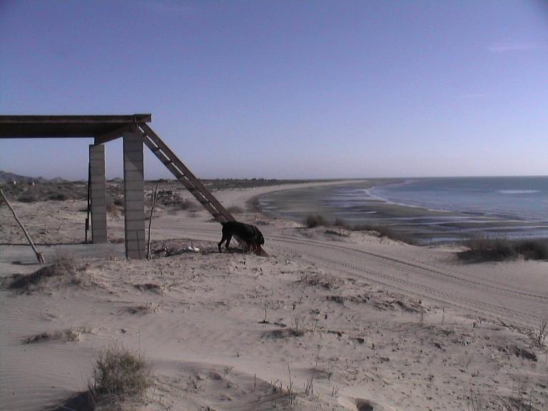
I continue my trek northward until I see a shed/palapa on elevated ground (on sand, of course)
toward the shore and head for it. The turn to the palapa indicates deep soft sand but I see tire
tracks and I keep going and I shoot for the top, right next to the palapa. I almost make it!; not
too bad. BUT I'm now stuck! The differential is still locked and I try to reverse. No good; the
tires are dug in! It's 6:45PM.
Although worried, I resign to getting stranded and take a little breather walk with my dog.
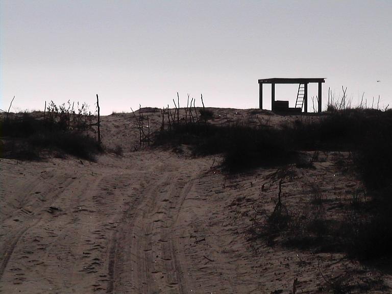
Photo: My first "unplanned" campsite
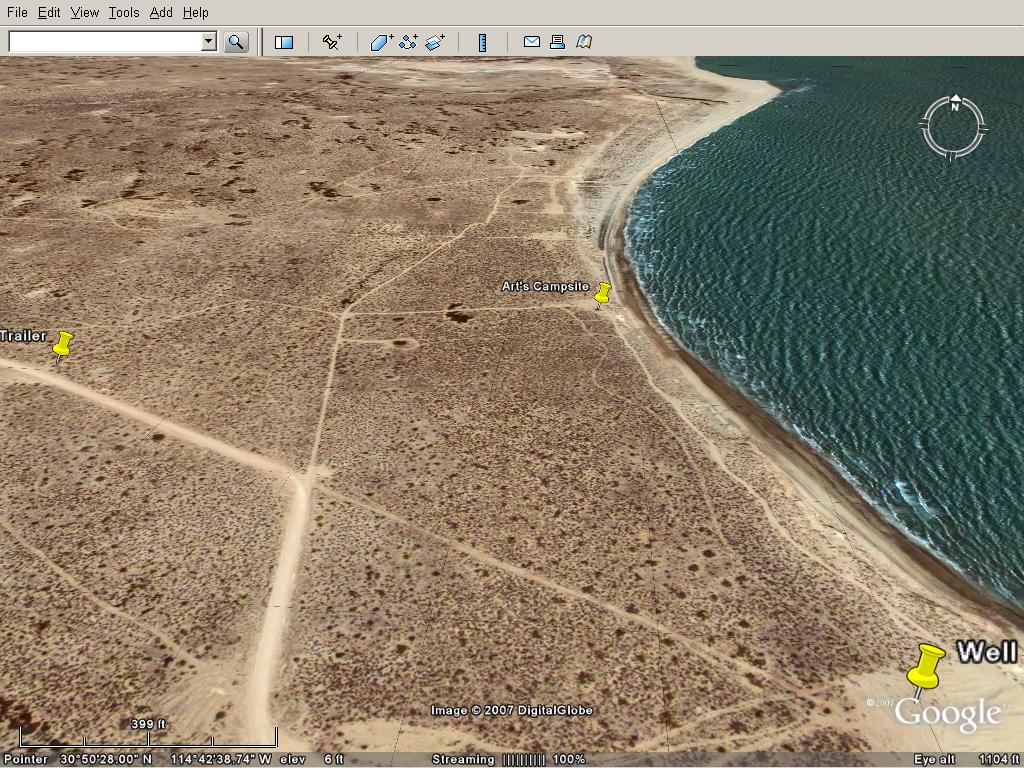
Photo: Google Earth
Before evening hits, I work on getting the RV un-stuck, shoveling, airing-down, etc. It is
re-assuring that I am not the first to get stuck here, evidenced by pieces of plywood, carpet, and
other traction "devices" around. After a few tries and making just a little progress overall
(moving 6 feet only) I soon realize that I could not possibly get unstuck without jacking the RV
up.
My hydraulic jack is about 25 inches tall and extends up to 20 inches for a 45-inches lift. Plus I
have to put a 12X12inch 6-inch thick wood block at the bottom. That means in this situation I have
to dig the sand down to some 30 inches under my RV so that I could position the jack for lifting.
Shoveling sand is very easy but as I shovel 50% of every scoop gets replaced into the hole by
surrounding sand. After a few breaks/gatorades/powerades/etc, I finally get one side lifted to
normal ground level, with carpet before the tires. Now I have to do the other side. With the breeze
now cooling off, and enough break times, it's far from strenous. It feels like I'm enjoying playing
in the sand!
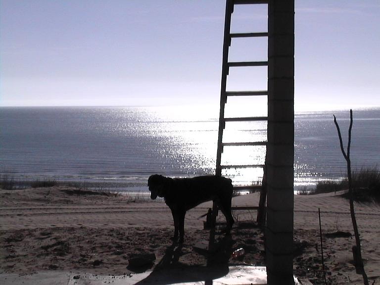
All the while my dog is tied to the ladder (leading to the roof) of the palapa. At one point, his
collar slips off his head and he's free. Fortunately, I spot him 50 ft away and he comes to me as I
call his name. I replace his collar and tag with his choke chain; that keeps him out of trouble.
Now that everything is on normal ground level, I keep debating whether or not to get the RV unstuck
at this time. It is in a perfect camping spot right now and if I back off my view of the ocean will
be blocked. However, on the other hand, what if I need to dash out of here for any reason
(bandidos, etc.)? Well, to help with the decision making, I take my dog for a walk on the beach and
enjoy the seascape and landscape.
Before dark, I decide to get unstuck; I reverse and turn around in a 2-point swoop and settle on
firm ground. It's time to take a shower, dinner over Pacifico and retire for the night.
The night is so quiet and the stars are so bright and "near".
[Edited on 8-3-2007 by edm1]
|
|
|
BAJACAT
Ultra Nomad
Posts: 2902
Registered: 11-21-2005
Location: NATIONAL CITY, CA
Member Is Offline
|
|
You are great story teller edm1, I enjoy your post.I can't see my self driving solo in Baja,will be waithing for more thanks.
BAJA IS WHAT YOU WANTED TO BE, FUN,DANGEROUS,INCREDIBLE, REMOTE, EXOTIC..JUST GO AND HAVE FUN.....
|
|
|
woody with a view
PITA Nomad
Posts: 15940
Registered: 11-8-2004
Location: Looking at the Coronado Islands
Member Is Offline
Mood: Everchangin'
|
|
that sand must be decieving. in the last foto it looks pretty solid!!!
|
|
|
edm1
Senior Nomad
Posts: 568
Registered: 8-23-2006
Location: Oak Hills, Ca
Member Is Offline
|
|
woody, that trail along the shore has more solid ground/sand than not. But the trail leading UP (perpendicular to the shore) to the palapa is deep
disturbed sand.
[Edited on 7-24-2007 by edm1]
|
|
|
edm1
Senior Nomad
Posts: 568
Registered: 8-23-2006
Location: Oak Hills, Ca
Member Is Offline
|
|
| Quote: | Originally posted by BAJACAT
You are great story teller edm1, I enjoy your post.I can't see my self driving solo in Baja,will be waithing for more thanks. |
bajacat, thank you. I'm glad you like it. Part 2B coming up.
|
|
|
|