| Pages:
1
2 |
David K
Honored Nomad
        
Posts: 65436
Registered: 8-30-2002
Location: San Diego County
Member Is Offline
Mood: Have Baja Fever
|
|
BAJA 1/09... So super fine! Part 3: To the 'Choral Pepper' mesa wall site!
This story is continued from Part 2, here: http://forums.bajanomad.com/viewthread.php?tid=36240
=============================================
(made a small edit to this part's title... 'lost mission' is a fun term for the site, but it is really just a mysterious old wall, dam, rock circles,
etc.)
Remember The Baja Book made a comment about the site being 40 miles from Bahia de los Angeles?

Tom Miller was reading the very same book I was...
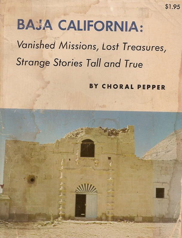 1973 first edition 1973 first edition
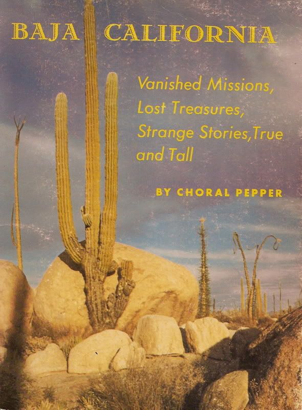 1975 second edition 1975 second edition
The Erle Stanley Gardner party was heading south to El Barril through some really unexplored territory... no roads on any maps much beyond Las Flores!
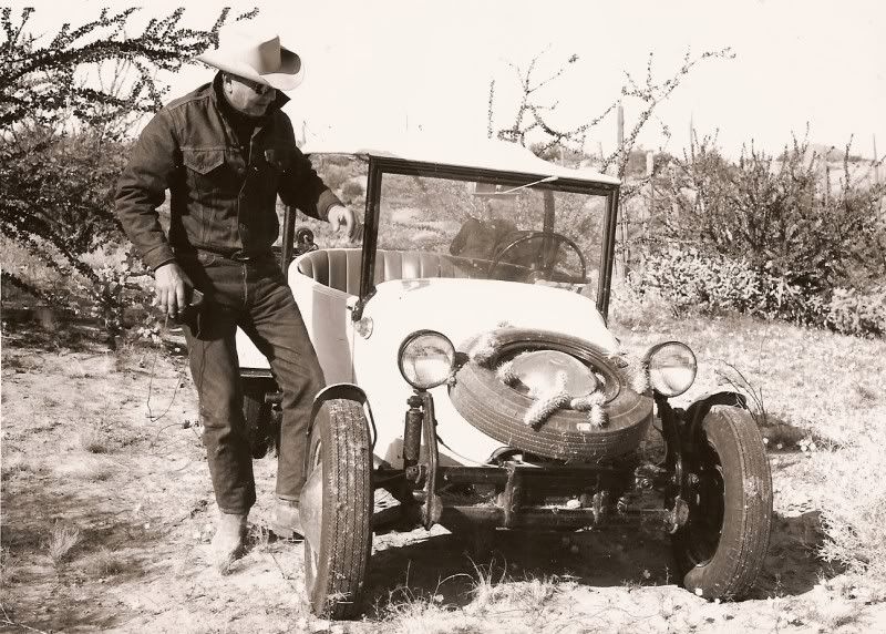
Here is a photo Choral gave me showing Bruce Barron and one of J.W. Black's dune buggies, called a 'Grasshopper'. This photo was likely taken the same
day they found the site.
Anyway, I concentrated my searches along the route the Gardner party made as well as the water hole 'Santa Maria' on the Gulfo Camino Real, shown to
me by Jesus Flores in 2001, who guided Gradner in the early 60's.
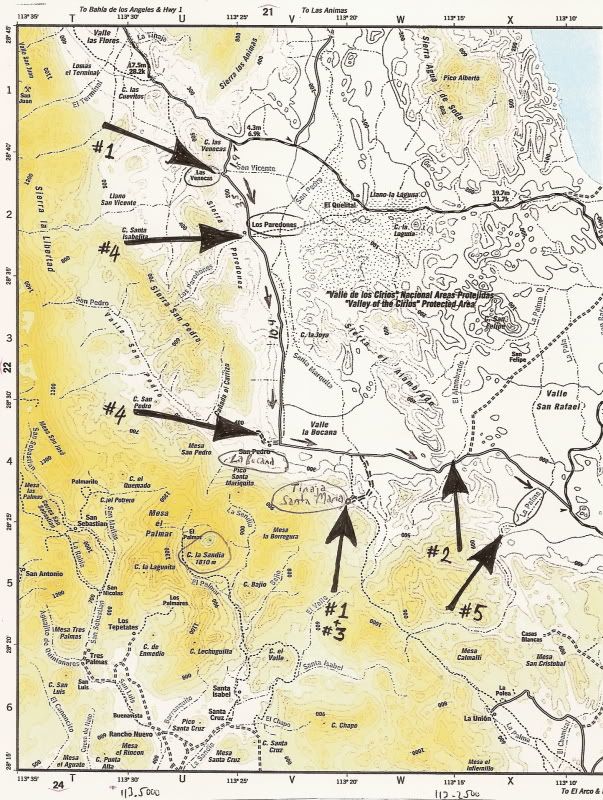
Perhaps it was time to think differently... but still be along the route of the Gardner party!?
The reason Choral gave the site the name 'Santa Maria Magdalena' was due to this Jesuit map of 1757 showing a mission of that name 'started'
(empezada) south of Bahia de los Angeles (and northeast of Santa Gertrudis/ then listed as Dolores del Norte). Here is a close up of that map, with
the mission at the bottom:
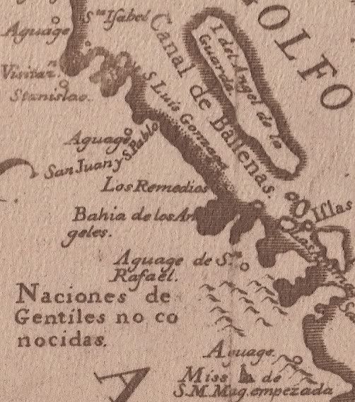
Note that the mission site on this map is south of Bahia de los Angeles and the 'San Rafael' waterhole... Not really the case, but this map was made
by a Jesuit who was never in Baja, using notes he aquired from other Jesuits.
In addition, a bell cast with the name of the new mission 'Santa Maria Magdalena' now hangs at Santa Gertrudis! Since S.M. Magdalena was abandoned,
that bell remained at the closest mission (Santa Gertrudis).
So, off we go... south from Bahia de los Angeles on a perfect Friday morning! Watch out for a couple of DEEP washouts, just south of Camp Gecko's
driveway (4+ miles south of town)!
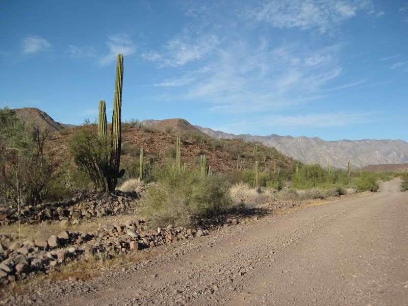
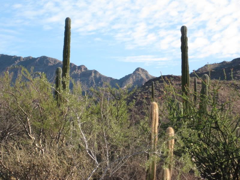

Just the best of Baja! I actually went down this road once before looking for signs of the wall or the distant mountain range seen in the old photo of
the sleeping circles. It was the satellite clue from Sharksbaja that had me return this way!
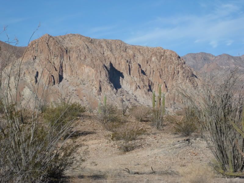
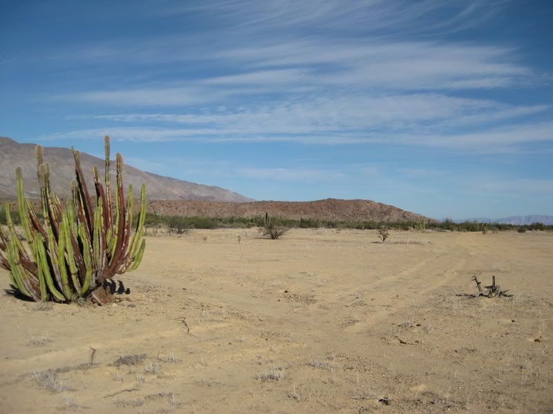
There, in the distance... the volcanic mesa seen in the satellite image!
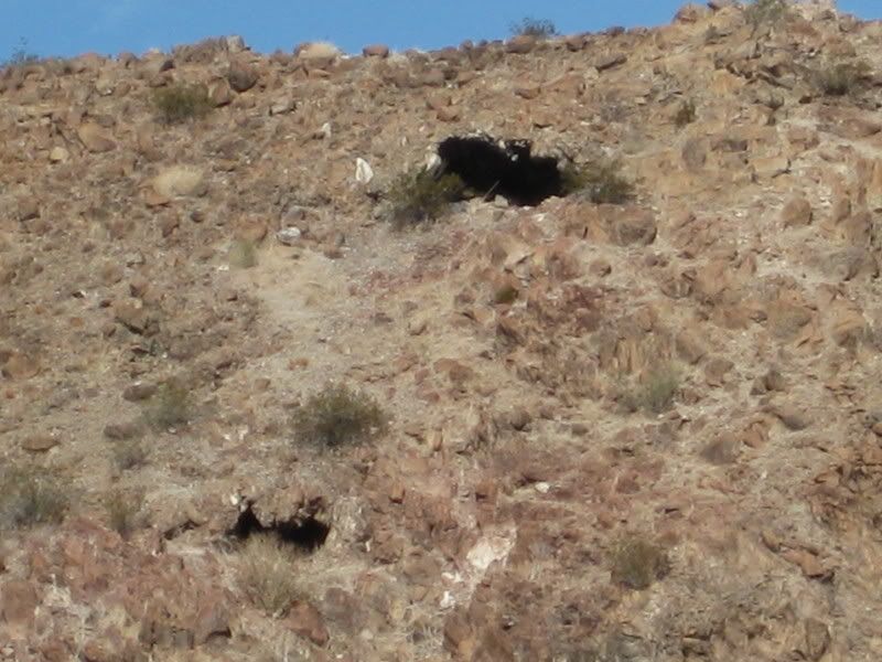
Wow, a big cave!
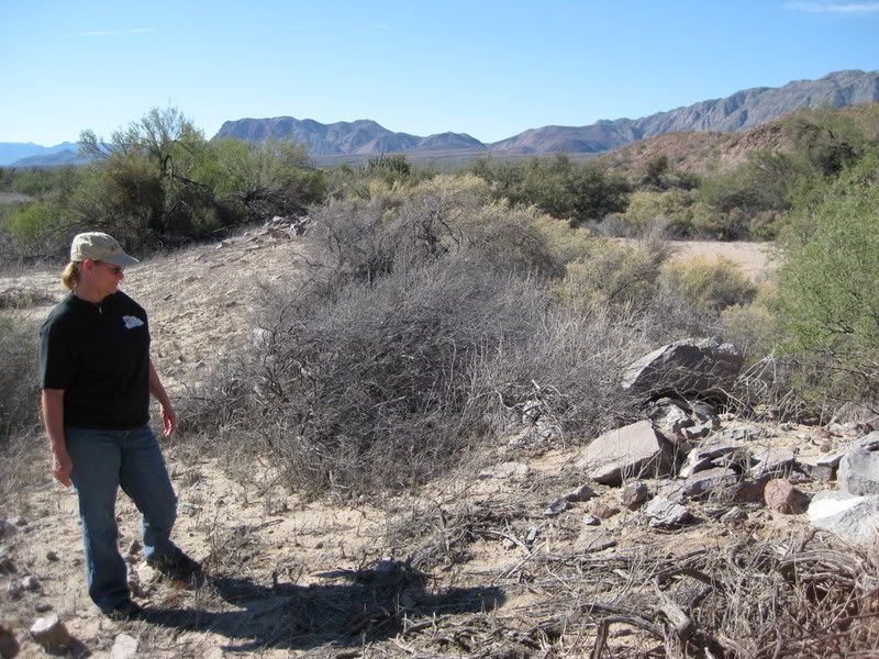
Wow... the remains of a dam and reservoir, below the cave!
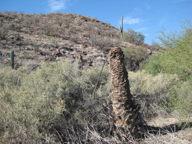
FANTASTIC, the remains of a palm tree... just as Choral described!!! This is 35 miles from Bahia de los Angeles... pretty close to Tom Miller's guess!
Although 'south' isn't totally correct!
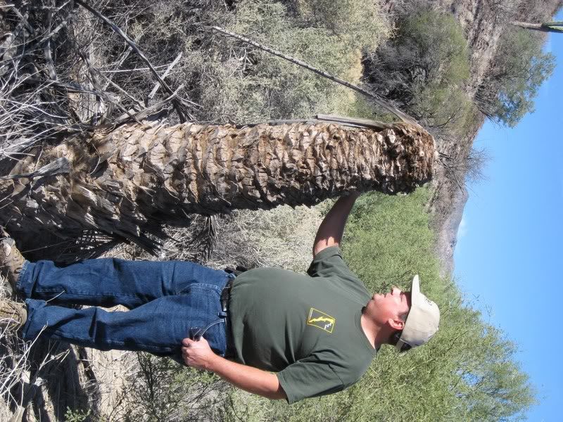
After all these years and searches!!! But, where is the wall that could be seen going up the mountain?
The road we were on splits and a road goes on each side of this mesa and rejoins on the far side... 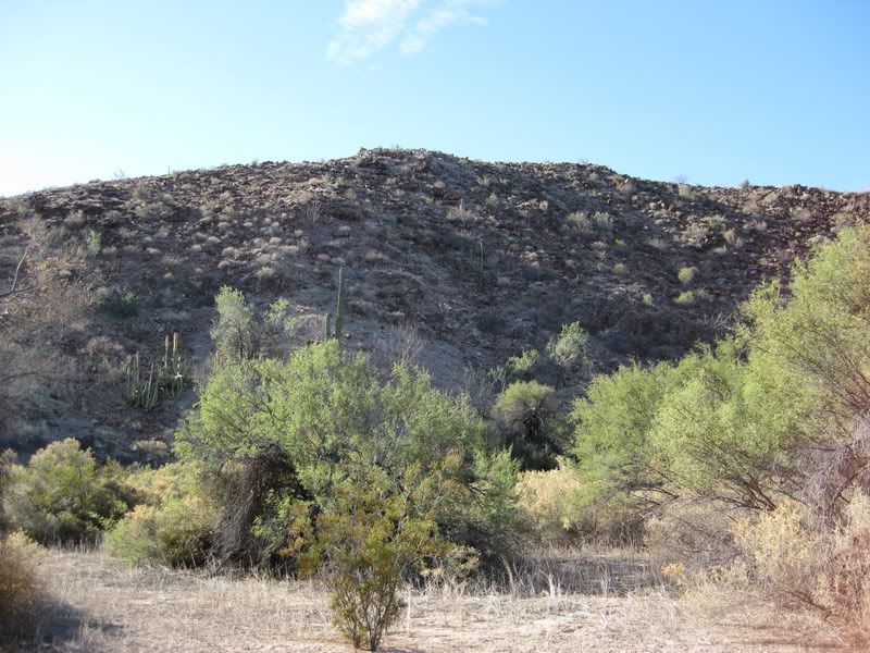
We continued to the other side, circling back around the other side of the mesa...
Oh my, oh my... look up there!!!
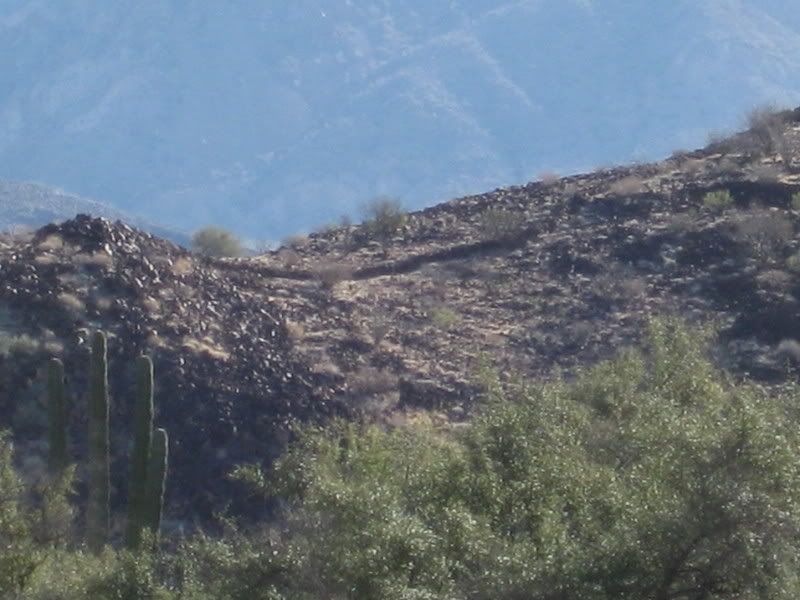
We circle back to the palm tree on the opposite side, then back up just a bit to where we saw the dam to check it out.
I am so thrilled...
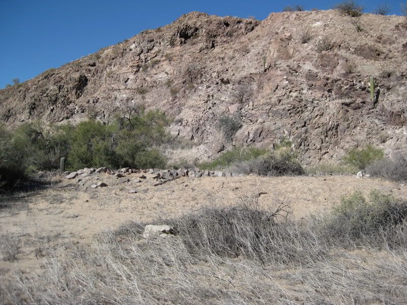
I climb up for a high view of the dam and reservoir...
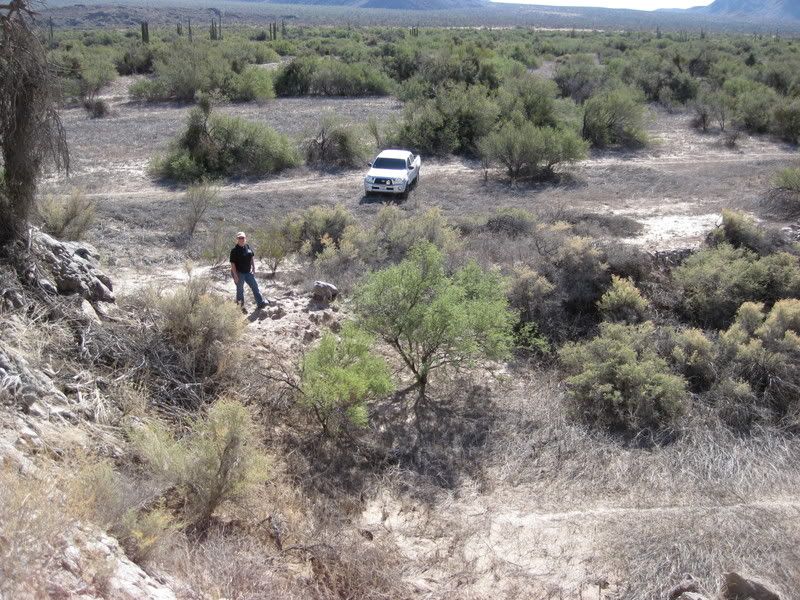
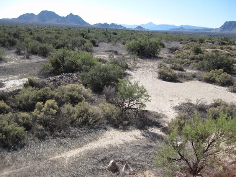
I see that a flume of sorts is along the base of the mesa to direct any rain water flowing off the mesa towards the reservoir, which is at the low end
of the foot of the mesa.
In the next installment, we will climb the steep side of the mesa to the wall(s)... a find the spot where Choral Pepper took Bruce Barron's photo, 43
years ago!
Stay Tuned!
[Edited on 1-6-2009 by David K]
|
|
|
David K
Honored Nomad
        
Posts: 65436
Registered: 8-30-2002
Location: San Diego County
Member Is Offline
Mood: Have Baja Fever
|
|
SOUTH OF BAHIA DE LOS ANGELES in 1966!
The two maps available to travelers of Baja in 1966 were the Lower California Guidebook maps by Howard Gulick and the Auto Club of Southern California
(AAA) Baja map, which Choral mentions in her story...
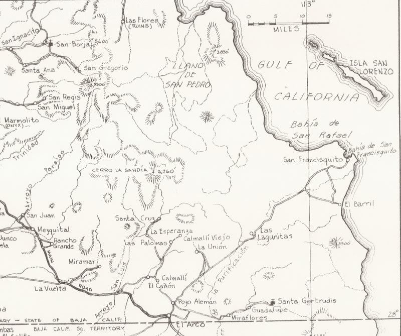
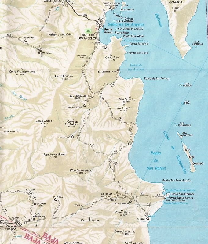
Howard Gulick's map shows the road ending 5 miles south of Las Flores (The railroad terminal platform).
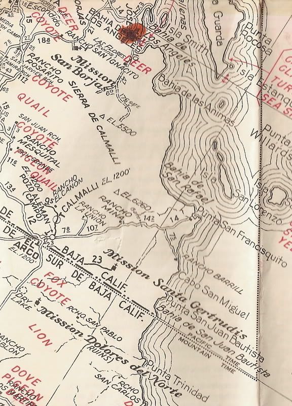
The AAA map has the road (or a different road) splitting 4.7 miles south of Las Flores with the east branch going another 17.6 miles...
Neither map shows a road going back north to Bahia las Animas... and the Gardner party did go there first, after visiting Las Flores.
Jump to 1989...
This map shows BOTH the new graded road and the entire older route...
[Edited on 1-5-2009 by David K]
|
|
|
David K
Honored Nomad
        
Posts: 65436
Registered: 8-30-2002
Location: San Diego County
Member Is Offline
Mood: Have Baja Fever
|
|
SOUTH OF L.A. BAY in 2009!
The best maps today do show a road going north to Las Animas Bay, as well as the original Gardner Party route south through La Bocana Valley. That
1966 road was replaced some 20 years later with the graded road to San Francisquito that went towards Bahia San Rafael instead of down the valley.
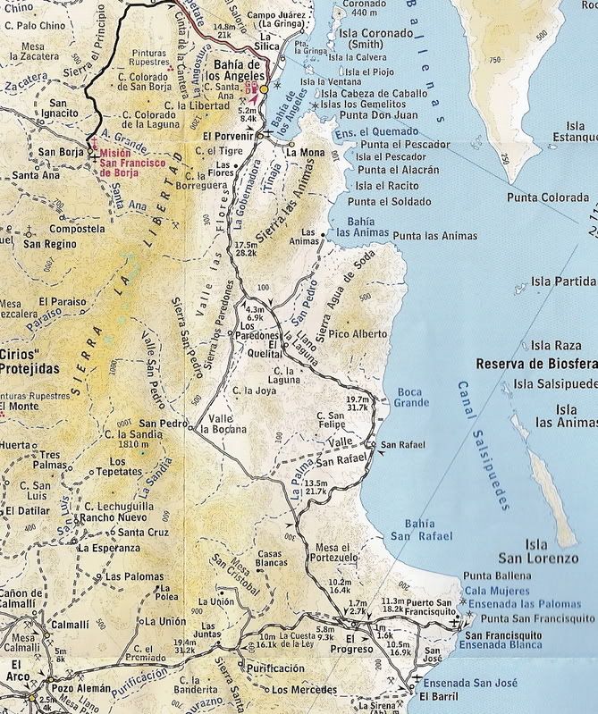
It was when the Gardner Party left Bahia las Animas, going back south, that the palm, dam, wall was spotted...
As it turns out, they were VERY NEAR the shore of the bay...
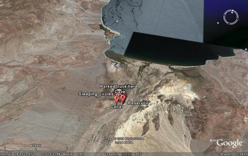
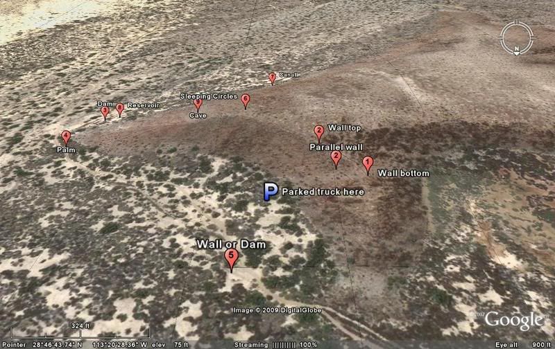
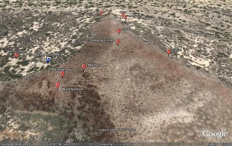
Here are 4 satellite maps with sites we observed, marked:
LOOKING NORTH
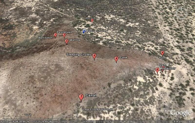
LOOKING WEST
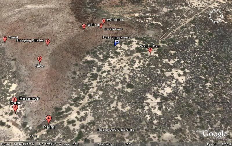
NOTE the 'canal' marker, this is where I saw a big ditch running along the base of the cliff, directing any water off the mesa towards the reservoir.
(thanks to 'avid' for reminding me I got distracted before typing this!)
LOOKING SOUTH
LOOKING EAST
[Edited on 1-6-2009 by David K]
|
|
|
David K
Honored Nomad
        
Posts: 65436
Registered: 8-30-2002
Location: San Diego County
Member Is Offline
Mood: Have Baja Fever
|
|
A good thought!
I would like to share with you some of my reply to a concerned Nomad, about sharing with all of you what we saw and where it is.
The Nomad had a valid point in wondering if the Mexican authorities should be notified and allowed to go over the site before the 'public' was made
aware of it.
As I see it, this site WAS discovered 43 years ago... and WAS published in books and Desert Magazine...
A few days after the discovery, the Gardner Party picked up Dr. Margain, in San Ignacio... Margain was Mexico's head archeologist... and Gardner was
going to show him their discoveries near San Ignacio. I am certain they told Margain all about it...
Mexico has thousands of historic sites, and this is nothing much more than a rock wall, some shells two miles from the beach, and an old reservoir.
When I see known missions allowed to disappear from lack of any action, I doubt if this unknown or uncertain historic site would rate higher.
As I see it, Mexican archeologist and authorities have had 43 years to study the site... and perhaps they already have?
I would be surprised if the local Mexicans have not already walked around the site... in all these years.
Time for the Baja enthusiasts to enjoy the place, create some new excitement, bring some more money south... all of which are good for Mexico.
Thank you for your concern!
|
|
|
Barry A.
Select Nomad
      
Posts: 10007
Registered: 11-30-2003
Location: Redding, Northern CA
Member Is Offline
Mood: optimistic
|
|
I totally agree with your above post, David. Well done.
Barry
|
|
|
David K
Honored Nomad
        
Posts: 65436
Registered: 8-30-2002
Location: San Diego County
Member Is Offline
Mood: Have Baja Fever
|
|
ROAD LOG Jan. 2, 2009
Remember, not all odometers match! Total and (partial) mileages:
0.0 (0.0) Turn left (south) off pavement by Xitlali Market, Bahia de los Angeles on the graded road south.
4.1 (4.1) Camp Gecko road to left, continue south... Deep washouts just ahead, caution!
9.9 (5.8) Las Flores Jail Ruins, 1/4 mile off to the right.
12.4 (2.5) Graded road curves to the left and faint road continues straight, going to the Terminal Canyon cable line terminal. Continue on graded
road.
22.7 (10.3) A faint road to the right is the older route south, going down Valle la Bocana. A car door turned into a sign once marked the turnoff, but
is gone. Continue on graded road.
26.7 (4.0) Turnoff left goes north to Bahia las Animas. Graded road continues straight. Turn left.
33.7 (7.0) FORK, approaching the mesa. Both roads go to Las Animas and rejoin on the opposite side of the mesa. The left branch is the more used route
and runs 2.3 miles before rejoining with the right branch. Go right.
35.0 (1.3) PALM (just after passing near the dam and the edge of the mesa).
35.2 (0.2) Access to climb to the wall is off to the left. More photos from the top of the mesa to follow.
35.9 (0.7) Rejoin with left branch road that came from the fork at mile 33.7.
37.9 (2.0) End of road at lagoon, just past fish camp on the beach at Bahia las Animas.
This report continues with Part 4: http://forums.bajanomad.com/viewthread.php?tid=36261
[Edited on 2-7-2009 by David K]
|
|
|
Barry A.
Select Nomad
      
Posts: 10007
Registered: 11-30-2003
Location: Redding, Northern CA
Member Is Offline
Mood: optimistic
|
|
In your aerial photo looking "north", if you look west of the identified "sleeping circles" but still on the mesa top, there are many light colored
"things" that look like they also may be sleeping circles---------did you walk over that way to see what they were??
Barry
|
|
|
mtgoat666
Platinum Nomad
       
Posts: 20561
Registered: 9-16-2006
Location: San Diego
Member Is Offline
Mood: Hot n spicy
|
|
| Quote: | Originally posted by David K
As I see it, this site WAS discovered 43 years ago... and WAS published in books and Desert Magazine...
As I see it, Mexican archeologist and authorities have had 43 years to study the site... and perhaps they already have?
|
dk, your conclusions are based on many assumptions and few facts. in 43 years antiquities in trade have gone from being "worthless" to valuable. you
have done well in alerting pot robbers. you should take the approach of most of who care, don't publicize locations of sites. period. while you may
have good intentions, there is a thriving illegal trade that doesn't operate with the best of intentions.
i think you really have no accurate knowledge of whether the site is significant, so why take the risk of promoting it? would you feel bad if you
return there in a year and see that someone has dug it up scavenging for artifacts?
|
|
|
David K
Honored Nomad
        
Posts: 65436
Registered: 8-30-2002
Location: San Diego County
Member Is Offline
Mood: Have Baja Fever
|
|
| Quote: | Originally posted by mtgoat666
| Quote: | Originally posted by David K
As I see it, this site WAS discovered 43 years ago... and WAS published in books and Desert Magazine...
As I see it, Mexican archeologist and authorities have had 43 years to study the site... and perhaps they already have?
|
dk, your conclusions are based on many assumptions and few facts. in 43 years antiquities in trade have gone from being "worthless" to valuable. you
have done well in alerting pot robbers. you should take the approach of most of who care, don't publicize locations of sites. period. while you may
have good intentions, there is a thriving illegal trade that doesn't operate with the best of intentions.
i think you really have no accurate knowledge of whether the site is significant, so why take the risk of promoting it? would you feel bad if you
return there in a year and see that someone has dug it up scavenging for artifacts? |
NOTE to all reading my trip report: The removal of historic artifacts is illegal. Don't break the law.
The site is of no value if nobody can see it, explore it, enjoy it. The snakes and scorpions will just have to share the location with us humans who
have the desire and energy to go there. It is our planet, too.
I hope others who have the quest for discovery and to see this location will now enjoy what I have shown here, what was first shown in 1966.
Perhaps your concern should be with the thoughtless Spaniards and/ or Indians who moved all those rocks and disturbed countless animal and insect
habitats, 250 years ago?
Thanks for reading my trip report, please share yours!
|
|
|
David K
Honored Nomad
        
Posts: 65436
Registered: 8-30-2002
Location: San Diego County
Member Is Offline
Mood: Have Baja Fever
|
|
| Quote: | Originally posted by Barry A.
In your aerial photo looking "north", if you look west of the identified "sleeping circles" but still on the mesa top, there are many light colored
"things" that look like they also may be sleeping circles---------did you walk over that way to see what they were??
Barry |
I walked the entire upper mesa as I thought the sleeping circles were to the south of the wall. Elizabeth went to the east... the high point on the
mesa, above the cave and found dozens of sleeping circles all there.
I think what we see in the satellite image of all those other circles are the sweeping effect around shrubs, caused by the wind?
|
|
|
Sharksbaja
Elite Nomad
     
Posts: 5814
Registered: 9-7-2004
Location: Newport, Mulege B.C.S.
Member Is Offline
|
|
| Quote: | Originally posted by David K
I would like to share with you some of my reply to a concerned Nomad, about sharing with all of you what we saw and where it is.
The Nomad had a valid point in wondering if the Mexican authorities should be notified and allowed to go over the site before the 'public' was made
aware of it.
As I see it, this site WAS discovered 43 years ago... and WAS published in books and Desert Magazine...
A few days after the discovery, the Gardner Party picked up Dr. Margain, in San Ignacio... Margain was Mexico's head archeologist... and Gardner was
going to show him their discoveries near San Ignacio. I am certain they told Margain all about it...
Mexico has thousands of historic sites, and this is nothing much more than a rock wall, some shells two miles from the beach, and an old reservoir.
When I see known missions allowed to disappear from lack of any action, I doubt if this unknown or uncertain historic site would rate higher.
As I see it, Mexican archeologist and authorities have had 43 years to study the site... and perhaps they already have?
I would be surprised if the local Mexicans have not already walked around the site... in all these years.
Time for the Baja enthusiasts to enjoy the place, create some new excitement, bring some more money south... all of which are good for Mexico.
Thank you for your concern! |
That is not what I said David. I asked you if it is prudent to expose the exact site to the public before it's examined by professionals. You posted
this w/o really discussing it with anyone. Is that prudent?
You have expressed a desire to save important sites. Just because this not(yet) of historical value doesn't mean it should be considered any less
important.
Please don't downplay the importance of having the place checked out by a knowledgeable archeologist.
btw, after the initial discovery, why was it "lost" if it was documented.
DON\'T SQUINT! Give yer eyes a break!
Try holding down [control] key and toggle the [+ and -] keys
Viva Mulege!
Nomads\' Sunsets
|
|
|
David K
Honored Nomad
        
Posts: 65436
Registered: 8-30-2002
Location: San Diego County
Member Is Offline
Mood: Have Baja Fever
|
|
| Quote: | Originally posted by Sharksbaja
| Quote: | Originally posted by David K
I would like to share with you some of my reply to a concerned Nomad, about sharing with all of you what we saw and where it is.
The Nomad had a valid point in wondering if the Mexican authorities should be notified and allowed to go over the site before the 'public' was made
aware of it.
As I see it, this site WAS discovered 43 years ago... and WAS published in books and Desert Magazine...
A few days after the discovery, the Gardner Party picked up Dr. Margain, in San Ignacio... Margain was Mexico's head archeologist... and Gardner was
going to show him their discoveries near San Ignacio. I am certain they told Margain all about it...
Mexico has thousands of historic sites, and this is nothing much more than a rock wall, some shells two miles from the beach, and an old reservoir.
When I see known missions allowed to disappear from lack of any action, I doubt if this unknown or uncertain historic site would rate higher.
As I see it, Mexican archeologist and authorities have had 43 years to study the site... and perhaps they already have?
I would be surprised if the local Mexicans have not already walked around the site... in all these years.
Time for the Baja enthusiasts to enjoy the place, create some new excitement, bring some more money south... all of which are good for Mexico.
Thank you for your concern! |
That is not what I said David. I asked you if it is prudent to expose the exact site to the public before it's examined by professionals. You posted
this w/o really discussing it with anyone. Is that prudent?
You have expressed a desire to save important sites. Just because this not(yet) of historical value doesn't mean it should be considered any less
important.
Please don't downplay the importance of having the place checked out by a knowledgeable archeologist.
btw, after the initial discovery, why was it "lost" if it was documented. |
I did not post what you said, it is what I said back to you Corky.
So much for remaining annonymous!
Okay Corky, here it goes... I call it a 'lost mission' for the fun of it... It is a fun thing (for me) to go searching for lost missions in Baja...
Lost mission hunting was quite a thing to write about in the 1950's and 60's... when I grew up and first started traveling to Baja.
The truth? THERE ARE NO LOST MISSIONS IN BAJA. Well, at least that's what the hard core history people claim. For a site to be a mission, it has a lot
of documentation and funding... NOTHING other than a Jesuit propaganda map drawn by someone who never was in Baja has ever been written that a mission
of Santa Maria Magdalena or any other name was built or abandoned in that region.
The site is not hidden, it is 'wide open' along a well traveled road, the wall can be seen from the road as well as the palm tree. No reason to
believe that it hasn't been seen by Mexicans or Americans between 1966 and today. The site, if deemed to be of value, would have been researched.
As I said before... the Mexicans 'allow' established and published mission sites to crumble and be plowed over... If they allow verified missions and
visitas to be treated that way, why would they care about this wall?
IF I do not tell anyone where this is, what value is it, ow can it be appreciated, enjoyed, examined?
In my u2u reply (you didn't see before posting this, I guess), I agreed to your request to not publish the GPS data.
However, you can see the wall from the road to Las Animas, if you look. I hope this does inspire historic site- seekers... it does nothing, otherwise.
|
|
|
Sharksbaja
Elite Nomad
     
Posts: 5814
Registered: 9-7-2004
Location: Newport, Mulege B.C.S.
Member Is Offline
|
|
Whatever. I never asked to be anonymous??
Ok, I suppose I should of attached a user note to the original Google photo. It should have said "bla bla bla" and because of it's potential
significance please keep exact location secure until which time.....
That certainly does not mean you shouldn't share the "re" discovery though. I appreciate your candid response.
(sigh)
DON\'T SQUINT! Give yer eyes a break!
Try holding down [control] key and toggle the [+ and -] keys
Viva Mulege!
Nomads\' Sunsets
|
|
|
mtgoat666
Platinum Nomad
       
Posts: 20561
Registered: 9-16-2006
Location: San Diego
Member Is Offline
Mood: Hot n spicy
|
|
| Quote: | Originally posted by David K
The site is of no value if nobody can see it, explore it, enjoy it.
|
this is your view, not shared by all.
| Quote: | Originally posted by David K
Perhaps your concern should be with the thoughtless Spaniards and/ or Indians who moved all those rocks and disturbed countless animal and insect
habitats, 250 years ago?
|
 huh? try to stay on topic, dk. huh? try to stay on topic, dk.
| Quote: | Originally posted by David K
Thanks for reading my trip report, please share yours! |
I don't share reports about my favorite places in the wilderness. If I did, I doubt they would stay on my favorites list.
peace out! 
yes we can! 
|
|
|
Barry A.
Select Nomad
      
Posts: 10007
Registered: 11-30-2003
Location: Redding, Northern CA
Member Is Offline
Mood: optimistic
|
|
| Quote: | Originally posted by mtgoat666
dk, your conclusions are based on many assumptions and few facts. in 43 years antiquities in trade have gone from being "worthless" to valuable. you
have done well in alerting pot robbers. you should take the approach of most of who care, don't publicize locations of sites. period. while you may
have good intentions, there is a thriving illegal trade that doesn't operate with the best of intentions.
i think you really have no accurate knowledge of whether the site is significant, so why take the risk of promoting it? would you feel bad if you
return there in a year and see that someone has dug it up scavenging for artifacts? |
Senor Goat------
Thank goodness that most managers of our nations National Parks and Monuments don't feel as you do, or they would be locked up, and nobody would ever
see the wonders they contain.
I spent a lot of time during my Ranger and Manager career in the National Park Service and BLM countering arguments such as you make which could have
been better spent providing for the enjoyment of them. Of particular anoyance to me were those that tried (often successfully) to delete things from
maps, including many roads, that THEY felt were vulnerable and should NEVER be seen by any other than their academic "friends" and cohorts who had the
"sensitivity"(???) to not harm things (yeah, right????). By far the most general damage to treasures in the Parks were caused by "sensitive" (??)
groups of academics concentrating their "academic probings" on various items of interest----not the general public who almost never harmed anything.
And the areas that were declared "restricted" by these same zealots were/are almost never visited due to restricted access. They do nobody any good
at all, IMO.
As I earlier said, I totally support David's efforts in getting the public interested and involved in finds such as this.
Bravo, David!!!! you are doing a wonderful job.
Barry
|
|
|
David K
Honored Nomad
        
Posts: 65436
Registered: 8-30-2002
Location: San Diego County
Member Is Offline
Mood: Have Baja Fever
|
|
Thank you Barry for stating the truth about 'public' land use and the public's right to enjoy and educate themselves by DIRECT involvement!
The trip report continues with Part 4, the photos from the top of the mesa, here: http://forums.bajanomad.com/viewthread.php?tid=36261
|
|
|
Paulina
Ultra Nomad
    
Posts: 3812
Registered: 8-31-2002
Location: BCN
Member Is Offline
|
|
"22.7 (10.3) A faint road to the right is the older route south, going down Valle la Bocana. A car door turned into a sign once marked the
turnoff, but is gone. Continue on graded road."
 Bummer that the truck door is missing. I loved that piece of green road art.
It's probably someone's yard art now. Too bad. It's monuments like the door that give the off the beaten track dirt roads a little extra character. Bummer that the truck door is missing. I loved that piece of green road art.
It's probably someone's yard art now. Too bad. It's monuments like the door that give the off the beaten track dirt roads a little extra character.
[Edited on 6-1-2009 by Paulina]

\"Well behaved women rarely make history.\" Laurel Thatcher Ulrich
|
|
|
Sharksbaja
Elite Nomad
     
Posts: 5814
Registered: 9-7-2004
Location: Newport, Mulege B.C.S.
Member Is Offline
|
|
| Quote: | Originally posted by Barry A.
| Quote: | Originally posted by mtgoat666
dk, your conclusions are based on many assumptions and few facts. in 43 years antiquities in trade have gone from being "worthless" to valuable. you
have done well in alerting pot robbers. you should take the approach of most of who care, don't publicize locations of sites. period. while you may
have good intentions, there is a thriving illegal trade that doesn't operate with the best of intentions.
i think you really have no accurate knowledge of whether the site is significant, so why take the risk of promoting it? would you feel bad if you
return there in a year and see that someone has dug it up scavenging for artifacts? |
Senor Goat------
Thank goodness that most managers of our nations National Parks and Monuments don't feel as you do, or they would be locked up, and nobody would ever
see the wonders they contain.
I spent a lot of time during my Ranger and Manager career in the National Park Service and BLM countering arguments such as you make which could have
been better spent providing for the enjoyment of them. Of particular anoyance to me were those that tried (often successfully) to delete things from
maps, including many roads, that THEY felt were vulnerable and should NEVER be seen by any other than their academic "friends" and cohorts who had the
"sensitivity"(???) to not harm things (yeah, right????). By far the most general damage to treasures in the Parks were caused by "sensitive" (??)
groups of academics concentrating their "academic probings" on various items of interest----not the general public who almost never harmed anything.
And the areas that were declared "restricted" by these same zealots were/are almost never visited due to restricted access. They do nobody any good
at all, IMO.
As I earlier said, I totally support David's efforts in getting the public interested and involved in finds such as this.
Bravo, David!!!! you are doing a wonderful job.
Barry |
Barry, how do you feel about newly found undisturbed burial sites in any place? There is a limit to an amateurs involvement in such sites. David is a
good adventurer and documenter and Baja historian but he certainly is no Dr Leaky.
[Edited on 1-6-2009 by Sharksbaja]
DON\'T SQUINT! Give yer eyes a break!
Try holding down [control] key and toggle the [+ and -] keys
Viva Mulege!
Nomads\' Sunsets
|
|
|
Jack Swords
Super Nomad
   
Posts: 1095
Registered: 8-30-2002
Location: Nipomo, CA/La Paz, BCS
Member Is Offline
|
|
Of course this is a classic argument for pristine and isolated places in our world whether to expose them or not. But experience in the real world
of Baja indicates otherwise. Missions and visitas and other historical sites were being ignored and allowed to deteriorate for lack of awareness.
Digging did occur as many sites were available to clandestine pillaging since few knew about them. Interestingly, since about the year 2000, INAH
(National Institute of Anthropoogy and History) has fenced, restored, covered, and publicized these historical Mexican resources. Incidentally, it is
no accident that this corresponds with efforts of David K and others to bring attention to these valuable sites. In fact, INAH has acknowledged these
efforts to bring attention to forgotten sites and supported them. With the very many ancient sites in mainland Mexico, Baja has been left out in the
preservation efforts. The awareness created since 2000 has put INAH on board and they have been active partipants in developing these historical
resources. Just because one is unaware of INAH and other goverment involvement does not mean it is lacking. Cartainly every Nomad and friend that
seek out these places brings a favorable response by the citizenry. Now instead of a worthless ruin or wall to be bulldozed for a hotel or restaurant
one might take pause and change plans if the value is recognized. David has contributed to our (and INAH) knowledge and is to be commended. Your
contribution might be one of appreciating yet another reason to be in Baja, or reading historical literature in Spanish and English and delving into
the many existing mysteries surrounding early Baja. Please bring them to all of our attention as further knowledge begats greater appreciation and
understanding.
|
|
|
Barry A.
Select Nomad
      
Posts: 10007
Registered: 11-30-2003
Location: Redding, Northern CA
Member Is Offline
Mood: optimistic
|
|
Sharks------
"Burial sites"???? I had not even thought about it. Since my family has had cremations as far back as we can trace, I have never had any "thoughts"
about "burial sites". I believe that when you are dead, that's it----------we do not celebrate our dead in my family---only the living.
But your point is well taken---------I do know that it IS important for most about their relatives grave sites (tho I don't pretend to understand it)
and that is something to be taken into consideration, for sure.
If there is any evidence of grave sites then yes, it should be evaluated by those "in the know"-------ok, has that been done since the location has
been sorta "known" for some 45 years, at least??? or concerned folks should have known if it was important to them. (?????)
Barry
|
|
|
| Pages:
1
2 |
|

