| Pages:
1
2 |
David K
Honored Nomad
        
Posts: 65436
Registered: 8-30-2002
Location: San Diego County
Member Is Offline
Mood: Have Baja Fever
|
|
BAJA 1/09... So super fine! Part 4: Photos on top of the mesa
Cotinued from Part 3 here: http://forums.bajanomad.com/viewthread.php?tid=36243
We parked the truck at the base of the mesa, closest to the wall location. The slope was very steep and no easy trail could be seen.
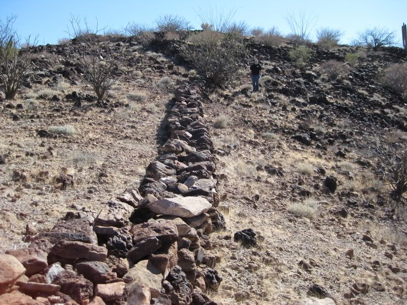
A cleared chute or slide went straight up the steep slope where it looked to me supplies for the people on top may have been pulled/ dragged up by
rope... This was just to the right of where we parked and climbed up. See photo below.
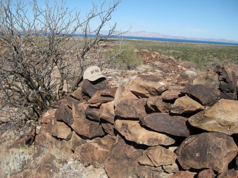
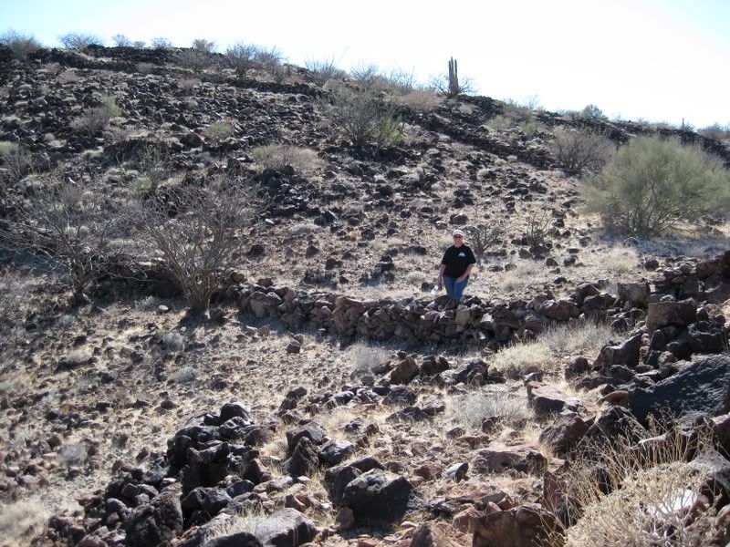
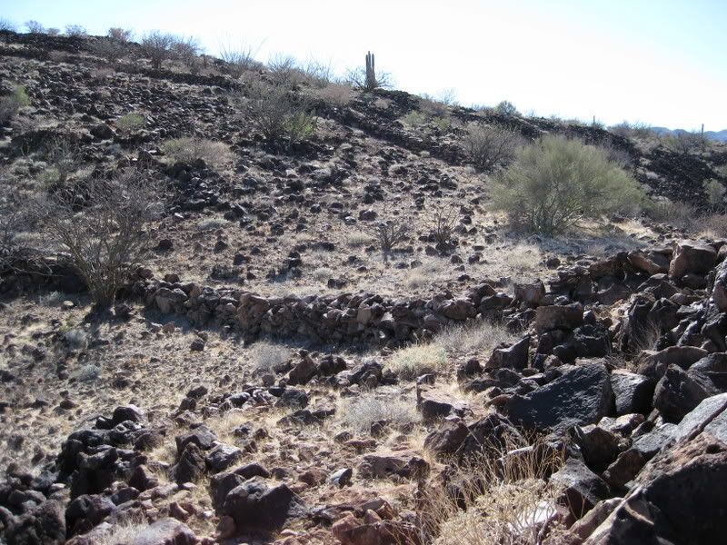
We saw there were two walls in the saddle on top, parallel to each other, but not connecting.
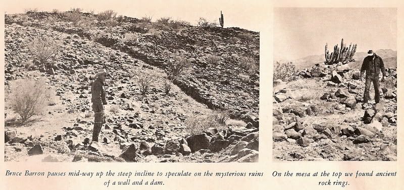
When we got to the spot seen in the 1966 photo we took several photos.
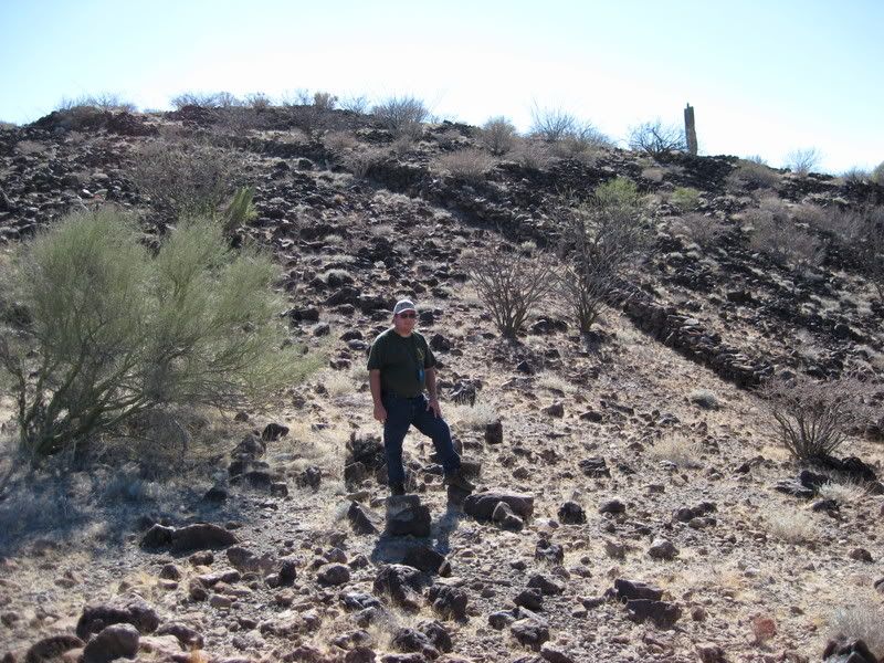
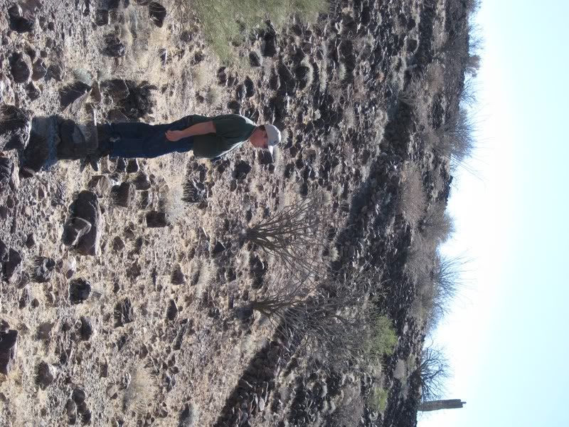
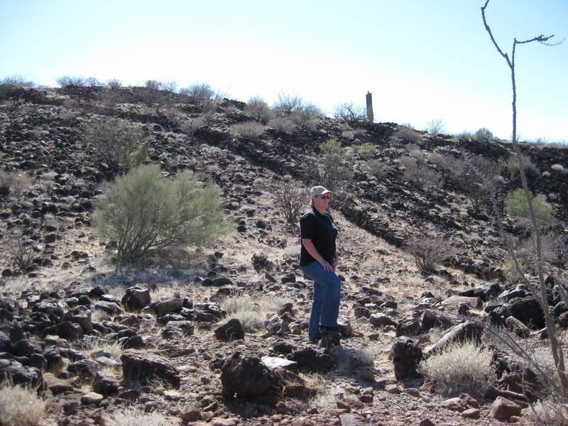
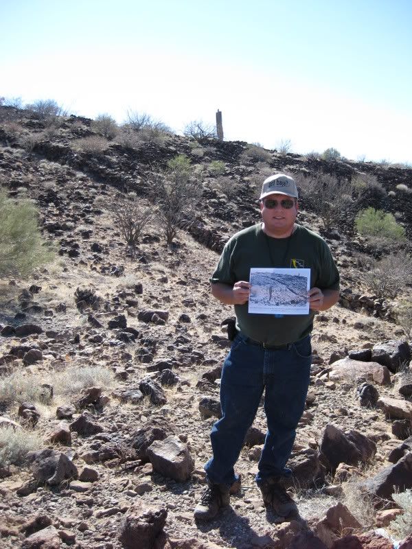
Then sitting on the wall...
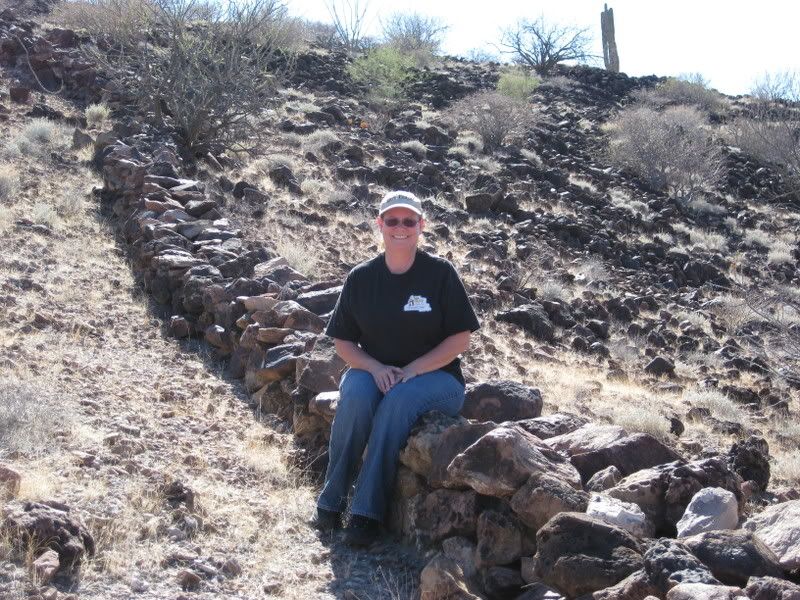
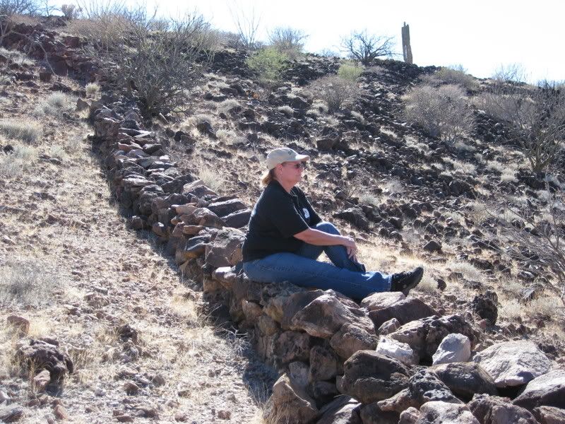
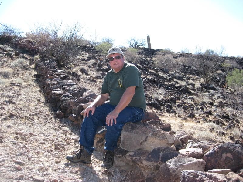
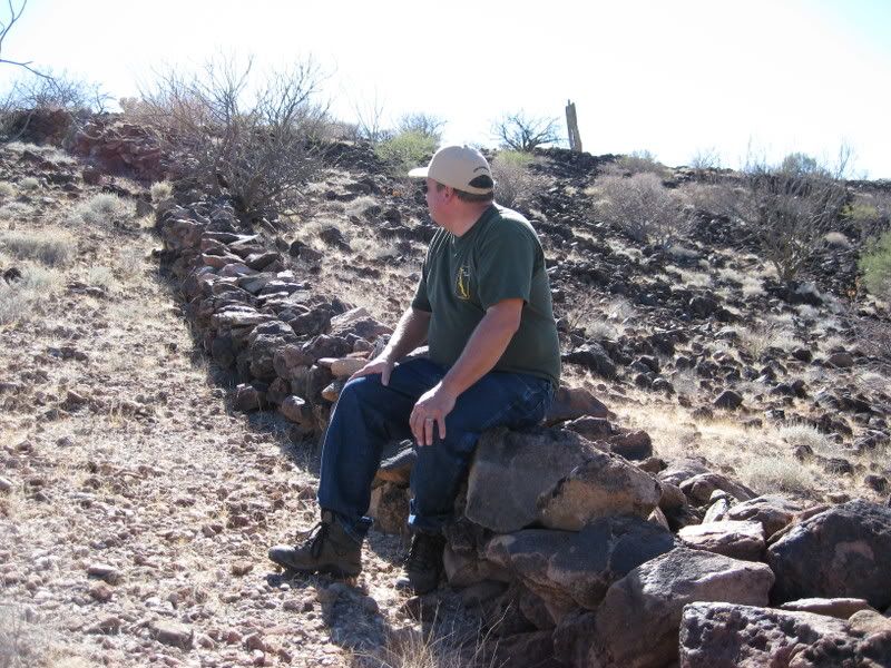
Here's looking down the side of the mesa at my truck and the place where we climbed up...
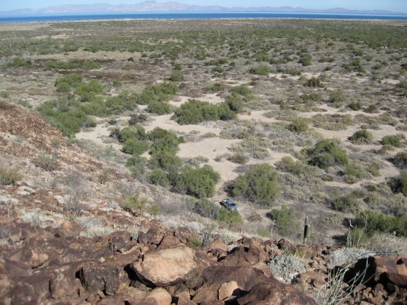
As you can see, the walls at the top were not needed for defence, since the mountain side alone was much more an obsticle.
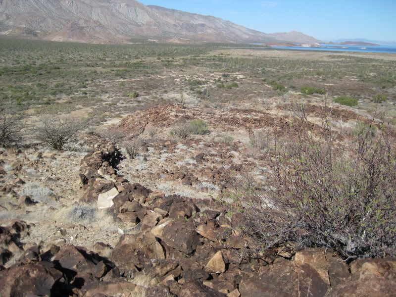
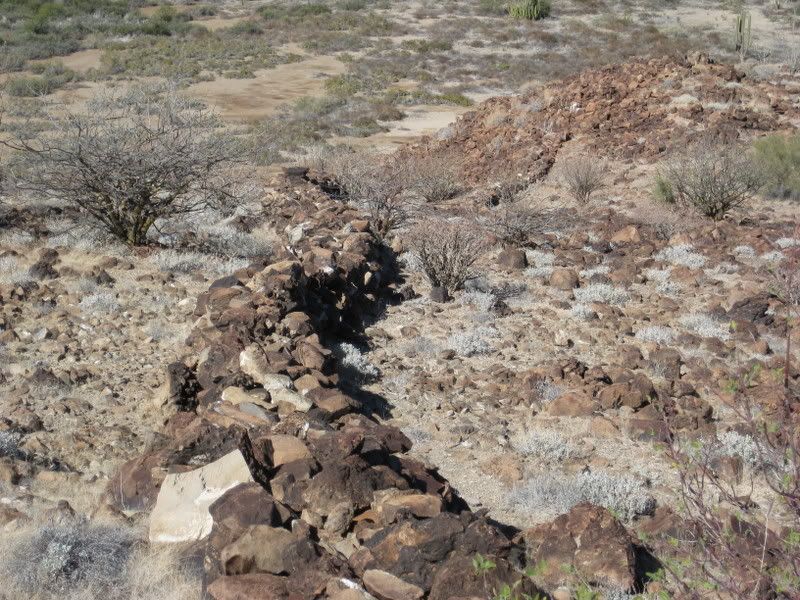
Next, I took a walk south on top of the mesa to the really flat areas... Elizabeth went east to the high point. She found stuff, I did not... (note to
self: stay close to Elizabeth)!
[Edited on 1-6-2009 by David K]
|
|
|
Sharksbaja
Elite Nomad
     
Posts: 5814
Registered: 9-7-2004
Location: Newport, Mulege B.C.S.
Member Is Offline
|
|
So what were those walls for up there? You would have to rule out livestock. Very intriguing.
DON\'T SQUINT! Give yer eyes a break!
Try holding down [control] key and toggle the [+ and -] keys
Viva Mulege!
Nomads\' Sunsets
|
|
|
David K
Honored Nomad
        
Posts: 65436
Registered: 8-30-2002
Location: San Diego County
Member Is Offline
Mood: Have Baja Fever
|
|
Flat area:
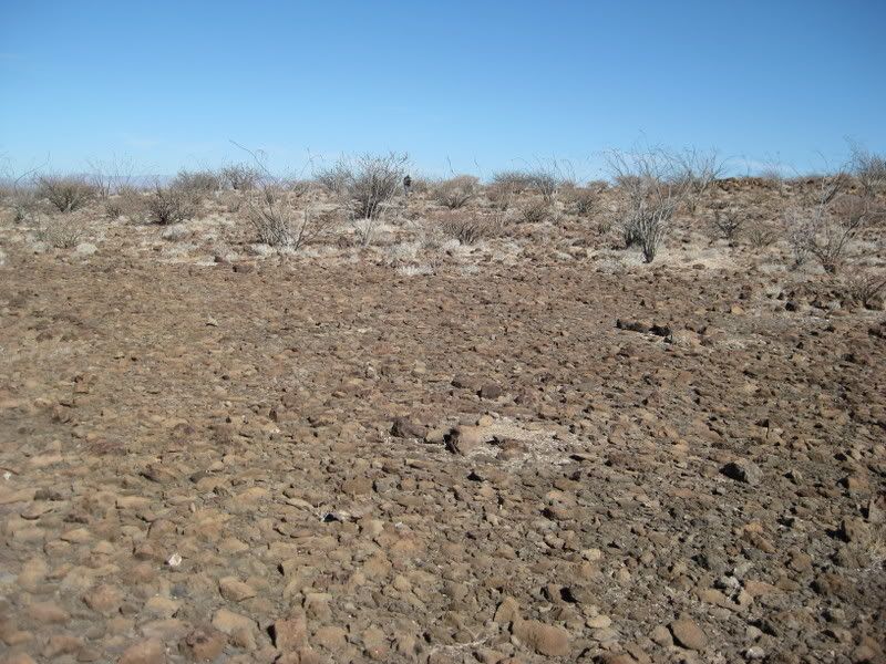
Looking back north/ northeast to the high point:
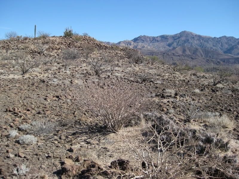
Southeast:
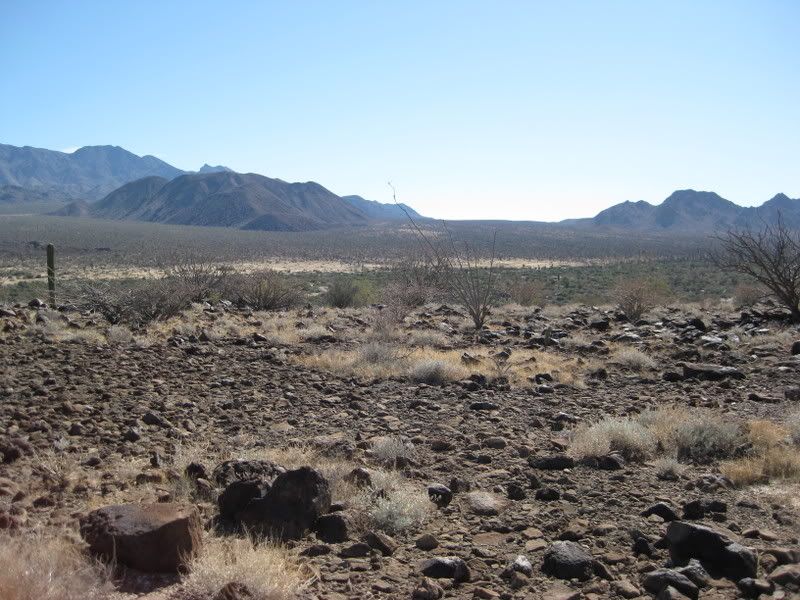
Norteast along the edge, towards the dam:
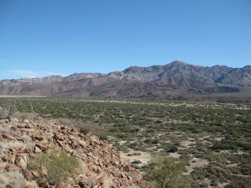
See Baja Angel?:
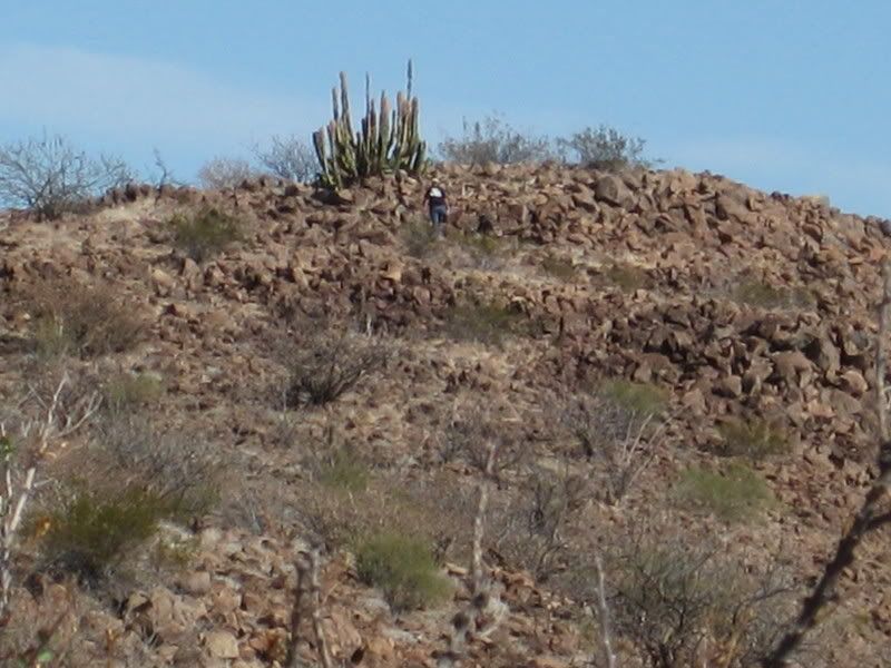
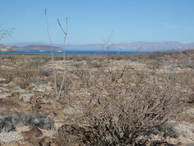
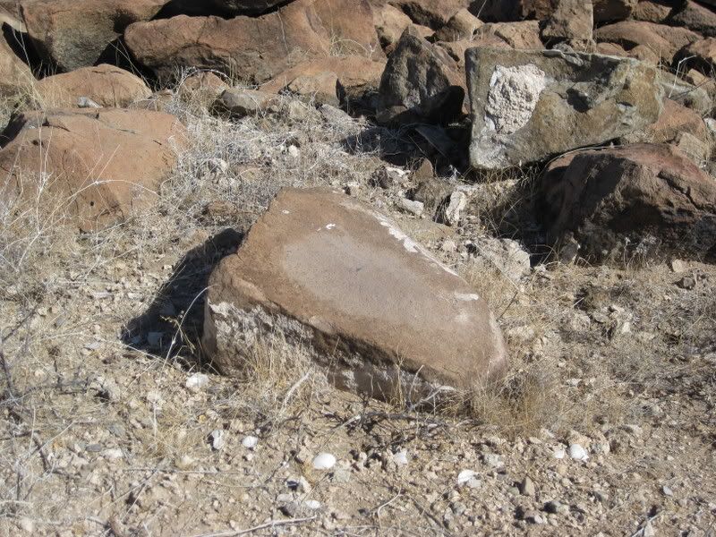
Grinding stone/ metate?
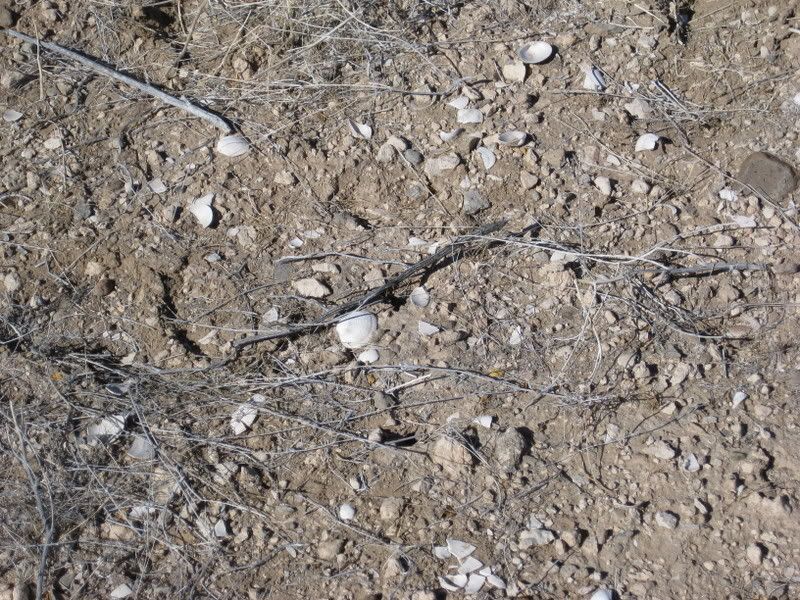
Sea shells!
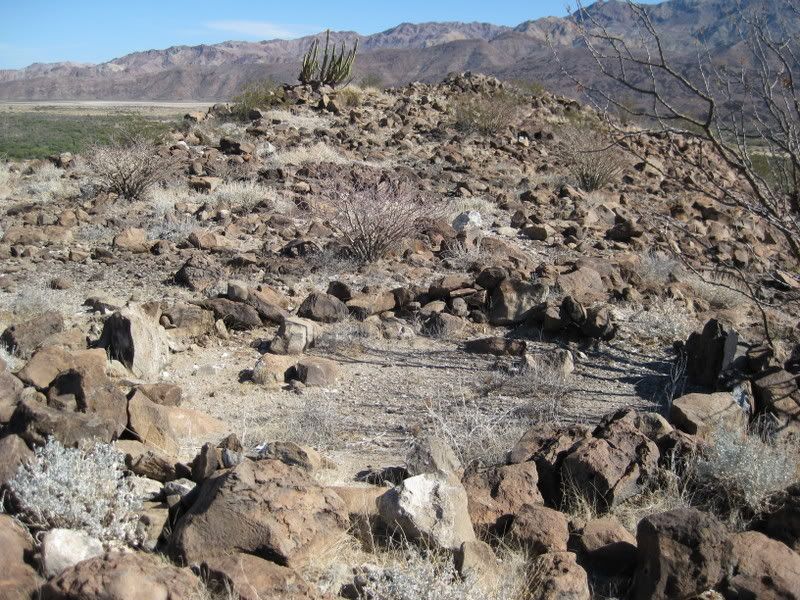
Rooms or sleeping circles?
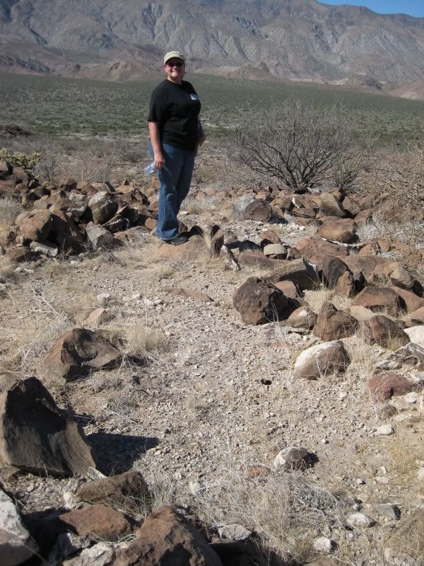
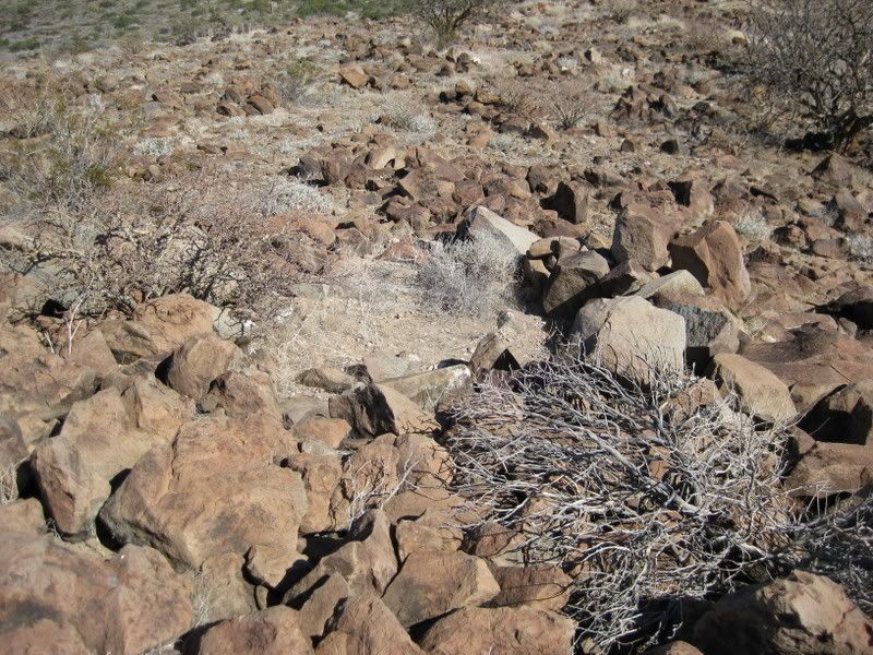
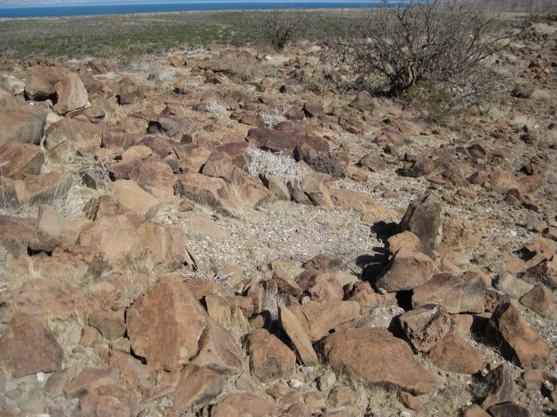
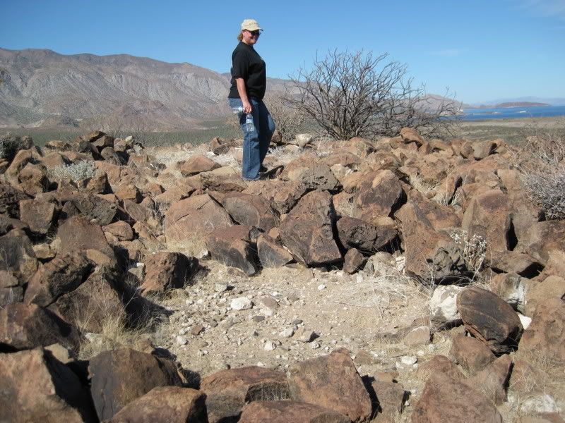
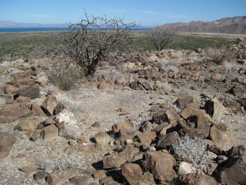
This shot is much like the one in 1966 of Bruce Barron at the sleeping circles:
|
|
|
Iflyfish
Ultra Nomad
    
Posts: 3747
Registered: 10-17-2006
Member Is Offline
|
|
One can not rule out the possibility of defensive structure even though the location has good visibility. It is not uncommon for human's to construct
fortifications on top of high elevations. It is also common for human's to construct religious sites on top of elevations. Curious place. Has this
site been explored by anthropologists or archeologists? What is the name of this site, or does it have a name?
Thanks for sharing this interesting finding.
Iflyfish
|
|
|
David K
Honored Nomad
        
Posts: 65436
Registered: 8-30-2002
Location: San Diego County
Member Is Offline
Mood: Have Baja Fever
|
|
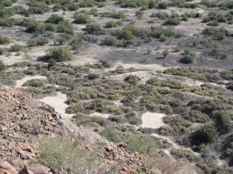
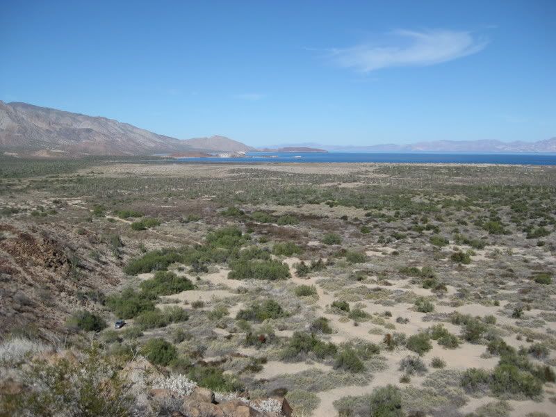
Looking down to the dam and reservoir:
With a commanding view of the bay (and the desert), this location would make an ideal fort, if that was needed to protect a mission, below, by the
reservoir.
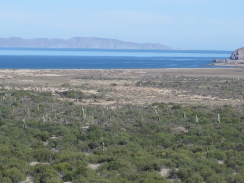
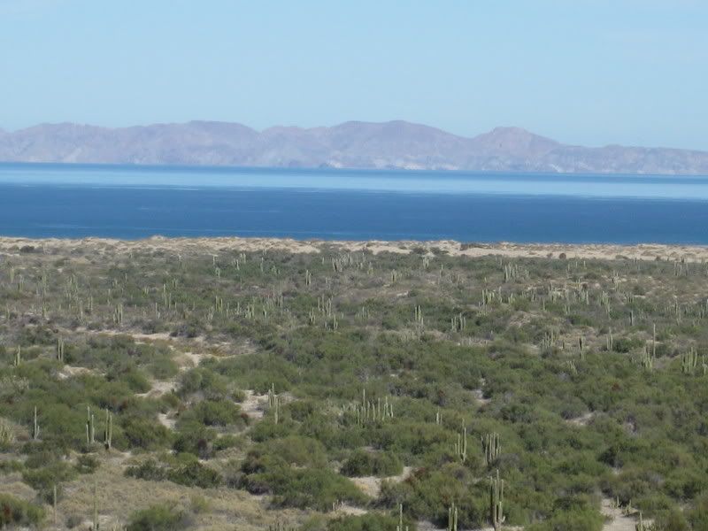
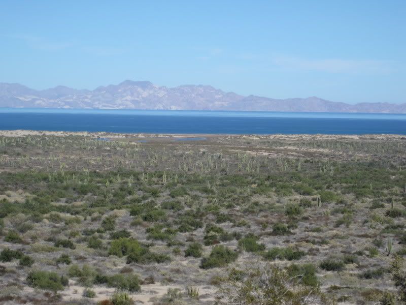
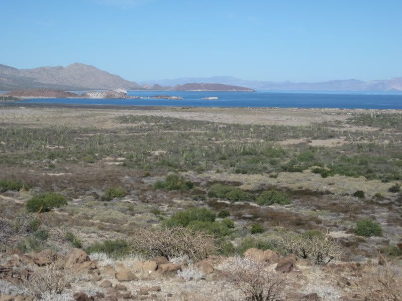
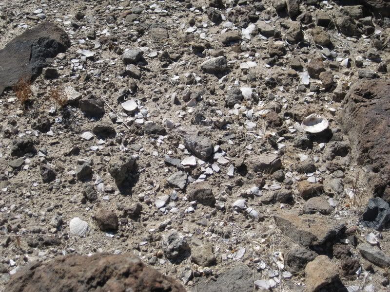
They sure ate a lot of clams and oysters up there!
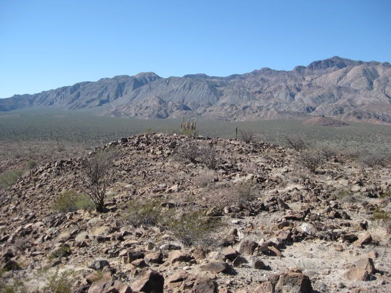
Again, note my truck parking spot and how steep the sides of this mesa are:
|
|
|
David K
Honored Nomad
        
Posts: 65436
Registered: 8-30-2002
Location: San Diego County
Member Is Offline
Mood: Have Baja Fever
|
|
| Quote: | Originally posted by Iflyfish
One can not rule out the possibility of defensive structure even though the location has good visibility. It is not uncommon for human's to construct
fortifications on top of high elevations. It is also common for human's to construct religious sites on top of elevations. Curious place. Has this
site been explored by anthropologists or archeologists? What is the name of this site, or does it have a name?
Thanks for sharing this interesting finding.
Iflyfish |
I have been sharing Choral's writings about this site for many years... I reposted Choral's chapter again here on the Nomad Historic Intersts forum a
couple months ago: http://forums.bajanomad.com/viewthread.php?tid=35520
I have a special web site (2 pages) on the 1757 Jesuit map and links to my 5 other trips web pages looking for this site: http://vivabaja.com/1757
Choral believed this was the site of an aborted mission to be called Santa Maria Magdalena, since a mission of that name is shown as 'started' in this
general area between L.A. Bay and Santa Gertrudis.
There must have been a spring or higher rainfall to keep the reservoir full, as evidence by the remains of the palm... and a requirement for human
habitation... let alone a mission.
Sharks, having known of my desire to find the site and my very recent re-posting about it, statred looking close at the satellite images in the area
along the Gardner route, and saw the wall.... and asked me if I thought it could be the one the Gardner party found in 1966... I said the only way to
know was to go there in person.
Before starting my trip report, I did post the finding in the Nomad Baja News forum, and included the part about this site in Tom Miller's popular
'The Baja Book'... do have a look there, as well.
Also, before posting anything on Nomad, I shared the news with intersted people who may not read Nomad or who were with me on earlier trips looking
for this place. As well as Baja mission book author Ed Vernon.
I also emailed Choral's son and daughter...
The site description was published in 1966, 1973, 1975, and in The Baja Book, The Baja Book II, The Baja Book III.
Baja historians discredited the site as a possible new mission as nothing more than a map and a bell contain its name. The final edition of The Baja
Book (IV) was reviewed before being published by a historian and the site mention was removed!
It seems quite evident to me that historians are not interested in this site enough to investigate it after so many years of it being known.
So, now let the people who enjoy seeing such sites enjoy all this hard work from who knows how long ago!
|
|
|
David K
Honored Nomad
        
Posts: 65436
Registered: 8-30-2002
Location: San Diego County
Member Is Offline
Mood: Have Baja Fever
|
|
Remember the cave, seen from the ground near the dam...
It is just below the top of the ridge:
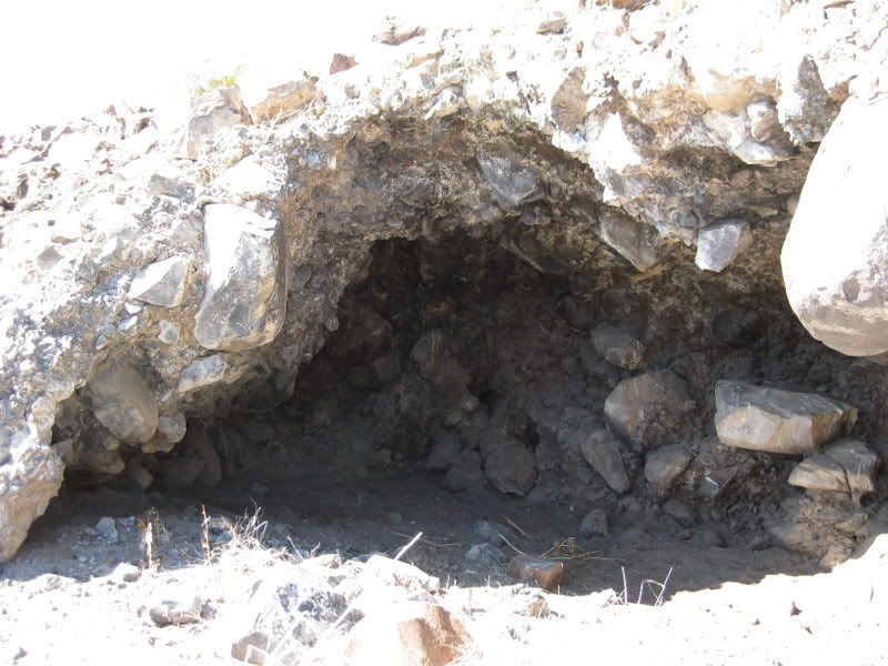
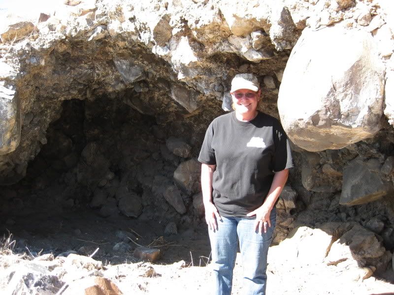
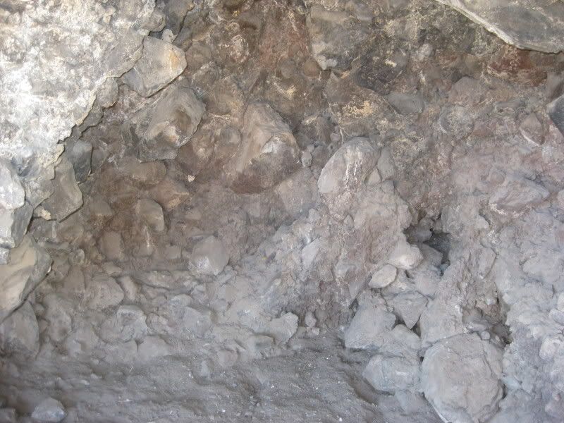
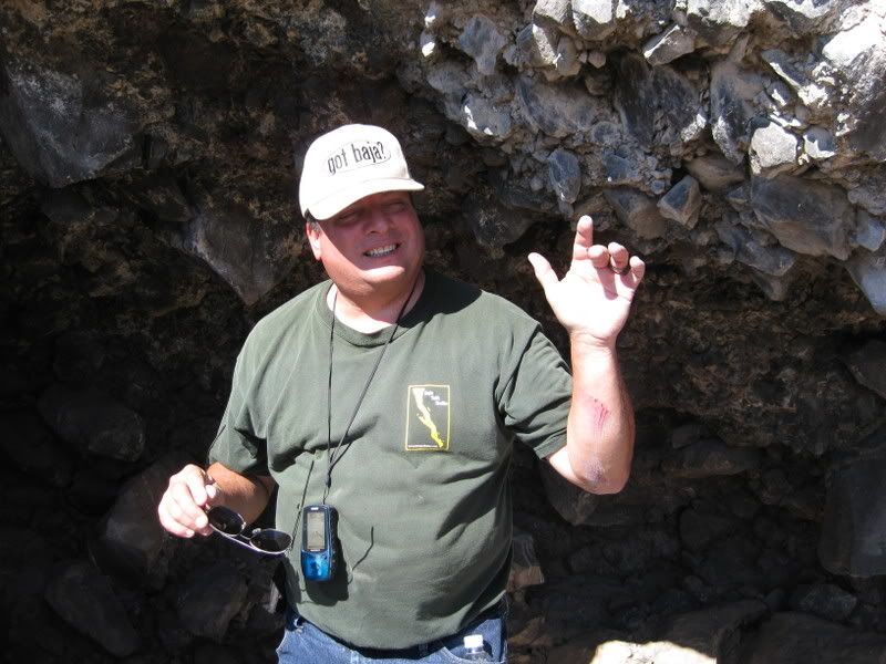
It was empty... no treasure, no bones, just a great view to the southeast.
Oh, I fell trying to get to it... ouch!
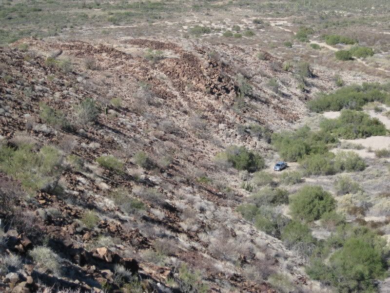
Another look along the north side of the mesa... Notice the chute or rock-free strip going up the slope just up from my truck? May have been where
supplies were pulled up by rope?
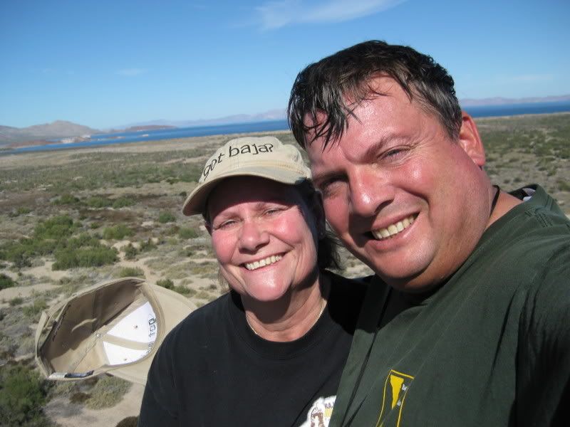
Here we are!
Time to head back down...
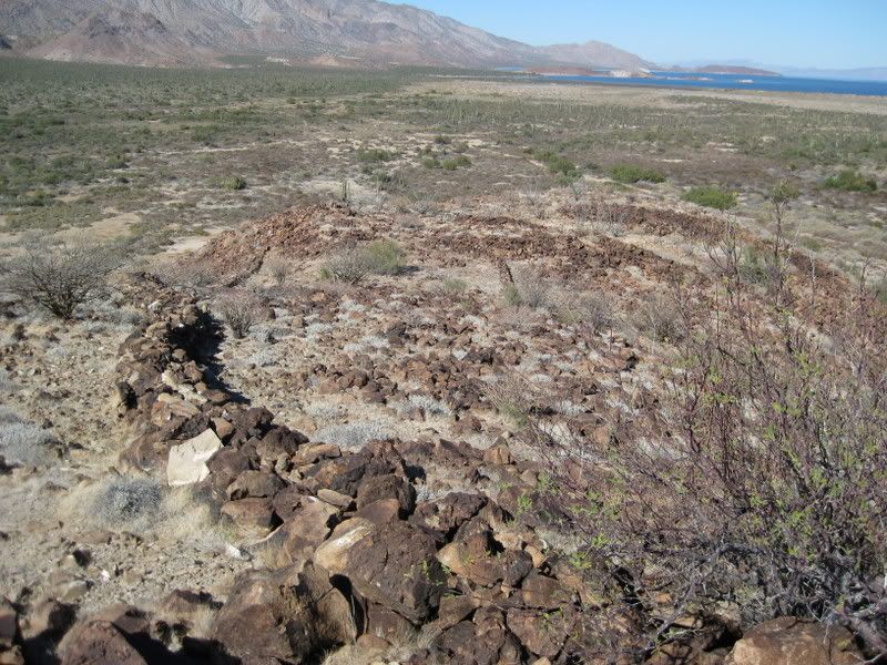
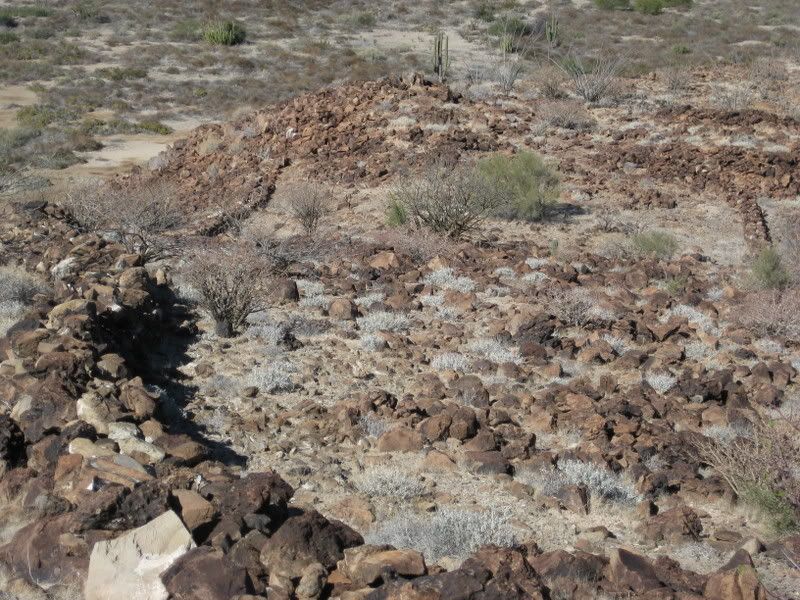
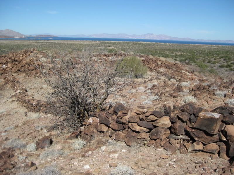
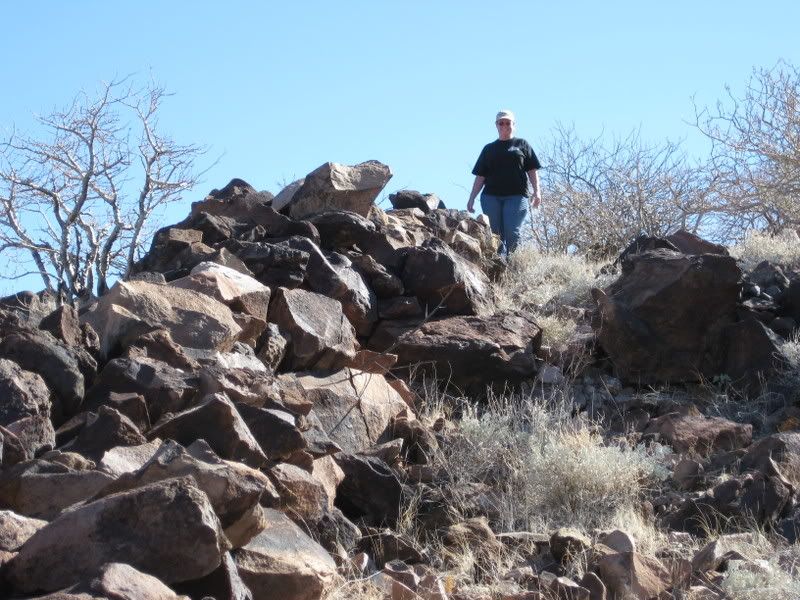
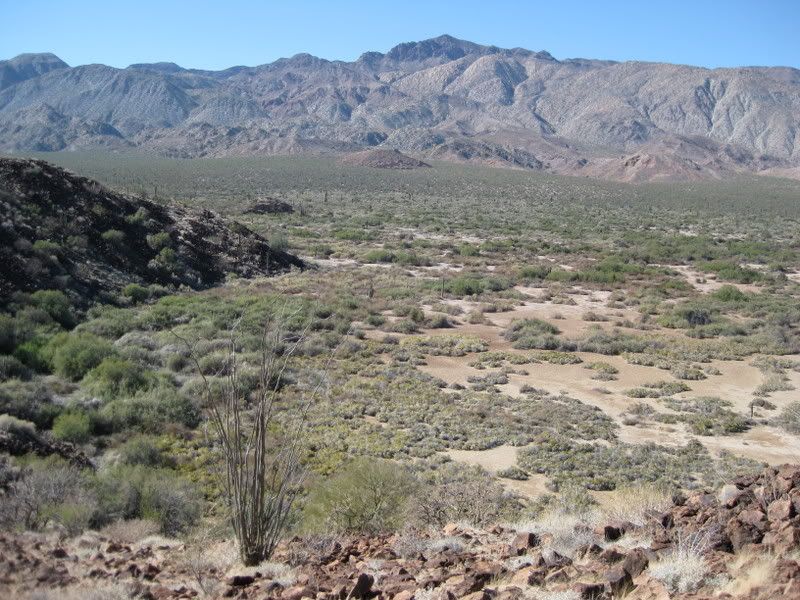
Here is the area to the northwest of the mesa, below the wall, looking west here:
Here's that parallel wall:
NEXT... to the shore of Bahia las Animas, 3 miles away.
[Edited on 1-6-2009 by David K]
|
|
|
woody with a view
PITA Nomad
      
Posts: 15940
Registered: 11-8-2004
Location: Looking at the Coronado Islands
Member Is Offline
Mood: Everchangin'
|
|
Wow! glad to see you finally found it!
|
|
|
BillB
Newbie
Posts: 16
Registered: 9-20-2004
Member Is Offline
|
|
Congratulation David. I know you have spent hundreds of hours researching and searching for this site. Well deserved!
Here is a cool thing I noticed. The vegetation has not changed much at all in the past 42 years. Take a close look at the 1966(ish) photo of Bruce
Barron, then compare that to the first photo of you on this part #4. Not only have the rocks not moved, but look at the position of the two bushes
right behind your left shoulder. Not only are they the same ones, but they have not grown all that much! Also see the position of the brush on the
hill by the tall cactus. Some Botanist may enjoy seeing this.
Bill Bryant
Now in Golden, CO
|
|
|
Sharksbaja
Elite Nomad
     
Posts: 5814
Registered: 9-7-2004
Location: Newport, Mulege B.C.S.
Member Is Offline
|
|
| Quote: | Originally posted by BillB
Congratulation David. I know you have spent hundreds of hours researching and searching for this site. Well deserved!
Here is a cool thing I noticed. The vegetation has not changed much at all in the past 42 years. Take a close look at the 1966(ish) photo of Bruce
Barron, then compare that to the first photo of you on this part #4. Not only have the rocks not moved, but look at the position of the two bushes
right behind your left shoulder. Not only are they the same ones, but they have not grown all that much! Also see the position of the brush on the
hill by the tall cactus. Some Botanist may enjoy seeing this.
Bill Bryant
Now in Golden, CO |
Yah, I hope it stays preserved.
DON\'T SQUINT! Give yer eyes a break!
Try holding down [control] key and toggle the [+ and -] keys
Viva Mulege!
Nomads\' Sunsets
|
|
|
Barry A.
Select Nomad
      
Posts: 10007
Registered: 11-30-2003
Location: Redding, Northern CA
Member Is Offline
Mood: optimistic
|
|
| Quote: | Originally posted by Sharksbaja
| Quote: | Originally posted by BillB
Congratulation David. I know you have spent hundreds of hours researching and searching for this site. Well deserved!
Here is a cool thing I noticed. The vegetation has not changed much at all in the past 42 years. Take a close look at the 1966(ish) photo of Bruce
Barron, then compare that to the first photo of you on this part #4. Not only have the rocks not moved, but look at the position of the two bushes
right behind your left shoulder. Not only are they the same ones, but they have not grown all that much! Also see the position of the brush on the
hill by the tall cactus. Some Botanist may enjoy seeing this.
Bill Bryant
Now in Golden, CO |
Yah, I hope it stays preserved. |
It will, since David photographed it all.
Barry
|
|
|
Mexitron
Ultra Nomad
    
Posts: 3397
Registered: 9-21-2003
Location: Fort Worth, Texas
Member Is Offline
Mood: Happy!
|
|
Great reporting David--you just have to torture me don't you! Must get back to Baja.....I've wanted to explore that region more since I was there in
the late 90's, particularly the Pico Echeveria/La Sandia ridges to the west do some botanizing.
|
|
|
David K
Honored Nomad
        
Posts: 65436
Registered: 8-30-2002
Location: San Diego County
Member Is Offline
Mood: Have Baja Fever
|
|
Exactly why Jack Swords, Kevin Clough, Robert Jackson, Ed Vernon and I have been photographing all the sites... Because they do get changed, sometimes
by the very people it would benefit if they were preserved. The worst usually happens to the sites that have been ignored and got little or no
publicity. Never visited, never protected, never mind... it's all gone! San Juan de Dios comes to mind and both sites of Santo Tomas are nearly gone.
See http://vivabaja.com/bajamissions
|
|
|
avid
Junior Nomad

Posts: 41
Registered: 7-10-2008
Location: SW Oregon
Member Is Offline
Mood: adventurous
|
|
David,
Great pictorial and fabulous research work. Having worked in similar looking country in Montana the wall makes me wonder about sheep herders. Did the
Spanish Missionaries bring sheep to Baja? I ask because sheepherders do all kinds of wild stuff with rock. They build walls, gargoyles and sheep pens.
Shepherds have a world of time on their hands and sometimes do stuff just for something to do. The proximity to the dam is the other factor that made
me wonder about sheep in addition to the height of the fence and the bare chute up the hill (livestock trail?) Could this have been a shephard's way
of protecting his flock from wolves and Grizzly bears. In regards to the dam, could the water have come from the nearby wash via a channel or ditch?
Of course, this wouldn't be inconsistent with the possibility of a Mission it just could have been a beta test.
FWIW
David K II- Nomad wannabe
avid
Ashland, OR
|
|
|
David K
Honored Nomad
        
Posts: 65436
Registered: 8-30-2002
Location: San Diego County
Member Is Offline
Mood: Have Baja Fever
|
|
| Quote: | Originally posted by avid
David,
Great pictorial and fabulous research work. Having worked in similar looking country in Montana the wall makes me wonder about sheep herders. Did the
Spanish Missionaries bring sheep to Baja? I ask because sheepherders do all kinds of wild stuff with rock. They build walls, gargoyles and sheep pens.
Shepherds have a world of time on their hands and sometimes do stuff just for something to do. The proximity to the dam is the other factor that made
me wonder about sheep in addition to the height of the fence and the bare chute up the hill (livestock trail?) Could this have been a shephard's way
of protecting his flock from wolves and Grizzly bears. In regards to the dam, could the water have come from the nearby wash via a channel or ditch?
Of course, this wouldn't be inconsistent with the possibility of a Mission it just could have been a beta test.
FWIW
David K II- Nomad wannabe |
Part of my sharing this is to get answers (and to inspire a lust for Baja history)!
Sure all kinds of livestock needed for European style living in the 1700's came to Baja... Yes, I did mention (I thought) *about the canal. See the
satellite map with numbered darts. The canal was along the east side of the mesa at the base of the cliff and would direct rain water coming off the
mesa and sides of the cliff, towards the reservoir... working like a roof rain gutter at your home. * I added it below the west facing image, thanks!
No wolves or bears, but coyotes and mountain lions for sure!
Keep those ideas coming Nomads!
Welcome to Nomad avid!
Now, on the Las Animas in Part 5, here: http://forums.bajanomad.com/viewthread.php?tid=36263
(PS, one more wall on the desert floor photograped in Part 5)
[Edited on 1-6-2009 by David K]
|
|
|
Barry A.
Select Nomad
      
Posts: 10007
Registered: 11-30-2003
Location: Redding, Northern CA
Member Is Offline
Mood: optimistic
|
|
Both wolves and griz. bears were all over the southwestern deserts 170 years ago, and before. Tho I have never heard reference to them in Baja, they
certainly could have been there-------Sonora had it's share back then.
Barry
|
|
|
Sharksbaja
Elite Nomad
     
Posts: 5814
Registered: 9-7-2004
Location: Newport, Mulege B.C.S.
Member Is Offline
|
|
Now, how's about a little theorizing. Do you think those walls had any Spanish influence? There is not an encompassing wall so it was not there to
contain animals. Could it have been a windbreak of sorts? Seems pretty exposed up there. Do you suppose those rock circles are possibly old fallen
down walls that could have supported a roof?
A palm of that size meant water was available near-surface for quite a long period. I would imagine that dead palm would have been alive 20 years
ago. How decayed was it? It ws alive in 1966? Did it fall apart in your hands? Did you see any greener plants that would indicate subsurface water?
The sea is quite a ways away to haul scallops in the shell. So theoretically, you had people actually living and making meals up there. The downside
would be the lack of shade, making that mesa hot as hell up there. The upside would be the view. As for a defensive wall, I wonder why it would be
only in that area to defend attackers. Doesn't seem plausible to me.
DON\'T SQUINT! Give yer eyes a break!
Try holding down [control] key and toggle the [+ and -] keys
Viva Mulege!
Nomads\' Sunsets
|
|
|
Barry A.
Select Nomad
      
Posts: 10007
Registered: 11-30-2003
Location: Redding, Northern CA
Member Is Offline
Mood: optimistic
|
|
My 2 cents worth--------
#1 the sea is actually only about a mile away----a 20 min. walk. (the old fish camp is 2 miles away)
#2 What we are calling "sleeping circles" may actually be the sub-structure to wiki-ups, brush structures that provide shade and protecting (like
Sharks infers).
#3 The area could have been much wetter 250+ years ago---there is much evidence to support that.
#4 There could have been a fresh water spring close by back then-----springs come and go depending on earthquakes that form, and shut down, springs
in all of Baja.
#5 I have seen dead palm trunks in washes further north that I KNOW have been laying there for 50 years + (because I saw them them) and they look
pretty darn fresh. I have no idea how long they could possibly last-----270 years + ?????-----I doubt that.
#6 The walls are a total mystery to me, and I have no concept what they were used for, especially the way they seem to be laid out.
(afterall, Sharks asked for speculation)
#7 Undoubtably there are riches in Gold and Silver there beyond comprehension, as this IS the hidingplace for all the Jesuit treasures stashed
before they were kicked out of los Californias.  
I will be heading down there next week with my end-loader starting excavations, along with my crew of 50.
[Just messing with you, Sharks. Your concerns are legit, but I just think possibly overkill (???) ]
Barry 
|
|
|
Sharksbaja
Elite Nomad
     
Posts: 5814
Registered: 9-7-2004
Location: Newport, Mulege B.C.S.
Member Is Offline
|
|
Barry for the sake of argument. Let's agree this is a find that may or may not be significant enough to warrant closer study. Would that be a fair
enough assumption?
Anyhoo, I hope it has clues to it's origin. It's more than just a wall imho. To me it holds key to the people and the goings-on many years ago. It
could settle a number of debates and set to rest a myth perhaps.
I really have no dog in this or I would have never given the info to David in the first place. My interests are purely on a scientific level. I held
the honor for David, we both knew this was the place he was looking for. I felt a certain responsibility to share the info I had with ONLY him. I hope
David follows through and we get some good historical material out of it. Afterall, David is quite the amatuer Baja historian.
Overkill no...... Ego control si...... 
DON\'T SQUINT! Give yer eyes a break!
Try holding down [control] key and toggle the [+ and -] keys
Viva Mulege!
Nomads\' Sunsets
|
|
|
Iflyfish
Ultra Nomad
    
Posts: 3747
Registered: 10-17-2006
Member Is Offline
|
|
What a fascinating thread. You are an official amateur archeologist. What a find!
It would appear that the cave may have evicence of smudging from fire on the ceiling. Carbon dating on coals could help determine the age of
occupancy. Fascinating stuff.
Thanks again for this great post David.
Iflyfish
|
|
|
| Pages:
1
2 |

