David K
Honored Nomad

Posts: 65595
Registered: 8-30-2002
Location: San Diego County
Member Is Offline
Mood: Have Baja Fever
|
|
Old Road and Hwy. 1: (Part 2 Cataviña - Punta Prieta)
Continued from Part 1: http://forums.bajanomad.com/viewthread.php?tid=48770
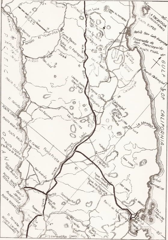
Old road map with new roads marked in.
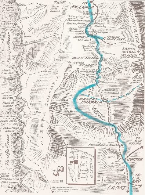
On the Cliff Cross map, the approx. relationship of Hwy. 1 is shown with a blue highlight line.
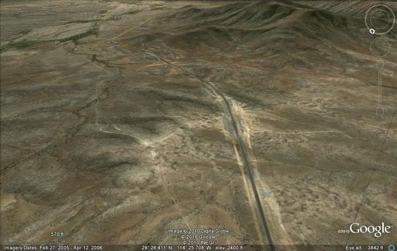
From Cataviña (Rancho Santa Ynez) to the Laguna Chapala valley, the highway runs very close or right over the old road. One exception is the El
Pedregoso boulder mountain. The old road went to the right/ west side of it and the highway went to the east side.
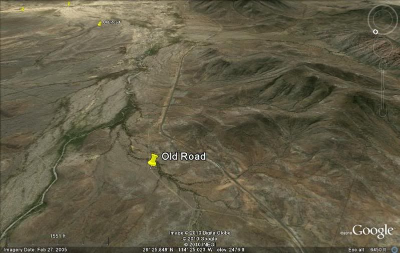
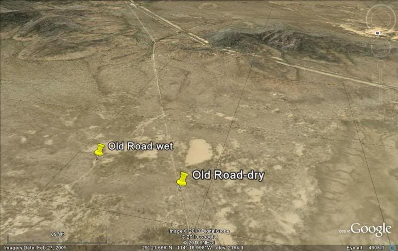
On the north end of the Laguna Chapala valley, the old road headed across the most hated part of the main road before Hwy. 1, the silt beds of
Chapala. Between the silt beds and the dry lake was Arturo Grosso's Rancho Laguna Chapala. Past the ranch, the dry lake allowed highway speeds for a
couple of miles to help blow off some of the dust. In wet weather, a long detour around the east shore of the lake was necessary.
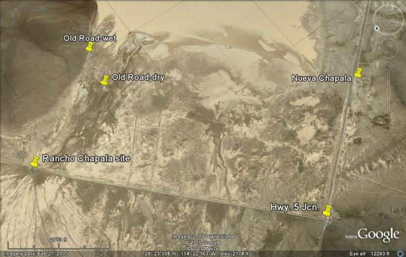
Following the construction of Highway 1, Grosso moved his ranch to the highway and renamed it 'Nueva Chapala'. The new (1982) graded road to Puerto
Calamajue (and Coco's Corner & Gonzaga Bay) runs right next to the old ranch site.
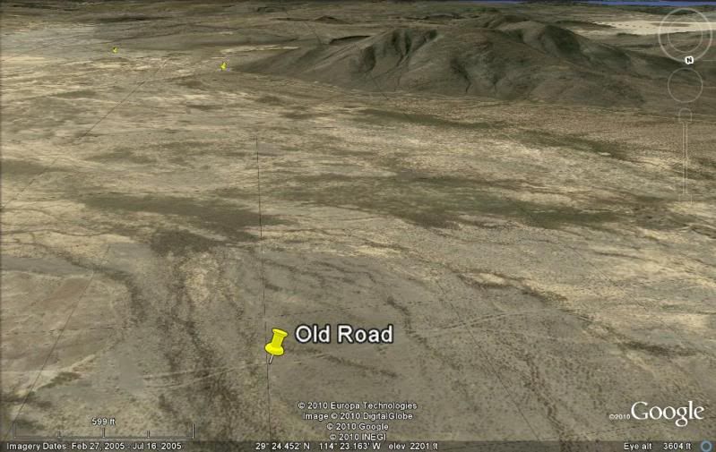
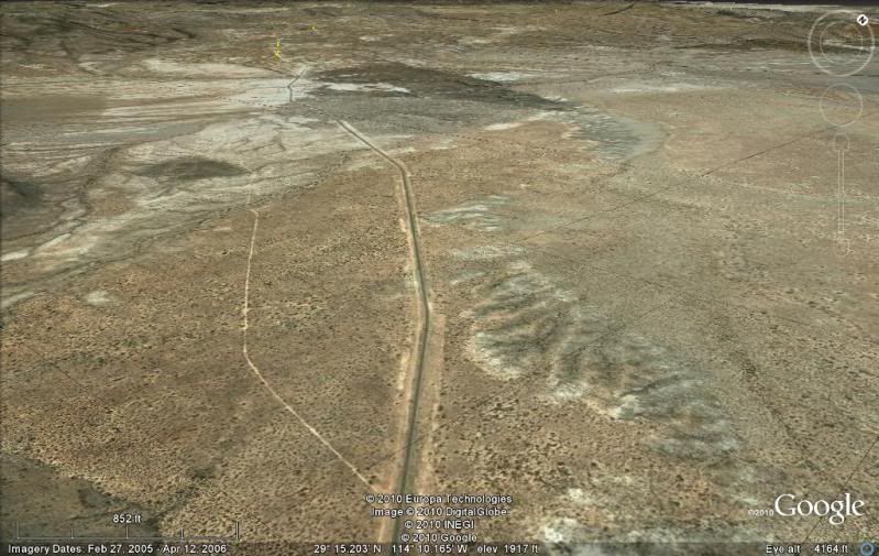
At the far south end of the Chapala Valley, bith the old and new roads join to get through the mountain pass called 'El Portezuelo'. This is the place
on Hwy. 1 where you get the first view of the Sierra la Asamblea and Sierra Calamajue and the highway way ahead. South of the pass the old road goes
both to the left (east) and right (west) of the highway route.
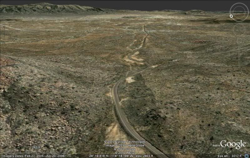
The above view is looking back north.
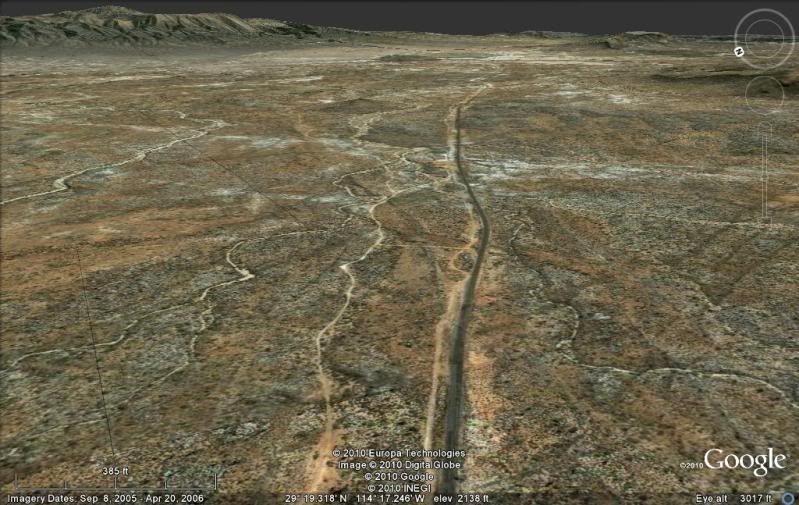
In another north view, further down the highway is both the shortcut to Calamajue Canyon going right (east, built to bring water to the highway for
construction) and the road to the Pacific via Rancho San Antonio...

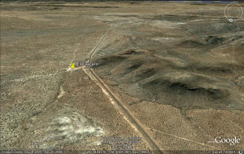
Just before El Crucero, the old road comes to the highway... view north...
Now, looking south again... El Crucero is where the old San Felipe (Gulf Route) road (via Gonzaga Bay and Calamajue Canyon) joined the main
Transpeninsular Road. It is a popular pitting location when the Baja 1000 runs past here.
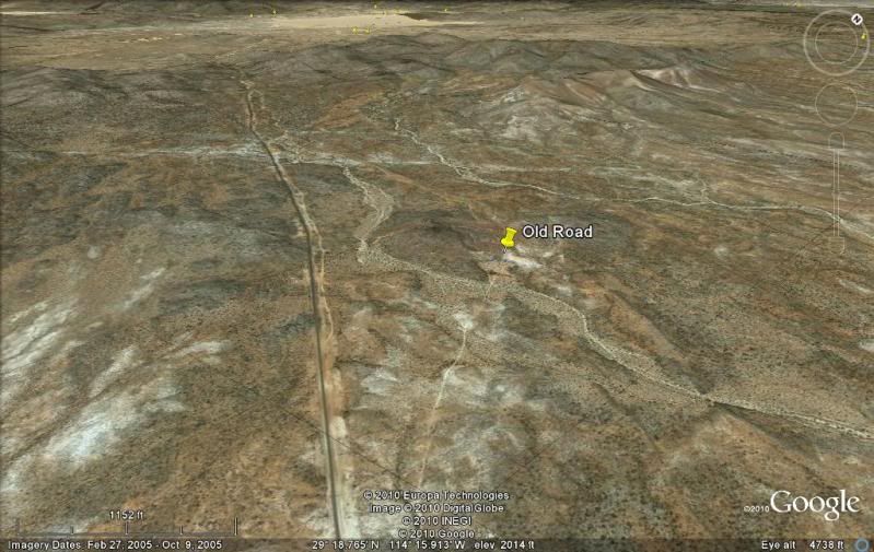
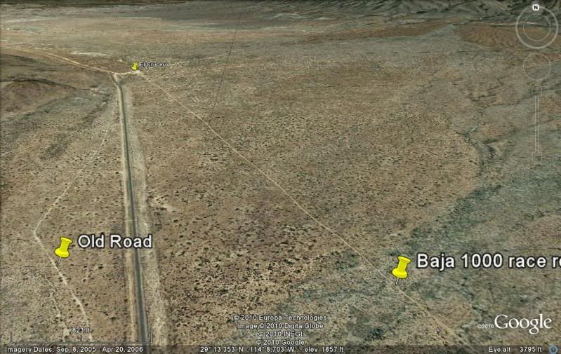
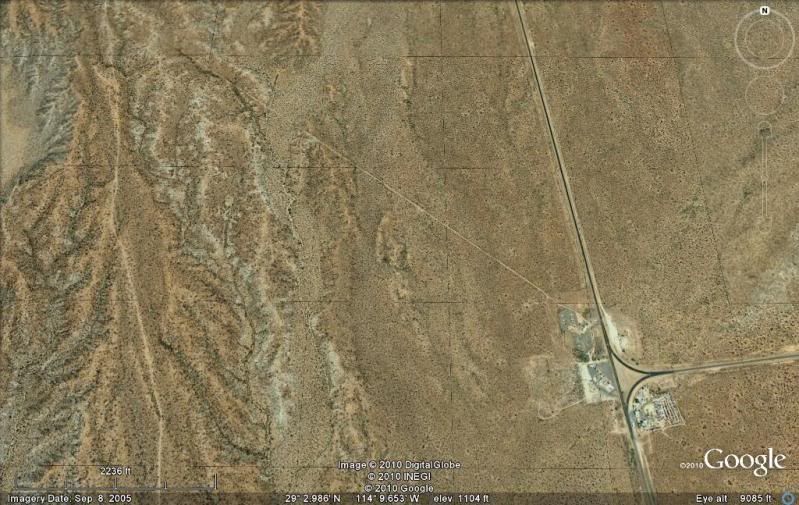
The Baja 1000 (after the highway was built) uses a parallel dirt road to the east of Hwy. 1 and that ends on the old L.A. Bay road. The old main road
soon runs to the west of Hwy. 1 and remains there almost all the way to Punta Prieta.
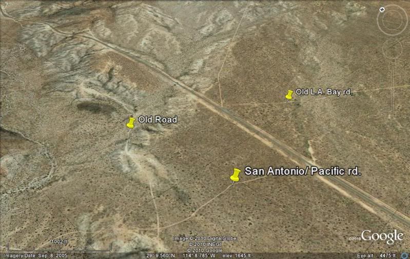
Where the old L.A. Bay road crosses Hwy. 1, a newer road was made that goes northeast to the headwaters of Arroyo Sal Si Puedes (Rancho San Luis)... a
gate has blocked entry in the past. Just south of the old L.A. Bay road junction is a newer road that goes to Rancho San Antonio and on to the Pacific
coast.
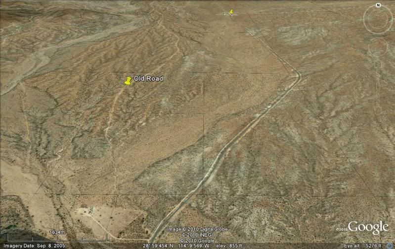
The old road wanders further away to the west of Hwy. 1...
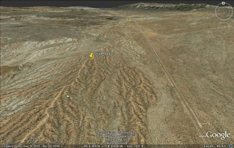
The new L.A. Bay Hwy. junction with Hwy. 1 was once called 'Parador Punta Prieta' as there was a parador (rest stop, refreshments, meals, showers, RV
park, gas station) built to handle traveles on the new highway. All but perhaps the RV park area is closed and vendors sell gas from cans in front of
the abandoned parador.
Just north of the town of Punta Prieta, the old and new roads come together... an new ranch is on the spot...
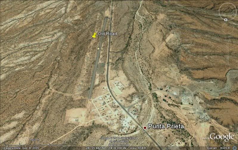
Here is a look south, over the tiny village of Punta Prieta and the paved airport built during the highway construction... and the old road heading
south from the new airport, built right on top of it! Anorther parallel 'old road' south of Punta Prieta stays to the west of Hwy. 1. There were often
parallel routes in the old days because of washouts, or just better routes made by the truckers or ranchers.
EDIT: Upon reviewing the old road south of Punta Prieta, I find that while the road the airport was built over is pre-highway, the original 1960's and
earlier road was closer to the hills and runs fairly straight to La Bachata... the other road rejoins here too. Often truckers would make new routes
parallel to the other as conditions warranted. See that route pinned in the next part, Punta Prieta to El Arco.
To the south Hwy. 1 and the old main road stay fairly close to each other until the town of Rosarito where they split... the old road went towards the
center of the peninsula where the town of El Arco was located. The new highway stays closer to the Pacific coast to the new town of Guerrero Negro.
Stay tuned for more of the Old Road to Cabo San Lucas!
[Edited on 11-3-2010 by David K]
|
|
|
motoged
Elite Nomad
Posts: 6481
Registered: 7-31-2006
Location: Kamloops, BC
Member Is Offline
Mood: Gettin' Better
|
|
David  
My sombrero is off to you, sir 
Your effort is appreciated by many....your tips have influenced my motorcycle exploration of Baja every time I go down there (8 rides so far...next
trip is Feb/11).
I can only imagine how much fun you have "flying" Google Earth constructing these maps 
Thank you....
Don't believe everything you think....
|
|
|
mcfez
Elite Nomad
Posts: 8678
Registered: 12-2-2009
Location: aka BN yankeeirishman
Member Is Offline
|
|
| Quote: | Originally posted by motoged
David
My sombrero is off to you, sir
Your effort is appreciated by many....your tips have influenced my motorcycle exploration of Baja every time I go down there (8 rides so far...next
trip is Feb/11).
I can only imagine how much fun you have "flying" Google Earth constructing these maps
Thank you.... |
Yeah David.....My skull cap is off to u 2. Keep it going.
motoged.....where are you going, any ideas yet?
Old people are like the old cars, made of some tough stuff. May show a little rust, but good as gold on the inside.
|
|
|
motoged
Elite Nomad
Posts: 6481
Registered: 7-31-2006
Location: Kamloops, BC
Member Is Offline
Mood: Gettin' Better
|
|
McFez,
(Dave, sorry to hijack)
Our bike bus will likely park in BoLA (or Kiki's in SF as usual if we change logistics)...10-12 days riding.
My ride plan is : 
BoLA-San Francisquito
SF - Bahia Asuncion
Asuncion-La Bocana-San Ignacio
San Ignacio-Mulege via northern pass (Magdalena) rather
than Ballena route
Mulege-San Sebastion day loop
Mulege-LaPurisima-San Xavier-Loreto loop
Loreto-Agua Verde in-out day
Loreto-La Purisima-San Juanico
San Juanico-San Ignacio-Guerrero Negro
GN-BoLA via San Borja
Back to regular programming re: David's Old Highway (we could take this to off-road forum)
Don't believe everything you think....
|
|
|
David K
Honored Nomad
Posts: 65595
Registered: 8-30-2002
Location: San Diego County
Member Is Offline
Mood: Have Baja Fever
|
|
Maybe you m/c travelers can cruise the old road where ever it is out-of-sight of Mex. 1 and take photos and note how it was? This was the original
Baja 1000 (Mexican 1000) race route to from 1967-1972 (El Rosario south), as well!
|
|
|
jahImpala3
Junior Nomad
Posts: 80
Registered: 12-6-2007
Member Is Offline
|
|
Great. I love history of the old road. You do a good job with all things Baja!
|
|
|
David K
Honored Nomad
Posts: 65595
Registered: 8-30-2002
Location: San Diego County
Member Is Offline
Mood: Have Baja Fever
|
|
Thanks! I am working on the next section: Punta Prieta to El Arco... I may have it ready to post tomorrow...
|
|
|
David K
Honored Nomad
Posts: 65595
Registered: 8-30-2002
Location: San Diego County
Member Is Offline
Mood: Have Baja Fever
|
|
PART 3: http://forums.bajanomad.com/viewthread.php?tid=48866
(Punta Prieta to El Arco)
|
|
|
David K
Honored Nomad
Posts: 65595
Registered: 8-30-2002
Location: San Diego County
Member Is Offline
Mood: Have Baja Fever
|
|
Part 2 bump
|
|
|


