| Pages:
1
..
3
4
5
6
7
..
9 |
TMW
Select Nomad

Posts: 10659
Registered: 9-1-2003
Location: Bakersfield, CA
Member Is Offline
|
|
Quote: Originally posted by elbeau  | I'll pay real money for someone to go build a fake Diaz rock-pile at one of their locations before they get there this weekend!
  |
How much are we talking about? Have money will travel.
|
|
|
elbeau
Nomad
Posts: 256
Registered: 3-2-2011
Location: Austin, TX
Member Is Offline
|
|
I'll give you the secret cooridnates to a lost mission that is rumored to be filled with Jesuit gold!
|
|
|
David K
Honored Nomad
Posts: 65243
Registered: 8-30-2002
Location: San Diego County
Member Is Offline
Mood: Have Baja Fever
|
|
Arroyo D
The third possible arroyo that Walter Henderson and friend came down to Arroyo Grande in, I have labeled 'Arroyo D', it is my third choice based on
looking at the options and trying to think like Walter did in the 1930's.
I posted his letter in hopes someone would have a 'eureka' moment and see something I missed or interpret him differently.... that has not happened,
so we shall try out what is there before our eyes.
My first choice was Arroyo B, but PaulW explored it after entering from the north (using what I had originally called Arroyo C) and found a dry
waterfall with no way around. Since Walter never mentioned such an obstacle, it would seem that Arroyo B is out.
My second choice is Arroyo A, and Phil and TW found a dam just in from Arroyo Grande that of course was not there 80 years ago. We made need a small
ladder or a way around the ravine with the dam to explore the canyon beyond. It is 2 miles to the top of the divide in Arroyo A. That would put the
rock-pile 1 1/4 to 1 1/2 miles up from Arroyo Grande.
The third (and perhaps final) choice is Arroyo D, it is just 0.6 mile up Arroyo Grande from Arroyo A and is only 1 1/4 mile long to the divide.
We can go up Arroyo A (if we can get around the dam) and if we don't see the rock-pile, walk the 0.3 mile from Divide A to Divide D, and come on down
Arroyo D to return to camp. Two birds with one stone, as they say.
Here are the two arroyos looking east from Arroyo Grande:
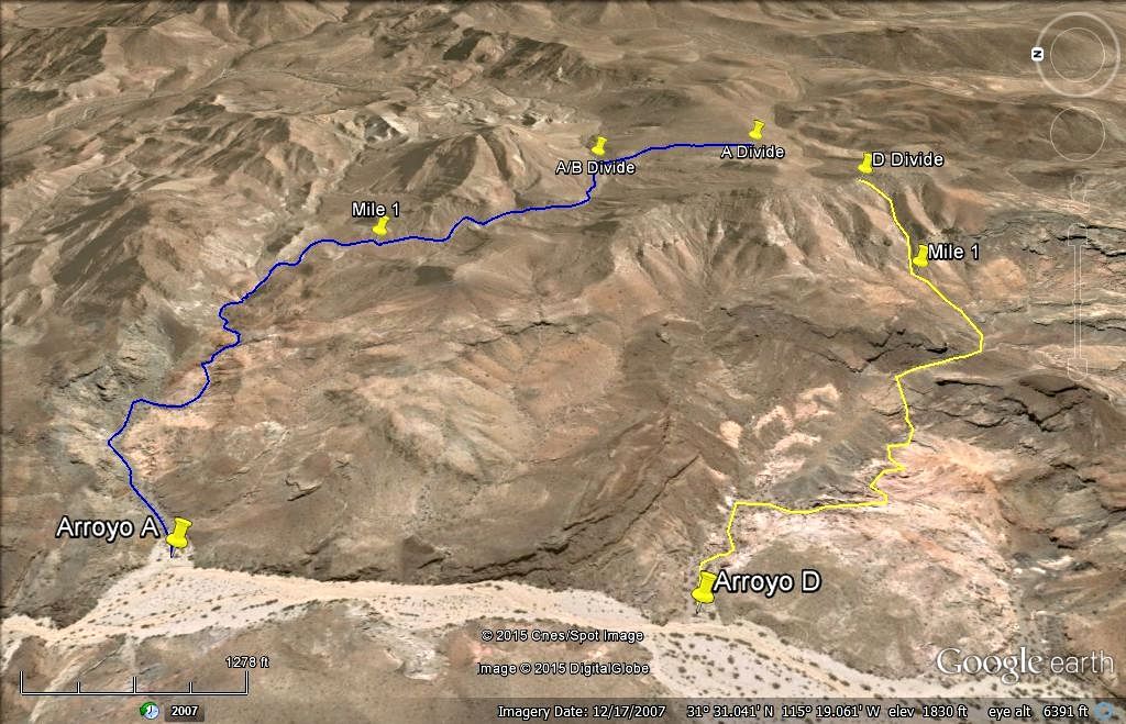
Here is looking west from the divide back down to Arroyo Grande:
|
|
|
Ken Cooke
Elite Nomad
Posts: 8963
Registered: 2-9-2004
Location: Riverside, CA
Member Is Offline
Mood: Pole Line Road postponed due to injury
|
|
Tuesday, the high temperature in Calexico, CA will be 79 and breezy! Good hiking weather!
[Edited on 4-3-2015 by Ken Cooke]
|
|
|
David K
Honored Nomad
Posts: 65243
Registered: 8-30-2002
Location: San Diego County
Member Is Offline
Mood: Have Baja Fever
|
|
| Quote: Originally posted by Ken Cooke | Tuesday, the high temperature in Calexico, CA will be 79 and breezy! Good hiking weather!
[Edited on 4-3-2015 by Ken Cooke] |
Monday is the hike day... but should still be nice... doesn't matter anyway, because after all these years talking the talk, it's time to WALK THE
WALK!
|
|
|
David K
Honored Nomad
Posts: 65243
Registered: 8-30-2002
Location: San Diego County
Member Is Offline
Mood: Have Baja Fever
|
|
Wonderful, remote canyons... we made two special discoveries, as well!
We didn't arrive at Arroyo Grande until Monday Noon, staying with the Pole Line Road group until they left the Pole Line Road at the T Junction. The
five of us on the Henderson Hike were 4x4ABC (Harald), Fernwah (Karl), Frigatebird (Joe), TMW (TW Tom), and me. We hiked Arroyo A that Monday
afternoon and Frigatebird, TW and I hiked Arroyo D Tuesday morning and a little of Arroyo B on our way north.
Trip Report coming soon...
|
|
|
elbeau
Nomad
Posts: 256
Registered: 3-2-2011
Location: Austin, TX
Member Is Offline
|
|
Santa Isabel and the fountain?
|
|
|
ehall
Super Nomad
Posts: 1906
Registered: 3-29-2014
Location: Buckeye, Az
Member Is Offline
Mood: It's 5 o'clock somewhere
|
|
The rest of us were only 3 hours behind you David. ( after a slight detour) I didn't see your tracks where you guys turned off the road.
|
|
|
David K
Honored Nomad
Posts: 65243
Registered: 8-30-2002
Location: San Diego County
Member Is Offline
Mood: Have Baja Fever
|
|
| Quote: Originally posted by ehall | | The rest of us were only 3 hours behind you David. ( after a slight detour) I didn't see your tracks where you guys turned off the road.
|
So, you guys didn't get to Ejido Saldaña and out to Hwy. 5 at the sand dunes... and doubled back going to Arroyo Grande and out to La Ventana?
Where the Pole Line Road reaches Arroyo Grande (4.3 miles from the T junction, where we separated from you guys), we turned right to go up Arroyo
Grande fro our hikes and camp Monday night.
|
|
|
David K
Honored Nomad
Posts: 65243
Registered: 8-30-2002
Location: San Diego County
Member Is Offline
Mood: Have Baja Fever
|
|
Don't you wish!!??
|
|
|
ehall
Super Nomad
Posts: 1906
Registered: 3-29-2014
Location: Buckeye, Az
Member Is Offline
Mood: It's 5 o'clock somewhere
|
|
The road had been completely washed away. No sign of it could be found. We tried for about 2 hours to find it with no luck. We didn't have enough fuel
left to risk continued searching so we cut our losses and backtracked.
|
|
|
David K
Honored Nomad
Posts: 65243
Registered: 8-30-2002
Location: San Diego County
Member Is Offline
Mood: Have Baja Fever
|
|
Wow, well... At least you got to see one more pole, which was on that last 4.3 miles of the road, of the run ending at Arroyo Grande... and you had
our fresh tracks to follow.
The amazing road building may last many years for other 4 wheelers to do the run, eastward. Going west it wasn't as bad an issue, plus nobody was
being towed.
[Edited on 4-8-2015 by David K]
|
|
|
güéribo
Nomad
Posts: 239
Registered: 10-17-2014
Member Is Offline
|
|
Looking forward to the report.
|
|
|
David K
Honored Nomad
Posts: 65243
Registered: 8-30-2002
Location: San Diego County
Member Is Offline
Mood: Have Baja Fever
|
|
Thanks. I will have road logs, GPS, Sat views, and photos!
|
|
|
Ken Cooke
Elite Nomad
Posts: 8963
Registered: 2-9-2004
Location: Riverside, CA
Member Is Offline
Mood: Pole Line Road postponed due to injury
|
|
I will upload my videos this weekend. Can't wait to see your full trip report.
|
|
|
David K
Honored Nomad
Posts: 65243
Registered: 8-30-2002
Location: San Diego County
Member Is Offline
Mood: Have Baja Fever
|
|
It has just begun: http://forums.bajanomad.com/viewthread.php?tid=78437
|
|
|
David K
Honored Nomad
Posts: 65243
Registered: 8-30-2002
Location: San Diego County
Member Is Offline
Mood: Have Baja Fever
|
|
LOOKING FOR THE ROCK-PILE
Inspired by Choral Pepper, I hopped to use Walter Henderson's 1967 letter details of his discovery to see what he saw in the 1930's. It didn't matter
if it was a grave of the first European explorer to walk into California or just a pile of rocks, made by men, it was just to confirm Henderson's
route into Arroyo Grande from where he drove and parked his Model A.
Previous searchers for the 'Rock-Pile' included Bruce Barber and Nomad 'DesertGhost' (Tad) using the details the Pepper gave in her Baja book and
Desert Magazine articles.
The problem with those details is that they were not accurate and did not say where Henderson began his hike (parked his Model A). The letter
(published in this thread for all to enjoy) was buried in a box of letters and photos belonging to Choral Pepper that was given to me by her children,
following her death (per her wishes), as well as her 'Baja Dream' painting (she was an artists as well as a writer).
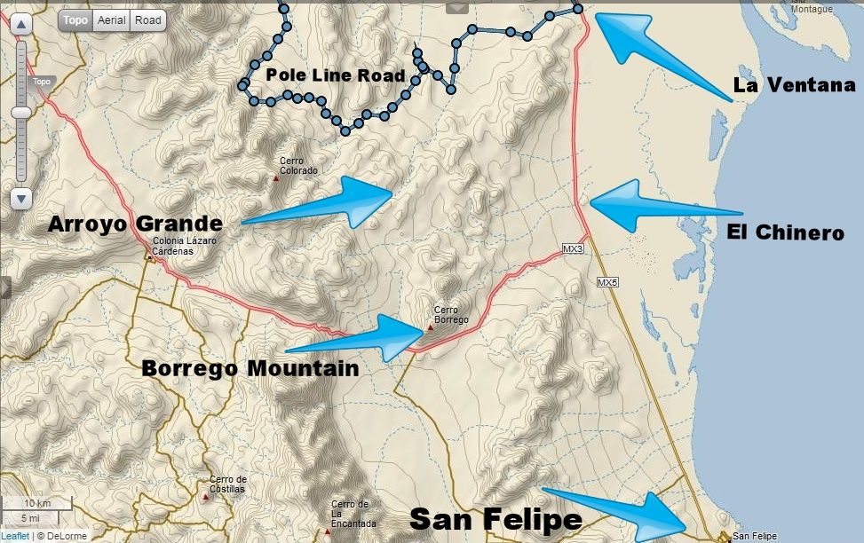
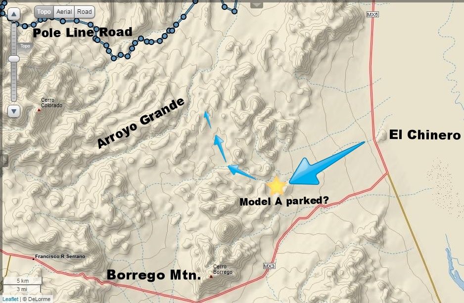
What we read is that Henderson (and a friend) drove south of La Ventana to about El Chinero Mountain, then west to the base of the Sierra La Pinta
(Las Pintas) mountains. Arroyo el Arrajal was possibly used or parallel to it.
The next morning, they got an early start and began walking towards their goal (Las Tinajas Mountain/ La Palmita) to find blue palms. They later would
realize they were too far south to begin such a walk. After reaching the top of the Sierra las Pintas (approx. 10 miles from the Model A?) they
descended down, steeply to Arroyo Grande. 1/4 to 1/3 the distance down they found the 'Rock-Pile' (about noon). It was on a small mesa-like knob of
land on the north side of the west flowing canyon/ wash.
They continued down the westward canyon and reached Arroyo Grande, where they camped the first night. The next day, they headed towards the base of
Borrego Mountain (Cerro el Arrajal) and circled back to the Model A.
It was later that Henderson read about Melchior Diaz and realized the elaborate rock pile fit the description of how and where he was buried by his 25
troops and Indian guides. His efforts to get the Mexican government to send an expedition to find and preserve the possible grave failed when he was
told that he would have to pay for the expedition!
So, the rock-pile and the grave of Melchior Diaz, made on January 8, 1541, remains un-found!???
Coming next, the 2015 expedition to all three west flowing washes....
|
|
|
David K
Honored Nomad
Posts: 65243
Registered: 8-30-2002
Location: San Diego County
Member Is Offline
Mood: Have Baja Fever
|
|
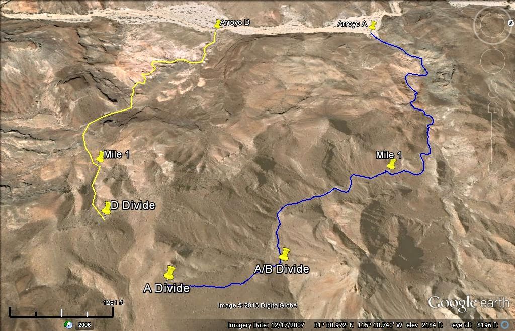
Which Wash was it in?
Henderson said west flowing. Years ago, I assigned letters to possible routes down to Arroyo Grande from the divide of the Las Pintas sierra. The one
I called Arroyo C is north flowing, so I dropped it from consideration. PaulW hiked up Arroyo C (or a parallel wash) to enter the mid section of
Arroyo B. He then went down B only to find an impassable waterfall... and hiked over the ridge south of that point and into Arroyo Grande.
Because of that data, I dropped going up Arroyo B from our hike, and moved it down to Arroyo A, 2 miles south of B. We also hiked up Arroyo D, another
0.6 mile south of A.
Here are the maps of my idea of how Walter hiked up to the divide (blue arrows) and then the three possible west-flowing washes down to Arroyo Grande
(A, B, D), (in red arrows).
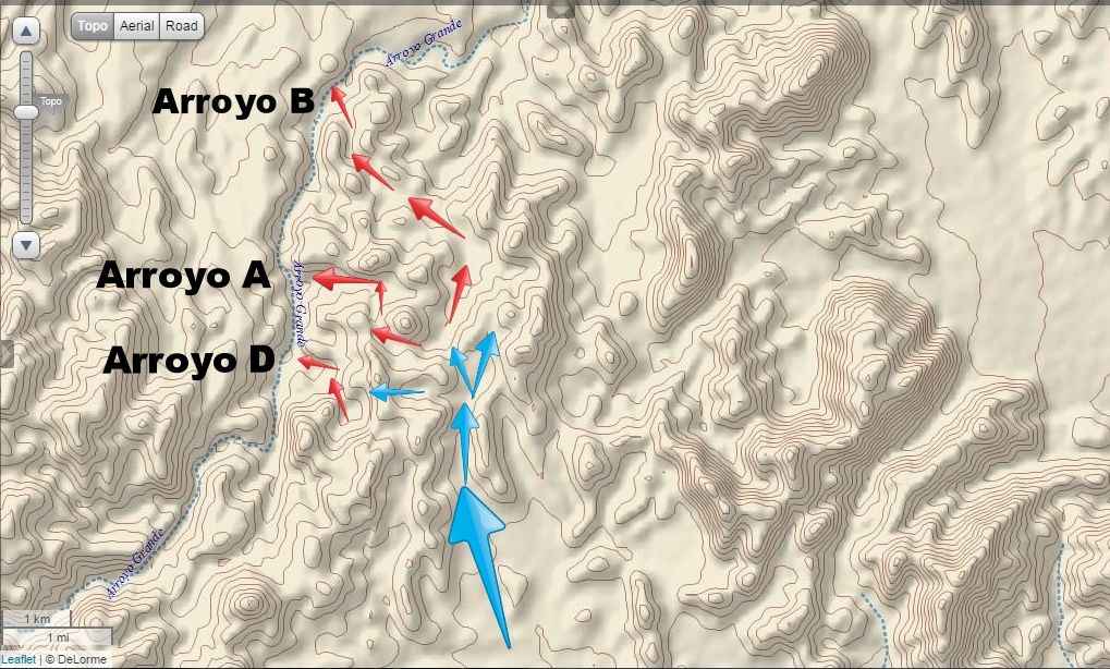
On Monday afternoon, the five of us hiked up and around Arroyo A.
On Tuesday, 3 of us hiked up Arroyo D and a little of Arroyo B.
We made two awesome discoveries!!! Stand by for photos...
|
|
|
David K
Honored Nomad
Posts: 65243
Registered: 8-30-2002
Location: San Diego County
Member Is Offline
Mood: Have Baja Fever
|
|
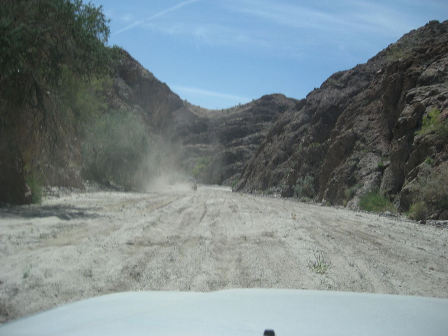
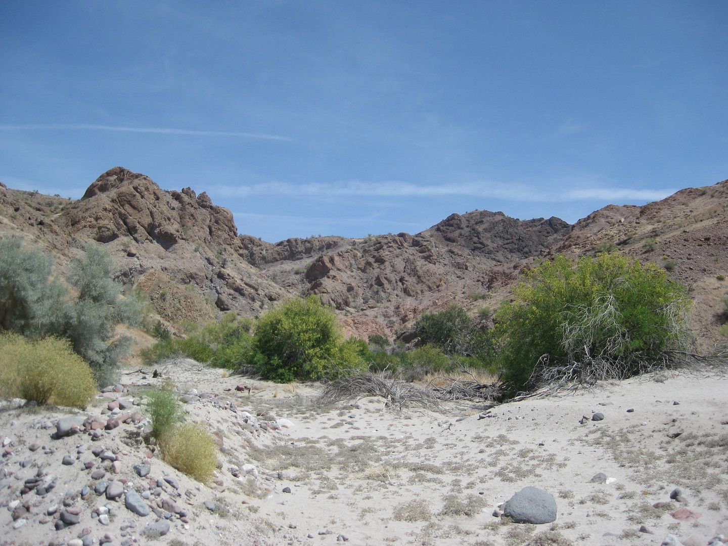
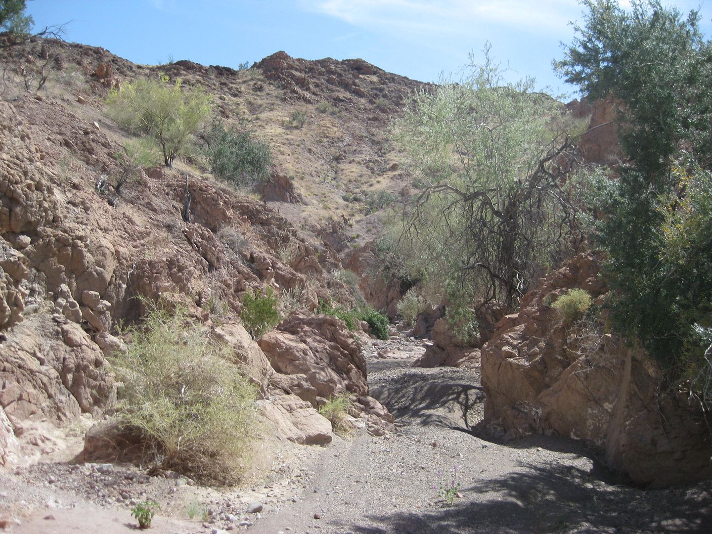
South in Arroyo Grande, from the Pole Line Road
The Pole Line Road from Ensenada meets Arroyo Grande, 4.3 miles from the T Junction. The elevation at the big arroyo is 803 feet, and you cannot see
the opposite side where the Pole Line Road climbs out via a short grade. Off road racers use that southern route out to head towards San Felipe or
Hwy. 3 at 'Borrego Wash', after it passes over the Sierra las Pintas.
Joe (Frigatebird), Tom (TMW), Harald (4x4abc), Karl (Fernweh), and I head south in the very sandy arroyo for 9.5 miles to our camp at the junction
with Arroyo A, takes us about 20 minutes, arriving at 12:15 pm. Karl bypassed us at a fork in the wash tracks and kept driving a few more miles before
turning back.
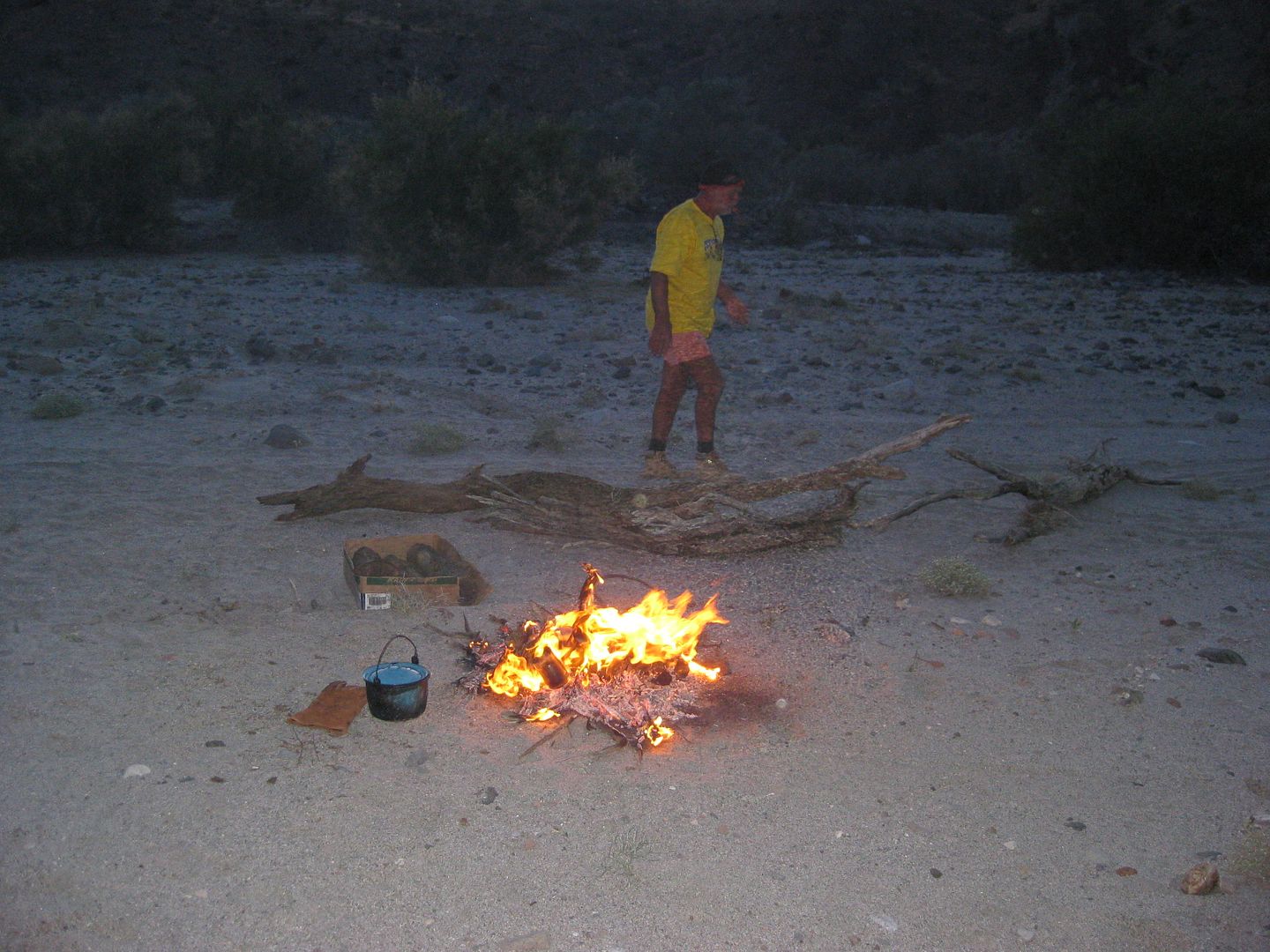
We find some shade and Harald has a sun canopy he sets up, and we make lunch and relax.
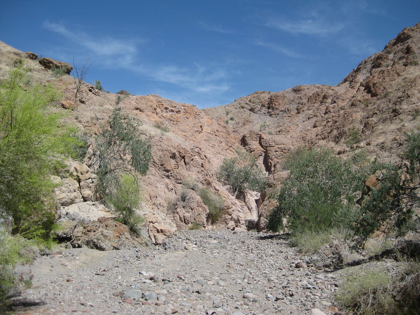
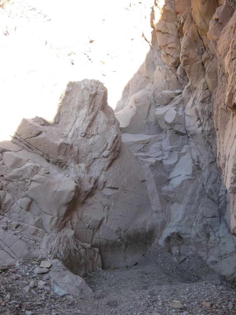
After a couple of hours, I decide to do a scouting hike to make sure we can get around or over the dam that Phil and Tom found blocking the way, a few
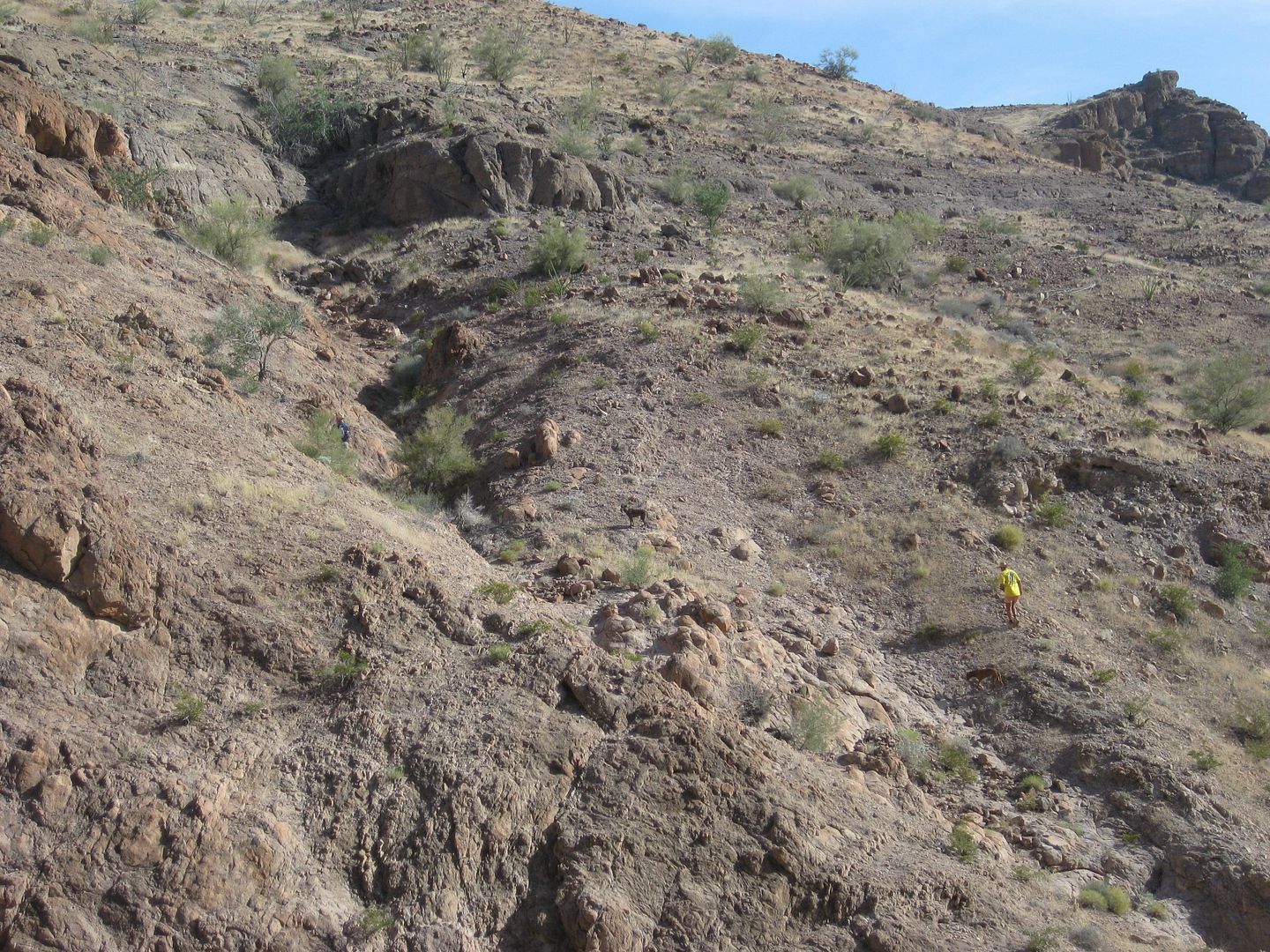
months earlier. There was a deep pit at the base of the dam from the waterfall action, so I scrambled up the left (north) side of the canyon. On
Google Earth you cannot make out that this side isn't near level... and it was quite steep, and loose!
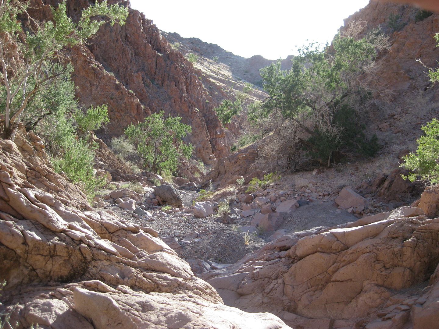
I did manage to get beyond the gorge with the dams (more than one) and came down the other side into a small valley. On the north side of the valley
was a mesa-like area... However, I knew it was too far from being 1/3 down from the divide... but it was exciting. Henderson said these mesa-like
knobs are common in the area.
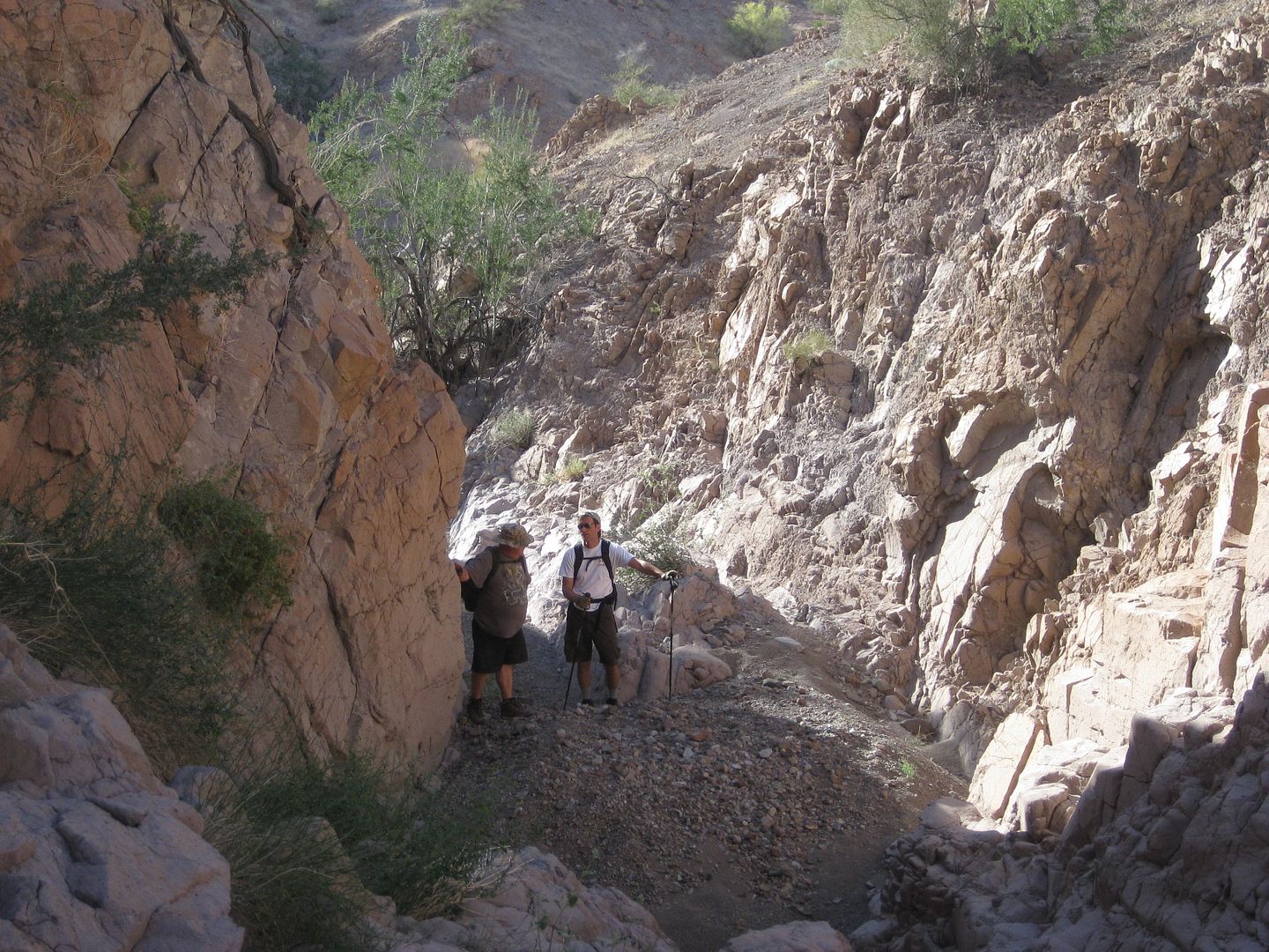
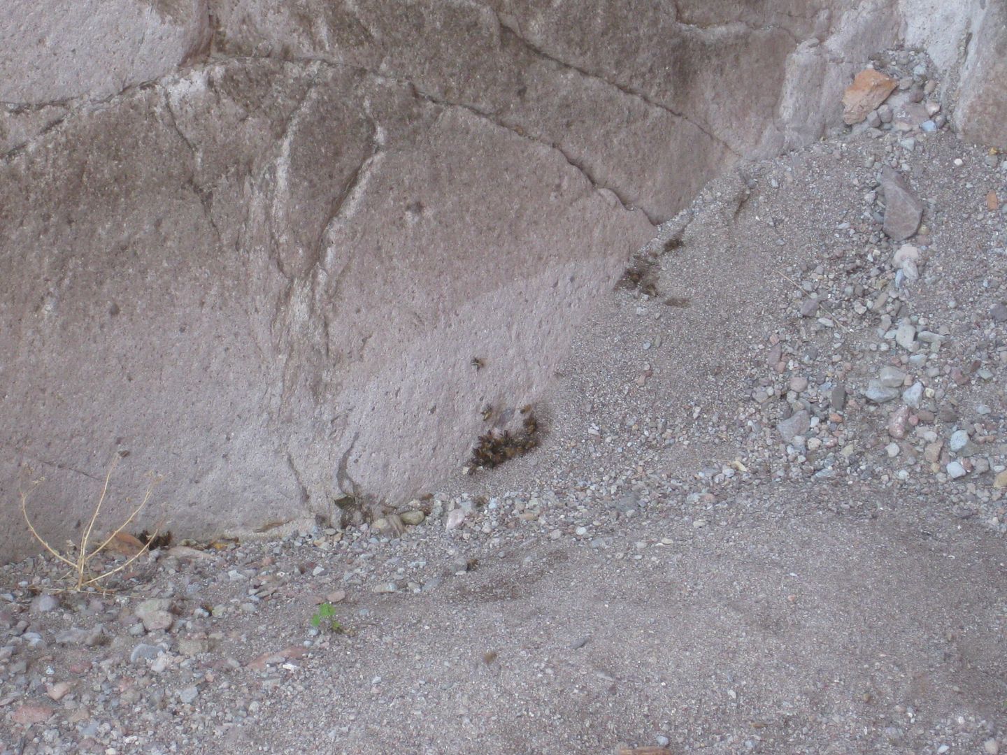
The valley soon narrowed and another small gorge was entered. I found some bees clustered at the base of a waterfall apparently getting moisture from
a tinaja, covered by the gravel (a coyote well). I was able to climb to the left of that waterfall and avoid the bees, as well. I checked my GPS for
the time, as I told the guys I would be back in an hour. I had to turn back in order not to cause a search party to be organized!
Here is where I hiked that hour (total distance from camp 0.5 mile):
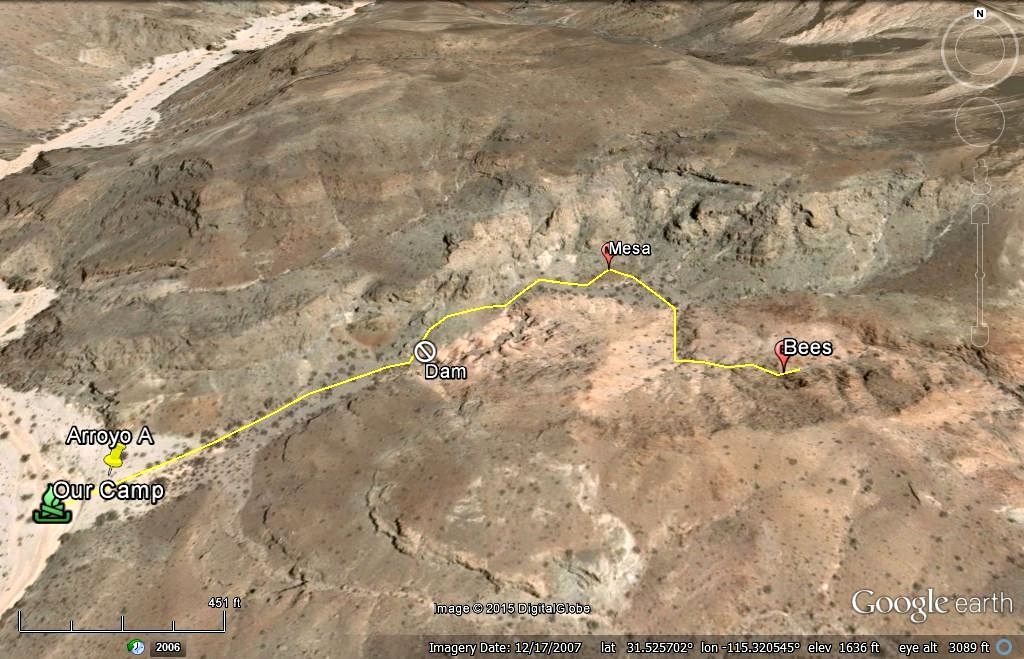
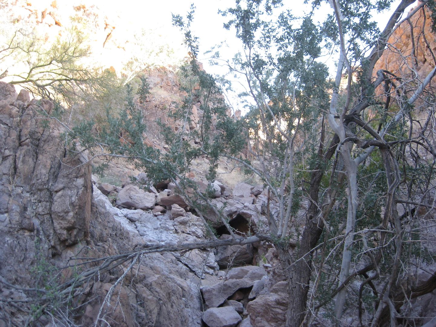
About an hour after my return the rest of the group was ready to explore beyond my turn around location.
The Germans (Harald & Karl) hiked up the south side of the mountain before the dam and Joe, Tom and I used the way I had made it into the canyon.
Tom decided he had enough fun after passing the mesa, and headed back to camp. Joe and I continued, but we could not progress further than 1/4 mile
past the Bee Tinaja. The canyon forked, and we tried both branches. The left had a bolder lodged in a waterfall crack and the right branch just got
way steep.
To get 25+ people, sheep, a man on a stretcher up this way was not possible, unless the geology had drastically changed. I don't even see Henderson
getting through so easily, even coming downhill.
Karl explored over on the north ridge of the canyon and Harald checked out all he could on the south rim. Harald thought perhaps the Spanish soldiers
came up from the east side, as did Henderson, and no from Arroyo Grande...?
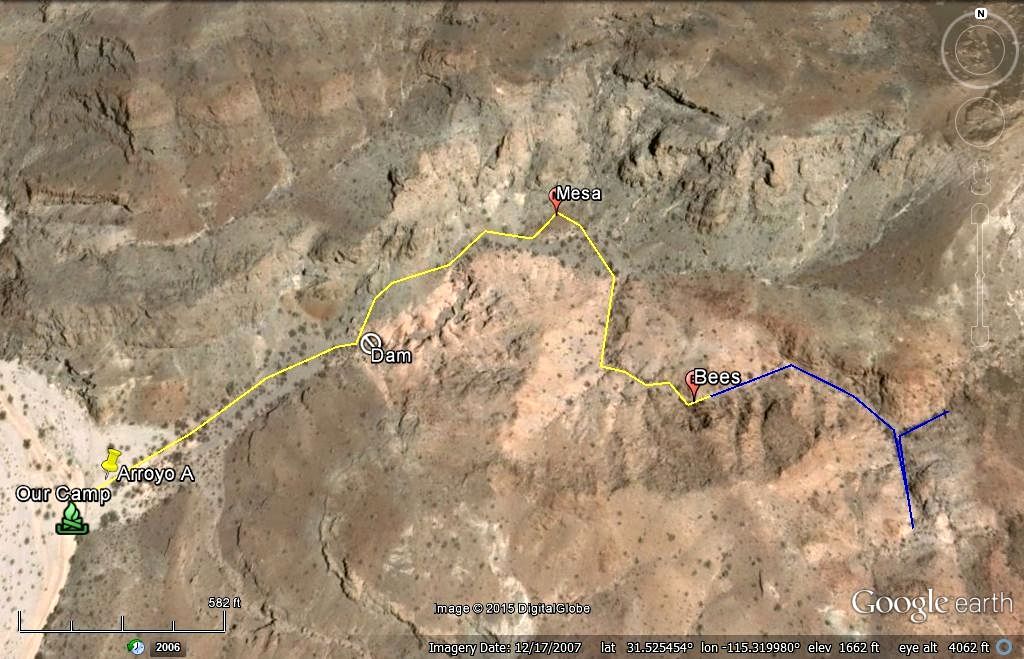
Blue line is the additional amount Joe and I explored up from the Bees.
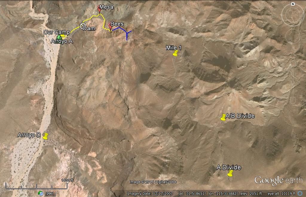
The high view shows the entire Arroyo A to the divide, and how little we were able to see of it (just the lower 3/4 mile of the 2 mile arroyo)...
Driving up Arroyo Grande from the Pole Line Road:
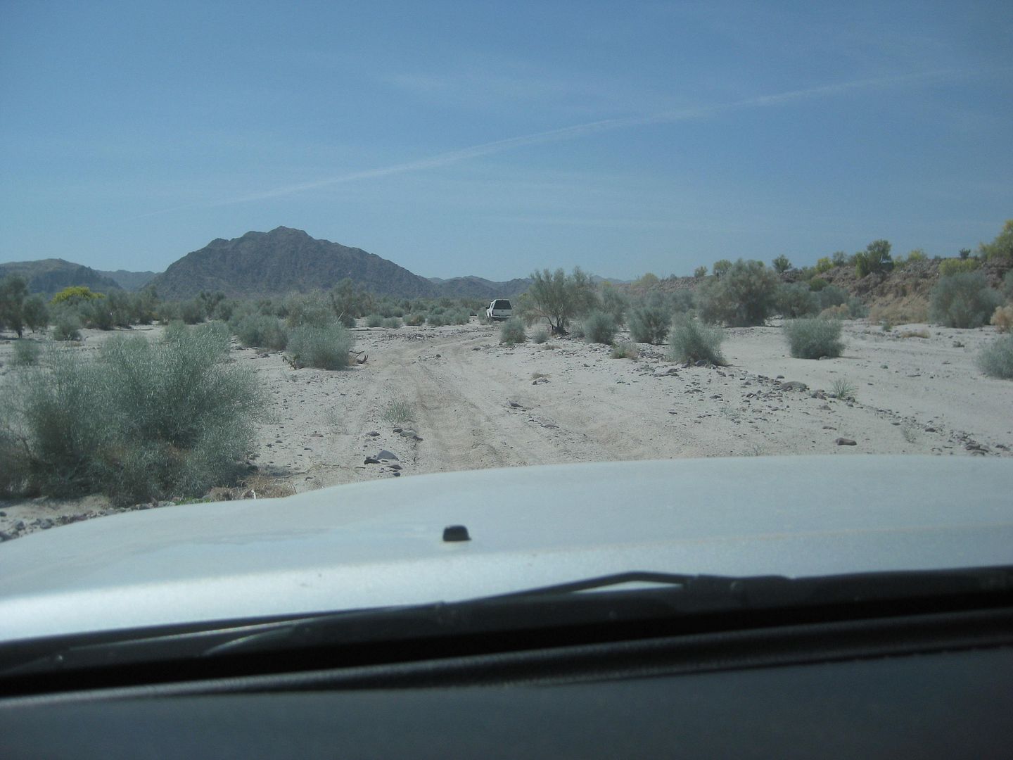

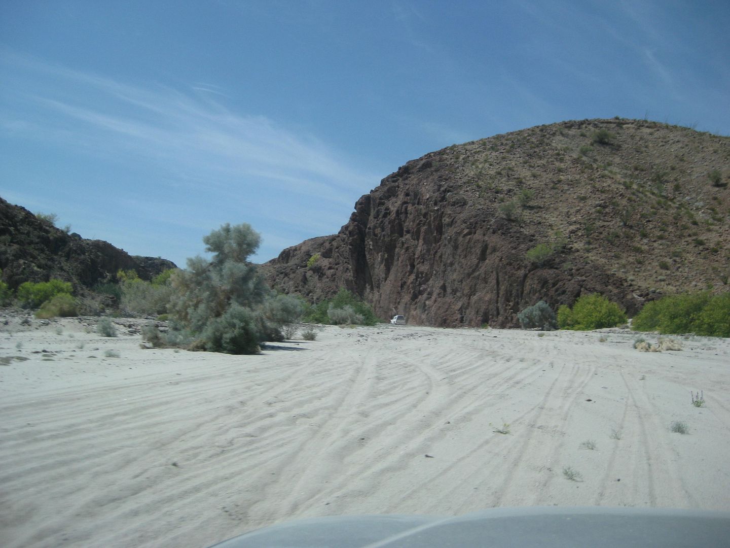
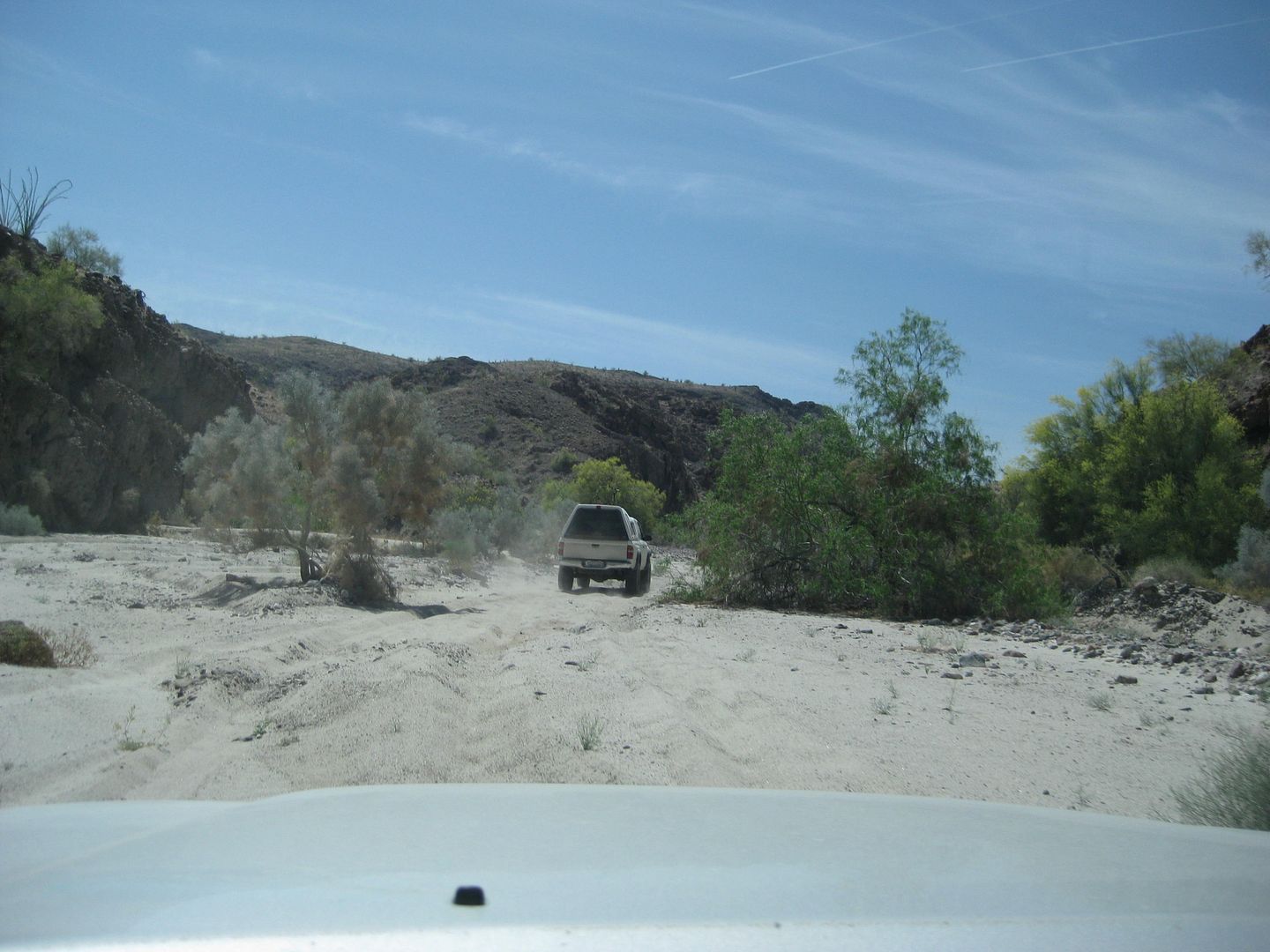
Sand was so deep, dropping below 20 psi was advised.
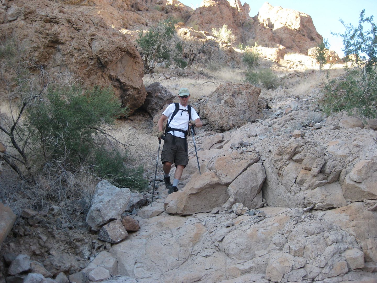
Hiking up Arroyo A:
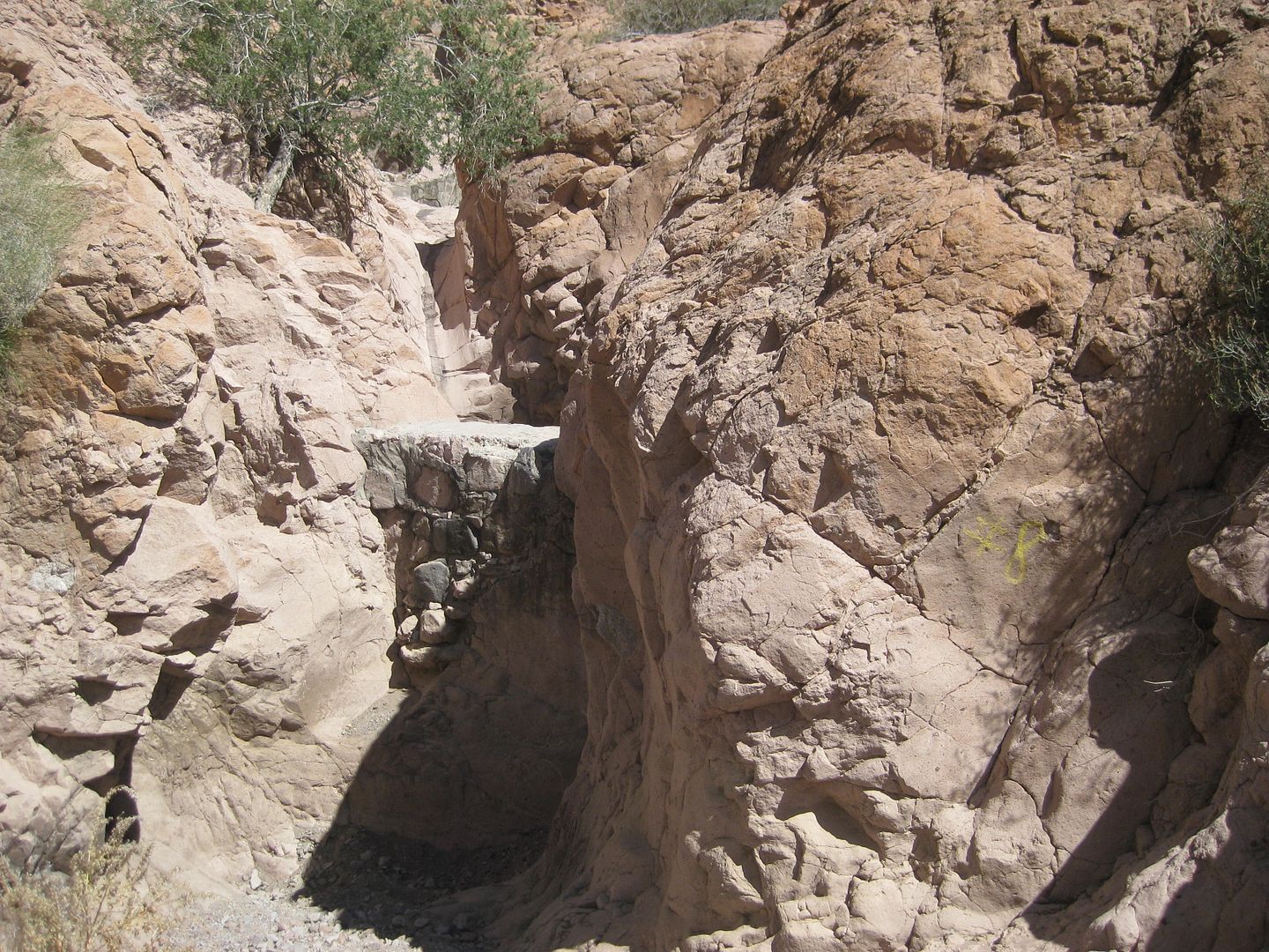
Dam! Detour up to the north side...
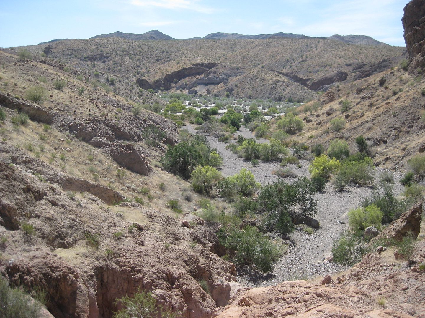
View down the arroyo towards camp from the detour above the dam.
Somewhere before I turned back to camp.
Coming Next, we all go up Arroyo A...
|
|
|
David K
Honored Nomad
Posts: 65243
Registered: 8-30-2002
Location: San Diego County
Member Is Offline
Mood: Have Baja Fever
|
|
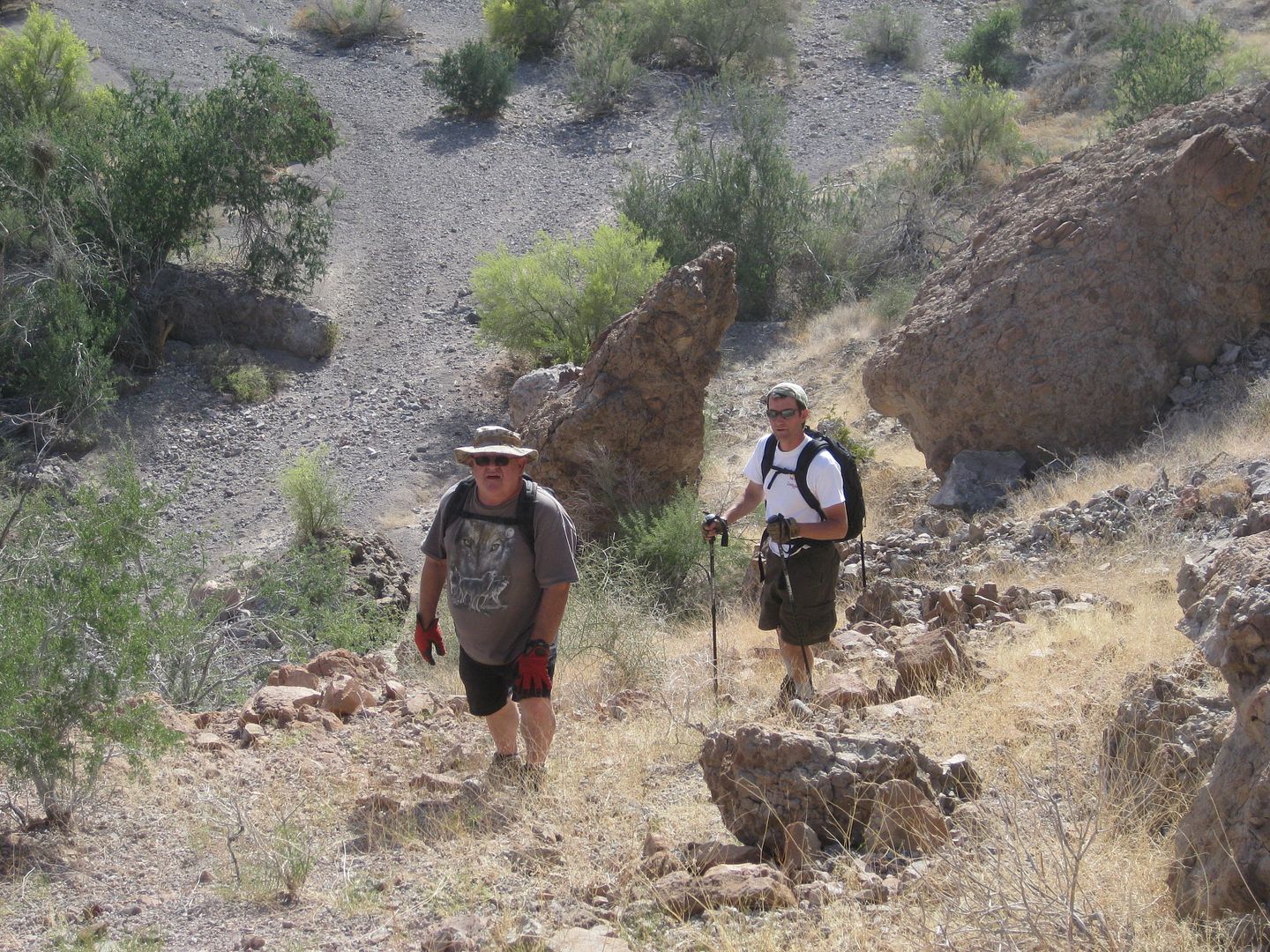
Tom and Joe follow me up and around the dam gorge.
Harald and his dog on the south side, nice bright yellow shirt!
Tom and Joe probably discussing how they will kill me in my sleep?
The Bee Tinaja
The left (straight) fork.
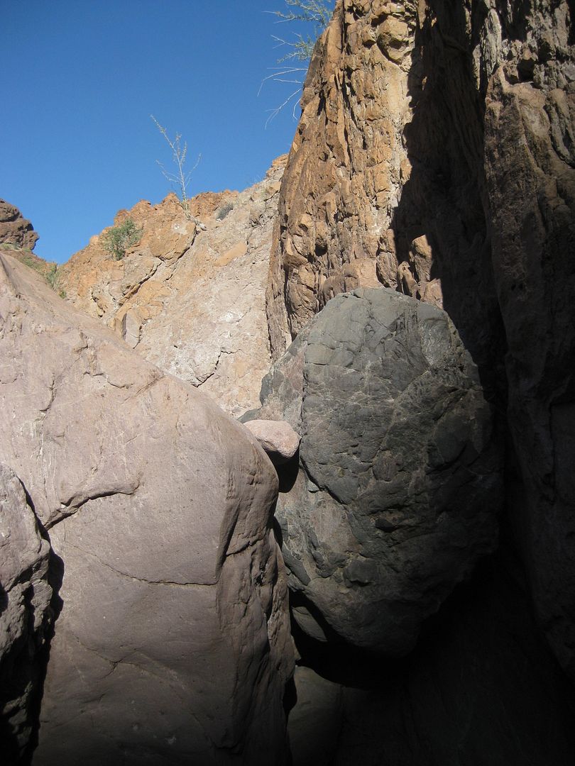
Boulder block

Beyond the boulder
Frigatebird coming down the dam detour.

Campo Arroyo A
Coming Up Next: Tuesday's Hike up Arroyo D and Arroyo B... and two BIG SURPRISES!! Stay Tuned!!
|
|
|
| Pages:
1
..
3
4
5
6
7
..
9 |


